2010 Census Data Release and Current Geographic Programs. Michaellyn Garcia Geographer Seattle Regional Census Center
|
|
|
- Leona Harrell
- 6 years ago
- Views:
Transcription
1 2010 Census Data Release and Current Geographic Programs Michaellyn Garcia Geographer Seattle Regional Census Center
2
3
4
5
6


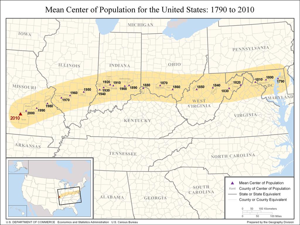
7 2010 Center of Population Located approximately 2.7 miles northeast of Plato, Missouri
8
9 2010 Census Data Products Released: 2010 Census Redistricting Data (PL ) State Population Counts, Race and Ethnicity State Housing Units and Occupancy Status

10 2010 Census Data Products
11 American Community Survey Replaces the once every 10 years or Long Form detailed demographic sample survey of 1 in 5 households that was conducted during the Decennial Census. Long Form data was published in Summary Files 3 & 4 after Census There will be no SF 3 or SF 4 for This data is now updated annually through the American Community Survey (ACS)
12 American Community Survey Population Characteristics Period estimates describe the average characteristics over a specific time period Questions similar to long form from 2000 Participation is mandatory Survey: 250k households per month (3 Million per year) Social Education Marital status Fertility Citizenship Veterans Disability Economic Income Benefits Employment Status Occupation Industry Commuting to Work Place of Work Housing Tenure Occupancy & Structure Housing Value Taxes and Insurance Utilities Mortgage/payment Demographic Gender Age Hispanic Origin Race
13 American Community Survey Up to three types of estimates are available from the American Community Survey (ACS) depending on the level of geography: 1 year estimates (based on data collected in a single year) for areas with 65,000+ population 3 year estimates (based on data collected in three consecutive years) for areas with 20,000+ population 5 year estimates (based on data collected in five consecutive years) for small geographic areas
14 1 Year Estimates 3 Year Estimates 5 Year Estimates The 2009 ACS 1 yr estimates are based on data collected between January 2009 and December 2009 The ACS 3 yr estimates are based on data collected between January 2007 and December 2009 The ACS 5 yr estimates are based on data collected between January 2005 and December 2009 * Published for selected geographic areas with populatons of 65,000 or greater Current ACS Data Releases * Published for selected geographic areas with populatons of 20,000 or greater * Published for small geographic areas * Represents the average characteristics over calendar year 2009 * Have smaller sample size than 3 year and 5 year estimates * Are more current than 3 year and 5 year estimates Next Release: The year ACS estimate * Represents the average characteristics over a 3 year period of time * Have larger sample size than the 1 year estimates but smaller than the 5 year estimates * Are less current than the 1 year estimates however more current than the 5 year Next Release: The year ACS estimate * Represents the average characteristics over a 5 year period of time * Have larger sample size than the 1 year and 3 year estimates * Are less current than the 1 year and 3 year estimates Next Release: The year ACS estimate

15 AFF Transition Page to New (AFF2) from Legacy (AFF)

16 SIMPLE DATA QUERY OVERVIEW THIS BOX DRIVES THE DATA SELECTION. The 1 st step is to populate this box
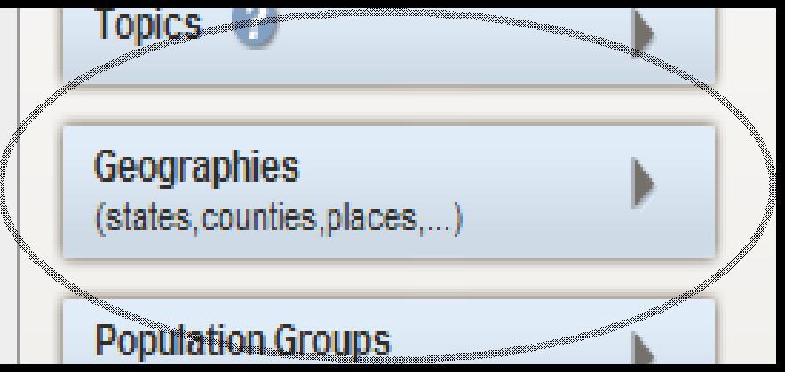
17 CLICK on Geographies


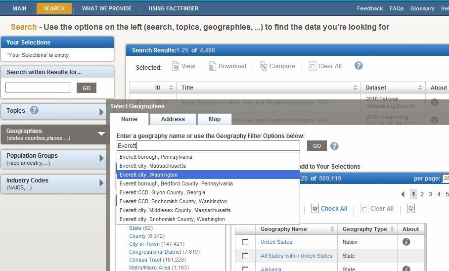
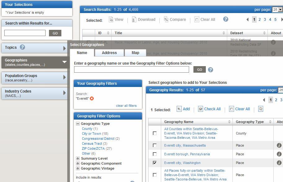
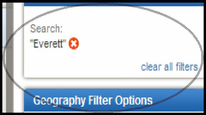
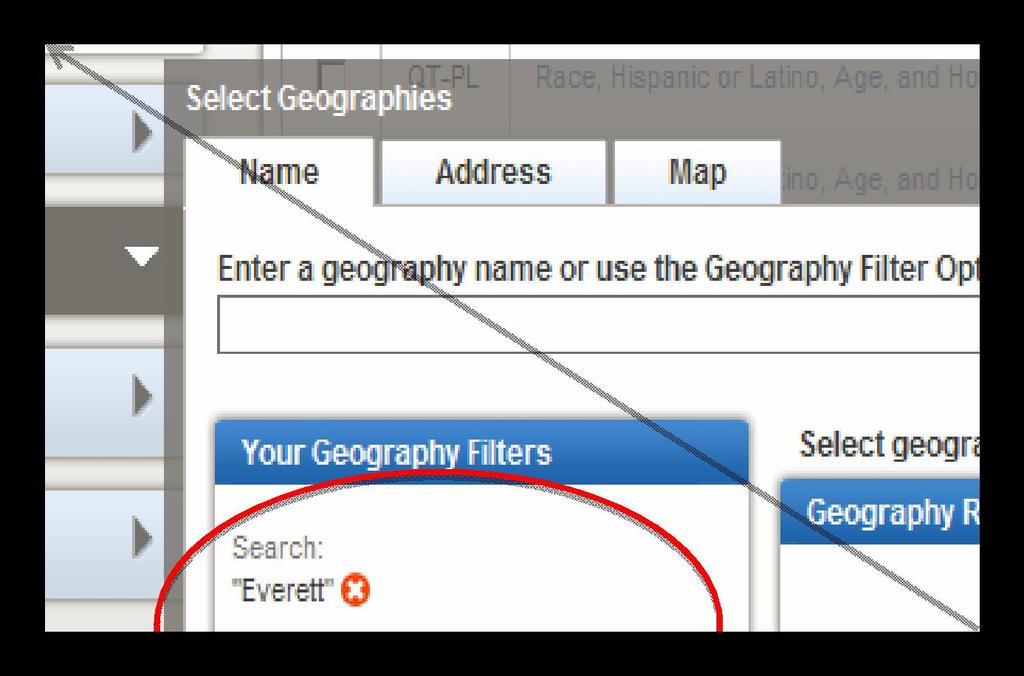
18 Select Geographies box comes up. The easiest way to get to the data is to type your desired geography into the filter:

19
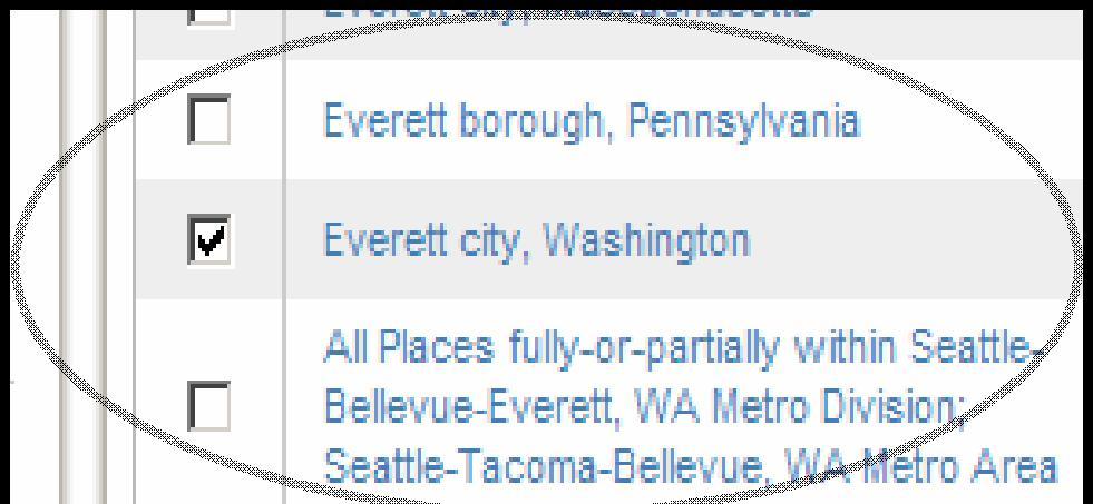


20

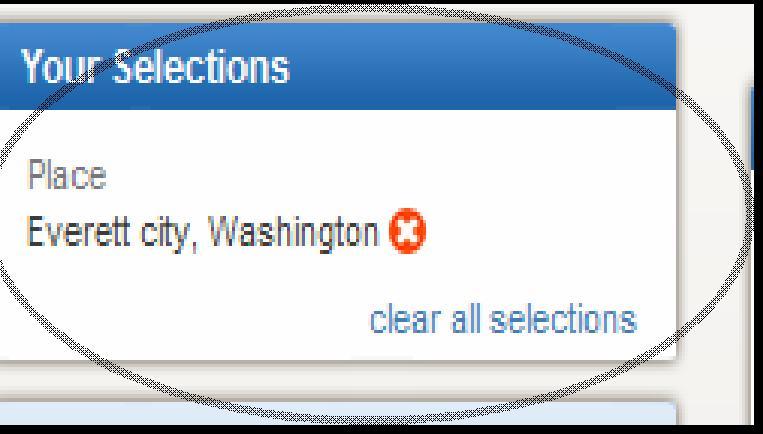

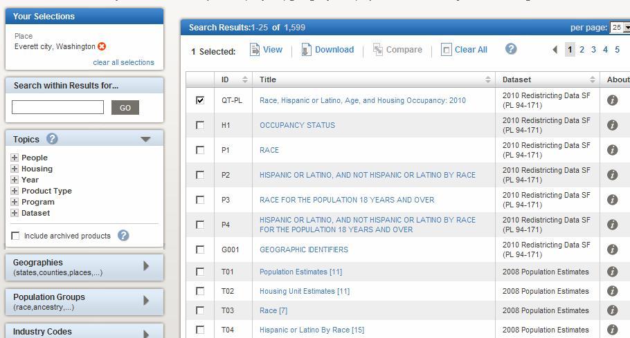
21 TURN OFF Select Geographies
22
23
24 2010 Geographic Products Released: 2010 TIGER/Line Shapefiles (via FTP or Web interface) 2000 Tab Block to 2010 Tab Block Relationship files (txt files) PDF maps: Tract Reference Maps, County Block Maps, Voting District/School District maps, Total population and pop change maps RECOMMENDED LINK: 24
25 Geographic Improvements for the 2010 Census Use of GPS for the 2010 Census GPS coordinates collected for the majority of housing units in the United States (exception for extreme rural areas with limited access and areas in Alaska) Required TIGER to shift from: Relative Accuracy to Positional Accuracy So that GPS Coordinates for Housing Units would Geocode to the correct Census Block 25
26 MAF/TIGER Accuracy Improvement Project (MTAIP) Obtained GIS files from local partners Generally county, state, tribal or regional planning officials Files were evaluated for completeness and spatial accuracy Evaluated against TIGER and imagery for completeness Spatial accuracy tested Also obtained the National Hydrography Dataset (NHD) from USGS High resolution 1:24,000 used in most places
27 Implementing MTAIP, cont. If local sources did not meet spatial accuracy and no other source was available Spatial Enhancement of local file to imagery NAIP imagery used for several rural counties in Washington State Limitation was that no attribute data (such as street names and addressing) were collected If imagery was not available Contractor drove every road in the county collecting a GPS trail Attributes collected Snohomish County was the only Driven county in Washington


28 Pre MTAIP Legacy TIGER/Line 2000 City of Kent King County Washington


29 Post MTAIP TIGER/Line Realigned to King County s file

30 Comparison Realigned TIGER Pre MTAIP TIGER
31 Comparing Data and/or Assessing Change The realigned files currently maintain the topography of Census Boundaries from Census 2000 To compare data or geography between 2000 and 2010, you must use the 2000 and 2010 geographic layers from the downloadable 2010 TIGER/Line files. The following Census 2000 boundaries have been realigned to 2010 Geography: American Indian Areas (aiannh) Block Groups (bg) The 108 th Congress Congressional Districts (cd108) Counties (county) County Subdivision(cousub) Places (place) School Districts (unsd) State Legislative Districts (sld) Tabulation Blocks (tabblock) Tracts (tract) Voting Districts (vtd) Annexations/Incorporations/Boundary Changes that occurred after Census 2000 will be represented as they were on Census Day in the 2010 TIGER/Line Shapefiles. Previous benchmarks will not be topologically corrected.
32 Count Question Resolution CQR
33 CQR Program that allows State, Local and Tribal governments to challenge the census count for their jurisdiction if they believe there was an error due to: Incorrect Boundaries Undisputed legal boundaries on or before January 1, 2010 incorrectly delineated or reported Geocoding Coverage Issues (incorrect deletion, addition, duplication)
34 CQR The Census Bureau requires specific documentation before committing resources to investigate a challenge. The submitted challenges must specify whether the challenge disputes the location of a governmental unit boundary, the location or number of housing units and/or group quarters counts in one or more 2010 census tabulation blocks, or both. Maps must identify the state, county, 2010 census tracts, and 2010 census tabulation blocks associated with the challenge. Address lists of housing units and/or group quarters located in the challenged areas are also required. The Census Bureau will specify the format required for the submission.
35 CQR Program information is NOW posted on the CQR website: Guidelines Address List Templates (similar to LUCA) Contact Information cqr.php
36 CQR Challenges must be submitted by the Highest Elected Official (HEO) or designated representative June 1 st 2011 June 1 st 2013 (postmarked) Submit either electronically or by mail: dmd.cqr@census.gov Count Question Resolution Program Decennial Management Division U.S. Census Bureau Washington, DC 20233
37 CQR Questions Please call or the CQR program at: Or call the Seattle Regional Census Center at:
38 Moving Forward: Preparing for the 2020 Census
39 The Geographic Support System Initiative What is it? An initiative before Congress to increase in our base funding for improving the addresses in our Master Address File Why is it important? A response to stakeholder and oversight recommendations to update and maintain our address and spatial data with a special focus on rural areas, group quarters and Puerto Rico What does it involve? An integrated program of improved address coverage, continual spatial feature updates, and enhanced quality assessment and measurement through partnerships Who are the major players? US Census Bureau with federal, state, local and tribal governments
40 Ongoing GSS Teams Teams comprised of Census Bureau staff and other federal agencies (USGS, NOAA NGS, USPS) were formed to address specific aspects of the GSS Initiative Project and Contract Management Policy Research and Development Quality, Assessments/Evaluations Address Coverage and Sources Feature Coverage and Sources Partnerships MAF/TIGER Integration/Linkage Geocoding Global Positioning Systems (GPS)
41 A Shift in Focus for the 2020 Census From a complete address canvassing to a targeted address canvassing Hinges on establishing an acceptable address list for each level of government What defines acceptable will be a partnership collaboration between government partners and the Census Bureau 41
42 Improving the Master Address File (MAF) In conducting the 2010 Census, our primary sources for address updates: USPS Delivery Sequence File (DSF) Local Update of Census Addresses (LUCA) Field updates For FY 11 and beyond, additional sources will focus on best available data from government partners and commercial files 42
43 MAF Challenges No national addressing system Lack of addressing standards these are just now coming into place Constraints in working with partners to build and maintain the MAF Requires close collaboration with the U.S. Postal Service However DSF only covers areas that receive mail Not all DSF records geocode to TIGER Requires substantial partnership program with tribal, state, and local governments (up to 40,000) Two way address sharing is difficult and tenuous under confidentiality constraints of Title 13
44 Maintaining Our Feature Network Continuous update of street network and attributes Sharing results with USGS and DOT Sources will focus on best available data from government partners and commercial files Extensive use of imagery Source for spatial data Used for data verification Used for data quality assurance
45 Quality Quality improvements apply to Address and spatial data IT processes Geographic products Quantitative measures of address and spatial data quality are needed
46 For the Geographic Support System Initiative to be Successful Partners are important Federal, state, local, and tribal governments Commercial vendors (data and service providers) Working relationships must be: Least intrusive on the participating government Most efficient / timely Ensure complete and quality data
47 THANK YOU Michaellyn Garcia Geographer Seattle Regional Census Center
Geographic Products and Data. Improvements in Spatial Accuracy and Accessing Data
 Geographic Products and Data Improvements in Spatial Accuracy and Accessing Data How it Began TIGER was internally developed to support the 1990 Decennial Census operations Used data sources such as USGS
The 2020 Census Geographic Partnership Opportunities
 The 2020 Census Geographic Partnership Opportunities Web Adams Geographer, U.S. Census Bureau New York Regional Office 1 Geographic Partnership Opportunities The 2020 Census Local Update of Census Addresses
Boundary and Annexation Survey (BAS)
") Boundary and Annexation Survey (BAS) New Mexico SDC Meeting Chris Wingate Geography Division U.S. Census Bureau 1 Agenda Boundary and Annexation Survey (BAS) BAS Overview American Community Survey (ACS)
Boundary and Annexation Survey (BAS) New Mexico SDC Meeting Chris Wingate Geography Division U.S. Census Bureau 1 Agenda Boundary and Annexation Survey (BAS) BAS Overview American Community Survey (ACS)
PLANNING FOR THE FUTURE: THE GEOGRAPHIC SUPPORT SYSTEM INITIATIVE FOR THE U.S. CENSUS BUREAU
 PLANNING FOR THE FUTURE: THE GEOGRAPHIC SUPPORT SYSTEM INITIATIVE FOR THE U.S. CENSUS BUREAU Tim Trainor Geography Division, U.S. Census Bureau, Washington, DC. 20233 timothy.f.trainor@census.gov KEY WORDS:
Utilizing Data from American FactFinder with TIGER/Line Shapefiles in ArcGIS
 Utilizing Data from American FactFinder with TIGER/Line Shapefiles in ArcGIS Web Adams, GISP Data Dissemination Specialist U.S. Census Bureau New York Regional Office 1 What We Do Decennial Census Every
Using American Factfinder
 Using American Factfinder What is American Factfinder? American Factfinder is a search engine that provides access to the population, housing and economic data collected by the U.S. Census Bureau. It can
Spatial Organization of Data and Data Extraction from Maptitude
 Spatial Organization of Data and Data Extraction from Maptitude N. P. Taliceo Geospatial Information Sciences The University of Texas at Dallas UT Dallas GIS Workshop Richardson, TX March 30 31, 2018 1/
GIS Lecture 5: Spatial Data
 GIS Lecture 5: Spatial Data GIS 1 Outline Vector Data Formats Raster Data Formats Map Projections Coordinate Systems US Census geographic files US Census data files GIS Data Sources GIS 2 Vector Data Formats
Demographic Data in ArcGIS. Harry J. Moore IV
 Demographic Data in ArcGIS Harry J. Moore IV Outline What is demographic data? Esri Demographic data - Real world examples with GIS - Redistricting - Emergency Preparedness - Economic Development Next
Utilizing GIS Technology for Rockland County. Rockland County Planning Department Douglas Schuetz & Scott Lounsbury
 Utilizing GIS Technology for Rockland County Rockland County Planning Department Douglas Schuetz & Scott Lounsbury Presentation Agenda Introduction What is GIS What can GIS do GIS Efforts for BOE Resources
State GIS Update. Master Address Repository (MAR) IMAGIN 2016 Everett Root May 16, 2016
 IMAGIN 2016 Everett Root May 16, 2016") State GIS Update Master Address Repository (MAR) IMAGIN 2016 Everett Root roote@michigan.gov May 16, 2016 Master Address Repository Mark Holmes GeoSpatial Services Manager (MAR) Josh Ross Framework Manager
State GIS Update Master Address Repository (MAR) IMAGIN 2016 Everett Root roote@michigan.gov May 16, 2016 Master Address Repository Mark Holmes GeoSpatial Services Manager (MAR) Josh Ross Framework Manager
Census and USGS: Bringing Improved TIGER to The National Map. Jennie Karalewich-Census Andrea Johnson- Census Dick Vraga- USGS
 Census and USGS: Bringing Improved TIGER to The National Map Jennie Karalewich-Census Andrea Johnson- Census Dick Vraga- USGS USGS and the Census Bureau Since 1880 there has been a close working relationship
Census Geography, Geographic Standards, and Geographic Information
 Census Geography, Geographic Standards, and Geographic Information Michael Ratcliffe Geography Division US Census Bureau New Mexico State Data Center Data Users Conference November 19, 2015 Today s Presentation
Oregon Population Forecast Program
 Oregon Population Forecast Program Regional Forecast Meeting October 2, 2015 Presentation by Population Forecast Program Team Hood River County Oregon Population Forecast Program Project Team Xiaomin Ruan,
The Church Demographic Specialists
 The Church Demographic Specialists Easy-to-Use Features Map-driven, Web-based Software An Integrated Suite of Information and Query Tools Providing An Insightful Window into the Communities You Serve Key
Speakers: Jeff Price, Federal Transit Administration Linda Young, Center for Neighborhood Technology Sofia Becker, Center for Neighborhood Technology
 Speakers: Jeff Price, Federal Transit Administration Linda Young, Center for Neighborhood Technology Sofia Becker, Center for Neighborhood Technology Peter Haas, Center for Neighborhood Technology Craig
To: Ross Martin, Lisa Stapleton From: Brad Lind Subject: Joint Funding Agreement with USGS for 2012 Imagery Date: March 14, 2012.
 To: Ross Martin, Lisa Stapleton From: Brad Lind Subject: Joint Funding Agreement with USGS for 2012 Imagery Date: March 14, 2012 Attached are two copies of the Joint Funding Agreement (JFA) between SanGIS
Working with Census 2000 Data from MassGIS
 Tufts University GIS Tutorial Working with Census 2000 Data from MassGIS Revised September 26, 2007 Overview In this tutorial, you will use pre-processed census data from Massachusetts to create maps of
US Census Bureau Geographic Entities and Concepts. Geography Division
 US Census Bureau Geographic Entities and Concepts Geography Division Geographic Concepts Addresses vs. Geographic features and entities Legal/Administrative vs. Statistical Nesting relationships (or the
Basic Training Battlemind to Home Symposium. Sept
 Basic Training Battlemind to Home Symposium Sept 2017 1 What is Measuring Communities? A social indicators project which allows users to obtain military-specific information about communities strengths
Targeted LiDAR use in Support of In-Office Address Canvassing (IOAC) March 13, 2017 MAPPS, Silver Spring MD
 March 13, 2017 MAPPS, Silver Spring MD") Targeted LiDAR use in Support of In-Office Address Canvassing (IOAC) March 13, 2017 MAPPS, Silver Spring MD Imagery, LiDAR, and Blocks In 2011, the GEO commissioned independent subject matter experts (Jensen,
Targeted LiDAR use in Support of In-Office Address Canvassing (IOAC) March 13, 2017 MAPPS, Silver Spring MD Imagery, LiDAR, and Blocks In 2011, the GEO commissioned independent subject matter experts (Jensen,
Understanding China Census Data with GIS By Shuming Bao and Susan Haynie China Data Center, University of Michigan
 Understanding China Census Data with GIS By Shuming Bao and Susan Haynie China Data Center, University of Michigan The Census data for China provides comprehensive demographic and business information
Population Research Center (PRC) Oregon Population Forecast Program
 Oregon Population Forecast Program") Population Research Center (PRC) Oregon Population Forecast Program 2013 Oregon League of Cities Conference Risa S. Proehl Jason R. Jurjevich, Ph.D. Population Research Center (PRC) Population Research
Population Research Center (PRC) Oregon Population Forecast Program 2013 Oregon League of Cities Conference Risa S. Proehl Jason R. Jurjevich, Ph.D. Population Research Center (PRC) Population Research
Office of Technology Partnerships GIS Collaboration
 Office of Technology Partnerships GIS Collaboration State GIS Update April 21, 2017 Mark Holmes, GISP Outline MGF Upgrade Project Census Programs Imagery Update LiDAR Update Open Discussion 2 MGF Background
An Internet-Based Integrated Resource Management System (IRMS)
") An Internet-Based Integrated Resource Management System (IRMS) Third Quarter Report, Year II 4/1/2000 6/30/2000 Prepared for Missouri Department of Natural Resources Missouri Department of Conservation
An Internet-Based Integrated Resource Management System (IRMS) Third Quarter Report, Year II 4/1/2000 6/30/2000 Prepared for Missouri Department of Natural Resources Missouri Department of Conservation
GIS ADMINISTRATOR / WEB DEVELOPER EVANSVILLE-VANDERBURGH COUNTY AREA PLAN COMMISSION
 GIS ADMINISTRATOR / WEB DEVELOPER EVANSVILLE-VANDERBURGH COUNTY AREA PLAN COMMISSION SALARY RANGE INITIATION $43,277 SIX MONTHS $45,367 POSITION GRADE PAT VI The Evansville-Vanderburgh County Area Plan
ZIP Code Tabulation Areas For Census 2000
 ZIP Code Tabulation Areas For Census 2000 NCHS, CDC Andrew Flora June 13, 2000 TIGER Operations Branch Geography Division U S C E N S U S B U R E A U Helping You Make Informed Decisions ZIP Code Tabulations
The econ Planning Suite: CPD Maps and the Con Plan in IDIS for Consortia Grantees Session 1
 The econ Planning Suite: CPD Maps and the Con Plan in IDIS for Consortia Grantees Session 1 1 Training Objectives Use CPD Maps to analyze, assess, and compare levels of need in your community Use IDIS
FHWA Planning Data Resources: Census Data Planning Products (CTPP) HEPGIS Interactive Mapping Portal
 HEPGIS Interactive Mapping Portal") FHWA Planning Data Resources: Census Data Planning Products (CTPP) HEPGIS Interactive Mapping Portal Jeremy Raw, P.E. FHWA, Office of Planning, Systems Planning and Analysis August 2017 Outline Census
FHWA Planning Data Resources: Census Data Planning Products (CTPP) HEPGIS Interactive Mapping Portal Jeremy Raw, P.E. FHWA, Office of Planning, Systems Planning and Analysis August 2017 Outline Census
OREGON POPULATION FORECAST PROGRAM
 OREGON POPULATION FORECAST PROGRAM PROGRAM OVERVIEW BACKGROUND Beginning in 1973 with the passage of Senate Bill (SB) 100, Oregon s growth management system has relied on population forecasts as the primary
Inclusion of Non-Street Addresses in Cancer Cluster Analysis
 Inclusion of Non-Street Addresses in Cancer Cluster Analysis Sue-Min Lai, Zhimin Shen, Darin Banks Kansas Cancer Registry University of Kansas Medical Center KCR (Kansas Cancer Registry) KCR: population-based
The 2010 Census Successful Because of GIS
 The 2010 Census Successful Because of GIS Timothy F. Trainor Chief, Geography Division, U.S. Census Bureau Vice President, International Cartographic Association Establishing the Framework of the Operation
Providing Public Access to King County GIS Data. Presented by: Michael Jenkins King County GIS Center Seattle, WA
 Providing Public Access to King County GIS Data Presented by: Michael Jenkins King County GIS Center Seattle, WA King County, Washington Microsoft Boeing Amazon.Com Starbucks Port of Seattle Weyerhauser
Geospatial Analysis of Job-Housing Mismatch Using ArcGIS and Python
 Geospatial Analysis of Job-Housing Mismatch Using ArcGIS and Python 2016 ESRI User Conference June 29, 2016 San Diego, CA Jung Seo, Frank Wen, Simon Choi and Tom Vo, Research & Analysis Southern California
INSIDE. Metric Descriptions by Topic Area. Data Sources and Methodology by Topic Area. Technical Appendix
 As part of the Chicago Neighborhoods 2015 (CN2015) project, the Institute for Housing Studies at DePaul University collected data and built metrics to help The Chicago Community Trust and the City of Chicago
John Laznik 273 Delaplane Ave Newark, DE (302)
") Office Address: John Laznik 273 Delaplane Ave Newark, DE 19711 (302) 831-0479 Center for Applied Demography and Survey Research College of Human Services, Education and Public Policy University of Delaware
Office Address: John Laznik 273 Delaplane Ave Newark, DE 19711 (302) 831-0479 Center for Applied Demography and Survey Research College of Human Services, Education and Public Policy University of Delaware
The 3D Elevation Program: Overview. Jason Stoker USGS National Geospatial Program ESRI 2015 UC
 + The 3D Elevation Program: Overview Jason Stoker USGS National Geospatial Program ESRI 2015 UC + 2 A little history USGS has a long, proud tradition of mapmaking (2009) + 3 The changing times Mapping
BROOKINGS May
 Appendix 1. Technical Methodology This study combines detailed data on transit systems, demographics, and employment to determine the accessibility of jobs via transit within and across the country s 100
An Introduction to China and US Map Library. Shuming Bao Spatial Data Center & China Data Center University of Michigan
 An Introduction to China and US Map Library Shuming Bao Spatial Data Center & China Data Center University of Michigan Current Spatial Data Services http://chinadataonline.org China Geo-Explorer http://chinageoexplorer.org
Community Inclusion in Colorado
 A Mapping Project for Emergency Preparedness and Response Aimee Voth Siebert, MA Julia Beems, MA Rachel Coles, MA Devon Williford, MPH Adam Anderson, MURP, MPH March 2015 understanding that HUMAN ENERGY
Visualization of Origin- Destination Commuter Flow Using CTPP Data and ArcGIS
 Visualization of Origin- Destination Commuter Flow Using CTPP Data and ArcGIS Research & Analysis Department Southern California Association of Governments 2015 ESRI User Conference l July 23, 2015 l San
COMMISSION ON ACCREDITATION 2011 ANNUAL REPORT ONLINE
 COMMISSION ON ACCREDITATION 2011 ANNUAL REPORT ONLINE SUMMARY DATA: POSTDOCTORAL PROGRAMS ^Clicking a table title will automatically direct you to that table in this document *Programs that combine two
Tax Jurisdiction Sourcing Data Bases
 Tax Jurisdiction Sourcing Data Bases Reducing Cost and Improving Tax Determination via quality data base information Bob Meador Director, GeoTAX Product Management Group 1 Software Agenda Tax issues Tax
Storm Surge Analysis Update Meeting Cross City, Florida June 17, 2014
 Big Bend Coastal Storm Surge Study Storm Surge Analysis Update Meeting Cross City, Florida June 17, 2014 Introductions Risk MAP Project Team FEMA Region IV Florida Division of Emergency Management (FDEM)
emerge Network: CERC Survey Survey Sampling Data Preparation
 emerge Network: CERC Survey Survey Sampling Data Preparation Overview The entire patient population does not use inpatient and outpatient clinic services at the same rate, nor are racial and ethnic subpopulations
Oregon Population Forecast Program Rulemaking Advisory Committee (RAC) Population Research Center (PRC)
 Population Research Center (PRC)") Oregon Population Forecast Program Rulemaking Advisory Committee (RAC) Population Research Center (PRC) RAC Meeting Agenda 1. Committee member introductions 2. Review charge of the Oregon Population Forecast
Oregon Population Forecast Program Rulemaking Advisory Committee (RAC) Population Research Center (PRC) RAC Meeting Agenda 1. Committee member introductions 2. Review charge of the Oregon Population Forecast
Globally Estimating the Population Characteristics of Small Geographic Areas. Tom Fitzwater
 Globally Estimating the Population Characteristics of Small Geographic Areas Tom Fitzwater U.S. Census Bureau Population Division What we know 2 Where do people live? Difficult to measure and quantify.
Council Workshop on Neighbourhoods Thursday, October 4 th, :00 to 4:00 p.m. Burlington Performing Arts Centre
 Council Workshop on Neighbourhoods Thursday, October 4 th, 2012 1:00 to 4:00 p.m. Burlington Performing Arts Centre Agenda Introductions Warm-Up Exercise Presentation Exercise Neighbourhood Planning Break
Spotlight on Population Resources for Geography Teachers. Pat Beeson, Education Services, Australian Bureau of Statistics
 Spotlight on Population Resources for Geography Teachers Pat Beeson, Education Services, Australian Bureau of Statistics Population Population size Distribution Age Structure Ethnic composition Gender
Integration for Informed Decision Making
 Geospatial and Statistics Policy Intervention: Integration for Informed Decision Making Greg Scott Global Geospatial Information Management United Nations Statistics Division Department of Economic and
A Street Named for a King
 A Street Named for a King Dr. Jerry Mitchell University of South Carolina OVERVIEW This lesson adapts the work of Dr. Derek Alderman, a geographer who has used the Martin Luther King, Jr. street-naming
Improving TIGER, Hidden Costs: The Uncertain Correspondence of 1990 and 2010 U.S. Census Geography
 Improving TIGER, Hidden Costs: The Uncertain Correspondence of 1990 and 2010 U.S. Census Geography Jonathan P. Schroeder ABSTRACT: The U.S. Census Bureau supplies GIS-compatible definitions of census geographic
Orien Ori t en a t tion a Webi W nar: ebi CPD Maps 2
 Orientation Webinar: CPD Maps 2 Agenda 1. Background - econ Planning Suite 2. Expanded Planning Data 3. CPD Maps Overview 4. Demonstration Guide Me Wizard Map Selection Identify Tool Printing and Saving
TRAFFIC ANALYSIS ZONES - HOW DO WE MOVE FORWARD?
 TRAFFIC ANALYSIS ZONES - HOW DO WE MOVE FORWARD? Huimin Zhao (Corresponding author) Independent Consultant hzhao88@gmail.com Yong Zhao Senior Transportation Planner Jacobs Engineering Group 2705 Bee Cave
Understanding Your Community A Guide to Data
 Understanding Your Community A Guide to Data Alex Lea September 2013 Research and Insight Team LeicestershireCounty Council Understanding Geographies Important to understand the various geographies that
2014 Planning Database (PDB)
") 2014 Planning Database (PDB) November 19, 2014 Barbara O Hare, Nancy Bates, Julia Coombs, Travis Pape, Chandra Erdman Office of Survey Analytics 1 Overview Tract and Block Group PDBs Useful for: Identifying
2014 Planning Database (PDB) November 19, 2014 Barbara O Hare, Nancy Bates, Julia Coombs, Travis Pape, Chandra Erdman Office of Survey Analytics 1 Overview Tract and Block Group PDBs Useful for: Identifying
ADDRESSING TITLE VI AND ENVIRONMENTAL JUSTICE IN LONG-RANGE TRANSPORTATION PLANS
 ADDRESSING TITLE VI AND ENVIRONMENTAL JUSTICE IN LONG-RANGE TRANSPORTATION PLANS Activities from the National Capital Region Transportation Planning Board Sergio Ritacco Transportation Planner 2017 Association
Department of Statistics Malaysia
 Department of Statistics Malaysia 1 2 1 2 3 4 5 Introduction Geographic Information Systems (GIS) Geospatial activities for 2020 Modernisation Way Forward 3 Malaysia Population (Millions) Census 2010 2018
Environmental Analysis, Chapter 4 Consequences, and Mitigation
 Environmental Analysis, Chapter 4 4.17 Environmental Justice This section summarizes the potential impacts described in Chapter 3, Transportation Impacts and Mitigation, and other sections of Chapter 4,
Appendix B: Data Sources. In this exercise you will: Find data sources Download needed data
 In this exercise you will: Find data sources Download needed data California data Consult your instructor regarding California data sources. Page 2 National Park Service data Consult your instructor regarding
An Assessment of People, Place and Business on Syracuse s Near Northside
 An Assessment of People, Place and Business on Syracuse s Near Northside May 2013 Report produced by Jon Glass, Kelly Montague and Mark Pawliw Edited by Jon Glass and Jonnell Robinson Syracuse Community
Are You Maximizing The Value Of All Your Data?
 Are You Maximizing The Value Of All Your Data? Using The SAS Bridge for ESRI With ArcGIS Business Analyst In A Retail Market Analysis SAS and ESRI: Bringing GIS Mapping and SAS Data Together Presented
Exercise on Using Census Data UCSB, July 2006
 Exercise on Using Census Data UCSB, July 2006 Purpose The purpose of this lab is to become familiar with Census Bureau data. Second, we will learn how to join tables which allows you to add data to the
Social Vulnerability Index. Susan L. Cutter Department of Geography, University of South Carolina
 Social Vulnerability Index Susan L. Cutter Department of Geography, University of South Carolina scutter@sc.edu Great Lakes and St. Lawrence Cities Initiative Webinar December 3, 2014 Vulnerability The
DEVELOPING DECISION SUPPORT TOOLS FOR THE IMPLEMENTATION OF BICYCLE AND PEDESTRIAN SAFETY STRATEGIES
 DEVELOPING DECISION SUPPORT TOOLS FOR THE IMPLEMENTATION OF BICYCLE AND PEDESTRIAN SAFETY STRATEGIES Deo Chimba, PhD., P.E., PTOE Associate Professor Civil Engineering Department Tennessee State University
PALS: Neighborhood Identification, City of Frederick, Maryland. David Boston Razia Choudhry Chris Davis Under the supervision of Chao Liu
 PALS: Neighborhood Identification, City of Frederick, Maryland David Boston Razia Choudhry Chris Davis Under the supervision of Chao Liu University of Maryland School of Architecture, Planning & Preservation
DATA DISAGGREGATION BY GEOGRAPHIC
 PROGRAM CYCLE ADS 201 Additional Help DATA DISAGGREGATION BY GEOGRAPHIC LOCATION Introduction This document provides supplemental guidance to ADS 201.3.5.7.G Indicator Disaggregation, and discusses concepts
Visualization of Commuter Flow Using CTPP Data and GIS
 Visualization of Commuter Flow Using CTPP Data and GIS Research & Analysis Department Southern California Association of Governments 2015 ESRI User Conference l July 23, 2015 l San Diego, CA Jung Seo,
Visualizing Census Data in GIS. Andrew Rowan, Ph.D. Director, NJ Office of GIS
 Visualizing Census Data in GIS Andrew Rowan, Ph.D. Director, NJ Office of GIS Outline VERY accelerated cartography primer Software choices Demos/how-to ArcGIS Desktop (formerly ArcView) ArcGIS Online Notes
Institutional Research with Public Data and Open Source Software
 2017 Institutional Research with Public Data and Open Source Software DUE1304591, 1644409, 1700496 Opinions expressed are those of the authors and not necessarily those of the National Science Foundation.
GIS-T 2010 Building a Successful Geospatial Data Sharing Framework: A Ohio DOT Success Story
 GIS-T 2010 Building a Successful Geospatial Data Sharing Framework: A Ohio DOT Success Story ODOT District 2 GIS John Puente District 1 GIS Coordinator\ Planning Administrator 2 Interoperability 3 District
Big-Geo-Data EHR Infrastructure Development for On-Demand Analytics
 Big-Geo-Data EHR Infrastructure Development for On-Demand Analytics Sohayla Pruitt, MA Senior Geospatial Scientist Duke Medicine DUHS DHTS EIM HIRS Page 1 Institute of Medicine, World Health Organization,
H. R heading to fund the award and oversight by the Administrator of grants made under this heading. FEDERAL HIGHWAY ADMINISTRATION
 H. R. 1 92 heading to fund the award and oversight by the Administrator of grants made under this heading. FEDERAL HIGHWAY ADMINISTRATION HIGHWAY INFRASTRUCTURE INVESTMENT For an additional amount for
Applying Health Outcome Data to Improve Health Equity
 Applying Health Outcome Data to Improve Health Equity Devon Williford, MPH, Health GIS Specialist Lorraine Dixon-Jones, Policy Analyst CDPHE Health Equity and Environmental Justice Collaborative Mile High
2020 Census Participant Statistical Areas Program (PSAP) Standard Statistical Geography Webinar
 Standard Statistical Geography Webinar") 2020 Census Participant Statistical Areas Program (PSAP) Standard Statistical Geography Webinar Agenda PSAP Overview. Schedule. Materials. Standard Statistical Geography Overview. Geographic Update Partnership
2020 Census Participant Statistical Areas Program (PSAP) Standard Statistical Geography Webinar Agenda PSAP Overview. Schedule. Materials. Standard Statistical Geography Overview. Geographic Update Partnership
Evaluating Community Analyst for Use in School Demography Studies
 Portland State University PDXScholar Publications, Reports and Presentations Population Research Center 7-2013 Evaluating Community Analyst for Use in School Demography Studies Richard Lycan Portland State
Census Transportation Planning Products (CTPP)
") Census Transportation Planning Products (CTPP) Penelope Weinberger CTPP Program Manager - AASHTO September 15, 2010 1 What is the CTPP Program Today? The CTPP is an umbrella program of data products, custom
Census Transportation Planning Products (CTPP) Penelope Weinberger CTPP Program Manager - AASHTO September 15, 2010 1 What is the CTPP Program Today? The CTPP is an umbrella program of data products, custom
Spatial and Socioeconomic Analysis of Commuting Patterns in Southern California Using LODES, CTPP, and ACS PUMS
 Spatial and Socioeconomic Analysis of Commuting Patterns in Southern California Using LODES, CTPP, and ACS PUMS Census for Transportation Planning Subcommittee meeting TRB 95th Annual Meeting January 11,
emerge Network: CERC Survey Survey Sampling Data Preparation
 emerge Network: CERC Survey Survey Sampling Data Preparation Overview The entire patient population does not use inpatient and outpatient clinic services at the same rate, nor are racial and ethnic subpopulations
3/3/2015 PTS Application
 TW11/1008 BASIC PROJECT INFO EOI Num: BASIC DETAILS Title of Proposed Evaluation Study Country(s) Where the intervention that will be targeted by the proposed takes place Select one or more regions and
pdcensus2010 User Guide Census Demographics Database
 [Type text] Version 1.0 7 pdcensus2010 User Guide Census Demographics Database An easy-to-use, comprehensive, and up-to-date United States demographics package drawn from U.S. Census Bureau 2010 Census
OnTheMap for Emergency Management
 OnTheMap for Emergency Management Robert Pitts Geographer/Project Manager Longitudinal Employer Household Dynamics (LEHD) Center for Economic Studies U.S. Census Bureau Jody Hoon-Star Geographer/Application
Population Profiles
 U N D E R S T A N D I N G A N D E X P L O R I N G D E M O G R A P H I C C H A N G E MAPPING AMERICA S FUTURES, BRIEF 6 2000 2010 Population Profiles Atlanta, Las Vegas, Washington, DC, and Youngstown Allison
Developing Spatial Data to Support Statistical Analysis of Education
 Developing Spatial Data to Support Statistical Analysis of Education Doug Geverdt National Center for Education Statistics Education Demographic and Geographic Estimates (EDGE) Program 2016 ESRI User Conference
Climate Risk Visualization for Adaptation Planning and Emergency Response
 Climate Risk Visualization for Adaptation Planning and Emergency Response NCR Flood Fact Finding Workshop Ricardo Saavedra ricardo@vizonomy.com Social Media, Mobile, and Big Data St. Peter s Basilica,
2015 NYS Geospatial Applications Awards Competition Entry Form
 2015 NYS Geospatial Applications Awards Competition Entry Form Please use the below template to submit your entry for the 2015 NYS Geospatial Applications Awards Competition. By entering the competition,
Rural Pennsylvania: Where Is It Anyway? A Compendium of the Definitions of Rural and Rationale for Their Use
 Rural Pennsylvania: Where Is It Anyway? A Compendium of the Definitions of Rural and Rationale for Their Use Pennsylvania Office of Rural Health 310 Nursing Sciences Building University Park, PA 16802
Victor Valley Community College District
 When beginning a redistricting process, one of the initial steps is to identify the communities of interest. As discussed in our earlier presentation, these can include characteristics of the population
Medical GIS: New Uses of Mapping Technology in Public Health. Peter Hayward, PhD Department of Geography SUNY College at Oneonta
 Medical GIS: New Uses of Mapping Technology in Public Health Peter Hayward, PhD Department of Geography SUNY College at Oneonta Invited research seminar presentation at Bassett Healthcare. Cooperstown,
How is Your Health? Using SAS Macros, ODS Graphics, and GIS Mapping to Monitor Neighborhood and Small-Area Health Outcomes
 Paper 3214-2015 How is Your Health? Using SAS Macros, ODS Graphics, and GIS Mapping to Monitor Neighborhood and Small-Area Health Outcomes Roshni Shah, Santa Clara County Public Health Department ABSTRACT
Demographic Data. How to get it and how to use it (with caution) By Amber Keller
 By Amber Keller") Demographic Data How to get it and how to use it (with caution) By Amber Keller 101 Where does it come from? o The American Community Survey o Socio-economic characteristics of a population o Administered
Demographic Data How to get it and how to use it (with caution) By Amber Keller 101 Where does it come from? o The American Community Survey o Socio-economic characteristics of a population o Administered
USGS Hydrography Overview. May 9, 2018
 + 1 USGS Hydrography Overview May 9, 2018 + 2 The National Geospatial Program Provides the geospatial baseline of the Nation s topography, natural landscape and built environment through The National Map,
COMMISSION ON ACCREDITATION 2012 ANNUAL REPORT ONLINE
 COMMISSION ON ACCREDITATION 2012 ANNUAL REPORT ONLINE SUMMARY DATA: POSTDOCTORAL PROGRAMS ^Clicking a table title will automatically direct you to that table in this document *Programs that combine two
E Geographic Information System. Created By: Freda Rocker Pearl River County Mapping
 E-9-1-1 Geographic Information System Created By: Freda Rocker Pearl River County Mapping frocker@pearlrivercounty.net Overview of Pearl River County E-9-1-1 Communications District GIS In 1998 the Pearl
Creating a Pavement Management System Using GIS
 Christopher Castruita PPD 631 Prof. Barry Waite & Prof. Bonnie Shrewsbury Creating a Pavement Management System Using GIS Problem Definition As is the case with many cities, the city of La Cañada Flintridge
Guide to the Data-Driven Planning Toolkit in CPD Maps
 The econ Planning Suite: Guide to the Data-Driven Planning Toolkit in CPD Maps Version: April 2014 TABLE OF CONTENTS Introduction... 1 The Data-Driven Planning Toolkit... 3 Overview of the Basic Model...
ITEM 11 Information June 20, Visualize 2045: Update to the Equity Emphasis Areas. None
 ITEM 11 Information June 20, 2018 Visualize 2045: Update to the Equity Emphasis Areas Staff Recommendation: Issues: Background: Briefing on the TPB-approved methodology to update the Equity Emphasis Areas
NC Streambed Mapping Project Issue Paper
 ISSUE 1: The Western North Carolina Drainage Area Requirement Issue Several inquiries and discussions in regard to the determination of the 6-acre drainage area requirement as the upstream limit have been
Easy Analytic Software, Inc. (EASI) Methodology Demographics, Related Data, and Life Stage Clusters
 Methodology Demographics, Related Data, and Life Stage Clusters") (EASI) Methodology Demographics, Related Data, and Life Stage Clusters Thank you for interest in (EASI) and The Right Site. We have included a description of our company, and a description of our basic
(EASI) Methodology Demographics, Related Data, and Life Stage Clusters Thank you for interest in (EASI) and The Right Site. We have included a description of our company, and a description of our basic
Introducing the WISERD Geoportal. WISERD DATA TEAM Dr Robert Berry & Dr Richard Fry, University of Glamorgan Dr Scott Orford, Cardiff University
 Introducing the WISERD Geoportal WISERD DATA TEAM Dr Robert Berry & Dr Richard Fry, University of Glamorgan Dr Scott Orford, Cardiff University WISERD What is WISERD? Wales Institute of Social and Economic