Departm ent of Mining Engineering I SM Dhanbad. Role and Relevance of Geospatial Technology
|
|
|
- Hugh Neal
- 6 years ago
- Views:
Transcription

 www.dkumar.")
1 Departm ent of Mining Engineering I SM Dhanbad Role and Relevance of Geospatial Technology in Mining Sector Dr. Dheeraj Kumar B.Tech, M.Tech, Ph.D.(IIT KGP) dheeraj@dkumar.org
2 The implementation of novel systems and adoption of improvised equipment in mines help mining companies in two important ways: enhanced mine productivity and improved worker safety. There is a substantial need of adoption of state-of-the-art automation technologies in the mines to ensure the safety and to protect health of mineworkers.
3 During 1960s mini ERP comprising of preparation of pay rolls, listing of store items, manpower control etc During 1970s designing of civil engineering constructions, laying of tracks, roads, etc During 1980s MIS, MPS and TDS During 1990s GPS and GIS (a visualizing technology that captures, stores, checks, integrates, manipulates and displays data using digital mapping)
4 Major Application of Geospatial Technology in Mining Semi Automated /Automated Systems Machine health and maintenance monitoring Geo-sensing and artificial intelligence Systems safety and human factors Automated loading, transport and dispatch systems (OITDS) Global Positioning Satellite applications Monitoring of Dump slope stability in an opencast mine using 3D laser Scanners & Slope Stability Radars Remote Survey Vehicles
5 GPS, GIS & Remote Sensing: Mine positioning, facility locations and layouts, land use patterns, reclamation & rehabilitation planning Alignment and orientation surveys
6 GPS based system s These system s require all m obile equipm ent to have a GPS receiver, thus allow ing having absolute real tim e position inform ation of the equipm ent Fatalities am ong equipm ent operators in open pit m ines can be reduced if GPS technology is incorporated in their m achines
7 GPS based system s
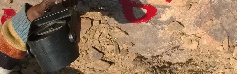
8 DynaMine: Online Truck dispatch system (OITDS): a Case Study (CMC Ltd) A global positioning system (GPS)- based, operator- independent truck dispatch system (OITDS) suitable for open cast mines at Jayant, NCL The Mine handles 30 million cubic metres of mine overburden (the waste product generated during mining operations) and around 10 million tonnes of coal in a year. It has a fleet of 15 excavators with a capacity ranging from eight to 14 cubic metres, 50 trucks of 85-tonne capacity and 30 trucks of 120- tonne capacity. The OITDS system covers the entire fleet of excavators and trucks. This system was conceptualized in 1999 and was implemented in September 2002
9 DynaMine: Online Truck dispatch system (OITDS): a Case Study (CMC Ltd)
10 DynaMine: Online Truck dispatch system (OITDS): a Case Study (CMC Ltd) Global positioning system (GPS)- based on- board equipment with voice and data communication facilities and vital signs monitoring devices (VSMDs) is mounted on the excavators and trucks. Three communication masts with repeaters are installed at strategic locations to ensure reliable radio communications over an area of around 20 sq km, covering the entire mine. Fibre- optic cables are laid over a length of 18 km for LAN connectivity between the main control room and various user locations. Around 25 clients are connected to the host application and database server for online monitoring.
11 DynaMine: Online Truck dispatch system (OITDS): a Case Study (CMC Ltd) The system is integrated w ith the attendance recording system for the operating staff based on card sw iping, and m anages an autom atic crew - m ining equipm ent- allocation facility. The system directs each truck to m ove on optim ised route, increasing productivity through a dynam ic program m ing technique. The system tracks the m ovem ent of m ining equipm ent and m aintains a register of w arnings
12
13 DECISION MAKING IN THE MINES DEPENDS ON GRAPHI C I NFORMATI ON i.e. Mine plans of various types. I nform ation derived from data either collected from field or know n from other sources. Visual inspection of the site. Past inform ation available from records.
14 GI S & Rem ote Sensing GIS can contribute in providing a safe working environment in underground mining by performing network analysis and determine the appropriate sites for refuge chambers and facilitate the prompt evacuation of mine personnel GIS and remote sensing assist the planners in identifying natural hazards such as potential landslides, floods, and earthquakes prior to the construction of production and housing installations GIS can be also used for the selection of a housing site that meets safety, scenic, and recreational requirement within reasonable proximity to the mining operation
15
16 GI S and Rem ote Sensing Other applications : Assessment of land use and land resource pattern in the mining areas Determination of ground deform ations and slope stability in the vicinity of open pit m ining operations Mapping the Mines region with the Remote Sensing technology integrated w ith GI S mapping the regions affected by underground fires and its surrounding areas Developing and implementing a rehabilitation plan for the same Digital Imaging in the Mining Industry
17 LU/LC map of JCF in 2011
18 2.67% 16.33% 37.77% 40.97% 2.25% Vegetation Built-up Barren land & OB Water bodies Mining area
19 Thermal infrared band and short wavelength Thermal infrared band and short wavelength infrared bands of Satellite imageries haven been extensive used for detecting and mapping subsurface coal fires of Jharia
20 GI S and Rem ote Sensing Other applications : Land ownership and mineral claims Exploration management Siting of ore pass, draw points, ramps, shaft, winze, raises, haulways that are within a certain distance of production centers (stopes) and meeting production criteria. Querying the production stopes affected by unstable ground conditions, hazardous gas, refractory ore, etc. In mine development, GIS can assist the planners in establishing the In mine development, GIS can assist the planners in establishing the optimal location for exploration drifts, crosscuts, sublevels, man ways, ventilation shafts
21 The use of satellite imagery in mineral exploration, generally a combination of panchromatic and multispectral image information has been used in mineral and petroleum industries over the final decade. Imagery from satellite sensors such as ASTER, LANDSAT, GeoEye-1 and WorldView-2 apiece supplying panchromatic and multispectral total color imagery have benefited geologists, scientists and exploration managers in earth sciences due to the sensor containing multiple band colors


22 . Imagery of a mineral area using satellite sensor ASTER ((rsandgis.com, 2011) Rock colors mainly reflect the presence of iron minerals, and variations
23 Mine subsidence monitoring using the DInSAR technique as a cost-effective and complementary method to conventional geodetic techniques
24 accurately map, model and interpret geological structures in a pit conduct daily or end of month survey - detailed and accurate model of a stope or development face contract volume measurement, truck and shovel load measurement and analysis survey for pit production measurement, underground development and void survey conduct rapid pre- and post-blast surveys conduct airborne surveys for reserves assessments (where topography is critical in shallow flat lying deposits) conduct stope surveying
25 Automated Remote Survey Vehicle
26


27
28 Generation of 3D profile of an underground excavation using 3D laser scanner
29 Generation of 3D profile of an underground excavation using 3D laser scanner
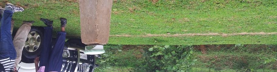
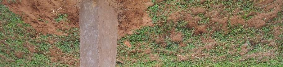
30 3D point cloud modelling of an opencast benches using Terrestrial Laser Scanner


31 Monitoring of Dump slope stability in an opencast mine using 3D laser Scanners
32 Alignment and Orientation Surveys
33 Correlation surveys are essential for : Correct location of underground workings with respect to the surface features. Combined workings of adjacent areas and adjacent seams. Connection of underground workings. Mine expansion works.
34 Correlation surveys involve the determination or transfer from the surface to the underground, of :- Coordinates of at least one point in surface coordinate system. Bearing of at least one line in surface reference system. Height (or r. L.) Of at least one point with respect to the datum or mean sea level.
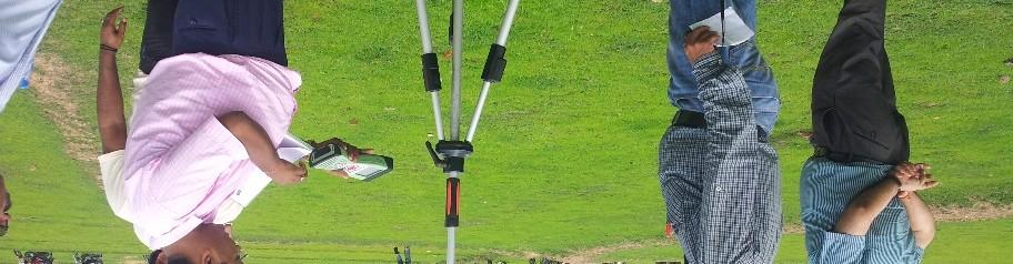
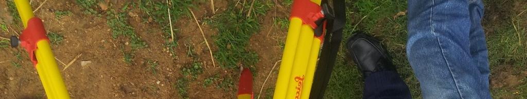
35 Correlation by suspension of plumb wires
36 Correlation and alignment by Laser-Gyro combination
37


38 CORRELATION SURVEY AND DEPTH MEASUREMENT IN A SHAFT IN MOONIDIH MINE


39


40 Orientation Surveys by Gyromat 3000
41 Shaft depth measurement with total station
42 CORRELATION SURVEY IN A METAL MINE ( A CASE HISTORY) MINE SHAFT SURFACE 500 M TOP LEVEL LEVEL A UNDERGROUND SHAFT HORIZON 1 HORIZON 2 HORIZON M
43 Subsidence Monitoring Dump slope monitoring Control surveys
44


45 Monitoring of subsidence over the permanent subsidence monitoring station on hilltop using Prism monitoring (EDM) keeping total station on stable ground
46
47
48 Geodetic Monitoring of OB dumps using Total Station
49


50 SUSIDENCE MONITORING BY DIGITAL LEVEL


51
52 It provides for high density, high precision measurements of up to 0.2 mm accuracy. The SSR has the ability to cover a broad area simultaneously (approximately horizontal view and vertical at ranges between 30m and 850m, potentially 1400 m at a reduced resolution). The system has the ability to monitor continuously and depending on the scan range it completes a scan area after about five to seven minutes
53 The slope stability radar utilises the differential interferometry processing technique on a stationary platform positioned 50m to 1700m back from the foot of the wall. The system scans a region of the wall in a grid pattern and compares the phase measurement of each footprint (pixel) with the first scan to determine the nature of movement on the rock face, and hence the stability of the slope. The SSR system has a pixel size of 1m x 1m at a range of 50 metres and of 15m x 15m at 850 metres.


54
55 The system provides immediate monitoring of slope movement without calibration and prior history. Scan times are typically every 1 to 10 minutes, depending on the size of the selected scanned area. Data can be viewed directly on the SSR unit or uploaded to a remote location via a dedicated radio link.
56
57
58
59
60 Reutec h Ra d a r Systems Pty Ltd http :/ / o.za / Ground p rob e Slop e Sta b ility Ra d a r http :/ / p rob e.c om/ slop esta b ility.html
61
62
63 Virtual Reality in Mineral I ndustry
64 Virtual Reality in Mineral I ndustry I t helps m ine planners and designers through a strong capability to visualize overall im pact of various factors in a com plex m ining environm ent.
65 Virtual Reality in Mineral I ndustry Mining Equipm ent Concept developm ent Design Review, Operator I nput, Maintenance Procedure Review and Sim ulations Developm ent of a sim ulation / m odel for m ine planning anim ation Presentation of Mining Concepts to an Approving Authority


66 Virtual Reality in Mineral I ndustry


67 Com puter Aided Mine Plan and design Solid modeling & block modeling of an iron ore deposit using SURPAC
68
69 Conclusion There is a substantial need of adoption of state of the art automation technologies in the mines to ensure the safety and to protect health of mineworkers. The paper has highlighted some of the applications of Geospatial Technology in the Indian mines for safe mining operations Significant developments have been made in the areas of surface and underground communication, robotics, smart sensors, tracking systems etc.
70 Conclusion semi-automated / automated mining technologies backboned with information technologies is need of the day This will satisfy the two most important goals of any mining operation: improved productivity and safer working conditions.
71
A Broad View of Geospatial Technology & Systems
 A Broad View of Geospatial Technology & Systems Pete Large Vice President, Trimble On the shoulders of giants 1 Since their time, our ability to generate geospatial information has grown exponentially
Geographical Information System (GIS) Prof. A. K. Gosain
 Prof. A. K. Gosain") Geographical Information System (GIS) Prof. A. K. Gosain gosain@civil.iitd.ernet.in Definition of GIS GIS - Geographic Information System or a particular information system applied to geographical data
Geographical Information System (GIS) Prof. A. K. Gosain gosain@civil.iitd.ernet.in Definition of GIS GIS - Geographic Information System or a particular information system applied to geographical data
Early Exploration Plan Activity Information
 Early Exploration Plan Activity Information Activities That Require an Early Exploration Plan: Line cutting that is a width of 1.5 metres or less; Geophysical surveys on the ground requiring the use of
SURVEYING Chapter 1 Introduction
 PHILADELPHIA UNIVERSITY Faculty of Engineering. Department of Civil Engineering. SURVEYING Chapter 1 Introduction Surveying : the art or science of measuring and representing natural and artificial features
POSSIBILITY FOR APPLICATION OF GIS TECHNOLOGIES IN RTB BOR GROUP
 MINING AND METALLURGY INSTITUTE BOR UDK: 622 ISSN: 2334-8836 (Štampano izdanje) ISSN: 2406-1395 (Online) UDK: 681.33:622.343(045)=111 doi:10.5937/mmeb1603021v Nenad Vušović *, Marko Vuković **, Igor Svrkota
GIS Application for Effective and Efficient Reporting and Information Media in Freeport Underground Mine
 GIS Application for Effective and Efficient Reporting and Information Media in Freeport Underground Mine Benget HUTAURUK, Drajat SETIAWAN, Sandi NUGRAHA, Indonesia Key words: GIS, underground mine, survey,
NZQA unit standard New US6 to replace and version 1 Page 1 of 5
 Page 1 of 5 Title Demonstrate knowledge of mining methods, and analyse and select plant for metalliferous underground extraction Level 6 Credits 20 Purpose People credited with this unit standard are able
Chapter 1 Overview of Maps
 Chapter 1 Overview of Maps In this chapter you will learn about: Key points when working with maps General types of maps Incident specific maps Map legend and symbols Map sources A map is a navigational
GEOMATICS. Shaping our world. A company of
 GEOMATICS Shaping our world A company of OUR EXPERTISE Geomatics Geomatics plays a mayor role in hydropower, land and water resources, urban development, transport & mobility, renewable energy, and infrastructure
Site Surveying Procedures for Construction and the Built Environment
 Unit 27: Site Surveying Procedures for Construction and the Built Environment Unit code: R/601/1291 QCF level: 4 Credit value: 15 Aim This unit develops an understanding of the principles of site surveying
MineScape Geological modelling, mine planning and design
 INTELLIGENT MINING SOLUTIONS MineScape Geological modelling, mine planning and design Specifically developed to meet the mining industry s rigorous demands, MineScape is used at more than 200 of the world
Airborne Corridor-Mapping. Planning and documentation of company infrastructure: precise, rapid, and cost effective
 Airborne Corridor-Mapping Planning and documentation of company infrastructure: precise, rapid, and cost effective Technology Airborne Laser-Scanning, digital orthophotos and thermal imaging: one flight
Ramani Geosystems. Putting Africa On The Map. Authorized Resellers
 Ramani Geosystems Putting Africa On The Map Authorized Resellers Ramani Profile Started in 1999 Aerial, Land Surveying & Mapping Solutions + 10 Countries in the region + 80 Staff working in projects Asset
Empowering water/wastewater network management with GIS
 Empowering water/wastewater network management with GIS Ioannis Kavouras_GIS Manager Surveying Engineer, MSc, MBA The Company responsible for fresh water distribution & sanitation serving 1.500.000 citizens
Mapping a Nation in 3D Singapore s Journey. Bryan Chew Registrar of Titles Assistant Chief Executive Singapore Land Authority
 Mapping a Nation in 3D Singapore s Journey Bryan Chew Registrar of Titles Assistant Chief Executive Singapore Land Authority Singapore Size - 719 sq km Population - 5.5 million Density 7,600/sq km Singapore
An Industry Perspective. Bryn Fosburgh Vice President Trimble
 An Industry Perspective Bryn Fosburgh Vice President Trimble Who are we? Professionals & Consultants Geospatial Professionals working at or with: AEC Consultants Transportation Departments Construction
VISUALIZING THE SMART CITY 3D SPATIAL INFRASTRUCTURE GEOSMART ASIA- 30 SEP, 2015
 www.aamgroup.com VISUALIZING THE SMART CITY 3D SPATIAL INFRASTRUCTURE GEOSMART ASIA- 30 SEP, 2015 Agenda AAM What is a Smart City? Data Acquisition 3D Modelling Benefits Questions AAM AAM is a Geospatial
THE USE OF GEOMATICS IN CULTURAL HERITAGE AND ARCHAEOLOGY FOR VARIOUS PURPOSES
 THE USE OF GEOMATICS IN CULTURAL HERITAGE AND ARCHAEOLOGY FOR VARIOUS PURPOSES FEBRUARY 2013 AL BEIDA GEOPLAN CONTENT Company Profile Concept Objectives and Strategies Data Production Methods Data Samples
Protection of Underground Mine Structures Due to Adjoining Open-pit Mine Blasting
 Protection of Underground Mine Structures Due to Adjoining Open-pit Mine Blasting By Pradeep K Singh Chief Scientist & Professor, Academy of Scientific & Innovative Research CSIR Central Institute of Mining
USING GIS CARTOGRAPHIC MODELING TO ANALYSIS SPATIAL DISTRIBUTION OF LANDSLIDE SENSITIVE AREAS IN YANGMINGSHAN NATIONAL PARK, TAIWAN
 CO-145 USING GIS CARTOGRAPHIC MODELING TO ANALYSIS SPATIAL DISTRIBUTION OF LANDSLIDE SENSITIVE AREAS IN YANGMINGSHAN NATIONAL PARK, TAIWAN DING Y.C. Chinese Culture University., TAIPEI, TAIWAN, PROVINCE
ENV208/ENV508 Applied GIS. Week 1: What is GIS?
 ENV208/ENV508 Applied GIS Week 1: What is GIS? 1 WHAT IS GIS? A GIS integrates hardware, software, and data for capturing, managing, analyzing, and displaying all forms of geographically referenced information.
MAD345 - Mining II INTRODUCTION. 10 October Hacettepe University. Introduction Prospecting Mining Dilution Resource and Reserve Estimation
 MAD345 - Mining II INTRODUCTION 10 October 2018 Course content MAD345 THEORY Date October, 10 October, 17 October, 24 October, 31 November, 7 November, 14 November, 21 Topic Introduction Prospecting, exploration
Brazil Paper for the. Second Preparatory Meeting of the Proposed United Nations Committee of Experts on Global Geographic Information Management
 Brazil Paper for the Second Preparatory Meeting of the Proposed United Nations Committee of Experts on Global Geographic Information Management on Data Integration Introduction The quick development of
Cutting Edge Engineering for Modern Geospatial Systems Rear Admiral Dr. S Kulshrestha, retd
 Cutting Edge Engineering for Modern Geospatial Systems Rear Admiral Dr. S Kulshrestha, retd 11 Jun 2015 GeoIntelligence Asia 2015 The technology would become so pervasive that it becomes a part of you
Roadmap to Stability
 Landslide Policy Committee for Aizawl City February 2014 Technical Support by: Aizawl is in earthquake hazard zone V and highly prone to natural, man-made and earthquake induced landslides. In order to
Syllabus Reminders. Geographic Information Systems. Components of GIS. Lecture 1 Outline. Lecture 1 Introduction to Geographic Information Systems
 Syllabus Reminders Geographic Information s Lecture Introduction to Geographic Information s. Class Info: www.saigis.com/class/ 2. Office T / TH (8:00-9:30 a.m.) and (2:30 3:30pm) or Appt 3. Email: burgerpr@unk.edu
ESRI GIS For Mining Seminar, 10 th August, 2016, Nairobi, Kenya. Spatial DATA Solutions for Mining
 ESRI GIS For Mining Seminar, 10 th August, 2016, Nairobi, Kenya Spatial DATA Solutions for Mining Spatial Data Solutions for Mining Spatial - Data that identifies the geographic location of features &
Yev Kontar. Illinois State Geological Survey, University of Illinois at Urbana-Champaign
 Addressing Caribbean Geophysical Hazards through the Continuously Operating Caribbean GPS Observational Network (COCONet) and International Ocean Drilling Program (IODP) Yev Kontar Illinois State Geological
Flood Mapping Michael Durnin October 9 th
 Michael Durnin October 9 th 2014 Leading Surveyors Company Profile Est. 1983 Celebrating 30 Years in Business Six Offices in UK & Ireland Over 30 Specialised Survey Services ISO 9001:2008 Registered Over
Exploring the boundaries of your built and natural world. Geomatics
 Exploring the boundaries of your built and natural world Geomatics Before the Luxor brought magic to the Las Vegas strip and before the South LRT extension in Edmonton gave residents a new route to travel,
Scout Aerial Africa DRONES THE BIG PICTURE FOR GEOLOGY AND MINING
 Scout Aerial Africa DRONES THE BIG PICTURE FOR GEOLOGY AND MINING WHO ARE WE? Scout Aerial Group is a diversified operating and investment group with market leading businesses and targeted investment in
Early Exploration Permit Activity Information
 Early Exploration Permit Activity Information Activities That Require an Early Exploration Permit: Line cutting that is a width greater than 1.5 metres Mechanized stripping of a total surface area of greater
FEBRUARY tis ... Po. III. Cll
 FEBRUARY 2010 ṯs....... ts Po. o Cll ~ ADVSORY BOARD 4 ndigenous knowledge validates GS outcome Purabl Chanda ndian Agricultural Research nstitute, ndia Dato' Dr. Abdul Kadir bin Taib Director General
APPLICATION OF MODELLING TOOLS IN ESTONIAN OIL SHALE MINING AREA
 Oil Shale, 2008, Vol. 25, No. 2 Special, pp. 135 144 ISSN 0208-189X doi: 10.3176/oil.2008.2S.05 2008 Estonian Academy Publishers APPLICATION OF MODELLING TOOLS IN ESTONIAN OIL SHALE MINING AREA V. KARU
Imagery and the Location-enabled Platform in State and Local Government
 Imagery and the Location-enabled Platform in State and Local Government Fred Limp, Director, CAST Jim Farley, Vice President, Leica Geosystems Oracle Spatial Users Group Denver, March 10, 2005 TM TM Discussion
LOZAR RADAR INTRODUCTORY PRESENTATION COAL SURVEYING
 LOZAR RADAR INTRODUCTORY PRESENTATION COAL SURVEYING WWW.LOZARRADAR.COM ABOUT LOZAR RADAR Lozar Radar is a ground-scanning device, which verifies and investigates the presence of mineral resources and
Practical long-term planning in narrow vein mines a case study
 Underground Design Methods 2015 Y Potvin (ed.) 2015 Australian Centre for Geomechanics, Perth, ISBN 978-0-9924810-3-2 https://papers.acg.uwa.edu.au/p/1511_31_khani/ Practical long-term planning in narrow
Curriculum Document Mining Technician: Strata Control Practitioner (Surface) Occupational Curriculum
 Occupational Curriculum") Curriculum Document Curriculum Code Curriculum Title 311701-008 Mining Technician: Strata Control Practitioner (Surface) TABLE OF CONTENTS SECTION 1: CURRICULUM OVERVIEW 1 Occupational Information 1 Associated
Curriculum Document Curriculum Code Curriculum Title 311701-008 Mining Technician: Strata Control Practitioner (Surface) TABLE OF CONTENTS SECTION 1: CURRICULUM OVERVIEW 1 Occupational Information 1 Associated
DATA SOURCES AND INPUT IN GIS. By Prof. A. Balasubramanian Centre for Advanced Studies in Earth Science, University of Mysore, Mysore
 DATA SOURCES AND INPUT IN GIS By Prof. A. Balasubramanian Centre for Advanced Studies in Earth Science, University of Mysore, Mysore 1 1. GIS stands for 'Geographic Information System'. It is a computer-based
WEIR INTERNATIONAL, INC. Mining, Geology and Energy Consultants
 WEIR INTERNATIONAL, INC. Mining, Geology and Energy Consultants Introduction to Coal Mining History of Coal in the United States Coal was one of man s earliest sources of heat and light Coal was first
Mapping Coastal Change Using LiDAR and Multispectral Imagery
 Mapping Coastal Change Using LiDAR and Multispectral Imagery Contributor: Patrick Collins, Technical Solutions Engineer Presented by TABLE OF CONTENTS Introduction... 1 Coastal Change... 1 Mapping Coastal
Composition of the crust. Ore deposits. Ore distribution. Resources: Mineral resources. Reading: Today: Ch 12 (to p306)
") Composition of the crust Resources: Mineral resources Reading: Today: Ch 12 (to p306) QUESTION Ore deposits A rock containing a useful metal in a useable concentration Ore distribution by definition ore
Composition of the crust Resources: Mineral resources Reading: Today: Ch 12 (to p306) QUESTION Ore deposits A rock containing a useful metal in a useable concentration Ore distribution by definition ore
Mineral resources. Composition of the crust. Resources: Reading: Today: Ch 12 (to p306) QUESTION Environmental Geology Mineral resources
 QUESTION Environmental Geology Mineral resources") Resources: Mineral resources Reading: Today: Ch 12 (to p306) QUESTION Composition of the crust 1 Ore deposits A rock containing a useful metal in a useable concentration Concentration factor = concentration
Resources: Mineral resources Reading: Today: Ch 12 (to p306) QUESTION Composition of the crust 1 Ore deposits A rock containing a useful metal in a useable concentration Concentration factor = concentration
MCDR INSPECTION General. Date of Inspection Name of the Mine Bhatbhera Limestone Mine 2 Total Lease Area (Ha)
") ::1:: MCDR INSPECTION General SN Particulars Details Date of Inspection 23.8.2015 1 Name of the Mine Bhatbhera Limestone Mine 2 Total Lease Area (Ha) 4.808 Hect (Govt. Revenue Land), Non-forest land with
::1:: MCDR INSPECTION General SN Particulars Details Date of Inspection 23.8.2015 1 Name of the Mine Bhatbhera Limestone Mine 2 Total Lease Area (Ha) 4.808 Hect (Govt. Revenue Land), Non-forest land with
Themes for Geomatics Conference. Geodesy Themes
 Themes for Geomatics Conference Geodesy Themes Geodynamics o Modeling the Deformation of the Earth s Crust o Recent Advances in Geometric Approaches to Deformation Analysis o Monitoring Systems (Sensors
indigeo Consultants Pvt Ltd Geophysical Surveys Geological Surveys GIS & Data Solutions Image Processing indigeo Company Profile, Page 1
 indigeo Consultants Pvt Ltd Geophysical Surveys Geological Surveys GIS & Data Solutions Image Processing MM Corner, 3 rd Floor #58, Banaswadi Main Road Bangalore 560033 INDIA Ph: +91 80 41638310 Mob: +91
GEOMATICS SURVEYING AND MAPPING EXPERTS FOR OVER 35 YEARS
 GEOMATICS SURVEYING AND MAPPING EXPERTS FOR OVER 35 YEARS 2 GEOMATICS AND SURVEYING SOLUTIONS SPANNING THE ENTIRE PROJECT LIFECYCLE 1,000+ 250+ 24 Surveying professionals Active field crews Geomatics offices
Building a National Data Repository
 Building a National Data Repository Mladen Stojic, Vice President - Geospatial 1/30/2013 2012 Intergraph Corporation 1 Information has meaning and gives power only when shared and distributed. Information,
Colorado Academic Standards for High School Science Earth Systems Science
 A Correlation of Pearson 12 th Edition 2015 Colorado Academic Standards Introduction This document demonstrates the alignment between, 12 th Edition, 2015, and the, Earth Systems Science. Correlation page
Identifying Audit, Evidence Methodology and Audit Design Matrix (ADM)
") 11 Identifying Audit, Evidence Methodology and Audit Design Matrix (ADM) 27/10/2012 Exercise XXX 2 LEARNING OBJECTIVES At the end of this session participants will be able to: 1. Identify types and sources
11 Identifying Audit, Evidence Methodology and Audit Design Matrix (ADM) 27/10/2012 Exercise XXX 2 LEARNING OBJECTIVES At the end of this session participants will be able to: 1. Identify types and sources
PROGRESS GALLERY Advancing our projects
 November 23, 2017. Ignition of the detonating cord for the first blast marked the start of development of the twin declines to access the ultra-high-grade Kakula Copper Discovery on the Tier One Kamoa-Kakula
The financial and communal impact of a catastrophe instantiated by. volcanoes endlessly impact on lives and damage expensive infrastructure every
 Chapter 1 Introduction The financial and communal impact of a catastrophe instantiated by geophysical activity is significant. Landslides, subsidence, earthquakes and volcanoes endlessly impact on lives
Geotechnical & Mining Engineering Services
 Geotechnical & Mining Engineering Services Southwest Research Institute San Antonio, Texas A s an independent, nonprofit research and development organization, Southwest Research Institute (SwRI ) uses
GIS-based Smart Campus System using 3D Modeling
 GIS-based Smart Campus System using 3D Modeling Smita Sengupta GISE Advance Research Lab. IIT Bombay, Powai Mumbai 400 076, India smitas@cse.iitb.ac.in Concept of Smart Campus System Overview of IITB Campus
Submitted to: Central Coalfields Limited Ranchi, Jharkhand. Ashoka & Piparwar OCPs, CCL
 Land Restoration / Reclamation Monitoring of more than 5 million cu. m. (Coal + OB) Capacity Open Cast Coal Mines of Central Coalfields Limited Based on Satellite Data for the Year 2013 Ashoka & Piparwar
a system for input, storage, manipulation, and output of geographic information. GIS combines software with hardware,
 Introduction to GIS Dr. Pranjit Kr. Sarma Assistant Professor Department of Geography Mangaldi College Mobile: +91 94357 04398 What is a GIS a system for input, storage, manipulation, and output of geographic
SRJC Applied Technology 54A Introduction to GIS
 SRJC Applied Technology 54A Introduction to GIS Overview Lecture of Geographic Information Systems Fall 2004 Santa Rosa Junior College Presented By: Tim Pudoff, GIS Coordinator, County of Sonoma, Information
HKND Group Ltd Grand Canal Project
 HKND Group Ltd Grand Canal Project General Overview of Aerial Survey Project Managua, Nicaragua September 21 st 2015 Presented by: Jeff Elliott Managing Director CSA Global About CSA Global CSA Global
Sustainable and Harmonised Development for Smart Cities The Role of Geospatial Reference Data. Peter Creuzer
 Sustainable and Harmonised Development for Smart Cities The Role of Geospatial Reference Data Peter Creuzer 1. Introduction - Smart Cities and Geodata 2. Geodata in Germany 3. Examples 4. Data and Service
July 5-6, 2010 Mytilene, Greece
 Web GIS platform for forest fire management Prof. Kostas Kalabokidis Principal Investigator Univ. of the Aegean, Dept. of Geography, Greece Prof. George Kallos Univ. of Athens, Dept. of Physics, Greece
An Introduction to Field Explorations for Foundations
 An Introduction to Field Explorations for Foundations J. Paul Guyer, P.E., R.A. Paul Guyer is a registered mechanical engineer, civil engineer, fire protection engineer and architect with over 35 years
Geoscientific Instrumentation in River Valley Projects
 J. Ind. Geophys. Union ( July 2008 ) Vol.12, No.3, pp.141-147 Geoscientific Instrumentation in River Valley Projects G.C.Pargaien Energy Infratech Private Limited, 145-146, Udyog Vihar, Phase IV, Gurgaon
Coal Mining Methods. Underground Mining. Longwall & Room and Pillar Mining. Fig. 1: Longwall Mining
 Coal Mining Methods Underground Mining Longwall & Room and Pillar Mining Longwall mining and room-and-pillar mining are the two basic methods of mining coal underground, with room-and-pillar being the
Land-Line Technical information leaflet
 Land-Line Technical information leaflet The product Land-Line is comprehensive and accurate large-scale digital mapping available for Great Britain. It comprises nearly 229 000 separate map tiles of data
GEOGRAPHIC INFORMATION SYSTEMS SPECIALIST FOR INCIDENT MANAGEMENT
 GEOGRAPHIC INFORMATION SYSTEMS SPECIALIST FOR INCIDENT MANAGEMENT Incident Command System A standardized, on-scene, all-hazard incident management concept. Co-ordinates ordinates multiple agencies to make
An Introduction to Geographic Information System
 An Introduction to Geographic Information System PROF. Dr. Yuji MURAYAMA Khun Kyaw Aung Hein 1 July 21,2010 GIS: A Formal Definition A system for capturing, storing, checking, Integrating, manipulating,
Airborne Multi-Spectral Minefield Survey
 Dirk-Jan de Lange, Eric den Breejen TNO Defence, Security and Safety Oude Waalsdorperweg 63 PO BOX 96864 2509 JG The Hague THE NETHERLANDS Phone +31 70 3740857 delange@fel.tno.nl ABSTRACT The availability
Geotechnical Monitoring for Safe Excavation of Large Rock Cavern: A Case Study
 The 31st International Symposium on Automation and Robotics in Construction and Mining (ISARC 2014) Geotechnical Monitoring for Safe Excavation of Large Rock Cavern: A Case Study A.Mandal a, C. Kumar b,
GEOGRAPHIC INFORMATION SYSTEMS Session 8
 GEOGRAPHIC INFORMATION SYSTEMS Session 8 Introduction Geography underpins all activities associated with a census Census geography is essential to plan and manage fieldwork as well as to report results
Surveying the Old Underground Mine Works Using Innovative Techniques
 Surveying the Old Underground Mine Works Using Innovative Techniques Miroslav Novosad, Dana Vrublova, Jiří Pospíšil and Rostislav Dandoš VSB Technical University of Ostrava, Czech Republic *Contact: miroslav.novosad@vsb.cz
Automated Seabed Mapping and Data Delivery in the Cloud
 Automated Seabed Mapping and Data Delivery in the Cloud London, 2nd November 2017 11/20/2017 1 2 WE CALL IT SEABED INTELLIGENCE Ocean Infinity are explorers. We go to unmapped locations to survey the seabed
GIS = Geographic Information Systems;
 What is GIS GIS = Geographic Information Systems; What Information are we talking about? Information about anything that has a place (e.g. locations of features, address of people) on Earth s surface,
Subsurface laser scanning and multibeam sonar void surveys What really does lie beneath and where exactly? Mitigating your Risk
 Subsurface laser scanning and multibeam sonar void surveys What really does lie beneath and where exactly? Mitigating your Risk UNDERGROUND CAVITY SURVEYS C-ALS (Cavity Auto Laser Scanner) - DRY Deployed
INVESTOR SITE VISIT MAGARENG MINE - 10 NOVEMBER
 INVESTOR SITE VISIT MAGARENG MINE - 10 NOVEMBER 2017 Legal notice/disclaimer This presentation is published solely for informational purposes and does not constitute investment, legal, tax or other advice
High-precision NATM tunnelling through advanced surveying and monitoring technology. Klaus Rabensteiner
 High-precision NATM tunnelling through advanced surveying and monitoring technology Klaus Rabensteiner Introduction to Geodata www.geodata.com Activities o o o o Surveying Monitoring Instrumentation Software
UNFC COAL MINES CASE STUDIES
 UNFC COAL MINES CASE STUDIES Format for Collecting Information Block Geological Reserve in the block Geological Reserve Considered Extractable Reserve Balance Extractable Reserve Econ /Not Econ F1 F2 G1
King of the Hills Gold Project, Leonora, to commence production in Q2 2011
 King of the Hills Gold Project, Leonora, to commence production in Q2 2011 St Barbara is pleased to announce the King of the Hills gold project near Leonora (formerly referred to as the Tarmoola higher
Location. Mt Owen Complex. Overview. Mine Layout. Mining Method. Mitsubishi Lecture. In-Pit Lowwall Dump Design and Stability at Mt Owen Mine
 Location In-Pit Lowwall Dump Design and Stability at Mt Owen Mine Wayne Bartlett Senior Engineering Geologist Mt Owen Complex Overview In the past Mt Owen Mine lowwall dumps have failed. Lowwall dumps
Submitted to Central Coalfields Limited BHURKUNDA OCP, CCL
 Land Restoration / Reclamation Monitoring of Open Cast Coal Mines of Central Coalfields Limited producing less than 5 m cu m. (Coal+ OB) based on Satellite Data for the Year 2013 BHURKUNDA OCP, CCL Submitted
Unmanned Aircraft Systems (UAS) Activities in Earth Sciences
 Activities in Earth Sciences") Unmanned Aircraft Systems (UAS) Activities in Earth Sciences Bruce K. Quirk quirk@usgs.gov Department of the Interior U.S. Geological Survey June 22, 2015 Department of the Interior Bureau of Land Management
Unmanned Aircraft Systems (UAS) Activities in Earth Sciences Bruce K. Quirk quirk@usgs.gov Department of the Interior U.S. Geological Survey June 22, 2015 Department of the Interior Bureau of Land Management
Lesson 4b Remote Sensing and geospatial analysis to integrate observations over larger scales
 Lesson 4b Remote Sensing and geospatial analysis to integrate observations over larger scales We have discussed static sensors, human-based (participatory) sensing, and mobile sensing Remote sensing: Satellite
Oposura Scoping Study Nearing Completion
 20 AUGUST 2018 KEY POINTS: Oposura Scoping Study Nearing Completion Mining study with open pit optimisations and underground mine designs completed High grade massive sulphide mineralisation occurs near
Expert paper GIS CONTENT PROPOSAL FOR UNDERGROUND MINING ROOMS
 UNDERGROUND MINING ENGINEERING 14 (2005) 95-100 UDK 62 FACULTY OF MINING AND GEOLOGY, BELGRADE YU ISSN 0354-2904 ABSTRACT Expert paper GIS CONTENT PROPOSAL FOR UNDERGROUND MINING ROOMS Milutinović Aleksandar
Coal Loss and Dilution Considerations for Western Canadian Foothills Open Pit Coal Projects
 Coal Loss and Dilution Considerations for Western Canadian Foothills Open Pit Coal Projects Presenter: Mike Allen Manager, Surface Mining April 29, 2015 Outline Terms / Definitions Factors affecting coal
University of Saskatchewan
 University of Saskatchewan Geological Engineering GEOE 498.3 Introduction to Mineral Engineering Lecture 2 Underground Mining Methods Bulk vs. Selective Reasons for Selection (Geotechnical, Geometry, Value,
Surveying, Surveyors and. Systems. Curt Crow NOAA s National Geodetic Survey September 22, 2009 URISA New England, Bedford, NH
 Surveying, Surveyors and Geographic Information Systems Curt Crow NOAA s National Geodetic Survey September 22, 2009 URISA New England, Bedford, NH Surveying The technique and science of accurately determining
FIELD MONITORING OF STABILITY OF DUMP A CASE STUDY
 FIELD MONITORING OF STABILITY OF DUMP A CASE STUDY Dr. Singam Jayanthu*, and Dr. Simantini Behera** Professor, Associate Professor Department of Mining Engineering National Institute of Technology Rourkela-769008
GIS and Remote Sensing
 Spring School Land use and the vulnerability of socio-ecosystems to climate change: remote sensing and modelling techniques GIS and Remote Sensing Katerina Tzavella Project Researcher PhD candidate Technology
Louisiana Transportation Engineering Conference. Monday, February 12, 2007
 Louisiana Transportation Engineering Conference Monday, February 12, 2007 Agenda Project Background Goal of EIS Why Use GIS? What is GIS? How used on this Project Other site selection tools I-69 Corridor
Engineer. Engineering. Engineering. (in-ja-neer ) A person trained and skilled in any of the various branches of engineering: a civil engineer
 A person trained and skilled in any of the various branches of engineering: a civil engineer") Engineer (in-ja-neer ) A person trained and skilled in any of the various branches of engineering: a civil engineer (Random House Webster s College Dictionary, 1991) CE100 Introduction to Civil Geotechnical
Engineer (in-ja-neer ) A person trained and skilled in any of the various branches of engineering: a civil engineer (Random House Webster s College Dictionary, 1991) CE100 Introduction to Civil Geotechnical
Monitoring the earth
 Monitoring the earth Name Date Technology has provided a way to monitor and see the ever-changing and often remote corners of the Earth. Satellite imagery, ocean buoys, and thermal imaging are all used
Advanced Algorithms for Geographic Information Systems CPSC 695
 Advanced Algorithms for Geographic Information Systems CPSC 695 Think about Geography What is Geography The 3 W s of Geography What is where Why is it there Why do I care Data - Data - Data We all got
Integrating Geographical Information Systems (GIS) with Hydrological Modelling Applicability and Limitations
 with Hydrological Modelling Applicability and Limitations") Integrating Geographical Information Systems (GIS) with Hydrological Modelling Applicability and Limitations Rajesh VijayKumar Kherde *1, Dr. Priyadarshi. H. Sawant #2 * Department of Civil Engineering,
Integrating Geographical Information Systems (GIS) with Hydrological Modelling Applicability and Limitations Rajesh VijayKumar Kherde *1, Dr. Priyadarshi. H. Sawant #2 * Department of Civil Engineering,
Earth Science (Tarbuck, et al) 2009 Correlated to: Colorado Academic Standards Science (High School)
 2009 Correlated to: Colorado Academic Standards Science (High School)") Content Area: Science Standard: Earth Systems Science Prepared Graduates: Describe and interpret how Earth's geologic history and place in space are relevant to our understanding of the processes that
Content Area: Science Standard: Earth Systems Science Prepared Graduates: Describe and interpret how Earth's geologic history and place in space are relevant to our understanding of the processes that
P R O U D LY C A N A D I A N
 P R O U D LY C A N A D I A N 1.855.423.3185 info@rmegeomatics.com AERIAL SURVEYING IMAGING TERRAIN ANALYSIS WHO WE ARE HSE & REGULATORY CLIENT INDUSTRIES RME Geomatics (formerly NGF Geomatics) was founded
Geology and the Aggregate Industry: The Role of Geologists
 Geology and the Aggregate Industry: The Role of Geologists Donald G. Mikulic Illinois State Geological Survey Prairie Research Institute University of Illinois at Urbana-Champaign Outline Importance of
K. Zainuddin et al. / Procedia Engineering 20 (2011)
") Available online at www.sciencedirect.com Procedia Engineering 20 (2011) 154 158 The 2 nd International Building Control Conference 2011 Developing a UiTM (Perlis) Web-Based of Building Space Management
Available online at www.sciencedirect.com Procedia Engineering 20 (2011) 154 158 The 2 nd International Building Control Conference 2011 Developing a UiTM (Perlis) Web-Based of Building Space Management
What s New in the World of Winter Maintenance Technology. Laser Road Surface Sensor (LRSS) Functional Description
 Functional Description") What s New in the World of Winter Maintenance Technology Dennis Burkheimer Winter Operations Administrator Iowa Department of Transportation John Scharffbillig Fleet Manager Minnesota Department of Transportation
What s New in the World of Winter Maintenance Technology Dennis Burkheimer Winter Operations Administrator Iowa Department of Transportation John Scharffbillig Fleet Manager Minnesota Department of Transportation
Key words: global monitoring, disaster control, coal fires, China
 Remote-sensing GIS based investigations of coal fires in northern China; global monitoring to support the estimation of CO 2 emissions from spontaneous combustion of coal Freek van der Meer, Paul van Dijk,
1. Rock Mechanics and mining engineering
 1. Rock Mechanics and mining engineering 1.1 General concepts Rock mechanics is the theoretical and applied science of the mechanical behavior of rock and rock masses; it is that branch of mechanics concerned