Flood Mapping Michael Durnin October 9 th
|
|
|
- Anne Wilkinson
- 5 years ago
- Views:
Transcription


1 Michael Durnin October 9 th 2014


2 Leading Surveyors Company Profile Est Celebrating 30 Years in Business Six Offices in UK & Ireland Over 30 Specialised Survey Services ISO 9001:2008 Registered Over 140 Permanent Full-Time Staff 100 Sub-Contracted Staff 140 Full-Time


3 Global Business Partners
4 Clients

5 Why is mapping required? Generate hydrodynamic models Calibrate models To produce flood risk maps Flood forecasting Flood risk management analysis To enable the design of flood relief schemes
6 Applying Different Methods and Tools For one result In Urban and Rural Environments Multipurpose Integrated Cost Effective Dynamic


7 Survey Methodologies Terrestrial and Satellite Positioning
8 Remote Sensing LiDAR Offers a significantly lower cost for large scale Mapping Widely used for extension of Flood Plain analysis Typical Flying height XY accuracy Z accuracy Ortho photo pixel size Lidar point density m +/-0.05m to 0.08m +/-0.05m to 0.08m 0.03m to 0.05m points per square meter m +/-0.08m to 0.10m +/-0.08m to 0.10m 0.05m to 0.10m points per square meter 700m +/-0.20m +/ m 1-10 points per square meter


9 3D Imaging Draped Orthophotos, High Res 3cm pixels DSM DTM Vegetation Penetration Real-time positioning and image collection to an accuracy of 10cm without ground control Horizontal and Vertical Scans

10 Economical method of accurate spatial data capture. Could provide a comprehensive source for all flood risk and coastal management data Not only on flood plains but also on flood defences and flood risk management assets, when being assessed and categorised
")
11 Client: OPW The Office of Public Works (OPW) National Catchment Flood Risk Assessment and Management (CFRAM) Programme

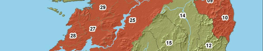
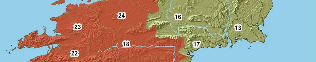
12 Scale of the Project
13 STATS (Six Contracts: 1, 2, 3, 5, Western SC2 and North West Neagh Bann) River Sections: 37,306 Open Sections: 19,500 Extended Gauge Sections: 1,100 Bridges: 1,800 Culvert: 1,500 Weirs: 600 Others: 2,300 Control Points: 260 Drawings: 5,500 Photos: 260,000 People: 100 Data: 500Gb+


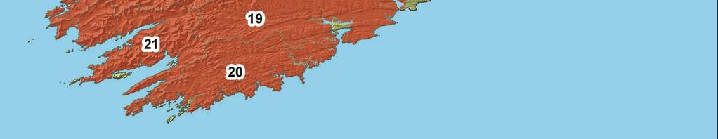
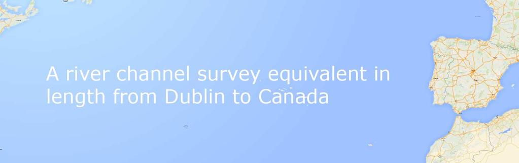
14 Largest Survey of it s kind in Europe 54,000Km2 area 4190Km in length
15 Project Considerations Safely, Efficiently, Effectively Safety Approx 25,000 hours near water and no serious incidents Consistent Data 60 Survey Teams Efficient Delivery Short Timeline
16 Workflow Implementation Project team structure Insure consistent data Training and QA Checks Maximise time on site Technology/Reconnaissance/ Program/Crew Management Rigid workflows Continually reviewed Troubleshooting Geo-Information management and storage Protocols on data transfer Project structure protocols and awareness


17 Cross and long-sections (x,y,z spatial coordinates) on river channels and banks Structures (bridge, weirs, sluices) Flood Defences (walls, embankments) Photo and Videos Meta Data and GIS Survey Data Collected
18 Data Collection Protocols Assessment of specification Reviewed workflow and implemented new survey strategy Training and Standardised working practices Equipment Data collection Coding and fully digital recording On site QA protocols and verification of spatial data collected Gross error checks Real time data transfer Logistics and crew management


19 Equipment and Data Collection Trimble GNSS R6/R8 Total Station S6 Controller TCS3 Sonarmite Leica GS14 TS15i CS s GNSS D8 Disto Sonarmite


20 4 Orkney Fast Liner 19ft 6 Aluminium unsinkable 3.7m long by 1.3m wide Mokai Jet-propelled kayaks 6 Mercury 6hp 2 stroke with 12l fuel tank 4 Mercury 30hp 2 stroke with 25l fuel tank and 25ltr secondary tank Single man hovercraft Vessels

21 GIS Management Developed Scripts for QA Creation of Crew Packs Management Geo-tagged data Photos Notes Visual for PM


22 Data was collected and tracked in field and remotely loaded onto secure cloud. Project Management This method of data transfer enabled almost real-time survey processing. Data could be sent to the field crews through the cloud, directly to their loggers in the field.


23 Training and Standardised workflows Initial QA Check on survey data bespoke script Imagery renamed Output report created Report back to crews in real-time Bespoke River Module for Autodesk Civil 3D One step process Built in QA procedures Report back to crews and managed GIS Meta data All meta data related to cross sections and structures Additional photos Management tool Data Processing


24 A piece of cake?


25 Other Considerations Is your Mapping Accurate enough? Height systems with GNSS Is the OSGM02 Geoid sufficient? Are the long term studies been done for flood analysis of modelled topography, coastal and inland, as well as pluvial flooding events being affected by the local bias in the geoid corrector surface? Sea Surface Topography (SST) Altimeters Co-located GNSS and Tide Gauges


26 Orthometric Heights fundamental for the positioning of a point on the surface that best represents the topography In order to convert GPS geodetic coordinates the definition of the geoid is of critical importance for the user GEOID Gravimetric Geoid more suitable, as the time dependent gravity causes only small variations in the quasi/geoid model when compared to physical benchmarks which are subject to land uplift and local topographical changes True Equipotential Surface PPK/PPP Political and Economical will
 and land movement give excellent long term monitoring and evaluation of")

27 Co located GNSS and Tide Gauges Currently Ireland is not part of the European Vertical Reference System (EVRS) as there are no co-located GPS-Tide gauges in operation that are associated with EUREF Help monitor the sea surface topography (SST) and land movement give excellent long term monitoring and evaluation of gravimetric geoids Accurate SST and the comparative land topography critical for flood mapping, and flood prevention Citizens will also benefit by knowing were the potential risks Insurance companies can process claims in a timely manner with access to accurate mapping and long term data. Sea Surface Topography (SST)
28 Questions & Answers Thank you for your attention, we welcome any questions! facebook facebook.com/murphysurveys Twitter twitter.com/murphy_surveys LinkedIn linkedin.com/murphy-surveys YouTube youtube.com/murphysurvey101


29 Learn more on our website!
21 489 5704 London T:+44 (0)20 3178")
30 Contact Us Kildare T:+353 (0) Belfast T:+44 (0) Cork T:+353 (0) London T:+44 (0)
To achieve these Global Sustainable Development Goals, geospatial data are crucial.
 To achieve these Global Sustainable Development Goals, geospatial data are crucial. 2 http://www.globalgoals.org/ HIGH INCOME NATION SUSTAINABLE GROWTH SOCIALLY INCLUSIVE 3 http://etp.pemandu.gov.my/ 12
BANGLADESH SURVEY OF BANGLADESH PREMISES
 BANGLADESH SURVEY OF BANGLADESH PREMISES Survey of Bangladesh (SOB) is the National Mapping organization of Bangladesh SOB is carrying out all Geodetic activities of Bangladesh SOB is responsible for taking
Sustainable and Harmonised Development for Smart Cities The Role of Geospatial Reference Data. Peter Creuzer
 Sustainable and Harmonised Development for Smart Cities The Role of Geospatial Reference Data Peter Creuzer 1. Introduction - Smart Cities and Geodata 2. Geodata in Germany 3. Examples 4. Data and Service
GEOMATICS. Shaping our world. A company of
 GEOMATICS Shaping our world A company of OUR EXPERTISE Geomatics Geomatics plays a mayor role in hydropower, land and water resources, urban development, transport & mobility, renewable energy, and infrastructure
Modeling Great Britain s Flood Defenses. Flood Defense in Great Britain. By Dr. Yizhong Qu
 Modeling Great Britain s Flood Defenses AIRCurrents Editor s note: AIR launched its Inland Flood Model for Great Britain in December 2008. The hazard module captures the physical processes of rainfall-runoff
A Broad View of Geospatial Technology & Systems
 A Broad View of Geospatial Technology & Systems Pete Large Vice President, Trimble On the shoulders of giants 1 Since their time, our ability to generate geospatial information has grown exponentially
Geodesy. orientation. shape. gravity field
 Geodesy noun Science of measuring the shape, orientation and gravity field of the Earth and how it changes over time. shape orientation gravity field Positioning has always been important Downstream applications
The National Spatial Reference System of the Future
 The National Spatial Reference System of the Future William Stone Southwest Region (AZ, NM, NV, UT) Geodetic Advisor william.stone@noaa.gov NOAA s National Geodetic Survey geodesy.noaa.gov Salt Lake City
Leveraging Geospatial Technology for Cadastral Surveys
 Matthew Delano, LS Geospatial World Forum January 2017 Leveraging Geospatial Technology for Cadastral Surveys Fit-for-Purpose Simple to start Can improve over time whenever necessary Meet the needs of
VISUALIZING THE SMART CITY 3D SPATIAL INFRASTRUCTURE GEOSMART ASIA- 30 SEP, 2015
 www.aamgroup.com VISUALIZING THE SMART CITY 3D SPATIAL INFRASTRUCTURE GEOSMART ASIA- 30 SEP, 2015 Agenda AAM What is a Smart City? Data Acquisition 3D Modelling Benefits Questions AAM AAM is a Geospatial
Initial OPW Designation APSR AFRR IRR Co-ordinates Easting: Northing: River / Catchment / Sub-catchment Type of Flooding / Flood Risk
 Location: Shannon International Airport Radar Station, Co. Clare Unique ID: 275485 (from PFRA database) Initial OPW Designation APSR AFRR IRR Co-ordinates Easting: 137684 Northing: 160636 River / Catchment
Land Administration and Cadastre
 Geomatics play a major role in hydropower, land and water resources and other infrastructure projects. Lahmeyer International s (LI) worldwide projects require a wide range of approaches to the integration
Exploring the boundaries of your built and natural world. Geomatics
 Exploring the boundaries of your built and natural world Geomatics Before the Luxor brought magic to the Las Vegas strip and before the South LRT extension in Edmonton gave residents a new route to travel,
State of Israel Ministry of Housing and Construction Survey of Israel. The Hydrological project case
 State of Israel Ministry of Housing and Construction Survey of Israel The Hydrological project case Survey of Israel Content Introduction To the Survey of Israel The operation assumptions The main responsibilities
GEOMATICS SURVEYING AND MAPPING EXPERTS FOR OVER 35 YEARS
 GEOMATICS SURVEYING AND MAPPING EXPERTS FOR OVER 35 YEARS 2 GEOMATICS AND SURVEYING SOLUTIONS SPANNING THE ENTIRE PROJECT LIFECYCLE 1,000+ 250+ 24 Surveying professionals Active field crews Geomatics offices
An Industry Perspective. Bryn Fosburgh Vice President Trimble
 An Industry Perspective Bryn Fosburgh Vice President Trimble Who are we? Professionals & Consultants Geospatial Professionals working at or with: AEC Consultants Transportation Departments Construction
Vertical Reference Frame Pacific
 Vertical Reference Frame Pacific Andrick Lal SPC Geoscience Division GIS&RS User Conference 29 th November 2016 USP, Fiji. What does it mean? All buildings and features have a height. But what is it relative
Global UAV-based solutions for the industry and agriculture.
 Global UAV-based solutions for the industry and agriculture. Remote sensing of vegetation from drones (UAS). The example of the Trimble Unmanned Aerial Solution Emmanuel de Maistre, co-founder & CEO demaistre@redbird.fr
County Clare Flood Forecasting System
 County Clare Flood Forecasting System Paul Moroney BE (Civil), C. Eng. M.I.E.I. M.C.I.Arb. Head of the Environment Section Clare County Council (The views expressed in this paper represent the professional
Airborne Corridor-Mapping. Planning and documentation of company infrastructure: precise, rapid, and cost effective
 Airborne Corridor-Mapping Planning and documentation of company infrastructure: precise, rapid, and cost effective Technology Airborne Laser-Scanning, digital orthophotos and thermal imaging: one flight
OSGM15 Geoid Changes for Ireland
 Geomatics client guides OSGM15 Geoid Changes for Ireland Avoid the potential dangers of height differences between geoid models OSGM15 Geoid Changes for Ireland OSGM15 Geoid Changes for Ireland Are you
Land-Line Technical information leaflet
 Land-Line Technical information leaflet The product Land-Line is comprehensive and accurate large-scale digital mapping available for Great Britain. It comprises nearly 229 000 separate map tiles of data
The AMGI project: A Brief Overview
 The AMGI project: A Brief Overview World Bank Group (Energy & Extractives Global Practice) GEEDR Francisco Igualada (figualada@worldbank.org) Presented by Ash Johnson, Geosoft Inc. The AMGI Project: Vision
Flood Map. National Dataset User Guide
 Flood Map National Dataset User Guide Version 1.1.5 20 th April 2006 Copyright Environment Agency 1 Contents 1.0 Record of amendment... 3 2.0 Introduction... 4 2.1 Description of the Flood Map datasets...4
Mapping a Nation in 3D Singapore s Journey. Bryan Chew Registrar of Titles Assistant Chief Executive Singapore Land Authority
 Mapping a Nation in 3D Singapore s Journey Bryan Chew Registrar of Titles Assistant Chief Executive Singapore Land Authority Singapore Size - 719 sq km Population - 5.5 million Density 7,600/sq km Singapore
A Global Approach to Building a GIS Strategy Esri UC July 15th, 2014
 Scott Sitzman and Paloma Urbano A Global Approach to Building a GIS Strategy Esri UC July 15th, 2014 1 METHODOLOGY 2 GIS Strategy Study Methodology Maturity Model by Carnegie Mellon Current State Review
SURVEYING Chapter 1 Introduction
 PHILADELPHIA UNIVERSITY Faculty of Engineering. Department of Civil Engineering. SURVEYING Chapter 1 Introduction Surveying : the art or science of measuring and representing natural and artificial features
enny Mills chool of Civil ngineering & eosciences ewcastle University
 Future of Surveying: Educating the future geospatial expert A Newcastle University perspective enny Mills chool of Civil ngineering & eosciences ewcastle University Future of surveying: Do we still need
Europass Curriculum Vitae
 Europass Curriculum Vitae Personal information First name(s) / Surname(s) Clinci Tudorel Silviu Address Valea Doftanei, Prahova county, 107640, Romania E-mail(s) tudorelsilviu@yahoo.com Nationality Romanian
Technical Drafting, Geographic Information Systems and Computer- Based Cartography
 Technical Drafting, Geographic Information Systems and Computer- Based Cartography Project-Specific and Regional Resource Mapping Services Geographic Information Systems - Spatial Analysis Terrestrial
Sea Level Space Watch: Service Offering
 Space for Smarter Government Programme Sea Level Space Watch: Service Offering General Sea Level Space Watch : Operational service developed to support national flood defence planning. Systematically updated
THE REVISION OF 1:50000 TOPOGRAPHIC MAP OF ONITSHA METROPOLIS, ANAMBRA STATE, NIGERIA USING NIGERIASAT-1 IMAGERY
 I.J.E.M.S., VOL.5 (4) 2014: 235-240 ISSN 2229-600X THE REVISION OF 1:50000 TOPOGRAPHIC MAP OF ONITSHA METROPOLIS, ANAMBRA STATE, NIGERIA USING NIGERIASAT-1 IMAGERY 1* Ejikeme, J.O. 1 Igbokwe, J.I. 1 Igbokwe,
GIS as a tool in flood management
 GIS for the United Nations and the International Community Conference Panel: GIS and Capacity - How Territorial Planning Benefits from Geospatial Information 3-5 April 2012 Geneva, Switzerland GIS as a
Scout Aerial Africa DRONES THE BIG PICTURE FOR GEOLOGY AND MINING
 Scout Aerial Africa DRONES THE BIG PICTURE FOR GEOLOGY AND MINING WHO ARE WE? Scout Aerial Group is a diversified operating and investment group with market leading businesses and targeted investment in
Part : General Situation of Surveying and Mapping. The Development of Surveying and Mapping in China. The contents
 The Development of Surveying and Mapping in China Dr. Ping Xiao China.P.R The contents Part : General Situation of Surveying and Mapping 1. The legal systems of surveying and mapping 2. The technologies
September 2016 New ArcGIS Solutions
 September 2016 New ArcGIS Solutions Hydroelectric https://profservices.maps.arcgis.com/apps/mapjournal/index.html?appid=0ef98f74f8fb4f9da88 1adc521e1c90f Adopta Engage the public in the maintenance and
Aerial Survey of Coffee Estates
 Aerial Survey of Coffee Estates Why get an Aerial Survey of your Coffee Estate done? Aerial surveying produces high resolution and highly accurate image data about your coffee estate. This data can be
Crime Analysis. GIS Solutions for Intelligence-Led Policing
 Crime Analysis GIS Solutions for Intelligence-Led Policing Applying GIS Technology to Crime Analysis Know Your Community Analyze Your Crime Use Your Advantage GIS aids crime analysis by Identifying and
Mobile Mapping Tips and Tricks
 Mobile Mapping Tips and Tricks Projections, Datums and Geoids, May 2017 Introduction This guide is designed to provide a basic understanding of coordinate system projections, datums and geoids. The guide
Techniques for Science Teachers: Using GIS in Science Classrooms.
 Techniques for Science Teachers: Using GIS in Science Classrooms. After ESRI, 2008 GIS A Geographic Information System A collection of computer hardware, software, and geographic data used together for
Modeling Coastal Change Using GIS Technology
 Emily Scott NRS 509 Final Report December 5, 2013 Modeling Coastal Change Using GIS Technology In the past few decades, coastal communities around the world are being threatened by accelerating rates of
Hurricane Preparation and Recovery. October 11, 2011 Jon Nance, Chief Engineer, NCDOT
 Hurricane Preparation and Recovery October 11, 2011 Jon Nance, Chief Engineer, NCDOT North Carolina & Severe Weather Our state often bears the brunt of storms, which include: Ice storms Snow storms Heavy
Dynamic Coast. Coastal erosion / Management Briefing to THC
 Dynamic Coast Coastal erosion / Management Briefing to THC What is Dynamic Coast? Dynamic Coast is a Scottish Government project, funded by CREW, managed by SNH, with a research team from the University
Country Report on SDI Activities in Singapore *
 UNITED NATIONS E/CONF.100/CRP.9 ECONOMIC AND SOCIAL COUNCIL Eighteenth United Nations Regional Cartographic Conference for Asia and the Pacific Bangkok, 26-29 October 2009 Item 7(a) of the provisional
Quick Response Report #126 Hurricane Floyd Flood Mapping Integrating Landsat 7 TM Satellite Imagery and DEM Data
 Quick Response Report #126 Hurricane Floyd Flood Mapping Integrating Landsat 7 TM Satellite Imagery and DEM Data Jeffrey D. Colby Yong Wang Karen Mulcahy Department of Geography East Carolina University
Copernicus Overview. Major Emergency Management Conference Athlone 2017
 Copernicus Overview Major Emergency Management Conference Athlone 2017 Copernicus is a European programme implemented by the European Commission. The services address six thematic areas: land, marine,
EO Information Services. Assessing Vulnerability in the metropolitan area of Rio de Janeiro (Floods & Landslides) Project
 Project") EO Information Services in support of Assessing Vulnerability in the metropolitan area of Rio de Janeiro (Floods & Landslides) Project Ricardo Armas, Critical Software SA Haris Kontoes, ISARS NOA World
EO Information Services in support of Assessing Vulnerability in the metropolitan area of Rio de Janeiro (Floods & Landslides) Project Ricardo Armas, Critical Software SA Haris Kontoes, ISARS NOA World
Scott Sitzman and Paloma Urbano. A Global Approach to Building a GIS Strategy. Esri Petroleum Conference April 2014
 Scott Sitzman and Paloma Urbano A Global Approach to Building a GIS Strategy Esri Petroleum Conference April 2014 1 GIS Strategy Study Methodology Maturity Model by Carnegie Mellon Current State Review
STEREO ANALYST FOR ERDAS IMAGINE Stereo Feature Collection for the GIS Professional
 STEREO ANALYST FOR ERDAS IMAGINE Stereo Feature Collection for the GIS Professional STEREO ANALYST FOR ERDAS IMAGINE Has Your GIS Gone Flat? Hexagon Geospatial takes three-dimensional geographic imaging
DEVELOPMENT OF A FORECAST EARLY WARNING SYSTEM ethekwini Municipality, Durban, RSA. Clint Chrystal, Natasha Ramdass, Mlondi Hlongwae
 DEVELOPMENT OF A FORECAST EARLY WARNING SYSTEM ethekwini Municipality, Durban, RSA Clint Chrystal, Natasha Ramdass, Mlondi Hlongwae LOCATION DETAILS AND BOUNDARIES ethekwini Municipal Area = 2297 km 2
MISSOURI LiDAR Stakeholders Meeting
 MISSOURI LiDAR Stakeholders Meeting East-West Gateway June 18, 2010 Tim Haithcoat Missouri GIO Enhanced Elevation Data What s different about it? Business requirements are changing.fast New data collection
The National Spatial Data Infrastructure of Zambia Shlomi SIVAN, Israel. Key words: National Land Audit, GIS, LIS, Common Spatial Data
 The National Spatial Data Infrastructure of Zambia Shlomi SIVAN, Israel Key words: National Land Audit, GIS, LIS, Common Spatial Data SUMMARY One of Zambia's important challenges is to recognize the title
Building a National Data Repository
 Building a National Data Repository Mladen Stojic, Vice President - Geospatial 1/30/2013 2012 Intergraph Corporation 1 Information has meaning and gives power only when shared and distributed. Information,
Application of high-resolution (10 m) DEM on Flood Disaster in 3D-GIS
 DEM on Flood Disaster in 3D-GIS") Risk Analysis V: Simulation and Hazard Mitigation 263 Application of high-resolution (10 m) DEM on Flood Disaster in 3D-GIS M. Mori Department of Information and Computer Science, Kinki University, Japan
Risk Analysis V: Simulation and Hazard Mitigation 263 Application of high-resolution (10 m) DEM on Flood Disaster in 3D-GIS M. Mori Department of Information and Computer Science, Kinki University, Japan
Compact guides GISCO. Geographic information system of the Commission
 Compact guides GISCO Geographic information system of the Commission What is GISCO? GISCO, the Geographic Information System of the COmmission, is a permanent service of Eurostat that fulfils the requirements
12/07/2017. Flash Flood Warning Service, an advanced approach towards flood resilient cities Floodplain Management Association Conference, Newcastle
 12/07/2017 Worldwide problem: Flash Floods Flash Floods are a Global Problem Flash Flood Warning Service, an advanced approach towards flood resilient cities Floodplain Management Association Conference,
Steve Pietersen Office Telephone No
 Steve Pietersen Steve.Pieterson@durban.gov.za Office Telephone No. 031 311 8655 Overview Why geography matters The power of GIS EWS GIS water stats EWS GIS sanitation stats How to build a GIS system EWS
Emergency Planning. for the. Democratic National. Convention. imaging notes // Spring 2009 //
 Emergency Planning for the Democratic National Convention The DRAPP Demonstrates Partnership among Local, Regional, State, Utility and Federal Governments 14 imaging notes // Spring 2009 // www.imagingnotes.com
Integrating LiDAR data into the workflow of cartographic representation.
 Integrating LiDAR data into the workflow of cartographic representation. Cartographic Workflow I. 1 2 3 4 5 Surveying Vector (Nat. GDB) GPS, Laser Range Finder Yes/ No Scanning old maps LiDARflights Capture
1994: JV formed for civil engineering consultancy COWI/KX A/s, Denmark(51%) IFU, Denmark (24% ) IL&FS Infrastructure Dev Corp, India(25%)
 IFU, Denmark (24% ) IL&FS Infrastructure Dev Corp, India(25%)") Company Profile 1994: JV formed for civil engineering consultancy COWI/KX A/s, Denmark(51%) IFU, Denmark (24% ) IL&FS Infrastructure Dev Corp, India(25%) 1998: Start of mapping as a new segment of Business.
Company Profile 1994: JV formed for civil engineering consultancy COWI/KX A/s, Denmark(51%) IFU, Denmark (24% ) IL&FS Infrastructure Dev Corp, India(25%) 1998: Start of mapping as a new segment of Business.
Geospatial SDI Portal for effective Governance of Pune METROPOLIS region
 Geospatial SDI Portal for effective Governance of Pune METROPOLIS region Mr. Praveen Gautam Senior Manager 19 th January 2018 PMRDA Overview Provide a Spatial Framework for the entire region with various
Mapping Coastal Change Using LiDAR and Multispectral Imagery
 Mapping Coastal Change Using LiDAR and Multispectral Imagery Contributor: Patrick Collins, Technical Solutions Engineer Presented by TABLE OF CONTENTS Introduction... 1 Coastal Change... 1 Mapping Coastal
UNITED NATIONS E/CONF.96/CRP. 5
 UNITED NATIONS E/CONF.96/CRP. 5 ECONOMIC AND SOCIAL COUNCIL Eighth United Nations Regional Cartographic Conference for the Americas New York, 27 June -1 July 2005 Item 5 of the provisional agenda* COUNTRY
SCENT: A Smart Toolbox for Engaging Citizens into a People Centric Observation Web. INSPIRE 2016 Conference Barcelona, 28 September 2016
 SCENT: A Smart Toolbox for Engaging Citizens into a People Centric Observation Web INSPIRE 2016 Conference Barcelona, 28 September 2016 Summary SCENT Facts & figures Motivation SCENT @ a glance SCENT objectives
Country Report On Sdi Activities In Singapore ( )
") UNITED NATIONS E/CONF.102/IP.4 ECONOMIC AND SOCIAL COUNCIL Nineteenth United Nations Regional Cartographic Conference for Asia and the Pacific Bangkok, 29 October 1 November 2012 Item 6(b) of the provisional
UNITED NATIONS E/CONF.102/IP.4 ECONOMIC AND SOCIAL COUNCIL Nineteenth United Nations Regional Cartographic Conference for Asia and the Pacific Bangkok, 29 October 1 November 2012 Item 6(b) of the provisional
ArcGIS. for Server. Understanding our World
 ArcGIS for Server Understanding our World ArcGIS for Server Create, Distribute, and Manage GIS Services You can use ArcGIS for Server to create services from your mapping and geographic information system
NEW GEODETIC REFERENCE FRAME KOSOVAREV 01
 Bashkim IDRIZI Ismail KABASHI NEW GEODETIC REFERENCE FRAME KOSOVAREV 01 Overview: Basic data of the Republic of Kosova Geodetic referent frame before year 2001 KOSOVAREF 01 KOSOVAREF 01 1 st order Observations
Shape of the Earth. Data Output by the Receiver
 It is quite common for confusion to arise about the process used during a hydrographic survey when GPS-derived water surface elevation is incorporated into the data as an RTK Tide correction. This article
UAV APPLICATIONS IN ENGINEERING. Presented By Wohnrade Civil Engineers, Inc.
 UAV APPLICATIONS IN ENGINEERING Presented By Wohnrade Civil Engineers, Inc. UAV BUSINESS STARTUP March 31, 2015 - Obtained DJI Inspire 1 Unmanned Aerial Vehicle (UAV) FAA requires Certificate of Authorization
Texas A & M University and U.S. Bureau of Reclamation Hydrologic Modeling Inventory Model Description Form
 Texas A & M University and U.S. Bureau of Reclamation Hydrologic Modeling Inventory Model Description Form JUNE, 1999 Name of Model: Two-Dimensional Alluvial River and Floodplain Model (MIKE21 CHD & CST)
DMS-UAV Accuracy Assessment: AP20 with Nikon D800E
 DMS-UAV Accuracy Assessment: AP20 with Nikon D800E Joe Hutton, Greg Lipa, James Lutes, Omer Mian Applanix, William Chan - GeoPixel Air Introduction The Direct Mapping Solution for Unmanned Aerial Vehicles
Ramani Geosystems. Putting Africa On The Map. Authorized Resellers
 Ramani Geosystems Putting Africa On The Map Authorized Resellers Ramani Profile Started in 1999 Aerial, Land Surveying & Mapping Solutions + 10 Countries in the region + 80 Staff working in projects Asset
Applying Hazard Maps to Urban Planning
 Applying Hazard Maps to Urban Planning September 10th, 2014 SAKAI Yuko Disaster Management Expert JICA Study Team for the Metro Cebu Roadmap Study on the Sustainable Urban Development 1 Contents 1. Outline
MAPPS 2012 Geospatial Products and Services Excellence Awards Awards Entry Form
 MAPPS 2012 Geospatial Products and Services Excellence Awards 2012 Awards Entry Form Please include a copy of this document with the project/product submission Entry Information Submission Number: 1741558
2 nd Tidal and Water Level Working Group Meeting
 2 nd Tidal and Water Level Working Group Meeting Norwegian Hydrographic Service, Stavanger, Norway 27 29 April 2010 Vertical Offshore Reference Framework (VORF) Chris Jones United Kingdom Hydrographic
Applications of GIS in Electrical Power System. Dr. Baqer AL-Ramadan Abdulrahman Al-Sakkaf
 Applications of GIS in Electrical Power System Dr. Baqer AL-Ramadan Abdulrahman Al-Sakkaf OUTLINES: Objective Importance of GIS GIS data development Application of GIS Findings Conclusions and Recommendations
CLICK HERE TO KNOW MORE
 CLICK HERE TO KNOW MORE GENERALIZATION OF TOPOGRAPHIC DATABASE FOR SERVING GEOSPATIAL DATA FOR MILITARY AND SOCIO-ECONOMIC TASKS IN VIETNAM Speaker: Lieutenant Colonel, Nguyen Dinh Minh GENERAL STAFF -
ArcGIS Pro 3D Workflows. Zena Pelletier
 ArcGIS Pro 3D Workflows Zena Pelletier 3D as a GIS capability Core part of the platform Desktop Web Device Combine 2D and 3D in the same web GIS architecture Reuse dynamic services across clients Securely
THE USE OF GEOMATICS IN CULTURAL HERITAGE AND ARCHAEOLOGY FOR VARIOUS PURPOSES
 THE USE OF GEOMATICS IN CULTURAL HERITAGE AND ARCHAEOLOGY FOR VARIOUS PURPOSES FEBRUARY 2013 AL BEIDA GEOPLAN CONTENT Company Profile Concept Objectives and Strategies Data Production Methods Data Samples
FIRE DEPARMENT SANTA CLARA COUNTY
 DEFINITION FIRE DEPARMENT SANTA CLARA COUNTY GEOGRAPHIC INFORMATION SYSTEM (GIS) ANALYST Under the direction of the Information Technology Officer, the GIS Analyst provides geo-spatial strategic planning,
SDI Development in the Russian Federation
 , the Russian Federation Key words: SDI development, the Russian Federation SUMMARY A reform in the field of spatial data is gathering headway in Russia. Creation of a single agency, which united state
Enhance Security, Safety and Efficiency With Geospatial Visualization
 Areas within 10 minutes of an exit are emphasized on this map, to give an indication of how accessible neighborhoods are by highway. The colors represent 1, 3, 5 and 10 minute increments from the exits.
Innovation in mapping and photogrammetry at the Survey of Israel
 16, October, 2017 Innovation in mapping and photogrammetry at the Survey of Israel Yaron Felus and Ronen Regev Contents Why HD mapping? Government requirements Mapping regulations o Quality requirements
QuestUAV DATAhawk PPK Accuracy Assessment and Validation
 QuestUAV DATAhawk PPK Accuracy Assessment and Validation Accuracy of 3.0cm(X), 3.3cm(Y), 3.9cm(Z) Nigel King 1, Kerstin Traut 2, Cameron Weeks 3, Chris Mills 4, Phil Mills 5, Ruairi Hardman 6, Stuart King
Regional Centre for Mapping of Resources for Development (RCMRD), Nairobi, Kenya. Introduction GIS (2 weeks: 10 days)
, Nairobi, Kenya. Introduction GIS (2 weeks: 10 days)") Regional Centre for Mapping of Resources for Development (RCMRD), Nairobi, Kenya Introduction GIS (: 10 days) Intake Dates: 9 th Jan, 6 th Feb, 6 th Mar, 3 rd April, 8 th May, 5 th June, 3 rd July, 2017
Regional Centre for Mapping of Resources for Development (RCMRD), Nairobi, Kenya Introduction GIS (: 10 days) Intake Dates: 9 th Jan, 6 th Feb, 6 th Mar, 3 rd April, 8 th May, 5 th June, 3 rd July, 2017
Geodetic applications of GNSS in the Black Sea region
 BALGEOS II - Balkan countries integration into GGOS Second workshop, 27-29 January, 2010 Vienna - AUSTRIA Geodetic applications of GNSS in the Black Sea region Lyubka Pashova CENTRAL LABORATORY OF GEODESY
GEOSPATIAL ENGINEERING COMPETENCIES. Core Geospatial Competencies
 GEOSPATIAL ENGINEERING COMPETENCIES Core Geospatial Competencies Which Underpin the Chosen Specialism Revision 2018: Security mindedness added to GE CORE 02E The measurement, definition and portrayal,
ELEVATION IS FOUNDATIONAL. A DEM that is inaccurate or of poor resolution will pass those characteristics onto other data layers
 ELEVATION IS FOUNDATIONAL A DEM that is inaccurate or of poor resolution will pass those characteristics onto other data layers THE DEM IS FOUNDATIONAL TO ALL GIS (Geospatial Information System) LAYERS
USGS Hydrography Overview. May 9, 2018
 + 1 USGS Hydrography Overview May 9, 2018 + 2 The National Geospatial Program Provides the geospatial baseline of the Nation s topography, natural landscape and built environment through The National Map,
The Global Fundamental Geospatial Data Themes Journey. April Clare Hadley WG Chair
 The Global Fundamental Geospatial Data Themes Journey April 2018 Clare Hadley WG Chair The Road to here Why Global? Why Geospatial? Why Fundamental? Why Themes? The route we took Where does the road go
Presented to Sub-regional workshop on integration of administrative data, big data and geospatial information for the compilation of SDG indicators
 Presented to Sub-regional workshop on integration of administrative data, big data and geospatial information for the compilation of SDG indicators 23-25 April,2018 Addis Ababa, Ethiopia By: Deogratius
Manitoba s Elevation (LiDAR) & Imagery Datasets. Acquisition Plans & Opportunities for Collaboration
 & Imagery Datasets. Acquisition Plans & Opportunities for Collaboration") Manitoba s Elevation (LiDAR) & Imagery Datasets Acquisition Plans & Opportunities for Collaboration Manitoba Planning Conference May 2017 Presentation Outline Manitoba s Elevation (LiDAR) and Imagery Datasets
Manitoba s Elevation (LiDAR) & Imagery Datasets Acquisition Plans & Opportunities for Collaboration Manitoba Planning Conference May 2017 Presentation Outline Manitoba s Elevation (LiDAR) and Imagery Datasets
Belfast Sea Level Rise A Briefing for Policy Makers
 Belfast Sea Level Rise A Briefing for Policy Makers Version 3, issued 16/02/17 This paper briefly sets out the relative current rate of sea level rise in Belfast, and how this increases the risk of coastal
GIS Geographical Information Systems. GIS Management
 GIS Geographical Information Systems GIS Management Difficulties on establishing a GIS Funding GIS Determining Project Standards Data Gathering Map Development Recruiting GIS Professionals Educating Staff
Height systems. Rüdiger Gens
 Rüdiger Gens 2 Outline! Why bother about height systems?! Relevant terms! Coordinate systems! Reference surfaces! Geopotential number! Why bother about height systems?! give a meaning to a value defined
Remote Sensing and EO activities at the University of Turku
 Remote Sensing and EO activities at the University of Turku Niina Käyhkö Associate Professor Department of Geography and Geology GEO meeting/syke May 23rd, 2018 Geospatial competence at the University
Yaneev Golombek, GISP. Merrick/McLaughlin. ESRI International User. July 9, Engineering Architecture Design-Build Surveying GeoSpatial Solutions
 Yaneev Golombek, GISP GIS July Presentation 9, 2013 for Merrick/McLaughlin Conference Water ESRI International User July 9, 2013 Engineering Architecture Design-Build Surveying GeoSpatial Solutions Purpose
Geospatial Data, Services, and Products. National Surveying, mapping and geospatial conference
 Geospatial Data, Services, and Products Federal Programs -- USDA NRCS National Surveying, mapping and geospatial conference March 15, 2016 NRCS Applications using Geosaptial Products & Services Field
Gis for Land Management: An Overview on Italy
 Gis for Land Management: An Overview on Italy Paola RONZINO, Italy Key words: Cartography, Land Management, Spatial Planning, Urban Renewal, Spatial Information, Environment SUMMARY The introduction of
The FloodProBE project
 25/07/2014 The FloodProBE project Lessons learned and new approaches for improvement of urban flood defense in a European context WGF 15 meeting, April 2 nd 2014 Budapest - Hungary Derk van Ree, Deltares