GEOGRAPHIC INFORMATION SYSTEMS SPECIALIST FOR INCIDENT MANAGEMENT
|
|
|
- Ralph Hubbard
- 5 years ago
- Views:
Transcription

1 GEOGRAPHIC INFORMATION SYSTEMS SPECIALIST FOR INCIDENT MANAGEMENT
2 Incident Command System A standardized, on-scene, all-hazard incident management concept. Co-ordinates ordinates multiple agencies to make a combined response more effective, safe, and efficient. Agencies and their personnel should understand ICS before going out on an incident.


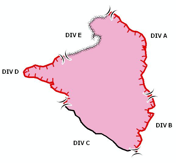
3 INCIDENT COMMAND SYSTEM STRUCTURE Situation Unit is a part of the Planning Section Member of the Situation Unit

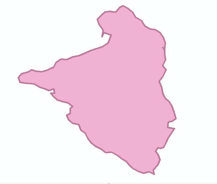
4 Wildland Fire Incident
5 Pre-Assignment Responsibilities Make sure you have your supervisor s s permission List yourself in the Resource Ordering and Status System (ROSS) system as Available Be prepared


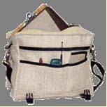

6 Equipment General Office Supplies GPS unit Laptop Software
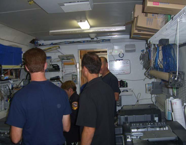
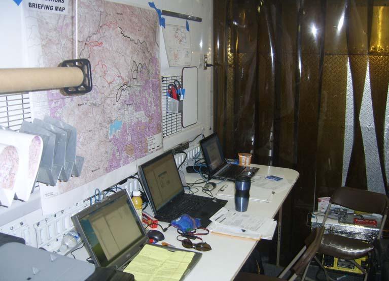
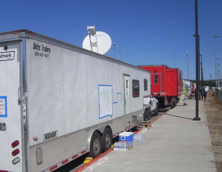
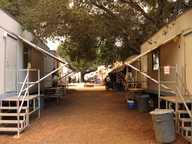
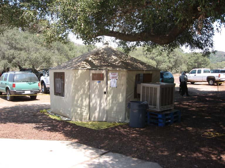
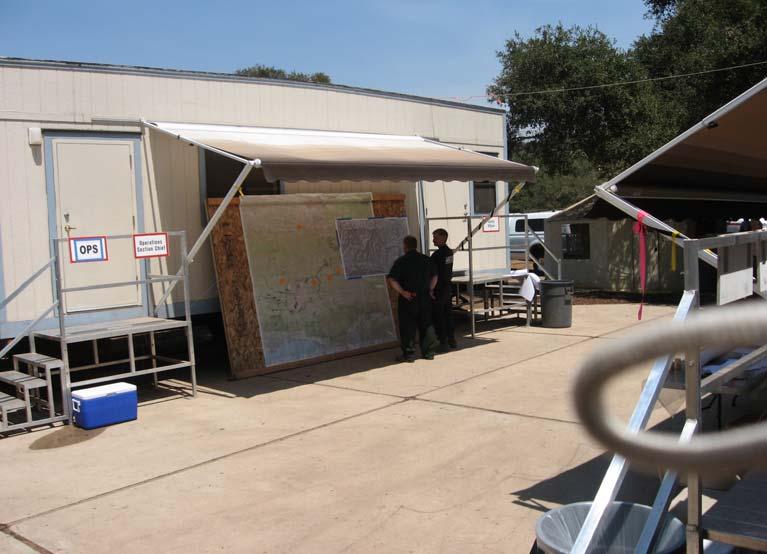
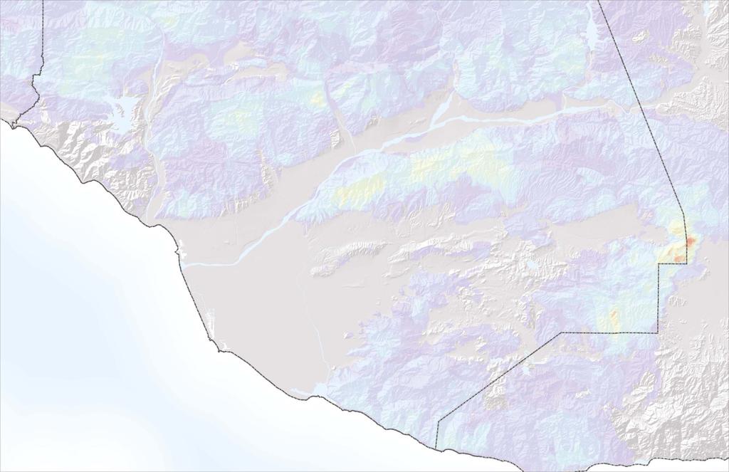
7 WORK ENVIRONMENT Sesnon Fire Incident Command Post (Conejo Creek Park)
8 GISS RESPONSIBILITIES Transfers field observations and infrared interpretation to a digital geo-referenced format. Downloads GPS data for integration into the incident database. Produces original copies of Situation, IAP, briefing, transportation, situation/planning and progression maps in a timely manner. Calculates fire statistics, such as acres and length of line, based on GIS data. Performs daily back ups of incident GIS data. Delivers spatial fire perimeter data for distribution to regional and national coordination centers.


9 WHO S S COLLECTING THE DATA? Field Observers GISS


10 DNR GARMIN Shareware created and maintained by staff at the Minnesota Department of Natural Resources. This extension was built to provide users the ability to directly transfer data between Garmin GPS handheld receivers and various GIS software packages.
. Created to help standardize the creation of maps used to support a fire incident.")

11 FIRE INCIDENT MANAGEMENT TOOLS Utility functions Perimeter Sector Tools FireLine Tools FirePoint Tools FIMT is based on the Incident Command System (ICS). Created to help standardize the creation of maps used to support a fire incident. Assists GISS in the management of GIS data required to produce maps that support a fire incident. As part of FIMT, a standardized geodatabase model was developed for storing fire incident features. Provides a consistent framework for all fire GIS personnel using FIMT tools.
12

13 The Planning Clock
14 Map Products Incident Action Plan Map Briefing Map Operations Map

15 Incident Action Plan Map Communicates the tactical and geographic features of an incident to operations staff working out in the field or on the fire line. Primary map used by operations personnel. Supplement to the Incident Action Plan. Generally 1:24,000 scale Typically 8.5 x 11 or 11 x 17


16 Briefing Map Enables operations staff to brief personnel assigned to upcoming operational period. It is not uncommon for a briefing map to be 72 X 72 or 4 E size pieces of paper. Tiling techniques are typically used.

17 Operations Map Large-Format map E size (34 x 44 ) Communicates the tactical and geographic features of an incident to operations staff working out in the field or on the fire line.
18 Other Maps Transportation Map Progression Map Air Operations Map Public Information Map Ownership Map Damage Assessment Map Structural Protection Map Rehabilitation Map Facilities Map Infrared Information Map Fire Perimeter History Map Vegetation Map Fuels Map Contingency Maps

19 POSTING PRODUCTS & DATA ftp.nifc.gov ftp.oes.ca.gov
20 INCIDENT COMMAND SYSTEM ICS is Performance Based Qualification is based upon real performance measured on the job versus perceived performance measured by an exam or classroom activities.
21 COMPONENTS OF THE WILDLAND FIRE QUALIFICATION SYTEM Training courses and job aids GISS Taskbook Agency Certification
22 Required Training Courses: ICS-100 Introduction to Incident Command System ICS-200 for Single Resources and Initial Action Incidents IS-700 National Incident Management System (NIMS), An Introduction IS-800 National Response Framework, an Introduction S244 S244 Field Observer S245 S245 Display Processor S341 S341 GIS Specialist For Incident Management
23 GISS S-341 S Task Book

24 THANK YOU
Chapter 1 Overview of Maps
 Chapter 1 Overview of Maps In this chapter you will learn about: Key points when working with maps General types of maps Incident specific maps Map legend and symbols Map sources A map is a navigational
JOB TITLE: CURRENT CLASSIFICATION/GRID POSITION # GIS Coordinator AD Grid Level 6(c) # 420
 # 420") COUNTY OF GRANDE PRAIRIE JOB DESCRIPTION JOB TITLE: CURRENT CLASSIFICATION/GRID POSITION # GIS Coordinator AD Grid Level 6(c) # 420 NOC CODE: 2255 STANDARD HOURS: 35 hours/week (non-management) JOB TITLE
COUNTY OF GRANDE PRAIRIE JOB DESCRIPTION JOB TITLE: CURRENT CLASSIFICATION/GRID POSITION # GIS Coordinator AD Grid Level 6(c) # 420 NOC CODE: 2255 STANDARD HOURS: 35 hours/week (non-management) JOB TITLE
GEOGRAPHIC INFORMATION SYSTEMS Session 8
 GEOGRAPHIC INFORMATION SYSTEMS Session 8 Introduction Geography underpins all activities associated with a census Census geography is essential to plan and manage fieldwork as well as to report results
GIS TECHNICIAN I GIS TECHNICIAN II
 GIS TECHNICIAN I GIS TECHNICIAN II CITY OF ROSEVILLE DEFINITION To perform a variety of technical office and field work duties related to the creation and maintenance of maps, tables, graphs and other
Steve Pietersen Office Telephone No
 Steve Pietersen Steve.Pieterson@durban.gov.za Office Telephone No. 031 311 8655 Overview Why geography matters The power of GIS EWS GIS water stats EWS GIS sanitation stats How to build a GIS system EWS
RADIATION SAFETY GUIDELINES FOR NON-USERS
 RADIATION SAFETY GUIDELINES FOR NON-USERS This is a Read and Sign Awareness Training document. You should read and sign this document if you: 1. DO NOT work directly with radioactive materials, but 2.
GEOGRAPHIC INFORMATION SYSTEM ANALYST I GEOGRAPHIC INFORMATION SYSTEM ANALYST II
 CITY OF ROSEVILLE GEOGRAPHIC INFORMATION SYSTEM ANALYST I GEOGRAPHIC INFORMATION SYSTEM ANALYST II DEFINITION To perform professional level work in Geographic Information Systems (GIS) management and analysis;
GIS ADMINISTRATOR / WEB DEVELOPER EVANSVILLE-VANDERBURGH COUNTY AREA PLAN COMMISSION
 GIS ADMINISTRATOR / WEB DEVELOPER EVANSVILLE-VANDERBURGH COUNTY AREA PLAN COMMISSION SALARY RANGE INITIATION $43,277 SIX MONTHS $45,367 POSITION GRADE PAT VI The Evansville-Vanderburgh County Area Plan
BUILDING AN ASSET MANAGEMENT GEODATABASE FOR RANCHING. Matt Crawford, GISP
 BUILDING AN ASSET MANAGEMENT GEODATABASE FOR RANCHING Matt Crawford, GISP Introduction East Foundation Formed in 2007 Mission Research Education Outreach Properties Six ranches ~ 215,000 acres San Antonio
CENSUS MAPPING WITH GIS IN NAMIBIA. BY Mrs. Ottilie Mwazi Central Bureau of Statistics Tel: October 2007
 CENSUS MAPPING WITH GIS IN NAMIBIA BY Mrs. Ottilie Mwazi Central Bureau of Statistics E-mail: omwazi@npc.gov.na Tel: + 264 61 283 4060 October 2007 Content of Presentation HISTORICAL BACKGROUND OF CENSUS
USAGE OF SPATIAL TECHNOLOGY IN EMERGENCY MAPPING
 USAGE OF SPATIAL TECHNOLOGY IN EMERGENCY MAPPING Nandakumar Thananjeyan Former UN staff member, Sri Lanka nthananjeyan@gmail.com ABSTRACT: This paper reports on the findings of a study to use of GIS, Remote
Applications: Introduction Task 1: Introduction to ArcCatalog Task 2: Introduction to ArcMap Challenge Question References
 CHAPTER 1 INTRODUCTION 1.1 GIS? 1.1.1 Components of a GIS 1.1.2 A Brief History of GIS 1.1.3 GIS Software Products Box 1.1 A List of GIS Software Producers and Their Main Products 1.2 GIS Applications
The PEAC-WMD Gamma Radiation Dose Calculator
 The PEAC-WMD Gamma Radiation Dose Calculator During the last couple of months newsletters I ve discussed some of the new computational tools included in the PEAC-WMD 2007 (v5.5) application. This month
Best Practices Protocol for Methamphetamine Clandestine Labs
 Best Practices Protocol for Methamphetamine Clandestine Labs Diane Catley Forensic Science Supervisor Virginia Dept. of Forensic Science 6600 Northside High School Drive Roanoke VA 24019 540.283.5931 May,
POSITION DESCRIPTION. Position Title: Geographic Information Systems (GIS) Coordinator Department: Engineering
 Coordinator Department: Engineering") POSITION DESCRIPTION Position Title: Geographic Information Systems (GIS) Coordinator Department: Engineering Reports To: Engineering Supervisor FLSA Status: Exempt Date: April 2018 PRIMARY OBJECTIVE OF
POSITION DESCRIPTION Position Title: Geographic Information Systems (GIS) Coordinator Department: Engineering Reports To: Engineering Supervisor FLSA Status: Exempt Date: April 2018 PRIMARY OBJECTIVE OF
Educational Qualification No ( No of Positions) 01. Geographic
 01. Geographic") ICZMP, State Project Management Unit-Orissa Plot # 108,Unit VII, Suryanagar,Bhubaneswar 751 003 ICZMP invites applications from eligible candidates for filling up of posts as mentioned below under the
ICZMP, State Project Management Unit-Orissa Plot # 108,Unit VII, Suryanagar,Bhubaneswar 751 003 ICZMP invites applications from eligible candidates for filling up of posts as mentioned below under the
Coastal Viewer Mapping Application:
 Coastal Viewer Mapping Application: MAPPING OF COASTAL PUBLIC PROPERTY, THE COASTAL PROTECTION ZONE BOUNDARIES AND AUDITING OF STRUCTURES ON THE COASTAL PUBLIC PROPERTY 15 May 2014 INTEGRATED COASTAL MANAGEMENT
Notes: Notes: Notes: Notes:
 Lesson 1 Introduction of tools used in GIS and Emergency management Introduction of the tools used in GIS for Emergency Management and Fire Incident Mapping. Basic concepts to Incident mapping and the
United States Forest Service Makes Use of Avenza PDF Maps App to Reduce Critical Time Delays and Increase Response Time During Natural Disasters
 CASE STUDY For more information, please contact: Christine Simmons LFPR Public Relations www.lfpr.com (for Avenza) 949.502-7750 ext. 270 Christines@lf-pr.com United States Forest Service Makes Use of Avenza
Instituting Land Use Controls (LUCs) for Environmental Compliance and Planning
 for Environmental Compliance and Planning") Eleventh Air Force Instituting Land Use Controls (LUCs) for Environmental Compliance and Planning Robert Beachler GeoBase Administrator 611 Civil Engineer Squadron Elmendorf AFB, AK As of: 1 Agenda Introduction
Eleventh Air Force Instituting Land Use Controls (LUCs) for Environmental Compliance and Planning Robert Beachler GeoBase Administrator 611 Civil Engineer Squadron Elmendorf AFB, AK As of: 1 Agenda Introduction
John Laznik 273 Delaplane Ave Newark, DE (302)
") Office Address: John Laznik 273 Delaplane Ave Newark, DE 19711 (302) 831-0479 Center for Applied Demography and Survey Research College of Human Services, Education and Public Policy University of Delaware
Office Address: John Laznik 273 Delaplane Ave Newark, DE 19711 (302) 831-0479 Center for Applied Demography and Survey Research College of Human Services, Education and Public Policy University of Delaware
Enhance Security, Safety and Efficiency With Geospatial Visualization
 Areas within 10 minutes of an exit are emphasized on this map, to give an indication of how accessible neighborhoods are by highway. The colors represent 1, 3, 5 and 10 minute increments from the exits.
Applications of GIS in Electrical Power System
 Applications of GIS in Electrical Power System Abdulrahman M. AL-Sakkaf 201102310 CRP 514 May 2013 Dr. Baqer M. AL-Ramadan Abstract GIS has been widely used in various areas and disciplines. This paper
FIRE DEPARMENT SANTA CLARA COUNTY
 DEFINITION FIRE DEPARMENT SANTA CLARA COUNTY GEOGRAPHIC INFORMATION SYSTEM (GIS) ANALYST Under the direction of the Information Technology Officer, the GIS Analyst provides geo-spatial strategic planning,
Mapping Utilities with Mobile GIS Applications
 Mapping Utilities with Mobile GIS Applications Kristy M. Capobianco Reynolds, Smith and Hills, Inc. GIS Analyst Kristy.Capobianco@rsandh.com (904) 256-2251 2007 ESRI Southeast User Group Conference May
Learning Computer-Assisted Map Analysis
 Learning Computer-Assisted Map Analysis by Joseph K. Berry* Old-fashioned math and statistics can go a long way toward helping us understand GIS Note: This paper was first published as part of a three-part
Greg Collier, Battalion Chief Larry Fox, Captain Mount Laurel Fire Department
 Greg Collier, Battalion Chief Larry Fox, Captain Mount Laurel Fire Department Hurdles (NAVTEQ data Laurel Green example) Current software use map books field data (COP, OEM, disasters, critical infrastructure,
GEOGRAPHIC INFORMATION SYSTEMS SPECIALIST 3 DEFINITION:
 Hunterdon County Department of Planning and Land Use Vacancy: Geographic Information Systems Specialist 3 Full Time: 40 Hours per Week Compensation: $42,000.00 per year GEOGRAPHIC INFORMATION SYSTEMS SPECIALIST
Health, Safety, Security and Environment
 Document owner and change code Document Owner Aaron Perronne Title HSSE Manager Mark X Change Code Description X N/A First Issue A Typographical/Grammatical correction; formatting change; text clarification-no
BOWIE SENIORS COMPUTER CLUB
 BOWIE SENIORS COMPUTER CLUB Meeting Minutes for May 5, 2016 Through the efforts of Program Chairman Dan Lee, we had Patrick T. Callahan, GIS Manager of the Prince George's County Office of Information
Developing a Community Geographical Information System (GIS) in Rural India
 in Rural India") Developing a Community Geographical Information System (GIS) in Rural India Before rushing off and describing the unique challenges of developing a small scale GIS system India I better first describe
Developing a Community Geographical Information System (GIS) in Rural India Before rushing off and describing the unique challenges of developing a small scale GIS system India I better first describe
Oakland County Parks and Recreation GIS Implementation Plan
 Oakland County Parks and Recreation GIS Implementation Plan TABLE OF CONTENTS 1.0 Introduction... 3 1.1 What is GIS? 1.2 Purpose 1.3 Background 2.0 Software... 4 2.1 ArcGIS Desktop 2.2 ArcGIS Explorer
Sistema de Informacion Geografica Peninsular de Yucatan (SIGPY): WORK PLAN for the UQROO- URI GIS Development Project
: WORK PLAN for the UQROO- URI GIS Development Project") Sistema de Informacion Geografica Peninsular de Yucatan (SIGPY): WORK PLAN for the UQROO- URI GIS Development Project Eddie Ellis, UQROO 2001 Citation: Quintana Roo, Mexico: Universidad de Quintana Roo
Sistema de Informacion Geografica Peninsular de Yucatan (SIGPY): WORK PLAN for the UQROO- URI GIS Development Project Eddie Ellis, UQROO 2001 Citation: Quintana Roo, Mexico: Universidad de Quintana Roo
HIGH RESOLUTION BASE MAP: A CASE STUDY OF JNTUH-HYDERABAD CAMPUS
 HIGH RESOLUTION BASE MAP: A CASE STUDY OF JNTUH-HYDERABAD CAMPUS K.Manjula Vani, Abhinay Reddy, J. Venkatesh, Ballu Harish and R.S. Dwivedi ABSTRACT The proposed work High Resolution Base map: A Case study
Developing a Tactical-Level Geospatial Course for Army Engineers
 Developing a Tactical-Level Geospatial Course for Army Engineers Jared L. Ware Geospatial Information Science Program Department of Geography and Environmental Engineering United States Military Academy
CHEMICAL SAFETY. 2.1 DOE O 231.1, Environment, Safety, and Health Reporting
 Chemical Safety Page 1 of 9 1.0 Objective The objective of this surveillance is to ensure that practices for handling, using and storing dangerous or toxic chemicals provide effective protection of the
Marquette University Effective: 5/21/02 Hazard Communication Program Updated: 03/11/09 Revision No.: 1 Page: 1
 Marquette University Effective: 5/21/02 Hazard Communication Program Updated: 03/11/09 Revision No.: 1 Page: 1 Introduction: The Occupational Safety & Health Administration (OSHA) Hazard Communication
ABSTRACT TIES TO CURRICULUM TIME REQUIREMENT
 ABSTRACT LEARNING OBJECTIVES Many students have heard of Global Positioning Systems (GPS) as a navigation tool, but few know exactly what this complicated technology is, or how widespread are its applications
Hazard Communication Policy
 Table of Contents I. Purpose... 2 II. Scope... 2 III. Policy... 2 III.A. Responsibilities... 2 III.A.1. Management... 2 III.A.2. Environmental Health and Safety Department (EH&S)... 3 III.A.3. Supervisors...
Spatial Data Infrastructure Concepts and Components. Douglas Nebert U.S. Federal Geographic Data Committee Secretariat
 Spatial Data Infrastructure Concepts and Components Douglas Nebert U.S. Federal Geographic Data Committee Secretariat August 2009 What is a Spatial Data Infrastructure (SDI)? The SDI provides a basis for
MODERNIZATION OF THE MUNICIPAL MAPPING USING HIGH END GNSS SYSTEM AND GIS SOFTWARE
 MODERNIZATION OF THE MUNICIPAL MAPPING USING HIGH END GNSS SYSTEM AND GIS SOFTWARE Mr. R. A. R. Khan Assistant Engineer, Sewerage Utility Management Centre (SUMC) Municipal Corporation Of Greater Mumbai
LAKE SURVEY REPORT. Fisheries Management. DOW Number: Survey ID Date: 07/31/2017. Lake Identification. Lake Location. Legal Descriptions
 Fisheries Management LAKE SURVEY REPORT Lake Name: Kroon Survey Type: Targeted Survey DOW Number: 13-0013-00 Survey ID Date: 07/31/2017 Lake Identification Alternate Lake Name: N/A Primary Lake Class ID:
Continental Divide National Scenic Trail GIS Program
 CDNST Vision Statement: Provide the most accurate geospatial locational information of the Continental Divide Trail and nearby resources to the public as well as help provide internal management information
Utilizing GIS as a Critical Campus. Karen Jordan February 24, 2011
 Utilizing GIS as a Critical Campus Resource Karen Jordan February 24, 2011 Agenda Campus Background Opportunity for a Campus-wide GIS Data Structure and Collection How Has GIS Been Utilized on Campus Over
Cartographic and Geospatial Futures
 Cartographic and Geospatial Futures 1. Web Cartography, WebGIS, & Virtual Globes--New Roles for Maps, GIS, and GIS professionals 2. Map Mashups, the Neo Neo-geography Movement, & Crowd-sourcing Geospatial
A Regional Database Tracking Fire Footprint Each Year within the South Atlantic Region: Current Database Description and Future Directions
 A Regional Database Tracking Fire Footprint Each Year within the South Atlantic Region: Current Database Description and Future Directions Last Updated on September 30, 2018 Contributors: NatureServe,
Chemical Hygiene Plan for Laboratories
 SAFETY POLICIES AND PROCEDURES MANUAL LABORATORY SAFETY 4.12.1 OVERVIEW Washington State University has developed the chemical hygiene plan to aid units in promoting a high standard of health and safety.
13.2 USING VIRTUAL GLOBES TO IMPROVE SITUATIONAL AWARENESS IN THE NATIONAL WEATHER SERVICE
 13.2 USING VIRTUAL GLOBES TO IMPROVE SITUATIONAL AWARENESS IN THE NATIONAL WEATHER SERVICE Andy Foster* National Weather Service Springfield, Missouri* Keith Stellman National Weather Service Shreveport,
Report of the Texas Forest Service Accident Investigation Team Hildreth Pool Road Bull Dozer Accident. Montague County February 9, 2006.
 Report of the Texas Forest Service Accident Investigation Team Hildreth Pool Road Bull Dozer Accident Montague County February 9, 2006 Final Report TABLE OF CONTENTS I. Introduction II. Summary III. Analysis
STORAGE, HANDLING & SAFE USE OF CHEMICALS AND HAZARDOUS MATERIALS
 Training Title STORAGE, HANDLING & SAFE USE OF CHEMICALS AND HAZARDOUS MATERIALS Training Duration 5 days Training Venue and Dates REF Storage, Handling and Safe Use of Chemicals HS041 and Hazardous Materials
SAMPLE PAGES. Hazard Communication Program. [Company name]
![SAMPLE PAGES. Hazard Communication Program. [Company name]](/thumbs/95/125522244.jpg "SAMPLE PAGES. Hazard Communication Program. [Company name]") The safety and health of our employees are our top priority. Everyone goes home safe and healthy everyday. Hazard Communication Program [Company name] [Date Authorized] [Version} Page 0 Table of Contents
The safety and health of our employees are our top priority. Everyone goes home safe and healthy everyday. Hazard Communication Program [Company name] [Date Authorized] [Version} Page 0 Table of Contents
Lecture 11. Data Standards and Quality & New Developments in GIS
 Lecture 11 Data Standards and Quality & New Developments in GIS Lecture 11: Outline I. Data Standards and Quality 1. Types of Spatial Data Standards 2. Data Accuracy II. New Developments/The Future of
SRJC Applied Technology 54A Introduction to GIS
 SRJC Applied Technology 54A Introduction to GIS Overview Lecture of Geographic Information Systems Fall 2004 Santa Rosa Junior College Presented By: Tim Pudoff, GIS Coordinator, County of Sonoma, Information
Initial Report. North Central Texas Initial Attack. Hildreth Road Dozer Accident. February 9, 2006
 6.152 February 17, 2006 Initial Report North Central Texas Initial Attack Hildreth Road Dozer Accident February 9, 2006 This report is intended to inform interested parties, for a safety and training tool,
Facilities Management
 Policy Number: 700.20 Title: Chemical Fume Hood Policy Implementation Date: 2002 Last Audited: August, 2017 Last Revised: October 23rd, 2017 Facilities Management Introduction The laboratory chemical fume
Lecture 12. Data Standards and Quality & New Developments in GIS
 Lecture 12 Data Standards and Quality & New Developments in GIS Lecture 12: Outline I. Data Standards and Quality 1. Types of Spatial Data Standards 2. Data Accuracy 3. III. Documenting Spatial Data Accuracy
JOB DESCRI PTI ON. GIS Administrator
 JOB DESCRI PTI ON JOB GRADE: GS-0 Cla ss Code : Office - 8 8 0 DEPARTMENT: 2 0 - FLSA: EXEMPT JOB NO: 6-0 9-2 7 SALARY: To Be De t e rm in e d Job description statements are intended to describe the general
MPCA Water Quality Database
 Appendix : MPCA Water Quality Database meta-data descriptions and requirements Project information 1 Project ID Project name Project purpose Start date Name of the monitoring project Reason why the monitoring
GREEN SHEET. California Department of Forestry and Fire Protection (CAL FIRE)
") GREEN SHEET California Department of Forestry and Fire Protection (CAL FIRE) Informational Summary Report of Serious CAL FIRE Injuries, Illnesses, Accidents and Near Serious Accidents Dozer Rollover Fatality
GREEN SHEET California Department of Forestry and Fire Protection (CAL FIRE) Informational Summary Report of Serious CAL FIRE Injuries, Illnesses, Accidents and Near Serious Accidents Dozer Rollover Fatality
GIS and Web Technologies to Improve Irrigation Districts
 GIS and Web Technologies to Improve Irrigation Districts Presented To: Montana Association of Dam and Canal Systems Workshop Presented By: Brian Fischer, CFM GIS Manager October 07, 2010 What you won t
HAZARD COMMUNICATION PROGRAM
 HAZARD COMMUNICATION PROGRAM UNIVERSITY RISK MANAGEMENT Occupational Safety and Health Programs 19 Hagood Avenue, Suite 908 Charleston SC 29425 843-792-3604 Revised: January, 2015 TABLE OF CONTENTS Safety
State-of-the-Art GIS as an Integrating Technology
 Paper # 104: GIS for Oil Spill Prevention & Response Devon Humphrey Instructor, National Spill Control School Texas A&M University at Corpus Christi, TX Introduction and History The National Spill Control
The Geospatial Census: plans and progress for the 2010 round of population censuses
 The Geospatial Census: plans and progress for the 2010 round of population censuses David Rain, Assistant Professor of Geography & International Affairs, and Consultant to the United Nations/UNSD drain@gwu.edu
Syllabus Reminders. Geographic Information Systems. Components of GIS. Lecture 1 Outline. Lecture 1 Introduction to Geographic Information Systems
 Syllabus Reminders Geographic Information s Lecture Introduction to Geographic Information s. Class Info: www.saigis.com/class/ 2. Office T / TH (8:00-9:30 a.m.) and (2:30 3:30pm) or Appt 3. Email: burgerpr@unk.edu
THE DATA REVOLUTION HAS BEGUN On the front lines with geospatial data and tools
 THE DATA REVOLUTION HAS BEGUN On the front lines with geospatial data and tools Slidedoc of presentation for MEASURE Evaluation End of Project Meeting Washington DC May 22, 2014 John Spencer Geospatial
The Emerging Role of Enterprise GIS in State Forest Agencies
 The Emerging Role of Enterprise GIS in State Forest Agencies Geographic Information System (GIS) A geographic information system (GIS) is a computer software system designed to capture, store, manipulate,
Georelational Vector Data Model
 Georelational Vector Data Model Contents Georelational Data Model Representation of Simple Features Topology Non-topological Vector Data Data Models for Composite Features Geo-relational Looking at a paper
GIS Geographic Information Systems
 GIS Geographic Information Systems Connecting your Community Ruekert Mielke WAUKESHA WHO WE ARE DATE ESTABLISHED 1946 SERVING LOCAL PEOPLE. SOLVING LOCAL PROBLEMS. TYPE OF ORGANIZATION Ruekert & Mielke,
GISLab (UK) School of Computing and Mathematical Sciences Liverpool John Moores University, UK. Dr. Michael Francis. Keynote Presentation
 School of Computing and Mathematical Sciences Liverpool John Moores University, UK. Dr. Michael Francis. Keynote Presentation") GISLab (UK) School of Computing and Mathematical Sciences Liverpool John Moores University, UK Dr. Michael Francis Keynote Presentation Dr. Michael Francis North-West GIS Research Laboratory, LJMU, Liverpool,
GISLab (UK) School of Computing and Mathematical Sciences Liverpool John Moores University, UK Dr. Michael Francis Keynote Presentation Dr. Michael Francis North-West GIS Research Laboratory, LJMU, Liverpool,
NWS Fire Weather Forecast, Wildland Fire Assessment Systems and OKMesonet Products Applications as Short Term Mitigation Tools for Emergency Response
 NWS Fire Weather Forecast, Wildland Fire Assessment Systems and OKMesonet Products Applications as Short Term Mitigation Tools for Emergency Response Presentation for The Southern Climate Impacts Planning
GIS for the Beginner on a Budget
 GIS for the Beginner on a Budget Andre C. Bally, RLA, GIS Coordinator, Harris County Public Infrastructure Department Engineering Division This presentation, GIS for Beginners on a Budget. will briefly
Statewide Topographic Mapping Program
 Statewide Topographic Mapping Program February 28, 2018 www.dotd.la.gov Outline Purpose of the Statewide Topographic Mapping Program History Breakdown of R.S. 48:36 - Topographic Mapping Statewide Topographic
GEOGRAPHICAL INFORMATION SYSTEMS. GIS Foundation Capacity Building Course. Introduction
 GEOGRAPHICAL INFORMATION SYSTEMS. GIS Foundation Capacity Building Course. Introduction In recent times digital mapping has become part and parcel of our daily lives with experience from Google Maps on
GIS Resource Typing, Standards, GIS Corps. David Hansen, GISP SARGIS7 November 15, 2015 Resource Typing
 GIS Resource Typing, Standards, GIS Corps David Hansen, GISP SARGIS7 November 15, 2015 Resource Typing GIS Corps lcoordinates short-term, volunteer GIS services to the community lgis Corps and volunteers
WELCOME & INTRODUCTIONS
 GIS Monroe Geographic Information System January 31, 2018 WELCOME & INTRODUCTIONS Chip Thomas, Ritter GIS Sarah Schrader, Acct. Mgr., ESRI Chris Beyett, Solutions Engineer, ESRI Colleen Hinzmann, IT Director,
Hobart and William Smith Colleges. Hazard Communication Program
 Hobart and William Smith Colleges Geneva, New York Hazard Communication Program Copies of the Hazard Communication Program: 1. Human Resources Office 2. Office of the President (Provost) 3. Campus Safety
GIS Geographical Information Systems. GIS Management
 GIS Geographical Information Systems GIS Management Difficulties on establishing a GIS Funding GIS Determining Project Standards Data Gathering Map Development Recruiting GIS Professionals Educating Staff
Bringing GIS to the Front Lines Author- Mike Masters Co-Author James Kelt
 Pearland, Texas and Enterprise Wide GIS Bringing GIS to the Front Lines Author- Mike Masters Co-Author James Kelt Presenters Mike Masters- GIS Coordinator The City of Pearland, Texas Richard DeLa Mater-
Integrating GIS and GPS Technologies into Cultural Resource Management Strategies The Technology
 SERDP/ESTCP/Legacy Program DoD Cultural Resources Workshop Background Paper: Knowledge Management Integrating GIS and GPS Technologies into Cultural Resource Management Strategies Deidre McCarthy National
The 7th Annual SARGIS Workshop and Meeting. Welcome to SARGIS7!
 The 7th Annual SARGIS Workshop and Meeting Welcome to SARGIS7! The National Alliance for Public Safety GIS Foundation is a 501 (C) (3) not-forprofit organization» OUR VISION A Nation of emergency responders
HURRICANE MATTHEW A GIS PERSPECTIVE GLYNN COUNTY GIS
 HURRICANE MATTHEW A GIS PERSPECTIVE GLYNN COUNTY GIS Situation September 25 th October 9 th 2016 Hurricane Matthew tracked its way up the east coast bringing hurricane force winds and flooding from Haiti
THE STUDY ON 4S TECHNOLOGY IN THE COMMAND OF EARTHQUAKE DISASTER EMERGENCY 1
 THE STUDY ON 4S TECHNOLOGY IN THE COMMAND OF EARTHQUAKE DISASTER EMERGENCY 1 Zhou Wensheng 1, Huang Jianxi 2, Li Qiang 3, Liu Ze 3 1 Associate Professor, School of Architecture, Tsinghua University, Beijing.
Introduction to GIS (GEOG 401) Spring 2014, 3 credit hours
 Spring 2014, 3 credit hours") Introduction to GIS (GEOG 401) Spring 2014, 3 credit hours Instructors: Guangxing Wang, Ph.D. Email: gxwang@siu.edu Phone: (618) 453-6017 Office: 4442 Faner Hall Office hours: M& W&F 9:00am-11:00am or
Introduction to GIS (GEOG 401) Spring 2014, 3 credit hours Instructors: Guangxing Wang, Ph.D. Email: gxwang@siu.edu Phone: (618) 453-6017 Office: 4442 Faner Hall Office hours: M& W&F 9:00am-11:00am or
Hazard Communications
 1 Hazard Communications 1 2 Hazard Communication Program Table of Contents 1. Purpose of the Hazard Communication Program 2. Access to Written Program 3. Responsibilities 4. Hazard Recognition/Determination
This Week s Topics. GIS and Forest Engineering Applications. FE 257. GIS and Forest Engineering Applications. Instructor Information.
 FE 257. GIS and Forest Engineering Applications Introduction Instructor Information Associate Professor in FERM Department Instructor for FE 257, FE 480, FE 432/532 PhD from Forest Resources with minor
GIS Basics GIS lab
 Geographic importance Almost everything that happens or exists occurs somewhere. Knowing where it happened or existed is critically important. All human activities require knowledge about the Earth, thus
Construction Project Data Management
 Construction Project Data Management Establishing Foundations for an Asset Database Scot Twining Project Activities Supported by GIS Cadastral Mapping Proposed Pipeline Route Selection Right Of Way Acquisition
Year 7 Health & Safety
 Year 7 Health & Safety Key staff member: Richard Atkinson Attitude to learning: Subject criteria: Research Always Usually Occasionally Rarely Class work 1 2 3 4 Homework 1 2 3 4 Participation 1 2 3 4 Ideas
Course Description. Illicit Drug Labs A Safe Response for Public Safety Personnel. International Association of Fire Fighters
 Illicit Drug Labs A Safe Response for Public Safety Personnel Course Duration: 8 hours (1 day). Learning Objectives: Given an 8-hour course on illicit drug labs, students will be able to describe illicit
Revaluing Property in St Vincent and the Grenadines using GIS
 Revaluing Property in St Vincent and the Grenadines using GIS ESRI User Conference, San Diego, July 2010 Chris Ewing, GIS Analyst, Halcrow Group Limited, London, UK 1 Contents St Vincent and The Grenadines
Daphne Payne NRS 509 Fire Modeling
 Daphne Payne NRS 509 Fire Modeling Wildfires destroy millions of acres of land every year, along with the communities who live in those areas, cost hundreds of millions of dollars in suppression and rehabilitation
Version 1.1 GIS Syllabus
 GEOGRAPHIC INFORMATION SYSTEMS CERTIFICATION Version 1.1 GIS Syllabus Endorsed 1 Version 1 January 2007 GIS Certification Programme 1. Target The GIS certification is aimed at: Those who wish to demonstrate
Systems. Department Mission: Mandated Services: Department Overview: Successes and Challenges:
 Department: Geographic Information Systems FY 2018 Proposed Budget Department Mission: The mission of the Klamath County Geographic Information Systems (GIS) department is to provide maintenance of and
USS Arizona Drawings and Underwater GPS Surveys Linked by ArcIMS
 ESRI UC2004 USS Arizona Drawings and Underwater GPS Surveys Linked by ArcIMS Tim Smith National Park Service Matt Brown Northrop Grumman Information Technology Outline! Introduction! Geodatabase Development!
GHS/ CHEMICAL RIGHT TO KNOW
 28.0 ARKANSAS TECH UNIVERSITY GHS/ CHEMICAL RIGHT TO KNOW The purpose of the Hazard Communication/GHS Policy is to establish guidelines that will ensure the hazards of all chemicals/substances are evaluated,
STANDARD OPERATING PROCEDURES
 PAGE: 1 of 5 CONTENTS 1.0 SCOPE AND APPLICATION 2.0 METHOD SUMMARY 3.0 SAMPLE PRESERVATION, CONTAINERS, HANDLING, AND STORAGE 4.0 INTERFERENCE AND POTENTIAL PROBLEMS 5.0 EQUIPMENT/APPARATUS 6.0 REAGENTS
Hazard Communication Program
 Hazard Communication Program The Meriden Board of Education school district is complying with the requirements of OSHA's Hazard Communication Standard for construction by compiling a list of hazardous
IMPLEMENTING GOVERNMENT-WIDE ENTERPRISE GIS; THE FEDERATED MODEL
 IMPLEMENTING GOVERNMENT-WIDE ENTERPRISE GIS; THE FEDERATED MODEL James E. Mitchell, Ph. D. IT GIS Manager Louisiana Department of Transportation and Development presented at the ESRI International Users
GEOMATICS SURVEYING AND MAPPING EXPERTS FOR OVER 35 YEARS
 GEOMATICS SURVEYING AND MAPPING EXPERTS FOR OVER 35 YEARS 2 GEOMATICS AND SURVEYING SOLUTIONS SPANNING THE ENTIRE PROJECT LIFECYCLE 1,000+ 250+ 24 Surveying professionals Active field crews Geomatics offices
Roles of NGII in successful disaster management
 The Second UN-GGIM-AP Plenary Meeting Roles of NGII in successful disaster management Republic of Korea Teheran Iran 28 October 2013 Sanghoon Lee, Ph.D. NGII Outline Type of Disasters Occur in Korea Practical