South Alamito Creek Ranch
|
|
|
- Allison Wheeler
- 5 years ago
- Views:
Transcription


1 South Alamito Creek Ranch 1500 acres, Presidio County, Texas James King, Agent Office Cell King Land & Water LLC P.O. Box 109, 600 State Street, Fort Davis, TX Office Fax KingLandWater.com
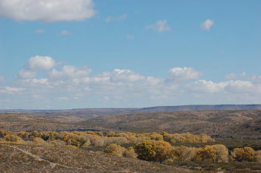
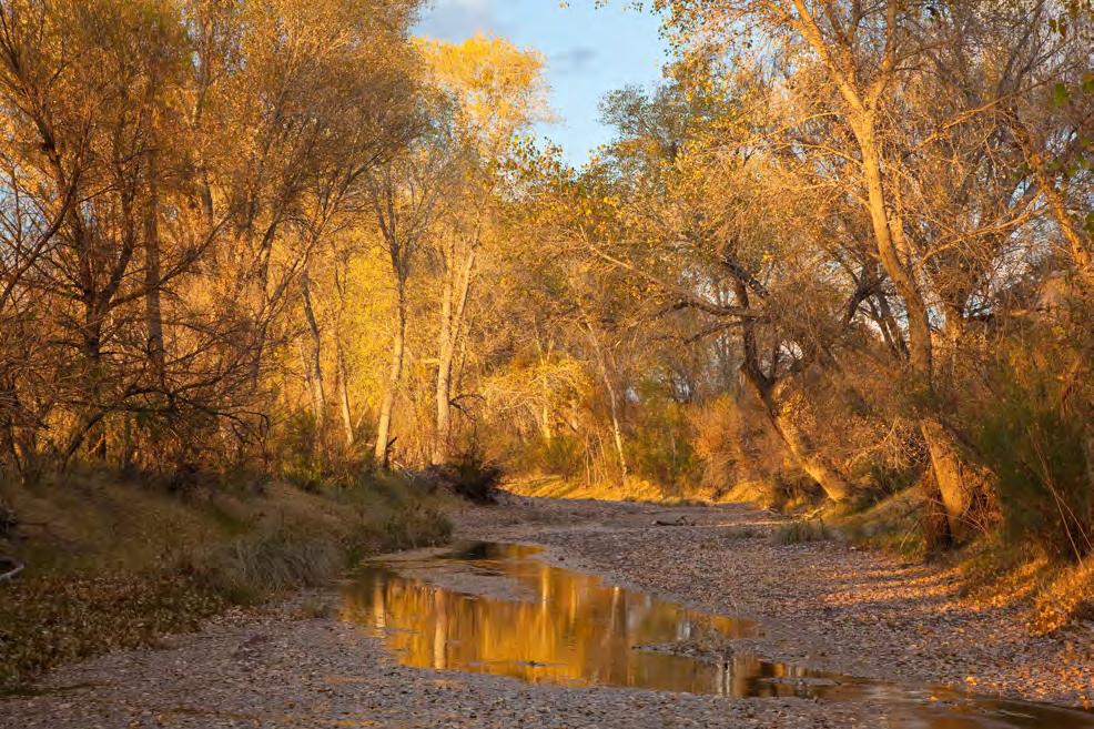
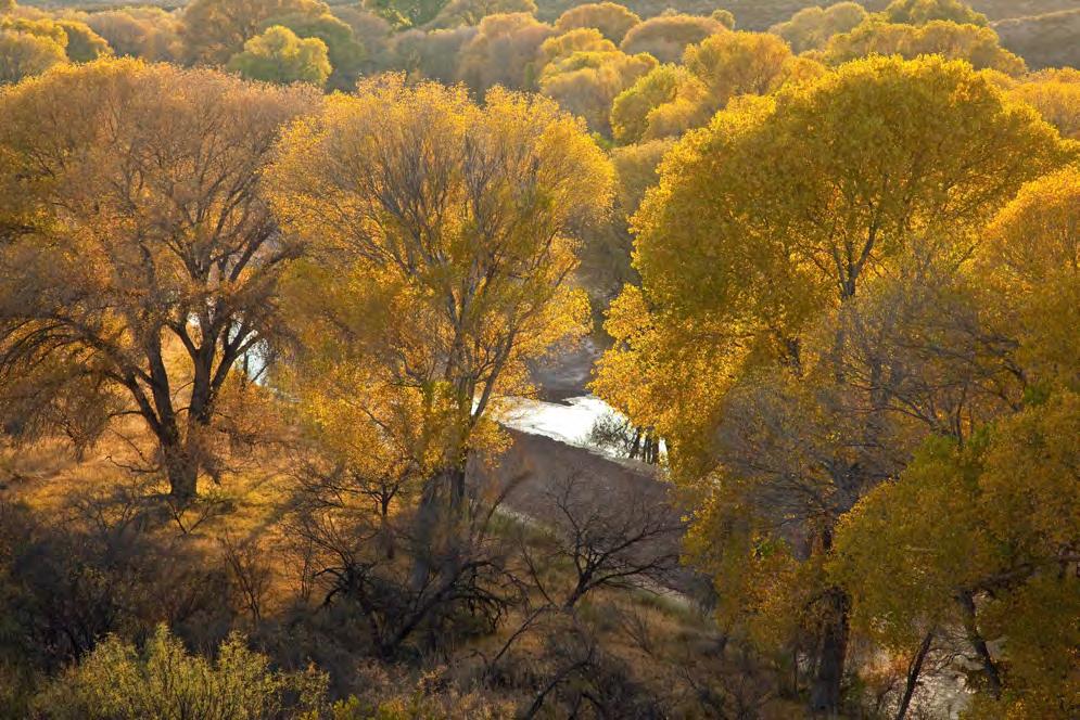
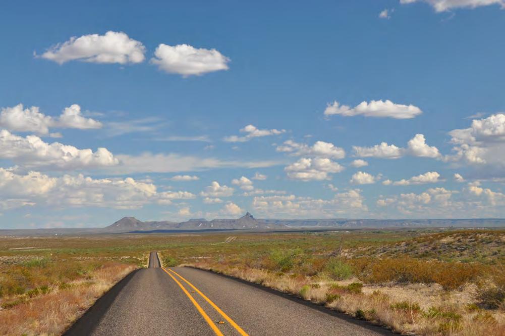
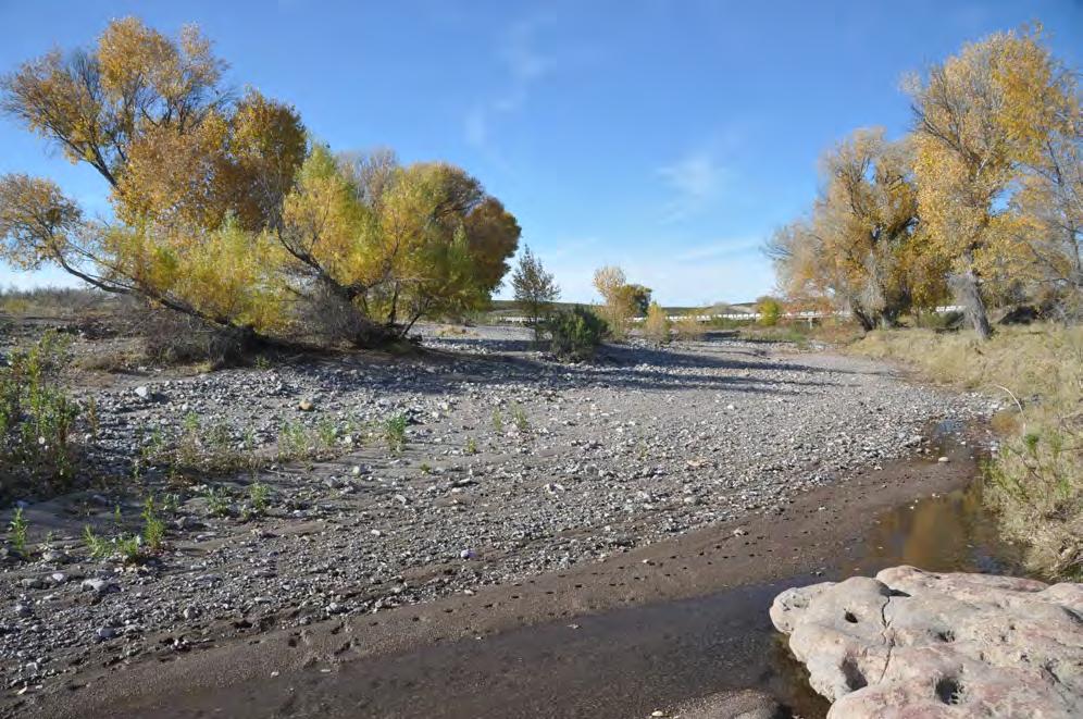
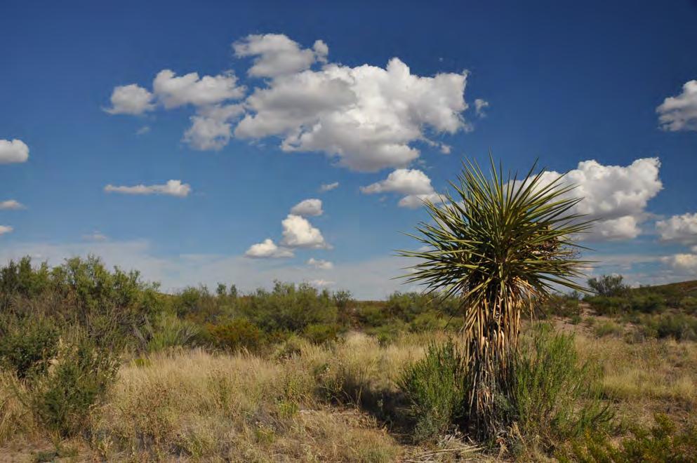
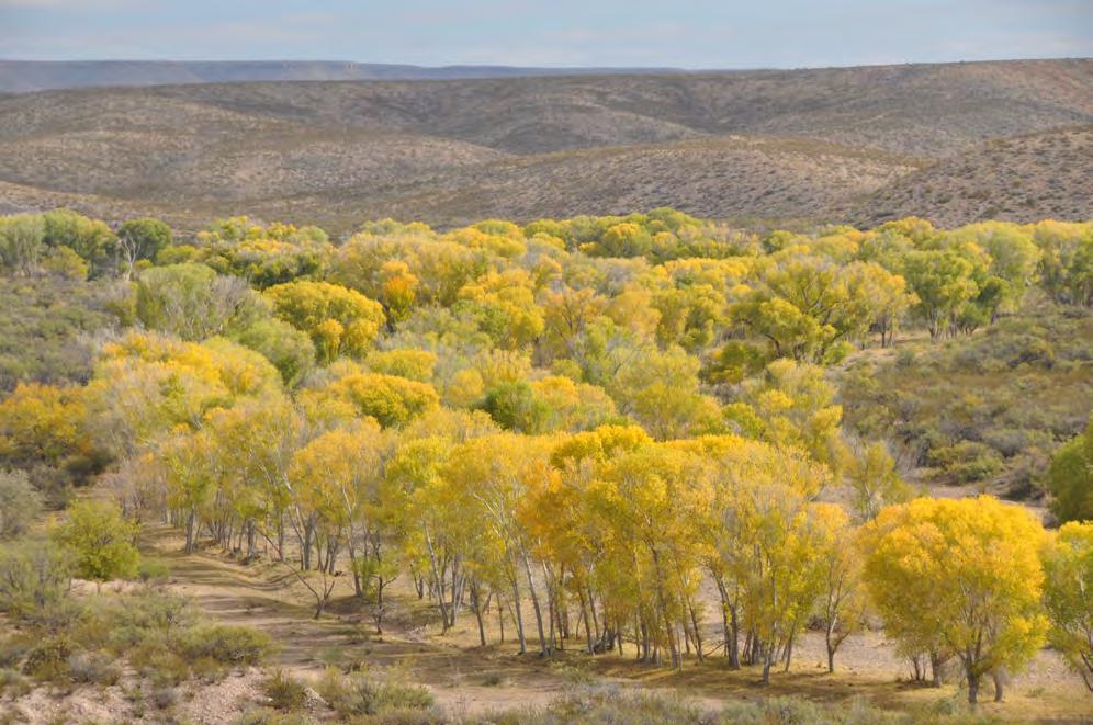
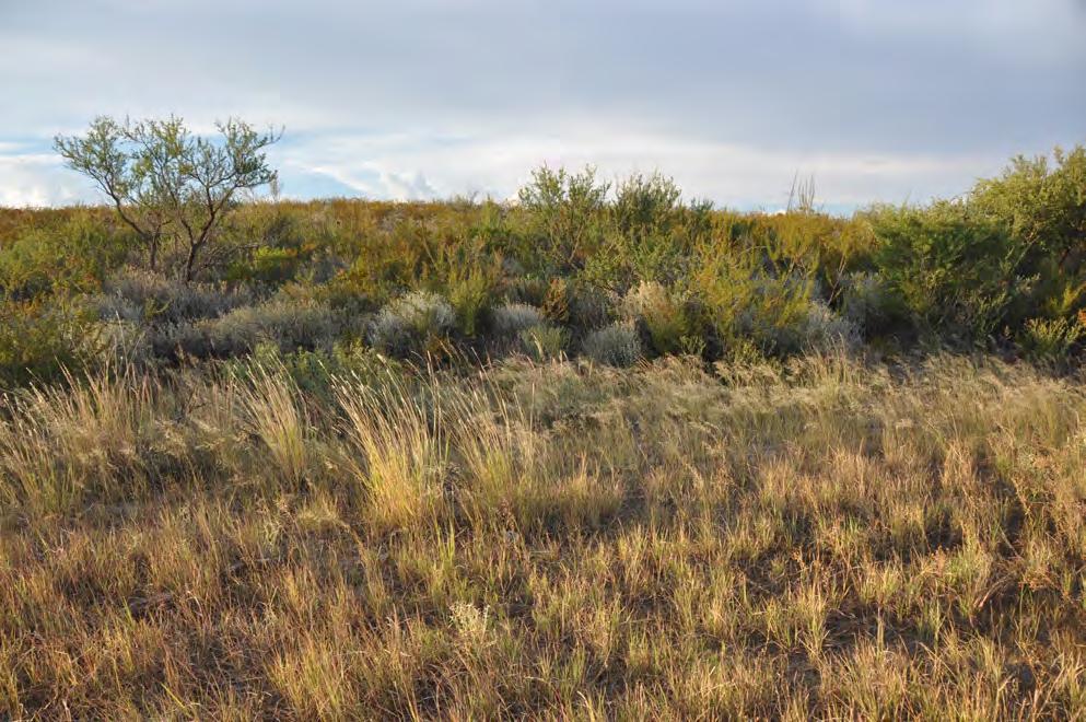
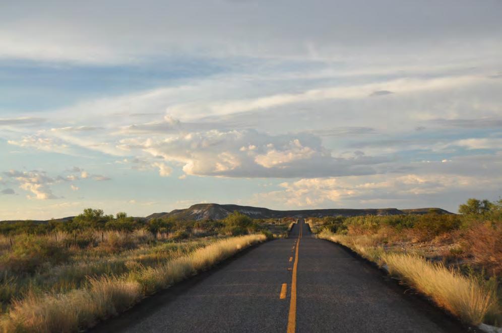
2 South Alamito Ranch 1,500 Acres, south of Marfa, Casa Piedra Road Presidio County, Texas James King, Agent Office Location South Alamito Ranch is the perfect Presidio County ranch located on both sides of State Highway 169, (Casa Piedra Road) just 25 minutes south of Marfa, in Far West Texas. This paved road ends just a few miles south of the ranch after it crosses beautiful Alamito Creek where it continues as a gravel public road for 50 miles, down to the River Road near Presidio and into Big Bend Ranch State Park. This two-lane ribbon of remote highway adjoins the ranch for several miles and bisects one of the most scenic large ranch neighborhoods in the region, ending at Plata, a historic abandoned farming community which raised vegetables for Shafter Mine in the early part of the 20 th Century. Acreage 1,500 Acres Description South Alamito Ranch is very accessible and is located in the transition zone between the Marfa Grasslands and the lower Chihuahuan Desert. The ranch has excellent topography, created by numerous draws that flow into nearby Alamito Creek, carving high hills with excellent views of area mountains, deep protected canyons, and draws. There are breathtaking vistas of the Davis, Chinati, San Jacinto, French, and Cienega Mountains, as well as views all the way into Mexico to the Sierra Ricas. Native grasses and mixed shrubs provide excellent habitat for wildlife and forage for livestock. There are incredible building sites with views of the gallery Cottonwood forest which strings out for miles along the banks of Alamito Creek, providing a stunning western landscape. The ranch actually owns part of Alamito Creek south of the bridge. The Alamito Creek Preserve, owned and operated by the Dixon Water Foundation, is just next door, providing opportunities for birding and hiking along its 2 ½ miles of Cottonwood-lined Alamito Creek. The buyer of this ranch will have limited access to the Preserve. The ranch is subject to a Conservation Easement with the Texas Agricultural Land Trust that focuses on restricting subdivision while allowing compatible uses like recreation, hunting, planned grazing, and limited development.
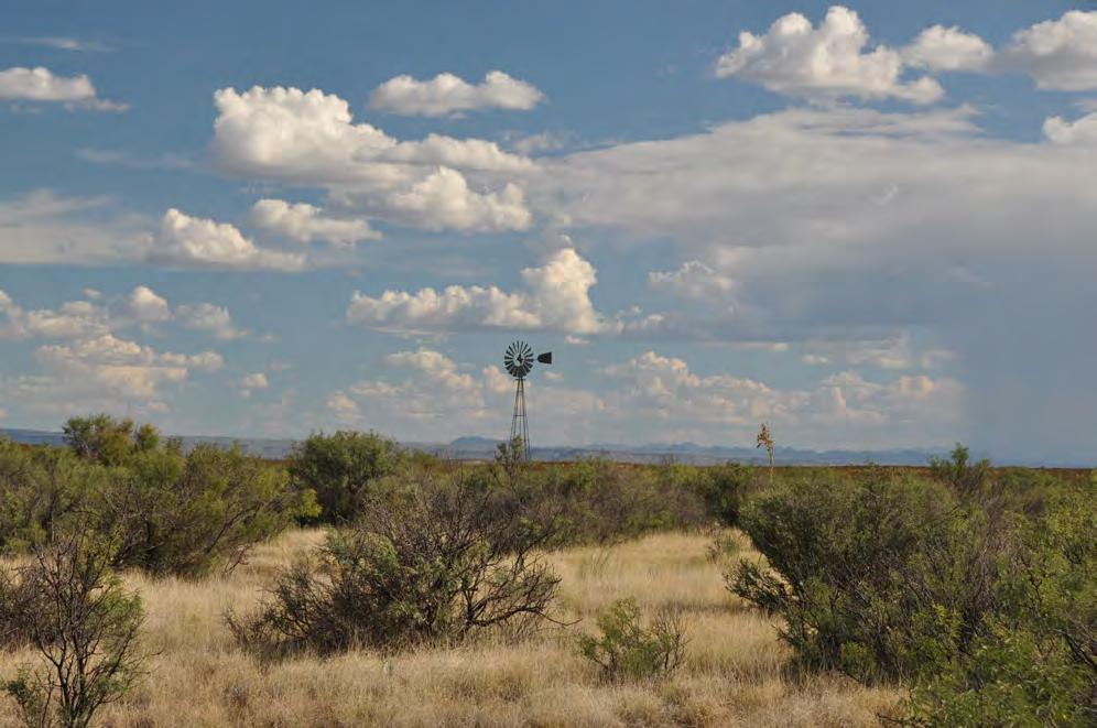
3 Habitat South Alamito Ranch is located within the Alamito Creek watershed in Presidio County, which originates in the Davis Mountains to the north and joins into Cienega Creek to the southwest, eventually meeting the Rio Grande River near Presidio, Texas. The large drainage, or valley, has tremendous surface and groundwater resources, providing a corridor of habitat for migrating animals. Sideoats grama, cane bluestem, tabosa, blue grama and giant sacaton are typical grasses found on the ranch as well as brush and woody species like mesquite, creosote, agarita, sumac, desert willow, white brush, and four-wing saltbush. This ranch is across the highway from Alamito Creek Preserve and a limited deeded access will be provided to the new owner, allowing hiking, birding, and recreation along this amazing Cottonwood gallery forest wonderland with live water. Wildlife Big mule deer, Javelina, Blue Quail, and dove populations are tremendous and the wooded creek drainages make for an excellent hunting ranch. For bird-watching interests, there are many of the migrating species during the fall and spring seasons. Winter nesting is abundant for northern species. Native brush and grasses provide excellent habitat for these game species and many native birds and other non-game animals. Water Alamito Creek watershed has very shallow and abundant groundwater resources. The windmill well located on the property provides high-quality water and storage could be expanded and distributed further to enhance wildlife populations. The ranch fronts both sides of Alamito Creek just south of the bridge where water can be found year-round most years. There is a dirt tank located at the windmill that holds water from overflow from the well and several other dirt tanks east of the highway. Price $550 per Acre or $825,000 Contact James King, Agent King Land & Water, LLC Office Cell James@KingLandWater.com Disclaimer This Ranch offering is subject to prior sale, change in price, or removal from the market without notice. While the information above was provided by sources deemed reliable, it is in no way guaranteed by the broker or agent.

4 SOUTH ALAMITO RANCH - 1,500 AC +/- PRESIDIO COUNTY, TEXAS Van Horn Lobo C u l b e r s o n 90 Candelaria Ruidosa 10 Valentine P r e s i d i o Chinati Mountains FM 170 Date: Data Source: ESRI \ Property Ochoa Quebec Ryan Kent ST 166 Shafter Presidio Alamito Creek Preserve Dixon Water Foundation Property Boundary Pinto Canyon Rd Ê ST ST 17 Marfa \ Balmorhea J e f f D a v i s Davis Mountains State Park Ranch Rd 169 KING LAND & WATER Plata Balmorhea State Park Casa Piedra Big Bend Ranch State Park ST 17 Fort Davis Lajitas Alpine ST 118 Pecos R e e v e s 90 Terlingua Elephant Mtn. Wildlife Mgmt. Areaa Marathon 385 P e c o s ST 118 Coyanosa 385 ST 18 B r e w s t e r Black Gap Wildlife Mgmt. Area Big Bend National Park Fort Stockton Miles James King 600 North State Street PO Box 109 Fort Davis, TX P: (432) kinglandwater.com Sanderson McCamey Bakersfield Ranch Rd 169 T e r r e l l Plata ST 349 Dryden 90 ST 349 C r o c k e t t ST Sheffield Texon Miles The information contained herein was obtained from sources deemed to be reliable. Mapright Services makes no warranties or guarantees as to the completeness or accuracy thereof

5 KING LAND & WATER SOUTH ALAMITO RANCH - 1,500 AC +/PRESIDIO COUNTY, TEXAS M M TT AA O N O S O O C CR RE E K 169 RM O O CR M M II TT K E E EE K A L AA % & D U N M M A R E E EK K NN C 2,000 4,000 6,000 Feet Ê Date: Data Source: TNRIS, USDA, Google 0 Windmill Pond/Tank Primary Road % & Road/Trail Alamito Creek Preserve Transmission Line Creek Dixon Water Foundation Property Boundary Stream, Intermittent King Land & Water, LLC P: (432) /(512) kinglandwater.com The information contained herein was obtained from sources deemed to be reliable. Mapright Services makes no warranties or guarantees as to the completeness or accuracy thereof apright.com
6 A N M A T SOUTH ALAMITO RANCH - 1,500 AC +/- PRESIDIO COUNTY, TEXAS KING LAND & WATER O N O S O C R E E K RM RM A L A M II T O C R E E K &%&% D U N M C R E E K &% Windmill 0 2,000 4,000 6,000 Feet Date: Data Source: TNRIS, USDA, Google Primary Road Road/Trail Transmission Line Creek Stream, Intermittent Pond/Tank Ê Alamito Creek Preserve Dixon Water Foundation Property Boundary King Land & Water, LLC P: (432) /(512) kinglandwater.com The information contained herein was obtained from sources deemed to be reliable. Mapright Services makes no warranties or guarantees as to the completeness or accuracy thereof

7
8

9
10
11
Kennedy Ranch /- acres, Presidio County, Texas
 Kennedy Ranch 3187 +/- acres, Presidio County, Texas Kennedy Ranch 3,187 Acres Casa Piedra Road Marfa, Presidio County, Texas James King, Agent Office 432 426.2024 James@KingLandWater.com Location The
Alamito Waters Ranch 80 acres, Presidio County, Texas James King, Agent Office Cell
 Alamito Waters Ranch 80 acres, Presidio County, Texas James King, Agent Office 432-426-2024 Cell 432-386-2821 James@KingLandWater.com King Land & Water LLC P.O. Box 109, 600 State Street, Fort Davis, TX
Alamito Creek Preserve Ranches for Sale Marfa, Presidio County, Texas
 Alamito Creek Preserve Ranches for Sale Marfa, Presidio County, Texas James King, Agent Office 432 426.2024 Cell 432 386.2821 James@KingLandWater.com Alamito Creek Preserve Various size Ranch Properties,
Kennedy Ranch 3,187 Acres, near Marfa, Presidio County Texas
 Kennedy Ranch 3,187 Acres, near Marfa, Presidio Texas James King, Agent Office 432-426-2024 Cell 432-386-2821 James@KingLandWater.com King Land & Water LLC P.O. Box 109, 600 State Street, Fort Davis, TX
Quebec Ranch 12,500Acres Presidio County, Texas
 Quebec Ranch 12,500Acres Presidio County, Texas James King, Agent Office 432.426.2024 Cell 432.386.2821 James@KingLandWater.com Quebec Ranch 12,500 Acres Marfa, Presidio County, Texas James King, Agent
Quebec Ranch 12,500 acres, Presidio County
 Quebec Ranch 12,500 acres, Presidio County Quebec Ranch 12,500 Acres Marfa, Presidio County, exas James King, Agent Office 432.426.2024 James@KingLandWater.com Location he Quebec Ranch is located 25 miles
Comanche Trail Ranch 48,404 Acres, Pecos County, Texas James King, Agent Office Cell
 Comanche rail Ranch 48,404 Acres, Pecos County, exas James King, Agent Office 432-426-2024 Cell 432-386-2821 James@KingLandWater.com King Land & Water LLC P.O. Box 109, 600 State Street, Fort Davis, X
Agua Fria Ranch +/- 23,482 Acres South of Alpine, Texas Adjacent to Big Bend Ranch State Park
 Agua Fria Ranch +/- 23,482 Acres South of Alpine, Texas Adjacent to Big Bend Ranch State Park James King, Agent Office 432.426.2024 Cell 432.386.2821 James@KingLandWater.com King Land & Water LLC P.O.
Aplomado Flats Ranch acres, Brewster County, Texas
 Aplomado Flats Ranch 2701.7 acres, Brewster County, Texas James King, Agent Office 432-426-2024 Cell 432-386-2821 James@KingLandWater.com King Land & Water LLC P.O. Box 109, 600 State Street, Fort Davis,
Blue Mountain Retreat Acres, Jeff Davis County, Texas
 Blue Mountain Retreat 29.33 Acres, Jeff Davis County, Texas Blue Mountain Retreat 29.33 acres Fort Davis, Jeff Davis County, Texas James King, Agent Office 432 426.2024 James@KingLandWater.com Location
Randolph Ranch 12,164 Acres Brewster and Pecos Counties, Texas
 Randolph Ranch 12,164 Acres Brewster and Pecos Counties, Texas James King, Agent Office 432.426.2024 Cell 432.386.2821 James@KingLandWater.com Randolph Ranch 12,164 Acres Brewster and Pecos Counties, Texas
carpenter real estate presents:
 carpenter real estate presents: this is one of the best trophy class desert mule deer, aoudad sheep and bird hunting ranches in west texas. Elevations range from 4,400 feet to 5,180 feet. Ideal habitat
Marfa House and Ranch Property 2,400 acres with premier residence, Marfa, Presidio County, Texas
 Marfa House and Ranch Property 2,400 acres with premier residence, Marfa, Presidio County, Texas James King, Agent Office 432 426.2024 Cell 432 386.2821 James@KingLandWater.com Marfa House and Ranch Property
Coyote Creek Apache County, Arizona
 Coyote Creek Apache County, Arizona Listed for sale exclusively by: Traegen Knight Headquarters West Ltd. PO BOX 1980 St. Johns, AZ 85936 Phone: (928) 524-3740, Fax: (928) 563-7004, Cell: (602) 228-3494
The Swan House and Adobe Construction Lab Sales Presentation Presidio, Texas Big Bend Country, reachable by scenic route only.
 The Swan House and Adobe Construction Lab Sales Presentation Presidio, Texas Big Bend Country, reachable by scenic route only. 500 Acres 2,000 sq. ft. house 360º views Adjacent to Big Bend State Park Solar
David Gold Hiking Tours
 David Gold Hiking Tours Join us for a West Texas Active Adventure Tour February 14 21, 2017 Led by David Gold and Ulrike Porat The Big Bend area of West Texas is one of the most remote, and least visited
Cherry County, Nebraska
 Cherry County, Nebraska Co-Listed with Maddux Landbanc Realty, LLC Offered Exclusively By: NORTH PLATTE OFFICE P.O. Box 1166 I-80 & US Hwy 83 North Platte, NE 69103 www.agriaffiliates.com (308) 534-9240
Review of Riparian Function Riparian Management Riparian Monitoring
 Review of Riparian Function Riparian Management Riparian Monitoring Water Shed Water Catchment Water catching creek Water shedding creek Properly functioning riparian area Properly Functioning Riparian
LANDSCAPE CHANGE IN THE SOUTHWEST: Historical changes in selected ecosystems of the southwestern United States
 LANDSCAPE CHANGE IN THE SOUTHWEST: Historical changes in selected ecosystems of the southwestern United States Robert H. Webb U.S. Geological Survey 520 N. Park Avenue Tucson, AZ 85719 rhwebb@usgs.gov
Old Thomasson Range, Chico, CA
 AG-LAND INVESTMENT BROKERS 275 Sale Lane, Suite 2 / P. O. Box 896 Red Bluff, CA 96080 530.529.4400 office / 530.527.5042 fax Old Thomasson Range, Chico, CA Property: Approximately 5,270 acres bordered
Information Paper. Kansas City District. Missouri River Fish and Wildlife Mitigation Project Jim and Olivia Hare Wildlife Area, MO
 City District Information Paper River Fish and Wildlife Mitigation Project Jim and Olivia Hare Wildlife Area, MO Riverine habitat created in 2004/2005 by modifying existing river structures along the banks,
Upper Owyhee Watershed Assessment
 * Owyhee Watershed Council and Scientific Ecological Services The upper Owyhee subbasin is located in parts of three states: the southeastern corner of Oregon, the southwestern corner of Idaho, and north
Big Bend National Park Visitor Study
 Big Bend National Park Visitor Study The Visitor Services Project 2 OMB Approval 1024-0099 Expiration Date: 08-15-92 3 DIRECTIONS One adult in your group should complete the questionnaire. It should only
Fall River Valley Irrigated Farmland
 AG-LAND Investment Brokers 275 Sale Lane Red Bluff, CA 96080 530-529-4400 Fax 530-527-5042 Fall River Valley Irrigated Farmland Tehama McArthur, County, California 2015 well, 16 inch casing, 150 HP, 2,000
Name period date assigned date due date returned. Texas Ecoregions
 Name period date assigned date due date returned Directions: Go to the following website: https://www-k6.thinkcentral.com/epc/start.do Use the log in that is taped to the top of your laptop. If you are
Objectives. Understand the different physical & human characteristics of each region
 TEXAS REGIONS Objectives Know the 4 regions of Texas Understand the different physical & human characteristics of each region Understand how physical differences affect human characteristics (way of life)
Natural Texas. Regions and Climates
 Natural Texas Regions and Climates Two Kinds: Physical geography Climate, vegetation, rivers, lakes, oceans, plateaus, plains, and mountain ranges Human geography Economic activities How we earn a living
Producing Chandler Walnut Orchard
 AG-LAND Investment Brokers 275 Sale Lane Red Bluff, CA 96080 530-529-4400 Fax 530-527-5042 Producing Chandler Walnut Orchard West Sacramento Avenue - Chico, CA AG-LAND INVESTMENT BROKERS 275 Sale Lane
Weathering/ Erosion/ Deposition in the Texas Ecoregions
 Practice Test Study these answers Weathering/ Erosion/ Deposition in the Texas Ecoregions 1. In the Texas Panhandle, physical weathering by abrasion is usually caused by wind, water and gravity 2. Two
Cripps Ranch 76+/- Acres Orchard Development Opportunity Dixon, CA. Presented By:
 Cripps Ranch 76+/- Acres Orchard Development Opportunity Dixon, CA Presented By: Cripps Ranch 76+/- Acres Orchard Development Opportunity Dixon, CA Location: This property is located at 5663 Dally Road
Chittenden Road Prune Orchard Corning, California
 AG-LAND INVESTMENT BROKERS 275 Sale Lane / P. O. Box 896 Red Bluff, CA 96080 530.529.4400 office / 530.527.5042 fax Chittenden Road Prune Orchard Corning, California Property: 40.00 acres planted to producing
Sacramento River Farmland Anderson, California
 AG-LAND INVESTMENT BROKERS 275 Sale Lane / P. O. Box 896 Red Bluff, CA 96080 530.529.4400 office / 530.527.5042 fax Sacramento River Farmland Anderson, California Property: 45 +/- acres of farmland with
CITY OF PORTLAND, TEXAS SERVICE PLAN FOR ANNEXATION AREA
 CITY OF PORTLAND, TEXAS SERVICE PLAN FOR ANNEXATION AREA Location and Acreage Approximately 1,863 acres of land in San Patricio County, located in the ETJ northwest of the existing City Limits. Metes and
CALIFORNIA AGRICULTURAL PR OPERTIES, IN C. BOWLSBEY 320 LIBERTY ISLAND ROAD BUYER: RASSMUSSEN TRUST
 CALIFORNIA AGRICULTURAL PR OPERTIES, IN C. BOWLSBEY 320 LIBERTY ISLAND ROAD SELLER: BOWLSBEY TRUST BUYER: RASSMUSSEN TRUST LOCATION: The Bowlsbey 320 is located ten (10) miles southeast of the City of
Name period date assigned date due date returned. Texas Ecoregions
 Name period date assigned date due date returned Directions: Go to the following website: https://www-k6.thinkcentral.com/epc/start.do Use the log in that is taped to the top of your laptop. If you are
Changes in Texas Ecoregions
 Comment On Lesson Changes in Texas Ecoregions The state of Texas can be divided into 10 distinct areas based on unique combinations of vegetation, topography, landforms, wildlife, soil, rock, climate,
FOR SALE +/- 419 ACRES ¼ Mile South of Alliance Airport
 FOR SALE +/- 419 ACRES ¼ Mile South of Alliance Airport Alliance Airport Subject property +/- 419 AC Pat McDowell +1 817 334 8106 pat.mcdowell@am.jll.com JLL 201 Main Street, Suite 1440 Fort Worth, TX
Chapter 6. Field Trip to Sandia Mountains.
 University of New Mexico Biology 310L Principles of Ecology Lab Manual Page -40 Chapter 6. Field Trip to Sandia Mountains. Outline of activities: 1. Travel to Sandia Mountains 2. Collect forest community
PUBLIC UTILITY COMMISSION OF TEXAS DOCKET NO
 Application of CenterPoint Energy Houston Electric, LLC for a Certificate of Convenience and Necessity for a Proposed 138 kv Transmission Line within Harris County, Texas PUBLIC UTILITY COMMISSION OF TEXAS
CALIFORNIA AGRICULTURAL PR OPERTIES, IN C. GALE RANCH
 CALIFORNIA AGRICULTURAL PR OPERTIES, IN C. GALE RANCH LOCATION: The Ranch is located 6 Yi miles west of the City of Davis on the northwest corner of County Roads 29A and 92E in Yolo County. SIZE: 368.64
TSEGI WASH 50% DESIGN REPORT
 TSEGI WASH 50% DESIGN REPORT 2/28/2014 Daniel Larson, Leticia Delgado, Jessica Carnes I Table of Contents Acknowledgements... IV 1.0 Project Description... 1 1.1 Purpose... 1 Figure 1. Erosion of a Headcut...
Hydraulics and Hydrology of the Rio Grande/Bravo Basin: A Bi-National View
 Hydraulics and Hydrology of the Rio Grande/Bravo Basin: A Bi-National View Daene McKinney University of Texas at Austin Javier Aparicio Instituto Mexicano de Tecnológica del Agua Project Rio Workshop,
A little helpful hint.. PLEASE TAKE CORNELL NOTES AND THEN REWRITE YOUR NOTES AT HOME. YOU WILL NEED TO ORGANIZE YOUR NOTES USING EITHER MAIN IDEAS
 JOANNE HOWARD A little helpful hint.. PLEASE TAKE CORNELL NOTES AND THEN REWRITE YOUR NOTES AT HOME. YOU WILL NEED TO ORGANIZE YOUR NOTES USING EITHER MAIN IDEAS OR QUESTIONS Can you name the Regions of
MAPS AND THEIR CLASSIFICATION
 MAPPING MAPS AND THEIR CLASSIFICATION WHAT IS A MAP? A map is representation of the Earth's surface, showing how things are related to each other by distance, direction, and size. Maps are a way of showing
REQUEST FOR PROPOSALS CLOSING DATE:
 Request for Proposals 110 Westlake Drive City of West Lake Hills 110 Westlake Drive REQUEST FOR PROPOSALS CLOSING DATE: Tuesday, October 23, 2018 City of West Lake Hills Request for Proposals 1 I. INTRODUCTION
Ecological Land Cover Classification For a Natural Resources Inventory in the Kansas City Region, USA
 Ecological Land Cover Classification For a Natural Resources Inventory in the Kansas City Region, USA by Applied Ecological Services, Inc. In cooperation with the Mid-America Regional Council 600 Broadway,
B. T. Brady, M. S. Bedinger, John Mikels, William H. Langer, and Deborah A. Mulvihill
 DEPARTMENT OF THE INTERIOR UNITED STATES GEOLOGICAL SURVEY TO ACCOMPANY WRI REPORT 83-4121-B MAP SHOWING GROUND-WATER LEVELS, SPRINGS. AND DEPTH TO GROUND WATER, BASIN AND RANGE PROVINCE, TEXAS by B. T.
CRUM RANCH AREA MAP YOLO COUNTY, California, AC +/-
 CRUM RANCH AREA MAP YOLO COUNTY, California, 235.59 AC +/- Map data 2016 Google Imagery 2016, CAPCOG, DigitalGlobe, Texas Orthoimagery Program, U.S. Geological Survey, USDA Farm Service Agency Boundary
CANYON THE. The Grand Canyon A Reading A Z Level K Leveled Book Word Count: 394 H K N. LEVELED BOOK K Grand
 The Grand Canyon A Reading A Z Level K Leveled Book Word Count: 394 Connections Writing and Art What would you like to do at the Grand Canyon? Why? Draw a picture and write five or more sentences about
Features of the Arid and Semiarid Region
 Appendixes Appendix A Features of the Arid and Semiarid Region Note: The information in this appendix further elaborates on material presented in chapter II. Natural Features of the Arid and Semiarid Region
IDAWRA: Groundwater-flow model for the Wood River Valley aquifer system, south-central Idaho February 1, 2017, 11:30-1:00
 Idaho Section of the American Water Resources Association IDAWRA: Groundwater-flow model for the Wood River Valley aquifer system, south-central Idaho A three-dimensional numerical model of groundwater
Which map shows the stream drainage pattern that most likely formed on the surface of this volcano? A) B)
 B)") 1. When snow cover on the land melts, the water will most likely become surface runoff if the land surface is A) frozen B) porous C) grass covered D) unconsolidated gravel Base your answers to questions
1. When snow cover on the land melts, the water will most likely become surface runoff if the land surface is A) frozen B) porous C) grass covered D) unconsolidated gravel Base your answers to questions
Steve Pye LA /22/16 Final Report: Determining regional locations of reference sites based on slope and soil type. Client: Sonoma Land Trust
 Steve Pye LA 221 04/22/16 Final Report: Determining regional locations of reference sites based on slope and soil type. Client: Sonoma Land Trust Deliverables: Results and working model that determine
Your web browser (Safari 7) is out of date. For more security, comfort and the best experience on this site: Update your browser Ignore
 is out of date. For more security, comfort and the best experience on this site: Update your browser Ignore") Your web browser (Safari 7) is out of date. For more security, comfort and the best experience on this site: Update your browser Ignore ALLU VIAL FAN colluvial fan, debris cone For the complete encyclopedic
Your web browser (Safari 7) is out of date. For more security, comfort and the best experience on this site: Update your browser Ignore ALLU VIAL FAN colluvial fan, debris cone For the complete encyclopedic
BISTI / DE-NA-ZIN WILDERNESS
 BISTI / DE-NA-ZIN WILDERNESS Activities: Facilities: Season / Hours: Description: Hiking and photography. No electrical hookups, water, or restrooms are available. Open year-round. The Bisti/De-Na-Zin
Big Chino Valley Pumped Storage Project (FERC No ) Vegetation Mapping and Habitat Assessment Study Plan
 Vegetation Mapping and Habitat Assessment Study Plan") March 21, 2018 1.0 Introduction Big Chino Valley Pumped Storage LLC (BCV), a subsidiary of ITC Holdings Corp. (ITC), submitted a preliminary permit application to the Federal Energy Regulatory Commission
March 21, 2018 1.0 Introduction Big Chino Valley Pumped Storage LLC (BCV), a subsidiary of ITC Holdings Corp. (ITC), submitted a preliminary permit application to the Federal Energy Regulatory Commission
Chapter 3. Description of the Study Area. Karl Taboga, James Stafford and Paul Taucher 3-19
 Chapter 3 Description of the Study Area Karl Taboga, James Stafford and Paul Taucher 3-19 T his study examines groundwater resources that underlie the Bear River drainage basin in Wyoming as well as areas
3.3 CLIMATE, GEOLOGY, TOPOGRAPHY, AND SOILS CLIMATE GEOLOGY TOPOGRAPHY
 3.3 CLIMATE, GEOLOGY, TOPOGRAPHY, AND SOILS This section describes the climate, geology, topography, and soil resource characteristics of the Yolo Bypass Wildlife Area (Wildlife Area). Agricultural soil
Upper Truckee River Restoration Lake Tahoe, California Presented by Brendan Belby Sacramento, California
 Upper Truckee River Restoration Lake Tahoe, California Presented by Brendan Belby Sacramento, California Mike Rudd (Project Manager), Charley Miller & Chad Krofta Declines in Tahoe s Water Clarity The
!! The Rio Grande River starts at the Rocky Mountains in Colorado. This River is 1,885 miles long!
 The Southwest Region By Taylor Noble and Kaiya Leismer Land and water The southwest region covers a lot of land but the Southwest region has lowest amount of states in any other region. In the Southwest
Grant Opportunity Monitoring Bi-State Sage-grouse Populations in Nevada
 Grant Opportunity Monitoring Bi-State Sage-grouse Populations in Nevada Proposals are due no later than November 13, 2015. Grant proposal and any questions should be directed to: Shawn Espinosa @ sepsinosa@ndow.org.
Changes in Texas Ecoregions Copy the questions and answers
 Changes in Texas Ecoregions Copy the questions and answers 1. What are some kinds of damage that hurricanes cause? Roads and bridges might be washed away. Trees and power lines can be knocked down. Area
ROAD SEDIMENT ASSESSMENT & MODELING: KOOTENAI-FISHER TMDL PLANNING AREA ROAD GIS LAYERS & SUMMARY STATISTICS
 ROAD SEDIMENT ASSESSMENT & MODELING: KOOTENAI-FISHER TMDL PLANNING AREA ROAD GIS LAYERS & SUMMARY STATISTICS Prepared by: ATKINS Water Resources Group 820 North Montana Avenue Helena, MT 59601 November
Lagunitas Creek Stewardship Plan. Marin Municipal Water District
 Lagunitas Stewardship Plan Marin Municipal Water District Final June 2011 FIGURES Lagunitas Stewardship Plan Final June 2011 Legend Tomales Bay Highway 1 Major Roads Public Lands Marin Municipal Water
Lower South Fork McKenzie River Floodplain Enhancement Project
 Lower South Fork McKenzie River Floodplain Enhancement Project McKenzie River Ranger District Willamette National Forest Project Location The project is located in the South Fork McKenzie River Watershed,
Wetland & Floodplain Functional Assessments and Mapping To Protect and Restore Riverine Systems in Vermont. Mike Kline and Laura Lapierre Vermont DEC
 Wetland & Floodplain Functional Assessments and Mapping To Protect and Restore Riverine Systems in Vermont Mike Kline and Laura Lapierre Vermont DEC NWI+ Hydro-Geomorphic Characterization of Wetlands and
Implementing a Project with 319 Funds: The Spring Brook Meander Project. Leslie A. Berns
 Implementing a Project with 319 Funds: The Spring Brook Meander Project Leslie A. Berns "...to acquire... and hold lands... for the purpose of protecting and preserving the flora, fauna and scenic beauties...
1.0 PURPOSE AND FORMAT OF THE FINAL EIR
 1.0 PURPOSE AND FORMAT OF THE FINAL EIR 1.1 PROJECT OVERVIEW CEMEX (RMC Pacific Materials, dba CEMEX) operates the Bonny Doon Shale and Limestone Quarries in Santa Cruz County for the production of Portland
Topographic Recreational Map Of New Mexico: Detailed Travel Map By GTR Mapping
 Topographic Recreational Map Of New Mexico: Detailed Travel Map By GTR Mapping Biological Assessment for Proposed Reconstruction of New Mexico Forest Highway 12. Cuba and Jemez Recreation Opportunity Spectrum
Colorado Front Range Wildfires Situation Report #7 Monday, July 02, :15 AM (MDT)
") Colorado Front Range Wildfires Situation Report #7 Monday, July 02, 2012 10:15 AM (MDT) Mandatory evacuations for the Waldo Canyon fire have been reduced from 35,000 to 3,000. Remaining evacuations are
Colorado Front Range Wildfires Situation Report #7 Monday, July 02, 2012 10:15 AM (MDT) Mandatory evacuations for the Waldo Canyon fire have been reduced from 35,000 to 3,000. Remaining evacuations are
More Sites for the LWA: South Circle
 More Sites for the LWA: South Circle John Dickel (UNM), Pat Crane (NRL), and Aaron Cohen (NRL) August 24, 2007 ABSTRACT In this memo we describe a visit to more potential sites for the LWA. We employ the
RANCHO de DOS PALMAS DAVIS, California, AC +/-
 RANCHO de DOS PALMAS DAVIS, California, 507.28 AC +/- Boundary Transmission Line Pond / Tank Well SCOTT STONE P: (530) 662-4094 sastone57@gmail.com 37874 County Road 28, Woodland, Ca. 95695 The information
The following maps must be provided as a part of the ADA. The appropriate scale for each map should be determined at the pre application conference.
 Main Street @ Coconut Creek DRI QUESTION 9 MAPS The following maps must be provided as a part of the ADA. The appropriate scale for each map should be determined at the pre application conference. Map
Arizona Recreation Map By Benchmark Maps READ ONLINE
 Arizona Recreation Map By Benchmark Maps READ ONLINE Families can come and see what the Sierra Montana Recreation Center has to offer. The center has a game room with Xbox 360s on high definition TV's,
Ellis County-Midlothian to Waxahachie Trail Corridor Research
 Ellis County- to Trail Corridor Research The University of Texas at Arlington Program in Landscape Architecture, School of Architecture and The Institute of Urban Studies, The School of Urban and Public
Changes to Land 5.7B. landforms: features on the surface of Earth such as mountains, hills, dunes, oceans and rivers
 All the landforms on Earth have changed over time and continue to change. Many of the changes were caused by wind, moving water, and moving ice. Mountains have grown and shrunk. Rivers have cut away land
BUILDING AN ASSET MANAGEMENT GEODATABASE FOR RANCHING. Matt Crawford, GISP
 BUILDING AN ASSET MANAGEMENT GEODATABASE FOR RANCHING Matt Crawford, GISP Introduction East Foundation Formed in 2007 Mission Research Education Outreach Properties Six ranches ~ 215,000 acres San Antonio
Think about the landforms where you live. How do you think they have changed over time? How do you think they will change in the future?
 reflect All the landforms on Earth have changed over time and continue to change. Many of the changes were caused by wind, moving water, and moving ice. Mountains have grown and shrunk. Rivers have cut
Maps of the Rush Creek Watershed
 Maps of the Watershed Yuba River Watershed South Yuba River Watershed Watershed 1 Monitoring Sites 5 Land Cover 8 Parcel Density 2 Topology & Hydrology 6 Land Use 9 Road Density 3 Public Ownership 7 Parcels
TRACT 7: ±252 Acres Irrigated Farmland Grassland
 TRACT 7: ±252 Acres Irrigated Farmland Grassland 1880 FM 2013, Friona, Texas 79035 ±252 acres of irrigated farmland and grassland. This farmland is currently being leased and farmed. The lease agreement
Mule Shoe Bar South Ranch
 Mule Shoe Bar South Ranch All contiguous rangeland with sub irrigated range sites consisting of 11,555 total acres Mike Lashley Owner Broker Mike s Cell: 308-530-0134 Email: mike@lashleyland.com Property
Urbanczyk CV, page 1
 Kevin Urbanczyk Professor, Department of Biology, Geology, and Physical Sciences Director, Rio Grande Research Center Sul Ross State University 400 N. Harrison, Alpine, TX 79832 432-837-8110 kevinu@sulross.edu
Sacred Lands File & Native American Contacts List Request
 Sacred Lands File & Native American Contacts List Request NATIVE AMERICAN HERITAGE COMMISSION 915 Capitol Mall, RM 364 Sacramento, CA 95814 (916) 653-4082 (916) 657-5390 Fax nahc@pacbell.net Information
 Red River Flooding June 2015 Caddo and Bossier Parishes Presented by: Flood Technical Committee Where the Rain Falls Matters I-30 versus I-20 I-20 Backwater and Tributary Floods (Localized) 2016 Flood
Project Delivery Team Meeting. December 14, Trusted Partners Delivering Value Today for a Better Tomorrow
 LOXAHATCHEE RIVER WATERSHED RESTORATION PROJECT Project Delivery Team Meeting December 14, 2016 One of the Last Old Growth Cypress Floodplains in the SE Florida Federally designated as a National Wild
Revised February 9, 2017
 Revised February 9, 2017 Geography of the U.S. II-A-1* Apply geographic tools of title, grid system, legends, symbols, scale and compass rose to construct and interpret maps. II-A-2* Translate geographic
Grade Five Social Studies Assessment Regions/Native Americans
 Name Grade Five Social Studies Assessment Regions/Native Americans Use the map below to answer questions 1 and 2 1. (Geo 1) For this location give the name of the city found there. 38 N, 100 W a. Scottsbluff
Five Themes of Geography Project Ms. Kiesel, Per 5. The United States of America
 Five Themes of Geography Project Ms. Kiesel, Per 5 The United States of America Location Absolute Location : The USA is located in the continent of North America in the northern and western hemispheres.
One of the many strengths of a GIS is that you can stack several data layers on top of each other for visualization or analysis. For example, if you
 One of the many strengths of a GIS is that you can stack several data layers on top of each other for visualization or analysis. For example, if you overlay a map of the habitat for an endangered species
CWC Water Plan
 CWC Water Plan ----------------------------------------------------------------------------------------------------------------------------- IMPLEMENTATION: MISSISSIPPI RIVER The begins as a trickle flowing
How Do Human Impacts and Geomorphological Responses Vary with Spatial Scale in the Streams and Rivers of the Illinois Basin?
 How Do Human Impacts and Geomorphological Responses Vary with Spatial Scale in the Streams and Rivers of the Illinois Basin? Bruce Rhoads Department of Geography University of Illinois at Urbana-Champaign
Laboratory Exercise #3 The Hydrologic Cycle and Running Water Processes
 Laboratory Exercise #3 The Hydrologic Cycle and Running Water Processes page - 1 Section A - The Hydrologic Cycle Figure 1 illustrates the hydrologic cycle which quantifies how water is cycled throughout
MARS AREA SCHOOL DISTRICT CURRICULUM GRADE: Grade 4
 MARS AREA SCHOOL DISTRICT CURRICULUM GRADE: Grade 4 Course Title: Social Studies Brief Description Overview: Students will explore the history, geography, government, and economy of the United States with
Advanced Geologic Exploration, Inc.
 Advanced Geologic Exploration, Inc. Scientists of the Earth PO Box 1956, Chester, CA 96020 Voice: (530) 258-4228 Fax (530) 258-4339 www.advancedgeologic.com January 23, 2009 Job No. G-081201 Terri Barber,
2. PHYSICAL SETTING FINAL GROUNDWATER MANAGEMENT PLAN. 2.1 Topography. 2.2 Climate
 FINAL GROUNDWATER MANAGEMENT PLAN 2. PHYSICAL SETTING Lassen County is a topographically diverse area at the confluence of the Cascade Range, Modoc Plateau, Sierra Nevada and Basin and Range geologic provinces.
Evaluating Wildlife Habitats
 Lesson C5 4 Evaluating Wildlife Habitats Unit C. Animal Wildlife Management Problem Area 5. Game Animals Management Lesson 4. Evaluating Wildlife Habitats New Mexico Content Standard: Pathway Strand: Natural
APPENDIX I - AREA PLANS
 ROUTE 37 WEST LAND USE PLAN ROUTE 37 WEST LAND USE PLAN Recent land use decisions and development trends have drawn attention to the land within the Route 37 western by-pass area between Route 50 and
APPENDIX A REACH DECRIPTIONS. Quantico Creek Watershed Assessment April 2011
 APPENDIX A REACH DECRIPTIONS Basin 615, South Fork of Quantico Creek - Project Reach Descriptions Reach Name: 615-A Coordinates (NAD 83, Virginia State Plane North): 11796510.57, 6893938.95 to 11801555.79,
EAGLES NEST AND PIASA ISLANDS
 EAGLES NEST AND PIASA ISLANDS HABITAT REHABILITATION AND ENHANCEMENT PROJECT MADISON AND JERSEY COUNTIES, ILLINOIS ENVIRONMENTAL MANAGEMENT PROGRAM ST. LOUIS DISTRICT FACT SHEET I. LOCATION The proposed
Southwest LRT Habitat Analysis. May 2016 Southwest LRT Project Technical Report
 Southwest LRT Habitat Analysis Southwest LRT Project Technical Report This page intentionally blank. Executive Summary This technical report describes the habitat analysis that was performed to support