Review of Riparian Function Riparian Management Riparian Monitoring
|
|
|
- Shona Malone
- 5 years ago
- Views:
Transcription

1 Review of Riparian Function Riparian Management Riparian Monitoring

2 Water Shed Water Catchment


3 Water catching creek Water shedding creek


4

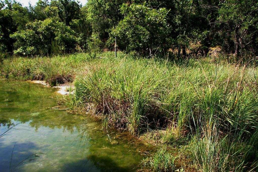
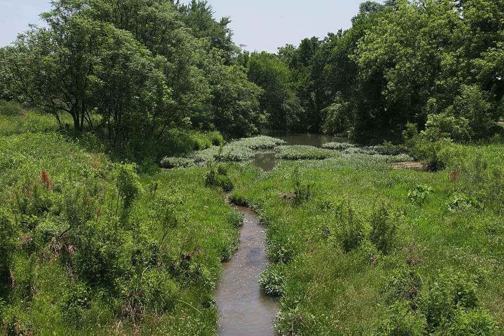
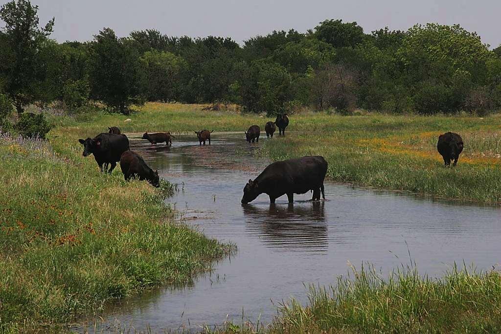
5 Properly functioning riparian area
6 Properly Functioning Riparian Area Adequate vegetation to: Dissipate stream energy Stabilize banks Reduce erosion Trap sediment Build / enlarge floodplain Store water Floodwater retention Groundwater recharge Sustain baseflow Water quality Water quantity Forage Aquatic habitat Wildlife habitat Recreational value Aesthetic beauty Physical Processes Values
7 If you want the values, manage for function

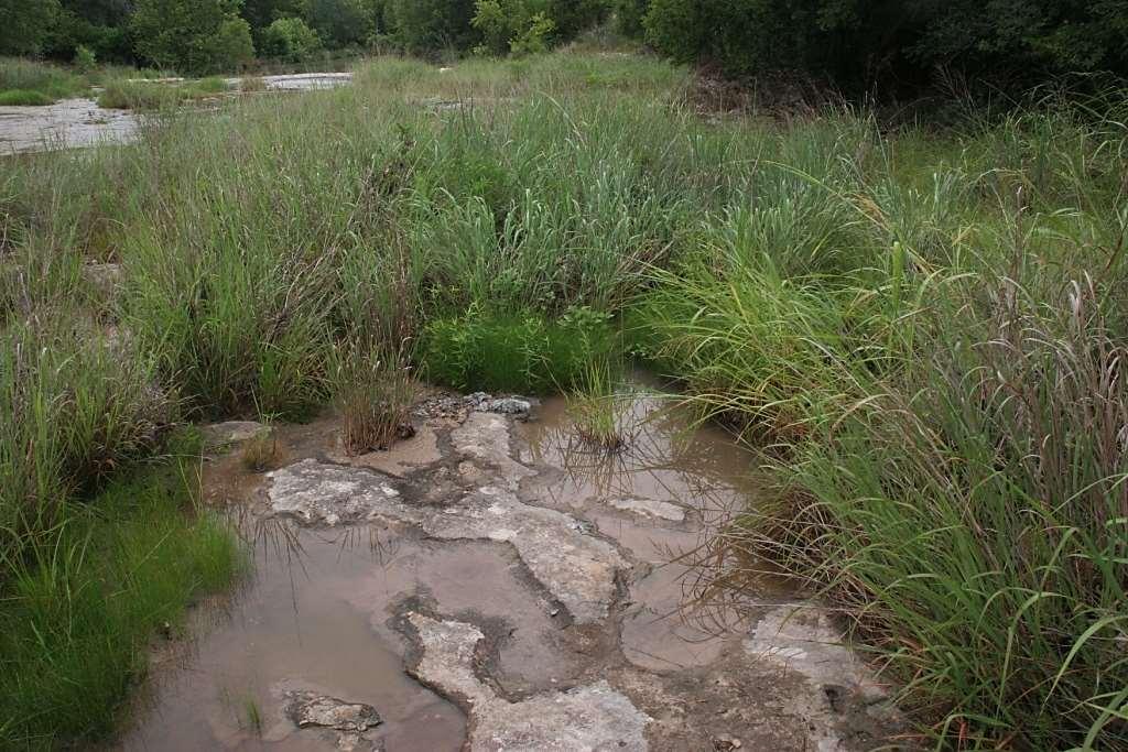
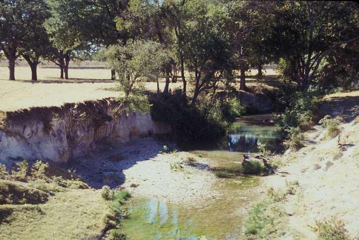
8 Fixing the Creek
9
10
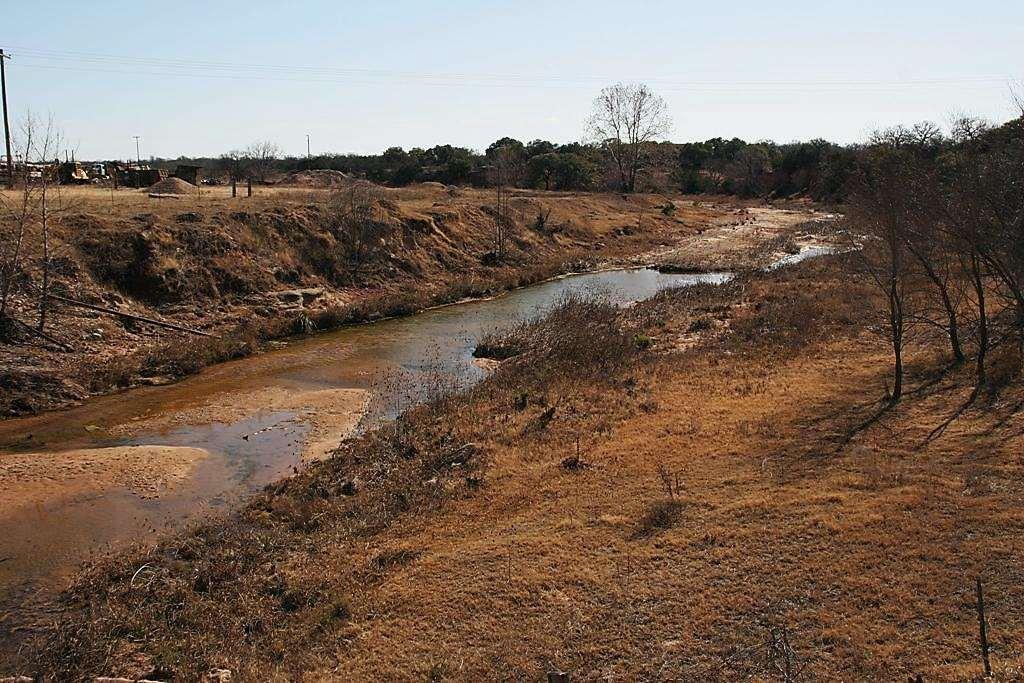
11
12
13
14
15
16


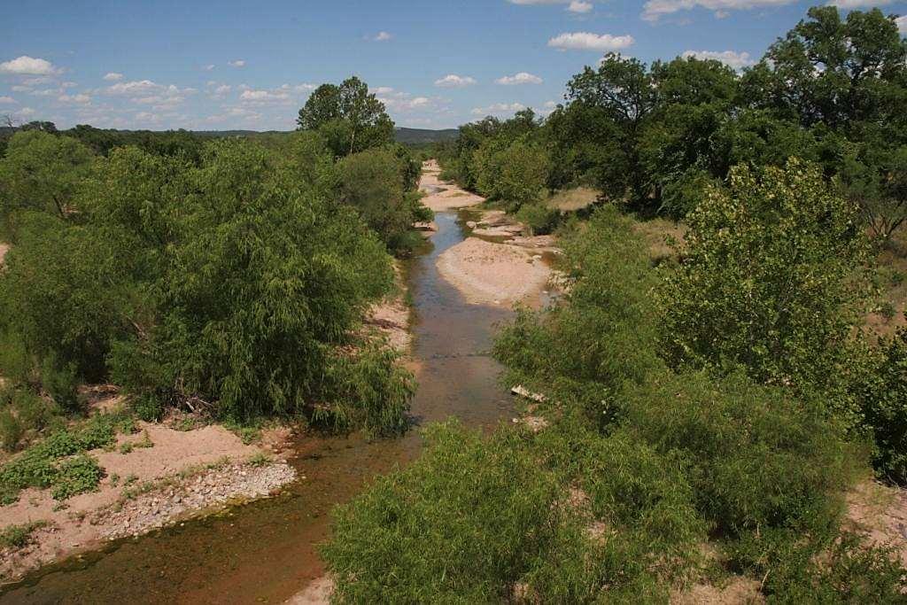
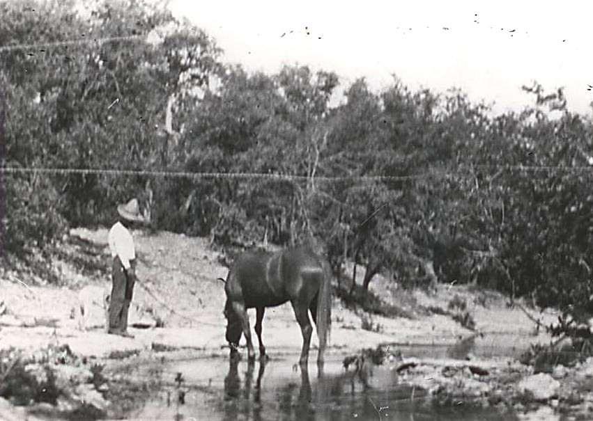
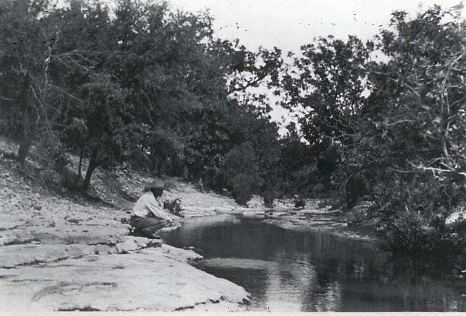
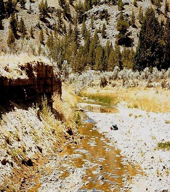
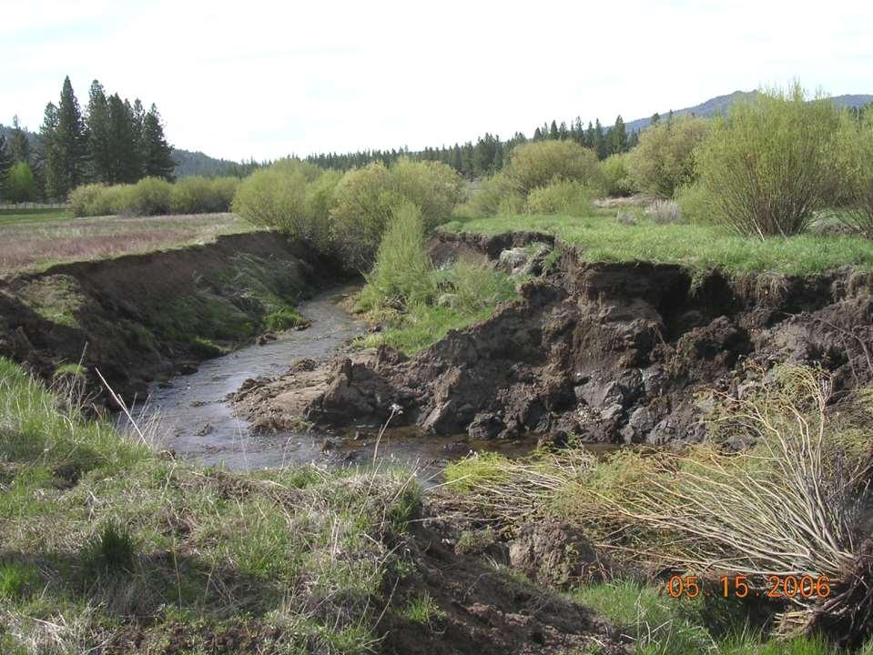
17 1981 Burro Creek 2000

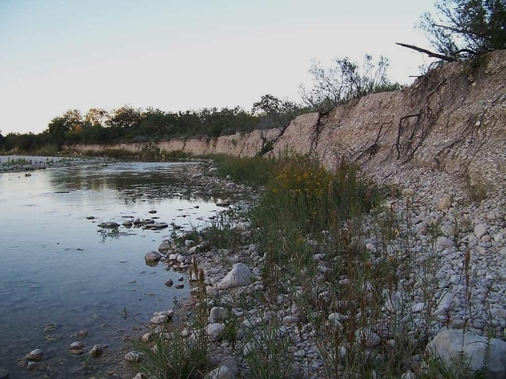
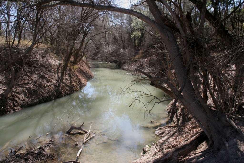
18 Nueces River
19
20
21
22
23
24

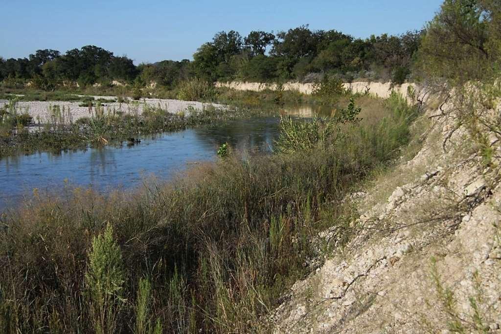
25 Bear Creek
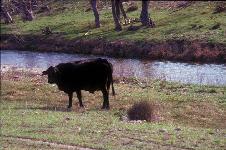
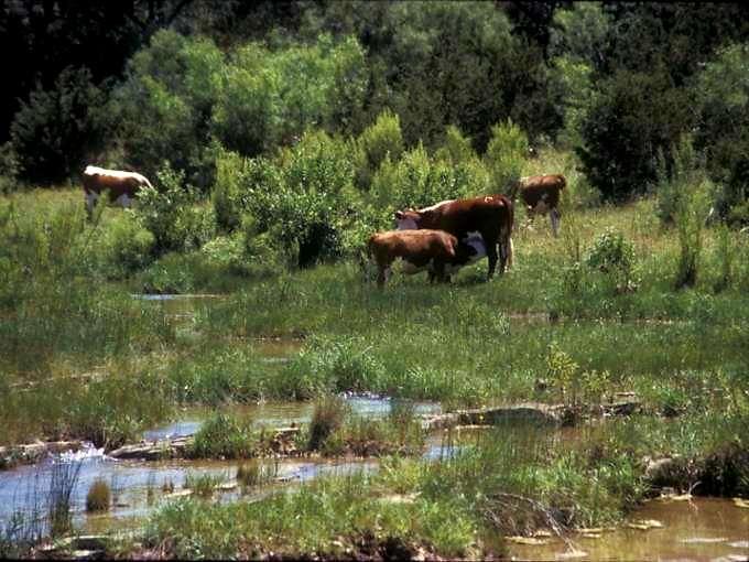
26 A Change in Grazing Management Continuous growing-season grazing Initial Rest to jump-start recovery Short term grazing during dormant season
27 Bear Creek : Change In Channel Profile ( )
28 Vegetation is the key to a healthy, functional riparian area
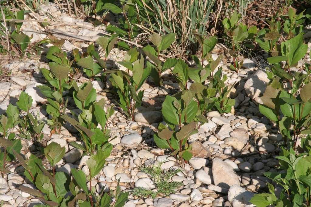
29 Root Length; Miles per Cubic Foot Curlymesquite Sideoats grama Upland plants Deergrass Baltic rush Knotgrass Riparian plants 18.8 Spikerush 67 feet per cubic inch
30 Rootmass; Pounds per Acre Curlymesquite Sideoats grama Big bluestem 3,100 4,100 11,000 Upland plants Knotgrass Spikerush Baltic rush Deergrass 24,000 27,000 Riparian plants 47,000 65, ,000 20,000 30,000 40,000 50,000 60,000 70,000

31 Key Functions of Riparian Vegetation Dissipate Energy / Reduce Erosion Trap Sediment / Build Floodplain Increase Water Storage - Riparian Sponge Slow Down the Water
32 Plant Vigor-Leaves and Roots Caring for the Green Zone, Riparian Areas and Grazing Management Alberta Riparian Habitat Management Project, Cows and Fish Project

33 How to Maintain or Restore Riparian Areas: Creeks / Riparian Areas are special places; they need preferential treatment Identify the factors that inhibit recovery; Manage to overcome those barriers
34 Hindrances to Healthy / Functional Riparian Areas: Farming too close to the bank Mowing, spraying close to the creek Manicured landscapes next to the creek Chronic grazing concentrations in creek areas Excessive deer, exotics, hogs in creek areas Removal of large dead wood Artificial manipulation of banks / sediment Excessive vehicle traffic in creek area Excessive recreational foot traffic in creek area
35 Grazing Management
36 Riparian Grazing Management
37 Overcoming Disproportional Grazing
38
39 Reduce Animal Numbers by 50%?
40
41 Alternate Water Development
42 Riparian Pasture
43
44
45
46
47
48
49
50
51
52
53
54
55
56 Bear Creek, Oregon 12 inch
57

58
59

60 Results of Good Riparian Management Clean Water Reliable Supply of Water Abundant Livestock Forage Fish and Aquatic Habitat Wildlife Habitat Natural Beauty/Recreation

61 Monitoring Riparian Health
62 Riparian Bullseye Monitoring Worksheet Sediment Deposition 14 Active Floodplain 1 2 Energy Dissipation; Channel & Banks Bank Erosion 13 3 Energy Dissipation; Floodplain Wetland Plant Abundance 12 4 New Colonization Fresh Sediment Plant Vigor Grass / Sedge 11 5 % Bank Coverage Stabilizing Veg Plant Vigor Woody Plants 10 6 Reproduction Woody Plants Diversity Grass / Sedge 9 8 Diversity Woody Plants 7 Reproduction Grass / Sedge
63 Riparian Bullseye Monitoring Worksheet Sediment Deposition 14 Active Floodplain 1 2 Energy Dissipation; Channel & Banks Bank Erosion 13 3 Energy Dissipation; Floodplain Wetland Plant Abundance 12 4 New Colonization Fresh Sediment Plant Vigor Grass / Sedge 11 5 % Bank Coverage Stabilizing Veg Plant Vigor Woody Plants 10 6 Reproduction Woody Plants Diversity Grass / Sedge 9 8 Diversity Woody Plants 7 Reproduction Grass / Sedge
64
65
66
67 Riparian Bullseye Monitoring Worksheet Sediment Deposition 14 Active Floodplain 1 2 Energy Dissipation; Channel & Banks Bank Erosion 13 3 Energy Dissipation; Floodplain Wetland Plant Abundance 12 4 New Colonization Fresh Sediment Plant Vigor Grass / Sedge 11 5 % Bank Coverage Stabilizing Veg Plant Vigor Woody Plants 10 6 Reproduction Woody Plants Diversity Grass / Sedge 9 8 Diversity Woody Plants 7 Reproduction Grass / Sedge

68 Excellent Energy Dissipation on Bank

69 Poor Energy Dissipation on Bank
70 Riparian Bullseye Monitoring Worksheet Sediment Deposition 14 Active Floodplain 1 2 Energy Dissipation; Channel & Banks Bank Erosion 13 3 Energy Dissipation; Floodplain Wetland Plant Abundance 12 4 New Colonization Fresh Sediment Plant Vigor Grass / Sedge 11 5 % Bank Coverage Stabilizing Veg Plant Vigor Woody Plants 10 6 Reproduction Woody Plants Diversity Grass / Sedge 9 8 Diversity Woody Plants 7 Reproduction Grass / Sedge

71 Good Energy Dissipation on Floodplain

72 Poor Energy Dissipation on Floodplain
73 Riparian Bullseye Monitoring Worksheet Sediment Deposition 14 Active Floodplain 1 2 Energy Dissipation; Channel & Banks Bank Erosion 13 3 Energy Dissipation; Floodplain Wetland Plant Abundance 12 4 New Colonization Fresh Sediment Plant Vigor Grass / Sedge 11 5 % Bank Coverage Stabilizing Veg Plant Vigor Woody Plants 10 6 Reproduction Woody Plants Diversity Grass / Sedge 9 8 Diversity Woody Plants 7 Reproduction Grass / Sedge
74 Some Colonization of New Deposits

75 No Colonization of New Deposits

76 Good Colonization of New Deposits
77 Riparian Bullseye Monitoring Worksheet Sediment Deposition 14 Active Floodplain 1 2 Energy Dissipation; Channel & Banks Bank Erosion 13 3 Energy Dissipation; Floodplain Wetland Plant Abundance 12 4 New Colonization Fresh Sediment Plant Vigor Grass / Sedge 11 5 % Bank Coverage Stabilizing Veg Plant Vigor Woody Plants 10 6 Reproduction Woody Plants Diversity Grass / Sedge 9 8 Diversity Woody Plants 7 Reproduction Grass / Sedge

78 High Coverage of Stabilizing Vegetation

79 Low to Moderate Coverage of Stabilizing Vegetation
80 Riparian Bullseye Monitoring Worksheet Sediment Deposition 14 Active Floodplain 1 2 Energy Dissipation; Channel & Banks Bank Erosion 13 3 Energy Dissipation; Floodplain Wetland Plant Abundance 12 4 New Colonization Fresh Sediment Plant Vigor Grass / Sedge 11 5 % Bank Coverage Stabilizing Veg Plant Vigor Woody Plants 10 6 Reproduction Woody Plants Diversity Grass / Sedge 9 8 Diversity Woody Plants 7 Reproduction Grass / Sedge

81 Look for Young Trees / Shrubs

82 Excellent Reproduction Sycamore

83 No Reproduction
84 Riparian Bullseye Monitoring Worksheet Sediment Deposition 14 Active Floodplain 1 2 Energy Dissipation; Channel & Banks Bank Erosion 13 3 Energy Dissipation; Floodplain Wetland Plant Abundance 12 4 New Colonization Fresh Sediment Plant Vigor Grass / Sedge 11 5 % Bank Coverage Stabilizing Veg Plant Vigor Woody Plants 10 6 Reproduction Woody Plants Diversity Grass / Sedge 9 8 Diversity Woody Plants 7 Reproduction Grass / Sedge

85 Expansion of colony forming species

86 Mature switchgrass plants Young, new switchgrass plants
87 Riparian Bullseye Monitoring Worksheet Sediment Deposition 14 Active Floodplain 1 2 Energy Dissipation; Channel & Banks Bank Erosion 13 3 Energy Dissipation; Floodplain Wetland Plant Abundance 12 4 New Colonization Fresh Sediment Plant Vigor Grass / Sedge 11 5 % Bank Coverage Stabilizing Veg Plant Vigor Woody Plants 10 6 Reproduction Woody Plants Diversity Grass / Sedge 9 8 Diversity Woody Plants 7 Reproduction Grass / Sedge

88 Poor Woody Plant Diversity

89 Elm Ash Mulberry Oak Pecan Good Tree Diversity
90 Riparian Bullseye Monitoring Worksheet Sediment Deposition 14 Active Floodplain 1 2 Energy Dissipation; Channel & Banks Bank Erosion 13 3 Energy Dissipation; Floodplain Wetland Plant Abundance 12 4 New Colonization Fresh Sediment Plant Vigor Grass / Sedge 11 5 % Bank Coverage Stabilizing Veg Plant Vigor Woody Plants 10 6 Reproduction Woody Plants Diversity Grass / Sedge 9 8 Diversity Woody Plants 7 Reproduction Grass / Sedge

91 Good Grass / Sedge Diversity

92 Poor Grass / Sedge Diversity
93 Riparian Bullseye Monitoring Worksheet Sediment Deposition 14 Active Floodplain 1 2 Energy Dissipation; Channel & Banks Bank Erosion 13 3 Energy Dissipation; Floodplain Wetland Plant Abundance 12 4 New Colonization Fresh Sediment Plant Vigor Grass / Sedge 11 5 % Bank Coverage Stabilizing Veg Plant Vigor Woody Plants 10 6 Reproduction Woody Plants Diversity Grass / Sedge 9 8 Diversity Woody Plants 7 Reproduction Grass / Sedge

94 Extreme Browsing

95 Good Vigor
96 Riparian Bullseye Monitoring Worksheet Sediment Deposition 14 Active Floodplain 1 2 Energy Dissipation; Channel & Banks Bank Erosion 13 3 Energy Dissipation; Floodplain Wetland Plant Abundance 12 4 New Colonization Fresh Sediment Plant Vigor Grass / Sedge 11 5 % Bank Coverage Stabilizing Veg Plant Vigor Woody Plants 10 6 Reproduction Woody Plants Diversity Grass / Sedge 9 8 Diversity Woody Plants 7 Reproduction Grass / Sedge


97 Plant Vigor-Leaves and Roots Caring for the Green Zone, Riparian Areas and Grazing Management Alberta Riparian Habitat Management Project, Cows and Fish Project

98 Plant Vigor / Grazing

99 Plant Vigor / Wildlife

100 Good Vigor
101 Riparian Bullseye Monitoring Worksheet Sediment Deposition 14 Active Floodplain 1 2 Energy Dissipation; Channel & Banks Bank Erosion 13 3 Energy Dissipation; Floodplain Wetland Plant Abundance 12 4 New Colonization Fresh Sediment Plant Vigor Grass / Sedge 11 5 % Bank Coverage Stabilizing Veg Plant Vigor Woody Plants 10 6 Reproduction Woody Plants Diversity Grass / Sedge 9 8 Diversity Woody Plants 7 Reproduction Grass / Sedge

102 Abundance of Wetland Plant Species Indicate Water Storage

103 Lack of Wetland Plant Species Indicate Poor Water Storage
104 Riparian Bullseye Monitoring Worksheet Sediment Deposition 14 Active Floodplain 1 2 Energy Dissipation; Channel & Banks Bank Erosion 13 3 Energy Dissipation; Floodplain Wetland Plant Abundance 12 4 New Colonization Fresh Sediment Plant Vigor Grass / Sedge 11 5 % Bank Coverage Stabilizing Veg Plant Vigor Woody Plants 10 6 Reproduction Woody Plants Diversity Grass / Sedge 9 8 Diversity Woody Plants 7 Reproduction Grass / Sedge

105 Little or No Bank Erosion

106 Extreme Bank Erosion
107
108 Riparian Bullseye Monitoring Worksheet Sediment Deposition 14 Active Floodplain 1 2 Energy Dissipation; Channel & Banks Bank Erosion 13 3 Energy Dissipation; Floodplain Wetland Plant Abundance 12 4 New Colonization Fresh Sediment Plant Vigor Grass / Sedge 11 5 % Bank Coverage Stabilizing Veg Plant Vigor Woody Plants 10 6 Reproduction Woody Plants Diversity Grass / Sedge 9 8 Diversity Woody Plants 7 Reproduction Grass / Sedge

109 Abnormal Sediment Deposition in Channel
110

111 Sediment is Being Processed / Transported
112 Riparian Bullseye Monitoring Worksheet Sediment Deposition 14 Active Floodplain 1 2 Energy Dissipation; Channel & Banks Bank Erosion 13 3 Energy Dissipation; Floodplain Wetland Plant Abundance 12 4 New Colonization Fresh Sediment Plant Vigor Grass / Sedge 11 5 % Bank Coverage Stabilizing Veg Plant Vigor Woody Plants 10 6 Reproduction Woody Plants Diversity Grass / Sedge 9 8 Diversity Woody Plants 7 Reproduction Grass / Sedge
113 Riparian Bullseye Monitoring Worksheet Sediment Deposition 14 Active Floodplain 1 2 Energy Dissipation; Channel & Banks Bank Erosion 13 3 Energy Dissipation; Floodplain Wetland Plant Abundance 12 4 New Colonization Fresh Sediment Plant Vigor Grass / Sedge 11 5 % Bank Coverage Stabilizing Veg Plant Vigor Woody Plants 10 6 Reproduction Woody Plants Diversity Grass / Sedge 9 8 Diversity Woody Plants 7 Reproduction Grass / Sedge

114 Steve Nelle
Garner State Park Pavilion Preservation Study
 D4 Garner State Park Pavilion Preservation Study Presented by Andy Johnston, PE, CPESC, CFM Halff Associates, Inc. Austin Mark Winford, RA, LEED AP Texas Parks and Wildlife Department, Austin Location
Assessment. Assessment
 2001 SPRINGBROOK CREEK RESTORATION - THREE YEAR POST-CONSTRUCTION REVIEW - Presented by Bruce Henderson and Andy Harris 2005 River Restoration Northwest Symposium Skamania Lodge, Washington www.hendersonlandservices.com
Learning Objectives: I can identify and interpret river flows and directions.
 Learning Objectives: I can identify and interpret river flows and directions. Bellringer Review: Check for Understanding Questions: 1 2 What Are The Key Parts Of A River s Anatomy? In your data notebooks
How Do Human Impacts and Geomorphological Responses Vary with Spatial Scale in the Streams and Rivers of the Illinois Basin?
 How Do Human Impacts and Geomorphological Responses Vary with Spatial Scale in the Streams and Rivers of the Illinois Basin? Bruce Rhoads Department of Geography University of Illinois at Urbana-Champaign
DETAILED DESCRIPTION OF STREAM CONDITIONS AND HABITAT TYPES IN REACH 4, REACH 5 AND REACH 6.
 DETAILED DESCRIPTION OF STREAM CONDITIONS AND HABITAT TYPES IN REACH 4, REACH 5 AND REACH 6. The Eklutna River was divided into study reaches (figure 1) prior to this site visit. Prominent geologic or
Catastrophic Events Impact on Ecosystems
 Catastrophic Events Impact on Ecosystems Hurricanes Hurricanes An intense, rotating oceanic weather system with sustained winds of at least 74 mph and a welldefined eye Conditions for formation: Warm water
RAILWAYS AND FISH: HOW TO PROTECT AND ENHANCE FISH HABITAT VALUES AT STREAM CROSSINGS THROUGH PROJECT DESIGN AND CONSTRUCTION
 RAILWAYS AND FISH: HOW TO PROTECT AND ENHANCE FISH HABITAT VALUES AT STREAM CROSSINGS THROUGH PROJECT DESIGN AND CONSTRUCTION Rail Environment Conference November 2016 AGENDA Objective Background Benefits
South Alamito Creek Ranch
 South Alamito Creek Ranch 1500 acres, Presidio County, Texas James King, Agent Office 432-426-2024 Cell 432-386-2821 James@KingLandWater.com King Land & Water LLC P.O. Box 109, 600 State Street, Fort Davis,
Kootenai River Habitat Restoration Program Update
 Kootenai River Habitat Restoration Program Update Kootenai Tribe of Idaho Kootenai Valley Resource Initiative November 19, 2012 Bonners Ferry, Idaho Changes to Kootenai Basin Beaver trapping Floodplain
VEGETATION EVA BOEHRINGER
 VEGETATION EVA BOEHRINGER April 2, 2014 WUP CONSULTATIVE COMMITTEE WUP Consultative Committee (WUP CC) recognized that riparian and wetland vegetation in the reservoir drawdown zone is valuable for fish,
Natural Shoreline Landscapes on Michigan Inland Lakes
 Natural Shoreline Landscapes on Michigan Inland Lakes Excerpts from Chapters 2 and 3 Photo Photo by Jane by Jane Herbert Herbert Did you know? Twenty-four species of amphibians, 25 species of reptiles,
Natural Shoreline Landscapes on Michigan Inland Lakes
 Natural Shoreline Landscapes on Michigan Inland Lakes Excerpts from Chapters 2 and 3 Photo Photo by Jane by Jane Herbert Herbert Session topics Characteristics of natural and altered shorelines Lakes,
Riparian Assessment. Steps in the right direction... Drainage Basin/Watershed: Start by Thinking Big. Riparian Assessment vs.
 Riparian Assessment vs. Monitoring Riparian Assessment What is a healthy stream? Determine stream/riparian health Determine change or trend, especially in response to mgmt Classification = designation
Birch Creek Geomorphic Assessment and Action Plan
 Birch Creek Geomorphic Assessment and Action Plan Jim Webster Tim Hanrahan, PhD, CFM Jesse Schwartz, PhD Zach Hill January 22, 2015 White Eagle Grange This Project is a First Step in Strategy Planning
CR AAO Bridge. Dead River Flood & Natural Channel Design. Mitch Koetje Water Resources Division UP District
 CR AAO Bridge Dead River Flood & Natural Channel Design Mitch Koetje Water Resources Division UP District Old County Road AAO Bridge Map courtesy of Marquette County Silver Lake Basin McClure Basin
Sprague River Basin Restoration Post Project Evaluations: Lessons Learned and Future Applications
 River Restoration Northwest, 2015 Sprague River Basin Restoration Post Project Evaluations: Lessons Learned and Future Applications Mark R. Tompkins, P.E., Ph.D. ACKNOWLEDGEMENTS The Klamath Tribes Larry
GENERAL SUMMARY BIG WOOD RIVER GEOMORPHIC ASSESSMENT BLAINE COUNTY, IDAHO
 GENERAL SUMMARY BIG WOOD RIVER GEOMORPHIC ASSESSMENT BLAINE COUNTY, IDAHO Prepared For Trout Unlimited 300 North Main Street, Hailey, Idaho, 83333 Prepared By P. O. Box 8578, 140 E. Broadway, Suite 23,
Lower South Fork McKenzie River Floodplain Enhancement Project
 Lower South Fork McKenzie River Floodplain Enhancement Project McKenzie River Ranger District Willamette National Forest Project Location The project is located in the South Fork McKenzie River Watershed,
Why Geomorphology for Fish Passage
 Channel Morphology - Stream Crossing Interactions An Overview Michael Love Michael Love & Associates mlove@h2odesigns.com (707) 476-8938 Why Geomorphology for Fish Passage 1. Understand the Scale of the
Ms. A. Mormando's Class *
 8 th Grade Science Essential Standard: 8.E.1.1 Explain the structure of the hydrosphere including: Water distribution on Earth; Local river basin and water availability Stream - A stream is a body of water
The River Restoration Centre therrc.co.uk. Understanding Fluvial Processes: supporting River Restoration. Dr Jenny Mant
 The River Restoration Centre therrc.co.uk Understanding Fluvial Processes: supporting River Restoration Dr Jenny Mant Jenny@therrc.co.uk Understanding your catchment Hydrology Energy associated with the
Evaluating Wildlife Habitats
 Lesson C5 4 Evaluating Wildlife Habitats Unit C. Animal Wildlife Management Problem Area 5. Game Animals Management Lesson 4. Evaluating Wildlife Habitats New Mexico Content Standard: Pathway Strand: Natural
Lower Pinhook Spring Condition Assessment
 Lower Pinhook Spring Condition Assessment Location: Castle Valley Allotment, Manti-La Sal National Forest Date: September 23, 2016 Begin/End Time: 10:30am to 12:30pm Whitman College Semester in the West
EAGLES NEST AND PIASA ISLANDS
 EAGLES NEST AND PIASA ISLANDS HABITAT REHABILITATION AND ENHANCEMENT PROJECT MADISON AND JERSEY COUNTIES, ILLINOIS ENVIRONMENTAL MANAGEMENT PROGRAM ST. LOUIS DISTRICT FACT SHEET I. LOCATION The proposed
AP ENVIRONMENTAL SCIENCE 2013 SCORING GUIDELINES [14 pt space] Question 1
![AP ENVIRONMENTAL SCIENCE 2013 SCORING GUIDELINES [14 pt space] Question 1](/thumbs/77/74883235.jpg "AP ENVIRONMENTAL SCIENCE 2013 SCORING GUIDELINES [14 pt space] Question 1") AP ENVIRONMENTAL SCIENCE 2013 SCORING GUIDELINES [14 pt space] Question 1 (a) Identify TWO human activities that alter the natural flow of sediments into Gulf Coast ecosystems. Explain how each of the
AP ENVIRONMENTAL SCIENCE 2013 SCORING GUIDELINES [14 pt space] Question 1 (a) Identify TWO human activities that alter the natural flow of sediments into Gulf Coast ecosystems. Explain how each of the
Steven Noble MDEQ - WRD Enbridge Response Unit
 EPA situation report, October 19, 2012 Steven Noble MDEQ - WRD Enbridge Response Unit Brief history of the spill Monitoring Monitoring the impacts Follow the oil The Current Situation A Look at the Future
Assignment 1. Measuring River Characteristics- Vernon Creek. Applied Fluvial Geomorphology Field Techniques EESc 435
 Assignment 1 Measuring River Characteristics- Vernon Creek Applied Fluvial Geomorphology Field Techniques EESc 435 Amanda Jardine 30100093 Jaime McDonald 14177083 Erica Massey 50870088 April 28, 2012 Introduction
Development of Riparian Maps for Sonoma County Long Term Riparian Corridor Conservation. Mark Tukman & Dylan Loudon Tukman Geospatial
 L A N D F O R Development of Riparian Maps for Sonoma County Long Term Riparian Corridor Conservation Mark Tukman & Dylan Loudon Tukman Geospatial L I F E Mark Background on functional riparian mapping
Beaver Dam Influence on Wet Meadow Habitat
 Beaver Dam Influence on Wet Meadow Habitat HOPE FISHER WRITER S COMMENT: I ve always been fascinated by the natural world. This deep appreciation for nature and passion for conservation inspired me to
Representative Reference Area Akehurst, Venner meadow, Burnette lake, Fork meadow, paradise meadow, Rimrock swamp, Goose Carex,
 Description This mixed sedge wetland community is the most common wetland type in BC s interior rangelands. These sedge species are able to tolerate anaerobic soil conditions for the entire growing season.
Upper Truckee River Restoration Lake Tahoe, California Presented by Brendan Belby Sacramento, California
 Upper Truckee River Restoration Lake Tahoe, California Presented by Brendan Belby Sacramento, California Mike Rudd (Project Manager), Charley Miller & Chad Krofta Declines in Tahoe s Water Clarity The
Columbia Estuary Province
 Rolling Provincial Review: Implementation 2001-2004 Province 73 Columbia Basin Fish & Wildlife Authority Province FY 2001-2004 Spending Summaries NPCC Recommendations and BPA Spending by Project Category,
Watershed Assessment of River Stability and Sediment Supply: Advancing the Science of Watershed Analysis
 Watershed Assessment of River Stability and Sediment Supply: Advancing the Science of Watershed Analysis 2009 MWEA Annual Conference Rob Myllyoja, CET rmyllyoja@hrc-engr.com Watershed Assessment of River
Description: Shrub-carrs
 Description: Shrub-carrs There are two other shrub-carr types in BC that are described in other accounts Grey-leaved willow glow moss (Sc02) Barclay willow arrow-leaved groundsell Valerian (Sc03) Shrub-carrs
Step 6: Rapid Habitat Assessment (RHA)
") Step 6: Rapid Habitat Assessment (RHA) Background Physical processes, combined with chemical constituents and biological interactions, are what determine biological productivity and diversity; and, in
Step 6: Rapid Habitat Assessment (RHA) Background Physical processes, combined with chemical constituents and biological interactions, are what determine biological productivity and diversity; and, in
3.3 CLIMATE, GEOLOGY, TOPOGRAPHY, AND SOILS CLIMATE GEOLOGY TOPOGRAPHY
 3.3 CLIMATE, GEOLOGY, TOPOGRAPHY, AND SOILS This section describes the climate, geology, topography, and soil resource characteristics of the Yolo Bypass Wildlife Area (Wildlife Area). Agricultural soil
Little Blackfoot TPA 2009 Sediment and Habitat Assessment QAQC Review March 9, 2010
 Little Blackfoot TPA 2009 Sediment and Habitat Assessment QAQC Review March 9, 2010 1.0 PROJECT OVERVIEW Sediment and habitat monitoring in the Little Blackfoot TPA was conducted in July of 2009 as outlined
Cherry County, Nebraska
 Cherry County, Nebraska Co-Listed with Maddux Landbanc Realty, LLC Offered Exclusively By: NORTH PLATTE OFFICE P.O. Box 1166 I-80 & US Hwy 83 North Platte, NE 69103 www.agriaffiliates.com (308) 534-9240
Steve Pye LA /22/16 Final Report: Determining regional locations of reference sites based on slope and soil type. Client: Sonoma Land Trust
 Steve Pye LA 221 04/22/16 Final Report: Determining regional locations of reference sites based on slope and soil type. Client: Sonoma Land Trust Deliverables: Results and working model that determine
Instream Erosion Control General
 Instream Erosion Control General EROSION CONTROL TECHNIQUES Revegetation Temperate Climates Short-Term Non Vegetation Wet Tropics Long-Term Weed Control [1] Semi-Arid Zones Permanent [1] Weed control attributes
3.7 VISUAL RESOURCES Environmental Setting
 2 3 4 5 6 7 8 9 0 2 3 4 5 6 7 8 9 20 2 22 23 24 25 26 27 28 29 30 3 32 33 34 35 36 37 38 39 40 4 3.7 VISUAL RESOURCES This section assesses the effects of the treatment techniques on views from public
SESSION 6: FLUVIAL LANDFORMS
 SESSION 6: FLUVIAL LANDFORMS KEY CONCEPTS: Fluvial Landforms Management of River Catchment Areas Slope Elements X-PLANATION: FLUVIAL LANDFORMS Rivers form landforms as they erode the landscape. These landforms
DESCHUTES RIVER BANK STABILIZATION PROJECTS ASSESSMENT
 DESCHUTES RIVER BANK STABILIZATION PROJECTS ASSESSMENT Prepared for: Deschutes River Conservancy 700 NW Hill Street Bend, Oregon 97701 Prepared by: River Design Group, Inc. 6029 SW 33 rd Place Portland,
Restoring the Napa River:
 Restoring the Napa River: lessons learned from a long term private-public project Andy Collison Environmental Science Associates acollison@esassoc.com 1 Napa River Restoration Projects Rutherford Reach
Crows Landing Naval Base Easement
 1 of 15 West Stanislaus Resource Conservation District Crows Landing Naval Base Easement Annual Reserve Monitoring Report Jamie McFarlin 11/112012 2 of 15 West Stanislaus Resource Conservation District
Changes in Texas Ecoregions
 Comment On Lesson Changes in Texas Ecoregions The state of Texas can be divided into 10 distinct areas based on unique combinations of vegetation, topography, landforms, wildlife, soil, rock, climate,
Stream Geomorphology. Leslie A. Morrissey UVM July 25, 2012
 Stream Geomorphology Leslie A. Morrissey UVM July 25, 2012 What Functions do Healthy Streams Provide? Flood mitigation Water supply Water quality Sediment storage and transport Habitat Recreation Transportation
TUNDRA. Column 1 biome name Column 2 biome description Column 3 examples of plant adaptations
 Biome Cards (pp. 1 of 7) Cut out each biome card and divide each card into three sections. Place all sections in a plastic storage bag. Have one bag for every two students. Column 1 biome name Column 2
SCOPE OF PRESENTATION STREAM DYNAMICS, CHANNEL RESTORATION PLANS, & SEDIMENT TRANSPORT ANALYSES IN RELATION TO RESTORATION PLANS
 DESIGN METHODS B: SEDIMENT TRANSPORT PROCESSES FOR STREAM RESTORATION DESIGN PETER KLINGEMAN OREGON STATE UNIVERSITY CIVIL ENGINEERING DEPT., CORVALLIS 2 ND ANNUAL NORTHWEST STREAM RESTORATION DESIGN SYMPOSIUM
Use of Bioengineering Techniques for Revegetation of Riparian Areas: Colomac Mine Remediation Project, NWT
 Use of Bioengineering Techniques for Revegetation of Riparian Areas: Colomac Mine Remediation Project, NWT McPherson, M. 1, Vanderspiegel, R. 2, Breadmore, R. 2, and Hewitt, M. 3 2012 RPIC Federal Contaminated
Your web browser (Safari 7) is out of date. For more security, comfort and the best experience on this site: Update your browser Ignore
 is out of date. For more security, comfort and the best experience on this site: Update your browser Ignore") Your web browser (Safari 7) is out of date. For more security, comfort and the best experience on this site: Update your browser Ignore ALLU VIAL FAN colluvial fan, debris cone For the complete encyclopedic
Your web browser (Safari 7) is out of date. For more security, comfort and the best experience on this site: Update your browser Ignore ALLU VIAL FAN colluvial fan, debris cone For the complete encyclopedic
The Refugia Concept: Using Watershed Analysis to Prioritize Salmonid Habitat for Conservation and Restoration
 The Refugia Concept: Using Watershed Analysis to Prioritize Salmonid Habitat for Conservation and Restoration Christopher May Battelle & UW Cumulative Impacts of Urbanization Landscape Alterations Loss
Island Design. UMRS EMP Regional Workshop. Presentation for the
 Island Design Presentation for the UMRS EMP Regional Workshop by Jon Hendrickson Hydraulic Engineer Regional Technical Specialist, Water Quality and Habitat Restoration August 17 19, 2005 Project Delivery
REVEGETATION TRENDS AND LESSONS MONTANA COAL
 REVEGETATION TRENDS AND LESSONS MONTANA COAL The secret of managing is to keep the guys who hate you away from the guys who are undecided. Casey Stengel Can't anybody here play this game? Casey Stengel
Case Study 2: Twenty-mile Creek Rock Fords
 Case Study : Twenty-mile Creek Rock Fords Location Crossing Description Washington. Okanagan National Forest. Methow Valley Ranger District. Chewuch river basin, East Chewuch Road. The Twenty-mile Creek
Human Impacts to Rivers
 Human Impacts to Rivers Sediment Water Wood Confinement Valley slope Channel morphology Bank material Flow obstructions Riparian vegetation Human Impacts on Rivers dams channelization loss of woody debris/riparian
24.0 Mineral Extraction
 Chapter 24 - Mineral Extraction 24.0 Mineral Extraction 24.1 Introduction Apart from gravel, sand, rock, limestone and salt extraction in relatively small quantities mineral extraction is not a strong
Project (Project No. US-CA-62-2) Maintenance Inspection and Reports (Subtask 14.1) Inspection Report No.2
 Maintenance Inspection and Reports (Subtask 14.1) Inspection Report No.2") MEMORANDUM TO: FROM: Jim Well, Ducks Unlimited Mike Harvey, PhD, PG SUBJECT: M&T/ Llano Seco Fish Screen Project (Project No. US-CA-62-2) Maintenance Inspection and Reports (Subtask 14.1) Inspection Report
MEMORANDUM TO: FROM: Jim Well, Ducks Unlimited Mike Harvey, PhD, PG SUBJECT: M&T/ Llano Seco Fish Screen Project (Project No. US-CA-62-2) Maintenance Inspection and Reports (Subtask 14.1) Inspection Report
Step 5: Channel Bed and Planform Changes
 Step 5: Channel Bed and Planform Changes When disturbed, streams go through a series of adjustments to regain equilibrium with the flow and sediment supply of their watersheds. These adjustments often
ODIORNE POINT STATE PARK Restoration Activities
 ODIORNE POINT STATE PARK Restoration Activities 2009-2012 OVERVIEW Stressors Solutions Goals Management Managed Fields Forested Fields Barrier Marshes & Maritime Shrub Thickets Discussion Swiper Historic
HISTORICAL DELTA LANDSCAPES Conceptual models for building a diverse and resilient future
 HISTORICAL DELTA LANDSCAPES ITEM REMOVED DUE TO COPYRIGHT STATUS Conceptual models for building a diverse and resilient future Robin Grossinger and Alison Whipple San Francisco Estuary Institute/Aquatic
Carmel River Bank Stabilization at Rancho San Carlos Road Project Description and Work Plan March 2018
 Carmel River Bank Stabilization at Rancho San Carlos Road Project Description and Work Plan March 2018 EXISTING CONDITION The proposed Carmel River Bank Stabilization at Rancho San Carlos Road Project
ADDRESSING GEOMORPHIC AND HYDRAULIC CONTROLS IN OFF-CHANNEL HABITAT DESIGN
 ADDRESSING GEOMORPHIC AND HYDRAULIC CONTROLS IN OFF-CHANNEL HABITAT DESIGN Conor Shea - Hydrologist U.S. Fish and Wildlife Service Conservation Partnerships Program Arcata, CA Learning Objectives Examine
Hydrologic Analysis for Ecosystem Restoration
 Hydrologic Analysis for Ecosystem Restoration Davis, California Objectives: To provide participants with: 1) an understanding of the issues in restoration studies; 2) an overview of Corps policies and
ODFW AQUATIC INVENTORY PROJECT RESTORATION MONITORING STREAM HABITAT REPORT. Peggy Kavanagh, Trevan Cornwell TOLEDO SOUTH Coast Range Lora Tennant
 ODFW AQUATIC INVENTORY PROJECT RESTORATION MONITORING STREAM HABITAT REPORT STREAM: GCG: 2-MC SITE ID: 489 BASIN: YAQUINA TREATMENT DATE: 24 SURVEY DATE: 2/27/24 SURVEY CREW: USGS MAPS: ECOREGION: REPORT
APPENDIX A REACH DECRIPTIONS. Quantico Creek Watershed Assessment April 2011
 APPENDIX A REACH DECRIPTIONS Basin 615, South Fork of Quantico Creek - Project Reach Descriptions Reach Name: 615-A Coordinates (NAD 83, Virginia State Plane North): 11796510.57, 6893938.95 to 11801555.79,
Conceptual Model of Stream Flow Processes for the Russian River Watershed. Chris Farrar
 Conceptual Model of Stream Flow Processes for the Russian River Watershed Chris Farrar Several features of creeks affect the interactions between surface and groundwater. This conceptual model uses the
Chapter 3 Erosion in the Las Vegas Wash
 Chapter 3 Erosion in the Las Vegas Wash Introduction As described in Chapter 1, the Las Vegas Wash (Wash) has experienced considerable change as a result of development of the Las Vegas Valley (Valley).
Fact sheet: Glacial rivers (all Europe)
") Fact sheet: Glacial rivers (all Europe) General description Valleyplanform Hydrology and The valley form varies from a gorge to a V-shaped valley and the single-thread channel is mainly characterized by
Fact sheet: Glacial rivers (all Europe) General description Valleyplanform Hydrology and The valley form varies from a gorge to a V-shaped valley and the single-thread channel is mainly characterized by
Flood Control of the Willamette River
 Flood Control of the Willamette River Alexis Steinberg HC 441: Willamette River Health Clark Honors College, University of Oregon June 3, 2004 Since the 1850s and some of the earliest European-American
ODFW AQUATIC INVENTORY PROJECT OREGON PLAN FOR SALMON & WATERSHEDS STREAM RESTORATION HABITAT REPORT
 ODFW AQUATIC INVENTORY PROJECT OREGON PLAN FOR SALMON & WATERSHEDS STREAM RESTORATION HABITAT REPORT STREAM: BASIN: SURVEY TYPE: Munson Creek (NC-342) Tillamook River Post-Tx DATE: February 2, 28 SURVEY
Earth s Major Terrerstrial Biomes. *Wetlands (found all over Earth)
") Biomes Biome: the major types of terrestrial ecosystems determined primarily by climate 2 main factors: Depends on ; proximity to ocean; and air and ocean circulation patterns Similar traits of plants
Biomes Biome: the major types of terrestrial ecosystems determined primarily by climate 2 main factors: Depends on ; proximity to ocean; and air and ocean circulation patterns Similar traits of plants
TAC Recommendation Document No. 001 Design Criteria
 TAC Recommendation Document No. 001 Design Criteria Notes from ERO on Reference Documents: Four documents are being provided to the TAC for review in relation to Design Criteria. The first document is
Biodiversity Blueprint Overview
 Biodiversity Blueprint Overview Climate Variability Climate projections for the Glenelg Hopkins Regions suggest that the weather will be hotter and drier in the coming years which will impact on land use,
WE LIVE in a complex world. Many
 Ecology and Ecosystems Part One WE LIVE in a complex world. Many different species of organisms have niches in this world and share the earth s environment. These niches provide for the well-being of these
Science of Natural Disasters: RIVERS& FLOODS! 27 April 2016
 Science of Natural Disasters: RIVERS& FLOODS! 27 April 2016 Rebecca Clotts Department of Geology, University of St Thomas Flood in St Paul, 2014, Star Tribune 1 2 What is a watershed? 3 4 5 6 7 What is
Chapter Five. Synopsis
 Chapter Five Synopsis .0 Proposed Level Assessments. Prioritization of Level Assessments. Recommended Level P Locations.3 Level RAPP Locations 5 & Mosley Creek & RA.0 Proposed Level Assessments Based on
BEC Correlation Old field guide IDFdk1a 91,92 & 93 BGxh2 06 BGxw 06. Site Characteristics. Soils Black chernozems on morainal blanket.
 Description At PNC this type is dominated by very high cover of rough fescue. It has a few forbs and very few shrubs except in draws and on cooler aspects. Bluebunch wheatgrass is a minor component in
Quebec Ranch 12,500Acres Presidio County, Texas
 Quebec Ranch 12,500Acres Presidio County, Texas James King, Agent Office 432.426.2024 Cell 432.386.2821 James@KingLandWater.com Quebec Ranch 12,500 Acres Marfa, Presidio County, Texas James King, Agent
Identifying, Understanding and Addressing Flood-Related Hazards
 Identifying, Understanding and Addressing Flood-Related Hazards Julie Moore, P.E. July 9, 2012 Agenda Traditional approach to river management Understanding flood-related hazards Common flood and flood
In-channel coarse sediment trap Best Management Practice
 In-channel coarse sediment trap Best Management Practice By Henry R. Hudson July 2002 Environmental Management Associates Ltd., Christchurch Complexity Environmental Value Cost Low Moderate High Low Moderate
Tom Ballestero University of New Hampshire. 1 May 2013
 Tom Ballestero University of New Hampshire 1 May 2013 1 Hydrology 2 Basic Hydrology Low flows most common Flows that fill the stream to the banks and higher are much less common Filling the stream to the
-- Lessons from a successful salmon stream and estuary relocation on Gravina Island
 Re-inventing Government Creek -- Lessons from a successful salmon stream and estuary relocation on Gravina Island Jon Houghton, Ph.D. and Derek Ormerod, M.S., P.E. - Pentec Environmental/Hart Crowser,
LANDSCAPE CHANGE IN THE SOUTHWEST: Historical changes in selected ecosystems of the southwestern United States
 LANDSCAPE CHANGE IN THE SOUTHWEST: Historical changes in selected ecosystems of the southwestern United States Robert H. Webb U.S. Geological Survey 520 N. Park Avenue Tucson, AZ 85719 rhwebb@usgs.gov
Surface Water Short Study Guide
 Name: Class: Date: Surface Water Short Study Guide Multiple Choice Identify the letter of the choice that best completes the statement or answers the question. 1. The three ways in which a stream carries
Wetland and Riparian Mapping: An Overview of the Montana Program
 Wetland and Riparian Mapping: An Overview of the Montana Program Meghan Burns, Catherine McIntyre, Karen Newlon Ecology Program Montana Natural Heritage Program Helena, MT Montana Natural Heritage Program
Restoring Meanders to Straightened Rivers 1.7 Reconnecting remnant meanders
 .7 Reconnecting remnant meanders River Little Ouse Location - Thetford, Norfolk TL87082 Date of construction - 994 Length 900m Cost 5,000 Maximum extent of flooding during winter floods BTO boundary Small
NORTHUMBERLAND COUNTY, PA
 QUAKER RUN Stream and Wetland Restoration As-Built Completion Report and First Year Monitoring Data Coal Township NORTHUMBERLAND COUNTY, PA Upstream Before Upstream After Prepared for: COAL TOWNSHIP 805
APPENDIX E. GEOMORPHOLOGICAL MONTORING REPORT Prepared by Steve Vrooman, Keystone Restoration Ecology September 2013
 APPENDIX E GEOMORPHOLOGICAL MONTORING REPORT Prepared by Steve Vrooman, Keystone Restoration Ecology September 2 Introduction Keystone Restoration Ecology (KRE) conducted geomorphological monitoring in
7/29/2011. Lesson Overview. Vegetation Sampling. Considerations. Theory. Considerations. Making the Connections
 Lesson Overview Vegetation Sampling Considerations Theory 1 Considerations Common sense: wildlife management must identify habitat selection (i.e., vegetation types and food used) by animals in comparison
C. STUDENT FIELD DATA SHEETS
 C. STUDENT FIELD DATA SHEETS Student Name Date Time Stream Location Parameter to find Your Group s Results Units trial trial average Transparency cm Water Temperature Air Temperature Weather N sunny N
Southwest LRT Habitat Analysis. May 2016 Southwest LRT Project Technical Report
 Southwest LRT Habitat Analysis Southwest LRT Project Technical Report This page intentionally blank. Executive Summary This technical report describes the habitat analysis that was performed to support
Opportunities to Improve Ecological Functions of Floodplains and Reduce Flood Risk along Major Rivers in the Puget Sound Basin
 Opportunities to Improve Ecological Functions of Floodplains and Reduce Flood Risk along Major Rivers in the Puget Sound Basin Christopher Konrad, US Geological Survey Tim Beechie, NOAA Fisheries Managing
Chris Lenhart, John Nieber, Ann Lewandowski, Jason Ulrich TOOLS AND STRATEGIES FOR REDUCING CHANNEL EROSION IN MINNESOTA
 Chris Lenhart, John Nieber, Ann Lewandowski, Jason Ulrich TOOLS AND STRATEGIES FOR REDUCING CHANNEL EROSION IN MINNESOTA Background and approach Channel loading major source of sediment in much of MN River
What is a watershed or landscape perspective?
 What is a watershed or landscape perspective? -remove sediment -add sediment -add wood, riparian manipulation -alter (engineer) channel/floodplain morphology -restore/abandon roads You are here What is
Carex nudata, a native sedge, as facilitator of restoration goals following passive restoration
 Carex nudata, a native sedge, as facilitator of restoration goals following passive restoration Middle Fork John Day River, Oxbow Conservation Area Confederated Tribes of the Warm Springs Matthew Goslin
Appendix E: Cowardin Classification Coding System
 Appendix E: Cowardin Classification Coding System The following summarizes the Cowardin classification coding system and the letters and numbers used to define the USFWS NWI wetland types and subtypes:
Issues within the Sub-Watershed: Thief River
 Issues within the Sub-Watershed: Thief River What are the existing conditions, related potential problems and solution alternatives? Issues related to: FLOOD DAMAGE Flooding Agland & farmstead flooding,
POPULATION TRENDS FOR TULARE PSEUDOBAHIA AND STRIPED ADOBE LILY
 POPULATION TRENDS FOR TULARE PSEUDOBAHIA AND STRIPED ADOBE LILY Kern County has more endangered, threatened and rare plant species than most states. The geography and environmental conditions in the county
Bipole III Transmission Project Construction Environmental Protection Plan Construction Section N1 Environmentally Sensitive Site Locations Map 25
 ± DOCUMENT PATH: G :\_GIS_PROJECT_FOLDER\00_HYDRO\111440054_BPIII_EPP\ARCMAP\ESS_N1\BPIII_CENVPP_N1N2N3N4C1SECTIONBASEMAP_MAPBOOK_BTB_STANTEC_20131207.MXD N1-S11 Tower 10 E-723206, N-6272609 N1-Soils-154