Implementing a Project with 319 Funds: The Spring Brook Meander Project. Leslie A. Berns
|
|
|
- Clifford Warren
- 5 years ago
- Views:
Transcription


1 Implementing a Project with 319 Funds: The Spring Brook Meander Project Leslie A. Berns

2 "...to acquire... and hold lands... for the purpose of protecting and preserving the flora, fauna and scenic beauties... for the purpose of the education, pleasure and recreation of the public." -- Downstate Forest Preserve District Act of 1915

3 25,000 acres 60 Preserves 12% of County

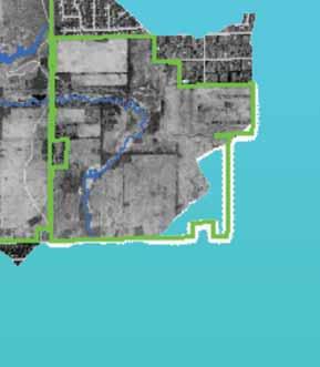
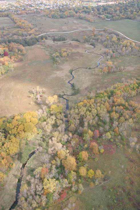
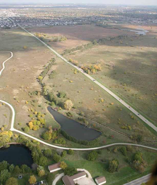
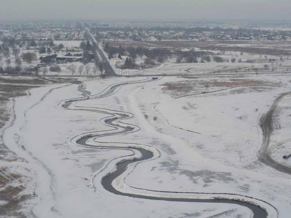
4 Springbrook Prairie Forest Preserve
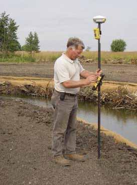
5 Springbrook Prairie Forest Preserve 75th Street Book Rd Modaf Rd Naperville Plainfield Rd 87th Street
6
7
8
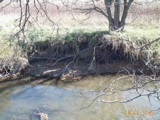
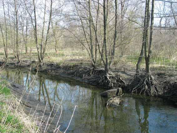
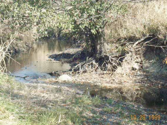
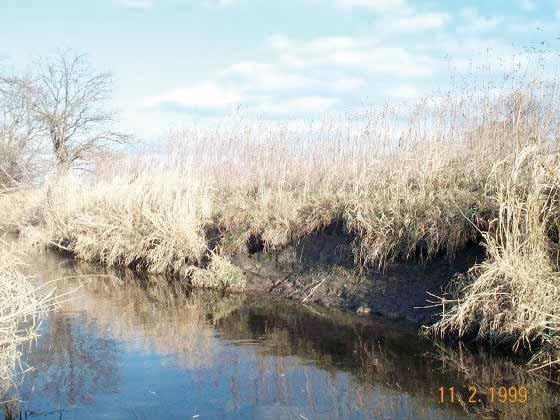
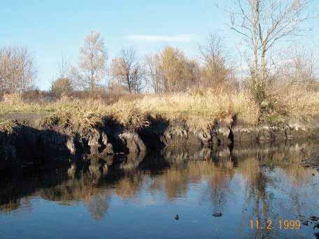
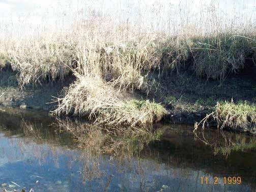
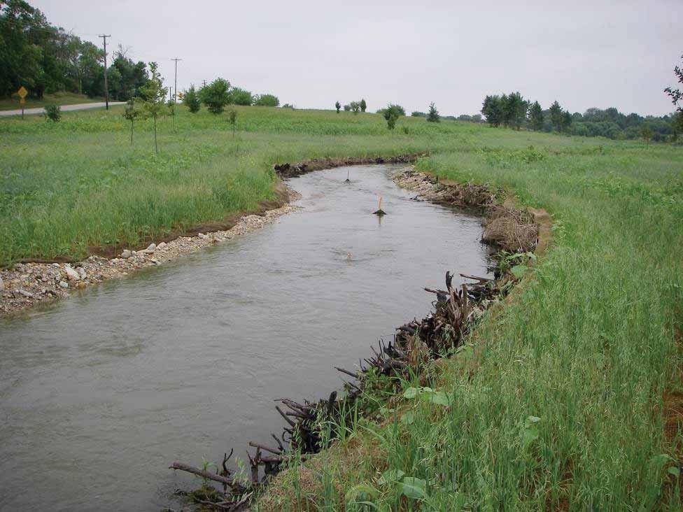
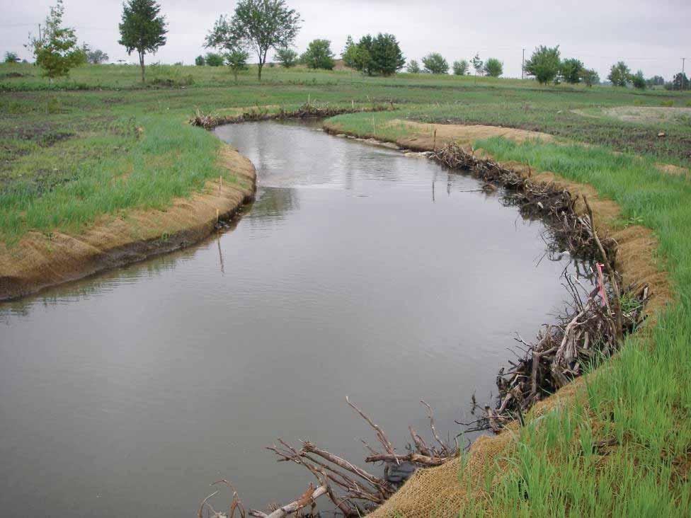
9
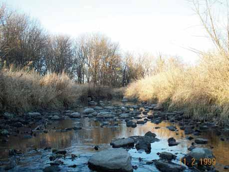
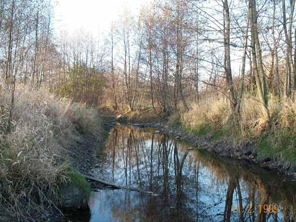
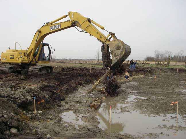
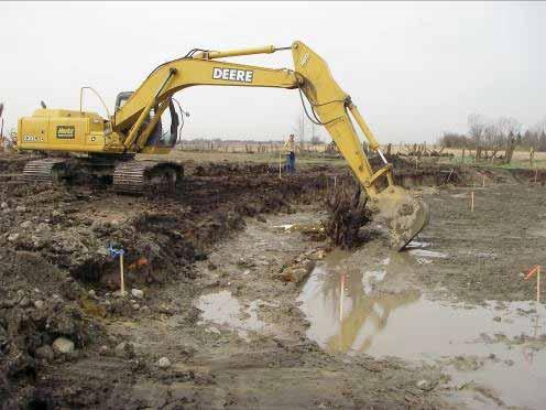
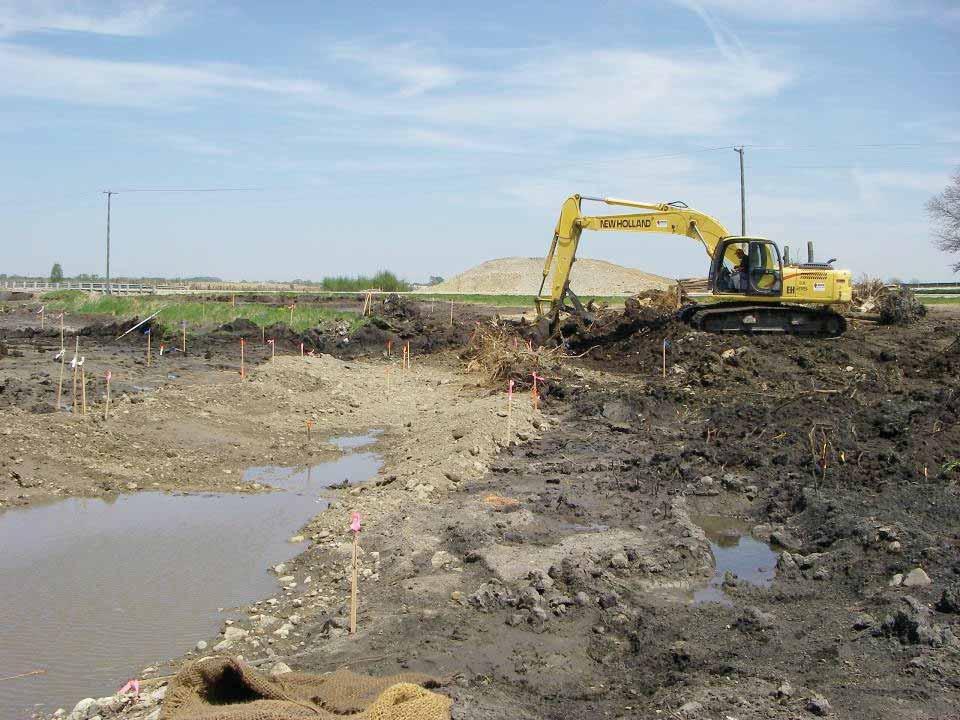
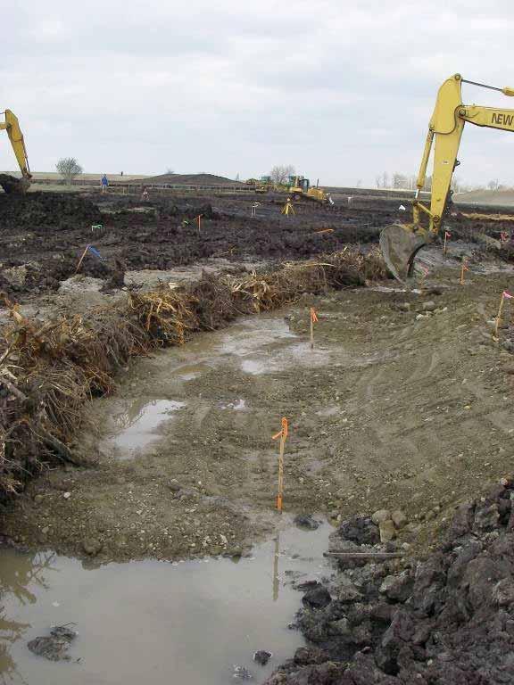
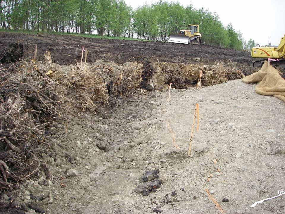
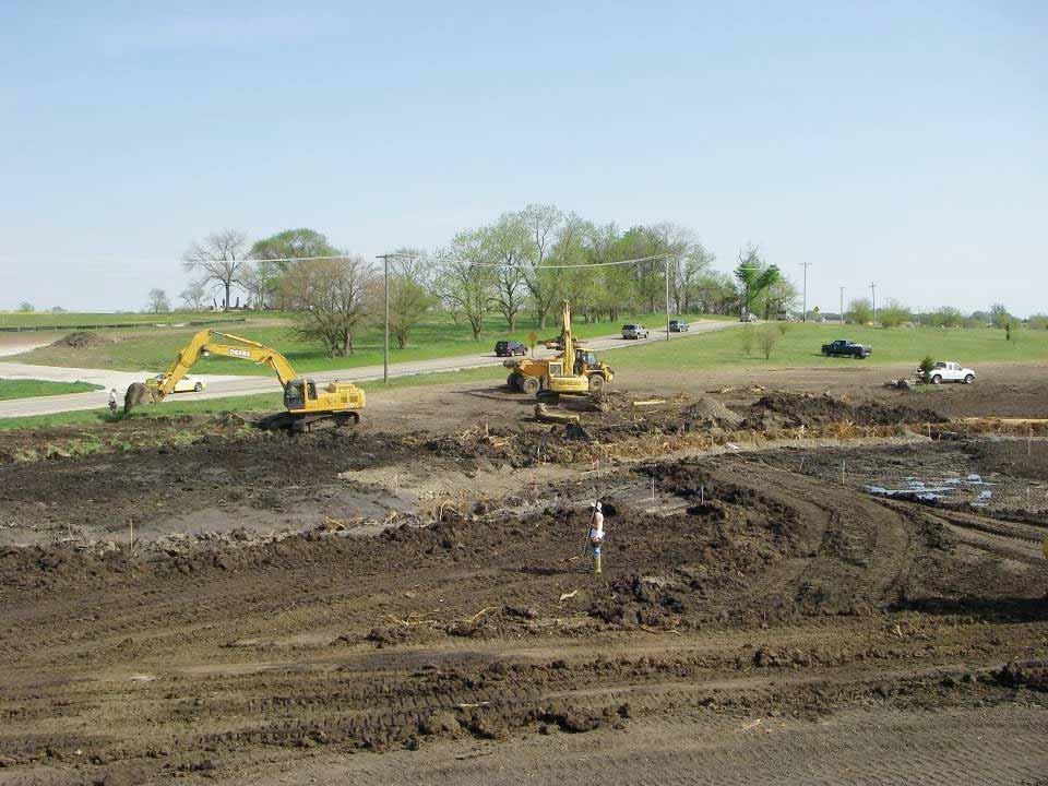
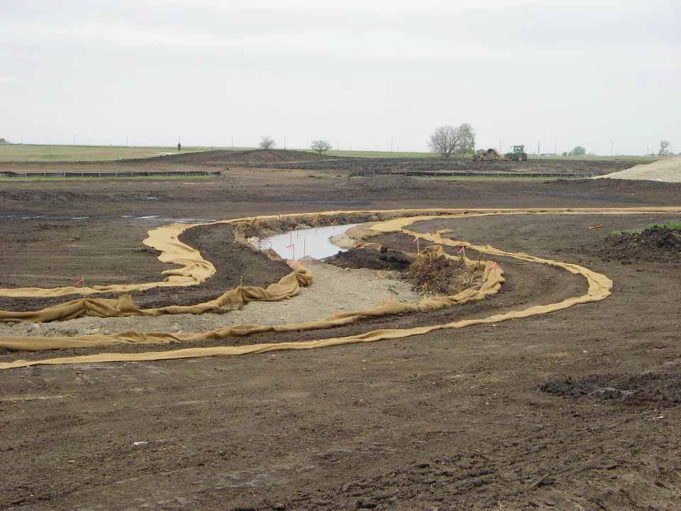
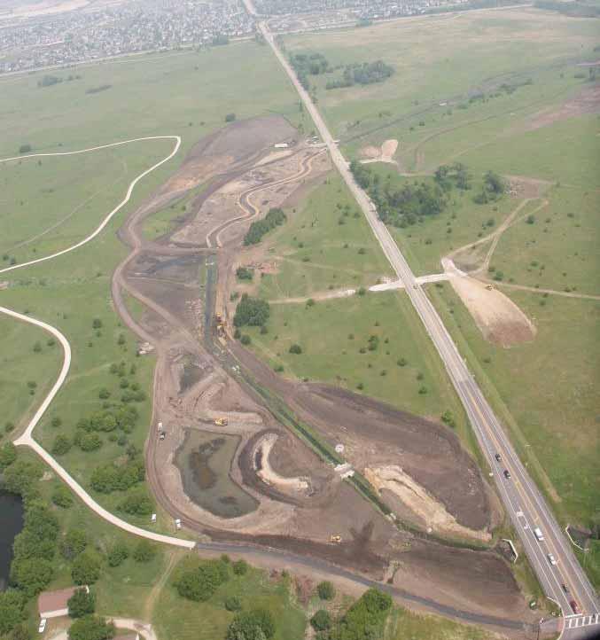
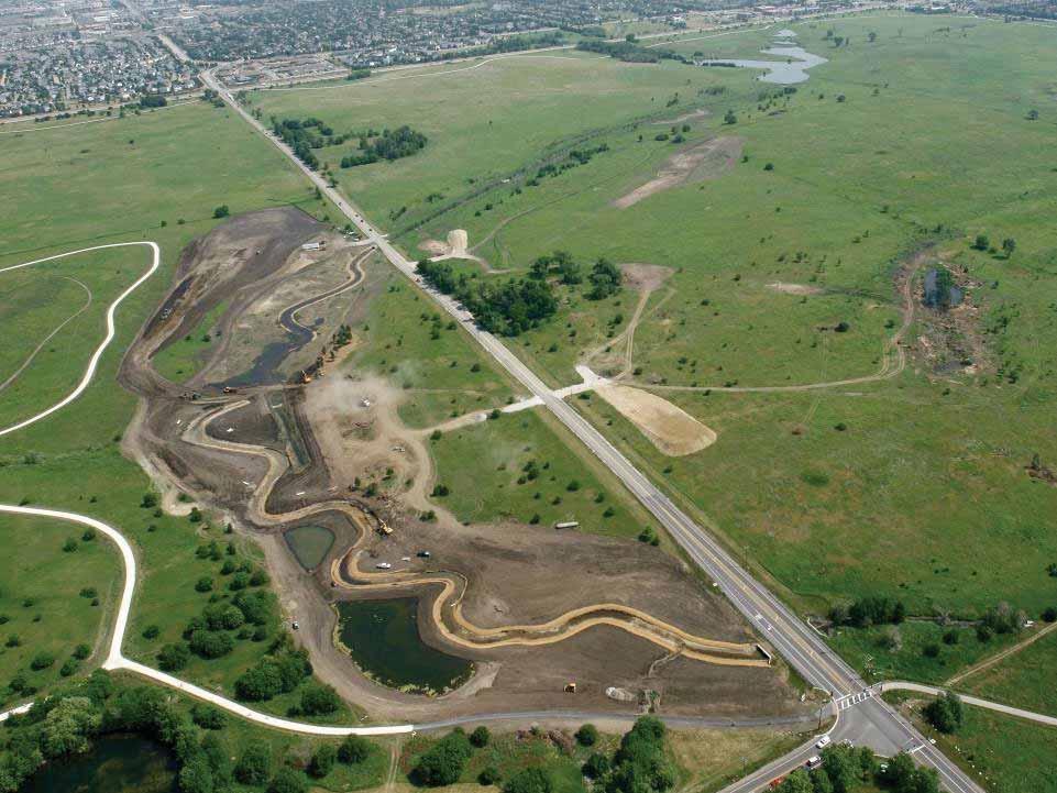
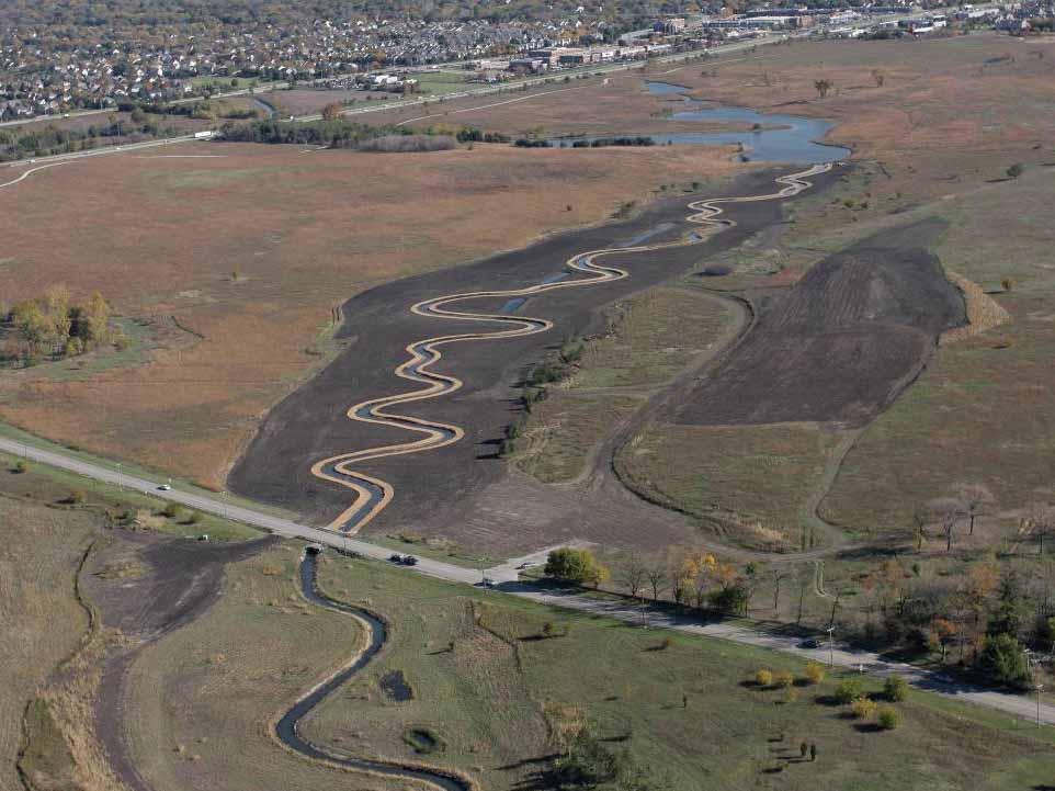
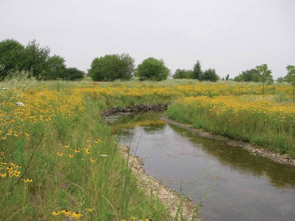
10 The Spring Brook Stream Meander Project Develop an accurate picture of stream stability/instability. Measure stream instability. Characterize lotic habitat. Develop a conceptual plan for restoration.


11 Spring Brook Watershed 9.9 sq. miles 25.6 sq. km 1/3 preserve
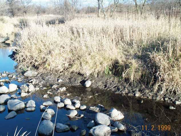
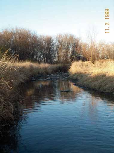
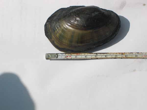
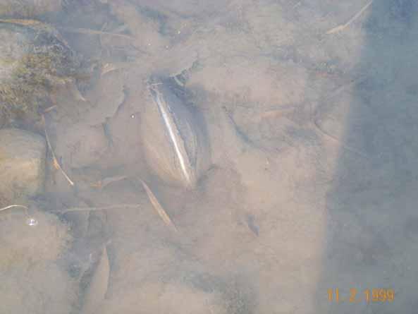
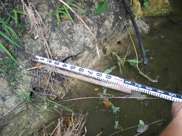
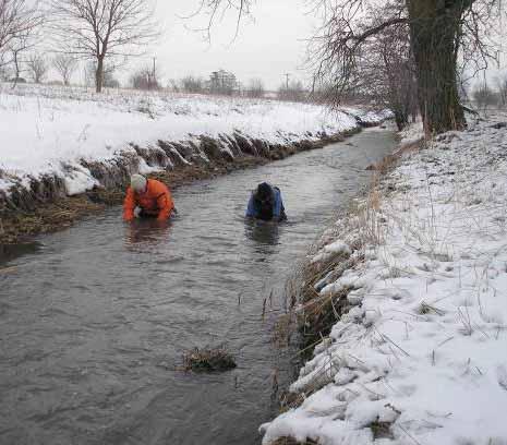
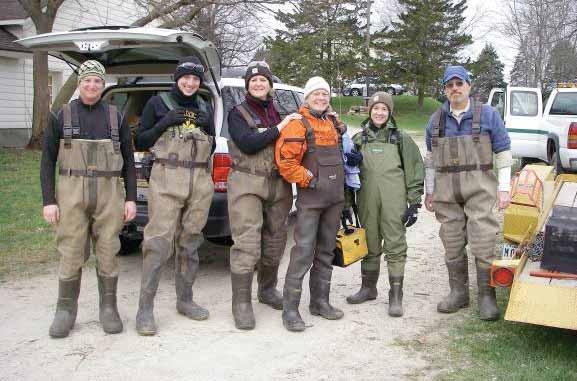
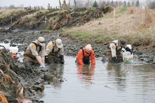
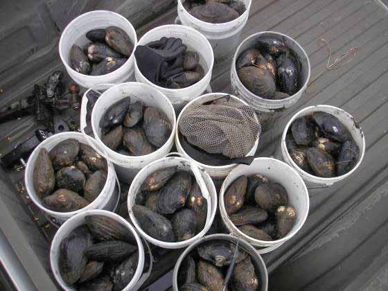
12 The Spring Brook Stream Meander Project Cross-Section Studies Substrate Studies Pebble Counts Measure Bank Erosion Bank Pins Measure Stream Scouring Scour Chains Longitudinal Profile Studies Hydrological Data USGS Gage Station Benthic Invertebrate Studies Mussel Surveys
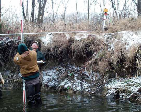
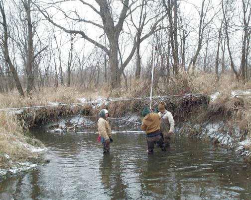
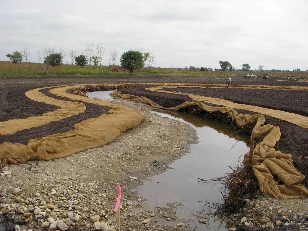
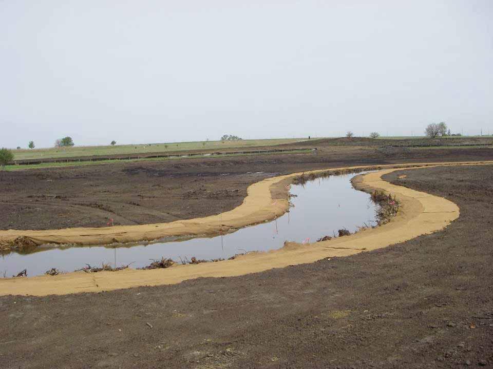
13 Cross-Section Studies
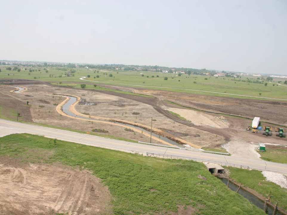
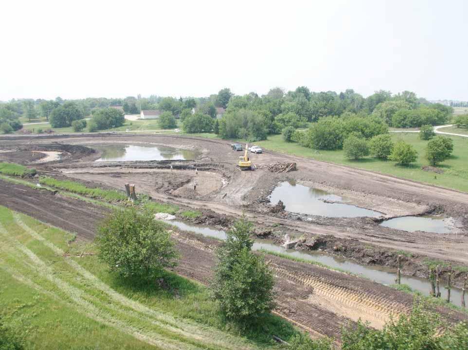
14 Springbrook Creek: Cross Section - O Springbrook Creek: Cross Section - R Bed Surface Bankfull Water Surface Bed Surface Bankfull Water Surface Elevation (ft) Elevation (ft) Distance From Left Bank Pin (ft) Distance From Left Bank Pin (ft) Springbrook Creek: Cross Section - NN Springbrook Creek: Cross Section - TT Bed Surface Bankfull Water Surface Bed Surface Bankfull Water Surface Elevation (ft) Elevation (ft) Distance From Left Bank Pin (ft) Distance From Left Bank Pin (ft)
15 Springbrook Creek: Cross Section - O Springbrook Creek: Cross Section - R 100% Clay Silt Sand Gravel Cobble Boulder 100% Clay Silt Sand Gravel Cobble Boulder 90% 90% 80% 80% Cumulative % Finer Than 70% 60% 50% 40% 30% Percent of Total Cumulative % Finer Than 70% 60% 50% 40% 30% Percent of Total 20% 20% 10% 10% 0% Particle Size (mm) 0% Particle Size (mm) Springbrook Creek: Cross Section - NN Springbrook Creek: Cross Section - TT 100% Clay Silt Sand Gravel Cobble Boulder 100% Clay Silt Sand Gravel Cobble Boulder 90% 90% 80% 80% Cumulative % Finer Than 70% 60% 50% 40% 30% Percent of Total Cumulative % Finer Than 70% 60% 50% 40% 30% Percent of Total 20% 20% 10% 10% 0% Particle Size (mm) 0% Particle Size (mm)

16 Bank Erosion Bank Pins
17 Bank Pins 11/2000 thru 7/2004 (Feet) X-Section Top Pin Bottom Pin XS-E XS-N XS-O XS-R XS-Z XS-CC XS-GG XS-II XS-JJ XS-KK XS-NN
18 QQ Distance Below Dam Along Channel (s tation,ft) T S R Q Spring Brook Longitudinal Profile Elevation (ft) Floodplain Thalweg Cross Section Location
19 Hydrological Data USGS Gage Station Duration of Flows at Gage Station Average No. Days Mean Daily per Year Flow (cfs) Peak Discharge Instantaneous Recurrence Peak Interval Discharge (years) (cfs)
20 Working Together Flow volumes and storm events Channel width and depth Channel slope Channel Sinuosity Substrate size Transporting Sediment
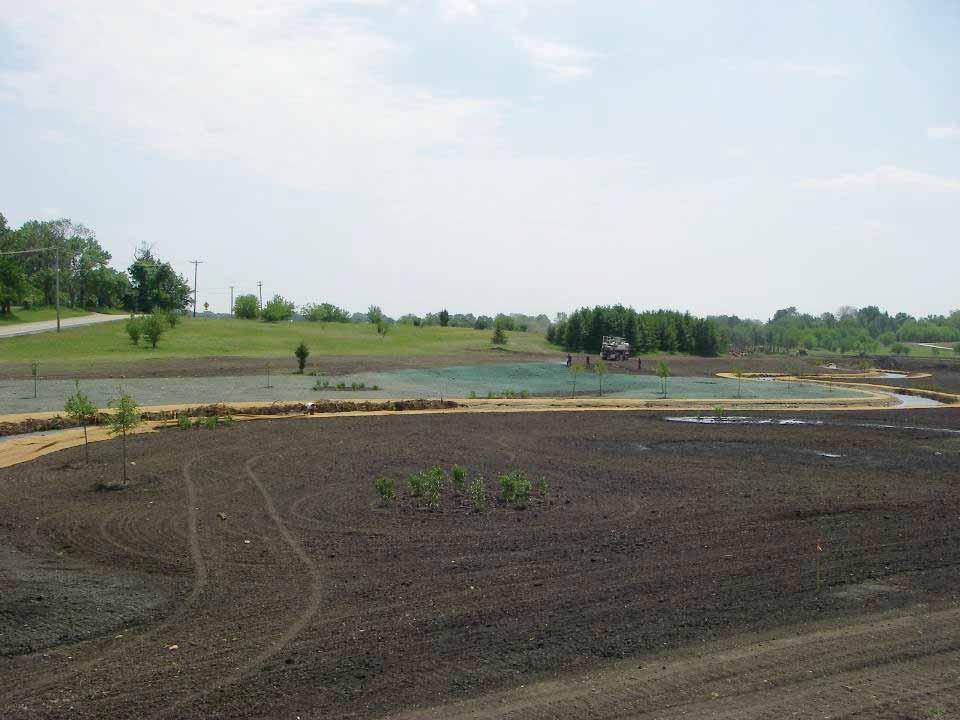
21 The Spring Brook Stream Meander Project Create normal entrenchment condition. Create geomorophologically appropriate meanders. Plan, profile geometry and bed substrate to prevent channel incisement. Channel and floodplain geometry mimic natural features and move flood flows. Natural material bank revetment and bed substrates to improve lotic diversity. Establish native riparian species with continuity to preserve restoration plans.
22
23 Bankfull Channel Design Parameters by Reach. Upper Middle Lower Discharge (cfs) Width (ft) Cross Sectional Area (ft 2 ) Mean Depth (ft) Max Depth (ft) Pool Depth (ft) Width/Depth Ratio (ft/ft) Belt Width (ft) Meander Wavelength (ft) Sinuosity (ft/ft) Slope (ft/ft)

24 The Spring Brook Stream Meander Project
25 Permits Corp of Engineers (404) National Pollution Discharge Elimination System (NPDES) 401 Certificate IDNR Water Resources Dam Safety DuPage County Stormwater IDNR Incidental Take
26
27
28
29
30
31
32
33
34
35
36
37
38
39
40
41
42
43
44
45
46
47 6 Stages of a Project Enthusiasm Disillusionment Panic Search for the guilty Punishment of the innocent Reward for the non-participants

48 Spring Brook Stream Meander Project US Environmental Protection Agency Illinois Environmental Protection Agency Illinois Department of Natural Resources DuPage County USDA Natural Resource Conservation Service

49 Learn to Read the River Scalable Change the entrenchment ratio Reconnect with floodplain Take the flood plain down Lock it in place by redistributing the energy
50 Questions?
Squaw Creek. General Information
 General Information is a tributary to the Salmon River. It enters the north side of the river about 0 miles downstream of North Fork, Idaho. The study reach is about a 30 ft length of stream about 2 miles
!"#$%&&'()*+#$%(,-./0*)%(!
*+#$%(,-./0*)%(!") 8:30 Sign in Hoosic River Revival Coalition!"#$%&&'()*+#$%(,-./0*)%(! 12-#30+4/#"5-(60 9:00 Welcome and Introductions 9:15 Goals for Today s Program: A Description of the Planning Process 9:30 First Session:
8:30 Sign in Hoosic River Revival Coalition!"#$%&&'()*+#$%(,-./0*)%(! 12-#30+4/#"5-(60 9:00 Welcome and Introductions 9:15 Goals for Today s Program: A Description of the Planning Process 9:30 First Session:
Big Wood River. General Information
 General Information The flows out of the southern portion of the Sawtooth National Recreation Area in central Idaho. The study reach is about a,200 ft length of river about.5 miles upstream from the discontinued
Assessment. Assessment
 2001 SPRINGBROOK CREEK RESTORATION - THREE YEAR POST-CONSTRUCTION REVIEW - Presented by Bruce Henderson and Andy Harris 2005 River Restoration Northwest Symposium Skamania Lodge, Washington www.hendersonlandservices.com
Stream Simulation: A Simple Example
 Stream Simulation: A Simple Example North Thompson Creek, CO Paul T. Anderson U.S.D.A. Forest Service Here s How We Started May 2011 2-1 USDA-Forest Service Here s How We Finished Forest Service Aquatic
May 7, Roger Leventhal, P.E. Marin County Public Works Laurel Collins Watershed Sciences
 May 7, 2013 Roger Leventhal, P.E. Marin County Public Works Laurel Collins Watershed Sciences Background Funded in 2009 under EPA 2100 Grant for $30k and managed by SFEP Project Goals: Update original
Riparian Assessment. Steps in the right direction... Drainage Basin/Watershed: Start by Thinking Big. Riparian Assessment vs.
 Riparian Assessment vs. Monitoring Riparian Assessment What is a healthy stream? Determine stream/riparian health Determine change or trend, especially in response to mgmt Classification = designation
Why Stabilizing the Stream As-Is is Not Enough
 Why Stabilizing the Stream As-Is is Not Enough Several examples of alternatives to the County s design approach have been suggested. A common theme of these proposals is a less comprehensive effort focusing
Stream Classification
 Stream Classification Why Classify Streams? Communication Tool Describe Existing Conditions & Trends Describe Restoration Goals Research Tool Morphologic Stream Classification Systems Schumm (1977) Alluvial
Aquifer an underground zone or layer of sand, gravel, or porous rock that is saturated with water.
 Aggradation raising of the streambed by deposition that occurs when the energy of the water flowing through a stream reach is insufficient to transport sediment conveyed from upstream. Alluvium a general
Tom Ballestero University of New Hampshire. 1 May 2013
 Tom Ballestero University of New Hampshire 1 May 2013 1 Hydrology 2 Basic Hydrology Low flows most common Flows that fill the stream to the banks and higher are much less common Filling the stream to the
Application of Fluvial Geomorphologic Techniques At Abandoned Mine Sites 1. David A. Greenfield 2 Dennis M. Palladino 3
 Application of Fluvial Geomorphologic Techniques At Abandoned Mine Sites 1 David A. Greenfield 2 Dennis M. Palladino 3 ABSTRACT Watersheds that have been severely impacted by mining can no longer transport
CR AAO Bridge. Dead River Flood & Natural Channel Design. Mitch Koetje Water Resources Division UP District
 CR AAO Bridge Dead River Flood & Natural Channel Design Mitch Koetje Water Resources Division UP District Old County Road AAO Bridge Map courtesy of Marquette County Silver Lake Basin McClure Basin
Field Methods to Determine/ Verify Bankfull Elevation, XS Area & Discharge
 Module # 6 Field Methods to Determine/ Verify Bankfull Elevation, XS Area & Discharge Iowa s River Restoration Toolbox Level 1 / Base Training Overview of Basic Field Data Collection Site Map Cross Sections
MEANDER MIGRATION MODEL ASSESSMENT FOR THE JANUARY 2005 STORM, WHITMAN PROPERTY, SAN ANTONIO CREEK, VENTURA COUNTY, CALIFORNIA
 MEANDER MIGRATION MODEL ASSESSMENT FOR THE JANUARY 2005 STORM, WHITMAN PROPERTY, SAN ANTONIO CREEK, VENTURA COUNTY, CALIFORNIA Prepared by Eric Larsen, Ph.D. Mark Rains, Ph.D. October 2006 INTRODUCTION
Wetland & Floodplain Functional Assessments and Mapping To Protect and Restore Riverine Systems in Vermont. Mike Kline and Laura Lapierre Vermont DEC
 Wetland & Floodplain Functional Assessments and Mapping To Protect and Restore Riverine Systems in Vermont Mike Kline and Laura Lapierre Vermont DEC NWI+ Hydro-Geomorphic Characterization of Wetlands and
Vermont Stream Geomorphic Assessment. Appendix J. Vermont Regional Hydraulic Geometry Curves
 Vermont Stream Geomorphic Assessment Appendix J Vermont Regional Hydraulic Geometry Curves River Management Program Vermont Water Quality Division November, 2001 Natural Resources - J0 - VT Agency of Background
EAGLES NEST AND PIASA ISLANDS
 EAGLES NEST AND PIASA ISLANDS HABITAT REHABILITATION AND ENHANCEMENT PROJECT MADISON AND JERSEY COUNTIES, ILLINOIS ENVIRONMENTAL MANAGEMENT PROGRAM ST. LOUIS DISTRICT FACT SHEET I. LOCATION The proposed
Stream Geomorphology. Leslie A. Morrissey UVM July 25, 2012
 Stream Geomorphology Leslie A. Morrissey UVM July 25, 2012 What Functions do Healthy Streams Provide? Flood mitigation Water supply Water quality Sediment storage and transport Habitat Recreation Transportation
Business. Meteorologic monitoring. Field trip? Reader. Other?
 Business Meteorologic monitoring Field trip? Reader Other? Classification Streams Characterization Discharge measurements Why classify stream channels? Why Classify Stream Channels? Provides a common language
Rosgen Classification Unnamed Creek South of Dunka Road
 Rosgen Classification Unnamed Creek South of Dunka Road Prepared for Poly Met Mining Inc. September 2013 Rosgen Classification Unnamed Creek South of Dunka Road Prepared for Poly Met Mining Inc. September
Appendix E Rosgen Classification
 Appendix E Stream Type s Using the morphometric parameters described above, stream reaches are classified into 7 major stream types (Aa+ through G) based on s (1996) criteria. The relevant stream classifications
Coarse Sediment Augmentation on Regulated Rivers. Scott McBain McBain & Trush, Inc.
 Coarse Sediment Augmentation on Regulated Rivers Scott McBain McBain & Trush, Inc. scott@mcbaintrush.com Components Some geomorphic and ecological considerations Conceptual approach at understanding augmentation
Ways To Identify Background Verses Accelerated Erosion
 Ways To Identify Background Verses Accelerated Erosion Establish Background Condition From Old Ground Photos, Aerial Photos, and Maps Compare Rate Over Time At the Same Location, or for Reaches Channel
Technical Memorandum. To: From: Copies: Date: 10/19/2017. Subject: Project No.: Greg Laird, Courtney Moore. Kevin Pilgrim and Travis Stroth
 Technical Memorandum To: From: Greg Laird, Courtney Moore Kevin Pilgrim and Travis Stroth 5777 Central Avenue Suite 228 Boulder, CO 80301 www.otak.com Copies: [Electronic submittal] Date: 10/19/2017 Subject:
Upper Truckee River Restoration Lake Tahoe, California Presented by Brendan Belby Sacramento, California
 Upper Truckee River Restoration Lake Tahoe, California Presented by Brendan Belby Sacramento, California Mike Rudd (Project Manager), Charley Miller & Chad Krofta Declines in Tahoe s Water Clarity The
Rapid Geomorphic Assessments: RGA s
 Establishing Current Reference Conditions Rates and concentrations of suspended-sediment transport vary over time and space due to factors such as precipitation characteristics and discharge, geology,
Watershed Assessment of River Stability and Sediment Supply: Advancing the Science of Watershed Analysis
 Watershed Assessment of River Stability and Sediment Supply: Advancing the Science of Watershed Analysis 2009 MWEA Annual Conference Rob Myllyoja, CET rmyllyoja@hrc-engr.com Watershed Assessment of River
Carmel River Bank Stabilization at Rancho San Carlos Road Project Description and Work Plan March 2018
 Carmel River Bank Stabilization at Rancho San Carlos Road Project Description and Work Plan March 2018 EXISTING CONDITION The proposed Carmel River Bank Stabilization at Rancho San Carlos Road Project
Diagnostic Geomorphic Methods for Understanding Future Behavior of Lake Superior Streams What Have We Learned in Two Decades?
 Diagnostic Geomorphic Methods for Understanding Future Behavior of Lake Superior Streams What Have We Learned in Two Decades? Faith Fitzpatrick USGS WI Water Science Center, Middleton, WI fafitzpa@usgs.gov
Griswold Creek August 22, 2013
 Creek August 22, 2013 1 Lake Erie Protection Fund Creek Study ver Evaluate the overall condition of Creek Determine stable channel dimensions & appropriate restoration techniques Starting Stat gpoint for
Limitation to qualitative stability indicators. the real world is a continuum, not a dichotomy ~ 100 % 30 % ~ 100 % ~ 40 %
 Stream Stability Assessment & BEHI Surveys Joe Rathbun MDEQ Water Resources Division rathbunj@michigan.gov 517--373 517 373--8868 Stability Stream can transport its water and sediment inputs without changing
The how, why, and lessons learned
 The how, why, and lessons learned emulates natural river systems integrates fluvial processes over temporal and spatial scales of self-formed and self-maintained natural rivers reestablish the physical,
How Do Human Impacts and Geomorphological Responses Vary with Spatial Scale in the Streams and Rivers of the Illinois Basin?
 How Do Human Impacts and Geomorphological Responses Vary with Spatial Scale in the Streams and Rivers of the Illinois Basin? Bruce Rhoads Department of Geography University of Illinois at Urbana-Champaign
NORTHUMBERLAND COUNTY, PA
 QUAKER RUN Stream and Wetland Restoration As-Built Completion Report and First Year Monitoring Data Coal Township NORTHUMBERLAND COUNTY, PA Upstream Before Upstream After Prepared for: COAL TOWNSHIP 805
OBJECTIVES. Fluvial Geomorphology? STREAM CLASSIFICATION & RIVER ASSESSMENT
 STREAM CLASSIFICATION & RIVER ASSESSMENT Greg Babbit Graduate Research Assistant Dept. Forestry, Wildlife & Fisheries Seneca Creek, Monongahela National Forest, West Virginia OBJECTIVES Introduce basic
NATURAL RIVER. Karima Attia Nile Research Institute
 NATURAL RIVER CHARACTERISTICS Karima Attia Nile Research Institute NATURAL RIVER DEFINITION NATURAL RIVER DEFINITION Is natural stream of water that flows in channels with ih more or less defined banks.
Kaskaskia Morphology Study Headwaters to Lake Shelbyville
 Kaskaskia Morphology Study Headwaters to Lake Shelbyville KWA Mini Summit 5 March 2012 1 Kaskaskia Morphology Study Headwaters to Lake Shelbyville Conducted by U.S. Army Corps of Engineers, St. Louis District
Birch Creek Geomorphic Assessment and Action Plan
 Birch Creek Geomorphic Assessment and Action Plan Jim Webster Tim Hanrahan, PhD, CFM Jesse Schwartz, PhD Zach Hill January 22, 2015 White Eagle Grange This Project is a First Step in Strategy Planning
PENNSYLVANIA DEPARTMENT OF TRANSPORTATION ENGINEERING DISTRICT 3-0
 PENNSYLVANIA DEPARTMENT OF TRANSPORTATION ENGINEERING DISTRICT 3-0 LYCOMING COUNTY S.R.15, SECTION C41 FINAL HYDROLOGIC AND HYDRAULIC REPORT STEAM VALLEY RUN STREAM RELOCATION DATE: June, 2006 REVISED:
Dolores River Watershed Study
 CHAPTER 4: RIVER AND FLOODPLAIN ISSUES The Dolores River falls into a category of streams in Colorado that share some unique characteristics. Like some other mountain streams in the state, it has a steep
 Red River Flooding June 2015 Caddo and Bossier Parishes Presented by: Flood Technical Committee Where the Rain Falls Matters I-30 versus I-20 I-20 Backwater and Tributary Floods (Localized) 2016 Flood
STREAM MODULES: SPREADSHEET TOOLS FOR RIVER EVALUATION, ASSESSMENT AND MONITORING **
 STREAM MODULES: SPREADSHEET TOOLS FOR RIVER EVALUATION, ASSESSMENT AND MONITORING ** D. E. Mecklenburg 1, A. Ward 2 Abstract Stream physical condition is increasingly a priority for resource managers.
STUDY PERFORMANCE REPORT
 STUDY PERFORMANCE REPORT State: Michigan Project No.: F-80-R-8 Study No.: 230702 Title: Effects of sediment traps on Michigan river channels Period Covered: October 1, 2006 to September 30, 2007 Study
Fluvial Driven Alluvial Fans
 Fluvial Driven Alluvial Fans Restoration Project Evaluations - Examples from the Russian and Napa River Watersheds Mia Docto Masters Thesis UC Berkeley 1. Basic Fan Description 2. Fluvial Driven Fan Characteristics
PolyMet NorthMet Project
 RS 26 Draft-01 December 8, 2005 RS26 Partridge River Level 1 Rosgen Geomorphic Survey Rosgen Classification Partridge River from Headwaters to Colby Lake Prepared for PolyMet NorthMet Project December
5/4/2017 Fountain Creek. Gage Analysis. Homework 6. Clifton, Cundiff, Pour, Queen, and Zey CIVE 717
 5/4/2017 Fountain Creek Gage Analysis Homework 6 Clifton, Cundiff, Pour, Queen, and Zey CIVE 717 Introduction: The CIVE 717 class members, Nate Clifton, Susan Cundiff, Ali Reza Nowrooz Pour, Robbie Queen
CASE STUDIES. Introduction
 Introduction The City of Winston-Salem faces the challenge of maintaining public infrastructure (e.g., water and sewer lines, storm drains, roads, culverts and bridges) while minimizing the potential impacts
Bank Erosion and Morphology of the Kaskaskia River
 Bank Erosion and Morphology of the Kaskaskia River US Army Corps Of Engineers St. Louis District Fayette County Soil and Water Conservation District Team Partners : Carlyle Lake Ecosystem Partnership Vicinity
HAW CREEK, PIKE COUNTY, MISSOURI-TRIB TO SALT RIVER ERODING STREAM THREATHENING COUNTY ROAD #107, FOURTEEN FT TALL ERODING BANK WITHIN 4 FT OF THE
 HAW CREEK, PIKE COUNTY, MISSOURI-TRIB TO SALT RIVER ERODING STREAM THREATHENING COUNTY ROAD #107, FOURTEEN FT TALL ERODING BANK WITHIN 4 FT OF THE ROAD, PROJECT CONSTRUCTED IN 1 DAY, MARCH 10, 2009 BY
(3) Sediment Movement Classes of sediment transported
 Sediment Movement Classes of sediment transported") (3) Sediment Movement Classes of sediment transported Dissolved load Suspended (and wash load ) Important for scouring algae Bedload (5-10% total load Moves along bed during floods Source of crushing for
(3) Sediment Movement Classes of sediment transported Dissolved load Suspended (and wash load ) Important for scouring algae Bedload (5-10% total load Moves along bed during floods Source of crushing for
Habitat Assessment. Peggy Compton UW-Extension Water Action Volunteers Program Coordinator
 Habitat Assessment Peggy Compton UW-Extension Water Action Volunteers Program Coordinator Adapted from a presentation by Jean Unmuth, Water Quality Biologist, WI DNR dnr.wi.gov www.uwex.edu erc.cals.wisc.edu
Design and Construction
 Design and Construction Stream Simulation With power point slides shamelessly stolen from: Forest Service AOP Training Course Bob Gubernick Paul Anderson John Kattell USDA Forest Service Interim Directive
SELBY CREEK STREAM HABITAT RESTORATION AND RIPARIAN REVEGETATION PROJECT: GEOMORPHIC ANALYSIS AND REVIEW
 SELBY CREEK STREAM HABITAT RESTORATION AND RIPARIAN REVEGETATION PROJECT: GEOMORPHIC ANALYSIS AND REVIEW Submitted to Bioengineering Institute P.O. Box 1554 Laytonville, CA 95454 By Matthew O Connor, PhD,
Summary of Hydraulic and Sediment-transport. Analysis of Residual Sediment: Alternatives for the San Clemente Dam Removal/Retrofit Project,
 Appendix N SUMMARY OF HYDRAULIC AND SEDIMENT-TRANSPORT ANALYSIS OF RESIDUAL SEDIMENT: ALTERNATIVES FOR THE SAN CLEMENTE DAM REMOVAL/RETROFIT PROJECT, CALIFORNIA the San Clemente Dam Removal/Retrofit Project,
Avoiding Geohazards in the Mid-Atlantic Highlands by Using Natural Stream Principles
 Avoiding Geohazards in the Mid-Atlantic Highlands by Using Natural Stream Principles J. Steven Kite, WVU Neal Carte, WVDOT Will Harman, Michael Baker Corp. Donald D. Gray, WVU Photo: W. Gillespie North
UPPER COSUMNES RIVER FLOOD MAPPING
 UPPER COSUMNES RIVER FLOOD MAPPING DRAFT BASIC DATA NARRATIVE FLOOD INSURANCE STUDY SACRAMENTO COUTY, CALIFORNIA Community No. 060262 November 2008 Prepared By: CIVIL ENGINEERING SOLUTIONS, INC. 1325 Howe
Case Study 14. Rocky Creek Vented Box Culvert Ford
 Case Study. Rocky Creek Vented Box Culvert Ford Location West Central Arkansas. Ouachita National Forest; Oden Ranger District. Rocky Creek crossing on Forest Road 887 (Muddy Gibbs Road). Crossing Description
Restoration of Goose Creek and Big Meadows. Conceptual Design Plan
 Prepared for: Kalispel Tribe of Indians Michelle Andersen Kalispel Tribal Fisheries Department PO Box 39 Usk, WA 99180 April, 2010 Submitted by: P.O. Box 1133, Bozeman, MT 59771-1133 p. 406-585-9500, f.406-582-9142
Why Geomorphology for Fish Passage
 Channel Morphology - Stream Crossing Interactions An Overview Michael Love Michael Love & Associates mlove@h2odesigns.com (707) 476-8938 Why Geomorphology for Fish Passage 1. Understand the Scale of the
APPENDIX E. GEOMORPHOLOGICAL MONTORING REPORT Prepared by Steve Vrooman, Keystone Restoration Ecology September 2013
 APPENDIX E GEOMORPHOLOGICAL MONTORING REPORT Prepared by Steve Vrooman, Keystone Restoration Ecology September 2 Introduction Keystone Restoration Ecology (KRE) conducted geomorphological monitoring in
Final Report. Prepared for. American Rivers, California Trout, Friends of the River and Trout Unlimited
 A of the Potential Downstream Sediment Deposition Following the Removal of Iron Gate, Copco, and J.C. Boyle Dams, Klamath River, CA Final Report Prepared for American Rivers, California Trout, Friends
Session C1 - Applying the Stream Functions Pyramid to Geomorphic Assessments and Restoration Design
 University of Massachusetts - Amherst ScholarWorks@UMass Amherst International Conference on Engineering and Ecohydrology for Fish Passage International Conference on Engineering and Ecohydrology for Fish
Natural Shoreline Landscapes on Michigan Inland Lakes
 Natural Shoreline Landscapes on Michigan Inland Lakes Excerpts from Chapters 2 and 3 Photo Photo by Jane by Jane Herbert Herbert Did you know? Twenty-four species of amphibians, 25 species of reptiles,
Gravel Transport Study Report for Energy Northwest's Packwood Lake Hydroelectric Project FERC No Lewis County, Washington
 Final Gravel Transport Study Report for Energy Northwest's Packwood Lake Hydroelectric Project FERC No. 2244 Lewis County, Washington Submitted to P.O. Box 968 Richland, Washington 99352-0968 Submitted
What discharge (cfs) is required to entrain the D 84 (84 th percentile of sediment size distribution) in Red Canyon Wash?
 is required to entrain the D 84 (84 th percentile of sediment size distribution) in Red Canyon Wash?") Gregory Indivero 31 October 2011 What discharge (cfs) is required to entrain the D 84 (84 th percentile of sediment size distribution) in Red Canyon Wash? What discharge was required to deposit observed
Gregory Indivero 31 October 2011 What discharge (cfs) is required to entrain the D 84 (84 th percentile of sediment size distribution) in Red Canyon Wash? What discharge was required to deposit observed
MEANDER MIGRATION MODEL ASSESSMENT FOR THE 50- AND 100-YEAR STORMS, WHITMAN PROPERTY, SAN ANTONIO CREEK, VENTURA COUNTY, CALIFORNIA
 MEANDER MIGRATION MODEL ASSESSMENT FOR THE 50- AND 100-YEAR STORMS, WHITMAN PROPERTY, SAN ANTONIO CREEK, VENTURA COUNTY, CALIFORNIA Prepared by Eric Larsen, Ph.D. Mark Rains, Ph.D. October 2006 TABLE OF
ADDRESSING GEOMORPHIC AND HYDRAULIC CONTROLS IN OFF-CHANNEL HABITAT DESIGN
 ADDRESSING GEOMORPHIC AND HYDRAULIC CONTROLS IN OFF-CHANNEL HABITAT DESIGN Conor Shea - Hydrologist U.S. Fish and Wildlife Service Conservation Partnerships Program Arcata, CA Learning Objectives Examine
Stop 1: Marmot Dam Stop 1: Marmot Dam
 Stop 1: Marmot Dam Stop 1: Marmot Dam Following the removal of Marmot Dam in 2007, the fate of the reservoir sediments has been monitored through a series of surveys and sediment transport measurements.
NATURE OF RIVERS B-1. Channel Function... ALLUVIAL FEATURES. ... to successfully carry sediment and water from the watershed. ...dissipate energy.
 1 2 Function... Sevier River... to successfully carry sediment and water from the watershed....dissipate energy. 3 ALLUVIAL FEATURES 4 CHANNEL DIMENSION The purpose of a stream is to carry water and sediment
Stream Restoration and Environmental River Mechanics. Objectives. Pierre Y. Julien. 1. Peligre Dam in Haiti (deforestation)
") Stream Restoration and Environmental River Mechanics Pierre Y. Julien Malaysia 2004 Objectives Brief overview of environmental river mechanics and stream restoration: 1. Typical problems in environmental
Stream Restoration and Environmental River Mechanics Pierre Y. Julien Malaysia 2004 Objectives Brief overview of environmental river mechanics and stream restoration: 1. Typical problems in environmental
Geomorphic Assessment of City Center Athletic Club Development Impacts on Existing Stream Channel Stability, Lenexa, KS.
 Ozarks Environmental and Water Resources Institute (OEWRI) Geomorphic Assessment of City Center Athletic Club Development Impacts on Existing Stream Channel Stability, Lenexa, KS. Final report to Olsson
SECTION G SEDIMENT BUDGET
 SECTION G SEDIMENT BUDGET INTRODUCTION A sediment budget has been constructed for the for the time period 1952-2000. The purpose of the sediment budget is to determine the relative importance of different
Fish Passage at Road Crossings
 Fish Passage at Road Crossings 1 Crossing Design Workshop Outline 1:00 to 2:00 Intro, Design Overview, Channel Width 2:00 to 2:15 Break 2:15 to 3:15 No-Slope, Stream Simulation Design 3:15 to 3:30 Break
Black Gore Creek 2013 Sediment Source Monitoring and TMDL Sediment Budget
 Black Gore Creek 2013 Sediment Source Monitoring and TMDL Sediment Budget Prepared for: Prepared By: - I. Introduction The Black Gore Creek Total Maximum Daily Load (TMDL) was developed in collaboration
Two-Stage Channel Design
 United States Department of Agriculture Natural Resources Conservation Service Stream Restoration Design Chapter 10 Issued August 2007 Cover photo: Low gradient, nonincising channels and ditches may be
BZ471, Steam Biology & Ecology Exam
 BZ471, Eam1, p.1 BZ471, Steam Biology & Ecology Eam Name Multiple choice When benthic organisms enter the water column with a regular diel periodicity: a) catastrophic drift b) behavioral drift c) constant
Session 1 Healthy Streams Stream Hydraulics Natural Channel Design
 Session 1 Healthy Streams Stream Hydraulics Natural Channel Design Bill Brant Heart of America Flyfishers Black & Veatch Kansas City, MO February 21, 2014 http://www.bobswebspace.com Audience? What do
THE MIDDLE SACRAMENTO RIVER: HUMAN IMPACTS ON PHYSICAL AND ECOLOGICAL PROCESSES ALONG A MEANDERING RIVER 1
 THE MIDDLE SACRAMENTO RIVER: HUMAN IMPACTS ON PHYSICAL AND ECOLOGICAL PROCESSES ALONG A MEANDERING RIVER 1 Koll Buer, Dave Forwalter, Mike Kissel, and Bill Stohler 2 Abstract: Native plant and wildlife
Do you think sediment transport is a concern?
 STREAM RESTORATION FRAMEWORK AND SEDIMENT TRANSPORT BASICS Pete Klingeman 1 What is Your Restoration Project Like? k? Do you think sediment transport is a concern? East Fork Lewis River, WA Tidal creek,
Technical Supplement 3E. Rosgen Stream Classification Technique Supplemental Materials. (210 VI NEH, August 2007)
") Technical Supplement 3E (210 VI NEH, August 2007) Issued August 2007 Cover photo: The Rosgen stream classification system uses morphometric data to characterize streams. Advisory Note Techniques and approaches
Technical Supplement 3E (210 VI NEH, August 2007) Issued August 2007 Cover photo: The Rosgen stream classification system uses morphometric data to characterize streams. Advisory Note Techniques and approaches
60 PERCENT DESIGN REPORT HABITAT RESTORATION OF THE CHELAN RIVER REACH 4 AND TAILRACE
 60 PERCENT DESIGN REPORT HABITAT RESTORATION OF THE CHELAN RIVER REACH 4 AND TAILRACE Prepared for Public Utility District Number 1 of Chelan County 327 North Wenatchee Avenue Wenatchee, Washington 98801
Case Study 2: Twenty-mile Creek Rock Fords
 Case Study : Twenty-mile Creek Rock Fords Location Crossing Description Washington. Okanagan National Forest. Methow Valley Ranger District. Chewuch river basin, East Chewuch Road. The Twenty-mile Creek
Lower South Fork McKenzie River Floodplain Enhancement Project
 Lower South Fork McKenzie River Floodplain Enhancement Project McKenzie River Ranger District Willamette National Forest Project Location The project is located in the South Fork McKenzie River Watershed,
BZ471, Steam Biology & Ecology Exam 1
 BZ471, Exam1, p.1 BZ471, Steam Biology & Ecology Exam 1 Name Matching. Select the single best (most precise) answer for each of the following. Use each answer no more than once. No partial credit is given.
Upper Mississippi River Basin Environmental Management Program Workshop
 Presentation to the Upper Mississippi River Basin Environmental Management Program Workshop by Michael Rodgers River Engineer US Army Corps of Engineers, St. Louis District August 17, 2007 Engineering
Appendix K.2: Sediment Management Excerpt from South Orange County Hydromodification Management Plan
 Appendix K.2: Sediment Management Excerpt from South Orange County Hydromodification Management Plan 4 Sediment Supply Management Requirements Permit Order R9-2013-0001 as amended by Order No. R9-2015-0001Section
May Creek Canyon LWD Stream Restoration Project. Helicopter Placement of LWD in an Urban Stream. By Kathryn Neal, P.E.
 Helicopter Placement of LWD in an Urban Stream By Kathryn Neal, P.E. May Creek Canyon LWD Stream Restoration Project By Kathryn Neal, P.E. Project proponents: King County City of Renton City of Newcastle
Development of a Fluvial Erosion Hazard Mitigation Program for Indiana
 Development of a Fluvial Erosion Hazard Mitigation Program for Indiana Indiana Watersheds Webinar Series October 12,2011 Robert Barr Center for Earth and Environmental Science Department of Earth Sciences
Geomorphic Importance of Winter Peak Flows and Annual Snowmelt Hydrographs in a Sierra Nevada Boulder-Bedrock River
 Geomorphic Importance of Winter Peak Flows and Annual Snowmelt Hydrographs in a Sierra Nevada Boulder-Bedrock River Scott McBain and Bill Trush McBain & Trush, Inc. Clavey River and Cherry Creek vicinity
CHANGES IN CHANNEL MORPHOLOGY ALONG LOWER CIENEGA CREEK, CIENEGA CREEK NATURAL PRESERVE,
 CHANGES IN CHANNEL MORPHOLOGY ALONG LOWER CIENEGA CREEK, CIENEGA CREEK NATURAL PRESERVE, 80-98 April 2002 Prepared by Pima Association of Governments for Pima County Flood Control District ii TABLE OF
Hydraulic Geometry Relationships for Rural North Carolina Coastal Plain Streams
 Hydraulic Geometry Relationships for Rural North Carolina Coastal Plain Streams Barbara A. Doll 1, Angela D. Dobbins 2, Jean Spooner 3, Daniel R. Clinton 4, David A. Bidelspach 4 ABSTRACT: Hydraulic geometry
Restoring the Napa River:
 Restoring the Napa River: lessons learned from a long term private-public project Andy Collison Environmental Science Associates acollison@esassoc.com 1 Napa River Restoration Projects Rutherford Reach
PRE-CONSTRUCTION REPORT FOR THE WARD BRANCH STREAM RESTORATION PROJECT
 Page 1 of 106 The Ozarks Environmental and Water Resources Institute (OEWRI) PRE-CONSTRUCTION REPORT FOR THE WARD BRANCH STREAM RESTORATION PROJECT Prepared By: Marc R. Owen, M.S., Research Specialist
Forest Service AOP Meeting Objectives of Stream Simulation: Examples and Talking Points
 Forest Service AOP Meeting Objectives of Stream Simulation: Examples and Talking Points Traci Sylte, P.E. Hydrology/Fluvial Geomorphology Lolo National Forest Is It True? Are Road Crossings a Dam with
Restoring Entrenched Rivers: lessons learned from the
 Restoring Entrenched Rivers: lessons learned from the N i PProject j Napa Ri River RRestoration Andy Collison Geomorphologist ESA PWA acollison@esassoc.com Napa County Flood Control and Water Conservation
(3) Sediment Movement Classes of sediment transported
 Sediment Movement Classes of sediment transported") 9/17/15 (3) Sediment Movement Classes of sediment transported Dissolved load Suspended load Important for scouring algae Bedload (5-10% total load) Moves along bed during floods Source of crushing for
9/17/15 (3) Sediment Movement Classes of sediment transported Dissolved load Suspended load Important for scouring algae Bedload (5-10% total load) Moves along bed during floods Source of crushing for
Field Observations and One-Dimensional Flow Modeling of Summit Creek in Mack Park, Smithfield, Utah
 Intermountain Center for River Rehabilitation and Restoration, Utah State University 31 July 2018 Field Observations and One-Dimensional Flow Modeling of Summit Creek in Mack Park, Smithfield, Utah I.
Geomorphic Assessment of the Middle and Lower Swan Lake Watershed, Calhoun Division of Two Rivers National Wildlife Refuge.
 Geomorphic Assessment of the Middle and Lower Swan Lake Watershed, Calhoun Division of Two Rivers National Wildlife Refuge Report Figures 33 34 Figure 1. Location of Middle and Lower Swan Lake watersheds
REDWOOD VALLEY SUBAREA
 Independent Science Review Panel Conceptual Model of Watershed Hydrology, Surface Water and Groundwater Interactions and Stream Ecology for the Russian River Watershed Appendices A-1 APPENDIX A A-2 REDWOOD