The Civil Protection System of the Autonomous Region of Friuli Venezia Giulia (Italy)
|
|
|
- Rodney Nelson
- 5 years ago
- Views:
Transcription


1 The Civil Protection System of the Autonomous Region of Friuli Venezia Giulia (Italy) Geol. Raffaele Lotto La Plata, November 2017


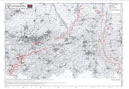
2 Friuli Venezia Giulia Autonomous Region Austria Pordenone Udine Gorizia SLOVENIA Palmanova Veneto Region Adriatic Sea Croatia Trieste


3 Organisation widespread on the regional territory 216 Municipalities 216 Civil protection Municipality Groups 23 Districts Regional Civil protection Operative Center in Palmanova: SOR/SOUP/CCS


4 Volunteers

 Fella river and Rio")
5 Emergence examples 29 th August 2003 Flood in Val Canale - Canal del Ferro Pontebba - Pietratagliata 293 mm / 4 hours Pietratagliata (Pontebba) Fella river and Rio Geloviz Confluence


6 4th September 2009 Flood Val Canale - Canal del Ferro - Val Dogna
7 Main tools for risk management and realisation of prevention actions Regional Operative Room (SOR) in Palmanova Territory real-time control and monitoring systems Emergency planning Prevention, fast intervention and restoration works Civil protection personnel, volunteers and population training
")
8 CIVIL PROTECTION OPERATIVE ROOM h24 control room Monitoring networks and logistic Regional Radio network Coordinates the operations of civil protection Connected with National civil protection Department (DPC)
 Seismic Monitoring")
9 Territory real-time control and monitoring systems The data from all of the Civil Protection Monitoring Networks are collected in the Operative Centre in Palmanova : Hydro-Meteo-Marine monitoring network Hydro Geological monitoring network Meteorological Radars for nowcasting Satellite observations (Meteosat MSG) Seismic Monitoring Network


10 Hydro Meteo Marine monitoring network Real time monitoring ground effects of meteorological events by automatic monitoring network managed by regional civil protection : 191 monitoring stations 111 hydrometers 112 rain gages 27 barometers 100 air thermometers 5 sea level sensors 18 snow level sensors 4 present weather sensors
 Real time")

11 Hydro Meteo Marine Monitoring Network 6 marine buoys (3 meteo-oceanographic + 3 for waves monitoring) Real time monitoring system based on fixed buoys on which different oceanographic and meteorological sensors are installed.
12 Hydro Geological monitoring


13 Example of laserscan relief elaboration Flood Liguria Region November 2011 Area: 200 km 2 Lidar points density > 4 points/m 2 Ortofoto: ground resolution 15 cm/pixel In the early days of the emergency, due to the calculation of the difference between the DTM created by the laserscan relief and the DTM already in the possession of the Liguria Region, landslides and estimated volumes have been identified.

14 Example of laserscan relief elaboration Flood Liguria Region November 2011


15 Meteorological Radars for nowcasting Fossalon Radar Mount Zouf Plan Radar Meteorological radar data are used for civil protection purposes in order to detect and monitor critical events and, during the phase of meteorological nowcasting The meteorological radar of DPC installed on Mount Zouf Plan grants the maximum coverage of the mountain area of FVG and also of part of Carinzia region (Austria) and Slovenia
16 Flood monitoring

17 The High-water service High-water service ( Servizio di piena ) consists of procedures and activities for the monitoring of river embankment status, in the case of water level exceeding fixed warning levels. Are established 4 phases: I) Planning phase Task of Regional Civil protection (PCR) and Public Works Offices II) III) Monitoring and Meteorological alerting phase Embankment surveillance phase Task of PCR Task supported by volunteers of Civil protection Municipality Groups VI) Management and quick Intervention phase for prevention ed restoration Task of PCR and Public Works Offices

18 Organized high-water service on Embanked rivers This service is organized for the selected and classified reaches of the main water courses, where embankments are of first and second or third category of importance. Total length of the embankments: 235 Km
 - 27 Nov 2002 Civil protection municipality")


19 Embankments surveillance phase Meduna river - Prata di Sopra (PN) - 27 Nov 2002 Civil protection municipality Groups are in charged of the surveillance of the embankments in order to permit a prompt hydraulic quick intervention in case of damages avoiding ruptures and flooding of inhabited areas Livenza river Loc. Traffe (PN) - 28 Nov 2002


20 Embankment surveillance phase Infiltration Cracks


21 Cartography Support for High-water service Cartografia delle tratte di sorveglianza


22 REGIONAL OPERATIVE ROOM High-water service Coordination Technical-scientific activity Institutional relations
 level : activation of")


23 High-water service Coordination : alerting levels Continouous Monitoring of river levels on reference points to activate planned actions: Attention (Guard) level : activation of hydraulic officers; 1 presidium level : activation of surveillance of embankments with volunteers of civil protection municipality Groups; 2 presidium level : intensification of surveillance with more volunteers of civil protection municipality Groups Invillino Tolmezzo VENZONE Villuzza Dignano PONTE DELLA DELIZIA Varmo Volta di Latisana LATISANA Reference hydrometers


24 High-water service Coordination: Real-time GIS implementation Immediate perception and visualization of situation on field


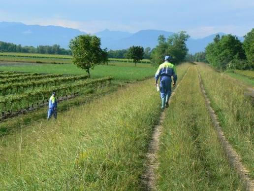
25 High-water service: activity on field Embankment surveillance with men has an irreplaceable importance in order to allow prompt intervention, avoiding that an high-water event becomes a catastrophic inundation

26 The hydrological forecasting and management system of Friuli Venezia Giulia The Friuli Venezia Giulia Region has hydrological and hydraulic models for:: basin of rivers Cellina-Meduna basin of river Tagliamento basin of river Isonzo with GIS interface for environmental monitoring and high water real-time forecasting.

27 The dams of the basin Cellina-Meduna Coordination between Civil Protection and Dam Managers to laminate the floods and mitigate downstream effects
28 Prevention, quick intervention and restoration works


29 3rd February 2003 water courses maintenance Meduna river Visinale di Sopra (Pasiano di Pordenone) Vegetation cutting inside the river bed 14th April 2003
")

30 Flood 2003 (Ugovizza) Gravel and material removal from the creek bed

31 Concrete screening of embankments (Latisana)
32 Civil protection personnel, volunteers and population training


33 Torre creek - bed cleaning

34 Thank you for your attention
The Civil Protection System of the Autonomous Region of Friuli Venezia Giulia (Italy) The response to hydro geological and alluvial risk
 The response to hydro geological and alluvial risk") The Civil Protection System of the Autonomous Region of Friuli Venezia Giulia (Italy) The response to hydro geological and alluvial risk Geol. Raffaele Lotto La Plata, November 2017 Friuli Venezia Giulia
The Civil Protection System of the Autonomous Region of Friuli Venezia Giulia (Italy) The response to hydro geological and alluvial risk Geol. Raffaele Lotto La Plata, November 2017 Friuli Venezia Giulia
THE ISONZO SOČA RIVER BASIN
 relator: PhD Geologist Alberto Cisotto e-mail: alberto.cisotto@adbve.it www.adbve.it THE ISONZO SOČA RIVER BASIN Eastern Alps District (NE Italy W Slovenia) Workshop on Transboundary Water Cooperation
12/07/2017. Flash Flood Warning Service, an advanced approach towards flood resilient cities Floodplain Management Association Conference, Newcastle
 12/07/2017 Worldwide problem: Flash Floods Flash Floods are a Global Problem Flash Flood Warning Service, an advanced approach towards flood resilient cities Floodplain Management Association Conference,
THE ISONZO SOČA. Workshop on Transboundary Water Cooperation in Central and Western Europe. Eastern Alps District.
 relator: PhD Geologist Alberto Cisotto e-mail: alberto.cisotto@adbve.it www.adbve.it THE ISONZO SOČA RIVER BASIN Eastern Alps District (NE Italy W Slovenia) Workshop on Transboundary Water Cooperation
Europass Curriculum Vitae
 Europass Curriculum Vitae Personal information First name(s) / Surname(s) Francesco Silvestro Telephone(s) +39 019 861418 E-mail fdrancesco.silvestro@cimafoundation.org Nationality Italian Date of birth
Two case history of EMS data application: earthquake in central italy and flooding in Piedmont region
 Two case history of EMS data application: earthquake in central italy and flooding in Piedmont region Luca Lanteri*, Rocco Pispico*, R. Cremonini** *Arpa Piemonte, Geological and Natural Risk Dipartiment
Research Activities at CIMA Foundation and contributions to task teams activities
 4 HyMeX Workshop Bologna, 8-10 June 2010 Research Activities at CIMA Foundation and contributions to task teams activities G. Boni(1), F. Castelli(2,1), L. Ferraris(1), S. Gabellani(1), A. Parodi(1), N.
CLIMATE CHANGE ADAPTATION BY MEANS OF PUBLIC PRIVATE PARTNERSHIP TO ESTABLISH EARLY WARNING SYSTEM
 CLIMATE CHANGE ADAPTATION BY MEANS OF PUBLIC PRIVATE PARTNERSHIP TO ESTABLISH EARLY WARNING SYSTEM By: Dr Mamadou Lamine BAH, National Director Direction Nationale de la Meteorologie (DNM), Guinea President,
MANAGEMENT OF THE NIEMEN RIVER BASIN WITH ACCOUNT OF ADAPTATION TO CLIMATE CHANGE. Hydro-meteorological Monitoring System
 MANAGEMENT OF THE NIEMEN RIVER BASIN WITH ACCOUNT OF ADAPTATION TO CLIMATE CHANGE Hydro-meteorological Monitoring System Draft Interim Report Milestone 1 Giovanni Crema 18 October 2012 Scope of work assessment
METEOSAT PRODUCTS FOR SURVEILLANCE: THE EUSKALMET CASE.
 METEOSAT PRODUCTS FOR SURVEILLANCE: THE EUSKALMET CASE. S. Gaztelumendi (1)(2), K. Otxoa de Alda (1)(2), R. Hernandez (1)(2), J. Egaña (1)(2), I. R. Gelpi (1)(2). (1) Basque Meteorology Agency (EUSKALMET).
Measures Also Significant Factors of Flood Disaster Reduction
 Non-Structual Measures Also Significant Factors of Flood Disaster Reduction Babiaková Gabriela, Leškov ková Danica Slovak Hydrometeorological Institute, Bratislava Hydrological Forecasts and Warning Department
Emerging Needs, Challenges and Response Strategy
 Emerging Needs, Challenges and Response Strategy Development of Integrated Observing Systems in China JIAO Meiyan Deputy Administrator China Meteorological Administration September 2011 Geneva Outline
Haydar Hussin (1), Roxana Ciurean (2), Paola Reichenbach (1), Cees van Westen (3), Gianluca Marcato (4), Simone Frigerio (4), V. Juliette Cortes (4)
, Roxana Ciurean (2), Paola Reichenbach (1), Cees van Westen (3), Gianluca Marcato (4), Simone Frigerio (4), V. Juliette Cortes (4)") 7/10/2013 Changing Hydro-meteorological Risks - as Analyzed by a New Generation of European Scientists Probabilistic 2D numerical landslide modeling: a first step towards assessing changes in risk due
7/10/2013 Changing Hydro-meteorological Risks - as Analyzed by a New Generation of European Scientists Probabilistic 2D numerical landslide modeling: a first step towards assessing changes in risk due
Flash flood forecasting and warning infrastructures of National Meteorology and Hydrological Services of Cambodia
 Development and Implementation of the South East Asia Flash Flood Guidance System (SEAFFGS) Ha Noi, Viet Nam, 20-23 November 2017 Flash flood forecasting and warning infrastructures of National Meteorology
Overview of Early Warning Systems and the role of National Meteorological and Hydrological Services
 Overview of Early Warning Systems and the role of National Meteorological and Hydrological Services South Africa Second Experts Symposium on Multi-Hazard Early Warning Systems With focus on the Role of
Programs of Regione Campania for reduction of seismic risk (and others)
") Programs of Regione Campania for reduction of seismic risk (and others) 2011-10151015 Prof ing Edoardo Cosenza Assessore (Regional Ministry) Public Works and Civil Protection Regione Campania Napoli, 1900.
Programs of Regione Campania for reduction of seismic risk (and others) 2011-10151015 Prof ing Edoardo Cosenza Assessore (Regional Ministry) Public Works and Civil Protection Regione Campania Napoli, 1900.
Analysis of catastrophic floods affecting Croatia in May 2014 Meteorological and Hydrological Service Zagreb, Croatia
 Analysis of catastrophic floods affecting Croatia in May 2014 Meteorological and Hydrological Service Zagreb, Croatia http://meteo.hr Branka Ivančan-Picek e-mail: picek@cirus.dhz.hr Overview The most affected
INCA CE: Integrating Nowcasting with crisis management and risk prevention in a transnational framework
 INCA CE: Integrating Nowcasting with crisis management and risk prevention in a transnational framework Yong Wang ZAMG, Austria This project is implemented through the CENTRAL EUROPE Programme co-financed
Role of Hydro-Met Services in Disaster Risk Management
 Role of Hydro-Met Services in Disaster Risk Management Tshewang Rigzin (Mr) National Centre for Hydrology and Meteorology, Bhutan 30 th November 2017 Outline Vision and Mission Functions related to Disaster
URBAS Prediction and management of flash floods in urban areas
 URBAS Prediction and management of flash floods in urban areas 1 Thomas Einfalt, Klaus Friedeheim, Andreas Wagner Project funded by the Federal Ministry of Education and Research BMBF (Germany) as a part
Flash Flood Guidance System On-going Enhancements
 Flash Flood Guidance System On-going Enhancements Hydrologic Research Center, USA Technical Developer SAOFFG Steering Committee Meeting 1 10-12 July 2017 Jakarta, INDONESIA Theresa M. Modrick Hansen, PhD
WMO/WWRP FDP: INCA CE
 WMO/WWRP FDP: INCA CE Yong Wang ZAMG, Austria This project is implemented through the CENTRAL EUROPE Programme co-financed by the ERDF INCA CE: implementation over Central Europe A Nowcasting Initiative
Operational modelling & forecasting in urban catchments. Richard Body Product Sector Leader Operational Forecasting
 Operational modelling & forecasting in urban catchments Richard Body Product Sector Leader Operational Forecasting Contents What is operational forecasting Innovyze software ICMLive components Benefits
WHAT S CIVIL DEFENCE?
 WHAT S CIVIL DEFENCE? The Civil Protection Department was found in 1982 in order to prevent, forecast and supervise the natural disasters in agreement with regional and local governments. It also cooperates
Ridracoli Dam: surveillance and safety evaluation reported on internet page
 Ridracoli Dam: surveillance and safety evaluation reported on internet page P.P. MARINI; P. BALDONI; F. FARINA; F. CORTEZZI - Romagna Acque, Forlì, Italy A. MASERA - Enel.Hydro, ISMES Division, Bergamo,
Progress Report. Flood Hazard Mapping in Thailand
 Progress Report Flood Hazard Mapping in Thailand Prepared By: Mr. PAITOON NAKTAE Chief of Safety Standard sub-beuro Disaster Prevention beuro Department of Disaster Prevention and Mitigation THAILAND E-mail:
Visualising and communicating probabilistic flow forecasts in The Netherlands
 Visualising and communicating probabilistic flow forecasts in The Netherlands Eric Sprokkereef Centre for Water Management Division Crisis Management & Information Supply 2-2-2009 Content The basins Forecasting
Effective Utilization of Synthetic Aperture Radar (SAR) Imagery in Rapid Damage Assessment
 Imagery in Rapid Damage Assessment") Effective Utilization of Synthetic Aperture Radar (SAR) Imagery in Rapid Damage Assessment Case Study Pakistan Floods SUPARCO M. Maisam Raza, Ahmad H. Rabbani SEQUENCE Flood Monitoring using Satellite
Effective Utilization of Synthetic Aperture Radar (SAR) Imagery in Rapid Damage Assessment Case Study Pakistan Floods SUPARCO M. Maisam Raza, Ahmad H. Rabbani SEQUENCE Flood Monitoring using Satellite
MODERN TECHNOLOGIES IN HYDRO-METEOROLOGICAL INFORMATION SYSTEMS
 MODERN TECHNOLOGIES IN HYDRO-METEOROLOGICAL INFORMATION SYSTEMS MARK HEGGLI, INNOVATIVE HYDROLOGY CONSULTING METEOROLOGIST/HYDROLOGIST TO THE WORLD BANK AREAS OF TECHNOLOGY ADVANCEMENT RECENT TECHNOLOGY
FLASH FLOOD FORECASTING AND EARLY WARNING IN SLOVENIA. Sašo Petan Hydrological Forecast Department, Slovenian Environment Agency (ARSO)
") REPUBLIC OF S LOVE NIA MINIS TR Y OF THE E NVIR ONME NT AND S PATIAL PALNNING SLOVENIAN ENVIRONMENT AGENCY FLASH FLOOD FORECASTING AND EARLY WARNING IN SLOVENIA Sašo Petan Hydrological Forecast Department,
REPUBLIC OF S LOVE NIA MINIS TR Y OF THE E NVIR ONME NT AND S PATIAL PALNNING SLOVENIAN ENVIRONMENT AGENCY FLASH FLOOD FORECASTING AND EARLY WARNING IN SLOVENIA Sašo Petan Hydrological Forecast Department,
Integrating Nowcastingwith crisis management and risk prevention in a transnational framework (INCA-CE)
") Integrating Nowcastingwith crisis management and risk prevention in a transnational framework (INCA-CE) Yong Wang ZAMG, Austria This project is implemented through the CENTRAL EUROPE Programme co-financed
Integrating Nowcastingwith crisis management and risk prevention in a transnational framework (INCA-CE) Yong Wang ZAMG, Austria This project is implemented through the CENTRAL EUROPE Programme co-financed
Regional Flash Flood Guidance and Early Warning System
 WMO Training for Trainers Workshop on Integrated approach to flash flood and flood risk management 24-28 October 2010 Kathmandu, Nepal Regional Flash Flood Guidance and Early Warning System Dr. W. E. Grabs
ÖBB Natural Hazard Management
 ÖBB Natural Hazard Management Management of Weather Events in the Austrian Federal Railways MOWE-IT, Brussels 17 th of September 2013 DI Günther Kundela Integrated Track Management Integration Technic
An Overview of Operations at the West Gulf River Forecast Center Gregory Waller Service Coordination Hydrologist NWS - West Gulf River Forecast Center
 National Weather Service West Gulf River Forecast Center An Overview of Operations at the West Gulf River Forecast Center Gregory Waller Service Coordination Hydrologist NWS - West Gulf River Forecast
Flood Management in Japan
 Flood Management in Japan 1. Comprehensive Flood Control Measures 2. Provision of River information 3. Responses to the Niigata Torrential Rain Disaster 4. About ICHARM 5. Responses to 2011 Thailand Floods
National Report on Weather Forecasting Service
 MINISTRY OF WATER RESOURCES AND METEOROLOGY DEPARTMENT OF METEOROLOGY, CAMBODIA National Report on Weather Forecasting Service Tokyo, 11-15 March 2014 Department of Meteorology, Cambodia Presentation Outline
for Emergency System in the Czech Republic Ivan Obrusník Czech Hydrometeorological Institute
 Multi-Hazard Warning Service for Emergency System in the Czech Republic Ivan Obrusník Czech Hydrometeorological Institute Catastrophic Flood 2002 Prague Catastrophic flood 1997 in Moravia Flood the main
Improvement of Hazard Assessment and Management in the Philippines
 Improvement of Hazard Assessment and Management in the Philippines (2014 Summer Training Course for Slope Land Disaster Reduction) Ian Alejandrino (Philippines) Nguyen Manh Hieu (Vietnam) Presentation
Thunderstorm Forecasting and Warnings in the US: Applications to the Veneto Region
 Thunderstorm Forecasting and Warnings in the US: Applications to the Veneto Region Bill Conway Vice President Weather Decision Technologies Norman, Oklahoma, USA Andrea Rossa ARPAV Lead Scientist Centre
TOOLS FOR RISK MANAGEMENT Related to climate change
 TOOLS FOR RISK MANAGEMENT Related to climate change copyright CONTENT 1 CLIMATE CHANGE AND ENVIRONMENTAL STUDIES 2 METHODS AND TOOLS DEVELOPED BY EGIS For infrastructures For urban areas For crisis management
EARLY WARNING SYSTEM AND THE ROLE OF METEOROLOGICAL AND HYDROLOGICAL SERVICE CROATIA
 EARLY WARNING SYSTEM AND THE ROLE OF METEOROLOGICAL AND HYDROLOGICAL SERVICE CROATIA Meteorological and Hydrological Service National Protection and Rescue Directorate B. Ivančan an-picek V. Stajčić Establishment
FFGS Advances. Initial planning meeting, Nay Pyi Taw, Myanmar February, Eylon Shamir, Ph.D,
 FFGS Advances Initial planning meeting, Nay Pyi Taw, Myanmar 26-28 February, 2018 Eylon Shamir, Ph.D, EShamir@hrcwater.org Hydrologic Research Center San Diego, California FFG System Enhancements The following
BARON END-TO-END HYDROLOGICAL MODELING SOLUTION NOW AVAILABLE IN NEW BARON LYNX DISPLAY
 4930 Research Drive Huntsville, AL 35805 (256)-881-8811 www.baronweather.com FOR IMMEDIATE RELEASE BARON END-TO-END HYDROLOGICAL MODELING SOLUTION NOW AVAILABLE IN NEW BARON LYNX DISPLAY Powerful scientific
Flood Risk Reduction Strategies and the Early Warning Systems for Alerting the Population in Western Balkan Countries Presentation
 2018/TEL58/DSG/WKSP1/004 Track: 1 Flood Risk Reduction Strategies and the Early Warning Systems for Alerting the Population in Western Balkan Countries Presentation Submitted by: Alfa BK University Workshop
1 st FORALPS CONFERENCE
 www.foralps.net Contributions for a wise management of water resources from meteorology and climatology TOWARDS A COMMON REPORTING SYSTEM FOR METEOROLOGICAL FORECAST VERIFICATION ACTIVITIES IN THE ALPINE
Smart use of Geographic Information System (GIS) platform for delivering weather information and nowcasting services
 platform for delivering weather information and nowcasting services") Smart use of Geographic Information System (GIS) platform for delivering weather information and nowcasting services C. K. Pan Hong Kong Observatory Hong Kong, China It is a world of beauty Source: Image
Smart use of Geographic Information System (GIS) platform for delivering weather information and nowcasting services C. K. Pan Hong Kong Observatory Hong Kong, China It is a world of beauty Source: Image
APPROACH TO THE SPANISH WATER ORGANISATION IMPROVING FLOOD HAZARD MAPPING, LAWS AND AUTHORITIES COORDINATION
 "Workshop On Land Use Planning And Water Management, With Focus On Flood Risk Management Oslo, Norway. Wednesday 31 January and Thursday 1 February 2007 APPROACH TO THE SPANISH WATER ORGANISATION IMPROVING
FOURTH INTERNATIONAL PORT METEOROLOGICAL OFFICERS WORKSHOP AND SUPPORT TO GLOBAL OCEAN OBSERVATIONS USING SHIP LOGISTICS
 FOURTH INTERNATIONAL PORT METEOROLOGICAL OFFICERS WORKSHOP AND SUPPORT TO GLOBAL OCEAN OBSERVATIONS USING SHIP LOGISTICS PMO-IV 8-10 DEC 2010, ORLANDO, FLORIDA, USA 1 This presentation is generally for
Why Hydrological Services are Important to Business
 Why Hydrological Services are Important to Business Dr. David Green Program Manager, Disasters Earth Science Division David.s.green@nasa.gov May 8, 2018 2 Communities and Areas of Intensive Risk Socio-Economic
Landslide Disaster Management in Sri Lanka and Nichola Oya as a Case study. Group 16 Gamini Jayathissa Udeni Nawagamuwa
 Landslide Disaster Management in Sri Lanka and Nichola Oya as a Case study Group 16 Gamini Jayathissa Udeni Nawagamuwa Taiwan Sri lanka >2582 mm, max >5000mm NE= Nov. to Feb 1750 2500 mm >2500 mm Central
A SIMPLE GIS METHOD FOR OBTAINING FLOODED AREAS
 A SIMPLE GIS METHOD FOR OBTAINING FLOODED AREAS ROMAN P., I. 1, OROS C., R. 2 ABSTRACT. A simple GIS method for obtaining flooded areas. This paper presents a method for obtaining flooded areas near to
Flash Flood Guidance Gazette
 Volume 1, Issue 4 December 2012 Flash Flood Guidance Gazette Flash Flood Guidance (FFG) Gazette, a bi-annual newsletter bringing users of FFG products all the latest news operational information, technical
WORLD METEOROLOGICAL ORGANIZATION. WMO Regional Training Centres (RTCs) Course Offerings for the year Location (City/Country) Term I:
 Course Offerings for the year Location (City/Country) Term I:") RTC/Component: PAGASA RTC, WORLD METEOROLOGICAL ORGANIZATION WMO Regional Training Centres (RTCs) Course Offerings for the year Course Title 1. Meteorologists Training Course Holder of Bachelor s degree
RTC/Component: PAGASA RTC, WORLD METEOROLOGICAL ORGANIZATION WMO Regional Training Centres (RTCs) Course Offerings for the year Course Title 1. Meteorologists Training Course Holder of Bachelor s degree
Delaware River Flood Advisory Committee
 Delaware River Flood Advisory Committee A Partnership to Support Flood Mitigation Alan Tamm Pennsylvania Emergency Management Agency Bureau of Recovery and Mitigation atamm@state.pa.us Peter Gabrielsen
Early Warning System and Role of IMD. Manmohan Singh Meteorological Centre Shimla
 Early Warning System and Role of IMD Manmohan Singh Meteorological Centre Shimla India a land with a unique climatic regime Two monsoon seasons (southwest & northeast monsoons) Two cyclone seasons (pre
Assessment of Flood Monitoring and Forecasting of the Republic of Bulgaria
 Flood Protection Expert Group Assessment of Flood Monitoring and Forecasting of the Republic of Bulgaria E. Artinyan, D. Dimitrov, S. Balabanova National Institute of Meteorology and Hydrology www.meteo.bg
REGIONAL INSTRUMENT CENTER (RIC) MANILA Philippines (Regional Association V)
 MANILA Philippines (Regional Association V)") REGIONAL INSTRUMENT CENTER (RIC) MANILA Philippines (Regional Association V) Ferdinand Barcenas Contact Person, RIC Manila fybarce8@yahoo.com, ferdie@pagasa.dost.gov.ph PAGASA STRUCTURE PAGASA STRUCTURE
REGIONAL INSTRUMENT CENTER (RIC) MANILA Philippines (Regional Association V) Ferdinand Barcenas Contact Person, RIC Manila fybarce8@yahoo.com, ferdie@pagasa.dost.gov.ph PAGASA STRUCTURE PAGASA STRUCTURE
Instituto de Pesquisas Meteorológicas - IPMet Universidade Estadual Paulista - Unesp
 IPMET WEB GIS APPLICATION FOR SEVERE WEATHER ALERT AND DECISION SUPPORT Jaqueline Murakami Kokitsu Instituto de Pesquisas Meteorológicas - IPMet Universidade Estadual Paulista - Unesp IPMet/Unesp Meteorological
Challenges in providing effective flood forecasts and warnings
 Challenges in providing effective flood forecasts and warnings National Centre for Flood Research Inaugural Symposium Justin Robinson Bureau of Meteorology October 2018 Zero Lives Lost A key responsibility
President s Day Weekend Storm Community Meeting and Workshop April 17, 2017
 President s Day Weekend Storm Community Meeting and Workshop April 17, 2017 Meeting outline 1. Progress update on the City of San Jose s recovery efforts 2. Water district presentation on: Weather situation
Steering Committee on Global Flash Flood Guidance 29 November 2016, Inter-Continental Hotel, Phnom Penh. Cambodia National Weather Services
 Steering Committee on Global Flash Flood Guidance 29 November 2016, Inter-Continental Hotel, Phnom Penh Cambodia National Weather Services Activities and Responsibilities of Research and Flood Forecasting
EARLY WARNING IN SOUTHERN AFRICA:
 EARLY WARNING IN SOUTHERN AFRICA: Enhancing the Meteorological Early Warning System Eugene Poolman South African Weather Service OUTLINE OF PRESENTATION Impact of Climate Change Meteorological Early Warning
Floodplain Risk Management in Dungog after the April 2015 Super Storm. Presentation Outline
 Presentation Outline Floodplain Risk Management in after the April 2015 Super Storm Rohan Hudson, Royal HaskoningDHV FMA 2017 Preparing for the Next Great Flood 17th May 2017 Background and Flood Mechanisms
Summary of the 2017 Spring Flood
 Ottawa River Regulation Planning Board Commission de planification de la régularisation de la rivière des Outaouais The main cause of the exceptional 2017 spring flooding can be described easily in just
Landslide monitoring system in Iceland. Harpa Grímsdóttir Jón Kristinn Helgason NVE, Oslo, October
 Landslide monitoring system in Iceland Harpa Grímsdóttir Jón Kristinn Helgason NVE, Oslo, October 26 2016 History Avalanches and landslides have caused extensive damages and loss of human lives in Iceland
SedAlp presentation Lyon, June 22 nd 2015
 SedAlp presentation Lyon, June 22 nd 2015 SedAlp Sediment management in Alpine basins: integrating sediment continuum, risk mitigation and hydropower Introducing the background and project Lyon, June 22
Landslide Hazard Assessment Methodologies in Romania
 A Scientific Network for Earthquake, Landslide and Flood Hazard Prevention SciNet NatHazPrev Landslide Hazard Assessment Methodologies in Romania In the literature the terms of susceptibility and landslide
Overview and purposes of the meeting
 Overview and purposes of the meeting 1 Flash Floods vs. River Floods Riverine Flooding: is caused by heavy rainfall (and/or snow melt) over long periods e.g., days, leading to rising water levels and flooding
Agrometeorological activities in RHMSS
 Republic of Serbia Republic Hydrometeorological Service of Serbia Agrometeorological activities in RHMSS Department for applied climatology and agrometeorology www.hidmet.gov.rs Meteorological Observing
Keynote Address. Development of Multi-Hazard Early Warning System in Indonesia by Prof. Armi Susandi, PhD
 Keynote Address Development of Multi-Hazard Early Warning System in Indonesia by Prof. Armi Susandi, PhD Professor of Meteorology, Bandung Institute of Technology, Indonesia. Dr. Susandi is an expert in
USING 3D GIS TO ASSESS ENVIRONMENTAL FLOOD HAZARDS IN MINA
 King Fahd University of Petroleum & Minerals College of Environmental Design Geographical Information system USING 3D GIS TO ASSESS ENVIRONMENTAL FLOOD HAZARDS IN MINA Prepared by : Ali AL-Zahrani OUTLINE
GEOMATICS. Shaping our world. A company of
 GEOMATICS Shaping our world A company of OUR EXPERTISE Geomatics Geomatics plays a mayor role in hydropower, land and water resources, urban development, transport & mobility, renewable energy, and infrastructure
INCA-CE: The Challenge of Severe Weather Warnings. Yong Wang, ZAMG
 INCA-CE: The Challenge of Severe Weather Warnings Yong Wang, ZAMG Severe Weather and Impact The need of civil society and economy Save Life! Save Cost! Reduce Risks and impacts! The Challenge of Severe
Floods Lecture #21 20
 Floods 20 Lecture #21 What Is a Flood? Def: high discharge event along a river! Due to heavy rain or snow-melt During a flood, a river:! Erodes channel o Deeper & wider! Overflows channel o Deposits sediment
DRR-related mandates and relevant activities and projects of RA III
 DRR-related mandates and relevant activities and projects of RA III 2015 Meeting of the Disaster Risk Reduction Focal Points of WMO Regional Associations, Technical Commissions and Programmes (DRR FP RA-TC-TP)
Robert Shedd Northeast River Forecast Center National Weather Service Taunton, Massachusetts, USA
 Robert Shedd Northeast River Forecast Center National Weather Service Taunton, Massachusetts, USA Outline River Forecast Centers FEWS Implementation Status Forcing Data Ensemble Forecasting The Northeast
IRDAT Fvg, evolving a regional Spatial Data Infrastructure according to INSPIRE
 IRDAT Fvg, evolving a regional Spatial Data Infrastructure according to INSPIRE Tutti i diritti riservati. Proprietà INSIEL SpA. A. Benvenuti, A. Chiarandini Insiel (Italy) M. Lunardis - Friuli Venezia
Early Flood Warning System in Pakistan
 Early Flood Warning System in Pakistan By Muhammad Tahir Anwar Director General M/o National Food Security and Research Government of Pakistan Asian Water Cycle Forum 2016 March 1-2, 2016 Tokyo, Japan
Outline. Remote Sensing, GIS and DEM Applications for Flood Monitoring. Introduction. Satellites and their Sensors used for Flood Mapping
 Outline Remote Sensing, GIS and DEM Applications for Flood Monitoring Prof. D. Nagesh Kumar Chairman, Centre for Earth Sciences Professor, Dept. of Civil Engg. Indian Institute of Science Bangalore 560
Ms. Latoya Regis. Meteorologist Hydrometeorological Service, Guyana
 Ms. Latoya Regis Meteorologist Hydrometeorological Service, Guyana Background Ninety percent (90%) of Guyana s population resides along the (Atlantic) Coast, which is below mean sea level and accounts
Moroccan lightning detection network, topology, performance and management of the network
 Moroccan lightning detection network, topology, performance and management of the network Mohamed DAHOUI, Mohamed NBOU and Rabia MERROUCHI Moroccan Meteorological Center Tel (212)71302837, Fax: (212)22908593
National Public Weather and Warning Services in the Swaziland Meteorological Service Dennis S.Mkhonta /
 National Public Weather and Warning Services in the Swaziland Meteorological Service Dennis S.Mkhonta dennis.mkhonta@gmail.com / dennis@swazimet.gov.sz Introduction Swaziland s geographical position exposes
THE ADRIARadNet PROJECT
 THE ADRIARadNet PROJECT Activity carried out by Abruzzo Region: Results, problems, aims A. Santacasa, G. Ragni, L. Tontodimamma, F. Rossi, A. Cimoroni, B. Di Giacomantonio, A. Iovino The main project activities
COMMUNITY EMERGENCY RESPONSE TEAM FLOODS INTRODUCTION
 INTRODUCTION Floods are one of the most common hazards in the United States. A flood occurs any time a body of water rises to cover what is usually dry land. Flood effects can be local, impacting a neighborhood
Real-Time Flood Forecasting Modeling in Nashville, TN utilizing HEC-RTS
 Real-Time Flood Forecasting Modeling in Nashville, TN utilizing HEC-RTS Brantley Thames, P.E. Hydraulic Engineer, Water Resources Section Nashville District, USACE August 24, 2017 US Army Corps of Engineers
Flood Forecasting Methodology in Alberta
 Flood Forecasting Methodology in Alberta Evan Friesenhan, M.Eng., P.Eng Alberta Environment and Sustainable Resource Development February 18, 2014 River Forecast Team Mandate To provide Albertans with
Indian Ocean Tsunami Warning System: Example from the 12 th September 2007 Tsunami
 Indian Ocean Tsunami Warning System: Example from the 12 th September 2007 Tsunami Charitha Pattiaratchi 1 Professor of Coastal Oceanography, The University of Western Australia Email: chari.pattiaratchi@uwa.edu.au
THE 3D SIMULATION INFORMATION SYSTEM FOR ASSESSING THE FLOODING LOST IN KEELUNG RIVER BASIN
 THE 3D SIMULATION INFORMATION SYSTEM FOR ASSESSING THE FLOODING LOST IN KEELUNG RIVER BASIN Kuo-Chung Wen *, Tsung-Hsing Huang ** * Associate Professor, Chinese Culture University, Taipei **Master, Chinese
C o p e r n i c u s E m e r g e n c y M a n a g e m e n t S e r v i c e f o r e c a s t i n g f l o o d s
 C o p e r n i c u s E m e r g e n c y M a n a g e m e n t S e r v i c e f o r e c a s t i n g f l o o d s Copernicus & Copernicus Services Copernicus EU Copernicus EU Copernicus EU www.copernicus.eu W
Status & Challengers of Cook Islands GEO DRM. Cook Islands GEO S/GIS History
 Status & Challengers of Cook Islands GEO DRM By Patrick A. ARIOKA Planning & Advisory Officer EMERGENCY MANAGEMENT COOK ISLANDS Cook Islands GEO S/GIS History 1990 NZODA/MFAT trained by Landcare Research
Use of satellite information in research and operational activities at NIMH of Bulgaria
 Use of satellite information in research and operational activities at NIMH of Bulgaria Rilka Valcheva NIMH, Bulgaria WMO/EUMETSAT Satellite Products Training Course 24-28 April 2017, Budapest, Hungary
Use of Climate information in Disaster Risk Management in Zimbabwe
 Use of Climate information in Disaster Risk Management in Zimbabwe WMO Regional Technical Meeting & User/CONOPS Workshop, 28 th October 2015 Lameck Betera Department of Civil Protection Institutional Arrangements
Wali Ullah Khan Pakistan Meteorological Department
 An overview of Weather Observation practices over Pakistan By Wali Ullah Khan Pakistan Meteorological Department JMA/WMO TRAINING WORKSHOP ON CALIBRATION AND MAINTENANCE OF METEOROLOGICAL INSTRUMENTS IN
DEVELOPMENT OF A FORECAST EARLY WARNING SYSTEM ethekwini Municipality, Durban, RSA. Clint Chrystal, Natasha Ramdass, Mlondi Hlongwae
 DEVELOPMENT OF A FORECAST EARLY WARNING SYSTEM ethekwini Municipality, Durban, RSA Clint Chrystal, Natasha Ramdass, Mlondi Hlongwae LOCATION DETAILS AND BOUNDARIES ethekwini Municipal Area = 2297 km 2
H SAF SATELLITE APPLICATION FACILITY ON SUPPORT TO OPERATIONAL HYDROLOGY AND WATER MANAGEMENT EUMETSAT NETWORK OF SATELLITE APPLICATION FACILITIES
 H SAF SATELLITE APPLICATION FACILITY ON SUPPORT TO OPERATIONAL HYDROLOGY AND WATER MANAGEMENT EUMETSAT NETWORK OF SATELLITE APPLICATION FACILITIES H-SAF: SATELLITE PRODUCTS FOR OPERATIONAL HYDROLOGY H-SAF
Workshop on hydrological modelling, forecasting and warnings
 WMO RAVI Hydrological Forum 2016 Workshop on hydrological modelling, forecasting and warnings 20 September 2016, Oslo, Norway Norwegian Water Resources and Energy Directorate (NVE) Middelthunsgate 29,
Central Asian Institute for Applied Geosciences: one year with Sentinel Asia
 Central Asian Institute for Applied Geosciences: one year with Sentinel Asia http://www.caiag.kg Dr. B.Moldobekov DPN and JPTM 2010 for Sentinel Asia STEP-2 5-8 July 2010, Manila, Philippines Concept of
South African Weather Service. Description of Public Weather and Warning Services. Tshepho Ngobeni. 18 November 2013
 South African Weather Service Description of Public Weather and Warning Services Tshepho Ngobeni 18 November 2013 SAWS-SWFDP_PRES_18-22_Nov_2013 1 Outline Forecasting Descriptions and Processes Severe
Recent development of the National Hydro-Meteorological Service (NHMS) of Viet Nam for disaster risk reduction
 of Viet Nam for disaster risk reduction") Ministry of Natural Resources and Environment National Hydro-Meteorological Service Recent development of the National Hydro-Meteorological Service (NHMS) of Viet Nam for disaster risk reduction Tran Van
Ministry of Natural Resources and Environment National Hydro-Meteorological Service Recent development of the National Hydro-Meteorological Service (NHMS) of Viet Nam for disaster risk reduction Tran Van
DRRM in the Philippines: DRRM Projects, Geoportals and Socio-Economic Integration
 Regional workshop on Geo-referenced information system for improving disaster risk preparedness and management in Asia and the Pacific 26-27 June 2014, UNCC, Bangkok, Thailand DRRM in the Philippines: