Shape of Earth, Cycles, Distribution of Water
|
|
|
- Jeffrey Simmons
- 6 years ago
- Views:
Transcription

1 Shape of Earth, Cycles, Distribution of Water


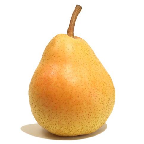

2 What is the shape of Earth? A. Spherical B. Apple-shaped C. Pear-shaped

3 Shape of the Earth It should be spherical: Earth condensed under gravity, thus everything making the Earth would be pulled toward the center of mass. However, there are complexities Rotation of Earth distorts the sphere by a centrifugal effect. If solely gravity and rotation acted on the shape of the Earth, it would be an oblate spheroid Density variations within the Earth distort Earth s gravity. This distortion (combined with rotation) result in a shape similar to a pear
: Deviation is on the order")

4 Shape of Earth results from distorted gravity and rotation of the earth Earth is shaped like a pear. Notice the shape deviates from the oblate spheroid (dashed line): Deviation is on the order of 10s of meters This is minor relative to the radius of the Earth low places like South Pole and the northern hemisphere are due to low density continents effecting gravity variations King-Hele, 1969
5 Which direction does Earth rotate? A. West B. East C. Depends on your perspective relative to the North Pole or the South Pole

6 A. 10º/hour B. 15º/hour C. 180º/hour D. 360º/hour How Fast does Earth rotate?

7 Earth s roughness or topography Highest mountain: Deepest trench: Radius at equator: Everest 8.85 km Mariana km ~6370 km


8 Which has roughness similar to Earth? A. Tennis Ball B. Basketball C. Beach ball


9 Earth s roughness 1. Radius of Earth ~ 6370 km 2. Greatest relative relief: Everest - Mariana = km (Or 0.3% or Earth s radius)

10 Distribution of Water: 1% of Fresh water 77% of Fresh water 22% of Fresh water

11 Hydrologic Cycle moves water between reservoirs video


12 The hydrologic cycle 40% 84% evap Off oceans 75% precip Fall on oceans 60% Transfer between Reservoirs Powered by? The Cycle: Evap. + Transpiration + Sublimation Precipitation
13 The Earth s Oceans: can you name them?

14 Earth s Oceans

15 Can you rank the oceans by area and depth?
16 Latitude Lines 0º at equator increasing to 90º at poles 1º latitude = 60 nm = 111 km = 69 statute miles 1 nautical mile = 1 minute latitude What is Urbanas Latitude?

17 Longitude Lines Perpendicular to Latitude lines 0º = prime meridian Set at Royal Naval Observatory, Greenwich GMT=UT= Zulu 180º = int. date line 1201 UT = new day at I.D.L. Question: Why can t you measure Longitude in miles? A. Because lines of longitude are not parallel to each other. B. Because the surface of the Earth is not flat. C. Because most of the world measures distance in kilometers.
18 How then, do you determine the latitude and longitude of your location? Latitude is relatively easy: there are two ways Observe the angle of the sun at Noon given knowledge of Suns path during year, you can calculate latitude. Or, determine the inclination of a compass needle Simple calculation will give latitude. Longitude is tricky: This was a major problem - ships would easily be lost Galileo could do it. British Empire held a contest to solve this problem 1730, J. Harrison s Chronometer


19 The Problem with Maps Distortion! Caused by depicting globe on a FLAT surface Examples: Lay an orange peal flat Wrap a ball in paper

20 Projections limit distortion What is a projection? Place paper in contact with globe shine light from center onto paper Shadows = map Distortion is Minimized at contact Extreme away from contact Three types shown here Look at Greenland
21 Review Questions Why is the Earth not a perfect sphere? How are the cardinal directions defined? Which adjective best describes Earth s surface: bumpy, angular/spiky, smooth-as-silk. Where does water reside on Earth s Surface? How is the Sun involved in the Hydrologic Cycle?
22 Review Questions Why is the Southern Ocean not an ocean? Rank the oceans in order of decreasing volume. Compare the angle of rotation and the linear distance distance of rotation at the equator to that at 40º latitude. Why can t you measure longitude in miles, yet you can measure latitude in miles? Which type of map projection would be most useful to a polar explorer?
Shape of Earth, Cycles, Distribution of Water
 Shape of Earth, Cycles, Distribution of Water What is the shape of Earth? A. Spherical B. Apple-shaped C. Pear-shaped Shape of the Earth It should be spherical: Earth condensed under gravity, thus everything
What is the shape of Earth?
 Shape of Earth, Cycles, Distribution of Water 1 What is the shape of Earth? A. Spherical B. Apple-shaped C. Pear-shaped 2 Draw shape of the Earth 3 1 Shape of the Earth It should be spherical: Earth condensed
Chapter 3 Models of the Earth. 3.1 Finding Locations on the Earth. 3.1 Objectives
 Chapter 3 Models of the Earth 3.1 Finding Locations on the Earth 3.1 Objectives Explain latitude and longitude. How can latitude and longitude be used to find locations on Earth? How can a magnetic compass
Latitude and Longitude
 Latitude and Longitude Finding Your Location on a Sphere Coordinate Systems n When you are locating a point on a flat surface you can use Cartesian coordinates of x and y. n The point 2, 3 is plotted on
Ch2&3 Test. Multiple Choice Identify the choice that best completes the statement or answers the question.
 Ch2&3 Test Multiple Choice Identify the choice that best completes the statement or answers the question. 1. Earth s circumference is about 40,000 km, and its shape is a. an oval. c. a perfect sphere.
Background Information
 Oceanography LAB #1: Marine Charts and Navigation Background Information Latitude and Longitude A coordinate is an address a means of designating location. Most coordinate systems involve a network of
Tonight. {01} The map. Relative space. What does a map do? Types of maps GEOG 201 2/17/2010. Instructor: Pesses 1
 Tonight {01} The map What makes a map Measuring the Earth Map Interpretation & GPS Spring 2010 M. Pesses What does a map do? Shows where things are Shows spatial (topological) relationships Shows patterns,
2 Mapping Earth Reading Essentials. 2. Contrast What is the difference between a map view and a profile view?
 Mapping Earth Maps What do you think? Read the three statements below and decide whether you agree or disagree with them. Place an A in the Before column if you agree with the statement or a D if you disagree.
Latitude and Longitude Pre Test
 Name Date Latitude and Longitude Pre Test Multiple Choice Directions: For questions, 1 10 circle the answer that letter that best answers the question. Each question is worth 1 point each. 1. To locate
EARTHS SHAPE AND POLARIS PRACTICE 2017
 1. In the diagram below, letters A through D represent the locations of four observers on the Earth's surface. Each observer has the same mass. 3. Which diagram most accurately shows the cross-sectional
What is a map? A Map is a two or three-dimensional model or representation of the Earth s surface. 2-Dimensional map
 What is a map? A Map is a two or three-dimensional model or representation of the Earth s surface. 2-Dimensional map What is a Map Projection? Planar Projection Projection A Projection is a mathematical
Introduction to Geography
 Introduction to Geography ropic of Cancer 3½ N Arctic Circle 90 N Prime Meridian 0 Arctic Ocean Mississippi R. Appalachian Mts. Europe Rocky Mountains N. America Atlantic Gulf of Ocean Mexico Caribbean
Module 2: Mapping Topic 2 Content: Determining Latitude and Longitude Notes
 Introduction In order to more easily locate points on a globe or map, cartographers designed a system of imaginary vertical lines (also called parallels) and horizontal lines (also called meridians) that
Chapter 1 Introduction to the Earth
 Chapter 1 Introduction to the Earth What is Geography? The study of the earth as the home of humankind. Greek - Eratosthenes Father of Geography Geo means Earth Graphy means to write Study how things are
Introduction to Geography
 Introduction to Geography What is geography? Geography comes from the Greek word Geographia. Geo means earth and graphia means to describe or chart. Geographers study the earth in relation to space and
The Earth is a Rotating Sphere
 The Earth is a Rotating Sphere The Shape of the Earth Earth s Rotation ( and relative movement of the Sun and Moon) The Geographic Grid Map Projections Global Time The Earth s Revolution around the Sun
Latitude and Longitude. Begin
 Latitude and Longitude Begin The Earth is divided in two halves, the top half is called the northern hemisphere, and the bottom half is called the southern hemisphere. The dividing line between the two
A. Spatial Sense (Working with Maps, Globes, and Other Geographic Tools)
") A. Spatial Sense (Working with Maps, Globes, and Other Geographic Tools) Measuring Distance Using Map Scale All maps are drawn to scale; that is, they are smaller than the things they represent. Scale
A. Spatial Sense (Working with Maps, Globes, and Other Geographic Tools) Measuring Distance Using Map Scale All maps are drawn to scale; that is, they are smaller than the things they represent. Scale
Cardinal and Intermediate Directions:
 Name Period Parent Signature Due Date: (TBA) Geography/Map Skills Study Guide Continents and Oceans of the World: Label the continents (7) and oceans (4) on the lines below the map. 1 11 3 5 4 8 2 9 10
Scientists observe the environment around them using their five senses.
 Earth Science Notes Topics 1: Observation and Measurement Topic 2: The Changing Environment Review book pages 1-38 Scientists observe the environment around them using their five senses. When scientists
4. Which object best represents a true scale model of the shape of the Earth? A) a Ping-Pong ball B) a football C) an egg D) a pear
 a Ping-Pong ball B) a football C) an egg D) a pear") Name Test on Friday 1. Which diagram most accurately shows the cross-sectional shape of the Earth? A) B) C) D) Date Review Sheet 4. Which object best represents a true scale model of the shape of the Earth?
Name Test on Friday 1. Which diagram most accurately shows the cross-sectional shape of the Earth? A) B) C) D) Date Review Sheet 4. Which object best represents a true scale model of the shape of the Earth?
+ 35º 53ʹ 16ʺ 84º 09ʹ 35ʺ
 + 35º 53ʹ 16ʺ 84º 09ʹ 35ʺ 35º 53ʹ 16ʺ N 84º 09ʹ 35ʺ W (the precise location of Farragut High School!) Spherical Coordinates Mapping a Sphere The student will be able to: HW: 1 Utilize and convert SI units
Period: Name: Astronomy Part 3A. Earth s Rotation: Video Notes Sheets. Earth Science with Mr. Sammartano Hommocks Middle School, Team 8-3
 Name: Period: Astronomy Part 3A Earth s Rotation: Video Notes Sheets Earth Science with Mr. Sammartano Hommocks Middle School, Team 8-3 PROOF #1 What is the Shape of the Earth? How do we know the Earth
Cartesian Coordinates Need two dimensional system 2 number lines perpendicular to each other X-axis is horizontal Y-axis is vertical Position relative
 General Physical Science Chapter 15 Place and Time Space and Time Einstein Space and time related Single entity Time is the 4 th dimension! Cartesian Coordinates Need some system to tell us where something
Coordinate Systems. Location on earth is defined by coordinates
 Coordinate Systems We think of the earth as a sphere It is actually a spheroid (ellipsoid), slightly larger in radius at the equator than at the poles Shape of the Earth Location on earth is defined by
page - 1 Laboratory Exercise #1 - Introduction to Latitude and Longitude Northern Hemisphere Southern Hemisphere
 page - 1 Laboratory Exercise #1 - Introduction to Latitude and Longitude A. Introduction There are many methods that can be used to locate ones position on the surface of the earth. A common method for
Mid Term Prep-Shape of the Earth
 1. The Earth is slightly flattened from a perfect spherical shape because of A) its rotation B) the pull of the sun and moon C) storms on the sun's surface D) its molten core 2. The diagrams below represent
Lesson 5: Map Scale and Projections
 Organizing Data and Information Lesson 5: Map Scale and Projections Map Scales Projections Information can be organized as lists, numbers, tables, text, pictures, maps, or indexes. Clusters of information
 Name Period Parent Signature Geography/Map Skills Study Guide *For extra practice with these skills, check out Mr. Kath s website: http://rkath.weebly.com/activities--links.html Continents and Oceans of
Practice Questions: Shape of the Earth
 Practice Questions: Shape of the Earth 1. The Earth is slightly flattened from a perfect spherical shape because of A) its rotation B) the pull of the sun and moon C) storms on the sun's surface D) its
UNIT 1: THE PLANET EARTH
 UNIT 1: THE PLANET EARTH How many planets are there in our Solar System? What is the Equator? Why does life exist in our planet? Does The Earth move? What is a map? 1. Planet Earth TOPICS 2. Movements
Complete the following: a. Lines of latitude are parallel to the equator. Name:
 Name: Date: Social Studies Introduction: Basic Geography Period: Latitude Latitude is defined as a measurement of distance in degrees north and south of the equator. The word latitude is derived from the
1. Geospatial technology rarely links geospatial data to nonspatial data. a. True *b. False
 Chapter 2 Where in the Geospatial World Are You? 1. Geospatial technology rarely links geospatial data to nonspatial data. 2. For geospatial technology to work, every location on Earth must be: a. inhabited
Welcome to Lesson 4. It is important for a GIS analyst to have a thorough understanding of map projections and coordinate systems.
 Welcome to Lesson 4. It is important for a GIS analyst to have a thorough understanding of map projections and coordinate systems. A GIS without coordinates would simply be a database like Microsoft Excel
Map Skills Unit. Note taking unit
 Map Skills Unit Note taking unit Introduction To learn about the Earth, we are going to learn about two geographic tools you can use.globes and maps. Globe A globe is a round model of the planet Earth
Some of these parallels are very important. In the Northern Hemisphere, there is the Tropic of Cancer and the Arctic Circle.
 PDF 2 Geographic coordinates 1 The geographic coordinates system is network of imaginary horizontal and vertical lines that are drawn on globes or maps. These lines are called parallels (lines of latitude)
Mapping Earth Review Note Cards
 Review Note Cards Spheres of Earth Atmosphere- Layer of gases Hydrosphere- All liquid water Lithosphere- Solid surface Biosphere-Living Portion Cryosphere-Ice Portion Evidence that the Earth is Round The
CHAPTER 2 SKILL SHEET 2: CELESTIAL NAVIGATION
 CHAPTER 2 SKILL SHEET 2: CELESTIAL NAVIGATION Before the invention of GPS technology, how were people on ships far at sea, out of the sight of land, able to tell where they were? For thousands of years
2. What does the map scale tell the map reader? a ratio between the actual distance on the ground and the length given to that distance on a map
 AP Human Geography - Damon Name Unit 1 - Intro to Human Geography Hour Map and Globe Skills Review Note: All links in this packet are found on our Wikispace under Map and Globe Skills Review First, read
Map Skills Test. 1. What do we call a person who makes maps? a. mapographer b. cartographer c. geologist d. archaeologist
 Map Skills Test 1. What do we call a person who makes maps? a. mapographer b. cartographer c. geologist d. archaeologist 2. What is the name of the 0 latitude line? a. Equator b. Arctic Circle c. First
Name Date Class. a. High elevation and high relief b. High elevation and level surface c. Flat land and low relief
 Exploring Earth s Surface (pp. 21 27) This section describes factors that determine the shape of Earth s land surface. The section also describes how scientists divide Earth into four spheres. Use Target
Stamp Area. Earth Science - Note Packet #6. The shape of the Earth. The Earth is in shape.
 Name: Earth Science - Note Packet #6 Mr. LaFranca s - Period Date: Aim: What are Latitude and Longitude? Do Now: Using the map, where is this location? Stamp Area X The shape of the Earth The Earth is
Latitudes and Longitudes
 Latitudes and Longitudes Angles are used to label latitudes and longitudes in order to locate points on our planet. It is a known fact that the earth is approximately a big sphere with a radius that is
Understanding Projections
 GEOGRAPHY SKILLS 1 Understanding Projections The earth is a sphere and is best shown as a globe. For books and posters, though, the earth has to be represented as a flat object. To do this, mapmakers create
L.O: THE ANGLE OF INSOLATION ANGLE INSOLATION: THE ANGLE SUNLIGHT HITS THE EARTH
 L.O: THE ANGLE OF INSOLATION ANGLE INSOLATION: THE ANGLE SUNLIGHT HITS THE EARTH 1. The graph below shows air temperatures on a clear summer day from 7 a.m. to 12 noon at two locations, one in Florida
Map Making. Chapter 2 Section 1
 Map Making Chapter 2 Section 1 Latitude and Longitude Objectives Compare and contrast latitude and longitude. Describe how time zones vary. Vocabulary cartography equator latitude longitude prime meridian
GLOBE : LATITUDES AND LONGITUDES
 2 Figure 2.1 : Globe Let s Do Take a big round potato or a ball. Pierce a knitting needle through it. The needle resembles the axis shown in a globe. You can now move the potato or the ball around this
Map Projections. Chapter 4 MAP PROJECTION
 Map Projections Chapter 4 Map Projections What is map projection? Why are map projections drawn? What are the different types of projections? Which projection is most suitably used for which area? In this
1. Label a few examples of lines of latitude and lines of longitude on the globe above left.
 Oceanography 2 Location, Direction, and Distance on Nautical Charts Please read Appendix III in the textbook for reference. Learning Objectives for the first nautical chart Lab 1. Use the latitude-longitude
Mid Term Prep-Latitude and Longitude
 1. What is the approximate altitude of Polaris at Syracuse, New York? A) 43 B) 47 C) 76 D) 90º 2. If an observer on Earth views Polaris on the horizon, the observer is located at the A) equator (0 ) B)
LATITUDES AND LONGITUDES
 NAME SCHOOL INDEX NUMBER DATE LATITUDES AND LONGITUDES KCSE 1989 2012 Form 4 Mathematics Answer all the questions 1. 1989 Q18 P1 A globe representing the earth has a radius 0.5m. Points A(10 0 W), B (0
PHYSICAL GEOGRAPHY. By Brett Lucas
 PHYSICAL GEOGRAPHY By Brett Lucas INTRODUCTION Introduction to Earth Geography as a Field of Learning Geography is from two Greek words, Geo Earth, and Graphien to write. Elements/Branches of Geography
WHERE ARE YOU? Maps & Geospatial Concepts Fall 2015
 WHERE ARE YOU? Maps & Geospatial Concepts Fall 2015 Where are you? Relative location I m at school Absolute Location 45 26 18.07 122 43 50.78 Where is Boston? Introducing Geodesy, Ellipsoids & Geoids Geodesy
The position of the Sun on the celestial sphere at the solstices and the equinoxes.
 1 2 3 4 5 6 7 8 9 10 11 12 13 EARTH IN SPACE Tillery, Chapter 18 Artist's concept of the solar system. Shown are the orbits of the planets, Earth being the third planet from the Sun, and the other planets
CHAPTER EXIT CHAPTER. Models of Earth. 3.1 Modeling the Planet. 3.2 Mapmaking and Technology. 3.3 Topographic Maps CHAPTER OUTLINE
 EXIT CHAPTER.1 Modeling the Planet.2 Mapmaking and Technology. Topographic Maps CHAPTER OUTLINE CHAPTER.1 Modeling the Planet A flat of Earth is a convenient tool, but it can distort the shape, distance,
Chapter 1: The World of Geography
 Chapter 1: The World of Geography Chapter 1: What is Geography? *It is the study of our earth; our home. OR *Anything that can be mapped! *Geography mixes up the physical and human aspects of our world
17. According to the data below, what is the exact shape of the Earth?
 1. The Earth is slightly flattened from a perfect spherical shape because of A) its rotation B) the pull of the sun and moon C) storms on the sun's surface D) its molten core 2. Which diagram most accurately
Latitude and Longitude. Finding your location throughout the world!
 Latitude and Longitude Finding your location throughout the world! What is Latitude? Latitude is defined as a measurement of distance in degrees north and south of the equator The word latitude is derived
Topic Guide: The Celestial Sphere. GCSE (9-1) Astronomy. Pearson Edexcel Level 1/Level 2 GCSE (9-1) in Astronomy (1AS0)
 Astronomy. Pearson Edexcel Level 1/Level 2 GCSE (9-1) in Astronomy (1AS0)") Topic Guide: The Celestial Sphere GCSE (9-1) Astronomy Pearson Edexcel Level 1/Level 2 GCSE (9-1) in Astronomy (1AS0) The Celestial Sphere Contents Specification Points 1 The Astronomy 2 Equatorial coordinates
Topic Guide: The Celestial Sphere GCSE (9-1) Astronomy Pearson Edexcel Level 1/Level 2 GCSE (9-1) in Astronomy (1AS0) The Celestial Sphere Contents Specification Points 1 The Astronomy 2 Equatorial coordinates
Seasons & Time.
 Seasons & Time Earth s Movements Rotation Movement of Earth Around the Sun Elliptical Orbit Revolution 24 Hours (1 Day) 365 Days (1 Year) The Earth s Revolution & the Tilt of the axis cause variations
Dirty REMOTE SENSING : Lecture 8 A mapping interlude..
 Dirty REMOTE SENSING : Lecture 8 A mapping interlude.. Stuart Green Teagasc Spatial Analysis Group Stuart.green@teagasc.ie Web for the Week: http://electronics.howstuffworks.com/gps.htm http://www.cstars.ucdavis.edu/classes/ers186-w03/lecture17/lecture17.ppt
A Warm Up Exercise. Mapping the Earth and Sky and the Motions of the Stars. A Warm Up Exercise. A Warm Up Exercise. A Warm Up Exercise
 Mapping the Earth and Sky and the Motions of the Stars A person with a mass of 60 kg goes to the Moon. There she will have a mass of a) othing b) 10 kg c) 360 kg d) 60 kg e) 123 kg A person with a mass
What is Geography? Lecture 1 The Earth As A Rotating Planet. What is Geography? What is geography? Subfields of Geography?
 Lecture 1 The Earth As A Rotating Planet Geog210 Physical Geography What is Geography? Much more than place names and locations The study of spatial variation How and why things differ from place to place
WHERE ARE YOU? Maps & Geospatial Concepts Fall 2012
 WHERE ARE YOU? Maps & Geospatial Concepts Fall 2012 Where are you? Relative location I m at school Absolute Location 45 26 18.07 122 43 50.78 Datums Datums A reference surface of the Earth Used as the
ASTRONOMY. Chapter 4 EARTH, MOON, AND SKY PowerPoint Image Slideshow
 ASTRONOMY Chapter 4 EARTH, MOON, AND SKY PowerPoint Image Slideshow FIGURE 4.1 Southern Summer. As captured with a fish-eye lens aboard the Atlantis Space Shuttle on December 9, 1993, Earth hangs above
Shape e o f f the e Earth
 1 Coordinate Systems & Projections Coordinate Systems Two map layers are not going to register spatially unless they are based on the same coordinate system. 2 Contents Shape of the earth Datum Projections
CHAPTER II THE COORDINATES SYSTEM AND FORMULARIES
 CHAPTER II THE COORDINATES SYSTEM AND FORMULARIES www.loxodrome.org/ Introduction to Celestial Navigation/Chapter II THE CO-ORDINATES SYSTEMS AND FORMULARIES In previous section we had a purely geometrical
Unit I: Earth Dimensions. Review Book pp.19-30
 Unit I: Earth Dimensions Review Book pp.19-30 Objective #1 Describe the actual shape of the Earth and explain 3 pieces of evidence for its actual shape. Earth s Shape The Earth appears to be the shape
Geographic coordinate systems
 1 Geographic coordinate systems In this chapter you ll learn about longitude and latitude. You ll also learn about the parts that comprise a geographic coordinate system including Spheres and spheroids
Map Projections. Displaying the earth on 2 dimensional maps
 Map Projections Displaying the earth on 2 dimensional maps Map projections Define the spatial relationship between locations on earth and their relative locations on a flat map Are mathematical expressions
Lab Activity: Earth's Size and Shape
 Name: Date: Period: Measuring the Earth The Physical Setting: Earth Science Lab Activity: Earth's Size and Shape INTRODUCTION:! Pictures of the earth taken from space show that the earth appears to be
FIND PLACES ON GLOBES USING LATITUDE
 GLOBES, MAPS & GRAPHS FIND PLACES ON GLOBES USING LATITUDE AND LONGITUDE LINES FIND PLACES ON MAPS USING A GRID SYSTEM NAME SEVERAL TYPES OF MAP PROJECTIONS AND EXPLAIN THEIR BENEFITS AND SHORTCOMINGS
LONGITUDE AND LATITUDE. Semi great circles joining the true or geographic poles of the earth (true meridians).
.") MERIDIANS OF LONGITUDE LONGITUDE AND LATITUDE Semi great circles joining the true or geographic poles of the earth (true meridians). They are measured from 0 to 180 degrees East and West of the PRIME MERIDIAN,
MERIDIANS OF LONGITUDE LONGITUDE AND LATITUDE Semi great circles joining the true or geographic poles of the earth (true meridians). They are measured from 0 to 180 degrees East and West of the PRIME MERIDIAN,
Spatial locations. Spatial locations. Spatial locations. Spatial locations
 Where am I? sounds simple, but definitely not huge amount of picky detail Cartographers make a career from the details focus on the minimum you need to know c Philip M. Dixon (Iowa State Univ.) Spatial
EnvSci360 Computer and Analytical Cartography
 EnvSci360 Computer and Analytical Cartography Lecture 3 Geodesy Map Projections, Datums, and Coordinate Systems 1 Geodesy The science of measuring and representing the shape and size of the earth, and
Maps and Globes. By Kennedy s Korner
 Maps and Globes By Kennedy s Korner Map Key or Symbols Maps use symbols to show places and things on Earth. Symbols are drawings that stand for something real. A map key tells you what each symbol stands
Which graph best shows the relationship between intensity of insolation and position on the Earth's surface? A) B) C) D)
 B) C) D)") 1. The hottest climates on Earth are located near the Equator because this region A) is usually closest to the Sun B) reflects the greatest amount of insolation C) receives the most hours of daylight D)
1. The hottest climates on Earth are located near the Equator because this region A) is usually closest to the Sun B) reflects the greatest amount of insolation C) receives the most hours of daylight D)
Lecture 4. Coordinate Systems & Projections
 Lecture 4 Coordinate Systems & Projections Outline Geodesy Geoids Ellipsoids Geographic Coordinate Systems Magnetic North vs. True North Datums Projections Applying Coordinate Systems and Projections Why
NR402 GIS Applications in Natural Resources Lesson 4 Map Projections
 NR402 GIS Applications in Natural Resources Lesson 4 Map Projections From http://www.or.blm.gov/gis/ 1 Geographic coordinates Coordinates are expressed as Latitude and Longitude in Degrees, Minutes, Seconds
Celestial Sphere Spectroscopy (Something interesting; e.g., advanced data analyses with IDL)
") AST326, 2010 Winter Semester Celestial Sphere Spectroscopy (Something interesting; e.g., advanced data analyses with IDL) Practical Assignment: analyses of Keck spectroscopic data from the instructor (can
AST326, 2010 Winter Semester Celestial Sphere Spectroscopy (Something interesting; e.g., advanced data analyses with IDL) Practical Assignment: analyses of Keck spectroscopic data from the instructor (can
What is a Map Projection?
 What is a Map Projection? It is how we represent a three dimensional Earth on a flat piece of paper However The process of transferring information from the Earth to a map causes every projection to distort
Appearance of the Sky Orientation Motion of sky Seasons Precession (?)
") Today Appearance of the Sky Orientation Motion of sky Seasons Precession (?) The Celestial Sphere Stars at different distances all appear to lie on the celestial sphere. The ecliptic is the Sun s apparent
Today Appearance of the Sky Orientation Motion of sky Seasons Precession (?) The Celestial Sphere Stars at different distances all appear to lie on the celestial sphere. The ecliptic is the Sun s apparent
MR. GOFF S WORLD HISTORY UNIT ONE: GEOGRAPHY 5 THEMES OF GEOGRAPHY
 MR. GOFF S WORLD HISTORY UNIT ONE: GEOGRAPHY 5 THEMES OF GEOGRAPHY BYOD BRING YOUR OWN DEVICE IN SMALL GROUPS (3-4), USE YOUR ELECTRONIC DEVICE(S) AND DEFINE THE FOLLOWING VOCAB. WORDS 1. GEOGRAPHY 2.
EARTH SCIENCE KEY UNIT 2-H
 EARTH SCIENCE KEY UNIT 2-H UNIT 2 MODELS & DIMENSIONS OF EARTH I. Model = ANYTHING THAT REPRESENTS THE PROPERTIES OF AN OBJECT OR SYSTEM A. Types and examples of models: 1. PHYSICAL Provides us with information
Map Skills and Geographic Tools
 Name: Period: Map Skills and Geographic Tools TEKS: 8.9C interpret topographic maps and satellite views to identify land and erosional features and predict how these features may be reshaped by weathering
About places and/or important events Landmarks Maps How the land is, hills or flat or mountain range Connected to maps World Different countries
 What do you think you know about geography? About places and/or important events Landmarks Maps How the land is, hills or flat or mountain range Connected to maps World Different countries What do you
 Name Period Parent Signature Foundational Skills Study Guide *For extra practice with these skills, check out Mr. Kath s website: http://rkath.weebly.com/activities--links.html Continents and Oceans of
MR. JOHNSON S. Geography OHIO COUNTY MIDDLE SCHOOL
 MR. JOHNSON S Geography OHIO COUNTY MIDDLE SCHOOL CHAPTER 1 Geography The science of geography is likely the oldest of all sciences. Geography is the answer to the question that the earliest humans asked,
Navigation. Longitude and Latitude Foundations of Navigation. MTPs:
 Navigation 3.01 Foundations of Navigation References: FTGU pages 177-178, 184-190 Transport Canada Study and Reference Guide Glider Pilot Canada Flight Training Manual Pilot Navigation http://en.wikipedia.org/wiki/transverse_mercator_projection#spherical_transverse_mercator
Appearance of the Sky Orientation Motion of sky Seasons Precession (?)
") Today Appearance of the Sky Orientation Motion of sky Seasons Precession (?) The Celestial Sphere Stars at different distances all appear to lie on the celestial sphere. The ecliptic is the Sun s apparent
Today Appearance of the Sky Orientation Motion of sky Seasons Precession (?) The Celestial Sphere Stars at different distances all appear to lie on the celestial sphere. The ecliptic is the Sun s apparent
2. Environmental issues in the relationship of humankind to the environment
 Course Goals to Understand 1. Processes operating on the earth s surface Atmosphere Lithosphere Hydrosphere Biosphere 2. Environmental issues in the relationship of humankind to the environment 3. Science
GEOGRAPHIC COORDINATE SYSTEMS
 GEOGRAPHIC COORDINATE SYSTEMS Introduction to GIS Winter 2015 What is Georeferencing? Used to establish a location on the Earth s surface 1 st order polynomial transformation Georeferencing toolbar What
Cartography the art of making maps
 Cartography the art of making maps A map is a drawing or a picture of the earths surface, showing how things are related to each other by distance, direction and size. Maps are used for: Navigation Distance
The World of Geography Pre-Test/Study Guide Chapter 1 Test
 Read each statement or question. On the lines below write the letter of the best answer. 1. Geographers look at the Earth 5. What are the two specific A. by studying cities first. measurements of Earth
ESSENTIALS of GEOGRAPHY. Physical Geography (Geog. 300) Prof. Hugh Howard American River College
 Prof. Hugh Howard American River College") ESSENTIALS of GEOGRAPHY Physical Geography (Geog. 300) Prof. Hugh Howard American River College GEOGRAPHY GEOGRAPHY Earth description, or study of Earth Describes the natural environment and human interaction
ESSENTIALS of GEOGRAPHY Physical Geography (Geog. 300) Prof. Hugh Howard American River College GEOGRAPHY GEOGRAPHY Earth description, or study of Earth Describes the natural environment and human interaction
PY 124: Terrestrial Position from Celestial Observations
 The linked image cannot be displayed. The file may have been moved, renamed, or deleted. Verify that the link points to the correct file and location. The linked image cannot be displayed. The file may
INTERNATIONAL INDIAN SCHOOL, RIYADH HALF YEARLY
 INTERNATIONAL INDIAN SCHOOL, RIYADH HALF YEARLY 2018-19 STD V Fill in the blanks: WORKSHEET LESSON - 1 KNOW YOUR PLANET SOCIAL STUDIES 1 A book containing maps is called an _ 2 A Flemish map maker, collection
GISC3325 Class 2 - Latitude and Longitude on Sphere. 28 January 2013
 GISC3325 Class 2 - Latitude and Longitude on Sphere 28 January 2013 Geodesy Defined The science describing the size, shape and gravity field of the Earth in its threedimensional time-varying states. Branch
HOW TO TRAVEL ON EARTH WITHOUT GETTING LOST
 HOW TO TRAVEL ON EARTH WITHOUT GETTING LOST Using a globe to learn how a position on Earth can be described. Rui Dilão, Instituto Superior Técnico Curriculum topic latitude, longitude, coordinate system
Spherical Geometry HSC. Name:
 Spherical Geometry HSC Name: C:\Documents and Settings\tracey_h-butters\Desktop\mathematics\year_levels\math_stage6\General\hsc\spherical_geometry\spherical_geo_notes.doc 1 HSC CAPACITY MATRIX GENERAL