2. Environmental issues in the relationship of humankind to the environment
|
|
|
- Deirdre Sutton
- 6 years ago
- Views:
Transcription
1 Course Goals to Understand 1. Processes operating on the earth s surface Atmosphere Lithosphere Hydrosphere Biosphere 2. Environmental issues in the relationship of humankind to the environment 3. Science Goals and methods of scientific inquiry Predictive Self correcting
2 What is Geography, Especially Physical Geography? Geography tries to obtain a holistic understanding of the earth by merging environmental processes with human interaction. Physicalgeography ispart of the larger collection of disciplines known as Earth Systems Sciences. Geography is a way of analyzing phenomena that change across distance or space. Consequently it is a spatial science with 5 major themes: 1. Location = where things are. 2. Human environment relationships = how people p interact with their environment. How do environmental processes work? 3. Region = How do processes aggregate to create areas with uniform character? 4. Movement = the transfer of people or materials across distance. 5. Place = every place is unique. How does a place its own unique character.


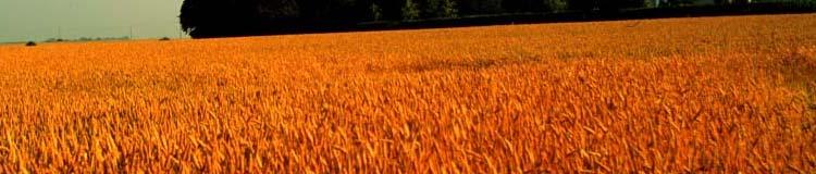

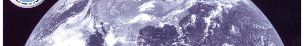
3 The Region. Iconic Images of the Great Plains


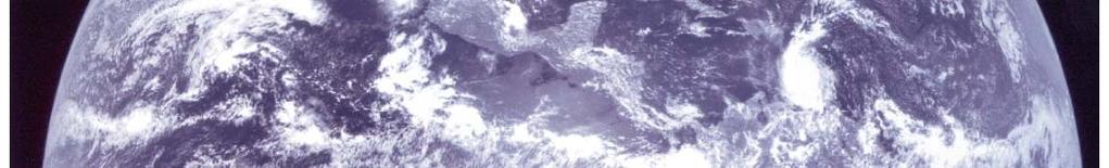
4 Interaction between People and Environment How do Environmental lprocesses Work? Flooding in Central Iowa, 2008 New Orleans, 2005
5 Cedar Rapids, Iowa, 2008


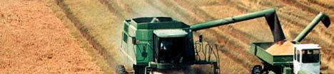
6 Movement of People and Materials
7 Every Place in Unique, Mill Lake RCNP
8 01_01tl.jpg01tl.jpg


9 Main Street Is a Micro region. Disneyland Typical


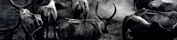
10 Cattle from Different Regions
11 The Earth s Four (4) Spheres: 1. The atmosphere = the collection of gases that surrounds the planet 2. The hydrosphere = the water part including oceans, rivers and lakes 3. The lithosphere = the solid part including rocks, minerals, and sediments 4. The biosphere = the living i organisms and ecosystems of the planet These intersect at or near the surface of the earth.
12 01_08c.jpg08c.jpg
13 Tools for cartography 1. Fieldwork and observation 2. Statistical data 3. Remote sensors = satellites and related technology 4. GPS = Global Positioning System 5. GIS = Geographic Information Systems


14 01_27.JPG
15 Radar Image of Antarctica


16 Types of Remote Sensing Systems 01_23.JPG
17 01_24.JPG Global Positioning Works by triangulation of signals from 3 satellites

18 01_29a.jpg
19 Types of Maps A map is a representation of some aspect of some part of the earth s surface. There are two basic types of maps. 1. General This type of map has many different types ofinformationonit on it, andcan be used for many different purposes. For example U.S.G.S. topographic map. 2. Thematic This is a specialized type of map showing one major theme or idea. For example: Population Density, Average Household Income, Annual Precipitation Total.


20 App_A05.JPGA05.JPG U.S.G.S. Topographic Map is a general use map because it contains many different types of information


21 Earth s Climate Regions This is an example of a thematic map because it displays information about only one topic or theme
22 Example of a Thematic Map
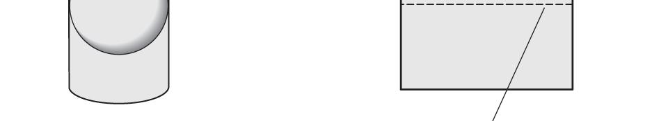
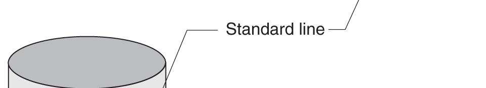
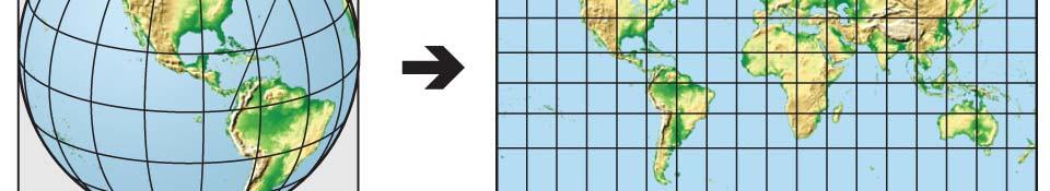
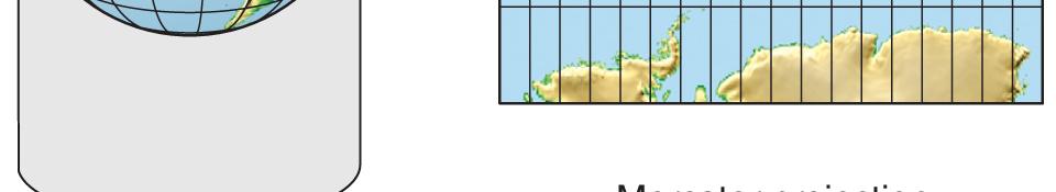
23 Map Projections A map projection is the geometric transformation (of a grid such as longitude and latitude) from a globe or a sphere (3 d) to a flat (2 d) map. This means that something has to be distorted from one part of the map to another. 1. Distance 2. Size 3. Shape 4. Direction There are projections on to 3 basic geometric forms: 1. Cylinder cylindrical projection 2. Cone conic projection 3. Disk gnomic or azimuthal projection
24 Accurate But Not Usable


25 01_21a.jpg
26 01_20b.jpg
27 01_21c.jpg


28 Projection onto a disk or a plane, the gnomic or azimuthal projection N t it l t h Note, it only touches the globe at one point


29 The Grid of Latitude and Longitude Lines Locates Any Point on the Earth


30 Lines of Latitude Run East West, But Locate Position Norht South Latitude is Measured from the Equator
31 01_11a.jpg11a.jpg
32 Lines of Longitude Run North South, But Locate Position East West Longitude is Measured from The Prime Meridian
33 Meridians Converge So 1 of Longitude Gets Shorter across the Distance from Equator to Pole
34 Locating Position Latitude and Longitude Locates Name Position Base End Range Lines Latitude N S Equator Poles 0 90 Parallel (Parallels) Longitude E W Prime M. Int. Date Line Converge at Poles (Meridians A degree of Latitude or Longitude (at the equator) is about 70 miles. Each degree is subdivided into 60 minutes. So each minute represents 1.1 statute (land) miles or 1 nautical mile. Each minute is subdivided into 60 seconds. So each second represents 101 feet. The Denton County Courthouse is 33 12' 31" N. Lat. 97 7' 32" W. Long. These simple coordinates locate the courthouse to within 100 feet of its actual location. Note that this is about the size of the building itself.
35 Great Circles Divide the Earth into Two Equal Halves and Define the Shortest Route Between Any Two Points


36 The Sextant Measures Latitude

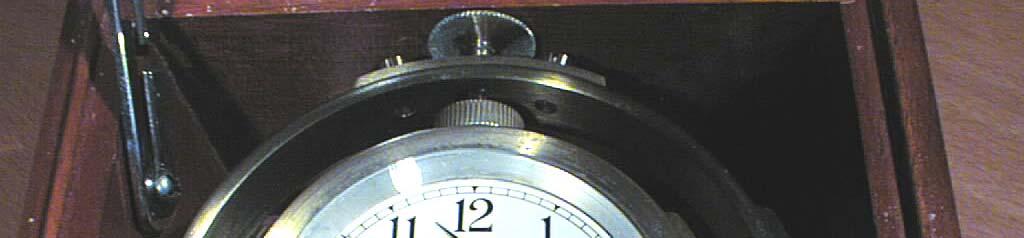

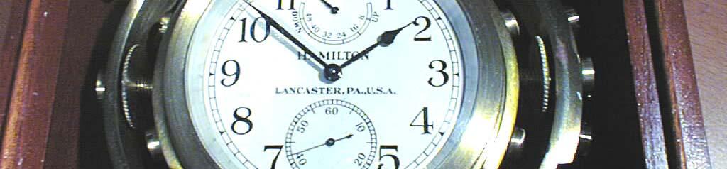


37 The Marine Chronometer Was the First Clock Accurate Enough to Determine Longitude
The World of Geography Pre-Test/Study Guide Chapter 1 Test
 Read each statement or question. On the lines below write the letter of the best answer. 1. Geographers look at the Earth 5. What are the two specific A. by studying cities first. measurements of Earth
MR. GOFF S WORLD HISTORY UNIT ONE: GEOGRAPHY 5 THEMES OF GEOGRAPHY
 MR. GOFF S WORLD HISTORY UNIT ONE: GEOGRAPHY 5 THEMES OF GEOGRAPHY BYOD BRING YOUR OWN DEVICE IN SMALL GROUPS (3-4), USE YOUR ELECTRONIC DEVICE(S) AND DEFINE THE FOLLOWING VOCAB. WORDS 1. GEOGRAPHY 2.
Chapter 3 Models of the Earth. 3.1 Finding Locations on the Earth. 3.1 Objectives
 Chapter 3 Models of the Earth 3.1 Finding Locations on the Earth 3.1 Objectives Explain latitude and longitude. How can latitude and longitude be used to find locations on Earth? How can a magnetic compass
Ch2&3 Test. Multiple Choice Identify the choice that best completes the statement or answers the question.
 Ch2&3 Test Multiple Choice Identify the choice that best completes the statement or answers the question. 1. Earth s circumference is about 40,000 km, and its shape is a. an oval. c. a perfect sphere.
Chapter 1. Essentials of Geography Pearson Education, Inc.
 Chapter 1. Essentials of Geography Learning Objectives Define geography in general and physical geography in particular. Discuss human activities and human population growth as they relate to geographic
Geography involves the study of places: their locations, their characteristics, and how humans use and move around them.
 Physical Geography Looking at the Earth Geography involves the study of places: their locations, their characteristics, and how humans use and move around them. NEXT Physical Geography Looking at the Earth
Map Projections. Displaying the earth on 2 dimensional maps
 Map Projections Displaying the earth on 2 dimensional maps Map projections Define the spatial relationship between locations on earth and their relative locations on a flat map Are mathematical expressions
Some of these parallels are very important. In the Northern Hemisphere, there is the Tropic of Cancer and the Arctic Circle.
 PDF 2 Geographic coordinates 1 The geographic coordinates system is network of imaginary horizontal and vertical lines that are drawn on globes or maps. These lines are called parallels (lines of latitude)
Introduction to Geography
 Introduction to Geography What is geography? Geography comes from the Greek word Geographia. Geo means earth and graphia means to describe or chart. Geographers study the earth in relation to space and
Shape e o f f the e Earth
 1 Coordinate Systems & Projections Coordinate Systems Two map layers are not going to register spatially unless they are based on the same coordinate system. 2 Contents Shape of the earth Datum Projections
Introduction to Geography
 Introduction to Geography ropic of Cancer 3½ N Arctic Circle 90 N Prime Meridian 0 Arctic Ocean Mississippi R. Appalachian Mts. Europe Rocky Mountains N. America Atlantic Gulf of Ocean Mexico Caribbean
1. Write down the term 2. Write down the book definition 3. Put the definition in your own words 4. Draw an image and/or put a Real Life Example
 Unit 1 Vocabulary 1. Write down the term 2. Write down the book definition 3. Put the definition in your own words 4. Draw an image and/or put a Real Life Example Absolute Location Where Is It EXACTLY?
THE EARTH AND ITS REPRESENTATION
 UNIT 7 THE EARTH AND ITS REPRESENTATION TABLE OF CONTENTS 1 THE EARTH AND THE SOLAR SYSTEM... 2 2 THE EARTH S MOVEMENTS... 2 2.1 Rotation.... 2 2.2 The revolution of the Earth: seasons of the year....
Key Issue #1. How do geographers describe where things are? 2014 Pearson Education, Inc.
 Key Issue #1 How do geographers describe where things are? Learning Outcomes 1.1.1: Explain differences between early maps and contemporary maps. 1.1.2: Describe the role of map scale and projections and
WHERE ARE YOU? Maps & Geospatial Concepts Fall 2012
 WHERE ARE YOU? Maps & Geospatial Concepts Fall 2012 Where are you? Relative location I m at school Absolute Location 45 26 18.07 122 43 50.78 Datums Datums A reference surface of the Earth Used as the
Introduction to Cartography GEOG 2016 E. Lecture-2 Geodesy and Projections
 Introduction to Cartography GEOG 2016 E Lecture-2 Geodesy and Projections What is Geodesy? The science of geodesy determines: Earth s shape and Interrelation of different points on earth s surface The
Mapping Our World Chapter 2
 Mapping Our World Chapter 2 Section 2.1: Latitude and Longitude Maps are flat models of threedimensional objects. For thousands of years people have used maps to define borders and to find places. With
Outline. Shape of the Earth. Geographic Coordinates (φ, λ, z) Ellipsoid or Spheroid Rotate an ellipse around an axis. Ellipse.
 Ellipsoid or Spheroid Rotate an ellipse around an axis. Ellipse.") Map Projections Outline Geodesy and map projections Prof. D. Nagesh Kumar Department of Civil Engineering Indian Institute of Science Bangalore 560 012, India http://www.civil.iisc.ernet.in/~nagesh Shape
Map Projections Outline Geodesy and map projections Prof. D. Nagesh Kumar Department of Civil Engineering Indian Institute of Science Bangalore 560 012, India http://www.civil.iisc.ernet.in/~nagesh Shape
Map Projections & Coordinate Systems
 Map Projections & Coordinate Systems 9/7/2017 1 Why? Laying the Earth Flat Need convenient means of measuring and comparing distances, directions, areas, shapes. Traditional surveying instruments measure
Introduction to Geographic Information Science. Updates/News. Last Lecture. Geography 4103 / Map Projections and Coordinate Systems
 Geography 4103 / 5103 Introduction to Geographic Information Science Map Projections and Coordinate Systems Updates/News Thursday s lecture Reading discussion 1 find the readings online open questions,
WHERE ARE YOU? Maps & Geospatial Concepts Fall 2015
 WHERE ARE YOU? Maps & Geospatial Concepts Fall 2015 Where are you? Relative location I m at school Absolute Location 45 26 18.07 122 43 50.78 Where is Boston? Introducing Geodesy, Ellipsoids & Geoids Geodesy
Georeferencing. Place names Postal addresses Postal codes Coordinate systems (lat/long, UTM, etc.)
") Georeferencing Georeferencing Used to describe the act of assigning locations to data or information Certain requirements include that they are: unique, have shared meaning, and are persistent through
Georeferencing Georeferencing Used to describe the act of assigning locations to data or information Certain requirements include that they are: unique, have shared meaning, and are persistent through
Name Class Date. For each pair of terms, explain how the meanings of the terms differ.
 Skills Worksheet Chapter Review USING KEY TERMS For each pair of terms, explain how the meanings of the terms differ. 1. true north and magnetic north 2. latitude and longitude 3. equator and prime meridian
AP Human Geography Chapter 1: Thinking Geographically Key Issue 1: How do Geographers describe where things are?
 AP Human Geography Chapter 1: Thinking Geographically Key Issue 1: How do Geographers describe where things are? Studying Human Geography Physical Geography Physical geography deals with Earth s natural
Exploring Geography. Chapter 1
 Exploring Geography Chapter 1 The Study of Geography Geography is the study of where people, places, and things are located and how they relate to each other. Greek meaning writing about or describing
Latitude and Longitude Pre Test
 Name Date Latitude and Longitude Pre Test Multiple Choice Directions: For questions, 1 10 circle the answer that letter that best answers the question. Each question is worth 1 point each. 1. To locate
Georeferencing, Map Projections, Cartographic Concepts. -Coordinate Systems -Datum
 Georeferencing, Map Projections, Cartographic Concepts -Map Projections -Coordinate Systems -Datum Map projection is "the process of systematically transforming positions on the Earth's spherical surface
2. GETTING STARTED WITH GIS
 2. GETTING STARTED WITH GIS What are geographic information systems and what are they used for? ArcGIS: ArcMap, ArcCatalog and ArcToolbox Vector data vs. raster data vs. attribute tables Polygons, polylines,
ESSENTIALS of GEOGRAPHY. Physical Geography (Geog. 300) Prof. Hugh Howard American River College
 Prof. Hugh Howard American River College") ESSENTIALS of GEOGRAPHY Physical Geography (Geog. 300) Prof. Hugh Howard American River College GEOGRAPHY GEOGRAPHY Earth description, or study of Earth Describes the natural environment and human interaction
ESSENTIALS of GEOGRAPHY Physical Geography (Geog. 300) Prof. Hugh Howard American River College GEOGRAPHY GEOGRAPHY Earth description, or study of Earth Describes the natural environment and human interaction
1. Geospatial technology rarely links geospatial data to nonspatial data. a. True *b. False
 Chapter 2 Where in the Geospatial World Are You? 1. Geospatial technology rarely links geospatial data to nonspatial data. 2. For geospatial technology to work, every location on Earth must be: a. inhabited
Unit 1 All. Study online at quizlet.com/_3l51hr
 Unit 1 All Study online at quizlet.com/_3l51hr 1. geography: 4. 7 APHG Units+: The study of the distribution and interaction of physical and human features on the earth 2. physical geography: 1. Geography:
Chapter 02 Maps. Multiple Choice Questions
 Chapter 02 Maps Multiple Choice Questions 1. Every projection has some degree of distortion because A. a curved surface cannot be represented on a flat surface without distortion. B. parallels and meridians
Chapter 1: The World of Geography
 Chapter 1: The World of Geography Chapter 1: What is Geography? *It is the study of our earth; our home. OR *Anything that can be mapped! *Geography mixes up the physical and human aspects of our world
Mapping Earth s Surface Chapter 2 Section 3
 Mapping Earth s Surface Chapter 2 Section 3 Day 1 Objective I will understand maps can be used to find locations on Earth and to represent information about features on Earth s Surface I will understand
Applied Cartography and Introduction to GIS GEOG 2017 EL. Lecture-1 Chapters 1 and 2
 Applied Cartography and Introduction to GIS GEOG 2017 EL Lecture-1 Chapters 1 and 2 What is GIS? A Geographic Information System (GIS) is a computer system for capturing, storing, querying, analyzing and
UNIT 1 THE BASICS OF GEOGRAPHY
 UNIT 1 THE BASICS OF GEOGRAPHY CHAPTER 1 LOOKING AT THE EARTH 1 Section 1.1: The 5 Themes of Geography.Geography comes from a Greek word meaning writing about or describing the earth. Geography is: Geographers
Maps: Geography s Basic Tools
 Maps: Geography s Basic Tools What is a map? - A map is a representation of the earth s features drawn on a flat surface. - Maps use points, lines, colours, and symbols to represent the features of an
Test Bank Chapter 2: Representations of Earth
 Multiple Choice Test Bank Chapter 2: Representations of Earth 1. A rhumb line on a Mercator projection is a line of. a. true size b. true shape c. true compass bearing d. true location 2. Maximum longitude
UNIT 1: THE PLANET EARTH
 UNIT 1: THE PLANET EARTH How many planets are there in our Solar System? What is the Equator? Why does life exist in our planet? Does The Earth move? What is a map? 1. Planet Earth TOPICS 2. Movements
netw rks Guided Reading Activity Essential Question: How does geography influence the way people live? What Is Geography?
 Guided Reading Activity What Is Geography? Lesson 1 Thinking Like a Geographer Essential Question: How does geography influence the way people live? Directions: Read the lesson and use your textbook to
Send Completed HW to:
 Section 1.1 What Is Earth Science? This section explains what Earth science is and what Earth scientists study. Reading Strategy Categorizing As you read about the different branches of Earth science,
Navigation. Longitude and Latitude Foundations of Navigation. MTPs:
 Navigation 3.01 Foundations of Navigation References: FTGU pages 177-178, 184-190 Transport Canada Study and Reference Guide Glider Pilot Canada Flight Training Manual Pilot Navigation http://en.wikipedia.org/wiki/transverse_mercator_projection#spherical_transverse_mercator
Mapping Earth. How are Earth s surface features measured and modeled?
 Name Mapping Earth How are Earth s surface features measured and modeled? Before You Read Before you read the chapter, think about what you know about maps Record your thoughts in the first column Pair
Notes on Projections Part II - Common Projections James R. Clynch February 2006
 Notes on Projections Part II - Common Projections James R. Clynch February 2006 I. Common Projections There are several areas where maps are commonly used and a few projections dominate these fields. An
2 Mapping Earth Reading Essentials. 2. Contrast What is the difference between a map view and a profile view?
 Mapping Earth Maps What do you think? Read the three statements below and decide whether you agree or disagree with them. Place an A in the Before column if you agree with the statement or a D if you disagree.
What is Geography? Lecture 1 The Earth As A Rotating Planet. What is Geography? What is geography? Subfields of Geography?
 Lecture 1 The Earth As A Rotating Planet Geog210 Physical Geography What is Geography? Much more than place names and locations The study of spatial variation How and why things differ from place to place
STUDY GUIDE. Exploring Geography. Chapter 1, Section 1. Terms to Know DRAWING FROM EXPERIENCE ORGANIZING YOUR THOUGHTS
 For use with textbook pages 19 22. Exploring Geography Terms to Know location A specific place on the earth (page 20) absolute location The exact spot at which a place is found on the globe (page 20) hemisphere
Number in your response section 1-5. Write the letter to the matching Theme of Geography. (Do not use your notes)
") Matching/Review Number in your response section 1-5. Write the letter to the matching Theme of Geography. (Do not use your notes) 1. Location a. The ability of people, goods, and ideas to spread from one
Matching/Review Number in your response section 1-5. Write the letter to the matching Theme of Geography. (Do not use your notes) 1. Location a. The ability of people, goods, and ideas to spread from one
What is a map? A Map is a two or three-dimensional model or representation of the Earth s surface. 2-Dimensional map
 What is a map? A Map is a two or three-dimensional model or representation of the Earth s surface. 2-Dimensional map What is a Map Projection? Planar Projection Projection A Projection is a mathematical
Unit 1 The Basics of Geography. Chapter 1 The Five Themes of Geography Page 5
 Unit 1 The Basics of Geography Chapter 1 The Five Themes of Geography Page 5 Geography comes from the Greek word geographia, which means to describe the earth. Geography is the study of the distribution
EnvSci360 Computer and Analytical Cartography
 EnvSci360 Computer and Analytical Cartography Lecture 3 Geodesy Map Projections, Datums, and Coordinate Systems 1 Geodesy The science of measuring and representing the shape and size of the earth, and
The Nature of Spatial Data. Keith C. Clarke Geography UCSB
 The Nature of Spatial Data Keith C. Clarke Geography UCSB Geographic primitives G = g (x, y, z, s, A, t) [x, y, z] = f(λ, φ, d) Geography also highly dependent upon model First, the datum (d) Models of
MR. JOHNSON S. Geography OHIO COUNTY MIDDLE SCHOOL
 MR. JOHNSON S Geography OHIO COUNTY MIDDLE SCHOOL CHAPTER 1 Geography The science of geography is likely the oldest of all sciences. Geography is the answer to the question that the earliest humans asked,
Lesson 5: Map Scale and Projections
 Organizing Data and Information Lesson 5: Map Scale and Projections Map Scales Projections Information can be organized as lists, numbers, tables, text, pictures, maps, or indexes. Clusters of information
History of Cartography,
 Maps History of Cartography, the art and science of making maps ~2300 BC ~600 BC Early oldest known maps: Babylonian clay tablets. Greek and Roman Ptolemy s (about AD 85-165) "world map" depicted the Old
Map Projections. What does the world look like? AITOFF AZIMUTHAL EQUIDISTANT BEHRMANN EQUAL AREA CYLINDRICAL
 Map Projections What does the world look like? AITOFF AZIMUTHAL EQUIDISTANT BEHRMANN EQUAL AREA CYLINDRICAL 1 CYLINDRICAL EQUAL AREA BONNE CRASTER PARABOLIC 2 ECKERT I ECKERT III ECKERT V There are many
The Earth is a Rotating Sphere
 The Earth is a Rotating Sphere The Shape of the Earth Earth s Rotation ( and relative movement of the Sun and Moon) The Geographic Grid Map Projections Global Time The Earth s Revolution around the Sun
Unit 1: Basics of Geography Test Review
 Name Date Period Unit 1: Basics of Geography Test Review Directions: Reading the following sections and complete the questions, charts, and diagrams. Types of Maps Maps that have a particular theme are
Map Master Skills Handbook
 1 Map Master Skills Handbook Five Themes of Geography Understanding Globes How To Use A Map Human Migration Notebook Number Mr. Graver Old World Cultures Name Period 2 In this chapter, you ll be introduced
1. Define map: 2. Name and define the five concepts that guide geographers a) 3. Define cartography: MAPS 4. A map serves two purposes a)
 3. Define cartography: MAPS 4. A map serves two purposes a)") 1. Define map: 2. Name and define the five concepts that guide geographers c) d) e) 3. Define cartography: MAPS 4. A map serves two purposes 5. Give two examples of early mapmaking and its (unusual?) materials
1. Define map: 2. Name and define the five concepts that guide geographers c) d) e) 3. Define cartography: MAPS 4. A map serves two purposes 5. Give two examples of early mapmaking and its (unusual?) materials
Chapter 1 Introduction to the Earth
 Chapter 1 Introduction to the Earth What is Geography? The study of the earth as the home of humankind. Greek - Eratosthenes Father of Geography Geo means Earth Graphy means to write Study how things are
Geographers Tools: Location Systems Prof. Anthony Grande Hunter College Geography
 5 Geographers Tools: Location Systems Prof. Anthony Grande Hunter College Geography Lecture design, content and presentation AFG 0119 Individual images and illustrations may be subject to prior copyright.
PHYSICAL GEOGRAPHY. By Brett Lucas
 PHYSICAL GEOGRAPHY By Brett Lucas INTRODUCTION Introduction to Earth Geography as a Field of Learning Geography is from two Greek words, Geo Earth, and Graphien to write. Elements/Branches of Geography
NR402 GIS Applications in Natural Resources Lesson 4 Map Projections
 NR402 GIS Applications in Natural Resources Lesson 4 Map Projections From http://www.or.blm.gov/gis/ 1 Geographic coordinates Coordinates are expressed as Latitude and Longitude in Degrees, Minutes, Seconds
Geographers Tools: Maps and their Parts
 MP MKIG Geographers Tools: Maps and their Parts Prof. nthony Grande Hunter ollege Geography Lecture design, content and presentation FG 0616. Individual images and illustrations may be subject to prior
Dirty REMOTE SENSING : Lecture 8 A mapping interlude..
 Dirty REMOTE SENSING : Lecture 8 A mapping interlude.. Stuart Green Teagasc Spatial Analysis Group Stuart.green@teagasc.ie Web for the Week: http://electronics.howstuffworks.com/gps.htm http://www.cstars.ucdavis.edu/classes/ers186-w03/lecture17/lecture17.ppt
Recall: The scale transformation
 Recall: The scale transformation Geography 12: Maps and Spatial Reasoning Lecture 3: Map Projection Basics Professor Keith Clarke 1:400M The real world A representation of the world A cartographic problem
Texas Geography. Understanding the physical and human characteristics of our state
 Texas Geography Understanding the physical and human characteristics of our state To understand Texas you must first learn about its Geography. Geography- The study of the world, its people, and the interaction
Earth Science Chapter 1: Introduction to Earth Science. Edward J. Tarbuck & Frederick K. Lutgens
 Earth Science Chapter 1: Introduction to Earth Science Edward J. Tarbuck & Frederick K. Lutgens Earth Science v Encompasses all sciences that seek to understand: Earth Earth's neighbors in space v Earth
CHAPTER EXIT CHAPTER. Models of Earth. 3.1 Modeling the Planet. 3.2 Mapmaking and Technology. 3.3 Topographic Maps CHAPTER OUTLINE
 EXIT CHAPTER.1 Modeling the Planet.2 Mapmaking and Technology. Topographic Maps CHAPTER OUTLINE CHAPTER.1 Modeling the Planet A flat of Earth is a convenient tool, but it can distort the shape, distance,
Warmup. geography compass rose culture longitude
 Warmup geography compass rose culture longitude ecosystem latitude 1. study of the special physical and human characteristics of a place or region 2. learned system of shared beliefs, traits, and values
What is Geography? *Mixes up the physical and human aspects of our world into one field of study.
 World Geography What is Geography? *It is the study of the earth *Mixes up the physical and human aspects of our world into one field of study. *Shows the relationship between people and the environment.
Map Skills and Geographic Tools
 Name: Period: Map Skills and Geographic Tools TEKS: 8.9C interpret topographic maps and satellite views to identify land and erosional features and predict how these features may be reshaped by weathering
Map Projections 2/4/2013. Map Projections. Rhumb Line (Loxodrome) Great Circle. The GLOBE. Line of constant bearing (e.g., 292.
 Great Circle. The GLOBE. Line of constant bearing (e.g., 292.") The GLOBE ADVANTAGES Directions True Distances True Shapes True Area True DISADVANTAGES Very small scale with little detail. Costly to reproduce and update. Difficult to carry around. Bulky to store. FACTS
The GLOBE ADVANTAGES Directions True Distances True Shapes True Area True DISADVANTAGES Very small scale with little detail. Costly to reproduce and update. Difficult to carry around. Bulky to store. FACTS
Modern Navigation. Thomas Herring
 12.215 Modern Navigation Thomas Herring Today s class Map Projections: Why projections are needed Types of map projections Classification by type of projection Classification by characteristics of projection
About places and/or important events Landmarks Maps How the land is, hills or flat or mountain range Connected to maps World Different countries
 What do you think you know about geography? About places and/or important events Landmarks Maps How the land is, hills or flat or mountain range Connected to maps World Different countries What do you
Map Projections (Part 1)
") 1 Earth is a round, maps are not. Four projection families. Equivalent (Equal Area) projections Preserves relative areas Commonly used for thematic maps Ex: Albers Conformal projections Preserve angles,
1 Earth is a round, maps are not. Four projection families. Equivalent (Equal Area) projections Preserves relative areas Commonly used for thematic maps Ex: Albers Conformal projections Preserve angles,
Chapter One. Thinking Geographically
 Chapter One Thinking Geographically Where are you? Tell me where you are. How do you know? Important Terms Map two dimensional or flat scale model of the Earth. Place A specific Point on the Earth s surface.
Importance of Understanding Coordinate Systems and Map Projections.
 Importance of Understanding Coordinate Systems and Map Projections. 1 It is extremely important that you gain an understanding of coordinate systems and map projections. GIS works with spatial data, and,
A. Spatial Sense (Working with Maps, Globes, and Other Geographic Tools)
") A. Spatial Sense (Working with Maps, Globes, and Other Geographic Tools) Measuring Distance Using Map Scale All maps are drawn to scale; that is, they are smaller than the things they represent. Scale
A. Spatial Sense (Working with Maps, Globes, and Other Geographic Tools) Measuring Distance Using Map Scale All maps are drawn to scale; that is, they are smaller than the things they represent. Scale
Introduction to Geoinformatics I
 Introduction to Geoinformatics I MAP CONCEPT Definition: 1) A map is a visual representation of an area a symbolic depiction highlighting relationships between elements of that space such as objects, regions,
Map projections. Rüdiger Gens
 Rüdiger Gens 2 Outline! Relevant terms! Why map projections?! Map projection categories " Projection surfaces " Features preserved from distortions! Map projection examples! Right choice Relevant terms!
Use your text to define the following term. Use the terms to label the figure below. Define the following term.
 Mapping Our World Section. and Longitude Skim Section of your text. Write three questions that come to mind from reading the headings and the illustration captions.. Responses may include questions about
Different types of maps and how to read them.
 Different types of maps and how to read them. A map is a picture or representation of the Earth's surface, showing how things are related to each other by distance, direction, and size. Maps have been
APPENDIX A GLOSSARY. Appendix A.1
 APPENDIX A GLOSSARY Appendix A.1 Appendix A.2 Back Bearing A back bearing is measured from the object to your position. It is the exact opposite of a direct bearing. Base Line An imaginary line on the
What is a Map Projection?
 What is a Map Projection? It is how we represent a three dimensional Earth on a flat piece of paper However The process of transferring information from the Earth to a map causes every projection to distort
First Exam: New Date. 6 Geographers Tools Maps and their Parts 9/14/2017 MAP MAKING MAP MAKING MAP PROJECTIONS MAP PROJECTIONS
 6 Geographers Tools Maps and their Parts Prof. nthony Grande Hunter ollege Geography Lecture design, content and presentation FG 0917. Individual images and illustrations may be subject to prior copyright.
ch02.pdf chap2.pdf chap02.pdf
 Introduction to Geographic Information Systems 8th Edition Karl Solutions Manual Full Download: http://testbanklive.com/download/introduction-to-geographic-information-systems-8th-edition-karl-solutions-manu
Working with georeferenced data. What is georeferencing? Coordinate Systems. Geographic and Projected Coordinate System
 GIS501 Fundamentals of Geographical Information Systems (GIS) Coordinate Systems Working with georeferenced data What is georeferencing? Geographically referenced data which is, in some way, referenced
Topographic Maps and Landforms Geology Lab
 Topographic Maps and Landforms Geology Lab Ray Rector: Instructor Today s Lab Activities 1) Discussion of Last Week s Lab 2) Lecture on Topo Maps and Elevation Contours 3) Construct Topographic Maps and
Name Class Date. Write the letter that best answers the question or completes the statement on the line provided.
 Chapter 1 Introduction to Earth Science Chapter Study Guide Multiple Choice Write the letter that best answers the question or completes the statement on the line provided. 1. Which of the following is
What Is a Globe? Hemispheres. Main Idea Globes and maps provide different ways of showing features of the earth. Terms to Know
 r Main Idea Globes and maps provide different ways of showing features of the earth. Terms to Know hemisphere latitude longitude scale bar scale relief elevation contour line What Is a Globe? A globe is
Plane coordinates ~~~~~~~~~~
 Coordinate Systems & Map Projections Geographic coordinates A Basic Introduction to Coordinate Systems & Map Projections Latitude & longitude Angles Parallels & meridians Lines Plane coordinates ~~~~~~~~~~
Geographic coordinate systems
 1 Geographic coordinate systems In this chapter you ll learn about longitude and latitude. You ll also learn about the parts that comprise a geographic coordinate system including Spheres and spheroids
Geographers Perspectives on the World
 What is Geography? Geography is not just about city and country names Geography is not just about population and growth Geography is not just about rivers and mountains Geography is a broad field that
Map Projections & Coordinate Systems 9/10/2013. Why? M. Helper GEO327G/386G, UT Austin 2. M. Helper GEO327G/386G, UT Austin 4
 Map Projections & Coordinates Laing the earth flat Wh? Need convenient means of measuring and comparing distances, directions, areas, shapes. Traditional surveing instruments measure in meters or feet,
Map projections. Rüdiger Gens
 Rüdiger Gens Coordinate systems Geographic coordinates f a: semi-major axis b: semi-minor axis Geographic latitude b Geodetic latitude a f: flattening = (a-b)/a Expresses as a fraction 1/f = about 300
4th Grade US Regional Geography First Nine Weeks
 4th Grade US Regional Geography First Nine Weeks 2014-2015 Identify the choice that best completes the statement or answers the question. 1 The line identified as 0 runs west and east on the globe and
CHAPTER 1: KEY ISSUE 1 How Do Geographers Describe Where Things Are? p. 4-13
 CHAPTER 1: KEY ISSUE 1 How Do Geographers Describe Where Things Are? p. 4-13 Always keep your vocabulary packet out whenever you take notes. As the term comes up in the text, add to your examples for the
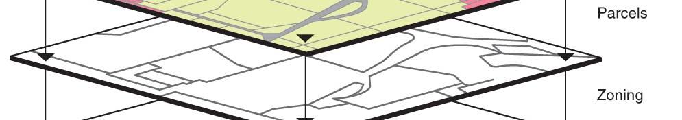
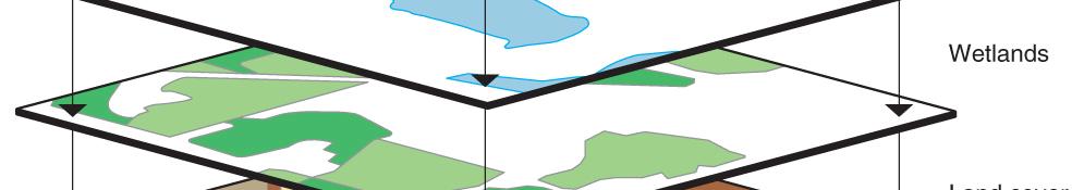
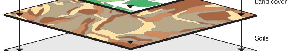
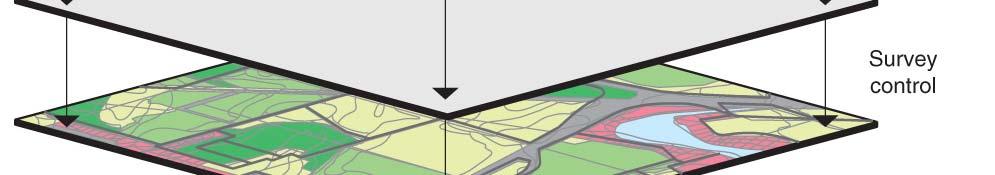
This week s topics. Week 6. FE 257. GIS and Forest Engineering Applications. Week 6
 FE 257. GIS and Forest Engineering Applications Week 6 Week 6 Last week Chapter 8 Combining and splitting landscape features and merging GIS databases Chapter 11 Overlay processes Questions? Next week