LAND SURFACE TEMPERATURE VALIDATION WITH IN SITU MEASUREMENTS
|
|
|
- Domenic Fletcher
- 5 years ago
- Views:
Transcription

1 LAND SURFACE TEMPERATURE VALIDATION WITH IN SITU MEASUREMENTS Group 7 Juan Manuel González Cantero Irene Grimaret Rincón Alex Webb Advisor: Darren Ghent


2 Research problem The project task is to design an experiment to validate clear-sky land surface temperature (LST) observations from space using ground-based measurements.
3 What is land surface temperature? Land surface temperature is the radiative skin temperature of the land. Land surface temperature is not the same as air temperature and can vary up to 10K over a few meters. It is influenced by conditions such as precipitations and albedo.

4 Motivations LST is important for assessing the surface energy balance between the atmosphere and the ground. LST is required for a wide variety of climatic, hydrological, ecological and biochemical studies.
5 Aim The aim is to validate satellite data with ground-based measurements so we can trust on that data. Ground measurements are point measurements and satellites measure areas, so we need to relate them.

6 Satellite Data SEVIRI can measure LST from geostationary orbit with 15min resolution. In the UK has ~6km spatial resolution.

7 Satellite Data ATSR and MODIS have 1km of spatial resolution. They have a lower temporal resolution than SEVIRI.

8 Case-study Area A 1km 2 region has been arbitrarily chosen because ATSR and MODIS have this resolution. This region has been chosen near to the University of Leicester for a hypothetical analysis.
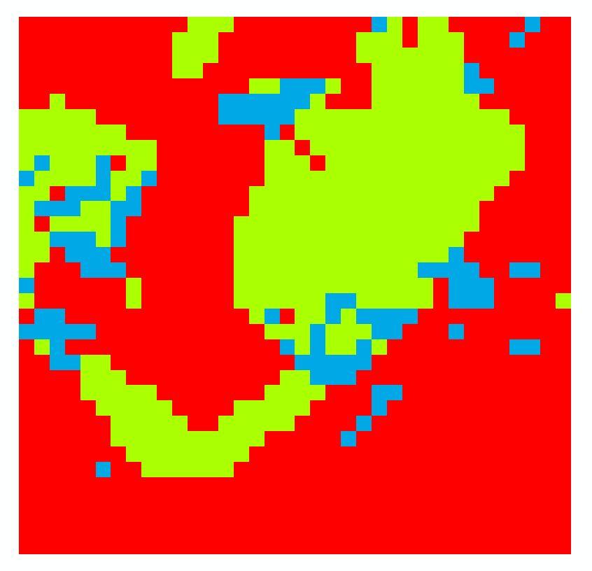
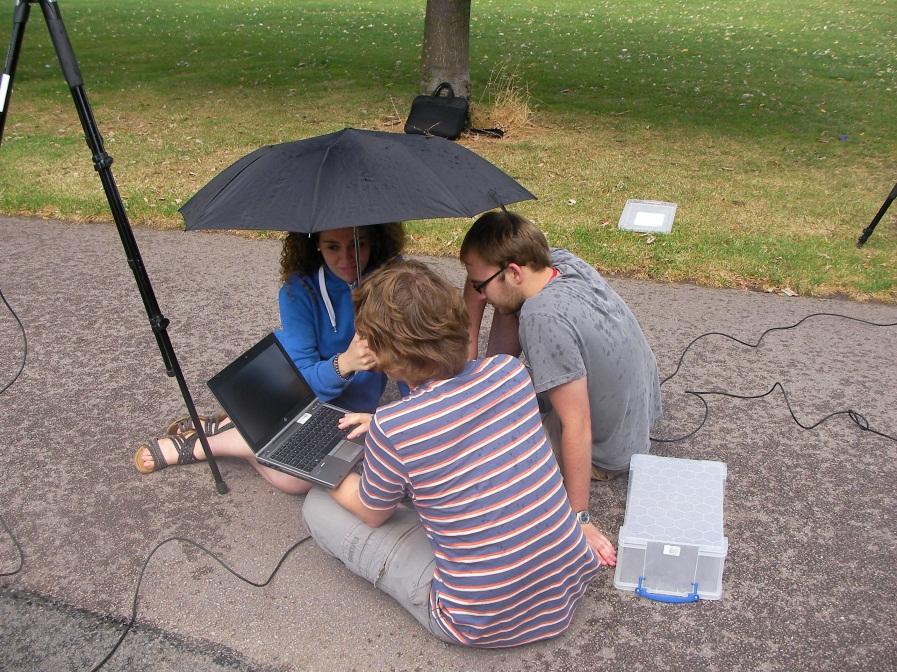
9 Methodology - Overview Three IR radiometers were available to measure LST on the ground, so it was necessary to divide our region into three land types. The LST of each type of land needed to be calculated as well as the percentage of each land type.
10 Methodology Land Classification In a Google Earth picture, the principal land types are: Trees Urban Grass A Landsat image has been downloaded and opened in the program ENVI.

11


12 Methodology Land Classification
13 Methodology Land Classification Blue zone: Deciduous trees Total area: 7.5%
14 Methodology Land Classification Red zone: Urban (Paving concrete) Total area: 63.2%
15 Methodology Land Classification Green zone: Green Grass Total area: 29.3%
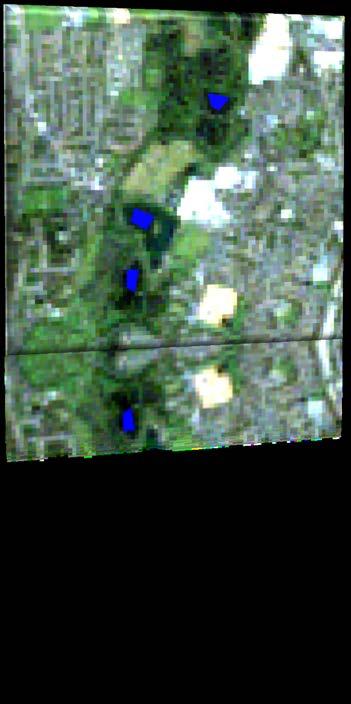
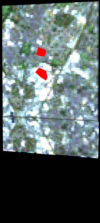
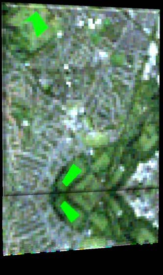
16 Methodology Field work
17 Methodology Field work
18 Methodology Field work
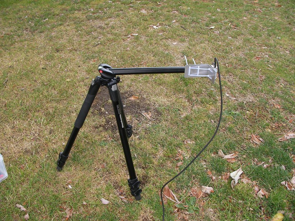
19 Methodology Field work

20 Methodology Field work Need to measure the brightness temperature of all surfaces at the same time when the satellite passes. Measurements are taken every second and averaged over a minute.


21 Methodology Field work A clear sky brightness temperature is also measured.
22 Methodology Problems The sky wasn t clear and it was raining.
23 Methodology Problems The sky wasn t clear and it was raining

24 Methodology Problems The sky wasn t clear and it was raining
25 Methodology Problems The sky wasn t clear and it was raining. The satellite cannot measure below clouds so will measure an incorrect LST if it is cloudy.
26 Methodology Problems The sky wasn t clear and it was raining. The satellite cannot measure below clouds so will measure an incorrect LST if it is cloudy. All urban zones were assumed with the same properties.
27 Methodology Problems The sky wasn t clear and it was raining. The satellite cannot measure below clouds so will measure an incorrect LST if it is cloudy. All urban zones were assumed with the same properties. Shadow regions have different LST s to sunny regions, but we assumed all zones were in sunlight.
28 Methodology Problems The sky wasn t clear and it was raining. The satellite cannot measure below clouds so will measure an incorrect LST if it is cloudy. All urban zones were assumed with the same properties. Shadow regions have different LST s to sunny regions, but we assumed all zones were in sunlight. Landsat has 30m resolution which makes the classification of the individual trees difficult.
29 Instrument calibration Each radiometer degrades over time so a correction needs to be applied. y 1 = x y 2 = x y 3 = x Where x i is the uncalibrated BT in the instrument i and y i is the calibrated BT.
30 Converting BT to LST B c T c = ε c B c T sss + 1 ε c B c T sss Where B c T c is the emitted radiance given by the Planck function for an effective BT in the channel c. B c T sss is the emitted radiance for surface temperature. ε c is the emissivity of the surface. B c T sss is the radiance for the effective BT of the sky.
31 Converting BT to LST The emissivity values for each surface were taken from the ASTER Spectral Library. The Library gives the emissivity in each wavelength and it is necessary to calculate an average in the range of the instruments.
32 Results Once the LST for each region has been calculated they need to be weighted by the surface fraction in the region: T sss = W tttt T sss,tttt + W ggggg T sss,ggggg +W uuuuu T sss,uuuuu Using this method the LST of the 1km 2 region is calculated as: T sss = 29.1
 than the urban zones.")
33 Interpretation of results The urban LST was calculated as 32.2 and the grass and trees were 24.2 and Looking at the Landsat LST image we can see that the park is colder (darker) than the urban zones. This agrees with our results. Victoria Park
34 Conclusion We have successfully demonstrated this method. This method is applicable to other places as well as Leicester. The LST calculated could not be compared with satellite data in this study because it was cloudy, but the method would work on a clear day.

35 Further work To repeat this experiment with more land classification types on a clear day and compare this results with actual satellite data.
36 References Prata, Trigo, Wan, ASTER spectral library,
37 Thank you!! Any question?
AN ACCURACY ASSESSMENT OF AATSR LST DATA USING EMPIRICAL AND THEORETICAL METHODS
 AN ACCURACY ASSESSMENT OF AATSR LST DATA USING EMPIRICAL AND THEORETICAL METHODS Elizabeth Noyes, Gary Corlett, John Remedios, Xin Kong, and David Llewellyn-Jones Department of Physics and Astronomy, University
C. Jimenez, C. Prigent, F. Aires, S. Ermida. Estellus, Paris, France Observatoire de Paris, France IPMA, Lisbon, Portugal
 All-weather land surface temperature estimates from microwave satellite observations, over several decades and real time: methodology and comparison with infrared estimates C. Jimenez, C. Prigent, F. Aires,
OSI SAF SST Products and Services
 OSI SAF SST Products and Services Pierre Le Borgne Météo-France/DP/CMS (With G. Legendre, A. Marsouin, S. Péré, S. Philippe, H. Roquet) 2 Outline Satellite IR radiometric measurements From Brightness Temperatures
Validation of Land Surface Temperatures derived from AATSR data at the Valencia Test Site
 Validation of Land Surface Temperatures derived from AATSR data at the Valencia Test Site César Coll, Vicente Caselles, Enric Valor, Raquel Niclòs, Juan M. Sánchez and Joan M. Galve Thermal Remote Sensing
GUEDJ Stephanie KARBOU Fatima RABIER Florence LSA-SAF User Workshop 2010, Toulouse
 CNRM/GAME GUEDJ Stephanie KARBOU Fatima RABIER Florence LSA-SAF User Workshop 2010, Toulouse INTRODUCTION (1/3) SEVIRI instrument Radiometer onboard METEOSAT-8/-9 (geostationnary) Measures «top-of-atmosphere»
A satellite-based long-term Land Surface Temperature Climate Data Record
 Federal Department of Home Affairs FDHA Federal Office of Meteorology and Climatology MeteoSwiss A satellite-based long-term Land Surface Temperature Climate Data Record, Virgílio A. Bento, Frank M. Göttsche,
APPLICATIONS WITH METEOROLOGICAL SATELLITES. W. Paul Menzel. Office of Research and Applications NOAA/NESDIS University of Wisconsin Madison, WI
 APPLICATIONS WITH METEOROLOGICAL SATELLITES by W. Paul Menzel Office of Research and Applications NOAA/NESDIS University of Wisconsin Madison, WI July 2004 Unpublished Work Copyright Pending TABLE OF CONTENTS
Principles of Radiative Transfer Principles of Remote Sensing. Marianne König EUMETSAT
 - Principles of Radiative Transfer Principles of Remote Sensing Marianne König EUMETSAT marianne.koenig@eumetsat.int Remote Sensing All measurement processes which perform observations/measurements of
ESTIMATION OF ATMOSPHERIC COLUMN AND NEAR SURFACE WATER VAPOR CONTENT USING THE RADIANCE VALUES OF MODIS
 ESTIMATION OF ATMOSPHERIC COLUMN AND NEAR SURFACE WATER VAPOR CONTENT USIN THE RADIANCE VALUES OF MODIS M. Moradizadeh a,, M. Momeni b, M.R. Saradjian a a Remote Sensing Division, Centre of Excellence
Measuring the surface temperatures of the earth from space. Darren Ghent, University of Leicester 13/09/2018
 Measuring the surface temperatures of the earth from space Darren Ghent, University of Leicester 13/09/2018 Contents Background Challenges of measuring Land Surface Temperature Applications Current capability
Improved assimilation of IASI land surface temperature data over continents in the convective scale AROME France model
 Improved assimilation of IASI land surface temperature data over continents in the convective scale AROME France model Niama Boukachaba, Vincent Guidard, Nadia Fourrié CNRM-GAME, Météo-France and CNRS,
Meteorological Satellite Image Interpretations, Part III. Acknowledgement: Dr. S. Kidder at Colorado State Univ.
 Meteorological Satellite Image Interpretations, Part III Acknowledgement: Dr. S. Kidder at Colorado State Univ. Dates EAS417 Topics Jan 30 Introduction & Matlab tutorial Feb 1 Satellite orbits & navigation
An experimental study of angular variations of brightness surface temperature for some natural surfaces
 An experimental study of angular variations of brightness surface temperature for some natural surfaces Juan Cuenca, José A. Sobrino, and Guillem Soria University of Valencia, c./ Dr. Moliner 5, 46 Burjassot,
INTERCOMPARISON OF METEOSAT-8 DERIVED LST WITH MODIS AND AATSR SIMILAR PRODUCTS
 INTERCOMPARISON OF METEOSAT-8 DERIVED LST WITH MODIS AND AATSR SIMILAR PRODUCTS Cristina Madeira, Prasanjit Dash, Folke Olesen, and Isabel Trigo, Instituto de Meteorologia, Rua C- Aeroporto, 700-09 Lisboa,
Satellite Radiance Data Assimilation at the Met Office
 Satellite Radiance Data Assimilation at the Met Office Ed Pavelin, Stephen English, Brett Candy, Fiona Hilton Outline Summary of satellite data used in the Met Office NWP system Processing and quality
Temperature and Emissivity from AHS data in the framework of the AGRISAR and EAGLE campaigns
 AGRISAR and EAGLE Campaigns Final Workshop 15-16 October 2007 (ESA/ESTEC, Noordwijk, The Netherlands) Temperature and Emissivity from AHS data in the framework of the AGRISAR and EAGLE campaigns J. A.
A Time Lag Model to Estimate Rainfall Rate Based on GOES Data
 A Time Lag Model to Estimate Rainfall Rate Based on GOES Data Nazario D. Ramirez, Robert J. Kuligowski, and Joan M. Castro Octava Reunión Nacional de Percepción Remota y Sistemas Geográficos de Información
Application of a Land Surface Temperature Validation Protocol to AATSR data. Dar ren Ghent1, Fr ank Göttsche2, Folke Olesen2 & John Remedios1
 Application of a Land Surface Temperature Validation Protocol to AATSR data Dar ren Ghent1, Fr ank Göttsche, Folke Olesen & John Remedios1 1 E a r t h O b s e r v a t i o n S c i e n c e, D e p a r t m
Lectures 7 and 8: 14, 16 Oct Sea Surface Temperature
 Lectures 7 and 8: 14, 16 Oct 2008 Sea Surface Temperature References: Martin, S., 2004, An Introduction to Ocean Remote Sensing, Cambridge University Press, 454 pp. Chapter 7. Robinson, I. S., 2004, Measuring
School on Modelling Tools and Capacity Building in Climate and Public Health April Remote Sensing
 2453-5 School on Modelling Tools and Capacity Building in Climate and Public Health 15-26 April 2013 Remote Sensing CECCATO Pietro International Research Institute for Climate and Society, IRI The Earth
Cloud detection using SEVIRI IR channels
 Cloud detection using SEVIRI IR channels Alessandro.Ipe@oma.be & Luis Gonzalez Sotelino Royal Meteorological Institute of Belgium GERB Science Team Meeting @ London September 9 10 2009 1 / 19 Overview
A high spectral resolution global land surface infrared emissivity database
 A high spectral resolution global land surface infrared emissivity database Eva E. Borbas, Robert O. Knuteson, Suzanne W. Seemann, Elisabeth Weisz, Leslie Moy, and Hung-Lung Huang Space Science and Engineering
Estimation of evapotranspiration using satellite TOA radiances Jian Peng
 Estimation of evapotranspiration using satellite TOA radiances Jian Peng Max Planck Institute for Meteorology Hamburg, Germany Satellite top of atmosphere radiances Slide: 2 / 31 Surface temperature/vegetation
Observing climate I: surface temperatures
 Observing climate I: surface temperatures John Remedios Earth Observation Science and NCEO Dept. of Physics and Astronomy U. Leicester Outline The Big Picture for Surface Temperature (ST) observations
Land Surface Temperature in the EUMETSAT LSA SAF: Current Service and Perspectives. Isabel Trigo
 Land Surface Temperature in the EUMETSAT LSA SAF: Current Service and Perspectives Isabel Trigo Outline EUMETSAT Land-SAF: Land Surface Temperature Geostationary Service SEVIRI Polar-Orbiter AVHRR/Metop
An Algorithm for Retrieving Land Surface Temperatures Using VIIRS Data in Combination with Multi-Sensors
 Sensors 2014, 14, 21385-21408; doi:10.3390/s141121385 Article OPEN ACCESS sensors ISSN 1424-8220 www.mdpi.com/journal/sensors An Algorithm for Retrieving Land Surface Temperatures Using VIIRS Data in Combination
Sunlight and Temperature
 Sunlight and Temperature Name Purpose: Study microclimate differences due to sunlight exposure, location, and surface; practice environmental measurements; study natural energy flows; compare measurements;
Comparison between Land Surface Temperature Retrieval Using Classification Based Emissivity and NDVI Based Emissivity
 Comparison between Land Surface Temperature Retrieval Using Classification Based Emissivity and NDVI Based Emissivity Isabel C. Perez Hoyos NOAA Crest, City College of New York, CUNY, 160 Convent Avenue,
RTTOV 10 Theory & Exercise
 RTTOV 10 Theory & Exercise Ø Overview of RTTOVS Radiative Transfer Model q Gases Absorption (water Vapor & other trace gases) q Aerosol/Clouds Scattering and Absorption q Surface Emissivity/Reflectivity
NEW SCHEME TO IMPROVE THE DETECTION OF RAINY CLOUDS IN PUERTO RICO
 NEW SCHEME TO IMPROVE THE DETECTION OF RAINY CLOUDS IN PUERTO RICO Joan Manuel Castro Sánchez Advisor Dr. Nazario Ramirez UPRM NOAA CREST PRYSIG 2016 October 7, 2016 Introduction A cloud rainfall event
AATSR DERIVED LAND SURFACE TEMPERATURE OVER A HETEROGENEOUS REGION
 AATSR DERIVED LAND SURFACE TEMPERATURE OVER A HETEROGENEOUS REGION José A. Sobrino (1), Guillem Sòria (1), Juan C. Jiménez- Muñoz (1), Belen Franch (1), Victoria Hidalgo (1) and Elizabeth Noyes (2). (1)
Comparison of cloud statistics from Meteosat with regional climate model data
 Comparison of cloud statistics from Meteosat with regional climate model data R. Huckle, F. Olesen, G. Schädler Institut für Meteorologie und Klimaforschung, Forschungszentrum Karlsruhe, Germany (roger.huckle@imk.fzk.de
Data assimilation of IASI radiances over land.
 Data assimilation of IASI radiances over land. PhD supervised by Nadia Fourrié, Florence Rabier and Vincent Guidard. 18th International TOVS Study Conference 21-27 March 2012, Toulouse Contents 1. IASI
AGRICULTURE DROUGHT AND FOREST FIRE MONITORING IN CHONGQING CITY WITH MODIS AND METEOROLOGICAL OBSERVATIONS *
 AGRICULTURE DROUGHT AND FOREST FIRE MONITORING IN CHONGQING CITY WITH MODIS AND METEOROLOGICAL OBSERVATIONS * HONGRUI ZHAO a ZHONGSHI TANG a, BIN YANG b AND MING ZHAO a a 3S Centre, Tsinghua University,
MSG system over view
 MSG system over view 1 Introduction METEOSAT SECOND GENERATION Overview 2 MSG Missions and Services 3 The SEVIRI Instrument 4 The MSG Ground Segment 5 SAF Network 6 Conclusions METEOSAT SECOND GENERATION
Lecture 3A: Interception
 3-1 GEOG415 Lecture 3A: Interception What is interception? Canopy interception (C) Litter interception (L) Interception ( I = C + L ) Precipitation (P) Throughfall (T) Stemflow (S) Net precipitation (R)
Spectral surface emissivity for use in assimilation of IR radiance data over land
 Spectral surface emissivity for use in assimilation of IR radiance data over land 1 2 Małgorzata Szczech-Gajewska, Florence Rabier 1 Institute of Meteorology and Water Management ul. P. Borowego 14, Kraków,
Blackbody radiation. Main Laws. Brightness temperature. 1. Concepts of a blackbody and thermodynamical equilibrium.
 Lecture 4 lackbody radiation. Main Laws. rightness temperature. Objectives: 1. Concepts of a blackbody, thermodynamical equilibrium, and local thermodynamical equilibrium.. Main laws: lackbody emission:
Comparison of NASA AIRS and MODIS Land Surface Temperature and Infrared Emissivity Measurements from the EOS AQUA platform
 Comparison of NASA AIRS and MODIS Land Surface Temperature and Infrared Emissivity Measurements from the EOS AQUA platform Robert Knuteson, Hank Revercomb, Dave Tobin University of Wisconsin-Madison 16
Study of the Influence of Thin Cirrus Clouds on Satellite Radiances Using Raman Lidar and GOES Data
 Study of the Influence of Thin Cirrus Clouds on Satellite Radiances Using Raman Lidar and GOES Data D. N. Whiteman, D. O C. Starr, and G. Schwemmer National Aeronautics and Space Administration Goddard
Comparison of NASA AIRS and MODIS Land Surface Temperature and Infrared Emissivity Measurements from the EOS AQUA platform
 Comparison of NASA AIRS and MODIS Land Surface Temperature and Infrared Emissivity Measurements from the EOS AQUA platform Robert Knuteson, Steve Ackerman, Hank Revercomb, Dave Tobin University of Wisconsin-Madison
Simulation and validation of land surface temperature algorithms for MODIS and AATSR data
 Tethys, 4, 27 32, 2007 www.tethys.cat ISSN-1697-1523 eissn-1139-3394 DOI:10.3369/tethys.2007.4.04 Journal edited by ACAM (Associació Catalana de Meteorologia) Simulation and validation of land surface
Radiation and the atmosphere
 Radiation and the atmosphere Of great importance is the difference between how the atmosphere transmits, absorbs, and scatters solar and terrestrial radiation streams. The most important statement that
Defining microclimates on Long Island using interannual surface temperature records from satellite imagery
 Defining microclimates on Long Island using interannual surface temperature records from satellite imagery Deanne Rogers*, Katherine Schwarting, and Gilbert Hanson Dept. of Geosciences, Stony Brook University,
REVISION OF THE STATEMENT OF GUIDANCE FOR GLOBAL NUMERICAL WEATHER PREDICTION. (Submitted by Dr. J. Eyre)
") WORLD METEOROLOGICAL ORGANIZATION Distr.: RESTRICTED CBS/OPAG-IOS (ODRRGOS-5)/Doc.5, Add.5 (11.VI.2002) COMMISSION FOR BASIC SYSTEMS OPEN PROGRAMME AREA GROUP ON INTEGRATED OBSERVING SYSTEMS ITEM: 4 EXPERT
WORLD METEOROLOGICAL ORGANIZATION Distr.: RESTRICTED CBS/OPAG-IOS (ODRRGOS-5)/Doc.5, Add.5 (11.VI.2002) COMMISSION FOR BASIC SYSTEMS OPEN PROGRAMME AREA GROUP ON INTEGRATED OBSERVING SYSTEMS ITEM: 4 EXPERT
Land Surface Temperature Retrieval from MODIS Data by Integrating Regression Models and the Genetic Algorithm in an Arid Region
 Remote Sens. 2014, 6, 5344-5367; doi:10.3390/rs6065344 Article OPEN ACCESS remote sensing ISSN 2072-4292 www.mdpi.com/journal/remotesensing Land Surface Temperature Retrieval from MODIS Data by Integrating
Remote Sensing in Meteorology: Satellites and Radar. AT 351 Lab 10 April 2, Remote Sensing
 Remote Sensing in Meteorology: Satellites and Radar AT 351 Lab 10 April 2, 2008 Remote Sensing Remote sensing is gathering information about something without being in physical contact with it typically
Remote Sensing Applications for Land/Atmosphere: Earth Radiation Balance
 Remote Sensing Applications for Land/Atmosphere: Earth Radiation Balance - Introduction - Deriving surface energy balance fluxes from net radiation measurements - Estimation of surface net radiation from
VALIDATION RESULTS OF THE OPERATIONAL LSA-SAF SNOW COVER MAPPING
 VALIDATION RESULTS OF THE OPERATIONAL LSA-SAF SNOW COVER MAPPING Niilo Siljamo, Otto Hyvärinen Finnish Meteorological Institute, Erik Palménin aukio 1, P.O.Box 503, FI-00101 HELSINKI Abstract Hydrological
GIFTS SOUNDING RETRIEVAL ALGORITHM DEVELOPMENT
 P2.32 GIFTS SOUNDING RETRIEVAL ALGORITHM DEVELOPMENT Jun Li, Fengying Sun, Suzanne Seemann, Elisabeth Weisz, and Hung-Lung Huang Cooperative Institute for Meteorological Satellite Studies (CIMSS) University
GCOM-W1 now on the A-Train
 GCOM-W1 now on the A-Train GCOM-W1 Global Change Observation Mission-Water Taikan Oki, K. Imaoka, and M. Kachi JAXA/EORC (& IIS/The University of Tokyo) Mini-Workshop on A-Train Science, March 8 th, 2013
VALIDATION OF THE AATSR LST PRODUCT AT THE VALENCIA TEST SITE: CAMPAIGNS
 VALIDATION OF THE AATSR LST PRODUCT AT THE VALENCIA TEST SITE: 2002 2005 CAMPAIGNS César Coll, Vicente Caselles, Enric Valor, Raquel Nicl s, Juan M. S nchez and Joan M. Galve Department of Thermodynamics,
SNOW COVER MAPPING USING METOP/AVHRR DATA
 SNOW COVER MAPPING USING METOP/AVHRR DATA Niilo Siljamo, Markku Suomalainen, Otto Hyvärinen Finnish Meteorological Institute, Erik Palménin Aukio 1, FI-00101 Helsinki, Finland Abstract LSA SAF snow cover
P2.12 Sampling Errors of Climate Monitoring Constellations
 P2.12 Sampling Errors of Climate Monitoring Constellations Renu Joseph 1*, Daniel B. Kirk-Davidoff 1 and James G. Anderson 2 1 University of Maryland, College Park, Maryland, 2 Harvard University, Cambridge,
Lecture 13. Applications of passive remote sensing: Remote sensing of precipitation and clouds.
 Lecture 13. Applications of passive remote sensing: Remote sensing of precipitation and clouds. 1. Classification of remote sensing techniques to measure precipitation. 2. Visible and infrared remote sensing
Mario Flores, Graduate Student Department of Applied Mathematics, UTSA. EES 5053: Remote Sensing
 Mario Flores, Graduate Student Department of Applied Mathematics, UTSA Miguel Balderas, E.I.T., Graduate Student Department of Civil/Environmental Engineering, UTSA EES 5053: Remote Sensing REMOTE SENSING
Operational systems for SST products. Prof. Chris Merchant University of Reading UK
 Operational systems for SST products Prof. Chris Merchant University of Reading UK Classic Images from ATSR The Gulf Stream ATSR-2 Image, ƛ = 3.7µm Review the steps to get SST using a physical retrieval
Saharan Dust Longwave Radiative Forcing using GERB and SEVIRI
 Imperial College London Saharan Dust Longwave Radiative Forcing using GERB and SEVIRI Vincent Gimbert 1, H.E. Brindley 1, Nicolas Clerbaux 2, J.E. Harries 1 1. Blackett Laboratory, Imperial College, London
INTRODUCTION TO THERMAL REMOTE SENSING
 INTRODUCTION TO THERMAL REMOTE SENSING Professor Constantinos Cartalis Department of Environmental Physics Remote Sensing and Image Processing Research Unit National and Kapodistrian University of Athens
Estimation and Validation of Land Surface Temperatures from Chinese Second-Generation Polar-Orbit FY-3A VIRR Data
 Remote Sens. 2015, 7, 3250-3273; doi:10.3390/rs70303250 Article OPEN ACCESS remote sensing ISSN 2072-4292 www.mdpi.com/journal/remotesensing Estimation and Validation of Land Surface Temperatures from
Infrared continental surface emissivity spectra and skin temperature retrieved from IASI observation
 Infrared continental surface emissivity spectra and skin temperature retrieved from IASI observation Capelle V., Chédin A., Péquignot E., N. A Scott Schlüssel P., Newman S. IASI Conference 2013 Introduction
Land Surface Temperature Measurements From the Split Window Channels of the NOAA 7 Advanced Very High Resolution Radiometer John C.
 Land Surface Temperature Measurements From the Split Window Channels of the NOAA 7 Advanced Very High Resolution Radiometer John C. Price Published in the Journal of Geophysical Research, 1984 Presented
Lecture 19: Operational Remote Sensing in Visible, IR, and Microwave Channels
 MET 4994 Remote Sensing: Radar and Satellite Meteorology MET 5994 Remote Sensing in Meteorology Lecture 19: Operational Remote Sensing in Visible, IR, and Microwave Channels Before you use data from any
ATMOS 5140 Lecture 7 Chapter 6
 ATMOS 5140 Lecture 7 Chapter 6 Thermal Emission Blackbody Radiation Planck s Function Wien s Displacement Law Stefan-Bolzmann Law Emissivity Greybody Approximation Kirchhoff s Law Brightness Temperature
THE LAND-SAF SURFACE ALBEDO AND DOWNWELLING SHORTWAVE RADIATION FLUX PRODUCTS
 THE LAND-SAF SURFACE ALBEDO AND DOWNWELLING SHORTWAVE RADIATION FLUX PRODUCTS Bernhard Geiger, Dulce Lajas, Laurent Franchistéguy, Dominique Carrer, Jean-Louis Roujean, Siham Lanjeri, and Catherine Meurey
P1.20 MICROWAVE LAND EMISSIVITY OVER COMPLEX TERRAIN: APPLIED TO TEMPERATURE PROFILING WITH NOGAPS ABSTRACT
 P1.0 MICROWAVE LAND EMISSIVITY OVER COMPLEX TERRAIN: APPLIED TO TEMPERATURE PROFILING WITH NOGAPS Benjamin Ruston *1, Thomas Vonder Haar 1, Andrew Jones 1, and Nancy Baker 1 Cooperative Institute for Research
Optical Theory Basics - 1 Radiative transfer
 Optical Theory Basics - 1 Radiative transfer Jose Moreno 3 September 2007, Lecture D1Lb1 OPTICAL THEORY-FUNDAMENTALS (1) Radiation laws: definitions and nomenclature Sources of radiation in natural environment
HIGH TEMPORAL AND SPATIAL RESOLUTION AIR TEMPERATURE RETRIEVAL FROM SEVIRI AND MODIS COMBINED DATA
 HIGH TEMPORAL AND SPATIAL RESOLUTION AIR TEMPERATURE RETRIEVAL FROM SEVIRI AND MODIS COMBINED DATA Attilio Gambardella 1, Klemen Zakšek 2,3, Thomas Huld 1, and Marion Schroeder-Homscheidt 4 1 Institute
Experience learned and recommendations from AATSR Land Surface Temperature (and Emissivity)
") Experience learned and recommendations from AATSR Land Surface Temperature (and Emissivity) Gary Corlett 1, Darren Ghent 1, John Remedios 1, Philipp Schneider 2, Simon Hook 3 1 University of Leicester,
Experience learned and recommendations from AATSR Land Surface Temperature (and Emissivity) Gary Corlett 1, Darren Ghent 1, John Remedios 1, Philipp Schneider 2, Simon Hook 3 1 University of Leicester,
Lecture 4: Radiation Transfer
 Lecture 4: Radiation Transfer Spectrum of radiation Stefan-Boltzmann law Selective absorption and emission Reflection and scattering Remote sensing Importance of Radiation Transfer Virtually all the exchange
WACMOS-ET LST Product. Algorithm Theoretical Basis Document
 WACMOS-ET LST Product Algorithm Theoretical Basis Document João Paulo Martins Isabel Franco Trigo Ana Cordeiro Pires Instituto Português do Mar e da Atmosfera 2014 Contents 1 Summary... 3 2 Introduction...
Results of the ESA-DUE UHI project
 13/12/2011 Results of the ESA-DUE UHI project Bino Maiheu (bino.maiheu@vito.be), on behalf of the UHI project Outline» Urban heat island problem» The ESA-DUE urban heat island project» UHI air temperature
D. Cimini*, V. Cuomo*, S. Laviola*, T. Maestri, P. Mazzetti*, S. Nativi*, J. M. Palmer*, R. Rizzi and F. Romano*
 D. Cimini*, V. Cuomo*, S. Laviola*, T. Maestri, P. Mazzetti*, S. Nativi*, J. M. Palmer*, R. Rizzi and F. Romano* * Istituto di Metodologie per l Analisi Ambientale, IMAA/CNR, Potenza, Italy ADGB - Dip.
Satellite-based Lake Surface Temperature (LST) Homa Kheyrollah Pour Claude Duguay
 Homa Kheyrollah Pour Claude Duguay") Satellite-based Lake Surface Temperature (LST) Homa Kheyrollah Pour Claude Duguay Lakes in NWP models Interaction of the atmosphere and underlying layer is the most important issue in climate modeling
Satellite-based Lake Surface Temperature (LST) Homa Kheyrollah Pour Claude Duguay Lakes in NWP models Interaction of the atmosphere and underlying layer is the most important issue in climate modeling
Climate Change: Global Warming Claims
 Climate Change: Global Warming Claims Background information (from Intergovernmental Panel on Climate Change): The climate system is a complex, interactive system consisting of the atmosphere, land surface,
Cross-calibration of Geostationary Satellite Visible-channel Imagers Using the Moon as a Common Reference
 Cross-calibration of Geostationary Satellite Visible-channel Imagers Using the Moon as a Common Reference Thomas C. Stone U.S. Geological Survey, Flagstaff AZ, USA 27 30 August, 2012 Motivation The archives
GLOBAL LAND COVER CLASSIFICATION BASED ON MICROWAVE POLARIZATION AND GRADIENT RATIO (MPGR)
") GLOBAL LAND COVER CLASSIFICATION BASED ON MICROWAVE POLARIZATION AND GRADIENT RATIO (MPGR) Mukesh, BOORI 1, Ralph, FERRARO 2 1 National Research Council (NRC) USA: Visiting Scientist 2 NOAA/NESDIS/STAR/
GLOBAL LAND COVER CLASSIFICATION BASED ON MICROWAVE POLARIZATION AND GRADIENT RATIO (MPGR) Mukesh, BOORI 1, Ralph, FERRARO 2 1 National Research Council (NRC) USA: Visiting Scientist 2 NOAA/NESDIS/STAR/
Flux Tower Data Quality Analysis in the North American Monsoon Region
 Flux Tower Data Quality Analysis in the North American Monsoon Region 1. Motivation The area of focus in this study is mainly Arizona, due to data richness and availability. Monsoon rains in Arizona usually
MONITORING THE SURFACE HEAT ISLAND (SHI) EFFECTS OF INDUSTRIAL ENTERPRISES
 EFFECTS OF INDUSTRIAL ENTERPRISES") MONITORING THE SURFACE HEAT ISLAND (SHI) EFFECTS OF INDUSTRIAL ENTERPRISES A. Şekertekin a, *, Ş. H. Kutoglu a, S. Kaya b, A. M. Marangoz a a BEU, Engineering Faculty, Geomatics Engineering Department
MONITORING THE SURFACE HEAT ISLAND (SHI) EFFECTS OF INDUSTRIAL ENTERPRISES A. Şekertekin a, *, Ş. H. Kutoglu a, S. Kaya b, A. M. Marangoz a a BEU, Engineering Faculty, Geomatics Engineering Department
Super-resolution of MTSAT Land Surface Temperature by Blending MODIS and AVNIR2
 Super-resolution of MTSAT Land Surface Temperature by Blending MODIS and AVNIR2 Wataru Takeuchi 1*, Kei Oyoshi 2 and Shin Akatsuka 3 1 Institute of Industrial Science, University of Tokyo, Japan (6-1,
LST CDR Algorithm Trade-Off Analysis
 DUE GLOBTEMPERATURE PROJECT Organisation: ULeic Page: ii Signatures Name Organisation Signature Written by Darren Ghent ULeic Reviewed by Darren Ghent ULeic Jerome Bruniquel ULeic Approved and authorised
Summary Remote Sensing Seminar
 Summary Remote Sensing Seminar Lectures at CREST Paul Menzel NOAA/NESDIS/ORA March 2006 Satellite remote sensing of the Earth-atmosphere Observations depend on telescope characteristics (resolving power,
Retrieval Algorithm Using Super channels
 Retrieval Algorithm Using Super channels Xu Liu NASA Langley Research Center, Hampton VA 23662 D. K. Zhou, A. M. Larar (NASA LaRC) W. L. Smith (HU and UW) P. Schluessel (EUMETSAT) Hank Revercomb (UW) Jonathan
Lectures 7 and 8: 13, 18 Feb Sea Surface Temperature
 Lectures 7 and 8: 13, 18 Feb 2008 Sea Surface Temperature References: Martin, S., 2004, An Introduction to Ocean Remote Sensing, Cambridge University Press, 454 pp. Chapter 7. Robinson, I. S., 2004, Measuring
Instrument Calibration Issues: Geostationary Platforms
 Instrument Calibration Issues: Geostationary Platforms Ken Holmlund EUMETSAT kenneth.holmlund@eumetsat.int Abstract The main products derived from geostationary satellite data and used in Numerical Weather
Geostationary Earth Radiation Budget Project: Status and Results
 Geostationary Earth Radiation Budget Project: Status and Results J. A. Hanafin, J. E. Harries, J. E. Russell, J. M. Futyan, H. Brindley, S. Kellock, S. Dewitte1, P. M. Allan2 Space and Atmospheric Physics,
C-1 APPENDIX C. 2. What fraction of the radiative flux emitted by the sun is intercepted by the earth?
 C-1 APPENDIX C PROBLEMS Problem Set for Chapter 2 1. (a) Given that c = fλ and ν = 1/λ, derive expressions relating the df and dν corresponding to a linewidth dλ. (b) An infrared window centred at 900
ECNU WORKSHOP LAB ONE 2011/05/25)
") ECNU WORKSHOP LAB ONE (Liam.Gumley@ssec.wisc.edu 2011/05/25) The objective of this laboratory exercise is to become familiar with the characteristics of MODIS Level 1B 1000 meter resolution data. After
ECNU WORKSHOP LAB ONE (Liam.Gumley@ssec.wisc.edu 2011/05/25) The objective of this laboratory exercise is to become familiar with the characteristics of MODIS Level 1B 1000 meter resolution data. After
Ice Surface temperatures, status and utility. Jacob Høyer, Gorm Dybkjær, Rasmus Tonboe and Eva Howe Center for Ocean and Ice, DMI
 Ice Surface temperatures, status and utility Jacob Høyer, Gorm Dybkjær, Rasmus Tonboe and Eva Howe Center for Ocean and Ice, DMI Outline Motivation for IST data production IST from satellite Infrared Passive
Surface temperature what does this data tell us about micro-meteorological processes?
 Surface temperature what does this data tell us about micro-meteorological processes? Prof. Dr. Eberhard Parlow Meteorology, Climatology and Remote Sensing (MCR Lab) Department of Environmental Sciences
Temperature (T) degrees Celsius ( o C) arbitrary scale from 0 o C at melting point of ice to 100 o C at boiling point of water Also (Kelvin, K) = o C
 degrees Celsius ( o C) arbitrary scale from 0 o C at melting point of ice to 100 o C at boiling point of water Also (Kelvin, K) = o C") 1 2 3 4 Temperature (T) degrees Celsius ( o C) arbitrary scale from 0 o C at melting point of ice to 100 o C at boiling point of water Also (Kelvin, K) = o C plus 273.15 0 K is absolute zero, the minimum
1 2 3 4 Temperature (T) degrees Celsius ( o C) arbitrary scale from 0 o C at melting point of ice to 100 o C at boiling point of water Also (Kelvin, K) = o C plus 273.15 0 K is absolute zero, the minimum
Sensitivity Study of the MODIS Cloud Top Property
 Sensitivity Study of the MODIS Cloud Top Property Algorithm to CO 2 Spectral Response Functions Hong Zhang a*, Richard Frey a and Paul Menzel b a Cooperative Institute for Meteorological Satellite Studies,
RETRIEVAL OF AEROSOL PROPERTIES FROM SEVIRI USING VISIBLE AND INFRA-RED CHANNELS.
 RETRIEVAL OF AEROSOL PROPERTIES FROM SEVIRI USING VISIBLE AND INFRA-RED CHANNELS. Elisa Carboni (1), Gareth Thomas (1), Roy Grainger (1), Caroline Poulsen (2), Richard Siddans (2), Daniel Peters (1), Elies
ASSESSMENT OF ALGORITHMS FOR LAND SURFACE ANALYSIS DOWN-WELLING LONG-WAVE RADIATION AT THE SURFACE
 ASSESSMENT OF ALGORITHMS FOR LAND SURFACE ANALYSIS DOWN-WELLING LONG-WAVE RADIATION AT THE SURFACE Isabel F. Trigo, Carla Barroso, Sandra C. Freitas, Pedro Viterbo Instituto de Meteorologia, Rua C- Aeroporto,
Physical Basics of Remote-Sensing with Satellites
 - Physical Basics of Remote-Sensing with Satellites Dr. K. Dieter Klaes EUMETSAT Meteorological Division Am Kavalleriesand 31 D-64295 Darmstadt dieter.klaes@eumetsat.int Slide: 1 EUM/MET/VWG/09/0162 MET/DK
MSG/SEVIRI CHANNEL 4 Short-Wave IR 3.9 m IR3.9 Tutorial
 MSG/SEVIRI CHANNEL 4 Short-Wave IR Channel @ 3.9 m IR3.9 Tutorial HansPeter Roesli EUMETSAT satmet.hp@ticino.com Contributions: D Rosenfeld (HUJ) J Kerkmann (EUM), M Koenig (EUM), J Prieto (EUM), HJ Lutz
P2.7 A GLOBAL INFRARED LAND SURFACE EMISSIVITY DATABASE AND ITS VALIDATION
 P2.7 A GLOBAL INFRARED LAND SURFACE EMISSIVITY DATABASE AND ITS VALIDATION Eva E. Borbas*, Leslie Moy, Suzanne W. Seemann, Robert O. Knuteson, Paolo Antonelli, Jun Li, Hung-Lung Huang, Space Science and
A statistical approach for rainfall confidence estimation using MSG-SEVIRI observations
 A statistical approach for rainfall confidence estimation using MSG-SEVIRI observations Elisabetta Ricciardelli*, Filomena Romano*, Nico Cimini*, Frank Silvio Marzano, Vincenzo Cuomo* *Institute of Methodologies
FOR 435/535: Remote Sensing for Fire Management. FOR 435: Remote Sensing for Fire Management. FOR 435: Thermal Properties of Fires
 FOR 435/535: Remote Sensing for Fire Management FOR 435: Remote Sensing for Fire Management 4. Active Fire Behavior Thermal Properties of Fires Field Measures Remote Sensing The amount of heat per unit
1. Introduction. Chaithanya, V.V. 1, Binoy, B.V. 2, Vinod, T.R. 2. Publication Date: 8 April DOI: https://doi.org/ /cloud.ijarsg.
 Cloud Publications International Journal of Advanced Remote Sensing and GIS 2017, Volume 6, Issue 1, pp. 2088-2096 ISSN 2320 0243, Crossref: 10.23953/cloud.ijarsg.112 Research Article Open Access Estimation