D. Cimini*, V. Cuomo*, S. Laviola*, T. Maestri, P. Mazzetti*, S. Nativi*, J. M. Palmer*, R. Rizzi and F. Romano*
|
|
|
- Bernice Caldwell
- 6 years ago
- Views:
Transcription
1 D. Cimini*, V. Cuomo*, S. Laviola*, T. Maestri, P. Mazzetti*, S. Nativi*, J. M. Palmer*, R. Rizzi and F. Romano* * Istituto di Metodologie per l Analisi Ambientale, IMAA/CNR, Potenza, Italy ADGB - Dip. Fisica, viale Berti Pichat 6/2, Bologna, Italy
2 Main Objective Investigation of Horizontal and Vertical clouds distribution using infrared and microwave data (AIRS and spatial and temporal collocated AMSU)
3 AIRS Cloud Detection Scheme AMSU/AIRS regression tests AIRS Spectral Signature of Clouds
4 AMSU /AIRS TEST AMSU channel 4,5,6 and 9 are used to predict AIRS channels at 909.9, , and AIRS FOV is labeled cloudy if the: predicted AIRS - measured AIRS > 3 K
5 AIRS Spectral Signature of Clouds Windows Channel Tests AIRS Inter-channel Regression Tests Test for Polar Regions Horizontal Coherency Test (Windows channel and water absorption band)
 Wavenumber")
6 Horizontal Coherency Test BT (K) Wavenumber (cm-1)
7 AIRS Cloud Mask Validation using MODIS and SEVIRI data MODIS CLEAR FOVS PERCENTAGE FOVS DETECTED EXACTLY 70 % 84.1 % 90 % 96.3 % 100 % 90.7 % SEVIRI CLEAR FOVS PERCENTAGE FOVS DETECTED EXACTLY 70 % 86.3 % 90 % 96.7 % 100 % 93.7 %
8 MODIS and SEVIRI FOVS DETECTED IN THE SAME WAY 95.4 %
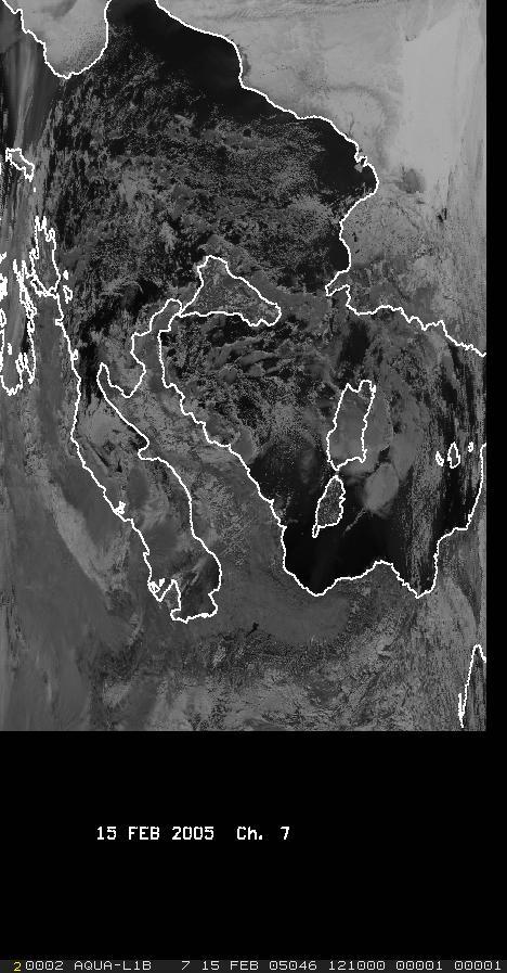
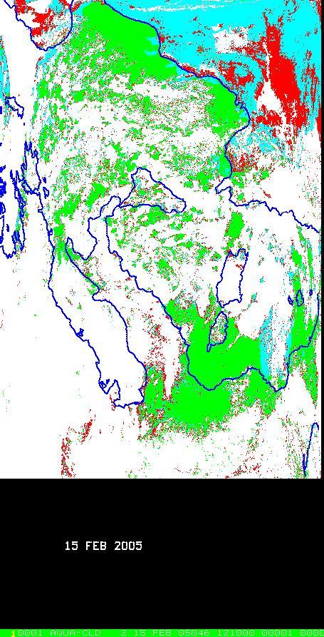
9 DATA SET SEVIRI DATA 28 OCT 2004 DAY/NIGHT 20 NOV 2004 DAY 10 DEC 2004 DAY/NIGHT 15 JAN 2005 NIGHT 15 FEB 2005 DAY 20 MAR 2005 DAY/NIGHT 15 APR 2005 NIGHT 01 MAY 2005 DAY/NIGHT 1500 AIRS and MODIS granules

10
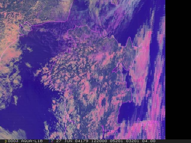
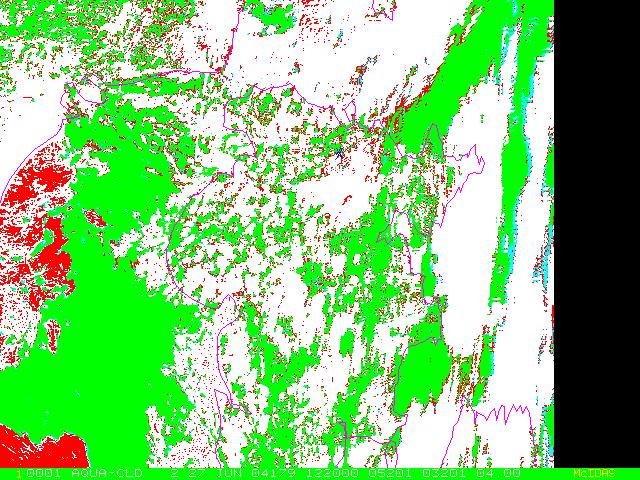
11 12:20
12 Multilayered clouds In this study we investigate the errors in CO2-slicing cloud top pressure retrievals due to the presence of multilayered clouds. When multi cloud layers are present, the CO2 slicing retrievals result in cloud top pressures located somewhere between the upper and lower cloud layers. We use two different tecniques to identify multilayered clouds.
13 To detect multilayered clouds, we use a technique which identifies MODIS pixels that contain thin cirrus overlying lower-level water clouds. Our approach uses the 2.13 µm band reflectance (for daytime), the 8.5 and 11 µm band brightness temperatures and the MODIS retrieved CO2 silicing as a function of observed 11-µm BT. Multilayered clouds are identified as those cloudy FOVs that have significant differences between the IR and MW cloud height
14 Infrared Cloud Top Height T(IR) => CO2 slicing method Clear Radiances => Kriging cloud clearing Temperature and Humidity Profiles => ECMWF
15 Microwave Cloud Top Height A lookup table for clear and cloudy AMSU/B brightness temperature was produced. To estimate LWP, Cloud water content (CWC, liquid or ice), and T(MW), T(IR) is used to selected a value of T(MW) and LWP from the lookup table to start AMSU simulation. If the difference between the observed and the estimated reaches a minimum, the retrieval process finishes, otherwise the cloud top is moved down and the steps are repeated.
16 CLEAR and CLOUDY RADIANCE SIMULATIONS Spectral properties of atmosphere gases and clear radiances are computed using RTTOV*, while cloud radiances for different cloud types are computed using RT3**. * Eyre J.R., 1991: A fast radiative transfer model for satellite sounding systems, ECMWF Tech. Memo ** R. Amorati and R. Rizzi, Radiances simulated in the presence of clouds by use of a fast radiative transfer model and a multiple-scattering scheme, Applied Optics,41, n.9 (2002)
17
18 Cloud Top Height Estimation Modified RT3 code searches for the best solution: simulated brightness temperature are compared to the observed selected 300 AIRS channels. Cloud top estimated using CO2 slicing method is used to start simulation. If the difference between the observed and the estimated reaches a minimum, the retrieval process finishes, otherwise the cloud top is moved up.
19 Multilayer Single-layer (CO2 slicing)


20 h CT =6.5 km h CT =7 km Cloud Thickness =3.1 km 12:35 h CT =2.7 Cloud Thickness=1 km


21 h CT =6.3 km h CT =7.4 Cloud Thickness =2.3 km 12:41 h CT =3.05 km Cloud Thickness =3 km


22 h CT =9.1km h CT =9.0 km Cloud Thickness =1.8 km 12:17 h CT =1.0 km Cloud Thickness =0.8 km


23 h CT =6.2 km h CT =6.7 km Cloud Thickness =1.4 km h CT =4.1 km Cloud Thickness =1.2 km
 MW AMSU ECMWF 31.9 30.5 29.")
 Sat Radar 12 8-14 r e2 micron Sat Radar 40 50")
24 LWP(Kg/m2) MW AMSU ECMWF IWV(Kg/m2) MW AMSU ECMWF ICW g/m3 AMSU RADAR r e1 (micron) Sat Radar r e2 micron Sat Radar h CT =9.5 km Cloud Thickness =4.3 km 13:25 h CT =1.0 km Cloud Thickness =0.8 km
25 A proper combination of infrared and microwave measurements could be useful to determine the cloud coverage, the vertical cloud structure and composition in all weather conditions. Validation of cloud parameters, based on ground based measuremets, will be extend to a large data set.
Cloud Parameters from Infrared and Microwave Satellite Measurements
 Cloud Parameters from Infrared and Microwave Satellite Measurements D. Cimini*, V. Cuomo*, S. Laviola*, T. Maestri, P. Mazzetti*, S. Nativi*, J. M. Palmer*, R. Rizzi and F. Romano* *Istituto di Metodologie
Meteorological Satellite Image Interpretations, Part III. Acknowledgement: Dr. S. Kidder at Colorado State Univ.
 Meteorological Satellite Image Interpretations, Part III Acknowledgement: Dr. S. Kidder at Colorado State Univ. Dates EAS417 Topics Jan 30 Introduction & Matlab tutorial Feb 1 Satellite orbits & navigation
CTTH Cloud Top Temperature and Height
 CTTH Cloud Top Temperature and Height 15 th June 2004 Madrid Hervé Le Gléau and Marcel Derrien Météo-France / CMS lannion 1 Plan of CTTH presentation Algorithms short description Some examples Planned
Comparison of NASA AIRS and MODIS Land Surface Temperature and Infrared Emissivity Measurements from the EOS AQUA platform
 Comparison of NASA AIRS and MODIS Land Surface Temperature and Infrared Emissivity Measurements from the EOS AQUA platform Robert Knuteson, Steve Ackerman, Hank Revercomb, Dave Tobin University of Wisconsin-Madison
Cloud detection for IASI/AIRS using imagery
 Cloud detection for IASI/AIRS using imagery Lydie Lavanant* Mohamed Dahoui** Florence Rabier***, Thomas Auligné*** * Météo-France/DP/CMS/R&D ** Moroccan Meterological Service. NWPSAF Visiting Scientist
All-sky assimilation of MHS and HIRS sounder radiances
 All-sky assimilation of MHS and HIRS sounder radiances Alan Geer 1, Fabrizio Baordo 2, Niels Bormann 1, Stephen English 1 1 ECMWF 2 Now at Bureau of Meteorology, Australia All-sky assimilation at ECMWF
A statistical approach for rainfall confidence estimation using MSG-SEVIRI observations
 A statistical approach for rainfall confidence estimation using MSG-SEVIRI observations Elisabetta Ricciardelli*, Filomena Romano*, Nico Cimini*, Frank Silvio Marzano, Vincenzo Cuomo* *Institute of Methodologies
A Time Lag Model to Estimate Rainfall Rate Based on GOES Data
 A Time Lag Model to Estimate Rainfall Rate Based on GOES Data Nazario D. Ramirez, Robert J. Kuligowski, and Joan M. Castro Octava Reunión Nacional de Percepción Remota y Sistemas Geográficos de Información
Interpretation of Polar-orbiting Satellite Observations. Atmospheric Instrumentation
 Interpretation of Polar-orbiting Satellite Observations Outline Polar-Orbiting Observations: Review of Polar-Orbiting Satellite Systems Overview of Currently Active Satellites / Sensors Overview of Sensor
Long-Term Time Series of Water Vapour Total Columns from GOME, SCIAMACHY and GOME-2
 Graphics: ESA Graphics: ESA Graphics: ESA Long-Term Time Series of Water Vapour Total Columns from GOME, SCIAMACHY and GOME-2 S. Noël, S. Mieruch, H. Bovensmann, J. P. Burrows Institute of Environmental
Towards a better use of AMSU over land at ECMWF
 Towards a better use of AMSU over land at ECMWF Blazej Krzeminski 1), Niels Bormann 1), Fatima Karbou 2) and Peter Bauer 1) 1) European Centre for Medium-range Weather Forecasts (ECMWF), Shinfield Park,
APPLICATIONS WITH METEOROLOGICAL SATELLITES. W. Paul Menzel. Office of Research and Applications NOAA/NESDIS University of Wisconsin Madison, WI
 APPLICATIONS WITH METEOROLOGICAL SATELLITES by W. Paul Menzel Office of Research and Applications NOAA/NESDIS University of Wisconsin Madison, WI July 2004 Unpublished Work Copyright Pending TABLE OF CONTENTS
Carmine Serio, Guido Masiello. DIFA, University of Basilicata, Italy
 Carmine Serio, Guido Masiello DIFA, University of Basilicata, Italy Stephen Tjemkes, Poster in this conference hs-test Surface temperature test IASI stand-alone cloud detection scheme The baseline Test
Data assimilation of IASI radiances over land.
 Data assimilation of IASI radiances over land. PhD supervised by Nadia Fourrié, Florence Rabier and Vincent Guidard. 18th International TOVS Study Conference 21-27 March 2012, Toulouse Contents 1. IASI
Synergistic Cloud Clearing Using Aqua Sounding and Imaging Infrared Measurements
 Synergistic Cloud Clearing Using Aqua Sounding and Imaging Infrared Measurements H-L Allen Huang, et al. CIMSS/SSEC Univ. of Wisconsin-Madison and William L. Smith, LaRC, NASA Cloud Clearing/Cloud Detection
Single footprint sounding, surface emissivity and cloud property retrievals from hyperspectral infrared radiances under all sky conditions
 Single footprint sounding, surface emissivity and cloud property retrievals from hyperspectral infrared radiances under all sky conditions Jun Li @, Elisabeth Weisz @, Jinlong Li @, Allen Huang @, Chian-Yi
Satellite section P. Bauer E. Moreau J.-N. Thépaut P. Watts. Physical aspects section M. Janiskova P. Lopez J.-J. Morcrette A.
 Prospects for assimilating Cloudy radiances from AIRS Frédéric Chevallier And Satellite section P. Bauer E. Moreau J.-N. Thépaut P. Watts Physical aspects section M. Janiskova P. Lopez J.-J. Morcrette
Hyperspectral IR clear and cloudy sounding retrieval study
 Hyperspectral IR clear and cloudy sounding retrieval study Jun Li @, Timothy J. Schmit #, Chian-Yi Liu @, Elisabeth Weisz @, Li Guan @, and Allen Huang @ @Cooperative Institute for Meteorological Satellite
Assimilation of Cloud-Affected Infrared Radiances at Environment-Canada
 Assimilation of Cloud-Affected Infrared Radiances at Environment-Canada ECMWF-JCSDA Workshop on Assimilating Satellite Observations of Clouds and Precipitation into NWP models ECMWF, Reading (UK) Sylvain
CIMSS Hyperspectral IR Sounding Retrieval (CHISR) Processing & Applications
 Processing & Applications") CIMSS Hyperspectral IR Sounding Retrieval (CHISR) Processing & Applications Jun Li @, Elisabeth Weisz @, Jinlong Li @, Hui Liu #, Timothy J. Schmit &, Jason Otkin @ and many other CIMSS collaborators @Cooperative
CIMSS Hyperspectral IR Sounding Retrieval (CHISR) Processing & Applications Jun Li @, Elisabeth Weisz @, Jinlong Li @, Hui Liu #, Timothy J. Schmit &, Jason Otkin @ and many other CIMSS collaborators @Cooperative
Recent improvements in the all-sky assimilation of microwave radiances at the ECMWF
 Recent improvements in the all-sky assimilation of microwave radiances at the ECMWF Katrin Lonitz, Alan Geer and many more katrin.lonitz@ecmwf.int ECMWF January 30, 2018 clear sky assimilation all-sky
Atmospheric Soundings of Temperature, Moisture and Ozone from AIRS
 Atmospheric Soundings of Temperature, Moisture and Ozone from AIRS M.D. Goldberg, W. Wolf, L. Zhou, M. Divakarla,, C.D. Barnet, L. McMillin, NOAA/NESDIS/ORA Oct 31, 2003 Presented at ITSC-13 Risk Reduction
NWP SAF. Quantitative precipitation estimation from satellite data. Satellite Application Facility for Numerical Weather Prediction
 NWP SAF Satellite Application Facility for Numerical Weather Prediction Document NWPSAF-MO-VS-011 Version 1.0 15 April 2006 Quantitative precipitation estimation from satellite data Sante Laviola University
GUEDJ Stephanie KARBOU Fatima RABIER Florence LSA-SAF User Workshop 2010, Toulouse
 CNRM/GAME GUEDJ Stephanie KARBOU Fatima RABIER Florence LSA-SAF User Workshop 2010, Toulouse INTRODUCTION (1/3) SEVIRI instrument Radiometer onboard METEOSAT-8/-9 (geostationnary) Measures «top-of-atmosphere»
Fine atmospheric structure retrieved from IASI and AIRS under all weather conditions
 Fine atmospheric structure retrieved from IASI and AIRS under all weather conditions Daniel K. Zhou 1, William L. Smith 2,3, Allen M. Larar 1, Xu Liu 1, Jonathan P. Taylor 4, Peter Schlüssel 5, L. Larrabee
GIFTS SOUNDING RETRIEVAL ALGORITHM DEVELOPMENT
 P2.32 GIFTS SOUNDING RETRIEVAL ALGORITHM DEVELOPMENT Jun Li, Fengying Sun, Suzanne Seemann, Elisabeth Weisz, and Hung-Lung Huang Cooperative Institute for Meteorological Satellite Studies (CIMSS) University
Combining GPS occultations with AIRS infrared measurements for improved atmospheric sounding
 Combining GPS occultations with AIRS infrared measurements for improved atmospheric sounding Éva E. Borbás*, Elisabeth Weisz*, Jun Li*, Harold M. Woolf*, and W. Paul Menzel** *Space Science and Engineering
Simulated MSG SEVIRI Imagery from HARMONIE-AROME
 Simulated MSG SEVIRI Imagery from HARMONIE-AROME Angeles Hernandez, AEMET Joint 28th ALADIN Workshop & HIRLAM All-Staff Meeting 2018 - Toulouse, 16-20 Apr 2018 Outline 1. Simulated Satellite Images (SSI)
Validation of the BRAMS high resolution simulations by satellite radiance comparison
 Validation of the BRAMS high resolution simulations by satellite radiance comparison Renato Galante Negri Luiz Augusto Toledo Machado Divisão de Satélites e Sistemas Ambientais, Centro de Previsão de Tempo
ECNU WORKSHOP LAB ONE 2011/05/25)
") ECNU WORKSHOP LAB ONE (Liam.Gumley@ssec.wisc.edu 2011/05/25) The objective of this laboratory exercise is to become familiar with the characteristics of MODIS Level 1B 1000 meter resolution data. After
ECNU WORKSHOP LAB ONE (Liam.Gumley@ssec.wisc.edu 2011/05/25) The objective of this laboratory exercise is to become familiar with the characteristics of MODIS Level 1B 1000 meter resolution data. After
Analysis of down-welling radiances in presence of thin ice clouds: data from the ECOWAR-COBRA Experiment
 Analysis of down-welling radiances in presence of thin ice clouds: data from the ECOWAR-COBRA Experiment Far-Infrared Workshop Madison, WI (USA), November 2011 Contributors University of Bologna: T. Maestri,
SAFNWC/MSG SEVIRI CLOUD PRODUCTS
 SAFNWC/MSG SEVIRI CLOUD PRODUCTS M. Derrien and H. Le Gléau Météo-France / DP / Centre de Météorologie Spatiale BP 147 22302 Lannion. France ABSTRACT Within the SAF in support to Nowcasting and Very Short
Jun Mitch Goldberg %, Pei Timothy J. Schmit &, Jinlong Zhenglong and Agnes
 Progress on the assimilation of advanced IR sounder radiances in cloudy skies Jun Li @, Mitch Goldberg %, Pei Wang @#, Timothy J. Schmit &, Jinlong Li @, Zhenglong Li @, and Agnes Lim @ @CIMSS, University
Observations of Mediterranean Precipitating Systems using AMSU
 Observations of Mediterranean Precipitating Systems using AMSU Beatriz FUNATSU 1, Chantal CLAUD 1 and Jean-Pierre CHABOUREAU 2 1 Laboratoire de Meteorologie Dynamique/IPSL, Palaiseau 2 Laboratoire d Aerologie/CNRS-UPS,
Status of Land Surface Temperature Product Development for JPSS Mission
 Status of Land Surface Temperature Product Development for JPSS Mission Yuling Liu 1,2, Yunyue Yu 2, Peng Yu 1,2 and Heshun Wang 1,2 1 ESSIC at University of Maryland, College Park, MD USA 2 Center for
On the Satellite Determination of Multilayered Multiphase Cloud Properties. Science Systems and Applications, Inc., Hampton, Virginia 2
 JP1.10 On the Satellite Determination of Multilayered Multiphase Cloud Properties Fu-Lung Chang 1 *, Patrick Minnis 2, Sunny Sun-Mack 1, Louis Nguyen 1, Yan Chen 2 1 Science Systems and Applications, Inc.,
Retrieval of precipitation from Meteosat-SEVIRI geostationary satellite observations
 Retrieval of precipitation from Meteosat-SEVIRI geostationary satellite observations Jan Fokke Meirink, Hidde Leijnse (KNMI) Rob Roebeling (EUMETSAT) Overview Introduction Algorithm description Validation
Lecture 19: Operational Remote Sensing in Visible, IR, and Microwave Channels
 MET 4994 Remote Sensing: Radar and Satellite Meteorology MET 5994 Remote Sensing in Meteorology Lecture 19: Operational Remote Sensing in Visible, IR, and Microwave Channels Before you use data from any
Combining Satellite & Model Information for Snowfall Retrieval
 Combining Satellite & Model Information for Snowfall Retrieval Yoo-Jeong Noh Cooperative Institute for Research in the Atmosphere Colorado State University CIRA/Colorado State University 5th Annual CoRP
Towards the assimilation of AIRS cloudy radiances
 Towards the assimilation of AIRS cloudy radiances N. FOURRIÉ 1, M. DAHOUI 1 * and F. RABIER 1 1 : National Center for Meteorological Research (CNRM, METEO FRANCE and CNRS) Numerical Weather Prediction
Snowfall Detection and Retrieval from Passive Microwave Satellite Observations. Guosheng Liu Florida State University
 Snowfall Detection and Retrieval from Passive Microwave Satellite Observations Guosheng Liu Florida State University Collaborators: Eun Kyoung Seo, Yalei You Snowfall Retrieval: Active vs. Passive CloudSat
Lecture 13. Applications of passive remote sensing: Remote sensing of precipitation and clouds.
 Lecture 13. Applications of passive remote sensing: Remote sensing of precipitation and clouds. 1. Classification of remote sensing techniques to measure precipitation. 2. Visible and infrared remote sensing
Assimilation of precipitation-related observations into global NWP models
 Assimilation of precipitation-related observations into global NWP models Alan Geer, Katrin Lonitz, Philippe Lopez, Fabrizio Baordo, Niels Bormann, Peter Lean, Stephen English Slide 1 H-SAF workshop 4
Inter-comparison of CRTM and RTTOV in NCEP Global Model
 Inter-comparison of CRTM and RTTOV in NCEP Global Model Emily H. C. Liu 1, Andrew Collard 2, Ruiyu Sun 2, Yanqiu Zhu 2 Paul van Delst 2, Dave Groff 2, John Derber 3 1 SRG@NOAA/NCEP/EMC 2 IMSG@NOAA/NCEP/EMC
CHAPTER 6 CLOUDS. 6.1 RTE in Cloudy Conditions
 6-1 CHAPTER 6 CLOUDS 6.1 RTE in Cloudy Conditions Thus far, we have considered the RTE only in a clear sky condition. When we introduce clouds into the radiation field of the atmosphere the problem becomes
Bias correction of satellite data at Météo-France
 Bias correction of satellite data at Météo-France É. Gérard, F. Rabier, D. Lacroix, P. Moll, T. Montmerle, P. Poli CNRM/GMAP 42 Avenue Coriolis, 31057 Toulouse, France 1. Introduction Bias correction at
The MODIS Cloud Data Record
 The MODIS Cloud Data Record Brent C. Maddux 1,2 Steve Platnick 3, Steven A. Ackerman 1 Paul Menzel 1, Kathy Strabala 1, Richard Frey 1, 1 Cooperative Institute for Meteorological Satellite Studies, 2 Department
Satellite data assimilation for Numerical Weather Prediction (NWP)
") Satellite data assimilation for Numerical Weather Prediction (NWP Niels Bormann European Centre for Medium-range Weather Forecasts (ECMWF (with contributions from Tony McNally, Slide 1 Jean-Noël Thépaut,
Satellite data assimilation for Numerical Weather Prediction (NWP Niels Bormann European Centre for Medium-range Weather Forecasts (ECMWF (with contributions from Tony McNally, Slide 1 Jean-Noël Thépaut,
New developments for the use of microphysical variables for the assimilation of IASI radiances in convective scale models
 New developments for the use of microphysical variables for the assimilation of IASI radiances in convective scale models Pauline Martinet a, Nadia Fourrié a, Florence Rabier a, Lydie Lavanant b, Antonia
CLOUD CLASSIFICATION AND CLOUD PROPERTY RETRIEVAL FROM MODIS AND AIRS
 6.4 CLOUD CLASSIFICATION AND CLOUD PROPERTY RETRIEVAL FROM MODIS AND AIRS Jun Li *, W. Paul Menzel @, Timothy, J. Schmit @, Zhenglong Li *, and James Gurka # *Cooperative Institute for Meteorological Satellite
OSI SAF SST Products and Services
 OSI SAF SST Products and Services Pierre Le Borgne Météo-France/DP/CMS (With G. Legendre, A. Marsouin, S. Péré, S. Philippe, H. Roquet) 2 Outline Satellite IR radiometric measurements From Brightness Temperatures
The impact of assimilation of microwave radiance in HWRF on the forecast over the western Pacific Ocean
 The impact of assimilation of microwave radiance in HWRF on the forecast over the western Pacific Ocean Chun-Chieh Chao, 1 Chien-Ben Chou 2 and Huei-Ping Huang 3 1Meteorological Informatics Business Division,
Application of the UW/CIMSS high spectral resolution global IR land surface emissivity database into the RTTOV model
 Application of the UW/CIMSS high spectral resolution global IR land surface emissivity database into the RTTOV model Eva Borbas 1, Ben Ruston 2, Roger Saunders 3, Andrew Collard 3, Robert Knuteson 1, James
School on Modelling Tools and Capacity Building in Climate and Public Health April Remote Sensing
 2453-5 School on Modelling Tools and Capacity Building in Climate and Public Health 15-26 April 2013 Remote Sensing CECCATO Pietro International Research Institute for Climate and Society, IRI The Earth
A high spectral resolution global land surface infrared emissivity database
 A high spectral resolution global land surface infrared emissivity database Eva E. Borbas, Robert O. Knuteson, Suzanne W. Seemann, Elisabeth Weisz, Leslie Moy, and Hung-Lung Huang Space Science and Engineering
COMPARISON OF SIMULATED RADIANCE FIELDS USING RTTOV AND CRTM AT MICROWAVE FREQUENCIES IN KOPS FRAMEWORK
 COMPARISON OF SIMULATED RADIANCE FIELDS USING RTTOV AND CRTM AT MICROWAVE FREQUENCIES IN KOPS FRAMEWORK Ju-Hye Kim 1, Jeon-Ho Kang 1, Hyoung-Wook Chun 1, and Sihye Lee 1 (1) Korea Institute of Atmospheric
RTTOV 10 Theory & Exercise
 RTTOV 10 Theory & Exercise Ø Overview of RTTOVS Radiative Transfer Model q Gases Absorption (water Vapor & other trace gases) q Aerosol/Clouds Scattering and Absorption q Surface Emissivity/Reflectivity
Assimilation of Cross-track Infrared Sounder radiances at ECMWF
 ssimilation of ross-track Infrared Sounder radiances at EMWF Reima Eresmaa, nthony P. McNally and Niels Bormann European entre for Medium-range Weather Forecasts Reading, Berkshire, United Kingdom Introduction
Summary Remote Sensing Seminar
 Summary Remote Sensing Seminar Lectures at CREST Paul Menzel NOAA/NESDIS/ORA March 2006 Satellite remote sensing of the Earth-atmosphere Observations depend on telescope characteristics (resolving power,
Land Surface Temperature Measurements From the Split Window Channels of the NOAA 7 Advanced Very High Resolution Radiometer John C.
 Land Surface Temperature Measurements From the Split Window Channels of the NOAA 7 Advanced Very High Resolution Radiometer John C. Price Published in the Journal of Geophysical Research, 1984 Presented
Principal Component Analysis (PCA) of AIRS Data
 of AIRS Data") Principal Component Analysis (PCA) of AIRS Data Mitchell D. Goldberg 1, Lihang Zhou 2, Walter Wolf 2 and Chris Barnet 1 NOAA/NESDIS/Office of Research and Applications, Camp Springs, MD 1 QSS Group Inc.
Principal Component Analysis (PCA) of AIRS Data Mitchell D. Goldberg 1, Lihang Zhou 2, Walter Wolf 2 and Chris Barnet 1 NOAA/NESDIS/Office of Research and Applications, Camp Springs, MD 1 QSS Group Inc.
SSMIS 1D-VAR RETRIEVALS. Godelieve Deblonde
 SSMIS 1D-VAR RETRIEVALS Godelieve Deblonde Meteorological Service of Canada, Dorval, Québec, Canada Summary Retrievals using synthetic background fields and observations for the SSMIS (Special Sensor Microwave
ASSIMILATION OF CLOUDY AMSU-A MICROWAVE RADIANCES IN 4D-VAR 1. Stephen English, Una O Keeffe and Martin Sharpe
 ASSIMILATION OF CLOUDY AMSU-A MICROWAVE RADIANCES IN 4D-VAR 1 Stephen English, Una O Keeffe and Martin Sharpe Met Office, FitzRoy Road, Exeter, EX1 3PB Abstract The assimilation of cloud-affected satellite
RTMIPAS: A fast radiative transfer model for the assimilation of infrared limb radiances from MIPAS
 RTMIPAS: A fast radiative transfer model for the assimilation of infrared limb radiances from MIPAS Niels Bormann, Sean Healy, and Marco Matricardi European Centre for Medium-range Weather Forecasts (ECMWF),
Description of Precipitation Retrieval Algorithm For ADEOS II AMSR
 Description of Precipitation Retrieval Algorithm For ADEOS II Guosheng Liu Florida State University 1. Basic Concepts of the Algorithm This algorithm is based on Liu and Curry (1992, 1996), in which the
Model errors in tropical cloud and precipitation revealed by the assimilation of MW imagery
 Model errors in tropical cloud and precipitation revealed by the assimilation of MW imagery Katrin Lonitz, Alan Geer, Philippe Lopez + many other colleagues 20 November 2014 Katrin Lonitz ( ) Tropical
Applications of the SEVIRI window channels in the infrared.
 Applications of the SEVIRI window channels in the infrared jose.prieto@eumetsat.int SEVIRI CHANNELS Properties Channel Cloud Gases Application HRV 0.7 Absorption Scattering
Rain rate retrieval using the 183-WSL algorithm
 Rain rate retrieval using the 183-WSL algorithm S. Laviola, and V. Levizzani Institute of Atmospheric Sciences and Climate, National Research Council Bologna, Italy (s.laviola@isac.cnr.it) ABSTRACT High
Satellite data assimilation for Numerical Weather Prediction II
 Satellite data assimilation for Numerical Weather Prediction II Niels Bormann European Centre for Medium-range Weather Forecasts (ECMWF) (with contributions from Tony McNally, Jean-Noël Thépaut, Slide
Cloud detection for IASI/AIRS using imagery
 Cloud detection for IASI/AIRS using imagery Lydie Lavanant 1, Mohamed Dahoui 2, Florence Rabier 3, Thomas Auligné 3 1 Météo-France, Centre de Météorologie Spatiale, BP 147, 22300, Lannion Cedex France
Microphysical Properties of Single and Mixed-Phase Arctic Clouds Derived From Ground-Based AERI Observations
 Microphysical Properties of Single and Mixed-Phase Arctic Clouds Derived From Ground-Based AERI Observations Dave Turner University of Wisconsin-Madison Pacific Northwest National Laboratory 8 May 2003
General Aspects I: What is a cloud?
 Cloud Detection General Aspects I: What is a cloud? I can tell you, if I see... A visible aggregate of minute water droplets and/or ice particles in the atmosphere above the earth s surface Global total
Remote sensing of ice clouds
 Remote sensing of ice clouds Carlos Jimenez LERMA, Observatoire de Paris, France GDR microondes, Paris, 09/09/2008 Outline : ice clouds and the climate system : VIS-NIR, IR, mm/sub-mm, active 3. Observing
MAIN ATTRIBUTES OF THE PRECIPITATION PRODUCTS DEVELOPED BY THE HYDROLOGY SAF PROJECT RESULTS OF THE VALIDATION IN HUNGARY
 MAIN ATTRIBUTES OF THE PRECIPITATION PRODUCTS DEVELOPED BY THE HYDROLOGY SAF PROJECT RESULTS OF THE VALIDATION IN HUNGARY Eszter Lábó OMSZ-Hungarian Meteorological Service, Budapest, Hungary labo.e@met.hu
Joel Susskind John M. Blaisdell Lena Iredell
 Improved methodology for surface and atmospheric soundings, error estimates, and quality control procedures: the atmospheric infrared sounder science team version-6 retrieval algorithm Joel Susskind John
Operational IASI Level 2 Processing
 Operational IASI Level 2 Processing Peter Schlüssel Arlindo Arriaga, Thomas August, Xavier Calbet, Tim Hultberg, Olusoji Oduleye, Lars Fiedler, Hidehiku Murata, Xu Liu, and Nikita Pougatchev EUM/MET/VWG/08/0380
Recommendation proposed: CGMS-39 WGII to take note.
 Prepared by EUMETSAT Agenda Item: G.II/8 Discussed in WGII EUM REPORT ON CAPABILITIES AND PLANS TO SUPPORT VOLCANIC ASH MONITORING In response to CGMS action WGII 38.31: CGMS satellite operators are invited
The retrieval of the atmospheric humidity parameters from NOAA/AMSU data for winter season.
 The retrieval of the atmospheric humidity parameters from NOAA/AMSU data for winter season. Izabela Dyras, Bożena Łapeta, Danuta Serafin-Rek Satellite Research Department, Institute of Meteorology and
Principles of Radiative Transfer Principles of Remote Sensing. Marianne König EUMETSAT
 - Principles of Radiative Transfer Principles of Remote Sensing Marianne König EUMETSAT marianne.koenig@eumetsat.int Remote Sensing All measurement processes which perform observations/measurements of
PARCWAPT Passive Radiometry Cloud Water Profiling Technique
 PARCWAPT Passive Radiometry Cloud Water Profiling Technique By: H. Czekala, T. Rose, Radiometer Physics GmbH, Germany A new cloud liquid water profiling technique by Radiometer Physics GmbH (patent pending)
ITSC-16 Conference. May 2008 Using AVHRR radiances analysis for retrieving atmospheric profiles with IASI in cloudy conditions
 ITSC-16 Conference. May 2008 Using AVHRR radiances analysis for retrieving atmospheric profiles with IASI in cloudy conditions Lydie Lavanant MF/DP/CMS/R&D Experimental production at CMS of near-real real
Comparison of NASA AIRS and MODIS Land Surface Temperature and Infrared Emissivity Measurements from the EOS AQUA platform
 Comparison of NASA AIRS and MODIS Land Surface Temperature and Infrared Emissivity Measurements from the EOS AQUA platform Robert Knuteson, Hank Revercomb, Dave Tobin University of Wisconsin-Madison 16
Examining effect of Asian dusts on the AIRS-measured radiances from radiative transfer simulations
 Examining effect of Asian dusts on the AIRS-measured radiances from radiative transfer simulations Hyo-Jin Han 1, B.J. Sohn 1 Allen Huang 2, Elisabeth Weisz 2 1 School of Earth and Environmental Sciences
Lambertian surface scattering at AMSU-B frequencies:
 Lambertian surface scattering at AMSU-B frequencies: An analysis of airborne microwave data measured over snowcovered surfaces Chawn Harlow, 2nd Workshop on Remote Sensing and Modeling of Land Surface
Clouds, Precipitation and their Remote Sensing
 Clouds, Precipitation and their Remote Sensing Prof. Susanne Crewell AG Integrated Remote Sensing Institute for Geophysics and Meteorology University of Cologne Susanne Crewell, Kompaktkurs, Jülich 24.
Report on CIMSS Participation in the Utility of GOES-R Instruments for Hurricane Data Assimilation and Forecasting
 Report on CIMSS Participation in the Utility of GOES-R Instruments for Hurricane Data Assimilation and Forecasting Award Number: NA10NES4400010 Award Period: 06/01/2010-05/31/2014 Program Office: NESDIS
Polar winds from highly elliptical orbiting satellites: a new perspective
 Polar winds from highly elliptical orbiting satellites: a new perspective 10 th International Winds Workshop Tokyo, Japan, Feb -6, 010 L. Garand 1, N. Wagneur 1, R. Sarrazin 1, D. Santek, J. Key 1 Environment
A satellite-based long-term Land Surface Temperature Climate Data Record
 Federal Department of Home Affairs FDHA Federal Office of Meteorology and Climatology MeteoSwiss A satellite-based long-term Land Surface Temperature Climate Data Record, Virgílio A. Bento, Frank M. Göttsche,
OSSE to infer the impact of Arctic AMVs extracted from highly elliptical orbit imagery
 OSSE to infer the impact of Arctic AMVs extracted from highly elliptical orbit imagery L. Garand 1 Y. Rochon 1, S. Heilliette 1, J. Feng 1, A.P. Trishchenko 2 1 Environment Canada, 2 Canada Center for
The potential impact of ozone sensitive data from MTG-IRS
 The potential impact of ozone sensitive data from MTG-IRS R. Dragani, C. Lupu, C. Peubey, and T. McNally ECMWF rossana.dragani@ecmwf.int ECMWF May 24, 2017 The MTG IRS Long-Wave InfraRed band O 3 Can the
Bias Correction of Satellite Data at NCEP
 Bias Correction of Satellite Data at NCEP Paul van Delst 1, John Derber 2, Russ Treadon 2, Kozo Okamoto 3 and Wan-Shu Wu 2 1 CIMSS @ NOAA/NWS/NCEP/EMC, 2 NOAA/NWS/NCEP/EMC 3 JMA visiting scientist @ NOAA/NWS/NCEP/EMC
Spaceborne Hyperspectral Infrared Observations of the Cloudy Boundary Layer
 Spaceborne Hyperspectral Infrared Observations of the Cloudy Boundary Layer Eric J. Fetzer With contributions by Alex Guillaume, Tom Pagano, John Worden and Qing Yue Jet Propulsion Laboratory, JPL KISS
Remote sensing with FAAM to evaluate model performance
 Remote sensing with FAAM to evaluate model performance YOPP-UK Workshop Chawn Harlow, Exeter 10 November 2015 Contents This presentation covers the following areas Introduce myself Focus of radiation research
Isabel Trigo, Sandra Freitas, Carla Barroso, Isabel Monteiro, Pedro Viterbo
 Land Surface Temperature, Emissivity and Long-Wave Downwlling Fluxes from MSG Observations: current status and way forward Isabel Trigo, Sandra Freitas, Carla Barroso, Isabel Monteiro, Pedro Viterbo 1
Aircraft Validation of Infrared Emissivity derived from Advanced InfraRed Sounder Satellite Observations
 Aircraft Validation of Infrared Emissivity derived from Advanced InfraRed Sounder Satellite Observations Robert Knuteson, Fred Best, Steve Dutcher, Ray Garcia, Chris Moeller, Szu Chia Moeller, Henry Revercomb,
Hampton University 2. University of Wisconsin-Madison 3. NASA Langley Research Center
 Ultra High Spectral Resolution Satellite Remote Sounding - Results from Aircraft and Satellite Measurements W. L. Smith Sr. 1,2, D.K. Zhou 3, A. M. Larar 3, and H. E. Revercomb 2 1 Hampton University 2
Cloud property retrievals for climate monitoring:
 X-1 ROEBELING ET AL.: SEVIRI & AVHRR CLOUD PROPERTY RETRIEVALS Cloud property retrievals for climate monitoring: implications of differences between SEVIRI on METEOSAT-8 and AVHRR on NOAA-17 R.A. Roebeling,
Comparison of cloud statistics from Meteosat with regional climate model data
 Comparison of cloud statistics from Meteosat with regional climate model data R. Huckle, F. Olesen, G. Schädler Institut für Meteorologie und Klimaforschung, Forschungszentrum Karlsruhe, Germany (roger.huckle@imk.fzk.de
Development of the Multilayer Cloudy Radiative Transfer Model for GOES-R Advanced Baseline Imager (ABI)
") Development of the Multilayer Cloudy Radiative Transfer Model for GOES-R Advanced Baseline Imager (ABI) Bormin Huang, Yong-Keun Lee, and Allen H.-L. Huang CIMSS/SSEC, UW-Madison Mitchell D. Goldberg NOAA
Development of the Multilayer Cloudy Radiative Transfer Model for GOES-R Advanced Baseline Imager (ABI) Bormin Huang, Yong-Keun Lee, and Allen H.-L. Huang CIMSS/SSEC, UW-Madison Mitchell D. Goldberg NOAA
Rainfall estimation from satellite passive microwave observations in the range 89 GHz to 190 GHz
 JOURNAL OF GEOPHYSICAL RESEARCH, VOL. 114,, doi:10.1029/2009jd011746, 2009 Rainfall estimation from satellite passive microwave observations in the range 89 GHz to 190 GHz E. Di Tomaso, 1 F. Romano, 1