OSI SAF SST Products and Services
|
|
|
- Todd Harry Malone
- 5 years ago
- Views:
Transcription

1 OSI SAF SST Products and Services Pierre Le Borgne Météo-France/DP/CMS (With G. Legendre, A. Marsouin, S. Péré, S. Philippe, H. Roquet)
 Production Validation Practical")
2 2 Outline Satellite IR radiometric measurements From Brightness Temperatures to Sea Surface Temperature SST from Metop Production Validation SST from MSG (GOES-E) Production Validation Practical information
3 3 Satellite IR Radiometric measurements IR Radiometric Measurement = (1) Emitted by surface + (2) Emitted by atmosphere and reflected to space + (3) Direct atmosphere contribution (emission+ absorption) (3) (1) (2)
4 Satellite IR Radiometric measurements From SST to Brightness Temperature (BT) 4 A satellite radiometer measures a radiance I λ : I λ = τ λ ε λ B λ (Ts) + Ir + Ia Emitted by surface Reflected Emitted by atmosphere Ts: surface temperature B λ : Planck function λ : wavelength IR: 0.7 to 1000 micron ε λ : surface emissivity τ λ : atmospheric transmittance I λ : measured radiance (w m -2 μ -1 ster -1 ) Clear sky only! Measured Brightness Temperature: BT = B 1 λ (I λ )
5 Satellite IR Radiometric measurements From BT to SST 5 Transmittance τ λ Which channel? 12.0 μm 3.7 μm 8.7 μm 10.8 μm

6 6 FROM BT to SST SST
7 7 FROM BT to SST BT 10.8μ
8 8 FROM BT to SST BT 12.0μ
9 9 FROM BT to SST SST - BT10.8μ
10 10 FROM BT to SST BT10.8μ - BT12.0μ
11 11 FROM BT to SST Multispectral methods Split Window (T10.8, T12) basic equation Principle: SST T10.8 is proportional to T10.8 T12 Hence SST= a T10.8+b (T10.8-T12) +C General case (T3.7, T8.7, T10.8, T12) SST= Σ (ai Tbi +C) How to determine ai and C?? 1)Needs a set of SSTs and TBs (measurements or simulations) 2)Regression -> ai and C Generates regional biases!

12 12 SST FROM METOP/AVHRR AVHRR: -3.7, 10.8, 12.0 microns -1.1 km resolution km swath
13 Land mask (GMT) METOP/ AVHRR SST PROCESSING CHAIN Preprocessing: ingestion of L1C data + Maia cl.mask 13 Clim. minimum SST Clim. maxi gradients Distance to coast Clim. mean SST Cloud mask control SST calculation Quality Level determination Ice edge (OSI SAF) Aerosols (SDI, NAAPS) MDB Validation database Full resolution L2P, global Product elaboration from Primary full resolution SST 0.05 resolution, global 12 hourly, L3, GRIB2 2km resolution, European Seas L3, GRIB2

14 14 METOP/ AVHRR SST

15 15 METOP/ AVHRR SST

16 16 METOP/ AVHRR SST

17 17 METOP/ AVHRR SST Quality level

18 18 AVHRR SST: North Atlantic Regional


19 19 AVHRR SST Atlantic High Latitudes AHL
20 20 AVHRR SST products Full resolution SST (METOP only) Netcdf (L2P GDSV1.7) and GRIB2 3 minute granules Full satellite resolution Regional European (METOP + NOAA) North Atlantic Regional:NAR (2 km resolution, twice daily) Atlantic High Latitudes: AHL (5 km resolution) GLOBAL SST Netcdf (L2P GDSV1.7) and GRIB2 Regular grid 0.05 resolution 12 hourly SST are provided with quality levels 1 (cloudy), 2, 3, 4, 5 Use 3, 4, 5 only!
21 21 VALIDATION: What is SST? Buoy?

22 22 VALIDATION 1 night

23 23 Night time VALIDATION: 10 day period Regional biases!
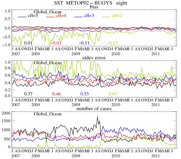
24 24
25 25 SST FROM MSG/SEVIRI SEVIRI: -3.9, 8.7, 10.8, 12.0 microns -Time sampling: 15 minutes -3 km resolution at nadir (varies with location!)

26 MSG/SEVIRI SST NWP based bias correction method Analysed SST (OSTIA) Retrieved SST 26 ECMWF profiles + RTTOV Simulated BTs Operational algorithm Applied on simulations Retrieved analyzed SST = Predicted algorithm error (used as a correction term)
27 27 SST operational processing (1) every 30 GOES-E 15 METEOSAT every 3 hours every hour Geostationary chain overview

28 28 GOES-E

29 29 MSG

30 30
31 31 Geostationary SST products New chain (operational Since August 2011!) Ingest all satellite data at full spatial resolution Includes a bias correction No merged products (MSG + GOES) Enhanced resolution: 0.05 Geostationary SST products Netcdf (L2P GDSV2.0) and GRIB resolution, hourly MSG SST: 60S-60N; 60 W- 60E GOES-E SST: 60S-60N; 135W- 15W SST are provided with quality levels 1 (cloudy), 2, 3, 4, 5 Use 3, 4, 5 only!

32 32 VALIDATION 1 night


33 33 Night time VALIDATION: 10 day period Application of a Bias correction method
34 SUMMARY: : OSI SAF SST product availability 34 We are in a transition period!! *August 2011: Availability of new OSI SAF products *ftp://eftp.ifremer.fr/cersat-rt/project/osi-saf/ *Password requested; see *Soon available through EUMETCAST in GRIB2 *February 2012: end of «old» OSI-SAF geostationary products *March 2012: AHL in netcdf GDSV2 *No later than mid 2012: all OSI-SAF products in netcdf GDSV2
35 35 THE END! More information See - Geostationary Sea Surface Temperature Product User Manual - Low Earth Orbiter Sea Surface Temperature Product User Manual - Atlantic High Latitude L3 Sea Surface Temperature Product User Manual OSI-203 See Pierre.leborgne@meteo.fr or Steinar.eastwood@met.no
36 OSI SAF radiative fluxes Products and Services Anne Marsouin, Pierre Le Borgne Météo-France/DP/CMS (With G. Legendre, S. Péré, S. Philippe, H. Roquet)
 products Practical information OSI-SAF radiative fluxes,")
37 Outline Algorithms Processing chains Surface Solar Irradiance (SSI) products Downward Longwave Irradiance (DLI) products Practical information OSI-SAF radiative fluxes, EUMETRAIN 2011
38 Algorithm inputs SSI (Surface Solar Irradiance): physical parameterization calibrated VIS channel NWC SAF cloud classification auxiliary data (U H2O, A s, O 3 ) DLI (surface Downward Longwave Irradiance): bulk parameterization predicted air T 2m and H 2m SSI/SSI clear NWC SAF cloud classification (day) (night) FROM SATELLITE Algorithms described in the Product Manuals available on OSI-SAF radiative fluxes, EUMETRAIN 2011
39 SSI simplified flowchart VIS count calibration, NB to BB, anisotropy cloud type & cover albedo A physical parameterization E s = E toa T a T cl atmospheric U H2O T a : clear sky transmittance if cloudy T cl : cloud factor, approx T cl = (A max A)/(A max A min ) atmospheric O 3 surface albedo E s other atlas and climatology: land-sea, land cover, altitude, atmospheric U H2O OSI-SAF radiative fluxes, EUMETRAIN 2011


40 Calculating time homogeneous SSI interpolated cloud albedo between ante and post calculated clear sky SSI SSI at 1500 (no missing data) OSI-SAF radiative fluxes, EUMETRAIN 2011
41 DLI algorithm DLI = ε 0 σ T a4 + C (1 - ε 0 ) σ T a 4 ε 0 (T a, e, p) clear sky emissivity Prata,1996 C infrared cloud amount day C = 1 SSI / SSI clear Crawford and Duchon, 1999 SSI and SSI clear effective and clear sky SSI C = Σ(n i C i ) night n i : fractional sky cover of cloud type i C i empirical coefficients OSI-SAF radiative fluxes, EUMETRAIN 2011


42 Hourly SSI products OSI-SAF radiative fluxes, EUMETRAIN 2011

43 GOES-E and METEOSAT product consistency OSI-SAF radiative fluxes, EUMETRAIN 2011


44 Hourly DLI products OSI-SAF radiative fluxes, EUMETRAIN 2011


45 Daily flux products OSI-SAF radiative fluxes, EUMETRAIN 2011
46 New High latitude radiative fluxes
47 Radiative Flux products New chain (operational Since August/September 2011!) Ingest satellite data every 30 minutes at full spatial resolution Hourly flux product at rounded TU hour No missing data (reduced quality level) High latitude products 5 Km resolution, daily Better coverage Geostationary Products Netcdf and GRIB resolution, hourly and daily MSG SST: 60S-60N; 60 W- 60E GOES-E SST: 60S-60N; 135W- 15W OSI-SAF radiative fluxes, EUMETRAIN 2011
48 Flux validation results: Error statistics (Aug 2010 Jul 2011) bias Wm -2 bias % stdev Wm -2 stdev % hourly SSI % % daily SSI % % hourly DLI % % daily DLI % % OSI-SAF radiative fluxes, EUMETRAIN 2011
49 OSI SAF radiative flux product availability September 2011: Availability of new OSI SAF products ftp://eftp.ifremer.fr/cersat-rt/project/osi-saf/ Password requested; see Soon available through EUMETCAST in GRIB2 February 2012: end of «old» OSI-SAF geostationary products OSI-SAF radiative fluxes, EUMETRAIN 2011
50 THE END More information See - Geostationary radiative flux Product User Manual - User Manual for the Atlantic High Latitude Radiative Fluxes OSI-301 OSI-302 Anne.marsouin@meteo.fr or Oystein Godoy steingod@met.no OSI-SAF radiative fluxes, EUMETRAIN 2011
VALIDATION OF THE OSI SAF RADIATIVE FLUXES
 VALIDATION OF THE OSI SAF RADIATIVE FLUXES Pierre Le Borgne, Gérard Legendre, Anne Marsouin Météo-France/DP/Centre de Météorologie Spatiale BP 50747, 22307 Lannion, France Abstract The Ocean and Sea Ice
NEW OSI SAF SST GEOSTATIONARY CHAIN VALIDATION RESULTS
 NEW OSI SAF SST GEOSTATIONARY CHAIN VALIDATION RESULTS Anne Marsouin, Pierre Le Borgne, Gérard Legendre, Sonia Péré Météo-France/DP/Centre de Météorologie Spatiale BP 50747, 22307 Lannion, France Abstract
HOMOGENEOUS VALIDATION SCHEME OF THE OSI SAF SEA SURFACE TEMPERATURE PRODUCTS
 HOMOGENEOUS VALIDATION SCHEME OF THE OSI SAF SEA SURFACE TEMPERATURE PRODUCTS Pierre Le Borgne, Gérard Legendre, Anne Marsouin, Sonia Péré Météo-France/DP/Centre de Météorologie Spatiale BP 50747, 22307
IASI L2Pcore sea surface temperature. By Anne O Carroll, Thomas August, Pierre Le Borgne and Anne Marsouin
 IASI L2Pcore sea surface temperature By Anne O Carroll, Thomas August, Pierre Le Borgne and Anne Marsouin Abstract Anne O Carroll EUMETSAT Eumetsat Allee 1 64295 Darmstadt Germany Tel: +49 6151 807 676
OPERATIONAL SST RETRIEVAL FROM METOP/AVHRR
 OPERATIONAL SST RETRIEVAL FROM METOP/AVHRR P. Le Borgne, G. Legendre and A. Marsouin Météo-France/DP/CMS, 22307 Lannion, France Abstract The new EUMETSAT Polar Orbiter, METOP, carries an Advanced Very
MAIA a software package for cloud detection and characterization for VIIRS and AVHRR imagers
 MAIA a software package for cloud detection and characterization for VIIRS and AVHRR imagers Pascale Roquet, Lydie Lavanant, Pascal Brunel CSPP/IMAPP USERS' GROUP MEETING 2017 27-29 June 2017 Outline MAIA
THE LAND-SAF SURFACE ALBEDO AND DOWNWELLING SHORTWAVE RADIATION FLUX PRODUCTS
 THE LAND-SAF SURFACE ALBEDO AND DOWNWELLING SHORTWAVE RADIATION FLUX PRODUCTS Bernhard Geiger, Dulce Lajas, Laurent Franchistéguy, Dominique Carrer, Jean-Louis Roujean, Siham Lanjeri, and Catherine Meurey
DEFINING OPTIMAL BRIGHTNESS TEMPERATURE SIMULATION ADJUSTMENT PARAMETERS TO IMPROVE METOP-A/AVHRR SST OVER THE MEDITERRANEAN SEA
 DEFINING OPTIMAL BRIGHTNESS TEMPERATURE SIMULATION ADJUSTMENT PARAMETERS TO IMPROVE METOP-A/AVHRR SST OVER THE MEDITERRANEAN SEA Igor Tomažić a, Pierre Le Borgne b, Hervé Roquet b a AGO-GHER, University
Algorithm Theoretical Basis Document for MSG/SEVIRI Sea Surface Temperature data record OSI-250 DOI: /EUM_SAF_OSI_0004
 Algorithm Theoretical Basis Document for MSG/SEVIRI Sea Surface Temperature data record OSI-250 DOI:10.15770/EUM_SAF_OSI_0004 Version: 1.3 Date: S. Saux Picart Documentation change record Version Date
Algorithms Theoretical Basis Document for the Low Earth Orbiter Sea Surface Temperature Processing Chain
 Algorithms Theoretical Basis Document for the Low Earth Orbiter Sea Surface Temperature Processing Chain OSI-201b / OSI-202b / OSI-204b Version : 1.2 Date : 20 th November 2015 Prepared by M-F/CMS EUMETSAT
Satellite Application Facility on Ocean and Sea Ice (OSI SAF) Cécile Hernandez Plouzané, 20 June 2017
 Cécile Hernandez Plouzané, 20 June 2017") Satellite Application Facility on Ocean and Sea Ice (OSI SAF) Cécile Hernandez Plouzané, 20 June 2017 About OSI SAF EUMETSAT SAFs : dedicated centres of excellence for processing satellite data OSI SAF
Satellite Application Facility on Ocean and Sea Ice (OSI SAF) Cécile Hernandez Plouzané, 20 June 2017 About OSI SAF EUMETSAT SAFs : dedicated centres of excellence for processing satellite data OSI SAF
The LSA-SAF Albedo products
 The LSA-SAF Albedo products G. Jacob, D. Carrer & J.-L. Roujean CNRM-GAME, Météo France, Toulouse 2 Outline Method for retrieval Theoretical Framework Available Input BRDF Inversion Algorithm overview
RTTOV 10 Theory & Exercise
 RTTOV 10 Theory & Exercise Ø Overview of RTTOVS Radiative Transfer Model q Gases Absorption (water Vapor & other trace gases) q Aerosol/Clouds Scattering and Absorption q Surface Emissivity/Reflectivity
SAFNWC/MSG SEVIRI CLOUD PRODUCTS
 SAFNWC/MSG SEVIRI CLOUD PRODUCTS M. Derrien and H. Le Gléau Météo-France / DP / Centre de Météorologie Spatiale BP 147 22302 Lannion. France ABSTRACT Within the SAF in support to Nowcasting and Very Short
OPERATIONAL CLOUD MASKING FOR THE OSI SAF GLOBAL METOP/AVHRR SST PRODUCT
 OPERATIONAL CLOUD MASKING FOR THE OSI SAF GLOBAL METOP/AVHRR SST PRODUCT Lydie Lavanant, Philippe Marguinaud Loic Harang, Jérôme Lelay, Sonia Péré, Sabine Philippe Météo-France / DP / Centre de Météorologie
INTERCOMPARISON OF METEOSAT-8 DERIVED LST WITH MODIS AND AATSR SIMILAR PRODUCTS
 INTERCOMPARISON OF METEOSAT-8 DERIVED LST WITH MODIS AND AATSR SIMILAR PRODUCTS Cristina Madeira, Prasanjit Dash, Folke Olesen, and Isabel Trigo, Instituto de Meteorologia, Rua C- Aeroporto, 700-09 Lisboa,
Mediterranean Marine Science
 Mediterranean Marine Science Vol. 12, 2011 The EUMETSAT Ocean an sea ICE SAF: production and distribution of operational products for key parameters of the ocean surface - atmosphere interface GUEVEL G.
OCEAN & SEA ICE SAF CDOP2. OSI-SAF Metop-A IASI Sea Surface Temperature L2P (OSI-208) Validation report. Version 1.4 April 2015
 Validation report. Version 1.4 April 2015") OCEAN & SEA ICE SAF CDOP2 OSI-SAF Metop-A IASI Sea Surface Temperature L2P (OSI-208) Validation report Version 1.4 April 2015 A. O Carroll and A. Marsouin EUMETSAT, Eumetsat-Allee 1, Darmstadt 64295, Germany
OCEAN & SEA ICE SAF CDOP2 OSI-SAF Metop-A IASI Sea Surface Temperature L2P (OSI-208) Validation report Version 1.4 April 2015 A. O Carroll and A. Marsouin EUMETSAT, Eumetsat-Allee 1, Darmstadt 64295, Germany
APPLICATIONS WITH METEOROLOGICAL SATELLITES. W. Paul Menzel. Office of Research and Applications NOAA/NESDIS University of Wisconsin Madison, WI
 APPLICATIONS WITH METEOROLOGICAL SATELLITES by W. Paul Menzel Office of Research and Applications NOAA/NESDIS University of Wisconsin Madison, WI July 2004 Unpublished Work Copyright Pending TABLE OF CONTENTS
SST measurements over the Arctic based on METOP data
 SST measurements over the Arctic based on METOP data Pierre Le Borgne*, Steinar Eastwood**, Jacob Hoyer*** EUMETSAT / Ocean and Sea Ice Satellite Application Facility Presented at the Space and the Arctic
ASSESSMENT OF ALGORITHMS FOR LAND SURFACE ANALYSIS DOWN-WELLING LONG-WAVE RADIATION AT THE SURFACE
 ASSESSMENT OF ALGORITHMS FOR LAND SURFACE ANALYSIS DOWN-WELLING LONG-WAVE RADIATION AT THE SURFACE Isabel F. Trigo, Carla Barroso, Sandra C. Freitas, Pedro Viterbo Instituto de Meteorologia, Rua C- Aeroporto,
OSI SAF Sea Ice products
 OSI SAF Sea Ice products Lars-Anders Brevik, Gorm Dybkjær, Steinar Eastwood, Øystein Godøy, Mari Anne Killie, Thomas Lavergne, Rasmus Tonboe, Signe Aaboe Norwegian Meteorological Institute Danish Meteorological
1 5 th RAIDEG PUMA 2010 Upgrade - EUM/OPS/VWG/14/ September 2014 PUMA-2010 UPGRADE
 1 5 th RAIDEG PUMA 2010 Upgrade - EUM/OPS/VWG/14/770918-6 September 2014 PUMA-2010 UPGRADE Category Product Title Format Consolidation of MDD stream, change of channel, no LRIT wrapping, use of wmo filenames
Cloud detection for IASI/AIRS using imagery
 Cloud detection for IASI/AIRS using imagery Lydie Lavanant* Mohamed Dahoui** Florence Rabier***, Thomas Auligné*** * Météo-France/DP/CMS/R&D ** Moroccan Meterological Service. NWPSAF Visiting Scientist
Operational systems for SST products. Prof. Chris Merchant University of Reading UK
 Operational systems for SST products Prof. Chris Merchant University of Reading UK Classic Images from ATSR The Gulf Stream ATSR-2 Image, ƛ = 3.7µm Review the steps to get SST using a physical retrieval
ITSC-16 Conference. May 2008 Using AVHRR radiances analysis for retrieving atmospheric profiles with IASI in cloudy conditions
 ITSC-16 Conference. May 2008 Using AVHRR radiances analysis for retrieving atmospheric profiles with IASI in cloudy conditions Lydie Lavanant MF/DP/CMS/R&D Experimental production at CMS of near-real real
Data assimilation of IASI radiances over land.
 Data assimilation of IASI radiances over land. PhD supervised by Nadia Fourrié, Florence Rabier and Vincent Guidard. 18th International TOVS Study Conference 21-27 March 2012, Toulouse Contents 1. IASI
MSG system over view
 MSG system over view 1 Introduction METEOSAT SECOND GENERATION Overview 2 MSG Missions and Services 3 The SEVIRI Instrument 4 The MSG Ground Segment 5 SAF Network 6 Conclusions METEOSAT SECOND GENERATION
Applications of the SEVIRI window channels in the infrared.
 Applications of the SEVIRI window channels in the infrared jose.prieto@eumetsat.int SEVIRI CHANNELS Properties Channel Cloud Gases Application HRV 0.7 Absorption Scattering
GUEDJ Stephanie KARBOU Fatima RABIER Florence LSA-SAF User Workshop 2010, Toulouse
 CNRM/GAME GUEDJ Stephanie KARBOU Fatima RABIER Florence LSA-SAF User Workshop 2010, Toulouse INTRODUCTION (1/3) SEVIRI instrument Radiometer onboard METEOSAT-8/-9 (geostationnary) Measures «top-of-atmosphere»
Half-Yearly Operations Report
 Half-Yearly Operations Report 2nd half 2 Version :. Date : Prepared by Meteo-France, Ifremer, MET Norway, DMI and KNMI Document Change record Document version Date Author Change description. 28-2-2 CH
Geostationary Radiative Fluxes Product User Manual
 Geostationary Radiative Fluxes Product User Manual METEOSAT (0 ) DLI (OSI-303-a) METEOSAT (0 ) SSI (OSI-304-a) GOES-E DLI (OSI-305-a) GOES-E SSI (OSI-306-a) METEOSAT over Indian Ocean DLI (demo) METEOSAT
Lectures 7 and 8: 13, 18 Feb Sea Surface Temperature
 Lectures 7 and 8: 13, 18 Feb 2008 Sea Surface Temperature References: Martin, S., 2004, An Introduction to Ocean Remote Sensing, Cambridge University Press, 454 pp. Chapter 7. Robinson, I. S., 2004, Measuring
Lectures 7 and 8: 14, 16 Oct Sea Surface Temperature
 Lectures 7 and 8: 14, 16 Oct 2008 Sea Surface Temperature References: Martin, S., 2004, An Introduction to Ocean Remote Sensing, Cambridge University Press, 454 pp. Chapter 7. Robinson, I. S., 2004, Measuring
Meteorological product extraction: Making use of MSG imagery
 Meteorological product extraction: Making use of MSG imagery Kenneth Holmlund, Simon Elliott, Leo van de Berg, Stephen Tjemkes* Meteorological Operations Division *Meteorological Division EUMETSAT Am Kavalleriesand
Preparation for Himawari 8
 Preparation for Himawari 8 Japan Meteorological Agency Meteorological Satellite Center Hidehiko MURATA ET SUP 8, WMO HQ, Geneva, 14 17 April 2014 1/18 Introduction Background The Japan Meteorological Agency
Cloud detection using SEVIRI IR channels
 Cloud detection using SEVIRI IR channels Alessandro.Ipe@oma.be & Luis Gonzalez Sotelino Royal Meteorological Institute of Belgium GERB Science Team Meeting @ London September 9 10 2009 1 / 19 Overview
Isabel Trigo, Sandra Freitas, Carla Barroso, Isabel Monteiro, Pedro Viterbo
 Land Surface Temperature, Emissivity and Long-Wave Downwlling Fluxes from MSG Observations: current status and way forward Isabel Trigo, Sandra Freitas, Carla Barroso, Isabel Monteiro, Pedro Viterbo 1
Usage of in situ SST measurements in match-up databases and Sentinel-3 SLSTR cal/val
 Usage of in situ SST measurements in match-up databases and Sentinel-3 SLSTR cal/val Jean-François Piollé (Ifremer) Gorm Dybkjaer (DMI), Anne Marsouin (Météo-France) & OSI SAF Team Igor Tomazic, Anne O
LAND SURFACE ALBEDO AND DOWNWELLING SHORTWAVE RADIATION FROM MSG GEOSTATIONARY SATELLITE (METHOD FOR RETRIEVAL, VALIDATION, AND APPLICATION)
") LAND SURFACE ALBEDO AND DOWNWELLING SHORTWAVE RADIATION FROM MSG GEOSTATIONARY SATELLITE (METHOD FOR RETRIEVAL, VALIDATION, AND APPLICATION) Dominique Carrer, Jean-Louis Roujean, Olivier Hautecoeur, Jean-Christophe
LAND SURFACE ALBEDO AND DOWNWELLING SHORTWAVE RADIATION FROM MSG GEOSTATIONARY SATELLITE (METHOD FOR RETRIEVAL, VALIDATION, AND APPLICATION) Dominique Carrer, Jean-Louis Roujean, Olivier Hautecoeur, Jean-Christophe
A diurnally corrected highresolution
 A diurnally corrected highresolution SST analysis Andy Harris 1, Jonathan Mittaz 1,4, Gary Wick 3, Prabhat Koner 1, Eileen Maturi 2 1 NOAA-CICS, University of Maryland 2 NOAA/NESDIS/STAR 3 NOAA/OAR/ESRL
NESDIS Polar (Region) Products and Plans. Jeff Key NOAA/NESDIS Madison, Wisconsin USA
 Products and Plans. Jeff Key NOAA/NESDIS Madison, Wisconsin USA") NESDIS Polar (Region) Products and Plans Jeff Key NOAA/NESDIS Madison, Wisconsin USA WMO Polar Space Task Group, 2 nd meeting, Geneva, 12 14 June 2012 Relevant Missions and Products GOES R ABI Fractional
NESDIS Polar (Region) Products and Plans Jeff Key NOAA/NESDIS Madison, Wisconsin USA WMO Polar Space Task Group, 2 nd meeting, Geneva, 12 14 June 2012 Relevant Missions and Products GOES R ABI Fractional
A unified, global aerosol dataset from MERIS, (A)ATSR and SEVIRI
ATSR and SEVIRI") A unified, global aerosol dataset from MERIS, and SEVIRI Gareth Thomas gthomas@atm.ox.ac.uk Introduction GlobAEROSOL is part of the ESA Data User Element programme. It aims to provide a global aerosol
A unified, global aerosol dataset from MERIS, and SEVIRI Gareth Thomas gthomas@atm.ox.ac.uk Introduction GlobAEROSOL is part of the ESA Data User Element programme. It aims to provide a global aerosol
LAND SURFACE TEMPERATURE VALIDATION WITH IN SITU MEASUREMENTS
 LAND SURFACE TEMPERATURE VALIDATION WITH IN SITU MEASUREMENTS Group 7 Juan Manuel González Cantero Irene Grimaret Rincón Alex Webb Advisor: Darren Ghent Research problem The project task is to design an
VALIDATION RESULTS OF THE OPERATIONAL LSA-SAF SNOW COVER MAPPING
 VALIDATION RESULTS OF THE OPERATIONAL LSA-SAF SNOW COVER MAPPING Niilo Siljamo, Otto Hyvärinen Finnish Meteorological Institute, Erik Palménin aukio 1, P.O.Box 503, FI-00101 HELSINKI Abstract Hydrological
QUALITY INFORMATION DOCUMENT For OSI TAC SST products , 007, 008
 QUALITY INFORMATION DOCUMENT For OSI TAC SST products 010-003, 007, 008 Issue: 1.5 Contributors: Jacob L. HOYER (DMI), Hanne HEIBERG (met.no), Jean-Francois PIOLLÉ (IFREMER), Bruce Hackett (MET Norway)
CLAVR-x is the Clouds from AVHRR Extended Processing System. Responsible for AVHRR cloud products and other products at various times.
 CLAVR-x in CSPP Andrew Heidinger, NOAA/NESDIS/STAR, Madison WI Nick Bearson, SSEC, Madison, WI Denis Botambekov, CIMSS, Madison, WI Andi Walther, CIMSS, Madison, WI William Straka III, CIMSS, Madison,
Ocean & Sea Ice SAF. Report on Algorithm Development. and Prototyping Activities. Version 1.0
 Ocean & Sea Ice SAF Report on Algorithm Development and Prototyping Activities Version 1.0 March 2000 Version 1.0 2 prepared by DMI, DNMI, Ifremer, KNMI, Météo-France and SMHI DOCUMENT SIGNATURE TABLE
Half-Yearly Operations Report
 Half-Yearly Operations Report st half 208 Version :. Date : Prepared by Météo-France, Ifremer, MET Norway, DMI and KNMI Document Change record Document version Date Author Change description.0 2/09/208
DANISH METEOROLOGICAL INSTITUTE
 DANISH METEOROLOGICAL INSTITUTE TECHNICAL REPORT 99-14 Evaluation of Skin-Bulk Sea Surface Temperature Difference Models for use in the Ocean and Sea Ice SAF July 1999 Brett Candy (UKMO) Søren Andersen
EUMETSAT Activities Related to Climate
 EUMETSAT Activities Related to Climate Jörg Schulz joerg.schulz@eumetsat.int Slide: 1 What we do USER REQUIREMENTS European National Meteorological Services Operating Agency! European Space Industry Private
Ice Surface temperatures, status and utility. Jacob Høyer, Gorm Dybkjær, Rasmus Tonboe and Eva Howe Center for Ocean and Ice, DMI
 Ice Surface temperatures, status and utility Jacob Høyer, Gorm Dybkjær, Rasmus Tonboe and Eva Howe Center for Ocean and Ice, DMI Outline Motivation for IST data production IST from satellite Infrared Passive
IMPACT OF IN-LINE CLEAR-SKY SIMULATIONS EXPECTED FOR THE NWCSAF GEO CLOUD MASK
 IMPACT OF IN-LINE CLEAR-SKY SIMULATIONS EXPECTED FOR THE NWCSAF GEO CLOUD MASK Marcel Derrien, Hervé Le Gléau, Marie-Paule Raoul Météo-France / DP / Centre de Météorologie Spatiale. BP 50747. 22307 Lannion.
EUMETSAT SAF NETWORK. Lothar Schüller, EUMETSAT SAF Network Manager
 1 EUMETSAT SAF NETWORK Lothar Schüller, EUMETSAT SAF Network Manager EUMETSAT ground segment overview METEOSAT JASON-2 INITIAL JOINT POLAR SYSTEM METOP NOAA SATELLITES CONTROL AND DATA ACQUISITION FLIGHT
CTTH Cloud Top Temperature and Height
 CTTH Cloud Top Temperature and Height 15 th June 2004 Madrid Hervé Le Gléau and Marcel Derrien Météo-France / CMS lannion 1 Plan of CTTH presentation Algorithms short description Some examples Planned
Simulated MSG SEVIRI Imagery from HARMONIE-AROME
 Simulated MSG SEVIRI Imagery from HARMONIE-AROME Angeles Hernandez, AEMET Joint 28th ALADIN Workshop & HIRLAM All-Staff Meeting 2018 - Toulouse, 16-20 Apr 2018 Outline 1. Simulated Satellite Images (SSI)
Saharan Dust Longwave Radiative Forcing using GERB and SEVIRI
 Imperial College London Saharan Dust Longwave Radiative Forcing using GERB and SEVIRI Vincent Gimbert 1, H.E. Brindley 1, Nicolas Clerbaux 2, J.E. Harries 1 1. Blackett Laboratory, Imperial College, London
Assimilation of Cloud-Affected Infrared Radiances at Environment-Canada
 Assimilation of Cloud-Affected Infrared Radiances at Environment-Canada ECMWF-JCSDA Workshop on Assimilating Satellite Observations of Clouds and Precipitation into NWP models ECMWF, Reading (UK) Sylvain
Sentinel-3A Product Notice SLSTR Level-2 Sea Surface Temperature
 Sentinel-3A Product Notice SLSTR Level-2 Sea Surface Temperature Mission Sensor Product Sentinel-3A SLSTR Level 2 Sea Surface Temperature Product Notice ID EUM/OPS-SEN3/DOC/18/984462 S3A.PN-SLSTR-L2M.003
EUMETSAT SAF NETWORK. Lothar Schüller, EUMETSAT SAF Network Manager
 1 EUMETSAT SAF NETWORK Lothar Schüller, EUMETSAT SAF Network Manager EUMETSAT ground segment overview METEOSAT JASON-2 INITIAL JOINT POLAR SYSTEM METOP NOAA SATELLITES CONTROL AND DATA ACQUISITION FLIGHT
SNOW COVER MAPPING USING METOP/AVHRR DATA
 SNOW COVER MAPPING USING METOP/AVHRR DATA Niilo Siljamo, Markku Suomalainen, Otto Hyvärinen Finnish Meteorological Institute, Erik Palménin Aukio 1, FI-00101 Helsinki, Finland Abstract LSA SAF snow cover
The NOAA/NESDIS/STAR IASI Near Real-Time Product Processing and Distribution System
 The NOAA/NESDIS/STAR Near Real-Time Product Processing and Distribution System W. Wolf 2, T. King 1, Z. Cheng 1, W. Zhou 1, H. Sun 1, P. Keehn 1, L. Zhou 1, C. Barnet 2, and M. Goldberg 2 1 QSS Group Inc,
CLOUD MASKING FOR THE O&SI SAF GLOBAL METOP/AVHRR SST PRODUCT
 CLOUD MASKING FOR THE O&SI SAF GLOBAL METOP/AVHRR SST PRODUCT A. Dybbroe #, Sara Hörnquist #, Lydie Lavanant, Philippe Marguinaud #: SMHI Folkborgsvägen 1, SE-601 76 Norrköping, Sweden : Météo-France,
Product User Manual for the Atlantic High Latitude Radiative Fluxes
 Product User Manual for the Atlantic High Latitude Radiative Fluxes OSI 301 OSI 302 Version 1.2 ØYSTEIN GODØY NORWEGIAN METEOROLOGICAL INSTITUTE 11. September 2014 This page is intentionally left blank.
Chapter 4 Nadir looking UV measurement. Part-I: Theory and algorithm
 Chapter 4 Nadir looking UV measurement. Part-I: Theory and algorithm -Aerosol and tropospheric ozone retrieval method using continuous UV spectra- Atmospheric composition measurements from satellites are
Use of Drifting Buoy SST in Remote Sensing. Chris Merchant University of Edinburgh Gary Corlett University of Leicester
 Use of Drifting Buoy SST in Remote Sensing Chris Merchant University of Edinburgh Gary Corlett University of Leicester Three decades of AVHRR SST Empirical regression to buoy SSTs to define retrieval Agreement
ERA-CLIM: Developing reanalyses of the coupled climate system
 ERA-CLIM: Developing reanalyses of the coupled climate system Dick Dee Acknowledgements: Reanalysis team and many others at ECMWF, ERA-CLIM project partners at Met Office, Météo France, EUMETSAT, Un. Bern,
Outgoing Longwave Radiation Product: Product Guide
 Outgoing Longwave Radiation Product: Product Guide Doc.No. : EUM/OPS/DOC/09/5176 EUMETSAT Eumetsat-Allee 1, D-64295 Darmstadt, Germany Tel: +49 6151 807-7 Issue : v1e Fax: +49 6151 807 555 Date : 6 May
Comparison of cloud statistics from Meteosat with regional climate model data
 Comparison of cloud statistics from Meteosat with regional climate model data R. Huckle, F. Olesen, G. Schädler Institut für Meteorologie und Klimaforschung, Forschungszentrum Karlsruhe, Germany (roger.huckle@imk.fzk.de
AMVs in the ECMWF system:
 AMVs in the ECMWF system: Overview of the recent operational and research activities Kirsti Salonen and Niels Bormann Slide 1 AMV sample coverage: monitored GOES-15 GOES-13 MET-10 MET-7 MTSAT-2 NOAA-15
McIDAS support of Suomi-NPP /JPSS and GOES-R L2
 McIDAS support of Suomi-NPP /JPSS and GOES-R L2 William Straka III 1 Tommy Jasmin 1, Bob Carp 1 1 Cooperative Institute for Meteorological Satellite Studies, Space Science and Engineering Center, University
Improved assimilation of IASI land surface temperature data over continents in the convective scale AROME France model
 Improved assimilation of IASI land surface temperature data over continents in the convective scale AROME France model Niama Boukachaba, Vincent Guidard, Nadia Fourrié CNRM-GAME, Météo-France and CNRS,
PRECONVECTIVE SOUNDING ANALYSIS USING IASI AND MSG- SEVIRI
 PRECONVECTIVE SOUNDING ANALYSIS USING IASI AND MSG- SEVIRI Marianne König, Dieter Klaes EUMETSAT, Eumetsat-Allee 1, 64295 Darmstadt, Germany Abstract EUMETSAT operationally generates the Global Instability
Shortwave Radiative Transfer in the Earth s Atmosphere: Current Models and Validation
 Shortwave Radiative Transfer in the Earth s Atmosphere: Current Models and Validation Jennifer Delamere, Eli Mlawer, and Tony Clough Atmospheric & Environmental Research, Inc. Summary AER builds radiative
VWG.01 EUMETSAT Corporate Slide Collection (EUM/CIS/VWG/14/743878) Version 1, January 2014 MONITORING WEATHER AND CLIMATE FROM SPACE
 Version 1, January 2014 MONITORING WEATHER AND CLIMATE FROM SPACE") 1 VWG.01 EUMETSAT Corporate Slide Collection (EUM/CIS/VWG/14/743878) Version 1, January 2014 MONITORING WEATHER AND CLIMATE FROM SPACE Royal charter: 25/26 October 1859 From observation to decision making:
1 VWG.01 EUMETSAT Corporate Slide Collection (EUM/CIS/VWG/14/743878) Version 1, January 2014 MONITORING WEATHER AND CLIMATE FROM SPACE Royal charter: 25/26 October 1859 From observation to decision making:
COMPARISON OF SIMULATED RADIANCE FIELDS USING RTTOV AND CRTM AT MICROWAVE FREQUENCIES IN KOPS FRAMEWORK
 COMPARISON OF SIMULATED RADIANCE FIELDS USING RTTOV AND CRTM AT MICROWAVE FREQUENCIES IN KOPS FRAMEWORK Ju-Hye Kim 1, Jeon-Ho Kang 1, Hyoung-Wook Chun 1, and Sihye Lee 1 (1) Korea Institute of Atmospheric
Summary Remote Sensing Seminar
 Summary Remote Sensing Seminar Lectures at CREST Paul Menzel NOAA/NESDIS/ORA March 2006 Satellite remote sensing of the Earth-atmosphere Observations depend on telescope characteristics (resolving power,
IMPROVING REGIONAL AVHRR SST MEASUREMENTS USING AATSR SST DATA
 IMPROVING REGIONAL AVHRR SST MEASUREMENTS USING AATSR SST DATA Igor Tomažić, Milivoj Kuzmić Ruđer Bošković Institute, Bijenička 54, Zagreb, Croatia Abstract The sea surface temperature (SST) is an important
Bayesian Cloud Detection for 37 Years of Advanced Very High Resolution Radiometer (AVHRR) Global Area Coverage (GAC) Data
 Global Area Coverage (GAC) Data") remote sensing Article Bayesian Cloud Detection for 37 Years of Advanced Very High Resolution Radiometer (AVHRR) Global Area Coverage (GAC) Data Claire E. Bulgin 1,2, * ID, Jonathan P. D. Mittaz 1,3, Owen
remote sensing Article Bayesian Cloud Detection for 37 Years of Advanced Very High Resolution Radiometer (AVHRR) Global Area Coverage (GAC) Data Claire E. Bulgin 1,2, * ID, Jonathan P. D. Mittaz 1,3, Owen
The ATOVS and AVHRR Product Processing Facility of EPS
 The ATOVS and AVHRR Product Processing Facility of EPS Dieter Klaes, Jörg Ackermann, Rainer Schraidt, Tim Patterson, Peter Schlüssel, Pepe Phillips, Arlindo Arriaga, and Jochen Grandell EUMETSAT Am Kavalleriesand
Towards a better use of AMSU over land at ECMWF
 Towards a better use of AMSU over land at ECMWF Blazej Krzeminski 1), Niels Bormann 1), Fatima Karbou 2) and Peter Bauer 1) 1) European Centre for Medium-range Weather Forecasts (ECMWF), Shinfield Park,
An Alternate Algorithm to Evaluate the Reflected Downward Flux Term for a Fast Forward Model
 An Alternate Algorithm to Evaluate the Reflected Downward Flux Term for a Fast Forward Model Introduction D.S. Turner Meteorological Service of Canada Downsview, Ontario, Canada In order to assimilate
Polar Multi-Sensor Aerosol Product: User Requirements
 Polar Multi-Sensor Aerosol Product: User Requirements Doc.No. Issue : : EUM/TSS/REQ/13/688040 v2 EUMETSAT EUMETSAT Allee 1, D-64295 Darmstadt, Germany Tel: +49 6151 807-7 Fax: +49 6151 807 555 Telex: 419
Evapotranspiration monitoring with Meteosat Second Generation satellites: method, products and utility in drought detection.
 Evapotranspiration monitoring with Meteosat Second Generation satellites: method, products and utility in drought detection. Nicolas Ghilain Royal Meteorological Institute Belgium EUMeTrain Event week
Preliminary validation results of Ocean and Sea Ice SAF HL short wave irradiance estimates using AVHRR data 1
 Preliminary validation results of Ocean and Sea Ice SAF HL short wave irradiance estimates using AVHRR data 1 ØYSTEIN GODØY 2 AND STEINAR EASTWOOD Norwegian Meteorological Institute 3 (25 June 2002) 1
Long-Term Time Series of Water Vapour Total Columns from GOME, SCIAMACHY and GOME-2
 Graphics: ESA Graphics: ESA Graphics: ESA Long-Term Time Series of Water Vapour Total Columns from GOME, SCIAMACHY and GOME-2 S. Noël, S. Mieruch, H. Bovensmann, J. P. Burrows Institute of Environmental
ERA-CLIM2-WP3: Satellite data reprocessing and inter-calibration
 ERA-CLIM2-WP3: Satellite data reprocessing and inter-calibration Rob Roebeling, Jörg Schulz, Marie Doutriaux- Boucher, Alessio Lattanzio, Viju John, and Andrey Bogdanov Thanks to: Christian Marquardt and
Product User Manual for Cloud. Products (CMa-PGE01 v3.2, CT-
 Page: 1/34 Product User Manual for Cloud SAF/NWC/CDOP2/MFL/SCI/PUM/01, Issue 3, Rev. 2.3 4 December 2014 Applicable to SAFNWC/MSG version 2013 Prepared by Météo-France / Centre de Météorologie Spatiale
Satellite Radiance Data Assimilation at the Met Office
 Satellite Radiance Data Assimilation at the Met Office Ed Pavelin, Stephen English, Brett Candy, Fiona Hilton Outline Summary of satellite data used in the Met Office NWP system Processing and quality
IASI Level 2 Product Processing
 IASI Level 2 Product Processing Dieter Klaes for Peter Schlüssel Arlindo Arriaga, Thomas August, Xavier Calbet, Lars Fiedler, Tim Hultberg, Xu Liu, Olusoji Oduleye Page 1 Infrared Atmospheric Sounding
Influence of Clouds and Aerosols on the Earth s Radiation Budget Using Clouds and the Earth s Radiant Energy System (CERES) Measurements
 Measurements") Influence of Clouds and Aerosols on the Earth s Radiation Budget Using Clouds and the Earth s Radiant Energy System (CERES) Measurements Norman G. Loeb Hampton University/NASA Langley Research Center Bruce
Influence of Clouds and Aerosols on the Earth s Radiation Budget Using Clouds and the Earth s Radiant Energy System (CERES) Measurements Norman G. Loeb Hampton University/NASA Langley Research Center Bruce
Satellite data assimilation for Numerical Weather Prediction II
 Satellite data assimilation for Numerical Weather Prediction II Niels Bormann European Centre for Medium-range Weather Forecasts (ECMWF) (with contributions from Tony McNally, Jean-Noël Thépaut, Slide
Evaluation of Regressive Analysis Based Sea Surface Temperature Estimation Accuracy with NCEP/GDAS Data
 Evaluation of Regressive Analysis Based Sea Surface Temperature Estimation Accuracy with NCEP/GDAS Data Kohei Arai 1 Graduate School of Science and Engineering Saga University Saga City, Japan Abstract
(1) AEMET (Spanish State Meteorological Agency), Demóstenes 4, Málaga, Spain ABSTRACT
 AEMET (Spanish State Meteorological Agency), Demóstenes 4, Málaga, Spain ABSTRACT") COMPARISON OF GROUND BASED GLOBAL RADIATION MEASUREMENTS FROM AEMET RADIATION NETWORK WITH SIS (SURFACE INCOMING SHORTWAVE RADIATION) FROM CLIMATE MONITORING-SAF Juanma Sancho1, M. Carmen Sánchez de Cos1,
COMPARISON OF GROUND BASED GLOBAL RADIATION MEASUREMENTS FROM AEMET RADIATION NETWORK WITH SIS (SURFACE INCOMING SHORTWAVE RADIATION) FROM CLIMATE MONITORING-SAF Juanma Sancho1, M. Carmen Sánchez de Cos1,
Land Surface Temperature in the EUMETSAT LSA SAF: Current Service and Perspectives. Isabel Trigo
 Land Surface Temperature in the EUMETSAT LSA SAF: Current Service and Perspectives Isabel Trigo Outline EUMETSAT Land-SAF: Land Surface Temperature Geostationary Service SEVIRI Polar-Orbiter AVHRR/Metop
A statistical approach for rainfall confidence estimation using MSG-SEVIRI observations
 A statistical approach for rainfall confidence estimation using MSG-SEVIRI observations Elisabetta Ricciardelli*, Filomena Romano*, Nico Cimini*, Frank Silvio Marzano, Vincenzo Cuomo* *Institute of Methodologies
THE ATMOSPHERIC MOTION VECTOR RETRIEVAL SCHEME FOR METEOSAT SECOND GENERATION. Kenneth Holmlund. EUMETSAT Am Kavalleriesand Darmstadt Germany
 THE ATMOSPHERIC MOTION VECTOR RETRIEVAL SCHEME FOR METEOSAT SECOND GENERATION Kenneth Holmlund EUMETSAT Am Kavalleriesand 31 64293 Darmstadt Germany ABSTRACT The advent of the Meteosat Second Generation
Creation of a 30 years-long high resolution homogenized solar radiation data set over the
 Creation of a 30 years-long high resolution homogenized solar radiation data set over the Benelux C. Bertrand in collaboration with M. Urbainand M. Journée Operational Directorate: Weather forecasting
Multi-Sensor Satellite Retrievals of Sea Surface Temperature
 Multi-Sensor Satellite Retrievals of Sea Surface Temperature NOAA Earth System Research Laboratory With contributions from many Outline Motivation/Background Input Products Issues in Merging SST Products
SolarGIS: Online Access to High-Resolution Global Database of Direct Normal Irradiance
 SolarGIS: Online Access to High-Resolution Global Database of Direct Normal Irradiance Marcel Suri PhD Tomas Cebecauer, PhD GeoModel Solar Bratislava, Slovakia Conference Conference SolarPACES 2012, 13