Impact of Tropical Cyclones Malaysia's Experience NURSALLEH K NURSALLEH BIN KASIM MALAYSIAN METEOROLOGICAL DEPARTMENT (MMD)
|
|
|
- Shona Lucas
- 6 years ago
- Views:
Transcription


1 Impact of Tropical Cyclones Malaysia's Experience NURSALLEH K NURSALLEH BIN KASIM MALAYSIAN METEOROLOGICAL DEPARTMENT (MMD) 1
2 OUTLINE Introduction MMD Main Services, General Climate Observation System Surface, Upper Air, Radar, Satellite Receiver, Ocean Effect of TC over SCS and Malaysia Direct Hit, Tail effect, Heavy Rain, Strong Wind/High Seas, Borneo Squall line (BSL), Storm/Wind Surge Case Study / Model Verification and Validation Monitoring and Early Warning System Conclusion 2


3 MMD Main Services Weather Forecasts Marine Meteorology & Oceanography Seismology & Tsunami Warnings Weather Modification Climatology Environmental Meteorology Agrometeorology Training 6
4 GENERAL CLIMATE OF MALAYSIA
 Wang & Ding")
5 Monsoon Regime (based on rainfall) Wang & Ding (2006) 9
 Ramage (1971)")
6 Monsoon Regime (based on wind) Ramage (1971) 10
7 Three Types of Season (based on the wind flow patterns) : 1. North East monsoon (Nov-March) Boreal Winter: Steady easterly or northeasterly winds of 10 to 20 knots prevail Surges of cold air from the north (cold surges) bring heavy rainfall to Malaysia (east coast states of Peninsular Malaysia are mostly affected)
8 2. South West monsoon (May-Sept) Boreal Summer : the prevailing wind flow is generally southwesterly and light, below 15 knots During the months of August to September, when TC frequently develop over the west Pacific and move westwards across the Philippines, southwesterly winds over the northwest coast of Sabah and Sarawak region may strengthen reaching 20 knots or more tail effect of TC over Malaysia (especially over Sabah)

")
9 3. Inter monsoon (Apr & Oct): winds are generally light and variable the equatorial trough lies over Malaysia Local effect : Mushroom TSRA Mean Streamline for April and October (Inter Monsoon) 850hPa


10 Severe Weather in Malaysia Nort-East Monsoon (Nov Mac) Inter-Monsoon (Apr-Mei & Sep-Okt) Monsson Flood South West Monsoon (June August) Flash Flood Haze Tropical Cyclone (May Nov) Strong Winds and Rough Seas
11 OBSERVATION NETWORK
 DATA ACQUISITION")
 UPPER AIR STATION")

 AWS")
 Rainfall")
12 METEOROLOGICAL STATION (45) DATA ACQUISITION WEATHER CAMERA STATION (17) UPPER AIR STATION (8) RADAR STATION (12) GROUND RECEIVING STATION (1) AUXILIARY STATIONS(339) AWS (141) Climatological Station (39) Rainfall Station (159) 23
 Principal Synop Surface Observation Station")
13 Upper Air and Synop Surface Observation Principal Station Network Rangkaian Stesen Radar, Satelit, Udara Atas Dan Pencemaran Udara Upper Air Station (8) Principal Synop Surface Observation Station (22)
14 Satellite and Rangkaian Stesen Radar, Satelit, Udara Atas Dan Pencemaran Udara Radar Network (Doppl er) Satellite Satation (1) Radar Station (12)

15 Radar Observation Coverage with nowcasting system from HKO (SWIRLS) FAST MALAYSIA TUE 29 AUG PM 11 PM NOWCAST NOWCAST OBSERVED 26

16 PENINSULAR MALAYSIA TUE 29 AUG PM 11 PM NOWCAST NOWCAST OBSERVED

17 SARAWAK/SABAH TUE 29 AUG PM 11 PM NOWCAST NOWCAST OBSERVED
 RMAF Gong")


18 Main Meteorological Offices (10) RMAF Gong Kedak RMAF Butterworth Bayan Lepas Kota Kinabalu RMAF Labuan Subang KLIA RMAF Kuantan Central Forecast Office Petaling Jaya Kuching KLIA Meteorological Office Central Forecasting Office Gong Kedak Meteorological Office 29
 -real time VOS Data from various agencies : Royal Navy, Marine Dept, Oil & Gas, Scientific Expedition etc Voluntary Observing Ship")
19 Marine Observational Network Bintulu RDCP Sandakan RDCP 4 Acoustic Doppler Current Profiler (ADCP) and 2 Recording Doppler Current Profiler (RDCP) -real time VOS Data from various agencies : Royal Navy, Marine Dept, Oil & Gas, Scientific Expedition etc Voluntary Observing Ship (VOS)
20 Tsunami Buoy Tsunami Buoy JMM


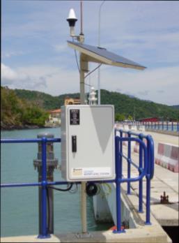
21 Tide Gauge Network Porto Malai Pulau Perak Teluk Bahang Terumbu Peninjau Kudat Pulau Perhentian Kota Kinabalu Sandakan Pulau Pangkor Pulau Ketam Kuala Terengganu Teluk Cempedak Bintulu Miri Labuan Semporna Sahabat Lahad Datu Tanjung Beruas Pulau Tioman Sibu Pontia n JMM
22 THE EFFECT OF TROPICAL CYCLONE TOWARDS MALAYSIA WEATHER
23 Past Tropical Cyclone Events In Malaysia Tropical Storm Greg (Dec 1996) : Direct Hit Tropical Storm Hilda (Jan 1999) : Tail Effect Typhoon Vamei (Dec 2001) : Direct Hit

24 Mean path of West Pacific originated Tropical Cyclone from The normal It is clear that Malaysia is not in the WNP typhoon track passage path of TC is westwards across the Philippines, recurring northeastwards as they approach the Asiatic land mass Malaysia may experience effect of TC TC formation in Southern South China Sea is rare : Based on past records, Malaysia suffered 2 direct strikes from TC mainly during this period 300km on either side of equator is cyclone free? 36
, November and December are the peak of TC occurrence (most of TS status) over SSCS about 1 TC per year Associated with the ITCZ movement Study")
25 Generally month of August and September is the peak season of TC in WNP According to Zuki, Z. M.,and A.R Lupo (2008), November and December are the peak of TC occurrence (most of TS status) over SSCS about 1 TC per year Associated with the ITCZ movement Study showed During La Nina (El Nino) years were more (less) occurrence


26 Tropical Storm Greg (Dec 1996) Formed in the South China Sea as TD on Dec 21 Headed east-southeastward, strengthened into the final TS on the 24 th After reaching a peak of 45 knots winds it crossed the northern part of Borneo on the 25th. Continued east-southeastward until dissipation on the 27th, south of the Philippines Caused flooding and severe mudslides in Sabah Leaved more than 4,000 people homeless Destruction of coral reefs Fatalities : 238 people Damage : $52 million USD


27 TS Greg : What actually happened? An example of Fujiwhara Effect between TS Greg and Typhoon Fern
28 Impacts of Tropical Storm Greg TS Greg moved into Sabah at around Z (Christmas night), depositing heavy rains that triggered floods and caused rivers to overflow their banks. The storm affected a total of 17,000 people from 226 villages along Sabah south west coast. It destroyed 4,925 houses and killed 230 people (as reported at that time) Tropical Storm Greg is the most devastating Tropical storm that ever hit Malaysia with an estimated economic loss around USD 280 million. 44


29 Impacts of Tropical Storm Greg The affected Pegalan River, Keningau (inland) Heavy rain from Greg cause it to flood with enormous volume of water and mud. 45


30 Impacts of Tropical Storm Greg Limbawan village is one of the most affected during TS Greg 46


31 Tropical Storm Hilda (Jan 1999) Stretched out from the NW Borneo coast early on Jan 4 Developed into a TD and moved slowly to the north away from the Borneo coast, becoming TS Hilda early on Jan 6 Tail effect to west coast of Sabah Caused flooding and landslides in Sabah Fatalities : 6 people Damage : $1.3 million USD

32 Impacts of Tropical Hilda Flood from heavy rain in Penampang Sabah caused by TS Hilda 48


33 Typhoon Vamei (Dec 2001) Developed on Dec 26 at 1.4 N in the South China Sea Strengthened quickly and made landfall along extreme southeastern Malaysia Rapidly dissipated over Sumatra on Dec 28, and the remnants eventually re-organized in the North Indian Ocean Brought flooding and landslides to Southeastern Peninsular Malaysia Fatalities : 5 people Damage : $4.2 million USD : $3.6 million USD (Lei and Zhou,2012)


34 Typhoon Vamei : Rare Typhoon of the Equator? Satellite imagery of Typhoon Vamei on 27 th December 2001 This rare event was first detected by observations of typhoon strength winds from a US navy ship, and the existence of an eye structure was confirmed by satellite and radar imageries Was the first recorded within 1.5 degree of the equator
, BV enhance convection and increase low level wind convergence over SCS but it will suppress the convective activity over its surrounding area The Borneo vortex is said to have occurred")
35 Borneo Vortex (BV) role during NE Monsoon According to Chang et. al. (2005), BV enhance convection and increase low level wind convergence over SCS but it will suppress the convective activity over its surrounding area The Borneo vortex is said to have occurred whenever a closed counterclockwise circulation on the 925-hPa wind field within the area of E E, 2.5 S 7.5 N was observed. The region of interest was depicted in the rectangular black box in Figure 8. This criteria was also used in Chang et al. (2005). 53


36 A strong cold surge event interacting spinning top effect with the BV that move and stay over narrow SCS water between Borneo and Peninsular Malaysia. As pointed out by Chang et al., the most intriguing question is not how Vamei could form so close to the equator, but is why such a formation was not observed before then suggested by Chang et al. (2003) In other word, such near equator typhoon can reoccur in the future. 54


37
 shows that TC presence over Borneo adjacent water can triggered BSL formation")
38 Recent study by Fadila et.al (2016, MMD Publication 6/2016) shows that TC presence over Borneo adjacent water can triggered BSL formation Strong convergence parallel to Borneo coastline and refreshing of SW Monsoon wind flow
39 JMA-MMD MRI III WAVE/ JMA STORM SURGE MODEL VERIFICATION AND VALIDATION

40 Bathymetry over SSCS Wind generally light Complex bathymetry Abrupt change in depth Not enough to generate high seas/swell TC cross over to West Philipines will be good for : Case study Tuning wave model The quality of numerical wave forecast output is strongly depend on the regional characteristics such as bathymetry and the wind field (Mazarakis et al., 2012)
41 SIGNIFICANT WAVE HEIGHT(m) WAVE MODEL VERIFICATION RESULTS 5 SWH_D_FG SWH_D_CG SWH_S_CG Layang Buoy (LB) TIME AT SIX-HOURLY 1st January - 28th February 2013 during TS Sonamu and Typhoon Shanshan
42 SIGNIFICANT WAVE HEIGHT(m) MEAN SIGNIFICANT WAVE HEIGHT Layang_Buoy SWH_S(FG) SWH_S(CG) TIME AT SIX-HOURLY Fine grid simulation of JMA- MRI III_S wave model show better accuracy
43 Reasonable High accuracy obtained PARAMETER MAE RMSE SI CC WSPD_CG WSPD_FG SWH_S(CG) SWH_S(FG)

44 Typhoon Vamei JMA-MMD Storm Surge Model simulation Kuantan 64 Best Track Parameterized wind JMA GSM NWP wind field Overestimation occurred for Best track input field No topography effect
45 Typhoon Vamei JMA-MMD Storm Surge Model Time series Best Track JMA GSM 65
46 Overestimation occurred for simulation using track data (RSMC) NWP wind and pressure forcing is more realistic Need to improve NWP atmospheric field : Typhoon bogussing in MMD mesoscale model? Model output deviates from observation. Possible : over-estimate wind speed from NWP during Vamei? Stations show slower wind / no surge Vamei was a typhoon during landfall? 67
47 MONITORING AND EARLY WARNING SYSTEM


48 JTWC Typhoon Center


49 JMA Typhoon Track FY-2E HIMAWARI NEW!!!

50 EC Wind Chart Wind chart (850 hpa) useful to detect areas of strong winds over Malaysia waters JMA Wind Chart
")

51 MMD WRF MODEL High Resolution (1km) WRF mesoscale Model Wind and other fields


52 Regional Storm Surge Watch Scheme Regional Storm Surge Watch Scheme ( Storm tide 73

53 Warning Criteria for Tropical Cyclones Warning Stages Orange Red Criteria Low-pressure system/tropical depression with sustained wind speeds of kmph accompanied by moderate to heavy rain. Tropical storm/typhoon with sustained wind speeds of at least 60 kmph accompanied by moderate to heavy rain. 75
54 MMD EARLY WARNING SYSTEM


55 WEATHER MONITORING, FORECASTING AND WARNING SYSTEM Radar Observation Surface Observation Marine Observation Aircraft Observation Weather Camera Upper Air Observation Satellite Observation Data Collection and Analysis Weather Forecast Centre Warning Dissemination Public


56 Dissemination of Sea Condition, Weather Forecast and Warning MMD WEBSITE MASS MEDIA TV, RADIO & NEWSPAPER SOCIAL MEDIA : FACEBOOK, TWITTER WEB SITE : MMD SMS INFORMATION SYSTEM SMS
57 CRITERIA FOR THE ISSUANCE OF STRONG WIND AND HIGH SEAS WARNING Warning Stage Criteria Possible Impact Yellow Orange Possibility of a monsoonal surge in the next 24 to 48 hours. Moderate monsoon rain is currently occurring or expected to occur in the next 24 hours. Low-pressure system/tropical depression with sustained wind speed of kmph accompanied by moderate to heavy rain. Flooding over low-lying areas and areas by river banks. Strong wind with sustained wind speed of kmph (whole tree in motion; inconvenience felt when walking against wind) with slight to moderate rain and has lasted for the last 2 hours. Thatched/zinc roofs can be blown off by the wind. Red Heavy widespread monsoon rain is currently occurring or expected to occur in the next few hours. Flooding over low-lying areas and areas by the river banks. Tropical storm/typhoon with sustained wind speed of at least 60 kmph accompanied by moderate to heavy rain. Strong wind with sustained wind speed of at least 60 kmph (breaks twigs off trees; generally impedes progress when walking against wind; structure damage occurs) with moderate to heavy rain and has lasted for the last 2 hours. Swift water currents can be dangerous to children playing besides monsoon drains and river banks. Thatched/zinc roofs can be blown off by the wind.
58 CONCLUSIONS Although Malaysia is not located on the common WNP TC track, TC has significant impact to the weather. TC that cross over to Western Philippines provide a valuable information in marine model verification/validation tuning Inadequate coverage of observational stations: automatic weather and marine stations, and radar. Huge cost of acquiring and maintaining observational instruments and systems. Low level of awareness on disaster due to limited capacity and resources to educate the POLITICIAN / public. 80
59 STRATEGIES FOR IMPROVEMENT Establishing observational stations at strategic locations and upgrading existing ones. Operationalization of advanced numerical models especially high resolution storm surge and wave models. Enhancing the dissemination of warnings through various telecommunication channels. Conducting regular disaster awareness programs. 81


60 PEOPLE-CENTRED MULTI-HAZARD EARLY WARNING SYSTEM PENGETAHUAN RISK KNOWLEDGE RISIKO OBSERVATION & WARNING SYSTEM DISSEMINATION & COMMUNICATION RESPONSE CAPACITY


61 Severe Weather Awareness Programs EXHIBITIONS DIALOGUES COMMUNITY PARTICIPATION MEDIA SESSIONS 83
62 STRATEGIES FOR IMPROVEMENT Identify risk areas and propose to the local authority to produce inundation maps for high risk zones. Colloboration with local authority involved in disaster management on data sharing, local and international agencies on tropical cyclone research (Blue Ocean Strategy) 84

63 Thank You Terima Kasih 85
Impact of Tropical Cyclones - Malaysia's Experience
 Impact of Tropical Cyclones - Malaysia's Experience ALUI BAHARI MALAYSIAN METEOROLOGICAL DEPARTMENT MINISTRY OF SCIENCE, TECHNOLOGY AND INNOVATION SCOPE Introduction Case Studies of Tropical Cyclones Impacting
UPDATE OF REGIONAL WEATHER AND SMOKE HAZE (December 2017)
") UPDATE OF REGIONAL WEATHER AND SMOKE HAZE (December 2017) 1. Review of Regional Weather Conditions for November 2017 1.1 In November 2017, Southeast Asia experienced inter-monsoon conditions in the first
UPDATE OF REGIONAL WEATHER AND SMOKE HAZE (December 2017) 1. Review of Regional Weather Conditions for November 2017 1.1 In November 2017, Southeast Asia experienced inter-monsoon conditions in the first
Strategic Planning and Management of MMD
 Fifth Technical Conference on Management of Meteorological & Hydrological Services In Regional V (South-West Pacific) Strategic Capacity Development of NMHS s in RAV Malaysia Meteorological Department
Malaysia Country Report
 Malaysia Country Report MALAYSIA METEOROLOGICAL DEPARTMENT asmadi@met.gov.my Joint Meeting of RA II WIGOS Project and RA V TT-SU Jakarta, Indonesia / 11 October 2018 BMKG Headquarter Outline I. Abstract
UPDATE OF REGIONAL WEATHER AND SMOKE HAZE (February 2018)
") UPDATE OF REGIONAL WEATHER AND SMOKE HAZE (February 2018) 1. Review of Regional Weather Conditions for January 2018 1.1 The prevailing Northeast monsoon conditions over Southeast Asia strengthened in January
UPDATE OF REGIONAL WEATHER AND SMOKE HAZE (February 2018) 1. Review of Regional Weather Conditions for January 2018 1.1 The prevailing Northeast monsoon conditions over Southeast Asia strengthened in January
KUALA LUMPUR MONSOON ACTIVITY CENT
 T KUALA LUMPUR MONSOON ACTIVITY CENT 2 ALAYSIAN METEOROLOGICAL http://www.met.gov.my DEPARTMENT MINISTRY OF SCIENCE. TECHNOLOGY AND INNOVATIO Introduction Atmospheric and oceanic conditions over the tropical
UPDATE OF REGIONAL WEATHER AND SMOKE HAZE November 2016
 UPDATE OF REGIONAL WEATHER AND SMOKE HAZE November 2016 1. Review of Regional Weather Conditions in November 2016 1.1 Southwest Monsoon conditions prevailed on most days in October 2016 and the winds were
UPDATE OF REGIONAL WEATHER AND SMOKE HAZE (September 2017)
") UPDATE OF REGIONAL WEATHER AND SMOKE HAZE (September 2017) 1. Review of Regional Weather Conditions in August 2017 1.1 Southwest Monsoon conditions continued to prevail in the region in August 2017. The
UPDATE OF REGIONAL WEATHER AND SMOKE HAZE (September 2017) 1. Review of Regional Weather Conditions in August 2017 1.1 Southwest Monsoon conditions continued to prevail in the region in August 2017. The
1. Introduction. 2. Verification of the 2010 forecasts. Research Brief 2011/ February 2011
 Research Brief 2011/01 Verification of Forecasts of Tropical Cyclone Activity over the Western North Pacific and Number of Tropical Cyclones Making Landfall in South China and the Korea and Japan region
UPDATE OF REGIONAL WEATHER AND SMOKE HAZE (May 2017)
") UPDATE OF REGIONAL WEATHER AND SMOKE HAZE (May 2017) 1. Review of Regional Weather Conditions in April 2017 1.1 Inter monsoon conditions, characterised by afternoon showers and winds that are generally
UPDATE OF REGIONAL WEATHER AND SMOKE HAZE (May 2017) 1. Review of Regional Weather Conditions in April 2017 1.1 Inter monsoon conditions, characterised by afternoon showers and winds that are generally
UPDATE OF REGIONAL WEATHER AND SMOKE HAZE December 2016
 UPDATE OF REGIONAL WEATHER AND SMOKE HAZE December 2016 1. Review of Regional Weather Conditions in November 2016 1.1 Inter monsoon conditions prevailed in the first half of November 2016. During this
Regional Climate Observation & Simulation of Extreme Temperature & Precipitation Trends
 Regional Climate Observation & Simulation of Extreme Temperature & Precipitation Trends By: M.K. Sammathuria & L.K. Ling Malaysian Meteorological Department Ministry of Science, Technology and Innovation
Development of Tropical Storm Falcon (Meari) over the Philippines
 over the Philippines") Development of Tropical Storm Falcon (Meari) over the Philippines June 20-27, 2011 At the end of June, 2011, the Philippines were struck again by Tropical storm Falcon (Meari). After gaining strength over
Development of Tropical Storm Falcon (Meari) over the Philippines June 20-27, 2011 At the end of June, 2011, the Philippines were struck again by Tropical storm Falcon (Meari). After gaining strength over
Enhancing Preparedness and Early Warning in Disaster Risk Reduction
 Enhancing Preparedness and Early Warning in Disaster Risk Reduction Fifth Technical Conference on Management of Meteorological and Hydrological Services in Regional Association V at PETALING JAYA, MALAYSIA
National Report on Weather Forecasting Service
 MINISTRY OF WATER RESOURCES AND METEOROLOGY DEPARTMENT OF METEOROLOGY, CAMBODIA National Report on Weather Forecasting Service Tokyo, 11-15 March 2014 Department of Meteorology, Cambodia Presentation Outline
Government of Sultanate of Oman Public Authority of Civil Aviation Directorate General of Meteorology. National Report To
 Government of Sultanate of Oman Public Authority of Civil Aviation Directorate General of Meteorology National Report To Panel on Tropical Cyclones in the Bay of Bengal And Arabian Sea 43rd Session, India
PREDICTION OF OIL SPILL TRAJECTORY WITH THE MMD-JMA OIL SPILL MODEL
 PREDICTION OF OIL SPILL TRAJECTORY WITH THE MMD-JMA OIL SPILL MODEL Project Background Information MUHAMMAD HELMI ABDULLAH MALAYSIAN METEOROLOGICAL DEPARTMENT(MMD) MINISTRY OF SCIENCE, TECHNOLOGY AND INNOVATION
Hurricanes. April 14, 2009
 Tropical Weather & Hurricanes Chapter 15 April 14, 2009 Tropical meteorology Tropics characterized by seasonal wet and drier periods- wet when sun is nearly overhead at noon and inter-tropical convergence
An Application of Hydrometeorological Information
 An Application of Hydrometeorological Information Weather-proof Café: Hydro-meteorological information in managing weather risks 17 19 November 2012 National Taiwan University, Chinese Taipei Nikos Viktor
Ocean in Motion 7: El Nino and Hurricanes!
 Ocean in Motion 7: El Nino and Hurricanes! A. Overview 1. Ocean in Motion -- El Nino and hurricanes We will look at the ocean-atmosphere interactions that cause El Nino and hurricanes. Using vocabulary
Analysis of Fall Transition Season (Sept-Early Dec) Why has the weather been so violent?
 Why has the weather been so violent?") WEATHER TOPICS Analysis of Fall Transition Season (Sept-Early Dec) 2009 Why has the weather been so violent? As can be seen by the following forecast map, the Fall Transition and early Winter Season of
WEATHER TOPICS Analysis of Fall Transition Season (Sept-Early Dec) 2009 Why has the weather been so violent? As can be seen by the following forecast map, the Fall Transition and early Winter Season of
Joint Meeting of RA II WIGOS Project and RA V TT-SU on 11 October 2018 BMKG Headquarter Jakarta, Indonesia. Mrs. Sinthaly CHANTHANA
 Joint Meeting of RA II WIGOS Project and RA V TT-SU on 11 October 2018 BMKG Headquarter Jakarta, Indonesia Mrs. Sinthaly CHANTHANA Lao PDR Background Department of Meteorology and Hydrology ( DMH ) in
Recent development of the National Hydro-Meteorological Service (NHMS) of Viet Nam for disaster risk reduction
 of Viet Nam for disaster risk reduction") Ministry of Natural Resources and Environment National Hydro-Meteorological Service Recent development of the National Hydro-Meteorological Service (NHMS) of Viet Nam for disaster risk reduction Tran Van
Ministry of Natural Resources and Environment National Hydro-Meteorological Service Recent development of the National Hydro-Meteorological Service (NHMS) of Viet Nam for disaster risk reduction Tran Van
Heavy Rain/Flooding September 8-10 Associated with Tropical Storm Etau
 Heavy Rain/Flooding September 8-10 Associated with Tropical Storm Etau Wx Files Vol.32 September 24, 2015 Tropical Storm Etau made landfall over the Chita Peninsula in Aichi just after 10:00 AM on September
Recent studies on tropical cyclone landfalling in China
 Recent studies on tropical cyclone landfalling in China Lei Xiaotu Shanghai Typhoon Institute CMA, Shanghai, China email: xtlei@21cn.com 1. Losses caused by tropical cyclones in China China is one of the
11/19/14. Chapter 11: Hurricanes. The Atmosphere: An Introduction to Meteorology, 12 th. Lutgens Tarbuck
 Chapter 11: Hurricanes The Atmosphere: An Introduction to Meteorology, 12 th Lutgens Tarbuck Lectures by: Heather Gallacher, Cleveland State University! Hurricanes: " Hurricanes are intense centers of
Verification of the Seasonal Forecast for the 2005/06 Winter
 Verification of the Seasonal Forecast for the 2005/06 Winter Shingo Yamada Tokyo Climate Center Japan Meteorological Agency 2006/11/02 7 th Joint Meeting on EAWM Contents 1. Verification of the Seasonal
Tokyo, Japan March Discussed By: May Khin Chaw, Kyaw Lwin Oo. Department of Meteorology and Hydrology
 Tokyo, Japan 11-14 March 2014 Discussed By: May Khin Chaw, Kyaw Lwin Oo Department of Meteorology and Hydrology Manpower: Out of DMH s total (1425), we are Working with (780) Staffs. 55% (37) stations
Ch. 11: Hurricanes. Be able to. Define what hurricane is. Identify the life and death of a hurricane. Identify the ways we track hurricanes.
 Ch. 11: Hurricanes Be able to Define what hurricane is. Identify the life and death of a hurricane. Identify the ways we track hurricanes. What are Hurricanes? Smaller than mid-latitude cyclones. Don t
ATMOSPHERIC MODELLING. GEOG/ENST 3331 Lecture 9 Ahrens: Chapter 13; A&B: Chapters 12 and 13
 ATMOSPHERIC MODELLING GEOG/ENST 3331 Lecture 9 Ahrens: Chapter 13; A&B: Chapters 12 and 13 Agenda for February 3 Assignment 3: Due on Friday Lecture Outline Numerical modelling Long-range forecasts Oscillations
Hurricanes and Tropical Weather Systems:
 Hurricanes and Tropical Weather Systems: An influence on weather in parts of the USA Meteorology 411 Iowa State University Week 2 Bill Gallus Classification/Terminology Tropical Disturbance enhanced convection
Disclaimer. This report was compiled by an ADRC visiting researcher (VR) from ADRC member countries.
 from ADRC member countries.") Disclaimer This report was compiled by an ADRC visiting researcher (VR) from ADRC member countries. The views expressed in the report do not necessarily reflect the views of the ADRC. The boundaries and
Disclaimer This report was compiled by an ADRC visiting researcher (VR) from ADRC member countries. The views expressed in the report do not necessarily reflect the views of the ADRC. The boundaries and
ESCI 241 Meteorology Lesson 19 Tropical Cyclones Dr. DeCaria
 ESCI 241 Meteorology Lesson 19 Tropical Cyclones Dr. DeCaria READING: Chapter 16 GENERAL A tropical cyclone is a large, low-pressure system that forms over the tropical oceans. Tropical cyclones are classified
Frank Revitte National Weather Service. Weather Forecast Office New Orleans/Baton Rouge
 Frank Revitte National Weather Service Weather Forecast Office New Orleans/Baton Rouge Above normal activity 17 Total Named Storms 7 Tropical Storms 4 Hurricanes 6 Major Hurricanes Not the most active,
UPDATE OF REGIONAL WEATHER AND SMOKE HAZE February 2016
 UPDATE OF REGIONAL WEATHER AND SMOKE HAZE February 2016 1. Review of Regional Weather Conditions in January 2016 1.1 The Northeast Monsoon conditions prevailed in the region in January 2016. With the monsoon
ARUBA CLIMATOLOGICAL SUMMARY 2017 PRECIPITATION
 ARUBA CLIMATOLOGICAL SUMMARY 2017 PRECIPITATION The total amount of rainfall recorded at Reina Beatrix International Airport for the year 2017 was 391.0 mm. This is 17.1 % below normal ( Figure 1 ). During
(April 7, 2010, Wednesday) Tropical Storms & Hurricanes Part 2
 Tropical Storms & Hurricanes Part 2") Lecture #17 (April 7, 2010, Wednesday) Tropical Storms & Hurricanes Part 2 Hurricane Katrina August 2005 All tropical cyclone tracks (1945-2006). Hurricane Formation While moving westward, tropical disturbances
Lecture #17 (April 7, 2010, Wednesday) Tropical Storms & Hurricanes Part 2 Hurricane Katrina August 2005 All tropical cyclone tracks (1945-2006). Hurricane Formation While moving westward, tropical disturbances
Meteorological Hazards and Current Approach to Observing, Modelling and Predicting Severe Events in Sri Lanka
 Regional Workshop on Impact-based Forecasts in RA II (Asia) 7-9, November, 2017, Seoul, Republic of Korea Meteorological Hazards and Current Approach to Observing, Modelling and Predicting Severe Events
Weather Forecasting in Flood Forecasting Activities
 Weather Forecasting in Flood Forecasting Activities Eugene Poolman South African Weather Service Representing CBS Pretoria South Africa FCAST PRES 20130919 001 Main Activities of CBS Development, implementation
UPDATE OF REGIONAL WEATHER AND SMOKE HAZE FOR MAY 2015
 UPDATE OF REGIONAL WEATHER AND SMOKE HAZE FOR MAY 2015 1. Review of Regional Weather Conditions in April 2015 1.1 Inter-Monsoon conditions prevailed over the ASEAN region in April 2015. The gradual northward
Using Reanalysis SST Data for Establishing Extreme Drought and Rainfall Predicting Schemes in the Southern Central Vietnam
 Using Reanalysis SST Data for Establishing Extreme Drought and Rainfall Predicting Schemes in the Southern Central Vietnam Dr. Nguyen Duc Hau 1, Dr. Nguyen Thi Minh Phuong 2 National Center For Hydrometeorological
Chapter 24 Tropical Cyclones
 Chapter 24 Tropical Cyclones Tropical Weather Systems Tropical disturbance a cluster of thunderstorms about 250 to 600 km in diameter, originating in the tropics or sub-tropics Tropical depression a cluster
Department of Atmospheric Sciences, National Taiwan University, Taipei, Taiwan
 10A.4 TROPICAL CYCLONE FORMATIONS IN THE SOUTH CHINA SEA CHENG-SHANG LEE 1 AND YUNG-LAN LIN* 1, 2 1 Department of Atmospheric Sciences, National Taiwan University, Taipei, Taiwan 2 Taipei Aeronautic Meteorological
Earth Observation & forecasting Storm Surges in the North Western Pacific. Mr. Nadao Kohno Japan Meteorological Agency
 Earth Observation & forecasting Storm Surges in the North Western Pacific Mr. Nadao Kohno Japan Meteorological Agency Lesson Outline Introduction JMA s responsibility and work as a RSMC, Tokyo Typhoon
Bistandsprosjekter i Sørøst-Asia
 Bistandsprosjekter i Sørøst-Asia -Sikre liv og verdier Lars R. Hole, Hanneke Luijting, Tor Ivar Mathisen og Kristine Gjesdal September 2017 Norwegian Meteorological Institute Background Ministry of Foreign
Chapter 24. Tropical Cyclones. Tropical Cyclone Classification 4/19/17
 Chapter 24 Tropical Cyclones Tropical Cyclones Most destructive storms on the planet Originate over tropical waters, but their paths often take them over land and into midlatitudes Names Hurricane (Atlantic
Ch. 3: Weather Patterns
 Ch. 3: Weather Patterns Sect. 1: Air Mass & Fronts Sect. 2: Storms Sect. 3: Predicting the Weather Sect. 4: Weather forecasters use advanced technologies Ch. 3 Weather Fronts and Storms Objective(s) 7.E.1.3
2014/2/25. Earth Observation & forecasting Storm Surges in the North Western Pacific. Lesson Outline. RSMC Tokyo Typhoon Center.
 Earth Observation & forecasting Storm Surges in the North Western Pacific Mr. Nadao Kohno Japan Meteorological Agency Lesson Outline Introduction JMA s responsibility and work as a RSMC, Tokyo Typhoon
Activities and Outlook related to Disaster Reduction in CMA
 Activities and Outlook related to Disaster Reduction in CMA WANG Bangzhong China Meteorological Administration March 15-17 2006 ADENDA Situation about MD and related disasters in CHINA Guidance for MD/RD
On the presence of tropical vortices over the Southeast Asian Sea- Maritime Continent region
 Technical Conference of 50 th Annual Session of Typhoon Committee 2018 On the presence of tropical vortices over the Southeast Asian Sea- Maritime Continent region Nguyen Dang-Quang 1, James Renwick 2,
Fire Weather Drivers, Seasonal Outlook and Climate Change. Steven McGibbony, Severe Weather Manager Victoria Region Friday 9 October 2015
 Fire Weather Drivers, Seasonal Outlook and Climate Change Steven McGibbony, Severe Weather Manager Victoria Region Friday 9 October 2015 Outline Weather and Fire Risk Environmental conditions leading to
WEATHER SYSTEMS IMPACTING THE CAYMAN ISLANDS Prepared by the staff of the Cayman Islands National Weather Service
 WEATHER SYSTEMS IMPACTING THE CAYMAN ISLANDS 2008 Prepared by the staff of the Cayman Islands National Weather Service TROPICAL STORM DOLLY Formed 194 miles west of Grand Cayman July 19 th. The tropical
Reduction of the Radius of Probability Circle. in Typhoon Track Forecast
 Reduction of the Radius of Probability Circle in Typhoon Track Forecast Nobutaka MANNOJI National Typhoon Center, Japan Meteorological Agency Abstract RSMC Tokyo - Typhoon Center of the Japan Meteorological
COUNTRY PRESENTATION ON MR JAYNAL ABEDIN JOINT SECRETARY ( WORKS & DEVELOPMENT ) MINISTRY OF DEFENCE
 MINISTRY OF DEFENCE") COUNTRY PRESENTATION ON By MR JAYNAL ABEDIN JOINT SECRETARY ( WORKS & DEVELOPMENT ) MINISTRY OF DEFENCE Bangladesh Geographical Location of Bangladesh Bangladesh Country at a Glance Physical Features 1,230
COUNTRY PRESENTATION ON By MR JAYNAL ABEDIN JOINT SECRETARY ( WORKS & DEVELOPMENT ) MINISTRY OF DEFENCE Bangladesh Geographical Location of Bangladesh Bangladesh Country at a Glance Physical Features 1,230
EFFECTIVE TROPICAL CYCLONE WARNING IN BANGLADESH
 Country Report of Bangladesh On EFFECTIVE TROPICAL CYCLONE WARNING IN BANGLADESH Presented At JMA/WMO WORKSHOP ON EFFECTIVE TROPICAL CYCLONE WARNING IN SOUTHEAST ASIA Tokyo, Japan,11-14 March 2014 By Sayeed
South Asian Climate Outlook Forum (SASCOF-12)
") Twelfth Session of South Asian Climate Outlook Forum (SASCOF-12) Pune, India, 19-20 April 2018 Consensus Statement Summary Normal rainfall is most likely during the 2018 southwest monsoon season (June
Twelfth Session of South Asian Climate Outlook Forum (SASCOF-12) Pune, India, 19-20 April 2018 Consensus Statement Summary Normal rainfall is most likely during the 2018 southwest monsoon season (June
What a Hurricane Needs to Develop
 Massive Storms! Hurricanes What a Hurricane Needs to Develop Warm tropical water - at least 80 F High Humidity Light wind Low Pressure Area Form between 5 and 20 latitude Hurricane Ingredients Hurricane
Smart use of Geographic Information System (GIS) platform for delivering weather information and nowcasting services
 platform for delivering weather information and nowcasting services") Smart use of Geographic Information System (GIS) platform for delivering weather information and nowcasting services C. K. Pan Hong Kong Observatory Hong Kong, China It is a world of beauty Source: Image
Smart use of Geographic Information System (GIS) platform for delivering weather information and nowcasting services C. K. Pan Hong Kong Observatory Hong Kong, China It is a world of beauty Source: Image
Hurricane Basics and Preparedness. Jim Weyman Director, Central Pacific Hurricane Center Phone Office:
 Hurricane Basics and Preparedness Jim Weyman Director, Central Pacific Hurricane Center Phone Office: 973-5270 james.weyman@noaa.gov United States Hurricane/Typhoon Centers National Hurricane Center, Miami
Tonga Country Report
 Tonga Country Report Tonga Meteorological Services Ph. (676)35355 email: metstaff@met.gov.to Joint Meeting of RA II WIGOS Project and RA V TT-SU Jakarta, Indonesia / 11 October 2018 BMKG Headquarter Outline
El Niño Update Impacts on Florida
 Current Issues in Emergency Management (CIEM) Sessions 1 &2 October 12 th and 26 th, 2006 Florida Division of Emergency Management Tallahassee, Florida El Niño Update Impacts on Florida Bart Hagemeyer
Outline of 4 Lectures
 Outline of 4 Lectures 1. Sept. 17, 2008: TC best track definition and datasets, global distribution of TCs; Review of history of meteorological satellites, introducing different orbits, scanning patterns,
HURRICANES AND TORNADOES
 HURRICANES AND TORNADOES The most severe weather systems are hurricanes and tornadoes. They occur in extremely low pressure systems, or cyclones, when the air spirals rapidly into the center of a low.
PAGASA s Expectations of New-generation Satellites for Hazard Monitoring
 Country Report Philippines PAGASA s Expectations of New-generation Satellites for Hazard Monitoring VICENTE P. PALCON, JR. (Assistant Weather Services Chief) Weather Division- PAGASA DOST Email: vppalconjr@pagasa.dost.gov.ph
Weather forecasts and warnings: Support for Impact based decision making
 Weather forecasts and warnings: Support for Impact based decision making Gerry Murphy, Met Éireann www.met.ie An Era of Change Climate and weather is changing Societal vulnerability is increasing The nature
"STUDY ON THE VARIABILITY OF SOUTHWEST MONSOON RAINFALL AND TROPICAL CYCLONES FOR "
 "STUDY ON THE VARIABILITY OF SOUTHWEST MONSOON RAINFALL AND TROPICAL CYCLONES FOR 2001 2010" ESPERANZA O. CAYANAN, Ph.D. Chief, Climatology & Agrometeorology R & D Section Philippine Atmospheric Geophysical
COUNTRY REPORT. Jakarta. July, th National Directorate of Meteorology and Geophysics of Timor-Leste (DNMG)
") The Southeastern Asia-Oceania Flash Flood COUNTRY REPORT Jakarta. July, 10-12 th 2017 National Directorate of Meteorology and Geophysics of Timor-Leste (DNMG) Carla Feritas and Crisostimo Lobato Democratic
The Southeastern Asia-Oceania Flash Flood COUNTRY REPORT Jakarta. July, 10-12 th 2017 National Directorate of Meteorology and Geophysics of Timor-Leste (DNMG) Carla Feritas and Crisostimo Lobato Democratic
JCOMM-CHy Coastal Inundation Forecasting Demonstration Project (CIFDP)
") WMO World Meteorological Organization Working together in weather, climate and water JCOMM-CHy Coastal Inundation Forecasting Demonstration Project (CIFDP) Coastal Flooding & Vulnerable Populations Coastal
WMO World Meteorological Organization Working together in weather, climate and water JCOMM-CHy Coastal Inundation Forecasting Demonstration Project (CIFDP) Coastal Flooding & Vulnerable Populations Coastal
Chapter 1 Climate in 2016
 Chapter 1 Climate in 2016 1.1 Global climate summary Extremely high temperatures were frequently observed in many regions of the world, and in particular continued for most of the year in various places
Weather and Climate Basics
 Weather and Climate Basics Laura Boekel Forecaster at Bureau of Meteorology Aims of this presentation To describe what I do as a forecaster at the Bureau of Meteorology To provide an interesting introduction
Weather and Climate Basics
 Aims of this presentation Weather and Climate Basics To describe what I do as a forecaster at the Bureau of Meteorology Laura Boekel Forecaster at Bureau of Meteorology To provide an interesting introduction
WMO Statement on the State of the Global Climate Preliminary conclusions for 2018 and WMO Greenhouse Bulletin
 WMO Statement on the State of the Global Climate Preliminary conclusions for 2018 and WMO Greenhouse Bulletin Dr Elena Manaenkova Deputy Secretary General World Meteorological Organisation Statement on
Chapter 16, Part Hurricane Paths. 2. Hurricane Paths. Hurricane Paths and Damage
 Chapter 16, Part 2 Hurricane Paths and Damage 1. Hurricane Paths Start over tropical water except South Atlantic and eastern South Atlantic, where water is too cold. Initially steered by easterly winds
Will a warmer world change Queensland s rainfall?
 Will a warmer world change Queensland s rainfall? Nicholas P. Klingaman National Centre for Atmospheric Science-Climate Walker Institute for Climate System Research University of Reading The Walker-QCCCE
JOINT BRIEFING TO THE MEMBERS. El Niño 2018/19 Likelihood and potential impact
 JOINT BRIEFING TO THE MEMBERS El Niño 2018/19 Likelihood and potential impact CURRENT EL NIÑO OUTLOOK (SEPTEMBER 2018) CPC/IRI ENSO Forecast from September. Red bars denote probability of an El Nino developing
Atmospheric circulation analysis for seasonal forecasting
 Training Seminar on Application of Seasonal Forecast GPV Data to Seasonal Forecast Products 18 21 January 2011 Tokyo, Japan Atmospheric circulation analysis for seasonal forecasting Shotaro Tanaka Climate
Improving global coastal inundation forecasting WMO Panel, UR2014, London, 2 July 2014
 Improving global coastal inundation forecasting WMO Panel, UR2014, London, 2 July 2014 Cyclone Sidr, November 2007 Hurricane Katrina, 2005 Prof. Kevin Horsburgh Head of marine physics, UK National Oceanography
 Page 1 of 5 Home research global climate enso effects Research Effects of El Niño on world weather Precipitation Temperature Tropical Cyclones El Niño affects the weather in large parts of the world. The
Hurricanes. Environmental Geology Mr. Paul Lowrey. Stacey Singleton, Cassandra Combs, Dwight Stephenson, Matt Smithyman
 Environmental Geology Mr. Paul Lowrey Stacey Singleton, Cassandra Combs, Dwight Stephenson, Matt Smithyman Hurricanes EMPACTS Project, Spring 2017 Northwest Arkansas Community College, Bentonville, AR
NWS HURRICANES June 3, 2015
 NWS HURRICANES June 3, 2015 Hurricane Season June 1 November 30 2 What s the concern? All tropical systems passing within 125nm of central Maryland since 1950 Mid-Atlantic Hurricanes Greatest Risk: August
Coastal Inundation Forecasting Demonstration Project CIFDP. Flood Forecasting Initiative-Advisory Group (FFI-AG 3), Geneva, 5-7 Dec, 2017
, Geneva, 5-7 Dec, 2017") Coastal Inundation Forecasting Demonstration Project CIFDP Flood Forecasting Initiative-Advisory Group (FFI-AG 3), Geneva, 5-7 Dec, 2017 Coastal Flooding & Vulnerable Populations Coastal populations are
Coastal Inundation Forecasting Demonstration Project CIFDP Flood Forecasting Initiative-Advisory Group (FFI-AG 3), Geneva, 5-7 Dec, 2017 Coastal Flooding & Vulnerable Populations Coastal populations are
Weathernews Looks Back at 2015: A Year of Storms. Powerful Typhoons Occurred with Changing Patterns in El Niño Years
 NEWS RELEASE January 27th, 2016 Weathernews Looks Back at 2015: A Year of Storms Powerful Typhoons Occurred with Changing Patterns in El Niño Years Weathernews Inc. (Chiba, Japan; Chihito Kusabiraki/CEO)
Life Cycle of Convective Systems over Western Colombia
 Life Cycle of Convective Systems over Western Colombia Meiry Sakamoto Uiversidade de São Paulo, São Paulo, Brazil Colombia Life Cycle of Convective Systems over Western Colombia Convective System (CS)
Impact of different cumulus parameterizations on the numerical simulation of rain over southern China
 Impact of different cumulus parameterizations on the numerical simulation of rain over southern China P.W. Chan * Hong Kong Observatory, Hong Kong, China 1. INTRODUCTION Convective rain occurs over southern
THE STUDY OF NUMBERS AND INTENSITY OF TROPICAL CYCLONE MOVING TOWARD THE UPPER PART OF THAILAND
 THE STUDY OF NUMBERS AND INTENSITY OF TROPICAL CYCLONE MOVING TOWARD THE UPPER PART OF THAILAND Aphantree Yuttaphan 1, Sombat Chuenchooklin 2 and Somchai Baimoung 3 ABSTRACT The upper part of Thailand
11/17/2017. Memorable Hurricanes of 2004 MET 4532
 MET 4532 2004 Hurricane Season Lecture 31 & 32 2004, 2005, and After 17-20 November 2017 1 2 Memorable Hurricanes of 2004 Hurricane Dates Damage (US) Deaths (US) Charlie (4) 9-14 AUG $14B 10 Ivan (4) 2-24
Marshall Alexander Forecaster Commonwealth of Dominica
 Marshall Alexander Forecaster Commonwealth of Dominica Dominica 2015 Impacts Tropical Storm Danny (August 24 th ) Tropical Storm Erika (August 27 th ) Tropical Storm Grace (Remnants) (September 10 th -11
JMA/WMO WORKSHOP ON EFFECTIVE TROPICAL CYCLONE WARNING IN SOUTHEAST ASIA
 JMA/WMO WORKSHOP ON EFFECTIVE TROPICAL CYCLONE WARNING IN SOUTHEAST ASIA TROPICAL CYCLONE MONITORING IN LAO PDR TOKYO, JAPAN 11 14 March 2014 Ministry of Natural Resource and Environment (MONRE) Department
- tornadoes. Further Reading: Chapter 08 of the text book. Outline. -tropical storms. -Storm surge
 (1 of 12) Further Reading: Chapter 08 of the text book Outline - tornadoes -tropical storms -Storm surge (2 of 12) Introduction Previously, We talked about fronts and their relationship to air masses Also
Tropical Cyclone Warning System in the Philippines
 Republic of the Philippines Department of Science and Technology PHILIPPINE ATMOSPHERIC GEOPHYSICAL AND ASTRONOMICAL SERVICES ADMINISTRAION (PAGASA) Science Garden Compound, Agham Road, Diliman, Quezon
The Role of PAGASA in Disaster Mitigation
 The Role of PAGASA in Disaster Mitigation Christopher F. Perez 2017 ACTS Workshop on Extreme Weather Forecast and Water Resource Management Hanoi, Vietnam September 26-27, 2017 Tropical Storm AMANG(Mekkhala),
Tropical Cyclone Hazards. Presentation
 Tropical Cyclone Hazards Presentation Kerry N Mallory AE5JY September 7, 2011 Tropical Cyclone Hazards The Four Primary Weapons of a Tropical Cyclone are: 1. Wind 2. Storm Surge 3. Rain/Freshwater Flooding
AVIATION APPLICATIONS OF A NEW GENERATION OF MESOSCALE NUMERICAL WEATHER PREDICTION SYSTEM OF THE HONG KONG OBSERVATORY
 P452 AVIATION APPLICATIONS OF A NEW GENERATION OF MESOSCALE NUMERICAL WEATHER PREDICTION SYSTEM OF THE HONG KONG OBSERVATORY Wai-Kin WONG *1, P.W. Chan 1 and Ivan C.K. Ng 2 1 Hong Kong Observatory, Hong
MEMBER REPORT. ESCAP/WMO Typhoon Committee 8 th Integrated Workshop/2 nd TRCG Forum (CAMBODIA)
") MEMBER REPORT ESCAP/WMO Typhoon Committee 8 th Integrated Workshop/2 nd TRCG Forum (CAMBODIA) Macao, China 2-6 December 2013 CONTENTS I. Overview of tropical cyclones which have affected/impacted Member
MEMBER REPORT ESCAP/WMO Typhoon Committee 8 th Integrated Workshop/2 nd TRCG Forum (CAMBODIA) Macao, China 2-6 December 2013 CONTENTS I. Overview of tropical cyclones which have affected/impacted Member
Metocean Forecast Verification for Erb West Platform over South China Sea
 Metocean Forecast Verification for Erb West Platform over South China Sea Ambun Dindang, Salleha Seth and Wan Azlina bt. Wan Abd Aziz The Malaysian Meteorological Department, Jalan Sultan, 46667, Petaling
Issue Overview: El Nino and La Nina
 Issue Overview: El Nino and La Nina By Bloomberg, adapted by Newsela staff on 09.28.16 Word Count 748 TOP: A Category 5 typhoon in the Pacific Ocean. BOTTOM: Graphics courtesy of the U.S. National Oceanic
Storm Surge Forecasting and Warning in the Philippines
 Storm Surge Forecasting and Warning in the Philippines 3 rd Masterclass on Disaster Mitigation APAN46 Asia Pacific Advanced Network Meeting 08 August 2018 Jehan Fe S. Panti PAGASA-DOST jspanti@pagasa.dost.gov.ph
What a Hurricane Needs to Develop
 Weather Weather is the current atmospheric conditions, such as air temperature, wind speed, wind direction, cloud cover, precipitation, relative humidity, air pressure, etc. 8.10B: global patterns of atmospheric
South African Weather Service. Description of Public Weather and Warning Services. Tshepho Ngobeni. 18 November 2013
 South African Weather Service Description of Public Weather and Warning Services Tshepho Ngobeni 18 November 2013 SAWS-SWFDP_PRES_18-22_Nov_2013 1 Outline Forecasting Descriptions and Processes Severe
Tropical Revolving Storms: Cuba 2008 By The British Geographer
 Place Context Tropical Revolving Storms: Cuba 2008 By The British Geographer The Republic of Cuba is located in the northern tropics with in island chain of the Caribbean. It is made up of one large Island,