Atmospheric River Reconnaissance
|
|
|
- Dana Barton
- 5 years ago
- Views:
Transcription

1 Air Force C 130 Aircraft Weather Recon Squadron NOAA G IV Atmospheric River Reconnaissance F. Marty Ralph Forest Cannon FMA Annual Conference 6 Sep Reno NV
 predictions AR Forecast skill assessment establishes a performance baseline error 400 km AR Landfall position forecast error at 3 day lead time Wick et al.")
2 Atmospheric River Reconnaissance FM Ralph (Scripps/CW3E), V Tallapragada (NWS/NCEP), J Doyle (NRL) Water managers, transportation sector, agriculture, etc require improved atmospheric river (AR) predictions AR Forecast skill assessment establishes a performance baseline error 400 km AR Landfall position forecast error at 3 day lead time Wick et al. 2013
 00Z 13 February (Final Time 12Z 14 February 2014) J. Doyle, C. Reynolds, C. Amerault, F.M.")
 Forecast improvement area Potential Impact of Targeted")
3 Atmospheric River Reconnaissance FM Ralph (Scripps/CW3E), V Tallapragada (NWS/NCEP), J Doyle (NRL) Three primary sources of error in numerical weather prediction: New Adjoint includes moisture and finds AR is prime target 36-h Sensitivity (Analysis) 00Z 13 February (Final Time 12Z 14 February 2014) J. Doyle, C. Reynolds, C. Amerault, F.M. Ralph (International Atmospheric Rivers Conference 2016) Color contours show the forecast sensitivity to 850 mb water vapor (grey shading) uncertainty at analysis time 00Z 13 Feb 2014 for a 36 h forecast over NorCal valid 12Z 14 Feb Unresolved subgridscale processes Parameterization error Initial condition error (WSWC Report 2013) Forecast improvement area Potential Impact of Targeted Observations is Maximized Moisture sensitivity is strongest along AR axis; located > 2000 km upstream Moisture sensitivity substantially larger than temp. or wind sensitivity.
 Was the Oroville Incident Related to an AR? Yes.")
4 An example forecast challenge: 7 Feb (Oroville) Was the Oroville Incident Related to an AR? Yes. An AR of Extreme intensity hit the area.
 and J.")
5 NCEP GEFS dprog/dt Example from February 2017 Oroville Case (dam spillway issue) Moderate Strong Extreme Init: 12Z/5 Feb Init: 12Z/6 Feb Init: 12Z/7 Feb F. M. Ralph and J. Cordeira

 indicated that ~6 fell along the Coastal Mts.")

6 AR Outlook: 22 March 2018 CNRFC 24 hr QPF issued 20 March valid 5 AM PDT 21 to 5 AM 22 March 2018 CNRFC 24 hr QPE valid 5 AM PDT 21 to 5 AM 22 March 2018 The 24 hr accumulated precipitation forecast for 6 + The 24 hr quantitative precipitation estimate (QPE) indicated that ~6 fell along the Coastal Mts. and ~2 fell over the Santa Ynez Mts. The QPE accumulations resulted in a over forecast of ~4 in. over the Santa Ynez Mts. and an under forecast of ~3 in. over Big Sur
 18 14 10 6 2 Analysis 96-h TIVT Forecast -")

")
.")
7 96-h TIVT Analysis and Forecast Verification: Valid 00Z 20 Mar. 00Z 24 Mar h TIVT (10 7 kg m -1 ) Analysis 96-h TIVT Forecast - Analysis h 40 o N 30 o N 130 o W 120 o W 130 o W 120 o W The errors in the precipitation forecasts were partly driven by errors in weather model forecast of AR landfall location However, the observations (GFS analysis) showed that the core of the AR was instead over Big Sur (~ km from the predicted position). Big Sur did receive up to 8+ inches of rain, while mountains above Santa Barbara received 2 4 inches


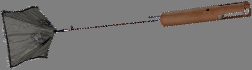
8 AR RECON: USAF C 130 NOAA G IV Average Number of AR Days and Percentage of Precipitation Attributable to ARs (Jan Feb, ) USAF C 130 NOAA G IV USAF C 130 Address model initial condition errors through targeted observation profiles Number of AR Days % of Precipitation Attributable to ARs
 1.")

 6 storms in 2018 Air Force C 130 Aircraft Weather Recon NOAA")
9 60N 55N 50N 3.5 h 3.0 h 2.0 h Upper level trough/pv anomaly G IV Ferry time from Seattle (black numbers) 1.0 h 2018 Atmospheric River Reconnaissance Flight Strategies Center time: 0000 UTC Dropsonde deployment window: UTC 45N Example of a target for 40Nthe NOAA G IV 35N Example of 30N Atmospheric River target for AF C 130s (color fill: IVT) 160W 150W AF C 130 AF C h 6 h 4 h 3 h 140W 130W 120W On station time for G IV (red text) 6 storms in 2018 Air Force C 130 Aircraft Weather Recon NOAA G IV 3 storms in 2018 Each aircraft has a range of about 3500 nm F.M. Ralph (AR Recon PI) and AR Recon Team
10 AR Recon 2018 Flight Operations Planning and Execution NWS Co PI V. Tallapragada (NCEP) Co PI A. Edman (NWS WR) Co PI AR Recon PI and Mission Director F.M. Ralph (SIO/CIMEC & CW3E) J. Doyle (NRL) Alternate Coordinators: A. Wilson, J. Kalansky, F. Cannon (CW3E) Flight Execution Major A. Lundry (AF C 130s) J. Parrish (NOAA G IV) Flight Directors C 130 & G IV Crews; CARCAH AR Core Target Planning Two C 130s J. Rutz (NWS WR) Primary J. Cordeira (Plym. St.) Alternate AR Core Target Advisors C. Reynolds (NRL) backup C. Smallcomb (NWS) D. Lavers (ECMWF) R. Demirdjian (SIO/CW3E) Planning Data and Flight Summaries iterate *Meetings led by either Cordeira, Rutz, Lavers, or alternate Moist Adjoint Team C. Reynolds (NRL) Primary J. Doyle (NRL) Alternate R. Demirdjian (SIO/CW3E) Support Flight Summaries TBD (SIO/CW3E) PDocs/GrStud Flight Track Assessment Air Force Navigator NOAA (Parrish/Cowan) Coordinator: F. Cannon (CW3E) Daily Forecasts, Flight Summaries and Planning 800 AM PT* AR Recon Forecasting Team J. Cordeira (Plymouth St.) Primary D. Lavers (ECMWF) Alternate J. J. Rutz (NWS WR) Alternate C. Hecht (SIO/CW3E) Alternate B. Kawzenuk (SIO/CW3E) K. Howard (NCEP), Other TBD iterate Secondary Target Planning NOAA G IV C. Davis (NCAR) Primary T. Galarneau (U.AZ) Alternate Secondary Target Advisors J. Doyle (NRL) L. Bosart (SUNY Albany) R. Demirdjian (SIO/CW3E) TBD *Attended by primary and alternate from each group (not by all members of each group) Modeling and Data Assimilation SC F.M. Ralph (SIO/CW3E) Co Chair V. Tallapragada (NCEP) Co Chair J. Doyle (NRL), C. Davis (NCAR) F. Pappenberger (ECMWF), A. Subramanian (SIO/CW3E) Key dates 19 January: commit where to deploy the 2nd C Jan 10 Feb: G IV is available for 3 storm flights from Seattle 25 Jan 27 Feb: two C 130s available for 6 storm flts from Hawaii, Seattle, Travis AFB or San Diego


11
12 AR Recon Modeling and Data Assimilation Steering Committee Contacts: F. M. Ralph (PI; V. Tallapragada (Co PI; 80 N 60 N 40 N 20 N 0 N 20 S 40 S 60 S 80 S IOP5 Feb 26, z ECMWF data coverage (used observations 27/01/ Total number of obs = 86 TEMP-SHIP TAC (1) Dropsonde (80) TEMP-Land TAC (46 TEMP-Ship (BUFR) (6) 150 W 120 W 90 W 60 W 30 W 0 E 30 E 150 W 120 W 90 W 60 W 30 W 0 E 30 E Steering Committee F. Martin Ralph (UCSD/Scripps/CW3E) AR Recon PI and AR DA SC Co Chair Vijay Tallapragada (NOAA/NWS/NCEP) AR Recon Co PI and AR DA SC Co Chair Jim Doyle (NRL) Aneesh Subramanian (UCSD/Scripps/CW3E) Chris Davis (NCAR/MMM) Florian Pappenberger (ECMWF)
; V.")


13 Contacts: F. M. Ralph (PI; V. Tallapragada (Co PI; IOP5 Feb 26, z IOP6 Feb 28, z Integrated Vapor Transport (kg s 1 m 1 )
14 AR Recon 2019: Requesting 3 Aircraft to Sample 9 Storms Two Air Force C-130s and NOAA s G-IV Feb 2016: 3 Storms (2 aircraft per storm) Jan Feb 2018: 6 Storms (3 aircraft per storm in 3 storms; 2 aircraft in 1 storm; 1 aircraft in 2 storms) o Jan Mar 2019 (Requested): 9 storms (3 aircraft per storm) o Target total number of cases: 18 storms, with 1, 2 or 3 aircraft sampling each storm Interagency, International Steering Committee in place Carry out assessments Refine data assimilation methods Create appropriate evaluation metrics Provide impact results in peer reviewed publications

15 Summary of AR Recon Advancements and Continued Investment Considerable effort is still required to quantify the impact of assimilating targeted dropsonde observations of offshore ARs on forecast skill and the potential for enhanced prediction of West Coast extreme weather events through the annual implementation of AR Recon. The potential upside of observing AR properties ahead of landfall warrants a large investment of aircraft, instrumentation and research resources at the national level. Lavers, D.A., M.J. Rodwell, D.S. Richardson, F.M. Ralph, J.D. Doyle, C.A. Reynolds, V. Tallapragada, and F. Pappenberger, 2018: The Gauging and Modeling of Rivers in the Sky. Geophysical Research Letters. doi: /2018gl079019
CW3E s Atmospheric River Monitoring and Forecast Product Development: Water Year 2018 S2S and AR Recon Highlights
 CW3E s Atmospheric River Monitoring and Forecast Product Development: Water Year 2018 S2S and AR Recon Highlights F. Martin Ralph Director, Center for Western Weather and Water Extremes (CW3E) Scripps
CW3E Atmospheric River Update Outlook
 Outlook provided by B. Kawzenuk, J. Kalansky, and F.M. Ralph; 12 PM PT Wednesday 7 March 2018 CW3E Atmospheric River Update Outlook Weak Atmospheric River expected to impact the U.S. West Coast this week
Outlook provided by B. Kawzenuk, J. Kalansky, and F.M. Ralph; 11 AM PT Monday 8 January 2018
 Outlook provided by B. Kawzenuk, J. Kalansky, and F.M. Ralph; 11 AM PT Monday 8 January 2018 CW3E Atmospheric River Update Outlook AR conditions currently bringing precipitation to U.S. West Coast - The
CW3E Atmospheric River Summary
 CW3E Atmospheric River Summary A strong AR made landfall over southern California this week - The atmospheric river made initial landfall over Big Sur around 1800 UTC Wednesday, 20 March 2018 - AR conditions
CW3E Atmospheric River Outlook
 CW3E Atmospheric River Outlook Update on Atmospheric River Forecast to Impact California This Week - Precipitation continues to fall across portions of California - The AR will begin to propagate southward
Outlook provided by B. Kawzenuk, J. Kalansky, and F.M. Ralph; 3 PM PT Wednesday 3 January 2018
 Outlook provided by B. Kawzenuk, J. Kalansky, and F.M. Ralph; 3 PM PT Wednesday 3 January 2018 CW3E Atmospheric River Update Outlook Two systems expected to produce precipitation over the U.S. West Coast
QPF? So it s a Land-falling Atmospheric River, Can That Help the Forecaster Make a Better. David W. Reynolds
 So it s a Land-falling Atmospheric River, Can That Help the Forecaster Make a Better QPF? David W. Reynolds Cooperative Institute for Research in Environmental Sciences Boulder, CO Brian Kawzenuk Center
CW3E Atmospheric River Update Outlook
 CW3E Atmospheric River Update Outlook Two systems expected to produce precipitation over the U.S. West Coast in the next week - AR conditions (IVT >250 kg m -1 s -1 and IWV >20 mm) are expected over most
CW3E Atmospheric River Outlook
 CW3E Atmospheric River Outlook For California DWR s AR Program Potential for Atmospheric River Activity over California Next Week - Multiple systems are currently forecasted to potentially bring AR conditions
CW3E Atmospheric River Update
 CW3E Atmospheric River Update Update on ARs Currently Impacting and Forecast to Impact West Coast Precipitation continues to fall over a majority of California The Transverse Mountains (north of Santa
CW3E Atmospheric River Outlook Update on the Multiple ARs forecast to Impact California this Week - Forecast confidence in the onset, duration, and
 CW3E Atmospheric River Outlook Update on the Multiple ARs forecast to Impact California this Week - Forecast confidence in the onset, duration, and magnitude of AR conditions has increased since the last
Atmospheric Rivers: Western U.S. Rainmakers and Key to Forecast-Informed Reservoir Operations
 Atmospheric Rivers: Western U.S. Rainmakers and Key to Forecast-Informed Reservoir Operations F. Martin Ralph UC San Diego/Scripps Institution of Oceanography A New Frontier in Water Operations: Atmospheric
CW3E Atmospheric River Outlook Update on Atmospheric River Forecast to Impact California This Week - Light to moderate precipitation has begun
 CW3E Atmospheric River Outlook Update on Atmospheric River Forecast to Impact California This Week - Light to moderate precipitation has begun falling over portions of California - GFS Ensemble members
CW3E Atmospheric River Update and Outlook
 Summary by C. Hecht and F.M. Ralph 3 PM PT Thurs 19 Jan. 2017 CW3E Atmospheric River Update and Outlook Update on 3 ARs Forecast to Impact the West Coast Over Next Several Days - AR 1 made landfall over
Recent Developments in Atmospheric River Science, Prediction and Applications
 Recent Developments in Atmospheric River Science, Prediction and Applications F. Martin Ralph Center for Western Weather and Water Extremes UC San Diego/Scripps Institution of Oceanography NOAA G-IV NOAA
CW3E Atmospheric River Update
 CW3E Atmospheric River Update Update on AR Currently Impacting CA, OR, and WA Precipitation continues to fall over portions of Northern California, Washington, and Oregon 6 10 inches of precipitation has
CW3E Atmospheric River Outlook
 CW3E Atmospheric River Outlook For California DWR s AR Program Multiple ARs Forecast to impact the USWC in the coming Week - A shift into an active flow pattern may result in the landfall of successive
Opportunities for Improving S2S Forecasting in the West: Extreme Precipitation and Atmospheric Rivers
 Opportunities for Improving S2S Forecasting in the West: Extreme Precipitation and Atmospheric Rivers F. Martin Ralph UC San Diego/Scripps Institution of Oceanography Sub-Seasonal and Seasonal Precipitation
CW3E Atmospheric River Outlook
 CW3E Atmospheric River Outlook For California DWR s AR Program Update on the ARs forecast to Impact California this Week - Forecast confidence within the GEFS has continued to increase for the two ARs
Lake Mendocino Forecast Informed Reservoir Operations
 Lake Mendocino Forecast Informed Reservoir Operations F. Martin Ralph Center for Western Weather and Water Extremes UC San Diego/Scripps Institution of Oceanography California Extreme Precipitation Symposium
CW3E Atmospheric River Post Event Summary
 CW3E Atmospheric River Post Event Summary CW3E Atmospheric River Post Event Summary Strong AR recently made landfall over northern California - The AR reached its strongest magnitude of ~ 750 kg m -1 s
Atmospheric Rivers. F. Martin Ralph Center for Western Weather and Water Extremes UC San Diego/Scripps Institution of Oceanography
 Atmospheric Rivers F. Martin Ralph Center for Western Weather and Water Extremes UC San Diego/Scripps Institution of Oceanography WRPI San Jose State University, CA, 6 April 2017 Outline What is an atmospheric
CW3E Atmospheric River Outlook
 CW3E Atmospheric River Outlook For California DWR s AR Program Update on the ARs Currently Impacting and Forecast to Impact the U.S. West Coast - Precip. has begun in association with AR 1, where as much
How do Spectrally Vast AR Thwart Attempts to Skillfully Forecast their Continental Precipitation?
 How do Spectrally Vast AR Thwart Attempts to Skillfully Forecast their Continental Precipitation? International Atmospheric Rivers Conference Modeling and Methods Session 1 August 9, 2016 Andrew Martin
CW3E Atmospheric River Update Outlook Strong AR forecast to impact California this weekend - A strong AR with IVT as high as 1000 kg m -1 s -1 is
 CW3E Atmospheric River Update Outlook Strong AR forecast to impact California this weekend - A strong AR with IVT as high as 1000 kg m -1 s -1 is forecast make landfall over the West Coast this Weekend
Southern California Storm of July 2015
 Southern California Storm of 18-20 July 2015 Discussion Former Hurricane Dolores moved north through the northeast Pacific along the Mexican and California coasts The tropical air mass associated with
CW3E Atmosphere River Update - Summary
 CW3E Atmosphere River Update - Summary Two Atmospheric Rivers (ARs) made landfall over the Pacific Northwest over the previous four days These events combined to produce >400 mm of precipitation in southern
CW3E Atmospheric River Update
 CW3E Atmospheric River Update Update on Late Season AR Forecast to Impact West Coast Later This Week - Little change from yesterday s forecast - Ensemble GFS members are still in good agreement of the
Mesoscale Frontal Waves Associated with Landfalling Atmospheric Rivers
 Mesoscale Frontal Waves Associated with Landfalling Atmospheric Rivers FIRO Science Task Group Workshop May 30, 2017 Andrew Martin, Brian Kawzenuk, Julie Kalansky, Anna Wilson, F. Martin Ralph Contacts:
CW3E Atmospheric River Outlook
 CW3E Atmospheric River Outlook Update on Atmospheric River Forecast to Impact California Next Week - The terminus of the atmospheric river plume is approaching coastal CA and precipitation will begin today
National Weather Service-Pennsylvania State University Weather Events
 National Weather Service-Pennsylvania State University Weather Events Abstract: West Coast Heavy Precipitation Event of January 2012 by Richard H. Grumm National Weather Service State College PA 16803
DWR Investments in Improving Forecasts at all Time Scales
 DWR Investments in Improving Forecasts at all Time Scales Dr. Michael Anderson, State Climatologist WEF Water Year 2019: Feast or Famine? December 5, 2018 Talk Overview Drought, Flood, and Atmospheric
Experimental Research in Subseasonal Forecasting of Atmospheric Rivers
 Experimental Research in Subseasonal Forecasting of Atmospheric Rivers Mike DeFlorio 1, Duane Waliser 2,3, F. Martin Ralph 1, Luca Delle Monache 1, Bin Guan 2,3, Alexander Goodman 2, Aneesh Subramanian
Experimental Short-term Forecasting of Atmospheric Rivers
 Experimental Short-term Forecasting of Atmospheric Rivers Mike DeFlorio 1, Duane Waliser 2,3, F. Martin Ralph 1, Luca Delle Monache 1, Bin Guan 2,3, Alexander Goodman 2, Aneesh Subramanian 1, Zhenhai Zhang
Forecasting Challenges
 Forecasting Challenges 2017-18 Alex Tardy- NWS San Diego Alexander.Tardy@noaa.gov CW3E meetings April 2018 Atmospheric Rivers Climate Forecast System by NOAA 100-h fuel moisture all-time low for South
Experimental Subseasonal Forecasting Of Atmospheric River Variations For The Western U.S. Winters and
 International Conferences on Subseasonal to Decadal Prediction 17-21 September, 2018 NCAR, Boulder, CO Experimental Subseasonal Forecasting Of Atmospheric River Variations For The Western U.S. Winters
Talk Overview. Concepts. Climatology. Monitoring. Applications
 Atmospheric Rivers Talk Overview Concepts Climatology Monitoring Applications Satellite View Where is the storm? Where is the impact? Atmospheric Rivers Plume or fire hose of tropical moisture Heavy precipitation
Anticipating Extreme Precipitation Events: Atmospheric Rivers and Scripps/CW3E Weather Modeling for the Bay Area
 16 inches of rain in 1 day in Central California Anticipating Extreme Precipitation Events: Atmospheric Rivers and Scripps/CW3E Weather Modeling for the Bay Area F. Martin Ralph Center for Western Weather
CW3E Atmospheric River Update
 CW3E Atmospheric River Update Update on ARs Currently Impacting and Forecast to Impact West Coast As much as 6.5 inches of precipitation has fallen over the high elevations of CA over the previous 48 hours
Uncertainty in Operational Atmospheric Analyses. Rolf Langland Naval Research Laboratory Monterey, CA
 Uncertainty in Operational Atmospheric Analyses 1 Rolf Langland Naval Research Laboratory Monterey, CA Objectives 2 1. Quantify the uncertainty (differences) in current operational analyses of the atmosphere
Assessing the Climate-Scale Variability and Seasonal Predictability of Atmospheric Rivers Affecting the West Coast of North America
 Assessing the Climate-Scale Variability and Seasonal Predictability of Atmospheric Rivers Affecting the West Coast of North America Alexander Gershunov, Tamara Shulgina, Marty Ralph, David Lavers CW3E
2. Methods and data. 1 NWS Reno, NV report circulated in the LA Times story maximum wind was observed at 0900 AM 8 January 2017.
 The California Extreme Precipitation Event of 8-10 January 2017 By Richard H. Grumm and Charles Ross National Weather Service State College, PA 16803 1. Introduction A strong Pacific jet and a surge of
El Niño, Climate Change and Water Supply Variability
 El Niño, Climate Change and Water Supply Variability Talk Overview El Niño and California California Climate Variability and Change Water Management in the Face of Change California s topography affects
Benjamin J. Moore. Education. Professional experience
 Benjamin J. Moore Department of Atmospheric and Environmental Sciences University at Albany, State University of New York 1400 Washington Avenue Albany, New York, 12222 phone: +1 507 398 7427 email: bjmoore@albany.edu
Multi-scale Predictability Aspects of a Severe European Winter Storm
 1 Multi-scale Predictability Aspects of a Severe European Winter Storm NASA MODIS James D. Doyle, C. Amerault, P. A. Reinecke, C. Reynolds Naval Research Laboratory, Monterey, CA Mesoscale Predictability
Northeastern United States Snowstorm of 9 February 2017
 Northeastern United States Snowstorm of 9 February 2017 By Richard H. Grumm and Charles Ross National Weather Service State College, PA 1. Overview A strong shortwave produced a stripe of precipitation
H. LIU AND X. ZOU AUGUST 2001 LIU AND ZOU. The Florida State University, Tallahassee, Florida
 AUGUST 2001 LIU AND ZOU 1987 The Impact of NORPEX Targeted Dropsondes on the Analysis and 2 3-Day Forecasts of a Landfalling Pacific Winter Storm Using NCEP 3DVAR and 4DVAR Systems H. LIU AND X. ZOU The
Recent Updates to Objective Atmospheric Detection Techniques and Resulting Implications for Atmospheric River Climatologies
 Recent Updates to Objective Atmospheric Detection Techniques and Resulting Implications for Atmospheric River Climatologies Gary Wick NOAA ESRL PSD With help from: P. Neiman, M. Ralph, D. Jackson, D. Reynolds,
AMERICAN METEOROLOGICAL SOCIETY
 AMERICAN METEOROLOGICAL SOCIETY Bulletin of the American Meteorological Society EARLY ONLINE RELEASE This is a preliminary PDF of the author-produced manuscript that has been peer-reviewed and accepted
2016 INTERNATIONAL ATMOSPHERIC RIVERS CONFERENCE SAN DIEGO, CA 8-11 August 2016
 ATMOSPHERIC RIVERS AND ENHANCED INTEGRATED VAPOR TRANSPORT EPISODES: THEIR ROLE IN DAMAGING FRONTAL PASSAGES IN SOUTHERN CALIFORNIA WITH AN EMPHASIS ON STRONG WINDS 2016 INTERNATIONAL ATMOSPHERIC RIVERS
New Zealand Heavy Rainfall and Floods
 New Zealand Heavy Rainfall and Floods 1. Introduction Three days of heavy rainfall associated with a deep upper-level low (Fig. 1) brought flooding to portions of New Zealand (Fig. 2). The flooding was
Ensemble Prediction Systems
 Ensemble Prediction Systems Eric Blake National Hurricane Center 7 March 2017 Acknowledgements to Michael Brennan 1 Question 1 What are some current advantages of using single-model ensembles? A. Estimates
Forecasting of Optical Turbulence in Support of Realtime Optical Imaging and Communication Systems
 Forecasting of Optical Turbulence in Support of Realtime Optical Imaging and Communication Systems Randall J. Alliss and Billy Felton Northrop Grumman Corporation, 15010 Conference Center Drive, Chantilly,
CalWater-2015 Update 26 January 2015
 CalWater-2015 Update 26 January 2015 Marty Ralph (UCSD/Scripps), Kim Prather (UCSD/Scripps), Allen White (NOAA/PSD), Ruby Leung (DOE/PNNL), Ryan Spackman (NOAA & STC), Daniel Rosenfeld (Hebrew Univ. of
Heavy Rainfall Event of June 2013
 Heavy Rainfall Event of 10-11 June 2013 By Richard H. Grumm National Weather Service State College, PA 1. Overview A 500 hpa short-wave moved over the eastern United States (Fig. 1) brought a surge of
National Weather Service-Pennsylvania State University Weather Events
 National Weather Service-Pennsylvania State University Weather Events Heavy Rain 7-8 December 2011 by Richard H. Grumm National Weather Service State College PA 16803 Abstract:. A mid-level short-wave
National Weather Service-Pennsylvania State University Weather Events
 National Weather Service-Pennsylvania State University Weather Events Abstract: Tropical Storm Debbie, standardized anomalies and heavy rainfall by Richard H. Grumm National Weather Service State College
Climate Change and Water Supply Research. Drought Response Workshop October 8, 2013
 Climate Change and Water Supply Research Drought Response Workshop October 8, 2013 DWR Photo Oroville Reservoir, 2009 Talk Overview Expectations History Atmospheric Rivers and Water Supply Current Research
Cooperative Institute for Research in Environmental Sciences (CIRES) CU-Boulder 2. National Oceanic and Atmospheric Administration
 CU-Boulder 2. National Oceanic and Atmospheric Administration") Moisture transport during the inland penetrating atmospheric river of early November 006 in the Pacific Northwest: A high-resolution model-based study Michael J. Mueller 1 and Kelly Mahoney 1 Cooperative
Moisture transport during the inland penetrating atmospheric river of early November 006 in the Pacific Northwest: A high-resolution model-based study Michael J. Mueller 1 and Kelly Mahoney 1 Cooperative
Hurricane Harvey the Name says it all. by Richard H. Grumm and Charles Ross National Weather Service office State College, PA
 Hurricane Harvey the Name says it all by Richard H. Grumm and Charles Ross National Weather Service office State College, PA 16803. 1. Overview Hurricane Harvey crossed the Texas coast (Fig. 1) as a category
Ensemble Prediction Systems
 Ensemble Prediction Systems Eric S. Blake & Michael J. Brennan National Hurricane Center 8 March 2016 Acknowledgements to Rick Knabb and Jessica Schauer 1 Why Aren t Models Perfect? Atmospheric variables
Impact of Targeted Dropsonde Data on Mid-latitude Numerical Weather Forecasts during the 2011 Winter Storms Reconnaissance Program
 ESRL Impact of Targeted Dropsonde Data on Mid-latitude Numerical Weather Forecasts during the 2011 Winter Storms Reconnaissance Program Presented by Tom Hamill Forecasts and assimilations : Carla Cardinali,
Applications/Users for Improved S2S Forecasts
 Applications/Users for Improved S2S Forecasts Nolan Doesken Colorado Climate Center Colorado State University WSWC Precipitation Forecasting Workshop June 7-9, 2016 San Diego, CA First -- A short background
291. IMPACT OF AIRS THERMODYNAMIC PROFILES ON PRECIPITATION FORECASTS FOR ATMOSPHERIC RIVER CASES AFFECTING THE WESTERN UNITED STATES
 291. IMPACT OF AIRS THERMODYNAMIC PROFILES ON PRECIPITATION FORECASTS FOR ATMOSPHERIC RIVER CASES AFFECTING THE WESTERN UNITED STATES Clay B. Blankenship, USRA, Huntsville, Alabama Bradley T. Zavodsky
Near-surface weather prediction and surface data assimilation: challenges, development, and potential data needs
 Near-surface weather prediction and surface data assimilation: challenges, development, and potential data needs Zhaoxia Pu Department of Atmospheric Sciences University of Utah, Salt Lake City, Utah,
Mid-West Heavy rains 18 April 2013
 Abstract: Mid-West Heavy rains 18 April 2013 By Richard H. Grumm and Charles Ross National Weather Service State College, PA The relatively wet conditions during the first 16 days of April 2013 set the
Southern Heavy rain and floods of 8-10 March 2016 by Richard H. Grumm National Weather Service State College, PA 16803
 Southern Heavy rain and floods of 8-10 March 2016 by Richard H. Grumm National Weather Service State College, PA 16803 1. Introduction Heavy rains (Fig. 1) produced record flooding in northeastern Texas
T PARC: Impact of dropsonde (and other) aircraft data
 aircraft data") T PARC: Impact of dropsonde (and other) aircraft data Sharanya J. Majumdar (RSMAS/U. Miami) Martin, Florian Harnisch, Chun Chieh Wu, Tetsuo Nakazawa, Sim Aberson, Hyun Mee Kim, Munehiko Yamaguchi Session
T PARC: Impact of dropsonde (and other) aircraft data Sharanya J. Majumdar (RSMAS/U. Miami) Martin, Florian Harnisch, Chun Chieh Wu, Tetsuo Nakazawa, Sim Aberson, Hyun Mee Kim, Munehiko Yamaguchi Session
Minor Winter Flooding Event in northwestern Pennsylvania January 2017
 1. Overview Minor Winter Flooding Event in northwestern Pennsylvania 12-13 January 2017 By Richard H. Grumm National Weather Service State College, PA A combination of snow melt, frozen ground, and areas
COSMIC GPS Radio Occultation and
 An Impact Study of FORMOSAT-3/ COSMIC GPS Radio Occultation and Dropsonde Data on WRF Simulations 27 Mei-yu season Fang-Ching g Chien Department of Earth Sciences Chien National and Taiwan Kuo (29), Normal
Intercomparison of Observation Sensitivity Experiments
 Intercomparison of Observation Sensitivity Experiments Ron Gelaro NASA/GMAO and Rolf Langland (NRL), Simon Pellerin (EC), Ricardo Todling (NRL), Carla Cardinali (ECMWF), Pierre Gauthier (UQAM), Stéphane
Deterministic vs. Ensemble Forecasts: The Case from Sandy
 Deterministic vs. Ensemble Forecasts: The Case from Sandy Robert Gall, David McCarren and Fred Toepfer Hurricane Forecast Improvement Program (HFIP); National Weather Service (NWS); National Oceanic and
Add NOAA nowcoast Layers to Maps
 WebEOC Maps Add-on Quick Reference Guide Add NOAA nowcoast Layers to Maps Overview With Maps Add-on, you can configure an unlimited number of map layers. These layers allow you to control the data you
Extreme precipitation events in the. southeast U.S.
 Extreme precipitation events in the Southeast US A preliminary investigation of operational forecast challenges related to moisture sources and transport TN flooding May 2010 Asheville, NC 2004 State Climate
Utilization of Forecast Models in High Temporal GOES Sounding Retrievals
 Utilization of Forecast Models in High Temporal GOES Sounding Retrievals Zhenglong Li, Jun Li, W. Paul Menzel, Steve Ackerman CIMSS/UW The CoRP Symposium Aug 12-13, 2008 Corvallis, OR Introduction: GOES
National Weather Service-Pennsylvania State University Weather Events
 National Weather Service-Pennsylvania State University Weather Events Heavy rainfall of 23 November 2011 by Richard H. Grumm National Weather Service State College PA 16803 Abstract:. A fast moving mid-tropospheric
Observing System Simulation Experiments (OSSEs) with Radio Occultation observations
 with Radio Occultation observations") Observing System Simulation Experiments (OSSEs) with Radio Occultation observations Lidia Cucurull Deputy Director, NOAA Quantitative Observing System Assessment Program (QOSAP) NOAA OAR Principal Investigator
Observing System Simulation Experiments (OSSEs) with Radio Occultation observations Lidia Cucurull Deputy Director, NOAA Quantitative Observing System Assessment Program (QOSAP) NOAA OAR Principal Investigator
Hurricane Alex: Heavy rainfall and anomalous precipitable water By Richard H. Grumm National Weather Service Office State College, PA 16803
 Hurricane Alex: Heavy rainfall and anomalous precipitable water By Richard H. Grumm National Weather Service Office State College, PA 16803 1. INTRODUCTION Hurricane Alex ambled across the Gulf of Mexico
Advances in weather modelling
 Advances in weather modelling www.cawcr.gov.au Robert Fawcett - speaking on behalf of CAWCR Earth-System Modelling and CAWCR Weather and Environmental Prediction May 2013 The Centre for Australian Weather
AVIATION APPLICATIONS OF A NEW GENERATION OF MESOSCALE NUMERICAL WEATHER PREDICTION SYSTEM OF THE HONG KONG OBSERVATORY
 P452 AVIATION APPLICATIONS OF A NEW GENERATION OF MESOSCALE NUMERICAL WEATHER PREDICTION SYSTEM OF THE HONG KONG OBSERVATORY Wai-Kin WONG *1, P.W. Chan 1 and Ivan C.K. Ng 2 1 Hong Kong Observatory, Hong
Western States Water Council Forecasting Weather Data June 24, 2014
 Western States Water Council Forecasting Weather Data June 24, 2014 Roger V. Pierce Meteorologist -in- Charge NOAA / National Weather Service San Diego CA Mission- to provide forecasts and warnings: The
Name of University Researcher Preparing Report: Russ Schumacher (PI) and Charles Yost (Graduate research assistant)
 and Charles Yost (Graduate research assistant)") FINAL REPORT University: Colorado State University Name of University Researcher Preparing Report: Russ Schumacher (PI) and Charles Yost (Graduate research assistant) NWS Office: Hydrometeorological Prediction
FINAL REPORT University: Colorado State University Name of University Researcher Preparing Report: Russ Schumacher (PI) and Charles Yost (Graduate research assistant) NWS Office: Hydrometeorological Prediction
Pre-Christmas Warm-up December 2013-Draft
 Pre-Christmas Warm-up 21-23 December 2013-Draft By Richard H. Grumm National Weather Service State College, PA 1. Overview A large ridge over the west-central Atlantic (Fig.1) and trough moving into eastern
Global Flash Flood Forecasting from the ECMWF Ensemble
 Global Flash Flood Forecasting from the ECMWF Ensemble Calumn Baugh, Toni Jurlina, Christel Prudhomme, Florian Pappenberger calum.baugh@ecmwf.int ECMWF February 14, 2018 Building a Global FF System 1.
Heavy rains and precipitable water anomalies August 2010 By Richard H. Grumm And Jason Krekeler National Weather Service State College, PA 16803
 Heavy rains and precipitable water anomalies 17-19 August 2010 By Richard H. Grumm And Jason Krekeler National Weather Service State College, PA 16803 1. INTRODUCTION Heavy rain fell over the Gulf States,
Observing System Impact Studies in ACCESS
 Observing System Impact Studies in ACCESS www.cawcr.gov.au Chris Tingwell, Peter Steinle, John le Marshall, Elaine Miles, Yi Xiao, Rolf Seecamp, Jin Lee, Susan Rennie, Xingbao Wang, Justin Peter, Alan
Establishing the Weather Research and Forecast (WRF) Model at NWS Miami and Incorporating Local Data sets into Initial and Boundary Conditions
 Model at NWS Miami and Incorporating Local Data sets into Initial and Boundary Conditions") Establishing the Weather Research and Forecast (WRF) Model at NWS Miami and Incorporating Local Data sets into Initial and Boundary Conditions COMET Outreach Project S04-44694 January 9, 2006 Dr. Brian
Establishing the Weather Research and Forecast (WRF) Model at NWS Miami and Incorporating Local Data sets into Initial and Boundary Conditions COMET Outreach Project S04-44694 January 9, 2006 Dr. Brian
A summary of the heat episodes of June 2017
 A summary of the heat episodes of June 2017 By Richard H. Grumm and Elissa A. Smith National Weather Service State College, PA 1. Overview Over 1800 record high temperatures were set or tied during the
Storm Summary for Hurricane Joaquin
 Storm Summary for Hurricane Joaquin Wednesday, September 30, 2015 at 5 PM EDT (Output from Hurrevac, based on National Hurricane Center Forecast Advisory #12) Joaquin is currently a Category 1 hurricane
NIDIS Intermountain West Drought Early Warning System January 15, 2019
 NIDIS Drought and Water Assessment NIDIS Intermountain West Drought Early Warning System January 15, 2019 Precipitation The images above use daily precipitation statistics from NWS COOP, CoCoRaHS, and
Monthly Long Range Weather Commentary Issued: SEPTEMBER 19, 2016 Steven A. Root, CCM, Chief Analytics Officer, Sr. VP,
 Monthly Long Range Weather Commentary Issued: SEPTEMBER 19, 2016 Steven A. Root, CCM, Chief Analytics Officer, Sr. VP, sroot@weatherbank.com SEPTEMBER 2016 Climate Highlights The Month in Review The contiguous
Atmospheric rivers as triggers for post-fire debris flows in the Transverse Ranges of Southern California
 Atmospheric rivers as triggers for post-fire debris flows in the Transverse Ranges of Southern California International Atmospheric Rivers Conference,10 August 2016 Nina Oakley, Jeremy Lancaster, Mike
The ECMWF Extended range forecasts
 The ECMWF Extended range forecasts Laura.Ferranti@ecmwf.int ECMWF, Reading, U.K. Slide 1 TC January 2014 Slide 1 The operational forecasting system l High resolution forecast: twice per day 16 km 91-level,
The Impact of Horizontal Resolution and Ensemble Size on Probabilistic Forecasts of Precipitation by the ECMWF EPS
 The Impact of Horizontal Resolution and Ensemble Size on Probabilistic Forecasts of Precipitation by the ECMWF EPS S. L. Mullen Univ. of Arizona R. Buizza ECMWF University of Wisconsin Predictability Workshop,
Daily Operations Briefing Tuesday, April 4, :30 a.m. EDT
 Daily Operations Briefing Tuesday, April 4, 2017 8:30 a.m. EDT Significant Activity Apr 3-4 Significant Events: Severe Weather Southern Plains to Southeast Significant Weather: Severe Thunderstorms and
Weather and Climate of the Rogue Valley By Gregory V. Jones, Ph.D., Southern Oregon University
 Weather and Climate of the Rogue Valley By Gregory V. Jones, Ph.D., Southern Oregon University The Rogue Valley region is one of many intermountain valley areas along the west coast of the United States.
Daily Operations Briefing. Saturday, March 3, :30 a.m. EST
 Daily Operations Briefing Saturday, March 3, 2018 8:30 a.m. EST Northeast Coastal Storm Situation A high-impact and long duration coastal storm is bringing area of heavy rain and snow, significant coastal
Scatterometer Wind Assimilation at the Met Office
 Scatterometer Wind Assimilation at the Met Office James Cotton International Ocean Vector Winds Science Team (IOVWST) meeting, Brest, June 2014 Outline Assimilation status Global updates: Metop-B and spatial
1.2 DEVELOPMENT OF THE NWS PROBABILISTIC EXTRA-TROPICAL STORM SURGE MODEL AND POST PROCESSING METHODOLOGY
 1.2 DEVELOPMENT OF THE NWS PROBABILISTIC EXTRA-TROPICAL STORM SURGE MODEL AND POST PROCESSING METHODOLOGY Huiqing Liu 1 and Arthur Taylor 2* 1. Ace Info Solutions, Reston, VA 2. NOAA / NWS / Science and
Activities of NOAA s NWS Climate Prediction Center (CPC)
") Activities of NOAA s NWS Climate Prediction Center (CPC) Jon Gottschalck and Dave DeWitt Improving Sub-Seasonal and Seasonal Precipitation Forecasting for Drought Preparedness May 27-29, 2015 San Diego,
Activities of NOAA s NWS Climate Prediction Center (CPC) Jon Gottschalck and Dave DeWitt Improving Sub-Seasonal and Seasonal Precipitation Forecasting for Drought Preparedness May 27-29, 2015 San Diego,