Joseph Kagenyi Principal Meteorologist (RS/GIS) IMTR-NAIROBI 13 th UFA September 2018
|
|
|
- Philippa Garrett
- 5 years ago
- Views:
Transcription
")

1 Joseph Kagenyi Principal Meteorologist (RS/GIS) IMTR-NAIROBI 13 th UFA September 2018
2 1. PUMA WorkStation structure 2. Data Available on PUMA Station 3. PUMA Nowcasting Applications 4. Forecasting Problem approach 5. Steps in Forecasting Using Synergie system 6. Forecast for Kenya based on this analysis 7. Summary 2

3 3
4 4


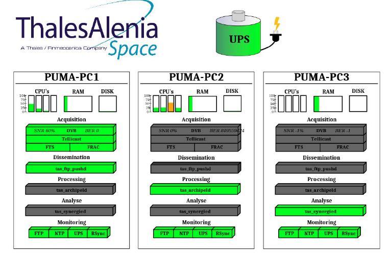
5 Login : synergie Password: synergie Displays this MMI PC3 only for you on Data sets 5
6 Satellite (MSG, RGB products) MPEF, LSAF,GOES E/W,FY2G/D Products e.g. MODIS,SARAL,Jason products, Jason etc), Wave Models, radiosonde data, Alpha data, NWP models Different spatial and temporal resolutions (UK Models Res. 0.5 deg, Arpege (FR)), ECMWF models, Local models (LAM, regional models), and many more Diagnostic models (300 hpa geopotental and analyses, development/steering and forecast) Synoptic data (Meteorological Data Dissemination on GTS) Lightning data FAX Images or Significant Weather charts NCEP data 6
7 Integrate all data in a workstation Equip the weather person with power of data and information Provide capacity to selectively utilize the relevant data for specific scenario for your forecasting skills development Obtain optimum information from ALL the available data to make Reliable Forecasts! 7
8 Forecast for Public-transport, sporting Required data 24 hours MSLP RGB Night micro-physics (10-9,9-4,9) Airmass RGB (5-6,8-9,5i) SURFACE WIND 925 (WEST Africa),850 hpa wind, Div, streamlines Instability Indices (CAPE, GII, TPWC, Li..), Lightning SST. (Moisture fetch) Temperature data (land and Sea) Lightening data 8
9 Forecast for AVIATION Required data NWP-> MSLP and Vertical wind profiles RGB Night Micro-physics (10-9,9-4,9) ->Icing and Turbulence Day Microphysics RGB 1,4,9 super cooled clouds (Yellow zones) Fog RGB (5-6,8-9,9) and Dust RGB(10-9,7-9,9) Winds at hpa: -> CAT areas 925 (W. Africa),850, 700, 500 hpa: wind, Div, streamlines Instability Indices (CAPE, GII, TPWC,li..), Lightning data SST (moisture fetch) Temperature data (land ) PNG data -> SigWX charts 9
10 Forecast for Marine Industry Required data Wind Model (sea height, Swell, wave speed) NWP-> MSLP Low pressure features RGB Night Micro-physics (10-9,9-4,9) TCs Fog RGB (5-6,8-9,9) and Dust RIB (10-9,7-9,9) 925 (W. Africa),850, 700, 500 hpa: wind, Div, streamlines CAPE, TPWC, and Lightning data SST 10
11 How do I make a good forecast? Three fundamental steps 1. Analysis 2. Diagnosis 3. Prognosis Analysis: understanding what is happening Diagnosis: understanding why it is happening Prognosis: understanding what's going to happen next 11
12 Step 1. What season are we? What is happening to the Weather? Step 2. Display a VIS Image if daytime or Natural color rgb but for the night use Night Microphysics RGB (10-9,9-4,9-0), to identify location of any deep convection by presence of water and ice clouds 12

13 Several convective cells at different stages of development 13
14 1. Look for Deep convection areas depicted by deep red 2. You may Animate to monitor translation of developments 14
15 Use WV 6.2 and 7.3 microns to identify potential areas with sufficient moisture to support further development (Deep moisture columns) White areas are moist and cold, dark or grey areas are dry on WV and warmer. For Enhanced WV5 (reddish brown is dry and warm, blue is Moist and very cold) Assessment of Upper level moisture from WV5 (6.2) Assessment of Medium Level moisture from WV6 (7.3) 15


16 1. Convective cells are within the high density water vapour. 2. They exist in convergence zone 3. Moisture supply is high 4. Time is 12:12 pm 5. Further development possible likely 16
 to generate deep")
17 Sufficient moisture at mid levels Question Is there enough Thermodyna mic (Pressure Field) convergence at lower levels and Upper air diffluence (wind data or Animations) to generate deep convection? 17
18 You may animate VIS or IR, RGB consecutive images for the last 6, 9,12, 18 hours This will answer the two questions: Is convection increasing or decreasing? What direction are pressure systems leading? If there is a system How fast is the system developing? Channel 3(1.6): good for daytime as reflectance reduces for developing severe storms and brightness increases for decaying storms At night use night time microphysics RGB (10-9,9-4,9-0) or 5-6,8-9,5i air-mass) 18

19 WX OVER L. Victoria NE and NW Kenya and Somali Coast very violent NW Kenya at 7:30 Heavy Rains Causing flooding and death Very Dangerous stom. Cpud temp, -81C 19


20 Deep dirty brown indicates very cold large ice clouds. The yellow areas are clouds with small ice and water clouds at stage of development- Super-cooled (-33 deg) clouds, see over lake Tanganyika. Cyan is cloud free and warm Deep Blue is warm water body. Thin Cirrus clouds appear dark brown 20
21 View reported synoptic data for synoptic hours. Confirm from dry bulb and web bulb data for drying or increase in moisture from depression values ( T a -T d ) You may use conditional plotting of Synergie tools. Area whose( T a -T d ) <=1 Moist or cloudy Areas whose (T a -T d )=>8 dry air conditions 21

22 You need confirmation of some reports on the ground. Scarce data stations requires to be complemented with Satellite data 22

23 1. Current Wind analysis suggests a convergence zone as shown 2. Position of deep convection is supported by convergence of the winds 3. Moist Easterly winds supply moisture 23


24 1. Dry cold air-mass from Southern Tip of Africa. 2. This appears to be under St Hellena high pressure ridge (descending air). supports synoptic p/gradient 3. Moisture: dry bulb 30 o C wet bulb -4 o C. (Dry air) 24
 contribute to development of severe weather.")
25 Deep convection goes beyond medium (WV6) and upper tropopause(wv5) hence Solar radiation and Thermodynamic processes that cause the: BT Diff (WV5-WV6) >0 generates TS and Heavy Showers/ rain Mechanical lifting ( convergence zone or orographic lifting) contribute to development of severe weather. Global Instability Index (GII), K>40 means 100% possibility of severe thunderstorms & s showers 25
")
26 Interpretation: >Dark is negative >White is positive or greater than or equal to zero Use storm RGB (5-6,9-4,3-1) 26
27 K Values legends Cyan K>20 showers possible Yellow K> % chance of TS Red K>40 100% chance of Showers and Thunderstorm Black= cloud mask Brown Desert,


28 Negative values mean Buoyant atmosphere -10<Li<-5 Thunderstor ms likely Red Brown stable

29 Color code Black=Cloud Masked Red=High precipitable water Yellow= less 60 % partially Blue= Dry


30 Synergie Under tool important for comparison WV5 under Airmass RGB Interpretation: Dry airmass is brown color 30
31 identifies dry air associated with ridges high cold clouds above moist air mass Green are areas with Relatively low moisture/ at medium layers 31

32 Night microphysics RGB Areas of deep convection in Red Blue=open land or Sea surface Pink=low level water clouds 32

33 Areas of folding and high PVA Positions of Jet streams affects: 1. Weather in their region of Influence by by creation of strong outflows at the troop-pause level. 2. The Onset of a season and its performance; 3. PVA +ve areas causes atmospheric Instability such as folding that initiates pressure falls (deepening of troughs) 33

34 Areas of low level convergence Corresponds with areas of deep clouds Producing MPE rates /values 34

35 Dines compensation law stated that if we have pressure rises ( Falls) at upper levels this will cause pressure falls (Rises) at lower levels to compensate for the mass In meteorology, Dines' compensation states that net mass convergence into a given column of air must be balanced by a net mass divergence from the same column of air 35

36 C A C A Streamlines on 200 hpa BLUE Notice the position of Outflow on 200 hpa areas Development term along trough axis or ridge lines at 200 hpa may initiate changes on surface pressure 36

37 C A C A Surface Pressure and Wind patterns C pressure falls) weakenig Libyan ridge A- Pressure rises- Enhancing Azores High 37

38 38

39 1. Since NWP data,synoptic data And satellite data are in agreement : 2. The Belt of convergence on NWP wind analysis on 850 hpa identifies areas of expected Severe Weather. 3. On the Meridional arm of the ITCZ 4. I have confidence in the NWP products 39

40 Ascent analysis: 1. Very Unstable at lower levels. 2. Generally moist atmosphere but dry at 450 hpa 3. Easterly Wind pattern conducive for afternoon WX activities Index: possibility of Showers and T/S over several places over Nairobi and Highlands East 40

41 1. Will the forecast Sustain the weather Or Reduce or provide more weather than has been observed? 2. Solution: It depends on the evolution on pressure patterns with time. 41

42 Prognosis: slight Pressure build in over Azores activiting the ITCZ, Unstable atmosphere, Supply of Moisture:: The 24 Forecast for Kenya is expected as follows: HE/NA : PTCN-> followed by SIM leading to Scattered SWs and T/S in afternoon HW/LB Isol SWS TN, SIM, Isol SWS &TS in Afternoon. COAST& SE: PCTN, ISOL SWS Morning,Sunny rest of Day. NE& NW PTCN, Isol rains in Morning, SIM rest of Day. ( Moist Eastery flow identified over Kenyan coastal rising from Indian Ocean ) 42

43 Save all steps as Macro for future use.
 Make your Forecast based on all")
 Rectify your forecast failure")
44 Use Yesterday and current Satellite data for assessment (Analysis) Look at all data: NWP to find agreement with your assessment (Diagnostic/ Analysis) Make your Forecast based on all available information impacts of possible changes in Pressure fields (Prognostic) Validate your forecast by other reports (Satellite Imagery and ground report) Rectify your forecast failure Improve 44
PRECONVECTIVE SOUNDING ANALYSIS USING IASI AND MSG- SEVIRI
 PRECONVECTIVE SOUNDING ANALYSIS USING IASI AND MSG- SEVIRI Marianne König, Dieter Klaes EUMETSAT, Eumetsat-Allee 1, 64295 Darmstadt, Germany Abstract EUMETSAT operationally generates the Global Instability
Day Microphysics RGB Nephanalysis in daytime. Meteorological Satellite Center, JMA
 Day Microphysics RGB Nephanalysis in daytime Meteorological Satellite Center, JMA What s Day Microphysics RGB? R : B04 (N1 0.86) Range : 0~100 [%] Gamma : 1.0 G : B07(I4 3.9) (Solar component) Range :
Khalid Y. Muwembe UGANDA NATIONAL METEOROLOGICAL AUTHORITY (UNMA)
") Forecasting Severe Weather over Lake Victoria region in Uganda Khalid Y. Muwembe UGANDA NATIONAL METEOROLOGICAL AUTHORITY (UNMA) Outline Background Set-up of forecasting/alert service Diurnal circulation
Forecasting Severe Weather over Lake Victoria region in Uganda Khalid Y. Muwembe UGANDA NATIONAL METEOROLOGICAL AUTHORITY (UNMA) Outline Background Set-up of forecasting/alert service Diurnal circulation
Aviation Hazards: Thunderstorms and Deep Convection
 Aviation Hazards: Thunderstorms and Deep Convection TREND Empirical thunderstorm forecasting techniques Contents Necessary conditions for convection: Instability Low-level moisture Trigger mechanism Forecasting
MSG FOR NOWCASTING - EXPERIENCES OVER SOUTHERN AFRICA
 MSG FOR NOWCASTING - EXPERIENCES OVER SOUTHERN AFRICA Estelle de Coning and Marianne König South African Weather Service, Private Bag X097, Pretoria 0001, South Africa EUMETSAT, Am Kavalleriesand 31, D-64295
QUALITY OF MPEF DIVERGENCE PRODUCT AS A TOOL FOR VERY SHORT RANGE FORECASTING OF CONVECTION
 QUALITY OF MPEF DIVERGENCE PRODUCT AS A TOOL FOR VERY SHORT RANGE FORECASTING OF CONVECTION C.G. Georgiev 1, P. Santurette 2 1 National Institute of Meteorology and Hydrology, Bulgarian Academy of Sciences
The water vapour channels of SEVIRI (Meteosat). An introduction
. An introduction") The water vapour channels of SEVIRI (Meteosat). An introduction jose.prieto@eumetsat.int Cachoeira P. July 2006 Formats 1.5 1 Objectives 2 Describe the characteristics of WV channels on board of SEVIRI
The water vapour channels of SEVIRI (Meteosat). An introduction jose.prieto@eumetsat.int Cachoeira P. July 2006 Formats 1.5 1 Objectives 2 Describe the characteristics of WV channels on board of SEVIRI
How to display RGB imagery by SATAID
 How to display RGB imagery by SATAID Akihiro SHIMIZU Meteorological Satellite Center (MSC), Japan Meteorological Agency (JMA) Ver. 2015110500 RGB imagery on SATAID SATAID software has a function of overlapping
For the operational forecaster one important precondition for the diagnosis and prediction of
 Initiation of Deep Moist Convection at WV-Boundaries Vienna, Austria For the operational forecaster one important precondition for the diagnosis and prediction of convective activity is the availability
Hurricanes. April 14, 2009
 Tropical Weather & Hurricanes Chapter 15 April 14, 2009 Tropical meteorology Tropics characterized by seasonal wet and drier periods- wet when sun is nearly overhead at noon and inter-tropical convergence
4/29/2011. Mid-latitude cyclones form along a
 Chapter 10: Cyclones: East of the Rocky Mountain Extratropical Cyclones Environment prior to the development of the Cyclone Initial Development of the Extratropical Cyclone Early Weather Along the Fronts
Moisture, Clouds, and Precipitation: Clouds and Precipitation. Dr. Michael J Passow
 Moisture, Clouds, and Precipitation: Clouds and Precipitation Dr. Michael J Passow What Processes Lift Air? Clouds require three things: water vapor, a condensation nucleus, and cooling Cooling usually
Divergence, Spin, and Tilt. Convergence and Divergence. Midlatitude Cyclones. Large-Scale Setting
 Midlatitude Cyclones Equator-to-pole temperature gradient tilts pressure surfaces and produces westerly jets in midlatitudes Waves in the jet induce divergence and convergence aloft, leading to surface
Weather Notes. Chapter 16, 17, & 18
 Weather Notes Chapter 16, 17, & 18 Weather Weather is the condition of the Earth s atmosphere at a particular place and time Weather It is the movement of energy through the atmosphere Energy comes from
Weather is the of the Earth s atmosphere at a place and time. It is the movement of through the atmosphere o Energy comes from the
 Weather Notes Weather Weather is the of the Earth s atmosphere at a place and time It is the movement of through the atmosphere o Energy comes from the The sun is the force that weather The sun s energy
Unit 5 Lesson 3 How is Weather Predicted? Copyright Houghton Mifflin Harcourt Publishing Company
 Tracking the Weather Warm up 1 Why is it important to watch the weather forecast before traveling to another country? Tracking the Weather A meteorologist is a scientist who studies weather. Meteorologists
1. COLD FRONT - CLOUD STRUCTURE IN SATELLITE IMAGES
 1. COLD FRONT - CLOUD STRUCTURE IN SATELLITE IMAGES The satellite image shows a cyclonically curved synoptic scale cloud band usually a few hundred kilometres wide; in the VIS image the cloud band mostly
Lec 10: Interpreting Weather Maps
 Lec 10: Interpreting Weather Maps Case Study: October 2011 Nor easter FIU MET 3502 Synoptic Hurricane Forecasts Genesis: on large scale weather maps or satellite images, look for tropical waves (Africa
Aviation Hazards: Thunderstorms and Deep Convection
 Aviation Hazards: Thunderstorms and Deep Convection TREND Diagnosis of thunderstorm hazards using imagery Contents Satellite imagery Visible, infrared, water vapour Basic cloud identification Identifying
Use the terms from the following list to complete the sentences below. Each term may be used only once.
 Skills Worksheet Directed Reading Section: Air Masses Use the terms from the following list to complete the sentences below. Each term may be used only once. high pressure poles low pressure equator wind
Nowcasting of Severe Weather from Satellite Images (for Southern
 Nowcasting of Severe Weather from Satellite Images (for Southern Europe) Petra Mikuš Jurković Forecasting/ nowcasting of convective storms NWP models cannot well predict the exact location and intesity
according to and water. High atmospheric pressure - Cold dry air is other air so it remains close to the earth, giving weather.
 EARTH'S ATMOSPHERE Composition of the atmosphere - Earth's atmosphere consists of nitrogen ( %), oxygen ( %), small amounts of carbon dioxide, methane, argon, krypton, ozone, neon and other gases such
Hurricanes and Tropical Weather Systems:
 Hurricanes and Tropical Weather Systems: An influence on weather in parts of the USA Meteorology 411 Iowa State University Week 2 Bill Gallus Classification/Terminology Tropical Disturbance enhanced convection
Introduction to African weather
 Introduction to African weather Dr Caroline Bain Met Office, Exeter, UK Overview Convection and general circulation A tour around the seasons: West African Monsoon, AEWs, Short rains East Africa, Low-level
INTERPRETATION GUIDE TO MSG WATER VAPOUR CHANNELS
 INTERPRETATION GUIDE TO MSG WATER VAPOUR CHANNELS C.G. Georgiev1 and P. Santurette2 1 National Institute of Meteorology and Hydrology, Tsarigradsko chaussee 66, 1784 Sofia, Bulgaria 2 Météo-France, 42,
1 What Is Climate? TAKE A LOOK 2. Explain Why do areas near the equator tend to have high temperatures?
 CHAPTER 17 1 What Is Climate? SECTION Climate BEFORE YOU READ After you read this section, you should be able to answer these questions: What is climate? What factors affect climate? How do climates differ
Forecast for 6/28-7/31. Forecaster: Matthew Brewer Forecast made at: 12z 6/27/2017
 Forecast for 6/28-7/31 Forecaster: Matthew Brewer Forecast made at: 12z 6/27/2017 Whiteface lodge Mesonet Meteogram for the past 24 hours http://www.nysmesonet.org/data/meteogram#?stid=wfmb Whiteface Summit
A SEVERE WEATHER EVENT IN ROMANIA DUE TO MEDITERRANEAN CYCLONIC ACTIVITY
 A SEVERE WEATHER EVENT IN ROMANIA DUE TO MEDITERRANEAN CYCLONIC ACTIVITY Florinela Georgescu, Gabriela Bancila, Viorica Dima National Meteorological Administration, Bucharest, Romania Abstract Mediterranean
General Circulation. Nili Harnik DEES, Lamont-Doherty Earth Observatory
 General Circulation Nili Harnik DEES, Lamont-Doherty Earth Observatory nili@ldeo.columbia.edu Latitudinal Radiation Imbalance The annual mean, averaged around latitude circles, of the balance between the
Science Olympiad Meteorology Quiz #1 Page 1 of 7
 1) What is generally true about the stratosphere: a) Has turbulent updrafts and downdrafts. b) Has either a stable or increasing temperature profile with altitude. c) Where the auroras occur. d) Both a)
Page 1. Name:
 Name: 1) As the difference between the dewpoint temperature and the air temperature decreases, the probability of precipitation increases remains the same decreases 2) Which statement best explains why
2) What general circulation wind belt is the place of origin for hurricanes? A) westerlies B) trade winds C) doldrums D) horse latitudes
 What general circulation wind belt is the place of origin for hurricanes? A) westerlies B) trade winds C) doldrums D) horse latitudes") Meteo 1010 Homework 6 1) What is the difference between a typhoon and a hurricane? A) A hurricane is a true tropical cyclone, but a typhoon is not. B) A hurricane is stronger than a typhoon. C) They represent
Meteo 1010 Homework 6 1) What is the difference between a typhoon and a hurricane? A) A hurricane is a true tropical cyclone, but a typhoon is not. B) A hurricane is stronger than a typhoon. C) They represent
Three things necessary for weather are Heat, Air, Moisture (HAM) Weather takes place in the Troposphere (The lower part of the atmosphere).
 Weather takes place in the Troposphere (The lower part of the atmosphere).") Grade 5 SCIENCE WEATHER WATCH Name: STUDY NOTES Weather - The condition of the atmosphere with respect to heat/cold, wetness/dryness, clearness/ cloudiness for a period of time. Weather changes over time
Grade 5 SCIENCE WEATHER WATCH Name: STUDY NOTES Weather - The condition of the atmosphere with respect to heat/cold, wetness/dryness, clearness/ cloudiness for a period of time. Weather changes over time
Mechanical Turbulence Wind forms eddies as it blows around hanger, stands of trees or other obstructions
 Turbulence Low-level Turbulence below 15,000 feet consists of Mechanical Turbulence Convective Turbulence Frontal Turbulence Wake Turbulence Mechanical Turbulence Wind forms eddies as it blows around hanger,
Weather. Chapter Test A. Multiple Choice. Write the letter of the correct answer on the line at the left.
 Weather Chapter Test A Multiple Choice Write the letter of the correct answer on the line at the left. 1. The most dangerous aspect of a snowstorm is often the a. high winds. b. depth of snow. c. brightness.
Aviation Hazards: Thunderstorms and Deep Convection
 Aviation Hazards: Thunderstorms and Deep Convection TREND NWP Products for Thunderstorm Forecasting Contents Model choice Identifying parameters important for convection: Low-level convergence High relative
STATISTICAL ANALYSIS ON SEVERE CONVECTIVE WEATHER COMBINING SATELLITE, CONVENTIONAL OBSERVATION AND NCEP DATA
 12.12 STATISTICAL ANALYSIS ON SEVERE CONVECTIVE WEATHER COMBINING SATELLITE, CONVENTIONAL OBSERVATION AND NCEP DATA Zhu Yaping, Cheng Zhoujie, Liu Jianwen, Li Yaodong Institute of Aviation Meteorology
1. Which weather map symbol is associated with extremely low air pressure? A) B) C) D) 2. The diagram below represents a weather instrument.
 B) C) D) 2. The diagram below represents a weather instrument.") 1. Which weather map symbol is associated with extremely low air pressure? 2. The diagram below represents a weather instrument. Which weather variable was this instrument designed to measure? A) air pressure
1. Which weather map symbol is associated with extremely low air pressure? 2. The diagram below represents a weather instrument. Which weather variable was this instrument designed to measure? A) air pressure
Practical Atmospheric Analysis
 Chapter 12 Practical Atmospheric Analysis With the ready availability of computer forecast models and statistical forecast data, it is very easy to prepare a forecast without ever looking at actual observations,
Forecasting Local Weather
 Forecasting Local Weather Sea/Land Breeze Temperature Dew Fog Frost Snow Thunderstorms Tropical Cyclones Temperatures: Radiation Balance Typical Diurnal Variation of Temperature Min soon after dawn Temp
The October 2015 Supercell Storm in Israel
 The October 2015 Supercell Storm in Israel Alissa Razy, Elyakom Vadislavsky, Anat Baharad, Noam Halfon, Itsik Carmona, Yoav Levi, Amit Savir Introduction A high-impact weather event associated with severe
Topic 1 The Atmosphere and Atmospheric Variables
 Name Notes: Topic 1 The Atmosphere Regents Earth Science Topic 1 The Atmosphere and Atmospheric Variables What is the atmosphere? Meteorology is the study of A. Structure of the Atmosphere: What two gases
Earth Science Chapter 16 and 17. Weather and Climate
 Earth Science Chapter 16 and 17 Weather and Climate Prediction Old way Groundhog Color of the sky Modern way satellites instruments computers Goal Weather Factors Studied by meteorologists Several factors
METEOROLOGY. 1 The average height of the tropopause at 50 N is about A 14 km B 16 km C 11 km D 8 km
 1 The average height of the tropopause at 50 N is about A 14 km B 16 km C 11 km D 8 km 2 In the lower part of the stratosphere the temperature A is almost constant B decreases with altitude C increases
Day Snow-Fog RGB Detection of low-level clouds and snow/ice covered area
 JMA Day Snow-Fog RGB Detection of low-level clouds and snow/ice covered area Meteorological Satellite Center, JMA What s Day Snow-Fog RGB? R : B04 (N1 0.86) Range : 0~100 [%] Gamma : 1.7 G : B05 (N2 1.6)
FORMATION OF AIR MASSES
 Chapter 24: Weather (air mass, fronts, Weather instruments, and forecasting the weather) Name: Period: Due Date: Air Mass Use the terms from the following list to complete the sentences below. Each term
Climate & Earth System Science. Introduction to Meteorology & Climate. Chapter 05 SOME OBSERVING INSTRUMENTS. Instrument Enclosure.
 Climate & Earth System Science Introduction to Meteorology & Climate MAPH 10050 Peter Lynch Peter Lynch Meteorology & Climate Centre School of Mathematical Sciences University College Dublin Meteorology
Combined and parallel use of MSG composite images and SAFNWC/MSG products at the Hungarian Meteorological Service
 Combined and parallel use of MSG composite images and SAFNWC/MSG products at the Hungarian Meteorological Service Mária Putsay, Kornél Kolláth and Ildikó Szenyán Hungarian Meteorological Service H-1525
The development and evolution of deep convection and heavy rainfall
 The development and evolution of deep convection and heavy rainfall Unique in spectra, space and time The spatial and temporal domains of the phenomena being investigated drive the satellite s spectral
Detection and Monitoring Convective Storms by. Using MSG SEVIRI Image. Aydın Gürol ERTÜRK. Contents
 Detection and Monitoring Convective Storms by 1 Using MSG SEVIRI Image Contents MSGView Software Cold U/V and Ring Shape Storm Tops Case Study, 2nd April 2011 Antalya, Türkiye Conclusion Aydın Gürol ERTÜRK
NUMERICAL EXPERIMENTS USING CLOUD MOTION WINDS AT ECMWF GRAEME KELLY. ECMWF, Shinfield Park, Reading ABSTRACT
 NUMERICAL EXPERIMENTS USING CLOUD MOTION WINDS AT ECMWF GRAEME KELLY ECMWF, Shinfield Park, Reading ABSTRACT Recent monitoring of cloud motion winds (SATOBs) at ECMWF has shown an improvement in quality.
Science Olympiad Meteorology Quiz #2 Page 1 of 8
 1) The prevailing general direction of the jet stream is from west to east in the northern hemisphere: 2) Advection is the vertical movement of an air mass from one location to another: 3) Thunderstorms
Improving real time observation and nowcasting RDT. E de Coning, M Gijben, B Maseko and L van Hemert Nowcasting and Very Short Range Forecasting
 Improving real time observation and nowcasting RDT E de Coning, M Gijben, B Maseko and L van Hemert Nowcasting and Very Short Range Forecasting Introduction Satellite Application Facilities (SAFs) are
RGB Experts and Developers Workshop - Introduction Tokyo, Japan 7-9 Nov 2017
 RGB Experts and Developers Workshop - Introduction Tokyo, Japan 7-9 Nov 2017 Workshop Objectives Review of existing RGB standards Reconfirm and extend existing standards (new multi-spectral imagers) Stimulate
b. The boundary between two different air masses is called a.
 NAME Earth Science Weather WebQuest Part 1. Air Masses 1. Find out what an air mass is. http://okfirst.mesonet.org/train/meteorology/airmasses.html a. What is an air mass? An air mass is b. The boundary
1 of 7 Thunderstorm Notes by Paul Sirvatka College of DuPage Meteorology. Thunderstorms
 1 of 7 Thunderstorm Notes by Paul Sirvatka College of DuPage Meteorology Thunderstorms There are three types of thunderstorms: single-cell (or air mass) multicell (cluster or squall line) supercell Although
"Experiences with use of EUMETSAT MPEF GII product for convection/storm nowcasting"
 "Experiences with use of EUMETSAT MPEF GII product for convection/storm nowcasting" Marianne König 1, Monika Pajek 2, Piotr Struzik 2 1) EUMETSAT 2) Institute of Meteorology and Water Management, Kraków,
Lecture 8. Monsoons and the seasonal variation of tropical circulation and rainfall
 Lecture 8 Monsoons and the seasonal variation of tropical circulation and rainfall According to the second hypothesis, the monsoon is a manifestation of the seasonal variation of the tropical circulation
WATER IN THE ATMOSPHERE
 WATER IN THE ATMOSPHERE I. Humidity A. Defined as water vapor or moisture in the air (from evaporation and condensation). B. The atmosphere gains moisture from the evaporation of water from oceans, lakes,
Application and verification of ECMWF products 2011
 Application and verification of ECMWF products 2011 National Meteorological Administration 1. Summary of major highlights Medium range weather forecasts are primarily based on the results of ECMWF and
Global Instability Index: Product Guide
 Doc.No. Issue : : EUM/TSS/MAN/15/802106 v1c e-signed EUMETSAT Eumetsat-Allee 1, D-64295 Darmstadt, Germany Tel: +49 6151 807-7 Fax: +49 6151 807 555 Date : 2 September 2015 http://www.eumetsat.int WBS/DBS
25.1 Air Masses. Section 25.1 Objectives
 Section 25.1 Objectives Explain how an air mass forms. List the four main types of air masses. Describe how air masses affect the weather of North America. Air Masses 25.1 Air Masses Differences in air
AOSC201: Weather and Climate Lab
 AOSC201: Weather and Climate Lab Week 8: Forecasting - Analysis Section 107/108 Instructor: Agniv Sengupta q Lab #7 of Lab Manual (pages 41-49) q 50 points in total q INDIVIDUAL Work for the entire lab
Chapter 24 Tropical Cyclones
 Chapter 24 Tropical Cyclones Tropical Weather Systems Tropical disturbance a cluster of thunderstorms about 250 to 600 km in diameter, originating in the tropics or sub-tropics Tropical depression a cluster
MET 3502 Synoptic Meteorology. Lecture 8: September 16, AIRMASSES, FRONTS and FRONTAL ANALYSIS (2)
") MET 3502 Synoptic Meteorology Lecture 8: September 16, 2010 AIRMASSES, FRONTS and FRONTAL ANALYSIS (2) Identifying a cold front on a surface weather map: 1. Surface front is located at the leading edge
MET 3502 Synoptic Meteorology Lecture 8: September 16, 2010 AIRMASSES, FRONTS and FRONTAL ANALYSIS (2) Identifying a cold front on a surface weather map: 1. Surface front is located at the leading edge
Week: Dates: 3/2 3/20 Unit: Climate
 clementaged.weebly.com Name: EVEN Period: Week: 28 30 Dates: 3/2 3/20 Unit: Climate Monday Tuesday Wednesday Thursday Friday 2 O 3 E *Vocabulary *Water in the Atmosphere and Clouds Notes *Cloud Drawings
Type of storm viewed by Spotter A Ordinary, multi-cell thunderstorm. Type of storm viewed by Spotter B Supecell thunderstorm
 ANSWER KEY Part I: Locating Geographical Features 1. The National Weather Service s Storm Prediction Center (www.spc.noaa.gov) has issued a tornado watch on a warm spring day. The watch covers a large
1 5 th RAIDEG PUMA 2010 Upgrade - EUM/OPS/VWG/14/ September 2014 PUMA-2010 UPGRADE
 1 5 th RAIDEG PUMA 2010 Upgrade - EUM/OPS/VWG/14/770918-6 September 2014 PUMA-2010 UPGRADE Category Product Title Format Consolidation of MDD stream, change of channel, no LRIT wrapping, use of wmo filenames
Applications of multi-spectral satellite data
 Applications of multi-spectral satellite data Jochen Kerkmann EUMETSAT, Satellite Meteorologist, Training Officer Adjusted by E de Coning South African Weather Service Content 1. Why should we use RGBs?
and 24 mm, hPa lapse rates between 3 and 4 K km 1, lifted index values
 3.2 Composite analysis 3.2.1 Pure gradient composites The composite initial NE report in the pure gradient northwest composite (N = 32) occurs where the mean sea level pressure (MSLP) gradient is strongest
AIR MASSES. Large bodies of air. SOURCE REGIONS areas where air masses originate
 Large bodies of air AIR MASSES SOURCE REGIONS areas where air masses originate Uniform in composition Light surface winds Dominated by high surface pressure The longer the air mass remains over a region,
Investigation of the Arizona Severe Weather Event of August 8 th, 1997
 Investigation of the Arizona Severe Weather Event of August 8 th, 1997 Tim Hollfelder May 10 th, 2006 Abstract Synoptic scale forcings were very weak for these thunderstorms on August 7-8, 1997 over the
MSG/SEVIRI CHANNEL 4 Short-Wave IR 3.9 m IR3.9 Tutorial
 MSG/SEVIRI CHANNEL 4 Short-Wave IR Channel @ 3.9 m IR3.9 Tutorial HansPeter Roesli EUMETSAT satmet.hp@ticino.com Contributions: D Rosenfeld (HUJ) J Kerkmann (EUM), M Koenig (EUM), J Prieto (EUM), HJ Lutz
Go With the Flow From High to Low Investigating Isobars
 Go With the Flow From High to Low Investigating Isobars Science 10 Mrs. Purba Air Masses The air over a warm surface can be heated, causing it to rise above more dense air. The result is the formation
1.23 A CASE STUDY OF THUNDERSTORM FORECASTING IN WEST AFRICA
 1.23 A CASE STUDY OF THUNDERSTORM FORECASTING IN WEST AFRICA * Okoloye C. U., ** Alilonu B. N. *Nigerian Meteorological Agency (NIMET) Mallam Aminu Kano Int l Airport, Kano, Nigeria ** Nigerian Meteorological
MSG Indian Ocean Data Coverage (IODC) Jochen Grandell & Sauli Joro
 Jochen Grandell & Sauli Joro") MSG Indian Ocean Data Coverage (IODC) Jochen Grandell & Sauli Joro 1 EUM/STG-SWG/42/17/VWG/03 v1, 7 8 Mach 2017 Topics Introduction MSG-IODC Overall Project Schedule Status Product validation Products
MSG Indian Ocean Data Coverage (IODC) Jochen Grandell & Sauli Joro 1 EUM/STG-SWG/42/17/VWG/03 v1, 7 8 Mach 2017 Topics Introduction MSG-IODC Overall Project Schedule Status Product validation Products
Lecture 19: Operational Remote Sensing in Visible, IR, and Microwave Channels
 MET 4994 Remote Sensing: Radar and Satellite Meteorology MET 5994 Remote Sensing in Meteorology Lecture 19: Operational Remote Sensing in Visible, IR, and Microwave Channels Before you use data from any
p = ρrt p = ρr d = T( q v ) dp dz = ρg
 dp dz = ρg") Chapter 1: Properties of the Atmosphere What are the major chemical components of the atmosphere? Atmospheric Layers and their major characteristics: Troposphere, Stratosphere Mesosphere, Thermosphere
Chapter 1: Properties of the Atmosphere What are the major chemical components of the atmosphere? Atmospheric Layers and their major characteristics: Troposphere, Stratosphere Mesosphere, Thermosphere
Occlusion Cyclogenesis
 Occlusion Cyclogenesis Part I: Occlusion cloud bands in comparison to CF and WFs Concepts for cyclogenesis Different types of cyclogenesis and examples Numerical parameters on isobaric and isentropic surfaces
ATMO 436a. The General Circulation. Redacted version from my NATS lectures because Wallace and Hobbs virtually ignores it
 ATMO 436a The General Circulation Redacted version from my NATS lectures because Wallace and Hobbs virtually ignores it Scales of Atmospheric Motion vs. Lifespan The general circulation Atmospheric oscillations
WEEKLY WEATHER OUTLOOK BELIZE, CENTRAL AMERICA
 WEEKLY WEATHER OUTLOOK BELIZE, CENTRAL AMERICA PERIOD: Sunday, July 1 until Monday, July 9, 2012 DATE ISSUED: Sunday, July 1, 2012 3:00 pm RFrutos EcoSolutions & Services SYNOPSIS: The features of interest
Convective Cloud Features in typical synoptic situations. Frans Debie
 Convective Cloud Features in typical synoptic situations Frans Debie me SATRAPPERS Henk vesa Frans Veronika ab Teachers classroom Langen Cumulonimbus: Convection Convection, seen from ground 1 2 3 4 Outflow
XC Meteorology. And other bullshit
 XC Meteorology And other bullshit (c) Jim White 2014 Why do Met? Choose whether to turn up Choose best task for day Choose glider configuration Choose pilot configuration! Avoid being in wrong place Achieve
Chapter 12 Section 12.1 The causes of weather
 Chapter 12 Section 12.1 The causes of weather Main Idea: Air masses have different temperatures and amounts of moisture because of the uneven heating of earth's surface. What is Meteorology The study of
Ch22&23 Test. Multiple Choice Identify the choice that best completes the statement or answers the question.
 Ch22&23 Test Multiple Choice Identify the choice that best completes the statement or answers the question. 1. The two most abundant compounds in the atmosphere are carbon dioxide and a. particulates.
GEOGRAPHY EYA NOTES. Weather. atmosphere. Weather and climate
 GEOGRAPHY EYA NOTES Weather and climate Weather The condition of the atmosphere at a specific place over a relatively short period of time Climate The atmospheric conditions of a specific place over a
MAURITIUS METEOROLOGICAL SERVICES
 MAURITIUS METEOROLOGICAL SERVICES CLIMATE FEBRUARY 2019 Introduction February 2019 was in mostly warm and dry. ENSO conditions and the Indian Ocean Dipole were neutral. However, the Inter Tropical Convergence
VWG.01 EUMETSAT Corporate Slide Collection (EUM/CIS/VWG/14/743878) Version 1, January 2014 MONITORING WEATHER AND CLIMATE FROM SPACE
 Version 1, January 2014 MONITORING WEATHER AND CLIMATE FROM SPACE") 1 VWG.01 EUMETSAT Corporate Slide Collection (EUM/CIS/VWG/14/743878) Version 1, January 2014 MONITORING WEATHER AND CLIMATE FROM SPACE Royal charter: 25/26 October 1859 From observation to decision making:
1 VWG.01 EUMETSAT Corporate Slide Collection (EUM/CIS/VWG/14/743878) Version 1, January 2014 MONITORING WEATHER AND CLIMATE FROM SPACE Royal charter: 25/26 October 1859 From observation to decision making:
DEPARTMENT OF GEOSCIENCES SAN FRANCISCO STATE UNIVERSITY. Metr Fall 2012 Test #1 200 pts. Part I. Surface Chart Interpretation.
 DEPARTMENT OF GEOSCIENCES SAN FRANCISCO STATE UNIVERSITY NAME Metr 356.01 Fall 2012 Test #1 200 pts Part I. Surface Chart Interpretation. Figure 1. Surface Chart for 1500Z 7 September 2007 1 1. Pressure
Atmosphere and Weather Revision Notes
 Atmosphere and Weather Revision Notes Atmosphere The blanket of gases that surrounds the Earth is called the atmosphere. The main gases are nitrogen (78 %), oxygen (21 %), water vapour, ozone and carbon
ESCI 344 Tropical Meteorology Lesson 7 Temperature, Clouds, and Rain
 ESCI 344 Tropical Meteorology Lesson 7 Temperature, Clouds, and Rain References: Forecaster s Guide to Tropical Meteorology (updated), Ramage Tropical Climatology, McGregor and Nieuwolt Climate and Weather
WRF Model Simulated Proxy Datasets Used for GOES-R Research Activities
 WRF Model Simulated Proxy Datasets Used for GOES-R Research Activities Jason Otkin Cooperative Institute for Meteorological Satellite Studies Space Science and Engineering Center University of Wisconsin
also known as barometric pressure; weight of the air above the surface of the earth; measured by a barometer air pressure, high
 Weather Vocabulary Vocabulary Term Meaning/Definition air mass * large bodies of air that have the similar properties throughout such as temperature, humidity, and air pressure; causes most of the weather
Basic cloud Interpretation using Satellite Imagery
 Basic cloud Interpretation using Satellite Imagery Introduction Recall that images from weather satellites are actually measurements of energy from specified bands within the Electromagnetic (EM) spectrum.
MSGVIEW: AN OPERATIONAL AND TRAINING TOOL TO PROCESS, ANALYZE AND VISUALIZATION OF MSG SEVIRI DATA
 MSGVIEW: AN OPERATIONAL AND TRAINING TOOL TO PROCESS, ANALYZE AND VISUALIZATION OF MSG SEVIRI DATA Aydın Gürol Ertürk Turkish State Meteorological Service, Remote Sensing Division, CC 401, Kalaba Ankara,
Utilization of Forecast Models in High Temporal GOES Sounding Retrievals
 Utilization of Forecast Models in High Temporal GOES Sounding Retrievals Zhenglong Li, Jun Li, W. Paul Menzel, Steve Ackerman CIMSS/UW The CoRP Symposium Aug 12-13, 2008 Corvallis, OR Introduction: GOES
Meteorology Today. 1 Aug st Lt Libby Haynes Capt Kim Mevers
 Meteorology 1950 - Today 1 Aug 2018 1 st Lt Libby Haynes Capt Kim Mevers What is meteorology? Is it important to you? Meteorology is the science of the atmosphere embracing both weather and climate. It
Weather Related Factors of the Adelaide floods ; 7 th to 8 th November 2005
 Weather Related Factors of the Adelaide floods ; th to th November 2005 Extended Abstract Andrew Watson Regional Director Bureau of Meteorology, South Australian Region 1. Antecedent Weather 1.1 Rainfall
MET 3502 Synoptic Meteorology. Lecture 5: Surface Weather Elements
 MET 3502 Synoptic Meteorology Lecture 5: Surface Weather Elements Surface Weather Elements Not observations of the surface, but Observations made by an observer (or instrument) at the surface Example:
East Penn School District Curriculum and Instruction
 East Penn School District Curriculum and Instruction Curriculum for: Meteorology Course(s): Meteorology Grades: 10-12 Department: Science Length of Period (average minutes): 42 Periods per cycle: 6 Length