IEM Potpourri. Daryl Herzmann. (combine a bunch of unrelated stuff and see if it smells good at the end)
|
|
|
- Marshall Garrison
- 5 years ago
- Views:
Transcription
1 IEM Potpourri (combine a bunch of unrelated stuff and see if it smells good at the end) Daryl Herzmann Department of Agronomy, ISU akrherz@iastate.edu
2 The next 50 minutes of your life will consist of: The IEM and its many daily features Fun with ASOS data Assembling unique datasets NWS Storm Based Warning verification A movie, if you are lucky


3 Ooooo, I have a website. ~ 100 interactive web applications of IEM Data 2 terabytes of stuff 70 gigabytes daily input 150 gigabytes daily output 10,000,000 8,000,000 6,000,000 4,000,000 2,000,000 Website Hits Per Day


4 IEM Daily Feature Daily blog post of something hopefully interesting Generated 1905 of these since 2002 Users can rate the feature as good or bad Most bad votes come from this guy Summary of Feature Voting 10072, 30% 23989, 70% Good Bad


5 Show Something Interesting


6 Climate Features


7 Comparison Features
8 Fun with ASOS Temperatures ASOS weather stations are the high end sensors at larger airports We ve all seen the hourly METARs KDSM Z 00000KT 10SM CLR 20/14 A3014 RMK AO2 SLP202 T What units and precision are the temperatures reported in? What are they actually internally recorded in?
9 KDSM Z 00000KT 10SM CLR 20/14 A3014 RMK AO2 SLP202 T The T group implies a precision of C Running a script against a database of observations yields these distinct values: What is 14 C in F > 57.2 What is 14.4 C in F > 57.9 The ASOS guide also notes the sensor accuracy at F on air temp
10 Distinct Celsius Values reported in T group Converted To Fahrenheit Which is actually in F These 5 minute averages are rounded ddto the nearest degree Fahrenheit, h converted to the nearest 0.1 degree Celsius, and reported ASOS Users Guide 1998 The T group is necessary to make sure the Fahrenheit conversion works.
11 Thought Experiment: What was the average temperature on 26 Jul l2009 for Cd Cedar Rapids? Hourly Obs: 60, 60, 59, 58, 59, 58, 58, 62, 66, 70, 73, 75, 75, 77, 79, 76, 79, 78, 75, 72, 68, 66, 65, 63 Sum of the obs was 1631, so which is right? 1631 / 24 = / 24.0 = Or what about mean of high and low? ( ) / 2 = 67 ( ) / = 67.5 Or using the 1 minute interval data? / 1440 = / = 67.9 Who remembers the Significant Figures rules? What a buzz kill.
12 One Minute Interval Archives ASOS (At the larger airports) [2000 ] Provided once monthly by NCDC AWOS (Smaller airports, non Federal) [1995 ] Provided once monthly by the Iowa DOT SchoolNets [2002 ] Collected in real time 6 second interval data available as well
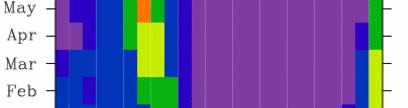
13 What about the daily normals? 100 IEM Daily Computed versus NCDC Interpolated Ames NCDC High IEM High NCDC Low IEM Low Overall NCDC Bias is +0.1 F 1 Jan 1 Feb 1 Mar 1 Apr 1 May 1 Jun 1 Jul 1 Aug 1 Sep 1 Oct 1 Nov 1 Dec NCDC The daily normals are derived by statistically fitting smooth curves through monthly values; daily data were not used to compute daily normals.
14 Daily NCDC Departure mperature Difference [F F] NCD DC IEM Te 8 High 6 Low Jan 1 Feb 1 Mar 1 Apr 1 May 1 Jun 1 Jul 1 Aug 1 Sep 1 Oct 1 Nov 1 Dec
15 NCDC Mean Bias per Day of Month NCDC C IEM Tem mperature Di ifference [F] Highs Lows NCDC a bit cooler NCDC a bit warmer Day of the Month
16 Authorities on the Subject NCDC s July Report For the contiguous United States the average temperature of 73.5 F was 0.8 F below the 20th century average Iowa s State Climatologist / IEM News Item for March The statewide average temperature was 36.7 F or0.7 7 F above normal. Wikipedia People who are not experts in metrology or statistics can overestimate the usefulness of significant figures. The topic receives much more emphasis in high school and undergraduate chemistry texts than it does in real world research laboratories. MarkTwain: "Therearethreekindsoflies: lies, damnedlies lies, and statistics." Moral: While it is debatable if ASOS can sense a 0.7 F change, it certainly can not report it.
17 1995 Present NEXRAD Composites 1 March :35 PM
18 Processing Steps Combine base reflectivity of individual WSR 88Ds onto a common grid (0.01 Lat/Lon) Compare this product against a gridded analysis of RUC surface temperatures (stop clutter suppression in the winter) Where above freezing, compare against the Net Echo Tops composite to filter out clutter Convert to a number of different formats for further web and local processing
19 Backfilling the archive National Climatic Data Center kindly provided their entire NIDS archive (1.4 TB) to run my scripts against to backfill to Took around 6 8 months for a handful of machines to process. Clutter suppression was done for APR SEP for years after 2003 (when NET product was available), no RUC temperature filter.


20 NEXRAD Composite Archive Stats ~ 1x1 km composite for the CONUS 1995 Now Valid every 5 minutes 1.5 million images 500 GB total size Updated in real time with a reanalysis done each hour. Example analysis showing the Iowa areal coverage of NEXRAD reflectivity on a day marked by summertime afternoon showers.


21 Makes a great data source for the Daily Feature Combine NEXRAD with 1 minute observations to show a wet bulb illustration. Ring of Fire illustrated by computing the daily maximum reflectivity.
22 Apply a Z R and have fun! Come on Darly, why don t you gauge correct this product?
23 Gauge Correction is not easy! Real time METARs from Cedar Rapids on 27 August 2009 METAR KCID Z 06017KT 1SM +RA BR BKN009 OVC036 17/17 A3000 RMK AO2 SLP158 P T METAR KCID Z 07010KT 1SM +RA BR BKN007 OVC036 17/17 A3000 RMK AO2 SLP157 P0058 T Delayed DailySummaryMessage arriveslaterthat that evening (period to 6 UTC!) KCID DS 27/ / // 64/ 60// /535/45/81/33/27/03/06/ 28/14/19/68/17/01/01/17/80/60/34/01/00/00/00/00/00/00/131/ / /1= The numbers do not match as they represent different hourly windows: METAR: :52 to :52 Daily Summary Message: :00 to :00
24 How much precipitation per minute? Total Preci ipitation [inch] Des Moines Minute of the Hour Precipitation Total ~10% Minute of the Hour


25 Why not use NCEP s stage4 precip? The Stage IV 6 hourlies are not simple summations of the hourlies. Some of the hourlies we receive are only the automated runs (no QC), while for the 6 hourlies we almost always receive the QC'd version. source: NCEP Stage4 FAQ
26 Model Output Statistics Archive 145 Database the NAM/GFS FOUS23 KWNO MAVNC1 KDSM GFS MOS GUIDANCE 9/17/ UTC DT /SEPT 17 /SEPT 18 /SEPT 19 / HR MOS data for all locations. X/N TMP DPT CLD FW FW FW FW CL CL CL CL CL CL CL FW CL CL CL CL CL CL CL BK OV WDR Mostly complete back to WSP P early 2007 P Q Q T06 0/ 0 0/ 0 0/ 0 0/ 0 0/ 0 0/ 0 1/ 0 0/ 0 0/ 0 6/ 0 T12 0/ 0 0/ 0 1/ 0 0/ 0 6/ 0 POZ POS TYP R R R R R R R R R R R R R R R R R R R R R SNW 0 0 CIG VIS OBV HZ N N N N N N N BR N N N N N N N BR N N N N
27 NWS Storm Based Warning Verification Images from:
28 Components of a NWS Warning UGC (County/Zones Impacted) P VTEC String Storm Based warning Polygon 210 WFUS53 KDMX TORDMX IAC /O.NEW.KDMX.TO.W T2146Z T2230Z/ BULLETIN - EAS ACTIVATION REQUESTED TORNADO WARNING NATIONAL WEATHER SERVICE DES MOINES IA 446 PM CDT SUN MAY THE NATIONAL WEATHER SERVICE IN DES MOINES HAS ISSUED A * TORNADO WARNING FOR... NORTHERN GRUNDY COUNTY IN CENTRAL IOWA... SOUTHEASTERN BUTLER COUNTY IN NORTH CENTRAL IOWA... * UNTIL 530 PM CDT. * AT 441 PM CDT...NATIONAL WEATHER SERVICE DOPPLER RADAR INDICATED A SEVERE THUNDERSTORM CAPABLE OF PRODUCING A TORNADO 7 MILES SOUTHWEST OF APLINGTON...OR 33 MILES WEST OF WATERLOO...MOVING NORTHEAST AT 36 MPH. * THE TORNADO WILL BE NEAR... APLINGTON BY 455 PM CDT... PARKERSBURG BY 500 PM CDT... ALLISON BY 510 PM CDT... SHELL ROCK AND CLARKSVILLE BY 520 PM CDT... THIS IS A HAZARDOUS SITUATION. SEEK SHELTER IN A BASEMENT...OR IN AN INTERIOR ROOM. STAY AWAY FROM WINDOWS. IF YOU ARE OUTSIDE OR IN A CAR...SEEK SHELTER IN A REINFORCED BUILDING. A TORNADO WATCH REMAINS IN EFFECT UNTIL 900 PM CDT SUNDAY EVENING FOR NORTHWESTERN IOWA. LAT...LON TIME...MOT...LOC 2146Z 238DEG 31KT


29 Polygon Size FAIL ~40,000 sq km Severe Thunderstorm Warning issued in July 2009 Covering portions of 16 counties


30 Polygon Shape FAIL
31 No rmalized Area [initial = 1] Polygon Time FAIL Storm Based Warning Normalized Size Change with SVS update [all 2008, 2009 thru 13 Aug] Minutes after Warning Issuance 2009 SVR 2009 TOR 2008 SVR 2008 TOR
32 How the Polygon Changed The edges were clipped to remove Carroll and Wright County from the warning.


33 Introduce some metrics IEM Cow Perimeter e e Ratio The coincident SBW border with county border Size Reduction The decreased amount of warned area Area Verified Storm reports are buffered and then composited. The composite area is compared to the SBW size.
34
35
36
37 Storm Based Warning Summary Stats *2007 TOR+SVR 2008 TOR+SVR 2009 TOR+SVR Total Warnings Polygon Size versus County Based 72% 72% 73% Areal Verification (15km buffer) 23% 23% 23% Perimeter Ratio 35% 33% 32% Average Size 1229 sq km 1615 sq km 1650 sq km Critical Success Index [CSI] Probability of Detection [POD] False Alarm Ratio [FAR] * Unofficial data computed by the IEM, 2009 data thru 21 Sep * 2007 Data prior to 1 Oct 2007 using issued polygons, when Storm Based Warnings started
38 Enough Complaining, Solutions? 1. Remove UGC requirement in warnings. This would free the warnings to resemble actual storm tracks. 2. Generating software should limit the number of vertices of polygon to prevent confusing shapes. (Maybe 6, currently around 20) 3. Remove odd policies preventing TOR/SVR warnings from being issued over marine zones. 4. Allow offices to issue warnings for areas outside of their CWA. Completely eliminate political boundaries from warnings.
39 Data Archives Summary SPCConvective Convective Watches [1997 ] NEXRAD Composite Reflectivity [1995 ] 1 minute interval obs ASOS [2000 ] AWOS [1995 ] SchoolNet [2002 ] RawMOS Output [2007 ] Stage4 Precipitation [1997 ] NWS Warnings, back to 1996 coming soon!
40 That s all folks. Questions? Daryl Herzmann 3015 Agronomy Hall akrherz@iastate.eduedu
The illusion of Storm Based Warnings. Daryl Herzmann Iowa State University
 The illusion of Storm Based Warnings Daryl Herzmann Iowa State University Don t agree with something you see? Do what this guy did! I ll act indignant and ignore you. Why am I so bitter? 1. Old Age 2.
KCCI SchoolNet8 Workshop
 KCCI SchoolNet8 Workshop Daryl Herzmann Iowa Environmental Mesonet Iowa State University The Rundown CIPCO/IEM/KCCI/NWS partnership Who is using your data? IEM Tracker (a.k.a. spam generator) Downloading
KCCI SchoolNet8 and the Iowa Mesonet
 KCCI SchoolNet8 and the Iowa Mesonet Daryl Herzmann Iowa State University Iowa Environmental Mesonet 411 What does mesonet mean? meso - Spatial scale, net - network Why environmental? We are interested
Sources of Hourly Surface Data and Weather Maps for the U.S.
 Sources of Hourly Surface Data and Weather Maps for the U.S. Weather Underground Weather Underground http://www.wunderground.com/history/ maintains a deep archive of hourly reports for around the world.
3D Weather Visualisation
 3D Weather Visualisation Virginia Tech Blacksburg, VA, 24061 Sarah Nimitz, Duke Forsyth, Andrew Knittle Client: Zachary Duer Trevor White CS 4624 4/28/2016 Overview Worked with Zachary Duer and Trevor
The Climate of Payne County
 The Climate of Payne County Payne County is part of the Central Great Plains in the west, encompassing some of the best agricultural land in Oklahoma. Payne County is also part of the Crosstimbers in the
Sources of Hourly Surface Data and Weather Maps for the U.S.
 Sources of Hourly Surface Data and Weather Maps for the U.S. Weather Underground Weather Underground http://www.wunderground.com/history/ maintains a deep archive of hourly reports for around the world.
The Climate of Grady County
 The Climate of Grady County Grady County is part of the Central Great Plains, encompassing some of the best agricultural land in Oklahoma. Average annual precipitation ranges from about 33 inches in northern
The Climate of Marshall County
 The Climate of Marshall County Marshall County is part of the Crosstimbers. This region is a transition region from the Central Great Plains to the more irregular terrain of southeastern Oklahoma. Average
The Climate of Seminole County
 The Climate of Seminole County Seminole County is part of the Crosstimbers. This region is a transition region from the Central Great Plains to the more irregular terrain of southeastern Oklahoma. Average
Champaign-Urbana 2001 Annual Weather Summary
 Champaign-Urbana 2001 Annual Weather Summary ILLINOIS STATE WATER SURVEY 2204 Griffith Dr. Champaign, IL 61820 wxobsrvr@sws.uiuc.edu Maria Peters, Weather Observer January: After a cold and snowy December,
Champaign-Urbana 1999 Annual Weather Summary
 Champaign-Urbana 1999 Annual Weather Summary ILLINOIS STATE WATER SURVEY 2204 Griffith Dr. Champaign, IL 61820 wxobsrvr@sws.uiuc.edu Maria Peters, Weather Observer A major snowstorm kicked off the new
The Climate of Kiowa County
 The Climate of Kiowa County Kiowa County is part of the Central Great Plains, encompassing some of the best agricultural land in Oklahoma. Average annual precipitation ranges from about 24 inches in northwestern
The Climate of Bryan County
 The Climate of Bryan County Bryan County is part of the Crosstimbers throughout most of the county. The extreme eastern portions of Bryan County are part of the Cypress Swamp and Forest. Average annual
The Climate of Murray County
 The Climate of Murray County Murray County is part of the Crosstimbers. This region is a transition between prairies and the mountains of southeastern Oklahoma. Average annual precipitation ranges from
The Climate of Texas County
 The Climate of Texas County Texas County is part of the Western High Plains in the north and west and the Southwestern Tablelands in the east. The Western High Plains are characterized by abundant cropland
The Climate of Haskell County
 The Climate of Haskell County Haskell County is part of the Hardwood Forest. The Hardwood Forest is characterized by its irregular landscape and the largest lake in Oklahoma, Lake Eufaula. Average annual
The Climate of Pontotoc County
 The Climate of Pontotoc County Pontotoc County is part of the Crosstimbers. This region is a transition region from the Central Great Plains to the more irregular terrain of southeast Oklahoma. Average
Minnesota s Climatic Conditions, Outlook, and Impacts on Agriculture. Today. 1. The weather and climate of 2017 to date
 Minnesota s Climatic Conditions, Outlook, and Impacts on Agriculture Kenny Blumenfeld, State Climatology Office Crop Insurance Conference, Sep 13, 2017 Today 1. The weather and climate of 2017 to date
Monthly Long Range Weather Commentary Issued: APRIL 25, 2016 Steven A. Root, CCM, Chief Analytics Officer, Sr. VP, sales
 Monthly Long Range Weather Commentary Issued: APRIL 25, 2016 Steven A. Root, CCM, Chief Analytics Officer, Sr. VP, sales sroot@weatherbank.com MARCH 2016 Climate Highlights The Month in Review The March
Champaign-Urbana 1998 Annual Weather Summary
 Champaign-Urbana 1998 Annual Weather Summary ILLINOIS STATE WATER SURVEY Audrey Bryan, Weather Observer 2204 Griffith Dr. Champaign, IL 61820 wxobsrvr@sparc.sws.uiuc.edu The development of the El Nìno
Final Report. COMET Partner's Project. University of Texas at San Antonio
 Final Report COMET Partner's Project University: Name of University Researcher Preparing Report: University of Texas at San Antonio Dr. Hongjie Xie National Weather Service Office: Name of National Weather
Volume 4, Number 5, February 2014
 Volume 4, Number 5, February 2014 Welcome to national Severe Weather Preparedness Week. Unfortunately, Alabama had its first 2014 brush of destructive weather on Feb. 20, just one week after our most recent
Denver International Airport MDSS Demonstration Verification Report for the Season
 Denver International Airport MDSS Demonstration Verification Report for the 2015-2016 Season Prepared by the University Corporation for Atmospheric Research Research Applications Division (RAL) Seth Linden
Case Study Las Vegas, Nevada By: Susan Farkas Chika Nakazawa Simona Tamutyte Zhi-ya Wu AAE/AAL 330 Design with Climate
 Case Study Las Vegas, Nevada By: Susan Farkas Chika Nakazawa Simona Tamutyte Zhi-ya Wu AAE/AAL 330 Design with Climate Professor Alfredo Fernandez-Gonzalez School of Architecture University of Nevada,
Champaign-Urbana 2000 Annual Weather Summary
 Champaign-Urbana 2000 Annual Weather Summary ILLINOIS STATE WATER SURVEY 2204 Griffith Dr. Champaign, IL 61820 wxobsrvr@sws.uiuc.edu Maria Peters, Weather Observer January: January started on a mild note,
GAMINGRE 8/1/ of 7
 FYE 09/30/92 JULY 92 0.00 254,550.00 0.00 0 0 0 0 0 0 0 0 0 254,550.00 0.00 0.00 0.00 0.00 254,550.00 AUG 10,616,710.31 5,299.95 845,656.83 84,565.68 61,084.86 23,480.82 339,734.73 135,893.89 67,946.95
Arizona Climate Summary
 Arizona Climate Summary April 2014 Summary of conditions for March 2014 March 2014 Temperature and Precipitation Summary March 1 st 16 th : We started off the month of March with a significant precipitation
Climatography of the United States No
 Climate Division: AK 5 NWS Call Sign: ANC Month (1) Min (2) Month(1) Extremes Lowest (2) Temperature ( F) Lowest Month(1) Degree s (1) Base Temp 65 Heating Cooling 90 Number of s (3) Jan 22.2 9.3 15.8
LAB 3: THE SUN AND CLIMATE NAME: LAB PARTNER(S):
:") GEOG 101L PHYSICAL GEOGRAPHY LAB SAN DIEGO CITY COLLEGE SELKIN 1 LAB 3: THE SUN AND CLIMATE NAME: LAB PARTNER(S): The main objective of today s lab is for you to be able to visualize the sun s position
GEOG 101L PHYSICAL GEOGRAPHY LAB SAN DIEGO CITY COLLEGE SELKIN 1 LAB 3: THE SUN AND CLIMATE NAME: LAB PARTNER(S): The main objective of today s lab is for you to be able to visualize the sun s position
AMDAR Forecast Applications. Richard Mamrosh NWS Green Bay, Wisconsin, USA
 AMDAR Forecast Applications Richard Mamrosh NWS Green Bay, Wisconsin, USA AMDAR has many applications Aviation Low level wind shear Ceilings and visibilities Icing and turbulence Winter Storms Precipitation
Monthly Long Range Weather Commentary Issued: APRIL 18, 2017 Steven A. Root, CCM, Chief Analytics Officer, Sr. VP,
 Monthly Long Range Weather Commentary Issued: APRIL 18, 2017 Steven A. Root, CCM, Chief Analytics Officer, Sr. VP, sroot@weatherbank.com MARCH 2017 Climate Highlights The Month in Review The average contiguous
Arizona Climate Summary September 2017 Summary of conditions for August 2017
 August 2017 Temperature and Precipitation Summary Arizona Climate Summary September 2017 Summary of conditions for August 2017 August 1 st 15 th : The monsoon activity that ended July continued into the
DAVE LEVIN AARON SCHULMAN
 YOUNDO LEE DAVE LEVIN NEIL SPRING RAMAKRISHNA PADMANABHAN University of Maryland AARON SCHULMAN Stanford Weather causes residential link failures Lightning destroys equipment and causes interference Water
The Colorado Drought of 2002 in Perspective
 The Colorado Drought of 2002 in Perspective Colorado Climate Center Nolan Doesken and Roger Pielke, Sr. Prepared by Tara Green and Odie Bliss http://climate.atmos.colostate.edu Known Characteristics of
University of Maryland. Tuesday, February 7, 12
 AARON SCHULMAN NEIL SPRING University of Maryland Measuring weather-related failures Identify residential IPs that will be subject to weather Ping before, during, and after a weather event Analyze the
Westmap: The Western Climate Mapping Initiative An Update
 Westmap: The Western Climate Mapping Initiative An Update Andrew Comrie 1, Kelly Redmond 2, Mary Glueck 1, Hauss Reinbold 3, Chris Daly 4 1 University of Arizona, 2 DRI / Western Regional Climate Center
2/27/2015. Big questions. What can we say about causes? Bottom line. Severe Thunderstorms, Tornadoes, and Climate Change: What We Do and Don t Know
 Severe Thunderstorms, Tornadoes, and Climate Change: What We Do and Don t Know Big questions How and why are weather hazards distributed? Are things changing in time and will they? HAROLD BROOKS NOAA/NSSL
APPENDIX G-7 METEROLOGICAL DATA
 APPENDIX G-7 METEROLOGICAL DATA METEOROLOGICAL DATA FOR AIR AND NOISE SAMPLING DAYS AT MMR Monthly Normals and Extremes for Honolulu International Airport Table G7-1 MMR RAWS Station Hourly Data Tables
CoCoRaHS Monitoring Colorado s s Water Resources through Community Collaborations
 CoCoRaHS Monitoring Colorado s s Water Resources through Community Collaborations Nolan Doesken Colorado Climate Center Atmospheric Science Department Colorado State University Presented at Sustaining
Section 7: Hazard Avoidance
 7.1 In-Flight Hazard Awareness Section 7: Hazard Avoidance As technology improves, pilots have more and more real-time information within reach in all phases of flight. Terrain proximity, real-time weather
Arizona Climate Summary
 May 2015 Temperature and Precipitation Summary Arizona Climate Summary June 2015 Summary of conditions for May 2015 May 1 st 14 th : May began with high pressure in the west, and May 1 st was dry statewide,
SOUTHERN CLIMATE MONITOR
 SOUTHERN CLIMATE MONITOR MARCH 2011 VOLUME 1, ISSUE 3 IN THIS ISSUE: Page 2 to 4 Severe Thunderstorm Climatology in the SCIPP Region Page 4 Drought Update Page 5 Southern U.S. Precipitation Summary for
Lesson Adaptation Activity: Analyzing and Interpreting Data
 Lesson Adaptation Activity: Analyzing and Interpreting Data Related MA STE Framework Standard: 3-ESS2-1. Use graphs and tables of local weather data to describe and predict typical weather during a particular
EVALUATION AND VERIFICATION OF PUBLIC WEATHER SERVICES. Pablo Santos Meteorologist In Charge National Weather Service Miami, FL
 EVALUATION AND VERIFICATION OF PUBLIC WEATHER SERVICES Pablo Santos Meteorologist In Charge National Weather Service Miami, FL WHAT IS THE MAIN DIFFERENCE BETWEEN A GOVERNMENT WEATHER SERVICE FORECAST
Fort Rucker Wx Operations
 Spring & Summer Weather Hazards Fort Rucker Wx Operations Overview Hours of Operation OWS vs FRWXOPS Products Services Climatology Seasonal Patterns Seasonal Hazards Hours of Operation Observing 24/7 (automated)
Climate Update. Wendy Ryan and Nolan Doesken Colorado Climate Center. Atmospheric Science Department Colorado State University
 Climate Update Wendy Ryan and Nolan Doesken Colorado Climate Center Atmospheric Science Department Colorado State University Presented to Water Availability Task Force June 26, 2008 Denver, CO Prepared
Jackson County 2013 Weather Data
 Jackson County 2013 Weather Data 61 Years of Weather Data Recorded at the UF/IFAS Marianna North Florida Research and Education Center Doug Mayo Jackson County Extension Director 1952-2008 Rainfall Data
MxVision WeatherSentry Web Services Content Guide
 MxVision WeatherSentry Web Services Content Guide July 2014 DTN 11400 Rupp Drive Minneapolis, MN 55337 00.1.952.890.0609 This document and the software it describes are copyrighted with all rights reserved.
Corridor Integrated Weather System (CIWS) MIT Lincoln Laboratory. CIWS D. Meyer 10/21/05
 MIT Lincoln Laboratory. CIWS D. Meyer 10/21/05") Corridor Integrated Weather System () Outline Example of Weather Impacting Air traffic Impacts on worst delay day Ways to reduce delay Improve forecasts Aid traffic flow management Aviation Delay Problem
Corridor Integrated Weather System () Outline Example of Weather Impacting Air traffic Impacts on worst delay day Ways to reduce delay Improve forecasts Aid traffic flow management Aviation Delay Problem
Memo. I. Executive Summary. II. ALERT Data Source. III. General System-Wide Reporting Summary. Date: January 26, 2009 To: From: Subject:
 Memo Date: January 26, 2009 To: From: Subject: Kevin Stewart Markus Ritsch 2010 Annual Legacy ALERT Data Analysis Summary Report I. Executive Summary The Urban Drainage and Flood Control District (District)
Complete Weather Intelligence for Public Safety from DTN
 Complete Weather Intelligence for Public Safety from DTN September 2017 White Paper www.dtn.com / 1.800.610.0777 From flooding to tornados to severe winter storms, the threats to public safety from weather-related
(Severe) Thunderstorms and Climate HAROLD BROOKS NOAA/NSSL
 Thunderstorms and Climate HAROLD BROOKS NOAA/NSSL") (Severe) Thunderstorms and Climate HAROLD BROOKS NOAA/NSSL HAROLD.BROOKS@NOAA.GOV Big questions How and why are weather hazards distributed? Are things changing in time and will they? Begin with thunderstorm
(Severe) Thunderstorms and Climate HAROLD BROOKS NOAA/NSSL HAROLD.BROOKS@NOAA.GOV Big questions How and why are weather hazards distributed? Are things changing in time and will they? Begin with thunderstorm
Applications/Users for Improved S2S Forecasts
 Applications/Users for Improved S2S Forecasts Nolan Doesken Colorado Climate Center Colorado State University WSWC Precipitation Forecasting Workshop June 7-9, 2016 San Diego, CA First -- A short background
University of Maryland. Monday, November 7, 11
 AARON SCHULMAN NEIL SPRING University of Maryland Residential links may fail Links are not redundant Equipment updates are rare Equipment operates in an uncontrolled environment photo credit: Ode Street
2.12 Inter-Comparison of Real-Time Rain Gage and Radar-Estimated Rainfall on a Monthly Basis for Midwestern United States Counties
 2.12 Inter-Comparison of Real-Time Rain and -Estimated Rainfall on a Monthly Basis for Midwestern United States Counties Nancy Westcott* and Kenneth E. Kunkel Illinois State Water Survey Champaign, Illinois
Arizona Climate Summary July 2015 Summary of conditions for June 2015
 June 2015 Temperature and Precipitation Summary Arizona Climate Summary July 2015 Summary of conditions for June 2015 June 1 st 14 th : Similar to May, June began with high pressure in the west, and conditions
Arizona Climate Summary April 2013
 Arizona Climate Summary April 2013 Summary of conditions for March 2013 March 2013 Temperature and Precipitation Summary March 1 st 16 th : March began as a ridge of high pressure progressed across the
A Preliminary Severe Winter Storms Climatology for Missouri from
 A Preliminary Severe Winter Storms Climatology for Missouri from 1960-2010 K.L. Crandall and P.S Market University of Missouri Department of Soil, Environmental and Atmospheric Sciences Introduction The
A Review of the 2007 Water Year in Colorado
 A Review of the 2007 Water Year in Colorado Nolan Doesken Colorado Climate Center, CSU Mike Gillespie Snow Survey Division, USDA, NRCS Presented at the 28 th Annual AGU Hydrology Days, March 26, 2008,
Quality Control of the National RAWS Database for FPA Timothy J Brown Beth L Hall
 Quality Control of the National RAWS Database for FPA Timothy J Brown Beth L Hall Desert Research Institute Program for Climate, Ecosystem and Fire Applications May 2005 Project Objectives Run coarse QC
UWM Field Station meteorological data
 University of Wisconsin Milwaukee UWM Digital Commons Field Station Bulletins UWM Field Station Spring 992 UWM Field Station meteorological data James W. Popp University of Wisconsin - Milwaukee Follow
Paul M. Iñiguez* NOAA/National Weather Service, Phoenix, AZ
 JP2.9 THE PHOENIX RAINFALL INDEX Paul M. Iñiguez* NOAA/National Weather Service, Phoenix, AZ 1. INTRODUCTION Like many other large western cities, Phoenix has a database of daily weather observations,
Monthly Long Range Weather Commentary Issued: SEPTEMBER 19, 2016 Steven A. Root, CCM, Chief Analytics Officer, Sr. VP,
 Monthly Long Range Weather Commentary Issued: SEPTEMBER 19, 2016 Steven A. Root, CCM, Chief Analytics Officer, Sr. VP, sroot@weatherbank.com SEPTEMBER 2016 Climate Highlights The Month in Review The contiguous
Weather Products for Decision Support Tools Joe Sherry April 10, 2001
 Weather Products for Decision Support Tools Joe Sherry National Convective Weather Forecast (NCWF) Computer generated graphical forecast extending 0-1 hours, updated every 5 minutes Conservative forecast
Multi-Sensor Precipitation Reanalysis
 Multi-Sensor Precipitation Reanalysis Brian R. Nelson, Dongsoo Kim, and John J. Bates NOAA National Climatic Data Center, Asheville, North Carolina D.J. Seo NOAA NWS Office of Hydrologic Development, Silver
Arizona Climate Summary February 2012
 Arizona Climate Summary February 2012 Summary of conditions for January 2012 January 2012 Temperature and Precipitation Summary January 1 st 20 th : The New Year has started on a very dry note. The La
Climate Forecasts and Forecast Uncertainty
 Climate Forecasts and Forecast Uncertainty Holly Hartmann Department of Hydrology and Water Resources University of Arizona, Tucson 520-626-8523 hollyh@hwr.arizona.edu CLIMAS-SAHRA press briefing August
Tracking the Climate Of Northern Colorado Nolan Doesken State Climatologist Colorado Climate Center Colorado State University
 Tracking the Climate Of Northern Colorado Nolan Doesken State Climatologist Colorado Climate Center Colorado State University Northern Colorado Business Innovations November 20, 2013 Loveland, Colorado
10 years after Hurricane Charley
 10 years after Hurricane Charley Hurricane Charley (2004) A Retrospective Scott M. Spratt Warning Coordination Meteorologist NWS Melbourne, FL Florida Governors Hurricane Conference May 15, 2014 11 AM
Climatography of the United States No
 Climate Division: CA 4 NWS Call Sign: Month (1) Min (2) Month(1) Extremes Lowest (2) Temperature ( F) Lowest Month(1) Degree s (1) Base Temp 65 Heating Cooling 100 Number of s (3) Jan 55.6 39.3 47.5 77
Climatography of the United States No
 Climate Division: CA 5 NWS Call Sign: Month (1) Min (2) Month(1) Extremes Lowest (2) Temperature ( F) Lowest Month(1) Degree s (1) Base Temp 65 Heating Cooling 100 Number of s (3) Jan 56.6 36.5 46.6 81
Climatography of the United States No
 Climate Division: CA 1 NWS Call Sign: Month (1) Min (2) Month(1) Extremes Lowest (2) Temperature ( F) Lowest Month(1) Degree s (1) Base Temp 65 Heating Cooling 100 Number of s (3) Jan 57.9 38.9 48.4 85
Climatography of the United States No
 Climate Division: CA 5 NWS Call Sign: Month (1) Min (2) Month(1) Extremes Lowest (2) Temperature ( F) Lowest Month(1) Degree s (1) Base Temp 65 Heating Cooling 100 Number of s (3) Jan 44.8 25.4 35.1 72
Climatography of the United States No
 Climate Division: CA 4 NWS Call Sign: Month (1) Min (2) Month(1) Extremes Lowest (2) Temperature ( F) Lowest Month(1) Degree s (1) Base Temp 65 Heating Cooling 100 Number of s (3) Jan 49.4 37.5 43.5 73
Climatography of the United States No
 Climate Division: CA 6 NWS Call Sign: Month (1) Min (2) Month(1) Extremes Lowest (2) Temperature ( F) Lowest Month(1) Degree s (1) Base Temp 65 Heating Cooling 100 Number of s (3) Jan 69.4 46.6 58.0 92
Climatography of the United States No
 Climate Division: CA 4 NWS Call Sign: Month (1) Min (2) Month(1) Extremes Lowest (2) Temperature ( F) Lowest Month(1) Degree s (1) Base Temp 65 Heating Cooling 1 Number of s (3) Jan 58.5 38.8 48.7 79 1962
Climatography of the United States No
 Climate Division: CA 6 NWS Call Sign: Month (1) Min (2) Month(1) Extremes Lowest (2) Temperature ( F) Lowest Month(1) Degree s (1) Base Temp 65 Heating Cooling 1 Number of s (3) Jan 67.5 42. 54.8 92 1971
Climatography of the United States No
 Climate Division: CA 1 NWS Call Sign: Month (1) Min (2) Month(1) Extremes Lowest (2) Temperature ( F) Lowest Month(1) Degree s (1) Base Temp 65 Heating Cooling 1 Number of s (3) Jan 57.8 39.5 48.7 85 1962
ZUMWALT WEATHER AND CLIMATE ANNUAL REPORT ( )
") ZUMWALT WEATHER AND CLIMATE ANNUAL REPORT (26-29) FINAL DRAFT (9 AUGUST 21) J.D. HANSEN 1, R.V. TAYLOR 2, AND V.S. JANSEN 3 INTRODUCTION The Zumwalt Prairie in northeastern Oregon is a unique grassland
ZUMWALT WEATHER AND CLIMATE ANNUAL REPORT (26-29) FINAL DRAFT (9 AUGUST 21) J.D. HANSEN 1, R.V. TAYLOR 2, AND V.S. JANSEN 3 INTRODUCTION The Zumwalt Prairie in northeastern Oregon is a unique grassland
Convective-scale NWP for Singapore
 Convective-scale NWP for Singapore Hans Huang and the weather modelling and prediction section MSS, Singapore Dale Barker and the SINGV team Met Office, Exeter, UK ECMWF Symposium on Dynamical Meteorology
University of Maryland. Friday, February 10, 12
 AARON SCHULMAN NEIL SPRING University of Maryland Residential links may fail Links are not redundant Equipment updates are rare Equipment operates in an uncontrolled environment photo credit: Patrick Shoemaker,
Arizona Climate Summary September 2014 Summary of conditions for August 2014
 Arizona Climate Summary September 2014 Summary of conditions for August 2014 August 2014 Temperature and Precipitation Summary August 1 st 16 th : The first 5 days of August were quite wet with high pressure
WHEN IS IT EVER GOING TO RAIN? Table of Average Annual Rainfall and Rainfall For Selected Arizona Cities
 WHEN IS IT EVER GOING TO RAIN? Table of Average Annual Rainfall and 2001-2002 Rainfall For Selected Arizona Cities Phoenix Tucson Flagstaff Avg. 2001-2002 Avg. 2001-2002 Avg. 2001-2002 October 0.7 0.0
Changing Hydrology under a Changing Climate for a Coastal Plain Watershed
 Changing Hydrology under a Changing Climate for a Coastal Plain Watershed David Bosch USDA-ARS, Tifton, GA Jeff Arnold ARS Temple, TX and Peter Allen Baylor University, TX SEWRU Objectives 1. Project changes
Hazard assessment based on radar-based rainfall nowcasts at European scale The HAREN project
 Hazard assessment based on radar-based rainfall nowcasts at European scale The HAREN project Marc Berenguer, Daniel Sempere-Torres 3 OPERA radar mosaic OPERA radar mosaic: 213919 133 Precipitation observations
Jackson County 2018 Weather Data 67 Years of Weather Data Recorded at the UF/IFAS Marianna North Florida Research and Education Center
 Jackson County 2018 Weather Data 67 Years of Weather Data Recorded at the UF/IFAS Marianna North Florida Research and Education Center Doug Mayo Jackson County Extension Director 1952-2008 Rainfall Data
NWS Resources For Public Works
 NWS Resources For Public Works August 28th, 2016 Shawn DeVinny shawn.devinny@noaa.gov Meteorologist National Weather Service Twin Cities/Chanhassen, MN 1 APWA 2016 PWX 8/28/2016 National Weather Service
Climatography of the United States No
 Climate Division: ND 8 NWS Call Sign: BIS Month (1) Min (2) Month(1) Extremes Lowest (2) Temperature ( F) Lowest Month(1) Degree s (1) Base Temp 65 Heating Cooling 100 Number of s (3) Jan 21.1 -.6 10.2
Arizona Climate Summary October 2015 Summary of conditions for September 2015
 September 2015 Temperature and Precipitation Summary Arizona Climate Summary October 2015 Summary of conditions for September 2015 September 1 st 18 th : September began with high pressure over southern
Climatography of the United States No
 Climate Division: TN 1 NWS Call Sign: Month (1) Min (2) Month(1) Extremes Lowest (2) Temperature ( F) Lowest Month(1) Degree s (1) Base Temp 65 Heating Cooling 100 Number of s (3) Jan 47.6 24.9 36.3 81
July 13, 2017 Session #1 In Lieu of the Surface Observation Including EWINS Authority, RTMA, Web Cams, and Remote Observation Systems
 July 13, 2017 Session #1 In Lieu of the Surface Observation Including EWINS Authority, RTMA, Web Cams, and Remote Observation Systems Part 121 Operator Perspective: Equivalent Level of Safety Using Remote
Climatography of the United States No
 Climate Division: CA 5 NWS Call Sign: FAT Month (1) Min (2) Month(1) Extremes Lowest (2) Temperature ( F) Lowest Month(1) Degree s (1) Base Temp 65 Heating Cooling 1 Number of s (3) Jan 53.6 38.4 46. 78
Climatography of the United States No
 Climate Division: CA 6 NWS Call Sign: 1L2 N Lon: 118 3W Month (1) Min (2) Month(1) Extremes Lowest (2) Temperature ( F) Lowest Month(1) Degree s (1) Base Temp 65 Heating Cooling 1 Number of s (3) Jan 63.7
Stream Discharge and the Water Budget
 Regents Earth Science Unit 6: Water Cycle & Climate Name: Lab # Stream Discharge and the Water Budget Introduction: The United States Geological Survey (USGS) measures and publishes values for the daily
Climatography of the United States No
 Climate Division: CA 5 NWS Call Sign: BFL Month (1) Min (2) Month(1) Extremes Lowest (2) Temperature ( F) Lowest Month(1) Degree s (1) Base Temp 65 Heating Cooling 1 Number of s (3) Jan 56.3 39.3 47.8
Montana Drought & Climate
 Montana Drought & Climate MARCH 219 MONITORING AND FORECASTING FOR AGRICULTURE PRODUCERS A SERVICE OF THE MONTANA CLIMATE OFFICE IN THIS ISSUE IN BRIEF PAGE 2 REFERENCE In a Word PAGE 3 REVIEW Winter 219:
Weather History on the Bishop Paiute Reservation
 Weather History on the Bishop Paiute Reservation -211 For additional information contact Toni Richards, Air Quality Specialist 76 873 784 toni.richards@bishoppaiute.org Updated 2//214 3:14 PM Weather History
2003 Water Year Wrap-Up and Look Ahead
 2003 Water Year Wrap-Up and Look Ahead Nolan Doesken Colorado Climate Center Prepared by Odie Bliss http://ccc.atmos.colostate.edu Colorado Average Annual Precipitation Map South Platte Average Precipitation
The Northeast Snowfall Impact Scale
 The Northeast Snowfall Impact Scale Michael Squires National Climatic Data Center Abstract While the Fujita and Saffir-Simpson Scales characterize tornadoes and hurricanes respectively, there is no widely