World Geography Copywork
|
|
|
- Timothy Preston
- 5 years ago
- Views:
Transcription
1


2 World Geography Copywork Copyright 2015 Janeen Herlugson This copywork pack is intended to enhance your child's knowledge of World Geography. It is not a Geography Curriculum, nor a complete Geography study and therefore, is not inclusive of all Geography facts. When researching facts, there were so many things I wanted to place on each map that I had to be careful not to over crowd them or they wouldn't be legible for copying. I sorted through all the information and only included facts that are the most important, the largest, the longest, the most well-known, or the must-know of each map topic. These facts will enhance the learning your child is already getting from their Geography program. I recommend that your child copy the names of the continents and oceans on every map they produce. This will help them quickly learn the most important basic facts. I also recommend that when copying the maps with color distributions, have your child copy one color at a time so they can see the distribution of that particular item on the map, for example, Mineral Distributions Map - color all of the iron shapes first so the child will see where all the iron deposits are located around the world and proceed with each mineral until complete. Credits and Acknowledgments Thank you to Richele McFarlin of Crisp Apple Design for designing my cover. Thank you to Zip-A-Dee-Doo-Dah Designs for the graphics. Copyright Janeen Herlugson. Original purchaser is granted permission to photocopy pages for use within their single family. All other rights reserved. For permission to make copies, written or otherwise, except for the use within one immediate family, please contact the author at
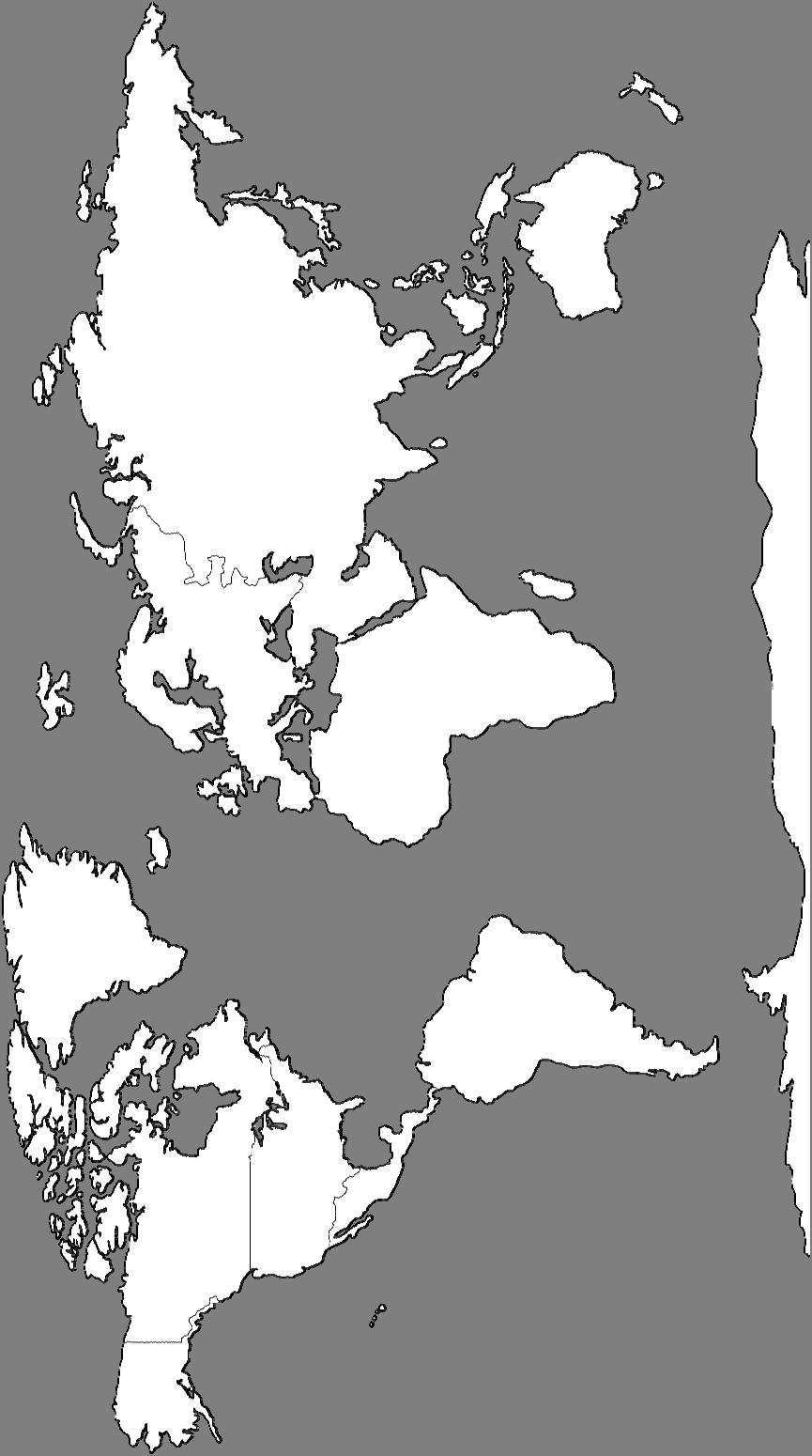
3 World Continents & Oceans Europe north Atlantic Ocean Africa Asia south Indian Ocean Australia Southern Ocean Antarctica
4 2
5 The World's Great Lines & Divisions North Pole 90 N Arctic Circle 66 N NORTHERN HEMISPHERE WESTERN HEMISPHERE Tropic of Cancer 23 N Equator 0 Tropic of Capricorn 23 S Lines of Longitude run north to south Prime Meridian SOUTHERN HEMISPHERE Lines of Latitude run east to west EASTERN HEMISPHERE South Pole 90 S Antarctic Circle 66 S 3
6 - 4
7 The World's Mountain Ranges North Mt. St. Helens Cascade Range Rocky Mountains Appalachian Mountains Atlantic Ocean South The Alps Atlas Mountains Europe Africa Ural Mountains Mt. Everest The Himalayas Asia Kunlun Mountains Mt. Fuji Andes Mountains Indian Ocean Australia Great Dividing Range Southern Ocean TransAntarctic Mountains Antarctica 5
8 6
9 World Deserts, Plains & Plateaus Siberian Plain Siberian Plateau North Great Basin Great Plains Atlantic Ocean Amazon Basin South Sahara Desert Europe Great Rift Valley Africa Arabian Desert Horn of Africa Asia Great Sandy Desert Gobi Desert Tibetan Plateau Australia Patagonia Steppe Southern Ocean Indian Ocean Antarctica Great Victoria Desert 7
10 8
11 The World's River Systems Yukon River Colorado River North Rio Grande Amazon River Strait of Magellan Mississippi River Drake Passage Atlantic Ocean South Southern Ocean Europe Danube River Tigris River Euphrates Nile River Indus Niger River River Africa Congo River Brahmaputra River Ganges River Indian Ocean Asia Antarctica Yellow River (Huang He) Yangtze River Mekong River Australia Darling River Murray River 9
12 10
13 World Seas, Bays & Gulf's Gulf of Alaska Beaufort Sea Ross Sea Hudson Bay North Gulf of Mexico Gulf of Arica Strait of Magellan Baffin Bay Caribbean Sea Atlantic Ocean South Drake Passage Labrador Sea North Sea Bay of Biscay Barents Norwegian Sea Sea Europe Mediterranean Sea Red Sea Southern Ocean Weddell Sea Baltic Sea Black Sea Africa Caspian Sea Persian Gulf Arabian Sea Bay of Bengal Indian Ocean Antarctica Asia Sea of Okhotsk Sea of Japan Arafura Sea Australia Great Australian Bight East China Sea South China Sea Bering Sea Great Barrier Reef Tasman Sea Ross Sea 11
14 12
15 Islands Around the World Arctic Ocean Banks Island Victoria Island Aleutian Islands Channel Islands Hawaiian Islands Christmas Island Queen Elizabeth Islands Marquesas Islands North Bermuda Bahamas Aruba Galapagos Islands Ellesmere Island Baffin Island Atlantic Ocean Caribbean Islands Curacao Bonaire South Orkney Islands Canary V Islands Shetland Islands Madeira Islands Cape Verde Europe Greek Islands Africa Asia Islands in Indonesia Indian Ocean New Siberian Islands Australia Pacific Ocean Okinawa The Philippines Marshall Islands Coral Sea Islands St. Lawrence Island Kuril Islands Solomon Islands Fiji Easter Island V ff Falkland Islands Southern Ocean Kerguelen Islands Tasmania New Zealand Berkner Island Antarctica 13
16 14

17 Major World Biomes North Europe Asia Asia Central Rainforest Polar Ice Caps Polar Tundra Temperate Arid / Dry Mediterranean Mountains Tropical Atlantic Ocean South Amazon Rainforest Congo Rainforest Southern Ocean Africa Africa Southeast Asia Rainforest Madagascar Rainforest Indian Ocean Australia Antarctica Antarctica 15
18 16

19 Mineral Distributions North Europe Asia Atlantic Ocean Africa Iron Nickel Copper Mercury Diamonds Gold Silver South South Southern Ocean Indian Ocean Australia Antarctica 17
20 18
21 Hurricanes & Tornadoes Tornado Alley North Atlantic Ocean Hurricanes August - October Africa Europe Cyclones October - November Asia Typhoons May - December (The strongest area of all ocean storms) Hurricanes June - October South South Areas where Tornadoes can form Cyclones December - March Australia Cyclones January - March Areas where Hurricanes can form Arrows show the direction of the storms. The months are when they occur. Southern Ocean Indian Ocean Antarctica 19
22 Areas where Tornadoes can form Areas where Hurricanes can form Arrows show the direction of the storms. The months are when they occur. 20
23 Tectonic Plates, Earthquakes & Tsunamis Tectonic Plates The Ring of Fire - This is where most earthquakes occur. Tsunami Risk Area - Most Tsunamis occur around the Indonesia islands. North n Plate Eurasian Plate North n Plate Caribbean Plate Arabian Plate Philippine Plate Pacific Plate Cocos Plate African Plate Pacific Plate Nazca Plate South n Plate Somali Plate Indian-Australian Plate Antarctic Plate Pacific Plate 21
24 Tectonic Plates - The Ring of Fire - Tsunami Risk Area - 22
25 The World's Volcanoes North Yellowstone Caldera Mt. St. Helen Mt. Rainier Kilauea Popocatepetl Atlantic Ocean South South Chaiten Mt. Surtsey Mt. Vesuvius Mt. Etna Africa Kilimanjaro Southern Ocean Europe Nyiragongo Mt. Ararat Antarctica Indian Ocean Asia Krakatau Mt. Merapi Sakurajima Mt. Fuji Yasur Australia Lake Taupo 23
26 24
27 Reference Map North Europe Asia South Atlantic Ocean Africa Indian Ocean Australia Southern Ocean Antarctica 25
AP Human Geography PROJECT
 AP Human Geography PROJECT WORLD MAPS Name Period Date This is a self-study of the geography of the world. You are to make three maps as described below. Each map is worth 100 points (30 points off if
AP Human Geography PROJECT
 AP Human Geography PROJECT WORLD MAPS Name Period Date This is a self-study of the geography of the world. You are to make three maps as described below and complete two worksheets. Each project is worth
Pre-AP World Geography Summer Assignment
 Pre-AP World Geography 2018-2019 Summer Assignment This is the summer assignment for students who intend on being accepted and enrolled in Pre-AP World Geography. Successful performance on this assignment
Physical Geography. Ariel view of the Amazon Rainforest. A Look at the Seven Continents
 Physical Geography In this unit you will learn about general physical geography. The study of the Earth s surface features provides the setting for the human-environmental interactions and for the human
Tropical Moist Rainforest
 Tropical or Lowlatitude Climates: Controlled by equatorial tropical air masses Tropical Moist Rainforest Rainfall is heavy in all months - more than 250 cm. (100 in.). Common temperatures of 27 C (80 F)
UNIT 3: THE CONTINENTS
 UNIT 3: THE CONTINENTS TOPICS 1. The continents 2. Europe 3. Africa 4. America 5. Asia 6. Oceania 7. Antarctica 8. Relief of Spain 1. The continents The Earth consist of six continents: Europe, Africa,
South, Southeast, and East Asia. Physical Geography
 South, Southeast, and East Asia Physical Geography Mountains v Mountains are important in Asia because they influence: A. Population patterns B. Movement of people and goods C. Climate Mountains v The
AP Environmental Science. Earth Systems: Part 3
 AP Environmental Science Earth Systems: Part 3 River Deep, Mountain High Geomorphology-the scientific study of landforms and the processes that shape them Water, water everywhere.. Oceans Arctic Ocean
Pre AP World Geography Summer Project
 Part of the Pre AP goal is to have a deeper understanding of the impact of physical and political locations on each other. This project is designed to ensure that you have a strong foundation of the locations
Crustal Activity. Plate Tectonics - Plates - Lithosphere - Asthenosphere - Earth s surface consists of a major plates and some minor ones
 Name: Date: Period: Tectonics The Physical Setting: Earth Science CLASS NOTES Tectonics - s - Lithosphere - Asthenosphere - Earth s surface consists of a major plates and some minor ones The plates are
WG.21.C Create and interpret different types of maps to answer geographic questions, infer relationships, and analyze change.
 Unit: Essentials Cartography (Maps) Social Studies Skills Standards: WG.21.A Analyze and evaluate the validity, and utility of multiple sources of geographic information such as primary and secondary sources,
Introduction to Geography
 Introduction to Geography ropic of Cancer 3½ N Arctic Circle 90 N Prime Meridian 0 Arctic Ocean Mississippi R. Appalachian Mts. Europe Rocky Mountains N. America Atlantic Gulf of Ocean Mexico Caribbean
Understanding Projections
 GEOGRAPHY SKILLS 1 Understanding Projections The earth is a sphere and is best shown as a globe. For books and posters, though, the earth has to be represented as a flat object. To do this, mapmakers create
Unit 1: Geography. For additional information, refer to this website: 1 G e o g r a p h y
 Unit 1: Geography For additional information, refer to this website: http://mryoungtms.weebly.com/ 1 G e o g r a p h y Continents and Oceans SOL USI. 2a Essential Understanding: Continents are large land
Chapter 1 Section 2. Land, Water, and Climate
 Chapter 1 Section 2 Land, Water, and Climate Vocabulary 1. Landforms- natural features of the Earth s land surface 2. Elevation- height above sea level 3. Relief- changes in height 4. Core- most inner
Why VOCABULARY? clues
 It s GHSGT Time! Why VOCABULARY? Social Studies is all about MAKING CONNECTIONS Key Terms provide relational clues to guide you in answering test questions! The more WORDS you know, the smarter you are
The United States & Canada. A Regional Study of Anglo America
 A Regional Study of Anglo America Landform Regions of the United States & Canada world leaders in agricultural and industrial production because of... VAST LANDS stretch from the Atlantic Ocean on the
Map Skills Scavenger Hunt
 Map Skills Scavenger Hunt Introduction to: Continents Cardinal Directions Relative Location Equator and Prime Meridian Hemispheres Reading a Political Map Reading a Physical Map Idea: This product includes
AP Human Geography World Atlas Project
 AP Human Geography World Atlas Project - 2018 Welcome to Robert E. Lee High School and Advanced Placement Human Geography! You are going to thoroughly enjoy this class. It will be a lot of work, but the
Module 11: Meteorology Topic 3 Content: Climate Zones Notes
 Introduction Latitude is such an important climate factor that you can make generalizations about a location's climate based on its latitude. Areas near the equator or the low latitudes are generally hot
Plates Moving Apart Types of Boundaries
 Plates Moving Apart Types of Boundaries PLATE TECTONICS IS The theory that the Earth s crust is broken into slabs of rock that move around on top of the asthenosphere. How fast are plates moving? The Arctic
September 14, 2013 Objective: How does geography impact history? What important features exist that have shaped societies?
 Lowenhaupt 1 September 14, 2013 Objective: How does geography impact history? What important features exist that have shaped societies? Warm-Up: In your binder, answer the following question: Imagine you
On Earth, the land is broken into large pieces. These pieces are separated by large bodies of water called oceans. We call some of these pieces of
 The 7 Continents On Earth, the land is broken into large pieces. These pieces are separated by large bodies of water called oceans. We call some of these pieces of land continents. A continent is an area
Module 7: Plate Tectonics and Earth's Structure Topic 2 Content: Plates of the World Presentation Notes
 There are several large plates and several smaller plates that comprise the Earth s crust. How do these plates interact with the bordering plates? Review each of the world s plates and the landforms that
Chapter 21 Southwest Asia: Harsh & Arid Lands
 Name Hour Chapter 21 Southwest Asia: Harsh & Arid Lands Essential Question: How has the physical geography of Asia influenced the development of these regions (i.e. history, population distribution, &
CHAPTER 1. Geo Challenges 1A to 1D. & World Map Activity
 CHAPTER 1 Geo Challenges 1A to 1D & World Map Activity SELECT YOUR CHALLENGE World Map Activity Challenge 1A Challenge 1B Challenge 1C Challenge 1D Challenge 1A WS PG. 2 STEP #1 Label the largest continent
Downloaded from
 I II III IV V VI Define the following terms:- a) Orbitb) Meteoroids c) Celestial bodies GEOGRAPHY ASSIGNMENTS The Earth In The Solar System d) Satellite e) Comets Give one word answers:- a) Blue planet
discussion of North America s physical features, including its landforms and bodies of
 Chapter 7 Natural Environments of North America Chapter 7 focuses on the natural environments of North America. The chapter opens with a discussion of North America s physical features, including its landforms
Your task: 11 - Lena 4,400 km 12 - Mekong 4,350 km 13 - Mackenzie 4,241 km 14 - Niger 4,200 km 15 - Murray-Darling 3,672 km
 1 Your task: Using an atlas to help you, identify each of these rivers marked on the map above. The first one is done for you. 1 - Nile 6,650 km 2 - Amazon 6,400 km 3 - Yangtze 6,300 km 4 - Mississippi
First 9 Weeks 3rd Grade
 First 9 Weeks 3rd Grade Common Core Standard Student Friendly (I Can statement) Week 1-4 Geography Standards 3.1 Process and report information identifying, locating, comparing, and contrasting the major
MR. JOHNSON S. Geography OHIO COUNTY MIDDLE SCHOOL
 MR. JOHNSON S Geography OHIO COUNTY MIDDLE SCHOOL CHAPTER 1 Geography The science of geography is likely the oldest of all sciences. Geography is the answer to the question that the earliest humans asked,
Latitude & Longitude. Worksheets & activities to teach latitude & longitude. Includes notes, activities, review & all answer keys. 11 pages!
 Latitude & Longitude Worksheets & activities to teach latitude & longitude. Includes notes, activities, review & all answer keys. 11 pages! Lines of Latitude & Longitude Name: Lines of latitude and longitude
Third grade framework Social Studies
 Third grade framework Social Studies Reporting Category Percentage of final assessment # of items on Part II # of possible links to Part I Number of standards to be taught 1 19 % 8-12 items 4 Standard
Europe, Canada, Latin America, & Australia
 Europe, Canada, Latin America, & Australia EUROPE SS6G8 The student will locate selected features of Europe. a. Locate on a world and regional political- physical map: the Danube River, Rhine River, English
Major Domain of the Earth
 Major Domain of the Earth The surface of the earth is a complex zone in which three main components of the environment meet, overlap and interact. The solid portion of the earth on which we live is called
Proposed draft marine bioregions
 Proposed draft marine bioregions 1. PROPOSED PELAGIC BIOREGIONS Map 1. Proposed draft pelagic bioregions List of proposed pelagic bioregions: 1. Agulhas Current 2. Antarctic 3. Antarctic Polar Front 4.
7.1.spi.2. locate cultural information definitions (i.e., language, on a thematic map (i.e., languages, religion, customs, political
 Standards Term 1 Term 2 Term 3 Term 4 Throughout Year 7.1.spi.1. recognize cultural 7.1.spi.2. locate cultural information definitions (i.e., language, on a thematic map (i.e., languages, religion, customs,
Physical Geography of the United States and Canada Chapter 5 A Land of Contrasts
 Physical Geography of the United States and Canada Chapter 5 A Land of Contrasts Land Area Together the U.S. and Canada cover more than 7 million square miles. In total area, Canada ranks 2 nd and the
1. Match the words in the first column to the meaning in the second column. [5]
![1. Match the words in the first column to the meaning in the second column. [5]](/thumbs/96/126839765.jpg "1. Match the words in the first column to the meaning in the second column. [5]") Exercise 1: [40 POINTS] 1. Match the words in the first column to the meaning in the second column. [5] Equator Around earth between the Equator and the Poles. Greenwich meridian Half of earth. Longitude
Exercise 1: [40 POINTS] 1. Match the words in the first column to the meaning in the second column. [5] Equator Around earth between the Equator and the Poles. Greenwich meridian Half of earth. Longitude
Location and Distance on Earth (Chapter 22 part 1)
") GEOLOGY 306 Laboratory Instructor: TERRY J. BOROUGHS NAME: Location and Distance on Earth (Chapter 22 part 1) For this assignment you will require: a calculator, protractor, and a metric ruler, and an
GEOLOGY 306 Laboratory Instructor: TERRY J. BOROUGHS NAME: Location and Distance on Earth (Chapter 22 part 1) For this assignment you will require: a calculator, protractor, and a metric ruler, and an
OCEANOGRAPHY MEASURING THE DEPTHS OF THE OCEANS
 Water 2 page 1 OCEANOGRAPHY Name If all the water was drained from the ocean basins, what kind of surface would be revealed? It would not be the quiet, subdued topography as was once thought, but a surface
Climate Outlook for March August 2018
 The APEC CLIMATE CENTER Climate Outlook for March August 2018 BUSAN, 26 February 2018 The synthesis of the latest model forecasts for March to August 2018 (MAMJJA) from the APEC Climate Center (APCC),
A Global View. We Understand the World Better by Studying:
 Graphic Organizer A Global View We Understand the World Better by Studying: The Continents Physical Features Human Features Human/Environment Interaction Global Patterns Michigan Citizenship Collaborative
Physical Geography of East Asia
 Physical Geography of East Asia Satellite View of China Landforms of China China s Geography China Miles 0 250 500 1,000 1,500 2,000 United States 3 rd largest country in the world. Comparable to the US
Unit 1: Basics of Geography Test Review
 Name Date Period Unit 1: Basics of Geography Test Review Directions: Reading the following sections and complete the questions, charts, and diagrams. Types of Maps Maps that have a particular theme are
09 November 2017 (Week ) NEW BRITISH ADMIRALTY PUBLICATIONS AVAILABLE NOW
 NEW BRITISH ADMIRALTY PUBLICATIONS AVAILABLE NOW") 09 November 2017 (Week 45 2017) NEW BRITISH ADMIRALTY PUBLICATIONS AVAILABLE NOW CODE TITLE AVAILABLE PRICE GBP NP057B Norway Pilot Volume 2B, 10th Edition, 2017 WK 45/17 60.60 NP207-18 ADMIRALTY Tide
09 November 2017 (Week 45 2017) NEW BRITISH ADMIRALTY PUBLICATIONS AVAILABLE NOW CODE TITLE AVAILABLE PRICE GBP NP057B Norway Pilot Volume 2B, 10th Edition, 2017 WK 45/17 60.60 NP207-18 ADMIRALTY Tide
Continents. and. Oceans
 Continents and Oceans Continents and Oceans Africa Africa Antarctica Antarctica Asia Asia Australia Australia Europe Europe North America North America South America South America World Map World Map Continents
1 st Term Test 2014 Maris Stella College - Negombo. Geography
 Grade 9 1 st Term Test 2014 Maris Stella College - Negombo Geography 2 Hour Name(. Class ( No ( Use MCQ paper to answer Part 1. 1) What is the Blue Planet? i. Neptune iii. Uranus ii. Earth iv. Merury 2)
Maps and Globes. By Kennedy s Korner
 Maps and Globes By Kennedy s Korner Map Key or Symbols Maps use symbols to show places and things on Earth. Symbols are drawings that stand for something real. A map key tells you what each symbol stands
Cardinal and Intermediate Directions:
 Name Period Parent Signature Due Date: (TBA) Geography/Map Skills Study Guide Continents and Oceans of the World: Label the continents (7) and oceans (4) on the lines below the map. 1 11 3 5 4 8 2 9 10
12. The diagram below shows the collision of an oceanic plate and a continental plate.
 Review 1. Base your answer to the following question on the cross section below, which shows the boundary between two lithospheric plates. Point X is a location in the continental lithosphere. The depth
Chapter 1. Global agroclimatic patterns
 19 Chapter 1. Global agroclimatic patterns Chapter 1 describes the CropWatch agroclimatic indicators for rainfall (RAIN), temperature (TEMP), and radiation (RADPAR), along with the agronomic indicator
Third Grade World Geography and Cultures
 Third Grade World Geography and Cultures Course Description: Third grade students will learn about the major components of world geography and world cultures. Students will develop skills across the six
Iceland. 1. Warm up. A. Talk about the picture and read the essay. B. Discuss the questions about the essay.
 1. Warm up A. Talk about the picture and read the essay. Iceland My country, Iceland, is one of the most beautiful countries on Earth. It is an island country. It is located in Europe, in the North Atlantic
Terms, People, and Places. Five Themes of Geography: Three Kinds of Maps: Natural Resources: Land Terms: Water Terms:
 Terms, People, and Places Five Themes of Geography: Three Kinds of Maps: Natural Resources: Land Terms: Water Terms: Lesson Objectives Explain how geography impacts human development Analyze how human
Earth s Tectonic Plates
 MASTER 49 6.2 3.7 5.4 Philippine Pacific 5.4 North American Juan de Fuca Caribbean Cocos 10.0 9.2 2.3 2.5 2.3 1.8 3.0 Indian-Australian 10.5 7.1 17.2 16.8 6.0 Nazca South American 11.1 10.3 7.3 3.7 7.5
Unit 2 Study Guide: The World in Spatial Terms
 Name Date Hour Unit 2 Study Guide: The World in Spatial Terms TEST is WEDNESDAY, DECEMBER 19 TH This study guide contains all the concepts that will be on your test. Vocabulary words and concepts will
A) B) C) D) 4. Which diagram below best represents the pattern of magnetic orientation in the seafloor on the west (left) side of the ocean ridge?
 B) C) D) 4. Which diagram below best represents the pattern of magnetic orientation in the seafloor on the west (left) side of the ocean ridge?") 1. Crustal formation, which may cause the widening of an ocean, is most likely occurring at the boundary between the A) African Plate and the Eurasian Plate B) Pacific Plate and the Philippine Plate C)
1. Crustal formation, which may cause the widening of an ocean, is most likely occurring at the boundary between the A) African Plate and the Eurasian Plate B) Pacific Plate and the Philippine Plate C)
... Asia. Based on Bloom s Taxonomy. Human & Movement. Location Place. Regions. Environment. Interactions
 ... Asia Location Place Human & Environment Interactions Movement Regions LEVEL 1 Knowledge Match Show or Label List Information Recall Details (5Ws + H) Find Information LEVEL 2 Comprehension LEVEL 3
Bell Work. REVIEW: Our Planet Earth Page 29 Document A & B Questions
 9.12.16 Bell Work REVIEW: Our Planet Earth Page 29 Document A & B Questions Intro to Climate & Weather https://www.youtube.com/watch?v=vhgyoa70q7y Weather vs. Climate Video Climate & Weather 3.1 Weather
EXAM II Thursday, November 10, 2016
 Hunter College - CUNY Department of Geography EXAM II Thursday, November 10, 2016 Be sure to bring to the exam a No. 2 pencil and an eraser for the Scantron sheet. This exam will focus on the material
STUDENTS ACTIVITIES UNIT 1 UNIT 2
 STUDENTS ACTIVITIES UNIT 1 UNIT 2 Unit 1: The Earth UNIT 1 THE EARTH...2 1. CONTINENTS AND OCEANS...2 2. THE EARTH S RELIEF...5 2.1THE STRUCTURE OF THE EARTH...5 2.2FEATURES OF RELIEF...7 2.3PHYSICAL MAP...10
Weather Atmospheric condition in one place during a limited period of time Climate Weather patterns that an area typically experiences over a long
 Weather Atmospheric condition in one place during a limited period of time Climate Weather patterns that an area typically experiences over a long period of time Many factors influence weather & climate
... Europe. Based on Bloom s Taxonomy. Environment Interactions Movement. Human & Location. Regions. Place
 ... Europe Location Place Human & Environment Interactions Movement Regions LEVEL 1 Knowledge Match Show or Label List Information Recall Details (5Ws + H) Find Information LEVEL 2 Comprehension Describe
APPENDIX A. The Major River Deltas Of The World
 APPENDIX A The Major River Deltas Of The World Selected High Quality Images Classified Examples of Delta Types Location, Landmass, Ocean Basin, Climate, Air Temperature, Tide, Discharge (water/sediment),
Climate Outlook for October 2017 March 2018
 The APEC CLIMATE CENTER Climate Outlook for October 2017 March 2018 BUSAN, 25 September 2017 The synthesis of the latest model forecasts for October 2017 to March 2018 (ONDJFM) from the APEC Climate Center
Introduction to the Seafloor. Follow the steps below while taking notes in your science notebook.
 Procedure Follow the steps below while taking notes in your science notebook. 1. Name and locate all of the continents. 2. Identify linear (straight-line) and arcuate (curved-line) features on the continents.
Welcome to AP Environmental Science! (APES)
") Welcome to AP Environmental Science! (APES) I am glad you are taking the class this year! Here is a review assignment to get you in the right frame of mind for the new school year. Please bring your completed
Welcome to AP Environmental Science! (APES) I am glad you are taking the class this year! Here is a review assignment to get you in the right frame of mind for the new school year. Please bring your completed
United States of America Geography
 United States of America Geography Part I by Sonja E. Schild LearnSmart Publishing Co. Vancouver, BC, Canada Phone: (604) 433-1347 ISBN 0-9694445-3-9 Notice! All rights reserved. Permission to reproduce
Chapter 1. Social Studies History and Geography
 Chapter 1 Social Studies History and Geography Unit 01 Geography Skills 1 Reading Maps Key Words border landform rely on display focus on route locater 1 There are many different kinds of maps. A political
Essential Questions What are the major physical components of the world, and how are they represented on a map? 3.4
 Third Grade Social Studies Unit One Six Weeks GEOGRAPHY Originally compiled by Russellville In order for students to understand that geography influences the development of a region as well as the interactions
Geology Topics. Unit 6 Notes
 Geology Topics Unit 6 Notes Composition of the Earth Earth is layered due to density differences. Crust thin outer layer, solid, made up of continental and oceanic crust Mantle rocky layer below the crust
Weather Atmospheric condition in one place during a limited period of time Climate Weather patterns that an area typically experiences over a long
 Weather Atmospheric condition in one place during a limited period of time Climate Weather patterns that an area typically experiences over a long period of time Many factors influence weather & climate
Word Cards. 2 map. 1 geographic representation. a description or portrayal of the Earth or parts of the Earth. a visual representation of an area
 Name: Date: Hour: Word Cards 1 geographic representation a description or portrayal of the Earth or parts of the Earth Example: A map is a representation of an actual location or place. 2 map a visual
STUDY GUIDE. The Land. Physical Features. Australia. Oceania. Chapter 32, Section 1. New Zealand Antarctica. Terms to Know DRAWING FROM EXPERIENCE
 For use with textbook pages 793 798. The Land Terms to Know artesian well A well from which pressurized water flows to the surface (page 794) coral The limestone skeletons of tiny sea animals (page 795)
Map Skills Test. 1. What do we call a person who makes maps? a. mapographer b. cartographer c. geologist d. archaeologist
 Map Skills Test 1. What do we call a person who makes maps? a. mapographer b. cartographer c. geologist d. archaeologist 2. What is the name of the 0 latitude line? a. Equator b. Arctic Circle c. First
Sample. Our Earth RED4001. Earth Science themes for 9 12 year olds. ISBN
 RED4001 Our Earth Earth Science themes for 9 12 year olds. Written by Judy Gabrovec. Illustrated by Melinda Parker. Typesetting and Design by Shay Howard. Published by Ready-Ed Publications (2006) Ready-Ed
Visit activities.carsondellosa.com for FREE activities!
 Grades 5 8 CD-404170 Go to carsondellosa.com for a lower-level version of every reading passage. Visit activities.carsondellosa.com for FREE activities! Table of Contents Table of Contents Introduction
SECOND GRADE 1 WEEK LESSON PLANS AND ACTIVITIES
 SECOND GRADE 1 WEEK LESSON PLANS AND ACTIVITIES UNIVERSE CYCLE OVERVIEW OF SECOND GRADE UNIVERSE WEEK 1. PRE: Discovering stars. LAB: Analyzing the geometric pattern of constellations. POST: Exploring
Atlases. About Chapter 2. Chapter II: Earth in Space
 Chapter 2: Earth in Space Class Workbooks Each chapter will have a mapping section You will receive a class workbook to KEEP You need to take this to class when it is announced the day before if you forget
Laboratory #7: Plate Tectonics
 Materials Needed: 1. Pencil 2. Colored Pencils 3. Metric/Standard Ruler 4. Calculator 5. Tracing Paper Laboratory #7: Plate Tectonics Plate Tectonics The Earth is composed of layers. At the center is a
ORLD G EOGRAPHY BASIC. NotB oring. Inventive Exercises to Sharpen Skills and Raise Achievement. Imogene Forte & Marjorie Frank
 The BASIC NotB oring SERIES SOCIAL IP 402-0 STUDIES SKILLS MIDDLE GRADES ORLD G EOGRAPHY Inventive Exercises to Sharpen Skills and Raise Achievement Series Concept & Development by Imogene Forte & Marjorie
Friday, February 23, 2018.
 Hunter College-CUNY GEOG 101 Extra Credit for Exam 1 Instructions The extra credit exercises associated with each third of the course are worth a maximum of 5 points added to your exam score at the end
 Page 1 of 5 Home research global climate enso effects Research Effects of El Niño on world weather Precipitation Temperature Tropical Cyclones El Niño affects the weather in large parts of the world. The
Geography Long Term Plan 2018
 Geography Long Term Plan 2018 Geography Co-ordinator: Megan Frost A high-quality geography education should inspire in pupils a curiosity and fascination about the world and its people that will remain
 Name Period Parent Signature Geography/Map Skills Study Guide *For extra practice with these skills, check out Mr. Kath s website: http://rkath.weebly.com/activities--links.html Continents and Oceans of
Sample file. Teacher Guide ... Before You Teach. Our resource has been created for ease of use by both TEACHERS and STUDENTS alike.
 8 7 9 10 12 13 14 11 Introduction T his resource provides ready-to-use information and activities for remedial students in grades five to eight. Written to grade and using simplified language and vocabulary,
This image cannot currently be displayed. Course Catalog. History and Geography Glynlyon, Inc.
 This image cannot currently be displayed. Course Catalog History and Geography 2016 Glynlyon, Inc. History and Geography Table of Contents COURSE OVERVIEW... 1 UNIT 1: OUR EARTH... 1 UNIT 2: SEAPORT CITIES...
Map Elements & The 5 Oceans
 Map Elements & The 5 Oceans Latitude and Longitude Longitude lines run north and south. Latitude lines run east and west. The lines measure distances in degrees. Latitude Longitude Where is 0 degrees?
Dr. M.K.K. Arya Model School Class-V, Social Science Assignment Ch-1, Globe The Model of the Earth Answer the following:- Q.1.
 Class-V, Social Science Assignment Ch-1, Globe The Model of the Earth - Q.1. What are the disadvantages/demerits of a globe? Ans. Some disadvantages of globe are: a) It is difficult to carry. b) It cannot
L.O Students will learn about factors that influences the environment
 Name L.O Students will learn about factors that influences the environment Date 1. At the present time, glaciers occur mostly in areas of A) high latitude or high altitude B) low latitude or low altitude
World Geography Unit 14 Suggested Dates Australia and the Pacific Realm 1 week 6 th 6 weeks. in the Pacific Realm?
 World Geography Unit 14 Title Suggested Dates Australia and the Pacific Realm 1 week 6 th 6 weeks Big Idea/Enduring Understanding The components of culture affect the way people live and shape the characteristics
Map Skills: Continents and Oceans. Map Skills: Continents and Oceans
 Map Skills: Continents and Oceans Our Earth is made up of continents and oceans. A continent is an enormous mass of land. There are seven continents on our planet. The continents include North America,
Primrose Schools NATIONAL PRIMTALENT OLYMPIAD EXAMINATIONS GEOGRAPHY
 Primrose Schools Affiliated to the CISCE Board for ICSE & ISC Affiliated to the Cambridge University for IGCSE, AS & A Level An ISO 9001:2015 Certified Institution NATIONAL PRIMTALENT OLYMPIAD EXAMINATIONS
World Geography. Test Pack
 World Geography Test Pack WALCH PUBLISHING Table of Contents To the Teacher......... v Testing Students Who Do Not Test Well....... vi Test-Taking Strategies for Power Basics........ vii Pretest.......
Dynamic Earth A B1. Which type of plate boundary is located at the Jordan Fault? (1) divergent (3) convergent (2) subduction (4) transform
 divergent (3) convergent (2) subduction (4) transform") Dynamic Earth A B1 1. The edges of most lithospheric plates are characterized by (1) reversed magnetic orientation (2) unusually rapid radioactive decay (3) frequent volcanic activity (4) low P-wave and
Dynamic Earth A B1 1. The edges of most lithospheric plates are characterized by (1) reversed magnetic orientation (2) unusually rapid radioactive decay (3) frequent volcanic activity (4) low P-wave and
SMART NOTES ON INDIAN GEOGRAPHY - 1
 ON INDIAN GEOGRAPHY - 1 Point. Precise. Powerful. www.thesmartnotes.org ON INDIAN GEOGRAPHY - 1 To our Hardworking and persistence aspirants. Success is going from failure to failure without losing enthusiasm.
ATOC 5051 INTRODUCTION TO PHYSICAL OCEANOGRAPHY. Lecture 2
 ATOC 5051 INTRODUCTION TO PHYSICAL OCEANOGRAPHY Lecture 2 Ocean basins and relation to climate Learning objectives: (1)What are the similarities and differences among different ocean basins? (2) How does
Name: Political. Map of Canada. Map #1 - Locations to be labelled:
 5. Sketch in the west and east coast of the United States and label the U.S.A. 6. Label St. Pierre et Miquelon (France) 8. Colour the water blue and the United States green. Political maps are designed
World Geography Name This Country 4 th Grade
 World Geography Name This Country 4 th Grade West Brooke Curriculum By: Susan Adams & Jennifer Westbrook World Geography Name This Country 4 th Grade West Brooke Curriculum 2014 Written by: Susan Adams