Name: Political. Map of Canada. Map #1 - Locations to be labelled:
|
|
|
- Griffin Cross
- 6 years ago
- Views:
Transcription

 neatness. I would recommend the use of a pencil. border. through the lakes.")

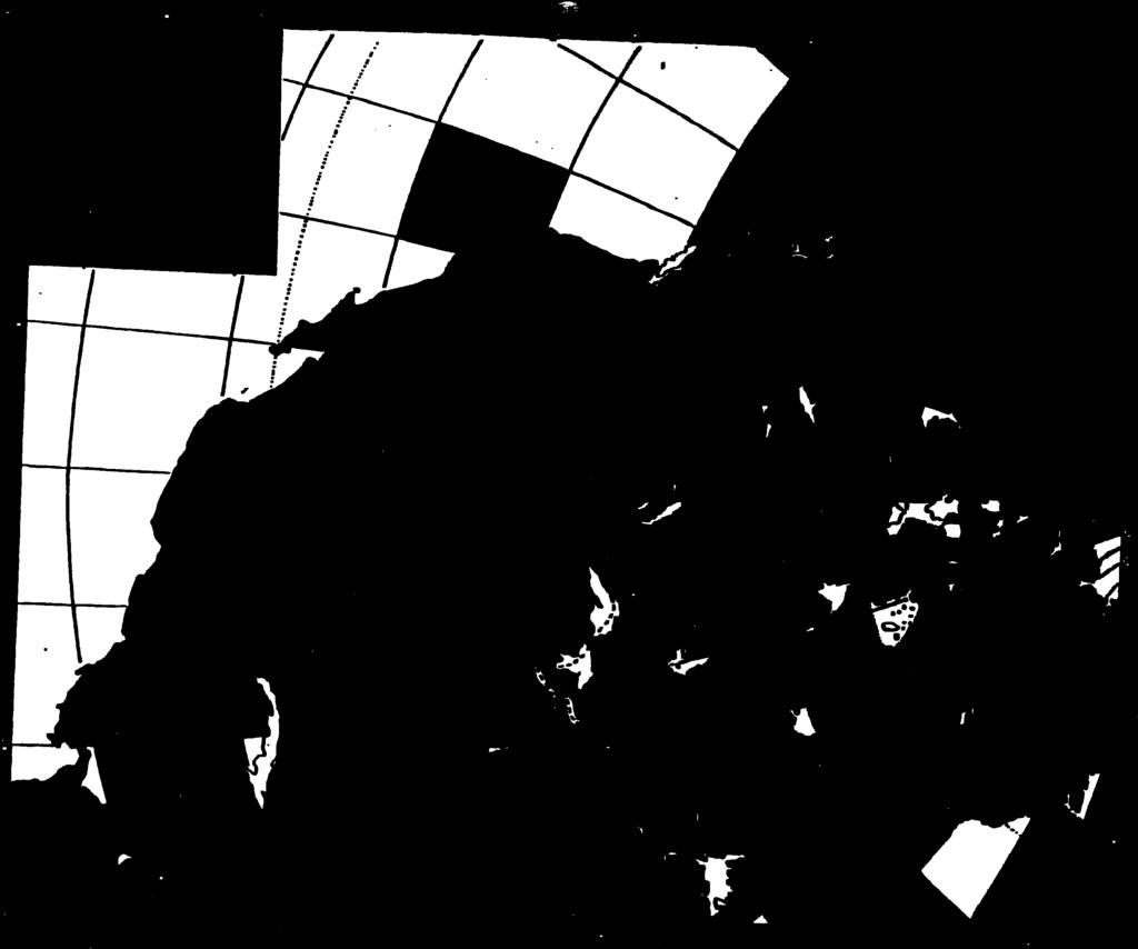
1 5. Sketch in the west and east coast of the United States and label the U.S.A. 6. Label St. Pierre et Miquelon (France) 8. Colour the water blue and the United States green. Political maps are designed to show governmental boundaries of countries, states, and counties, the location of major cities, and they usually include significant bodies of water. Bright colours are often used to help the user the actual location. fmd the borders. such as mountains where the printing is done to show the exact location of the mountains. However, this is a political map so you will not be showing major physical features.) neatness. I would recommend the use of a pencil. border. through the lakes. Vancouver Calgary Saskatoon Thunder Bay Windsor London Montreal Hamilton Saint John Chicago New York Seattle :1 3. Pencil is probably the safest way to label a map, but pen is permitted if you can ensure accuracy and or, if it is a coastal location, out in the ocean. Using a ruler, draw an arrow to the dot in order to indicate 2. If you cannot fit a label into its location, place a dot at the location and print the word neatly to the side 3. The national, provincial and territorial capitals. 4. Additional cities: 2. Provinces (10) and territories (3). I. Draw in the Great Lakes (5) and, in addition, draw the boundary between the U.S. and Canada that goes Locations to be labelled: 1. All labelling should be printed neatly and horizontally. (The only exception here is the physical features Directions: Map #1 - Map of Canada Political Name: 7. Using an arrow (ruler) label the 49 th parallel of latitude that comprises much of Canada s southern.. SLb, d.k :. Wr}d,ths i( ),.


2 Rubric for Marking: Title Checklist Printed neatly. Located at top of page. Underlined or highlighted in a box Clearly reflects the topic Accuracy of Features Features have been placed accurately on the Mapped map (border, coastline, etc.) /3 Criteria Level 4 Level Level 2 Level I Mark ssigcd Appearance Extremely Considerably Moderately Ineffective. Appropriate effective effective use effective use of use of colour use of of colour, use of colour,. Consistent colour, shading colour, shading shading shading and/or ruler. shading and/or Use of rule to and/or and/or ruler. create straight ruler. ruler. lines and/or frame Labels Checklist Labels Labels have Labels have Labels Printed neatly have been been mapped been have been Aligned mapped with mapped mapped carefully with a considerable with with Spelled great deal accuracy (2 moderate limited accurately of to 3 errors) accuracy (4 accuracy All labels done accuracy to 5 errors) (more than (0 to 1 5 errors) Overall Achievement Level: error only) /2 /15


3 Vc[VNYD 10 JYW 0 :ewepj /0 (9 a Asnzue3 zsj!-aunal SLfl O Seflss oqqdei6oeq mpau. UOIISDflPJ uocje.a goor o K!


.")
 Saskatchewan Rivers Once you have finished labeling the rivers do the following: 1.")

4 ... :. -. Map #2 River Map of North America While you work on this map, look carefully at the direction of flow of the rivers. What physical features account for their direction? Directions: As with mountains, you may label rivers parallel their actual location. Your labeling need not be horizontal though this makes it easier for you to read. Use an R. rather than write the entire word, River. *you may have to draw a few of the rivers listed below onto your map. ** BONUS LOCATIONS ;,.-, S.. Rivers to be labeled: * * extra locations (not required) Mississippi River Fraser River Snake River Red River (U.S.A.) St. Lawrence River Columbia River Arkansas River Athabasca River Colorado River Missouri River Peace River Rio Grande Platte River Mackenzie River Churchill River (MB). YukonRiver Ri Nelson River Slave River Ohio River Assiniboine River North and South CiwrbJ.J Rh cr Red River (MB) Saskatchewan Rivers Once you have finished labeling the rivers do the following: 1. Using a pencil crayon or a fine tip marker outline the rivers in the following ways: a. All rivers/lakes flowing into the Arctic Ocean, outline in red b. All rivers/lakes flowing into Hudson Bay, outline in green c. All rivers/lakes flowing into the Atlantic Ocean, outline in orange d. All rivers/lakes flowing into the Gulf of Mexico, outline in brown e. All rivers/lakes flowing into the Pacific Ocean, outline in purple f. All rivers/lakes flowing into the Gulf of California, outline in yellow 2. Do NOT colour any of the land on this map. Note: though this map will not be handed in for marks, its content will be included on an upcoming test. Be sure that you have labeled accurately so that you can use this map for studying purposes.


5 ooti oo


 Rocky Mountains Onk P.bteaai Victoria Island Appalachian Mts.")


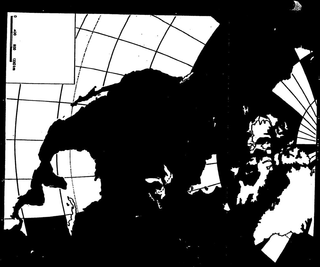
6 Directions:.4 t 1 sure that you have labelled accurately so that you can use this map for studying purposes. Note: though this map will not be handed in for marks, its content will be included on an upcoming test. Be Arctic Circle (66 1/20 N) Coast Mountains Davis Strait Tropic of Cancer (23 /2 0 N) Sik:r3Ni Hudson Strait Arctic Ocean $ : Hudson Bay Pacific Ocean i. Great Bear Lake Atlantic Ocean Mt. Logan (highest Great Slave Lake Labrador Sea Juii Re Lake Athabasca Beaufort Sea Brooks Range Lake Winnipeg Caribbean Sea M.a1r Oth rktal Lake Manitoba Canadian peak) Rocky Mountains Onk P.bteaai Victoria Island Appalachian Mts. Grand Canyon Baffm Island Alaska Range Bering Strait Isthmus of Panama Gulf of California Ldr Ou.;J Lake Winnepegosis Gulf of St. Lawrence Madre d1 Sur Cape Breton Island Gulf of Alaska Canadian Shield Vancouver Island Gulf of Mexico Great Plains Queen Charlotte Islands t.s. r Jtioi 1O ud Th. 91 i214;. ** BONUS LOCATIONS Do not forget to place the title on your map. location of the physical feature Mountains should be spaced so that it indicates the full extent of this physical feature s location. Your atlas demonstrates this very well. Use horizontai printing for labelling except for physical features where the labelling serves to indicate the instance, the Rocky Mountains. In this case, your printing of Rocky Label the following on your map of North America: **extra locations for Map #3 Physical Features of North America


7
AP Human Geography World Atlas Project
 AP Human Geography World Atlas Project - 2018 Welcome to Robert E. Lee High School and Advanced Placement Human Geography! You are going to thoroughly enjoy this class. It will be a lot of work, but the
Reference: climate data for Prince George and other locations at the back of this handout
 Name/Date: Socials 9 Unit 2: Cultures, Conflict, and Colonization in British North America 2A Physical Geography of Canada References: Cranny, M. (1998) Crossroads: A Meeting of Nations, Ch. 6 Canadian
discussion of North America s physical features, including its landforms and bodies of
 Chapter 7 Natural Environments of North America Chapter 7 focuses on the natural environments of North America. The chapter opens with a discussion of North America s physical features, including its landforms
The United States & Canada. A Regional Study of Anglo America
 A Regional Study of Anglo America Landform Regions of the United States & Canada world leaders in agricultural and industrial production because of... VAST LANDS stretch from the Atlantic Ocean on the
Unit 1: Geography. For additional information, refer to this website: 1 G e o g r a p h y
 Unit 1: Geography For additional information, refer to this website: http://mryoungtms.weebly.com/ 1 G e o g r a p h y Continents and Oceans SOL USI. 2a Essential Understanding: Continents are large land
Canadian Mapping Big Book
 Canadian Mapping Big Book Grades 4-6 Written by Lynda Golletz Illustrated by S&S Learning Materials About the Author: Lynda Golletz was an elementary school teacher for thirty-three years. She is the author
Geographer s Toolkit. Geography of Canada
 Geographer s Toolkit Geography of Canada www.craigmarlatt.com/school Geographer s Toolkit 1. Parts of a Map Map Symbols Mapping Your Location 2. Types of Maps 3. Political Map of Canada 4. Drainage Map
Meteorology 110. Lab 1. Geography and Map Skills
 Meteorology 110 Name Lab 1 Geography and Map Skills 1. Geography Weather involves maps. There s no getting around it. You must know where places are so when they are mentioned in the course it won t be
Canadian Mapping. Grades 5-6. Written by Lynda Golletz Illustrated by S&S Learning Materials
 Canadian Mapping Grades 5-6 Written by Lynda Golletz Illustrated by S&S Learning Materials About the Author: Lynda Golletz was an elementary school teacher for thirty-three years. She is the author of
GEOGRAPHY OF CANADA 1. PHYSICAL GEOGRAPHY
 GEOGRAPHY OF CANADA 1. PHYSICAL GEOGRAPHY 1.1. CANADIAN SHIELD 1.2. VOLCANOES 1.3. WESTERN CORDILLERA 1.4. CANADIAN ARCTIC 1.5. CANADIAN INTERIOR PLAINS 1.6. GREAT LAKES AND ST LAWRENCE LOWLANDS 1.7. APPALACHIAN
EQ: Discuss main geographic landforms of the U.S. & Canada and examine varied landforms in relation to their lifestyles.
 EQ: Discuss main geographic landforms of the U.S. & Canada and examine varied landforms in relation to their lifestyles. Places & Terms for Discussion Appalachian Mountains Great Plains Canadian Shield
CHAPTER 1. Geo Challenges 1A to 1D. & World Map Activity
 CHAPTER 1 Geo Challenges 1A to 1D & World Map Activity SELECT YOUR CHALLENGE World Map Activity Challenge 1A Challenge 1B Challenge 1C Challenge 1D Challenge 1A WS PG. 2 STEP #1 Label the largest continent
Downloaded from
 I II III IV V VI Define the following terms:- a) Orbitb) Meteoroids c) Celestial bodies GEOGRAPHY ASSIGNMENTS The Earth In The Solar System d) Satellite e) Comets Give one word answers:- a) Blue planet
Oklahoma Academic Standards Science Grade: 6 - Adopted: 2014
 Main Criteria: Oklahoma Academic Standards Secondary Criteria: Subjects: Science, Social Studies Grade: 6 Correlation Options: Show Correlated OK.6-LS. Oklahoma Academic Standards Science Grade: 6 - Adopted:
Physical Features of Canada and the United States
 Physical Features of Canada and the United tates 170 ARCTIC OCA Aleutian s 1 1 Bering ea ALAKA Yukon R. Mt. McKinley (20,320 ft. 6,194 m) Gulf of Alaska BROOK RAG RAG Queen Charlotte s R Vancouver O C
Grade 7 History Mr. Norton
 Grade 7 History Mr. Norton Section 1: Thinking Geographically Section 2: Land and Climates of the United States Section 3: The Tools of History Section 4: Economics and Other Social Sciences Grade 7 History
United States of America Geography
 United States of America Geography Part I by Sonja E. Schild LearnSmart Publishing Co. Vancouver, BC, Canada Phone: (604) 433-1347 ISBN 0-9694445-3-9 Notice! All rights reserved. Permission to reproduce
World Geography Name This Country 4 th Grade
 World Geography Name This Country 4 th Grade West Brooke Curriculum By: Susan Adams & Jennifer Westbrook World Geography Name This Country 4 th Grade West Brooke Curriculum 2014 Written by: Susan Adams
HI SUMMER WORK
 HI-201 2018-2019 SUMMER WORK This packet belongs to: Dear Dual Enrollment Student, May 7 th, 2018 Dual Enrollment United States History is a challenging adventure. Though the year holds countless hours
Preview: Making a Mental Map of the Region
 Preview: Making a Mental Map of the Region Draw an outline map of Canada and the United States on the next page or on a separate sheet of paper. Add a compass rose to your map, showing where north, south,
Activity One. To Scale
 Activity One To Scale The following map of Whale Island has been drawn to scale using the scale 1 inch = 1 mile or 1 cm = 1 km. With a ruler, measure the distance between Dolphin Harbor and Seal Point.
Markville. CGC 1DL/PL Geography. Geography of Canada. Natural Environment Unit Test
 Markville CGC 1DL/PL Geography Geography of Canada Natural Environment Unit Test Name: Thinking /10 Knowledge /10 Application /10 Communication /10 Part A: Blanks (1 mark each) Thinking Choose the correct
CANADA S LANDFORM REGIONS
 CANADA S LANDFORM REGIONS Canada s Regions Canada is divided into Eight major regions. A Region is an area that is defined on the basis of the presence or absence of certain characteristics: Age of rock
Europe, Canada, Latin America, & Australia
 Europe, Canada, Latin America, & Australia EUROPE SS6G8 The student will locate selected features of Europe. a. Locate on a world and regional political- physical map: the Danube River, Rhine River, English
copyright 2015 White's Workshop
 16 vocabulary cards & pictures 3 printable maps of Florida 2 resource maps of Florida Task cards for political maps Task cards for physical maps Rubrics This packet supports the following Sunshine State
LATITUDE. Latitude lines run to, but are measured & The 0 of latitude that circles the earth is called the?
 LATITUDE Latitude lines run to, but are measured & The 0 of latitude that circles the earth is called the? LATITUDE 0 0 Latitude lines run east to west, but are measured north & south The 0 of latitude
Why VOCABULARY? clues
 It s GHSGT Time! Why VOCABULARY? Social Studies is all about MAKING CONNECTIONS Key Terms provide relational clues to guide you in answering test questions! The more WORDS you know, the smarter you are
Unit 1: Geography CLASS WEBSITE: QUIZLET GAMES: ONLINE RESOURCES
 Unit 1: Geography ONLINE RESOURCES CLASS WEBSITE: HTTPS://MRYOUNGTMS.WEEBLY.COM/GEOGRAPHY.HTML QUIZLET GAMES: HTTPS://QUIZLET.COM/JOIN/MSFYY94T5 1 G e o g r a p h y Continents and Oceans The Seven Continents
Physical Features of Canada and the United States
 I VIUAL Physical Features of Canada and the United tates 170 ARCTIC OCA Aleutian s 1 Bering ea ALAKA Yukon R. Mt. McKinley (20,320 ft. 6,194 m) Gulf of Alaska BROOK RAG RAG Queen Charlotte s R Vancouver
Understanding Projections
 GEOGRAPHY SKILLS 1 Understanding Projections The earth is a sphere and is best shown as a globe. For books and posters, though, the earth has to be represented as a flat object. To do this, mapmakers create
Grade 9 Geography Chapter 11 - Climate Connections
 Grade 9 Geography Chapter 11 - Climate Connections 1. Define: Weather. 2. In what way has weather affected your activities in the last two weeks? 3. Define: Climate. 4. Canada s climate is a function of
Maps and Globes. By Kennedy s Korner
 Maps and Globes By Kennedy s Korner Map Key or Symbols Maps use symbols to show places and things on Earth. Symbols are drawings that stand for something real. A map key tells you what each symbol stands
GC1DR Exam Review 2013
 GC1DR Exam Review 2013 Name: Your exam is just around the corner! By completing this review, you will be EXTREMELY well prepared to write this exam. Part A ON A SEPARATE PIECE OF PAPER, please complete
Unit 1 Physical Setting
 Unit 1 Physical Setting Chapter 1: Finding Your Way Chapter 2: Our Natural Environment Chapter 3: The Changing Weather Chapter 4: A Place To Live Chapter 1: Finding Our Way Key Terms Lines of Latitude
Answers to British Columbia Quizzes
 Answers to British Columbia Quizzes p. 1 Test Your Knowledge What do you remember from your review of the British Columbia section of the E-atlas? 1. What percentage of Canada's total area does British
About places and/or important events Landmarks Maps How the land is, hills or flat or mountain range Connected to maps World Different countries
 What do you think you know about geography? About places and/or important events Landmarks Maps How the land is, hills or flat or mountain range Connected to maps World Different countries What do you
Guided Reading Activity
 Guided Reading Activity Lesson 1 Physical Features Essential Question: How does geography influence the way people live? A Vast Land Directions: Read the lesson and use your text to decide whether each
DRAWING YOUR CONTINENT
 CONTINENT PROJECT PART I On the attached sheet, you will draw your own continent. Use your creativity to create a continent that is uniquely your own. Give the continent a name. When you are finished with
MR. JOHNSON S. Geography OHIO COUNTY MIDDLE SCHOOL
 MR. JOHNSON S Geography OHIO COUNTY MIDDLE SCHOOL CHAPTER 1 Geography The science of geography is likely the oldest of all sciences. Geography is the answer to the question that the earliest humans asked,
Physical Geography of the United States and Canada Chapter 5 A Land of Contrasts
 Physical Geography of the United States and Canada Chapter 5 A Land of Contrasts Land Area Together the U.S. and Canada cover more than 7 million square miles. In total area, Canada ranks 2 nd and the
Cardinal and Intermediate Directions:
 Name Period Parent Signature Due Date: (TBA) Geography/Map Skills Study Guide Continents and Oceans of the World: Label the continents (7) and oceans (4) on the lines below the map. 1 11 3 5 4 8 2 9 10
Physiographic Provinces (West, Ch. 13)
") Geology 229 Engineering Geology Lecture 13 Physiographic Provinces (West, Ch. 13) The definition of the term Physiography Physiography (n.) The science which treats of the earth's exterior physical features,
Geology 229 Engineering Geology Lecture 13 Physiographic Provinces (West, Ch. 13) The definition of the term Physiography Physiography (n.) The science which treats of the earth's exterior physical features,
EXAM II Thursday, November 10, 2016
 Hunter College - CUNY Department of Geography EXAM II Thursday, November 10, 2016 Be sure to bring to the exam a No. 2 pencil and an eraser for the Scantron sheet. This exam will focus on the material
Unit 1: Basics of Geography Test Review
 Name Date Period Unit 1: Basics of Geography Test Review Directions: Reading the following sections and complete the questions, charts, and diagrams. Types of Maps Maps that have a particular theme are
ORLD G EOGRAPHY BASIC. NotB oring. Inventive Exercises to Sharpen Skills and Raise Achievement. Imogene Forte & Marjorie Frank
 The BASIC NotB oring SERIES SOCIAL IP 402-0 STUDIES SKILLS MIDDLE GRADES ORLD G EOGRAPHY Inventive Exercises to Sharpen Skills and Raise Achievement Series Concept & Development by Imogene Forte & Marjorie
 Name Period Parent Signature Geography/Map Skills Study Guide *For extra practice with these skills, check out Mr. Kath s website: http://rkath.weebly.com/activities--links.html Continents and Oceans of
LANDFORM REGIONS IN CANADA. Classroom Notes and Descriptions
 LANDFORM REGIONS IN CANADA Classroom Notes and Descriptions Landform Regions in Canada There are eight distinct landforms in Canada: Western Cordillera Region Interior Plains Canadian Shield Hudson Bay
Unit 2. United States Physical Geography
 Unit 2 United States Physical Geography Physical Geography U.S. extends from the Atlantic to Pacific U.S. is the 3rd largest country U.S. has fertile soils, vast forests, and variety of minerals All major
Canada s Provinces and Territories
 Canada s Provinces and Territories Grades 4-6 Written by Ruth Solski Revised January 2016 Canadian children should be exposed to and become more knowledgeable with their wonderful country. This book has
Globes, Maps, and Atlases. Plus, A Whole Bunch of Other Way Cool Geographic Information!!!
 Globes, Maps, and Atlases Plus, A Whole Bunch of Other Way Cool Geographic Information!!! Globes Are the Most Accurate Portrayal of the Earth The earth is about 24,900 miles in circumference, and about
World Geography. BY MARK STANGE and REBECCA LARATTA
 BY MARK STANGE and REBECCA LARATTA COPYRIGHT 2002 Mark Twain Media, Inc. ISBN 1-58037-205-8 Printing No. CD-1551 Mark Twain Media, Inc., Publishers Distributed by Carson-Dellosa Publishing Company, Inc.
8th Geography Pre-Test
 Quiz Preview Go back Student's Name appears here Course Name appears here QuizStar 8th Geography Pre-Test Quiz Directions Choose the BEST answer for each question. Directions: 1. Answer the questions below
Introduction to Geography
 Introduction to Geography ropic of Cancer 3½ N Arctic Circle 90 N Prime Meridian 0 Arctic Ocean Mississippi R. Appalachian Mts. Europe Rocky Mountains N. America Atlantic Gulf of Ocean Mexico Caribbean
Landforms and Bodies of Water
 Chapter 5, Section 1 For use with textbook pages 115 120. The Land Terms to Know divide A high point or ridge that determines the direction that rivers flow (page 118) headwaters The source waters of a
Massachusetts Curriculum Frameworks Science Grade: 4 - Adopted: 2016
 Main Criteria: Massachusetts Curriculum Frameworks Secondary Criteria: Subjects: Science, Social Studies Grade: 4 Correlation Options: Show Correlated Massachusetts Curriculum Frameworks Science Grade:
Pre-AP World Geography Summer Assignment
 Pre-AP World Geography 2018-2019 Summer Assignment This is the summer assignment for students who intend on being accepted and enrolled in Pre-AP World Geography. Successful performance on this assignment
Map Skills Unit. Note taking unit
 Map Skills Unit Note taking unit Introduction To learn about the Earth, we are going to learn about two geographic tools you can use.globes and maps. Globe A globe is a round model of the planet Earth
Outline Maps of Canada
 Outline Maps of Canada Grades K-3 About this book: Outline Maps of Canada is an important resource to help introduce and review mapping skills, with an emphasis on Canadian maps. Almost every map included
UNIT 1 PACKET: BECOMING A UTAH HISTORIAN
 Name Class Period UTAH HISTORY UNIT 1 PACKET: BECOMING A UTAH HISTORIAN Assignments: History Of Report /10 points History Apps /10 points Utah s Geography Maps /30 points Utah s Geology: Cause & Effect
Beginning Orienteering Post visit
 Beginning Orienteering Post visit Classroom Activities Brief Synopsis The post activities are designed to reinforce what the students learned at Eagle Bluff and practice the skill of map reading. Students
National Council for Geographic Education Curriculum & Instruction Committee Geography Club Submitted by: Steve Pierce
 National Council for Geographic Education Curriculum & Instruction Committee Geography Club Submitted by: Steve Pierce stevepierce@charter.net Ninth Month Activities Geography for Life: National Geography
Terms. divide headwaters tributary fall line fishery
 Chapter 5 Preview Section 1 The Land Objectives Identify some key similarities and differences in the physical geography of the United States and Canada. Explain why rivers have played such an important
OCEANOGRAPHY MEASURING THE DEPTHS OF THE OCEANS
 Water 2 page 1 OCEANOGRAPHY Name If all the water was drained from the ocean basins, what kind of surface would be revealed? It would not be the quiet, subdued topography as was once thought, but a surface
PHYSIOGRAPHIC REGIONS OF THE LOWER 48 UNITED STATES
 PHYSIOGRAPHIC REGIONS OF THE LOWER 48 UNITED STATES LAURENTIAN UPLAND 1. Superior Upland ATLANTIC PLAIN 2. Continental Shelf (not on map) 3. Coastal Plain a. Embayed section b. Sea Island section c. Floridian
North America ATLANTIC OCEAN PACIFIC OCEAN. The First Americans. Labrador Sea. Caribbean Sea. USI_ISN_U01_01.eps. Second Proof TCI19 65.
 G e o g r a p h y C h a l l e n g e North America 70 N 180 N 60 170 W 30 W 160 W 40 W Labrador Sea 150 W 50 N 50 W Hud s on B ay 140 W 40 N 60 W ATLANTIC OCEAN 30 N PACIFIC OCEAN Gulf of Mexico 20 N 130
Map Skills Scavenger Hunt
 Map Skills Scavenger Hunt Introduction to: Continents Cardinal Directions Relative Location Equator and Prime Meridian Hemispheres Reading a Political Map Reading a Physical Map Idea: This product includes
Five Themes of Geography Project Ms. Kiesel, Per 5. The United States of America
 Five Themes of Geography Project Ms. Kiesel, Per 5 The United States of America Location Absolute Location : The USA is located in the continent of North America in the northern and western hemispheres.
05/03/2017 Page 1 of 16. Alberta. Total % Change. United Way / Centraide Change Change Change. % Change
 GCWCC - National Results - Comparative Results - - Campaign () CCMTGC - Résultats nationaux - Résultats comparatifs - Campagne - (ment de ) Alberta Alberta Capital Region $311,634 $284,551-8.69 $209,079
Creating an Illustrated Map: New Zealand
 S T U D E N T H A N D O U T A Creating an Illustrated Map: New Zealand You will work in a group of four to create an illustrated map of one type of Pacific island: a continental island. Your illustrated
Landforms in Canada. Canada is made up of three dis;nct types of landforms: Canadian Shield Highlands Lowlands
 Canada s Landforms What is a Landform? A landform is any physical feature of the Earth s surface having a characteris;c, recognizable shape, produced by natural causes. Landforms include major features
4th Grade U.S. Regional Geography
 4th Grade U.S. Regional Geography Multiple Choice Identify the choice that best completes the statement or answers the question. What does the term mainland mean in the sentence above? A the continent
 Name Period Parent Signature Foundational Skills Study Guide *For extra practice with these skills, check out Mr. Kath s website: http://rkath.weebly.com/activities--links.html Continents and Oceans of
Tropical Moist Rainforest
 Tropical or Lowlatitude Climates: Controlled by equatorial tropical air masses Tropical Moist Rainforest Rainfall is heavy in all months - more than 250 cm. (100 in.). Common temperatures of 27 C (80 F)
Physical Geography. Ariel view of the Amazon Rainforest. A Look at the Seven Continents
 Physical Geography In this unit you will learn about general physical geography. The study of the Earth s surface features provides the setting for the human-environmental interactions and for the human
Essential Questions What are the major physical components of the world, and how are they represented on a map? 3.4
 Third Grade Social Studies Unit One Six Weeks GEOGRAPHY Originally compiled by Russellville In order for students to understand that geography influences the development of a region as well as the interactions
Chapter 1 Test on Geography Skills
 Name Score Chapter 1 Test on Geography Skills Part 1 Matching (14 pts.) Match each term in Column B with its correct definition in Column A by clearly writing the number in the blank space provided. Two
A. Geography Students know the location of places, geographic features, and patterns of the environment.
 Learning Targets Elementary Social Studies Grade 5 2014-2015 A. Geography Students know the location of places, geographic features, and patterns of the environment. A.5.1. A.5.2. A.5.3. A.5.4. Label North
Dr. M.K.K. Arya Model School Class-V, Social Science Assignment Ch-1, Globe The Model of the Earth Answer the following:- Q.1.
 Class-V, Social Science Assignment Ch-1, Globe The Model of the Earth - Q.1. What are the disadvantages/demerits of a globe? Ans. Some disadvantages of globe are: a) It is difficult to carry. b) It cannot
Chapter 1. Social Studies History and Geography
 Chapter 1 Social Studies History and Geography Unit 01 Geography Skills 1 Reading Maps Key Words border landform rely on display focus on route locater 1 There are many different kinds of maps. A political
First 9 Weeks 3rd Grade
 First 9 Weeks 3rd Grade Common Core Standard Student Friendly (I Can statement) Week 1-4 Geography Standards 3.1 Process and report information identifying, locating, comparing, and contrasting the major
Location and Distance on Earth (Chapter 22 part 1)
") GEOLOGY 306 Laboratory Instructor: TERRY J. BOROUGHS NAME: Location and Distance on Earth (Chapter 22 part 1) For this assignment you will require: a calculator, protractor, and a metric ruler, and an
GEOLOGY 306 Laboratory Instructor: TERRY J. BOROUGHS NAME: Location and Distance on Earth (Chapter 22 part 1) For this assignment you will require: a calculator, protractor, and a metric ruler, and an
Chapter 1: The Geography of the Western Hemisphere
 Chapter 1: The Geography of the Western Hemisphere Chapter 1, Lesson 1: The Changing Earth Objectives: - You will be able to identify the major natural events that cause the earth to change. - You will
Social Studies: Grade 4. Table of Contents
 Social Studies: Grade 4 Table of Contents Heritage and Citizenship Medieval Times Overview --------------------------- Page 1 Overall Expectations --------------------------- Page 1 Specific Expectations
Introduction to the Seafloor. Follow the steps below while taking notes in your science notebook.
 Procedure Follow the steps below while taking notes in your science notebook. 1. Name and locate all of the continents. 2. Identify linear (straight-line) and arcuate (curved-line) features on the continents.
Fig Major air masses of the world
 Fig. 9.3 Major air masses of the world CLASSIFICATION FOUR BASIC CATEGORIES OF AIR MASSES: POLAR - P ARCTIC - A TROPICAL - T EQUATORIAL - E TWO DESIGNATIONS OF SURFACE IN SOURCE REGION MARITIME - m. CONTINENTAL
Latitude & Longitude. Worksheets & activities to teach latitude & longitude. Includes notes, activities, review & all answer keys. 11 pages!
 Latitude & Longitude Worksheets & activities to teach latitude & longitude. Includes notes, activities, review & all answer keys. 11 pages! Lines of Latitude & Longitude Name: Lines of latitude and longitude
Geography Class 6 Chapters 3 and
 CHAPTER 3 MOTIONS OF THE EARTH The Earth is always travelling in Space. That makes each person on Earth, a Space Traveller. No one feels the movement of the Earth because humans are too tiny when compared
TECHNICAL DOCUMENT R 2 OF THE SPANISH BRAILLE COMMISSION GENERAL CRITERIA FOR PREPARING ADAPTED MAPS FOR VISUALLY IMPAIRED PERSONS
 TECHNICAL DOCUMENT R 2 OF THE SPANISH BRAILLE COMMISSION GENERAL CRITERIA FOR PREPARING ADAPTED MAPS FOR VISUALLY IMPAIRED PERSONS Updated on December 2013 (Version 1) First edition in English, March 2015
PS : ES Hurricane Tracking Lab
 PS : ES Hurricane Tracking Lab Copyright 1998, 2005 S.Kluge Name Period Companion Websites: http://weather.unisys.com/hurricane/index.html http://www.atwc.org http://stevekluge.com/geoscience/regentses/labs/hurricane1.html
Map Reading: Grades 2 & 3
 Map Reading: Grades 2 & 3 Grades: 2, 3 Team Size: 1-2 competitors Duration: 25 minutes (5 minute introduction, 20 minutes for questions) Supervisors: Rebecca Neill-Totsuka, Sriram Garapati Summary Description
Answers to Yukon Territory Quizzes
 Answers to Yukon Territory Quizzes p. 1 Test Your Knowledge What do you remember from your review of the Yukon section of the E-Atlas? 1. Human activity in Yukon probably dates back at least a) 150 years
Geography Test Unit 1 Study Guide. democracy profit citizenship Bill of Rights consumers federal government political process values
 Geography Test Unit 1 Study Guide Skills Identify Longitude and Latitude Identify Continents of the World Identify Time Zones Equator Prime Meridian Hemispheres Map Requirements Oceans Compare US/Mexico/Canada
Map Reading: Grades 4 & 5
 Map Reading: Grades 4 & 5 Grades: 4,5 Team Size: 1-2 competitors Duration: 25 minutes Supervisors: Sriram Garapati, Rebecca Neill-Totsuka Summary Description Students will solve a mystery using different
Suggested Activities. Pre-planning. Session One
 Suggested Activities Pre-planning Locate ball Assemble equipment In preparation for introducing the notion of geographic coordinates, bring to class in Session One a large ball (e.g., basketball, volleyball
Grade 9 Social Studies Canadian Identity. Chapter 2 Review Canada s Physical Landscape
 Grade 9 Social Studies Canadian Identity Chapter 2 Review Canada s Physical Landscape Name: Unit 1: Empowerment Terms (notes or textbook) 1. Core 2. Crust 3. Mantle 4. Magma 5. Continental drift 6. Plate
Earth Science Regents Watersheds & Drainage Basins Lab
 Name Earth Science Regents Watersheds & Drainage Basins Lab Copyright 2003 by Steve Kluge Lab # Period Part 1: New York State Drainage Exercise NOTE: You ll need pages 2 and 3 of your ESRT to complete
Major Domain of the Earth
 Major Domain of the Earth The surface of the earth is a complex zone in which three main components of the environment meet, overlap and interact. The solid portion of the earth on which we live is called
Chapter 6, Part Colonizers arriving in North America found extremely landscapes. It looked different to region showing great.
 Social Studies 9 Unit 1 Worksheet Chapter 6, Part 1. 1. Colonizers arriving in North America found extremely landscapes. It looked different to region showing great. 2. The Earth is years old and is composed
State Geography Due: Tuesday, October 24, 2017
 State Geography Due: Tuesday, October 24, 2017 Step 1: You will first go online to http://www.timeanddate.com/worldclock/distance.html. Click on calculators and from the drop down menu, click on distance
Social Studies. Chapter 2 Canada s Physical Landscape
 Social Studies Chapter 2 Canada s Physical Landscape Introduction Canada s geography its landforms and climate - has a great impact on Canadians sense of identity. Planet Earth The earth is divided into