AP Human Geography World Atlas Project
|
|
|
- Sherilyn Miles
- 5 years ago
- Views:
Transcription


1 AP Human Geography World Atlas Project Welcome to Robert E. Lee High School and Advanced Placement Human Geography! You are going to thoroughly enjoy this class. It will be a lot of work, but the benefits will be tremendous. This is the most-relevant course you will ever take as a student here at Robert E. Lee, and you will use the knowledge you gain from it in multiple other courses during your time here and in college. This year, you have an opportunity to get a jump start on your World Atlas assignment during the Summer. Being familiar with the physical geography of the world will only help you in this course. Please have this set of Maps completed by Friday, September 14, You will use these maps in various ways to earn Daily/Assessment Grades, such as: *Open-Notes Map Quizzes *Map Analysis Work *Reading / Atlas Activities Be sure to read and follow all instructions. Please do not procrastinate and produce subpar work. I need to see your best right from the start! If you have any questions about this assignment tasks for your Summer Assignment, please do not hesitate to me at Chandra.Hayter@tylerisd.org Enjoy your summer. See you August 2018! Ms. Chandra Hayter
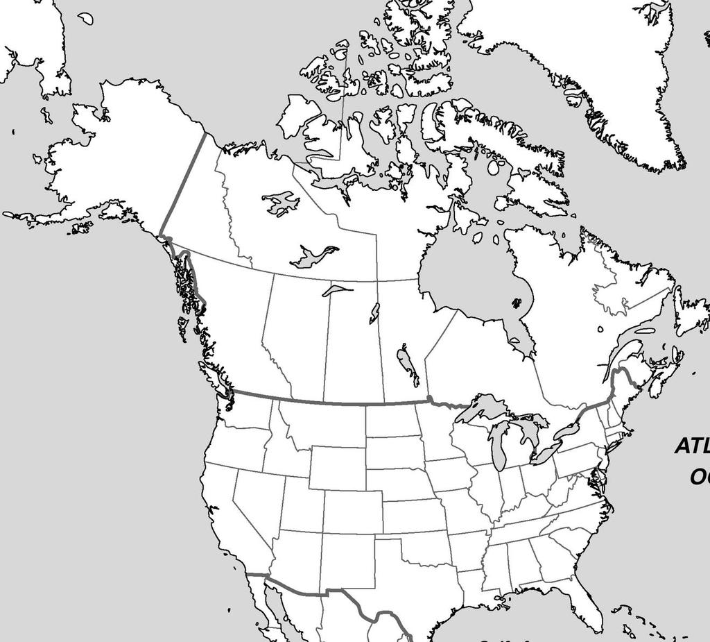
2 Name Due Date: September 14, 2018 APHG WORLD ATLAS PROJECT 2018 (MAP SET 1) *On a political map the same colors never touch! This allows the reader to clearly see the boundaries between countries and/or regions. *On a Physical Map, colors often represent different features, and sometimes reflect different elevations. This allows the reader to clearly see types of features. For AP Human Geog. Purposes, use the following: +Mountains = Brown +Water = Blue--Do NOT color Seas or Oceans +Deserts = Yellow +Plateaus = Orange +Plains & Lowlands = Green +Misc. Features = Purple +Lines of Latitude & Political Hot Spots = Red *Use colored pencils to shade countries and/or regions, markers tend to bleed and get messy! *Label place names in BLACK INK. It will allow all labels to have clarity. *You may use a fine point black Sharpie Pen if desired. *If places are small, label with numbers inside a box= #22 - & indicate what place names the number represents in the legend. *All labels should be written in same direction. The reader should not have to turn the map in order to read all the place names. EXCEPTION>Label mountains & rivers along their course(path). You may abbreviate M for Mountain & R for River. *All Maps should have a legend & a compass. *Be Neat. No HUGE LETTERING... MAP # 1 - Continents, Oceans, & Geographic Grid *Label and Color Code as Indicated [ ]AFRICA-brown [ ]EUROPE-green [ ]Arctic Ocean [ ]Equator [ ]ANTARCTICA-white [ ]NORTH AMERICA-blue [ ]Atlantic Ocean [ ]Prime Meridian [ ]ASIA-yellow [ ]SOUTH AMERICA-red [ ]Indian Ocean [ ]Tropic of Cancer [ ]AUSTRALIA-purple [ ]Pacific Ocean [ ]Tropic of Capricorn [ ]Southern Ocean MAP # 2 - World Regions A Close Look NORTH AMERICA: [ ]United States-blue [ ]Canada-red LATIN AMERICA: [ ]Central America-yellow [ ]South Amer.(excl.Brazil)-green [ ]Brazil-red [ ]Caribbean-outline in red MAP # 3 - United States and Canada EUROPE: [ ]Western Europe-red [ ]Eastern Europe-green SUB-SAHARAN AFRICA: [ ]West Africa-blue [ ]Central Africa-red [ ]Southern Africa-green [ ]East Africa-yellow S.W.A.N.A. : [ ]Southwest Asia-orange [ ]North Africa-brown *Label and Color Code as Indicated RUSSIA & THE FEDERATIONS: [ ]European Russia-blue [ ]Siberian(Asian) Russia-yellow [ ] Russian Federations-purple ASIA: [ ]South Asia-brown [ ]East Asia-orange [ ]Southeast Asia-red OCEANIA: [ ]Australia & New Zealand-blue [ ]Oceania-outline in green UNITED STATES CITIES: CANADIAN PROVINCES: [ ]Atlanta [ ]Miami [ ]Alberta [ ]Chicago [ ]New York City [ ]British Colombia [ ]Houston [ ]Washington DC [ ]Manitoba [ ]Los Angeles [ ]New Brunswick CANADIAN CITIES: [ ]Newfoundland & Labrador [ ]Montreal [ ]Toronto [ ]Nova Scotia [ ]Quebec City [ ]Vancouver [ ]Ontario [ ]Ottawa [ ]Prince Edward Island OCEANS: CANADIAN TERRITORIES: [ ]Quebec [ ]Arctic Ocean [ ]Northwest Territory [ ]Saskatchewan [ ]Atlantic Ocean [ ]Nunavut Territory LINES OF LATITUDE: [ ]Pacific Ocean [ ]Yukon Territory [ ]Arctic Circle OTHER BODIES OF WATER MAJOR LANDFORMS SPECIAL FEATURES [ ]Mississippi River [ ]Rio Grande [ ]Appalachian Mtns [ ]Rocky Mtns [ ]Everglades [ ]Missouri River [ ]Ohio River [ ]Great Plains [ ]Gulf of Mexico [ ]Great Lakes

3 Use this Sample Map to complete your Map # 2
4 2 1
5 3
Cardinal and Intermediate Directions:
 Name Period Parent Signature Due Date: (TBA) Geography/Map Skills Study Guide Continents and Oceans of the World: Label the continents (7) and oceans (4) on the lines below the map. 1 11 3 5 4 8 2 9 10
Canadian Mapping Big Book
 Canadian Mapping Big Book Grades 4-6 Written by Lynda Golletz Illustrated by S&S Learning Materials About the Author: Lynda Golletz was an elementary school teacher for thirty-three years. She is the author
Introduction to Geography
 Introduction to Geography ropic of Cancer 3½ N Arctic Circle 90 N Prime Meridian 0 Arctic Ocean Mississippi R. Appalachian Mts. Europe Rocky Mountains N. America Atlantic Gulf of Ocean Mexico Caribbean
 Name Period Parent Signature Geography/Map Skills Study Guide *For extra practice with these skills, check out Mr. Kath s website: http://rkath.weebly.com/activities--links.html Continents and Oceans of
Outline Maps of Canada
 Outline Maps of Canada Grades K-3 About this book: Outline Maps of Canada is an important resource to help introduce and review mapping skills, with an emphasis on Canadian maps. Almost every map included
Name: Political. Map of Canada. Map #1 - Locations to be labelled:
 5. Sketch in the west and east coast of the United States and label the U.S.A. 6. Label St. Pierre et Miquelon (France) 8. Colour the water blue and the United States green. Political maps are designed
Unit 1: Geography. For additional information, refer to this website: 1 G e o g r a p h y
 Unit 1: Geography For additional information, refer to this website: http://mryoungtms.weebly.com/ 1 G e o g r a p h y Continents and Oceans SOL USI. 2a Essential Understanding: Continents are large land
Maps and Globes. By Kennedy s Korner
 Maps and Globes By Kennedy s Korner Map Key or Symbols Maps use symbols to show places and things on Earth. Symbols are drawings that stand for something real. A map key tells you what each symbol stands
Canadian Mapping. Grades 5-6. Written by Lynda Golletz Illustrated by S&S Learning Materials
 Canadian Mapping Grades 5-6 Written by Lynda Golletz Illustrated by S&S Learning Materials About the Author: Lynda Golletz was an elementary school teacher for thirty-three years. She is the author of
Preview: Making a Mental Map of the Region
 Preview: Making a Mental Map of the Region Draw an outline map of Canada and the United States on the next page or on a separate sheet of paper. Add a compass rose to your map, showing where north, south,
Unit 1 Physical Setting
 Unit 1 Physical Setting Chapter 1: Finding Your Way Chapter 2: Our Natural Environment Chapter 3: The Changing Weather Chapter 4: A Place To Live Chapter 1: Finding Our Way Key Terms Lines of Latitude
Map Skills Unit. Note taking unit
 Map Skills Unit Note taking unit Introduction To learn about the Earth, we are going to learn about two geographic tools you can use.globes and maps. Globe A globe is a round model of the planet Earth
CHAPTER 1. Geo Challenges 1A to 1D. & World Map Activity
 CHAPTER 1 Geo Challenges 1A to 1D & World Map Activity SELECT YOUR CHALLENGE World Map Activity Challenge 1A Challenge 1B Challenge 1C Challenge 1D Challenge 1A WS PG. 2 STEP #1 Label the largest continent
United States of America Geography
 United States of America Geography Part I by Sonja E. Schild LearnSmart Publishing Co. Vancouver, BC, Canada Phone: (604) 433-1347 ISBN 0-9694445-3-9 Notice! All rights reserved. Permission to reproduce
 Name Period Parent Signature Foundational Skills Study Guide *For extra practice with these skills, check out Mr. Kath s website: http://rkath.weebly.com/activities--links.html Continents and Oceans of
Markville. CGC 1DL/PL Geography. Geography of Canada. Natural Environment Unit Test
 Markville CGC 1DL/PL Geography Geography of Canada Natural Environment Unit Test Name: Thinking /10 Knowledge /10 Application /10 Communication /10 Part A: Blanks (1 mark each) Thinking Choose the correct
Map Skills Lesson 1. Materials: maps, pencils, Lesson 1 Worksheet, strips of paper, grid paper
 Map Skills Lesson 1 Use cardinal directions, map grids, scales, and titles to locate places on a map. Interpret a map using information from its title, compass rose, scale, and legend. Vocabulary: map,
Pre-AP World Geography Summer Assignment
 Pre-AP World Geography 2018-2019 Summer Assignment This is the summer assignment for students who intend on being accepted and enrolled in Pre-AP World Geography. Successful performance on this assignment
World Geography. BY MARK STANGE and REBECCA LARATTA
 BY MARK STANGE and REBECCA LARATTA COPYRIGHT 2002 Mark Twain Media, Inc. ISBN 1-58037-205-8 Printing No. CD-1551 Mark Twain Media, Inc., Publishers Distributed by Carson-Dellosa Publishing Company, Inc.
Geographer s Toolkit. Geography of Canada
 Geographer s Toolkit Geography of Canada www.craigmarlatt.com/school Geographer s Toolkit 1. Parts of a Map Map Symbols Mapping Your Location 2. Types of Maps 3. Political Map of Canada 4. Drainage Map
Phase 1 Cards. Phase 1. Phase 1. How many picnic areas does the park have? Write the answer near the legend.
 S T U D E N T H A N D O U T F Cards Write the map s title in the northwest corner above the map. How many picnic areas does the park have? Write the answer near the legend. 1 2 Draw a compass rose near
Student Handout. Write the map s title in the northwest corner of the map. How many picnic areas does the park have? Write the answer near the legend.
 Student Handout 1F Cards Write the map s title in the northwest corner of the map. How many picnic areas does the park have? Write the answer near the legend. 1 2 Draw a compass rose near the west edge
Physical Geography. Ariel view of the Amazon Rainforest. A Look at the Seven Continents
 Physical Geography In this unit you will learn about general physical geography. The study of the Earth s surface features provides the setting for the human-environmental interactions and for the human
GEOGRAPHY. Map Skills. Mrs. Pere ~ 2013
 GEOGRAPHY Map Skills Mrs. Pere ~ 2013 WHAT IS A GLOBE? A globe is a model of the Earth. North Pole Equator South Pole WHAT IS A MAP? A map is a flat drawing of a place. THE IMPORTANT PARTS OF A MAP 1.
Map Skills Scavenger Hunt
 Map Skills Scavenger Hunt Introduction to: Continents Cardinal Directions Relative Location Equator and Prime Meridian Hemispheres Reading a Political Map Reading a Physical Map Idea: This product includes
World Geography Name This Country 4 th Grade
 World Geography Name This Country 4 th Grade West Brooke Curriculum By: Susan Adams & Jennifer Westbrook World Geography Name This Country 4 th Grade West Brooke Curriculum 2014 Written by: Susan Adams
Latitude & Longitude. Worksheets & activities to teach latitude & longitude. Includes notes, activities, review & all answer keys. 11 pages!
 Latitude & Longitude Worksheets & activities to teach latitude & longitude. Includes notes, activities, review & all answer keys. 11 pages! Lines of Latitude & Longitude Name: Lines of latitude and longitude
Unit 1: Basics of Geography Test Review
 Name Date Period Unit 1: Basics of Geography Test Review Directions: Reading the following sections and complete the questions, charts, and diagrams. Types of Maps Maps that have a particular theme are
The World of Geography Pre-Test/Study Guide Chapter 1 Test
 Read each statement or question. On the lines below write the letter of the best answer. 1. Geographers look at the Earth 5. What are the two specific A. by studying cities first. measurements of Earth
Pre AP World Geography Summer Project
 Part of the Pre AP goal is to have a deeper understanding of the impact of physical and political locations on each other. This project is designed to ensure that you have a strong foundation of the locations
Janet L. Klein Dickinson High School AP Human Geography Dear Advanced Placement Human Geography Student,
 Dear Advanced Placement Human Geography Student, Welcome to APHG. Congratulations on taking an advanced academic subject! This class is relevant as it gives a great foundation for many of the classes you
CANADA S LANDFORM REGIONS
 CANADA S LANDFORM REGIONS Canada s Regions Canada is divided into Eight major regions. A Region is an area that is defined on the basis of the presence or absence of certain characteristics: Age of rock
Simple Solutions Social Studies Level 2. Level 2. Social Studies. Help Pages
 Level 2 Social Studies 147 148 adobe houses with bricks made of clay and straw ancestor a family member who lived before us appoint choose; leaders can appoint others barter trading one thing for another
Why VOCABULARY? clues
 It s GHSGT Time! Why VOCABULARY? Social Studies is all about MAKING CONNECTIONS Key Terms provide relational clues to guide you in answering test questions! The more WORDS you know, the smarter you are
EQ: Discuss main geographic landforms of the U.S. & Canada and examine varied landforms in relation to their lifestyles.
 EQ: Discuss main geographic landforms of the U.S. & Canada and examine varied landforms in relation to their lifestyles. Places & Terms for Discussion Appalachian Mountains Great Plains Canadian Shield
Visit us at...
 Thanks for your purchase. We hope you are pleased. We think you might like the website that we are working on. You will find websites that go along with your unit and word wall cards. We hope you enjoy.
The United States & Canada. A Regional Study of Anglo America
 A Regional Study of Anglo America Landform Regions of the United States & Canada world leaders in agricultural and industrial production because of... VAST LANDS stretch from the Atlantic Ocean on the
Unit 1: Geography CLASS WEBSITE: QUIZLET GAMES: ONLINE RESOURCES
 Unit 1: Geography ONLINE RESOURCES CLASS WEBSITE: HTTPS://MRYOUNGTMS.WEEBLY.COM/GEOGRAPHY.HTML QUIZLET GAMES: HTTPS://QUIZLET.COM/JOIN/MSFYY94T5 1 G e o g r a p h y Continents and Oceans The Seven Continents
Understanding Projections
 GEOGRAPHY SKILLS 1 Understanding Projections The earth is a sphere and is best shown as a globe. For books and posters, though, the earth has to be represented as a flat object. To do this, mapmakers create
KIPP: Inspire Academy Social Studies Benchmark 1 PART I. Use the map of Missouri to answer questions 7-9.
 PART I 1) A physical map key shows: A. Climate B. Cities and borders C. Elevation and water depth D. Geographic features Use the map of Missouri to answer questions 7-9. 2) Lines of latitude: A. Are parallel
HI SUMMER WORK
 HI-201 2018-2019 SUMMER WORK This packet belongs to: Dear Dual Enrollment Student, May 7 th, 2018 Dual Enrollment United States History is a challenging adventure. Though the year holds countless hours
About places and/or important events Landmarks Maps How the land is, hills or flat or mountain range Connected to maps World Different countries
 What do you think you know about geography? About places and/or important events Landmarks Maps How the land is, hills or flat or mountain range Connected to maps World Different countries What do you
Toposim Continents: Cordillera v1.0 1
 Toposim Continents: Cordillera v1.0 1 Contents Installation... 3 Support... 4 File Contents... 5 Coverage images... 6 Canada Cordillera... 6 British Columbia... 7 Yukon Territory... 8 Toposim Continents:
Essential Questions What are the major physical components of the world, and how are they represented on a map? 3.4
 Third Grade Social Studies Unit One Six Weeks GEOGRAPHY Originally compiled by Russellville In order for students to understand that geography influences the development of a region as well as the interactions
1. Match the words in the first column to the meaning in the second column. [5]
![1. Match the words in the first column to the meaning in the second column. [5]](/thumbs/96/126839765.jpg "1. Match the words in the first column to the meaning in the second column. [5]") Exercise 1: [40 POINTS] 1. Match the words in the first column to the meaning in the second column. [5] Equator Around earth between the Equator and the Poles. Greenwich meridian Half of earth. Longitude
Exercise 1: [40 POINTS] 1. Match the words in the first column to the meaning in the second column. [5] Equator Around earth between the Equator and the Poles. Greenwich meridian Half of earth. Longitude
Section Reference: Defining The North American Realm and Its Population Clusters Population Clusters
 Package Title: Testbank Course Title: The World Today 7e Chapter Number: Chapter 01 Question type: Multiple-Choice 1) The two leading languages spoken in Canada are: a) English and Spanish b) English and
Unit 2 Study Guide: The World in Spatial Terms
 Name Date Hour Unit 2 Study Guide: The World in Spatial Terms TEST is WEDNESDAY, DECEMBER 19 TH This study guide contains all the concepts that will be on your test. Vocabulary words and concepts will
Map Skills Test. 1. What do we call a person who makes maps? a. mapographer b. cartographer c. geologist d. archaeologist
 Map Skills Test 1. What do we call a person who makes maps? a. mapographer b. cartographer c. geologist d. archaeologist 2. What is the name of the 0 latitude line? a. Equator b. Arctic Circle c. First
Suggested Activities. Pre-planning. Session One
 Suggested Activities Pre-planning Locate ball Assemble equipment In preparation for introducing the notion of geographic coordinates, bring to class in Session One a large ball (e.g., basketball, volleyball
Reference: climate data for Prince George and other locations at the back of this handout
 Name/Date: Socials 9 Unit 2: Cultures, Conflict, and Colonization in British North America 2A Physical Geography of Canada References: Cranny, M. (1998) Crossroads: A Meeting of Nations, Ch. 6 Canadian
Map Skills: Continents and Oceans. Map Skills: Continents and Oceans
 Map Skills: Continents and Oceans Our Earth is made up of continents and oceans. A continent is an enormous mass of land. There are seven continents on our planet. The continents include North America,
ORLD G EOGRAPHY BASIC. NotB oring. Inventive Exercises to Sharpen Skills and Raise Achievement. Imogene Forte & Marjorie Frank
 The BASIC NotB oring SERIES SOCIAL IP 402-0 STUDIES SKILLS MIDDLE GRADES ORLD G EOGRAPHY Inventive Exercises to Sharpen Skills and Raise Achievement Series Concept & Development by Imogene Forte & Marjorie
Physical Geography of the United States and Canada Chapter 5 A Land of Contrasts
 Physical Geography of the United States and Canada Chapter 5 A Land of Contrasts Land Area Together the U.S. and Canada cover more than 7 million square miles. In total area, Canada ranks 2 nd and the
Oklahoma Academic Standards Science Grade: 6 - Adopted: 2014
 Main Criteria: Oklahoma Academic Standards Secondary Criteria: Subjects: Science, Social Studies Grade: 6 Correlation Options: Show Correlated OK.6-LS. Oklahoma Academic Standards Science Grade: 6 - Adopted:
FIND PLACES ON GLOBES USING LATITUDE
 GLOBES, MAPS & GRAPHS FIND PLACES ON GLOBES USING LATITUDE AND LONGITUDE LINES FIND PLACES ON MAPS USING A GRID SYSTEM NAME SEVERAL TYPES OF MAP PROJECTIONS AND EXPLAIN THEIR BENEFITS AND SHORTCOMINGS
AP Human Geography Summer Assignment
 AP Human Geography Summer Assignment Name: Date: Period: Students enrolled in AP Human Geography are required to complete an assignment during the summer prior to the start of school. The assignment is
World Geography. Test Pack
 World Geography Test Pack WALCH PUBLISHING Table of Contents To the Teacher......... v Testing Students Who Do Not Test Well....... vi Test-Taking Strategies for Power Basics........ vii Pretest.......
Chapter 1 Section 2. Land, Water, and Climate
 Chapter 1 Section 2 Land, Water, and Climate Vocabulary 1. Landforms- natural features of the Earth s land surface 2. Elevation- height above sea level 3. Relief- changes in height 4. Core- most inner
Downloaded from
 I II III IV V VI Define the following terms:- a) Orbitb) Meteoroids c) Celestial bodies GEOGRAPHY ASSIGNMENTS The Earth In The Solar System d) Satellite e) Comets Give one word answers:- a) Blue planet
Parts of a Map. Map Skills. The Title. There are 4 main parts of a map: The Title The Compass Rose The Map Key The Scale
 Map Skills Parts of a Map There are 4 main parts of a map: The Title The Compass Rose The Map Key The Scale The Title The title of the map is usually at the top and describes the topic of the map Example:
YEAR 5 SUMMER EXAM REVISION QUESTIONS
 NAME: FORM: YEAR 5 SUMMER EXAM REVISION QUESTIONS 2017 YEAR 5 SUMMER EXAM REVISION QUESTIONS The exam will be forty minutes long. Answers will be short sentences or just oneword answers. The exam will
Globes, Maps, and Atlases. Plus, A Whole Bunch of Other Way Cool Geographic Information!!!
 Globes, Maps, and Atlases Plus, A Whole Bunch of Other Way Cool Geographic Information!!! Globes Are the Most Accurate Portrayal of the Earth The earth is about 24,900 miles in circumference, and about
Climate Change in Canada
 1 Climate Change in Canada Climate change is an urgent, global concern. The implications of climate change are significant and far reaching, with the potential of impacting future generations throughout
The Coordinate System
 5 The Coordinate System Key Words: latitude, degrees, longitude, prime meridian, absolute location You can locate any place on Earth by using a special set of numbers. These numbers are part of a set of
What Is a Globe? Hemispheres. Main Idea Globes and maps provide different ways of showing features of the earth. Terms to Know
 r Main Idea Globes and maps provide different ways of showing features of the earth. Terms to Know hemisphere latitude longitude scale bar scale relief elevation contour line What Is a Globe? A globe is
Wayne E. Sirmon GEO 301 World Regional Geography
 Wayne E. Sirmon GEO 301 Geography 301 Geography 301 MAP: A graphic representation of a portion of the earth s surface dawn to scale, as seen from above. Types of Maps Climate maps give general information
September 14, 2013 Objective: How does geography impact history? What important features exist that have shaped societies?
 Lowenhaupt 1 September 14, 2013 Objective: How does geography impact history? What important features exist that have shaped societies? Warm-Up: In your binder, answer the following question: Imagine you
2 Georgia: Its Heritage and Its Promise
 TERMS region, erosion, fault, elevation, Fall Line, aquifer, marsh, climate, weather, precipitation, drought, tornado, hurricane, wetland, estuary, barrier island, swamp PLACES Appalachian Mountains, Appalachian
Europe, Canada, Latin America, & Australia
 Europe, Canada, Latin America, & Australia EUROPE SS6G8 The student will locate selected features of Europe. a. Locate on a world and regional political- physical map: the Danube River, Rhine River, English
MR. JOHNSON S. Geography OHIO COUNTY MIDDLE SCHOOL
 MR. JOHNSON S Geography OHIO COUNTY MIDDLE SCHOOL CHAPTER 1 Geography The science of geography is likely the oldest of all sciences. Geography is the answer to the question that the earliest humans asked,
Dr. M.K.K. Arya Model School Class-V, Social Science Assignment Ch-1, Globe The Model of the Earth Answer the following:- Q.1.
 Class-V, Social Science Assignment Ch-1, Globe The Model of the Earth - Q.1. What are the disadvantages/demerits of a globe? Ans. Some disadvantages of globe are: a) It is difficult to carry. b) It cannot
Year 1 name and locate the four countries and capital cities of the United Kingdom and its surrounding seas
 Long Term Objective Organisation for Geography Please note that only statutory requirements should be included in this document; any supplementary guidance and information should be retained by Subject
4th Grade US Regional Geography First Nine Weeks
 4th Grade US Regional Geography First Nine Weeks 2014-2015 Identify the choice that best completes the statement or answers the question. 1 The line identified as 0 runs west and east on the globe and
Teachers Curriculum Institute Map Skills Toolkit 411
 Map kills Toolkit To the Teacher tudents encounter maps every day inside and outside their classes in books and on handheld devices, computers, or television screens. Whether they re navigating cities
Unit 2. United States Physical Geography
 Unit 2 United States Physical Geography Physical Geography U.S. extends from the Atlantic to Pacific U.S. is the 3rd largest country U.S. has fertile soils, vast forests, and variety of minerals All major
Chapter 1. Social Studies History and Geography
 Chapter 1 Social Studies History and Geography Unit 01 Geography Skills 1 Reading Maps Key Words border landform rely on display focus on route locater 1 There are many different kinds of maps. A political
Grade 9 Social Studies Canadian Identity. Chapter 2 Review Canada s Physical Landscape
 Grade 9 Social Studies Canadian Identity Chapter 2 Review Canada s Physical Landscape Name: Unit 1: Empowerment Terms (notes or textbook) 1. Core 2. Crust 3. Mantle 4. Magma 5. Continental drift 6. Plate
Answers to British Columbia Quizzes
 Answers to British Columbia Quizzes p. 1 Test Your Knowledge What do you remember from your review of the British Columbia section of the E-atlas? 1. What percentage of Canada's total area does British
DRAWING YOUR CONTINENT
 CONTINENT PROJECT PART I On the attached sheet, you will draw your own continent. Use your creativity to create a continent that is uniquely your own. Give the continent a name. When you are finished with
Unit 1: Geography and Social Studies Skills
 Unit 1: Geography and Social Studies Skills Standard(s) of Learning: WHI.1 The student will improve skills in historical research and geographical analysis by a) Identifying, analyzing, and interpreting
This image cannot currently be displayed. Course Catalog. World Geography Glynlyon, Inc.
 This image cannot currently be displayed. Course Catalog World Geography 2016 Glynlyon, Inc. Table of Contents COURSE OVERVIEW... 1 UNIT 1: INTRODUCTION TO GEOGRAPHY... 1 UNIT 2: HUMAN GEOGRAPHY... 1 UNIT
Grade 9 Geography Chapter 11 - Climate Connections
 Grade 9 Geography Chapter 11 - Climate Connections 1. Define: Weather. 2. In what way has weather affected your activities in the last two weeks? 3. Define: Climate. 4. Canada s climate is a function of
4th Grade Social Studies First Nine Weeks
 4th Grade Social Studies First Nine Weeks Multiple Choice Identify the choice that best completes the statement or answers the question. 1 Name the mountains that are located in the eastern United States.
Grade 7 History Mr. Norton
 Grade 7 History Mr. Norton Section 1: Thinking Geographically Section 2: Land and Climates of the United States Section 3: The Tools of History Section 4: Economics and Other Social Sciences Grade 7 History
Curriculum Catalog
 2017-2018 Curriculum Catalog 2017 Glynlyon, Inc. Table of Contents WORLD GEOGRAPHY COURSE OVERVIEW...1 UNIT 1: INTRODUCTION TO GEOGRAPHY... 1 UNIT 2: HUMAN GEOGRAPHY... 1 UNIT 3: NORTH AMERICA... 2 UNIT
... Asia. Based on Bloom s Taxonomy. Human & Movement. Location Place. Regions. Environment. Interactions
 ... Asia Location Place Human & Environment Interactions Movement Regions LEVEL 1 Knowledge Match Show or Label List Information Recall Details (5Ws + H) Find Information LEVEL 2 Comprehension LEVEL 3
... Europe. Based on Bloom s Taxonomy. Environment Interactions Movement. Human & Location. Regions. Place
 ... Europe Location Place Human & Environment Interactions Movement Regions LEVEL 1 Knowledge Match Show or Label List Information Recall Details (5Ws + H) Find Information LEVEL 2 Comprehension Describe
Map Of Eastern Hemisphere Labeled
 Map Of Eastern Hemisphere Labeled When somebody should go to the books stores, search instigation by shop, shelf by shelf, it is in reality problematic. This is why we give the book compilations in this
Social Studies: The World Post Test Study Guide
 Name: Period: Social Studies: The World Post Test Study Guide Map and Globe Skills: Label the continents and oceans on the lines below the map. 1 11 3 4 5 8 2 9 10 8 6 7 1. 8. 2. 9. 3. 10. 4. 11. 5. 6.
ELEMENTS OF BASIC WORLD GEOGRAPHY TABLE OF CONTENTS UNIT 1 THE BASICS OF GEOGRAPHY AND NORTH AMERICA
 TABLE OF CONTENTS UNIT 1 THE BASICS OF GEOGRAPHY AND NORTH AMERICA IMPORTANT WORDS TO KNOW... 1 CHAPTER 1 THE BASICS OF GEOGRAPHY GEOGRAPHY... 2 TOOLS OF GEOGRAPHY... 3 EARTH...4 SEASONS, CLIMATE, AND
copyright 2015 White's Workshop
 16 vocabulary cards & pictures 3 printable maps of Florida 2 resource maps of Florida Task cards for political maps Task cards for physical maps Rubrics This packet supports the following Sunshine State
Explain the impact of location, climate, natural resources, and population distribution on Europe. a. Compare how the location, climate, and natural
 SS6G10 Explain the impact of location, climate, natural resources, and population distribution on Europe. a. Compare how the location, climate, and natural resources of Germany, the United Kingdom and
2. What does the map scale tell the map reader? a ratio between the actual distance on the ground and the length given to that distance on a map
 AP Human Geography - Damon Name Unit 1 - Intro to Human Geography Hour Map and Globe Skills Review Note: All links in this packet are found on our Wikispace under Map and Globe Skills Review First, read
Introduction to the Seafloor. Follow the steps below while taking notes in your science notebook.
 Procedure Follow the steps below while taking notes in your science notebook. 1. Name and locate all of the continents. 2. Identify linear (straight-line) and arcuate (curved-line) features on the continents.
LAB C - GEOGRAPHIC GRID AND TIME
 Introduction LAB C - GEOGRAPHIC GRID AND TIME In this lab the student will learn to determine latitude and longitude, to plot the location of various places on a geographic grid, and to calculate the difference
Social Studies Tools (Maps & Sources) Test Study Guide
 Test Study Guide") Social Studies Tools (Maps & Sources) Test Study Guide Name: ANSWER KEY Date: Period: Directions: Complete this study guide as a way to prepare for your test on our Social Studies Tools unit about maps
Social Studies Tools (Maps & Sources) Test Study Guide Name: ANSWER KEY Date: Period: Directions: Complete this study guide as a way to prepare for your test on our Social Studies Tools unit about maps
What is the name of the continent that is labeled #1 on the map?
 What is the name of the continent that is labeled #1 on the map? North America What is the name of the continent that is labeled #2 on the map? South America What is the name of the continent that is labeled
Location and Distance on Earth (Chapter 22 part 1)
") GEOLOGY 306 Laboratory Instructor: TERRY J. BOROUGHS NAME: Location and Distance on Earth (Chapter 22 part 1) For this assignment you will require: a calculator, protractor, and a metric ruler, and an
GEOLOGY 306 Laboratory Instructor: TERRY J. BOROUGHS NAME: Location and Distance on Earth (Chapter 22 part 1) For this assignment you will require: a calculator, protractor, and a metric ruler, and an
AP Human Geography Summer Assignment (2014)
") Name: Period AP Human Geography Summer Assignment (2014) Students enrolled in AP Human Geography are required to complete an assignment during the summer prior to the start of school. The assignment is
Name: Period AP Human Geography Summer Assignment (2014) Students enrolled in AP Human Geography are required to complete an assignment during the summer prior to the start of school. The assignment is
Geography Long Term Plan. Autumn Spring Summer
 Geography Long Term Plan Autumn Spring Summer Year 1 Working Scientifically covered throughout the year Location Geography of UK Name, locate and identify characteristics of the four countries and capital