Globes, Maps, and Atlases. Plus, A Whole Bunch of Other Way Cool Geographic Information!!!
|
|
|
- Daniela Allen
- 6 years ago
- Views:
Transcription


1 Globes, Maps, and Atlases Plus, A Whole Bunch of Other Way Cool Geographic Information!!!

2 Globes Are the Most Accurate Portrayal of the Earth
3 The earth is about 24,900 miles in circumference, and about 7,900 miles in diameter. The polar circumference is about 50 miles shorter than the equatorial circumference, meaning that Earth is not a perfect sphere, or globe.
.")
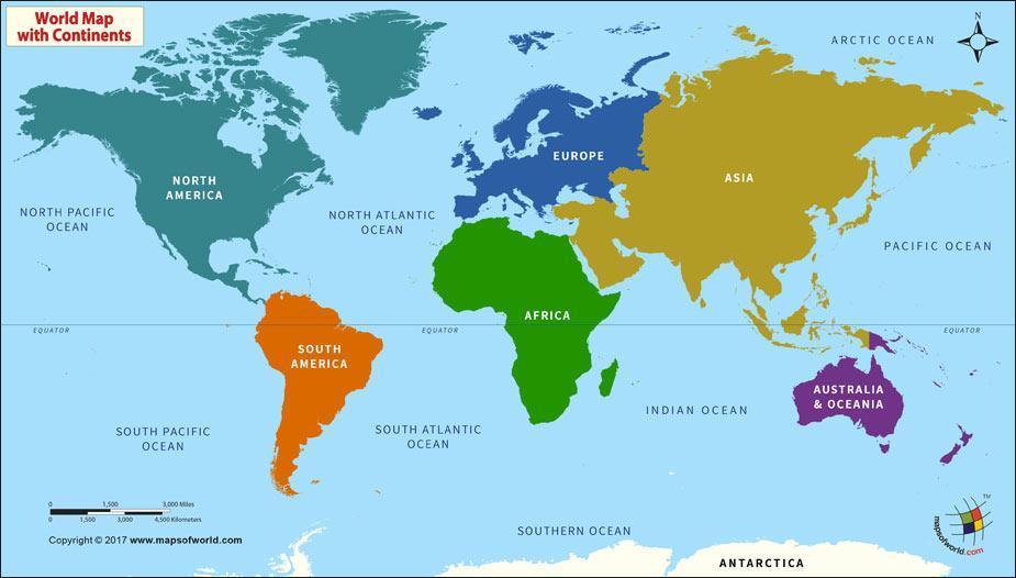
4 Planet Earth is Divided Into 4 Hemispheres (half circles).

5 Lines of LATITUDE are also called PARALLELS because they never intersect. They are measured in DEGREES, and go from 0-90 both North and South from the EQUATOR.

6 This was taken on a roadway in Idaho.
7 5 Key Lines of Latitude EQUATOR 0 Latitude TROPIC OF CANCER 23½ N TROPIC OF CAPRICORN 23½ S ARCTIC CIRCLE 66½ N ANTARCTIC CIRCLE 66½ S

8 66 1/2 North 23 1/2 North /2 South 66 1/2 South
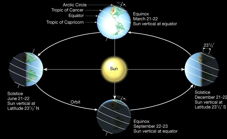
9 Why Do We Have Seasons? As the earth revolves around the sun, its 23 ½ angle causes much of the world to have different seasons. This tilt causes different parts of earth to receive more direct rays at different times of the year.
10 The Solstices Twice a year, we have what is known as a SOLSTICE. These days mark the furthest north or south from the equator that the sun s rays shine directly overhead. The solstices mark the first days of summer and winter.

11 The line of latitude at 23½ N where this happens is called the TROPIC OF CANCER. The line of latitude at 23½ S where this happens is called the TROPIC OF CAPRICORN.

12 The sun s rays are directly over the Tropic of Cancer. This would mark the beginning of summer in the Northern Hemisphere. June
13 The sun s rays are directly over the Tropic of Capricorn. This would mark the beginning of winter in the Northern Hemisphere. December
14 The Equinoxes Twice a year we go through an EQUINOX. On these two days, the sun shines directly over the equator, and the days and nights are equal in the northern and southern hemispheres. The equinoxes mark the beginnings of spring and fall.
15 The sun s rays are directly over the equator twice a year. March September
16

17 It is interesting to note that the seasons in the southern hemisphere are exactly opposite of what we experience here in the northern hemisphere.
18 The Importance of Longitude Lines of LONGITUDE are also called MERIDIANS. They are not parallel because they happen to intersect at the poles.


19 At the North and South Poles, longitude lines meet.


20 The Geographic South Pole The Ceremonial South Pole


21 The North Pole sits on ice of the Arctic Ocean. Here, a submarine has broken through.
22 The key line of longitude is the PRIME MERIDIAN running through Greenwich, England. Lines are measured either East or West of it until 180 Longitude.
, and is considered to be 0 Longitude.")
23 The Prime Meridian runs through Greenwich, England (near London), and is considered to be 0 Longitude.


24 At the Equator, the lines of longitude are 15 apart. The closer you get to the poles, the narrower the distance between them.

25 Together, Latitude and Longitude create a GLOBAL GRID that can be used to pinpoint locations on Earth.
26

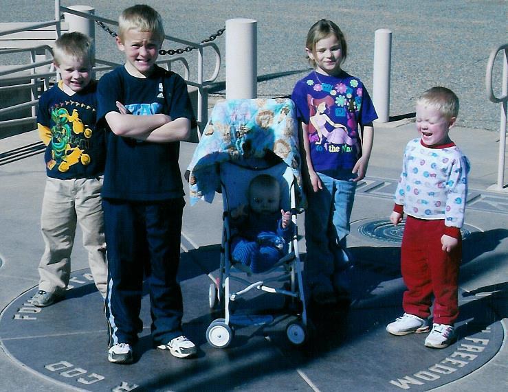
27 The Four Corners Area

28 The only spot where four states come together at a common point.
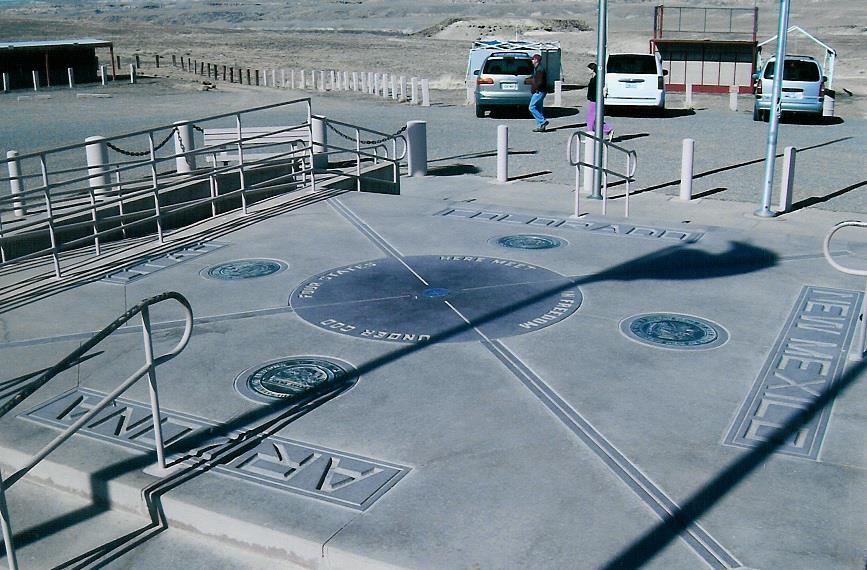
29
")
30 You can be in four states all at once. (March 2008)
31
32 Longitude also provides us with something else interesting. In the days of slower travel, most people and towns set their own local times. By the late 1800s, with trains and other inventions, most countries had adopted the idea of having TIME ZONES to coordinate travel and make communication easier.

33 The World s 24 Time Zones

34 International Date Line Located at 180 Longitude is where a new day begins. This line is a little crooked to avoid splitting territory.

35 Terminator Lines At the International Date Line, a new day begins, and hour by hour, the new day slowly takes over the old one. The entire planet is on the same day only once in a 24- hour period.

36 The Terminator Line marks the two places on Earth between darkness and light.

37 Dawn Darkness becoming light Twilight Light becoming darkness

38 Russia has 9 Time Zones! China used to have 5, but now has only 1.

39 In the Continental U. S., we have 4 main Time Zones
40 Map Projections Although globes are the most accurate portrayal of what the Earth looks like, they are not always the most convenient to use. A PROJECTION is a way of showing the curved surface of the earth on a flat map. Because the earth is a sphere, a flat map will distort some aspect of the earth s surface. Distance, shape, direction, or area may be distorted.

41
42 Political and Physical Maps Political Maps Show things like country, state, or county borders, capital cities, other cities, etc. Physical Maps Show things like mountains, elevation, lakes, rivers, etc.

43 Counties and County Seats of Utah

44 Mountains, Lakes, and Rivers of Utah

45 A Combination of both Political and Physical Maps
46 This map that shows major roads in Utah, is a Thematic Map

47 Thematic Maps Show a specific theme or topic by taking a regular map and altering it to make a point. This is a map of favorite NFL teams by Facebook users.

48 Legend/Key Explains symbols on a map.
49 A Compass Rose CARDINAL and SECONDARY Directions Compass Roses have been on maps for centuries. They show the major directions on a map. Sometimes only north is indicated.
50 Scale A geographer decides what SCALE to use by determining how much detail to show. If many details are needed, a LARGE SCALE is used. If fewer details are needed, a SMALLER SCALE is used.

51 Small Scale

52 Large Scale

53 How Can I Access the Atlas at Home? Go to stratalogica.com Click the button that says login For the username, type: thbell For the password, type minutemen Don t forget to logout when you are done

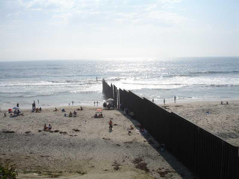
54 The Map Projections used in the Atlas may have some distortion, but are very useful.

55 The Glossary will explain key terms.

56 The Index is extremely helpful in letting you know if something is a city, country, lake, river, mountain, etc


57 Politically, the term STATE is used to describe an independent place that occupies a specific territory and has full control of its affairs. Sometimes we also call it a COUNTRY. France Brazil South Africa

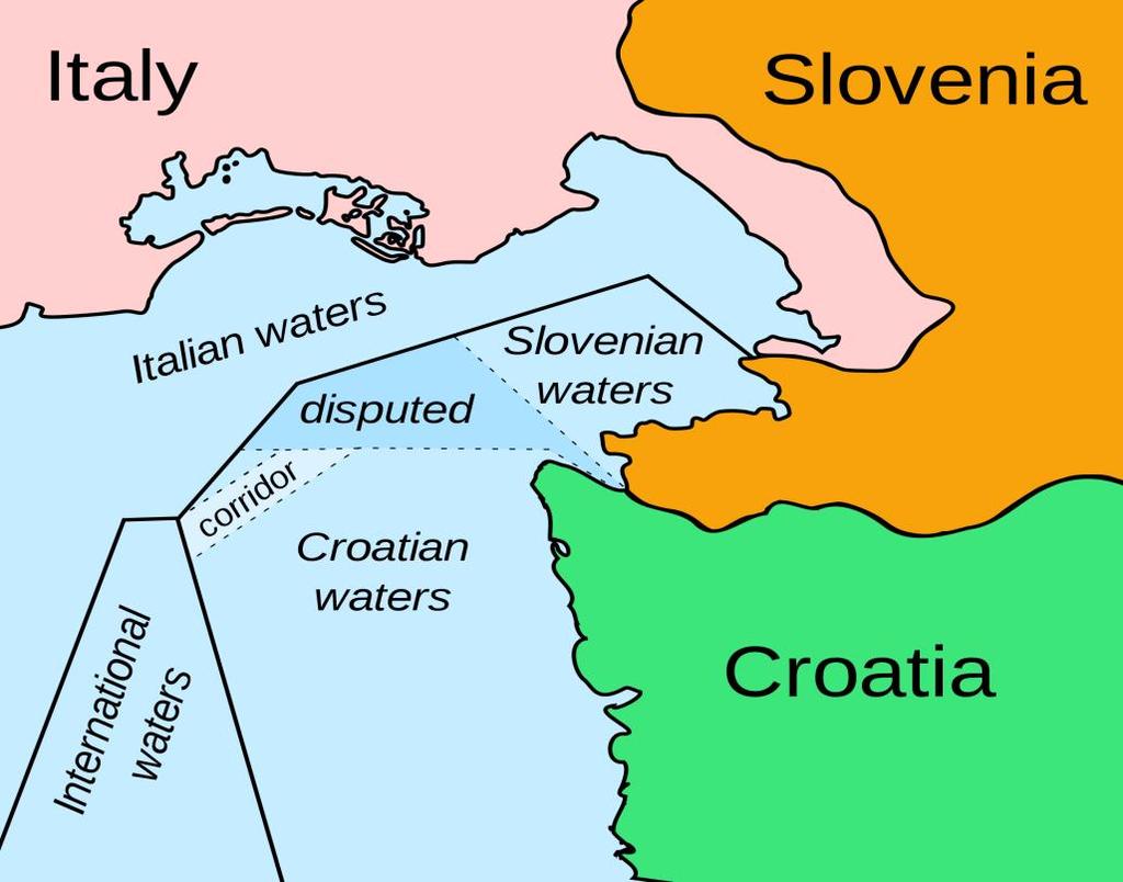
58 NATION refers to a group of people with a common culture living in a territory and having a strong sense of unity. When a nation and a state occupy the same territory, we often call it a NATION-STATE. There are some nations without a state, such as Quebec. French-speaking Quebec has its own distinct culture, separate from the rest of Canada. It is its own province within Canada, but it is not a separate state.

59 The Kurdish people (a nation) of the Middle East would like to have their own state. However, Turkey, Syria, Iraq, and Iran are not exactly jumping at the chance to donate territory for the Kurds to have their own state.
60 Characteristics and Boundaries The size of a country can help determine its wealth and power. It might have a lot of natural resources or a big population that creates a large work force. However, Great Britain, a smaller country achieved one of the greatest empires the world has known. Keep in mind that large countries also need to worry about defending longer borders and longer stretches of sea coasts as well.


61 The shape of a country may determine its relationship with other countries, how it is governed, and how goods are moved. Germany Is Compacted Chile Is Elongated Japan Is Fragmented

62 A country s location means a great deal. For instance, a landlocked country may find itself more isolated from the world. A LANDLOCKED country has no direct outlet to the sea and must find other ways to build connections with the rest of the world to get goods in and out the country.

63 Bolivia has mountains, lakes, and rivers, but no way to get to the Pacific or Atlantic Oceans. It must work with its neighbors.


64 Most countries are protective of their borders or boundaries. They usually want to make their own laws, and control things like natural resources. The borders may be friendly or intense. Pakistan and India North and South Korea
65 NATURAL BOUNDARIES are based on physical features such as rivers, lakes, or chains of mountains. Example: our Rio Grande River border with Mexico. ARTIFICIAL BOUNDARIES are usually fixed lines, following latitude or longitude. Example: our 49 N border with Canada.


66 Along part of the U. S./Canadian Border


67 Along part of the U. S./Mexican Border

68 MARITIME or boundaries in water also exist
Cities, Countries, and Population
 Cities, Countries, and Population After the world industrialized, better food, improved sanitation, and new medicines caused the world population to soar. To understand how heavily populated an area is,
Geography Class 6 Chapters 3 and
 CHAPTER 3 MOTIONS OF THE EARTH The Earth is always travelling in Space. That makes each person on Earth, a Space Traveller. No one feels the movement of the Earth because humans are too tiny when compared
THE EARTH AND ITS REPRESENTATION
 UNIT 7 THE EARTH AND ITS REPRESENTATION TABLE OF CONTENTS 1 THE EARTH AND THE SOLAR SYSTEM... 2 2 THE EARTH S MOVEMENTS... 2 2.1 Rotation.... 2 2.2 The revolution of the Earth: seasons of the year....
Map Skills Unit. Note taking unit
 Map Skills Unit Note taking unit Introduction To learn about the Earth, we are going to learn about two geographic tools you can use.globes and maps. Globe A globe is a round model of the planet Earth
The Earth-Moon-Sun System
 chapter 7 The Earth-Moon-Sun System section 2 Time and Seasons What You ll Learn how to calculate time and date in different time zones how to distinguish rotation and revolution what causes seasons Before
Latitude & Longitude. Worksheets & activities to teach latitude & longitude. Includes notes, activities, review & all answer keys. 11 pages!
 Latitude & Longitude Worksheets & activities to teach latitude & longitude. Includes notes, activities, review & all answer keys. 11 pages! Lines of Latitude & Longitude Name: Lines of latitude and longitude
Module 2: Mapping Topic 2 Content: Determining Latitude and Longitude Notes
 Introduction In order to more easily locate points on a globe or map, cartographers designed a system of imaginary vertical lines (also called parallels) and horizontal lines (also called meridians) that
UNIT 1: THE PLANET EARTH
 UNIT 1: THE PLANET EARTH How many planets are there in our Solar System? What is the Equator? Why does life exist in our planet? Does The Earth move? What is a map? 1. Planet Earth TOPICS 2. Movements
Geographic Grid -Latitudes and Longitudes
 GEOGRAPHY STD 9 Geographic Grid -Latitudes and Longitudes 2018-2019 Q1. Define Geographic Grid. The network of latitudes and longitudes are known as Geographic Grid. They help us to locate places on the
Latitude & Longitude Study Guide
 Latitude & Longitude Study Guide Name: Date: Section: Label the important Latitude lines on the diagram below. Include the degree measurements The equator is located at zero degrees latitude. The equator
01) The Sun s rays strike the surface of the Earth at 90 degrees at the on December 22.
 The Sun s rays strike the surface of the Earth at 90 degrees at the on December 22.") Package Title: Testbank Course Title: Introducing Physical Geography 6e Chapter Number: 01 Question Type: Multiple Choice 01) The Sun s rays strike the surface of the Earth at 90 degrees at the on December
Package Title: Testbank Course Title: Introducing Physical Geography 6e Chapter Number: 01 Question Type: Multiple Choice 01) The Sun s rays strike the surface of the Earth at 90 degrees at the on December
Phase 1 Cards. Phase 1. Phase 1. How many picnic areas does the park have? Write the answer near the legend.
 S T U D E N T H A N D O U T F Cards Write the map s title in the northwest corner above the map. How many picnic areas does the park have? Write the answer near the legend. 1 2 Draw a compass rose near
Lesson 20: The Earth in its Orbit
 291 Lesson 20: The Earth in its Orbit Recall that the Earth s orbit around the un is an ellipse which is almost a perfect circle. The average distance from the un to the Earth is 152,100,000 km (to the
Daylight Data: Days and Nights Around the World
 Days & Nights 1 Name Daylight Data: Days and Nights Around the World Purpose: To investigate the number of hours of daylight received by countries at different latitudes. Materials: Daylight data sheet
Introduction to Geography
 Introduction to Geography ropic of Cancer 3½ N Arctic Circle 90 N Prime Meridian 0 Arctic Ocean Mississippi R. Appalachian Mts. Europe Rocky Mountains N. America Atlantic Gulf of Ocean Mexico Caribbean
FIND PLACES ON GLOBES USING LATITUDE
 GLOBES, MAPS & GRAPHS FIND PLACES ON GLOBES USING LATITUDE AND LONGITUDE LINES FIND PLACES ON MAPS USING A GRID SYSTEM NAME SEVERAL TYPES OF MAP PROJECTIONS AND EXPLAIN THEIR BENEFITS AND SHORTCOMINGS
SAMPLE. Succeeding in Social Studies 5 6 TH IN A SERIES OF 7. Years 5 9. Written by Valerie Marett. CORONEOS PUBLICATIONS Item No 508
 AUSTRALIAN HOMESCHOOLING SERIES Succeeding in Social Studies 5 6 TH IN A SERIES OF 7 Years 5 9 Written by Valerie Marett CORONEOS PUBLICATIONS Item No 508 Contents Notes to Parents.2 Latitude and Longitude...3
Student Handout. Write the map s title in the northwest corner of the map. How many picnic areas does the park have? Write the answer near the legend.
 Student Handout 1F Cards Write the map s title in the northwest corner of the map. How many picnic areas does the park have? Write the answer near the legend. 1 2 Draw a compass rose near the west edge
A Living Planet. The Earth Inside and Out
 A Living Planet The Earth Inside and Out Planet Earth Earth s Rotation, Revolution, and Tilt Most of Earth s energy comes from the Sun, which we call solar energy. Imagine that the Earth has an imaginary
Chapter 1 Introduction to the Earth
 Chapter 1 Introduction to the Earth What is Geography? The study of the earth as the home of humankind. Greek - Eratosthenes Father of Geography Geo means Earth Graphy means to write Study how things are
Map Skills and Geographic Tools
 Name: Period: Map Skills and Geographic Tools TEKS: 8.9C interpret topographic maps and satellite views to identify land and erosional features and predict how these features may be reshaped by weathering
2. What does the map scale tell the map reader? a ratio between the actual distance on the ground and the length given to that distance on a map
 AP Human Geography - Damon Name Unit 1 - Intro to Human Geography Hour Map and Globe Skills Review Note: All links in this packet are found on our Wikispace under Map and Globe Skills Review First, read
Geography Can Be Cool. Seriously
 Geography Can Be Cool Seriously Why does geography matter? Geography: the study of looking at every aspect of the Earth s systems, such as human economies, societies, cultures, plants, animals, & climate.
Cardinal and Intermediate Directions:
 Name Period Parent Signature Due Date: (TBA) Geography/Map Skills Study Guide Continents and Oceans of the World: Label the continents (7) and oceans (4) on the lines below the map. 1 11 3 5 4 8 2 9 10
Seasons, Global Wind and Climate Study Guide
 Seasons, Global Wind and Climate Study Guide Seasons 1. Know what is responsible for the change in seasons on Earth. 2. Be able to determine seasons in the northern and southern hemispheres given the position
What Is a Globe? Hemispheres. Main Idea Globes and maps provide different ways of showing features of the earth. Terms to Know
 r Main Idea Globes and maps provide different ways of showing features of the earth. Terms to Know hemisphere latitude longitude scale bar scale relief elevation contour line What Is a Globe? A globe is
CHAPTER 2 SKILL SHEET 2: CELESTIAL NAVIGATION
 CHAPTER 2 SKILL SHEET 2: CELESTIAL NAVIGATION Before the invention of GPS technology, how were people on ships far at sea, out of the sight of land, able to tell where they were? For thousands of years
Understanding Projections
 GEOGRAPHY SKILLS 1 Understanding Projections The earth is a sphere and is best shown as a globe. For books and posters, though, the earth has to be represented as a flat object. To do this, mapmakers create
The Earth is a Rotating Sphere
 The Earth is a Rotating Sphere The Shape of the Earth Earth s Rotation ( and relative movement of the Sun and Moon) The Geographic Grid Map Projections Global Time The Earth s Revolution around the Sun
Know the Lingo LATITUDE LONGITUDE
 Station Alpha SS.6.G.1.1 Use latitude and longitude coordinates to understand the relationship between people and places on the Earth - - - - - - - - - - - - - - - - - - - - - - - - - - - Know the Lingo
Seasons. What causes the seasons?
 Questions: Seasons What causes the seasons? How do we mark the progression of the seasons? What is the seasonal motion of the sun in the sky? What could cause the seasonal motion of the sun to change over
Geography Long Term Plan 2018
 Geography Long Term Plan 2018 Geography Co-ordinator: Megan Frost A high-quality geography education should inspire in pupils a curiosity and fascination about the world and its people that will remain
Complete the following: a. Lines of latitude are parallel to the equator. Name:
 Name: Date: Social Studies Introduction: Basic Geography Period: Latitude Latitude is defined as a measurement of distance in degrees north and south of the equator. The word latitude is derived from the
Some of these parallels are very important. In the Northern Hemisphere, there is the Tropic of Cancer and the Arctic Circle.
 PDF 2 Geographic coordinates 1 The geographic coordinates system is network of imaginary horizontal and vertical lines that are drawn on globes or maps. These lines are called parallels (lines of latitude)
Year 1 name and locate the four countries and capital cities of the United Kingdom and its surrounding seas
 Long Term Objective Organisation for Geography Please note that only statutory requirements should be included in this document; any supplementary guidance and information should be retained by Subject
GEOGRAPHY STD.9 LATITUDE & LONGITUDE
 GEOGRAPHY STD.9 LATITUDE & LONGITUDE 1. What is the Earth Grid? A. The complete network of meridians & parallels is called the earth Grid. 2. What is Latitude? A. The latitude of a place is the distance
Cartography the art of making maps
 Cartography the art of making maps A map is a drawing or a picture of the earths surface, showing how things are related to each other by distance, direction and size. Maps are used for: Navigation Distance
Section. 1 Our Planet, Earth. Prepare to Read
 1 Section Step-by-Step Instruction Objectives Social Studies 1. Learn about Earth s movement in relation to the sun. 2. Explore seasons and latitude. Reading/Language Arts Use context clues from surrounding
Cartesian Coordinates Need two dimensional system 2 number lines perpendicular to each other X-axis is horizontal Y-axis is vertical Position relative
 General Physical Science Chapter 15 Place and Time Space and Time Einstein Space and time related Single entity Time is the 4 th dimension! Cartesian Coordinates Need some system to tell us where something
 Name Period Parent Signature Geography/Map Skills Study Guide *For extra practice with these skills, check out Mr. Kath s website: http://rkath.weebly.com/activities--links.html Continents and Oceans of
Geographer s Toolkit. Geography of Canada
 Geographer s Toolkit Geography of Canada www.craigmarlatt.com/school Geographer s Toolkit 1. Parts of a Map Map Symbols Mapping Your Location 2. Types of Maps 3. Political Map of Canada 4. Drainage Map
New National Curriculum Geography Skills Planning KS1
 New National Curriculum Geography Skills Planning KS1 Enquiry Question Objective-essential knowledge skills or understanding Locational Knowledge Standards /Success Criteria Lesson progression over half
Map Skills Test. 1. What do we call a person who makes maps? a. mapographer b. cartographer c. geologist d. archaeologist
 Map Skills Test 1. What do we call a person who makes maps? a. mapographer b. cartographer c. geologist d. archaeologist 2. What is the name of the 0 latitude line? a. Equator b. Arctic Circle c. First
Complete Geography Overview: Year 1 to Year 6
 Option 1 Complete Geography Overview: Year 1 to Year 6 Autumn Term Spring Term Summer Term Year 1 Where do I live? Around the World The Four Seasons Year 2 At the Farm Let s go on Safari My World and Me
5 Themes of Geography Review Video Notes What is Geography?
 Name PG # 5 Themes of Geography Review Video Notes What is Geography? The study of, their, and their Main Idea or Topic Continents Notes about Main Idea or Topic There are 7 Continents or in the world:
Unit 1: Geography and Social Studies Skills
 Unit 1: Geography and Social Studies Skills Standard(s) of Learning: WHI.1 The student will improve skills in historical research and geographical analysis by a) Identifying, analyzing, and interpreting
(1) Over the course of a day, the sun angle at any particular place varies. Why?
 Over the course of a day, the sun angle at any particular place varies. Why?") (1) Over the course of a day, the sun angle at any particular place varies. Why? (Note: Although all responses below are true statements, only one of them actually explains the observation!) (A)The sun
(1) Over the course of a day, the sun angle at any particular place varies. Why? (Note: Although all responses below are true statements, only one of them actually explains the observation!) (A)The sun
Earth s Orbit. Sun Earth Relationships Ridha Hamidi, Ph.D. ESCI-61 Introduction to Photovoltaic Technology
 1 ESCI-61 Introduction to Photovoltaic Technology Sun Earth Relationships Ridha Hamidi, Ph.D. Spring (sun aims directly at equator) Winter (northern hemisphere 23.5 tilts away from sun) 2 Solar radiation
The World of Geography Pre-Test/Study Guide Chapter 1 Test
 Read each statement or question. On the lines below write the letter of the best answer. 1. Geographers look at the Earth 5. What are the two specific A. by studying cities first. measurements of Earth
L.O: EARTH'S 23.5 DEGREE TILT ON ITS AXIS GIVES EARTH ITS SEASONS March 21 (SPRING), June 21(SUMMER), Sept 22 (AUTUMN) & Dec 21(WINTER)
, June 21(SUMMER), Sept 22 (AUTUMN) & Dec 21(WINTER)") L.O: EARTH'S 23.5 DEGREE TILT ON ITS AXIS GIVES EARTH ITS SEASONS March 21 (SPRING), June 21(SUMMER), Sept 22 (AUTUMN) & Dec 21(WINTER) 1. The apparent daily path of the Sun changes with the seasons because
L.O: EARTH'S 23.5 DEGREE TILT ON ITS AXIS GIVES EARTH ITS SEASONS March 21 (SPRING), June 21(SUMMER), Sept 22 (AUTUMN) & Dec 21(WINTER) 1. The apparent daily path of the Sun changes with the seasons because
Downloaded from
 I II III IV V VI Define the following terms:- a) Orbitb) Meteoroids c) Celestial bodies GEOGRAPHY ASSIGNMENTS The Earth In The Solar System d) Satellite e) Comets Give one word answers:- a) Blue planet
Introduction to Geography
 Introduction to Geography What is geography? Geography comes from the Greek word Geographia. Geo means earth and graphia means to describe or chart. Geographers study the earth in relation to space and
Cranford Park CE Primary School. Subject Overview for Geography. Autumn 1 Autumn 2 Spring 1 Spring 2 Summer 1 Summer 2 Title of unit.
 Autumn 1 Autumn 2 Spring 1 Spring 2 Summer 1 Summer 2 Main Objectives /Skills Main Objectives /Skills Main Objectives /Skills Main Objectives /Skills Main Objectives /Skills Main Objectives /Skills Foundation
European Union Can you label the twenty-seven countries of the EU on the map attached? (Do not revise the capitals.)
") NAME: FORM: YEAR 5 SUMMER EXAM REVISION QUESTIONS 2016 The exam will be forty minutes long. Answers will be short sentences or just one-word answers. The exam will be based upon the work that you have
NAME: FORM: YEAR 5 SUMMER EXAM REVISION QUESTIONS 2016 The exam will be forty minutes long. Answers will be short sentences or just one-word answers. The exam will be based upon the work that you have
Chapter 4 Earth, Moon, and Sky 107
 Chapter 4 Earth, Moon, and Sky 107 planetariums around the world. Figure 4.4 Foucault s Pendulum. As Earth turns, the plane of oscillation of the Foucault pendulum shifts gradually so that over the course
World geography 3200/3202 Unit 2 review
 World geography 3200/3202 Unit 2 review 1. Does this statement use the terms revolve & rotate correctly? "Saturn revolves on its axis while several moons rotate around it." 2. Does this statement use the
Map Skills Lesson 1. Materials: maps, pencils, Lesson 1 Worksheet, strips of paper, grid paper
 Map Skills Lesson 1 Use cardinal directions, map grids, scales, and titles to locate places on a map. Interpret a map using information from its title, compass rose, scale, and legend. Vocabulary: map,
Geography Long Term Plan
 Geography Long Term Plan Year Group Children should be taught about: The topic this will be based on: Essential Learning Objectives: (Taken from Chris Quigley) Year 1 Name and locate the world s seven
Geography Long Term Plan. Autumn Spring Summer
 Geography Long Term Plan Autumn Spring Summer Year 1 Working Scientifically covered throughout the year Location Geography of UK Name, locate and identify characteristics of the four countries and capital
Word Cards. 2 map. 1 geographic representation. a description or portrayal of the Earth or parts of the Earth. a visual representation of an area
 Name: Date: Hour: Word Cards 1 geographic representation a description or portrayal of the Earth or parts of the Earth Example: A map is a representation of an actual location or place. 2 map a visual
... Asia. Based on Bloom s Taxonomy. Human & Movement. Location Place. Regions. Environment. Interactions
 ... Asia Location Place Human & Environment Interactions Movement Regions LEVEL 1 Knowledge Match Show or Label List Information Recall Details (5Ws + H) Find Information LEVEL 2 Comprehension LEVEL 3
Maps and Globes. By Kennedy s Korner
 Maps and Globes By Kennedy s Korner Map Key or Symbols Maps use symbols to show places and things on Earth. Symbols are drawings that stand for something real. A map key tells you what each symbol stands
GRADE 6 GEOGRAPHY TERM 1 LATITUDE AND LONGITUDE (degrees)
") 1 GRADE 6 GEOGRAPHY TERM 1 LATITUDE AND LONGITUDE (degrees) Contents Lines of Latitude... 2 Lines of Longitude... 3 The hemispheres of The Earth... 4 Finding countries and cities on a map using latitude
1 GRADE 6 GEOGRAPHY TERM 1 LATITUDE AND LONGITUDE (degrees) Contents Lines of Latitude... 2 Lines of Longitude... 3 The hemispheres of The Earth... 4 Finding countries and cities on a map using latitude
Unit 2 Study Guide: The World in Spatial Terms
 Name Date Hour Unit 2 Study Guide: The World in Spatial Terms TEST is WEDNESDAY, DECEMBER 19 TH This study guide contains all the concepts that will be on your test. Vocabulary words and concepts will
7a LATITUDE LONGITUDE.notebook. September 19, 2017
 1 PANGEA Add a pangea link to here 2 There are 4 hemispheres Hemispheres are divided using the Equator (north and south) and Prime Meridian (west and east) 3 4 Northern Hemisphere Equator SOUTHERN OCEAN
A. Spatial Sense (Working with Maps, Globes, and Other Geographic Tools)
") A. Spatial Sense (Working with Maps, Globes, and Other Geographic Tools) Measuring Distance Using Map Scale All maps are drawn to scale; that is, they are smaller than the things they represent. Scale
A. Spatial Sense (Working with Maps, Globes, and Other Geographic Tools) Measuring Distance Using Map Scale All maps are drawn to scale; that is, they are smaller than the things they represent. Scale
Chapter 2: Studying Geography, Economics, and Citizenship
 Chapter 2: Studying Geography, Economics, and Citizenship Lesson 2.1 Studying Geography I. Displaying the Earth s Surface A. A globe of the Earth best shows the sizes of continents and the shapes of landmasses
Canadian Mapping Big Book
 Canadian Mapping Big Book Grades 4-6 Written by Lynda Golletz Illustrated by S&S Learning Materials About the Author: Lynda Golletz was an elementary school teacher for thirty-three years. She is the author
YEAR 5 SUMMER EXAM REVISION QUESTIONS
 NAME: FORM: YEAR 5 SUMMER EXAM REVISION QUESTIONS 2017 YEAR 5 SUMMER EXAM REVISION QUESTIONS The exam will be forty minutes long. Answers will be short sentences or just oneword answers. The exam will
ClassAction: Coordinates and Motions Module Instructor s Manual
 ClassAction: Coordinates and Motions Module Instructor s Manual Table of Contents Section 1: Warm-up Questions...3 The Sun s Path 1 4 Section 2: General Questions...5 Sledding or Going to the Beach...6
The Earth and its representation
 GEOGRAPHY UNIT 1 The Earth and its representation THE SOLAR SYSTEM AND THE EARTH THE SOLAR SYSTEM The solar system is a planetary system. Is a group of astronomical objects who surround a star, in this
GEOGRAPHY. Map Skills. Mrs. Pere ~ 2013
 GEOGRAPHY Map Skills Mrs. Pere ~ 2013 WHAT IS A GLOBE? A globe is a model of the Earth. North Pole Equator South Pole WHAT IS A MAP? A map is a flat drawing of a place. THE IMPORTANT PARTS OF A MAP 1.
Planet Earth. Part 2
 Planet Earth Part 2 Sun, Earth and Moon Motions The Solar System revolves around the Milky Way galaxy center. The Sun rotates on its own axis. Earth revolves around the Sun (1 year) and rotates on its
MR. JOHNSON S. Geography OHIO COUNTY MIDDLE SCHOOL
 MR. JOHNSON S Geography OHIO COUNTY MIDDLE SCHOOL CHAPTER 1 Geography The science of geography is likely the oldest of all sciences. Geography is the answer to the question that the earliest humans asked,
What Is the Relationship Between Earth s Tilt and the Seasons?
 Learning Set 2 Why Are There Differences in Temperature? Review Images and Graphics While reading about Earth s tilt and the seasons, pay particular attention to the graphics included. How do they help
GLOBE : LATITUDES AND LONGITUDES
 2 Figure 2.1 : Globe Let s Do Take a big round potato or a ball. Pierce a knitting needle through it. The needle resembles the axis shown in a globe. You can now move the potato or the ball around this
Lecture #03. January 20, 2010, Wednesday
 Lecture #03 January 20, 2010, Wednesday Causes of Earth s Seasons Earth-Sun geometry Day length Solar angle (beam spread) Atmospheric beam depletion Shape and Size of the Earth North Pole E Geoid: not
locate the world s countries, using maps to focus on Europe (including the location of
 Year 3 and 4 Geography study- Autumn 2 2017 National curriculum: Locational knowledge locate the world s countries, using maps to focus on Europe (including the location of Russia) and North and South
2. Knowing the Heavens
 2. Knowing the Heavens Ancient naked-eye astronomy Eighty-eight constellations The sky s ever-changing appearance The celestial sphere Celestial coordinates Seasons: Earth s axial tilt Precession of Earth
Aim: What causes Seasons?
 Notepack 28 Aim: What causes Seasons? Do Now: What is the difference between revolution and rotation? Earth s rotation The Earth rotates on its axis (imaginary vertical line around which Earth spins) every
The Sun-Earth-Moon System
 chapter 311 section 1 Earth The Sun-Earth-Moon System Before You Read What do you already know about Earth s shape, its size, and how it moves? Write what you know on the lines below. What You ll Learn
About places and/or important events Landmarks Maps How the land is, hills or flat or mountain range Connected to maps World Different countries
 What do you think you know about geography? About places and/or important events Landmarks Maps How the land is, hills or flat or mountain range Connected to maps World Different countries What do you
Appearance of the Sky Orientation Motion of sky Seasons Precession (?)
") Today Appearance of the Sky Orientation Motion of sky Seasons Precession (?) The Celestial Sphere Stars at different distances all appear to lie on the celestial sphere. The ecliptic is the Sun s apparent
Today Appearance of the Sky Orientation Motion of sky Seasons Precession (?) The Celestial Sphere Stars at different distances all appear to lie on the celestial sphere. The ecliptic is the Sun s apparent
What causes Earth to have seasons?
 Seasons What causes Earth to have seasons? The distance to Earth does NOT cause seasons seasons are caused by : 1. the tilt of the earth on its axis (23.5 degrees) 2.revolution of earth around the sun
The Geography Curriculum at Coston Primary
 The Geography Curriculum at Coston Primary Years Year 1 Year 2 Summer We are learning about where food is farmed and in The physical features of farms. The human features of farms. The characteristics
 Name Period Parent Signature Foundational Skills Study Guide *For extra practice with these skills, check out Mr. Kath s website: http://rkath.weebly.com/activities--links.html Continents and Oceans of
Practice Questions: Seasons #1
 1. Seasonal changes on Earth are primarily caused by the A) parallelism of the Sun's axis as the Sun revolves around Earth B) changes in distance between Earth and the Sun C) elliptical shape of Earth's
Seasons Page 520. A. What Causes Seasons?
 Seasons Page 520 A. What Causes Seasons? 1. Seasons are caused by the tilt of the earth s axis as it moves around the sun. 2. Seasons happen because the Earth is tilted on its axis at a 23.5 angle. 3.
UNIT 3: EARTH S MOTIONS
 UNIT 3: EARTH S MOTIONS After Unit 3 you should be able to: o Differentiate between rotation and revolution of the Earth o Apply the rates of rotation and revolution to basic problems o Recall the evidence
Holy Trinity 3-16 School. Geography Overview (Primary)
") Holy Trinity 3-16 School Key Stage 1 Geography Overview (Primary) Year Autumn 1 Autumn 2 Spring1 Spring 2 Summer 1 Summer 2 Y1 Dear Zoo Castles Gadgets and Gizmos (UK) Name, locate and identify characteristics
Holy Trinity 3-16 School Key Stage 1 Geography Overview (Primary) Year Autumn 1 Autumn 2 Spring1 Spring 2 Summer 1 Summer 2 Y1 Dear Zoo Castles Gadgets and Gizmos (UK) Name, locate and identify characteristics
Chapter: The Earth-Moon-Sun System
 Chapter 7 Table of Contents Chapter: The Earth-Moon-Sun System Section 1: Earth in Space Section 2: Time and Seasons Section 3: Earth s Moon 1 Earth in Space Earth s Size and Shape Ancient Measurements
page - 1 Laboratory Exercise #1 - Introduction to Latitude and Longitude Northern Hemisphere Southern Hemisphere
 page - 1 Laboratory Exercise #1 - Introduction to Latitude and Longitude A. Introduction There are many methods that can be used to locate ones position on the surface of the earth. A common method for
1/3/12. Chapter: The Earth-Moon-Sun System. Ancient Measurements. Earth s Size and Shape. Ancient Measurements. Ancient Measurements
 // Table of Contents Chapter: The Earth-Moon-Sun System Section : Chapter 7 Section : Section : Earth s Size and Shape Ancient Measurements First, no matter where you are on Earth, objects fall straight
Chapter 1 Section 2. Land, Water, and Climate
 Chapter 1 Section 2 Land, Water, and Climate Vocabulary 1. Landforms- natural features of the Earth s land surface 2. Elevation- height above sea level 3. Relief- changes in height 4. Core- most inner
Geography Progression
 Geography Progression This document aims to track expectations for History within George Grenville Academy. What the National Curriculum says: KS1: Locational Knowledge: Name and locate the world s 7 continents
Downloaded from
 Geo Globe : Latitudes and Longitudes 1.Suppose the time at 30 east is 2 p.m. then what is the time at Greenwich? (A) 2 p.m. (B) 12 p.m. (C) 1 p.m. (D) Cannot find 2.What does the term 'Grid' mean
MOTIONS OF THE EARTH. Figure 3.1 : Inclination of the Earth s axis and the orbital plane. Figure 3.2 : Day and Night on the Earth due to rotation
 3 Let s Do Take a ball to represent the earth and a lighted candle to represent the sun. Mark a point on the ball to represent a town X. Place the ball in such a way that the town X is in darkness. Now
Earth is rotating on its own axis
 Earth is rotating on its own axis 1 rotation every day (24 hours) Earth is rotating counterclockwise if you are looking at its North pole from other space. Earth is rotating clockwise if you are looking
Geography Route Planner
 Geography Route Planner Introduction to Route Planners Route Planners outline the Key Stages 1-3 curriculum to be taught within each campus of the Bury St Edmunds Trust. Each Route Planner has been designed
Appearance of the Sky Orientation Motion of sky Seasons Precession (?)
") Today Appearance of the Sky Orientation Motion of sky Seasons Precession (?) The Celestial Sphere Stars at different distances all appear to lie on the celestial sphere. The ecliptic is the Sun s apparent
Today Appearance of the Sky Orientation Motion of sky Seasons Precession (?) The Celestial Sphere Stars at different distances all appear to lie on the celestial sphere. The ecliptic is the Sun s apparent