Erosion and Accretion Patterns along the Danish Shores
|
|
|
- Daniel Cooper
- 6 years ago
- Views:
Transcription
 Climate Change and Coastal Adaptation 30 October 2012, GUS")
1 Department of Geosciences and Natural Resource Management rosion and Accretion Patterns along the Danish Shores Aart Kroon Danish Coasts and Climate Adaptation (COADAPT) Climate Change and Coastal Adaptation 30 October 2012, GUS Copenhagen
2 Contents Introduction Character of the Danish shores rosion and accretion patterns Responsible coastal processes Climate change and changes along the coasts
3 Introduction Relevance of the study Coadapt erosion and flooding of shores Climate change: changes in forcing changes in waves and waterlevels What do we have now? process characteristics special attention to extreme events What about the character of the Danish shores? quaternary geology geomorphology sediment sources and sinks centennial and decadal changes along the Danish shores???
4
 of Denmark (Hansen et al.")
5 Present-time isostatic uplift rates (mm year -1 ) of Denmark (Hansen et al., 2011)

6 North Sea Geomorphology of Denmark Kattegat 3 Wadden Sea Baltic Sea Sted og dato Dias 6 Sources of sediment (GUS, Geodatabase)
7 Height above sea level North Sea Kattegat Wadden Sea Baltic Sea Risk for flooding (KMS, 2010)

")

8 Height above sea level onshore Lyø offshore (Google arth, 2012) Coastal classification (Dyrholm Hansen, 2012)

9 rosion and accretion rates Data source: Topographic maps HMB/LMB Scanned paper map sheets K10 Vector dataset Survey dates Map-sheet polygon feature attributes Map sheets Orthorectified & georeferenced raster Digitize shoreline Shoreline Polyline Split by map-sheet polygons Spatial join Shoreline feature class HMB/LMB Survey dates as attributes Shoreline feature class K10 Survey dates as attributes Shoreline acquisition in ArcGIS HMB: Høje Målebordsblade, LMB: Lave Målebordsblade, K10: Kort10 (Kabuth et al., submitted)
 (Kabuth et al.")
10 Shoreline change computation in ArcGIS / DSAS Digital Shoreline Analysis System (USGS) (Kabuth et al., submitted)
11 12 0'0" 10 0'0" 8 0'0" 57 0'0"N 56 0'0"N 55 0'0"N Shoreline movement rate [m/yr] km 15 0'0" 55 0'0"N Danish Coasts and Climate Adaptation (Kabuth et al., submitted) rosion and accretion rates along the Danish shores
12 SHORLIN CHANGS - ORDR OF MAGNITUD SHORLIN CLASS BHAVIOR Alongshore extension [m] Cross-shore range [m] xamples of shoreline-change rate (99 th percentile)[m/yr] Straightening coast Adjacent accretion and erosion m/yr, m/yr (Vigsø bight) +1.8 m/yr, -2.0 m/yr (Jammer bight) Distal accretion, longitudinal and/or latitudinal m/yr (Feddet spit) m/yr (Korevlerne barrier spits) Spit, barrier spit Proximal erosion m/yr (Krageø) Proximal stability or accretion (barrier spits) ca. +2 m/yr (Korevlerne) Pivoting spit point (mature spits) m/yr, -6.3 m/yr (Skagens Odde) Marsh Accretion ,, confined by bay extent or barrier +2.8 m/yr (Ølsemagle Revle lagoon) Marine dominated estuaries Accretion (shoreline straightening) m/yr (Tudeå) Land reclamation Accretion 10 3, confined by dam 10 3, confined by dam m/yr (Lumby Kvissel bay closure) m/yr (Amager territorial waters) Upstream accretion ,, confined by jetty length +1.5 m/yr (Hanstholm) Harbour Upstream erosion m/yr (Gilleleje) Downstream erosion m/yr (Frederikshavn) Coastal protection Upstream accretion ,, confined by groin length or breakwater position +0.5 m/yr (Lisleje) Downstream erosion m/yr (Lisleje) Beach parks Accretion 10 3 Unconfined Not computed (Kabuth et al., submitted)
13 rosion and accretion patterns Remarks first erosion-accretion map of DK with a high spatial resolution observed patterns are in line with expectations (verified at several locations with detailed studies) Critical remarks resolution in time is limited no distinction between natural processes and man-made interventions no direct coupling to coastal processes
![Coastal processes @ a site Waves Wave energy flux (longshore/cross-shore); Ω parameter NORTH 15% 10% WST 5% SOUTH AST Hs[m] 3.](/docs-images/72/67976833/images/14-1.jpg "5-4 3-3.5 2.5-3 2-2.5 1.5-2 1-1.5 0.5-1 0-0.5-0.")
14 Coastal a site Waves Wave energy flux (longshore/cross-shore); Ω parameter NORTH 15% 10% WST 5% SOUTH AST Hs[m] xtreme events xtreme water levels wave overtopping Tides (spring) tidal range

15 Spit on the eastern shore of Sjælland Shoreline movement rate (m/yr) Coastline 1891 Coastline 2002 none ± Præstø Fjord Feddet km
16 Spit on the eastern shore Shoreline movement rate (m/yr) Coastline 1891 Coastline 2002 Præstø Fjord none ± WST NORTH NORTH 20% 20% 15% 10% 5% AST Hs[m] SOUTH SOUTH (Modelled wave data , DHI-DMI) Rørvig Feddet km (xtreme sea level statistics; DCA, 2007)
17 Spit on the eastern shore Abundant sediment in the system cliff erosion in the north shallow waters around the fjord entrance Sources are not protected by construction works Beach ridge plain is building up during the Holocene xtreme event: only once observed with overwashes (1872; Clemmensen et al., in prep.)


18 Barrier island on the southern shore of Sjælland Danish Coasts and Climate Adaptation

19 Barrier island on the southern shore ± Holsteinborg Nor Basnæs Nor Glænø Shoreline movement rate (m/yr) none Coastline 1891 Coastline km rosion of a former glacial bluff? (KMS, 1989)

20 Barrier island on the southern shore Inlet dynamics (After Brøndum, 1972 in Westh, 2012)

21 Barrier island on the southern shore (Westh, 2012)
22 Barrier island on the southern shore ± Holsteinborg Nor Basnæs Nor Glænø NORTH 15% Shoreline movement rate (m/yr) none Coastline 1891 Coastline km WST 5% SOUTH 10% AST Hs[m] (Modelled wave data , DHI-DMI) Korsør (xtreme sea level statistics; DCA, 2007)
 xtreme event: water level +120 cm over DVR90, 6 January 2012")

23 Concluding remarks Inlet closing: longshore wave-driven fluxes; Inlet breaching: extreme water levels and onshore storms (Photos Sune Westh, 2012) xtreme event: water level +120 cm over DVR90, 6 January 2012 Flooding, but no breaching nor erosion Last 20 years, under 30% of high waters with eroding waves What is the joint probability? Time series are too short! Climate change, change in the joint probability distribution?

24 Thanks for your attention! (Photo Mette Bendixen, 17 February 2011)
Geol 117 Lecture 18 Beaches & Coastlines. I. Types of Coastlines A. Definition:
 I. Types of Coastlines A. Definition: 1. Shore = narrow zone where ocean meets land (e.g. beach) 2. Coast is a broad area where both ocean and land processes act a. Includes onshore marshes, dunes, sea
SHORELINE AND BEACH PROCESSES: PART 2. Implications for Coastal Engineering
 SHORELINE AND BEACH PROCESSES: PART 2 Implications for Coastal Engineering Objectives of the lecture: Part 2 Show examples of coastal engineering Discuss the practical difficulties of ocean engineering
Coastal Evolution in Sedimentary Areas in Greenland
 Coastal Evolution in Sedimentary Areas in Greenland Mette Bendixen P h D s t u d e n t DANCORE Young Professionals Day Dias 1 Outline Motivation State of the art on Arctic coasts Purpose of my Phd Presentation
Numerical models in context of coastal climate change, adaptation and protection schemes. Nils Drønen Head of Innovation, CED, DHI
 Numerical models in context of coastal climate change, adaptation and protection schemes Nils Drønen Head of Innovation, CED, DHI Agenda Introduction How can we quantify coastal response to climate change
Sea-level Rise on Cape Cod: How Vulnerable Are We? Rob Thieler U.S. Geological Survey Woods Hole, MA
 Sea-level Rise on Cape Cod: How Vulnerable Are We? Rob Thieler U.S. Geological Survey Woods Hole, MA Outline Sea-level and coastal processes Past sea-level change Predictions for the future Coastal responses
The Coast: Beaches and Shoreline Processes
 1 2 3 4 5 6 7 8 9 The Coast: es and Shoreline Processes Trujillo & Thurman, Chapter 10 Oceanography 101 Chapter Objectives Recognize the various landforms characteristic of beaches and coastal regions.
The Coast: Beaches and Shoreline Processes Trujillo & Thurman, Chapter 10
 The Coast: es and Shoreline Processes Trujillo & Thurman, Chapter 10 Oceanography 101 Chapter Objectives Recognize the various landforms characteristic of beaches and coastal regions. Identify seasonal
ON THE EVOLUTION OF A HOLOCENE BARRIER COAST
 ON THE EVOLUTION OF A HOLOCENE BARRIER COAST Response to sea-level change and sediment supply DANCORE Seminar 2014 COADAPT - Danish Coasts and Climate Adaptation Flooding Risk and Coastal Protection Mikkel
Supplemental Slides. Shore: Junction of Land & Water. Junction of Land & Water. Sea Level Variations. Shore vs. Coast. Sea Level Variations
 Shore: Junction of Land & Water Supplemental Slides Sediments come off land Most get dumped at the beach Sediment interacts with ocean waves and currents Junction of Land & Water Features: Breaking waves,
Shore: Junction of Land & Water. Sediments come off land Most get dumped at the beach Sediment interacts with ocean waves and currents
 Shore: Junction of Land & Water Supplemental Slides Sediments come off land Most get dumped at the beach Sediment interacts with ocean waves and currents Junction of Land & Water Features: Breaking waves,
The Marine Environment
 The Marine Environment SECTION 16.1 Shoreline Features In your textbook, read about erosional landforms, beaches, estuaries, longshore currents, and rip currents. For each statement below, write true or
Integrating new coastline information and geographically coordinated coastal geomorphology data
 Integrating new coastline information and geographically coordinated coastal geomorphology data NOAA Contemporary Shoreline DOE Coastal Geomorphology Cynthia Miller Corbett Jeff Simley 1 National Hydrography
Australian Coastal Councils Conference
 Australian Coastal Councils Conference 11 March 2015 Estimating Future Coastal Inundation and Erosion Hazards Dr Andrew McCowan Dr Christine Lauchlan-Arrowsmith Warwick Bishop Background Victorian Future
Coastline Changes in Mantanani Besar Island, Sabah, Malaysia
 Transactions on Science and Technology, 3(2-2), 401-406, 2016 ISSN: 2289-8786 Coastline Changes in Mantanani Besar Island, Sabah, Malaysia Russel Felix Koiting*, Ejria Saleh, John Madin, Fazliana Mustajap
The Marine Environment
 The Marine Environment SECTION 16.1 Shoreline Features In your textbook, read about erosional landforms, beaches, estuaries, longshore currents, and rip currents. For each statement below, write or. 1.
Shoreline Changes during the last 60 years in Arecibo, Puerto Rico
 UNIVERSITY OF PUERTO RICO MAYAGUEZ COLLEGE CAMPUS FACULTY OF ARTS AND SCIENCES DEPARTAMENT OF GEOLOGY Shoreline Changes during the last 60 years in Arecibo, Puerto Rico Héctor M. Crespo Jones GEOL 4049:
DANCORE-Day. Master s Thesis
 DANCORE-Day Master s Thesis Interpretation of Shallow Seismic and Sediment Cores from the Area stretching from the Southern Part of Kattegat to the Great Belt in the Period Late-Weichselian to Early Holocene.
In 1990, 50% of the U.S. population lived within 75 km of a coast. By 2010, 75% of the U.S. population will live within 75 km of a coast.
 In 1990, 50% of the U.S. population lived within 75 km of a coast. By 2010, 75% of the U.S. population will live within 75 km of a coast. High Tech Methods for Surveying the Deep Sea Floor Fig. 20.18 1
GLY Coastal Geomorphology Notes
 GLY 4734 - Coastal Geomorphology Notes Dr. Peter N. Adams Spring 2011 2 Coastal Classification In this lecture, we discuss some successful classification schemes of the coastal landscape, and pay particular
Sea-level Rise and Storm Effects on Coastal Systems under Changing Global Climate. Cape May, NJ 12 January 2009
 Sea-level Rise and Storm Effects on Coastal Systems under Changing Global Climate 2009 Delaware Estuary Science Summit Cape May, NJ 12 January 2009 S. Jeffress Williams Senior Coastal Marine Geologist
Coastal Processes and Shoreline Erosion on the Oregon Coast, Cascade Head to Cape Kiwanda
 State of Oregon Department of Geology and Mineral Industries Vicki S. McConnell, State Geologist Open File Report OFR O-04-11 Coastal Processes and Shoreline Erosion on the Oregon Coast, Cascade Head to
Map 4: Cowal Peninsula: Cluniter to Ardyne Point Map Content Descriptions
 Map 4: Cowal Peninsula: Cluniter to Ardyne Point Map Content Descriptions 1. Built Heritage and Archaeology A total of twenty four sites were recorded in the area covered by Map 4. Of these six were previously
WP4: COASTAL PROCESSES
 WP4: COASTAL PROCESSES Coordinator: G. EBERHARDS Faculty of Geography and Earth Sciences, University of Latvia Daugavpils, 2008 Goal: The objective of this study is analysis of coastal changes and forecast
Mapping of Future Coastal Hazards. for Southern California. January 7th, David Revell, Ph.D. E.
 Mapping of Future Coastal Hazards for Southern California January 7th, 2014 David Revell, Ph.D. drevell@esassoc.com E. Vandebroek, 2012 Outline Coastal erosion hazard zones Flood hazard zones: Coastal
Coastal Processes 101. Greg Berman (Woods Hole Sea Grant & Cape Cod Cooperative Extension)
") Coastal Processes 101 Greg Berman (Woods Hole Sea Grant & Cape Cod Cooperative Extension) January 23, 2019 Coastal Processes 101 Outline: ~30 min talk Coastal Processes What is Erosion? Value of the Ecosystem
Coastal Processes 101 Greg Berman (Woods Hole Sea Grant & Cape Cod Cooperative Extension) January 23, 2019 Coastal Processes 101 Outline: ~30 min talk Coastal Processes What is Erosion? Value of the Ecosystem
Term Knowledge Using and applying Grade Criteria Autumn 1 Assessment window October Natural hazards pose major risks to people and property.
 Assessment Schedule Year 9 2015/6 Term Knowledge Using and applying Grade Criteria Autumn 1 Assessment window October 2015 3.1.1.2 Tectonic Natural hazards pose major risks to people and property. Definition
Regional-scale understanding of the geologic character and sand resources of the Atlantic inner continental shelf, Maine to Virginia
 Regional-scale understanding of the geologic character and sand resources of the Atlantic inner continental shelf, Maine to Virginia Workshop on Dredging, Beach Nourishment and Bird Conservation Atlantic
1 Shoreline Landforms 2. 2 Emergent v. Submergent 2. 3 Wavecutting 3. 4 Planview 4. 5 Marine Terraces 5. 6 California 7. 7 Tombolos, Sea Stacks 8
 Shorelines November 9, 2008 Contents 1 Shoreline Landforms 2 2 Emergent v. Submergent 2 3 Wavecutting 3 4 Planview 4 5 Marine Terraces 5 6 California 7 7 Tombolos, Sea Stacks 8 8 Active Processes 9 9 Emergence
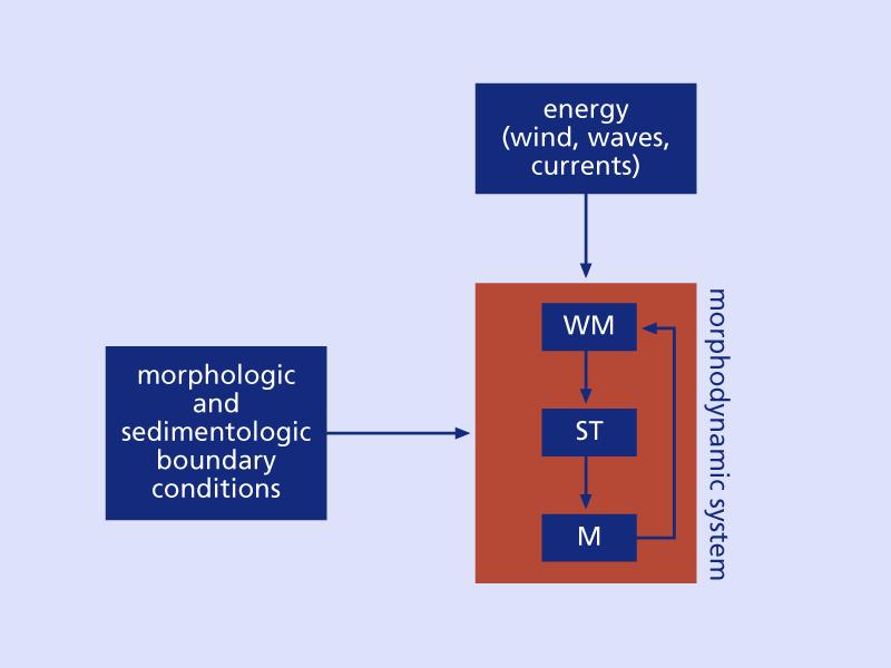
The Systems Approach. Alun Williams, ABPmer
 The Systems Approach Alun Williams, ABPmer Overview What is A Systems Approach? Behavioural / Qualitative Modelling? System Definition / Mapping (Behavioural Statements Objective) What is a Systems Approach?
Importance of Understanding Coastal Landforms
 Importance of Understanding Coastal Landforms Costa Concordia Shipwreck, Isola del Giglio, Italy Depositional Coastal Landforms Can interpret landforms in light of geomorphic processes, both terrestrial
GIS 2010: Coastal Erosion in Mississippi Delta
 1) Introduction Problem overview To what extent do large storm events play in coastal erosion rates, and what is the rate at which coastal erosion is occurring in sediment starved portions of the Mississippi
GenCade. Combining and Extending the GENESIS and Cascade Models for Planning and Design in a Regional Sediment Management Framework
 GenCade Combining and Extending the GENESIS and Cascade Models for Planning and Design in a Regional Sediment Management Framework G Presented by Nicholas C. Kraus For the GenCade Development Team Ken
Aim and objectives Components of vulnerability National Coastal Vulnerability Assessment 2
 ASSESSING THE UTILITY OF GEOMORPHIC SENSITIVITY MAPPING ON THE ILLAWARRA COAST Pamela Abuodha, Christina Baker, Chris Sharples, Darren Skene and Colin Woodroffe Geoquest Research Centre, University of
Geology Setting Management Options Management Structure
 Geology Setting Management Options Management Structure WFF = Wallops Flight Facility LST = Longshore sediment transport SLR = Sea level rise September 29, 2015 Accomack County/Accomack Northampton County
Donald K. Stauble and Bill Birkemeier Coastal and Hydraulics Laboratory US Army Corps of Engineers
 Donald K. Stauble and Bill Birkemeier Coastal and Hydraulics Laboratory US Army Corps of Engineers Define the Problem Navigation Shore Protection Environmental Political So what is the problem? Management
Holocene evolution of Dahab coastline Gulf of Aqaba, Sinai Peninsula, Egypt 1
 Holocene evolution of Dahab coastline Gulf of Aqaba, Sinai Peninsula, Egypt 1 Magdy Torab* 2 * Prof. of Geomorphology, Department of Geography, Damanhour University, Egypt 3 E-mail: magdytorab@hotmail.com.
Ocean and Coastal Processes. Ocean Basins. Chapter 20. Ocean Basins and Plates. Ocean Terms. Sea Arch Bay-mouth Bar Spit Tombolo Coast.
 Chapter 20 Ocean Basins and Plates Ocean and Coastal Processes Tide Wave Height Length Period Base Refraction Tsunami Beach Sea stack Ocean Terms Sea Arch Bay-mouth Bar Spit Tombolo Coast Emergent Submergent
BYPASS IN GROYNE FIELDS: CASE STUDY ALONG THE LOBITO SPIT
 BYPASS IN GROYNE FIELDS: CASE STUDY ALONG THE LOBITO SPIT Sten Esbjørn Kristensen 1, Nils Drønen 2, Rolf Deigaard 3, Berry Elfrink 4 Abstract The Lobito spit, in Angola, is fronted by a groyne field along
Coasts Key Word Glossary
 Coasts Key Word Glossary Abrasion Also known as corrosion. It is the wearing away of the cliff by sand, fragments of rock and boulders that are being hurled at the cliff by the waves. It causes grinding
Coastal issues: Beaches and Estuaries
 Coastal issues: Beaches and Estuaries Definitions: Coast = broad zone where both marine & terrestrial processes act It includes the beach, lagoons, marshes, bars etc. Coastal processes act to shape the
Usage of remote sensing data for the identification of Shoreline evolution of the Holderness, UK
 Usage of remote sensing data for the identification of Shoreline evolution of the Holderness, UK STEPHANIE D. MONTALVO DELGADO Geology Department, University of Puerto Rico, Mayagüez Campus P.O. Box 9017
Chapter 17. Ocean and Coastal Processes
 Chapter 17 Ocean and Coastal Processes Ocean Basins and Plates Ocean Basins Ocean Basins are profoundly different from the continents. Ocean crust is thin and dense and young. New ocean crust is generated
Active Coastal Processes in the Lubec Embayment
 The Lubec Embayment Maine Geologic Facts and Localities August, 1998 Active Coastal Processes in the Lubec Embayment 44 49 50.51 N, 66 59 34.16 W Text by Joseph T. Kelley, Department of Agriculture, Conservation
Unit 1: Water Systems on Earth Chapter 2
 Unit 1: Water Systems on Earth Chapter 2 Create a mind map with the driving question, Why are Oceans Important? Remember: Why are oceans so important? Why are oceans so important? Primary water source
Phillip Island Nature Parks Coastal Process Study 8 October 2014
 Phillip Island Nature Parks Coastal Process Study 8 October 2014 Project Overview Coastal Geology Basaltic and fragmented lavas, granite at Pyramid Rock and Cape Woolamai Weathered basalt (>10m thick)
Map 9: Ayrshire Coast: Stevenston Pier to Barassie Map Content Descriptions
 Map 9: Ayrshire Coast: Stevenston Pier to Barassie Map Content Descriptions 1. Built Heritage and Archaeology A total of thirteen sites were recorded in the area covered by Map 9. Of these five were previously
Monitoring Shoreline Change along Assateague Barrier Island: The First Trend Report
 Journal of Coastal Research SI 64 8-84 ICS211 (Proceedings) Poland ISSN 749-28 Monitoring Shoreline Change along Assateague Barrier Island: The First Trend Report N. P. Psuty and T. M. Silveira Marine
II Why study coastal landforms?
 COASTAL LANDFORMS (32) I Main topics A Why study coastal landforms? B Sediment budget and system response C Coastal landforms 3/26/15 GG454 1 II Why study coastal landforms? A Dynamic systems B Reflect
Climate Change and Gravel-Beach Responses: Hawke s Bay, New Zealand
 Conference Proceedings, 2015 Solutions of Coastal Disasters, Boston, MA COPRI, American Society of Civil Engineers Climate Change and Gravel-Beach Responses: Hawke s Bay, New Zealand Paul D. Komar 1 and
The U.S. Army Corps of Engineers Philadelphia District
 The U.S. Army Corps of Engineers Philadelphia District The Atlantic Coast of New Jersey Regional Sediment Budget 1986-2003 Cape May Point to Manasquan Inlet Final Report March 2006 The Atlantic Coast of
SEGMENTED BREAKWATERS AND THEIR USE IN COASTAL LOUISIANA
 SEGMENTED BREAKWATERS AND THEIR USE IN COASTAL LOUISIANA Prepared by: Louisiana Coastal Protection and Restoration Authority Engineering Division March 2016 The geology of Louisiana s coastal zone is intimately
Holderness Erosion and Evolution of the Spurn Peninsula
 Holderness Erosion and Evolution of the Spurn Peninsula Prof. Ken Pye and Dr. Simon Blott Kenneth Pye Associates Ltd. Outline of the Presentation Overview of historical erosion trends Effects of coast
Integrated geological approach to the study of coastal subsidence in Emilia-Romagna. Luisa PERINI Calabrese Lorenzo, Luciani Paolo, Severi Paolo,
 Integrated geological approach to the study of coastal subsidence in Emilia-Romagna Luisa PERINI Calabrese Lorenzo, Luciani Paolo, Severi Paolo, Subsidence hazard of Emilia-Romagna coastal plain Caputo
New modelling tools for coastal problems related to climate change
 New modelling tools for coastal problems related to climate change Nils Drønen Coastal and Estuarine Department, CED, DHI Climate change and coastal engineering Natural system Beach and dune system Coastal
Temporal and spatial scales of the features and processes forming the Polish Baltic Sea coast
 The coasts of the North Sea and the Baltic Sea under climate change - synthesis of German and Polish strategies for development and prediction, Hamburg, 11 12 October, 2016, German Polish Seminar Temporal
Map Introduction: South Uist Map 1
 96 Map Introduction: Map This map section covers part of the south coast of, including the head of the causeway which links the island to Eriskay. It extends from South Glen Dale to Taobh a'caolas. There
Cross Boundary Issues
 6 Cross Boundary Issues 6 C R O S S B O U N D A R Y I S S U E S 6.1 Introduction The effects of an activity within the coastal marine area are often felt in adjacent areas, outside of the immediate vicinity
Tony Pratt, DNREC to The Center for the Inland Bays Scientific and Technical Advisory Committee. August 21, 2009
 Sea Level Rise in Delaware Presented by Tony Pratt, DNREC to The Center for the Inland Bays Scientific and Technical Advisory Committee August 21, 2009 Sea level has been fluctuating ever since there have
BARRIER MORPHODYNAMICS UNDER MICRO-TIDAL AND LOW TO MODERATE WAVE CONDITIONS, RØDSAND, DENMARK. Abstract
 BARRIER MORPHODYNAMICS UNDER MICRO-TIDAL AND LOW TO MODERATE WAVE CONDITIONS, RØDSAND, DENMARK Oliver Ries 1, Nils Drønen 2 and Aart Kroon 3 Abstract Coastal barriers often form a protection of the hinterland
Graduate School of Civil and Ecological Engineering, I-Shou University, Kaohsiung, Taiwan, R.O.C.
 Journal of Civil Engineering and Architecture 10 (2016) 1297-1303 doi: 10.17265/1934-7359/2016.11.011 D DAVID PUBLISHING Ho-Shong Hou Graduate School of Civil and Ecological Engineering, I-Shou University,
Soil erosion susceptibility and coastal evolution: examples in southern New Caledonia
 Pacific Island Countries GIS /RS User Conference Soil erosion susceptibility and coastal evolution: examples in southern New Caledonia Pascal DUMAS et Olivier COHEN University of New-Caledonia (EA 4242/
Objectives. Vocabulary
 Shoreline Features Objectives Explain how shoreline features are formed and modified by marine processes. Describe the major erosional and depositional shoreline features. Vocabulary wave refraction beach
Shoreline Evolution: City of Hampton, Virginia Chesapeake Bay, Back River, and Hampton River Shorelines
 Shoreline Evolution: City of Hampton, Virginia Chesapeake Bay, Back River, and Hampton River Shorelines Virginia Insitute of Marine Science College of William & Mary Gloucester Point, Virginia September
Shoreline Mapping & Erosion Patterns. Julia Knisel Julia Knisel Coastal Shoreline & Floodplain Manager
 Shoreline Mapping & Erosion Patterns Along the Massachusetts Coast Julia Knisel Julia Knisel Coastal Shoreline & Floodplain Manager CZM Shoreline Change Project Timeline 1989: produced coast wide maps
Scenarios for the NI coast in the 21 st Century
 Scenarios for the NI coast in the 21 st Century Prof Julian Orford Geography, Archaeology & Palaeoecology Queen s University, Belfast Challenging perspective Living by the coast is good for your health!
Shoreline Mapping and Coastal Change Studies Along Chennai Coast Using Remote Sensing and GIS Merin Jose, Glitson Francis Pereira, S.
 2018 IJSRST Volume 4 Issue 5 Print ISSN: 2395-6011 Online ISSN: 2395-602X Themed Section: Science and Technology Shoreline Mapping and Coastal Change Studies Along Chennai Coast Using Remote Sensing and
Remote sensing and GIS for multi-hazard risk assessments in the coastal zone: recent applications and challenges in the Pacific Jens Kruger
 Remote sensing and GIS for multi-hazard risk assessments in the coastal zone: recent applications and challenges in the Pacific Jens Kruger Geoscience Division Pacific Community (SPC) The First Pacific
Developed in Consultation with Florida Educators
 Developed in Consultation with Florida Educators Table of Contents Next Generation Sunshine State Standards Correlation Chart... 7 Benchmarks Chapter 1 The Practice of Science...................... 11
The "Geo-Information System Coast Mecklenburg-Vorpommern"
 The "Geo-Information System Coast Mecklenburg-Vorpommern" Lars Tiepolt State Office for Environment and Nature Rostock, Germany Abstract The Division Coast of the State Office for Environment and Nature
Mapping Coastal Change Using LiDAR and Multispectral Imagery
 Mapping Coastal Change Using LiDAR and Multispectral Imagery Contributor: Patrick Collins, Technical Solutions Engineer Presented by TABLE OF CONTENTS Introduction... 1 Coastal Change... 1 Mapping Coastal
Section 2.1 Ocean Basins. - Has helped determine where ocean basins are located. - Tectonic plates move changing the position of the continents.
 Science 8 Unit 1: Water Systems on Earth Chapter 2: Oceans Control the Water Cycle Section 2.1 Ocean Basins Oceans are important because: 1. Primary water source for the water cycle 2. Control weather
Weathering of Rocks. Weathering - Breakdown of rocks into pieces (sediment) 2 main types of weathering to rocks
 2 main types of weathering to rocks") Weathering of Rocks Weathering - Breakdown of rocks into pieces (sediment) 2 main types of weathering to rocks Mechanical weathering requires physical forces to break rocks into smaller pieces. Chemical
Weathering of Rocks Weathering - Breakdown of rocks into pieces (sediment) 2 main types of weathering to rocks Mechanical weathering requires physical forces to break rocks into smaller pieces. Chemical
Jasper Beach, Machiasport, Maine
 Maine Geologic Facts and Localities June, 2000 Jasper Beach, Machiasport, Maine 44 o 38 30.28 N, 67 o 22 31.96 W Text by Joesph T. Kelley, Department of Agriculture, Conservation & Forestry 1 Map by USGS
26 Coastal erosion and accretion
 26 Coastal erosion and accretion 26.1 Rate of erosion and accretion 26.2 Length of protected coastline 26.3 Volume of sand nourishment Fig. 26.1: Coastline dynamics of the South East Baltic region Key
Earth Science Lesson Plan Quarter 2, Week 10, Day 1
 Earth Science Lesson Plan Quarter 2, Week 10, Day 1 Outcomes for Today Standard Focus: PREPARE 1. Background knowledge necessary for today s reading. Beaches are created by the actions of waves, tides,
A Quantitative Assessment of Human Interventions and Climate Change on the West African sediment budget
 Public Disclosure Authorized Public Disclosure Authorized A Quantitative Assessment of Human Interventions and Climate Change on the West African sediment budget Public Disclosure Authorized The West African
Example Quiz on Earthquakes
 Example Quizzes, Tests, and Review Information A Example Quiz on Earthquakes Quizzes such as this one are given at the beginning of each lab. 1. The point beneath the Earth s surface at which an earthquake
Map 2: Cowal Peninsula: Lazaretto Point to Dunoon Harbour North Map Content Descriptions
 Map 2: Cowal Peninsula: Lazaretto Point to Dunoon Harbour North Map Content Descriptions 1. Built Heritage and Archaeology A total of thirteen sites were recorded in the area covered by Map 2. Of these
Hurricanes and Storm Surge : Before coming to lab, visit the following web site:
 Geol 108 Lab #7 Week of October 15-19, 2012 Coastal Studies Hurricanes and Storm Surge : Before coming to lab, visit the following web site: http://www.usatoday.com/graphics/weather/gra/gsurge/flash.htm
Shoreline Evolution: Lancaster County, Virginia Rappahannock River and Chesapeake Bay Shorelines
 Shoreline Evolution: Lancaster County, Virginia Rappahannock River and Chesapeake Bay Shorelines Virginia Institute of Marine Science College of William & Mary Gloucester Point, Virginia March 2012 Shoreline
2.2.7 Backbarrier flats
 FIGURE 24. VERTICAL PHOTOGRAPH SHOWING THE DEVELOPMENT OF SMALL PARABOLIC DUNES FROM BLOWOUTS IN A LARGE RELICT FOREDUNE NORTHWEST OF HUNTER'S CREEK. PHOTOGRAPH COURTESY OF CAR'T'ER HOLT HARVEY FORESTS
Shoreline Evolution: Prince William County, Virginia Potomac River, Occoquan Bay, and Occoquan River Shorelines
 Shoreline Evolution: Prince William County, Virginia Potomac River, Occoquan Bay, and Occoquan River Shorelines Virginia Institute of Marine Science College of William & Mary Gloucester Point, Virginia
Earth Science Chapter 9. Day 6 - Finish Capillary Action Lab - Quiz over Notes - Review Worksheets over Sections 9.2 and 9.3
 Earth Science Chapter 9 Day 1 Day 2 Day 3 Read Section 9.1 Surface Water Chapter 9 Term Sheet Notes over Section 9.1 Surface Water Section 9.1 Review Worksheets Quiz over Section 9.1 Notes Virtual Lab
The Use of Geographic Information Systems to Assess Change in Salt Marsh Ecosystems Under Rising Sea Level Scenarios.
 The Use of Geographic Information Systems to Assess Change in Salt Marsh Ecosystems Under Rising Sea Level Scenarios Robert Hancock The ecological challenges presented by global climate change are vast,
Environment Bay of Plenty Ohope Beach system
 Environment Bay of Plenty 7 5. Ohope Beach system Environmental Publication 27/ NERMN Beach Profile Monitoring Environment Bay of Plenty 5..1 Ohope Spit (CCS 9) Discussion The site is located 2m to the
COASTAL QUATERNARY GEOLOGY MAPPING FOR NSW: EXAMPLES AND APPLICATIONS
 COASTAL QUATERNARY GEOLOGY MAPPING FOR NSW: EXAMPLES AND APPLICATIONS A Troedson Geological Survey of New South Wales Abstract Detailed geological mapping of the coastal plains of regional NSW was undertaken
Coastal Vulnerability and Risk Parameters
 European Water 11/12: 3-7, 2005. 2005 E.W. Publications Coastal Vulnerability and Risk Parameters E. Doukakis National Technical University of Athens-Dept. of Rural and Surveying Engineering, Lab. of Higher
Map 12: Ayrshire Coast: Doonfoot Beach to Dunure Map Content Descriptions
 Map 12: Ayrshire Coast: Doonfoot Beach to Dunure Map Content Descriptions 1. Built Heritage and Archaeology A total of twenty three sites were located in the area covered by Map 12. Of these seventeen
Primer on Coastal Erosion And Habitat Creation
 2 nd Regional Conference Dredging, Beach Nourishment & Bird Conservation Primer on Coastal Erosion And Habitat Creation Timothy Kana Ph.D Source: Newsday 1962 Photo by Kelsey Aerials 1978 Source: U Mass
Barrier Island Accretion and Geomorphological Evolution of Keewaydin Island, Collier County, Florida
 Barrier Island Accretion and Geomorphological Evolution of Keewaydin Island, Collier County, Florida Karyn I. Novakowski Geosciences Department, Franklin and Marshall College, 501 Harrisburg Pike, Lancaster,
Beach nourishment behaviour Modeling of beach nourishment planform evolution: a case study of the coast of North Zealand
 Institut for Geovidenskab og Naturforvaltning Beach nourishment behaviour Modeling of beach nourishment planform evolution: a case study of the coast of North Zealand Serena Pilunnguaq Sørensen & Sofie
Coastal Sediment Properties and Longshore Sediment Transport
 Coastal Sediment Properties and Longshore Sediment Transport Julie Rosati Julie.D.Rosati@erdc.usace.army.mil 601-634-3005 Coastal Planning Course Lesson #8 Tuesday 8:00-9:00 am CEM III-1, III-2 1. Coastal
MEMORANDUM FOR SWG
 MEMORANDUM FOR SWG-2007-1623 Subject: Jurisdictional Determination (JD) for SWG-2007-1623 on Interdunal Wetlands Adjacent to Traditional Navigable Waters (TNWs) Summary The U.S. Environmental Protection
Shoreline Evolution: Richmond County, Virginia Rappahannock River Shorelines
 Shoreline Evolution: Richmond County, Virginia Rappahannock River Shorelines Virginia Institute of Marine Science College of William & Mary Gloucester Point, Virginia September 2011 Shoreline Evolution:
RESULTS FROM THE TEXAS COASTAL SEDIMENT SOURCES: A GENERAL EVALUATION STUDY
 RESULTS FROM THE TEXAS COASTAL SEDIMENT SOURCES: A GENERAL EVALUATION STUDY JUAN MOYA KELSEY CALVEZ CRIS WEBER ANTHONY RISKO *KEVIN FRENZEL FREESE AND NICHOLS, INC. COASTAL AND WATERWAYS GROUP OBJECTIVES
Landslide & Coastal Erosion Risk Reduction at Oregon s Water/Wastewater Networks
 Landslide & Coastal Erosion Risk Reduction at Oregon s Water/Wastewater Networks Laura Gabel, RG (with Bill Burns, RG & Jonathan Allan, Ph. D) Oregon Department of Geology and Mineral Industries (541)
CHAPTER 28. PHYSIOGRAPHY Cook Inlet Drainages
 PEBBLE PROJECT ENVIRONMENTAL BASELINE DOCUMENT 2004 through 2008 CHAPTER 28. PHYSIOGRAPHY Cook Inlet Drainages PREPARED BY: Knight Piésold Ltd. PHYSIOGRAPHY COOK INLET DRAINAGES TABLE OF CONTENTS TABLE
The Science of Sea Level Rise and the Impact of the Gulf Stream
 Old Dominion University ODU Digital Commons July 29, 2016: The Latest in Sea Level Rise Science Hampton Roads Sea Level Rise/Flooding Adaptation Forum 7-29-2016 The Science of Sea Level Rise and the Impact
EROSIONAL RATES IN THE POINT AUX CHENES BAY AREA, MISSISSIPPI: Kathleen P. Wacker G. Alan Criss INTRODUCTION
 Summary of a Paper Presented at the: Sixtieth Annual Meeting of the Mississippi Academy of Sciences in Jackson, Mississippi February 22, 1996 ===============================================================
COASTAL DATA APPLICATION
 2015 Coastal GeoTools Proactive By Design. Our Company Commitment COASTAL DATA APPLICATION Projecting Future Coastal Flood Risk for Massachusetts Bay Bin Wang, Tianyi Liu, Daniel Stapleton & Michael Mobile