Aquifer Systems in Southern Ontario: Hydrogeological Considerations for Well Drilling and Plugging
|
|
|
- Arron Thornton
- 6 years ago
- Views:
Transcription

1 Aquifer Systems in Southern Ontario: Hydrogeological Considerations for Well Drilling and Plugging Terry R. Carter, Ontario Ministry of Natural Resources Lee Fortner, Ontario Ministry of Natural Resources Mitchell E. Skuce, University of Western Ontario Fred J. Longstaffe, University of Western Ontario Canadian Society of Petroleum Geologists Calgary, Alberta May 13, 2014
2 Background Ministry of Natural Resources (MNR) regulates oil and gas industry in Ontario Oil, Gas and Salt Resources Act requires isolation of potable water aquifers and other porous and permeable intervals during well drilling, construction and plugging to prevent movement and mixing of fluids. MNR Abandoned Works Program plugs orphan wells with no identifiable operator other than landowner Accurate knowledge of geology and hydrogeology needed by industry to protect environment, design drilling and plugging programs, anticipate drilling hazards MNR to assess well licence applications, monitor industry compliance, design plugging programs for Abandoned Works wells Map drilling hazards: sulphur water, artesian flow, karst


3 Steel casing + Sulphur water = Corrosion


4 Artesian Flow - Sulphur Water


5 Flowing Sulphur Water in Lucas Formation Big Otter Ck Big Ck Hemlock Ck Dundee Lucas Amherstburg Marcellus


6 Before During Plugging T T T T012355


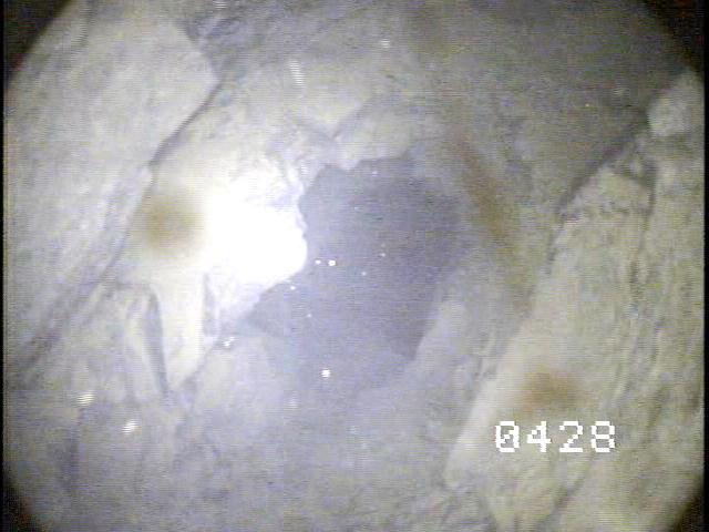
7 Karst Grike Bruce peninsula Guelph Fm - Bruce Peninsula Cave entrance Eramosa ANSI Guelph Fm T007290


8 Incompetent Bedrock
9 Aquifer Mapping & Isotopic Fingerprinting In 2009 a project to map regional bedrock aquifers in southern Ontario was initiated by MNR, with focus on the sulphur water zone and potable water made possible by improvements to MNR petroleum well database and custom ArcGIS extension PetroGIS QA checks of 35,000 water records, construction of water type maps and static level maps Project scope expanded in 2011 to acquire isotopic and geochemical fingerprints of formation waters and gases to identify source of leaking fluids at orphan wells and fluid origin Joint project with University of Western Ontario Dr. Fred Longstaffe: principal researcher Mitchell Skuce: Formation waters Dr. Joanne Potter: Natural gas

10 Bedrock Geology Unconformity 250+ Ma! Paleozoic marine sedimentary rocks Ma Drift 10 ka 2.6 Ma Precambrian >1 Ga Geological Survey of Canada Map 1263A

11 Bedrock Geology Shallowly-dipping bedrock strata form subcrop belts at surface Deeply eroded
12 Water Types Terminology Fresh water contains less than 1,000 ppm TDS 500 ppm TDS MOE & Canada Drinking Water Standard Brackish 1,000 to 10,000 ppm TDS Saline 10,000 to 100,000 ppm TDS Brine - >100,000 ppm TDS Sulphur water water containing dissolved hydrogen sulfide
13 Sources of Information Outcrops, road cuts, quarries New Isotopic and hydrogeochemical data from 130 water samples MOE water well records (drift and very shallow bedrock) MNR petroleum well records: Ontario Geological Survey Hobbs et al (2011), Dollar (1988), Weaver (1994), Armstrong and Carter (2010), Hamilton (2010), MacRitchie et al (1994), Singer et (1997), Lazorek and Carter (2008), Skuce (2014), Sharpe et al (2014), Carter (2012), others Acknowledgements Lee Fortner, Frank Brunton, Chris Smart, Theo Beukeboom, Dick Jackson, Jeff Markle, Derek Armstrong, Dave Sharpe, Scott MacRitchie, Mitchell Skuce, Fred Longstaffe, Candace Freckelton, Jonathon Sykes, Jordan Clark and others

14 Petroleum Well Records - MNR Records for over 26,000 wells Ontario Petroleum Data System 35,000 water records
")
15 Water well records - MOE Records for over 400,000 wells in southern Ontario Very few wells penetrate more than 10 metres into bedrock Water Well Information System (from Singer, Cheng, and Scafe 1997)
16 Aquifer Mapping by Water Type 35,000 water records in petroleum well database Water type as recorded by driller for petroleum wells drilled by cable tool method & plotted by formation Fresh water (FRE) Sulphur water (SUL) Brine (SAL)


17 Water Type Map: Guelph Fm Fresh m Karstic Reefal Facies Brine 200+ m 134, ,000 ppm TDS Sulphur Water m Bedrock Geology Port Lambton Group Kettle Point Hamilton Group Marcellus Dundee Lucas Amherstburg Bois Blanc Bass Islands Salina Guelph Amabel
18 Aquifers by Water Type & Depth Fresh Sulphur Water Shallow Aquifers Lucas & Dundee formations Bass Islands Formation m m 200+ m Guelph Formation Brine Cambrian
19 Aquifer Systems southern Ontario Shallow (Fresh Water) Regime 1. Overburden Aquifer System 2. Interface Aquifer System 3. Karst Aquifer System Intermediate Regime 4. Sulphur Water Aquifer System Deep Regime 5. Brine Aquifer System
20 Shallow Aquifers 1. Overburden Aquifer System Fresh water in unconsolidated Recent sediments, and glacial sediments Tens of metres overburden thickness, max 260 m in moraines and bedrock valleys Complex a quifers of local extent, principal source of potable groundwater in southern Ontario
21 Shallow Aquifers 2. Interface/Contact Aquifer System Regional fresh water aquifer at interface between porous & permeable surficial sediments and less porous & permeable Paleozoic bedrock Includes uppermost few metres of bedrock which is usually jointed, weathered, porous Most extensive, continuous, fresh water aquifer in southern Ontario Ca-HCO3, Ca-SO4 ph 6.2 to 8.8 (measured in field) TDS, avg 731, median 494 (calculated from Hamilton, 2011) NOTE: fresh water only penetrates a few metres into bedrock unless the bedrock is karsted or fractured

22 Shallow Regime Contact Aquifer Glacial boulder till Bedrock Dundee Formation Water flow St Mary s quarry


23 Contact aquifer Joints at bedrock surface Kettle Point Kettle Point shales, L. Huron Whirlpool Formation, Niagara River Goat Island-Gasport (Amabel) dolostone, Bruce peninsula
24 Shallow Aquifers 3. Karst Aquifer System Fresh water aquifers in karst-influenced carbonate and evaporite bedrock near present day surface Local extent, complex, within outcropping bedrock or beneath shallow drift Extend as deep as 250 metres below surface

25 Karst in Outcrop Fresh water To 250 m

26 Interpreted Karst in Subcrop Fresh water metres below top of bedrock 130 Red = Karst Aquifer Blue = Contact Aquifer

27 Intermediate to Deep Regime Paleokarst Paleokarst All regional aquifers associated with paleokarst at unconformities Paleokarst Thin, regional extent Most deep bedrock formations are aquitards Paleokarst
28 Intermediate Regime 4. Sulphur Water Aquifer System Confined to unconfined aquifers of brackish to saline sulphur water separated by thick aquitards Anoxic conditions Moderate salinities 563 to 43,600 mg/l TDS ph 7.24 to 11.7 Oxygen/hydrogen isotopes indicate water is meteoricboth modern and Pleistocene Na-Ca-Cl, Ca-Na-SO4
29 Sulphur Water Aquifers Lucas & Dundee Bass Islands m Sulphur Water Guelph

30 Lucas Sulphur Water Discharge Port Dover Quarry sulphide-oxidizing bacteria Port Dover quarry

31 Lucas Sulphur Water Discharge: MacGregor Quarry Ironoxidizing bacteria Sulphuroxidizing bacteria
32 δ 2 H (VSMOW) Isotopic Ratios Sulphur Water -20 GLMWL = Great Lakes Meteoric Water Line Summer precip. avg. -80 Dundee -100 Winter Columbus precip. Lucas avg. Amherstberg -120 Coolerclimate Bass Islands Salina (subcrop) recharge Unknowns Skuce 2014 δ 18 O (VSMOW)
33 δ 18 O SO4 (VSMOW) Sulphate Isotopes evidence of 20 microbial activity 18 Cambrian-Devonian seawater sulphate Sulphur Water Dundee Detroit River Salina subcrop 12 Salina A-2 carbonate Salina A-1 carbonate Guelph 10 Deep Brines Clinton-Cataract Trenton-Black River Cambrian Unknown δ 34 S SO4 (CDT)
34 Deep incursion of Pleistocene Water Dundee Lucas Amherstburg 18O H O H O H O H O H Marcellus 18O H Downdip depletion in heavy isotopes modern to Pleistocene precipitation 18O - isotopic ratio 18O to 16O 2H isotopic ratio 2H to H
35 5. Deep Brine System Hydrocarbon reservoirs and thin confined regional brine aquifers, separated by thick aquitards No flow Anoxic Extreme salinities 134,000 to 515,000 mg/l TDS (Soy sauce contains ,000 mg/l) Na-Ca-Cl, Ca-Na-Cl Laboratory-measured ph 3 to 7 Isotopic compositions indicate water is evaporatively concentrated seawater 300+ million years old (Skuce, 2014, NWMO, 2011)
36 Deep Saline Aquifers Bass Islands Bois Blanc 200+ m Guelph Formation Cambrian
 GMWL = Global Meteoric Water Line")
37 δ 2 H (VSMOW) Isotopic Ratios - Deep Brine 0 Seawater Salina A-2 carbonate Salina A-1 carbonate Guelph Clinton-Cataract Trenton-Black River Cambrian mixed with meteoric water δ 18 O (VSMOW) GMWL = Global Meteoric Water Line Skuce 2014
38 δ 81 Br (SMOB) Cl and Br isotopes origin of dissolved 2.5 salt 2.0 Sulphur Water: dissolved halite Deep Brines: evaporated seawater δ 37 Cl (SMOC) Dundee Columbus Lucas Amherstburg Salina subcrop Salina A-2 carbonate Salina A-1 carbonate Guelph Clinton-Cataract Trenton-Black River Unknown Dundee (SS) Detroit River (SS) Guelph (SS) Thorold-Grimsby (SS) Whirlpool (SS) TBR (SS) Cambrian (SS) *(SS) = data from Shouakar-Stash (2008)

39 Origin of Dissolved Salt Saline sulphur water Fresh water Brine evaporated seawater Salt beds Geological Survey of Canada, Open File 401
40 Geological Groundwater Model before isotope data
41 Geological Groundwater Model - with isotope data Modern Meteoric Cold-climate Meteoric Brine evaporated seawater
42 Considerations for Drilling and Plugging Vertical zonation of water type must be isolated from each other Shallow fresh water - meteoric Intermediate sulphurous saline water meteoric with dissolved salt from bedrock Deep brine evaporatively concentrated seawater Fresh water up to 130 metres below top of bedrock in karst regions Regional fresh water aquifer at interface between drift and bedrock Hazards Artesian sulphur water flow in valleys north of Lake Erie Regional sulphur water zone at 30 to 450 metres Locally incompetent bedrock in Lucas Loss of circulation in shallow karst
43 Strontium Isotopes Deep Brines Sr/ 86 Sr Shallow Dundee Detroit River Salina subcrop Salina A-2 carbonate Salina A-1 carbonate Guelph Clinton-Cataract Trenton-Black River Cambrian total Sr (mg/l)
Shale Gas Opportunities in Southern Ontario an Update
 Shale Gas Opportunities in Southern Ontario an Update Terry Carter, Ministry of Natural Resources, London, ON Lee Fortner, Ministry of Natural Resources, London, ON Catherine Béland-Otis, Ontario Geological
Karst Assessment. March Prepared by: S.R.H. Worthington NWMO DGR-TR
 Karst Assessment March 2011 Prepared by: S.R.H. Worthington NWMO DGR-TR-2011-22 Karst Assessment March 2011 Prepared by: S.R.H. Worthington NWMO DGR-TR-2011-22 Karst Assessment - ii - March 2011 THIS
Origin and Evolution of Formation Waters in the West-Central Part of the Alberta Basin
 Page No. 004-1 Origin and Evolution of Formation Waters in the West-Central Part of the Alberta Basin Karsten Michael* University of Alberta, 1-26 ESB, Edmonton, AB T6G 2E3 karsten@ualberta.ca and Stefan
OIL AND GAS PLAYS OF THE MICHIGAN BASIN, SOUTHERN ONTARIO. Terry Carter, Consulting Geologist London, Ontario
 OIL AND GAS PLAYS OF THE MICHIGAN BASIN, SOUTHERN ONTARIO Terry Carter, Consulting Geologist London, Ontario 1 Ontario Petroleum Industries Oil and Natural Gas 1250 oil wells, 1200 gas wells, annual production
Ontario Ministry of Northern Development and Mines Submission to the Joint Review Panel Public Hearing Proposed Bruce Deep Geological Repository
 Ontario Ministry of Northern Development and Mines Submission to the Joint Review Panel Public Hearing Proposed Bruce Deep Geological Repository August 27, 2013 Background and Scope June 18, 2013, the
Follow this and additional works at: Part of the Geology Commons
 Western Michigan University ScholarWorks at WMU Michigan Geological Repository for Research and Education Geosciences 2016 Geology of Michigan William B. Harrison III Michigan Geological Repository for
Regional Hydrogeochemistry Southern Ontario
 Regional Hydrogeochemistry Southern Ontario March 2011 Prepared by: M.Y. Hobbs, S.K. Frape, O. Shouakar-Stash and L.R. Kennell NWMO DGR-TR-2011-12 Regional Hydrogeochemistry Southern Ontario March 2011
ONTARIO OIL, GAS & SALT RESOURCES LIBRARY - WELL DATA DESCRIPTION
 ONTARIO OIL, GAS & SALT RESOURCES LIBRARY - WELL DATA DESCRIPTION Note: all depth measurements are expressed in metres Note: and BER refere to the same unique well identification number. Note: KB means
Assessment of Porosity Data and Gas Phase Presence in DGR Cores
 Technical Report Title: Document ID: Authors: Assessment of Porosity Data and Gas Phase Presence in DGR Cores TR-08-34 Sean Sterling, Richard Jackson, Robert Walsh, Dru Heagle, and Ian Clark (University
Differentiation of chloride source using stable chlorine isotopes
 Differentiation of chloride source using stable chlorine isotopes RemTech 2009 Banff, Alberta October 14-16 2009 Dr. Alec Blyth and Tom Anthony 1 1 currently City of Calgary Background: DOW Chemical Canada
Michigan s Geology and Groundwater
 Michigan s Geology and Groundwater Ralph J. Haefner Deputy Director U.S. Geological Survey Michigan-Ohio Water Science Center Lansing, Michigan Outline About the USGS Geology 101 Michigan s geology Bedrock
Series Title: The Isotopic Characterization of Natural Gas and Water in Paleozoic Bedrock Formations in Southwestern Ontario
 1 Series Title: The Isotopic Characterization of Natural Gas and Water in Paleozoic Bedrock Formations in Southwestern Ontario Volume IV. The Isotopic Characterization of Natural Gas in Natural Gas Reservoirs
Geologic Considerations of Shallow SAGD Caprock; Seal Capacity, Seal Geometry and Seal Integrity, Athabasca Oilsands, Alberta Canada
 Geologic Considerations of Shallow SAGD Caprock; Seal Capacity, Seal Geometry and Seal Integrity, Athabasca Oilsands, Alberta Canada Gordon T. Stabb, Michael Webb Durando Resources Corp, Suncor Energy
Hydrogeology of Karst NE Wisconsin. Dr. Maureen A. Muldoon UW-Oshkosh Geology Department
 Hydrogeology of Karst NE Wisconsin Dr. Maureen A. Muldoon UW-Oshkosh Geology Department WI Bedrock Outline Karst Landscapes Existing WQ Data Flow in Karst Aquifers Overview of Silurian Aquifer Water Level
Basin Analysis Applied to Modelling Buried Valleys in the Great Lakes Basin
 EARTH SCIENCES SECTOR GENERAL INFORMATION PRODUCT 35 Basin Analysis Applied to Modelling Buried Valleys in the Great Lakes Basin Sharpe, D R; Russell, H A J 2004 Originally released as: Basin Analysis
Oriented Core Logging of DGR-5 and DGR-6. Steve Gaines, Kenneth Raven and Michael Melaney
 Technical Report Title: Document ID: Authors: Oriented Core Logging of DGR-5 and DGR-6 TR-09-09 Steve Gaines, Kenneth Raven and Michael Melaney Revision: 0 Date: April 8, 2011 DGR Site Characterization
The Niagara Escarpment extends from western New York, through the GTA all the way up to Manitoulin Island and into Michigan and Wisconsin.
 is southern Ontario s most prominent topographic feature, extending more than 500 kilometres from western New York, through Niagara Falls and the western part of the Greater Toronto Area (GTA), and north
Search and Discovery Article #80372 (2014) Posted May 12, 2014
 Posted May 12, 2014") Paleozoic Stratigraphic Framework beneath the Muskeg River Mine, Northeastern Alberta (Twp 95, Rge 9-10W4): Controls and Constraints on Present Day Hydrogeology* R. Mahood 1, M. Verhoef 1, and F.A. Stoakes
Paleozoic Stratigraphic Framework beneath the Muskeg River Mine, Northeastern Alberta (Twp 95, Rge 9-10W4): Controls and Constraints on Present Day Hydrogeology* R. Mahood 1, M. Verhoef 1, and F.A. Stoakes
Karst found mostly in limestone (rock with at least 50% carbonate minerals), depends on 1) permeability & porosity
, depends on 1) permeability & porosity") KARST LANDFORMS produced by weathering & erosion in regions of carbonate rocks and evaporites processes called karstification mainly below ground surface predominantly underground drainage poorly-developed
KARST LANDFORMS produced by weathering & erosion in regions of carbonate rocks and evaporites processes called karstification mainly below ground surface predominantly underground drainage poorly-developed
the Quarrying Industry Dewatering and the Quarrying Industry the Quarrying Industry
 Dewatering and the Quarrying Industry Dewatering and Dewatering and the Quarrying Industry the Quarrying Industry Les Brown Eugene P. Daly John Kelly Objectives 1) To present a summary of water management
 12 10 8 6 4 2 0 40-50 50-60 60-70 70-80 80-90 90-100 Fresh Water What we will cover The Hydrologic Cycle River systems Floods Groundwater Caves and Karst Topography Hot springs Distribution of water in
Regional and site geological frameworks proposed Deep Geologic Repository, Bruce County, Ontario
 Regional and site geological frameworks proposed Deep Geologic Repository, Bruce County, Ontario Kenneth Raven, Sean Sterling, Steven Gaines and Andrew Wigston Intera Engineering Ltd., Ottawa, Ontario,
11/22/2010. Groundwater in Unconsolidated Deposits. Alluvial (fluvial) deposits. - consist of gravel, sand, silt and clay
 deposits. - consist of gravel, sand, silt and clay") Groundwater in Unconsolidated Deposits Alluvial (fluvial) deposits - consist of gravel, sand, silt and clay - laid down by physical processes in rivers and flood plains - major sources for water supplies
Groundwater in Unconsolidated Deposits Alluvial (fluvial) deposits - consist of gravel, sand, silt and clay - laid down by physical processes in rivers and flood plains - major sources for water supplies
WATER QUANTITY STRESS ASSESSMENT
 Chapter 3 WATER QUANTITY STRESS ASSESSMENT APPROVED ASSESSMENT REPORT for the Northern Bruce Peninsula Source Protection Area October 15, 2015 Northern Bruce Peninsula Source Protection Area This page
Trenton-Black River (TBR) hydrothermal dolomite (HTD) reservoir model
 hydrothermal dolomite (HTD) reservoir model") The Ontario phase of the Trenton-Black River (TBR) hydrothermal dolomite (HTD) play: Historical context and contributions to a modern exploration model Terry Carter, Ministry of Natural Resources, London,
The Ontario phase of the Trenton-Black River (TBR) hydrothermal dolomite (HTD) play: Historical context and contributions to a modern exploration model Terry Carter, Ministry of Natural Resources, London,
Regional groundwater mapping and model
 Regional groundwater mapping and model Boyd, Dwight 1, Steve Holysh 2, and Jeff Pitcher 1 1 Grand River Conservation Authority, Canada; 2 Regional Municipality of Halton, Canada The Grand River forms one
Structural Deformation and Karst in the Devonian Waterways Formation: Examples from Outcrops along the Athabasca River*
 Structural Deformation and Karst in the Devonian Waterways Formation: Examples from Outcrops along the Athabasca River* Chris L. Schneider 1 and Matthias Grobe 2 Search and Discovery Article #51073 (2015)
HYDROGEOLOGIC MODELLING IN SUPPORT OF OPG S PROPOSED DEEP GEOLOGIC REPOSITORY, TIVERTON ONTARIO
 HYDROGEOLOGIC MODELLING IN SUPPORT OF OPG S PROPOSED DEEP GEOLOGIC REPOSITORY, TIVERTON ONTARIO Eric A. Sykes 1, Jonathan F. Sykes 2, Edward A. Sudicky 1, Shaun K. Frape 1 1 Department of Earth Sciences
Chapter 14: Groundwater. Fig 14.5b
 Chapter 14: Groundwater Fig 14.5b OBJECTIVES Recognize that groundwater is a vital source of accessible freshwater. Describe how groundwater forms below the water table. Explain the origin of aquifers,
MIDDLE DEVONIAN PLAY MICHIGAN BASIN OF ONTARIO. Duncan Hamilton
 MIDDLE DEVONIAN PLAY MICHIGAN BASIN OF ONTARIO Duncan Hamilton 1 Middle Devonian Pools of the Michigan Basin 375+ Million Barrels Michigan 45+ million Barrels Ontario 2 Outline of Presentation History
Alex Haluszka Gordon MacMillan Matrix Solutions Inc. Simon Maev Laurus Energy Canada Inc.
 Alex Haluszka Gordon MacMillan Matrix Solutions Inc. Simon Maev Laurus Energy Canada Inc. Objectives Underground Coal Gasification has potential in Alberta UCG background UCG and groundwater Laurus Energy
Buried-valley Aquifers: Delineation and Characterization from Reflection Seismic and Core Data at Caledon East, Ontario
 Buried-valley Aquifers: Delineation and Characterization from Reflection Seismic and Core Data at Caledon East, Ontario Russell, H.A.J. 1, S.E. Pullan 1, J.A. Hunter 1, D.R. Sharpe 1, and S. Holysh 2 1
Identifying Sensitive Aquifers in Ohio
 State of Ohio Environmental Protection Agency Division of Drinking and Ground Waters Identifying Sensitive Aquifers in Ohio May 2007 Ted Strickland, Governor Chris Korleski, Director Acknowledgments Ohio
HYDROGEOLOGICAL PROPERTIES OF THE UG2 PYROXENITE AQUIFERS OF THE BUSHVELD COMPLEX
 R. Gebrekristos, P.Cheshire HYDROGEOLOGICAL PROPERTIES OF THE UG2 PYROXENITE AQUIFERS OF THE BUSHVELD COMPLEX R. Gebrekristos Digby Wells Environmental P. Cheshire Groundwater Monitoring Services Abstract
Oak Ridges Moraine Aquifer Vulnerability Mapping
 Accompanying Document to the Reference Map for Ontario Regulation 140/02 (Oak Ridges Moraine Conservation Plan) March 2004 2 1. Purpose of Report Accompanying Document to the Reference Map for Ontario
1.72, Groundwater Hydrology Prof. Charles Harvey Lecture Packet #5: Groundwater Flow Patterns. Local Flow System. Intermediate Flow System
 1.72, Groundwater Hydrology Prof. Charles Harvey Lecture Packet #5: Groundwater Flow Patterns c Local Flow System 10,000 feet Intermediate Flow System Regional Flow System 20,000 feet Hydrologic section
Investigation of Devonian Unconformity Surface Using Legacy Seismic Profiles, NE Alberta
 Investigation of Devonian Unconformity Surface Using Legacy Seismic Profiles, NE Alberta Elahe P. Ardakani and Douglas R. Schmitt Department of Physics, University of Alberta Summary The Devonian Grosmont
ISOTOPE GEOCHEMISTRY OF GEOTHERMAL WATERS IN NORTHERN NORTH CHINA BASIN: IMPLICATIONS ON DEEP FLUID MIGRATION
 ISOTOPE GEOCHEMISTRY OF GEOTHERMAL WATERS IN NORTHERN NORTH CHINA BASIN: IMPLICATIONS ON DEEP FLUID MIGRATION PANG Zhonghe Institute of Geology and Geophysics, Chinese Academy of Sciences, Beijing, China,
Geological Mapping using Geophysics
 Geological Mapping using Geophysics Pugin, A.J.M. and T.H. Larson Illinois State Geological Survey, 615 E Peabody Dr., Champaign, IL 61820; E-mail: A.J.M. Pugin at pugin@isgs.uiuc.edu Mapping Techniques.
Lab 9: Petroleum and groundwater
 Geology 101 Name(s): Lab 9: Petroleum and groundwater Petroleum (oil) is a multi-component liquid refined to generate different hydrocarbons, such as heptane (a component of gasoline) and waxes. For the
Groundwater. (x 1000 km 3 /y) Reservoirs. Oceans Cover >70% of Surface. Groundwater and the. Hydrologic Cycle
 Reservoirs. Oceans Cover >70% of Surface. Groundwater and the. Hydrologic Cycle") Chapter 13 Oceans Cover >70% of Surface Groundwater and the Hydrologic Cycle Oceans are only 0.025% of Mass Groundwater Groundwater is liquid water that lies in the subsurface in fractures in rocks and
Chapter 13 Oceans Cover >70% of Surface Groundwater and the Hydrologic Cycle Oceans are only 0.025% of Mass Groundwater Groundwater is liquid water that lies in the subsurface in fractures in rocks and
Lines-of-Evidence Approach to the Evaluation of Stray Gas Incidents
 Lines-of-Evidence Approach to the Evaluation of Stray Gas Incidents Lisa Molofsky, Ann Smith, John Connor, Shahla Farhat GSI Environmental Inc. Tom Wagner, Albert Wylie Cabot Oil and Gas Corporation GSI
Postclosure Safety Assessment: Groundwater Modelling
 Postclosure Safety Assessment: Groundwater Modelling March 2011 Prepared by: Geofirma Engineering Ltd. NWMO DGR-TR-2011-30 Postclosure Safety Assessment: Groundwater Modelling March 2011 Prepared by:
STUDY GUIDE FOR CONTENT MASTERY. Movement and Storage of Groundwater
 Groundwater SECTION 10.1 Movement and Storage of Groundwater In your textbook, read about the hydrosphere, precipitation and groundwater, and groundwater storage. Use the following terms to complete the
The Capitan Aquifer - Ellenburger Production Wells Geothermal Engine Source?
 GEOTHERMAL ENERGY UTILIZATION ASSOCIATED WITH OIL & GAS DEVELOPMENT June 17-18, 2008 Southern Methodist University Dallas, Texas The Capitan Aquifer - Ellenburger Production Wells Geothermal Engine Source?
Water Framework Directive. Groundwater Monitoring Programme. Site Information. Galbally
 Water Framework Directive Groundwater Monitoring Programme Site Information Galbally ImagePath1: Galbally\Galbally1.jpg Galbally source is comprised of 2 boreholes situated in Devonian Old Red Sandstones
Initial Borehole Drilling and Testing in Central Huron,
 JULY 2016 PRELIMINARY ASSESSMENT OF POTENTIAL SUITABILITY Initial Borehole Drilling and Testing in Central Huron, Huron-Kinloss and South Bruce DRAFT FOR DISCUSSION WITH COMMUNITIES In 2012, at the request
Chapter 8 Fetter, Applied Hydrology 4 th Edition, Geology of Groundwater Occurrence
 Chapter 8 Fetter, Applied Hydrology 4 th Edition, 2001 Geology of Groundwater Occurrence Figure 8.42. Alluvial Valleys ground-water region. Fetter, Applied Hydrology 4 th Edition, 2001 Fetter, Applied
GPR AS A COST EFFECTIVE BEDROCK MAPPING TOOL FOR LARGE AREAS. Abstract
 GPR AS A COST EFFECTIVE BEDROCK MAPPING TOOL FOR LARGE AREAS Dr. Jutta L. Hager, Hager GeoScience, Inc., Waltham, MA Mario Carnevale, Hager GeoScience, Inc., Waltham, MA Abstract Hager GeoScience, Inc.
Connecticut's Aquifers
 Page 1 of 5 DEP Search: Connecticut's Aquifers The technical definition of the word "aquifer" is: any geologic formation capable of yielding significant quantities of water to wells. By that definition,
Where does free convection (buoyancy and density driven) flow occur?
 flow occur?") Where does free convection (buoyancy and density driven) flow occur? K. Udo Weyer and James C. Ellis WDA Consultants Inc. (corresponding author: weyer@wda-consultants.com) Summary Close physical analysis
Where does free convection (buoyancy and density driven) flow occur? K. Udo Weyer and James C. Ellis WDA Consultants Inc. (corresponding author: weyer@wda-consultants.com) Summary Close physical analysis
Groundwater Hydrology
 EXERCISE 12 Groundwater Hydrology INTRODUCTION Groundwater is an important component of the hydrologic cycle. It feeds lakes, rivers, wetlands, and reservoirs; it supplies water for domestic, municipal,
Exploration, Drilling & Production
 Nontechnical Guide to PETMOLEUM Geology, Exploration, Drilling & Production Third Edition Norman J. Hyne, Ph.D. Contents Preface *i Introduction 1 The Nature of Gas and Oil 1 Petroleum 1 The Chemistry
DEVONIAN OIL AND GAS PLAYS OF THE MICHIGAN BASIN
 DEVONIAN OIL AND GAS PLAYS OF THE MICHIGAN BASIN William B. Harrison, III Michigan Geological Repository for Research and Education (MGRRE) Western Michigan University-Michigan Geological Survey 1 Devonian
Geology and Soils. Technical Memorandum
 Geology and Soils Technical Memorandum TO: FDOT FROM: HDR, Inc. DATE: February 2013 PROJECT: St Johns River Crossing FPID No: 208225-3-21-01 Clay, Duval, and St. Johns Counties; Florida Geology and soils
Magmatic Rifting and Active Volcanism Conference 2012, January 11-13, Addis Ababa.
 Magmatic Rifting and Active Volcanism Conference 2012, January 11-13, Addis Ababa. DallolVolcano and Danakil Depression, Ethiopia TadiwosChernet* Research and Development Centre, Ministry of Mines, P.O.Box
MECHANISMS OF GROUNDWATER RECHARGE IN THE BALTIC ARTESIAN BASIN
 and modelling system for groundwater research MECHANISMS OF GROUNDWATER RECHARGE IN THE BALTIC ARTESIAN BASIN Alise BABRE 1, Rein VAIKMÄE 2, Tõnu MARTMA 2, Konrāds POPOVS 1, Aija DĒLIŅA 1 1 University
Groundwater. (x 1000 km 3 /y) Oceans Cover >70% of Surface. Groundwater and the. Hydrologic Cycle
 Oceans Cover >70% of Surface. Groundwater and the. Hydrologic Cycle") Chapter 17 Oceans Cover >70% of Surface Groundwater and the Hydrologic Cycle Vasey s Paradise, GCNP Oceans are only 0.025% of Mass Groundwater Groundwater is liquid water that lies in the subsurface in
Chapter 17 Oceans Cover >70% of Surface Groundwater and the Hydrologic Cycle Vasey s Paradise, GCNP Oceans are only 0.025% of Mass Groundwater Groundwater is liquid water that lies in the subsurface in
L.O: HOW GEOLOGISTS SEQUENCE EVENTS IN EARTH'S GEOLOGIC HISTORY IF NOT OVERTURNED, OLDEST ON BOTTOM, YOUNGEST ON TOP
 L.O: HOW GEOLOGISTS SEQUENCE EVENTS IN EARTH'S GEOLOGIC HISTORY IF NOT OVERTURNED, OLDEST ON BOTTOM, YOUNGEST ON TOP 1. Unless a series of sedimentary rock layers has been overturned, the bottom rock layer
The Oxygen and Hydrogen Isotope Evolution of the Great Lakes
 The Oxygen and Hydrogen Isotope Evolution of the Great Lakes Fred J. Longstaffe, Avner Ayalon, Ryan Hladyniuk, Ayumi Hyodo, Rebecca Macdonald, Natalie St. Amour, Allan Crowe and Patrice Huddart Laurentide
Groundwater Resources of Missouri. Cynthia Brookshire, R. G.
 Groundwater Resources of Missouri Cynthia Brookshire, R. G. GROUNDWATER... Water beneath the Earth s surface within a zone of saturation AQUIFER... A geologic formation or group of formations that are
Use of Non-Invasive Near-Surface Geophysics for Managing Brine Releases
 Use of Non-Invasive Near-Surface Geophysics for Managing Brine Releases Presented by: Brent W. Barker, Staff Geophysicist Remediation Technologies Symposium 2012 Imagine the result Co-Authors Boyce L.
Sedimentary Rocks, our most Valuable Rocks. Or, what you will probably find when you are outdoors exploring.
 Sedimentary Rocks, our most Valuable Rocks Or, what you will probably find when you are outdoors exploring. Sedimentary rocks give us evidence to earth s earlier history. We look at processes happening
Phase 1 Geoscientific Desktop Preliminary Assessment of Potential Suitability for Siting a Deep Geological Repository for Canada s Used Nuclear Fuel
 Phase 1 Geoscientific Desktop Preliminary Assessment of Potential Suitability for Siting a Deep Geological Repository for Canada s Used Nuclear Fuel MUNICIPALITIES OF ARRAN-ELDERSLIE, BROCKTON AND SOUTH
Structural Geology of the Mountains
 Structural Geology of the Mountains Clinton R. Tippett Shell Canada Limited, Calgary, Alberta clinton.tippett@shell.ca INTRODUCTION The Southern Rocky Mountains of Canada (Figure 1) are made up of several
USGS Research Origin of Stray Gas in Groundwater
 Origin of combustible gases in water-supply wells in north-central Pennsylvania -- isotopic data from 2005 during a time when there was no Marcellus development or hydraulic fracturing activity Kinga M.
Chapter 13. Groundwater
 Chapter 13 Groundwater Introduction Groundwater is all subsurface water that completely fills the pores and other open spaces in rocks, sediments, and soil. Groundwater is responsible for forming beautiful
REGIONAL GROUNDWATER MAPPING AN ASSESSMENT TOOL FOR INCORPORATING GROUNDWATER INTO THE PLANNING PROCESS
 REGIONAL GROUNDWATER MAPPING AN ASSESSMENT TOOL FOR INCORPORATING GROUNDWATER INTO THE PLANNING PROCESS Steve Holysh, Regional Municipality of Halton, Canada Jeff Pitcher, Grand River Conservation Authority,
Oola PWS - Carrigmore BH
 Water Framework Directive Groundwater Monitoring Programme Site Information Oola PWS - Carrigmore BH ImagePath1: Oola PWS - Carrigmore BH\OolaPWSCarrigmore1.jpg Oola PWS Carrigmore BH is a borehole used
Before writing the discipline examinations, candidates must have passed, or have been exempted from, the Basic Studies Examinations.
 INTRODUCTION The Canadian Engineering Qualifications Board of Engineers Canada issues the Examination Syllabus that includes a continually increasing number of engineering disciplines. Each discipline
Cappog Bridge (PW-3)
") Water Framework Directive Groundwater Monitoring Programme Site Information Cappog Bridge (PW-3) ImagePath1: Cappog Bridge\IEGBNI_NB_G_012_18_0 01_A_SiteLocation.jpg Cappog Bridge PW-3 is one of 8 boreholes
Water Framework Directive Groundwater Monitoring Programme Site Information Cappog Bridge (PW-3) ImagePath1: Cappog Bridge\IEGBNI_NB_G_012_18_0 01_A_SiteLocation.jpg Cappog Bridge PW-3 is one of 8 boreholes
What we will cover. The Hydrologic Cycle. River systems. Floods. Groundwater. Caves and Karst Topography. Hot springs
 Fresh Water What we will cover The Hydrologic Cycle River systems Floods Groundwater Caves and Karst Topography Hot springs On a piece of paper, put these reservoirs of water in to order from largest to
Essentials of Geology, 11e
 Essentials of Geology, 11e Groundwater Chapter 10 Instructor Jennifer Barson Spokane Falls Community College Geology 101 Stanley Hatfield Southwestern Illinois Co Jennifer Cole Northeastern University
Hydrogeologic modelling in support of a proposed Deep Geologic Repository in Canada for low and intermediate level radioactive waste
 Hydrogeologic modelling in support of a proposed Deep Geologic Repository in Canada for low and intermediate level radioactive waste Jonathan F. Sykes, Stefano D. Normani & Yong Yin Department of Civil
Mark S. Nordberg Geology and Groundwater Investigations Section North Central Region Office California Department of Water Resources
 Mark S. Nordberg Geology and Groundwater Investigations Section North Central Region Office California Department of Water Resources Ukiah Drought Workshop July 29, 2009 Groundwater 101 Groundwater is
1. The timeline below represents time on Earth from the beginning of the Paleozoic Era Ato the present B.
 Name Roy G Biv 1. The timeline below represents time on Earth from the beginning of the Paleozoic Era Ato the present B. Which numbered position best represents the time when humans first appeared in the
Chapter 23 test. Multiple Choice Identify the choice that best completes the statement or answers the question. Figure 23-1
 Chapter 23 test Multiple Choice Identify the choice that best completes the statement or answers the question. Figure 23-1 1. In Figure 23-1, what process does the arrow labeled A represent? a. transpiration
Beneath the Oil Sands: Stratigraphy and Structural Features of the Devonian of Northeast Alberta, Canada*
 Beneath the Oil Sands: Stratigraphy and Structural Features of the Devonian of Northeast Alberta, Canada* Chris L. Schneider 1, Shilong Mei 1, Matthias Grobe 1, and Kristine Haug 1 Search and Discovery
Outline 16: The Mesozoic World: Formation of Oil Deposits (with a side trip to the Devonian Marcellus Shale)
") Outline 16: The Mesozoic World: Formation of Oil Deposits (with a side trip to the Devonian Marcellus Shale) The first commercial oil well was drilled by Colonel Edwin Drake in Titusville, Pennsylvania,
Outline 16: The Mesozoic World: Formation of Oil Deposits (with a side trip to the Devonian Marcellus Shale) The first commercial oil well was drilled by Colonel Edwin Drake in Titusville, Pennsylvania,
Dunkerrin - Guilfoyles Well
 Water Framework Directive Groundwater Monitoring Programme Site Information Dunkerrin - Guilfoyles Well ImagePath1: Dunkerrin - Guilfoyles Well\IE_SH_G_19_005_a_Pump House_(800_x_600).jpg Dunkerrin/ Guilfoyles
MRCSP- Michigan Basin Geologic CO 2 Sequestration Field Test
 MRCSP- Michigan Basin Geologic CO 2 Sequestration Field Test EPA Region 5 Regional Carbon Sequestration Meeting March 21-22, 2007, Pokagon State Park, Indiana Michigan Basin- Otsego County Test Site Project
FRACTURE TRACES AND PRODUCTIVITY OF MUNICIPAL WELLS IN THE MADISON LIMESTONE, RAPID CITY, SOUTH DAKOTA
 Proceedings of the South Dakota Academy of Science, Vol. 87 (2008) 261 FRACTURE TRACES AND PRODUCTIVITY OF MUNICIPAL WELLS IN THE MADISON LIMESTONE, RAPID CITY, SOUTH DAKOTA Perry H. Rahn Department of
How Can We Sustain Groundwater Quality in Karst and Fracturedcarbonate. Maureen A. Muldoon Geology Department Univ. Of Wisconsin-Oshkosh
 How Can We Sustain Groundwater Quality in Karst and Fracturedcarbonate Aquifers? Maureen A. Muldoon Geology Department Univ. Of Wisconsin-Oshkosh The Question Karst and fracturedcarbonates form productive,
Devonian Petroleum Systems and Exploration Potential, Southern Alberta, Part 3 Core Conference
 Devonian Petroleum Systems and Exploration Potential, Southern Alberta, Part 3 Core Conference Andy Mort (1), Leonard Stevens (2), Richard Wierzbicki (2) Abstract Part 1: Devonian Petroleum Systems Dr.
Water Framework Directive. Groundwater Monitoring Programme. Site Information. Drum Bingahamstown
 Water Framework Directive Groundwater Monitoring Programme Site Information Drum Bingahamstown ImagePath1: Drum Bingahamstown\IE_WE_G_16_ 1_a_Spring.jpg Drum Binghamstown is a spring that is used for a
Evidence Linking Surface Lineaments, Deep-Seated Faults and Fracture-Controlled Fluid Movement in the Williston Basin
 Evidence Linking Surface Lineaments, Deep-Seated Faults and Fracture-Controlled Fluid Movement in the Williston Basin Lynden Penner J.D. Mollard and Associates Limited Regina, SK Canada 14 th Williston
Geology and Natural Resources
 Geology and Natural Resources Brought to you by: Western Michigan University Department of Geosciences and The Michigan Geological Repository for Research and Education s K-12 Outreach Program Core Kids
GEOLOGY AND MINERAL RESOURCES OF INDIAN RESERVE 26
 ) 41HI3NW94I4 I R NO 26 1*A1 MANITOULIN ISLAND 010 -f?;. GEOLOGY AND MINERAL RESOURCES OF INDIAN RESERVE 26 September 16, 1975 D. G. Innes, Resident Geologist Sudbury District Ministry of Natural Resources
Chemical Profiles of Formation Waters from Potash Mine Shafts, Saskatchewan
 Chemical Profiles of Formation Waters from Potash Mine Shafts, Saskatchewan G.K.S. Jensen, B.J. Rostron, M.J.M. Duke 2, and C. Holmden 3 Jensen, G.K.S., Rostron, B.J., Duke, M.J.M., and Holmden, C. (26):
Groundwater from ophiolite aquifer: flow path and recharge rate
 Groundwater from ophiolite aquifer: flow path and recharge rate Rashid Al Abri 1,2, Osman Abdalla 2 and Khadija Semhi 2 1 Ministry of Regional Municipalities and Water Resources, Muscat, Oman 2 Dept. of
Fracture, Fluid Flow and Diagenetic History of the Arbuckle Group
 Fracture, Fluid Flow and Diagenetic History of the Arbuckle Group Robert H. Goldstein, Evan K. Franseen, W. Lynn Watney, Bradley King STATUS: Focused-term near completion, year 3 of 3 TIMING: Began August
Applications of the U.S. Geological Survey Produced Waters Geochemical Database for Environmental Oil and Gas Operations
 Applications of the U.S. Geological Survey Produced Waters Geochemical Database for Environmental Oil and Gas Operations Mark A. Engle 1, Kathleen D. Gans 2, MadalynS. Blondes 3, James J. Thordsen 2, Mark
ENVI.2030L Geologic Time
 Name ENVI.2030L Geologic Time I. Introduction There are two types of geologic time, relative and absolute. In the case of relative time geologic events are arranged in their order of occurrence. No attempt
SASKATCHEWAN STRATIGRAPHY GLACIAL EXAMPLE BOULDERS IN GLACIAL DEPOSITS
 SASKATCHEWAN STRATIGRAPHY GLACIAL EXAMPLE BOULDERS IN GLACIAL DEPOSITS 51 SASKATCHEWAN STRATIGRAPHY GLACIAL SURFICIAL STRATIFIED DEPOSITS 52 SASKATCHEWAN STRATIGRAPHY GLACIAL EXAMPLE OF SEDIMENT DEPOSITION
Prof. Stephen A. Nelson EENS 111. Groundwater
 Page 1 of 8 Prof. Stephen A. Nelson EENS 111 Tulane University Physical Geology This page last updated on 20-Oct-2003 is water that exists in the pore spaces and fractures in rock and sediment beneath
BASIC PRINCIPLES OF GROUND-WATER OCCURANCE AND FLOW
 BASIC PRINCIPLES OF GROUND-WATER OCCURANCE AND FLOW GWPC Annual Forum Sept. 27-30, 2015 Oklahoma City, OK Mike Wireman Water well Rural Romania Water well Castle in Austria 1 ??? 2 BASIC PRINCIPLES OF
WATER ON AND UNDER GROUND. Objectives. The Hydrologic Cycle
 WATER ON AND UNDER GROUND Objectives Define and describe the hydrologic cycle. Identify the basic characteristics of streams. Define drainage basin. Describe how floods occur and what factors may make
Impacts of Pleistocene glaciation on large-scale groundwater flow and salinity in the Michigan Basin
 Geofluids (2011) 11, 18 33 doi: 10.1111/j.1468-8123.2010.00303.x Impacts of Pleistocene glaciation on large-scale groundwater flow and salinity in the Michigan Basin J. C. MCINTOSH 1, *, G. GARVEN 2 ANDJ.S.HANOR
Procedia Earth and Planetary Science 13 ( 2015 ) th Applied Isotope Geochemistry Conference, AIG-11 BRGM
 th Applied Isotope Geochemistry Conference, AIG-11 BRGM") Available online at www.sciencedirect.com ScienceDirect Procedia Earth and Planetary Science 13 ( 2015 ) 47 51 11th Applied Isotope Geochemistry Conference, AIG-11 BRGM Halogen isotopes ( 37 Cl and 81
Available online at www.sciencedirect.com ScienceDirect Procedia Earth and Planetary Science 13 ( 2015 ) 47 51 11th Applied Isotope Geochemistry Conference, AIG-11 BRGM Halogen isotopes ( 37 Cl and 81
UNIT 4: Earth Science Chapter 21: Earth s Changing Surface (pages )
") CORNELL NOTES Directions: You must create a minimum of 5 questions in this column per page (average). Use these to study your notes and prepare for tests and quizzes. Notes will be turned in to your teacher
CORNELL NOTES Directions: You must create a minimum of 5 questions in this column per page (average). Use these to study your notes and prepare for tests and quizzes. Notes will be turned in to your teacher