Groundwater Resources of Missouri. Cynthia Brookshire, R. G.
|
|
|
- Gavin Simpson
- 6 years ago
- Views:
Transcription
1 Groundwater Resources of Missouri Cynthia Brookshire, R. G.
2 GROUNDWATER... Water beneath the Earth s surface within a zone of saturation
3 AQUIFER... A geologic formation or group of formations that are capable of yielding an economically significant volume of water.
4 Boundaries AQUIFER... Hydrologic coefficients Recharge and discharge characteristics Water quality characteristics

5


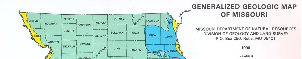
6 Groundwater Provinces
7 Missouri Groundwater Provinces

8 ESTIMATED GROUNDWATER RECHARGE Glacial drift 1-4 in/year West-Central Missouri 1-4 in/year St. Francois Mts. 1-4 in/year Springfield Plateau 6-12 in/year Salem Plateau 6-14 in/year Southeast Lowlands 6-10 in/year
9 Groundwater Provinces Northwest
10 Northwestern Missouri Groundwater Province Northwest Missouri
11 Northwest Missouri Groundwater Province... All or parts of 23 counties, an area of about 12,117 square miles (17.4% of Missouri) Thick glacial drift and alluvial deposits Pennsylvanian and older bedrock beneath the glacial drift
12 Northwest Missouri Groundwater Province Northwest Missouri groundwater province is estimated to contain about 11.2 % of Missouri's potable groundwater, about 55.8 trillion gallons Groundwater availability varies from good to poor
13 Northwest Missouri Groundwater Province Locally used for irrigation and public water supply Thick alluvial deposits underlie the floodplains of the major rivers Agriculture and public water supply >2,000 gpm possible from Missouri River alluvium.
14 Glacial Drift Sand Thickness, Northwest Missouri
15 Alluvial Aquifers in Northwestern Missouri
16 Groundwater Provinces Northeast
17 Northeastern Missouri Groundwater Province Northeast Missouri
18 Northeast Missouri Groundwater Province... All or parts of 21 counties, an area of about 11,708 square miles (16.8% of Missouri) Pennsylvanian-age and older bedrock overlain by up to 300 feet of glacial drift Southern part of province is in the freshwater zone, northern part in the saline-water zone.
19 Glacial Drift Thickness
20 Extent of Glaciation in Missouri of
21 Groundwater Provinces West Central
22 West-Central Missouri Groundwater Province West-Central Missouri
23 West-Central Missouri Groundwater Province... All or parts of 12 counties, an area of about 5,080 square miles (7.3% of Missouri) Pennsylvanian-age and older sedimentary rocks 1.2 trillion gallons of usable groundwater (0.24% of Missouri s groundwater resource)
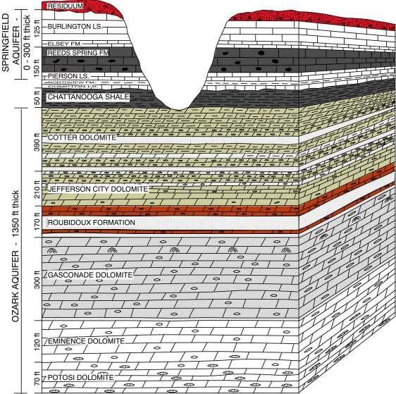
24 West-Central Missouri Groundwater Province Pennsylvanian limestones, sandstones, and shales Mississippian limestones Northview Formation Ordovician and Cambrian dolomites and sandstones Springfield Plateau Aquifer, (mineralized water) Ozark Aquifer (mineralized water)
25 Freshwater-Salinewater Transition Zone
26 Deeper aquifers contain highly mineralized groundwater Deeper aquifers contain good-quality groundwater
27 Groundwater Provinces Springfield Plateau
28 Springfield Plateau Groundwater Province Springfield Plateau
29 Springfield Plateau Groundwater Province... All or parts of 27 counties, about 8,900 square miles (12.8 percent of Missouri) Mississippian-age and older sedimentary (mostly carbonate) rocks Many karst features springs, caves, sinkholes
30 Springfield Plateau Groundwater Province... Two major aquifers Springfield Plateau aquifer Ozark aquifer trillion gallons of usable groundwater (24.5 % of Missouri s groundwater resources)
31 Ozark Confining Unit feet RESIDUUM BURLINGTON LIMESTONE ELSEY FORMATION REEDS SPRING FORMATION PIERSON LIMESTONE NORTHVIEW FORMATION COMPTON LIMESTONE CHATTANOOGA SHALE COTTER DOLOMITE JEFFERSON CITY DOLOMITE ROUBIDOUX FORMATION GASCONADE DOLOMITE 300 EMINENCE DOLOMITE POTOSI DOLOMITE
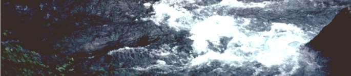
32
33 Ozark Confining Unit feet RESIDUUM BURLINGTON LIMESTONE ELSEY FORMATION REEDS SPRING FORMATION PIERSON LIMESTONE NORTHVIEW FORMATION COMPTON LIMESTONE CHATTANOOGA SHALE COTTER DOLOMITE JEFFERSON CITY DOLOMITE ROUBIDOUX FORMATION GASCONADE DOLOMITE 300 EMINENCE DOLOMITE POTOSI DOLOMITE
34 Springfield Plateau Groundwater Province... Ozark Aquifer Thickness
35 Groundwater Provinces Salem Plateau
36 Salem Plateau Groundwater Province Salem Plateau
37 Salem Plateau Groundwater Province... Includes all or parts of 49 counties, an area of about 24,760 mi 2 (35.5 % of Missouri) Ordovician and Cambrian-age dolomite and sandstone formations Many karst features including caves, large springs, sinkholes and losing streams
38 Salem Plateau Groundwater Province. Two major regional aquifer systems St. Francois aquifer Ozark aquifer 233 trillion gallons of usable groundwater (46.6 % of Missouri s groundwater resources)
39 Salem Plateau Groundwater Province... Eight first magnitude springs - average discharge >100 ft 3 /sec or 64.6 million gallons of water per day)


40 Big Spring, Carter County, 288 mgd
41 Big Spring. 445 ft 3 /sec or 288 million gallons per day St. Louis City mgd Kansas City 85 mgd Springfield..23 mgd Total 260 mgd

42 Blue Spring, Shannon County, 85 mgd


43 Alley Spring, Shannon County, 87 mgd

44 Bennett Spring, Dallas County, 107 mgd
45 Water Trivia. The combined flows of the eight 1 st magnitude springs is 1,650 ft 3 /sec or 1.07 billion gallons per day Missouri s Population. About 5,500,000 people The average flow of these 8 springs would supply every Missouri resident with 194 gallons of water per day per person
46 Recharge Areas of Major Springs Where does all that water come from?
47 Discharge versus Recharge Area Size... In general, the larger the spring the larger the recharge area A = 13.6 x Q R Where: A = Recharge Area (mi 2 ) Q = Average R discharge (ft 3 /sec) R = Recharge Rate (inches/year) Rough rule of thumb: 1 square mile of recharge area for each 1 ft 3 /sec average discharge
48 Groundwater Provinces Missouri and Mississippi River Alluvium
49 Missouri and Mississippi River Alluvium
50 Mississippi and Missouri Alluvial Aquifers... Occupy a relatively small area... Mississippi River alluvium square miles Missouri River alluvium - 1,401 square miles Unconsolidated sand and gravel deposits underlying the floodplains

51 Mississippi River Valley, northeast Missouri
52 Groundwater Provinces St. Francois Mts.
53 St. Francois Mountains Groundwater Province St. Francois Mountains
54 St. Francois Mountains Groundwater Province... All or parts of seven counties - 1,300 square mile area (1.9 % of Missouri) Characterized by Precambrian-age igneous rocks such as granite and rhyolite Estimated groundwater storage, 919 billion gallons (0.2 percent of Missouri s groundwater)

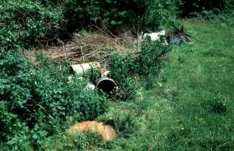
55 Elephant Rocks State Park, Precambrian-age granite boulders

56 Johnson s Shut-ins, Reynolds County East Fork Black River, Rhyolite


57 Groundwater Provinces Southeast Lowlands
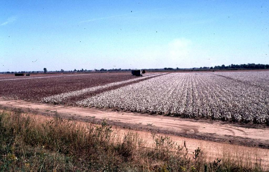
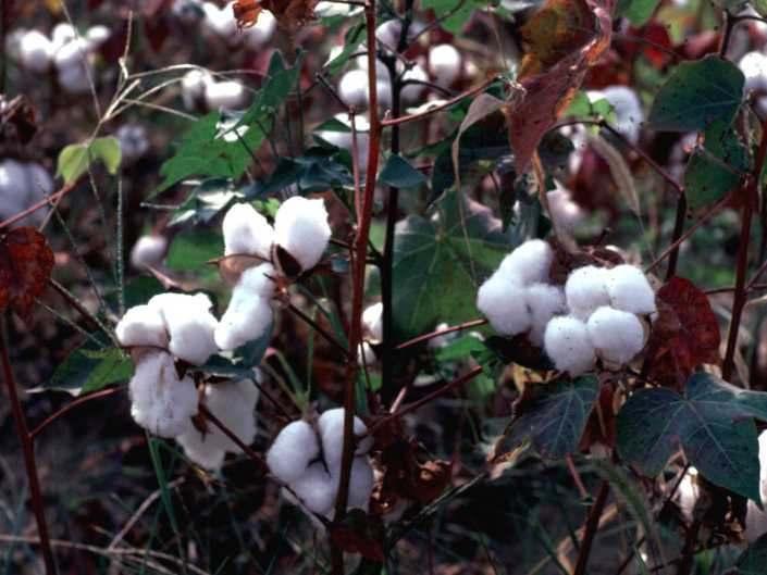
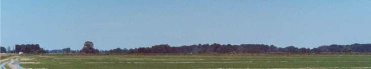
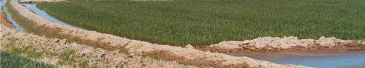
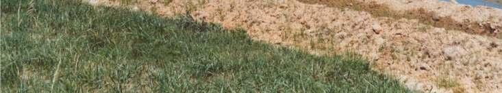
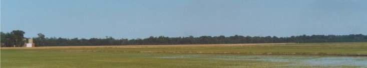
58 Southeastern Lowlands Groundwater Province Southeaste Lowlands
59 Southeastern Lowlands Groundwater Province... 3,916 mi2 (5.7 % of Missouri) Cretaceous, Tertiary, and Quaternary unconsolidated sand and gravel deposits comprising three major aquifers Deeper bedrock aquifers west of Crowleys Ridge (Ozark and St. Francois aquifers)
60 Southeastern Lowlands Groundwater Province trillion gallons of groundwater (15 % of Missouri s usable groundwater) Enough water to cover the province with 93 feet of water


61 Southeastern Lowlands, Alluvial Aquifer Thickness

62 Bald Cyprus and Tupulo Gum Swamp, Dunklin County
63
64
65 Rice Irrigation, Ripley County


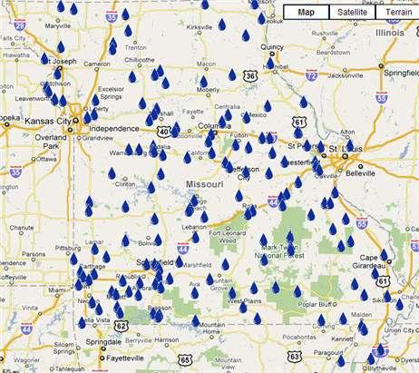
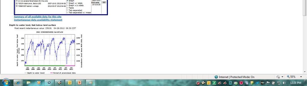
66 Rice Irrigation, Butler County
67 WATER QUALITY CONSIDERATIONS.
68 WATER QUALITY. Chemical Biological Radiological
69 NATURAL WATER QUALITY 1. Type of Rock 2. Length of contact time with water 3. Other factors (ph, Eh, D.O. etc.)
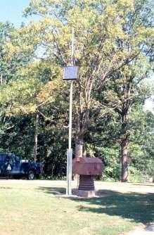
70 CHEMICAL WATER QUALITY. CATIONS Calcium (Ca +2 ) Magnesium (Mg +2 ) Potassium (K + ) Sodium (Na + ) Iron (Fe +2, Fe +3 ) Manganese (Mn +2 ) ANIONS Bicarbonate (HCO 3- ) Carbonate (CO 3-2 ) Sulfate (SO 4-2 ) Chloride (Cl - ) Nitrate (NO 3- ) Silica (SiO 2 )

71 Total Dissolved Solids in the Paleozoic Aquifers Marginal to Poor Quality Groundwater Good Quality Groundwater
72 POTENTIAL CONTAMINANT SOURCES
73 Groundwater-Level Observation Well Network >160 wells

74
75

76
77 Water Resources Center Observation Well Network Water Resources Center Home Page Real Time Groundwater Level Data - USGS
78 Summary. Missouri has a lot of groundwater most of it has good quality! 500 trillion gallons, enough to cover the entire state to a depth of 30 feet Missouri currently uses about 30 billion gallons of groundwater per year Groundwater is not evenly distributed, 86.7% in southern Missouri, 13.3% in northern Missouri

79
PRECAMBRIAN CRYSTALLINE AQUIFER (METAMORPHIC ROCKS)
") HAYWARD QUADRANGLE: Groundwater Production by Aquifer In the 56-square-mile area of the Hayward Quadrangle, groundwater is produced from metamorphic crystalline rocks of the Precambrian basement (in the
HAYWARD QUADRANGLE: Groundwater Production by Aquifer In the 56-square-mile area of the Hayward Quadrangle, groundwater is produced from metamorphic crystalline rocks of the Precambrian basement (in the
Wisconsin s Hydrogeology: an overview
 2012 Soil and Water Conservation Society Conference Stevens Point, WI Feb 9, 2012 Wisconsin s Hydrogeology: an overview Ken Bradbury Wisconsin Geological and Natural History Survey University of Wisconsin-Extension
Hydrogeology of East-Central Union County, Northeastern New Mexico
 Hydrogeology of East-Central Union County, Northeastern New Mexico Geoffrey Rawling April 2013 New Mexico Bureau of Geology & Mineral Resources 1 What are the important hydrogeologic issues in Union County?
11/22/2010. Groundwater in Unconsolidated Deposits. Alluvial (fluvial) deposits. - consist of gravel, sand, silt and clay
 deposits. - consist of gravel, sand, silt and clay") Groundwater in Unconsolidated Deposits Alluvial (fluvial) deposits - consist of gravel, sand, silt and clay - laid down by physical processes in rivers and flood plains - major sources for water supplies
Groundwater in Unconsolidated Deposits Alluvial (fluvial) deposits - consist of gravel, sand, silt and clay - laid down by physical processes in rivers and flood plains - major sources for water supplies
Description DESCRIPTION
 DESCRIPTION The location of the Upper James Watershed is located in northeastern South Dakota as well as southeastern North Dakota. It includes the following counties located in North Dakota Barnes, Dickey,
Chapter 8 Fetter, Applied Hydrology 4 th Edition, Geology of Groundwater Occurrence
 Chapter 8 Fetter, Applied Hydrology 4 th Edition, 2001 Geology of Groundwater Occurrence Figure 8.42. Alluvial Valleys ground-water region. Fetter, Applied Hydrology 4 th Edition, 2001 Fetter, Applied
Mammoth Cave National Park, Kentucky
 Mammoth Cave National Park, Kentucky Objectives of Today s Lecture Refresher on Sedimentary Depositional Systems and Rock Classifications Transgressive and Regressive Marine Environments Carbonate Depositional
General Geologic Setting and Seismicity of the FHWA Project Site in the New Madrid Seismic Zone
 General Geologic Setting and Seismicity of the FHWA Project Site in the New Madrid Seismic Zone David Hoffman University of Missouri Rolla Natural Hazards Mitigation Institute Civil, Architectural & Environmental
Information Pamphlet 8 WATER LEVELS IN THE UPPER WEST BENCH ALLUVIAL AQUIFER, RED LODGE, MONTANA
 Ground Water Assessment Program Information Pamphlet 8 WATER LEVELS IN THE UPPER WEST BENCH ALLUVIAL AQUIFER, RED LODGE, MONTANA Camela Carstarphen, Thomas Patton, and John I. LaFave View of Remington
Follow this and additional works at: Part of the Geology Commons
 Western Michigan University ScholarWorks at WMU Michigan Geological Repository for Research and Education Geosciences 2016 Geology of Michigan William B. Harrison III Michigan Geological Repository for
Soils, Hydrogeology, and Aquifer Properties. Philip B. Bedient 2006 Rice University
 Soils, Hydrogeology, and Aquifer Properties Philip B. Bedient 2006 Rice University Charbeneau, 2000. Basin Hydrologic Cycle Global Water Supply Distribution 3% of earth s water is fresh - 97% oceans 1%
Michigan s Geology and Groundwater
 Michigan s Geology and Groundwater Ralph J. Haefner Deputy Director U.S. Geological Survey Michigan-Ohio Water Science Center Lansing, Michigan Outline About the USGS Geology 101 Michigan s geology Bedrock
Sacramento Valley Groundwater Basin, Sutter Subbasin
 Sacramento Valley Groundwater Basin, Sutter Subbasin Groundwater Basin Number: 5-21.62 County: Sutter Surface Area: 234,400 acres (366 square miles) Boundaries and Hydrology The Sutter Subbasin lies in
WELL PLUGGING PROCEDURES
 PUBLIC INFORMATION CIRCULAR JULY 1971 NUMBER I OPTIMAL WELL PLUGGING PROCEDURES BY ORVILLE J VAN ECK IOWA GEOLOGICAL SURVEY SAMUEL J. TUTHILL, State Geologist Iowa City OPTIMAL WELL PLUGGING PROCEDURES
THE FRESH-SALINE WATER INTERFACE IN KENTUCKY. By H.T. Hopkins U.S. Geological Survey
 THE FRESH-SALINE WATER INTERFACE IN KENTUCKY By H.T. Hopkins U.S. Geological Survey Kentucky Geological Survey University of Kentucky In cooperation with United States Geological Survey Department of the
 12 10 8 6 4 2 0 40-50 50-60 60-70 70-80 80-90 90-100 Fresh Water What we will cover The Hydrologic Cycle River systems Floods Groundwater Caves and Karst Topography Hot springs Distribution of water in
Chapter 13. Groundwater
 Chapter 13 Groundwater Introduction Groundwater is all subsurface water that completely fills the pores and other open spaces in rocks, sediments, and soil. Groundwater is responsible for forming beautiful
Connecticut's Aquifers
 Page 1 of 5 DEP Search: Connecticut's Aquifers The technical definition of the word "aquifer" is: any geologic formation capable of yielding significant quantities of water to wells. By that definition,
FRACTURE TRACES AND PRODUCTIVITY OF MUNICIPAL WELLS IN THE MADISON LIMESTONE, RAPID CITY, SOUTH DAKOTA
 Proceedings of the South Dakota Academy of Science, Vol. 87 (2008) 261 FRACTURE TRACES AND PRODUCTIVITY OF MUNICIPAL WELLS IN THE MADISON LIMESTONE, RAPID CITY, SOUTH DAKOTA Perry H. Rahn Department of
APPENDIX 3B OCCURRENCE OF SIGNIFICANT RIVER ALLUVIUM AQUIFERS IN THE PLATEAU REGION
 Plateau Region Water Plan January 2011 APPENDIX 3B OCCURRENCE OF SIGNIFICANT RIVER ALLUVIUM AQUIFERS IN THE PLATEAU REGION Occurrence of Significant River Alluvium Aquifers in the Plateau Region Prepared
PHYSIOGRAPHIC REGIONS OF THE LOWER 48 UNITED STATES
 PHYSIOGRAPHIC REGIONS OF THE LOWER 48 UNITED STATES LAURENTIAN UPLAND 1. Superior Upland ATLANTIC PLAIN 2. Continental Shelf (not on map) 3. Coastal Plain a. Embayed section b. Sea Island section c. Floridian
April 27, Ground Water in Kingwood Township
 KINGWOOD TOWNSHIP ENVIRONMENTAL COMMITTEE April 27, 2010 Ground Water in Kingwood Township Gail Ashley Debbie Kratzer Information source, unless otherwise noted: Environmental Resource Inventory for Kingwood
KANSAS GEOLOGICAL SURVEY Open File Report LAND SUBSIDENCE KIOWA COUNTY, KANSAS. May 2, 2007
 KANSAS GEOLOGICAL SURVEY Open File Report 2007-22 LAND SUBSIDENCE KIOWA COUNTY, KANSAS Prepared by Michael T. Dealy L.G., Manager, Wichita Operations SITE LOCATION The site was approximately four miles
Fossils and Geology of Litzsinger Road Ecology Center
 Fossils and Geology of Litzsinger Road Ecology Center Table of Content Key Terms 1 Key Terms 2 What you need to know Geologic Map of Missouri Geologic Time Chart More of what you need to know Digital map
Module 10: Resources and Virginia Geology Topic 4 Content: Virginia Geology Notes
 Virginia is composed of a very diverse landscape that extends from the beaches and barrier islands all of the way to the highly elevated Appalachian Plateau. Geologists have discovered ancient shallow
Follow this and additional works at:
 Georgia State University ScholarWorks @ Georgia State University Geosciences Theses Department of Geosciences 4-21-2009 Temporal Variations in Spring Water Chemistry and Comparison of Variable Paleozoic
OVERVIEW AND RESULTS OF THE BLACK HILLS HYDROLOGY STUDY
 Proceedings of the South Dakota Academy of Science, Vol. 83 (2004) 149 OVERVIEW AND RESULTS OF THE BLACK HILLS HYDROLOGY STUDY Daniel G. Driscoll and Janet M. Carter U.S. Geological Survey Rapid City,
Groundwater. (x 1000 km 3 /y) Reservoirs. Oceans Cover >70% of Surface. Groundwater and the. Hydrologic Cycle
 Reservoirs. Oceans Cover >70% of Surface. Groundwater and the. Hydrologic Cycle") Chapter 13 Oceans Cover >70% of Surface Groundwater and the Hydrologic Cycle Oceans are only 0.025% of Mass Groundwater Groundwater is liquid water that lies in the subsurface in fractures in rocks and
Chapter 13 Oceans Cover >70% of Surface Groundwater and the Hydrologic Cycle Oceans are only 0.025% of Mass Groundwater Groundwater is liquid water that lies in the subsurface in fractures in rocks and
WATER ON AND UNDER GROUND. Objectives. The Hydrologic Cycle
 WATER ON AND UNDER GROUND Objectives Define and describe the hydrologic cycle. Identify the basic characteristics of streams. Define drainage basin. Describe how floods occur and what factors may make
Betsy Stevenson and Allison Mohrs (Skagit County Planning and Development Services) Jenny Baker, The Nature Conservancy
 Jenny Baker, The Nature Conservancy") TC Fisher Slough Final Design and Permitting Subject: Well Review Memorandum To: From: Betsy Stevenson and Allison Mohrs (Skagit County Planning and Development Services) Jenny Baker, The ature Conservancy
TC Fisher Slough Final Design and Permitting Subject: Well Review Memorandum To: From: Betsy Stevenson and Allison Mohrs (Skagit County Planning and Development Services) Jenny Baker, The ature Conservancy
ILLINOIS GROUNDWATER - BEDROCK
 ILLINOIS GROUNDWATER - BEDROCK Northern Illinois Fresh Water Water Supply Shallow Bedrock Aquifers < 500 depth Deep Bedrock Aquifers > 500 depth Southern Illinois Saline water Oil Fracking Coal Waste injection
Differentiation of chloride source using stable chlorine isotopes
 Differentiation of chloride source using stable chlorine isotopes RemTech 2009 Banff, Alberta October 14-16 2009 Dr. Alec Blyth and Tom Anthony 1 1 currently City of Calgary Background: DOW Chemical Canada
Seismic Data and Drilling in Hancock Co., Kentucky February 21, 2008
 Seismic Data and Drilling in Hancock Co., Kentucky February 21, 2008 J.A. Drahovzal 2/21/08 1 Hancock County (H1) Information Provided at 2/7/08 Meeting Depth of Top (t) and Thickness (th) in feet t Kn
Lecture Outlines PowerPoint. Chapter 5 Earth Science 11e Tarbuck/Lutgens
 Lecture Outlines PowerPoint Chapter 5 Earth Science 11e Tarbuck/Lutgens 2006 Pearson Prentice Hall This work is protected by United States copyright laws and is provided solely for the use of instructors
Unconformities are depositional contacts that overlie rocks distinctly older than they are. They are often called gaps in the sedimentary record.
 UNCONFORMITIES Unconformities are depositional contacts that overlie rocks distinctly older than they are. They are often called gaps in the sedimentary record. The contact represents time when no sediment
STUDY GUIDE FOR CONTENT MASTERY. Movement and Storage of Groundwater
 Groundwater SECTION 10.1 Movement and Storage of Groundwater In your textbook, read about the hydrosphere, precipitation and groundwater, and groundwater storage. Use the following terms to complete the
Cretaceous, Dakota Formation, Terra Cotta Member South Side of I-70, Salina County, Kansas
 Cretaceous, Dakota Formation, Terra Cotta Member South Side of I-70, Salina County, Kansas Written By: Steven D.J. Baumann G-102010-1A Outcrop looking southeast Photo taken by: Steven Baumann on 10-20-2010
Groundwater. (x 1000 km 3 /y) Oceans Cover >70% of Surface. Groundwater and the. Hydrologic Cycle
 Oceans Cover >70% of Surface. Groundwater and the. Hydrologic Cycle") Chapter 17 Oceans Cover >70% of Surface Groundwater and the Hydrologic Cycle Vasey s Paradise, GCNP Oceans are only 0.025% of Mass Groundwater Groundwater is liquid water that lies in the subsurface in
Chapter 17 Oceans Cover >70% of Surface Groundwater and the Hydrologic Cycle Vasey s Paradise, GCNP Oceans are only 0.025% of Mass Groundwater Groundwater is liquid water that lies in the subsurface in
BASIC PRINCIPLES OF GROUND-WATER OCCURANCE AND FLOW
 BASIC PRINCIPLES OF GROUND-WATER OCCURANCE AND FLOW GWPC Annual Forum Sept. 27-30, 2015 Oklahoma City, OK Mike Wireman Water well Rural Romania Water well Castle in Austria 1 ??? 2 BASIC PRINCIPLES OF
TOPOGRAPHIC RELIEF MAP of NYS. LANDFORMS of NYS. Landforms. Creation of NYS Landforms 9/22/2011
 TOPOGRAPHIC RELIEF MAP of NYS LANDFORMS of NYS Prof. Anthony Grande AFG 2011 Landforms The basis of present-day landforms (surface features) is the bedrock geology that has been worked on by the forces
Groundwater. Earth Chapter 17
 Groundwater Earth Chapter 17 Chapter 17 Groundwater Importance of Groundwater Groundwater is water found in the pores of soil and sediment, plus narrow fractures in bedrock Groundwater and the Hydrosphere
What we will cover. The Hydrologic Cycle. River systems. Floods. Groundwater. Caves and Karst Topography. Hot springs
 Fresh Water What we will cover The Hydrologic Cycle River systems Floods Groundwater Caves and Karst Topography Hot springs On a piece of paper, put these reservoirs of water in to order from largest to
Name. 4. The diagram below shows a soil profile formed in an area of granite bedrock. Four different soil horizons, A, B, C, and D, are shown.
 Name 1. In the cross section of the hill shown below, which rock units are probably most resistant to weathering? 4. The diagram below shows a soil profile formed in an area of granite bedrock. Four different
Essentials of Geology, 11e
 Essentials of Geology, 11e Groundwater Chapter 10 Instructor Jennifer Barson Spokane Falls Community College Geology 101 Stanley Hatfield Southwestern Illinois Co Jennifer Cole Northeastern University
SECTION 4 TABLES. 1 Summary of Hydrogeologic Parameters for Various Stratigraphic Units FIGURES
 SECTION 4 4.0 OVERVIEW OF GEOLOGY AND HYDROGEOLOGY... 13 4.1 Comparison of East and West Sides of Study Area... 15 4.2 Bedrock Sequence... 17 4.3 Mancos Shale (Upper Cretaceous)... 18 4.4 Mesaverde Formation
2 Aggregates in Indiana
 2 Aggregates in Indiana Origin of Aggregates Gravel and Natural Sands Crushed Stone Slag Distribution of Aggregates Glacial Deposits Bedrock Deposits Aggregate Types Natural Aggregates Artificial Aggregates
The Capitan Aquifer - Ellenburger Production Wells Geothermal Engine Source?
 GEOTHERMAL ENERGY UTILIZATION ASSOCIATED WITH OIL & GAS DEVELOPMENT June 17-18, 2008 Southern Methodist University Dallas, Texas The Capitan Aquifer - Ellenburger Production Wells Geothermal Engine Source?
Continental Landscapes
 Continental Landscapes Landscape influenced by tectonics, climate & differential weathering Most landforms developed within the last 2 million years System moves toward an equilibrium Continental Landscapes
SAMPLE QUESTIONS FOR GEOLOGY 103, TEST 1
 SAMPLE QUESTIONS FOR GEOLOGY 103, TEST 1 The correct answers are listed at the bottom (no peeking!). These questions are to give you an idea of the type of questions that will be asked. They are not a
STUDY GUIDE FOR CONTENT MASTERY. Surface Water Movement
 Surface Water SECTION 9.1 Surface Water Movement In your textbook, read about surface water and the way in which it moves sediment. Complete each statement. 1. An excessive amount of water flowing downslope
RIVERS, GROUNDWATER, AND GLACIERS
 RIVERS, GROUNDWATER, AND GLACIERS Delta A fan-shaped deposit that forms when a river flows into a quiet or large body of water, such as a lake, an ocean, or an inland sea. Alluvial Fan A sloping triangle
Chapter 2. Regional Landscapes and the Hydrologic Cycle
 Chapter 2. Regional Landscapes and the Hydrologic Cycle W. Lee Daniels Department of Crop and Soil Environmental Sciences, Virginia Tech Table of Contents Introduction... 23 Soils and landscapes of the
Hydrogeology and Simulated Effects of Future Water Use and Drought in the North Fork Red River Alluvial Aquifer: Progress Report
 Hydrogeology and Simulated Effects of Future Water Use and Drought in the North Fork Red River Alluvial Aquifer: Progress Report Developed in partnership with the Oklahoma Water Resources Board S. Jerrod
ABC s. Indiana Geology. Anhydrite, Ais for
 Ais for Anhydrite, a blueish to gray mineral that is formed from the dehydration the mineral gypsum. Anhydrite occurs with gypsum in the lower part the St. Louis Limestone in south-central Indiana near
LAS ANIMAS ARCH PROVINCE (040)
") LAS ANIMAS ARCH PROVINCE (040) By C. William Keighin INTRODUCTION The Las Animas Arch of southeastern Colorado is a north-northeast striking structural high, bounded on the south by the Apishipa Uplift.
LAS ANIMAS ARCH PROVINCE (040) By C. William Keighin INTRODUCTION The Las Animas Arch of southeastern Colorado is a north-northeast striking structural high, bounded on the south by the Apishipa Uplift.
LANDFORMS of NYS. Landforms. Exercise 4 9/13/2012. TOPOGRAPHIC RELIEF MAP of NYS. Physiographic map of NYS and vicinity showing Surface Features
 TOPOGRAPHIC RELIEF MAP of NYS LANDFORMS of NYS Prof. Anthony Grande AFG 2012 Landforms REMINDER: The basis of present-day landforms (surface features) is the bedrock geology that has been worked on by
Groundwater Hydrology
 EXERCISE 12 Groundwater Hydrology INTRODUCTION Groundwater is an important component of the hydrologic cycle. It feeds lakes, rivers, wetlands, and reservoirs; it supplies water for domestic, municipal,
New Mexico Geological Society
 New Mexico Geological Society Downloaded from: http://nmgs.nmt.edu/publications/guidebooks/26 Tectonic significance of the Pony Hills, Luna County, New Mexico LeRoy L. Corbitt and Fred L. Nials, 1975,
Section I: Multiple Choice Select the best answer to each question. Mark your final answer on the answer sheet. (1 pt each)
") Sedimentary Rocks & Surface Processes Quest Name: Earth Science 2013 Block: Date: Section I: Multiple Choice Select the best answer to each question. Mark your final answer on the answer sheet. (1 pt each)
Sedimentary Rocks & Surface Processes Quest Name: Earth Science 2013 Block: Date: Section I: Multiple Choice Select the best answer to each question. Mark your final answer on the answer sheet. (1 pt each)
Origin and Evolution of Formation Waters in the West-Central Part of the Alberta Basin
 Page No. 004-1 Origin and Evolution of Formation Waters in the West-Central Part of the Alberta Basin Karsten Michael* University of Alberta, 1-26 ESB, Edmonton, AB T6G 2E3 karsten@ualberta.ca and Stefan
Student Theses and Dissertations
 Scholars' Mine Masters Theses Student Theses and Dissertations Spring 2017 2-D and 3-D mapping of soil and rock structure in karst terrain of southwestern Missouri using the non-invasive electrical resistivity
Groundwater Sensitivity Regions of Kentucky
 Groundwater Sensitivity Regions of Kentucky by Kentucky Department for Environmental Protection Division of Water Groundwater Branch 1994 Interpreted by Joseph A. Ray James S. Webb Phillip W. O'dell Scale
Identifying Sensitive Aquifers in Ohio
 State of Ohio Environmental Protection Agency Division of Drinking and Ground Waters Identifying Sensitive Aquifers in Ohio May 2007 Ted Strickland, Governor Chris Korleski, Director Acknowledgments Ohio
Per r y H. Rahn and J. School of Mines and Rapid City, S. Oak.
 s. Oak. of No. /07 by Oak. Per r y H. Rahn and J. School of Mines and Rapid City, S. Oak. P. Gries Technology in cooperation with the Water Resources Research Institute under Project No. A-O2/- SOAK S.
TAMPA BAY TRIBUTARIES BASIN. Hydrogeological Setting
 TAMPA BAY TRIBUTARIES BASIN Hydrogeological Setting Aquifers within the Tampa Bay Tributaries Basins ground water flow system include the Floridan aquifer system, the intermediate aquifer system, and the
Why is it called the "Inland Basins" Region?
 Learning Series: Rocks of the Southeastern U. S. The BIG Picture Why is it called the "Inland Basins" Region? Inland from the mountains, the Earth s crust was buckled (downwarped) into a series of depressions
GEOL Introductory Geology: Exploring Planet Earth Fall 2010 Test #2 October 18, 2010
 GEOL 101 - Introductory Geology: Exploring Planet Earth Fall 2010 Test #2 October 18, 2010 Name KEY ID# KEY Multiple choice questions (2 points each). 1. What type of metamorphic rock is formed over large
Critical Aquifer Recharge Area Susceptibility Index Methodology
 Prepared for 207 4th Ave. N. Kelso, WA 98626 Prepared by Parametrix 700 NE Multnomah, Suite 1000 Portland, OR 97232-4110 T. 503.233.2400 T. 360.694.5020 F. 1.855.542.6353 www.parametrix.com July 5, 2016
Mark S. Nordberg Geology and Groundwater Investigations Section North Central Region Office California Department of Water Resources
 Mark S. Nordberg Geology and Groundwater Investigations Section North Central Region Office California Department of Water Resources Ukiah Drought Workshop July 29, 2009 Groundwater 101 Groundwater is
Chapter 14: Groundwater. Fig 14.5b
 Chapter 14: Groundwater Fig 14.5b OBJECTIVES Recognize that groundwater is a vital source of accessible freshwater. Describe how groundwater forms below the water table. Explain the origin of aquifers,
Lab 9: Petroleum and groundwater
 Geology 101 Name(s): Lab 9: Petroleum and groundwater Petroleum (oil) is a multi-component liquid refined to generate different hydrocarbons, such as heptane (a component of gasoline) and waxes. For the
THE GEOLOGY OF PENNSYLVANIA S GROUNDWATER
 Educational Series 3 THE GEOLOGY OF PENNSYLANIA S GROUNDWATER COMMONWEALTH OF PENNSYLANIA DEPARTMENT OF CONSERATION AND NATURAL RESOURCES OFFICE OF CONSERATION AND ENGINEERING SERICES BUREAU OF TOPOGRAPHIC
Cuyama Basin North Fork Vineyard
 Cuyama Basin North Fork Vineyard Company Background plus Data Insights to Support GSP Development for the Cuyama Basin Presented by Grapevine Capital Partners and Cleath-Harris Geologists April 26th, 2018
the Quarrying Industry Dewatering and the Quarrying Industry the Quarrying Industry
 Dewatering and the Quarrying Industry Dewatering and Dewatering and the Quarrying Industry the Quarrying Industry Les Brown Eugene P. Daly John Kelly Objectives 1) To present a summary of water management
Simulation of Ground-Water Flow in the Cedar River Alluvial Aquifer Flow System, Cedar Rapids, Iowa
 Prepared in cooperation with the City of Cedar Rapids Simulation of Ground-Water Flow in the Cedar River Alluvial Aquifer Flow System, Cedar Rapids, Iowa Scientific Investigations Report 2004-5130 U.S.
B. T. Brady, M. S. Bedinger, John Mikels, William H. Langer, and Deborah A. Mulvihill
 DEPARTMENT OF THE INTERIOR UNITED STATES GEOLOGICAL SURVEY TO ACCOMPANY WRI REPORT 83-4121-B MAP SHOWING GROUND-WATER LEVELS, SPRINGS. AND DEPTH TO GROUND WATER, BASIN AND RANGE PROVINCE, TEXAS by B. T.
R ENW Services - Geophysics & GIS
 Yankton Block 1 Vermillion Block 2 N 2 0 1 Block 3 Elk Point 2 3 4 5 6 MILES Block 4 R20-2002-01 0 1 2 3 4 5 6 7 8 9 10 KILOMETERS Block 5 Figure courtesy of ENW Services - Geophysics & GIS Block 6 Test
Hydrogeology of Karst NE Wisconsin. Dr. Maureen A. Muldoon UW-Oshkosh Geology Department
 Hydrogeology of Karst NE Wisconsin Dr. Maureen A. Muldoon UW-Oshkosh Geology Department WI Bedrock Outline Karst Landscapes Existing WQ Data Flow in Karst Aquifers Overview of Silurian Aquifer Water Level
Earth History Exam. The remains of an early dinosaur could be found at reference point A. A B. B C. C D. D. page 1
 Name: Date: 1. Base your answer(s) to the following question(s) on the Earth Science Reference Tables and your knowledge of Earth science. The accompanying cross section shows undisturbed sedimentary bedrock.
Laboratory Exercise #3 The Hydrologic Cycle and Running Water Processes
 Laboratory Exercise #3 The Hydrologic Cycle and Running Water Processes page - 1 Section A - The Hydrologic Cycle Figure 1 illustrates the hydrologic cycle which quantifies how water is cycled throughout
Geology and Soils. Technical Memorandum
 Geology and Soils Technical Memorandum TO: FDOT FROM: HDR, Inc. DATE: February 2013 PROJECT: St Johns River Crossing FPID No: 208225-3-21-01 Clay, Duval, and St. Johns Counties; Florida Geology and soils
1. In the block diagram shown here, which is the oldest rock unit?
 Pre/Post GCI Name (print) 1. In the block diagram shown here, which is the oldest rock unit? 2. Referring to the same diagram as the previous question, which of the labeled rock units is the youngest?
L.O: HOW GEOLOGISTS SEQUENCE EVENTS IN EARTH'S GEOLOGIC HISTORY IF NOT OVERTURNED, OLDEST ON BOTTOM, YOUNGEST ON TOP
 L.O: HOW GEOLOGISTS SEQUENCE EVENTS IN EARTH'S GEOLOGIC HISTORY IF NOT OVERTURNED, OLDEST ON BOTTOM, YOUNGEST ON TOP 1. Unless a series of sedimentary rock layers has been overturned, the bottom rock layer
Salinity. foot = 0.305m yard = 0.91m. Length. Area m 2 square feet ~0.09m2. Volume m 3 US pint ~ 0.47 L fl. oz. ~0.02 L.
 Length m foot = 0.305m yard = 0.91m Area m 2 square feet ~0.09m2 Volume m 3 US pint ~ 0.47 L, L (liters) fl. oz. ~0.02 L Speed m/s mph Acceleration m/s 2 mph/s Weight kg, gram pound ~0.45kg Temperature
2.5.3 Willow Creek Valley
 2.5.3 Willow Creek Valley Identified as a priority groundwater basin based on stakeholder input, land use, water source patterns, and existing groundwater well infrastructure, Willow Creek Valley is in
Groundwater in Bayfield County
 Groundwater in Bayfield County Presented to Bayfield County Large Scale Livestoc Study Committee April 23, 2015 Madeline Gotowitz Hydrogeologist Groundwater in Bayfield County Groundwater basics Hydrogeology
Prepared By: John Blair Sean Donahue Celeste Hoffman Kimberly Klinkers Megan Slater
 Prepared By: John Blair Sean Donahue Celeste Hoffman Kimberly Klinkers Megan Slater Green River Basin Location Green River Basin Stratigraphic Correlation Chart showing Study Map Units Sample of Existing
Shallow Karst Aquifer System of the Lake Belt Study Area, Miami-Dade County, Florida, USA EXTENDED ABSTRACT
 Second International Conference on Saltwater Intrusion and Coastal Aquifers Monitoring, Modeling, and Management. Merida, Mexico, March 30 April 2, 2003 Shallow Karst Aquifer System of the Lake Belt Study
Chapter 14. Groundwater
 Chapter 14 Groundwater Importance of groundwater! Groundwater is water found in the pores of soil and sediment, plus narrow fractures in bedrock! Groundwater is the largest reservoir of fresh water that
Geologic Mapping in Northeastern Illinois. What do we know about. Donald A. Keefer, Director Geologic Mapping and Hydrogeology Center
 Geologic Mapping in Northeastern Illinois & What do we know about Lake County s Geology? Donald A. Keefer, Director Geologic Mapping and Hydrogeology Center Societal Benefits of Mapping Water Supply Delineation,
Geologic Map of the Hatch Quadrangle, Doña County, New Mexico
 Geologic Map of the Hatch Quadrangle, Doña County, New Mexico By William R. Seager May 1995 New Mexico Bureau of Geology and Mineral Resources Open-file Digital Geologic Map OF-GM 213 Scale 1:24,000 This
EARTH S HISTORY. What is Geology? logy: science. Geology is the scientific study of the Earth, including its:
 EARTH S HISTORY 1 What is Geology? Geo: earth logy: science Geology is the scientific study of the Earth, including its: composition, structure, and physical properties. 2 1 Geologists study: the origin
Your web browser (Safari 7) is out of date. For more security, comfort and the best experience on this site: Update your browser Ignore
 is out of date. For more security, comfort and the best experience on this site: Update your browser Ignore") Your web browser (Safari 7) is out of date. For more security, comfort and the best experience on this site: Update your browser Ignore BEDRO CK For the complete encyclopedic entry with media resources,
Your web browser (Safari 7) is out of date. For more security, comfort and the best experience on this site: Update your browser Ignore BEDRO CK For the complete encyclopedic entry with media resources,
Fossils, Geologic Time, Absolute & Relative Dating, and Natural Resources. Chapters 5 & 6
 Fossils, Geologic Time, Absolute & Relative Dating, and Natural Resources Chapters 5 & 6 How Do Fossils Form? Fossils are found in sedimentary rocks like sandstone, limestone, and shale In Virginia, most
Overview. Rock weathering Functions of soil Soil forming factors Soil properties
 UN-FAO A. Healthy soils are the basis for healthy food production. B. A tablespoon of normal topsoil has more microorganisms than the entire human population on Earth. C. It can take up to 1,000 years
Paso Robles Groundwater Basin: Effects of Geothermal Waters on Water Quality and Availability
 Paso Robles Groundwater Basin: Effects of Geothermal Waters on Water Quality and Availability Jim Rytuba and Daniel Goldstein U.S. Geological Survey, Menlo Park, CA Paso Robles Intake from Lake Nacimiento
The Nubian Sandstone Aquifer System. Martina Müller Claudia Dengler Felix Leicht
 The Nubian Sandstone Aquifer System Martina Müller Claudia Dengler Felix Leicht Geography Transboundary groundwater system beneath the north-eastern Sahara total extension of over 2.2 Mio km² Shared between
Salinity. See Appendix 1 of textbook x10 3 = See Appendix 1 of textbook
 Length Area Volume m m m foot = 0.305m yard = 0.91m square feet ~0.09m2 US pint ~ 0.47 L fl. oz. ~0.02 L Speed m/s mph Acceleration m/s mph/s Weight kg, gram pound ~0.45kg Temperature o o See Appendix
Unit 5: Earth s History Practice Problems
 Name: Date: 1. Which bedrock would be most likely to contain fossils? A. Precambrian granite B. Cambrian shale C. Pleistocene basalt D. Middle-Proterozoic quartzite 6. Base your answer(s) to the following
Karst Topography In order to understand karst topography we must first have a basic understanding of the water cycle, the formation of limestone (carb
 Karst Topography The formation of caves and other associated features in limestone bedrock is called karst topography. Limestone, a sedimentary rock made mostly of the mineral calcite and small amounts