University of Wyoming Near-Surface Geophysical Instrument Center & Wyoming Center for Environmental Hydrology and Geophysics
|
|
|
- Andrew Juniper Poole
- 5 years ago
- Views:
Transcription


1 University of Wyoming Near-Surface Geophysical Instrument Center & Wyoming Center for Environmental Hydrology and Geophysics UWNSG & WyCEHG Groundwater Studies on the Brule Formation near Pine Bluffs, Wyoming: What can near-surface geophysics tell us about tops and fracturing in the upper Brule Formation. Brad Carr, Ph.D. University of Wyoming
2 Acknowledgments University of Wyoming-Department of Geology and Geophysics Near-Surface Geophysics Instrument Center (UWNSG) University of Wyoming-Office of Research and Economic Development Wyoming Center for Environmental Hydrology and Geophysics (WyCEHG) -- NSF grant EPS UWNSG 2017 summer personnel: Matthew Elliot and Evan Cox Dahlgren Consulting, Inc.. Russ Dahlgren, P.G. and Shana Wolff
3 University of Wyoming Near-Surface Geophysical Instrument Center & Wyoming Center for Environmental Hydrology and Geophysics What is UWNSG? The Univ. of Wyoming cost center (like the Stable Isotope lab) for geophysical equipment and data support for: environmental hydrology, environmental engineering, natural hazards, near surface petrophysics, and near surface geophysics and hydrogeophysics. UWNSG serves the geophysical community, water science, engineering and watershed management by providing cutting-edge tools to managers, scientists, public educators and private sectors. Funded by equipment rentals and project work. Started April, 2017 Currently find our personnel at: and our equipment at:
4 University of Wyoming Near-Surface Geophysical Instrument Center & Wyoming Center for Environmental Hydrology and Geophysics UWNSG & WyCEHG Geophysical Tools Seismic Refraction, Reflection and Surface Wave 240 channel capability, impact sources, 4.5Hz/10Hz/40Hz geophones, 2 24 channel borehole/marine hydrophone arrays Ground Penetrating Radar 3 - systems with 100MHz/250MHz/500MHz and 800MHz antennae DC Resistivity/Induced Polarization/Self-Potential 5 systems with ~ 56 electrode capability, 60 Non-Polarizable electrodes, 2 56 electrode borehole/marine cables Electromagnetics (shallow and deep) Surface loop EM system (WalkTEM), 2 handheld soil conductivity meters (DualEM and GEM2) Magnetics & Magnetotellurics Proton Precession Base Station and Cesium Vapor Gradiometer CSAMT - StrataGEM Nuclear Magnetic Resonance Surface (GMR) and Borehole (Javelin & Dart) Gravity CG-5 microgravimeter Borehole Geophysical Logging Caliper, Optical Televiewer, Acoustic Televiewer, Natural Gamma, Fluid Temperature/Conductivity, Spectral Gamma, Spinner Flowmeter, Heat Pulse Flowmeter, Electromagnetic/Magnetic Susceptibility, Full Waveform Sonic (3 receiver), Resistivity (normal 8,16, 32, 64 ) & Induced Polarization, and Fluid Sampler. Direct Push Sampling/Rotary Coring/HPT-EC Direct Imaging Geoprobe 7822DT


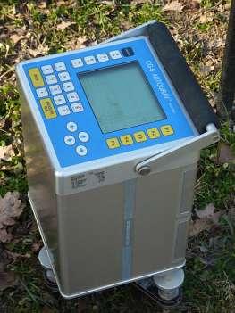
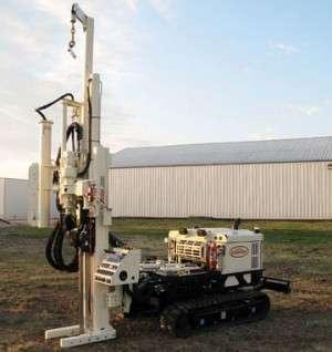
5 Geophysical Instrumentation Shallow drilling/coring Ground-Penetrating Radar Seismic Refraction Electrical Resistivity Microgravity Magnetic Resonance Sounding


6 University of Wyoming Near-Surface Geophysical Instrument Center & Wyoming Center for Environmental Hydrology and Geophysics Audio magnetotellurics Downhole Logging Time-domain EM Electromagnetic Induction Magnetic Gradiometry

7 University of Wyoming Near-Surface Geophysical Instrument Center & Wyoming Center for Environmental Hydrology and Geophysics Geophysical Pilot Study to Image the top of the Brule Formation near Pine Bluffs, Wyoming
8 University of Wyoming Near-Surface Geophysical Instrument Center & Wyoming Center for Environmental Hydrology and Geophysics Project Goals: 1) Use surface geophysics (Seismic Refraction and DC Resistivity) to image the top of the Brule Fm. 2) Use borehole geophysical logging to study in situ fractures in the upper Brule Fm.
9 University of Wyoming Near-Surface Geophysical Instrument Center & Wyoming Center for Environmental Hydrology and Geophysics Generalized Stratigraphy for the Pine Bluffs, WY area:

10 University of Wyoming Near-Surface Geophysical Instrument Center & Wyoming Center for Environmental Hydrology and Geophysics Geophysical Site surrounding the Duello Well
11 University of Wyoming Near-Surface Geophysical Instrument Center & Wyoming Center for Environmental Hydrology and Geophysics Well Summary of the Duello Well from UWNSG geophysical logging data: -- TD = m // ft. bgs -- ID = 16.5 cm // 6.5 in. -- H 2 O level (~6.02 m // ft. bgs) were measured on June 15, The top of the Brule Fm. is at the base of the cased interval (~ 2.8 m // ~ 9.1 ft. bgs). -Fractured Intervals of the upper Brule Fm. were determined from the caliper & optical televiewer tools.
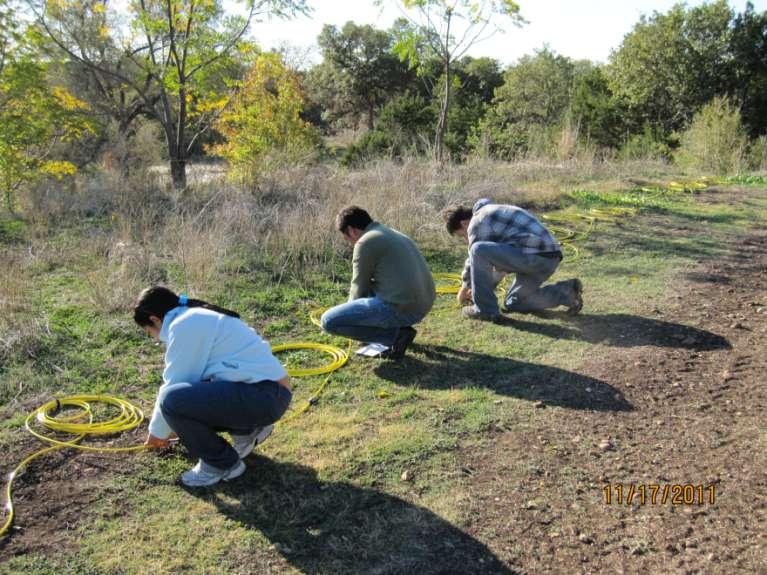
12 University of Wyoming Near-Surface Geophysical Instrument Center & Wyoming Center for Environmental Hydrology and Geophysics Surface Geophysical Methods
13 Resistivity/IP /SP Methods Why is Resistivity Imaging useful? and what can the color/values really represent?

14 Resistivity/IP /SP Methods Photos and data courtesy of Triad Engineering, Inc.
15 Resistivity /IP /SP Methods DC Resistivity (Galvanic): For each measurement, a DC electric current is injected into the ground through two electrodes (A and B) that are planted into the ground. The resulting electric potential is measured between another two electrodes (M and N). Measured data (i.e. apparent resistivity) are inverted to produce true subsurface resistivity distribution. Resistivity distribution is correlated to subsurface geology by a data interpreter I V A B M N Transmitter Receiver ρ a

16 Apparent resistivity Apparent resistivity is a weighted average of the resistivities under the four electrodes. If the ground is homogenous, the apparent resistivity equals the true resistivity r r r r i V a General formula for calculating apparent resistivity Resistivity/IP/SP Methods
17 Resistivity/IP/SP Methods Resistivity of soil and rock is a complicated function of the following parameters: 1) Moisture (water) content, a dominant factor 2) Porosity 3) Pore fluid chemistry (fresh water vs. saltwater) 4) Temperature of pore water (resistivity decreases with increasing temperature) 5) Resistivity of minerals

18 Refraction: Why Care? Seismic refraction data allow us to determine the distribution of seismic velocity in the Earth -- which has a myriad of uses, from small-scale studies of local geology and soil structure to large-scale problems like the structure of continents.

19 Snell s Law: Critical Refraction Guy G. Drijkoningen v 1 v 2 A special case of refraction occurs when 2 =90 (so that sin 2 =1): 2 in this case is called the critical angle c. The resulting refraction travels along the boundary and is called a head wave. Waves such as this are the basis for refraction seismology, about which we ll have more to say later.

20 Refractions (Head Wave): One-Layer Case Here is one form of the onelayer equations, from Mussett & Khan: t = 1 v 2 x + 2h 1 1 v v 2 2 i.e., time = slope distance + intercept (note that I ve changed z to h 1 ) Mussett & Khan
21 Controls on Velocity Confining Pressure Composition (Mineralogy) Temperature Porosity (Voids and cracks) Pore Fluid Composition (gas/water) Pore Pressure Most important for near-surface geophysics

22

23

24

25

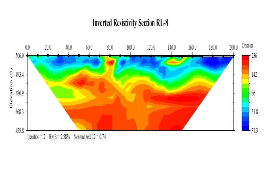
26 University of Wyoming Near-Surface Geophysical Instrument Center & Wyoming Center for Environmental Hydrology and Geophysics Summary of Interpreted Fracture locations at the site from UWNSG surface geophysical imaging data:
27 University of Wyoming Near-Surface Geophysical Instrument Center & Wyoming Center for Environmental Hydrology and Geophysics

28 University of Wyoming Near-Surface Geophysical Instrument Center & Wyoming Center for Environmental Hydrology and Geophysics Borehole Deviation of the Duello Well

29 Brule Fm. water logs in the Duello Well

30 Brule Fm. water logs in the Duello Well

31 Brule Fm. fracturing in the Duello Well
32 University of Wyoming Near-Surface Geophysical Instrument Center & Wyoming Center for Environmental Hydrology and Geophysics Fracture Strike and Dip of the Duello Well (Southern (Lower) Hemisphere, Kamb contouring, Standard deviations =2) Strike and Dip angle of DS1 Fractures Dip azimuth and dip angle of DS1 Fractures
")
33 Brule Fm. fracture density/m (yellow) in the Duello Well

34 Bottom of casing in the Duello Well
35 Brule Fm. fracturing in the Duello Well

36 Brule Fm. fracturing & water table in the Duello Well
37 Brule Fm. fracturing in the Duello Well

38 Brule Fm. fracturing in the Duello Well

39 Brule Fm. fracturing at bottom of the Duello Well

40 University of Wyoming Near-Surface Geophysical Instrument Center & Wyoming Center for Environmental Hydrology and Geophysics


41 Acoustic Televiewer data from DS-1 Acoustic & Optical Televiewer data from UW Blair-Wallis #6
42 Conclusions: University of Wyoming Near-Surface Geophysical Instrument Center & Wyoming Center for Environmental Hydrology and Geophysics 1) Surface geophysics (Seismic Refraction and DC Resistivity) can be used to image the top of the Brule Fm. (i.e. determine regolith thickness) away from well control. Additionally, these data provide indications of areas with elevated fracture density and bulk porosity. At this site, the area interpreted to show the most fracturing define an elliptical area that encompasses the Duello well(s) and is oriented at ~ N 20 W. This is the same direction that the borehole deviates. 2) Details about Brule Fm. fracture density and orientation can be observed with borehole geophysical logging. 3) In this particular well, fractures strike to the west and dip to north at less than 30 degrees.
43 University of Wyoming Near-Surface Geophysical Instrument Center & Wyoming Center for Environmental Hydrology and Geophysics Thank you
44 Supporting material
45 University of Wyoming Near-Surface Geophysical Instrument Center & Wyoming Center for Environmental Hydrology and Geophysics What is WyCEHG ( Y-Keg )? A center of excellence in environmental hydrology and hydrogeophysics that serves water science and watershed management by providing cutting-edge tools to managers, scientists and educators in the public and private sectors. Funded by a 5-year, $20 M grant from NSF-EPSCoR (plus $4 M match from UW). EPSCoR Track-1 Research Infrastructure Improvement grant Expires June 30, 2017 Two major facilities: The Facility for Imaging the Near- and Sub-surface Environment (FINSE): Geophysical Equipment The Surface and Subsurface Hydrology Lab (SSHL): Hydrological Equipment Long-term: Transition to a self-supporting, UW cost center for hydrogeophysics April 2017 UW NS Geophysical Instrument Center (UWNSG) Find us at:

 and the timing of snowmelt, affect")

46 University of Wyoming Near-Surface Geophysical Instrument Center & Wyoming Center for Environmental Hydrology and Geophysics Science Goals 1. Surface water/groundwater interaction. Hyporheic zone Integrated watershed modeling 2. How do snow processes, particularly moisture content (SWE) and the timing of snowmelt, affect the downstream system? 3. Critical Zone science How does regolith vary across landscapes? How does this variation affect ecosystems and watershed hydrology? How do hydrothermal waters interact with surface features at Yellowstone National Park?
47 Resistivity/IP/SP Methods Typical Applications for Resistivity Cavity and sinkhole detection Geotechnical site characterization Groundwater exploration Lithologic mapping Mineral exploration Archaeological site investigation Detection of free products of contaminant plumes. Time lapse monitoring of remediation process such as steam injection, air sparging, injection of various oxidants such as hydrogen peroxide (H 2 O 2 ) and potassium permanganate (KMnO 4 ) Time lapse monitoring of subsurface processes such as groundwater recharge, infiltration, saltwater intrusion, tunneling, and dam leakage
48 Resistivity/IP /SP Methods Typical Ranges of Resistivities for common materials: Rock/material type: Resistivity range (Wm): Igneous 100 1,000,000 Limestone ,000 Sandstone ,000 Sand (both dry & wet sand) 1 10,000 Gravel ,000 Clay (including wet clay) Alluvium 1 1,000 Soil 1 10 Drill mud, hydraul-ez 4.5 Fresh water Salt water Copper (native)
49 Resistivity /IP /SP Methods Fundamental Principle: Ohms law: Resistance = Voltage/Current; -Unit for Resistance is Ohm -Unit for Resistivity is Ohm-meter R V I Think about it like water flowing through a hose: Voltage = Pressure difference at the ends of the hose Current = Flow of water through the hose Resistance = Dirt clogging up the hose
 and the sink (negative).")
50 Potential and current fields around a point source and sink If we have both a source and a sink of current (i.e., two electrodes with current passing between them), then the potential surfaces are more complex they are the sum of the two potential surfaces created independently by the source (positive) and the sink (negative). current potential Reynolds, 2011

51
52 Resistivity/IP/SP Methods

53 Resistivity/IP/SP Methods Resistivity and IP inversion software
54 Resistivity/IP /SP Methods


55 Sources and Receivers: Near- Surface Seismic Refraction

56 Velocities in Different Materials
 and recording the refracted energy on a line of")
57 Data Acquisition Acquisition involves generating sound waves with a source (like a sledgehammer) and recording the refracted energy on a line of geophones.

58 Data Example: Seismograms from one shot

59 Travel Times from Many Shots
, and distance from the source to the receiver")
60 Ray Paths In this example, the geophones were 50 m apart, and each one produces one trace. Note that time is plotted on the vertical axis (increasing upward), and distance from the source to the receiver is on the horizontal axis.


61 Final Velocity Model
Site Characterization & Hydrogeophysics
 Site Characterization & Hydrogeophysics (Source: Matthew Becker, California State University) Site Characterization Definition: quantitative description of the hydraulic, geologic, and chemical properties
An Introduction to Geophysical Exploration
 An Introduction to Geophysical Exploration Philip Kearey Department of Earth Sciences University of Bristol Michael Brooks Ty Newydd, City Near Cowbridge Vale of Glamorgan Ian Hill Department of Geology
ENVIRONMENTAL AND ENGINEERING GEOPHYSICS
 ENVIRONMENTAL AND ENGINEERING GEOPHYSICS Environmental Engineering MSc 08/09 nd semester COURSE COMMUNICATION DOCUMENT University of Miskolc Faculty of Earth Science and Engineering Institute of Geophysics
High Resolution Geophysics: A Better View of the Subsurface. By John Jansen, P.G., Ph.D., Aquifer Science and Technology
 High Resolution Geophysics: A Better View of the Subsurface By John Jansen, P.G., Ph.D., Aquifer Science and Technology Geologist Use Only Part of the Information Available To Them Most Geologist rely
The mountain is permeable and fractured: Hydrological Connectivity in the Laramie Range
 WyCHEG Interest Group Meeting, Oct 30, 2017, Laramie, WY The mountain is permeable and fractured: Hydrological Connectivity in the Laramie Range Ye Zhang 1, Brad Carr 1, Shuangpo Ren 2, Andy Parsekian
Geophysics for Environmental and Geotechnical Applications
 Geophysics for Environmental and Geotechnical Applications Dr. Katherine Grote University of Wisconsin Eau Claire Why Use Geophysics? Improve the quality of site characterization (higher resolution and
INTRODUCTION TO APPLIED GEOPHYSICS
 INTRODUCTION TO APPLIED GEOPHYSICS EXPLORING THE SHALL0W SUBSURFACE H. Robert Burger Anne F. Sheehan Craig H.Jones VERSITY OF COLORADO VERSITY OF COLORADO W. W. NORTON & COMPANY NEW YORK LONDON Contents
Geology 228/378 Applied and Environmental Geophysics Lecture 6. DC resistivity Surveys
 Geology 228/378 Applied and Environmental Geophysics Lecture 6 DC resistivity Surveys Direct current (DC) Resistivity. Introduction 2. Current flow in the ground 3. Schlumberger, Wenner, dipole-dipole,
ambiguity in earth sciences IESO Geophysics Section Eddy hartantyo, Lab Geofisika FMIPA UGM
 ambiguity in earth sciences IESO Geophysics Section Eddy hartantyo, Lab Geofisika FMIPA UGM Pelatihan Tahap II IESO Teknik Geologi UGM Februari 2009 1 Introduction Photos from http://www.eegs.org/whatis/
Resistivity & IP methods
 International PhD Course in HYDROGEOPHYSICS Resistivity & IP methods Andrew Binley Lancaster University Overview We have demonstrated links between hydrological and geophysical properties and show the
Applied Geophysics for Environmental Site Characterization and Remediation
 Applied Geophysics for Environmental Site Characterization and Remediation MSECA Webinar September 24, 2015 John Mundell, P.E., L.P.G. Ryan Brumbaugh, L.P.G. MUNDELL & ASSOCIATES, INC. Webinar Objective
MOUNT POLLEY MINING CORPORATION TECHNICAL REPORT ON MULTI-ELECTRODE RESISTIVITY AND SEISMIC REFRACTION SURVEYS MOUNT POLLEY TAILINGS DAM PROJECT
 MOUNT PLEY MINING CORPORATION TECHNICAL REPORT ON MULTI-ELECTRODE RESISTIVITY AND SEISMIC REFRACTION SURVEYS MOUNT PLEY TAILINGS DAM PROJECT LIKELY, B.C. by Claudia Krumbiegel, M.Sc. Cliff Candy, P.Geo.
Case Study: University of Connecticut (UConn) Landfill
 Landfill") Case Study: University of Connecticut (UConn) Landfill Problem Statement:» Locate disposal trenches» Identify geologic features and distinguish them from leachate and locate preferential pathways in fractured
Case Study: University of Connecticut (UConn) Landfill Problem Statement:» Locate disposal trenches» Identify geologic features and distinguish them from leachate and locate preferential pathways in fractured
2-D Resistivity Study: The Horizontal Resolution Improvement by Introducing the Enhancing Horizontal Resolution (EHR) Technique
 Technique") Open Journal of Geology, 213, 3, 1-6 doi:1.4236/ojg.213.32b1 Published Online April 213 (http://www.scirp.org/journal/ojg) 2-D Resistivity Study: The Horizontal Resolution Improvement by Introducing the
Open Journal of Geology, 213, 3, 1-6 doi:1.4236/ojg.213.32b1 Published Online April 213 (http://www.scirp.org/journal/ojg) 2-D Resistivity Study: The Horizontal Resolution Improvement by Introducing the
Geophysics Course Introduction to DC Resistivity
 NORAD supported project in MRRD covering Capacity Building and Institutional Cooperation in the field of Hydrogeology for Faryab Province Afghanistan Geophysics Course Introduction to DC Resistivity By
LECTURE 10. Module 3 : Field Tests in Rock 3.6 GEOPHYSICAL INVESTIGATION
 LECTURE 10 3.6 GEOPHYSICAL INVESTIGATION In geophysical methods of site investigation, the application of the principles of physics are used to the study of the ground. The soil/rock have different characteristics
Geophysical Site Investigation (Seismic methods) Amit Prashant Indian Institute of Technology Gandhinagar
 Amit Prashant Indian Institute of Technology Gandhinagar") Geophysical Site Investigation (Seismic methods) Amit Prashant Indian Institute of Technology Gandhinagar Short Course on Geotechnical Aspects of Earthquake Engineering 04 08 March, 2013 Seismic Waves
Geophysical Site Investigation (Seismic methods) Amit Prashant Indian Institute of Technology Gandhinagar Short Course on Geotechnical Aspects of Earthquake Engineering 04 08 March, 2013 Seismic Waves
Introducing the Stratagem EH4. Electrical Conductivity Imaging System Hybrid-Source Magnetotellurics
 Introducing the Stratagem EH4 Electrical Conductivity Imaging System Hybrid-Source Magnetotellurics Stratagem EH4 Hybrid-Source Magnetotellurics Frequency range of 10 Hz to 90k Hz Approx. depth of investigation
Geophysical Exploration in Water Resources Assessment. John Mundell, P.E., L.P.G., P.G. Ryan Brumbaugh, L.P.G. Mundell & Associates, Inc.
 Geophysical Exploration in Water Resources Assessment John Mundell, P.E., L.P.G., P.G. Ryan Brumbaugh, L.P.G. Mundell & Associates, Inc. Presentation Objective Introduce the use of geophysical survey methods
Groundwater Sustainability at Wadi Al Bih Dam, Ras El Khaimah, United Arab Emirates (UAE) using Geophysical methods
 using Geophysical methods") Groundwater Sustainability at Wadi Al Bih Dam, Ras El Khaimah, United Arab Emirates (UAE) using Geophysical methods Ahmed Murad, Amir Gabr, Saber Mahmoud, Hasan Arman & Abdulla Al Dhuhoori Geology Department
Groundwater Sustainability at Wadi Al Bih Dam, Ras El Khaimah, United Arab Emirates (UAE) using Geophysical methods Ahmed Murad, Amir Gabr, Saber Mahmoud, Hasan Arman & Abdulla Al Dhuhoori Geology Department
Geo-imaging: An Introduction to Engineering Geophysics
 Geo-imaging: An Introduction to Engineering Geophysics Chih-Ping Lin Distinguished Professor, Department of Civil Engineering & Natural Hazard Mitigation Research Center National Chiao Tung University,
Integration of Seismic Refraction and 2D Electrical Resistivity in Locating Geological Contact
 Open Journal of Geology, 2013, 3, 7-12 doi:10.4236/ojg.2013.32b002 Published Online April 2013 (http://www.scirp.org/journal/ojg) Integration of Seismic Refraction and 2D Electrical Resistivity in Locating
Electrical prospecting involves detection of surface effects produced by electrical current flow in the ground.
 Electrical Surveys in Geophysics Electrical prospecting involves detection of surface effects produced by electrical current flow in the ground. Electrical resistivity method Induced polarization (IP)
3. Magnetic Methods / 62
 Contents Preface to the Second Edition / xv Excerpts from Preface to the FirstEdition / xvii Mathematical Conventions / xix 1. Introduction / 1 Reference / 5 2. Gravity Methods / 6 2. I. Introduction /
Geoelectricity. ieso 2010
 Geoelectricity ieso 2010 1 RESISTIVITY SURVEY AT VENETO VILLA GRITTI AT THE TOWN OF TREVISO (VENETO REGION) The survey was carried out to verify the underground presence of the fondations of a rustic building.
ERTH2020 Introduction to Geophysics The Seismic Method. 1. Basic Concepts in Seismology. 1.1 Seismic Wave Types
 ERTH2020 Introduction to Geophysics The Seismic Method 1. Basic Concepts in Seismology 1.1 Seismic Wave Types Existence of different wave types The existence of different seismic wave types can be understood
POTASH DRAGON CHILE GEOPHYSICAL SURVEY TRANSIENT ELECTROMAGNETIC (TEM) METHOD. LLAMARA and SOLIDA PROJECTS SALAR DE LLAMARA, IQUIQUE, REGION I, CHILE
 METHOD. LLAMARA and SOLIDA PROJECTS SALAR DE LLAMARA, IQUIQUE, REGION I, CHILE") POTASH DRAGON CHILE GEOPHYSICAL SURVEY TRANSIENT ELECTROMAGNETIC (TEM) METHOD LLAMARA and SOLIDA PROJECTS SALAR DE LLAMARA, IQUIQUE, REGION I, CHILE OCTOBER 2012 CONTENT Page I INTRODUCTION 1 II FIELD
POTASH DRAGON CHILE GEOPHYSICAL SURVEY TRANSIENT ELECTROMAGNETIC (TEM) METHOD LLAMARA and SOLIDA PROJECTS SALAR DE LLAMARA, IQUIQUE, REGION I, CHILE OCTOBER 2012 CONTENT Page I INTRODUCTION 1 II FIELD
Hazard Mapping Along the Dead Sea Shoreline
 FIG Working Week in Marrakech, Morocco 18-22 May 2011 Hazard Mapping Along the Dead Sea Shoreline Rami Al-Ruzouq, Abdullah Al-Zuobi, AbdEl-Rahman Abueladas, Emad Akkawi Department of Surveying and Geomatics
The Role of Magnetotellurics in Geothermal Exploration
 The Role of Magnetotellurics in Geothermal Exploration Adele Manzella CNR - Via Moruzzi 1 56124 PISA, Italy manzella@igg.cnr.it Foreword MT is one of the most used geophysical methods for geothermal exploration.
KARST MAPPING WITH GEOPHYSICS AT MYSTERY CAVE STATE PARK, MINNESOTA
 KARST MAPPING WITH GEOPHYSICS AT MYSTERY CAVE STATE PARK, MINNESOTA By Todd A. Petersen and James A. Berg Geophysics Program Ground Water and Climatology Section DNR Waters June 2001 1.0 Summary A new
HOW. HOW vehicle mounted units portable units also available. HOW, WHEN & WHY to Geophysically Log in S.I.?
 HOW, WHEN & WHY to Geophysically Log in S.I.? by Kim Beesley HOW HOW vehicle mounted units portable units also available Access to borehole Depth of borehole sump / rat -hole? 1 HOW? - subject to borehole
Oak Ridge IFRC. Quantification of Plume-Scale Flow Architecture and Recharge Processes
 Oak Ridge IFRC Quantification of Plume-Scale Flow Architecture and Recharge Processes S. Hubbard *1, G.S. Baker *2, D. Watson *3, D. Gaines *3, J. Chen *1, M. Kowalsky *1, E. Gasperikova *1, B. Spalding
Seismoelectric Ground-flow DC-4500 Locator
 Seismoelectric Ground-flow DC-4500 Locator Introduction The seismoelectric survey is a new technology combined the electro kinetic potential method and geophysical technology. It is applied directly to
PART A: Short-answer questions (50%; each worth 2%)
") PART A: Short-answer questions (50%; each worth 2%) Your answers should be brief (just a few words) and may be written on these pages if you wish. Remember to hand these pages in with your other exam pages!
PART A: Short-answer questions (50%; each worth 2%) Your answers should be brief (just a few words) and may be written on these pages if you wish. Remember to hand these pages in with your other exam pages!
Geotechnical / Geophysical Investigation
 FEATURES TerraDol provides innovative geotechnical and geophysical exploration for civil construction projects including highway, railroad, subway, tunnel, bridge, port, and underground storage projects.
Recommendations for Injection and Storage Monitoring
 Energy and Environmental Systems Group Institute for Sustainable Energy, Environment and Economy (ISEEE) Recommendations for Injection and Storage Monitoring WABAMUN AREA CO 2 SEQUESTRATION PROJECT (WASP)
Site characterization at the Groundwater Remediation Field Laboratory
 Site characterization at the Groundwater Remediation Field Laboratory WILLIAM P. C LEMENT, STEVE CARDIMONA, ANTHONY L. ENDRES, Boston College, Boston, Massachusetts KATHARINE KADINSKY-CADE, Phillips Laboratory,
Gotechnical Investigations and Sampling
 Gotechnical Investigations and Sampling Amit Prashant Indian Institute of Technology Gandhinagar Short Course on Geotechnical Investigations for Structural Engineering 12 14 October, 2017 1 Purpose of
Instructional Objectives
 GE 6477 DISCONTINUOUS ROCK 8. Fracture Detection Dr. Norbert H. Maerz Missouri University of Science and Technology (573) 341-6714 norbert@mst.edu Instructional Objectives 1. List the advantages and disadvantages
Use of Non-Invasive Near-Surface Geophysics for Managing Brine Releases
 Use of Non-Invasive Near-Surface Geophysics for Managing Brine Releases Presented by: Brent W. Barker, Staff Geophysicist Remediation Technologies Symposium 2012 Imagine the result Co-Authors Boyce L.
National Geophysical Survey Science Opportunities
 National Geophysical Survey Science Opportunities Anton Ziolkowski Professor of Petroleum Geoscience University of Edinburgh BGS Keyworth 4 April 2016 Outline Brief biography Science opportunities High
DOWN-HOLE SEISMIC SURVEY AND VERTICAL ELECTRIC SOUNDINGS RABASKA PROJECT, LÉVIS, QUÉBEC. Presented to :
 DOWN-HOLE SEISMIC SURVEY AND VERTICAL ELECTRIC SOUNDINGS RABASKA PROJECT, LÉVIS, QUÉBEC Presented to : TERRATECH 455, René-Lévesque Blvd. West Montreal, Québec HZ 1Z3 Presented by : GEOPHYSICS GPR INTERNATIONAL
EXTREMELY FAST IP USED TO DELINEATE BURIED LANDFILLS. Norman R. Carlson, Cris Mauldin Mayerle, and Kenneth L. Zonge
 EXTREMELY FAST IP USED TO DELINEATE BURIED LANDFILLS Norman R. Carlson, Cris Mauldin Mayerle, and Kenneth L. Zonge Zonge Engineering and Research Organization, Inc. 3322 East Fort Lowell Road Tucson, Arizona,
FINAL REPORT GEOPHYSICAL INVESTIGATION WATER TOWER NO. 6 SITE PLANT CITY, FL
 APPENDIX B FINAL REPORT GEOPHYSICAL INVESTIGATION WATER TOWER NO. 6 SITE PLANT CITY, FL Prepared for Madrid Engineering Group, Inc. Bartow, FL Prepared by GeoView, Inc. St. Petersburg, FL February 28,
RESISTIVITY IMAGING IN EASTERN NEVADA USING THE AUDIOMAGNETOTELLURIC METHOD FOR HYDROGEOLOGIC FRAMEWORK STUDIES. Abstract.
 RESISTIVITY IMAGING IN EASTERN NEVADA USING THE AUDIOMAGNETOTELLURIC METHOD FOR HYDROGEOLOGIC FRAMEWORK STUDIES Darcy K. McPhee, U.S. Geological Survey, Menlo Park, CA Louise Pellerin, Green Engineering,
Chapter 13. Groundwater
 Chapter 13 Groundwater Introduction Groundwater is all subsurface water that completely fills the pores and other open spaces in rocks, sediments, and soil. Groundwater is responsible for forming beautiful
Geology 228/378 Applied & Environmental Geophysics Lecture 8. Induced Polarization (IP) and Nuclear Magnetic Resonance (NMR)
 and Nuclear Magnetic Resonance (NMR)") Geology 228/378 Applied & Environmental Geophysics Lecture 8 Induced Polarization (IP) and Nuclear Magnetic Resonance (NMR) Induced Polarization (IP) and Nuclear Magnetic Resonance (NMR) 1. Time domain
Geology 228/378 Applied & Environmental Geophysics Lecture 8 Induced Polarization (IP) and Nuclear Magnetic Resonance (NMR) Induced Polarization (IP) and Nuclear Magnetic Resonance (NMR) 1. Time domain
INTRODUCTION TO LOGGING TOOLS
 BY: MUHAMMAD ZAHID INTRODUCTION TO LOGGING TOOLS 1- SPONTANEOUS POTENTIAL (SP) The Spontaneous potential survey, (sp) was one of the first measurements, which was carried out, in a well bore. The SP log
Electrical Methods. Resistivity Surveying
 Electrical Methods Resistivity Surveying Geologic Resistivity 1101 Resistivity surveying investigates variations of electrical resistance, by causing an electrical current to flow through the subsurface
GEOPHYSICAL SITE CHARACTERIZATION IN SUPPORT OF HIGHWAY EXPANSION PROJECT
 GEOPHYSICAL SITE CHARACTERIZATION IN SUPPORT OF HIGHWAY EXPANSION PROJECT * Shane Hickman, * Todd Lippincott, * Steve Cardimona, * Neil Anderson, and + Tim Newton * The University of Missouri-Rolla Department
Measurement, Monitoring and Verification (MMV)
") Measurement, Monitoring and Verification (MMV) Larry Myer USCSC CCS Capacity Building Workshop Charleston, West Virginia October 25, 2011 Outline Why monitor? Information needs Monitoring methods Baselines
Measurement, Monitoring and Verification (MMV) Larry Myer USCSC CCS Capacity Building Workshop Charleston, West Virginia October 25, 2011 Outline Why monitor? Information needs Monitoring methods Baselines
Introduction to Formation Evaluation Abiodun Matthew Amao
 Introduction to Formation Evaluation By Abiodun Matthew Amao Monday, September 09, 2013 Well Logging PGE 492 1 Lecture Outline What is formation evaluation? Why do we evaluate formation? What do we evaluate?
GLG 471; MICHIGAN STATE UNIVERSITY INSTRUCTOR R.L. VAN DAM PROJECT: ELECTRICAL RESISTIVITY
 GLG 471; MICHIGAN STATE UNIVERSITY INSTRUCTOR R.L. VAN DAM PROJECT: ELECTRICAL RESISTIVITY General information: This is a group (2-3 students) project requiring lab-, computer-, and fieldwork. Work will
Chapter 1 Introduction
 Chapter 1 Introduction 1.1 Statement of the Problem Engineering properties of geomaterials are very important for civil engineers because almost everything we build - tunnels, bridges, dams and others
Improved Exploration, Appraisal and Production Monitoring with Multi-Transient EM Solutions
 Improved Exploration, Appraisal and Production Monitoring with Multi-Transient EM Solutions Folke Engelmark* PGS Multi-Transient EM, Asia-Pacific, Singapore folke.engelmark@pgs.com Summary Successful as
Monitoring of In-Situ Chemical Oxidation (ISCO) with Time Series Geophysical Surveys
 with Time Series Geophysical Surveys") Monitoring of In-Situ Chemical Oxidation (ISCO) with Time Series Geophysical Surveys Philip T. Harte, P.G. U.S. Geological Survey ptharte@usgs.gov 603-226-7813 U.S. Department of the Interior U.S. Geological
Monitoring of In-Situ Chemical Oxidation (ISCO) with Time Series Geophysical Surveys Philip T. Harte, P.G. U.S. Geological Survey ptharte@usgs.gov 603-226-7813 U.S. Department of the Interior U.S. Geological
The UK GeoEnergy Test Bed Ceri J Vincent British Geological Survey
 The UK GeoEnergy Test Bed Ceri J Vincent British Geological Survey Thanks to Matthew Hall (GTB Theme Lead for G ERA), Phil Meldrum, Russell Swift, Oliver Kuras, Richard Luckett, Andrew Butcher, Jonathan
The Efficacy of Enhancing Horizontal Resolution (EHR) Technique in Shallow Subsurface Study Using 2D Resistivity Method at Bukit Bunuh
 Technique in Shallow Subsurface Study Using 2D Resistivity Method at Bukit Bunuh") 212 International Conference on Geological and Environmental Sciences IPCBEE vol.3 6(212) (212)IACSIT Press, Singapoore The Efficacy of Enhancing Horizontal Resolution (EHR) Technique in Shallow Subsurface
212 International Conference on Geological and Environmental Sciences IPCBEE vol.3 6(212) (212)IACSIT Press, Singapoore The Efficacy of Enhancing Horizontal Resolution (EHR) Technique in Shallow Subsurface
Essentials of Geology, 11e
 Essentials of Geology, 11e Groundwater Chapter 10 Instructor Jennifer Barson Spokane Falls Community College Geology 101 Stanley Hatfield Southwestern Illinois Co Jennifer Cole Northeastern University
UTC R189 GEOPHYSICAL ASSESSMENT OF KARST ACTIVITY. Neil L. Anderson
 GEOPHYSICAL ASSESSMENT OF KARST ACTIVITY by Neil L. Anderson UTC R189 A University Transportation Center Program at Missouri University of Science & Technology Disclaimer The contents of this report reflect
Geologging Imagery, Applications and Geological Interpretation. Shea Altadonna 1, Jim Fulton 2, E.I.T.
 Geologging Imagery, Applications and Geological Interpretation Shea Altadonna 1, Jim Fulton 2, E.I.T. 1 Geologist, Advanced Construction Techniques Inc. 1000 N. West St. Ste 1200, Wilmington, DE 19801;
Lesson 2 Geophysical methods for rock mass characterization Emanuele Forte
 Lesson 2 Geophysical methods for rock mass characterization Emanuele Forte 3 rd September 2016 Naxos, Greece Outline Review of geophysical methods and their applicability to rock mass characterization:
Groundwater. (x 1000 km 3 /y) Oceans Cover >70% of Surface. Groundwater and the. Hydrologic Cycle
 Oceans Cover >70% of Surface. Groundwater and the. Hydrologic Cycle") Chapter 17 Oceans Cover >70% of Surface Groundwater and the Hydrologic Cycle Vasey s Paradise, GCNP Oceans are only 0.025% of Mass Groundwater Groundwater is liquid water that lies in the subsurface in
Chapter 17 Oceans Cover >70% of Surface Groundwater and the Hydrologic Cycle Vasey s Paradise, GCNP Oceans are only 0.025% of Mass Groundwater Groundwater is liquid water that lies in the subsurface in
Soils, Hydrogeology, and Aquifer Properties. Philip B. Bedient 2006 Rice University
 Soils, Hydrogeology, and Aquifer Properties Philip B. Bedient 2006 Rice University Charbeneau, 2000. Basin Hydrologic Cycle Global Water Supply Distribution 3% of earth s water is fresh - 97% oceans 1%
MT Prospecting. Map Resistivity. Determine Formations. Determine Structure. Targeted Drilling
 MT Prospecting Map Resistivity Determine Formations Determine Structure Targeted Drilling Cross-sectional interpretation before and after an MT survey of a mineral exploration prospect containing volcanic
Geophysical Characterization and Monitoring of Groundwater/Surface-Water Interaction in the Hyporheic Corridor at the Hanford 300 Area
 Geophysical Characterization and Monitoring of Groundwater/Surface-Water Interaction in the Hyporheic Corridor at the Hanford 300 Area L. Slater 1, F. Day-Lewis 2, R. Versteeg 3, A. Ward 4, J. Lane 2,
Fundamentals Of Petroleum Engineering FORMATION EVALUATION
 Fundamentals Of Petroleum Engineering FORMATION EVALUATION Mohd Fauzi Hamid Wan Rosli Wan Sulaiman Department of Petroleum Engineering Faculty of Petroleum & Renewable Engineering Universiti Technologi
1. Resistivity of rocks
 RESISTIVITY 1) Resistivity of rocks 2) General principles of resistivity surveying 3) Field procedures, interpretation and examples 4) Summary and conclusions INDUCED POLARIZATION 1) General principles
DATA ACQUISITION METHODS FOR GROUNDWATER INVESTIGATION AND THE SITING OF WATER SUPPLY WELLS
 DATA ACQUISITION METHODS FOR GROUNDWATER INVESTIGATION AND THE SITING OF WATER SUPPLY WELLS M.B.J. Foster Tetra Tech EM Inc., San Francisco, CA, USA Keywords: Groundwater, water wells, drilled wells, geophysical
LITTLE ABOUT BASIC PETROPHYSICS
 LITTLE ABOUT BASIC PETROPHYSICS Author: MUHAMMAD ZAHID M.Sc (Applied Geology) Specialization in Petrophysics University of Azad Jammu & Kashmir, Muzaffarabad. ENTER Introduction - Determination of Physical
GPR surveys at Nõmmküla Detection of underground water routes
 GPR surveys at Nõmmküla 2009 Detection of underground water routes Tomi Herronen & Timo Saarenketo 2009 1. Introduction The purpose of this survey was to locate possible underground water routes (rivers)
Enhanced Characterization of the Mississippi River Valley Alluvial Aquifer Using Surface Geophysical Methods
 Photo by Shane Stocks, U.S. Geological Survey Enhanced Characterization of the Mississippi River Valley Alluvial Aquifer Using Surface Geophysical Methods Presented by Ryan F. Adams US Geological Survey
Formation Evaluation: Logs and cores
 These powerpoint files were produced for the Earth History class at the Free University Berlin, Department of Geological Sciences The copyright for texts, graphical elements, and images lies with C. Heubeck,
B7 Applications of DC resistivity exploration
 B7 Applications of DC resistivity exploration Modern DC resistivity surveys collect data for generating a 2-D or 3-D geoelectric model of the Earth. A simple 1-D analysis does not often yield results that
Hydrological geophysical relationships
 International PhD Course in HYDROGEOPHYSICS Hydrological geophysical relationships Andrew Binley Lancaster University Overview In the course we will concentrate on electrical, electromagnetic and radar
Geology and Soil Mechanics /1A ( ) Mark the best answer on the multiple choice answer sheet.
 Mark the best answer on the multiple choice answer sheet.") Geology and Soil Mechanics 55401 /1A (2003-2004) Mark the best answer on the multiple choice answer sheet. 1. Soil mechanics is the application of hydraulics, geology and mechanics to problems relating
Geology and Soil Mechanics 55401 /1A (2003-2004) Mark the best answer on the multiple choice answer sheet. 1. Soil mechanics is the application of hydraulics, geology and mechanics to problems relating
GEOLOGICAL FRACTURE MAPPING USING ELECTROMAGNETIC GEOTOMOGRAPHY. A.L. Ramirez, F.J. Deadrick and R.J. Lytle
 GEOLOGICAL FRACTURE MAPPING USING ELECTROMAGNETIC GEOTOMOGRAPHY A.L. Ramirez, F.J. Deadrick and R.J. Lytle Lawrence Livermore National Laboratory Livermore, California 94550 ABSTRACT This article describes
Introduction. Electrical surveying. Resistivity method Induced polarization method (IP) Self-potential (SP) method
 Self-potential (SP) method") Introduction Electrical surveying Resistivity method Induced polarization method (IP) Self-potential (SP) method Higher frequency methods (electromagnetic surveys): Electromagnetic induction methods Ground
Introduction Electrical surveying Resistivity method Induced polarization method (IP) Self-potential (SP) method Higher frequency methods (electromagnetic surveys): Electromagnetic induction methods Ground
Joint inversion of geophysical and hydrological data for improved subsurface characterization
 Joint inversion of geophysical and hydrological data for improved subsurface characterization Michael B. Kowalsky, Jinsong Chen and Susan S. Hubbard, Lawrence Berkeley National Lab., Berkeley, California,
LIST OF FIGURES APPENDICES
 RESISTIVITY / INDUCED POLARIZATION SURVEY EL PORVENIR PROJECT MUNICIPALITY OF REMEDIOS, ANTIOQUIA, COLOMBIA LOGISTICS REPORT M-17427 APRIL 2017 TABLE OF CONTENTS Abstract... 1 1. The Mandate... 2 2. El
Groundwater. (x 1000 km 3 /y) Reservoirs. Oceans Cover >70% of Surface. Groundwater and the. Hydrologic Cycle
 Reservoirs. Oceans Cover >70% of Surface. Groundwater and the. Hydrologic Cycle") Chapter 13 Oceans Cover >70% of Surface Groundwater and the Hydrologic Cycle Oceans are only 0.025% of Mass Groundwater Groundwater is liquid water that lies in the subsurface in fractures in rocks and
Chapter 13 Oceans Cover >70% of Surface Groundwater and the Hydrologic Cycle Oceans are only 0.025% of Mass Groundwater Groundwater is liquid water that lies in the subsurface in fractures in rocks and
GY 402: Sedimentary Petrology
 UNIVERSITY OF SOUTH ALABAMA GY 402: Sedimentary Petrology Lecture 27: Introduction to Wireline Log Interpretations Instructor: Dr. Douglas W. Haywick Last Time Carbonate Diagenesis Diagenesis 0.5 mm PPL
Comparison of geophysical. techniques to determine depth to. bedrock in complex weathered. environments of the Mount Crawford. region, South Australia
 Comparison of geophysical techniques to determine depth to bedrock in complex weathered environments of the Mount Crawford region, South Australia Thesis submitted in accordance with the requirements of
Well Logging. Salam Al Rbeawi 2011
 Well Logging Salam Al Rbeawi 2011 Well Logging: Is a technique used for formation evaluation to determine the size of the reservoir and the amount of oil and gas in place. The following parameters can
CONTENTS 1. INTRODUCTION. 2. THE D.C. RESISTIVITY METHOD 2.1 Equipment 2.2 Survey Procedure 2.3 Data Reduction
 (i) CONTENTS 1. INTRODUCTION page 1 2. THE D.C. RESISTIVITY METHOD 2.1 Equipment 2.2 Survey Procedure 2.3 Data Reduction 3 3 3 3 3. GEOPHYSICAL RESULTS 3.1 General 3.2 Discussion 4 4 4 4. LIMITATIONS 5
Ground-Water Exploration in the Worthington Area of Nobles County: Summary of Seismic Data and Recent Test Drilling Results
 Ground-Water Exploration in the Worthington Area of Nobles County: Summary of Seismic Data and Recent Test Drilling Results Jim Berg and Todd Petersen Geophysicists, DNR Waters January 2000 Table of Contents
ELECTRICAL RESISTIVITY TOMOGRAPHY
 NOTIO Association Clay Technological Centre C/ Río Cabriel s/n 45007 Toledo Tel.: 925 24 11 62 info@notio.es www.notio.es Page 1 / 7 SUMMARY 1. PHYSICAL FUNDAMENTALS OF THE... 3 1.1. ELECTRICAL BEHAVIOR
FINAL REPORT GEOPHYSICAL INVESTIGATION VILLAGE ALHAMBRA RETENTION POND SITE THE VILLAGES, FLORIDA
 FINAL REPORT GEOPHYSICAL INVESTIGATION VILLAGE ALHAMBRA RETENTION POND SITE THE VILLAGES, FLORIDA Prepared for Andreyev Engineering, Inc. Oxford, FL Prepared by GeoView, Inc. St. Petersburg, FL August
The Value of Geophysical Data to the Refinement of a Groundwater-flow Model Les Voigt Fish Hatchery, Bayfield, WI
 The Value of Geophysical Data to the Refinement of a Groundwater-flow Model Les Voigt Fish Hatchery, Bayfield, WI Leah Kammel 1 Peter Chase 2, Carolyn Streiff 2, Michael Baierlipp 3, William Kean 3 1 USGS
The Role of Well Logging in Coal-Bed Methane Extraction
 The Role of Well Logging in Coal-Bed Methane Extraction Roger Samworth Research Director, East Leake Weatherford UK Ltd 0 History of Logging For Coal BPB started logging for coal in the late 1960s World-wide
Reservoir Rock Properties COPYRIGHT. Sources and Seals Porosity and Permeability. This section will cover the following learning objectives:
 Learning Objectives Reservoir Rock Properties Core Sources and Seals Porosity and Permeability This section will cover the following learning objectives: Explain why petroleum fluids are found in underground
Amplitude variation with offset AVO. and. Direct Hydrocarbon Indicators DHI. Reflection at vertical incidence. Reflection at oblique incidence
 Amplitude variation with offset AVO and Direct Hydrocarbon Indicators DHI Reflection at vertical incidence Reflection coefficient R(p) c α 1 S wavespeed β 1 density ρ 1 α 2 S wavespeed β 2 density ρ 2
Geoelectrical and IP Imaging Used for Pre-investigation at a Tunnel Project. Danielsen, Berit Ensted; Arver, Henrik; Karlsson, T; Dahlin, Torleif
 Geoelectrical and IP Imaging Used for Pre-investigation at a Tunnel Project Danielsen, Berit Ensted; Arver, Henrik; Karlsson, T; Dahlin, Torleif 2008 Link to publication Citation for published version
An Introduction to Applied and Environmental Geophysics
 An to Applied and Environmental Geophysics 2nd Edition John M. Reynolds Reynolds International Ltd Preface to the 2 na Edition Acknowledgements 1 1.1 1.2 1.3 1.4 1.5 What are 'applied' and 'environmental'
Geophysical mapping and imaging of soil structures: basic overview
 Geophysical mapping and imaging of soil structures: basic overview Stéphane Garambois Landslide team, LGIT, Université Joseph Fourier 3D imaging of the water table (seismic) Geophysical methods 1 Plan
SEISMIC REFRACTION ANALYSIS OF EAST RIVER FLATS MINNEAPOLIS MINNESOTA A THESIS SUBMITTED TO THE FACULTY OF UNIVERSITY OF MINNESOTA AUTUMN HAAGSMA
 SEISMIC REFRACTION ANALYSIS OF EAST RIVER FLATS MINNEAPOLIS MINNESOTA A THESIS SUBMITTED TO THE FACULTY OF UNIVERSITY OF MINNESOTA BY AUTUMN HAAGSMA IN PARTIAL FULFILLMENT OF THE REQUIREMENTS FOR THE DEGREE
Amistad Dam Investigation and Oversight: Karst- Founded Dam on the USA-Mexico Border
 Amistad Dam Investigation and Oversight: Karst- Founded Dam on the USA-Mexico Border Brook Brosi, CPG, PG USACE Lisa Nowicki Perks, PG USACE Kimberly Heenan, PE AECOM US Army Corps of Engineers BUILDING
Electrical imaging techniques for hydrological and risk assessment studies
 Séminaire IPG le 9 mars 2006 Strasbourg Institute of Geophysics ETH Hoenggerberg CH-8093 Zurich Electrical imaging techniques for hydrological and risk assessment studies Laurent Marescot laurent@aug.ig.erdw.ethz.ch
FUNDAMENTALS OF ENGINEERING GEOLOGY
 FUNDAMENTALS OF ENGINEERING GEOLOGY Prof. Dr. HUSSEIN HAMEED KARIM Building and Construction Engineering Department 2012 Preface The impulse to write this book stemmed from a course of geology given by
Pressure Grouting of Fractured Bedrock to Control Acid Mine Drainage
 WATER RESOURCES AT RISK May 14-18, 1995 Denver American Institute of Hydrology Pressure Grouting of Fractured Bedrock to Control Acid Mine Drainage S. A. Effner, G. D. Vandersluis, and V. Straskraba Hydro-Geo