3304 Cambie bt. Vancouver, B.C.
|
|
|
- Aron Townsend
- 5 years ago
- Views:
Transcription
1 KEPOKT OF GEOCHEMICAL 5UKVEY KING GKOUP LILLUOET MINING DIVISION for BENN EXPLORATIONS LTD Cambie bt. Vancouver, B.C. by E. J. Schutz June 15 - August 10,1966 bupervised by + F. C. Tomlinson, P.EWT. ral C.1 a- King 1-15 Mineral King 16-24, 26 & 27 King 26 to 38, 43, 45, Latitude - 12z0 Longitude Sh
2 4SSESSMENT WORK REPORT o n D E KING GROUP OF MINING CLAIMS for BENN EXPLORATIONS LTD CAMBIE ST.. VANCOUVER. B.Cc F.C. by Tonlincmn, P.Eng. Vancouver, 8. C.
3 Pans No, Assaearent Work Report... 1 to 4 Location and Claim Numbers... 1 Work Performed... 2 Interpretation of Geochemical Eurvey... 4 e Key Map... 5 Addendum i & ii Attached - Plan ohowing Brunton and Tape Survey of road^, traile, loaation of soil srmplee with P. P.M. tabulated. 6 Key plan showing claim on which *3 work wan done 7 Y Lerox copiee of P.P.U. Determinations by Technical Service Laboratories 8 to 23
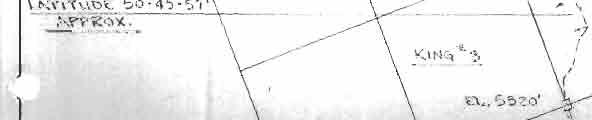
4 ASSESSMENT WORK REPORT on THE KING GROUP OF MlNING CLAW for BbNN txplokations LTD CAMBIE 5'IREEET. VANCUJVEk, IL(L by F.C. Torlineon, P.tng. bocation: The King group of mini% claims were staked covering the crest of Mismion Mountain and part of the flank facing towards Carpenter Lake, (Bridge River) to the north and part of the flank facing towarda Anderaon and Seton Lakes on the south. as followe: This group is componed of 46 located mineral claims Claim NWera Becord Number* Expiration Date King 1 to to June 30, 1967 King 5 to to April 29, 1967 King 16-24,26, to May 16, 1967 King 28 to to May 25,1967 King 43 to to May 25, 1967 Early in June a prominent mining engineer,employed by a well known exploration company, examined the showings on the Kiqg Group of claims accompanied by Mr. John Schutz. President of Benn Explorations Ltd.
5 This engineer recommended a Brunton and Tape survey of the workings, trenches, adit, trails and roads existing on the property and a reconnaissance soil sampling program. This work was done intermittently during the summer of 1966 by Mr. John Schutz with assistance as shown on the attached Statutory Declaration, in duplicate, by Mr. Schutz. Board and lodging was arranged for at Seton Lake Lodge ad they commuted to the prospect. For the survey Mr. Schutz used a Brunton Compase, a 200 ft. tape and an Abney level. The compass was adjusted to read astronomic horizontal angles and vertical angles were taken with the Abney level. A Thommens 3D 16 alti- meter was also used to check roughly calculated elevations and reference elevation at the Relay Tower. Horizontal distances were also calculated. Mr. Schutz is well qualified to carry out such a eurvey and also to take soil samples. He was employed by a eyndicate consisting of Noranda Mines, Granby and Placer Development, in charae of a party doing reconnaissance soil sampling, E.M. Survey and magnetometer survey in 1957 and 1958 seasons in the Merritt - Kamloopd area. Keith Fahrnie was the Professional Engineer in charge of this work for the syndicate.
6 Mr. Schutz supervised tb soil sampling. The samples were taken at depths from 6" to lw, or well below the humus on the surface. The lines were run on compass bearing and tied in on the surveyed trails as shorn on the plan, and samples were taken at intervals as shown on the attached plan reduced to half size. The original survey was plotted on a acale of 100 ft. to the inch. Yellow or orange plastic tape flag with sample number marked on it urks the location of each sample on the ground. Any sample taken can be located and checked if desired. 1 have personally inspected Hr. Schutzlc work in part on the ground and can vouch for the accuracy of the attached plan as prepared by him with allowance error of less than 1% for horizontal distance and less than 3% on vertical. 40 of the 46 claims have been grouped by the Benn Exploration as follows and as shown on the British Columbia Mining Receipt No E: Recording King Group of 40 claine - King 1-15; Mineral King! 16 to 24, 26, 27; King , 45 and 51. Accordi n( to the attached Statutory Declaration sworn to by Hr. property which, assessment work John bchutc,(ijol~.66 has been spent on the in my opinion, ~hould be acceptable as on the group.
7 If this amount can be applied as aanesarent work it can be applied to claim King #1 to #15, Mineral King k21, )23 and #24, Xing #29 to #31, and Kiw 633, $35, #37, $43, #45, $47, P48, #49, #SO and Y51. If any amount less than $3,000 is approved, the work can be recorded on the claiar in the order linted above omitting the claima at tho end of the lint. Jnter~retationr The total heavy metal. determination. as indicated on the plan and +400 along with the mineralisation showing in the adit and the soil sampling adjacent to the known Pb. Zn. mineralization, muggeste the possibility that the area covered by part of the reoomaieaance geochemical survey may be underlain by aediur to low grade ore of appreciable extent. A program of bulldozing to bedrock along or close to the surveyed trails has been recommended to inveetigate the geochemical anoaaloue areas. If appreciable areas of mineralization with ore raking possibilities am indicated a drilling program will be recommended. Vancouver, B C. $ d&j,dw- 'V F.C. Torlineon, P.Eng. April 7, 1967
8 ADDENDUM 1. Additional data on soil sampling procedures: a) The instrument used for obtaining samples was a small pick. When the hoie was of sufficient depth the sample was manually removed. b) I cannot identify the soil horizon, how- ever the samples were soil and clear of organic material. c) The samples were packaged in "Plain Poly Bagsn measuring 4" x 2" x 10" with capacity of 2 lbs. as manufactured by Union Carbide. d) Mr. Van hnglund of T.5.L. Laboratories Ltd. stated the samples were dried to 200 temperature, then screened through an 80 mesh nylon screen. The minus 80 mesh material was retained on an alumina pan.
9 1. e) Mr. Van Englund of T.S.L. Laboratories stated the Mo result was obtained by hot HC1 extraction, then determined by Zinc Dithiol method. The Cu., Pb., and Zn. result was by hot nitric extraction with each element determined by atomic absorption do not consider that the cost per sample is excessive. If, for example, a rectangular field that is level and with known boundaries were to be sampled the cost would be low. However, transpose this field to the side of a mountain whose general area only is known and with vertical elevation ranging more U~an 1000 feet, the problems increase proportionately. In view of the circumstances it was decided that a simultaneous survey - soil sampling program be effected. Control has been achieved and positions of all samples are known. Because of this, further soil sampling should be at a reduced cost. BENN EXPLORAZIONS LTD. (N.P.L.1


10
11 ASSAYERS OEOCHEMlST6 325 HOWE STREET - VANCOUVER 1, 0.C. TELEPHONE REPORT NO. I
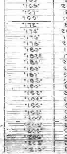
12 325 HOWE STREET - VANCOUVER 1, B.C. TELEPHONE OEO I REPORT NO. I SAMPLE No Cu Pb Zn 1 AS 1 Ni Mo - 24 I I I I I I I I F7 DATE SIGNED C 22caZ-&-, u I ". LI DIVISION OF TECHNICAL SERVICE LABORATORIES 1.1 1" +
13 ASSAYERS QEOCHEMISTB u SAMPLE@) FROM 325 HOWE STREET - VANCOUVER I, B.C. TELEPHONE I REPORT'NO. I a,*fla/-4,. DATE Zh SIGNED - - 6' L -7" DIVISION OF TECHNICAL SERVICE LABORATORIES.-
14 ASSAYERS GEO 325 HOWE STREET - VANCOUVER 1, B.C. TELEPHONE I REPORT NO. ISbk DATE, 2, SIGNED A I - U 7- DIVISION OF TECHNICAL SERVICE LABORATORIES.-
15 ASSAYERS GEO 325 HOWE STREET - VANCOUVER 1, B.C. TELEPHONE I REPORT NO. ( 251: 17C.L DATE SIGNED - = I DIVISION OF TECHNICAL SERVICE LABORATORIES
16 ASSAYERS GEO J 325 HOWE STREET - VANCOUVER 1, B.C. TELEPHONE REPORT NO. 0 DATE U 27. I I ~ L SIGNED & i a DIVISION OF TECHNICAL SERVICE LABORATORIES WZ-
17 ASSAYERS QEO 325 HOWE STREET - VANCOUVER 1, B.C. TELEPHONE I REPORT NO. I I, ijkh r I 14I A' u -- \ DATE SIGNED 67 DIVISION OF TECHNICAL SERVICE LABORATORIES i,-.. -
18 ASSAYERS OEO 325 HOWE STREET - VANCOUVER 1, LC. TELEPHONE I REPORT NO. I n DATE SIONED t7ii \ DIVISION OF TECHNICAL SERVICE LABORATORIES I I
19 ASSAYERS GEO U 325 HOW STREET - VANCOUVER 1, B.C. TELEPHONE SAMPLEG) FROM REPORT NO. - - DATE SIGNED u I +=. DIVISION OF TECHNICAL SERVICE LABORATORIES
20 ASSAYERS OEOCHEMIsTs 325 HOWE STREET - VANCOUVER 1, LC. TELEPHONE SAMPLE(S) FROM /yo-+' REPORT NO. ---.I 4, DIVISION OF TECHNICAL SERVICE LABORATORIES DATE 7, SIGNED /E -A??&&&/
21 ASSAYERS GEO 325 HOWE STREET - VANCOUVER 1, B.C. TELEPHONE SAMPLE&) FROM SAMPLE(S1 OF El REPORT NO ~ DATE b b XB&/ SIGNED /' _ a j DIVISION OF TECHNICAL SERVICE UBORAT6RIES
22 ~ -~ ASSAYERS OEO 325 HOWE STREET - VANCOUVER 1, B.C. TELEPHONE REPORT NO. I 21 / / 22 " H*, C$- /' ~1.3 DATE SIGNED DIVISION OF TECHNICAL SERVICE LAB ~. Y. I ~ ~
23 ASSAYERS OEOCHEMISTD HOWE STREET - VANCOUVER 1, B.C. TELEPHONE DIVI~ION OF TECHNICAL SERVI
24 i ASSAYERS GEO 325 HOWE STREET - VANCOUVER 1, B.C. TELEPHONE REPORT NO. I DATE SIGNED DIVISION OF TECHNICAL SERVICE LABORAT
25 ASSAYERS OEOCHEMISTB 325 HOWE STREET - VANCOUVER 1, LC. TELEPHONE DIVISION OF TECHNICA - u. 7- U
26 ASSAYERS GEO 325 HOWE STREET - VANCOUVER 1, B.C. TELEPHONE SAMPLEM OF Scil I I 23 24?- _i- Q DATE w- SIONED DIVISION OF TECHNICAL SERVICE LAB RAT0../ dfl. ~. ~.. ~~~p wx-..


27


28
- LONGITUDE : 128'06 'W
 COMINCO LTD. WESTERN DISTRICT MARCH 1977 SOIL GEOCHEMICAL SURVEY SAND 1 and SAND 2 CLAIMS HIDDEN VALLEY AREA LIARD MINING DIVISION LATITUDE : 59'03' - LONGITUDE : 128'06 'W JUNE 20/76-JULY 12/76 REPORT
Geo chemi c a1 Rep or t SILVER KING FAST GROUP. H. S. Lazenby Geologist. Vancouver, B.C. 16 November 1967
 Geo chemi c a1 Rep or t on SILVER KING FAST GROUP 1967 Vancouver, B.C. 16 November 1967 H. S. Lazenby Geologist Contents Introduction P. 1 Method of Survey P. 1 Interpretation of Results p. L&2 Statement
Cominco ltd. REPORT OF GRID "C" GEOCHEMICAL SURVEY ON VINE 1 CLAIM, VINE 1, 25, 27 CLAIM GROUP Fort Steele Mining Division
 GOVERNMENT OFFICE Cominco ltd. EXPLORATION DIVISION REPORT OF GRID "C" GEOCHEMICAL SURVEY ON VINE 1 CLAIM, VINE 1, 25, 27 CLAIM GROUP Fort Steele Mining Division Submitted by: E.W. BATCHELOR Cominco Ltd.
REPORT SOIL GEOCHEMICAL SURVEY. ATTYCELLEY NO. 2 GROUP (Attycelley Mineral Claims No. 7-10)
") REPORT SOIL GEOCHEMICAL SURVEY ATTYCELLEY NO. 2 GROUP (Attycelley Mineral Claims No. 7-10) Situated 7 miles east of north end of Thutade Lake, Omineca Mining Division British Columbia I Department of I
REPORT SOIL GEOCHEMICAL SURVEY ATTYCELLEY NO. 2 GROUP (Attycelley Mineral Claims No. 7-10) Situated 7 miles east of north end of Thutade Lake, Omineca Mining Division British Columbia I Department of I
GEOCHEMICAL REPORT THE 82M/12 FH GROUP BIRCH ISLAND, B.C. S1 119O NOW. ROYAL CANADIAN VENTUR 3S LTD. By: Vollo, P. Eng. N.B. Pay 28th, 1969.
 c GEOCHEMICAL REPORT ON THE 82M/12 FH GROUP AT BIRCH ISLAND, BC S1 119O NOW BY ROYAL CANADIAN VENTUR 3S LTD NB By: Vollo, P Eng Pay 28th, 1969 Approximately 700 samples were collected over 14 miles of
BALFOUR MINING LTD. (N.P.L.) HAM GROUP 92-P-6, CLINTON M. D.8 B. C. Lat 51 17'N, GEOCHEMICAL REPORT. V. CUKOR, P. Eng.
 HAM GROUP 92-P-6, CLINTON M. D.8 B. C. Lat 51 17'N, GEOCHEMICAL REPORT. V. CUKOR, P. Eng.") 34q '7 BALFOUR MINING LTD. (N.P.L.) HAM GROUP 92-P-6, CLINTON M. D.8 B. C. Lat 51 17'N, Long 12lo14'W GEOCHEMICAL REPORT, V. CUKOR, P. Eng. January 31, 1972 TABLE OF CONTENTS 1. INTRODUCTION 2. PROPERTY,
34q '7 BALFOUR MINING LTD. (N.P.L.) HAM GROUP 92-P-6, CLINTON M. D.8 B. C. Lat 51 17'N, Long 12lo14'W GEOCHEMICAL REPORT, V. CUKOR, P. Eng. January 31, 1972 TABLE OF CONTENTS 1. INTRODUCTION 2. PROPERTY,
COMINCO LTD. GRID A VINE CLAIM GROUP. Fort Steele Mining Division 82G/5. Sulilnit t ed by :
 COMNCO LTD. EXPLORATON DVSON WESTERN DSTRCT REPORT ON GEOCHEMCAL SURVEY GRD A VNE CLAM GROUP Fort Steele Mining Division 82G/5 Sulilnit t ed by : E.W. BATCHELOR Cominco Ltd. Kootenay Exploration 2450 Cranbrook
PROSPECTING REPORT THE WALLACE CLAIM OMENICA MINING DIVISION. 54" x6" 3.d d. for. Reako Exlorat ions Ltd. Wallace Rev. C.G.
 PROSPECTING REPORT ON THE WALLACE CLAIM OMENICA MINING DIVISION 54"44 14 1x6" 3.d d by David A. Howard P.Eng. for Reako Exlorat ions Ltd. Claim Locat ion Wallace Rev. C.G. #1560 Dome Mountain Area 9 3
PRECIOUS METALS. owner. JMT Services Corp. GEOCHPlICAL SAMPLING CHELASLIE WCE, NORTH CENTRAL, B.C. OMINECA MINING DIVISION NTS 93F/5E & 6W
 PRECIOUS METALS REPORT ON 1980 RECONNAISSANCE GEOCHPlICAL SAMPLING CHELASLIE WCE, NORTH CENTRAL, B.C. OMINECA MINING DIVISION NTS 93F/5E & 6W LATITUDE 53O28 N LONGITUDE 125O31 W DATES Qp WORK: JULY 10
Work performed between August 1 and December 1, 1975 COMINCO LTD. WESTERN DISTRICT NTS 93 '(~15 EXPLORATION GEOCHEMICAL SURVEY THE CRY AND CAB CLAIMS
 COMINCO LTD. EXPLORATION WESTERN DISTRICT NTS 93 '(~15 GEOCHEMICAL SURVEY ON THE CRY AND CAB CLAIMS CRIN PROPERTY Work performed between August 1 and December 1, 1975 NICHOLAS L. SZABO TABLE OF CONTENTS
ASSESShAENT REPORT Mines and Petroleum Resources. Department of. No* JIMMY MINERAL CLAIM FRANKLIN CREEK AREA, GREENWOOD M. D.
 GEOCHEMICAL REPORT ON JIMMY MINERAL CLAIM FRANKLIN CREEK AREA, GREENWOOD M. D. Lat. 49'35' OON, N.T.S. Long. 118O22' 00W 82-E-9 July 18-21, 1974 Vancouver, B.C. J.J. McDougall, P.Eng. July 21, 1974 * Department
51 46'N Latitude, 119'44'1;!
 COMI)!CO LTD. EXPLORATION NTS: 82 1'1/13E GEOCHEKICAL ASSESSMENT REPORT ON THE SI 1 MINERAL CLAIM in the Kamloops Mining Division 51 46'N Latitude, 119'44'1;! Longitude Work Period: June 25, 1979 - July
GEOLOGICAL BRANCH ASSESSMENT REPORT 12. FItE NO: ACTION: THE GOLDEN MINING DIVISION, GOLDEN, Including THE NTS MAP; M82K/15W
 ACTION: FItE NO: Including 1990 GEO-CHEM SURVEY RESULTS -- THE AVD CLAIMS - THE GOLDEN MINING DIVISION, GOLDEN, B.C. NTS MAP; M82K/15W Lat. 50 deg. 55 Min. Long 116 deg. 55 min. For GEOLOGICAL BRANCH ASSESSMENT
UMEX UNION MlNlERE EXPLORATIONS. AND MINING CORPORATION LIMITED
 UMEX UNION MlNlERE EXPLORATIONS. AND MINING CORPORATION LIMITED SUITE 200 I 4299 CANADA WAY BURNABY. RC. vso in4 TELEPHONE 437-949 i GEOCHEMICAL SOIL SURVEY CLAW -20 MINEFULL CLAIlW (Record Numbers 70095-7002,
GEOCHEMICAL REPORT ON THE YEP CLAIMS, Clinton Mining Division. P.E. Fox, PhD. P.Eng.
 CLNTON 1 MNNG RECORDER GEOCHEMCAL REPORT ON THE YEP CLAMS, Clinton Mining Division P.E. Fox, PhD. P.Eng. Fox Geological Consultants Ltd 204-635 Victoria St. Kamloops, B. C. August 5, 1974 Work done: Juge
GRANGES EXPLORATION AB CANADIAN DIVISION
 GRANGES EXPLORATON AB CANADAN DVSON GEOCHEMCAL REPORT ON "B" and "D" CLAMS OMNECA MNNG DEVSON FAWNE NOSE AREA LATTUDE: 53O 19' LONGTUDE: 125O 1' MNERAL RESOURCES BRANCH N.T.S 93F/6 E Owner and Operator
for the Greenwood Mining Division, B.C. NTS 82E/7W Latitude 49' 27' W, Longitude 118' 5 Prepared by a= D. Dylan Watt, B.Sc.
 t. b LOGnO: 37~ -08 m. ACTIO#: for the AMP AMP 2 AMP 3 t AMP 4 CLAIMS Greenwood Mining Division, B.C. NTS 82E/7W Latitude 49' 27' W, Longitude 8' 5 %E c,w zc *& a w Prepared by a= -4c. D. Dylan Watt, B.Sc.
58 l'gr'n 'E. Date: January 23, 1979 ASSESSMENT REPORT PLACER SAMPLING & JADE BOULDER EVALUATION PLACER LEASE Liard Mining Divison 1041/7E
 ASSESSMENT REPORT PLACER SAMPLING & JADE BOULDER EVALUATION PLACER LEASE 1711 Liard Mining Divison 1041/7E 58 l'gr'n 18 38'E Owner & operator: Cry Lake Jade Mines Ltd. Author: A.M. Homenuke, P.Eng. Date:
REPORT ON THE MAGNETOMETER SURVEYOF THE SO0 MINERAL CLAIMS MERRITT, B. C.
 336 REPORT ON THE MAGNETOMETER SURVEYOF THE SO0 MINERAL CLAIMS MERRITT, B. C. To: The Directore Copper Soo Mining Syndicate OSO~OOS, B. C. R. C. Clough hglneering Ltd. Harvey H. Cohen, P. Pmg. TABLE OF
GEOCSZNICAL - SURVEY. ICAMLOOPS Kl.D. 2'' 6;kr. HY "'f. Alfred R. Allen,P.Eng. 1 NO.%=...,... 6"- 'I.
 t i.i GEOCSZNICAL - SURVEY i p' ICAMLOOPS Kl.D. 2'' 6;kr HY 50-64 +."'f 121-51 NE 5-10-70 : 19-10-70 Alfred R. Allen,P.Eng. I) ' 1 6"- 'I. 1 NO.%=...,..... Q.C. EXPLORATIONS LTD. 2Cl- 535 Kowe Street Vancouver
UNION MINIERE EXPLORATIONS AND MINING CORPORATION LIMITED ASSESSMENT REPORT ON FITINAT MINERAL CLAIM. Alberni Mining Division Record No.
 M F )( UNION MINIERE EXPLORATIONS AND MINING CORPORATION LIMITED Suite 200, 4299 Canada Way, Burnaby, B.C. V5G 1 H4 Telephone (604) 437-9491 ASSESSMENT REPORT ON GEOCHEMICAL SOIL SURVEYS AND ROCKSAMPLING
PERCUSSION DRILLING REPORT ON THE MARA #1 CLAIM. Sirnilkameen Mining Division, B.C. for
 PERCUSSION DRILLING REPORT ON THE MARA #1 CLAIM Sirnilkameen Mining Division, B.C. for PARA MINERALS ti OILS INC. 770 McFarlane Tower, 700-4th Avenue S.W. Calgary, Alberta T2P 354 J.P. ELWELL, P. Eng.
RE~ORT ON. J.F.V. MILLAR, P. Eng. GEOCHEMICAL SURVEY TIMBASKET AND MOGUL MINERAL CLAIMS. Kinbasket Lake, B. C. 51 degrees 118 degrees N.E.
 RE~ORT ON GEOCHEMICAL SURVEY TIMBASKET AND MOGUL MINERAL CLAIMS Kinbasket Lake, B. C. 51 degrees 118 degrees N.E. J.F.V. MILLAR, P. Eng. Lease held by J.F.V. MILLAR Work done Sept. 22 - Oct. 3, 1967. REPORT
GOLDPLAY ANNOUNCES FURTHER SAMPLING RESULTS FROM SAN MARCIAL HISTORICAL CORE; CONFIRMS OPEN PIT TARGET NEAR SURFACE WITH gpt AgEq.
 GOLDPLAY ANNOUNCES FURTHER SAMPLING RESULTS FROM SAN MARCIAL HISTORICAL CORE; CONFIRMS OPEN PIT TARGET NEAR SURFACE WITH 46.0 METERS @ 129 gpt AgEq. August 28, 2018, Vancouver, BC - Goldplay Exploration
Summary of Rover Metals Geologic Mapping Program at the Up Town Gold Project, Northwest Territories
 October 13, 2017 Summary of Rover Metals Geologic Mapping Program at the Up Town Gold Project, Northwest Territories Vancouver, British Columbia, Canada - Rover Metals Corp., Rover, is pleased to provide
between F.J. on the 0H)PHYSICAL and GPX)CIiEMICAL SURVEYS of part of the sa.& SSmRT FIVE MILES SOUTH of GREENWOD, B.C. FIELD WORK DONE FOR
PHYSICAL and GPX)CIiEMICAL SURVEYS of part of the sa.& SSmRT FIVE MILES SOUTH of GREENWOD, B.C. FIELD WORK DONE FOR") FRED J. HEMSWORTH MINING ENGINEER 616 CREDIT FONCIER BLDG. 850 WEST HASTINGS STREET VANCOUVER 1, B.C. SSmRT on the 0H)PHYSICAL and GPX)CIiEMICAL SURVEYS of part of the LM-C GRDUP Of MINERAL CIAIN FIVE
FRED J. HEMSWORTH MINING ENGINEER 616 CREDIT FONCIER BLDG. 850 WEST HASTINGS STREET VANCOUVER 1, B.C. SSmRT on the 0H)PHYSICAL and GPX)CIiEMICAL SURVEYS of part of the LM-C GRDUP Of MINERAL CIAIN FIVE
UNION MINIERE EXPLORATIONS AND MINING CORPORATION LIMITED 1 GROUP OF MINERAL CLAIMS. Liard Mining Division, British Columbia
 UNION MINIERE EXPLORATIONS AND MINING CORPORATION LIMITED SUITE 200-4299 CANADA WAY BURNABY. RC. V5G 1 H4 TELEPHONE 437-949 1 - Z ASSESSMENT REPORT ON DIAMOND DRILLING ON THE CLAW NO. 1 GROUP OF MINERAL
ON TRACK FOR DISCOVERY. January
 ON TRACK FOR DISCOVERY http://dsmsyndicate.ca/ January 2018 1 PROJECT GENERATOR MODEL The DSM syndicate is a project generator focused on original discovery resulting from glacial and snowpack recession.
SOIL GEOCHEMISTRY ENTERPRISE MINE NTS 82 F/14 W ARCTEX ENGINEERING SERVICES CONSULTANT, OWNER, OPERATOR, AUTHOR JANUARY, 1.981
 SOIL GEOCHEMISTRY ENTERPRISE MINE t SLOCAN MINING DIVISION, Bn C, NTS 82 F/14 W LATITUDE 49'49') LONGITUDE 1'19' ARCTEX ENGINEERING SERVICES I L, B, GOLDSMITH, PiENG, CONSULTANT, OWNER, OPERATOR, AUTHOR
49" 3-4 I4 I \ Y 59 tj
 ASSESSMENT REPORT Mary 4 FORT STEELE M.D. NTS 82G/5W 49" 3-4 4 \ Y 59 tj Owner: St. Eugene Mining Corporation Limited Operator : St. Eugene Mining Corporation Limited Author: John R. Wilson Date Submitted:
Reconnaissance. Of the. Denis mineral claims. Situated at Kilometer 844 of the Alaska Highway. Liard Mining Division. Northeastern British Columbia
 Reconnaissance Of the Denis mineral claims Situated at Kilometer 844 of the Alaska Highway Liard Mining Division Northeastern British Columbia N.T.S. 94M.075 Latitude 59 42 25 Longitude 127 13 12 Field
7 MILES WEST OF PORT HARDY, B.C.
 GEOPHYSICAL REPORT VERTICAL INTENSITY MAGNETOMEER SURVEY ON LUK CLAIMS, 7 MILES WEST OF PORT HARDY, B.C. 50' 127O SE BY R. E. SHIELDS UNDER SUPERVISION OF J. R. BILLINGSLEY FOR SECOND0 MINING LTD. (N.
GOLD REACH (GRV) ANNOUNCES A 141% INCREASE IN INDICATED AND 91% INCREASE IN INFERRED RESOURCES AT SEEL
 ANNOUNCES A 141% INCREASE IN INDICATED AND 91% INCREASE IN INFERRED RESOURCES AT SEEL") GOLD REACH (GRV) ANNOUNCES A 141% INCREASE IN INDICATED AND 91% INCREASE IN INFERRED RESOURCES AT SEEL New Resource at Seel Contains 2.81 Billion lbs of Cu Eq Inferred Plus 0.58 Billion lbs of Cu Eq Indicated
GOLD REACH (GRV) ANNOUNCES A 141% INCREASE IN INDICATED AND 91% INCREASE IN INFERRED RESOURCES AT SEEL New Resource at Seel Contains 2.81 Billion lbs of Cu Eq Inferred Plus 0.58 Billion lbs of Cu Eq Indicated
3 I1 I I Ill 111 II! II 111 II Ill I IlE I I P I
 -7 3 1 1 11111111111111111111111111111111 ll 111! 111 111 111 111 111111111111111 ll 1111111 1 11111111111111 le P GEOCHEMCAL SURVEY OF THE KE AND D'ARCY CLAM GROUPS.. Similkameen Mining Division, B.C.
A B C PAD A HIGHLIGHTS
 Murchison Minerals Intercepts 12.30% Zinc, 0.70% Copper, 0.18% Lead and 42.03 g/t Silver 14.97% ZnEq over 6.37 Metres and Extends Known Limits of Brabant McKenzie VMS Deposit June 25, 2018 (Toronto, Ontario):
GEOLOGICAL BRANCH ASSESSMTNF REPORT
 A GEOCHEMICAL REPORT on the 49 CR. GROUP APPROX. 9 mi SW OF NELSON, B.C 49 CREEK AREA NELSON NINING DIVISION BRITISH COLUNBIA NINERAL CLAIM MAP N. T.S. 82-~/6 WEST LATITUDE$ 49' 27'~ LONGITUDE : 117' 2j0w
NICOLA M.D King Street West, April, 1969 AMALG 1-44 MINERAL CLAIMS 1. OWNER: Dr. F. R. Burton, W. M. Sirola, P. Eng.
 REPORT ON ' MAGNETIC AND ELECTROMAGNETIC SURVEY AMALG 1-44 MINERAL CLAIMS 1. NICOLA M.D. 49'501 N - 12Oo57f W OWNER: Dr. F. R. Burton, 1506-44 King Street West, Toronto 1, Ontario. by W. M. Sirola, P.
GIANT MASCOT MINES LIMITED ~nen~z~s~11~uumsn~ SURRARD STREET VANCOUVER 1, B. C. June 4, 1968
 NtNI OFFICE; P. 0. BOX 820. HOPE. 8. C. TELEP*ON
PHYSICAL WORK REPORT. the BAY CLAIMS. Omineca Mining Division Smithers, British Columbia N.T.S. 93E 13E/W
 PHYSICAL WORK REPORT the BAY CLAIMS Omineca Mining Division Smithers, British Columbia a N.T.S. 93E 13E/W LATITUDE: 53 57 00 N I LONGITUDE: 127 45 OO W for Home Ventures Ltd. 1201-675 West Hastings Street
SOIL GEOCHEMISTRY. OK-ll AND OK-Ill MINERAL CLAIMS MOUNT THOEN AREA OMINECA MINING DIVISION, B.C. NTS 93 MI6 E & 7 W
 SOIL GEOCHEMISTRY OK-ll AND OK-Ill MINERAL CLAIMS MOUNT THOEN AREA OMINECA MINING DIVISION, B.C. NTS 93 MI6 E & 7 W LATITUDE 55O23'N, LONGITUDE 127 01W Locke B. Goldsmith, P.Eng. Consulting Geologist December
GEOPHYSICAL REPORT. Airborne Magnetometer Survey. of the SHEEP-GOAT GROUP OF MINERAL CLAIMS. near Li l looet, B.C.
 GEOPHYSICAL REPORT 977 Airborne Magnetometer Survey of the SHEEP-GOAT GROUP OF MINERAL CLAIMS near Li l looet, B.C. Lillooet Mining Division (Lat.51 'lot Long. 122 40' 7 5t0[2L05E. for DUFFEY LAKES MINES
CANEX. PLACEE LIMITE-D
 P- CANEX. PLACEE LIMITE-D EhTDA KO MINES D IWSI OiV PHONE: FRASER LA'KE 699-6211 ENDAKO, B.C. CANADA VOJ ILO PERCUSSION DRILLING REPORT FOR NU. 2 GROUP OF MINERAL CLAINS CANEX PLACER LIMITED ENDAKO MINES
NTS 93L/9W GEOCHEMICAL AND GEOPHYSICAL REPORT MONA CLAIM OMINICA MINING DIVISION. Lati tude 54036'N; Longitude 'W
 GEOCHEMICAL AND GEOPHYSICAL REPORT ON MONA CLAIM OMINICA MINING DIVISION Lati tude 54036'N; Longitude 126018'W NTS 93L/9W April 1981 Paul Plicka Consulting Geologist LOCATION MAP INTRODUCTION TABLE OF
GEOCHEMICAL REPORT LAST LINK GROUP TEXADA ISLAND NANAIMO MINING DIVISION
 I GEOCHEMICAL REPORT LAST LINK GROUP TEXADA ISLAND NANAIMO MINING DIVISION -1- PROSPECTING & GEOCHEMICAL SOIL SURVEY FOR GOLD On the Last Link Group of Claims North End of Texada Island Nanaimo Mining
REPORT ON GEOCHEMICAL SAMPLING. Alta 1-8; Alta 1 & 2 Fr. Hillside 1-3; Hillside 5-8; Hillside Ext 3 & 4 Mellisande, Hepzibah, Jhanta Fr.
 REPORT ON GEOCHEMICAL SAMPLING Alta 1-8; Alta 1 & 2 Fr. Hillside 1-3; Hillside 5-8; Hillside Ext 3 & 4 Mellisande, Hepzibah, Jhanta Fr. Alpha 1-3 CLAIMS CARPENTER LAKE LILLOOET, B.C. AUGUST 1983, GEOLOGICAL
TOPOGRAPHICAL SURVEY REPORT ON THE GREENDROP PROPERTY NEAR CHILLIWACK, B.C. 92-H-3/W
 TOPOGRAPHICAL SURVEY REPORT ON THE GREENDROP PROPERTY NEW WESTMINSTER M.D. NEAR CHILLIWACK, B.C. 92-H-3/W Location: The central pap of the claims is located at coordinates 49 08'N, latitude by 121 26'W,
COPPER MOUNTAIN COMPLETES PHASE 2 DRILL PROGRAM AT NEW INGERBELLE WITH CONTINUED POSITIVE RESULTS
 COPPER MOUNTAIN COMPLETES PHASE 2 DRILL PROGRAM AT NEW INGERBELLE WITH CONTINUED POSITIVE RESULTS Vancouver, British Columbia September 19, 2018 Copper Mountain Mining Corporation (TSX: CMMC ASX:C6C) (the
(TSXV: GPLY, OTCQB: GLYXF
 GOLDPLAY ANNOUNCES POSITIVE RESULTS FROM SAMPLING OF HISTORICAL CORE AT SAN MARCIAL - ATTRACTIVE SILVER-LEAD-ZINC MINERALIZATION SUPPORTS OPEN PIT POTENTIAL October 09, 2018, Vancouver, BC - Goldplay Exploration
Simplified exploration work report
 Simplified exploration work report Work Report of exploration and examination of outcrops of rock and boulders Report on stripping and excavating work of $ 5 000 or less.(section 81 of regulation) Report
RECONNAISSANCE GEOCHEMICAL SURVEY
 RECONNAISSANCE GEOCHEMICAL SURVEY LEGAL, RITA, LOUISE FR. (CHAPLEAU GROUP) REVERTED CROWN GRANTS CHAPLEAU CREEK AREAJ, SLOC& MINING DIVISION 82 F/11W Lat: 49'44" Long: 117"22'W MINERAL RESOURCES BRANCH
PHYSICAL WORK REPORT ON THE. KINGDOMlwINERAL LILLOOET MINING DIVISION. NTS Map Sheet 92J/15W. Co-Ordinates North: East
 PHYSICAL WORK REPORT ON THE KINGDOMlwINERAL CLAIM LILLOOET MINING DIVISION NTS Map Sheet 92J/15W Co-Ordinates North: 50 48 East 120 48 For Assessment Work BY Edward Skoda October 15,2002 Vancouver, British
2013 GEOLOGICAL ASSESSMENT REPORT SHERIDAN HILL PROPERTY
 2013 GEOLOGICAL ASSESSMENT REPORT ON THE SHERIDAN HILL PROPERTY NEW WESTMINSTER MINING DIVISION BRITISH COLUMBIA NTS 092G07 49 16 31 NORTH LATITUDE, 122 39 48 WEST LONGITUDE PREPARED FOR Sheridan Hill
510 W. HASTINGS STREET
 GEOCHEMICAL SOIL SURVEY OF THE DILLARD & MABEL AREAS BRITISH COLUMBIA PREPARED FOR : CYPRUS EXPLORATION CORPORATION LIMITED 510 W. HASTINGS STREET VANCOUVER,B.C. PREPARED BY: BARRINGER RESEARCH LIMITED
GOLIATH REPORTS g/t Au and 1845 g/t Ag (53.9 oz/t) FROM 1 METRE CHIP SAMPLE AT DSM SKYHIGH PROPERTY
 FROM 1 METRE CHIP SAMPLE AT DSM SKYHIGH PROPERTY") GOLIATH REPORTS 15.75 g/t Au and 1845 g/t Ag (53.9 oz/t) FROM 1 METRE CHIP SAMPLE AT DSM SKYHIGH PROPERTY Toronto, Ontario December 4 th, 2018 Goliath Resources Limited (TSX-V: GOT) (OTCQB: GOTRF) (FSE:
GOLIATH REPORTS 15.75 g/t Au and 1845 g/t Ag (53.9 oz/t) FROM 1 METRE CHIP SAMPLE AT DSM SKYHIGH PROPERTY Toronto, Ontario December 4 th, 2018 Goliath Resources Limited (TSX-V: GOT) (OTCQB: GOTRF) (FSE:
GOLDSTRIKE DRILLING INTERSECTS 13 METERS GRADING 2.2 GRAMS PER TONNE GOLD, INCLUDING 8.50 METERS GRADING 3.21 GRAMS PER TONNE GOLD AT PLATEAU
 TSX-V: GSR APRAF.PK Frankfurt:KCG1 GOLDSTRIKE RESOURCES LTD. 1300-1111 West Georgia Street Vancouver, British Columbia Canada, V6E 4M3 Telephone: 604 681 1820 Facsimile: 604 681 1864 IR: 604 210 2150 http://www.goldstrikeresources.com
MAYO LAKE MINERALS INC
 MAYO LAKE MINERALS INC FOR IMMEDIATE RELEASE Press release 2014-05 Gold-Arsenic-Antimony Anomalies on Anderson Claim Group Follow-up Sampling on Davidson, Edmonton and Roop Claim Groups OTTAWA, ONTARIO,
ASSESSMENT REPORT ON THE PEAVINE PROJECT. DGW & Associates # Alberni Street, Vancouver, British Columbia, V6E 4V2
 ASSESSMENT REPORT ON THE PEAVINE PROJECT KAMLOOPS MINING DIVISION BRITISH COLUMBIA NTS 082M 12 Latitude 51 36' 19.0"North -- Longitude --119 47' 27.0"West UTM Zone 11, NAD 83 5720827N 306744E Prepared
lat ' N Long ' W
 305 7 ec1;, REPORT ON THE JERY CLAIMS OF POLA RESOURCES LTD. NTS 93L/16 0 0 lat. 54 45' N Long. 126 22' W BABIXE LAKE AREA OMINECA MINING DIVISION, B.C. PAUL PLICKA CONSULTING GEOLOGIST DECEMBER 30, 1981
True Width (m) Carneritos to
 Carneritos to") Exchange Tower 410-150 York Street Toronto, Ontario M5H 3S5 Canada www.mammothresources.ca FOR IMMEDIATE RELEASE: July 13, 2017 No. 08/17 Mammoth Resources Intersects 36.5 Grams per Tonne Gold in Channel
Exchange Tower 410-150 York Street Toronto, Ontario M5H 3S5 Canada www.mammothresources.ca FOR IMMEDIATE RELEASE: July 13, 2017 No. 08/17 Mammoth Resources Intersects 36.5 Grams per Tonne Gold in Channel
TRENCHING AT LAS DOLORES EXTENDS STRIKE LENGTH TO OVER 1,000 METRES, INTERSECTING
 January 31, 2018 NEWS RELEASE - #18-03 TSX- V: GRR Suite 501-595 Howe Street Vancouver, BC V6C 2T5 Tel: (604) 685-4655 Fax: (604) 685-4675 Toll Free: 1-888-685-4655 TRENCHING AT LAS DOLORES EXTENDS STRIKE
GEOCHEMICAL STREAM SAMPLING. on the PLACER LEASES NO. Jordan River/Bear Creek Area. Victoria Mining Division. Latitude 48 degrees 32 minutes N.T.S.
 GEOCHEMCAL STREAM SAMPLNG on the PLACER LEASES NO P. 8149, 8150, 8151, 8152, 8161, 8162, 8163, 8400, 10844, 10845 Jordan River/Bear Creek Area Victoria Mining Division Latitude 48 degrees 32 minutes Longitude
A PRELIMINARY REPORT ON THE ZYMOST2 CLAIM GROtP, TERRACE, B.C.
 NATIVE EXPLORATIONS LTD. A PRELIMINARY REPORT ON THE ZYMOST2 CLAIM GROtP, TERRACE, B.C. INTRODUCTION': The Zymoetz claim group is, at present, held under option by Native Explorations Ltd.. On the 19th
46s9. on the. July 19, 1973 to July 24, October, Troup 92-P-8. i nc I u s ive
 N.T.S.= 92-P-8 GEOCHEMICAL REPORT on the 'DUM' CLAIM GROUP A.G. Troup October, 1.473 -.- Names - Record Numbers DUM 1-24 inclusive 122804 to 122827 LOCATION: Little Fort area, British Columbia N.T.S. 92-P-8
DIAMOND DRILL REPORT ON THE LOCATED IN THE OMINECA MINING DIVISION FAWNIE NOSE AREA LATITUDE: 53O 17' LONGITUDE: 125O 10' NTS 93F 6E
 GRANGES EXPLORATION AB CANADIAN DIVISION DIAMOND DRILL REPORT ON THE G, H and I CLAIM BLOCKS LOCATED IN THE OMINECA MINING DIVISION FAWNIE NOSE AREA LATITUDE: 53O 17' LONGITUDE: 125O 10' NTS 93F 6E. -.
Goldsource Coal Intercepts in Saskatchewan
 Goldsource Coal Intercepts in Saskatchewan For Immediate Release VANCOUVER, B.C. April 28, 2008 Goldsource Mines Inc. (the Company ) wishes to make the following statements regarding the intercepts of
OSISKO METALS INTERSECTS 10.49% ZINC+LEAD OVER METRES AND 12.15% ZINC+LEAD OVER METRES AT PINE POINT
 OSISKO METALS INTERSECTS 10.49% ZINC+LEAD OVER 22.84 METRES AND 12.15% ZINC+LEAD OVER 17.00 METRES AT PINE POINT (Montreal November 19, 2018) Osisko Metals Incorporated (the Company or Osisko Metals )
of Youbou, V.I. on Work Done between Aulqust 10 and November four miles north 4a0w0 NE J.H. Mcmtqomery, Ph.D. P. Enq. GEOCHEMICAL SEPORT
 GEOCHEMCAL SEPORT on Work Done between Aulqust 10 and November 19. 1969, on Anne 23-3Ze 35-40 0.--...-, Mineral,..-... ~. -. -...: ::,;./.,....... ;; ' ',Claims.. owned::by Hlbernla Mlnlnq Co. Ltd.,' '..'
_.----." 2) Gravimetric Profiles... In Pocket TABLE OF CONTENTS PAGE - SUMMARY AN0 CONCLUSIONS... 1A GRAVIMETRIC SURVEY Field Procedures...
 Gravimetric Profiles... In Pocket TABLE OF CONTENTS PAGE - SUMMARY AN0 CONCLUSIONS... 1A GRAVIMETRIC SURVEY Field Procedures...") _.----." TABLE OF CONTENTS PAGE - SUMMARY AN0 CONCLUSIONS... 1A GRAVIMETRIC SURVEY... 1 Field Procedures... 1 Elevation and Horizontal Control... 2 Meter Procedures... 2 Computing Procedures... 2 Plotting...
_.----." TABLE OF CONTENTS PAGE - SUMMARY AN0 CONCLUSIONS... 1A GRAVIMETRIC SURVEY... 1 Field Procedures... 1 Elevation and Horizontal Control... 2 Meter Procedures... 2 Computing Procedures... 2 Plotting...
Mineral Resource Estimate Comparison at 3 g/t Au cut-off
 HARTE GOLD CORP. 8 King Street East, Suite 1700 Toronto, Ontario, M5C 1B5 Tel: 416-368-0999 Fax: 416-368-5146 Harte Gold Announces 2018 Drilling Increases Indicated Mineral Resources by 55% Overall Resource
A Report on a Magnetometer Survey. Division, British Columbia. Gypsy 1-32 and Gypsy 1 Fr-9 Fr. 27 miles north of Smithers
 - A Report on a Magnetometer Survey on the Gypsy Claims, Omineca Mining Division, British Columbia Covering: Gypsy 1-32 and Gypsy 1 Fr-9 Fr Located: 27 miles north of Smithers Latitude 55O11' N Longitude
Spruce Ridge Resources Ltd Leslie Road West, Puslinch, ON N0B 2J0 Telephone: (519) , Fax: (519)
 , Fax: (519)") Spruce Ridge Resources Ltd. 7735 Leslie Road West, Puslinch, ON N0B 2J0 Telephone: (519) 822-5904, Fax: (519) 823-5090 PRESS RELEASE 2018-07 July 24, 2018 Spruce Ridge Resources Provides Update on the
Spruce Ridge Resources Ltd. 7735 Leslie Road West, Puslinch, ON N0B 2J0 Telephone: (519) 822-5904, Fax: (519) 823-5090 PRESS RELEASE 2018-07 July 24, 2018 Spruce Ridge Resources Provides Update on the
June 2017 Quarterly Report
 ASX ANNOUNCEMENT Date: 31 July 2017 June 2017 Quarterly Report Victory Mines Limited (ASX:VIC) ( Victory or the Company ) provides a review of its activities during the June 2017 quarter. Exploration Western
O ITHIS )WE OF WORK IN I EXTENT OF WORK I I PROJECT COSTS I ON WHICH CLAIMS (IN METRIC UNITS) APPORTIONED (id. support) GEOLOGICAL (scale, area)
WE OF WORK IN I EXTENT OF WORK I I PROJECT COSTS I ON WHICH CLAIMS (IN METRIC UNITS) APPORTIONED (id. support) GEOLOGICAL (scale, area)") Geological Survey Branch TITLE OF REPORT [type of SUNOY(S)] TOTAL COST 1 MINERAL INVENTORY M OWNER@) MAILING ADDRESS -.,-- a 5 -a OPERATOR(S) [who paid ffo the wnk) 2) MAILING ADDRESS 76e2 HWY 97/gm LP
Geological Survey Branch TITLE OF REPORT [type of SUNOY(S)] TOTAL COST 1 MINERAL INVENTORY M OWNER@) MAILING ADDRESS -.,-- a 5 -a OPERATOR(S) [who paid ffo the wnk) 2) MAILING ADDRESS 76e2 HWY 97/gm LP
Golden Predator Intersects 7.5 m of 33 g/t Gold at the 3 Aces Project; Discovers Significant Stockwork Mineralization
 NEWS RELEASE TSX.V: GPY January 19 th, 2017 NR 17-02 www.goldenpredator.com Golden Predator Intersects 7.5 m of 33 g/t Gold at the 3 Aces Project; Discovers Significant Stockwork Mineralization Vancouver,
Assessment Work Report. on the Geophysical Surveys carried out over the
 Assessment Work Report on the Geophysical Surveys carried out over the PINE GROUP of Mineral Claims 951-J-15-W Lillooet Mining Division Goldbridge, B.C. Long 122 48' Lat. 50 48' by Levon Resources Ltd.
A5SK S S.'r'oE :-17 REPURT
 Tatuk Lake Cu Proaperct report on TAT #lo28 CLAIM GROUP APIIERIEAN SMELTING & REPXHING COMPANY Located on the North slope of Tatuk M i l l minoca Mininq Dfviafon 53O -,124' SW Department of Mines and Petroleum
LH Property Update: Magnum Goldcorp Hits High Grade Gold 16.9 m of g/t, including 10.9 m of g/t, and as well, 11 m of 20.
 Trading symbol: TSX-V: IBC News Release No. 15-04 2489 BELLEVUE AVENUE WEST VANCOUVER, BC V7V 1E1 TEL 604 922 2030 FAX 604 922 2037 TOLL FREE (CANADA) 1 888 888 9122 TOLL FREE (USA) 1 888 888 9123 LH Property
FIRST 2 DRILL HOLES AT NAKRU-2 PROSPECT BOTH INTERSECT SIGNIFICANT HIGHER GRADE COPPER MINERALISATION
 ADDRESS PHONE PO Box 6965 +61(07) 5592 1001 Gold Coast Mail Centre FAX Qld 9726 Australia +61 (07) 5592 1011 EMAIL ABN 54 126 490 855 info@coppermoly.com.au WEBSITE www.coppermoly.com.au ASX Announcement
Fox 2-Record No. 2524
 F HELICOPTER E.M. AND MAGNETOMETER SURVEY OVER THE FOX CLAIMS, OMINECA MINING DISTRICT BRITISH COLUMBIA ON BEHALF OF OWNER MR. MIKE BOYLE Claims: Fox l-record No. 2523 Fox 2-Record No. 2524 Location 126'
GEOCHEMICAL REPORT ON A SOIL SAMPLING SURVEY OF PORTIONS OF THE KR GROUP OF MINERAL CLAIMS OF PLATEAU METALS LIMITED.
 GEOCHEMICAL REPORT ON A SOIL SAMPLING SURVEY OF PORTIONS OF THE KR GROUP OF MINERAL CLAIMS OF PLATEAU METALS LIMITED By Kol Lovang Christopher Riley, P. Eng., Supervisor c Vancouver, B. c. Work Performed:
REPORT OF PHYSICAL EXPLORATION AND DEVELOPMENT Section 15 - Mineral Tenure Act Regulation
 1. EVENT NUMBER(S) 1234567 4. RECORDED HOLDER Doe 123 Main Street REPORT OF PHYSICAL EXPLORATION AND DEVELOPMENT Section 15 - Mineral Tenure Act Regulation Mineral Titles and Policy Branch Ministry of
NEWS RELEASE Ocean Park Ventures Identifies Large Multi-Structure Sulfide Mineralized System Trapper Gold Project, British Columbia
 Suite 302 750 West Pender St Vancouver, BC V6C 2T7 Tel: 604-681-0084 Fax: 604-681-0094 www.oceanparkventures.com TSX-V SYMBOL: OCP NEWS RELEASE Ocean Park Ventures Identifies Large Multi-Structure Sulfide
Prospecting Report on the Dynasty Jade Placer Dorthy Creek Claims
 Prospecting Report on the Dynasty Jade Placer Dorthy Creek Claims Claims 550004, 541288, 547670 Mining Division - Liard NTS or BCGS location 104J080 Latitude and longitude of geographic centre of work
R.A. COMINCO LTD. EXPLORATION NTS: 92H/16. WESTERN DISTRICT January 6, 1982 ASSESSMENT REPORT 1981 SOIL GEOCHEMISTRY ON THE TROUT PROPERTY
 COMINCO LTD. EXPLORATION NTS: 92H/16 WESTERN DISTRICT January 6, 1982 ASSESSMENT REPORT 1981 SOIL GEOCHEMISTRY ON THE TROUT PROPERTY (Trout 1 and 6 Claims) SIWASH LAKE AREA, SIMILKAMEEN M.D., B.C. (Work
HIGH GRADE GOLD-BEARING QUARTZ VEIN DISCOVERED AT MIAREE, KARRATHA AREA WESTERN AUSTRALIA
 17 November 2010 Company Announcements Office Australian Stock Exchange Limited 20 Bridge Street SYDNEY NSW 2000 HIGH GRADE GOLD-BEARING QUARTZ VEIN DISCOVERED AT MIAREE, KARRATHA AREA WESTERN AUSTRALIA
W. 1.NELSON Jr. P. ENG.
 GEOCHEMICAL AND GEOPHYSICAL SURVEY SNO GROUP CLAIMS W. 1.NELSON Jr. P. ENG. NORANDA EXPLORATION COMPANY, LIMITED OMINECA MINING DIVISION AUG. 17, 1971 - AUG. 29, 1971 TABLE OF CONTENTS - Page INTRODUCTION
Prospecting Report 'S Office i DB Property, B.C. -J Negro Creek Nelson Mining District NTS 82F.050. Operator: Kootenay Gold Inc.
 . '.' I"' i9 12 Prospecting Report 'S Office i DB Property, B.C. -J Negro Creek Nelson Mining District NTS 82F.050 Operator: Kootenay Gold Inc. Owner: Darlene Lavoie Work Performed Summer of 2007 Report
Nortec Minerals reports Assays, Phase 1 drilling, Tom 1 North - Priority 1 Target, Tomboko Gold Property, Northeast Guinea, West Africa
 Nortec Minerals reports Assays, Phase 1 drilling, Tom 1 North - Priority 1 Target, Tomboko Gold Property, Northeast Guinea, West Africa Vancouver, BC / TNW Accesswire / Vancouver, B.C., January 3, 2018
REPORT ON ON THE. ALAMO 1 AND 2 CLAIMS Record Nos: 784(4) - 785(4) KAMLOOPS MINING DMSION LONG. 120'59'
 - 785(4) KAMLOOPS MINING DMSION LONG. 120'59'") REPORT ON BIOGEOCHEMICAL SURVEY AND LINECUTTING ON THE ALAMO 1 AND 2 CLAIMS Record Nos: 784(4) - 785(4) KAMLOOPS MINING DMSION N.T.S. LAT. 50 22', 92U7W LONG. 120'59', Owner: H. H. Shear 580-625 Howe Street
REPORT ON BIOGEOCHEMICAL SURVEY AND LINECUTTING ON THE ALAMO 1 AND 2 CLAIMS Record Nos: 784(4) - 785(4) KAMLOOPS MINING DMSION N.T.S. LAT. 50 22', 92U7W LONG. 120'59', Owner: H. H. Shear 580-625 Howe Street
Nortec Minerals announces Option to acquire 100% interest in the Cottonwood Vanadium-Uranium Project, Utah
 Nortec Minerals announces Option to acquire 100% interest in the Cottonwood Vanadium-Uranium Project, Utah Vancouver, BC / The Newswire / March 8, 2019 (the Company or Nortec ) (TSXV: NVT): Nortec announces
LUCKY BEN MINE PROJECT SEPTEMBER 2018 UPDATE
 LUCKY BEN MINE PROJECT SEPTEMBER 2018 UPDATE During the first week of July 2018 work was completed by our Geologist, Richard Morris, and support personnel to stake the Lucky Ben vein structure at surface
SAMPLE ID SAMPLE TYPE Au (g/t) Ag (g/t) Cu (%) AuEq**(g/t)
 Ag (g/t) Cu (%) AuEq**(g/t)") GOLDEN RIDGE RESOURCES DISCOVERS NEW ALKALIC CU-AU PORPHYRY TARGET ON ITS HANK PROJECT Kelowna, British Columbia November 22,2017 - Golden Ridge Resources Ltd. ( Golden Ridge or the Company ) (TSXV: GLDN).
GOLDEN RIDGE RESOURCES DISCOVERS NEW ALKALIC CU-AU PORPHYRY TARGET ON ITS HANK PROJECT Kelowna, British Columbia November 22,2017 - Golden Ridge Resources Ltd. ( Golden Ridge or the Company ) (TSXV: GLDN).
Where Exploration Intersects Discovery
 Phase III Step Out Drilling Extends Gold Mineralization to 0.5 km Along Trend at Pamlico Project, Nevada VANCOUVER, BRITISH COLUMBIA, July 10, 2018 (, US: NRGOF, Frankfurt: X6C) Newrange Gold Corp. ("Newrange"
NEWS RELEASE DRILLING BEGINS AT THE CERRO CASCARON GOLD AND SILVER PROJECT IN MEXICO
 HARVEST GOLD CORP. Suite 804 750 West Pender Street Vancouver, BC V6C 2T7 T: (604) 682-2928 F: (604) 685-6905 E: info@harvestgoldcorp.com W: www.harvestgoldcorp.com NEWS RELEASE DRILLING BEGINS AT THE
GEOLOGICAL BRAN ASSESS
 TITLE PAGE This report covers assessment work performed on the Mundy group, located in the Boundary Creek area, north of Greenwood, British Columbia. The work comprises of THM soil testing, trenching and
Goldsource Completes Winter Drill Program At Border; 34 Holes Contain Aggregate Coal Intercepts Ranging From 10 to 100 Meters
 Goldsource Completes Winter Drill Program At Border; 34 s Contain Coal Intercepts Ranging 10 to 100 Meters TSX-V: GXS For Immediate Release VANCOUVER, B.C. April 7, 2009 Goldsource Mines Inc. ( Goldsource
CERRO PRIETO PROJECT MINERAL CONCESSIONS LOCATION AND ACCESS
 Cerro Prieto CERRO PRIETO PROJECT MINERAL CONCESSIONS The Cerro Prieto Project is comprised of three mining exploitation concessions encompassing 2,723 hectares in northern Sonora, Mexico. Oroco holds
Surface Trenching Highlights. Santos Target. To (m) Width (m) Au (g/t) Comment. (m) Santos (1)-includes internal dilution
 Width (m) Au (g/t) Comment. (m) Santos (1)-includes internal dilution") Goldplay Exploration announces surface trenching program results to date at the 100% owned El Habal Property: including 130 meters grading 1.86 g/t Au, 100 meters grading 1.20 g/t Au, 90 meters grading
Goldplay Exploration announces surface trenching program results to date at the 100% owned El Habal Property: including 130 meters grading 1.86 g/t Au, 100 meters grading 1.20 g/t Au, 90 meters grading
Blox, Inc. Announces New Drilling Target Defined at Mansounia Gold Project.
 Blox, Inc. Announces New Drilling Target Defined at Mansounia Gold Project. Vancouver, British Columbia, July 6, 2018 Blox, Inc. (OTCQB: BLXX), ( Blox or the Company ) is pleased to announce that a new
Nortec Minerals initiates NI Technical Report and provides update on Phase 1 drilling, Tomboko Gold Property, Northeast Guinea, West Africa
 Nortec Minerals initiates NI 43-101 Technical Report and provides update on Phase 1 drilling, Tomboko Gold Property, Northeast Guinea, West Africa Vancouver, BC / TNW Accesswire / Vancouver, B.C., June