Prospecting Report on the Dynasty Jade Placer Dorthy Creek Claims
|
|
|
- Myrtle Clarke
- 5 years ago
- Views:
Transcription
1 Prospecting Report on the Dynasty Jade Placer Dorthy Creek Claims Claims , , Mining Division - Liard NTS or BCGS location 104J080 Latitude and longitude of geographic centre of work N W Owner of claims Dynasty Jade Ltd. Operator (Dynasty Jade Ltd) Author of report Gary Critchley Date the report submitted
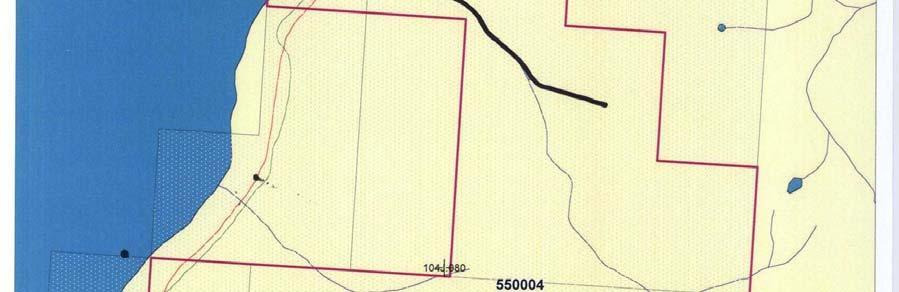
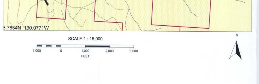
2 TABLE OF CONTENTS General geographic and physiographic position of the claims Property definition History of Property Brief Economic Assessment Summary of Work Done Prospecting Technical data and interpretation Author s and staff qualifications Maps Map Provincial Map Dease Lake Map 1:50,000 Scale Claims Map: Google Earth Map: Scale 1:30, Map: Road Work and Sample Collection Area Map: Creek Exploration area Pictures Photos: Placer Boulders Photos: Placer Boulders Photos: Attempting to Polish Other Documents Statement of Costs Copy Transaction Event Copy Transaction Event
3 General geographic and physiographic position of the claims The claims are located on the north east side of Dease Lake. Access to the claims is via an old overgrown road starting at Highway 37 at the north end of Dease Lake, about 10 kilo-meters north of the town of Dease Lake. Property definition Dynasty Jade Ltd. is a small development and mining company established for the purpose of mining jade. The major shareholder at this time is Gary Critchley. The Operator is Dynasty Jade Ltd. under the supervision of Steve Simonovic, with the help of Gary and Devon Critchley. Dynasty Jade Ltd. is the current owner of the tenures. Dynasty-Dorthy Dynasty Jade River History of Property Over the last many years there have been small mining operations, and exploration groups have worked the area. No extensive development has occurred, although an extensive trail system and test pits had resulted. Discoveries in the past had been small findings of placer, and exposed low grade jade. Brief Economic Assessment Early Economic Assessment indicates that more physical exploration is needed, and a further sampling of exposed jade boulders is also a must
4 Summary of Work Done 1. Prospecting The majority of the work was the loading of samples, and the transport of boulders to Jade City for cutting. Current road access was improved and the rehabilitation of an old road cut was accomplished. A few boulders were extracted using excavator, and samples were hauled away and cut using diamond saws. Walking the areas again, looking for more signs was completed again in the same areas previously walked. The majority of work done was for the exploration and development of the property, in a quest for high quality Jade boulders. Attached maps show areas of exploration 2. Technical data and interpretation The objection of the exploration program was to determine the likely hood of establishing a placer jade mining operation. Cobbles of jade found (10 tons), were of low quality, fractured, and very difficult to mine. More sampling will be necessary Preliminary investigation, also discovered, that quantities of low grade, in-situ nephrite jade was evident. The up-trust of exposed jade is surrounded by serpentine and fractured with asbestos. The jade was badly splintered, and was bluish green in color. 3. Author s and staff qualifications Gary Critchley Senior Accountant - Thompson Creek Mining Exploration, Jade Cutting - Jade City / King Mountain / Princess Jade Mines President (owner) of Dynasty Jade Robyn Bunns Exploration, Jade Cutting - Jade City / King Mountain Jade / Princess Jade Mines Donald Bunns???-2009 Exploration, Jade Cutting - Jade City - 2 -
5 Maps 1. Map Provincial Dynasty Dease Lake Placer Claims Map Center: N W - 3 -
6 2. Map Dease Lake 104J J I I J J I I J J I I.062 Map Center: 104J N W 104J
7 3. Map 1:50,000 Scale Claims 104J I J I.071 Map Center: N W - 5 -

8 4. Map: Google Earth - 6 -

9 5. Map: Scale 1:30,

10 6. Map: Road Work and Sample Collection Area - 8 -

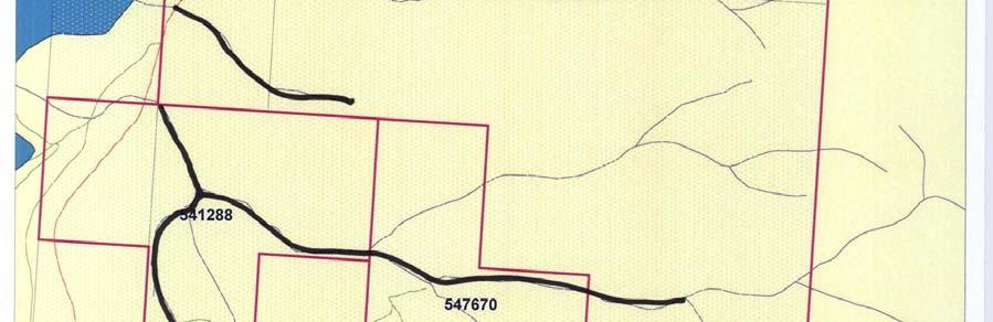
11 7. Map: Creek Exploration area - 9 -


12 Pictures 1. Photos: Placer Boulders 2. Photos: Placer Boulders

13 3. Photos: Attempting to Polish
14 Other Documents 1. Statement of Costs 19. Expense(s): (complete either hourly rate or daily rate) Total Hours OR # of days Hourly Rate Daily Rate Total(s) ($) Labour cost: (specify type) Robin ,750 Donnie Equipment & Machinery cost: (specify type) Quad Rental ,650 Lodging / Food: Rate(s) Days $16/meal Other: (specify) Live Out Costs 11 1, Total costs of work from above: $ Transportation/travel Rate(s) Days Total(s) ($) Specify type and full costs. 22. Transportation/travel, maximum 20% of $ value in 20 : Total costs of work (add 20 and 22): $7, Amount claimed for assessment credit on $ 7, claims:
Prospecting Report on the Dynasty Jade Claims
 Prospecting Report on the Dynasty Jade Claims Claims 519762, 520237, 520336 Mining Division - Liard NTS or BCGS location 104J080 Latitude and longitude of geographic centre of work 58.78 N 130.08 W Owner
ASSESSMENT REPORT TITLE PAGE AND SUMMARY
 ASSESSMENT REPORT TITLE PAGE AND SUMMARY TITLE OF REPORT: 2016 Prospecting Report Midas Claim TOTAL COST: $314.61 AUTHOR(S): Giacomo Grassi SIGNATURE(S): NOTICE OF WORK PERMIT NUMBER(S)/DATE(S): STATEMENT
ASSESSMENT REPORT TITLE PAGE AND SUMMARY
 ASSESSMENT REPORT TITLE PAGE AND SUMMARY TITLE OF REPORT: 2016 Prospecting Report Mystery Beryl TOTAL COST: $1299.09 AUTHOR(S): Giacomo Grassi SIGNATURE(S): NOTICE OF WORK PERMIT NUMBER(S)/DATE(S): STATEMENT
PROSPECTING REPORT. Karen Creek. EVENT # TENURE # Tenure Name: Karen Creek. New Westminster Mining Division Map 092H
 2008-2009 PROSPECTING REPORT Karen Creek EVENT # 4269354 TENURE # 578618 Tenure Name: Karen Creek New Westminster Mining Division Map 092H Central Coordinate Reference 121 17 30.7 W Longitude 49 26 21.9
ASSESSMENT REPORT TITLE PAGE AND SUMMARY
 ASSESSMENT REPORT TITLE PAGE AND SUMMARY TITLE OF REPORT: 2016 Prospecting Report Sphynx Claim TOTAL COST: $167.56 AUTHOR(S): Giacomo Grassi SIGNATURE(S): NOTICE OF WORK PERMIT NUMBER(S)/DATE(S): STATEMENT
ASSESSMENT REPORT TITLE PAGE AND SUMMARY
 ASSESSMENT REPORT TITLE PAGE AND SUMMARY TITLE OF REPORT: Assessment Report on Andys Bridge Mineral Claim, Turnagain River Area TOTAL COST: $2,100 AUTHOR(S): Bruce w Downing SIGNATURE(S): Bruce W Downing
REPORT OF PHYSICAL EXPLORATION AND DEVELOPMENT Section 15 - Mineral Tenure Act Regulation
 1. EVENT NUMBER(S) 1234567 4. RECORDED HOLDER Doe 123 Main Street REPORT OF PHYSICAL EXPLORATION AND DEVELOPMENT Section 15 - Mineral Tenure Act Regulation Mineral Titles and Policy Branch Ministry of
PROSPECTING REPORT. Broken Hill Property. EVENT # TENURE # Tenure Name: Broken Hill. New Westminster Mining Division Map 092H
 2009-2010 PROSPECTING REPORT Broken Hill Property EVENT # 4514071 TENURE # 600988 Tenure Name: Broken Hill New Westminster Mining Division Map 092H Central Coordinate Reference 121 24 26.2 W Longitude
O ITHIS )WE OF WORK IN I EXTENT OF WORK I I PROJECT COSTS I ON WHICH CLAIMS (IN METRIC UNITS) APPORTIONED (id. support) GEOLOGICAL (scale, area)
WE OF WORK IN I EXTENT OF WORK I I PROJECT COSTS I ON WHICH CLAIMS (IN METRIC UNITS) APPORTIONED (id. support) GEOLOGICAL (scale, area)") Geological Survey Branch TITLE OF REPORT [type of SUNOY(S)] TOTAL COST 1 MINERAL INVENTORY M OWNER@) MAILING ADDRESS -.,-- a 5 -a OPERATOR(S) [who paid ffo the wnk) 2) MAILING ADDRESS 76e2 HWY 97/gm LP
Geological Survey Branch TITLE OF REPORT [type of SUNOY(S)] TOTAL COST 1 MINERAL INVENTORY M OWNER@) MAILING ADDRESS -.,-- a 5 -a OPERATOR(S) [who paid ffo the wnk) 2) MAILING ADDRESS 76e2 HWY 97/gm LP
PROSPECTING REPORT PLACER CLAIM - FOX 4 SIMILKAMEEN MINING DIVISION MAP - 092H GPS COORDINATE REFERENCE CENTER OF CLAIM ' 6"N, 120.
 2011 PROSPECTING REPORT PLACER CLAIM - FOX 4 TENURE #793322 EVENT #5160421 SIMILKAMEEN MINING DIVISION MAP - 092H GPS COORDINATE REFERENCE CENTER OF CLAIM 49. 24' 6"N, 120. 36* 30" W REPORT PREPARED BY
PROSPECTING REPORT. re. Minera.1 C laims
 PROSPECTING REPORT re. Minera.1 C laims P R 1 Record #3052 (6) P R 2 Record #3053 (6) p R 3 Record #3054 (6) at Ilong.129, Latt. 58 20' in the Two Mile Creek area of Turnagain River drainage system in
GEOLOGICAL MAPPING REPORT ON THE ASH MINERAL CLAIM OSOYOOS MINING DIVISION ASHNOLA RIVER MAP SHEET NTS M092,H019 MCBRIDE CREEK AREA, ASHNOLA RIVER,
 GEOLOGICAL MAPPING REPORT ON THE ASH MINERAL CLAIM OSOYOOS MINING DIVISION ASHNOLA RIVER MAP SHEET NTS M092,H019 LATITUDE 49 o O6, LONGITUDE 120 o 22 MCBRIDE CREEK AREA, ASHNOLA RIVER, KEREMEOS, B.C. CANADA
PROSPECTING REPORT. Deneau Creek. EVENT # TENURE # Tenure Name: Deneau Creek. New Westminster Mining Division Map 092H
 2010-2011 PROSPECTING REPORT Deneau Creek EVENT # 4844921 TENURE # 578616 Tenure Name: Deneau Creek New Westminster Mining Division Map 092H Central Coordinate Reference 121 18 04.5 W Longitude 49 26 13.9
ASSESSMENT REPORT ON THE PEAVINE PROJECT. DGW & Associates # Alberni Street, Vancouver, British Columbia, V6E 4V2
 ASSESSMENT REPORT ON THE PEAVINE PROJECT KAMLOOPS MINING DIVISION BRITISH COLUMBIA NTS 082M 12 Latitude 51 36' 19.0"North -- Longitude --119 47' 27.0"West UTM Zone 11, NAD 83 5720827N 306744E Prepared
58 l'gr'n 'E. Date: January 23, 1979 ASSESSMENT REPORT PLACER SAMPLING & JADE BOULDER EVALUATION PLACER LEASE Liard Mining Divison 1041/7E
 ASSESSMENT REPORT PLACER SAMPLING & JADE BOULDER EVALUATION PLACER LEASE 1711 Liard Mining Divison 1041/7E 58 l'gr'n 18 38'E Owner & operator: Cry Lake Jade Mines Ltd. Author: A.M. Homenuke, P.Eng. Date:
PROSPECTING REPORT THE WALLACE CLAIM OMENICA MINING DIVISION. 54" x6" 3.d d. for. Reako Exlorat ions Ltd. Wallace Rev. C.G.
 PROSPECTING REPORT ON THE WALLACE CLAIM OMENICA MINING DIVISION 54"44 14 1x6" 3.d d by David A. Howard P.Eng. for Reako Exlorat ions Ltd. Claim Locat ion Wallace Rev. C.G. #1560 Dome Mountain Area 9 3
Tricon Mining Ltd. 104 I/lE GEOLOGY AND DRILLING B.S. GROUP (B.S. 1&2) PROVENCHER LAKE LIARD MINING DIVISION 58' 16" 128' 40'W
 PROVENCHER LAKE LIARD MINING DIVISION 58' 16 128' 40'W") GEOLOGY AND DRILLING B.S. GROUP (B.S. 1&2) PROVENCHER LAKE LIARD MINING DIVISION 104 I/lE 58' 16" 128' 40'W OWNER & OPERATOR: WRITER: SUBMITTED: CRY LAKE JADE MINES LTD. A.M. Homenuke, P. Eng.(Geol.) November
GEOLOGY AND DRILLING B.S. GROUP (B.S. 1&2) PROVENCHER LAKE LIARD MINING DIVISION 104 I/lE 58' 16" 128' 40'W OWNER & OPERATOR: WRITER: SUBMITTED: CRY LAKE JADE MINES LTD. A.M. Homenuke, P. Eng.(Geol.) November
PERCY CONTRACTING SERVICES LTD.
 GEOLOGICAL REPORT ON TEN PLACER LEASES (3139, 3140, 3141, 3142, 3143, 3144, 3145, 3146, 3147, 3148) MOREHEAD CREEK CARIB00 MINING DIVISION, B.C. 938/12W (52 38 N, 121 47 W) For PERCY CONTRACTING SERVICES
Date Submitted: June General Nature of Report: Examination of Placer Samples
 General Nature of Report: Examination of Placer Samples Claim: Gold Channel, Record Number 3775!8 1 (Gold Channel Placer Property) Mining Division: Cariboo NTS 093 G 09 W and E Latitude 520 23 N' Longitude1210
EXPLORATION and DEVELOPMENT REPORT. Conrad Creek. PLACER and MINERAL CLAIMS SOUTHEAST BRITISH COLUMBIA
 EXPLORATION and DEVELOPMENT REPORT on Conrad Creek PLACER and MINERAL CLAIMS in SOUTHEAST BRITISH COLUMBIA Ed Friesen, BSc.E.E., P. Eng 8 Lake Placid Rise SE Calgary, Alberta T2J 5B5 April 2009 1 P age
DEVELOPMENT REPORT. Lone I Mineral Claim Group. Wild Horse River Area Cranbrook, B.C.
 DEVELOPMENT REPORT Lone I Mineral Claim Group Wild Horse River Area Cranbrook, B.C. Fort Steele Mining District NTS 82G/12E 49 38 35 Latitude 115 38 00 Longitude LONE PEAK PLACER LTD. 514-13th Avenue South
Gold c 8 Rl!TI I8 8 I0 n0 '8 Off VANCOUVER, B.C. btandard I Property
 ,- PROSPECTING REPORT For the 1 Gold c 8 Rl!TI I8 8 I0 n0 '8 Off ig@ VANCOUVER, B.C. btandard I Property I SALMON GOVERNMENT AGENT ARM I Tenure Number 554772 Revelstoke Mining Division, B.C. BCGS GRID
STONE MOUNTAIN. Owner: Kimberly Gale Powell. Technical Report for Tenures: , , , , ,
 STONE MOUNTAIN Owner: Kimberly Gale Powell Technical Report for Tenures: 415067, 415068, 415069, 415070, 415071, 415072. Approximate Property Location Latitude 49 29 3 North Longitude: 120 40 47 West Similkameen
Reconnaissance. Of the. Denis mineral claims. Situated at Kilometer 844 of the Alaska Highway. Liard Mining Division. Northeastern British Columbia
 Reconnaissance Of the Denis mineral claims Situated at Kilometer 844 of the Alaska Highway Liard Mining Division Northeastern British Columbia N.T.S. 94M.075 Latitude 59 42 25 Longitude 127 13 12 Field
Ronin Placer Ground-penetrating Radar Survey Report
 Ronin Placer Ground-penetrating Radar Survey Report Tenures: 837095, 837097 Mining Division: Greenwood NTS Location: 082E/03 Geographic Center Coordinates: UTM Zone 11, E 345340, N 5438730 Claims Owner:
Prospecting Report Grandpa Claim Group
 2010 2011 Prospecting Report Grandpa Claim Group TENURE NUMBER: 705523 EVENT NUMBER: 4825383 TENURE NAME: GRANDPA Lillooet Mining Division Map 092I Central Coordinate Reference 50 57 30 N Latitude 121
Report on Exploration of Waterhen Claims Port Alberni Area of British Columbia. n 1 - Tenure # Tenure #399108
 Report on Exploration of Waterhen Claims Port Alberni Area of British Columbia n 1 - Tenure #399107 2 - Tenure #399108 Location: Victoria Mining Division Owner: Barry Hanslit Operator: Barry Hanslit A
4J)SESSMEN'I' REPORT BRANCH. cc" FILE No: ASSESSMENT REPORT VICTORIA MINING DIVISION. Latitude 123O SF' Longitude 48O S5'
SESSMEN'I' REPORT BRANCH. cc FILE No: ASSESSMENT REPORT VICTORIA MINING DIVISION. Latitude 123O SF' Longitude 48O S5'") ASSESSMENT REPORT - ON THE ORM 1 MINERAL CLAIM VICTORIA MINING DIVISION NTS 92B cc" Latitude 123O SF' Longitude 48O S5' 3-2. w N C FILE No: @&@LOGI.CAL BRANCH 4J)SESSMEN'I' REPORT Date : June 1, 1990 TABLE
ASSESSMENT REPORT - ON THE ORM 1 MINERAL CLAIM VICTORIA MINING DIVISION NTS 92B cc" Latitude 123O SF' Longitude 48O S5' 3-2. w N C FILE No: @&@LOGI.CAL BRANCH 4J)SESSMEN'I' REPORT Date : June 1, 1990 TABLE
Ronin and Dayton Placer Ground-penetrating Radar Survey Report
 Ronin and Dayton Placer Ground-penetrating Radar Survey Report Tenures: 837095, 837097, 889865, 890187 Mining Division: Greenwood NTS Location: 082E/03 Geographic Center Coordinates: UTM Zone 11, E 345340,
VICTORIA, BC FILE NO,
 FILE NO, VICTORIA, BC DEC - 7 2006 BFUTISH COLUMBIA Ministry of Energy & Mines Energy & Minerals Division Geological Survey Branch ASSESSMENT REPORT TITLE PAGE AND SUMMARY TITLE OF REPORT [type of survey(s)]
EMORY PLACER CLAIM Yale Region New Westminster Mining Division
 EMORY PLACER CLAIM Yale Region New Westminster Mining Division EVENT # 4646011 TENURE # 608187 Tenure Name: Emory NTS Map 92H/11 Approximate Centre of Tenure 121 25 12 W Longitude 49 30 44 N Latitude Report
Geology Geologists and Prospectors
 Geology Geologists and Prospectors David Lefebure and JoAnne Nelson BC Geological Survey April 17, 2008 Ministry of Energy and Mines Geology - A type of Geoscience is the study of the Earth, the materials
PROSPECTING REPORT TENURES # / / CLAIM NAMES OLD SETTLER; OLD SETTLER1; OLD SETTLER2
 2011 PROSPECTING REPORT EVENT - 5160426 TENURES # 688183 / 691903 / 691905 CLAIM NAMES OLD SETTLER; OLD SETTLER1; OLD SETTLER2 COAST CRYSTALINE BELT REGION NEW WESTMINSTER MINING DISTRICT MAP - 092H GPS
PROSPECTING REPORT TENURES # / / CLAIM NAMES OLD SETTLER; OLD SETTLER1; OLD SETTLER2
 2010 PROSPECTING REPORT EVENT # 4820658 TENURES # 688183 / 691903 / 691905 CLAIM NAMES OLD SETTLER; OLD SETTLER1; OLD SETTLER2 COAST CRYSTALINE BELT REGION NEW WESTMINSTER MINING DISTRICT MAP - 092H GPS
FORERUNNER RESOURCES REPORT ON SPANISH LAKE PLACER PROJECT PLACER CLAIM (PC 601) LIKELY, B.C. CARIB00 MINING DISTRICT N T A 11W
 LIKELY, B.C. CARIB00 MINING DISTRICT N T A 11W") I FORERUNNER RESOURCES REPORT ON SEISMIC REFRACTION INVESTIGATION SPANISH LAKE PLACER PROJECT PLACER CLAIM 264364 (PC 601) LIKELY, B.C. CARIB00 MINING DISTRICT N T 5 093 A 11W 0 ' 0 ' 52 35 NORTH, 121
I FORERUNNER RESOURCES REPORT ON SEISMIC REFRACTION INVESTIGATION SPANISH LAKE PLACER PROJECT PLACER CLAIM 264364 (PC 601) LIKELY, B.C. CARIB00 MINING DISTRICT N T 5 093 A 11W 0 ' 0 ' 52 35 NORTH, 121
Simplified exploration work report
 Simplified exploration work report Work Report of exploration and examination of outcrops of rock and boulders Report on stripping and excavating work of $ 5 000 or less.(section 81 of regulation) Report
About places and/or important events Landmarks Maps How the land is, hills or flat or mountain range Connected to maps World Different countries
 What do you think you know about geography? About places and/or important events Landmarks Maps How the land is, hills or flat or mountain range Connected to maps World Different countries What do you
COAU PROPERTY LEMHI COUNTY, IDAHO
 COAU PROPERTY LEMHI COUNTY, IDAHO Utah Mineral Resources 447 N 300 W, Suite 3 Kaysville, UT 84037 (801) 544-3421 ojgatten@nae-xploration.com Prepared by: North American Mine Services, LLC. March 21, 2017
ASSESSMENT REPORT MAGNETOMETER SURVEY GOLDEN ROD, GOLDEN ROD #2. Long.: General Delivery, Vananda, B. C.
 ASSESSMENT REPORT MAGNETOMETER SURVEY GOLDEN ROD, GOLDEN ROD #2 t=/ NTS 92~110w Lat.: Long.: 49O 44' N 124O 34' W Owner: E. Johanson General Delivery, Vananda, B. C. Operator: Rhyolite Resources I nc.
UNION MINIERE EXPLORATIONS AND MINING CORPORATION LIMITED ASSESSMENT REPORT ON FITINAT MINERAL CLAIM. Alberni Mining Division Record No.
 M F )( UNION MINIERE EXPLORATIONS AND MINING CORPORATION LIMITED Suite 200, 4299 Canada Way, Burnaby, B.C. V5G 1 H4 Telephone (604) 437-9491 ASSESSMENT REPORT ON GEOCHEMICAL SOIL SURVEYS AND ROCKSAMPLING
AiG ON THE EASTRIM mm. Record number KENNJZDY LAKE AREA - ALBERNI MINING DIVISION Map 92Fl3 W
 ON THE EASTRIM mm CLAIM Record number 3799 19 KENNJZDY LAKE AREA - ALBERNI MINING DIVISION Map 92Fl3 W 125" 23' West Lbngitude - 49" 09' North Latitude Walter GUPPY August ZO;i;! t I : AiG272002 TABLE
1 FILMED 1. FILE NO:!..rsrru -* -. GRAND TWO CLAIM
 FILE NO:!..rsrru -* -. GRAND TWO CLAIM REPORT ON 1993 ASSESSMENT WORK GRAND TWO CLAIM REC. NO. 301849 NELSON MINING DIVISION NTS MAP SHEET 82F6/W 49 25'51" NORTH 117 18'08" WEST 1 FILMED 1 AUTHOR: R. Jordan,
Mines Act Permit MX km East of Dease Lake, B.C. in the Skeena Mining Division. NTS Location at 1:50,000 Scale NAD 27 Base Map 104I 7
 TECHNICAL ASSESSMENT REPORT on the JEDWAY PROPERTY Mines Act Permit MX-1-904 62 km East of Dease Lake, B.C. in the Skeena Mining Division NTS Location at 1:50,000 Scale NAD 27 Base Map 104I 7 Centered
Prospecting Report 'S Office i DB Property, B.C. -J Negro Creek Nelson Mining District NTS 82F.050. Operator: Kootenay Gold Inc.
 . '.' I"' i9 12 Prospecting Report 'S Office i DB Property, B.C. -J Negro Creek Nelson Mining District NTS 82F.050 Operator: Kootenay Gold Inc. Owner: Darlene Lavoie Work Performed Summer of 2007 Report
ASSESSMENT REPORT TITLE PAGE AND SUMMARY
 ASSESSMENT REPORT TITLE PAGE AND SUMMARY TITLE OF REPORT: Assessment Report on The Plateau Mineral Claim, Turnagain River Area TOTAL COST: $11,026 AUTHOR(S): Bruce w Downing SIGNATURE(S): Bruce W Downing
Summary of Rover Metals Geologic Mapping Program at the Up Town Gold Project, Northwest Territories
 October 13, 2017 Summary of Rover Metals Geologic Mapping Program at the Up Town Gold Project, Northwest Territories Vancouver, British Columbia, Canada - Rover Metals Corp., Rover, is pleased to provide
Technical Report. On the. Owl Claim(s) Date: Jan. 17, Claim # Written By Lucas Handley. Claim Owner
 Date: Jan. 17, Claim # Written By Lucas Handley. Claim Owner") Technical Report On the Owl Claim(s) Date: Jan. 17, 2011 Claim # 837846 838049 838242 859407 Written By Lucas Handley Claim Owner Intro The 4 claims covered in this report cover what was mostly historically
Technical Report On the Owl Claim(s) Date: Jan. 17, 2011 Claim # 837846 838049 838242 859407 Written By Lucas Handley Claim Owner Intro The 4 claims covered in this report cover what was mostly historically
for the Greenwood Mining Division, B.C. NTS 82E/7W Latitude 49' 27' W, Longitude 118' 5 Prepared by a= D. Dylan Watt, B.Sc.
 t. b LOGnO: 37~ -08 m. ACTIO#: for the AMP AMP 2 AMP 3 t AMP 4 CLAIMS Greenwood Mining Division, B.C. NTS 82E/7W Latitude 49' 27' W, Longitude 8' 5 %E c,w zc *& a w Prepared by a= -4c. D. Dylan Watt, B.Sc.
American Creek Resources is a precious metals exploration company with an impressive portfolio of high-potential gold
 American Creek Resources is a precious metals exploration company with an impressive portfolio of high-potential gold and silver projects in British Columbia. These include properties in B.C.'s prolific
ASSESSMENT REPORT TITLE PAGE AND SUMMARY
 ASSESSMENT REPORT TITLE PAGE AND SUMMARY TITLE OF REPORT: Assessment Report on Big Dean Mineral Claim, Turnagain River Area TOTAL COST: $9,164 AUTHOR(S): Bruce w Downing SIGNATURE(S): Bruce W Downing NOTICE
The Cassiar Mountains
 The Cassiar Mountains Introduction Topography Dease Plateau Dease Lake, BC Stikine Ranges Eve Cone Mount Edziza Provincial Park Mount Ash, BC 2 125m Ketchika Ranges Muskwa- Ketchika Management Area Sifton
GEOLOGIC ASSESSMENT / QUARRY PLAN REVIEW BLACK GOLD GRANITE QUARRY DEVELOPMENT
 GEOLOGIC ASSESSMENT / QUARRY PLAN REVIEW BLACK GOLD GRANITE QUARRY DEVELOPMENT GARIBALDI RESOURCES CORP. BLACK GOLD GRANITE CLAIMS GREENWOOD MINING DIVISION GRAND FORKS, B.C., CANADA NTS 82 E/7 E UTM (Zone
on the Diamond Drilling done on the LAKESIOE GROUP of Mineral Claims SLOCAN MINING DIVISION 82-F-14-W Long ' Lat '
 Assessment Work Report on the Diamond Drilling done on the LAKESIOE GROUP of Mineral Claims SLOCAN MINING DIVISION 82-F-14-W Long 117 22' Lat. 49 58' ADRIAN KESLER SILVERTON, B.C. operator LEVON RESOURCES
Jedway Enterprises Ltd st Ave, Surrey, BC V3S 3M3
 Jedway Enterprises Ltd. 104-19286 21 st Ave, Surrey, BC V3S 3M3 Prospecting Report on the Den (Den#1 to #4) Property, Takla Landing Area, Omineca Mining Division, British Columbia NTS 93N/12 Trim 093N052,093N062
City of Six Project. Gold Mining Property in Downieville, CA. 60 Acres of Claims. Estimated Resource of over 8,800 ounces of Gold
 City of Six Project Gold Mining Property in Downieville, CA 60 Acres of Claims Estimated Resource of over 8,800 ounces of Gold Adjoining the famous Ruby Mine Property Located on a Rich Tertiary Channel
for the Greenwood Mining Division, B.C. NTS 82E/7W 29' W, Longitude 118' 53' N Prepared by D. Dylan Watt, B.Sc.
 for the FltE NO: u VOLT 1, VOLT 2, VOLT 3, & VOLT 4 CLAIMS Greenwood Mining Division, B.C. NTS 82E/7W Latitude 49' 29' W, Longitude 118' 53' N Prepared by D. Dylan Watt, B.Sc. #309-1996 Trutch Street Vancouver,
Geographical Sources Lab
 HEWLETT-PACKARD COMPANY ILS 504-70 Fall 2010 Dr. Clara Ogbaa Geographical Sources Lab Lucinda D. Mazza 11/13/2010 GEOGRAPHICAL SOURCES LAB 2 Geographical Sources Lab The purpose of this assignment is to
Borehole mining removes the need for pit cut back and associated waste removal
 Merlin Diamonds Limited has being investigating the use of borehole mining at Merlin, as a means to optimise the economics of ore extraction at Merlin. Borehole mining involves the use of high pressure
GEOLOGICAL BRAN ASSESS
 TITLE PAGE This report covers assessment work performed on the Mundy group, located in the Boundary Creek area, north of Greenwood, British Columbia. The work comprises of THM soil testing, trenching and
Report of Gridding and Magnetic Surveys. On the. Munro Property. Munro and Beatty Townships, Ontario. Larder Lake Mining Division
 Report of Gridding and Magnetic Surveys On the Munro Property Munro and Beatty Townships, Ontario Larder Lake Mining Division Claims: 39 4244 For Big Red Diamond Corporation October 3, 2 Timmins, Ontario
Montgomery Bedrock Geology 21d-Gowganda Formation: conglomerate, sandstone, siltstone, argillite
 Work Report 2014 Trenching Montgomery Township G-3303 Claim #4259384,4245818 Sault Ste. Marie Mining Division Michael & Yvon Gagne Montgomery Copper Property 1 P a g e 2 P a g e Montgomery Bedrock Geology
2013 GEOLOGICAL ASSESSMENT REPORT SHERIDAN HILL PROPERTY
 2013 GEOLOGICAL ASSESSMENT REPORT ON THE SHERIDAN HILL PROPERTY NEW WESTMINSTER MINING DIVISION BRITISH COLUMBIA NTS 092G07 49 16 31 NORTH LATITUDE, 122 39 48 WEST LONGITUDE PREPARED FOR Sheridan Hill
GEOCHEMICAL STREAM SAMPLING. on the PLACER LEASES NO. Jordan River/Bear Creek Area. Victoria Mining Division. Latitude 48 degrees 32 minutes N.T.S.
 GEOCHEMCAL STREAM SAMPLNG on the PLACER LEASES NO P. 8149, 8150, 8151, 8152, 8161, 8162, 8163, 8400, 10844, 10845 Jordan River/Bear Creek Area Victoria Mining Division Latitude 48 degrees 32 minutes Longitude
Vergo Placer Claims Ground-penetrating Radar Survey Report
 Vergo Placer Claims Ground-penetrating Radar Survey Report Tenures: 583789, 586819 Mining Division: Greenwood NTS Location: 082E/03 Geographic Center Coordinates: UTM Zone 11, E 346013, N 5440152 Claims
We are committed to providing accessible customer service. If you need accessible formats or communications supports, please contact us.
 We are committed to providing accessible customer service. If you need accessible formats or communications supports, please contact us. Nous tenons à améliorer l accessibilité des services à la clientèle.
Preliminary Mineral Exploration on the Pickett Mountain Property T6R6 WELS, Penobscot County, Maine. Public Information Session December 5, 2017
 Preliminary Mineral Exploration on the Pickett Mountain Property T6R6 WELS, Penobscot County, Maine Public Information Session December 5, 2017 Outline of Presentation Wolfden Resources Corporation Who
ASSESSMENT REPORT ON THE VLF-EM SURVEY. Trail Creek Mining Division NTS: 82 F/4 W Longitude: 1 17' 49' 50" Latitude: 49O 03' 40"
 ASSESSMENT REPORT ON THE JERO 5 MINERAL CLAIM ROSSLAND, BRJTISH COLUMBIA VLF-EM SURVEY Trail Creek Mining Division NTS: 82 F/4 W Longitude: 1 17' 49' 50" Latitude: 49O 03' 40" Owner: Operator: Author:
 Assessment Report Geophysical Technical Report on Placer Claim: 897 BC Geological Survey Assessment Report 68 Cariboo Mining Division British Columbia Latitude 8 N. Longitude W NTS map sheet, 09A/E Owner:
OWNER OPERATOR: BLACKWATER EXPLORATIONS LTD. REPORT ON SEISMIC REFRACTION SURVEY PLACER GOLD EXPLORATION
 OWNER OPERATOR: BLACKWATER EXPLORATIONS LTD. REPORT ON SEISMIC REFRACTION SURVEY PLACER GOLD EXPLORATION CARIBOO MINING DISTRICT NTS 93G CLAIM PC682023 Latitude 53 13 35.64 Longitude 122 49 40.65 by Russell
Photo: Jean Laforest, Qiqavik Property, Nunavik
 Photo: Jean Laforest, Qiqavik Property, Nunavik Kuujjuaq Mining Workshop April 2016 Cautionary Statements Concerning Forward-Looking Statements This presentation contains "forward-looking information"
Rogue Resources Channel Sampling Returns Up to 99.9% SiO2 on Same Quartzite Unit G, 1.4 Km from Last Reported High Grade Results
 Suite 2270-1055 W. Georgia Street P.O. Box 11144, Royal Centre Vancouver, BC V6E 3P3 Telephone: 604-629-1808 September 2, 2015 TSX-V: RRS Rogue Resources Channel Sampling Returns Up to 99.9% SiO2 on Same
First Year assessment Report on Prospecting and Rock sampling, King George property, License M NTS 12A/05 Newfoundland and Labrador.
 First Year assessment Report on Prospecting and Rock sampling, King George property, License 016679M NTS 12A/05 Newfoundland and Labrador. Submitted by Shawn Rose For Shawn Rose January 2011 Work year
Early Exploration Plan Activity Information
 Early Exploration Plan Activity Information Activities That Require an Early Exploration Plan: Line cutting that is a width of 1.5 metres or less; Geophysical surveys on the ground requiring the use of
SIXTH SCHEDULE REPUBLIC OF SOUTH SUDAN MINISTRY OF PETROLEUM, MINING THE MINING (MINERAL TITLE) REGULATIONS 2015
 REGULATIONS 2015") SIXTH SCHEDULE REPUBLIC OF SOUTH SUDAN MINISTRY OF PETROLEUM, MINING THE MINING ACT, 2012 THE MINING (MINERAL TITLE) REGULATIONS 2015 Guidelines should be prepared by the Directorate of Mineral Development
SIXTH SCHEDULE REPUBLIC OF SOUTH SUDAN MINISTRY OF PETROLEUM, MINING THE MINING ACT, 2012 THE MINING (MINERAL TITLE) REGULATIONS 2015 Guidelines should be prepared by the Directorate of Mineral Development
Five Themes of Geography of Ecuador
 LESSON 1 Five Themes of Geography of Ecuador Lesson Objective The students will be able to: find the five themes of geography (location, movement, human/environment interaction, place, and region) of Ecuador
H/16/2065
 2015-02-06 2012-02-21 012H/16/2065 TENTH YEAR ASSESSMENT REPORT OF SITE VISIT AND POLISHING TESTS ON LIC. # 19491m BAIE VERTE PENINSULA, NL NTS 12H/16 BY NATHANIEL NOEL MSc. FOR E. MICHELE NOEL MINERAL
Assessment Report #
 Table Of Contents Event Sheet #5576884 Exploration Program for 2015 Summery Introduction Location and Access Climate Local Resources and infrastructure Physiography Property Bedrock Geology History of
Traveling the Past into the Present The Regon's Highways & Byways
 Periodic Atlas of the Traveling the Past into the Present The Regon's Highways & Byways David Peterson del Mar, Historian Heather Kaplinger, Cartographer Meg Merrick, Atlas Concept Few of the overland
PHYSICAL WORK REPORT. the BAY CLAIMS. Omineca Mining Division Smithers, British Columbia N.T.S. 93E 13E/W
 PHYSICAL WORK REPORT the BAY CLAIMS Omineca Mining Division Smithers, British Columbia a N.T.S. 93E 13E/W LATITUDE: 53 57 00 N I LONGITUDE: 127 45 OO W for Home Ventures Ltd. 1201-675 West Hastings Street
Pierce Cedar Creek Institute GIS Development Final Report. Grand Valley State University
 Pierce Cedar Creek Institute GIS Development Final Report Grand Valley State University Major Goals of Project The two primary goals of the project were to provide Matt VanPortfliet, GVSU student, the
%+ '$# $) %, %*$ " $ $ ' %' !()'-!" %( %"%! " *'+ - % %$! $)! " $)!" !$ ' "! )( ! $ '%& ')- % % "!#( (( ((# $) ' ) ((* & *# ' % %"*# ( !!
 %, %*$ $ $ ' %' !()'-! %( %%! *'+ - % %$! $)! $)! !$ ' ! )( ! $ '%& ')- % % !#( (( ((# $) ' ) ((* & *# ' % %*# ( !!") 001L/14/0218 First Year Assessment Report of Prospecting, Rock and Stream Sediment Sampling On Licence 18880M, NTS 1L/14 Burin Peninsula Newfoundland and Labrador Submitted by: Keith Kelloway Work year:
001L/14/0218 First Year Assessment Report of Prospecting, Rock and Stream Sediment Sampling On Licence 18880M, NTS 1L/14 Burin Peninsula Newfoundland and Labrador Submitted by: Keith Kelloway Work year:
41,a* h0.iiii*bll*i2l,i DEADWOOD CREEK. for. James R. on the BOMBINI GROUP OF CLAIMS. GREENWOOD, British Columbia. Lat. 49'07' Long. 118'43 f.
 GEOLOGCAL REPORT on the BOMBN GROUP OF CLAMS DEADWOOD CREEK GREENWOOD, British Columbia Lat. 49'07' Long. 118'43 f in the GREENWOOD MNNG DVSON for FURY EXPLORATONS LTD. (N. P. L. ) Vancouver, B. C. December
Early Exploration Permit Activity Information
 Early Exploration Permit Activity Information Activities That Require an Early Exploration Permit: Line cutting that is a width greater than 1.5 metres Mechanized stripping of a total surface area of greater
Wayne E. Sirmon GEO 301 World Regional Geography
 Wayne E. Sirmon GEO 301 Geography 301 Geography 301 MAP: A graphic representation of a portion of the earth s surface dawn to scale, as seen from above. Types of Maps Climate maps give general information
DRAWING YOUR CONTINENT
 CONTINENT PROJECT PART I On the attached sheet, you will draw your own continent. Use your creativity to create a continent that is uniquely your own. Give the continent a name. When you are finished with
Technical Report. Geochemical Sampling West of Raymond Creek on Vancouver Island. Victoria Mining District 092C 15. UTM Co-ordinates N E
 Technical Report Geochemical Sampling West of Raymond Creek on Vancouver Island Victoria Mining District RECEIVED MINERAL TITLES BRANCH VANCOUVER, B.C. JAN 2 3 /i)13 L.l.g 092C 15 FILI NO. UTM Co-ordinates
SELF POTENTIAL SURVEY OVER THE JAY GROUP, INVERMERE AREA GOLDEN MINING DIVISION, BFUTISH COLUMBIA NTS 82W8W7 82W9W LATLONG 50 30' ' FOR
 - GEOLOGICAL SURVEY BRANCH ASSESSMENT REPORTS -- -- DATE RECEI?/::D 06T 10 1996 - SELF POTENTIAL SURVEY OVER THE JAY GROUP, INVERMERE AREA GOLDEN MINING DIVISION, BFUTISH COLUMBIA NTS 82W8W7 82W9W LATLONG
REPORT ON APPLICATION TO RECORD WORK. on the CLAIM GROUP. BY Owners. issued at Penticton, B.C. Jan 19,1976. issued at Rossland B.C. Jan.
 --.. REPORT ON APPLICATION TO RECORD WORK on the CLAIM GROUP 1976 2133 meters North-North-East Okanagan I- Falls Post Office 0,// --7 L Lat. 493 21 N., Long. 119 33 W
12 tons of high-grade ore was mined from the No. 1 vein with an average grade of 13 g/t gold, 3,250 g/t silver and 23.3% lead.
 DUNWELL MINE GROUP The Dunwell Mine Group (Dunwell, Dunwell East, Bear River/MM and Silvershot properties), which includes the historic, past-producing Dunwell mine, is located 8 km northeast of Stewart
PRECIOUS METALS. owner. JMT Services Corp. GEOCHPlICAL SAMPLING CHELASLIE WCE, NORTH CENTRAL, B.C. OMINECA MINING DIVISION NTS 93F/5E & 6W
 PRECIOUS METALS REPORT ON 1980 RECONNAISSANCE GEOCHPlICAL SAMPLING CHELASLIE WCE, NORTH CENTRAL, B.C. OMINECA MINING DIVISION NTS 93F/5E & 6W LATITUDE 53O28 N LONGITUDE 125O31 W DATES Qp WORK: JULY 10
We are committed to providing accessible customer service. If you need accessible formats or communications supports, please contact us.
 We are committed to providing accessible customer service. If you need accessible formats or communications supports, please contact us. Nous tenons à améliorer l accessibilité des services à la clientèle.
Ingle Creek Placer Mine
 Location and Accessibility The Ingle Creek claims lie within the Fortymile mining district of east central Alaska. There are 3 40-acre state claims located 4 miles west of Chicken. Ingle Creek is a 2 mile
PROSPECTING REPORT. Silver Dollar Property. EVENT # TENURE # Tenure Name: GPEX Silver Dollar
 2008-2009 PROSPECTING REPORT Silver Dollar Property EVENT # 4267989 TENURE # 555462 Tenure Name: GPEX Silver Dollar Similkameen Mining Division Map 092H Central Coordinate Reference 120 06 26.9 W Longitude
Level 1 Geography, 2011
 91010 910100 1SUPERVISOR S Level 1 Geography, 2011 91010 Apply concepts and basic geographic skills to demonstrate understanding of a given environment 9.30 am ednesday Wednesday 2 November 2011 Credits:
Topographic Maps and Profiles
 Name: Date: Period: Earth Science Foundations The Physical Setting: Earth Science CLASS NOTES! Topographic Maps [contour maps] -! Topographic maps show three-dimensional shapes in two dimensions Elevation
GEOLOGICAL SURVEY BRANCH ASSESSMENT REPORT
 GEOLOGICAL SURVEY BRANCH ASSESSMENT REPORTS DATE RECEIVED NOV 1 3 1996 ASSESSMENT REPORT -. on LINE CUTTING and DIAMOND DRILLING ABITIBI MINING CORPORATION BARR PROPERTY Palmer Bar Creek Area Fort Steele
51 46'N Latitude, 119'44'1;!
 COMI)!CO LTD. EXPLORATION NTS: 82 1'1/13E GEOCHEKICAL ASSESSMENT REPORT ON THE SI 1 MINERAL CLAIM in the Kamloops Mining Division 51 46'N Latitude, 119'44'1;! Longitude Work Period: June 25, 1979 - July
COMINCO LTD. HORIZONTAL LOOP EM AND MAGNETIC SURVEYS ON SHA. CLAIMS 1, 2, 7 and 8 NELSON AND FORT STEELE MINING DIVISIONS, B.C.
 COMINCO LTD. EXPLORATION WESTERN DISTRICT NTS: 82-F/1 HORIZONTAL LOOP EM AND MAGNETIC SURVEYS ON SHA CLAIMS 1, 2, 7 and 8 - ASSESSMENT REPORT - NELSON AND FORT STEELE MINING DIVISIONS, B.C. Latitude Longitude
GOLD CACHE INC. (CLIENT #407356) GOLD CACHE PROPERTY
 GOLD CACHE PROPERTY") PROVINCIAL RECORDING OFFICE - SUDBURY RECEIVED MAY 2 6 2016 A.M. P.M. REPORT ON 2015 EXPLORATION FOR GOLD CACHE INC.? e 5 66 4 5 (CLIENT #407356) GOLD CACHE PROPERTY DAWSON ROAD LOTS AND HORNE TOWNSHIP
PROVINCIAL RECORDING OFFICE - SUDBURY RECEIVED MAY 2 6 2016 A.M. P.M. REPORT ON 2015 EXPLORATION FOR GOLD CACHE INC.? e 5 66 4 5 (CLIENT #407356) GOLD CACHE PROPERTY DAWSON ROAD LOTS AND HORNE TOWNSHIP
GIS: Introductory Guide to MapPlace. Workshop Agenda. How the Maps Work. Geographic Information Systems. -The MapPlace is a web GIS application
 1 Introductory Guide to MapPlace Workshop 2007 Larry Jones MapPlace & Geoscience Databases Pat Desjardins Corporate GIS Gib McArthur Manager, Resource Information Kirk Hancock MINFILE Geologist Ward Kilby