Smart Point Clouds for information modelling: application in Cultural Heritage
|
|
|
- Melvyn Harper
- 5 years ago
- Views:
Transcription

1 Smart Point Clouds for information modelling: application in Cultural Heritage R. Billen, F. Poux & M. Van Ruymbeke Geomatics Unit, University of Liège

2 Introduction 2
3 About Geomatics Unit Teaching GIS Mapping Surveying Laserscanning Geodesy GNSS Remote Sensing - Photogrammetry 3


4 RB s Research Group About Geomatics Unit SI Theory 3D GIS U A B ( A B) topological state t t non topological state 3D Reality Capture / 3D Data processing A = B A B A B A B A B e d A B A B 4


5 RB s Research Group About Geomatics Unit SI Theory 3D GIS 3D Reality Capture / 3D Data processing 5

6 RB s Research Group About Geomatics Unit SI Theory 3D GIS 3D Reality Capture / 3D Data processing 6
7 Digital (Built) Cultural Heritage For Tourism : Video / VR and AR 7
8 Digital (Built) Cultural Heritage For fun multi-scale experience... Creating new space 8
9 Digital (Built) Cultural Heritage CH information system : CH researches, CH building management dealing with all the complexity of CH information

10 CH Information system R&D issues How to manage multiple needs? How to deal with multiple data sources? Which data models should be used? Do they encompass the whole CH information complexity? Etc.???
11 Our researches in Digital (Built) Cultural Heritage SI Theory Smart Point Cloud 3D GIS 3D Reality Capture / 3D Data processing 11
12 Our researches in Digital (Built) Cultural Heritage SI Theory Multiple Interpretation Data Model 3D GIS 3D Reality Capture / 3D Data processing 12
13 Smart Point Cloud A direct path from 3D Perception to Cognitive Decision 13


14 Semantics & Knowledge Integration TODAY WHAT WE WANT KNOWLEDGE DELIVERY INFORMATION PRODUCTION EXTRACTION (Floor plan, Mesh, based ), on Reasoning SIMULATION, 14

15 Conceptual SPC Model Overview
16 Level-0 SPC Meta-Model 16
17 Level-1: SPC CL Meta-Model 17

18 Level-1 SPC Meta-Model Model for semantically rich point cloud data 26th Oct th GEOINFO CONFERENCE Melbourne Australia 18

19 Level-2 SPC Domain Adaptation 19

20 SPC application to CH


21 Device knowledge TLS DATA Fusion / NURBS Colour point cloud DENSE-IMAGE MATCHING DATA 21
22 Device knowledge Amplitude of the spatial error between TLS and NURBS TLS signal is influenced by the material, the error issued from the material reflectance can be used as a semantic information to help tat he classification process. 22
23 Analytical knowledge Colour point cloud Segmented point cloud 23

24 Domain knowledge 24

25 Domain knowledge Colour point cloud Segmented point cloud Classified point cloud Sample Available knowledge Surface (in cm²) Approx. Geometry Reflectance (at 1.55 µm) Date Gold ~ 1 cm² ~ square H. Reflective XIX Gold < 1 cm² irregular ~ Mat < Faience ~ 20 cm² tear, diamond Reflective XIX Silver ~ 1 cm² ~ square H. Reflective XIX C. glass ~ 1 cm² irregular ~ Reflective < C. glass ~ 1 cm² irregular ~ Absorbent < C. glass ~ 1 cm² irregular Reflective < C. glass ~ 1 cm² irregular Reflective < C. glass ~ 1 cm² irregular ~ Mat < 25
26 Reasoning 26
27 Semantic integration by user / training platform 27
28 Multiple Interpretation Data Model CIDOC-CRM MDIM extension 28
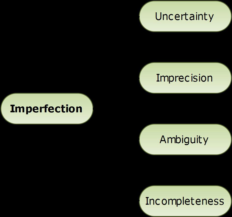
29 What is the MIDM? Multiple Interpretation Data Model We aimed at developing a model handling Complex nature of CH information and its inherent imperfection Events Multiple interpretation

30 Peculiarities of archaeological Data
31 What is the MIDM? Multiple Interpretation Data Model We aimed at developing a model handling Complex nature of CH information and its inherent imperfection Events Multiple interpretation


32 What is the MIDM?
33 What is the MIDM? Geometry Function version Event Time Episode Source Historical Object
34 MIDM - Example Record of two Episodes (version) about the Church of Theux EP-V1 Church with Tower 1175 EP-V2 Gothic choir 1520
35 What is the MIDM? Multiple Interpretation Data Model We aimed at developing a model handling Complex nature of CH information and its inherent imperfection Events Multiple interpretation
36 What is the MIDM? Geometry Function version Event Time Episode Life Map Source Interpetative Sequence Historical Object
37 MIDM - Example Record of one Interpretative Sequence by author 1 EP-V1 Church with Tower 1175 EP-V2 Gothic choir 1520
38 MIDM - Example Life Map of the Church of Theux EP-V1 Church with Tower 1175 EP-V2 Gothic choir 1520
39 MIDM - Example EP-V1 Church with Tower 1175 EP-V2 Gothic choir 1520
40 MIDM - Example Record of new Episodes (version and event) about the Church of Theux EP-V3.1 House 5th c AD EP-V3.2 P. Of Worship 5th c AD EP-V4 extension 6th 7th c AD EP-E1 Relics s acquisition 860 EP-V5 Church End of 9th c. EP-V6 Church 1091 EP-V1 EP-V2 EP-E2 Church with tower 1175 Gothic choir 1520 Norman s destruction 881
41 MIDM - Example Record of one Interpretative Sequence by author 2 EP-V3.1 House 5th c AD EP-V3.2 P. Of Worship 5th c AD EP-V4 extension 6th 7th c AD EP-E1 Relics s acquisition 860 EP-V5 Church End of 9th c. EP-V6 Church 1091 EP-V1 EP-V2 EP-E2 Church with tower 1175 Gothic choir 1520 Norman s destruction 881
42 MIDM - Example Record of a second Interpretative Sequence by author 2 EP-V3.1 House 5th c AD EP-V3.2 P. Of Worship 5th c AD EP-V4 extension 6th 7th c AD EP-E1 Relics s acquisition 860 EP-V5 Church End of 9th c. EP-V6 Church 1091 EP-V1 EP-V2 EP-E2 Church with tower 1175 Gothic choir 1520 Norman s destruction 881
43 MIDM - Example EP-V3.1 House 5th c AD Record of new Episodes (version and event) about the Church of Theux EP-V3.2 P. Of Worship 5th c AD EP-V4 extension 6th 7th c AD EP-E1 Relics s acquisition 860 EP-V5 Church End of 9th c. EP-V6 Church 1091 EP-V1 EP-V2 EP-V3.3 House End of 7th c. EP-V3.4 EP-V4.1 extension End of 8th Beg of 9th c. EP-E2 Norman s destruction 881 Church with tower 1175 Gothic choir 1520 P. Of Worship End of 7th c.
44 MIDM - Example Record of one Interpretative Sequence by author 3 EP-V3.1 House 5th c AD EP-V3.2 P. Of Worship 5th c AD EP-V4 extension 6th 7th c AD EP-E1 Relics s acquisition 860 EP-V5 Church End of 9th c. EP-V6 Church 1091 EP-V1 EP-V2 EP-V3.3 House End of 7th c. EP-V3.4 EP-V4.1 extension End of 8th Beg of 9th c. EP-E2 Norman s destruction 881 Church with tower 1175 Gothic choir 1520 P. Of Worship End of 7th c.
45 MIDM - Example New Life Map of the Church of Theux EP-V3.1 House 5th c AD EP-V3.2 P. Of Worship 5th c AD EP-V4 extension 6th 7th c AD EP-E1 Relics s acquisition 860 EP-V5 Church End of 9th c. EP-V6 Church 1091 EP-V1 EP-V2 EP-V3.3 House End of 7th c. EP-V3.4 EP-V4.1 extension End of 8th Beg of 9th c. EP-E2 Norman s destruction 881 Church with tower 1175 Gothic choir 1520 P. Of Worship End of 7th c.
46 MIDM Future MIDM first version has been mapped to CityGML Chaturvedi K., Smyth C.S., Gesquière G., Kutzner T., Kolbe T.H. (2017) Managing Versions and History Within Semantic 3D City Models for the Next Generation of CityGML. In: Abdul-Rahman A. (eds) Advances in 3D Geoinformation. Lecture Notes in Geoinformation and Cartography. Springer, Cham MIDM last version has been mapped to CIDOC CRM 46
47 Is MIDM just for CH and history? Uncertainty Fuziness Archaeologists Historians Architects Planners Present time: no or little uncertainty Past: Destruction, oversight, etc. Future: projects, evolutions, etc. time 47
48 Conclusions SPC is a new way to use point cloud as structural spatial elements carrying semantic information SPC is obviously not limited to CH application can be plugged to other domains MIDM is a new way to encompass complexity of CH information and variability of experts interpratations MIDM not only model the past but could be used to model the uncertainty of the future 48
49 These papers can interest you (SPC): Poux, F., Hallot, P., Neuville, R., Billen, R., SMART POINT CLOUD: DEFINITION AND REMAINING CHALLENGES. ISPRS Ann. Photogramm. Remote Sens. Spat. Inf. Sci. IV-2/W1, doi: /isprs-annals-iv-2- W Poux, F., Neuville, R., Billen, R., 2017a. POINT CLOUD CLASSIFICATION OF TESSERAE FROM TERRESTRIAL LASER DATA COMBINED WITH DENSE IMAGE MATCHING FOR ARCHAEOLOGICAL INFORMATION EXTRACTION. ISPRS Ann. Photogramm. Remote Sens. Spat. Inf. Sci. IV-2/W2, doi: /isprs-annals-iv-2-w Poux, F., Neuville, R., Hallot, P., Billen, R., 2017b. MODEL FOR REASONING FROM SEMANTICALLY RICH POINT CLOUD DATA. ISPRS Ann. Photogramm. Remote Sens. Spat. Inf. Sci. in press. Poux, F., Neuville, R., Wersch, L. Van, Nys, G.-A., Billen, R., 2017c. 3D Point Clouds in Archaeology: Advances in Acquisition, Processing and Knowledge Integration Applied to Quasi-Planar Objects. Geosci. 2017, Vol. 7, Page 96 7, 96. doi: /geosciences
50 These papers can interest you (MIDM): Pfeiffer, M., Carré, C., Delfosse, V., Hallot, P., & Billen, R. (2013). Virtual Leodium: from an historical 3D city scale model to an archaeological information system. ISPRS Annals Volume II-5/W1, Van Ruymbeke, M., Carré, C., Delfosse, V., Pfeiffer, M., & Billen, R. (2015). Towards an Archaeological Information System: improving the core data model. In CAA st century Archaeology: Concepts methods and tools: Proceedings of the 42nd Annual Conference on Computer Applications and Quantitative Methods in Archaeology (pp ). Archaeopress. Van Ruymbeke, M, Hallot, P. & Billen, R. (2017). Enhancing CIDOC - CRM and compatible models with the concept of multiple interpretation. ISPRS Annals of the Photogrammetry, Remote Sensing and Spatial Information Sciences, Volume IV-2/W2, Van Ruymbeke, M, Hallot, P. & Billen, R. (Forthcoming) IMPLEMENTATION OF MULTIPLE INTERPRETATION CONCEPT IN CIDOC-CRM AND COMPATIBLE MODELS, Virtual Archaeology Review

) geomatics.ulg.")
51 Thank you! geomatics.uliege.be (soon ;-)) geomatics.ulg.ac.be (temporary) 51
Qualitative Spatio-Temporal Reasoning & Spatial Database Design
 Qualitative Spatio-Temporal Reasoning Focus on 2 research topics at the of the University of Liège J-P. Donnay P. Hallot F. Laplanche Curriculum in «Surveying & Geomatics» in the Faculty of Sciences of
Themes for Geomatics Conference. Geodesy Themes
 Themes for Geomatics Conference Geodesy Themes Geodynamics o Modeling the Deformation of the Earth s Crust o Recent Advances in Geometric Approaches to Deformation Analysis o Monitoring Systems (Sensors
3D Laser Scanning for Digital Preservation and Dissemination of Cultural Heritage
 3D Laser Scanning for Digital Preservation and Dissemination of Cultural Heritage Main scanned objects - Four Temples of Different Religions in Sofia Eng. Zlatan Zlatanov, Eng. Milush Blagoev, Irina Nikoevska
3D historical models: the case studies of Liege and Nantes
 3D historical models: the case studies of Liege and Nantes R. Billen (1), C. Carré (1), V. Delfosse (1), B. Hervy (2) (3), F. Laroche (2), D. Lefèvre (4), M. Servières (5), M. Van Ruymbeke (1) ABSTRACT
Open data integration: from satellite to UAV for protection of built environment. The archaeological site in the Centa River bed in Albenga
 Open data integration: from satellite to UAV for protection of built environment. The archaeological site in the Centa River bed in Albenga L. Barazzetti a, R. Brumana a, B. Cuca a,b, M. Previtali a, R.
TOWARDS AN ARCHAEOLOGICAL INFORMATION SYSTEM: IMPROVING THE CORE DATA MODEL
 Proceedings of the 42nd Annual Conference on Computer Applications and Quantitative Methods in Archaeology, CAA 2014 L. Costa, F. Djindjian, F. Giligny, P. Moscati (eds.) TOWARDS AN ARCHAEOLOGICAL INFORMATION
First International Conference on Smart Data and Smart Cities, 30 th UDMS September 7 9, 2016, University of Split, Croatia
 First International Conference on Smart Data and Smart Cities, 30 th UDMS September 7 9, 2016, University of Split, Croatia First International Conference on Smart Data and Smart Cities was held in Split,
Geoinformation Science at TU Berlin
 Technische Universität Berlin Department of Geoinformation Science Geoinformation Science at TU Berlin Prof. Dr. Thomas H. Kolbe Institute for Geodesy and Geoinformation Science Berlin University of Technology
Integration of Historic Building Information Modeling (HBIM) and 3D GIS for Recording and Managing Cultural Heritage Sites
 and 3D GIS for Recording and Managing Cultural Heritage Sites") Dublin Institute of Technology ARROW@DIT Conference papers School of Surveying and Construction Management 2012 Integration of Historic Building Information Modeling (HBIM) and 3D GIS for Recording and
Dublin Institute of Technology ARROW@DIT Conference papers School of Surveying and Construction Management 2012 Integration of Historic Building Information Modeling (HBIM) and 3D GIS for Recording and
3D BUILDING MODELS IN GIS ENVIRONMENTS
 A. N. Visan 3D Building models in GIS environments 3D BUILDING MODELS IN GIS ENVIRONMENTS Alexandru-Nicolae VISAN, PhD. student Faculty of Geodesy, TUCEB, alexvsn@yahoo.com Abstract: It is up to us to
About the Author: E mail ID: Contact: Page 1 of 7. Student, DIT University, Dehradun 2
 Spatial Analysis and Visualization through 3D GIS Model: A Case Study of University Campus. Reena Chauhan 1, Saloni Jain 2 1 Student, DIT University, Dehradun 2 Research Scholar, Indian Institute of Technology,
OBJECT BASED IMAGE ANALYSIS FOR URBAN MAPPING AND CITY PLANNING IN BELGIUM. P. Lemenkova
 Fig. 3 The fragment of 3D view of Tambov spatial model References 1. Nemtinov,V.A. Information technology in development of spatial-temporal models of the cultural heritage objects: monograph / V.A. Nemtinov,
GIS-based Smart Campus System using 3D Modeling
 GIS-based Smart Campus System using 3D Modeling Smita Sengupta GISE Advance Research Lab. IIT Bombay, Powai Mumbai 400 076, India smitas@cse.iitb.ac.in Concept of Smart Campus System Overview of IITB Campus
Design and Development of a Large Scale Archaeological Information System A Pilot Study for the City of Sparti
 INTERNATIONAL SYMPOSIUM ON APPLICATION OF GEODETIC AND INFORMATION TECHNOLOGIES IN THE PHYSICAL PLANNING OF TERRITORIES Sofia, 09 10 November, 2000 Design and Development of a Large Scale Archaeological
enny Mills chool of Civil ngineering & eosciences ewcastle University
 Future of Surveying: Educating the future geospatial expert A Newcastle University perspective enny Mills chool of Civil ngineering & eosciences ewcastle University Future of surveying: Do we still need
Cutting Edge Engineering for Modern Geospatial Systems Rear Admiral Dr. S Kulshrestha, retd
 Cutting Edge Engineering for Modern Geospatial Systems Rear Admiral Dr. S Kulshrestha, retd 11 Jun 2015 GeoIntelligence Asia 2015 The technology would become so pervasive that it becomes a part of you
Planning in a Geospatially Enabled Society. Michael F. Goodchild University of California Santa Barbara
 Planning in a Geospatially Enabled Society Michael F. Goodchild University of California Santa Barbara What is a geospatially enabled society? Knowing the locations of all points of interest and their
HMK Swedish handbook in surveying and mapping
 HMK Swedish handbook in surveying and mapping A Alfredsson, J Sunna, C-G Persson TS07B - Standards and Recommended Practices for Positioning and Measurement, Paper no 7072 FIG Congress 2014 Engaging the
3D City/Landscape Modeling Non-Building Thematic: Vegetation
 3D City/Landscape Modeling Non-Building Thematic: Vegetation Presenter: Shafarina Wahyu Trisyanti shafarina.wahyu@gmail.com Co-Author: Deni Suwardhi, Agung Budi Harto dsuwardhi@kk-insig.org, agung@gd.itb.ac.id
Dynamizers - Modeling and implementing dynamic properties for semantic 3D city models
 Eurographics Workshop on Urban Data Modelling and Visualisation (2015) F. Biljecki and V. Tourre (Editors) Dynamizers - Modeling and implementing dynamic properties for semantic 3D city models K. Chaturvedi
Cláudio Carneiro dell Ecole Polytechnique Federale de Lausanne
 URBAN UTILITY _ milano 22 03 2013 LA COSTRUZIONE DEL DATO COME PRESUPPOSTO DELLA DECISIONE PRIMA SESSIONE THE USE 3D GIS AND LIDAR DATA FOR URBAN PLANNING AND DECISION MAKING Cláudio Carneiro dell Ecole
CITYGML MODELLING FOR SINGAPORE 3D NATIONAL MAPPING
 CITYGML MODELLING FOR SINGAPORE 3D NATIONAL MAPPING K. H. Soon* and V. H. S. Khoo Land Survey Division, Singapore Land Authority, 55 Newton Road, #12-01, 307987 Singapore - (soon_kean_huat, victor_khoo)@sla.gov.sg
Data for Spatial Planning A Comparison of Three Cities
 Data for Spatial Planning A Comparison of Three Cities Dr. Gerhard Navratil1 Dr. Johannes Scholz1 DI Ladislav Danek2 Dr. Farid Karimipour3 1 TU Vienna, Institute of Geoinformation and Cartography, Austria
A Digital Atlas for the Byzantine and Post Byzantine Churches of Troodos Region (central Cyprus)
") CAA'2010 Fusion of Cultures Francisco Contreras & Fco. Javier Melero (Editors) A Digital Atlas for the Byzantine and Post Byzantine Churches of Troodos Region (central Cyprus) Agapiou A. 1, Georgopoulos
CAA'2010 Fusion of Cultures Francisco Contreras & Fco. Javier Melero (Editors) A Digital Atlas for the Byzantine and Post Byzantine Churches of Troodos Region (central Cyprus) Agapiou A. 1, Georgopoulos
ArchaeoKM: Managing Archaeological data through Archaeological Knowledge
 Computer Applications and Quantitative Methods in Archeology - CAA 2010 Fco. Javier Melero & Pedro Cano (Editors) ArchaeoKM: Managing Archaeological data through Archaeological Knowledge A. Karmacharya
Taxonomies of Building Objects towards Topographic and Thematic Geo-Ontologies
 Taxonomies of Building Objects towards Topographic and Thematic Geo-Ontologies Melih Basaraner Division of Cartography, Department of Geomatic Engineering, Yildiz Technical University (YTU), Istanbul Turkey
VISUALIZATION OF PHOTOGRAMMETRIC DOCUMENTATION FOR ARCHITECTURE OF CULTURAL HERITAGE
 VISUALIZATION OF PHOTOGRAMMETRIC DOCUMENTATION FOR ARCHITECTURE OF CULTURAL HERITAGE Mojca KOSMATIN FRAS, Miran JANEŽIC Institute of Geodesy, Cartography and Photogrammetry, Ljubljana, Slovenia Mojca.fras@institut-gf.uni-lj.si
Basics of GIS reviewed
 Basics of GIS reviewed Martin Breunig Karlsruhe Institute of Technology martin.breunig@kit.edu GEODETIC INSTITUTE, DEPARTMENT OF CIVIL ENGINEERING, GEO AND ENVIRONMENTAL SCIENCES, CHAIR IN GEOINFORMATICS
How we build reality. In cooperation with the Zamani Project
 How we build reality Case Study Petra, Jordan Company Overview Z+F is one of the world s leading manufacturers in the field of non-contact laser measurement technology. Due to years of research, development
UWE has obtained warranties from all depositors as to their title in the material deposited and as to their right to deposit such material.
 Jamali, A., Abdul Rahman, A. and Boguslawski, P. (2016) A hybrid 3D indoor space model. In: Isikdag, U., Abdul Rahman, A., Castro, F. A. and Karas, I. R., eds. International Archives of the Photogrammetry,
Managing temporal change of cities with CityGML
 Eurographics Workshop on Urban Data Modelling and Visualization (2014) V. Tourre and G. Besuievsky (Editors) Managing temporal change of cities with CityGML M. Morel & G. Gesquière Laboratoire LIRIS, UMR
GIS = Geographic Information Systems;
 What is GIS GIS = Geographic Information Systems; What Information are we talking about? Information about anything that has a place (e.g. locations of features, address of people) on Earth s surface,
The Relevance of Cartography. Dubai 2015, Georg Gartner
 The Relevance of Cartography Dubai 2015, Georg Gartner Where are we? Data! Data? We are not short of data Technologies! Technologies? We are not short of technologies Data-driven and technology-driven
MODEL FOR SEMANTICALLY RICH POINT CLOUD DATA
 MODEL FOR SEMANTICALLY RICH POINT CLOUD DATA F. Poux a,, *, R. Neuville a, P. Hallot b, R. Billen a a ULG, Geomatics Unit, University of Liège, 4000 Liège, Belgium- (fpoux, romain.neuville, rbillen)@ulg.ac.be
CULTURAL HERITAGE THROUGH TIME
 JOINT PROGRAMMING INITIATIVE ON CULTURAL HERITAGE WORKSHOP: FUNDED RESEARCH PROJECTS PARADE CULTURAL HERITAGE THROUGH TIME 2017 BGC Geomatics, 22-25 June 2017, Gdańsk University of Technology, Poland CULTURAL
VISUALIZING THE SMART CITY 3D SPATIAL INFRASTRUCTURE GEOSMART ASIA- 30 SEP, 2015
 www.aamgroup.com VISUALIZING THE SMART CITY 3D SPATIAL INFRASTRUCTURE GEOSMART ASIA- 30 SEP, 2015 Agenda AAM What is a Smart City? Data Acquisition 3D Modelling Benefits Questions AAM AAM is a Geospatial
A Framework for Visualization of Geospatial Information in 3D Virtual City Environment for Disaster Risk Management
 A Framework for Visualization of Geospatial Information in 3D Virtual City Environment for Disaster Risk Management Asli Yilmaz 1, Sebnem Duzgun 2 1 Geodetic and Geographic Information Technologies, Middle
Translating urban history, research and sources, into interactive digital libraries
 Translating urban history, research and sources, into interactive digital libraries Fulvio Rinaudo 1, Rosa Tamborrino 1 1 Politecnico di Torino Dept. Of Architecture & Design Abstract Many results of historical
Uncertainties in spatial modelling of the cultural environment
 Uncertainties in spatial modelling of the cultural environment Tomaž PODOBNIKAR 1, 3 / Christian BRIESE 1 / Michael DONEUS 2 / Norbert PFEIFER 1 1 Institute of Photogrammetry and Remote Sensing of the
Research Group Cartography
 Research Group Cartography Research Group Cartography Towards supporting wayfinding LBS components 1. Mobile devices 2. Communication Network 3. Positioning Component 4. Service and Application Provider
GENERATION OF 3D CITY MODELS FROM TERRESTRIAL LASER SCANNING AND AERIAL PHOTOGRAPHY: A CASE STUDY
 GENERATION OF 3D CITY MODELS FROM TERRESTRIAL LASER SCANNING AND AERIAL PHOTOGRAPHY: A CASE STUDY Hakan KARABORK 1, Fatih SARI 1 1 Selcuk University in Konya, Faculty of Engineering and Architecture Konya,
Surveying, Mapping and Remote Sensing (LIESMARS), Wuhan University, China
, Wuhan University, China") Name: Peng Yue Title: Professor and Director, Institute of Geospatial Information and Location Based Services (IGILBS) Associate Chair, Department of Geographic Information Engineering School of Remote
Name: Peng Yue Title: Professor and Director, Institute of Geospatial Information and Location Based Services (IGILBS) Associate Chair, Department of Geographic Information Engineering School of Remote
XXIII CONGRESS OF ISPRS RESOLUTIONS
 XXIII CONGRESS OF ISPRS RESOLUTIONS General Resolutions Resolution 0: Thanks to the Czech Society commends: To congratulate The Czech Society, its president and the Congress Director Lena Halounová, the
Exploration of the changing structure of cities: Challenges for temporal city models
 Exploration of the changing structure of cities: Challenges for temporal city models Clémentine Périnaud, Georges Gay, Gilles Gesquière To cite this version: Clémentine Périnaud, Georges Gay, Gilles Gesquière.
Managing Versions and History Within Semantic 3D City Models for the Next Generation of CityGML
 Managing Versions and History Within Semantic 3D City Models for the Next Generation of CityGML Kanishk Chaturvedi, Carl Stephen Smyth, Gilles Gesquière, Tatjana Kutzner, Thomas H. Kolbe To cite this version:
Smart Cities: Visualization
 Smart Cities: Visualization ISO/IEC JTC 1/SC24 Meetings 20-25 January 2019 Seoul, Korea Peter Ryan 1 and Myeong Won Lee 2 1 Defence Science & Technology Group, Australia 2 University of Suwon, Korea Presentation
GEOMATICS SURVEYING AND MAPPING EXPERTS FOR OVER 35 YEARS
 GEOMATICS SURVEYING AND MAPPING EXPERTS FOR OVER 35 YEARS 2 GEOMATICS AND SURVEYING SOLUTIONS SPANNING THE ENTIRE PROJECT LIFECYCLE 1,000+ 250+ 24 Surveying professionals Active field crews Geomatics offices
3D CARTOGRAPHY IN URBAN ENVIRONMENTS FOR MUNICIPAL ADMINISTRATIONS
 3D CARTOGRAPHY IN URBAN ENVIRONMENTS FOR MUNICIPAL ADMINISTRATIONS Andreea Calugaru Andreea Calugaru, Paula Florina Anca, Alexandru Vasile a.esri Romania 8 Roma, Bucharest, Romania 011774 0212339086, 0212339088,
Developing GIS Software to Process Photogrammetric Point Cloud Data for Inventory Production
 Developing GIS Software to Process Photogrammetric Point Cloud Data for Inventory Production Kevin Lim, Ph.D. President and CTO Lim Geomatics Inc. 343 Preston Street, Floor 11, Ottawa, ON, K1S 1N4 Enhanced
European Spatial Data Research. EuroSDR. Prof. Dr. Ir. Joep Crompvoets. General Assembly CLGE Tirana 18 March
 EuroSDR Prof. Dr. Ir. Joep Crompvoets General Assembly CLGE - 2016 Tirana 18 March 2016 INTRODUCTORY QUESTIONS Who knows what is EuroSDR? Who does NOT know what is EuroSDR? Who is employed at mapping agencies?
Important note To cite this publication, please use the final published version (if applicable). Please check the document version above.
. Please check the document version above.") Delft University of Technology Building Information Modelling: essentials and issues The need to Integrate BIM and Geoinformation Zlatanova, Sisi; Isikdag, Umit Publication date 2016 Document Version Early
Delft University of Technology Building Information Modelling: essentials and issues The need to Integrate BIM and Geoinformation Zlatanova, Sisi; Isikdag, Umit Publication date 2016 Document Version Early
Airborne Corridor-Mapping. Planning and documentation of company infrastructure: precise, rapid, and cost effective
 Airborne Corridor-Mapping Planning and documentation of company infrastructure: precise, rapid, and cost effective Technology Airborne Laser-Scanning, digital orthophotos and thermal imaging: one flight
CK107 BA in Geographical and Archaeological Sciences
 CK107 BA in Geographical and Archaeological Sciences CK107 BA in Geographical and Archaeological Science Geography and Archaeology are closely related disciplines, concerned with concepts of time and space
REGIONAL SDI DEVELOPMENT
 REGIONAL SDI DEVELOPMENT Abbas Rajabifard 1 and Ian P. Williamson 2 1 Deputy Director and Senior Research Fellow Email: abbas.r@unimelb.edu.au 2 Director, Professor of Surveying and Land Information, Email:
K. Zainuddin et al. / Procedia Engineering 20 (2011)
") Available online at www.sciencedirect.com Procedia Engineering 20 (2011) 154 158 The 2 nd International Building Control Conference 2011 Developing a UiTM (Perlis) Web-Based of Building Space Management
Available online at www.sciencedirect.com Procedia Engineering 20 (2011) 154 158 The 2 nd International Building Control Conference 2011 Developing a UiTM (Perlis) Web-Based of Building Space Management
Commission VI, WG VI/3. KEY WORDS: teaching concept, 3D data, terrestrial laserscanning, photogrammetry, international project
 CONCEPT AND PRACTICE OF TEACHING TECHNICAL UNIVERSITY STUDENTS TO MODERN TECHNOLOGIES OF 3D DATA ACQUISITION AND PROCESSING: A CASE STUDY OF CLOSE-RANGE PHOTOGRAMMETRY AND TERRESTRIAL LASER SCANNING Iulia
Archaeology & Digital Humanities
 WAYNE STATE UNIVERSITY Archaeology & Digital Humanities The D.I.R.T. on Big Data STRENGTHENING THE BIG DATA & ANALYTICS ECOSYSTEM WAYNE STATE UNIVERSITY Krysta Ryzewski Associate Professor of Anthropology
Software. People. Data. Network. What is GIS? Procedures. Hardware. Chapter 1
 People Software Data Network Procedures Hardware What is GIS? Chapter 1 Why use GIS? Mapping Measuring Monitoring Modeling Managing Five Ms of Applied GIS Chapter 2 Geography matters Quantitative analyses
Multimodal Location Based Services Semantic 3D City Data as Virtual and Augmented Reality
 Multimodal Location Based Services Semantic 3D City Data as Virtual and Augmented Reality José Miguel Santana Agustín Trujillo José Pablo Suárez Jochen Wendel Alexander Simons Andreas Koch Collaboration
A Broad View of Geospatial Technology & Systems
 A Broad View of Geospatial Technology & Systems Pete Large Vice President, Trimble On the shoulders of giants 1 Since their time, our ability to generate geospatial information has grown exponentially
INTEGRATION OF UNMANNED AERIAL VEHICLE DATA WITH GEOGRAPHICAL INFORMATION SYSTEMS
 INTEGRATION OF UNMANNED AERIAL VEHICLE DATA WITH GEOGRAPHICAL INFORMATION SYSTEMS DOI: http://dx.doi.org/10.18509/gbp.2018.65 UDC: 528.931:004]:623.746.2-519 (560) Tarık Türk Anıl Can Birdal Önder Gürsoy
Digital Terrain Model GRID Width 50 m DGM50
 Digital Terrain Model GRID Width 50 m Status of documentation: 23.02.2015 Federal Agency for Cartography and Geodesy page 1 Contents DGM-D page 1 Overview of dataset 3 2 Description of the dataset contents
The Use of Geographical Information Systems. in Historic and Cultural Places. Case Study: Town of Side. Omur ESEN
 The Use of Geographical Information Systems in Historic and Cultural Places Case Study: Town of Side Omur ESEN Selcuk University, Office of Construction and Infrastructure Dept. Konya,TURKEY omuresen@hotmail.com
Trimble s ecognition Product Suite
 Trimble s ecognition Product Suite Dr. Waldemar Krebs October 2010 Trimble Geospatial in the Image Processing Chain Data Acquisition Pre-processing Manual/Pixel-based Object-/contextbased Interpretation
St. Kitts and Nevis Heritage and Culture
 St. Kitts and Nevis Heritage and Culture Eloise Stancioff, Habiba, Departmet of Culture St. Kitts HERA workshop: March 17-20, 2015 Goals Using freely available open source platforms, we implement two different
Developing 3D Geoportal for Wilayah Persekutuan Iskandar
 Developing 3D Geoportal for Wilayah Persekutuan Iskandar Dionnald Beh BoonHeng and Alias Abdul Rahman Department of Geoinformatics, Faculty of Geoinformation Engineering and Sciences, Universiti Teknologi
Horizon Scanning and Research Lead Innovation
 Horizon Scanning and Research Lead Innovation Helsinki, Finland 25 January 2013 Future Challenges,, Future Cooperation Joep 1 Crompvoets eurosdr@soc.kuleuven.be Objectives 1. EuroSDR 2. Horizon Scanning
Mappings For Cognitive Semantic Interoperability
 Mappings For Cognitive Semantic Interoperability Martin Raubal Institute for Geoinformatics University of Münster, Germany raubal@uni-muenster.de SUMMARY Semantic interoperability for geographic information
GEOMATICS. Shaping our world. A company of
 GEOMATICS Shaping our world A company of OUR EXPERTISE Geomatics Geomatics plays a mayor role in hydropower, land and water resources, urban development, transport & mobility, renewable energy, and infrastructure
DEVELOPPING A LAND INFORMATION SYSTEM FOR THE UNIFICATION OF THE ARCHAEOLOGICAL SITES OF ATHENS. Efi Dimopoulou, Vasso Nikolaidou, Panagiotis Zendelis
 DEVELOPPING A LAND INFORMATION SYSTEM FOR THE UNIFICATION OF THE ARCHAEOLOGICAL SITES OF ATHENS Efi Dimopoulou, Vasso Nikolaidou, Panagiotis Zendelis Laboratory of Photogrammetry, Faculty of Surveying
Faculty of Science and Technology Parthenope University Napoli
 Faculty of Science and Technology Parthenope University Napoli First Level Degree Course in COMPUTER SCIENCE (class L-31 DM 17) Years I and II running Computer Architecture with laboratory INF/01 12 Mathematics
Techniques for Science Teachers: Using GIS in Science Classrooms.
 Techniques for Science Teachers: Using GIS in Science Classrooms. After ESRI, 2008 GIS A Geographic Information System A collection of computer hardware, software, and geographic data used together for
Geographical Information System (GIS) Prof. A. K. Gosain
 Prof. A. K. Gosain") Geographical Information System (GIS) Prof. A. K. Gosain gosain@civil.iitd.ernet.in Definition of GIS GIS - Geographic Information System or a particular information system applied to geographical data
Geographical Information System (GIS) Prof. A. K. Gosain gosain@civil.iitd.ernet.in Definition of GIS GIS - Geographic Information System or a particular information system applied to geographical data
The French SIGMA-Cassini Research Group The Agenda for
 Page 1 of 9 The French SIGMA-Cassini Research Group The Agenda for 2005-2008 M. Mainguenaud C. Weber michel.mainguenaud@insa-rouen.fr christiane.weber@lorraine.u-strasbg.fr http://www.sigma-cassini.org
INTEGRATION OF HIGH RESOLUTION QUICKBIRD IMAGES TO GOOGLEEARTH
 INTEGRATION OF HIGH RESOLUTION QUICKBIRD IMAGES TO GOOGLEEARTH M. Alkan a, *, U.G. Sefercik a, M. Oruç a a ZKU, Engineering Faculty, 67100 Zonguldak, Turkey - (mehmetalkan44@yahoo.com) Interactive Sessions,
COMBINING URBAN METABOLISM METHODS AND SEMANTIC 3D CITY MODELS
 COMBINING URBAN METABOLISM METHODS AND SEMANTIC 3D CITY MODELS Ihab Hijazi 1,2, Vanessa Ebert 1, Andreas Donaubauer 1, Thomas H. Kolbe 1 1 Chair of Geoinformatics Technical University of Munich 2 An-Najah
Laserscanning for DEM generation Uwe Lohr TopoSys GmbH, Freiherr-vom-Stein-Str. 7, D Ravensburg,
 Laserscanning for DEM generation Uwe Lohr TopoSys GmbH, Freiherr-vom-Stein-Str. 7, D-88212 Ravensburg, Germany Email: toposys@w-4.de Abstract During the last years laserscanning has been accepted as a
CityBEM: Monthly Heating and Cooling Energy Needs for 3D Buildings in Cities
 CityBEM: Monthly Heating and Cooling Energy Needs for 3D Buildings in Cities EnergyADE workshop, Karlsruhe 06.12.2017 Syed Monjur Murshed European Institute for Energy Research, Germany Contents Research
Appropriate Selection of Cartographic Symbols in a GIS Environment
 Appropriate Selection of Cartographic Symbols in a GIS Environment Steve Ramroop Department of Information Science, University of Otago, Dunedin, New Zealand. Tel: +64 3 479 5608 Fax: +64 3 479 8311, sramroop@infoscience.otago.ac.nz
Innovation in mapping and photogrammetry at the Survey of Israel
 16, October, 2017 Innovation in mapping and photogrammetry at the Survey of Israel Yaron Felus and Ronen Regev Contents Why HD mapping? Government requirements Mapping regulations o Quality requirements
3D-SDI contribution to energy-efficient cities 3D CityModels for Energy Demand Simulation
 HFT Research 3D-SDI contribution to energy-efficient cities 3D CityModels for Energy Demand Simulation Claudia Schulte, HFT Stuttgart, Institute for Applied Research Prof. Dr. Volker Coors, HFT Stuttgart,
3D-geodata infrastructure in the city of coburg - Origin process und vision. INGeoForum e.v. Open Geospatial Consortium
 INGeoForum e.v. Open Geospatial Consortium at Fraunhofer Institut for Computer Graphics in Darmstadt 3D-geodata infrastructure in the city of coburg - Origin process und vision 29. September 2009 Requirements
Integrating geology in reality mesh? François ROBIDA BRGM (French Geological Survey)
") Integrating geology in reality mesh? François ROBIDA BRGM (French Geological Survey) > 1 UNDERSTANDING geological phenomena and associated risks. THE FRENCH GEOLOGICAL SURVEY THE BRGM IS FRANCE S LEADING
Integrating geology in reality mesh? François ROBIDA BRGM (French Geological Survey) > 1 UNDERSTANDING geological phenomena and associated risks. THE FRENCH GEOLOGICAL SURVEY THE BRGM IS FRANCE S LEADING
Mapping Historical Information Using GIS
 Mapping Historical Information Using GIS David Yun, GISP Troy Lawson ABSTRACT The City of San Luis Obispo, California, is rich with history. It is one of California s oldest communities that began with
The evolution of Geomatics at Delft University of Technology
 The evolution of Geomatics at Delft University of Technology 8 th European GIS Education Seminar September 7, 2012 Frans I. Rip, Edward Verbree (DUT) Overview 1.What: EduMapping the development of a GI
Canadian Board of Examiners for Professional Surveyors Core Syllabus Item C 5: GEOSPATIAL INFORMATION SYSTEMS
 Study Guide: Canadian Board of Examiners for Professional Surveyors Core Syllabus Item C 5: GEOSPATIAL INFORMATION SYSTEMS This guide presents some study questions with specific referral to the essential
Chris Rizos (IAG), Chair William Cartwright (ICA), immediate past Chair
, Chair William Cartwright (ICA), immediate past Chair") Chris Rizos (IAG), Chair William Cartwright (ICA), immediate past Chair Global Spatial Data Infrastructure (GSDI) Association IEEE Geoscience & Remote Sensing Society (IEEE-GRSS) International Association
Chris Rizos (IAG), Chair William Cartwright (ICA), immediate past Chair Global Spatial Data Infrastructure (GSDI) Association IEEE Geoscience & Remote Sensing Society (IEEE-GRSS) International Association
GISc Technologist model. Adv. Diploma or B Degree in GISc / Geoinformatics. NQF level 7. Minimum 360 credits
 Knowledge area (KA) Outcomes Units Themes and / or key words GSc: Geographical science Understanding Geographical sience as it relates to GISc GISc Technologist model. Adv. Diploma or B Degree in GISc
THE QUALITY CONTROL OF VECTOR MAP DATA
 THE QUALITY CONTROL OF VECTOR MAP DATA Wu Fanghua Liu Pingzhi Jincheng Xi an Research Institute of Surveying and Mapping (P.R.China ShanXi Xi an Middle 1 Yanta Road 710054) (e-mail :wufh999@yahoo.com.cn)
Semantic 3D City Models for Strategic Energy Planning in Berlin & London
 Semantic 3D City Models for Strategic Energy Planning in Berlin & London The content of this presentation is provided by Zhihang Yao, Robert Kaden, and Thomas H. Kolbe Chair of Geoinformatics, TU München
AUTOMATIC GENERATION OF 3D CITY MODELS AND RELATED APPLICATIONS
 International Archives of the Photogrammetry, Remote Sensing and Spatial Information Sciences, Vol. XXXIV-5/W10 AUTOMATIC GENERATION OF 3D CITY MODELS AND RELATED APPLICATIONS Y. Takase a, *, N. Sho a,
Massachusetts Institute of Technology Department of Urban Studies and Planning
 Massachusetts Institute of Technology Department of Urban Studies and Planning 11.204: Planning, Communications & Digital Media Fall 2002 Lecture 6: Tools for Transforming Data to Action Lorlene Hoyt October
Go to contents 17 Figure 1. Diagram of the system prototype framework
 GIS-based Visual Perception Analysis of Urban Natural Landscape for Urban Planning Supporting: A Case Study of Jinzishan Hill Region HE, Jie; TSOU, Jinyeu Tsou Department of Architecture, The Chinese University
IDBE. Common conceptual framework and roadmap of collaboration in Spatial Standards for the Digital Built Environment
 IDBE Common conceptual framework and roadmap of collaboration in Spatial Standards for the Digital Built Environment GeoBIM: 3D GIS in China Mei Xue: In my opinion, what matters most in the integration
3. CRITERIA FOR SPATIAL DIFFERENTIATION SPESP
 3. CRITERIA FOR SPATIAL DIFFERENTIATION SPESP from the tourist s point of view. Secondly, at equal levels of tourist pressure, areas with a high relative concentration of assets generate different problems
Sparse Representation-based Analysis of Hyperspectral Remote Sensing Data
 Sparse Representation-based Analysis of Hyperspectral Remote Sensing Data Ribana Roscher Institute of Geodesy and Geoinformation Remote Sensing Group, University of Bonn 1 Remote Sensing Image Data Remote
I. Pispidikis *, E. Dimopoulou
 DEVELOPMENT OF A 3D WEBGIS SYSTEM FOR RETRIEVING AND VISUALIZING CITYGML DATA BASED ON THEIR GEOMETRIC AND SEMANTIC CHARACTERISTICS BY USING FREE AND OPEN SOURCE TECHNOLOGY I. Pispidikis *, E. Dimopoulou
Extension of Electronical Nautical Charts for 3D interactive Visualization via CityGML
 Extension of Electronical Nautical Charts for 3D interactive Visualization via CityGML Kristine HAASE und Reinhard KOCH Multimedia Information Processing Group, Department of Computer Science Christian-Albrechts-University
USING GIS CARTOGRAPHIC MODELING TO ANALYSIS SPATIAL DISTRIBUTION OF LANDSLIDE SENSITIVE AREAS IN YANGMINGSHAN NATIONAL PARK, TAIWAN
 CO-145 USING GIS CARTOGRAPHIC MODELING TO ANALYSIS SPATIAL DISTRIBUTION OF LANDSLIDE SENSITIVE AREAS IN YANGMINGSHAN NATIONAL PARK, TAIWAN DING Y.C. Chinese Culture University., TAIPEI, TAIWAN, PROVINCE
Introduction To A New Geo-Referenced Street Level Content: 3D GEOPANO
 Free and Open Source Software for Geospatial (FOSS4G) Conference Proceedings Volume 15 Seoul, South Korea Article 10 2015 Introduction To A New Geo-Referenced Street Level Content: 3D GEOPANO Boram Yoon