St. Kitts and Nevis Heritage and Culture
|
|
|
- Marylou Lynn Cannon
- 5 years ago
- Views:
Transcription

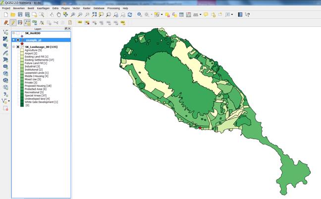
1 St. Kitts and Nevis Heritage and Culture Eloise Stancioff, Habiba, Departmet of Culture St. Kitts HERA workshop: March 17-20, 2015
2 Goals Using freely available open source platforms, we implement two different types of user friendly platforms to increase community participation and visible outreach in research: Crowd sourcing heritage perceptions Database management of diverse heritage data


3 Crowd Sourcing: An interactive tool for mapping heritage and culture Collecting and including public perceptions of heritage Promoting discussion on community places of value Engaging communities, academia, public institutions and cultural centers


4 Crowdsourcing: an overview Data collection: a tool (website, platform, mobile app) for the crowd to submit information Reports: categories, locations, pictures, geotagging, value, free text Analysis: Data filtering Data aggregation Knowledge discovery Challenges: effective interface and technical design quality control incentives to engage the local community
5 Current Implementation and Uses Define data to be collected Establish quality control and maintenance Administrator workshop Media and public dissemination Follow up
6 Future Uses: St. Kitts implementation: workshop for administrators media campaign Possible implementation in other context or islands

7 Arches: A platform for diverse data management and visualization Database platform based on CIDOC-CRM ontologies Data is connected through graphs Flexible identification and inventory of multidisciplinary data Spatial visualization of data


8 Arches Overview: " " " Arches Server Core system Manages information stored in database Arches Data Packages Modeled graphs of data (archaeological, heritage, site, artifact, person) User Interface
9 Current Implementation and Uses define vocabularies and thesauri set up graph documents load data into package and arches customize for personal use quality control: admin rights
10 Future Uses Example of archaeology sites in St. Kitts Possible outreach, educational and visibility tool of Nexus, Hera, island networks, etc.
11 Research benefits: Networks, Crowds, and Heritage Management Connectedness: Internet & web, Global communication, News and information Decentralized information: Diversity of opinions Dynamic evaluation of perception and values


12 Questions? This research has received funding from the European Research Council under the European Union's Seventh Framework Programme (FP7/ ) / ERC grant agreement n Pictures from personal collection and Ushahidi.com and Archesproject.org
13 GOING FURTHER
14 CIDOC-CRM provides definitions and a formal structure for describing the implicit and explicit concepts and relationships used in cultural heritage documentation Semantic glue creates extensive framework that any cultural heritage information can be mapped to Creates understanding between different heritage information and sources Official release:
15 E1 CRM Entity E2 - Temporal Entity Example" E4 - - Period E Event E Activity Property id Property Name E Modification Entity Domain Entity - Range E Production P1 is identified by (identifies) E13 - E1 CRM - Entity - - E41 Appellation - Attribute Assignment P2 has type (is type of) E1 CRM Entity E55 Type P3 has note E E1 CRM Entity - - E62 String Creation P4 has time-span (is time-span of) E63 - E2 Temporal - -Entity - E52 Time-Span Beginning of Existence P7 took place at (witnessed) E12 - E4 Period E53 Place - Production P10 falls within (contains) E4 Period E4 Period E Creation P12 occurred in the presence of (was present at) E5 Event E77 Persistent Item P11 - had participant (participated in) E End of Existence E5 Event E39 Actor P carried out by (performed) E77 - E7 Activity Persistent Item E39 Actor P16 - used specific object (was used for) E70 - E7 Activity - Thing E70 Thing P31 - has modified (was modified by) E72 - E11 Modification - - Legal Object E24 Physical Man-Made Thing P has produced (was produced by) E12 Production E24 Physical Man-Made Thing E Physical Thing P92 - brought into existence (was brought into existence by) E63 Beginning of Existence E77 Persistent Item P has produced (was produced by) E E12 Production - - Physical Man-Made Thing E24 Physical Man-Made P has created (was created by) E90 - E65 Creation E28 Conceptual Symbolic Object Object P93 - took out of existence (was taken out of existence by) E71 - E64 End - of Existence - Man-Made Thing E77 Persistent Item P15 was influenced by (influenced) E7 Activity E1 CRM Entity E Physical Man-Made Thing P16 - used specific object (was used for) E7 Activity E70 Thing P20 had specific purpose (was purpose of) E Conceptual Object E7 Activity E7 Activity P43 has dimension (is dimension of) E89 - E70 Thing E54 Dimension - Propositional Object P46 is composed of (forms part of) E30 - E18 Physical - Thing - - E18 Physical - Thing - Right P59 has section (is located on or within) E73 - E18 Physical - Thing - - E53 Place - P67 refers to ( is referred to by) E89 Propositional Object E1 CRM Entity - Information Object P75 possesses (is possessed by) E90 - E39 Actor E30 Right - Symbolic Object P81 ongoing throughout E52 Time-Span E61 Time Primitive E Appellation P82 at some time within E52 Time-Span E61 Time Primitive P89 falls within (contains) E Information Object E53 Place E53 Place P104 is subject to (applies to) E72 Legal Object E30 Right P106 is composed of (forms part of) E E90 Symbolic Object E90 Symbolic Object Type P107 has current or former member (is current or former member of) E E74 Group Actor E39 Actor E Group P127 has broader term (has narrower term) E52 - E55 Type Time-Span E55 Type P128 carries (is carried by) E24 Physical Man-Made Thing E90 Symbolic Object E53 - Place P130 shows features of (features are also found on) E70 Thing E70 Thing P140 assigned attribute to (was attributed by) E54 - Dimension E13 Attribute Assignment E1 CRM Entity P141 assigned (was assigned by) E59 Primitive E13 Attribute Value Assignement E1 CRM Entity P148 has component (is component of) E61 - E89 Propositional Time Primitive Object E89 Propositional Object E62 - String
16 Example of Arches Resource Graph Resource Graph: refers to class of heritage records. defines the set of resource types to include in inventory and terms that describe them. A resource is archaeological, built, landscape, immovable heritage, organization, person


17 Example of Arches Resource Graph User Defined Arches Defined

18 Example of Bloody Point, Challengers


19 Modified Example of CIDOC_CRM E52 Time-Span 1626 E53 Place St. Kitts Actor (past) P11 participated P82 at some time within E7 Activity Massacre of Caribs P7 took place at Archaeological Actor Actor P14 performed Activity Carifest 2000 E52 Time-Span Present 2014 P67 is referred to by P94 has created Natural 19
20 Technical Background Development: Python Javascript Core components: PostGIS ElasticSearch ExtJS OpenLayers
21 Arches development roadmap Import/Export Improvements Implement more advanced security model Create Geometries from GPS Data Arches Graphing Web Interface Run Multiple Packages from a Single Arches Instance Application Logging User Settings Admin UI Improvements Improve Representation of Spatial-Temporal Relationships Arches mobile app Improve temporal based searching
22 Key Points to take Away" Arches represents a flexible, open source inventory system It can be customized to fit needs of project It is not a GIS or does it have any analytical tools It organizes data and creates communal semantic framework
CIDOC-CRM Method: A Standardisation View. Haridimos Kondylakis, Martin Doerr, Dimitris Plexousakis,
 The CIDOC CRM CIDOC-CRM Method: A Standardisation View Haridimos Kondylakis, Martin Doerr, Dimitris Plexousakis, Center for Cultural Informatics, Institute of Computer Science Foundation for Research and
CRMarchaeo: A CIDOC CRM extension to support archaeological excavations
 CRMarchaeo: A CIDOC CRM extension to support archaeological excavations Achille Felicetti VAST-LAB, PIN, Università degli Studi di Firenze, Italy Archaeology and heterogeneity Archaeological excavation
Overview of Geospatial Open Source Software which is Robust, Feature Rich and Standards Compliant
 Overview of Geospatial Open Source Software which is Robust, Feature Rich and Standards Compliant Cameron SHORTER, Australia Key words: Open Source Geospatial Foundation, OSGeo, Open Standards, Open Geospatial
Application of WebGIS and VGI for Community Based Resources Inventory. Jihn-Fa Jan Department of Land Economics National Chengchi University
 Application of WebGIS and VGI for Community Based Resources Inventory Jihn-Fa Jan Department of Land Economics National Chengchi University OUTLINE Introduction Methodology Results Conclusions 2 MOTIVATION
Participatory GIS (PGIS)
") Participatory GIS (PGIS) Join public opinions as an information source into environmental decision-making ESRM 250. May, 29 th, 2012 Mu-Ning Wang wang0209@uw.edu GIS is... A Mapping Tool An Analysis Tool
Participatory GIS (PGIS) Join public opinions as an information source into environmental decision-making ESRM 250. May, 29 th, 2012 Mu-Ning Wang wang0209@uw.edu GIS is... A Mapping Tool An Analysis Tool
Definition of the CIDOC Conceptual Reference Model
 Definition of the CIDOC Conceptual Reference Model Produced by the ICOM/CIDOC Documentation Standards Group, Continued by the CIDOC CRM Special Interest Group Document Type: Current Editorial Status: In
CRMBA and CRMarchaeo models harmonization Paola Ronzino, Achille Felicetti PIN, VAST- LAB Prato, Italy
 CRMBA and CRMarchaeo models harmonization Paola Ronzino, Achille Felicetti PIN, VAST- LAB Prato, Italy 34th Joint Meeting of CIDOC CRM SIG and ISO/TC46/SC4/ WG9, 8 October 2015, Crete Central Institute
Definition of the CIDOC Conceptual Reference Model
 Definition of the CIDOC Conceptual Reference Model Produced by the ICOM/CIDOC Documentation Standards Group, Continued by the CIDOC CRM Special Interest Group Document Type: Current Editorial Status: In
Introduction to Portal for ArcGIS. Hao LEE November 12, 2015
 Introduction to Portal for ArcGIS Hao LEE November 12, 2015 Agenda Web GIS pattern Product overview Installation and deployment Security and groups Configuration options Portal for ArcGIS + ArcGIS for
Development of the Portal of Cultural Heritage Objects the Kingdom of Poland
 Evgeny KOVALEV, Natalia KOVALEVA Sholokhov Moscow State University for the Humanities, Russia Hadi SALEH Vladimir State University Named After Alexander and Nikolay Stoletovs, Russia Development of the
Introduction to Portal for ArcGIS
 Introduction to Portal for ArcGIS Derek Law Product Management March 10 th, 2015 Esri Developer Summit 2015 Agenda Web GIS pattern Product overview Installation and deployment Security and groups Configuration
Portal for ArcGIS: An Introduction
 Portal for ArcGIS: An Introduction Derek Law Esri Product Management Esri UC 2014 Technical Workshop Agenda Web GIS pattern Product overview Installation and deployment Security and groups Configuration
Jordan's Strategic Research Agenda in cultural heritage
 Jordan's Strategic Research Agenda in cultural heritage Analysis of main results Alessandra Gandini Amman, Jordan 3 rd November 2013 Main objectives The work performed had the main objective of giving
Evaluating Sustainability of the Georesources Observation System
 Evaluating Sustainability of the Georesources Observation System Michael Mente Federal Institute for Geosciences and Natural Resources Germany, Hannover GEOSS-CBC Meeting Athens April 27th 28th, 2009 GEOSS-CBC
The purpose of this report is to recommend a Geographic Information System (GIS) Strategy for the Town of Richmond Hill.
 Strategy for the Town of Richmond Hill.") Staff Report for Committee of the Whole Meeting Department: Division: Subject: Office of the Chief Administrative Officer Strategic Initiatives SRCAO.18.12 GIS Strategy Purpose: The purpose of this report
Staff Report for Committee of the Whole Meeting Department: Division: Subject: Office of the Chief Administrative Officer Strategic Initiatives SRCAO.18.12 GIS Strategy Purpose: The purpose of this report
Lecture 11. Data Standards and Quality & New Developments in GIS
 Lecture 11 Data Standards and Quality & New Developments in GIS Lecture 11: Outline I. Data Standards and Quality 1. Types of Spatial Data Standards 2. Data Accuracy II. New Developments/The Future of
SDI in Lombardia (Italy(
 SDI in Lombardia (Italy( Italy) Andrea Piccin European SDI Best Practice Awards 2009 - Learning from Best Practices Turin, 26th and 27th November 2009 Lombardia, in Italy, is 4 th Region for territorial
Geodatabase: Best Practices. Robert LeClair, Senior Instructor
 Geodatabase: Best Practices Robert LeClair, Senior Instructor Agenda Geodatabase Creation Data Ownership Data Model Data Configuration Geodatabase Behaviors Data Validation Extending Performance Geodatabase
ArcGIS is Advancing. Both Contributing and Integrating many new Innovations. IoT. Smart Mapping. Smart Devices Advanced Analytics
 ArcGIS is Advancing IoT Smart Devices Advanced Analytics Smart Mapping Real-Time Faster Computing Web Services Crowdsourcing Sensor Networks Both Contributing and Integrating many new Innovations ArcGIS
DP Project Development Pvt. Ltd.
 Dear Sir/Madam, Greetings!!! Thanks for contacting DP Project Development for your training requirement. DP Project Development is leading professional training provider in GIS technologies and GIS application
Your Virtual Workforce. On Demand. Worldwide. COMPANY PRESENTATION. clickworker GmbH 2017
 Your Virtual Workforce. On Demand. Worldwide. COMPANY PRESENTATION 2017 CLICKWORKER AT A GLANCE Segment: Paid Crowdsourcing / Microtasking Services: Text Creation (incl. SEO Texts), AI-Training Data, Internet
Status of implementation of the INSPIRE Directive 2016 Country Fiches. COUNTRY FICHE Malta
 Status of implementation of the INSPIRE Directive 2016 Country Fiches COUNTRY FICHE Malta Introduction... 1 1. State of Play... 2 1.1 Coordination... 2 1.2 Functioning and coordination of the infrastructure...
Portal for ArcGIS: An Introduction. Catherine Hynes and Derek Law
 Portal for ArcGIS: An Introduction Catherine Hynes and Derek Law Agenda Web GIS pattern Product overview Installation and deployment Configuration options Security options and groups Portal for ArcGIS
Leveraging Web GIS: An Introduction to the ArcGIS portal
 Leveraging Web GIS: An Introduction to the ArcGIS portal Derek Law Product Management DLaw@esri.com Agenda Web GIS pattern Product overview Installation and deployment Configuration options Security options
The CLIMB Geoportal. A web-based dissemination and documentation platform for hydrological modelling data
 European Geosciences Union GA 2015 ESSI2.13/SSS1.8: Vienna, 14 th April The CLIMB Geoportal A web-based dissemination and documentation platform for hydrological modelling data Michael Blaschek*1, Daniel
CHAPTER 22 GEOGRAPHIC INFORMATION SYSTEMS
 CHAPTER 22 GEOGRAPHIC INFORMATION SYSTEMS PURPOSE: This chapter establishes the administration and use of to improve the quality and accessibility of Department s spatial information and support graphical
Economic and Social Council 2 July 2015
 ADVANCE UNEDITED VERSION UNITED NATIONS E/C.20/2015/11/Add.1 Economic and Social Council 2 July 2015 Committee of Experts on Global Geospatial Information Management Fifth session New York, 5-7 August
SemaDrift: A Protégé Plugin for Measuring Semantic Drift in Ontologies
 GRANT AGREEMENT: 601138 SCHEME FP7 ICT 2011.4.3 Promoting and Enhancing Reuse of Information throughout the Content Lifecycle taking account of Evolving Semantics [Digital Preservation] SemaDrift: A Protégé
Geodatabase Best Practices. Dave Crawford Erik Hoel
 Geodatabase Best Practices Dave Crawford Erik Hoel Geodatabase best practices - outline Geodatabase creation Data ownership Data model Data configuration Geodatabase behaviors Data integrity and validation
Free and Open Source Software for Cadastre and Land Registration : A Hidden Treasure? Gertrude Pieper Espada. Overview
 Free and Open Source Software for Cadastre and Land Registration : A Hidden Treasure? Gertrude Pieper Espada Overview FLOSS concepts Digital Land Administration systems FLOSS Database alternatives FLOSS
IH 35 at Blanco River May 2015
 IH 35 at Blanco River May 2015 Presentation Objectives Background of historical damage assessment processes Introduction to Collector App ( Mat Peck) Collector App and Flood Damage Assessment (Katie Steele)
Using OGC standards to improve the common
 Using OGC standards to improve the common operational picture Abstract A "Common Operational Picture", or a, is a single identical display of relevant operational information shared by many users. The
Administering your Enterprise Geodatabase using Python. Jill Penney
 Administering your Enterprise Geodatabase using Python Jill Penney Assumptions Basic knowledge of python Basic knowledge enterprise geodatabases and workflows You want code Please turn off or silence cell
IUCLID Substance Data
 1 Workshop on CEFIC LRI Project EEM9.4 LRI AMBIT with IUCLID6 support and extended search capabilities IUCLID Substance Data Nikolay Kochev Ideaconsult Ltd. Sofia,Bulgaria 2 Chemical structure vs. Substance
ArchaeoKM: Managing Archaeological data through Archaeological Knowledge
 Computer Applications and Quantitative Methods in Archeology - CAA 2010 Fco. Javier Melero & Pedro Cano (Editors) ArchaeoKM: Managing Archaeological data through Archaeological Knowledge A. Karmacharya
ArcGIS Enterprise: What s New. Philip Heede Shannon Kalisky Melanie Summers Sam Williamson
 ArcGIS Enterprise: What s New Philip Heede Shannon Kalisky Melanie Summers Sam Williamson ArcGIS Enterprise is the new name for ArcGIS for Server What is ArcGIS Enterprise ArcGIS Enterprise is powerful
ACTION PLAN FOR WORLD HERITAGE IN LATIN AMERICA AND THE CARIBBEAN ( )
") Annex ACTION PLAN FOR WORLD HERITAGE IN LATIN AMERICA AND THE CARIBBEAN (2014-2024) The current Regional Action Plan for Latin America and the Caribbean for 2014-2024 has been elaborated by the State Parties
Annex ACTION PLAN FOR WORLD HERITAGE IN LATIN AMERICA AND THE CARIBBEAN (2014-2024) The current Regional Action Plan for Latin America and the Caribbean for 2014-2024 has been elaborated by the State Parties
Geography for the 2020 Round of Census
 Boundaries Key Census Data EA Id Population Male Female EA Id Area EA Id Num HH Avg HH size Geography for the 2020 Round of Census Linda Peters, Esri lpeters@esri.com Integration of Statistical and Geospatial
SWEDISH SDI DEVELOPMENT & IMPLEMENTATION OF INSPIRE
 SWEDISH SDI DEVELOPMENT & IMPLEMENTATION OF INSPIRE Christina Wasström, Lantmäteriet, 801 82 Gävle, Sweden, christina.wasstrom@lm.se ABSTRACT The Swedish Government and Parliament has given Lantmäteriet
Developing a Spatial Data Infrastructure for Cultural Heritage
 Developing a Spatial Data Infrastructure for Cultural Heritage Peter M c Keague (RCAHMS) Anthony Corns and Robert Shaw (Discovery Programme) Developing a Spatial Data Infrastructure for Cultural Heritage
4CitySemantics. GIS-Semantic Tool for Urban Intervention Areas
 4CitySemantics GIS-Semantic Tool for Urban Intervention Areas Nuno MONTENEGRO 1 ; Jorge GOMES 2 ; Paulo URBANO 2 José P. DUARTE 1 1 Faculdade de Arquitectura da Universidade Técnica de Lisboa, Rua Sá Nogueira,
GIS FOR MAZOWSZE REGION - GENERAL OUTLINE
 GIS FOR MAZOWSZE REGION - GENERAL OUTLINE S. Bialousz 1), K Mączewski 2), E. Janczar 2), K. Osinska-Skotak 1) 1) Warsaw University of Technology, Warsaw, Poland 2) Office of the Surveyor of the Mazowieckie
Lecture 12. Data Standards and Quality & New Developments in GIS
 Lecture 12 Data Standards and Quality & New Developments in GIS Lecture 12: Outline I. Data Standards and Quality 1. Types of Spatial Data Standards 2. Data Accuracy 3. III. Documenting Spatial Data Accuracy
Regione Umbria. ESRI EMEA User Conference 2010 Rome, October 27th 2010
 Direzione Ambiente, Territorio e Infrastrutture Servizio Informatico/Informativo: geografico, ambientale e territoriale ESRI EMEA User Conference 2010 Rome, October 27th 2010 Arch. Ambra Ciarapica, Dott.
GIS for the Police s Property Management Case study
 GIS for the Police s Property Management Case study TS02I - State Land Management, paper No 5807 Elzbieta Bielecka Military University of Technology Faculty of Civil Engineering and Geodesy F1G Working
Study Visit University of Applied Sciences Utrecht Netherlands
 Study Visit University of Applied Sciences Utrecht Netherlands Directorate-General for Territorial Development Lisbon 1 April 2014 1 Agenda Presentation Cadastre Department Surveying / Geodesy Department
A Map Through Time Virtual Historic Cities
 A Map Through Time Virtual Historic Cities NEW WAYS OF EXPLORING DIGITAL COLLECTIONS FLORIDA INTERNATIONAL UNIVERSITY JAMIE ROGERS Coral Gables Virtual Historic City & Unearthing St. Augustine s Colonial
Capacity Building on Geoportals. Geoinformatics Centre, AIT, Thailand
 Capacity Building on Geoportals in PIC Geoinformatics Centre, AIT, Thailand Content 1. About Geoinformatics Centre, AIT, Thailand 2. Introduction to Project and Our Contribution 3. Web Maps and Geonode
Lecture 2. Introduction to ESRI s ArcGIS Desktop and ArcMap
 Lecture 2 Introduction to ESRI s ArcGIS Desktop and ArcMap Outline ESRI What is ArcGIS? ArcGIS Desktop ArcMap Overview Views Layers Attribute Tables Help! Scale Tips and Tricks ESRI Environmental Systems
Information Integration in a Mining Landscape
 Information Integration in a Mining Landscape GERALD HIEBEL, KLAUS HANKE, GERT GOLDENBERG, CAROLINE O. GRUTSCH, MARKUS STAUDT University of Innsbruck, Austria The integration of information sources is
REPORT ON INVESTMENTS
 REPORT ON INVESTMENTS D.T2.3.3 Investments for technical equipment for the implementation of Web-GIS platform in Mantova 1 Local support group designing Mantova Web-GIS platform. Picture by Maria Giulia
Getting Started with Community Maps
 Esri International User Conference San Diego, California Technical Workshops July 24, 2012 Getting Started with Community Maps Shane Matthews and Tamara Yoder Topics for this Session ArcGIS is a complete
INSPIRE and Land Use Planning System in Portugal
 INSPIRE and Land Use Planning System in Portugal Rui Amaro Alves Director General Directorate General for Territorial Development ruialves@dgterritorio.pt Carlos Simões Senior Technician Directorate General
White Rock Tree Management Silverlight Application. Presented by: Boris Zanic, GIS Specialist Ying Lin, GIS/WEB Technician
 White Rock Tree Management Silverlight Application Presented by: Boris Zanic, GIS Specialist Ying Lin, GIS/WEB Technician Land Area 5.28 square km Population in 2011 19,339 Population density 3,500 Median
Manual Railway Industry Substance List. Version: March 2011
 Manual Railway Industry Substance List Version: March 2011 Content 1. Scope...3 2. Railway Industry Substance List...4 2.1. Substance List search function...4 2.1.1 Download Substance List...4 2.1.2 Manual...5
Arboretum Explorer: Using GIS to map the Arnold Arboretum
 Arboretum Explorer: Using GIS to map the Arnold Arboretum Donna Tremonte, Arnold Arboretum of Harvard University 2015 Esri User Conference (UC), July 22, 2015 http://arboretum.harvard.edu/explorer Mission
Bentley Map Advancing GIS for the World s Infrastructure
 Bentley Map Advancing GIS for the World s Infrastructure Presentation Overview Why would you need Bentley Map? What is Bentley Map? Where is Bentley Map Used? Red text signifies new things in Bentley Map
Chapter 2: Object Oriented Analysis. 1.0 Building Domain/Conceptual Models
 Chapter 2: Object Oriented Analysis 1.0 Building Domain/Conceptual Models The Object oriented analysis can be performed at different level of abstractions such as: 1. ENTERPRISE LEVEL 2. BUSINESS AREA
THE PO L ITICS O F PL ACE-
 Your web browser (Safari 7) is out of date. For more security, comfort and the best experience on this site: Update your browser Ignore Activity Student Version THE PO L ITICS O F PL ACE- NAMING Why are
Geo-Enabling Mountain Bike Trail Maintenance:
 Title Slide Geo-Enabling Mountain Bike Trail Maintenance: Enhanced Stewardship of the Fountainhead Mountain Bike Trail through GIS Technology Ruthann Ligon Follow the Trail Fountainhead Mountain Bike
Your web browser (Safari 7) is out of date. For more security, comfort and. the best experience on this site: Update your browser Ignore
 is out of date. For more security, comfort and. the best experience on this site: Update your browser Ignore") Your web browser (Safari 7) is out of date. For more security, comfort and Activityengage the best experience on this site: Update your browser Ignore Introduction to GIS What is a geographic information
Your web browser (Safari 7) is out of date. For more security, comfort and Activityengage the best experience on this site: Update your browser Ignore Introduction to GIS What is a geographic information
Transportation and Logistics Planning and Development Mapping Tool
 Transportation and Logistics Planning and Development Mapping Tool Doreen Gonzales-Gaboyan Business Development and Outreach Center for Innovation through Visualization and Simulation (CIVS) Purdue University
New COST Action: Towards a European Network on Chemical Weather Forecasting and Information Systems
 New COST Action: Towards a European Network on Chemical Weather Forecasting and Information Systems Proposer: Mikhail Sofiev Finnish Meteorological Institute Historical background EUMETNET Workshop on
Road Ahead: Linear Referencing and UPDM
 Road Ahead: Linear Referencing and UPDM Esri European Petroleum GIS Conference November 7, 2014 Congress Centre, London Your Work Making a Difference ArcGIS Is Evolving Your GIS Is Becoming Part of an
Geography. Programme of study for key stage 3 and attainment target (This is an extract from The National Curriculum 2007)
") Geography Programme of study for key stage 3 and attainment target (This is an extract from The National Curriculum 2007) Crown copyright 2007 Qualifications and Curriculum Authority 2007 Curriculum aims
Geography Programme of study for key stage 3 and attainment target (This is an extract from The National Curriculum 2007) Crown copyright 2007 Qualifications and Curriculum Authority 2007 Curriculum aims
Metropolitan Wi-Fi Research Network at the Los Angeles State Historic Park
 Metropolitan Wi-Fi Research Network at the Los Angeles State Historic Park Vidyut Samanta vids@remap.ucla.edu Chase Laurelle Alexandria Knowles chase@remap.ucla.edu Jeff Burke jburke@remap.ucla.edu Fabian
PaikkaOppi - a Virtual Learning Environment on Geographic Information for Upper Secondary School
 PaikkaOppi - a Virtual Learning Environment on Geographic Information for Upper Secondary School Jaakko Kähkönen*, Lassi Lehto*, Juha Riihelä** * Finnish Geodetic Institute, PO Box 15, FI-02431 Masala,
5.2. Historic heritage. Photo: Vaughan Homestead, Long Bay Regional Park, Auckland. (Source: ARC). Historic heritage
. Historic heritage") Photo: Vaughan Homestead, Long Bay Regional Park, Auckland. (Source: ARC). 274 Hazards and heritage Contents 5.2 Introduction 276 monitoring programmes 276 The state of historic heritage 277 Heritage items
Photo: Vaughan Homestead, Long Bay Regional Park, Auckland. (Source: ARC). 274 Hazards and heritage Contents 5.2 Introduction 276 monitoring programmes 276 The state of historic heritage 277 Heritage items
Application of GIS Technologies in maintenance and development of a Gas Transmission System
 Application of GIS Technologies in maintenance and development of a Gas Transmission System by Iva Juretić and Vanja Skopljak Štulić The main role of GIS, in addition to providing spatial data, is to create
The Global Statistical Geospatial Framework and the Global Fundamental Geospatial Themes
 The Global Statistical Geospatial Framework and the Global Fundamental Geospatial Themes Sub-regional workshop on integration of administrative data, big data and geospatial information for the compilation
Developing and Applying a User-friendly Web-based GIS for Participative Environmental Assessment
 Developing and Applying a User-friendly Web-based GIS for Participative Environmental Assessment A. Gonzalez, A. Gilmer, R. Foley, J. Sweeney & J. Fry Department of Environment & Planning, Dublin Institute
Open data integration: from satellite to UAV for protection of built environment. The archaeological site in the Centa River bed in Albenga
 Open data integration: from satellite to UAV for protection of built environment. The archaeological site in the Centa River bed in Albenga L. Barazzetti a, R. Brumana a, B. Cuca a,b, M. Previtali a, R.
Qualitative Spatio-Temporal Reasoning & Spatial Database Design
 Qualitative Spatio-Temporal Reasoning Focus on 2 research topics at the of the University of Liège J-P. Donnay P. Hallot F. Laplanche Curriculum in «Surveying & Geomatics» in the Faculty of Sciences of
Ministry of Health and Long-Term Care Geographic Information System (GIS) Strategy An Overview of the Strategy Implementation Plan November 2009
 Strategy An Overview of the Strategy Implementation Plan November 2009") Ministry of Health and Long-Term Care Geographic Information System (GIS) Strategy An Overview of the Strategy Implementation Plan November 2009 John Hill, Health Analytics Branch Health System Information
Ministry of Health and Long-Term Care Geographic Information System (GIS) Strategy An Overview of the Strategy Implementation Plan November 2009 John Hill, Health Analytics Branch Health System Information
Integrated application of Land Surveying and Mappipng. Data on Web-GIS
 Integrated application of Land Surveying and Mappipng Data on Web-GIS Abstract The data system of the land surveying and drawing is the core of the land information system. It includes the following contents:
The French SIGMA-Cassini Research Group The Agenda for
 Page 1 of 9 The French SIGMA-Cassini Research Group The Agenda for 2005-2008 M. Mainguenaud C. Weber michel.mainguenaud@insa-rouen.fr christiane.weber@lorraine.u-strasbg.fr http://www.sigma-cassini.org
APAN24. Xi an. Digital Silk Road. National Institute of Informatics
 APAN24 Xi an an, e-culture Digital Silk Road K. Ono, A.Kitamoto, M.Onishi, Y.Tanaka National Institute of Informatics 1 Digital Silk Road Project The Digital Silk Road Project extends the UNESCO s s 10-year
Data Aggregation with InfraWorks and ArcGIS for Visualization, Analysis, and Planning
 CI125230 Data Aggregation with InfraWorks and ArcGIS for Visualization, Analysis, and Planning Stephen Brockwell Brockwell IT Consulting Inc. Sean Kinahan Brockwell IT Consulting Inc. Learning Objectives
Paths Toward CAD and GIS Interoperability
 Paths Toward CAD and GIS Interoperability Bo Guo, PhD, PE Gistic Research, Inc Outline CAD and GIS Differences Interoperability Paths UDOT ROW Research Project CAD and GIS: The Difference (I) History Users
UC Berkeley International Conference on GIScience Short Paper Proceedings
 UC Berkeley International Conference on GIScience Short Paper Proceedings Title Crowd-sorting: reducing bias in decision making through consensus generated crowdsourced spatial information Permalink https://escholarship.org/uc/item/5wt35578
Copernicus Academy. Roles and responsibilities of the Copernicus Academy. user uptake. Focus Data uptake, capacity building and skills development
 Copernicus Academy user uptake Roles and responsibilities of the Copernicus Academy The European Commission has launched two Networks, the Copernicus Relays and the Copernicus Academy, to contribute on
Geostatistics and Spatial Scales
 Geostatistics and Spatial Scales Semivariance & semi-variograms Scale dependence & independence Ranges of spatial scales Variable dependent Fractal dimension GIS implications Spatial Modeling Spatial Analysis
The European Location Framework (ELF) Project One Source for Reference Geo-Information for Europe
 Project One Source for Reference Geo-Information for Europe") The European Location Framework (ELF) Project One Source for Reference Geo-Information for Europe Presentation to: By: Date: INSPIRE Conference Antti Jakobsson, Technical Coordinator 25 th June 2013 25
The European Location Framework (ELF) Project One Source for Reference Geo-Information for Europe Presentation to: By: Date: INSPIRE Conference Antti Jakobsson, Technical Coordinator 25 th June 2013 25
Administering Your Enterprise Geodatabase using Python. Gerhard Trichtl
 Administering Your Enterprise Geodatabase using Python Gerhard Trichtl What is the Geodatabase What is the Geodatabase A physical store of geographic data - Scalable storage model supported on different
Crowdsourcing Semantics for Big Data in Geoscience Applications
 Wright State University CORE Scholar Computer Science and Engineering Faculty Publications Computer Science and Engineering 2013 Crowdsourcing Semantics for Big Data in Geoscience Applications Thomas Narock
Web GIS Deployment for Administrators. Vanessa Ramirez Solution Engineer, Natural Resources, Esri
 Web GIS Deployment for Administrators Vanessa Ramirez Solution Engineer, Natural Resources, Esri Agenda Web GIS Concepts Web GIS Deployment Patterns Components of an On-Premises Web GIS Federation of Server
The Swedish National Geodata Strategy and the Geodata Project
 The Swedish National Geodata Strategy and the Geodata Project Ewa Rannestig, Head of NSDI Co-ordination Unit, Lantmäteriet, ewa.rannstig@lm.se Ulf Sandgren, Project Manager Geodata Project, Lantmäteriet,
Abstract. Interoperable Framework for Mobile Dynamic Surveying based on open source components
 Interoperable Framework for Mobile Dynamic Surveying based on open source components Sergiusz Pawlowicz, Didier Leibovici, Richard Saull±, Mike Jackson, Chaoyu Ye, Wenchao Jiang, Natalie Adams 1, Suchith
Creating Basemaps to Manage Buildings and Facilities
 Esri International User Conference San Diego, California Technical Workshops July 26, 2012 Creating Basemaps to Manage Buildings and Facilities Mark Stewart and Tamara Yoder Topics for this Session Overview
Introduction to ArcGIS Maps for Office. Greg Ponto Scott Ball
 Introduction to ArcGIS Maps for Office Greg Ponto Scott Ball Agenda What is Maps for Office? Platform overview What are Apps for the Office? ArcGIS Maps for Office features - Visualization - Geoenrichment
From the Venice Lagoon Atlas towards a collaborative federated system
 From the Venice Lagoon Atlas towards a collaborative federated system City of Venice Alessandro Mulazzani CORILA Consortium for Coordination of Research Activities Concerning the Venice Lagoon System ISMAR-CNR
PNC 2004 Annual Conference Taipei, October 2004
 Towards an Integrated Monitoring System for Angkor: Applications of GIS, Remote Sensing and TimeMap for Managing World Heritage Sites PNC 2004 Annual Conference Taipei, October 2004 Damian Evans & Spatial
Web GIS Administration: Tips and Tricks
 EdUC 2017 July 8 th, 2017 Web GIS Administration: Tips and Tricks Geri Miller Agenda Concerns Acknowledged User Management Content Management Monitoring Licensing and logins Sophistication of IT support
REGIONAL LAND USE PLAN. Joint master plan LOCAL MASTER PLAN. - Prepared and approved by local authority
 Information systems for monitoring land use planning in the Finnish Environmental Administration. GISALU (Land Use GIS) and KATSE (the Information System for Monitoring Land Use Planning). M.Sc. (Tech.)
Information System Design IT60105
 Information System Design IT60105 Lecture 8 Use Case Diagrams Lecture #8 What is a use-case diagram? Example: On-line purchase (OLP) system Use-case diagram of OLP system Different components in a use-case
ArcGIS Platform For NSOs
 ArcGIS Platform For NSOs Applying GIS and Spatial Thinking to Official Statistics Esri UC 2014 Demo Theater Applying GIS at the NSO Generic Statistical Business Process Model (GSBPM) 1 Specify Needs 2
WELCOME & INTRODUCTION
 MPA Management Capacity Building Training Module 1: WELCOME & INTRODUCTION Participants Distinguished Guests Welcome Site Overviews of MPAs represented Overview of Training Program What are Today s Objectives?
Collecting and sharing permafrost data: current initiatives in Europe and perspectives at global level
 Collecting and sharing permafrost data: current initiatives in Europe and perspectives at global level P. Pogliotti 1, E. Cremonese 1, U. Morra di Cella 1 1 Environmental Protection Agency of Aosta Valley,
Spatial Data Availability Energizes Florida s Citizens
 NASCIO 2016 Recognition Awards Nomination Spatial Data Availability Energizes Florida s Citizens State of Florida Agency for State Technology & Department of Environmental Protection Category: ICT Innovations
OC Enterprise GIS. Kevin Hills, PLS Cameron Smith, GISP. OC Survey
 OC Enterprise GIS Kevin Hills, PLS Cameron Smith, GISP OC Survey Discussion Points Background & Organizational Structure of OCPW Past practices prior to Enterprise Wide GIS License (ELA) Participating