Capacity Building on Geoportals. Geoinformatics Centre, AIT, Thailand
|
|
|
- Robert Fowler
- 5 years ago
- Views:
Transcription
1 Capacity Building on Geoportals in PIC Geoinformatics Centre, AIT, Thailand
2 Content 1. About Geoinformatics Centre, AIT, Thailand 2. Introduction to Project and Our Contribution 3. Web Maps and Geonode 4. Concluding Remarks
3 1. About Geoinformatics Centre, AIT, Thailand 1. About Geoinformatics Centre, AIT, Thailand 2. Introduction to Project and Our Contribution 3. Web Maps and Geonode 4. Concluding Remarks


4 Asian Institute of Technology, Thailand Graduate Institute founded in 1959 Aim is to "promote technological change and sustainable development" in the Asia-Pacific region, through higher education, research, and outreach. Schools School of Engineering & Technology School of Environment, Resources & Development School of Management

5 Over 1,600 Graduate students from 40+ countries 14,000 alumni from 74 countries 22,000 short-term trainees from 71 countries Establish in 1959 as a Post Graduate School Catering for higher education in Asia Over 100 faculty members from 26 countries
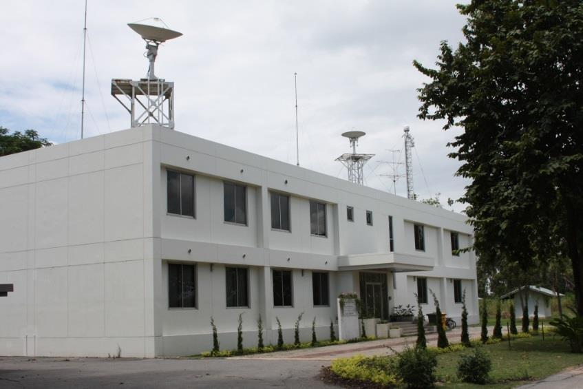


6 Geoinformatics Center Established in 1999
7

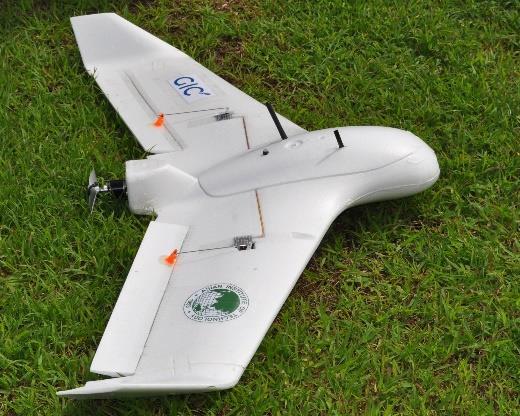
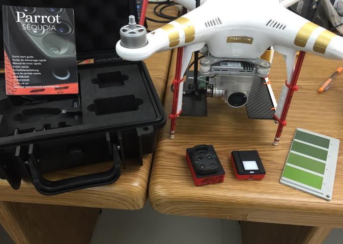
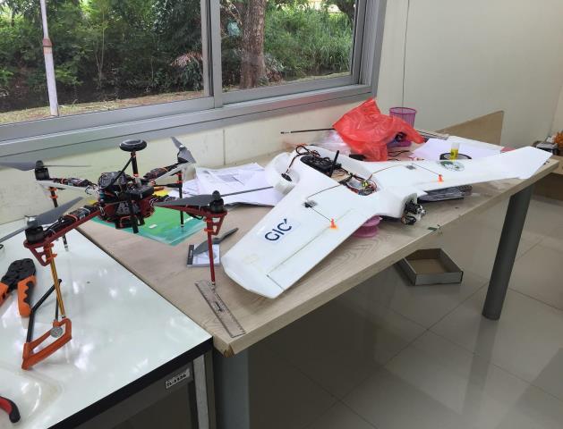
8
9 2. Introduction to Project and Our Contribution 1. About Geoinformatics Centre, AIT, Thailand 2. Introduction to Project and Our Contribution 3. Web Maps and Geonode 4. Concluding Remarks
10 Project Description Geo-portals One month training Program in AIT Early Warning Country Visits for further technical assistance Strengthening multihazard risk assessment and early warning systems with applications of space and geographic information systems in Pacific island countries
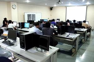
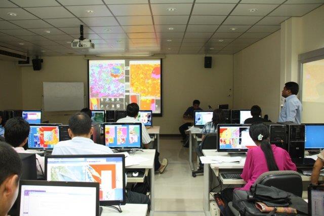
11 Project Description One Month Training Program The training program was at GIC, AIT from 6th February to 3rd March participants from 8 Pacific Island countries participated in this program (Cook Islands, Fiji, Kiribati, Micronesia, Samoa, Solomon Islands, Tonga, Vanuatu)
12 Project Description One Month Training Program Data Collection Storing and Sharing Analysis (QGIS) Week 1 (GIS) Week 2 (RS) Week 3 (Geo- DB) Introduction to GIS Creating and Editing GIS Data Vector Analysis and Table Management Map Composition Coordinates/Projections Introduction to RS Image Processing Image Classification Flood Damage Assessment Building Damage Assessment Satellite Based Rainfall Analysis Postgres/ PostGIS GeoServer Access PostGIS data from QGIS Access GeoServer data from QGIS WMS/WFS Week 4 (GeoNode) Introduction to GeoNode Upload data, documents Create, Publish Maps Security & permissions Customize GeoNodes Backup and Restore
13 Project Description Country Visits Visited 4 counties (June December, 2017) Tonga Fiji Federated States of Micronesia Solomon Islands


14 Micronesia Fiji Tonga Solomon Islands Working with in Government Network
15 3. Web Maps and Geonode 1. About Geoinformatics Centre, AIT, Thailand 2. Introduction to Project and Our Contribution 3. Web Maps and Geonode 4. Concluding Remarks


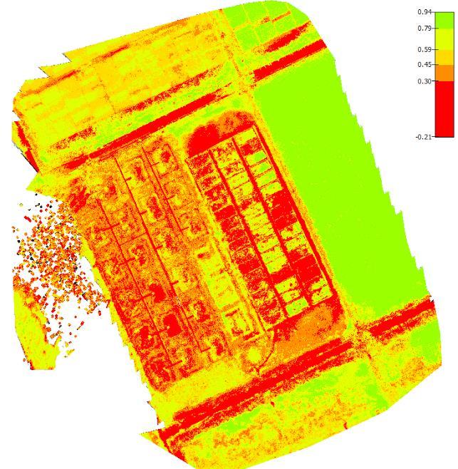
16
17

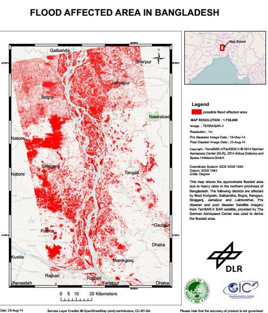
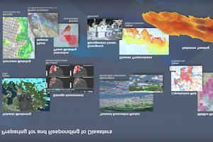
18 Natural Disaster Spatial Data Sharing At the time of a disaster it s very important to have ready-made data available for better decision making

19 Geo-portal is a centralized platform to share all the spatial data Open Data with Public and Restricted data only among the Agencies GEONODE is one such open source solution for a Geoportal Image Source:
 GeoNetwork (Meta Data) OpenLayers (Visualization) GeoExt (Tools)")
20 GeoNode Framework GeoNode Framework Building upon GIS open source projects GeoServer (Map Engine) PostgreSQL/PostGIS (Spatial Database) GeoNetwork (Meta Data) OpenLayers (Visualization) GeoExt (Tools) GeoWebCache (Caching)
21 End User (Public) Geoportal (GEONODE) Agency 1 Agency 2 Agency 3 Mainly Intended to Facilitate one way data flow from Data Providers to Public (End User) Additionally, restricted data can be shared among only intended Agencies
22 3 Types of Data Layers GIS or Satallite Image Data Maps Combination of Layers Documents
23
 is managed by")
24 Use Management Agencies that produce and use disaster related data can have account in Geonode All account (adding / removing) is managed by NDMO

25 Data Privacy When uploading data use can provide different level of privileges for different uses Data is hosted in local server rather than outside server
26 4. Concluding Remarks 1. About Geoinformatics Centre, AIT, Thailand 2. Introduction to Project and Our Contribution 3. Web Maps and Geonode 4. Concluding Remarks
27 Concluding Remarks Importance of country s capacity building rather than just deploying solutions Importance of having long term training

28 Sentinel Asia/IDC Activation in Sri Lanka


29 m1s
30 Thank you!
Crowdsourcing approach for large scale mapping of built-up land
 Crowdsourcing approach for large scale mapping of built-up land Kavinda Gunasekara Kavinda@ait.asia Geoinformatics Center Asian Institute of Technology, Thailand. Regional expert workshop on land accounting
Overview of Technical Advisory Missions
 Expert Group Meeting (EGM) on Georeferenced Information Systems for Disaster Risk Management (Geo-DRM) and sustaining the Community of Practice (COP) 23-25 April 2014 Bangkok Overview of Technical Advisory
RESAP Progress Report
 RESAP Progress Report December 2016 to October 2017 Presentation to the Twenty-first session of the Intergovernmental Consultative Committee on the Regional Space Applications Programme for Sustainable
Space Applications for Disaster Risk Reduction and Sustainable Development
 Space Applications for Disaster Risk Reduction and Sustainable Development Space Applications Section (SAS) ICT and Disaster Risk Reduction Division (IDD) UNESCAP Contents I. RESAP Activities 2016-2017
KEY ACHIEVEMENTS, LESSON LEARNT AND SUGGESTIONS FOR FUTURE OPPORTUNITIES
 KEY ACHIEVEMENTS, LESSON LEARNT AND SUGGESTIONS FOR FUTURE OPPORTUNITIES The project of Strengthening Multi-Hazard Risk Assessment and Early Warning Systems in Pacific Islands Countries Center for Public
Building Institutional Capacity for Multi-Hazard Early Warning in Pacific Countries Subtitle
 Building Institutional Capacity for Multi-Hazard Early Warning in Pacific Countries Subtitle Title Keran Wang Chief, Space Applications Section ICT and Disaster Risk Reduction Division 30 March 2018 Slide
Applied Geoscience and Technology Division SOPAC. Joy Papao, Risk Information Systems Officer
 Joy Papao, Risk Information Systems Officer Secretariat of the Pacific Community SPC 22 Pacific Island States Head office in Noumea, New Caledonia 2 Regional offices (Pohnpei and Honiara) 600 staff 9 Technical
Building Institutional Capacity for Multi-Hazard Early Warning in Asia and the Pacific Subtitle
 Building Institutional Capacity for Multi-Hazard Early Warning in Asia and the Pacific Subtitle Title Keran Wang Chief, Space Applications Section ICT and Disaster Risk Reduction Division 22 May 2018 Pillar
Capacity Building in Applications of Remote Sensing and GIS for Disaster Management
 Capacity Building in Applications of Remote Sensing and GIS for Disaster Management M.K. Hazarika, L. Samarakoon, N. Senevirathne, J.S.M. Fowze and R. de Silva Project Researcher GeoInformatics Center
Geo-portal as a Data Sharing Platform for Early Warning System in the Pacific
 EXPERT SEMINAR ON INTEGRATED STATISTICS FOR THE SDGS Geo-portal as a Data Sharing Platform for Early Warning System in the Pacific 11-13 DECEMBER 2017 BANGKOK, THAILAND Youjin Choe Natural disasters and
Boston, 16 August 2017 The UN Open GIS Initiative
 Boston, 16 August 2017 The UN Open GIS Initiative Kyoung-Soo Eom, UN Ricardo Arias, U.S. Africa Command (USAFRICOM) Maria Antonia Brovelli, OSGeo and Politecnico di Milano, Italy Ki-Joune Li, Pusan National
Satellite-based applications for water resources management in Asia and Pacific region
 Satellite-based applications for water resources management in Asia and Pacific region Ko Hamamoto Japan Aerospace Exploration Agency The views expressed in this paper/presentation are the views of the
THE SALB PROJECT: STATE OF PROGRESS IN ASIA AND THE PACIFIC SINCE THE 8 th SEASC
 THE SALB PROJECT: STATE OF PROGRESS IN ASIA AND THE PACIFIC SINCE THE 8 th SEASC Chandima Subasinghe 1, Yaniss Guigoz 2, Lal Samarakoon 1, Steeve Ebener 2 1 Geoinformatics Center, Asian Institute of Technology
March 2007 The Survey Department of Sri Lanka
 Contribution of Survey Department of Sri Lanka for Mitigation of Disasters in Sri Lanka K.A.U.N.Kasthuri Deputy Surveyor General (Information Technology) March 2007 The Survey Department of Sri Lanka 1
STATUS OF MARINE SPATIAL DATA INFRASTRUCTURE
 STATUS OF MARINE SPATIAL DATA INFRASTRUCTURE IN PACIFIC ISLAND COUNTRIES 26 th January, 2016 7 th IHO Marine Spatial Data Infrastructure Working Group Meeting Tokyo Sachindra Singh Senior Geospatial Systems
Geospatial Technologies for Resources Planning & Management
 Geospatial Technologies for Resources Planning & Management Lal Samarakoon, PhD Director, Geoinformatics Center Asian Institute of Technology, Thailand Content Geoinformatics for SDG Information Integration
Timoti Tangiruaine & Charles Carlson Cook Islands
 The First Pacific Regional Workshop on Multi-Hazard Risk Assessment and Early Warning Systems with Applications of Space and GIS 13 th 15 th September 2016 Nadi, Fiji Islands Timoti Tangiruaine & Charles
Journey of supporting CSNs to establish Geo-DRM
 Regional Workshop on Geo-referenced Information Systems for Disaster Risk Management (Geo-DRM) 26-27 June 2014 Bangkok, Thailand Journey of supporting CSNs to establish Geo-DRM Keran Wang Chief, Space
Sub-regional Training on development of Geo-referenced Disaster Risk Management Information Systems for SAARC countries
 Sub-regional Training on development of Geo-referenced Disaster Risk Management Information Systems for SAARC countries Jointly organized by Economic and Social Commission for Asia and the Pacific and
Country Report Vanuatu
 Country Report Vanuatu Ministry Infrastructure and Public Utilities. Application of Space Technology and the Geographic information system for DRR and Sustainable Development 18 th 22 nd December 2012
ESCAP Promotes Geo-referenced Information System for Disaster Risk Management in Asia and the Pacific
 Third High Level Forum on UNGGIM 22-24 October 2014 Beijing, China ESCAP Promotes Geo-referenced Information System for Disaster Risk Management in Asia and the Pacific Keran Wang Space Applications Section,
PUTTING THINGS TOGETHER: Geonetwork OpenSource, OpenLayers, GeoExt and MapFish under the roof of Drupal CMS - Geoportal RO as an example
 PUTTING THINGS TOGETHER: Geonetwork OpenSource, OpenLayers, GeoExt and MapFish under the roof of Drupal CMS - Geoportal RO as an example Hinrich Paulsen, terrestris GmbH & Co. KG 1 Agenda (1) The company
WMO s Severe Weather Forecasting Demonstration Project (SWFDP)
") 5 th Meeting of the RA II WIGOS Project on Satellites Coordination Group, 21 Oct 2017 WMO s Severe Weather Forecasting Demonstration Project (SWFDP) Abdoulaye Harou Chief DPFS Division/WDS WMO Secretariat
5 th Meeting of the RA II WIGOS Project on Satellites Coordination Group, 21 Oct 2017 WMO s Severe Weather Forecasting Demonstration Project (SWFDP) Abdoulaye Harou Chief DPFS Division/WDS WMO Secretariat
Regional EGM on Community of Practice of Georeferenced Information System. for Disaster Risk Management (Geo-DRM) April 2014, Bangkok, Thailand
 April 2014, Bangkok, Thailand") Regional EGM on Community of Practice of Georeferenced Information System for Disaster Risk Management (Geo-DRM) 23-25 April 2014, Bangkok, Thailand Presented By Mukesh Kumar Keshari Ministry of Home Affairs
Regional EGM on Community of Practice of Georeferenced Information System for Disaster Risk Management (Geo-DRM) 23-25 April 2014, Bangkok, Thailand Presented By Mukesh Kumar Keshari Ministry of Home Affairs
Spatial Data Infrastructure in the Pacific
 Spatial Data Infrastructure in the Pacific. Sachindra Singh Senior Geospatial Systems Architect ICT for Development, Geoscience Division Pacific Community (SPC) OrganisationalBackground SPC - The Pacific
THIRD MEETING OF THE PACIFIC METEOROLOGICAL COUNCIL. Theme: "Sustainable Weather and Climate Services for a Resilient Pacific "
 PMC-3/InformationPaper-1-Provisional Agenda THIRD MEETING OF THE PACIFIC METEOROLOGICAL COUNCIL Theme: "Sustainable Weather and Climate Services for a Resilient Pacific " 20-23 July 2015 Fa'onelua Convention
Sentinel Asia Tsunami Working Group
 Sentinel Asia Tsunami Working Group Co-Chairman: Prof. Shunichi Koshimura Abdul Muhari, PhD 4 th Joint Project Team Meeting (JPTM 2017): Sentinel Asia STEP 3 Abdul MUHARI, PhD Ministry of Marine Affairs
DP Project Development Pvt. Ltd.
 Dear Sir/Madam, Greetings!!! Thanks for contacting DP Project Development for your training requirement. DP Project Development is leading professional training provider in GIS technologies and GIS application
Application of remote sensing for agricultural disasters
 Application of remote sensing for agricultural disasters Bingfang Wu, Sheng Chang Institute of Remote Sensing and Digital Earth (RADI) Chinese Academy of Sciences (CAS) wubf@radi.ac.cn, changsheng@radi.ac.cn
Current status of operations of Pacific Islands Climate Outlook Forum (PICOF) Alexander Montoro Technical Expert on Climate and Weather Services
 Alexander Montoro Technical Expert on Climate and Weather Services") Current status of operations of Pacific Islands Climate Outlook Forum (PICOF) Alexander Montoro Technical Expert on Climate and Weather Services Secretariat of the Pacific Regional Environment Programme
Current status of operations of Pacific Islands Climate Outlook Forum (PICOF) Alexander Montoro Technical Expert on Climate and Weather Services Secretariat of the Pacific Regional Environment Programme
Monitoring Surveys PSLMP COSPPac
 Monitoring Surveys PSLMP COSPPac Andrick Lal, Marika Kalouniviti & Veenil Rattan Science, Technology And Resources (STAR) Conference 26 th 29 th June 2017 Nadi FIJI Geodetic Survey Unit (SPC) Andrick Lal,
Overview of Geospatial Open Source Software which is Robust, Feature Rich and Standards Compliant
 Overview of Geospatial Open Source Software which is Robust, Feature Rich and Standards Compliant Cameron SHORTER, Australia Key words: Open Source Geospatial Foundation, OSGeo, Open Standards, Open Geospatial
GI Technology for Disaster Management
 GI Technology for Disaster Management 17 th ICC on the Regional Space Applications Programme for Sustainable Development (RESAP) 26 th Nov 2013 Bangkok Thailand Period and time of seasonal in thailand
The Regional Integrated Multi-Hazard Early Warning System for Africa and Asia CAP in RIMES
 The Regional Integrated Multi-Hazard Early Warning System for Africa and Asia CAP in RIMES 2018 CAP Implementation Workshop OUTLINE 1. RIMES Overview 2. DSS tools developed in RIMES 3. CAP Integration
JMA s Cooperation with
 JMA s Cooperation with the Pacific Island Countries (PICs) Tomoyuki KITAMURA Japan Meteorological Agency Bali, Indonesia, 7 March 2018 Contents Background Steps to issue weather forecast/warning JMA s
A FOSS approach to Integrated Water Resource Management: the case study of Red-Thai Binh rivers system in Vietnam
 A FOSS approach to Integrated Water Resource Management: the case study of Red-Thai Binh rivers system in Vietnam Carolina Arias Munoz1, Maria Antonia Brovelli1, Simone Corti1, Marco Micotti2, Rodolfo
Report of the Working Group 2 Data Sharing and Integration for Disaster Management *
 UNITED NATIONS E/CONF.104/6 ECONOMIC AND SOCIAL COUNCIL Twentieth United Nations Regional Cartographic Conference for Asia and the Pacific Jeju, 6-9 October 2015 Item 5 of the provisional agenda Report
NUKU ALOFA MINISTERIAL DECLARATION For SUSTAINABLE WEATHER AND CLIMATE SERVICES FOR A RESILIENT PACIFIC. 24th July 2015, Nuku alofa, Tonga
 NUKU ALOFA MINISTERIAL DECLARATION For SUSTAINABLE WEATHER AND CLIMATE SERVICES FOR A RESILIENT PACIFIC 24th July 2015, Nuku alofa, Tonga The First Pacific Ministerial Meeting on Meteorology was held on
CHAPTER 22 GEOGRAPHIC INFORMATION SYSTEMS
 CHAPTER 22 GEOGRAPHIC INFORMATION SYSTEMS PURPOSE: This chapter establishes the administration and use of to improve the quality and accessibility of Department s spatial information and support graphical
Summary of Training Report
 Summary of Training Report Technical Assistance on Implementation of Geo-referenced Information Systems for Disaster Risk Management (Geo-DRM) Conducted in Nepal 11 14 February 2014 Submitted by Lal Samarakoon
CLICK HERE TO KNOW MORE
 CLICK HERE TO KNOW MORE Geoinformatics Applications in Land Resources Management G.P. Obi Reddy National Bureau of Soil Survey & Land Use Planning Indian Council of Agricultural Research Amravati Road,
4 th Joint Project Team Meeting for Sentinel Asia 2011
 A Revisit on the Structural Flood Mitigation Measure with the Application of Remote Sensing and GIS in Gin River Basin, Sri Lanka 4 th Joint Project Team Meeting for Sentinel Asia 2011 Geoinformatics Center
Technical and Administrative Challenges in Collecting Geoinformation to Function as a Flexible Regional Geoinformation Base.
 Technical and Administrative Challenges in Collecting Geoinformation to Function as a Flexible Regional Geoinformation Base. S.D.P.J. Dampegama Additional Surveyor General Survey Department of Sri Lanka
Capacity Building Programme
 Capacity Building Programme 14-17 August 2012 Space Technology for improving Hazard Mapping in Sri Lanka An event organised as a follow up of the UN-SPIDER Technical Advisory Mission to Sri Lanka - 17-21
Reference Frame in Practice Workshop 1A
 Reference Frame in Practice Workshop 1A Status of Geodetic Infrastructure in the Pacific Region Case Studies Rob Sarib - FIG Commission 5 Vice Chair of Administration Welcome! Bula! Who are the International
Geospatial Information for Disaster Risk Management in Asia-Pacific Region
 Geospatial Information for Disaster Risk Management in Asia-Pacific Region Ram S. Tiwaree, Dr.Eng. Space Applications Section Information and Communications Technology and Disaster Risk Reduction Division
Faatasi Malologa (PGSC Chair) Director Department of Lands & Survey, Tuvalu
 Director Department of Lands & Survey, Tuvalu") Seventh Session of the United Nations Committee of Experts on Global Geospatial Information Management (UN-GGIM) - 31 July -4 August 2017 Faatasi Malologa (PGSC Chair) Director Department of Lands & Survey,
Seventh Session of the United Nations Committee of Experts on Global Geospatial Information Management (UN-GGIM) - 31 July -4 August 2017 Faatasi Malologa (PGSC Chair) Director Department of Lands & Survey,
National Remote Sensing Center of China. Space Technology for Sustainable Development in China Status, Achievements and Futures.
 National Remote Sensing Center of China Space Technology for Sustainable Development in China Status, Achievements and Futures Jing Li National Remote Sensing Center of China Ministry of Science and Technology,
Geospatial application in Kiribati
 Geospatial application in Kiribati ICC-21 ST RESAP (9 TH TO 13 TH OCTOBER, 2017) BANGKOK, THAILAND Outline Kiribati Profile Natural disasters in Kiribati Achievements Challenges/Issues Ways forward 1 Kiribati
Economic and Social Council
 United Nations Economic and Social Council Distr.: General 18 July 2016 Original: English Committee of Experts on Global Geospatial Information Management Sixth session New York, 3-5 August 2016 Item 2
Capacity Building Activities at CRECTEALC. Ing. Jerjes Molina Blancas Professor and Developer.
 Capacity Building Activities at CRECTEALC Ing. Jerjes Molina Blancas Professor and Developer. Centro Regional de Enseñanza de Ciencia y Tecnología del Espacio para América Latina y el Caribe (CRECTEALC)
10 emergency observation requests were successfully processed during the period
 ISRO s Inputs for the Sentinel Asia DPN and JPT meeting being held during 13-16, 16, November 2012 November 2012 Sentinel Asia Activity Spectrum - A dedicated Sentinel Asia server established at NRSC,
DISATER MANAGEMENT IN LIBRARIES
 DISATER MANAGEMENT IN LIBRARIES by S. Padmashree National Seminar cum Workshop on Trends & Challenges in LIS Education and Profession March 24 25 th 2017 Andhra University, Visakhapatnam Disaster - A
Item 9.1 The Pacific Meteorological Desk Partnership (PMDP) Salesa Nihmei and Alex Montoro SPREP
 Salesa Nihmei and Alex Montoro SPREP") 1993 RMSD-1 Item 9.1 The Pacific Meteorological Desk Partnership (PMDP) Salesa Nihmei and Alex Montoro SPREP Content Who/what is the PMDP Partnerships The Pacific Met. Strategy Pacific Meteorological
1993 RMSD-1 Item 9.1 The Pacific Meteorological Desk Partnership (PMDP) Salesa Nihmei and Alex Montoro SPREP Content Who/what is the PMDP Partnerships The Pacific Met. Strategy Pacific Meteorological
Space Application in Support of Land Management for SDG Implementation
 Space Application in Support of Land Management for SDG Implementation Regional Expert Workshop on Land Accounting for SDG Monitoring and Reporting 26 September 2017 Space Application Section Information
JICA s Cooperation for NMHSs. Taisuke Watanabe Japan International Cooperation Agency
 JICA s Cooperation for NMHSs Taisuke Watanabe 28 Oct, 2014 JICA s Assistant Approach for Hydrological and Meteorological Services Assistance for improvement of Hydrological and Meteorological Services
The CLIMB Geoportal. A web-based dissemination and documentation platform for hydrological modelling data
 European Geosciences Union GA 2015 ESSI2.13/SSS1.8: Vienna, 14 th April The CLIMB Geoportal A web-based dissemination and documentation platform for hydrological modelling data Michael Blaschek*1, Daniel
Application of WebGIS and VGI for Community Based Resources Inventory. Jihn-Fa Jan Department of Land Economics National Chengchi University
 Application of WebGIS and VGI for Community Based Resources Inventory Jihn-Fa Jan Department of Land Economics National Chengchi University OUTLINE Introduction Methodology Results Conclusions 2 MOTIVATION
SPACE TECHNOLOGY INSTITUTE, VNREDSat-1 and DATA PROVIDER NODE (DPN) REPORT
 REPORT") 4th Joint Project Team Meeting for Sentinel Asia STEP3 (JPTM2017) 8-9 March 2017 SPACE TECHNOLOGY INSTITUTE, VNREDSat-1 and DATA PROVIDER NODE (DPN) REPORT www.sti.vast.ac.vn CONTENT 1. Overview of Space
4th Joint Project Team Meeting for Sentinel Asia STEP3 (JPTM2017) 8-9 March 2017 SPACE TECHNOLOGY INSTITUTE, VNREDSat-1 and DATA PROVIDER NODE (DPN) REPORT www.sti.vast.ac.vn CONTENT 1. Overview of Space
Assisting Countries in the Collection and Analysis of National Statistics
 Assisting Countries in the Collection and Analysis of National Statistics Peter O. Way, Ph.D., Chief International Programs Center U.S. Census Bureau Censuses in the 21 st Century: Improving Data Utilization
Disaster Management and Spatial Data An Experience of Sri Lanka for Joint project team meeting 2012
 Disaster Management and Spatial Data An Experience of Sri Lanka for Joint project team meeting 2012 1 by Padma Kumara Withana Provincial Surveyor General Uva Province 2 Out line ü Introduction ü Natural
A Spatial Data Infrastructure for Landslides and Floods in Italy
 V Convegno Nazionale del Gruppo GIT Grottaminarda 14 16 giugno 2010 A Spatial Data Infrastructure for Landslides and Floods in Italy Ivan Marchesini, Vinicio Balducci, Gabriele Tonelli, Mauro Rossi, Fausto
Cooperation is the key, FIG can facilitate
 Cooperation is the key, FIG can facilitate Mikael Lilje Vice President 2017-2020 Head, Geodetic infrastructure, Swedish mapping, cadastral and land registration authority Presented at the GIS/RS Conference
Geospatial Information and Services for Disasters (GIS4D)
") Geospatial Information and Services for Disasters (GIS4D) 31 July 2017 Tae Hyung KIM ICT and Disaster Risk Reduction Division (IDD) UNESCAP 1 About ESCAP Who is ESCAP? United Nations Economic and Social
Geospatial Information and Services for Disasters (GIS4D) 31 July 2017 Tae Hyung KIM ICT and Disaster Risk Reduction Division (IDD) UNESCAP 1 About ESCAP Who is ESCAP? United Nations Economic and Social
Geographic Information Infrastructure and Policy Framework for Sustainable Mountain Development in the Hindu Kush-Himalayas
 Geo SMART ASIA 2017 22-24 August, Kualalampur Geographic Information Infrastructure and Policy Framework for Sustainable Mountain Development in the Hindu Kush-Himalayas Basanta Shrestha, Director Strategic
Pacific Geospatial and Surveying Council (PGSC) Geospatial and GNSS CORS Infrastructure Forum. Kuala Lumpur October
 Geospatial and GNSS CORS Infrastructure Forum. Kuala Lumpur October") Pacific Geospatial and Surveying Council (PGSC) Geospatial and GNSS CORS Infrastructure Forum. Kuala Lumpur 16-17 October Beginning and Progress Members PGSC Charter PGSC Strategy 2017-2027 Meetings Geodetic
Pacific Geospatial and Surveying Council (PGSC) Geospatial and GNSS CORS Infrastructure Forum. Kuala Lumpur 16-17 October Beginning and Progress Members PGSC Charter PGSC Strategy 2017-2027 Meetings Geodetic
Effective Utilization of Synthetic Aperture Radar (SAR) Imagery in Rapid Damage Assessment
 Imagery in Rapid Damage Assessment") Effective Utilization of Synthetic Aperture Radar (SAR) Imagery in Rapid Damage Assessment Case Study Pakistan Floods SUPARCO M. Maisam Raza, Ahmad H. Rabbani SEQUENCE Flood Monitoring using Satellite
Effective Utilization of Synthetic Aperture Radar (SAR) Imagery in Rapid Damage Assessment Case Study Pakistan Floods SUPARCO M. Maisam Raza, Ahmad H. Rabbani SEQUENCE Flood Monitoring using Satellite
Climate Resilience Decision Making Framework in the Caribbean. A case of Spatial Data Management
 Climate Resilience Decision Making Framework in the Caribbean A case of Spatial Data Management Bishwa Pandey Sr. Data Management Specialist The World Bank Background The mission of The World Bank s Latin
The Southeast Asia and Pacific Biosphere Reserves Network SeaBRnet and PacMAB
 WORKSHOPS ON THE MAB REGIONAL NETWORKS The Southeast Asia and Pacific Biosphere Reserves Network SeaBRnet and PacMAB Tuesday 15 March 2016 Armatambo Room Shahbaz Khan Director UNESCO Office, Jakarta Southeast
Establishment of WINDS Ground Station in Sri Lanka. By G.K.D. Amarawardena Additional Secretary Ministry of Disaster Management Sri Lanka
 Establishment of WINDS Ground Station in Sri Lanka By G.K.D. Amarawardena Additional Secretary Ministry of Disaster Management Sri Lanka Contents Background SAS Implementation Progress of WINDS establishment
History of International Training in Seismology and Earthquake Engineering at IISEE
 History of International Training in Seismology and Earthquake Engineering at IISEE Activities of International Institute of Seismology and Earthquake Engineering (IISEE), BRI - Training for young researchers/engineers
Cross-Border Infrastructure Connectivity: Needs, Facts and Challenges
 Cross-Border Infrastructure Connectivity: Needs, Facts and Challenges Matthias Helble Research Economist Asian Development Bank Institute Financing Quality Infrastructure 19-20 December, 2016 Contents
Use of geo-referenced data for DRM in Central Asia, problems and prospective
 Use of geo-referenced data for DRM in Central Asia, problems and prospective Dr. Akylbek Chymyrov Director, Kyrgyz Center of Geoinformation Systems Member of the Public Supervisory Board MES KR KSUCTA,
Spatial Data Availability Energizes Florida s Citizens
 NASCIO 2016 Recognition Awards Nomination Spatial Data Availability Energizes Florida s Citizens State of Florida Agency for State Technology & Department of Environmental Protection Category: ICT Innovations
Nineteenth SPREP Meeting
 Page 1 SECRETARIAT OF THE PACIFIC REGIONAL ENVIRONMENT PROGRAMME Nineteenth SPREP Meeting Pohnpei, Federated States of Micronesia 04 12 September 2008 Agenda Item 9.2.5: Regional Meteorological Services
Development of Geoweb application using Open Source Technology: An innovative approach for disaster mitigation and management
 Development of Geoweb application using Open Source Technology: An innovative approach for disaster mitigation and management Harish Karnatak harish@iirs.gov.in Reedhi Shukla National Remote Sensing Center
Regional Centre for Mapping of Resources for Development (RCMRD), Nairobi, Kenya
, Nairobi, Kenya") Regional Centre for Mapping of Resources for Development (RCMRD), Nairobi, Kenya Introduction to GIS (2 weeks: 10 days) Intakes: 8 th January, 6 th February, 5th March, 3 rd. April 9 th, May 7 th, June
Regional Centre for Mapping of Resources for Development (RCMRD), Nairobi, Kenya Introduction to GIS (2 weeks: 10 days) Intakes: 8 th January, 6 th February, 5th March, 3 rd. April 9 th, May 7 th, June
Pacific Islands Regional Maritime Boundaries Project the latest Update. Malakai Vakautawale (Mr) Maritime Boundaries Adviser
 Maritime Boundaries Adviser") Pacific Islands Regional Maritime Boundaries Project the latest Update Malakai Vakautawale (Mr) Maritime Boundaries Adviser Consortium Partners 2 What we do? Provide technical advice and support on MB
Pacific Islands Regional Maritime Boundaries Project the latest Update Malakai Vakautawale (Mr) Maritime Boundaries Adviser Consortium Partners 2 What we do? Provide technical advice and support on MB
Newcastle City Council - Migration to QGIS and Open Source GIS
 Newcastle City Council - Migration to QGIS and Open Source GIS Brian Williams & Saber Razmjooei 13 April 2016 Outline I Why Open Source? Rational What we did How we did it Benefits Discussion Points QGIS
ENHANCING THE SHARE OF LLDCs IN. (Priority 3 of APoA) Dr Mia Mikic Chief, Trade Policy and Analysis Section Trade and Investment Division
 Dr Mia Mikic Chief, Trade Policy and Analysis Section Trade and Investment Division") ESCAP/OHRLLS/ECE/Government of Lao PDR Final Regional Review of the AlmatyProgrammeof of Action 5 7 March 2013, Vientiane, Lao PDR ENHANCING THE SHARE OF LLDCs IN GLOBAL TRADE FLOWS AND TRADE FACILITATION
ESCAP/OHRLLS/ECE/Government of Lao PDR Final Regional Review of the AlmatyProgrammeof of Action 5 7 March 2013, Vientiane, Lao PDR ENHANCING THE SHARE OF LLDCs IN GLOBAL TRADE FLOWS AND TRADE FACILITATION
Funded by Japan Government through UN ESCAP and BMKG
 METEOROLOGY & COAST RADIO SERVICES MINISTRY OF METEOROLOGY, ENERGY, INFORMATION,DISASTER MANAGEMENT, ENVIRONMENT, CLIMATE CHANGE AND COMMUNICATION KINGDOM OF TONGA P. O. Box 845, Domestic Terminal, Fua
Regional Centre for Mapping of Resources for Development (RCMRD), Nairobi, Kenya
, Nairobi, Kenya") Regional Centre for Mapping of Resources for Development (RCMRD), Nairobi, Kenya Introduction GIS ( 2 weeks: 10 days) Intakes: 7 th Jan, 4 th Feb,4 th March, 1 st April 6 th May, 3 rd June, 1 st July,
Regional Centre for Mapping of Resources for Development (RCMRD), Nairobi, Kenya Introduction GIS ( 2 weeks: 10 days) Intakes: 7 th Jan, 4 th Feb,4 th March, 1 st April 6 th May, 3 rd June, 1 st July,
IHP-WINS will make water-related information available online, allowing countries and stakeholders to access reliable data on an open source platform.
 United Nations Educational, Scientific and Cultural Organization International Hydrological Programme International Hydrological Programme Water Information Network System INTERNATIONAL HYDROLOGICAL PROGRAMME
Getting Started with Community Maps
 Esri International User Conference San Diego, California Technical Workshops July 24, 2012 Getting Started with Community Maps Shane Matthews and Tamara Yoder Topics for this Session ArcGIS is a complete
Sentinel Asia System Operation for Disaster Management in Sri Lanka Major General L.B.R. Mark (Retd) Director General Disaster Management Centre
 Director General Disaster Management Centre") Sentinel Asia System Operation for Disaster Management in Sri Lanka Major General L.B.R. Mark (Retd) Director General Disaster Management Centre Government of Sri Lanka OUTLINE Background Disasters in
Sentinel Asia System Operation for Disaster Management in Sri Lanka Major General L.B.R. Mark (Retd) Director General Disaster Management Centre Government of Sri Lanka OUTLINE Background Disasters in
Report of the Regional Committee of UN-GGIM for Asia and the Pacific (UN-GGIM-AP)
") Report of the Regional Committee of UN-GGIM for Asia and the Pacific (UN-GGIM-AP) At the Eighth Session of UN-GGIM UN Headquarters, New York, 1 3 August 2018 About UN-GGIM-AP One of the five regional committees
Report of the Regional Committee of UN-GGIM for Asia and the Pacific (UN-GGIM-AP) At the Eighth Session of UN-GGIM UN Headquarters, New York, 1 3 August 2018 About UN-GGIM-AP One of the five regional committees
Contribution to global Earth observation from satellites
 Contribution to global Earth observation from satellites - JAXA s Earth Observation strategy - April 16, 2008 Makoto Kajii Japan Aerospace Exploration Agency Earth Observation Summits and GEOSS 1 st EO
Geospatial Information for Disease Prevention and Control. INSPIRE Conference 2013
 Geospatial Information for Disease Prevention and Control Dr. Virginia Estevez, Senior Expert GIS Florence, 25 th June 2013 ECDC overview ECDC The European Centre for Disease Prevention and Control (ECDC),
WMO s Severe Weather Forecasting Demonstration Project (SWFDP)
") SCOPE Nowcasting Executive Panel, First Meeting, Geneva, Switzerland, 18-20 September 2017 WMO s Severe Weather Forecasting Demonstration Project (SWFDP) Abdoulaye Harou Chief DPFS Division/WDS WMO Secretariat
SCOPE Nowcasting Executive Panel, First Meeting, Geneva, Switzerland, 18-20 September 2017 WMO s Severe Weather Forecasting Demonstration Project (SWFDP) Abdoulaye Harou Chief DPFS Division/WDS WMO Secretariat
Regional Centre for Mapping of Resources for Development (RCMRD), Nairobi, Kenya. Introduction GIS ( 2 weeks: 10 days)
, Nairobi, Kenya. Introduction GIS ( 2 weeks: 10 days)") Regional Centre for Mapping of Resources for Development (RCMRD), Nairobi, Kenya Introduction GIS ( 2 weeks: 10 days) Intakes: 8 th Jan, 6 th Feb,5 th March, 3 rd April 9 th, May 7 th, June 4 th, July
Regional Centre for Mapping of Resources for Development (RCMRD), Nairobi, Kenya Introduction GIS ( 2 weeks: 10 days) Intakes: 8 th Jan, 6 th Feb,5 th March, 3 rd April 9 th, May 7 th, June 4 th, July
WMO Public Weather Services: Enhanced Communication Skills for Improved Service Delivery. by S.W. Muchemi (WMO)
") WMO Public Weather Services: Enhanced Communication Skills for Improved Service Delivery by S.W. Muchemi (WMO) Functions of the Public Weather Services (PWS) programme of WMO To strengthen the capabilities
WMO Public Weather Services: Enhanced Communication Skills for Improved Service Delivery by S.W. Muchemi (WMO) Functions of the Public Weather Services (PWS) programme of WMO To strengthen the capabilities
BMKG UPDATES ON SATELLITE-RELATED ACTIVITIES IN RA V
 UPDATES ON SATELLITE-RELATED ACTIVITIES IN RA V Riris Adriyanto (BMKG Indonesia / Member RA V TT-SU) With inputs from : Agnes Lane (Australian BoM / Leader RA V TT-SU) 1 Introduction Throughout these years,
Working Group 1. Geodetic Reference Frame. Activity Report. for. The UN-GGIM-AP Plenary Meeting
 Regional Committee of United Nations Global Geospatial Information Management for Asia and the Pacific (UN-GGIM-AP) Established by a United Nations Resolution Working Group 1 Geodetic Reference Frame Activity
From the Venice Lagoon Atlas towards a collaborative federated system
 From the Venice Lagoon Atlas towards a collaborative federated system City of Venice Alessandro Mulazzani CORILA Consortium for Coordination of Research Activities Concerning the Venice Lagoon System ISMAR-CNR
Status & Challengers of Cook Islands GEO DRM. Cook Islands GEO S/GIS History
 Status & Challengers of Cook Islands GEO DRM By Patrick A. ARIOKA Planning & Advisory Officer EMERGENCY MANAGEMENT COOK ISLANDS Cook Islands GEO S/GIS History 1990 NZODA/MFAT trained by Landcare Research
Climate Risk Visualization for Adaptation Planning and Emergency Response
 Climate Risk Visualization for Adaptation Planning and Emergency Response NCR Flood Fact Finding Workshop Ricardo Saavedra ricardo@vizonomy.com Social Media, Mobile, and Big Data St. Peter s Basilica,
Public Disclosure Copy
 Public Disclosure Authorized EAST ASIA AND PACIFIC Vanuatu Social, Urban, Rural and Resilience Global Practice Global Practice Recipient Executed Activities Technical Assistance Loan FY 2013 Seq No: 7
GeoHealth Applications Platform ESRI Health GIS Conference 2013
 GeoHealth Applications Platform ESRI Health GIS Conference 2013 Authors Thomas A. Horan, Ph.D. Professor, CISAT Director April Moreno Health GeoInformatics Ph.D. Student Brian N. Hilton, Ph.D. Clinical
USE OF GEOREFERENCE INFORMATION FOR DRM Arnob Bormdoi Research Associate, GIC
 USE OF GEOREFERENCE INFORMATION FOR DRM Arnob Bormdoi Research Associate, GIC CONTENTS INTRODUCTION THE IMPORTANCE OF SPATIAL INFORMATION CASE STUDIES SUMMARY INTRODUCTION The process of defining how raster
UN Open GIS Initiative
 Challenge & Opportunity Kyoung-Soo Eom Co-Chair of UN Open GIS Chief UNGIS FOSS4G 2018 Dar es Salaam @UNopenGIS Page 2 United Nations We the people of the United Nations determined to save succeeding generations