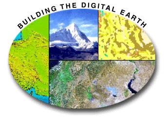
Vision 2020: Focus on the Future. Michael F. Goodchild University of California Santa Barbara
|
|
|
- Christine Porter
- 5 years ago
- Views:
Transcription
1 Vision 2020: Focus on the Future Michael F. Goodchild University of California Santa Barbara
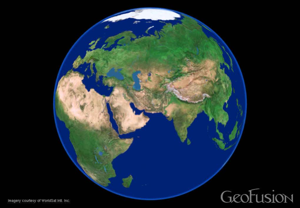
2 A little context Gore, Earth in the Balance, 1992 a single portal to Earth information Fall 1997 Tom Kalil, White House Science Advisor Tom Usselman, National Academies The Gore speech of 1/31/98 Simplification the Earth as it looks no projection complications away from the paper map legacy at the edge of feasibility
3 Imagine, for example, a young child going to a Digital Earth exhibit at a local museum. After donning a head-mounted display, she sees Earth as it appears from space. Using a data glove, she zooms in, using higher and higher levels of resolution, to see continents, then regions, countries, cities, and finally individual houses, trees, and other natural and man-made objects. Having found an area of the planet she is interested in exploring, she takes the equivalent of a magic carpet ride through a 3-D visualization of the terrain.


4

5 By the year 2005: Possible to assemble all relevant information from the resources of the Internet based on known location Possible for a child to learn about Earth and its infinite variety through the medium of digital technology from global to local


6

7
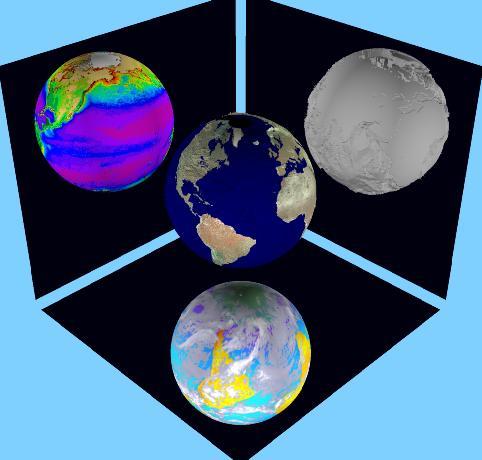
8 Summary: four perspectives An immersive environment A metaphor for information organization A distributed database transparent to the user A representation of the planet's dynamics
9 Milestones 2000: Gore loses election 2001: Keyhole s Earthviewer ca 2003: NVidia 32MB graphics become standard in PCs 2005: Google acquires Keyhole, rebrands, releases as Google Earth 2005: Google releases KML-based API
10 The numbers 500x10 6 sq km 1 sq km on a typical screen approximately 1m resolution 1 byte/1m pixel 5x10 14 bytes 5x10 9 secs at 1Mbps to download >100 years Refresh 1/sec a human lifetime to view
11 Technical achievements Video refresh rates 10km to better than 1m resolution Caching LOD management degrade in periphery Hidden data structure
12
13

14
 Ross Heikes and David Randall, Colorado State")
15 Discrete global grid based on the Icosahedron (20 triangles, 1:4 recursive subdivision) Ross Heikes and David Randall, Colorado State University
16 What s missing? A robust visualization implementing rigorous spherical geometry or spheroidal accurate georeferencing A single portal The MOADB Dynamics, process modeling, prediction

17
18 A dynamic Digital Earth Simulations of past and future conditions A library of simulation models applied to local conditions represented by data A tool with enormous educational value PCRaster demonstrations University of Utrecht, Peter Burrough


19 Volunteered geographic information (VGI) A phenomenon of the 21 st Century recent months User-generated content Collective intelligence Crowdsourcing Asserted information The empowerment of millions of private citizens largely untrained no obvious reward no guarantee of truth no authority
20 What makes this possible? Web 2.0 from downloaded content to user-generated content compare blogs, wikis Web search engines making it possible to find user-generated content Google Earth mash-ups Jane Austen Google Earth
21 Georeferencing The ability to determine location quickly and easily most people do not know their latitude and longitude what is at N, E? where is St-Dié-des-Vosges? Read coordinates from Google Earth etc. GPS


22 Dynamic geographic information Live feed to desktop, laptop, mobile phone integrated with other map data
23 Geotags Invisible codes inserted into Web text Wikipedia entries
24 Humans as sensors Sensor networks sensors that know where they are report appropriate features of environment networks of video monitors atmospheric sensors
25 Sensor networks Small, cheap devices smart dust digital dust Sensing ambient properties uploading to central site
26 The spatial web Objects that know and report where they are together with other information Servers that compile and distribute information Users who can combine data from various sources NPR audio clip
27 Three types of sensor networks Inert, fixed Carried on moving objects vehicles pedestrians asthma research Human beings 6 billion intelligent sensors informed observers rich local knowledge uplink technology broadband Internet mobile phone
28 Citizen science Networks of amateur observers possibly trained, skilled Christmas Bird Count thousands of volunteer participants protocols Project GLOBE an international network of school children reporting environmental conditions central integration and redistribution
29 Participant populations Open to all Wikimapia, Flickr Trained or skilled volunteers Christmas Bird Count School children GLOBE Vehicle fleets Inrix Farmers precision agriculture Reversing the traditional top-down flow
30 Early warning Recent disasters Indian Ocean tsunami Hurricane Katrina Breakdown of technology no power no computers no Internet connections Delays in acquiring imagery from satellites Human observers in the impacted area


31 Andrew Smith, MapAction,
32 Why do people do this? Self-promotion exhibitionism retaining ownership of contributed data Altruism a belief that everything on the Web can be found and will be used to good effect A desire to fill gaps in available data especially in areas where data are not available or where access is denied for security Sharing with friends, relatives but accessible by all
33 Authority and assertion Traditional mapping to high quality authoritative Type I VGI = Type III Potential for subversion Soviet mapping compare spam, viruses, attacks The Wikipedia process anyone can edit reviewed by volunteers crowdsourcing
34 The digital divide VGI implies connectivity preferably broadband for both uplink and downlink Roman alphabet dominant problems with diacriticals
35 The value of VGI A significant contribution to geography enhancing our knowledge of the Earth local focus engaging citizens Many unresolved questions trust preservation social psychology
Citizens as Sensors: Web 2.0 and the World of Volunteered Geography. Michael F. Goodchild University of California Santa Barbara
 Citizens as Sensors: Web 2.0 and the World of Volunteered Geography Michael F. Goodchild University of California Santa Barbara How is geographic information created? By authorities USGS NGA Ordnance Survey
The Spatial Web: Visions for a Geospatial World. Michael F. Goodchild Walton Fellow National Centre for Geocomputation
 The Spatial Web: Visions for a Geospatial World Michael F. Goodchild Walton Fellow National Centre for Geocomputation Outline Context Current technology My own research Technological vision Social issues
Citizens as sensors: the world of volunteered geography
 DOI 10.1007/s10708-007-9111-y Citizens as sensors: the world of volunteered geography Michael F. Goodchild Published online: 20 November 2007 Ó Springer Science+Business Media B.V. 2007 Abstract In recent
The Future of Geography in an. Society. Michael F. Goodchild University of California Santa Barbara
 The Future of Geography in an Emerging Information-Technology Society Michael F. Goodchild University of California Santa Barbara Geographic technologies Positioning i on the Earth s surface GPS, RFID
Geographic Information Systems and Science: Today and Tomorrow. Michael F. Goodchild University of California Santa Barbara
 Geographic Information Systems and Science: Today and Tomorrow Michael F. Goodchild University of California Santa Barbara Geospatial technologies Positioning on the Earth s surface GPS, RFID Acquisition
California Reality and Nova Scotia Dreaming. Michael F. Goodchild University of California Santa Barbara
 California Reality and Nova Scotia Dreaming Michael F. Goodchild University of California Santa Barbara 1 The geospatial world Remote sensing Geographic information systems Automated cartography Global
Reimaging GIS: Geographic Information Society. Clint Brown Linda Beale Mark Harrower Esri
 Reimaging GIS: Geographic Information Society Clint Brown Linda Beale Mark Harrower Esri 8 billion = Number of basemap requests per month on AGOL 14,000 = Unique requests per second 12,000 = New Items
Smart Citizens. Maria Antonia Brovelli Politecnico di Milano, Italy
 Smart Citizens Maria Antonia Brovelli Politecnico di Milano, Italy UN-GGIM Academic Network Forum Secure Land Rights and Smart Cities: Making It Work for Sustainable Development New York, 31 July 2017
Exploring Digital Earth. Michael F. Goodchild University of California Santa Barbara
 Exploring Digital Earth Michael F. Goodchild University of California Santa Barbara Some explaining to do What a curious career Nevill Mott, Cavendish Professor of Physics, University of Cambridge, 1965
by Dr. Ming-Hsiang (Ming) Tsou Associate Professor Internet-based Mapping is a new form (medium) of maps in cartography and for geographic research.
 Tsou Associate Professor Internet-based Mapping is a new form (medium) of maps in cartography and for geographic research.") San Diego State University GEOG 104 Class New Research Directions of Internet GIS and Disaster Management and Lessons Learned from the San Diego 2007 Wildfires. Technology Advancement by Dr. Ming-Hsiang
San Diego State University GEOG 104 Class New Research Directions of Internet GIS and Disaster Management and Lessons Learned from the San Diego 2007 Wildfires. Technology Advancement by Dr. Ming-Hsiang
Introduction to Google Mapping Tools
 Introduction to Google Mapping Tools Google s Mapping Tools Explore geographic data. Organize your own geographic data. Visualize complex data. Share your data with the world. Tell your story and educate
Esri and GIS Education
 Esri and GIS Education Organizations Esri Users 1,200 National Government Agencies 11,500 States & Regional Agencies 30,800 Cities & Local Governments 32,000 Businesses 8,500 Utilities 12,600 NGOs 11,000
GIScience: Current Technology. Michael F. Goodchild University of California Santa Barbara
 GIScience: Current Technology Michael F. Goodchild University of California Santa Barbara What is a GIS? A class of software designed to handle geographic information and perform virtually any conceivable
Web 2.0, map production & publishing and geospatial information dissemenation
 Web 2.0, map production & publishing and geospatial information dissemenation Professor William Cartwright President, International Cartographic Association William Cartwright 18th UNRCC for Asia and the
Michael F. Goodchild University of California Santa Barbara
 The Changing Face of GIS Michael F. Goodchild University of California Santa Barbara 1 Two topics New data sources Critical spatial thinking 2 How is geographic information created? By authorities and
Teacher Activity Packet: Observation Guide Campaign Dates that use Leo: March and April 11 20
 Teacher Activity Packet: Observation Guide Encourage your students to participate in a worldwide citizen science campaign to observe and record the magnitude of visible stars as a means of measuring light
You are Building Your Organization s Geographic Knowledge
 You are Building Your Organization s Geographic Knowledge And Increasingly Making it Available Sharing Data Publishing Maps and Geo-Apps Developing Collaborative Approaches Citizens Knowledge Workers Analysts
Agency Vision and Decision- Maker Needs: A USGS Perspective
 Agency Vision and Decision- Maker Needs: A USGS Perspective Connecting Grassroots to Government for Disaster Management David Applegate USGS Associate Director for Natural Hazards September 13, 2012 U.S.
Application of WebGIS and VGI for Community Based Resources Inventory. Jihn-Fa Jan Department of Land Economics National Chengchi University
 Application of WebGIS and VGI for Community Based Resources Inventory Jihn-Fa Jan Department of Land Economics National Chengchi University OUTLINE Introduction Methodology Results Conclusions 2 MOTIVATION
Citizens as Sensors: The World of Volunteered Geography. Michael F. Goodchild University of California Santa Barbara
 Citizens as Sensors: The World of Volunteered Geography Michael F. Goodchild University of California Santa Barbara VGI examples research hissues Case study Outline VGI in emergency management Individual
GIS CONCEPTS Part I. GIS ON THE WEB Part II
 Week 2 GIS CONCEPTS Part I GIS ON THE WEB Part II topics of the week part I GIS functions and GIS data Spatial relationships Organizing convention for spatial data Store Information by thematic layers
Re-imagining Religion: The Spatial Humanities as a Framework for New Scholarship
 2010 Re-imagining Religion: The Spatial Humanities as a Framework for New Scholarship David J. Bodenhamer The Polis Center at IUPUI Virtual Center for Spatial Humanities New Technologies and Interdisciplinary
Towards data driven decision-making using crowd-sourced geographic information. Linna Li University of Redlands December 2, 2015
 Towards data driven decision-making using crowd-sourced geographic information Linna Li (linna.li@csulb.edu) University of Redlands December 2, 2015 WalMap: Walgreens store location map Geographic information
2013 AND 2025 THE FUTURE OF GIS
 THE FUTURE OF GIS 2013 AND 2025 What is the state of geospatial computing today? What are the issues today? Unresolved problems What will geospatial computing be like in 2025? What issues will be of concern
Techniques for Science Teachers: Using GIS in Science Classrooms.
 Techniques for Science Teachers: Using GIS in Science Classrooms. After ESRI, 2008 GIS A Geographic Information System A collection of computer hardware, software, and geographic data used together for
Michael F. Goodchild University of California Santa Barbara
 The Changing Face of GIS Michael F. Goodchild University of California Santa Barbara 1 Two topics New data sources Critical spatial thinking 2 How is geographic information created? By authorities and
30 YEARS SINCE Z_GIS FOUNDING: PROVIDING SOLUTIONS FOR SOCIETY AND BUSINESS
 30 YEARS SINCE Z_GIS FOUNDING: PROVIDING SOLUTIONS FOR SOCIETY AND BUSINESS Michael F Goodchild Emeritus Professor of Geography University of California, Santa Barbara Keynote GIScience Symposium, Salzburg,
file://q:\report1\greenatlasfinalreportindex.html
 Page 1 of 8 Quick Links WATER MANAGEMENT INTERNSHIP USDA HIS GRANT FUNDED FINAL PROJECT REPORT SUBMITTED BY MELISSA QUINTANA 11/07/07-03/24/08 Summary Provided is an assessment of my accomplishments for
Indiana University Maps
 Indiana University 9.28.09 Maps Maps Mission Action Cause related cartography at National Geographic Networks and Complex Systems This talk series is open to all Indiana University faculty and students
Teacher Activity Packet: Observation Guide
 Teacher Activity Packet: Observation Guide Encourage your students to participate in a world-wide citizen science campaign to observe and record the magnitude of visible stars as a means of measuring light
geographic patterns and processes are captured and represented using computer technologies
 Proposed Certificate in Geographic Information Science Department of Geographical and Sustainability Sciences Submitted: November 9, 2016 Geographic information systems (GIS) capture the complex spatial
ArcGIS is Advancing. Both Contributing and Integrating many new Innovations. IoT. Smart Mapping. Smart Devices Advanced Analytics
 ArcGIS is Advancing IoT Smart Devices Advanced Analytics Smart Mapping Real-Time Faster Computing Web Services Crowdsourcing Sensor Networks Both Contributing and Integrating many new Innovations ArcGIS
ATINER's Conference Paper Series PLA
 ATINER CONFERENCE PAPER SERIES No: LNG2014-1176 Athens Institute for Education and Research ATINER ATINER's Conference Paper Series PLA2015-1709 A Tool for Quantifying the Urban Gradient Agnes Lipovits
Key Issue #1 - Why is Geography a Science?
 AP Human Geography - 1 Rubenstein s The Cultural Landscape Chapter 1: Thinking Geographically Introduction to Note Packets Reading the textbook and taking notes while reading are NECESSARY steps in processing
Building a National Data Repository
 Building a National Data Repository Mladen Stojic, Vice President - Geospatial 1/30/2013 2012 Intergraph Corporation 1 Information has meaning and gives power only when shared and distributed. Information,
ESRI Survey Summit August Clint Brown Director of ESRI Software Products
 ESRI Survey Summit August 2006 Clint Brown Director of ESRI Software Products Cadastral Fabric How does Cadastral fit with Survey? Surveyors process raw field observations Survey measurements define high-order
Research Group Cartography
 Research Group Cartography Research Group Cartography Towards supporting wayfinding LBS components 1. Mobile devices 2. Communication Network 3. Positioning Component 4. Service and Application Provider
ARGUS.net IS THREE SOLUTIONS IN ONE
 OVERVIEW H i g h l y c o n f i g u r a b l e s o f t w a r e a c c o m m o d a t e s a w i d e r a n g e o f c o l l e c t i o n s T h r e e s o l u t i o n s c o v e r P o r t a l s, C o l l e c t i o
Unit 1, Lesson 3 What Tools and Technologies Do Geographers Use?
 Unit 1, Lesson 3 What Tools and Technologies Do Geographers Use? Geographers use a variety of tools and technologies in investigating geographic questions. Maps and globes both represent the earth, but
VGIscience Summer School Interpretation, Visualisation and Social Computing of Volunteered Geographic Information (VGI)
") VGIscience Summer School Interpretation, Visualisation and Social Computing of Volunteered Geographic Information (VGI) TU Dresden, 11.-15. September 2017 Welcome PhD students working on research topics
VGIscience Summer School Interpretation, Visualisation and Social Computing of Volunteered Geographic Information (VGI) TU Dresden, 11.-15. September 2017 Welcome PhD students working on research topics
Citizen Science at the. U.S. Geological Survey
 Citizen Science at the U.S. Geological Survey David Applegate USGS Associate Director for Natural Hazards NRC Board on Earth Science & Resources December 5, 2014 U.S. Department of the Interior U.S. Geological
Climate Risk Visualization for Adaptation Planning and Emergency Response
 Climate Risk Visualization for Adaptation Planning and Emergency Response NCR Flood Fact Finding Workshop Ricardo Saavedra ricardo@vizonomy.com Social Media, Mobile, and Big Data St. Peter s Basilica,
ArcGIS Earth for Enterprises DARRON PUSTAM ARCGIS EARTH CHRIS ANDREWS 3D
 ArcGIS Earth for Enterprises DARRON PUSTAM ARCGIS EARTH CHRIS ANDREWS 3D ArcGIS Earth is ArcGIS Earth is a lightweight globe desktop application that helps you explore any part of the world and investigate
Working with ArcGIS Online
 Esri International User Conference San Diego, CA Technical Workshops July 12, 2011 Working with ArcGIS Online Bern Szukalski, Deane Kensok Topics for this Session ArcGIS Online Overview ArcGIS Online Content
Chapter 10: The Future of GIS Why Speculate? 10.2 Future Data 10.3 Future Hardware 10.4 Future Software 10.5 Some Future Issues and Problems
 Chapter 10: The Future of GIS 10.1 Why Speculate? 10.2 Future Data 10.3 Future Hardware 10.4 Future Software 10.5 Some Future Issues and Problems Theme of the Course GIS's place in understanding geographic
GIS for Crime Analysis. Building Better Analysis Capabilities with the ArcGIS Platform
 GIS for Crime Analysis Building Better Analysis Capabilities with the ArcGIS Platform Crime Analysis The Current State One of the foundations of criminological theory is that three things are needed for
Data Aggregation with InfraWorks and ArcGIS for Visualization, Analysis, and Planning
 Data Aggregation with InfraWorks and ArcGIS for Visualization, Analysis, and Planning Stephen Brockwell President, Brockwell IT Consulting, Inc. Join the conversation #AU2017 KEYWORD Class Summary Silos
Unit 1, Lesson 2. What is geographic inquiry?
 What is geographic inquiry? Unit 1, Lesson 2 Understanding the way in which social scientists investigate problems will help you conduct your own investigations about problems or issues facing your community
Google Maps and Beyond
 Google Maps and Beyond Aaron Paul First American Title apaul@firstam.com 2015 APRA Symposium Association of Professional Reserve Analysts May 2 nd, 2015 Google Maps and Beyond - Overview Business case
Esri s Living Atlas of the World Community Maps
 Esri s Living Atlas of the World Community Maps Seth Sarakaitis Wednesday May 7, 2014 ArcGIS Living Atlas Concept Living Atlas Content Tour Contributing to the Living Atlas (Community Maps) Seth Sarakaitis
DEVELOPMENT OF GPS PHOTOS DATABASE FOR LAND USE AND LAND COVER APPLICATIONS
 DEVELOPMENT OF GPS PHOTOS DATABASE FOR LAND USE AND LAND COVER APPLICATIONS An Ngoc VAN and Wataru TAKEUCHI Institute of Industrial Science University of Tokyo 4-6-1 Komaba, Meguro-ku, Tokyo 153-8505 Japan
Application Issues in GIS: the UCL Centre for Advanced Spatial Analysis. Paul Longley UCL
 Application Issues in GIS: the UCL Centre for Advanced Spatial Analysis Paul Longley UCL GIS: inclusive, shared understanding Geodemographics as a focus of interest Profiling public goods and services
Key Points Sharing fosters participation and collaboration Metadata has a big role in sharing Sharing is not always easy
 Sharing Resources Geoff Mortson esri, Inc. SDI Solutions Team Key Points Sharing fosters participation and collaboration Metadata has a big role in sharing Sharing is not always easy Data Sharing is Good
The Case for Space in the Social Sciences
 The Case for Space in the Social Sciences Don Janelle Center for Spatially Integrated Social Science University of California, Santa Barbara Roundtable on Geographical Voices and Geographical Analysis
ArcGIS 10.1 An Overview of the System
 ArcGIS 10.1 An Overview of the System ArcGIS 10.1 An Overview of the System Damian Spangrud Director of Solutions, Esri Redlands, CA USA ArcGIS 10.1 Web Cloud Online Mobile Enterprise Desktop ArcGIS 10.1
Developing a Community Geographical Information System (GIS) in Rural India
 in Rural India") Developing a Community Geographical Information System (GIS) in Rural India Before rushing off and describing the unique challenges of developing a small scale GIS system India I better first describe
Developing a Community Geographical Information System (GIS) in Rural India Before rushing off and describing the unique challenges of developing a small scale GIS system India I better first describe
GIS = Geographic Information Systems;
 What is GIS GIS = Geographic Information Systems; What Information are we talking about? Information about anything that has a place (e.g. locations of features, address of people) on Earth s surface,
Geographic information systems and science: today and tomorrow
 Procedia Earth and Planetary Science 1 (2009) 1037 1043 Procedia Earth and Planetary Science www.elsevier.com/locate/procedia 6th International Conference on Mining Science and Technology Geographic information
The Pace of Change Is Accelerating Creating Many Challenges
 VISION The Pace of Change Is Accelerating Creating Many Challenges Evidence Threatening Our Natural World and Our Future as Humans Social Conflict Mass Migration Ocean Acidification Food Population Urbanization
Introduction to GIS Suchith Anand
 Introduction to GIS Suchith Anand Introduction What is GIS? Spatial Data Models Fundamental GIS Map generalization Applied GIS Future Study links What is a Map? A map is a visual representation of an area
A Geographer s role in a Google Maps World. Jeremy Bartley ESRI
 A Geographer s role in a Google Maps World Jeremy Bartley ESRI 1 It is a good time to be a Geographer. 2 Microsoft, Google, Yahoo, and others are pushing geographic awareness to the general public Providing
Geographic Data Science - Lecture II
 Geographic Data Science - Lecture II (New) Spatial Data Dani Arribas-Bel "Yesterday" Introduced the (geo-)data revolution What is it? Why now? The need of (geo-)data science to make sense of it all Today
If you are looking for the ebook by Tobias H. Ppner;Tobias Hoppner Google Earth - NASA World Wind - MS Virtual Earth: Ein Wissenschaftlicher
 Google Earth - NASA World Wind - MS Virtual Earth: Ein Wissenschaftlicher Vergleich Aus Sicht Der Geodasie Und Geoinformatik (German Edition) By Tobias H. Ppner;Tobias Hoppner READ ONLINE If you are looking
Experiences and Directions in National Portals"
 FIG Seminar on e-land Administration Innsbruck/Austria 2-4 June 2004 "ESRI's Experiences and Directions in National Portals" Kevin Daugherty Cadastral/Land Records Manager ESRI Topic Points Technology
Tutorial: Urban Trajectory Visualization. Case Studies. Ye Zhao
 Case Studies Ye Zhao Use Cases We show examples of the web-based visual analytics system TrajAnalytics The case study information and videos are available at http://vis.cs.kent.edu/trajanalytics/ Porto
Geography. Programme of study for key stage 3 and attainment target (This is an extract from The National Curriculum 2007)
") Geography Programme of study for key stage 3 and attainment target (This is an extract from The National Curriculum 2007) Crown copyright 2007 Qualifications and Curriculum Authority 2007 Curriculum aims
Geography Programme of study for key stage 3 and attainment target (This is an extract from The National Curriculum 2007) Crown copyright 2007 Qualifications and Curriculum Authority 2007 Curriculum aims
Twenty Years of Progress: GIScience in Michael F. Goodchild University of California Santa Barbara
 Twenty Years of Progress: GIScience in 2010 Michael F. Goodchild University of California Santa Barbara Outline The beginnings: GIScience in 1990 Major accomplishments research institutional The future
Think Global, Map Local! Introducing the. Open Green Map
 Think Global, Map Local! Introducing the Open Green Map Green Map System: Promoting inclusive participation in sustainable community development since 1995 Engaging over 550 communities in 54 countries,
Smart Cities and Urban Governance. The urbanapi Project: Bologna Case Study David C. Ludlow, Maria Paola Mauri, Chiara Caranti
 1 ABSTRACT Smart Cities and Urban Governance. The urbanapi Project: Bologna Case Study David C. Ludlow, Maria Paola Mauri, Chiara Caranti (David C. Ludlow, UWE University of the West of England, Bristol-
Your web browser (Safari 7) is out of date. For more security, comfort and. the best experience on this site: Update your browser Ignore
 is out of date. For more security, comfort and. the best experience on this site: Update your browser Ignore") Your web browser (Safari 7) is out of date. For more security, comfort and Activityengage the best experience on this site: Update your browser Ignore Introduction to GIS What is a geographic information
Your web browser (Safari 7) is out of date. For more security, comfort and Activityengage the best experience on this site: Update your browser Ignore Introduction to GIS What is a geographic information
Demystifying ArcGIS Online. Karen Lizcano Esri
 Demystifying ArcGIS Online Karen Lizcano Esri An Integrated Web GIS Platform Desktop Web Device Powered by Services Managed via Portal Access from any Device Portal Server Online Content and Services ArcGIS
GEOMATICS AND DISASTER MANAGEMENT: Early Impact assessment in Haiti
 GEOMATICS AND DISASTER MANAGEMENT: Early Impact assessment in Haiti We will talk about... Post-disaster response: the main questions to be answered Post-disaster rapid mapping: the role of Geomatics The
Using GIS for Citizen Science Research
 Erin Harrington NRS 509 Final Project Using GIS for Citizen Science Research The concept of citizen science has existed since the beginning of the 20 th century, but it has not been until the last few
Dublin City Schools Social Studies Graded Course of Study Grade 5 K-12 Social Studies Vision
 K-12 Social Studies Vision The Dublin City Schools K-12 Social Studies Education will provide many learning opportunities that will help students to: develop thinking as educated citizens who seek to understand
PaikkaOppi - a Virtual Learning Environment on Geographic Information for Upper Secondary School
 PaikkaOppi - a Virtual Learning Environment on Geographic Information for Upper Secondary School Jaakko Kähkönen*, Lassi Lehto*, Juha Riihelä** * Finnish Geodetic Institute, PO Box 15, FI-02431 Masala,
From Your Home to NEPAL
 From Your Home to NEPAL Grade Levels: K-12 Overview Geography has a great impact on education and sustainability. This activity invites students to explore Nepal in comparison to their home country so
Enabling Geospatial Killer Apps Interfaces, Visualizations and APIs Imaging the World
 International Open Government Data Conference Enabling Geospatial Killer Apps Interfaces, Visualizations and APIs Imaging the World Jim Barrett, Data.gov Geospatial Architect Pat Cummens, Government Strategist,
Prof Chryssy Potsiou, FIG President
 THE VALUE OF GEOSPATIAL DATA AND ROLE OF SURVEYORS IN SUSTAINABLE DEVELOPMENT Prof Chryssy Potsiou, FIG President National Technical University of Athens School of Rural and Surveying Engineering, Greece
Cartographic and Geospatial Futures
 Cartographic and Geospatial Futures 1. Web Cartography, WebGIS, & Virtual Globes--New Roles for Maps, GIS, and GIS professionals 2. Map Mashups, the Neo Neo-geography Movement, & Crowd-sourcing Geospatial
Seymour Centre 2017 Education Program 2071 CURRICULUM LINKS
 Suitable for: Stage 5 Stage 6 HSC Subject Links: Seymour Centre 2017 Education Program 2071 CURRICULUM LINKS Science Stage Content Objective Outcomes Stage 5 Earth and Space ES3: People use scientific
A Broad View of Geospatial Technology & Systems
 A Broad View of Geospatial Technology & Systems Pete Large Vice President, Trimble On the shoulders of giants 1 Since their time, our ability to generate geospatial information has grown exponentially
ArcGIS. for Server. Understanding our World
 ArcGIS for Server Understanding our World ArcGIS for Server Create, Distribute, and Manage GIS Services You can use ArcGIS for Server to create services from your mapping and geographic information system
Geographic Knowledge Discovery Using Ground-Level Images and Videos
 This work was funded in part by a DOE Early Career award, an NSF CAREER award (#IIS- 1150115), and a PECASE award. We gratefully acknowledge NVIDIA for their donated hardware. Geographic Knowledge Discovery
Arboretum Explorer: Using GIS to map the Arnold Arboretum
 Arboretum Explorer: Using GIS to map the Arnold Arboretum Donna Tremonte, Arnold Arboretum of Harvard University 2015 Esri User Conference (UC), July 22, 2015 http://arboretum.harvard.edu/explorer Mission
When Map Quality Matters
 When Map Quality Matters 50% 25% Powerful geospatial mapping tools for Adobe Creative Cloud and offline map solutions for mobile devices 20% When Map Quality Matters 10% We re focused on creating powerful
Learning ArcGIS: Introduction to ArcCatalog 10.1
 Learning ArcGIS: Introduction to ArcCatalog 10.1 Estimated Time: 1 Hour Information systems help us to manage what we know by making it easier to organize, access, manipulate, and apply knowledge to the
UPDATING THE MINNESOTA NATIONAL WETLAND INVENTORY
 UPDATING THE MINNESOTA NATIONAL WETLAND INVENTORY An Integrated Approach Using Object-Oriented Image Analysis, Human Air-Photo Interpretation and Machine Learning AARON SMITH EQUINOX ANALYTICS INC. FUNDING
The World Bank and the Open Geospatial Web. Chris Holmes
 The World Bank and the Open Geospatial Web Chris Holmes Geospatial is Everywhere QuickTime and a TIFF (Uncompressed) decompressor are needed to see this picture. Spatial Data Infrastructure (SDI) the sources,
13 June Board on Research Data & Information (BRDI)
") Board on Research Data & Information (BRDI) OUTLINE 2 Challenges of Monitoring Climate Change Recruiting Internet Citizen Scientists Partnering with Citizen Science Alliance Project 1: Data Rescue for
Board on Research Data & Information (BRDI) OUTLINE 2 Challenges of Monitoring Climate Change Recruiting Internet Citizen Scientists Partnering with Citizen Science Alliance Project 1: Data Rescue for
G. I. Science Education: A Computing Perspective
 A Position Statement on G. I. Science Education: A Computing Perspective (A Panel Discussion in UCGIS Summer Assembly 2008) By Shashi Shekhar McKnight Distinguished University Professor Faculty of Computer
Lesson 16: Technology Trends and Research
 http://www.esri.com/library/whitepapers/pdfs/integrated-geoenabled-soa.pdf GEOG DL582 : GIS Data Management Lesson 16: Technology Trends and Research Overview Learning Objective Questions: 1. Why is integration
GIS Visualization: A Library s Pursuit Towards Creative and Innovative Research
 GIS Visualization: A Library s Pursuit Towards Creative and Innovative Research Justin B. Sorensen J. Willard Marriott Library University of Utah justin.sorensen@utah.edu Abstract As emerging technologies
Creating a Staff Development Plan with Esri
 Creating a Staff Development Plan with Esri Michael Green David Schneider Guest Presenter: Shane Feirer, University of California Esri UC 2014 Technical Workshop Agenda What is a Staff Development Plan?
XXIII CONGRESS OF ISPRS RESOLUTIONS
 XXIII CONGRESS OF ISPRS RESOLUTIONS General Resolutions Resolution 0: Thanks to the Czech Society commends: To congratulate The Czech Society, its president and the Congress Director Lena Halounová, the
United States Forest Service Makes Use of Avenza PDF Maps App to Reduce Critical Time Delays and Increase Response Time During Natural Disasters
 CASE STUDY For more information, please contact: Christine Simmons LFPR Public Relations www.lfpr.com (for Avenza) 949.502-7750 ext. 270 Christines@lf-pr.com United States Forest Service Makes Use of Avenza
Geo Business Gis In The Digital Organization
 We have made it easy for you to find a PDF Ebooks without any digging. And by having access to our ebooks online or by storing it on your computer, you have convenient answers with geo business gis in
STAGE 2 GEOGRAPHY: Natural environments
 STAGE 2 GEOGRAPHY: Natural environments Focus area: The Earth s environment Different environments Significance of environments Key inquiry questions How does the environment support the lives of people
FUTURE DATA. Future data Future hardware Future software Future issues. Getting Started With GIS. Chapter 10
 THE FUTURE OF GIS Getting Started With GIS Chapter 10 GIS Futures Future data Future hardware Future software Future issues Dursun Z. ªeker Theme of the book GIS's place in understanding geographic distributions
GUJARAT TECHNOLOGICAL UNIVERSITY Information & Communication Technology (32) BE 1st To 8th Semester Exam Scheme & Subject Code
 BE 1st To 8th Semester Exam Scheme & Subject Code") GUJARAT TECHNOLOGICAL UNIVERSITY Information & Communication Technology () BE 1st To 8th Semester Scheme & EVALUATION SCHEME () MAX MIN MAX MIN MAX MIN MAX MIN 20 8 10 4 23 X 50% of X 30 12 X 50% of X
GUJARAT TECHNOLOGICAL UNIVERSITY Information & Communication Technology () BE 1st To 8th Semester Scheme & EVALUATION SCHEME () MAX MIN MAX MIN MAX MIN MAX MIN 20 8 10 4 23 X 50% of X 30 12 X 50% of X
Assessing pervasive user-generated content to describe tourist dynamics
 Assessing pervasive user-generated content to describe tourist dynamics Fabien Girardin, Josep Blat Universitat Pompeu Fabra, Barcelona, Spain {Fabien.Girardin, Josep.Blat}@upf.edu Abstract. In recent