Mahamadou S. KEITA Regional Centre for Training in Aerospace Surveys (RECTAS), Obafemi Awolowo University Campus, Ile-Ife - NIGERIA
|
|
|
- Avice Spencer
- 5 years ago
- Views:
Transcription
1 United Nations International Conference in Space-based Technologies for Disaster Management Disaster risk identification, assessment and monitoring Beijing CHINA, October, 2013 Mahamadou S. KEITA Regional Centre for Training in Aerospace Surveys (RECTAS), Obafemi Awolowo University Campus, Ile-Ife - NIGERIA

2 OUTLINE Introduction Majors Disasters in West Africa Space-based Technologies and Disaster Management Geospatial solutions for efficient Disaster Management RECTAS contribution Conclusion - Recommendations
3 INTRODUCTION The number of disasters reported in Africa has increased significantly (since the 1970s) and their economic impact on West African countries became more and more apparent. The disasters experienced by Sub-Saharan Africa during the last decades constitute a major threat to development, putting the population and the economic gains at serious risk. The main challenges in managing the disasters include the low capacities of local authorities and other key actors to respond, especially to conflicts causing displacements and multiplying the vulnerability of populations. The opportunity given by space-based technologies could be explored to identify, assess and monitor the risk of both natural and man-made disasters in the region.
4 MAJORS DISASTERS IN WEST AFRICA All the countries in West Africa face recurrent complex emergencies causing serious challenges on the populations: frequent food insecurity, sustained prevalence of acute malnutrition, cyclical drought, seasonal floods, disease outbreaks, catastrophic accidents, wild fires, etc Desertification ranks among the greatest environmental challenges today. It occurs in all part of the African continent and affects the livelihood of millions of people in dry lands. It is also clear that the Sahara desert is already moving southward. That attracted the attention of authorities and specialists.


5 Areas Vulnerable to Desertification Source: Africa: Atlas of Our Changing Environment, UNEP
6 DIFFERENT TYPES OF DISASTER - Flooding/dam failure - Coastal/Gully Erosion - Drought - Sand Storm - Wild Fire - Thunder/Wind Storm - Pest Invasion - Epidemics (HIV/AIDS) - Geological Activities - Accidents (marine, road, air) - Collapsing Buildings/mine pits - Ammunition/Bomb Explosion - Oil Spillage (pipelines, LNG) - Hazardous Materials - Civil Disturbances -War/Terrorism/Mass Refugees


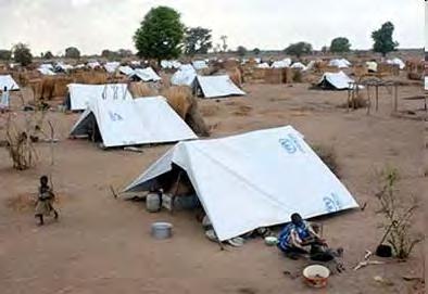
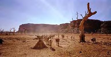
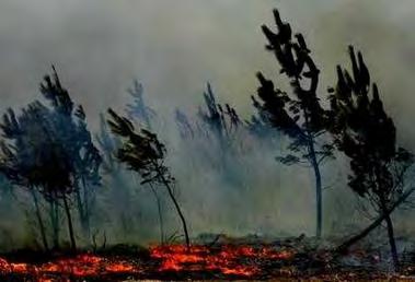
7 DISASTERS Flood Wild Fire Refugees camp Drought


8 DISASTERS Flood Deforestation Timber harvesting Deforestation Wild Fire Refugees camp Deforestation Fire woods Drought Coastal erosion

9
10 Catastrophic events reported in West-Africa 2000/2008 Drought Epidemic Extreme Temp. Flood Insect Infestation Slides Wild Fires Wind Storm Total Benin Burkina Faso Cape Verde Is Cote d'ivoire Gambia The Ghana Guinea Guinea Bissau Liberia Mali Mauritania Niger Nigeria Senegal Sierra Leone St Helena Togo Total Source: International Charter Space and Major Disasters


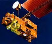
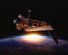
11 Use of Space-based Technologies for Disaster Management What is there in space?

12 Since the launch of the first artificial satellite Sputnik on 4 th October, 1957 many other satellites were launched... Currently, the following satellites are in Space 85 Earth resource and oceanographic satellites, 27 meteorological satellites, 250 communication satellites, 66 global positioning satellites (GPS), 21 search and rescue satellites; and 91 space and Earth science satellites


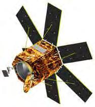
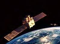
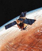
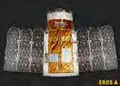
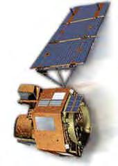

13 Some of the Current and Future Tools for Understanding the Earth and its Life Support Systems ENVISAT EO-1 EROS IKONOS (ESA) (USA) (Russia) (USA-P) IRS-1C KVR-1000 Landsat 7 KitSat-3 TERRA (India) (Russia) (USA) (USA) METOP OrbView-4 QuickBird Spot-5 TRIMM (ESA) (USA-P) (USA-P) (France) (USA & JAPAN) 25-Oct-13 13

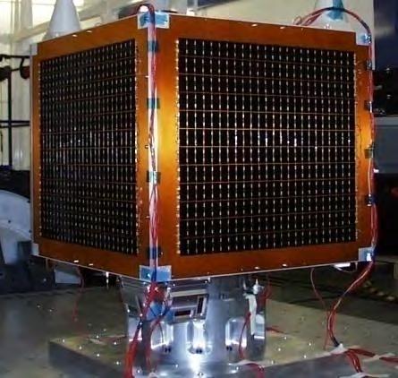
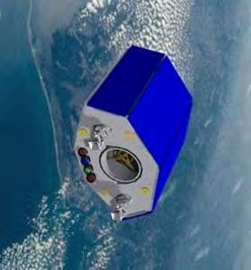
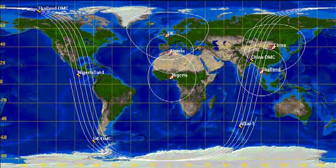
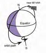
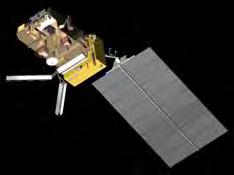
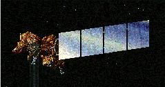
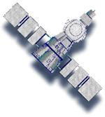
14 Africa s Remote Sensing Satellites EgyptSat-1 NigeriaSat-1 Alsat-1 NigeriaSat-2 SumbandilaSat

15 International Charter on Space and Major Disasters The International Charter on Space and Major Disasters is a charter which provides for the charitable acquisition of and transmission of space satellite data to relief organizations in the event of major disasters. It officially came into operation on 1 st November, 2000 and the Charter has since brought space assets into play for numerous disasters. It was activated for the flood disasters in Sokoto, Ibadan, Lokoja and Bayelsa in Nigeria.


16 SPACE-BASED TECHNOLOGIES & DISASTER MANAGEMENT (cont d)
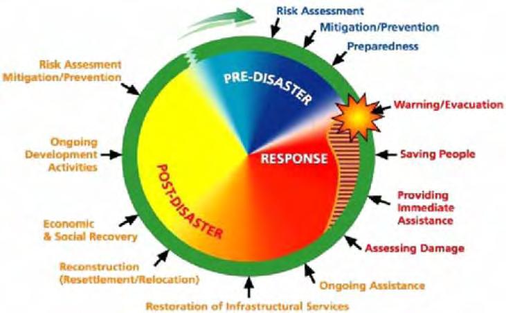
17 DISASTER IDENTIFICATION & ASSESSMENT For each type of Disaster, the following questions have to be answered: Which observable features precede the disaster? Which observable features accompany the event? Which observable features can be used to assess the damage?
18 DISASTER CARATERISATION & MONITORING For each type of Disaster, the following questions have to be answered: What is known about their speed of evolution? What is their return period? What is the area affected? What is the nature and extent of damage? What is the toll in loss of human life? Which forms of preparedness are practical? Which forms of mitigation/relief are practical?
 requires integrated multidisciplinary approach.")
19 GEOSPATIAL SOLUTIONS FOR DISASTER MANAGEMENT IN WEST- AFRICA The solution to the numerous disaster challenges in African Nations (drought, volcanous, landslides floods, coastal erosion, wild fires, environmental degradation, etc) requires integrated multidisciplinary approach. Geospatial technology supplies reliable, accurate and relevant information and services when and where-ever needed and improve decision making in disaster management. It is a strong backbone for disaster management strategies.


20 GEOSPATIAL SOLUTION FOR DISASTER MANAGEMENT

21 GEOSPATIAL SOLUTION = Synergy between stakeholders at all levels; Coordination; Data dissemination / sharing and Capacity Building of partners.

22
23 THE REGIONAL CENTRE FOR TRAINING IN AEROSPACE SURVEYS (RECTAS) CONTRIBUTION / ACHIVEMENTS

24 RECTAS, Obafemi Awolowo University Campus, Ile-Ife - NIGERIA
 and Senegal. - Interested countries are to apply for admission in Africa.")
25 THE CENTRE RECTAS was established on 21st October 1972 under the auspices of the United Nations Economic Commission for Africa (UNECA). RECTAS is a joint Institution of African countries. The participating countries at the moment are Benin, Burkina, Cameroon, Ghana, Mali, Niger, Nigeria (host country) and Senegal. - Interested countries are to apply for admission in Africa.

26 RECTAS MEMBER STATES NIGER MALI SENEGAL BURKINA GHANA BENIN NIGERIA CAMEROON

27 VISION OF RECTAS To be a leading Centre of Excellence providing one-stop solution for quality geospatial science training, education and research and critical capacity for sustainable development in Africa.
28 MISSION OF RECTAS To contribute to rapid development of member states in particular and Africa in general, through capacity building for timely delivery and responsible use of appropriate geospatial information.


29 OBJECTIVES Provide theoretical and practical training in Geoinformatics and applications Conduct seminars and workshops Undertake studies and research Provide consultancy and advisory services upon request


30 OBJECTIVES (cont d) Equip graduates of various disciplines with adequate technical capability in GIS, remote sensing and usage of geospatial technology in different areas of specialisation.
31 RECATS Academic Departments RECTAS has 3 academic Departments: Photogrammetry & Remote Sensing (PRS) Cartography (CAR) Geographic Information Systems (GIS) RECTAS is a bilingual centre and the programmes are run in ENGLISH and FRENCH
 PhD Geoinformation Science MSc. GI Science & Land Admin. (with UG) PhD Cartography & Geovisualisation 18 m 12 m 2-4 yrs 18 m 18 m 18 m 2-4 yrs 18 m 2-4 yrs")
32 RECTAS Academic Programmes Dept Programme Duration PRS GIS CAR Tgt Dipl. in GI Prod. & Mgt. PM in GI Prod. & Mgt PhD Remote Sensing Tech Dipl. in GI Prod. & Mgt. M.Tech in GIT (with FUTA) MSc. GI Science (with UAC) PhD Geoinformation Science MSc. GI Science & Land Admin. (with UG) PhD Cartography & Geovisualisation 18 m 12 m 2-4 yrs 18 m 18 m 18 m 2-4 yrs 18 m 2-4 yrs
33 AREAS OF SPECIALISATION - Disaster management - Environmental management - Land resource management - Natural resource (oil & gas) dev. - Hydrology & water resource mgt. - Meteorology & climate change - Soil survey and Agricultural Mgt - Health and social development - Crime Mapping, Peace and Security - Military Intelligence - Etc
 Distribution of Students Francophone Anglophon 40% e 60% No of")

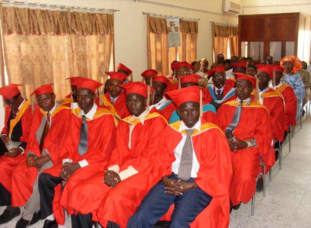
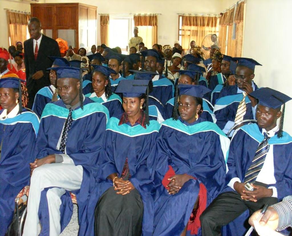
34 RECTAS has trained 1,732 students from 29 African countries (from 1973 to 2012) Distribution of Students Francophone Anglophon 40% e 60% No of Students = 60 No of Students Technicia n Anglophon e Francophone Technologis t Post Graduate Students enrolment at RECTAS
35
36 CONSULTANCY, RESEARCH & PROJECTS EXECUTION Customised Short Term Courses - Remote Sensing, GIS applications & Digital Cartography (NARSDA, NEMA, NPC, NGSA,...) - Remote Sensing & GIS applications in military operations - Remote Sensing & GIS application in Geology and Mineral Resources Exploration (MMSD) - Remote Sensing (CENATEL Benin Republic) - etc...
37 CONSULTANCY, RESEARCH & PROJECTS EXECUTION (cont d) Seminars & Workshops - Disaster Management Workshop (2007) - GIS-Day Seminar (2008) - AFREF Workshop (2009) - AFREF Experts Meeting (2010) - GSDI Regional Workshop (2011) - GARNET-E Regional Workshop (2012) - Joint NCA & GEOSIN Workshop and Conference (2013)
38 CONSULTANCY, RESEARCH & PROJECTS EXECUTION (cont d) Projects execution - Topographic mapping projects - Township/Cadastral mapping - Large scale/campus mapping - Supply of Satellite imageries - Installation of GIS Laboratories & Weather Stations - Repair of equipment - etc
39 Research & Projects Execution (cont d) RECTAS has contributed jointly with national, regional and international organisations in the following disaster management related research /projects : - Evaluation of Sokoto flood September Flood Hazard Mapping of Ona River Basin, Ibadan, Nigeria - Evaluation of the extent of Lokoja flood disaster 25 th September 2012

40 Consultancy RECTAS undertakes consultancy services in the application of Geoinformation in any field of endeavour. Sheet 303 SW1 ONUEKE topo Map 1:25,000


41 Consultancy Topographic mapping of Ondo State Sheet 263 SE 3 ONDO Township 1:25,000 RECTAS 41

42 Consultancy: provision of Satellite data imageries, digital photos, etc Quickbird image of Akure

43 Consultancy: Topographic mapping of a University campus
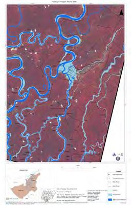
44 Flood mapping activities Creation of digital databases with existing data Flood mapping was performed for Charter Call 324 & 326. Call activated by National Emergency Management Agency (NEMA) Digital Mapping was performed by RECTAS (Project Manager)


45 FLOOD DISASTER MAPPING AND RISK ANALYSIS OF FLOODED AREAS IN SOKOTO STATE - NIGERIA 45
 Communities: UI,")

46 Assessment of Eleyele Dam Flood Disaster Ibadan, NIGERIA Area impacted = 22, 616, 260m² ( 2,262 hectares) Communities: UI, Apete, Ajibode, Oke Ayo, Elewe & New Garage. Roads = km Bridges = 10 Buildings = 5,751 Agriculture crops: maize, vegetables, etc


47 Identification of the localities affected by the Flood Disaster in Lokoja Kogi State, NIGERIA

48 Identification of flooded areas in Bayelsa NIGERIA
49 Other Activities Marine Environment Monitoring in Nigeria project ( ) Regional workshop on the use of Space-based technologies for Disaster Management for professionals of West and Central Africa (2011) Participation in UN-SPIDER TAMs and Training/Capacity building activities (Togo, Cameroon, Abuja, Burkina Faso) Participation in the Development of ECOWAS Spatial Data Infrastructure (EGDI).
50 CONCLUSION & RECOMMENDATIONS In view of above, the importance of Space basedtechnologies for efficient disaster management cannot be overemphasised. The assistance given by the International Charter Space and Major Disasters has greatly eased the acquisition of satellite imageries for disaster management operations. There is need to do proper capacity building of the key actors involved in disaster management There is also urgent need to develop a synergy between stakeholders to develop national and regional disaster management strategies (opportunities are given by ECOWAS Early Warning GDI, UNSPIDER, etc ).
51 THANK YOU
RECTAS
 RECTAS www.rectas.org RECTAS: Capacity Building in Space Technology and Geospatial Data Applications Isi A. Ikhuoria Executive Director, RECTAS, Ile-Ife, Nigeria e-mail: edrectas@rectas.org +234 803 373
Space-Based Disaster Management in Nigeria: The Role of the International Charter Space and Major Disasters.
 Space-Based Disaster Management in Nigeria: The Role of the International Charter Space and Major Disasters. Godstime JAMES, Halilu SHABA, Opeyemi ZUBAIR, Alade TESLIM, Gabriel YUSUF, Alhassan NUHU- Paper
DEVELOPMENT OF A CARTOGRAPHIC STRATEGY AND GEOSPATIAL SERVICES FOR DISASTER EARLY WARNING AND MITIGATION IN THE ECOWAS SUBREGION
 DEVELOPMENT OF A CARTOGRAPHIC STRATEGY AND GEOSPATIAL SERVICES FOR DISASTER EARLY WARNING AND MITIGATION IN THE ECOWAS SUBREGION L. A. Gueye a, M. S. Keita b,, J. O. Akinyede c, O. Kufoniyi d, G. Erin
TOWARDS BUILDING AND UTILIZATION OF CRITICAL MASS AFRICAN CAPACITY IN SPATIAL INFORMATION PRODUCTION AND MANAGEMENT
 TOWARDS BUILDING AND UTILIZATION OF CRITICAL MASS AFRICAN CAPACITY IN SPATIAL INFORMATION PRODUCTION AND MANAGEMENT Dr. Olajide KUFONIYI, Massaer MBAYE and B. S. O. OLAOFE, Nigeria Key words: Education,
13 th EUMETSAT User Forum in Africa
 13 th EUMETSAT User Forum in Africa GMES & Africa implementation in Western Africa Dogbeda M.Y. Azumah Regional Marine Centre University of Ghana Pictures zone UG GMES Presentation Layout UG G Project
RCOF Review [Regional Climate Outlook Forum for the Gulf of Guinea region of Africa - PRESAGG] Status Report
![RCOF Review [Regional Climate Outlook Forum for the Gulf of Guinea region of Africa - PRESAGG] Status Report](/thumbs/78/77466191.jpg "RCOF Review [Regional Climate Outlook Forum for the Gulf of Guinea region of Africa - PRESAGG] Status Report") RCOF Review 2017 [Regional Climate Outlook Forum for the Gulf of Guinea region of Africa - PRESAGG] Status Report Specific Climate features of concerned region This region typically covers the area below
RCOF Review 2017 [Regional Climate Outlook Forum for the Gulf of Guinea region of Africa - PRESAGG] Status Report Specific Climate features of concerned region This region typically covers the area below
Georeferencing and Satellite Image Support: Lessons learned, Challenges and Opportunities
 Georeferencing and Satellite Image Support: Lessons learned, Challenges and Opportunities Shirish Ravan shirish.ravan@unoosa.org UN-SPIDER United Nations Office for Outer Space Affairs (UNOOSA) UN-SPIDER
By Lillian Ntshwarisang Department of Meteorological Services Phone:
 By Lillian Ntshwarisang Department of Meteorological Services Phone: +267 3612200 Email: lntshwarisang@gov.bw/ lntshwarisang@gmail.com Introduction Mandate of DMS Function of the Department Services to
Weather Climate Science to Service Partnership South Africa
 PROJECTS UNDERWAY Title of the Weather Climate Science to Service Partnership South Africa Together, building on an existing strong partnership, South African Weather Service and the Met Office will build
ENVIRONMENTAL OBSERVATION IN THE CIRCUM SAHARA. GMES&Africa in Northern Africa OSS EXPERIENCE
 ENVIRONMENTAL OBSERVATION IN THE CIRCUM SAHARA GMES&Africa in Northern Africa OSS EXPERIENCE OSS International organisation 25 African countries : 7 countries of the North 7 African sub-regional organizations
African requirements for SDI standardization Antony Cooper Operating Unit Fellow Built Environment CSIR PO Box 395, Pretoria, 0001, South Africa
 ISO/TC 211 workshop on spatial data infrastructures (SDIs) African requirements for SDI standardization Antony Cooper Operating Unit Fellow Built Environment CSIR PO Box 395, Pretoria, 0001, South Africa
Early Warning > Early Action: The Next Frontier. Dr. Arame Tall Climate Services- Global Coordinator, Champion
 Early Warning > Early Action: The Next Frontier Dr. Arame Tall Climate Services- Global Coordinator, Champion a.tall@cgiar.org 2 3/21/11 The Challenge: Bridging The Gap Seasonal Precipitation Forecast
Disaster Management and Spatial Data An Experience of Sri Lanka for Joint project team meeting 2012
 Disaster Management and Spatial Data An Experience of Sri Lanka for Joint project team meeting 2012 1 by Padma Kumara Withana Provincial Surveyor General Uva Province 2 Out line ü Introduction ü Natural
World Meteorological Organization
 World Meteorological Organization Opportunities and Challenges for Development of Weather-based Insurance and Derivatives Markets in Developing Countries By Maryam Golnaraghi, Ph.D. Head of WMO Disaster
Status and Challenges on Geo-DRM Information Systems in Tonga
 Name: Mafua- i-vai utukakau Maka Status and Challenges on Geo-DRM Information Systems in Tonga 1 Roles and Relationships Land and Geographic Information Systems (LGIS) Unit: Establish updated high-resolution
GEOMATICS. Shaping our world. A company of
 GEOMATICS Shaping our world A company of OUR EXPERTISE Geomatics Geomatics plays a mayor role in hydropower, land and water resources, urban development, transport & mobility, renewable energy, and infrastructure
Assessing Hazards and Risk
 Page 1 of 6 EENS 204 Tulane University Natural Disasters Prof. Stephen A. Nelson Assessing Hazards and Risk This page last updated on 07-Jan-2004 As discussed before, natural disasters are produced by
Republic of Mozambique
 Republic of Mozambique Second Expert's Symposium on Multi-Hazard Early Warning Systems with focus on the Role of National Meteorological and Hydrological Services 5-7 May 2009, Toulouse France 1. Background
Space-based technology and applications and space science for humanitarian affairs, environment and security
 Space-based technology and applications and space science for humanitarian affairs, environment and security LUC ST-PIERRE United Nations Office for Outer Space Affairs United Nations Office at Vienna
Land Administration and Cadastre
 Geomatics play a major role in hydropower, land and water resources and other infrastructure projects. Lahmeyer International s (LI) worldwide projects require a wide range of approaches to the integration
Disaster RISK Management : Bhutanese Scenario
 Disaster RISK Management : Bhutanese Scenario Expert Group Meeting (EGM) on Geo-referenced Information Systems for Disaster Risk Management (Geo-DRM) and sustaining the Community of Practice (COP), Bangkok,
The International Charter Space and Major Disasters is further strengthening its contribution to disaster management worldwide.
 28 September 2012 Issue 3 The International Charter Space and Major Disasters is further strengthening its contribution to disaster management worldwide. Building on a decade of success in making satellite
Current experiences in the use of satellite information in development aid activities
 Current experiences in the use of satellite information in development aid activities Meeting at ESA/ESRIN in Frascati 16 th of September 2017 #WorldInCommon AGENCE FRANÇAISE DE DÉVELOPPEMENT FRENCH DEVELOPMENT
West Africa: The 2015 Season
 HIGHLIGHTS The West Africa 2015 growing season developed under an evolving El Nino event that will peak in late 2015. This region tends to have seasonal rainfall deficits in the more marginal areas during
National Disaster Management Centre (NDMC) Republic of Maldives. Location
 Republic of Maldives. Location") National Disaster Management Centre (NDMC) Republic of Maldives Location Country Profile 1,190 islands. 198 Inhabited Islands. Total land area 300 sq km Islands range b/w 0.2 5 sq km Population approx.
National Disaster Management Centre (NDMC) Republic of Maldives Location Country Profile 1,190 islands. 198 Inhabited Islands. Total land area 300 sq km Islands range b/w 0.2 5 sq km Population approx.
KARI Activation for the International Disasters
 KARI Activation for the International Disasters 5 th Joint Project Team Meeting for Sentinel Asia STEP2 (JPTM2012) 14 th Nov 2012 Boyeol Yoon Senior Researcher, Satellite Information Research Center (SIRC)
EARLY WARNING IN SOUTHERN AFRICA:
 EARLY WARNING IN SOUTHERN AFRICA: Enhancing the Meteorological Early Warning System Eugene Poolman South African Weather Service OUTLINE OF PRESENTATION Impact of Climate Change Meteorological Early Warning
Geospatial application in Kiribati
 Geospatial application in Kiribati ICC-21 ST RESAP (9 TH TO 13 TH OCTOBER, 2017) BANGKOK, THAILAND Outline Kiribati Profile Natural disasters in Kiribati Achievements Challenges/Issues Ways forward 1 Kiribati
THE ROLE OF SEAMIC IN SUSTAINABLE MINERAL RESOURCES DEVELOPMENT IN AFRICA
 THE ROLE OF SEAMIC IN SUSTAINABLE MINERAL RESOURCES DEVELOPMENT IN AFRICA Ketema Tadesse Director General-SEAMIC Dar es Salaam, Tanzania August 11, 2009 SEAMIC BACKGROUND SEAMIC was established in 1977
Global Monitoring for Environment and Security (GMES)
") Global Monitoring for Environment and Security (GMES) Satellite Earth Observation for the Emergency Services Dr Nick Veck Presentation to the G-STEP Launch Univ. of Leicester 19 th June 2009 Contents of
Global Monitoring for Environment and Security (GMES) Satellite Earth Observation for the Emergency Services Dr Nick Veck Presentation to the G-STEP Launch Univ. of Leicester 19 th June 2009 Contents of
Making a Mental Map of the Region
 Africa Preview Making a Mental Map of the Region Draw an outline map of Africa on the next page or on a separate sheet of paper. Add a compass rose to your map, showing where north, south, east, and west
Economic and Social Council
 United Nations Economic and Social Council Distr.: General 2 July 2012 E/C.20/2012/10/Add.1 Original: English Committee of Experts on Global Geospatial Information Management Second session New York, 13-15
Developing Spatial Data Infrastructure (SDI) in Africa: A cooperative Geospatial information Management process
 in Africa: A cooperative Geospatial information Management process") IAMOSA Geneva 16-18 March 2011 Developing Spatial Data Infrastructure (SDI) in Africa: A cooperative Geospatial information Management process United Nations Economic Commission for Africa ICT and Sciences
IAMOSA Geneva 16-18 March 2011 Developing Spatial Data Infrastructure (SDI) in Africa: A cooperative Geospatial information Management process United Nations Economic Commission for Africa ICT and Sciences
Copernicus Overview and Emergency Management Service
 Copernicus Overview and Emergency Management Service Frédéric BASTIDE European Commission Open informal session of the United Nations Inter-Agency Meeting on Outer Space Activities 12 March 2013, Geneva
Future perspectives for EO in Development
 Future perspectives for EO in Development Meeting at ESA/ESRIN in Frascati 11 th of September 2018 #WorldInCommon AGENCE FRANÇAISE DE DÉVELOPPEMENT FRENCH DEVELOPMENT AGENCY 01. What is AFD? France s international
DIPLOMA IN DISASTER MANAGEMENT. (Non-Semester) (With effect from the academic year )
 (With effect from the academic year )") DIPLOMA IN DISASTER MANAGEMENT (Non-Semester) (With effect from the academic year 2013-14) Eligibility for the Course Candidate should have passed the Higher Secondary Examination conducted by the Board
DIPLOMA IN DISASTER MANAGEMENT (Non-Semester) (With effect from the academic year 2013-14) Eligibility for the Course Candidate should have passed the Higher Secondary Examination conducted by the Board
SECOND GENERATION SEASONAL CLIMATE OUTLOOK PROGRAMME
 Page 1/5 CENTRE AFRICAIN POUR LES APPLICATIONS DE LA METEOROLOGIE AU DEVELOPPEMENT AFRICAN CENTRE OF METEOROLOGICAL APPLICATIONS FOR DEVELOPMENT Institution Africaine parrainée par la CEA et l OMM African
sentinel-2 COLOUR VISION FOR COPERNICUS
 sentinel-2 COLOUR VISION FOR COPERNICUS SATELLITES TO SERVE By providing a set of key information services for a wide range of practical applications, Europe s Copernicus programme is providing a step
Advanced Image Analysis in Disaster Response
 Advanced Image Analysis in Disaster Response Creating Geographic Knowledge Thomas Harris ITT The information contained in this document pertains to software products and services that are subject to the
Systematic Observations, Data, Climate Methods and. Tools - Availability, Applicability, Accessibility. Prepared by.
 Systematic Observations, Data, Climate Methods and Tools - Availability, Applicability, Accessibility Prepared by Maletjane Motsomi Lesotho Meteorological Services P. O. Box 14515 Tell: (266) 22 327 659
Uses of free satellite imagery for Disaster Risk Reduction (DRR)
") Centre of Applied Geoscience, Disaster Risk Reduction Research Group, School of Earth and Environmental Science, University of Portsmouth, UK Uses of free satellite imagery for Disaster Risk Reduction
Centre of Applied Geoscience, Disaster Risk Reduction Research Group, School of Earth and Environmental Science, University of Portsmouth, UK Uses of free satellite imagery for Disaster Risk Reduction
Launch of the Atlas and workshop on Land Use Land Cover
 The formal opening ceremony of the meeting took place on Tuesday 11 July 2017 and was chaired by Mrs. Fanta C. Kafando, Director of Environmental Preservation representing the Minister of the Environment
Regional Centre for Mapping of Resources for Development (RCMRD), Nairobi, Kenya
, Nairobi, Kenya") Regional Centre for Mapping of Resources for Development (RCMRD), Nairobi, Kenya Introduction to GIS (2 weeks: 10 days) Intakes: 8 th January, 6 th February, 5th March, 3 rd. April 9 th, May 7 th, June
Regional Centre for Mapping of Resources for Development (RCMRD), Nairobi, Kenya Introduction to GIS (2 weeks: 10 days) Intakes: 8 th January, 6 th February, 5th March, 3 rd. April 9 th, May 7 th, June
EDUCATIONAL INSTITUTIONS ATTENDED WITH DATES
 CURRICULUM VITAE 1. NAME: ADEBAYO, SUNDAY IDOWU 2. TELEPHONE: 234805 677 2398 3. E-MAIL: adebayosi@yahoo.com 4. ADDRESS: c/o The Manager, First Bank of Nigeria Plc, Egbe, Kogi State, Nigeria. 5. NATIONALITY:
Impact of Cyclone Nargis
 Lessons Learnt from Nargis Recovery for the Next Disaster International Recovery Forum (2011) 12, JAN 2011, Kobe, Japan Home for over 100 national races. Profile of Myanmar The 2 nd largest country in
Geospatial Technologies for Resources Planning & Management
 Geospatial Technologies for Resources Planning & Management Lal Samarakoon, PhD Director, Geoinformatics Center Asian Institute of Technology, Thailand Content Geoinformatics for SDG Information Integration
Effective Utilization of Synthetic Aperture Radar (SAR) Imagery in Rapid Damage Assessment
 Imagery in Rapid Damage Assessment") Effective Utilization of Synthetic Aperture Radar (SAR) Imagery in Rapid Damage Assessment Case Study Pakistan Floods SUPARCO M. Maisam Raza, Ahmad H. Rabbani SEQUENCE Flood Monitoring using Satellite
Effective Utilization of Synthetic Aperture Radar (SAR) Imagery in Rapid Damage Assessment Case Study Pakistan Floods SUPARCO M. Maisam Raza, Ahmad H. Rabbani SEQUENCE Flood Monitoring using Satellite
Regional Centre for Mapping of Resources for Development (RCMRD), Nairobi, Kenya. Introduction GIS (2 weeks: 10 days)
, Nairobi, Kenya. Introduction GIS (2 weeks: 10 days)") Regional Centre for Mapping of Resources for Development (RCMRD), Nairobi, Kenya Introduction GIS (: 10 days) Intake Dates: 9 th Jan, 6 th Feb, 6 th Mar, 3 rd April, 8 th May, 5 th June, 3 rd July, 2017
Regional Centre for Mapping of Resources for Development (RCMRD), Nairobi, Kenya Introduction GIS (: 10 days) Intake Dates: 9 th Jan, 6 th Feb, 6 th Mar, 3 rd April, 8 th May, 5 th June, 3 rd July, 2017
RESAP Progress Report
 RESAP Progress Report December 2016 to October 2017 Presentation to the Twenty-first session of the Intergovernmental Consultative Committee on the Regional Space Applications Programme for Sustainable
World Meteorological Organization
 Appendix VI Presentation on disaster risk reduction brainstorming session (1) World Meteorological Organization WMO DRR Programme Dieter C. Schiessl Director, Weather and Disaster Risk Reduction Services
Status & Challengers of Cook Islands GEO DRM. Cook Islands GEO S/GIS History
 Status & Challengers of Cook Islands GEO DRM By Patrick A. ARIOKA Planning & Advisory Officer EMERGENCY MANAGEMENT COOK ISLANDS Cook Islands GEO S/GIS History 1990 NZODA/MFAT trained by Landcare Research
Space Application in Support of Land Management for SDG Implementation
 Space Application in Support of Land Management for SDG Implementation Regional Expert Workshop on Land Accounting for SDG Monitoring and Reporting 26 September 2017 Space Application Section Information
Table ronde 5 : Cartographie d'urgence Emergency Mapping.
 Table ronde 5 : Cartographie d'urgence Emergency Mapping MapAction is an international NGO that provides maps and other information services to help humanitarian relief organisations in the field MapAction
Africa RiskView MONTHLY BULLETIN JANUARY Highlights: Rainfall
 The Africa RiskView Bulletin is a monthly publication by the African Risk Capacity (ARC). ARC is a Specialised Agency of the African Union designed to improve the capacity of AU Member States to manage
African Coastal Atlas developments. 10 July 2008 EEA Copenhagen, Denmark
 African Coastal Atlas developments 10 July 2008 EEA Copenhagen, Denmark Africa Overview Africa has approximately 40 000 km of coast across 32 mainland countries and four island states. Africa's coastal
Mapping Water Resources and Reservoirs for Climate Resilience in Zambezi River Basin
 Mapping Water Resources and Reservoirs for Climate Resilience in Zambezi River Basin Corné van der Sande, NEO BV Senior Advisor Earth Observation Services for Monitoring Drought and Water Resources in
Creating a WeatherSMART nation: SAWS drought related research, services and products
 Creating a WeatherSMART nation: SAWS drought related research, services and products Drought Dialogue 23-24 June 2016 Western Cape Government Hannes Rautenbach South African Weather Service SAWS mandate
Capacity Building Programme
 Capacity Building Programme 14-17 August 2012 Space Technology for improving Hazard Mapping in Sri Lanka An event organised as a follow up of the UN-SPIDER Technical Advisory Mission to Sri Lanka - 17-21
Use of Geospatial data for disaster managements
 Use of Geospatial data for disaster managements Source: http://alertsystemsgroup.com Instructor : Professor Dr. Yuji Murayama Teaching Assistant : Manjula Ranagalage What is GIS? A powerful set of tools
Regional Centre for Mapping of Resources for Development (RCMRD), Nairobi, Kenya
, Nairobi, Kenya") Regional Centre for Mapping of Resources for Development (RCMRD), Nairobi, Kenya Introduction GIS ( 2 weeks: 10 days) Intakes: 7 th Jan, 4 th Feb,4 th March, 1 st April 6 th May, 3 rd June, 1 st July,
Regional Centre for Mapping of Resources for Development (RCMRD), Nairobi, Kenya Introduction GIS ( 2 weeks: 10 days) Intakes: 7 th Jan, 4 th Feb,4 th March, 1 st April 6 th May, 3 rd June, 1 st July,
CLIMATE CHANGE ADAPTATION BY MEANS OF PUBLIC PRIVATE PARTNERSHIP TO ESTABLISH EARLY WARNING SYSTEM
 CLIMATE CHANGE ADAPTATION BY MEANS OF PUBLIC PRIVATE PARTNERSHIP TO ESTABLISH EARLY WARNING SYSTEM By: Dr Mamadou Lamine BAH, National Director Direction Nationale de la Meteorologie (DNM), Guinea President,
Historical background
 Space Technology for Disaster Management in Sri Lanka: Country profile, national perspectives & vision. Professor Ranjith Premalal De Silva Vice Chancellor Uva Wellassa University of Sri Lanka October
COMMERCIALISING WEATHER AND CLIMATE SERVICES:
 COMMERCIALISING WEATHER AND CLIMATE SERVICES: THE CASE OF UGANDA BY MICHAEL S.Z. NKALUBO Commissioner for Meteorology/PR of Uganda with WMO Uganda National Meteorological Authority Presentation Outline
JICA s Experiences of Connecting Japanese Science & Technologies for Disaster Risk Reduction in Developing Countries
 JICA s Experiences of Connecting Japanese Science & Technologies for Disaster Risk Reduction in Developing Countries Junji WAKUI Deputy Director General, Group Leader Disaster Risk Reduction Group Global
Copernicus Overview. Major Emergency Management Conference Athlone 2017
 Copernicus Overview Major Emergency Management Conference Athlone 2017 Copernicus is a European programme implemented by the European Commission. The services address six thematic areas: land, marine,
UGRC 144 Science and Technology in Our Lives/Geohazards
 UGRC 144 Science and Technology in Our Lives/Geohazards Session 1 Introduction to Hazards and Disasters Dr. Patrick Asamoah Sakyi Department of Earth Science, UG, Legon College of Education School of Continuing
GIS and Remote Sensing
 Spring School Land use and the vulnerability of socio-ecosystems to climate change: remote sensing and modelling techniques GIS and Remote Sensing Katerina Tzavella Project Researcher PhD candidate Technology
USE OF GEOREFERENCE INFORMATION FOR DRM Arnob Bormdoi Research Associate, GIC
 USE OF GEOREFERENCE INFORMATION FOR DRM Arnob Bormdoi Research Associate, GIC CONTENTS INTRODUCTION THE IMPORTANCE OF SPATIAL INFORMATION CASE STUDIES SUMMARY INTRODUCTION The process of defining how raster
GEOGRAPHIC INFORMATION TECHNOLOGY FOR RESEARCH AND APPLICATIONS IN FOOD SECURITY AND SUSTAINABLE DEVELOPMENT
 Distr: LIMITED 25 June 1996 } UNITED NATIONS Original: ENGLISH ECONOMIC AND SOCIAL COUNCIL ECONOMIC COMMISSION FOR AFRICA First Executive Dialogue of Ministers and Leaders in the Private Sector on Science
a division of Teacher Created Materials
 Sample Pages from a division of Teacher Created Materials Thanks for checking us out. Please call us at 877-777-3450 with questions or feedback, or to order this product. You can also order this product
Geospatial Information and Services for Disasters (GIS4D)
") Geospatial Information and Services for Disasters (GIS4D) 31 July 2017 Tae Hyung KIM ICT and Disaster Risk Reduction Division (IDD) UNESCAP 1 About ESCAP Who is ESCAP? United Nations Economic and Social
Geospatial Information and Services for Disasters (GIS4D) 31 July 2017 Tae Hyung KIM ICT and Disaster Risk Reduction Division (IDD) UNESCAP 1 About ESCAP Who is ESCAP? United Nations Economic and Social
Regional EGM on Community of Practice of Georeferenced Information System. for Disaster Risk Management (Geo-DRM) April 2014, Bangkok, Thailand
 April 2014, Bangkok, Thailand") Regional EGM on Community of Practice of Georeferenced Information System for Disaster Risk Management (Geo-DRM) 23-25 April 2014, Bangkok, Thailand Presented By Mukesh Kumar Keshari Ministry of Home Affairs
Regional EGM on Community of Practice of Georeferenced Information System for Disaster Risk Management (Geo-DRM) 23-25 April 2014, Bangkok, Thailand Presented By Mukesh Kumar Keshari Ministry of Home Affairs
Emergency Management Service (EMS) mapping
 mapping") GMES Emergency Management Service (EMS) mapping Frédéric BASTIDE GMES unit, European Commission UN-SPIDER Expert Meeting: "Crowdsource Mapping for Disaster Risk Management and Emergency Response" 3-5 December,
GMES Emergency Management Service (EMS) mapping Frédéric BASTIDE GMES unit, European Commission UN-SPIDER Expert Meeting: "Crowdsource Mapping for Disaster Risk Management and Emergency Response" 3-5 December,
SEASONAL CLIMATE OUTLOOK VALID FOR JULY-AUGUST- SEPTEMBER 2013 IN WEST AFRICA, CHAD AND CAMEROON
 SEASONAL CLIMATE OUTLOOK VALID FOR JULY-AUGUST- SEPTEMBER 2013 IN WEST AFRICA, CHAD AND CAMEROON May 29, 2013 ABUJA-Federal Republic of Nigeria 1 EXECUTIVE SUMMARY Given the current Sea Surface and sub-surface
What are the social, technical, environmental and economic benefits and opportunities of accessing and sharing geodetic data?
 What are the social, technical, environmental and economic benefits and opportunities of accessing and sharing geodetic data? Graeme Blick Group Manager Positioning and Resilience Land Information New
Use of Climate information in Disaster Risk Management in Zimbabwe
 Use of Climate information in Disaster Risk Management in Zimbabwe WMO Regional Technical Meeting & User/CONOPS Workshop, 28 th October 2015 Lameck Betera Department of Civil Protection Institutional Arrangements
GIS (GEOGRAPHICAL INFORMATION SYSTEMS) AS A FACILITATION TOOL FOR SUSTAINABLE DEVELOPMENT IN AFRICA
 AS A FACILITATION TOOL FOR SUSTAINABLE DEVELOPMENT IN AFRICA") GIS (GEOGRAPHICAL INFORMATION SYSTEMS) AS A FACILITATION TOOL FOR SUSTAINABLE DEVELOPMENT IN AFRICA a presentation by Elizabeth Hicken GDEST Conference on Geospatial Sciences for Sustainable Development
GIS (GEOGRAPHICAL INFORMATION SYSTEMS) AS A FACILITATION TOOL FOR SUSTAINABLE DEVELOPMENT IN AFRICA a presentation by Elizabeth Hicken GDEST Conference on Geospatial Sciences for Sustainable Development
Roles of NGII in successful disaster management
 The Second UN-GGIM-AP Plenary Meeting Roles of NGII in successful disaster management Republic of Korea Teheran Iran 28 October 2013 Sanghoon Lee, Ph.D. NGII Outline Type of Disasters Occur in Korea Practical
Integration of Geo spatial and Statistical Information: The Nepelese Experience
 Integration of Geo spatial and Statistical Information: The Nepelese Experience Krishna Raj B.C. Joint Secretary Ministry of Land Reform and Management, Nepal 11 June, 2014 Presentation Outline The Country
Advancing Geoscientific Capability. Geological Survey of Finland
 Advancing Geoscientific Capability Geological Survey of Finland GTK in brief The Geological Survey of Finland (GTK) is one of the largest European centres of excellence in assessment, research and the
ENV208/ENV508 Applied GIS. Week 1: What is GIS?
 ENV208/ENV508 Applied GIS Week 1: What is GIS? 1 WHAT IS GIS? A GIS integrates hardware, software, and data for capturing, managing, analyzing, and displaying all forms of geographically referenced information.
Country Report Nepal Geospatial Data Sharing Initiatives of Survey Department Supporting Disaster Management
 Third JPTM Step 2 for Sentinel Asia 6-8 July, 2010 Manila, The Philippines Country Report Nepal Geospatial Data Sharing Initiatives of Survey Department Supporting Disaster Management Durgendra M Kayastha
Building Disaster Resilience Community in Asia: Indonesian perspective
 Workshop C of the 7th Science Council of Asia (SCA) Conference Construction of Secure and Safe Society against Global Changes of Natural Disasters Okinawa, June 14 th, 2007 Building Disaster Resilience
Geography General Course Year 12. Selected Unit 3 syllabus content for the. Externally set task 2019
 Geography General Course Year 12 Selected Unit 3 syllabus content for the Externally set task 2019 This document is an extract from the Geography General Course Year 12 syllabus, featuring all of the content
West and East Africa The 2014 Rainfall Season
 West and East Africa The 2014 Rainfall Season Highlights SAHEL The pronounced dryness that dominated the earlier stages of the season was alleviated by good rains in August. In September, rainfall was
Space Applications for Disaster Risk Reduction and Sustainable Development
 Space Applications for Disaster Risk Reduction and Sustainable Development Space Applications Section (SAS) ICT and Disaster Risk Reduction Division (IDD) UNESCAP Contents I. RESAP Activities 2016-2017
ESRI educational site license in Bahir Dar University. Tegegn Molla Abebe Mengaw Geospatial Data and Technology Center, BDU
 ESRI educational site license in Bahir Dar University Tegegn Molla Abebe Mengaw Geospatial Data and Technology Center, BDU September, 2016 Mission, Vision Purpose and Values of the GDTC Mission of GDTC
5.2 IDENTIFICATION OF HAZARDS OF CONCERN
 5.2 IDENTIFICATION OF HAZARDS OF CONCERN 2016 HMP Update Changes The 2011 HMP hazard identification was presented in Section 3. For the 2016 HMP update, the hazard identification is presented in subsection
Regional Centre for Mapping of Resources for Development (RCMRD), Nairobi, Kenya. Introduction GIS ( 2 weeks: 10 days)
, Nairobi, Kenya. Introduction GIS ( 2 weeks: 10 days)") Regional Centre for Mapping of Resources for Development (RCMRD), Nairobi, Kenya Introduction GIS ( 2 weeks: 10 days) Intakes: 8 th Jan, 6 th Feb,5 th March, 3 rd April 9 th, May 7 th, June 4 th, July
Regional Centre for Mapping of Resources for Development (RCMRD), Nairobi, Kenya Introduction GIS ( 2 weeks: 10 days) Intakes: 8 th Jan, 6 th Feb,5 th March, 3 rd April 9 th, May 7 th, June 4 th, July
1. CLIMATIC AND ENVIRONMENTAL CONDITIONS OVER AFRICA. 1.1 Inter-Tropical Discontinuity (ITD)
") African Centre of Meteorological Application for Development Centre Africain pour les Applications de la Météorologie au Développement OCTOBER 2011 HIGHLIGHT: Cholera, Acute Water Diarrhoea, Yellow fever,
African Centre of Meteorological Application for Development Centre Africain pour les Applications de la Météorologie au Développement OCTOBER 2011 HIGHLIGHT: Cholera, Acute Water Diarrhoea, Yellow fever,
Fundamental Geospatial Datasets in Africa. Andre Nonguierma New York, 03 August 2015
 Fundamental Geospatial Datasets in Africa United Nations Economic Commission for Africa Geoinformation & Spatial Statistics Andre Nonguierma New York, 03 August 2015 Core Data : Lack of consistency Infrastructure
Applied Geoscience and Technology Division SOPAC. Joy Papao, Risk Information Systems Officer
 Joy Papao, Risk Information Systems Officer Secretariat of the Pacific Community SPC 22 Pacific Island States Head office in Noumea, New Caledonia 2 Regional offices (Pohnpei and Honiara) 600 staff 9 Technical
GenEd Courses offered by Dept. of Geography, Presidency University
 GenEd Courses offered by Dept. of Geography, Presidency University (All the Courses are offered to both Science and Humanities Students) Semester Course No. Course Name Maximum No. of Students (originally
THE STUDY ON 4S TECHNOLOGY IN THE COMMAND OF EARTHQUAKE DISASTER EMERGENCY 1
 THE STUDY ON 4S TECHNOLOGY IN THE COMMAND OF EARTHQUAKE DISASTER EMERGENCY 1 Zhou Wensheng 1, Huang Jianxi 2, Li Qiang 3, Liu Ze 3 1 Associate Professor, School of Architecture, Tsinghua University, Beijing.
GIS as a tool in flood management
 GIS for the United Nations and the International Community Conference Panel: GIS and Capacity - How Territorial Planning Benefits from Geospatial Information 3-5 April 2012 Geneva, Switzerland GIS as a
The current status, functions, challenges and needs of South Sudan Meteorological Department (SSMD)
") The current status, functions, challenges and needs of South Sudan Meteorological Department (SSMD) Presented: by Mojwok Ogawi Modo, South Sudan Meteorological Department. Background The present SSMD was
The current status, functions, challenges and needs of South Sudan Meteorological Department (SSMD) Presented: by Mojwok Ogawi Modo, South Sudan Meteorological Department. Background The present SSMD was
Overview of Technical Advisory Missions
 Expert Group Meeting (EGM) on Georeferenced Information Systems for Disaster Risk Management (Geo-DRM) and sustaining the Community of Practice (COP) 23-25 April 2014 Bangkok Overview of Technical Advisory
A Presentation By: Dr. G. M. Dar Centre for Disaster Management & Env. Studies, J&K IMPA, Srinagar
 A Presentation By: Dr. G. M. Dar Centre for Disaster Management & Env. Studies, J&K IMPA, Srinagar Introduction Disaster: Sudden or great misfortune. A catastrophe, a calamitous event. Hazards are a natural
Overview of Early Warning Systems and the role of National Meteorological and Hydrological Services
 Overview of Early Warning Systems and the role of National Meteorological and Hydrological Services South Africa Second Experts Symposium on Multi-Hazard Early Warning Systems With focus on the Role of
Linking Global and Regional Levels in the Management of Marine Areas Beyond National Jurisdiction
 Linking Global and Regional Levels in the Management of Marine Areas Beyond National Jurisdiction South Atlantic Region Session 4: «Experiences, Priorities and Opportunities in the South Atlantic and Indian