Assessment of Macrophytes Seasonal Dynamics Using Dense Time Series of Satellite Data
|
|
|
- Patrick Cook
- 5 years ago
- Views:
Transcription
, Milan (Italy) b Balaton Limnological Institute (MTA-BLI), Tihany (Hungary) c Department of Life")
1 Assessment of Macrophytes Seasonal Dynamics Using Dense Time Series of Satellite Data Paolo Villa a, Mariano Bresciani a, Monica Pinardi a, Viktor R. Tóth b, Rossano Bolpagni c a Institute for Electromagnetic Sensing of the Environment (CNR-IREA), Milan (Italy) b Balaton Limnological Institute (MTA-BLI), Tihany (Hungary) c Department of Life Sciences, University of Parma (UNIPR), Parma (Italy) contact: villa.p@irea.cnr.it
2 Introduction Aquatic vegetation (i.e. macrophytes) communities are a key component of shallow inland water ecosystems, acting on and interacting with: other primary producers (e.g. phytoplankton) biogeochemical cycles (e.g. carbon pools, N and P cycles) New generation of EO platforms (i.e. Sentinel-2), are crucial step forward towards operational monitoring of such dynamic ecosystems. We set up a multitemporal experiment based on SPOT5 Take5 data over a fluvial-lake ecosystem with the objective of: investigating the potential of high spatial (10m) and temporal (5 days revisit) resolution satellite data for monitoring macrophyte coverage and their inter-annual morphofunctional dynamics


3 Project context INFORM: Improved monitoring and forecasting of ecological status of European INland waters by combining Future earth ObseRvation data and Models Macrosentinel: Macrophytes Phenology Assessment using Sentinel-2


 12 April 2015 06 June2015")
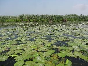
4 Study area Mantua lakes system North Italy: N, E Fluvial-lake system with connected wetlands Water body area: 6.1 km 2 Average depth: 3.5 m Hypertrophic, different macrophyte stands High anthropic pressure over the watershed (agriculture, husbandry, industry) 12 April June2015 SPOT5Take5 site: Mantua 11 July2015


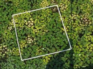

5 Target species Main macrophyte species sampled: Nuphar lutea (floating-leaved rhizophyte) Nelumbo nucifera (emergent rhizophyte) Trapa natans (floating pleustophyte)
 Collected data: Fractional cover (fc) Leaf Area Index (LAI) Above-water biomass (Biom) Chlorophyll-a leaf content (Chl-a) NL1-3 TN1-3 NN1")
6 45 samples: Macrophyte parameters data 3 sampling points per species (9 per date) 5 sampling dates in 2015 (12 May, 11 June, 16 July, 31 July, 4 September) Collected data: Fractional cover (fc) Leaf Area Index (LAI) Above-water biomass (Biom) Chlorophyll-a leaf content (Chl-a) NL1-3 TN1-3 NN1 NN2 NN3
7 April 2015 May 2015 June 2015 July 2015 August 2015 September 2015 Satellite data SPOT 5 HRG data Cloud cover < 5% Clud cover > 5% 4 spectral bands: Green ( µm) Red ( µm) NIR ( µm) SWIR ( µm) 5 day revisit (Take 5 experiment): S5T5 dataset -Mantua 27 scenes processed to L2A (surface reflectance)
8 Methodological approach Cloud cover screening (<5% over study area, 22 S5T5 scenes used) Extraction of time series of relevant SIs (14, see table) Selection of best linear predictors (3 SIs) for each macrophyte parameter SI-based semi-empirical linear modelling of each parameter (fc, LAI, Biom, Chl-a) Collected samples split: 2/3 for training, 1/3 for validation SI Formula References Vegetation parameters AFRI1600 Chlgreen CIgreen CVI EVI2 GNDVI SWIR1 NIR 0.66 NIR 0.66SWIR 1 Karnieli et al., 2001 Fractional cover, LAI Green Gitelson et al., 2006 Chlorophyll content NIR NIR Hunt et al., 2011 Chlorophyll content 1 Green Red NIR 2 Green NIR- Red 2.4 NIR Red 1 NIR- Green NIR Green Hunt et al., 2011 Jiang et al., 2008 Gitelson and Merzlyak, 1994 Lymburner et al., 2000 Chlorophyll content Fractional cover, LAI, Biomass Fractional cover, LAI, Biomass gwavi NIR- Green Tian et al., 2005 Fractional cover, LAI, 1.5 NIR Green 0.5 Biomass MCARI (NIR-Red)-1.3(NIR- Green) Haboudane et al, 2004 Chlorophyll content, LAI MTVI (NIR- Green)- 2.5(Red- Green) Haboudane et al, 2004 Chlorophyll content, LAI NDVI RI SAVI SLAVI TrVI NIR- Red NIR Red Red- Green Red Green NIR- Red 1.5 NIR Red 0.5 NIR Red SWIR 1 NIR Red 0.5 NIR Red Rouse et al., 1974 Escadafal and Huete, 1991 Bannari et al., 1995 Huete, 1988 Lymburner et al., 2000 Bannari et al., 1995 Hunt et al., 2011 Fractional cover, LAI, Biomass Chlorophyll content Fractional cover, LAI, Biomass LAI Chlorophyll content
9 Results Macrophyte functional types map rule-based algorithm fed with multitemporal spectral features adapted from Villa et al., 2015 Macrophyte morpho-functional traits maps Semi-empirical linear modelling based on best SI predictors: fc LAI Biom (above-water biomass) Chl-a (canopy density) Macrophyte parameter fc (%) LAI (m 2 m -2 ) Biom (kg m -2 ) Chl-a (g m -2 ) Spectral Index Validation N=14 (1/3 samples) R 2 MAE rrmse AFRI % 0.11 TrVI % 0.11 NDVI % 0.11 MCARI EVI SAVI CVI CI green GNDVI CI green CVI gwavi Villa, P., Bresciani, M., Bolpagni, R., Pinardi, M., and Giardino, C. (2015). Remote Sensing of Environment, 171,
10 Macrophyte map Macrophyte species Nuphar lutea Nelumbo nucifera Trapa natans
11 LAI (m2 m-2) Biom (kg m-2) fc (%) Morpho-functional traits evolution 100% 80% 60% 40% 20% 0% April May June July August September Date (2015) N. lutea N. nucifera T. natans N. lutea N. nucifera T. natans Emergence timing 12 Apr 07 May 07 May Growing phase lenght 60 days 40 days 60 days Full canopy timing 21 June 11 June 01 July Peak biomasss timing 26 July 30 August 20 August Senescence starting 15 August 04 September 20 August PoS fc 74.7±2.1% 98.6±1.2% 88.4±2.1% PoS LAI 1.00±0.05 m2 m ±0.06 m2 m ±0.08 m2 m-2 PoS Biomass 0.20±0.01 kg m ±0.05 kg m ±0.03 kg m-2 (Pos: Peak of Season) N. lutea N. nucifera T. natans N. lutea N. nucifera T. natans April May June July August September Date (2015) 0.00 April May June July August September Date (2015)
12 Chl-a (% dw) 0.4% 0.3% 0.2% 0.1% N. lutea N. nucifera T. natans Chlorophyll-a content 01 July % April May June July August September Date (2015)
13 Chl-a (% dw) 0.4% 0.3% 0.2% 0.1% N. lutea N. nucifera T. natans Chlorophyll-a content 06 July % April May June July August September Date (2015)

14 Chl-a (% dw) 0.4% 0.3% 0.2% 0.1% N. lutea N. nucifera T. natans Chlorophyll-a content 05 August % April May June July August September Date (2015)
15 Chl-a (% dw) 0.4% 0.3% 0.2% 0.1% N. lutea N. nucifera T. natans Chlorophyll-a content 15 August % April May June July August September Date (2015)
16 Chl-a (% dw) 0.4% 0.3% 0.2% 0.1% N. lutea N. nucifera T. natans Chlorophyll-a content 04 September % April May June July August September Date (2015)
 1.7 1.6 1.5 0.")
17 NN1 NN2 NN3 NN4 NN5 NN6 NN7 NN8 NN1 NN2 NN3 NN4 NN5 NN6 NN7 NN8 Single stand area (ha) LAI (m2 m-2) Chl-a (% dw) Intra-species variability: N. nucifera NN1 NN2 NN3 NN4 NN6 NN5 NN8 NN % % LAI (m2 m-2) % 0.28% 0.27%
18 TN1 TN2 TN3 TN4 TN5 TN6 TN7 TN8 TN1 TN2 TN3 TN4 TN5 TN6 TN7 TN8 Single stand area (ha) LAI (m2 m-2) Chl-a (% dw) Intra-species variability: T. natans TN2 TN3 TN1 TN4 TN5 TN LAI (m2 m-2) % 0.24% 0.23% 0.22% 0.21% 0.20% TN7 TN8
 Sentinel-2 MSI data Integration with S5T5 data (July 2015 on) 2016 (Mantua, Kis-Balaton")
19 Further developments Testing over additional S5T5 sites: Braila islands (RO) Lac du Grand Lieu (FR) Lake Fysigen (SE) Sentinel-2 MSI data Integration with S5T5 data (July 2015 on) 2016 (Mantua, Kis-Balaton wetland)
 and physiological (Chl-a, Cxc) parameters?")
20 Sentinel-2 MSI capabilities Enhanced spectral resolution (Blue bands, RedEdge bands) More reliable sub-type/species distinction? Better estimation of morphological (biomass) and physiological (Chl-a, Cxc) parameters? Mantua lakes system Sentinel-2 MSI (13 Aug 2015) Separability CD LM TN NL NN LH PA TV-Lm TV-Pa TV-ZmJ-M dist MSI- OLI diff C. demersum L. minor T. natans N. lutea N. nucifera L. hexapetala P.australis TV - L. multiflorae TV - P. alba TV - Z. mais
21 Conclusions Spatial and temporal patterns of macrophyte seasonal dynamics can be mapped from dense time series of multispectral data: High reliability for canopy density parameters rrmse fc =0.11, rrmse LAI =0.16 Good reliability for biomass and chlorophyll rrmse Biom =0.41, rrmse Chl-a =0.54 Intra-specific variability for most relevant species can be disclosed by exploiting satellite multi-temporal products lentic to lotic conditions gradient for N. nucifera open water to coastal stands differences for T. natans Enhanced capabilities will be granted as soon as Sentinel-2A and B will be both operational (Blue range bands, RedEdge bands, 5 day revisit)
22 Thank you for your attention contact:
Macrophytes products
 Macrophytes products Paolo Villa, Monica Pinardi, Mariano Bresciani CNR-IREA (villa.p@irea.cnr.it) Introduction Aquatic vegetation, or macrophytes, fulfil a pivotal role in biogeochemical cycles. Synoptic
Chlorophyll-a, Phycocyanin and Phytoplankton type products
 Chlorophyll-a, Phycocyanin and Phytoplankton type products Mariano Bresciani, Monica Pinardi, Claudia Giardino CNR IREA bresciani.m@irea.cnr.it Aims Implementation of algorithms dedicated to phytoplankton's
Remote detection of giant reed invasions in riparian habitats: challenges and opportunities for management planning
 Remote detection of giant reed invasions in riparian habitats: challenges and opportunities for management planning Maria do Rosário Pereira Fernandes Forest Research Centre, University of Lisbon Number
GNR401 Principles of Satellite Image Processing
 Principles of Satellite Image Processing Instructor: Prof. CSRE, IIT Bombay bkmohan@csre.iitb.ac.in Slot 5 Guest Lecture PCT and Band Arithmetic November 07, 2012 9.30 AM 10.55 AM IIT Bombay Slide 1 November
Land Cover Project ESA Climate Change Initiative. Processing chain for land cover maps dedicated to climate modellers.
 Land Cover Project ESA Climate Change Initiative Processing chain for land cover maps dedicated to climate modellers land_cover_cci S. Bontemps 1, P. Defourny 1, V. Kalogirou 2, F.M. Seifert 2 and O. Arino
Many of remote sensing techniques are generic in nature and may be applied to a variety of vegetated landscapes, including
 Remote Sensing of Vegetation Many of remote sensing techniques are generic in nature and may be applied to a variety of vegetated landscapes, including 1. Agriculture 2. Forest 3. Rangeland 4. Wetland,
NARROW-BAND VEGETATION INDEXES FROM HYPERION AND DIRECTIONAL CHRIS/PROBA DATA FOR CANOPY CHLOROPHYLL DENSITY ESTIMATION IN MAIZE
 NARROW-BAND VEGETATION INDEXES FROM HYPERION AND DIRECTIONAL CHRIS/PROBA DATA FOR CANOPY CHLOROPHYLL DENSITY ESTIMATION IN MAIZE Massimo Vincini, Ermes Frazzi, Paolo D Alessio Università Cattolica del
Remote Sensing Based Inversion of Gap Fraction for Determination of Leaf Area Index. Alemu Gonsamo 1 and Petri Pellikka 1
 Remote Sensing Based Inversion of Gap Fraction for Determination of Leaf Area Index Alemu Gonsamo and Petri Pellikka Department of Geography, University of Helsinki, P.O. Box, FIN- Helsinki, Finland; +-()--;
C M E M S O c e a n C o l o u r S a t e l l i t e P r o d u c t s
 Implemented by C M E M S O c e a n C o l o u r S a t e l l i t e P r o d u c t s This slideshow gives an overview of the CMEMS Ocean Colour Satellite Products Marine LEVEL1 For Beginners- Slides have been
Capabilities and Limitations of Land Cover and Satellite Data for Biomass Estimation in African Ecosystems Valerio Avitabile
 Capabilities and Limitations of Land Cover and Satellite Data for Biomass Estimation in African Ecosystems Valerio Avitabile Kaniyo Pabidi - Budongo Forest Reserve November 13th, 2008 Outline of the presentation
Introduction to Satellite Derived Vegetation Indices
 Introduction to the Use of Geospatial Information Technology for Drought Risk Management 13-17 November, 2017 Tonle Bassac II Restaurant, Phnom Penh, Cambodia Introduction to Satellite Derived Vegetation
Land Management and Natural Hazards Unit --- DESERT Action 1. Land Management and Natural Hazards Unit Institute for Environment and Sustainability
 Land Management and Natural Hazards Unit --- DESERT Action 1 Monitoring Drought with Meteorological and Remote Sensing Data A case study on the Horn of Africa Paulo Barbosa and Gustavo Naumann Land Management
Lecture Topics. 1. Vegetation Indices 2. Global NDVI data sets 3. Analysis of temporal NDVI trends
 Lecture Topics 1. Vegetation Indices 2. Global NDVI data sets 3. Analysis of temporal NDVI trends Why use NDVI? Normalize external effects of sun angle, viewing angle, and atmospheric effects Normalize
Interannual variation of MODIS NDVI in Lake Taihu and its relation to climate in submerged macrophyte region
 Yale-NUIST Center on Atmospheric Environment Interannual variation of MODIS NDVI in Lake Taihu and its relation to climate in submerged macrophyte region ZhangZhen 2015.07.10 1 Outline Introduction Data
Model Implementation Details for the Final Project in EEOS 465/
 Model Implementation Details for the Final Project in EEOS 465/627 2009 Last week, we introduced a conceptual model of estimating DOC loadings from landscape to coastal waters as a model template for the
Urban remote sensing: from local to global and back
 Urban remote sensing: from local to global and back Paolo Gamba University of Pavia, Italy A few words about Pavia Historical University (1361) in a nice town slide 3 Geoscience and Remote Sensing Society
Land cover research, applications and development needs in Slovakia
 Land cover research, applications and development needs in Slovakia Andrej Halabuk Institute of Landscape Ecology Slovak Academy of Sciences (ILE SAS) Štefánikova 3, 814 99 Bratislava, Slovakia Institute
RETRIEVAL OF VEGETATION BIOPHYSICAL VARIABLES FROM CHRIS/PROBA DATA IN THE SPARC CAMPAING
 RETRIEVAL OF VEGETATION BIOPHYSICAL VARIABLES FROM /PROBA DATA IN THE SPARC CAMPAING S. Gandia, G. Fernández, J. C. García, J. Moreno Laboratory for Earth Observation Department of Thermodynamics. Faculty
CadasterENV Sweden Time series in support of a multi-purpose land cover mapping system at national scale
 CadasterENV Sweden Time series in support of a multi-purpose land cover mapping system at national scale Mats Rosengren, Camilla Jönsson ; Metria AB Marc Paganini ; ESA ESRIN Background CadasterENV Sweden
Testing the Sensitivity of Vegetation Indices for Crop Type Classification Using Rapideye Imagery
 Testing the Sensitivity of Vegetation Indices for Crop Type Classification Using Rapideye Imagery Mustafa USTUNER and Fusun BALIK SANLI, Turkey Keywords: Remote Sensing, Agriculture, Geoinformation SUMMARY
Vegetation Remote Sensing
 Vegetation Remote Sensing Huade Guan Prepared for Remote Sensing class Earth & Environmental Science University of Texas at San Antonio November 2, 2005 Outline Why do we study vegetation remote sensing?
Ryan Baum, MS Candidate, ISU Matthew Germino, Assistant Professor, ISU
 Spatial and temporal variation in remotely sensed vegetation indices on the INEEL from 1984-2002 Ryan Baum, MS Candidate, ISU Matthew Germino, Assistant Professor, ISU Importance How does vegetation vary
Overview on Land Cover and Land Use Monitoring in Russia
 Russian Academy of Sciences Space Research Institute Overview on Land Cover and Land Use Monitoring in Russia Sergey Bartalev Joint NASA LCLUC Science Team Meeting and GOFC-GOLD/NERIN, NEESPI Workshop
Disturbance, site, and vegetation feedbacks create landscape structure in South Florida coastal wetlands. M Ross, K Zhang, B Thapa, and D Gann
 Disturbance, site, and vegetation feedbacks create landscape structure in South Florida coastal wetlands M Ross, K Zhang, B Thapa, and D Gann Department of Earth & Environment Florida International University
Sentinel 2 Pre-processing Requirements for coastal and inland waters
 Sentinel 2 Pre-processing Requirements for coastal and inland waters K A I S Ø R E NSEN NIVA CARSTEN B R O CKMANN Ecological and chemical classification of water bodies in Norway Water quality - products
Greening of Arctic: Knowledge and Uncertainties
 Greening of Arctic: Knowledge and Uncertainties Jiong Jia, Hesong Wang Chinese Academy of Science jiong@tea.ac.cn Howie Epstein Skip Walker Moscow, January 28, 2008 Global Warming and Its Impact IMPACTS
Environmental Remote Sensing GEOG 2021
 Environmental Remote Sensing GEOG 2021 Lecture 3 Spectral information in remote sensing Spectral Information 2 Outline Mechanisms of variations in reflectance Optical Microwave Visualisation/analysis Enhancements/transforms
sentinel-2 COLOUR VISION FOR COPERNICUS
 sentinel-2 COLOUR VISION FOR COPERNICUS SATELLITES TO SERVE By providing a set of key information services for a wide range of practical applications, Europe s Copernicus programme is providing a step
Remote Sensing Geographic Information Systems Global Positioning Systems
 Remote Sensing Geographic Information Systems Global Positioning Systems Assessing Seasonal Vegetation Response to Drought Lei Ji Department of Geography University of Nebraska-Lincoln AVHRR-NDVI: July
Sub-pixel regional land cover mapping. with MERIS imagery
 Sub-pixel regional land cover mapping with MERIS imagery R. Zurita Milla, J.G.P.W. Clevers and M. E. Schaepman Centre for Geo-information Wageningen University 29th September 2005 Overview Land Cover MERIS
N Management in Potato Production. David Mulla, Carl Rosen, Tyler Nigonand Brian Bohman Dept. Soil, Water & Climate University of Minnesota
 N Management in Potato Production David Mulla, Carl Rosen, Tyler Nigonand Brian Bohman Dept. Soil, Water & Climate University of Minnesota Topics Background and conventional nitrogen management Evaluate
Characterizing Urbanization Processes in West Africa using Multi-temporal Earth Observation Data
 Characterizing Urbanization Processes in West Africa using Multi-temporal Earth Observation Data Sebastian van der Linden 1,2 Franz Schug 2 Akpona Okujen 2 Patrick Hostert 1,2 Jonas Ø. Nielsen 1,2 Janine
GMES Initial Operations- Network for Earth Observation Research and Training
 GMES Initial Operations- Network for Earth Observation Research and Training Sybrand van Beijma, Dr. Virginia Nicolás-Perea, Prof. Heiko Balzter Centre for Landscape and Climate Research, University of
Assimilating terrestrial remote sensing data into carbon models: Some issues
 University of Oklahoma Oct. 22-24, 2007 Assimilating terrestrial remote sensing data into carbon models: Some issues Shunlin Liang Department of Geography University of Maryland at College Park, USA Sliang@geog.umd.edu,
Application of EO for Environmental Monitoring at the Finnish Environment Institute
 Application of EO for Environmental Monitoring at the Finnish Environment Institute Data Processing (CalFin) and Examples of Products Markus Törmä Finnish Environment Institute SYKE markus.torma@ymparisto.fi
Assessing Rice Chlorophyll Content with Vegetation Indices from Hyperspectral Data
 Assessing Rice Chlorophyll Content with Vegetation Indices from Hyperspectral Data Xingang Xu, Xiaohe Gu, Xiaoyu Song, Cunjun Li, and Wenjiang Huang National Engineering Research Center for Information
Hyperspectral Remote Sensing --an indirect trait measuring method
 Hyperspectral Remote Sensing --an indirect trait measuring method Jin Wu 05/02/2012 Outline Part 1: Terminologies & Tools of RS Techniques Part 2: RS Approaches to Estimating Leaf/Canopy Traits Part 3:
Seasonal and interannual relations between precipitation, soil moisture and vegetation in the North American monsoon region
 Seasonal and interannual relations between precipitation, soil moisture and vegetation in the North American monsoon region Luis A. Mendez-Barroso 1, Enrique R. Vivoni 1, Christopher J. Watts 2 and Julio
GLOBWETLAND AFRICA TOOLBOX
 The GlobWetland Africa Toolbox is an open source and free-of-charge software toolbox for inventorying, mapping, monitoring and assessing wetlands. The toolbox comes with end-to-end processing workflows
Remote Sensing products and global datasets. Joint Research Centre, European Commission
 Remote Sensing products and global datasets Joint Research Centre, European Commission Setting the stage. Needs and requirements for integrated approach(es) for land degradation assessment. in Special
Copernicus Global Land Service
 Copernicus Global Land Service Cryosphere Products Kari Luojus on behalf the consortium Follow us on: Copernicus EU CopernicusEU www.copernicus.eu Copernicus Services Land Marine Atmosphere Emergency Security
Climate Change and Vegetation Phenology
 Climate Change and Vegetation Phenology Climate Change In the Northeastern US mean annual temperature increased 0.7 C over 30 years (0.26 C per decade) Expected another 2-6 C over next century (Ollinger,
Land Surface Temperature Measurements From the Split Window Channels of the NOAA 7 Advanced Very High Resolution Radiometer John C.
 Land Surface Temperature Measurements From the Split Window Channels of the NOAA 7 Advanced Very High Resolution Radiometer John C. Price Published in the Journal of Geophysical Research, 1984 Presented
The DEIMOS Earth Observation System and the PanGeo Alliance. Contribution to CSCDA Data WareHouse 2. Fabrizio Pirondini CEO, Elecnor Deimos Imaging
 The DEIMOS Earth Observation System and the PanGeo Alliance Contribution to CSCDA Data WareHouse 2 Fabrizio Pirondini CEO, Elecnor Deimos Imaging Copernicus Space Component Data Access Workshop ESRIN,
in this web service Cambridge University Press
 Vegetation Dynamics Understanding ecosystem structure and function requires familiarity with the techniques, knowledge and concepts of the three disciplines of plant physiology, remote sensing and modelling.
Ecosystems. 1. Population Interactions 2. Energy Flow 3. Material Cycle
 Ecosystems 1. Population Interactions 2. Energy Flow 3. Material Cycle The deep sea was once thought to have few forms of life because of the darkness (no photosynthesis) and tremendous pressures. But
PNCD ORIZONT
 PNCD ORIZONT 2000 2000-2002 Assimilation of remotely-sensed data of high repetitivity in process models ICPA Bucharest - ICPPT Fundulea contribution to the ADAM Project (2000-2002 period) Project manager:
The Wide Dynamic Range Vegetation Index and its Potential Utility for Gap Analysis
 Summary StatMod provides an easy-to-use and inexpensive tool for spatially applying the classification rules generated from the CT algorithm in S-PLUS. While the focus of this article was to use StatMod
Feb 6 Primary Productivity: Controls, Patterns, Consequences. Yucatan, Mexico, Dry Subtropical
 Feb 6 Primary Productivity: Controls, Patterns, Consequences Yucatan, Mexico, Dry Subtropical History Hutchinson (1959), What factors limit the number of species in a place? - habitat heterogeneity - habitat
Is ground-based phenology of deciduous tree species consistent with the temporal pattern observed from Sentinel-2 time series?
 Is ground-based phenology of deciduous tree species consistent with the temporal pattern observed from Sentinel-2 time series? N. Karasiak¹, D. Sheeren¹, J-F Dejoux², J-B Féret³, J. Willm¹, C. Monteil¹.
Ecosystem Disturbance and
 Remote Sensing of Forest Health: Ecosystem Disturbance and Recovery Tracker (edart) Region 5 Remote Sensing Lab Michèle Slaton, Alex Koltunov, Carlos Ramirez edart Overview A group of automated and interactive
RESEARCH REPORT SERIES
 GREAT AUSTRALIAN BIGHT RESEARCH PROGRAM RESEARCH REPORT SERIES Regional Availability of MODIS Imagery in the Great Australian Bight Ana Redondo Rodriguez1 Edward King2 and Mark Doubell1 SARDI Aquatic Sciences
Weather and climate outlooks for crop estimates
 Weather and climate outlooks for crop estimates CELC meeting 2016-04-21 ARC ISCW Observed weather data Modeled weather data Short-range forecasts Seasonal forecasts Climate change scenario data Introduction
What is a vegetation index?
 Vegetation indexes What is a vegetation index? A tool: a vegetation index is a mathematical formula used to estimate the likelihood of vegetation presence in remotely sensed data A product: the result
Methods review for the Global Land Cover 2000 initiative Presentation made by Frédéric Achard on November 30 th 2000
 Methods review for the Global Land Cover 2000 initiative Presentation made by Frédéric Achard on November 30 th 2000 1. Contents Objectives Specifications of the GLC-2000 exercise Strategy for the analysis
GCOM-W1 now on the A-Train
 GCOM-W1 now on the A-Train GCOM-W1 Global Change Observation Mission-Water Taikan Oki, K. Imaoka, and M. Kachi JAXA/EORC (& IIS/The University of Tokyo) Mini-Workshop on A-Train Science, March 8 th, 2013
CONTINUOUS MAPPING OF THE ALQUEVA REGION OF PORTUGAL USING SATELLITE IMAGERY
 CONTINUOUS MAPPING OF THE ALQUEVA REGION OF PORTUGAL USING SATELLITE IMAGERY Célia Gouveia 1,2 and Carlos DaCamara 2 1 Escola Superior de Tecnologia, Instituto Politécnico de Setúbal, Setúbal. Portugal;
Band selection in Sentinel-2 satellite for agriculture applications
 Loughborough University Institutional Repository Band selection in Sentinel-2 satellite for agriculture applications This item was submitted to Loughborough University's Institutional Repository by the/an
Assessing Drought in Agricultural Area of central U.S. with the MODIS sensor
 Assessing Drought in Agricultural Area of central U.S. with the MODIS sensor Di Wu George Mason University Oct 17 th, 2012 Introduction: Drought is one of the major natural hazards which has devastating
GIS and Coastal Nutrients Luke Cole
 GIS and Coastal Nutrients Luke Cole Human population density has been widely utilized as a valid predictor of terrestrial nitrogen loads into marine systems. As 50% of the world s population lives within
A Facility for Producing Consistent Remotely Sensed Biophysical Data Products of Australia
 TERRESTRIAL ECOSYSTEM RESEARCH NETWORK - AusCover - A Facility for Producing Consistent Remotely Sensed Biophysical Data Products of Australia June, 2011 Mervyn Lynch Professor of Remote Sensing Curtin
Infrastructure monitoring using SAR interferometry
 Infrastructure monitoring using SAR interferometry Hossein Nahavandchi Roghayeh Shamshiri Norwegian University of Science and Technology (NTNU), Department of Civil and Environmental Engineering Geodesy
EXTRACTION OF REMOTE SENSING INFORMATION OF BANANA UNDER SUPPORT OF 3S TECHNOLOGY IN GUANGXI PROVINCE
 EXTRACTION OF REMOTE SENSING INFORMATION OF BANANA UNDER SUPPORT OF 3S TECHNOLOGY IN GUANGXI PROVINCE Xin Yang 1,2,*, Han Sun 1, 2, Zongkun Tan 1, 2, Meihua Ding 1, 2 1 Remote Sensing Application and Test
West meets East: Monitoring and modeling urbanization in China Land Cover-Land Use Change Program Science Team Meeting April 3, 2012
 West meets East: Monitoring and modeling urbanization in China Land Cover-Land Use Change Program Science Team Meeting April 3, 2012 Annemarie Schneider Center for Sustainability and the Global Environment,
Using MERIS and MODIS for Land Cover Mapping in the Netherlands
 Using MERIS and for Land Cover Mapping in the Netherlands Raul Zurita Milla, Michael Schaepman and Jan Clevers Wageningen University, Centre for Geo-Information, NL Introduction Actual and reliable information
GEO 874 Remote Sensing. Zihan Lin, Nafiseh Hagtalab, Ranjeet John
 GEO 874 Remote Sensing Zihan Lin, Nafiseh Hagtalab, Ranjeet John http://onlinelibrary.wiley.com/doi/10.1002/wat2.1147/full Landscape Heterogeneity S-I: homogeneous landscape using only cropland for the
The use of spatial-temporal analysis for noise reduction in MODIS NDVI time series data
 The use of spatial-temporal analysis for noise reduction in MODIS NDVI time series data Julio Cesar de Oliveira 1,2, José Carlos Neves Epiphanio 1, Camilo Daleles Rennó 1 1 Instituto Nacional de Pesquisas
AGOG 485/585 /APLN 533 Spring Lecture 5: MODIS land cover product (MCD12Q1). Additional sources of MODIS data
. Additional sources of MODIS data") AGOG 485/585 /APLN 533 Spring 2019 Lecture 5: MODIS land cover product (MCD12Q1). Additional sources of MODIS data Outline Current status of land cover products Overview of the MCD12Q1 algorithm Mapping
AGOG 485/585 /APLN 533 Spring 2019 Lecture 5: MODIS land cover product (MCD12Q1). Additional sources of MODIS data Outline Current status of land cover products Overview of the MCD12Q1 algorithm Mapping
SUPPORTING INFORMATION. Ecological restoration and its effects on the
 SUPPORTING INFORMATION Ecological restoration and its effects on the regional climate: the case in the source region of the Yellow River, China Zhouyuan Li, Xuehua Liu,* Tianlin Niu, De Kejia, Qingping
Challenges for the operational assimilation of satellite image data in agrometeorological models
 Challenges for the operational assimilation of satellite image data in agrometeorological models Mark Danson Centre for Environmental Systems Research, University of Salford, UK 0 Objectives The main objective
ANALYSIS OF VEGETATION DISTRIBUTION IN URBAN AREAS: SPATIAL ANALYSIS APPROACH ON A REGIONAL SCALE
 ANALYSIS OF VEGETATION DISTRIBUTION IN URBAN AREAS: SPATIAL ANALYSIS APPROACH ON A REGIONAL SCALE Kiichiro Kumagai Department of Civil and Environmental System Engineering, Setsunan University 17-8 Ikedanakamachi,
Undergraduate Research Final Report: Estimation of suspended sediments using MODIS 250 m bands in Mayagüez Bay, Puerto Rico
 Undergraduate Research Final Report: Estimation of suspended sediments using MODIS 250 m bands in Mayagüez Bay, Puerto Rico Abstract: José F. Martínez Colón Undergraduate Research 2007 802-03-4097 Advisor:
Biology and the hierarchies of life. finer scale. coarser scale. individual. populations. metapopulation. community. ecosystem. biome.
 Biology and the hierarchies of life finer scale individual populations metapopulation community ecosystem biome coarser scale biosphere 1 Communities: all species that live together in one place Eucalypt
Coupled assimilation of in situ flux measurements and satellite fapar time series within the ORCHIDEE biosphere model: constraints and potentials
 Coupled assimilation of in situ flux measurements and satellite fapar time series within the ORCHIDEE biosphere model: constraints and potentials C. Bacour 1,2, P. Peylin 3, P. Rayner 2, F. Delage 2, M.
European Space Agency
 Guidelines - Guidelines how/when to interact during the WebEx session: - Due to the number of attendees, please keep always your webcam and microphone switched-off - You can use anytime the chat to all
ANALYSIS AND VALIDATION OF A METHODOLOGY TO EVALUATE LAND COVER CHANGE IN THE MEDITERRANEAN BASIN USING MULTITEMPORAL MODIS DATA
 PRESENT ENVIRONMENT AND SUSTAINABLE DEVELOPMENT, NR. 4, 2010 ANALYSIS AND VALIDATION OF A METHODOLOGY TO EVALUATE LAND COVER CHANGE IN THE MEDITERRANEAN BASIN USING MULTITEMPORAL MODIS DATA Mara Pilloni
Possible Use of Synthetic Aperture Radar Images in IACS
 Possible Use of Synthetic Aperture Radar Images in IACS 51st Panta Rhei Conference Hungary - April 2017. György Surek Zoltán Friedl - Gizella Nádor - Mátyás Rada - Anikó Kulcsár - Irén Hubik Government
C N E S, U M R I R I S A
 M O N I T O R I N G U R B A N A R E A S W I T H S E N T I N E L - 2. APPLICATION TO THE UPDATE OF THE COPERNICUS HIGH RESOLUTION LAYER IMPERVIOUSNESS DEGREE O c t o b e r 2 5 th 2016, Brussels A n t o
EuroGEOSS Protected Areas Pilot
 EuroGEOSS Protected Areas Pilot Max Craglia European Commission Joint Research Centre Part 1: the present MyNatura2000 Mobile app. Awareness raising & volunteered data collection. Natura2000 covers 18%
Remote Sensing for Water Resource Management
 Remote Sensing for Water Resource Management Natascha Oppelt Kiel University Department of Geography Kiel University Ludewig-Meyn-Str 14 Department for Geography 24098 Kiel oppelt@geographie.uni-kiel.de
Landuse and Landcover change analysis in Selaiyur village, Tambaram taluk, Chennai
 Landuse and Landcover change analysis in Selaiyur village, Tambaram taluk, Chennai K. Ilayaraja Department of Civil Engineering BIST, Bharath University Selaiyur, Chennai 73 ABSTRACT The synoptic picture
Evaluation of estimated satellite images for filling data gaps in an intra-annual high spatial resolution time-series
 Evaluation of estimated satellite images for filling data gaps in an intra-annual high spatial resolution time-series Tobias Schmidt, Michael Förster, Birgit Kleinschmit Technical University Berlin, Geoinformation
Remote Sensing of Snow GEOG 454 / 654
 Remote Sensing of Snow GEOG 454 / 654 What crysopheric questions can RS help to answer? 2 o Where is snow lying? (Snow-covered area or extent) o How much is there? o How rapidly is it melting? (Area, depth,
The Delaware Environmental Monitoring & Analysis Center
 The Delaware Environmental Monitoring & Analysis Center Tina Callahan Delaware Estuary Science & Environmental Summit 2013 January 27-30, 2013 What is DEMAC? Delaware Environmental Monitoring & Analysis
Status and Data Applications of China Highresolution Earth Observation System. Earth Observation System and Data Center, CNSA Sep, 2016
 Status and Data Applications of China Highresolution Earth Observation System Earth Observation System and Data Center, CNSA Sep, 2016 Outlines Introduction Development of the Space-based System CHEOS
WATER BODIES V2 ALGORITHM
 26/03/2015 WATER BODIES V2 ALGORITHM USING PROBA-V 10 day mean composites multispectral data Water Bodies V2 PROBA-V µ-satellite, gap filler SPOT Sentinel PROBA-V S1-TOC synthesis products - full daily
COMPARING BROAD-BAND AND RED EDGE-BASED SPECTRAL VEGETATION INDICES TO ESTIMATE NITROGEN CONCENTRATION OF CROPS USING CASI DATA
 The International Archives of the Photogrammetry, emote Sensing and Spatial Information Sciences, Volume XLI-B7, 2016 XXIII ISPS Congress, 12 19 July 2016, Prague, Czech epublic COMPAING BOAD-BAND AND
Land cover/land use mapping and cha Mongolian plateau using remote sens. Title. Author(s) Bagan, Hasi; Yamagata, Yoshiki. Citation Japan.
 Bagan, Hasi; Yamagata, Yoshiki. Citation Japan.") Title Land cover/land use mapping and cha Mongolian plateau using remote sens Author(s) Bagan, Hasi; Yamagata, Yoshiki International Symposium on "The Imp Citation Region Specific Systems". 6 Nove Japan.
Title Land cover/land use mapping and cha Mongolian plateau using remote sens Author(s) Bagan, Hasi; Yamagata, Yoshiki International Symposium on "The Imp Citation Region Specific Systems". 6 Nove Japan.
The VENμS mission: Earth Observation with High Spatial and Temporal Resolution Capabilities
 Ben Gurion University The VENμS mission: Earth Observation with High Spatial and Temporal Resolution Capabilities G. Dedieu 1, O. Hagolle 2, A. Karnieli 3, S. Cherchali 2 P. Ferrier 2 and Y. Yaniv 4 1
UK Contribution to the European CORINE Land Cover
 Centre for Landscape andwww.le.ac.uk/clcr Climate Research CENTRE FOR Landscape and Climate Research UK Contribution to the European CORINE Land Cover Dr Beth Cole Corine Coordination of Information on
Vegetation Index Calculator
 Vegetation Index Calculator Janki M.Adhvaryu 1, Mayank Singh Sakla 2 1 Student, CEPT University 2 Student, CEPT University K.L.Campus university road Navrangpura Ahmedabad Gujarat, India Word Limit of
HYPERSPECTRAL VEGETATION INDICES FOR ESTIMATION OF LEAF AREA INDEX
 HYPERSPECTRAL VEGETATION INDICES FOR ESTIMATION OF LEAF AREA INDEX R. Darvishzadeh a, C. Atzberger b, A. K. Skidmore a a International Institute for Geo-information Science and Earth Observation (ITC),
 International Environmental Modelling and Software Society (iemss) 01 International Congress on Environmental Modelling and Software Managing Resources of a Limited Planet, Sixth Biennial Meeting, Leipzig,
Estimation of Wavelet Based Spatially Enhanced Evapotranspiration Using Energy Balance Approach
 Estimation of Wavelet Based Spatially Enhanced Evapotranspiration Using Energy Balance Approach Dr.Gowri 1 Dr.Thirumalaivasan 2 1 Associate Professor, Jerusalem College of Engineering, Department of Civil
ISO MODIS NDVI Weekly Composites for Canada South of 60 N Data Product Specification
 ISO 19131 MODIS NDVI Weekly Composites for South of 60 N Data Product Specification Revision: A Data specification: MODIS NDVI Composites for South of 60 N - Table of Contents - 1. OVERVIEW... 3 1.1. Informal
Remote Sensing of Environment
 Remote Sensing of Environment 112 (2008) 3833 3845 Contents lists available at ScienceDirect Remote Sensing of Environment journal homepage: www.elsevier.com/locate/rse Development of a two-band enhanced
sentinel-3 A BIGGER PICTURE FOR COPERNICUS
 sentinel-3 A BIGGER PICTURE FOR COPERNICUS SATELLITES TO SERVE By providing a set of key information services for a wide range of practical applications, Europe s Copernicus programme has been put in place
Customizable Drought Climate Service for supporting different end users needs
 1 Customizable Drought Climate Service for supporting different end users needs Ramona MAGNO, T. De Filippis, E. Di Giuseppe, M. Pasqui, E. Rapisardi, L. Rocchi (IBIMET-CNR; LaMMA Consortium) 1 Congresso
Biogeochemical modelling and data assimilation: status in Australia
 Biogeochemical modelling and data assimilation: status in Australia Richard Matear, Andrew Lenton, Matt Chamberlain, Mathieu Mongin, Emlyn Jones, Mark Baird www.cmar.csiro.au/staff/oke/ Biogeochemical