Is ground-based phenology of deciduous tree species consistent with the temporal pattern observed from Sentinel-2 time series?
|
|
|
- Milo Miller
- 5 years ago
- Views:
Transcription


1 Is ground-based phenology of deciduous tree species consistent with the temporal pattern observed from Sentinel-2 time series? N. Karasiak¹, D. Sheeren¹, J-F Dejoux², J-B Féret³, J. Willm¹, C. Monteil¹. ¹DYNAFOR, Université de Toulouse, INRA, Castanet-Tolosan, France ²CESBIO, Université de Toulouse, CNES, CNRS, IRD, INRA, Toulouse, France. ³TETIS, IRSTEA, Montpellier, France.
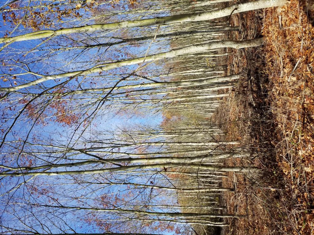
2 NDVI of Oak tree What is phenology and why it may be useful? Winter Spring Summer Fall - Annual cycle of the vegetation - Different behaviours according to tree species - Enhance tree species recognition - Follow climate evolution Winter 2


3 Annual phenological cycle Branches bare Budburst Leaf coloring and falling Budset 3

4 Annual phenological cycle Branches bare Budburst Leaf coloring and falling Budset 4

5 Annual phenological cycle Branches bare Budburst Leaf coloring and falling Budset 5

6 Annual phenological cycle Branches bare Budburst Leaf coloring and falling Budset 6
7 Research questions 1- Is Sentinel-2 time series able to identify tree species? 2- What is the consistency between the phenology observed in-situ and the one observed from S2 time series? 7


8 Study site - Extent of 25x25km (Subset of Sentinel-2) - Most of the site is composed of crops and small private forests - Temperate mixed forest, less than 10% (54km²) of the landcover FRANCE T31TCJ Sentinel-2 Tile 20km 8
9 Data / Images Sentinel-2 Time Series, T31TCJ tile, Level 2A¹: - 37 images, from 26 january 2017 to 27 december Temporal resampling every 5 days Clouds >80% or NA 60 to 80% 40 to 60% 20 to 40% <20% ¹Hagolle et al
10 Data / Tree species survey Total : 1682 pixels 1 sample = 1 pixel of Sentinel-2 Species Broadleaf Conifers Samples Forest stands Silver birch (Betula pendula) 64 3 Oak (Quercus robur/pubescens/petraea) Red Oak (Quercus rubra) European ash (Fraxinus excelsior) Aspen (Populus tremula) Black Locust (Robinia pseudoacacia) 88 6 Willow (Salix alba) 52 6 Eucalyptus(Eucalyptus spp.) Corsican Pine (Pinus nigra subsp. Laricio) Maritime Pine (Pinus pinaster) Black Pine (Pinus nigra) 52 2 Silver fir (Abies alba) 53 3 Douglas fir (Pseudotsuga menziesii) 72 8 Cypress (Cupressus)

11 Data / Phenological survey Since septembre 2017 : 10-days revisit of 14 plots (2 plots per species) - Phenological stage (using standard BBCH-scale¹) - Canopy Cover computed with fisheye² - Application GLAMA for Android Fisheye for smartphone devices - Chlorophyll measure with SPAD - Existence of the understory vegetation ¹ Badeau et al Plot ² Tichy L, Collins B km 11
12 BBCH 09 : bud burst Stage 0 Stage number Awakening Stage 1 Completion percentage (x10) of the stage Leaves coming out 00 : sleep BBCH 05 : bud swell 12 : 20% BBCH17 : 70% BBCH BBCH Branches bare Budburst Stage 9 Stage 3 Leaves coloring/falling 92 : 20% BBCH 97 : 70% Leaves growing 32 : 20% full size BBCH 37 : 70% BBCH BBCH Leaf coloring and falling Budset 12
13 november april may Quercus palustris Quercus pubescens 13
14 november april may Quercus palustris Quercus pubescens 14
15 november BBCH = 15 april may Quercus palustris BBCH = 18 Stage 1 Leaves coming out Quercus 15 : 50% pubescens 18 : 80% 15
16 Methodology / 1 Classification - Preprocessing : Gap-filling on detected clouds using linear interpolation - Supervised classification : - SVM with RBF Kernel (hyperparameters fixed by cross-validation) - Cross-validation : Spatial Leave-One-Out (SLOO)¹ to limit spatial autocorrelation ¹ Le Rest et al
17 Methodology / Sampling references for classification Spatial Leave-One-Out¹ sampling. ¹ Le Rest et al
18 Methodology / Sampling references for classification Spatial Leave-One-Out¹ sampling. Validation pixel ¹ Le Rest et al
19 Methodology / Sampling references for classification Spatial Leave-One-Out¹ sampling. Validation pixel 320m ¹ Le Rest et al Using Moran s Index to compute autocorrelation distance Median value from all bands 19
20 Methodology / Sampling references for classification Spatial Leave-One-Out¹ sampling. Validation pixel 320m Spatially correlated pixels ¹ Le Rest et al Using Moran s Index to compute autocorrelation distance Median value from all bands 20
21 Methodology / Sampling references for classification Spatial Leave-One-Out¹ sampling. Validation pixel Spatially correlated pixels ¹ Le Rest et al Using Moran s Index to compute autocorrelation distance Median value from all bands 21
22 Methodology / Sampling references for classification Spatial Leave-One-Out¹ sampling. Validation pixel Training pixels ¹ Le Rest et al
23 Methodology / Sampling references for classification Spatial Leave-One-Out¹ sampling. Validation pixel Training pixels Repeated as many times as the number of samples in the least populated class. Here 42 times (i.e. number of samples of cypress) ¹ Le Rest et al
24 Methodology / 2 Phenology - Smoothing with Double logistic1,2 using NDVI ( in R band) - Seasonal amplitude for Start Of Season : 10%3 - Seasonal amplitude for End Of Season : 90% - - Objective is to find the time where all leaves fell/colored. Comparison with ground survey ¹ Yang and Zhang (2012) ² Tan et al. (2010) ³ Jönsson and Eklundh (2002) 24
25 Results 25
26 Results 1 Tree species classification Phenology from ground survey (14 plots) 2 Phenology computed from NDVI (930 references, 7 species) 26
27 1 Species classification 77% kappa True label Results / using Spatial Leave-One-Out (SLOO) 27 Predicted label
28 1 Species classification 77% kappa True label Results / using Spatial Leave-One-Out (SLOO) 28 Predicted label
29 Tree species map with Spatial Leave-One-Out 1km 29

30 Tree species map with Spatial Leave-One-Out 1km 30
31 Tree species map with Spatial Leave-One-Out Silver birch Douglas fir Black pine Silver fir 150m IGN - ORTHO-SAT SPOT 6/

32 Tree species map with Spatial Leave-One-Out Silver birch Douglas fir Black pine Silver fir 150m IGN - ORTHO-SAT SPOT 6/
33 feb 15 april 20 Fern is growing at the same time as the canopy may 2


34 feb 15 11% april 20 55% Fern is growing at the same time as the canopy may 2 58%
35 NDVI NDVI 2 Phenology / Silver birch (plot n 1) CACO / Leaves fall / Leaves out (%) Results / 35
36 Results / 2 Phenology / Silver birch (plot n 1) All leaves are out Beginning of leaf falling or colouring 90% of leaves still on tree NDVI CACO / Leaves fall / Leaves out (%) NDVI Still 20% leaves on tree No more leaves Budburst Start Of Season 36
37 Results / 2 Phenology / Silver birch (plot n 1) All leaves are out Beginning of leaf falling or colouring 90% of leaves still on tree NDVI CACO / Leaves fall / Leaves out (%) NDVI CACO Canopoy Cover (%) Still 20% leaves on tree No more leaves Budburst Start Of Season 37
38 2 NDVI NDVI Phenology / Black locust (plot n 2) CACO / Leaves fall / Leaves out (%) Results / 38
39 Results / 2 Phenology / Black locust (plot n 2) All leaves are out CACO / Leaves fall / Leaves out (%) Beginning of leaf falling or colouring 90% of leaves still on tree NDVI NDVI Still 20% leaves on tree No more leaves Budburst Start Of Season 39
40 Results / 2 Phenology / Black locust (plot n 2) All leaves are out CACO / Leaves fall / Leaves out (%) Beginning of leaf falling or colouring 90% of leaves still on tree NDVI NDVI CACO Still 20% leaves on tree No more leaves Budburst Start Of Season 40


41 2 Phenology / Black locust All leaves are out CACO / Leaves fall / Leaves out (%) Results / Budburst Start Of Season 41
42 Results / 2 Phenology from SITS (n = 980) 20 days 42
43 Results / 2 Phenology from SITS (n = 980) ground truth 20 days 43
44 nov 7 nov 17 nov 27 Red oak plantation


45 nov 7 nov 17 nov 27 Red oak plantation


46 Start Of Season 02/05 03/02 03/27 End Of Season Aspen plantation 9/18 11/07 12/27 46
47 Conclusion and beyond 1 Classification, high potential but : - Importance of spatial autocorrelation (77% kappa Vs 97%) Mixed effects with the understory vegetation (Helman 2018) Unexpected high accuracy for several conifer species (F1>90%) Inconsistency with previous results (S2 versus Formosat-2, Sheeren et al. 2016) 2 Phenology : - High influence of understory vegetation (changing the phenological cycle) Consistent with ground survey, except Red oak Need to finish year 2018 to have a full vegetation cycle and SOS validation. 47


48 Presented by Nicolas Karasiak Thanks for listening 48

49 97% kappa using 50% random sampling True label Results / Species classification 49 Predicted label

50 50
51 NDVI (+0.05 in red) mean ± std Oak Silver birch 51
 mean ± std Black")
52 NDVI (+0.05 in red) mean ± std Black locust Oak European ash 52
 mean ± min/max value")
53 NDVI (+0.05 in red) mean ± min/max value Black locust Oak European ash 53
SATellite MOnitoring of VEgetation Seasonality SAT-MOVES. Brian O Connor, Ned Dwyer, Fiona Cawkwell
 SATellite MOnitoring of VEgetation Seasonality SAT-MOVES Brian O Connor, Ned Dwyer, Fiona Cawkwell Objective: To investigate a methodology for the potential of earth observation satellites to monitor vegetation
High Dimensional Kullback-Leibler divergence for grassland classification using satellite image time series with high spatial resolution
 High Dimensional Kullback-Leibler divergence for grassland classification using satellite image time series with high spatial resolution Presented by 1 In collaboration with Mathieu Fauvel1, Stéphane Girard2
Using digital cameras to monitoring vegetation phenology: Insights from PhenoCam. Andrew D. Richardson Harvard University
 Using digital cameras to monitoring vegetation phenology: Insights from PhenoCam Andrew D. Richardson Harvard University I thank my PhenoCam collaborators for their contributions to this work. I gratefully
BIOMES. Definition of a Biome. Terrestrial referring to land. Climatically controlled sets of ecosystems. Characterized by distinct vegetation
 BIOMES An Introduction to the Biomes of the World Definition of a Biome Terrestrial referring to land Climatically controlled sets of ecosystems Characterized by distinct vegetation 1 In a Biome There
The study of a common beech (Fagus sylvatica) population. Mt Ventoux, France
 population. Mt Ventoux, France") The study of a common beech (Fagus sylvatica) population. Mt Ventoux, France Master II EBEN Ingénieur agronome 3 e année, ENSA Toulouse Réunion CAQSIS 5/4/16 Montpellier In the northern hemisphere, climate
The study of a common beech (Fagus sylvatica) population. Mt Ventoux, France Master II EBEN Ingénieur agronome 3 e année, ENSA Toulouse Réunion CAQSIS 5/4/16 Montpellier In the northern hemisphere, climate
Land cover research, applications and development needs in Slovakia
 Land cover research, applications and development needs in Slovakia Andrej Halabuk Institute of Landscape Ecology Slovak Academy of Sciences (ILE SAS) Štefánikova 3, 814 99 Bratislava, Slovakia Institute
Wood phenology: from organ-scale processes to terrestrial ecosystem models
 Wood phenology: from organ-scale processes to terrestrial ecosystem models Nicolas Delpierre Université Paris-Sud, Orsay, France Phenology = study of the timing of detectable phase transitions between
remain on the trees all year long) Example: Beaverlodge, Alberta, Canada
 Example: Beaverlodge, Alberta, Canada") Coniferous Forest Temperature: -40 C to 20 C, average summer temperature is 10 C Precipitation: 300 to 900 millimeters of rain per year Vegetation: Coniferous-evergreen trees (trees that produce cones
Coniferous Forest Temperature: -40 C to 20 C, average summer temperature is 10 C Precipitation: 300 to 900 millimeters of rain per year Vegetation: Coniferous-evergreen trees (trees that produce cones
HYPXIM: a second generation high spatial resolution hyperspectral satellite for the assessment of plant biodiversity
 HYPXIM: a second generation high spatial resolution hyperspectral satellite for the assessment of plant biodiversity S. Jacquemoud (1), D. Sheeren (2), X. Briottet (3), V. Carrère (4), R. Marion (5) &
Land Cover Classification via Multitemporal Spatial Data by Deep Recurrent Neural Networks [Ienco17]
![Land Cover Classification via Multitemporal Spatial Data by Deep Recurrent Neural Networks [Ienco17]](/thumbs/90/102860624.jpg "Land Cover Classification via Multitemporal Spatial Data by Deep Recurrent Neural Networks [Ienco17]") Séminaire DL - AMAP 20/10/2017 Land Cover Classification via Multitemporal Spatial Data by Deep Recurrent Neural Networks [Ienco17] Dino Ienco, Raffaele Gaetano, Claire Dupaquier and Pierre Maurel Associated
Séminaire DL - AMAP 20/10/2017 Land Cover Classification via Multitemporal Spatial Data by Deep Recurrent Neural Networks [Ienco17] Dino Ienco, Raffaele Gaetano, Claire Dupaquier and Pierre Maurel Associated
Using geographically weighted variables for image classification
 Remote Sensing Letters Vol. 3, No. 6, November 2012, 491 499 Using geographically weighted variables for image classification BRIAN JOHNSON*, RYUTARO TATEISHI and ZHIXIAO XIE Department of Geosciences,
Assimilation of satellite fapar data within the ORCHIDEE biosphere model and its impacts on land surface carbon and energy fluxes
 Laboratoire des Sciences du Climat et de l'environnement Assimilation of satellite fapar data within the ORCHIDEE biosphere model and its impacts on land surface carbon and energy fluxes CAMELIA project
Object-based classification of grasslands from high resolution satellite image time series using Gaussian mean map kernels
 Object-based classification of grasslands from high resolution satellite image time series using Gaussian mean map kernels Maïlys Lopes, Mathieu Fauvel, Stephane Girard, David Sheeren To cite this version:
Lecture Topics. 1. Vegetation Indices 2. Global NDVI data sets 3. Analysis of temporal NDVI trends
 Lecture Topics 1. Vegetation Indices 2. Global NDVI data sets 3. Analysis of temporal NDVI trends Why use NDVI? Normalize external effects of sun angle, viewing angle, and atmospheric effects Normalize
CadasterENV Sweden Time series in support of a multi-purpose land cover mapping system at national scale
 CadasterENV Sweden Time series in support of a multi-purpose land cover mapping system at national scale Mats Rosengren, Camilla Jönsson ; Metria AB Marc Paganini ; ESA ESRIN Background CadasterENV Sweden
Introductory Lessons for Buds, Leaves and Global Warming JoAnn Mossman Gr. 7 Life Science Overlook Middle School Ashburnham-Westminster Regional
 Harvard LTER Schoolyard Program ------------------------------------------------------- Teacher Developed Lessons and Documents that integrate Harvard Forest Schoolyard Ecology Themes into curriculum.
Evaluation of phenology parameters as proxi for drought measurements
 Szegedi Tudományegyetem, Természettudományi és Informatikai Kar Természeti Földrajzi és Geoinformatikai Tanszék H-6722 Szeged, Egyetem u. 2-6. PB. 653. Tel.: +36-62 544156 Internet: http://www.geo.u-szeged.hu
VALERI-2001 campaigns in Nezer site (France): April 2001 and June 2001
: April 2001 and June 2001") VAERI-2001 campaigns in Nezer site (France): 01-17 April 2001 and 18-29 June 2001 Dominique GUYON Organisation : INRA, Bioclimatologie, France E-mail: guyon@bordeaux.inra.fr SPRING 2001 SUMMER 2001 Date
VAERI-2001 campaigns in Nezer site (France): 01-17 April 2001 and 18-29 June 2001 Dominique GUYON Organisation : INRA, Bioclimatologie, France E-mail: guyon@bordeaux.inra.fr SPRING 2001 SUMMER 2001 Date
Biomes Section 2. Chapter 6: Biomes Section 2: Forest Biomes DAY ONE
 Chapter 6: Biomes Section 2: Forest Biomes DAY ONE Of all the biomes in the world, forest biomes are the most widespread and the most diverse. The large trees of forests need a lot of water, so forests
Extracting Vegetation Phenology Metrics in Changbai Mountains Using an Improved Logistic Model
 Chin. Geogra. Sci. 2011 21(3) 304 311 doi: 10.1007/s11769-011-0471-3 www.springerlink.com/content/1002-0063 Extracting Vegetation Phenology Metrics in Changbai Mountains Using an Improved Logistic Model
NREM 301 Forest Ecology & Soils. Day 24 November 16, Succession Nutrient Cycling. Field Quiz next Tuesday see study guide
 NREM 301 Forest Ecology & Soils Day 24 November 16, 2008 Succession Nutrient Cycling Field Quiz next Tuesday see study guide Quiz Review What are 2 different terms for buds that give rise to cones? Floral
Main Issues Report - Background Evidence 5. Site Analysis
 Main Issues Report - Background Evidence 5. Site Analysis 134 Cairngorms National Park Local Development Plan 135 Main Issues Report - Background Evidence 5. Site Analysis 136 Cairngorms National Park
Supplementary Figures
 Supplementary Figures Supplementary Figure 1: The partial correlation coefficient of NDVI GS and GT for the first 15 years (1982-1996) and the last 15 years (1997-211) with five different definition of
COMMON CONIFERS OF THE PNW
 COMMON CONIFERS OF THE PNW The common conifers in the Pacific Northwest belong to the following genera: Abies, Calocedrus, Callitropsis, Juniperus, Larix, Picea, Pinus, Pseudotsuga, Taxus, Thuja, and Tsuga.
EXTRACTION OF REMOTE SENSING INFORMATION OF BANANA UNDER SUPPORT OF 3S TECHNOLOGY IN GUANGXI PROVINCE
 EXTRACTION OF REMOTE SENSING INFORMATION OF BANANA UNDER SUPPORT OF 3S TECHNOLOGY IN GUANGXI PROVINCE Xin Yang 1,2,*, Han Sun 1, 2, Zongkun Tan 1, 2, Meihua Ding 1, 2 1 Remote Sensing Application and Test
ECML PKDD Discovery Challenges 2017
 ECML PKDD Discovery Challenges 2017 Roberto Corizzo 1 and Dino Ienco 2 1 Department of Computer Science, University of Bari Aldo Moro, Bari, Italy roberto.corizzo@uniba.it 2 Irstea, UMR TETIS, Univ. Montpellier,
Leveraging Sentinel-1 time-series data for mapping agricultural land cover and land use in the tropics
 Leveraging Sentinel-1 time-series data for mapping agricultural land cover and land use in the tropics Caitlin Kontgis caitlin@descarteslabs.com @caitlinkontgis Descartes Labs Overview What is Descartes
Grade 4 Winter Outdoor Nature Walk: One-Page Summary
 Grade 4 Winter Outdoor Nature Walk: One-Page Summary Students will visit trees in the Conant schoolyard and identify them by their winter buds. Previously, they attended the Indoor Winter Session in which
Estimation of speciated and total mercury dry deposition at monitoring
 SUPPORTING INFORMATION Estimation of speciated and total mercury dry deposition at monitoring locations in eastern and central North America L. Zhang, P. Blanchard, D.A. Gay, E.M. Prestbo, M.R. Risch,
Patrick Leinenkugel. German Aerospace Center (DLR) Vortrag > Autor > Dokumentname > Datum
 Vortrag > Autor > Dokumentname > Datum") Characterisation of land surface phenology and land cover for the Mekong Basin on the basis of multitemporal and multispectral satellite data from the MODIS Sensor Patrick Leinenkugel German Aerospace
Characterisation of land surface phenology and land cover for the Mekong Basin on the basis of multitemporal and multispectral satellite data from the MODIS Sensor Patrick Leinenkugel German Aerospace
Joint International Mechanical, Electronic and Information Technology Conference (JIMET 2015)
") Joint International Mechanical, Electronic and Information Technology Conference (JIMET 2015) Extracting Land Cover Change Information by using Raster Image and Vector Data Synergy Processing Methods Tao
Joint International Mechanical, Electronic and Information Technology Conference (JIMET 2015) Extracting Land Cover Change Information by using Raster Image and Vector Data Synergy Processing Methods Tao
What is a TREE? Woody plant (stems, branches, roots) Long lived (typically 100 s of yrs. sometimes 10
 Long lived (typically 100 s of yrs. sometimes 10") What is a TREE? Woody plant (stems, branches, roots) Long lived (typically 100 s of yrs. sometimes 10 s or 1000 s) Single main axis (stem, trunk, bole) Typically 20-30 tall at maturity (note variability)
What is a TREE? Woody plant (stems, branches, roots) Long lived (typically 100 s of yrs. sometimes 10 s or 1000 s) Single main axis (stem, trunk, bole) Typically 20-30 tall at maturity (note variability)
Interannual variation of MODIS NDVI in Lake Taihu and its relation to climate in submerged macrophyte region
 Yale-NUIST Center on Atmospheric Environment Interannual variation of MODIS NDVI in Lake Taihu and its relation to climate in submerged macrophyte region ZhangZhen 2015.07.10 1 Outline Introduction Data
Radiation transfer in vegetation canopies Part I plants architecture
 Radiation Transfer in Environmental Science with emphasis on aquatic and vegetation canopy medias Radiation transfer in vegetation canopies Part I plants architecture Autumn 2008 Prof. Emmanuel Boss, Dr.
Project title. Evaluation of MIR data from SPOT4/VEGETATION for the monitoring of climatic phenomena impact on vegetation
 Project title 1 Evaluation of MIR data from SPOT4/VEGETATION for the monitoring of climatic phenomena impact on vegetation Principal investigator: M-Christine IMBERTI Co-investigator: Frédéric BIARD Stockholm
Methods review for the Global Land Cover 2000 initiative Presentation made by Frédéric Achard on November 30 th 2000
 Methods review for the Global Land Cover 2000 initiative Presentation made by Frédéric Achard on November 30 th 2000 1. Contents Objectives Specifications of the GLC-2000 exercise Strategy for the analysis
New opportunities for high-resolution countrywide tree type mapping
 New opportunities for high-resolution countrywide tree type mapping Lars T. Waser, Bronwyn Price, Nataliia Rehush, Marius Rüetschi, and David Small* Swiss National Forest Inventory Swiss Federal Research
The Redwood National and State Parks Vegetation Classification and Mapping Project Map Data Sets Completed and Delivered! 1
 The Redwood National and State Parks Vegetation Classification and Mapping Project Map Data Sets Completed and Delivered! 1 By Ken Stumpf and Leonel Arguello The Redwood National and State Parks Vegetation
TOWN OF VAIL TAXABLE SALES REPORT
 TOWN OF VAIL TAXABLE SALES REPORT Destination: Vail Report Period: through February 2015 a) Vail Village/Lionshead Combined Performance Retail Sales in Vail Village + Lionshead Restaurant Sales in Vail
AGOG 485/585 /APLN 533 Spring Lecture 5: MODIS land cover product (MCD12Q1). Additional sources of MODIS data
. Additional sources of MODIS data") AGOG 485/585 /APLN 533 Spring 2019 Lecture 5: MODIS land cover product (MCD12Q1). Additional sources of MODIS data Outline Current status of land cover products Overview of the MCD12Q1 algorithm Mapping
AGOG 485/585 /APLN 533 Spring 2019 Lecture 5: MODIS land cover product (MCD12Q1). Additional sources of MODIS data Outline Current status of land cover products Overview of the MCD12Q1 algorithm Mapping
A new leaf phenology for the land surface scheme TERRA of the COSMO atmospheric model
 A new leaf phenology for the land surface scheme TERRA of the COSMO atmospheric model Jan-Peter Schulz 1,3,*, Gerd Vogel 2, Bodo Ahrens 3, Reto Stöckli 4 and Jean-Marie Bettems 4 1 Biodiversity and Climate
CHAPTER-7 INTERFEROMETRIC ANALYSIS OF SPACEBORNE ENVISAT-ASAR DATA FOR VEGETATION CLASSIFICATION
 147 CHAPTER-7 INTERFEROMETRIC ANALYSIS OF SPACEBORNE ENVISAT-ASAR DATA FOR VEGETATION CLASSIFICATION 7.1 INTRODUCTION: Interferometric synthetic aperture radar (InSAR) is a rapidly evolving SAR remote
Tree morphology and identification. TreeKeepers March 18, 2017
 Tree morphology and identification TreeKeepers March 18, 2017 Tree identification keys What if you don t know what kind of tree it is? Dichotomous keys work you through it. Ask a series of yes or no questions
STUDY ON FOREST VEGETATION CLASSIFICATION BASED ON MULTI- TEMPORAL REMOTE SENSING IMAGES
 STUDY ON FOREST VEGETATION CLASSIFICATION BASED ON MULTI- TEMPORAL REMOTE SENSING IMAGES Xia Jing 1, 2, JiHua Wang 2, WenJiang Huang 2,*, LiangYun Liu 2, JinDi Wang 1 1 School of Geography, Beijing Normal
Remote detection of giant reed invasions in riparian habitats: challenges and opportunities for management planning
 Remote detection of giant reed invasions in riparian habitats: challenges and opportunities for management planning Maria do Rosário Pereira Fernandes Forest Research Centre, University of Lisbon Number
Received: 25 July 2017 ; Accepted: 22 September 2017; Published: 25 September 2017
 remote sensing Article Spectro-Temporal Heterogeneity Measures from Dense High Spatial Resolution Satellite Image Time Series: Application to Grassland Species Diversity Estimation Mailys Lopes 1, *, Mathieu
This article appeared in a journal published by Elsevier. The attached copy is furnished to the author for internal non-commercial research and
 This article appeared in a journal published by Elsevier. The attached copy is furnished to the author for internal non-commercial research and education use, including for instruction at the authors institution
Derivation of phenometrics from high resolution RapidEye imagery of semi-arid grasslands in South Africa
 André Parplies Student Research Colloquium Derivation of phenometrics from high resolution RapidEye imagery of semi-arid grasslands in South Africa Introduction Introduction Study area Methodology Results
UK Contribution to the European CORINE Land Cover
 Centre for Landscape andwww.le.ac.uk/clcr Climate Research CENTRE FOR Landscape and Climate Research UK Contribution to the European CORINE Land Cover Dr Beth Cole Corine Coordination of Information on
Modeling bird species diversity at broad scale from satellite imagery
 RemoteSensingof BiodiversityWorkshop Grenoble, November24 th -25 th 2014 GdRMAGIS IEEE GRSS ZA Alpes Modeling bird species diversity at broad scale from satellite imagery Findingthe best spatial representationof
EVALUATION OF AVHRR NDVI FOR MONITORING INTRA-ANNUAL AND INTERANNUAL VEGETATION DYNAMICS IN A CLOUDY ENVIRONMENT (SCOTLAND, UK)
") EVALUATION OF AVHRR NDVI FOR MONITORING INTRA-ANNUAL AND INTERANNUAL VEGETATION DYNAMICS IN A CLOUDY ENVIRONMENT (SCOTLAND, UK) S. Brand a,, T.J. Malthus b a Institute of Photogrammetry and Remote Sensing,
EVALUATION OF AVHRR NDVI FOR MONITORING INTRA-ANNUAL AND INTERANNUAL VEGETATION DYNAMICS IN A CLOUDY ENVIRONMENT (SCOTLAND, UK) S. Brand a,, T.J. Malthus b a Institute of Photogrammetry and Remote Sensing,
Land cover/land use mapping and cha Mongolian plateau using remote sens. Title. Author(s) Bagan, Hasi; Yamagata, Yoshiki. Citation Japan.
 Bagan, Hasi; Yamagata, Yoshiki. Citation Japan.") Title Land cover/land use mapping and cha Mongolian plateau using remote sens Author(s) Bagan, Hasi; Yamagata, Yoshiki International Symposium on "The Imp Citation Region Specific Systems". 6 Nove Japan.
Title Land cover/land use mapping and cha Mongolian plateau using remote sens Author(s) Bagan, Hasi; Yamagata, Yoshiki International Symposium on "The Imp Citation Region Specific Systems". 6 Nove Japan.
Waterlogging tolerance of trees
 Waterlogging tolerance of trees Tapani Repo, Metla Silviculture in Changing Environment, Nov. 24-25, 2014 Contents Motivation Background concerning waterlogging tolerance An example of dormancy waterlogging
K&C Phase 4 Status report. Use of short-period ALOS-2 observations for vegetation characterization and classification
 K&C Phase 4 Status report Use of short-period ALOS-2 observations for vegetation characterization and classification Paul Siqueira, Tracy Whelen University of Massachusetts, Amherst Yang Lei NASA JPL Science
GEO Joint Experiment for Crop Assessment and Monitoring (JECAM): 2014 Site Progress Report
: 2014 Site Progress Report") GEO Joint Experiment for Crop Assessment and Monitoring (JECAM): JECAM Test Site Name: China - Guangdong 2014 Site Progress Report Team Leader and Members: Prof Wu Bingfang (Leader), Jiratiwan Kruasilp,
GEO Joint Experiment for Crop Assessment and Monitoring (JECAM): JECAM Test Site Name: China - Guangdong 2014 Site Progress Report Team Leader and Members: Prof Wu Bingfang (Leader), Jiratiwan Kruasilp,
Temporal and spatial approaches for land cover classification.
 Temporal and spatial approaches for land cover classification. Ryabukhin Sergey sergeyryabukhin@gmail.com Abstract. This paper describes solution for Time Series Land Cover Classification Challenge (TiSeLaC).
The VENμS mission: Earth Observation with High Spatial and Temporal Resolution Capabilities
 Ben Gurion University The VENμS mission: Earth Observation with High Spatial and Temporal Resolution Capabilities G. Dedieu 1, O. Hagolle 2, A. Karnieli 3, S. Cherchali 2 P. Ferrier 2 and Y. Yaniv 4 1
Appendix E Environmental Analysis Tables
 Route Permit Application Bemidji-Grand Rapids Appendix E Environmental Analysis Tables. Appendices June 4, 2008 Chippewa National Forest Owned Forest Lands within Right-of-Way Segments Segments aspenwhite
A Planthopper in the Family Fulgoridae
 Lycorma delicatula (WHITE): A Planthopper in the Family Fulgoridae About 129 Genera, 696 Species in the world Christopher Marley Planthopper Formation Only 9 Genera and 17 species in North America Lycorma
Evaluation of estimated satellite images for filling data gaps in an intra-annual high spatial resolution time-series
 Evaluation of estimated satellite images for filling data gaps in an intra-annual high spatial resolution time-series Tobias Schmidt, Michael Förster, Birgit Kleinschmit Technical University Berlin, Geoinformation
Assessment of Macrophytes Seasonal Dynamics Using Dense Time Series of Satellite Data
 Assessment of Macrophytes Seasonal Dynamics Using Dense Time Series of Satellite Data Paolo Villa a, Mariano Bresciani a, Monica Pinardi a, Viktor R. Tóth b, Rossano Bolpagni c a Institute for Electromagnetic
Species-specific spring and autumn leaf phenology captured by time-lapse digital cameras
 Species-specific spring and autumn leaf phenology captured by time-lapse digital cameras YINGYING XIE, 1,2, DANIEL L. CIVCO, 3 AND JOHN A. SILANDER JR. 1 1 Department of Ecology and Evolutionary Biology,
Studies of Austfonna ice cap (Svalbard) using radar altimetry with other satellite techniques
 using radar altimetry with other satellite techniques") 15 Years of progress in Radar Altimetry Symposium Ocean surface topography science team (OSTST) International Doris Service (IDS) Workshop, Argo Workshop 13-18 March 2006, Venice, Italy Alexei V. Kouraev,
15 Years of progress in Radar Altimetry Symposium Ocean surface topography science team (OSTST) International Doris Service (IDS) Workshop, Argo Workshop 13-18 March 2006, Venice, Italy Alexei V. Kouraev,
An Automated Object-Oriented Satellite Image Classification Method Integrating the FAO Land Cover Classification System (LCCS).
.") An Automated Object-Oriented Satellite Image Classification Method Integrating the FAO Land Cover Classification System (LCCS). Ruvimbo Gamanya Sibanda Prof. Dr. Philippe De Maeyer Prof. Dr. Morgan De
An Automated Object-Oriented Satellite Image Classification Method Integrating the FAO Land Cover Classification System (LCCS). Ruvimbo Gamanya Sibanda Prof. Dr. Philippe De Maeyer Prof. Dr. Morgan De
Assessments for City of Moonee Valley's Significant Tree Study
 Unique ID 219 Botanical Name: Platanus Xacerifolia Common Name: London Plane Height (m): 16 Width1 (m): 18 Width2 (m): 18 Combined DBH (cm): 54 Location of Landscape Context 41-60 years Failure Probability:
ANALYSIS AND VALIDATION OF A METHODOLOGY TO EVALUATE LAND COVER CHANGE IN THE MEDITERRANEAN BASIN USING MULTITEMPORAL MODIS DATA
 PRESENT ENVIRONMENT AND SUSTAINABLE DEVELOPMENT, NR. 4, 2010 ANALYSIS AND VALIDATION OF A METHODOLOGY TO EVALUATE LAND COVER CHANGE IN THE MEDITERRANEAN BASIN USING MULTITEMPORAL MODIS DATA Mara Pilloni
WSU and UI Master Gardeners March 1, 2016 Philip Shinn
 WSU and UI Master Gardeners March 1, 2016 Philip Shinn What is a Woody Plant? Tree Biology CODIT Planting & Pruning Tree Triage C 9 H 10 O 2 Strengthens cell walls in Xylem Sequesters carbon 30% of
Mapping forests in monsoon Asia with ALOS PALSAR 50-m mosaic images and MODIS
 1 Supplementary Information 2 3 Mapping forests in monsoon Asia with ALOS PALSAR 50-m mosaic images and MODIS imagery in 2010 4 5 6 7 8 9 10 11 Yuanwei Qin, Xiangming Xiao, Jinwei Dong, Geli Zhang, Partha
Leaf Morphology Tree Biology-2012
 Leaf Morphology Tree Biology-2012 Leaf Morphology Outline Structure & Function Review Function Epidermis, mesophyll, vascular bundles, stoma Environment & Physical Variations Stoma density & climate change
Coupled assimilation of in situ flux measurements and satellite fapar time series within the ORCHIDEE biosphere model: constraints and potentials
 Coupled assimilation of in situ flux measurements and satellite fapar time series within the ORCHIDEE biosphere model: constraints and potentials C. Bacour 1,2, P. Peylin 3, P. Rayner 2, F. Delage 2, M.
Agricultural land-use from space. David Pairman and Heather North
 Agricultural land-use from space David Pairman and Heather North Talk Outline Motivation Challenges Different approach Paddock boundaries Classifications Examples Accuracy Issues Data sources Future possibilities
Climate Change Impacts on Maple Syrup Yield
 Climate Change Impacts on Maple Syrup Yield Rajasekaran R. Lada, Karen Nelson, Arumugam Thiagarajan Maple Research Programme, Dalhousie Agricultural Campus Raj.lada@dal.ca Canada is the largest maple
DECIDUOUS FORESTS. Odborná angličtina pro 2. ročník
 DECIDUOUS FORESTS Odborná angličtina pro 2. ročník Střední lesnická škola Hranice, Jurikova 588 Autor modulu: Mgr. Jaroslava Jalůvková Deciduous trees Leaves Deciduous trees usually have broad, large leaves
Changkun Fu, Wanqin Yang, Bo Tan, Zhenfeng Xu, Yu Zhang, Jiaping Yang, Xiangyin Ni, Fuzhong Wu
 Supplementary Materials Seasonal dynamics of litterfall in a sub alpine spruce fir on the eastern Tibetan Plateau: allometric scaling relationships based on one year of observations Changkun Fu, Wanqin
How does the physical environment influence communities and ecosystems? Hoodoos in Cappadocia, Turkey
 Biomes of the World How does the physical environment influence communities and ecosystems? Hoodoos in Cappadocia, Turkey ecosystems are shaped by: abiotic factors climate/weather space Rainfall Soil air
All species evolve characteristics, features or behaviours that allow them to survive in a certain habitat (or environment)
") What is adaptation? All species evolve characteristics, features or behaviours that allow them to survive in a certain habitat (or environment) o Animals and plants living in different habitats need different
What is adaptation? All species evolve characteristics, features or behaviours that allow them to survive in a certain habitat (or environment) o Animals and plants living in different habitats need different
KIDS CLUB FALL PRINTABLES
 KIDS CLUB FALL PRINTABLES Print this booklet for extra activities, games and puzzles, or print only the pages you want. Answers to the Printables and Kids Club Newsletter puzzles are on the last page.
SATELLITE REMOTE SENSING
 SATELLITE REMOTE SENSING of NATURAL RESOURCES David L. Verbyla LEWIS PUBLISHERS Boca Raton New York London Tokyo Contents CHAPTER 1. SATELLITE IMAGES 1 Raster Image Data 2 Remote Sensing Detectors 2 Analog
Biomes and Climate Relationships
 CO 2 Biomes and Climate Relationships Plant Ecology in a Changing World Jim Ehleringer, University of Utah http://plantecology.net Part 1 Global patterns and ordination with temperature and water Biome
Overview on Land Cover and Land Use Monitoring in Russia
 Russian Academy of Sciences Space Research Institute Overview on Land Cover and Land Use Monitoring in Russia Sergey Bartalev Joint NASA LCLUC Science Team Meeting and GOFC-GOLD/NERIN, NEESPI Workshop
Pages 63 Monday May 01, 2017
 Pages 6 Notebook check: Biome basics and A Modern Desert Biome Warm up: Copy the graph below, title it Defining factor a biome: temperature and precipitation Pages 6 an based on regarding Learning scale:
ESA-GLOBCOVER - A Global Land Cover Service at 300 m from ENVISAT MERIS Time Series
 October 15, 2008 (Jena Germany) ESA-GLOBCOVER - A Global Land Cover Service at 300 m from ENVISAT MERIS Time Series Defourny P.1, Bontemps S., Vancutsem C.1, Pekel J.F.1,, Vanbogaert E.1, Bicheron P.2,
NERC Geophysical Equipment Facility - View more reports on our website at
 NERC GEOPHYSICAL EQUIPMENT FACILITY LOAN 877 SCIENTIFIC REPORT Modelling gap microclimates in broadleaved deciduous forests using remotely sensed data: the contribution of GPS to geometric correction and
Land Cover Project ESA Climate Change Initiative. Processing chain for land cover maps dedicated to climate modellers.
 Land Cover Project ESA Climate Change Initiative Processing chain for land cover maps dedicated to climate modellers land_cover_cci S. Bontemps 1, P. Defourny 1, V. Kalogirou 2, F.M. Seifert 2 and O. Arino
Quality Assessment of Shuttle Radar Topography Mission Digital Elevation Data. Thanks to. SRTM Data Collection SRTM. SRTM Galapagos.
 Quality Assessment of Shuttle Radar Topography Mission Digital Elevation Data Third International Conference on Geographic Information Science College Park, Maryland, October 20-23 Ashton Shortridge Dept.
THE PYLA 2001 EXPERIMENT : EVALUATION OF POLARIMETRIC RADAR CAPABILITIES OVER A FORESTED AREA
 THE PYLA 2001 EXPERIMENT : EVALUATION OF POLARIMETRIC RADAR CAPABILITIES OVER A FORESTED AREA M. Dechambre 1, S. Le Hégarat 1, S. Cavelier 1, P. Dreuillet 2, I. Champion 3 1 CETP IPSL (CNRS / Université
Why the Evergreen Trees Never Lose Their Leaves by Florence Holbrook
 Paired Passages: Myth and fact about why evergreen trees do not lose their leaves Passage 1: Myth Why the Evergreen Trees Never Lose Their Leaves by Florence Holbrook 1 2 3 4 5 6 7 8 9 10 Winter was coming,
Evaluating Urban Vegetation Cover Using LiDAR and High Resolution Imagery
 Evaluating Urban Vegetation Cover Using LiDAR and High Resolution Imagery Y.A. Ayad and D. C. Mendez Clarion University of Pennsylvania Abstract One of the key planning factors in urban and built up environments
Climax Vegetation is the natural vegetation in the last possible stage of vegetation development. Climax vegetation is stable and in balance with the
 Climax Vegetation is the natural vegetation in the last possible stage of vegetation development. Climax vegetation is stable and in balance with the climatic conditions. It should change very little if
Meteorology. Chapter 15 Worksheet 1
 Chapter 15 Worksheet 1 Meteorology Name: Circle the letter that corresponds to the correct answer 1) The Tropic of Cancer and the Arctic Circle are examples of locations determined by: a) measuring systems.
Biology. 1. a) leaves are needle like.. White pine (Pinus) b) leaves are broad. Go to statement 2
 leaves are needle like.. White pine (Pinus) b) leaves are broad. Go to statement 2") Biology DICHOTOMOUS KEYING Name Period: 1 Date : Identify the names of the plants using the dichotomous keys: 1. a) leaves are needle like.. White pine (Pinus) b) leaves are broad. Go to statement 2 2.
Biology DICHOTOMOUS KEYING Name Period: 1 Date : Identify the names of the plants using the dichotomous keys: 1. a) leaves are needle like.. White pine (Pinus) b) leaves are broad. Go to statement 2 2.
11/20/15& Environmental Science. Monday, November 16, Do)Now:& Rainforest+Review+Do/Now &
Now:& Rainforest+Review+Do/Now &") Environmental Science Monday, November 16, 2015 Do)Now:& Rainforest+Review+Do/Now & 1. Write+down+today s+flt++ 2. Define+the+term+ biome + 3. IdenCfy+the+four+layers+found+in+a+tropical+ rainforest+ 4.
Environmental Science Monday, November 16, 2015 Do)Now:& Rainforest+Review+Do/Now & 1. Write+down+today s+flt++ 2. Define+the+term+ biome + 3. IdenCfy+the+four+layers+found+in+a+tropical+ rainforest+ 4.
EVALUATION OF CLASSIFICATION METHODS WITH POLARIMETRIC ALOS/PALSAR DATA
 EVALUATION OF CLASSIFICATION METHODS WITH POLARIMETRIC ALOS/PALSAR DATA Anne LÖNNQVIST a, Yrjö RAUSTE a, Heikki AHOLA a, Matthieu MOLINIER a, and Tuomas HÄME a a VTT Technical Research Centre of Finland,
Bell Ringer: February 6, 2013
 Bell Ringer: Please take 5 minutes to work on/ finish PBL BIOME MAP and PBL SCAVENGER HUNT! If you are finished with this, please take 5 minutes to write any last second questions about SCIENCE FAIR TONIGHT!
Biosphere Organization
 Biosphere Organization What is a biome? Biomes refer to a large region or area characterized by the following: 1. A particular climate pattern of the annual temperature and precipitation distribution,
Forest Fire Fuels Mapping by Geoinformatics for Fire Behavior Modeling
 Forest Fire Fuels Mapping by Geoinformatics for Fire Behavior Modeling Kostas Kalabokidis, Palaiologos Palaiologou, Phaedon Kyriakidis University of the Aegean, Department of Geography, 81100 Mytilene,
Instructions for Running the FVS-WRENSS Water Yield Post-processor
 Instructions for Running the FVS-WRENSS Water Yield Post-processor Overview The FVS-WRENSS post processor uses the stand attributes and vegetative data from the Forest Vegetation Simulator (Dixon, 2002)
P7: Limiting Factors in Ecosystems
 P7: Limiting Factors in Ecosystems Purpose To understand that physical factors temperature and precipitation limit the growth of vegetative ecosystems Overview Students correlate graphs of vegetation vigor
Hyperspectral Remote Sensing --an indirect trait measuring method
 Hyperspectral Remote Sensing --an indirect trait measuring method Jin Wu 05/02/2012 Outline Part 1: Terminologies & Tools of RS Techniques Part 2: RS Approaches to Estimating Leaf/Canopy Traits Part 3:
NOAA Snow Map Climate Data Record Generated at Rutgers
 NOAA Snow Map Climate Data Record Generated at Rutgers David A. Robinson Rutgers University Piscataway, NJ Snow Watch 2013 Downsview, Ontario January 29, 2013 December 2012 snow extent departures Motivation