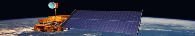
Remote Sensing Geographic Information Systems Global Positioning Systems
|
|
|
- Eric Burke
- 6 years ago
- Views:
Transcription

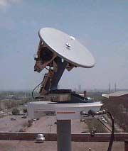

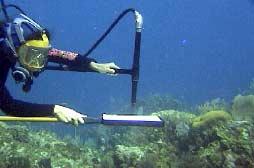
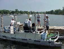

1 Remote Sensing Geographic Information Systems Global Positioning Systems


2 Assessing Seasonal Vegetation Response to Drought Lei Ji Department of Geography University of Nebraska-Lincoln AVHRR-NDVI: July 1999 AVHRR-NDVI: Jan 1999
3 Introduction Drought and drought indices, e.g. Standardized Precipitation Index (SPI) Use of AVHRR NDVI in detecting vegetation vigor and drought Relationship between NDVI and SPI Objectives Determine seasonal NDVI response to moisture Determine relationship between NDVI and SPI
4 Study Area Data Methods AVHRR NDVI ( ) Standardized Precipitation Index (SPI) Northern and Central Great Pains Time series analysis of monthly NDVI and SPI for grassland and crop by climate division (CD) Correlation Analysis of monthly NDVI and SPI Regression with seasonal-effect adjustment
5 Results Correlation of monthly NDVI and SPI Grassland Nebraska North-central CD Cropland Nebraska Northeastern CD NDVI Correlation Coefficient
6 Regression Model Test Land Cover Grassland North-central CD Cropland northeastern CD Seasonal Adjusted Regression p < R 2 = p < R 2 = Simple Regression p = R 2 = p = R 2 = Conclusions Relationship between vegetation condition and moisture availability is strong Relationship varies with growth stage Use of NDVI for drought monitoring requires consideration of the seasonal effect
7 Effects of Corn Tassel on Canopy Optical Measurements Andrés Viña CALMIT University of Nebraska-Lincoln December, 2002
8 Objective To evaluate the effects of corn tassels (flowers) on canopy optical measurements, specifically: Spectral regions of maximal effect Vegetation indices Leaf Area Index estimation


9 E dn ρ λ = (L λ /E λ ) Results Reflectance L up With Tassels Without Tassels Reflectance (%) Wavelength (nm) With Tassel Without Tassel Relative Difference Relative Difference (%)
10 Results Vegetation Indices/LAI NDVI NDVI = (ρ Red -ρ NIR )/(ρ Red +ρ NIR ) NDVI Tasseling VARI VARI Day of the Year -0.3 VARI After Tasseling VARI = (ρ Green -ρ Red )/ (ρ Green +ρ Red -ρ Blue ) LAI
11 Conclusions The red region (around 676 nm) showed the maximum relative response to the appearance of tassels. NDVI showed little or no sensitivity to the tassel. VARI showed high sensitivity to the tassel. VARI is a good estimator of LAI, although its predictive capability is reduced when tassels appear.

12 Commercial Agricultural Applications of Remote Sensing Doug Miller University of Nebraska - Lincoln
 Weather Agronomic Practices Incidence of Disease and insect")
13 IBM Joint Application Development Session Kansas City, Missouri March 1994 Business Objectives Make Money Effective Support Speed up Decision Making Provide Fast Accurate, & User Friendly Information Environmental Modeling Types of Data Required Crop Conditions Soil Properties Crop Production (Yield) Weather Agronomic Practices Incidence of Disease and insect damage
 Fits Market")
14 Product Parameters Reasonably Priced Timely Delivery Precise Reliable Accuracy Current - Updated Daily (Projected/Actual) Fits Market Structure

15 Defining Market Segments in Agriculture Who Collects Data? How is it used? Define information sources Design vendor products promoting added value products for farmers

16 File TSA Easting Tools View Northing Walima Systems Models Value Weather Buffer Zone 100 m GPS Reports Help Available Attributes DEM Soils Insect Weed Variety Population Tillage Nutrient LAI Biomass Harvest Yield
17 ALGORITHMS FOR REMOTE ESTIMATION OF WATER QUALITY Giorgio Dall Olmo Center for Advanced Land Management Information Technologies, School of Natural Resource Sciences, University of Nebraska-Lincoln
18 Spectral Reflectance The percentage of light reflected by a target E d L up Water body
19 Reflectance, % 5 High 4 [Chl-a] Low [Chl-a] Wavelength, nm
20 Spectral Indices Combinations of reflectance values at different wavelengths
21 Results: Chl-a model validation PREDICTED, mg/m STE = 9 mg/m 3 1: OBSERVED, mg/m 3

22 Geospatial Technologies for Homeland Security Jeff Arnold Featured in PE&RS September 2002, Volume 68, Number 9

23 Risk Assessment and Preparation Emergency Services, Notification and Evacuation Mapping Critical and Sensitive Facilities Inventory Special Needs Population Determination

24 Response and Recovery Prioritization of medical response efforts

25 Information Distribution On-line maps with query capabilities

26 Modeling & Analysis Lake McConaughy North Platte Digital elevation model indicating areas flooded


27 Remote Sensing Geographic Information Systems Global Positioning Systems
Land Management and Natural Hazards Unit --- DESERT Action 1. Land Management and Natural Hazards Unit Institute for Environment and Sustainability
 Land Management and Natural Hazards Unit --- DESERT Action 1 Monitoring Drought with Meteorological and Remote Sensing Data A case study on the Horn of Africa Paulo Barbosa and Gustavo Naumann Land Management
Introduction to Satellite Derived Vegetation Indices
 Introduction to the Use of Geospatial Information Technology for Drought Risk Management 13-17 November, 2017 Tonle Bassac II Restaurant, Phnom Penh, Cambodia Introduction to Satellite Derived Vegetation
The Wide Dynamic Range Vegetation Index and its Potential Utility for Gap Analysis
 Summary StatMod provides an easy-to-use and inexpensive tool for spatially applying the classification rules generated from the CT algorithm in S-PLUS. While the focus of this article was to use StatMod
Impact on Agriculture
 Weather Variability and the Impact on Agriculture InfoAg 2017 Copyright 2017, awhere. All Rights Reserved The Problem: The Earth s Atmosphere is a Heat Engine In transition 1 C warming of atmosphere Triples
Climate Change Impact on Air Temperature, Daily Temperature Range, Growing Degree Days, and Spring and Fall Frost Dates In Nebraska
 EXTENSION Know how. Know now. Climate Change Impact on Air Temperature, Daily Temperature Range, Growing Degree Days, and Spring and Fall Frost Dates In Nebraska EC715 Kari E. Skaggs, Research Associate
Copernicus Overview. Major Emergency Management Conference Athlone 2017
 Copernicus Overview Major Emergency Management Conference Athlone 2017 Copernicus is a European programme implemented by the European Commission. The services address six thematic areas: land, marine,
Evolving 2014 Weather Patterns. Leon F. Osborne Chester Fritz Distinguished Professor of Atmospheric Sciences University of North Dakota
 Evolving 2014 Weather Patterns Leon F. Osborne Chester Fritz Distinguished Professor of Atmospheric Sciences University of North Dakota Northern Pulse Growers January 27, 2014 Minot, ND Outline Today s
Geospatial Data, Services, and Products. National Surveying, mapping and geospatial conference
 Geospatial Data, Services, and Products Federal Programs -- USDA NRCS National Surveying, mapping and geospatial conference March 15, 2016 NRCS Applications using Geosaptial Products & Services Field
Midwest/Great Plains Climate-Drought Outlook August 17, 2017
 Midwest/Great Plains Climate-Drought Outlook August 17, 2017 Brian Fuchs National Drought Mitigation Center University of Nebraska-Lincoln School of Natural Resources General Information Providing climate
Potential (Reference) and Actual Evapotranspiration Trends across U.S. High Plains in Relation to Irrigation Development and Climate Change
 and Actual Evapotranspiration Trends across U.S. High Plains in Relation to Irrigation Development and Climate Change") EXTENSION Know how. Know now. EC712 Potential (Reference) and Actual Evapotranspiration Trends across U.S. High Plains in Relation to Irrigation Development and Climate Change Suat Irmak, Extension Soil
EXTENSION Know how. Know now. EC712 Potential (Reference) and Actual Evapotranspiration Trends across U.S. High Plains in Relation to Irrigation Development and Climate Change Suat Irmak, Extension Soil
NATIONAL HYDROPOWER ASSOCIATION MEETING. December 3, 2008 Birmingham Alabama. Roger McNeil Service Hydrologist NWS Birmingham Alabama
 NATIONAL HYDROPOWER ASSOCIATION MEETING December 3, 2008 Birmingham Alabama Roger McNeil Service Hydrologist NWS Birmingham Alabama There are three commonly described types of Drought: Meteorological drought
United States Multi-Hazard Early Warning System
 United States Multi-Hazard Early Warning System Saving Lives Through Partnership Lynn Maximuk National Weather Service Director, Central Region Kansas City, Missouri America s s Weather Enterprise: Protecting
Spatial Drought Assessment Using Remote Sensing and GIS techniques in Northwest region of Liaoning, China
 Spatial Drought Assessment Using Remote Sensing and GIS techniques in Northwest region of Liaoning, China FUJUN SUN, MENG-LUNG LIN, CHENG-HWANG PERNG, QIUBING WANG, YI-CHIANG SHIU & CHIUNG-HSU LIU Department
Geospatial Technologies
 An Overview of Prepared by: John McGee Jennifer McKee With support from: NSF DUE-0903270 in partnership with: Geospatial Technician Education Through Virginia s Community Colleges (GTEVCC) What is Geospatial?
Mapping Water Resources and Reservoirs for Climate Resilience in Zambezi River Basin
 Mapping Water Resources and Reservoirs for Climate Resilience in Zambezi River Basin Corné van der Sande, NEO BV Senior Advisor Earth Observation Services for Monitoring Drought and Water Resources in
The platform is the means, not the end goal
 The platform is the means, not the end goal + Complete analytics platform at an accessible price point Compliments existing workflows by integrating with the new intelligent farm equipment. The goal is
Predicting Impacts and Communicating Forecast Uncertainty in the Case of Drought
 Predicting Impacts and Communicating Forecast Uncertainty in the Case of Drought Dr. Cody L. Knutson National Drought Mitigation Center University of Nebraska-Lincoln, USA Predicting Drought Impacts through
The MRCC and Monitoring Drought in the Midwest
 The and Monitoring Drought in the Midwest Steve Hilberg Director, Illinois State Water Survey Prairie Research Institute, University of Illinois The A partner of a national climate service program that
Sources of Imagery and GIS Data Layers (Last updated October 2005)
") Sources of Imagery and GIS Data Layers (Last updated October 2005) The question of where to find data is one often asked by beginners in precision agriculture and other geospatial projects. The following
Sources of Imagery and GIS Data Layers (Last updated October 2005) The question of where to find data is one often asked by beginners in precision agriculture and other geospatial projects. The following
Nebraska Geospatial Extension Program Karisa Vlasek Geospatial Extension & Research Specialist
 Nebraska Geospatial Extension Program Karisa Vlasek Geospatial Extension & Research Specialist A NASA Nebraska Space Grant Consortium & EPSCoR Sponsored Research Endeavor Nebraska s Geospatial Extension
Forecasting wheat yield in the Canadian Prairies using climatic and satellite data
 Prairie Perspectives 81 Forecasting wheat yield in the Canadian Prairies using climatic and satellite data V. Kumar, University of Manitoba C. E. Haque, Brandon University Abstract: Wheat yield forecasting
Advanced Image Analysis in Disaster Response
 Advanced Image Analysis in Disaster Response Creating Geographic Knowledge Thomas Harris ITT The information contained in this document pertains to software products and services that are subject to the
UNITED STATES AND SOUTH AMERICA OUTLOOK (FULL REPORT) Thursday, December 28, 2017
 Thursday, December 28, 2017") T-storm Weather Summary Despite scattered t-storms Sat.-Sun. in central and northern areas in Argentina, more will likely be needed especially in sunflower areas of the southwest. Some t-storms likely
T-storm Weather Summary Despite scattered t-storms Sat.-Sun. in central and northern areas in Argentina, more will likely be needed especially in sunflower areas of the southwest. Some t-storms likely
Missouri River Basin Water Management
 Missouri River Basin Water Management US Army Corps of Engineers Missouri River Navigator s Meeting February 12, 2014 Bill Doan, P.E. Missouri River Basin Water Management US Army Corps of Engineers BUILDING
Doug Kluck NOAA Kansas City, MO National Center for Environmental Information (NCEI) National Integrated Drought Information System (NIDIS)
 National Integrated Drought Information System (NIDIS)") National Integrated Drought Information System (NIDIS) for the Missouri River Basin Drought Early Warning Information System (DEWS) & Runoff Trends in the Missouri Basin & Latest Flood Outlook Doug Kluck
National Integrated Drought Information System (NIDIS) for the Missouri River Basin Drought Early Warning Information System (DEWS) & Runoff Trends in the Missouri Basin & Latest Flood Outlook Doug Kluck
Transboundary water management with Remote Sensing. Oluf Jessen DHI Head of Projects, Water Resources Technical overview
 Transboundary water management with Remote Sensing Oluf Jessen DHI Head of Projects, Water Resources Technical overview ozj@dhigroup.com Transboundary water management Water management across national
Supplementary Figures
 Supplementary Figures Supplementary Figure 1: The partial correlation coefficient of NDVI GS and GT for the first 15 years (1982-1996) and the last 15 years (1997-211) with five different definition of
Christopher ISU
 Christopher Anderson @ ISU Excessive spring rain will be more frequent (except this year). Will it be more manageable? Christopher J. Anderson, PhD 89th Annual Soil Management and Land Valuation Conference
NOAA and Partners Midwest and Great Plains Drought Update Webinar
 NOAA and Partners Midwest and Great Plains Drought Update Webinar Brian Fuchs National Drought Mitigation Center School of Natural Resources University of Nebraska-Lincoln NOAA Webinar Series, July 18,
Variability of Reference Evapotranspiration Across Nebraska
 Know how. Know now. EC733 Variability of Reference Evapotranspiration Across Nebraska Suat Irmak, Extension Soil and Water Resources and Irrigation Specialist Kari E. Skaggs, Research Associate, Biological
CLICK HERE TO KNOW MORE
 CLICK HERE TO KNOW MORE Geoinformatics Applications in Land Resources Management G.P. Obi Reddy National Bureau of Soil Survey & Land Use Planning Indian Council of Agricultural Research Amravati Road,
Many of remote sensing techniques are generic in nature and may be applied to a variety of vegetated landscapes, including
 Remote Sensing of Vegetation Many of remote sensing techniques are generic in nature and may be applied to a variety of vegetated landscapes, including 1. Agriculture 2. Forest 3. Rangeland 4. Wetland,
Agrometeorological activities in RHMSS
 Republic of Serbia Republic Hydrometeorological Service of Serbia Agrometeorological activities in RHMSS Department for applied climatology and agrometeorology www.hidmet.gov.rs Meteorological Observing
Midwest/Great Plains Climate-Drought Outlook September 20, 2018
 Midwest/Great Plains Climate-Drought Outlook September 20, 2018 Brian Fuchs National Drought Mitigation Center University of Nebraska-Lincoln School of Natural Resources September 20, 2018 General Information
Drought Estimation Maps by Means of Multidate Landsat Fused Images
 Remote Sensing for Science, Education, Rainer Reuter (Editor) and Natural and Cultural Heritage EARSeL, 2010 Drought Estimation Maps by Means of Multidate Landsat Fused Images Diego RENZA, Estíbaliz MARTINEZ,
Table 1. August average temperatures and departures from normal ( F) for selected cities.
 for selected cities.") Climate Summary for Florida August 2016 Prepared by Lydia Stefanova and David Zierden Florida Climate Center, The Florida State University, Tallahassee, Florida Online at: http://climatecenter.fsu.edu/products-services/summaries
Climate Summary for Florida August 2016 Prepared by Lydia Stefanova and David Zierden Florida Climate Center, The Florida State University, Tallahassee, Florida Online at: http://climatecenter.fsu.edu/products-services/summaries
Midwest and Great Plains Climate- Drought Outlook 17 April 2014
 Midwest and Great Plains Climate- Drought Outlook 17 April 2014 Dr. Dennis Todey State Climatologist South Dakota State Univ. dennis.todey@sdstate.edu 605-688-5141 Photo taken Feb 19, 2013 Tornado-Trenton,
World Meteorological Organization
 World Meteorological Organization Opportunities and Challenges for Development of Weather-based Insurance and Derivatives Markets in Developing Countries By Maryam Golnaraghi, Ph.D. Head of WMO Disaster
North Central U.S. Climate Summary and Outlook Webinar July 21, 2016
 North Central U.S. Climate Summary and Outlook Webinar July 21, 2016 Stuart Foster State Climatologist for Kentucky Department of Geography and Geology Western Kentucky University Stuart.foster@wku.edu
Influence of variations in low-level moisture and soil moisture on the organization of summer convective systems in the US Midwest
 Influence of variations in low-level moisture and soil moisture on the organization of summer convective systems in the US Midwest Jimmy O. Adegoke 1, Sajith Vezhapparambu 1, Christopher L. Castro 2, Roger
Pierce Cedar Creek Institute GIS Development Final Report. Grand Valley State University
 Pierce Cedar Creek Institute GIS Development Final Report Grand Valley State University Major Goals of Project The two primary goals of the project were to provide Matt VanPortfliet, GVSU student, the
DROUGHT INDICES BEING USED FOR THE GREATER HORN OF AFRICA (GHA)
") DROUGHT INDICES BEING USED FOR THE GREATER HORN OF AFRICA (GHA) Christopher Oludhe IGAD Climate Prediction and Applications Centre (ICPAC) Inter-Regional Workshop on Indices and Early Warning Systems for
DROUGHT INDICES BEING USED FOR THE GREATER HORN OF AFRICA (GHA) Christopher Oludhe IGAD Climate Prediction and Applications Centre (ICPAC) Inter-Regional Workshop on Indices and Early Warning Systems for
Assessing Drought in Agricultural Area of central U.S. with the MODIS sensor
 Assessing Drought in Agricultural Area of central U.S. with the MODIS sensor Di Wu George Mason University Oct 17 th, 2012 Introduction: Drought is one of the major natural hazards which has devastating
Droughts are normal recurring climatic phenomena that vary in space, time, and intensity. They may affect people and agriculture at local scales for
 I. INTRODUCTION 1.1. Background Droughts are normal recurring climatic phenomena that vary in space, time, and intensity. They may affect people and agriculture at local scales for short periods or cover
Grade Level, Course Third Grade Social Studies PLSD Balanced Assessment Practices. Type* DOK
 Unit Guides Assessment Items Indic ator s Concept Standard Curricular Indicator DOK Type* SR CR PB Assessment Questions # DOK Level 1E 1M 1H 2E 2M 2H 3E 3M 3H Civics Students will develop and apply the
Status & Challengers of Cook Islands GEO DRM. Cook Islands GEO S/GIS History
 Status & Challengers of Cook Islands GEO DRM By Patrick A. ARIOKA Planning & Advisory Officer EMERGENCY MANAGEMENT COOK ISLANDS Cook Islands GEO S/GIS History 1990 NZODA/MFAT trained by Landcare Research
IMPLEMENTING GOVERNMENT-WIDE ENTERPRISE GIS; THE FEDERATED MODEL
 IMPLEMENTING GOVERNMENT-WIDE ENTERPRISE GIS; THE FEDERATED MODEL James E. Mitchell, Ph. D. IT GIS Manager Louisiana Department of Transportation and Development presented at the ESRI International Users
Midwest and Great Plains Climate- Drought Outlook 19 November 2015
 Midwest and Great Plains Climate- Drought Outlook 19 November 2015 Dr. Dennis Todey State Climatologist South Dakota State Univ. dennis.todey@sdstate.edu 605-688-5678 Photo taken Feb 19, 2013 SDSU Campus
Current Climate Trends and Implications
 Current Climate Trends and Implications Dr. Mark Seeley Professor emeritus Department of Soil, Water, and Climate University of Minnesota St Paul, MN 55108 Crop Insurance Conference September 12, 2018
Indian National (Weather) SATellites for Agrometeorological Applications
 SATellites for Agrometeorological Applications") Indian National (Weather) SATellites for Agrometeorological Applications Bimal K. Bhattacharya Agriculture-Terrestrial Biosphere- Hydrology Group Space Applications Centre (ISRO) Ahmedabad 380015, India
Indian National (Weather) SATellites for Agrometeorological Applications Bimal K. Bhattacharya Agriculture-Terrestrial Biosphere- Hydrology Group Space Applications Centre (ISRO) Ahmedabad 380015, India
Missouri River Basin Water Management Monthly Update
 Missouri River Basin Water Management Monthly Update Participating Agencies 255 255 255 237 237 237 0 0 0 217 217 217 163 163 163 200 200 200 131 132 122 239 65 53 80 119 27 National Oceanic and Atmospheric
European Space Agency
 Guidelines - Guidelines how/when to interact during the WebEx session: - Due to the number of attendees, please keep always your webcam and microphone switched-off - You can use anytime the chat to all
Weather and climate outlooks for crop estimates
 Weather and climate outlooks for crop estimates CELC meeting 2016-04-21 ARC ISCW Observed weather data Modeled weather data Short-range forecasts Seasonal forecasts Climate change scenario data Introduction
Tracking the Climate Of Northern Colorado Nolan Doesken State Climatologist Colorado Climate Center Colorado State University
 Tracking the Climate Of Northern Colorado Nolan Doesken State Climatologist Colorado Climate Center Colorado State University Northern Colorado Business Innovations November 20, 2013 Loveland, Colorado
North Central U.S. Climate Summary & Outlook May 19, 2016
 North Central U.S. Climate Summary & Outlook May 19, 2016 Golf course Lincoln, NE Image courtesy Terry Sohl Hailstones Lincoln, NE Image courtesy Andrew Ozaki EF1 tornado Lincoln, NE May 9 Photo by Bill
Drought risk assessment using GIS and remote sensing: A case study of District Khushab, Pakistan
 15 th International Conference on Environmental Science and Technology Rhodes, Greece, 31 August to 2 September 2017 Drought risk assessment using GIS and remote sensing: A case study of District Khushab,
The Palfai Drought Index (PaDI) Expansion of applicability of Hungarian PAI for South East Europe (SEE) region Summary
 Expansion of applicability of Hungarian PAI for South East Europe (SEE) region Summary") The Palfai Drought Index () Expansion of applicability of Hungarian PAI for South East Europe (SEE) region Summary In Hungary the Palfai drought index (PAI) worked out for users in agriculture and in water
The Palfai Drought Index () Expansion of applicability of Hungarian PAI for South East Europe (SEE) region Summary In Hungary the Palfai drought index (PAI) worked out for users in agriculture and in water
Drought and its effect on vegetation, comparison of NDVI for drought and non-drought years related to Land use classifications
 Drought and its effect on vegetation, comparison of NDVI for drought and non-drought years related to Land use classifications Jabbari *, S., Khajeddin, S. J. Jafari, R, Soltani, S and Riahi, F s.jabbari_62@yahoo.com
Midwest and Great Plains Climate- Drought Outlook 20 April 2017
 Midwest and Great Plains Climate- Drought Outlook 20 April 2017 Dr. Dennis Todey Director USDA Midwest Climate Hub Nat l Lab. for Ag. and Env. Ames, IA dennis.todey@ars.usda.gov 515-294-2013 Photo: BJ
Utility of National Spatial Data for Conservation Design Projects
 Utility of National Spatial Data for Conservation Design Projects Steve Williams Biodiversity and Spatial Information Center North Carolina State University PIF CDW St. Louis, MO April 11, 2006 Types of
Project title. Evaluation of MIR data from SPOT4/VEGETATION for the monitoring of climatic phenomena impact on vegetation
 Project title 1 Evaluation of MIR data from SPOT4/VEGETATION for the monitoring of climatic phenomena impact on vegetation Principal investigator: M-Christine IMBERTI Co-investigator: Frédéric BIARD Stockholm
Data Fusion and Multi-Resolution Data
 Data Fusion and Multi-Resolution Data Nature.com www.museevirtuel-virtualmuseum.ca www.srs.fs.usda.gov Meredith Gartner 3/7/14 Data fusion and multi-resolution data Dark and Bram MAUP and raster data Hilker
Monthly overview. Rainfall
 Monthly overview 1 to 10 April 2018 Widespread rainfall continued to fall over most parts of the summer rainfall region during this period. Unseasonably good rain fell over the eastern half of the Northern
MISSOURI LiDAR Stakeholders Meeting
 MISSOURI LiDAR Stakeholders Meeting East-West Gateway June 18, 2010 Tim Haithcoat Missouri GIO Enhanced Elevation Data What s different about it? Business requirements are changing.fast New data collection
Seasonal Hazard Outlook
 Winter 2016-2017 Current as of: October 21 Scheduled Update: December 614-799-6500 emawatch@dps.ohio.gov Overview Executive Summary Seasonal Forecast Heating Fuel Supply Winter Driving Preparedness Scheduled
Crop / Weather Update
 Crop / Weather Update The next will be published November 13, 2018, due to the Veteran s Day holiday on Monday. Corn Harvesting Progress 100% 90% 80% 70% 60% 50% 40% 30% 20% 10% 0% 9/9 9/16 9/23 9/30 10/7
Drought Assessment Using GIS and Remote Sensing in Amman-Zarqa Basin, Jordan
 Drought Assessment Using GIS and Remote Sensing in Amman-Zarqa Basin, Jordan Nezar Hammouri 1) and Ali El-Naqa 2) 1) Assistant Professor, Faculty of Natural Resources and Environment, Hashemite University,
Crop and pasture monitoring in Eritrea
 JRC SCIENTIFIC AND POLICY REPORTS Crop and pasture monitoring in Eritrea Kremti rainy season started with substantial delay Ana Pérez-Hoyos, Francois Kayitakire, Hervé Kerdiles, Felix Rembold, Olivier
Midwest and Great Plains Climate- Drought Outlook 21 August 2014
 Midwest and Great Plains Climate- Drought Outlook 21 August 2014 Dr. Jeff Andresen State Climatologist Michigan State University andresen@msu.edu 517-432-4756 Flooding along I-696 in Warren, MI 11 AUG
Central Region Climate Outlook May 15, 2014
 Central Region Climate Outlook May 15, 2014 Dr. Jim Angel State Climatologist IL State Water Survey University of Illinois jimangel@illinois.edu 217-333-0729 Chicago-area flooding General Information Providing
Midwest and Great Plains Drought and Climate Summary 20 February 2014
 Midwest and Great Plains Drought and Climate Summary 20 February 2014 Wendy Ryan Assistant State Climatologist Colorado Climate Center Colorado State University wendy.ryan@colostate.edu 970-491-8506 General
SEASONAL CLIMATE OUTLOOK VALID FOR JULY-AUGUST- SEPTEMBER 2013 IN WEST AFRICA, CHAD AND CAMEROON
 SEASONAL CLIMATE OUTLOOK VALID FOR JULY-AUGUST- SEPTEMBER 2013 IN WEST AFRICA, CHAD AND CAMEROON May 29, 2013 ABUJA-Federal Republic of Nigeria 1 EXECUTIVE SUMMARY Given the current Sea Surface and sub-surface
Minnesota K-12 Academic Standards in Social Studies. Grade 4: Geography of North America
 Minnesota K-12 Academic s in Social Studies Grade 4: Geography of North America 4 Describe how people take 1. Democratic government action to influence a depends on informed and decision on a specific
CWB Weather Outlook & Weather Network Initiative. January 11, 2008
 CWB Weather Outlook & Weather Network Initiative January 11, 2008 Weather Outlook Fall and Winter Situation in Western Canada Global Crop/Weather Situation Strong La Nina off South America Impacts for
Crop / Weather Update
 Crop / Weather Update Corn Crop Condition Percent of Acreage Rated Good or Excellent 85 80 75 70 65 60 55 50 45 As of September 9, USDA rates the crop at 68% good to excellent. The rating is up one point
Exploring GIS Potential for Northwestern Ontario Land Information Ontario
 Exploring GIS Potential for Northwestern Ontario Land Information Ontario May 13, 2015 The LIO Vision LIO Vision: That all geographic information about Ontario is fully integrated and accessible LIO Goal:
The Delaware Environmental Monitoring & Analysis Center
 The Delaware Environmental Monitoring & Analysis Center Tina Callahan Delaware Estuary Science & Environmental Summit 2013 January 27-30, 2013 What is DEMAC? Delaware Environmental Monitoring & Analysis
Enhancement of the U.S. Drought Monitor Through the Integration of NASA Vegetation Index Imagery
 Enhancement of the U.S. Drought Monitor Through the Integration of NASA Vegetation Index Imagery Project and Related Activities at USGS/EROS Jim Verdin, Jesslyn Brown, Yingxin Gu, Gail Schmidt, Troy McVay
Drought Assessment under Climate Change by Using NDVI and SPI for Marathwada
 Available online at www.ijpab.com ISSN: 2320 7051 Int. J. Pure App. Biosci. SPI: 6 (1): 1-5 (2018) Research Article Drought Assessment under Climate Change by Using NDVI and SPI for Marathwada A. U. Waikar
Wheat Outlook July 24, 2017 Volume 26, Number 44
 Today s Newsletter Market Situation Crop Progress 1 Weather 1 Grain Use 5 Market Situation Crop Progress. The U.S. spring wheat crop condition index this week is down only one point to 277 with 96% of
USDA NRCS Soil Survey
 USDA NRCS Soil Survey Thomas Reinsch National Leader World Soil Resources Slide 1 Slide 2 National Cooperative Soil Survey Congress Has Directed The Secretary Of Agriculture To: 1899-2011 Inventory Soils
Evapotranspiration monitoring with Meteosat Second Generation satellites: method, products and utility in drought detection.
 Evapotranspiration monitoring with Meteosat Second Generation satellites: method, products and utility in drought detection. Nicolas Ghilain Royal Meteorological Institute Belgium EUMeTrain Event week
ANALYSIS OF FLOODS AND DROUGHTS IN THE BAGO RIVER BASIN, MYANMAR, UNDER CLIMATE CHANGE
 ANALYSIS OF FLOODS AND DROUGHTS IN THE BAGO RIVER BASIN, MYANMAR, UNDER CLIMATE CHANGE Myo Myat Thu* MEE15631 ABSTRACT 1 Supervisor: Dr. Maskym Gusyev** Dr. Akira Hasegawa** This study investigates floods
University of Lusaka
 University of Lusaka BSPH 315 Health Mapping & GIS Topic: Background of GIS Content: 1. Aim of the course 2. What do you know about GIS? 3. Difference between geographic data and geographic information
Monthly Prediction of the Vegetation Condition: A case for Ethiopia
 Monthly Prediction of the Vegetation Condition: A case for Ethiopia Getachew Berhan Addis Ababa University, Ethiopia getachewb1@yahoo.com Tsegaye Tadesse National Drought Mitigation Center University of
TELE-EPIDEMIOLOGY URBAN MALARIA MAPPING
 TELE-EPIDEMIOLOGY URBAN MALARIA MAPPING Ministère de la Défense Vanessa Machault Advances in Geospatial Technologies for Health 12-13/09/2011 Objective To develop a robust pre-operational methodology to
Applications of yield monitoring systems and agricultural statistics in agricultural (re)insurance
insurance") Image: used under license from shutterstock.com Applications of yield monitoring systems and agricultural statistics in agricultural (re)insurance 18 October 2018 Ernst Bedacht Agenda Introduction 1. Munich
Image: used under license from shutterstock.com Applications of yield monitoring systems and agricultural statistics in agricultural (re)insurance 18 October 2018 Ernst Bedacht Agenda Introduction 1. Munich
Spanish national plan for land observation: new collaborative production system in Europe
 ADVANCE UNEDITED VERSION UNITED NATIONS E/CONF.103/5/Add.1 Economic and Social Affairs 9 July 2013 Tenth United Nations Regional Cartographic Conference for the Americas New York, 19-23, August 2013 Item
Anoka Hennepin K 12 Curriculum Unit Plan
 Anoka Hennepin K 12 Curriculum Unit Plan Department: Social Studies Grade Level: 4 Unit Title: Geographic Investigations Trimester: 2 and 3 (16) 55 minute lessons (can be (32) 25 minute lessons) Unit Summary:
September 2018 Weather Summary West Central Research and Outreach Center Morris, MN
 September 2018 Weather Summary The mean temperature for September was 60.6 F, which is 1.5 F above the average of 59.1 F (1886-2017). The high temperature for the month was 94 F on September 16 th. The
THE UNITED REPUBLIC OF TANZANIA MINISTRY OF WORKS, TRANSPORT AND COMMUNICATION TANZANIA METEOROLOGICAL AGENCY
 THE UNITED REPUBLIC OF TANZANIA MINISTRY OF WORKS, TRANSPORT AND COMMUNICATION TANZANIA METEOROLOGICAL AGENCY CLIMATE OUTLOOK FOR TANZANIA MARCH MAY, 2018 MASIKA RAINFALL SEASON Highlights for March May,
The AIR Bushfire Model for Australia
 The AIR Bushfire Model for Australia In February 2009, amid tripledigit temperatures and drought conditions, fires broke out just north of Melbourne, Australia. Propelled by high winds, as many as 400
Utilization of Global Map for Societal Benefit Areas
 Utilization of Global Map for Societal Benefit Areas The Fourth GEOSS AP Symposium Bali Indonesia, 11th March 2010 Shuhei Kojima Geographical Survey Institute Ministry of Land, Infrastructure, Transport
over the next three weeks could lower this estimate significantly. Near perfect conditions are needed to realize this projected yield.
 Peanuts across the V-C region experienced excessive rainfall in many areas as a result of Hurricane Florence. Rainfall was particularly heavy in southeastern North Carolina and northeastern South Carolina.
Customizable Drought Climate Service for supporting different end users needs
 1 Customizable Drought Climate Service for supporting different end users needs Ramona MAGNO, T. De Filippis, E. Di Giuseppe, M. Pasqui, E. Rapisardi, L. Rocchi (IBIMET-CNR; LaMMA Consortium) 1 Congresso
Assimilating terrestrial remote sensing data into carbon models: Some issues
 University of Oklahoma Oct. 22-24, 2007 Assimilating terrestrial remote sensing data into carbon models: Some issues Shunlin Liang Department of Geography University of Maryland at College Park, USA Sliang@geog.umd.edu,
VILLAGE INFORMATION SYSTEM (V.I.S) FOR WATERSHED MANAGEMENT IN THE NORTH AHMADNAGAR DISTRICT, MAHARASHTRA
 FOR WATERSHED MANAGEMENT IN THE NORTH AHMADNAGAR DISTRICT, MAHARASHTRA") VILLAGE INFORMATION SYSTEM (V.I.S) FOR WATERSHED MANAGEMENT IN THE NORTH AHMADNAGAR DISTRICT, MAHARASHTRA Abstract: The drought prone zone in the Western Maharashtra is not in position to achieve the agricultural
VILLAGE INFORMATION SYSTEM (V.I.S) FOR WATERSHED MANAGEMENT IN THE NORTH AHMADNAGAR DISTRICT, MAHARASHTRA Abstract: The drought prone zone in the Western Maharashtra is not in position to achieve the agricultural
Dust Storms of the Canadian Prairies: A Dustier and Muddier Outlook
 Dust Storms of the Canadian Prairies: A Dustier and Muddier Outlook E Wheaton, University of Saskatchewan and Saskatchewan Research Council, and V Wittrock, Saskatchewan Research Council Invited presentation
Number 270 November 5, 2010
 Number 270 November 5, 2010 1. Smoke modeling tool for Flint Hills burning could benefit grassland managers 1 2. Soil web app for your Droid phone, iphone, or ipad 2 3. Request for help evaluating the
Climate of Columbus. Aaron Wilson. Byrd Polar & Climate Research Center State Climate Office of Ohio.
 Climate of Columbus Aaron Wilson Byrd Polar & Climate Research Center http://bpcrc.osu.edu/greenteam Overview Historical Climatology Climate Change & Impacts Projected Changes Summary 2 Historical Climatology