Remote Sensing for Water Resource Management
|
|
|
- Augustus Jeffrey Campbell
- 6 years ago
- Views:
Transcription

1 Remote Sensing for Water Resource Management Natascha Oppelt Kiel University Department of Geography Kiel University Ludewig-Meyn-Str 14 Department for Geography Kiel
2 Why Collecting Data? One goal of resource management is to protect the environment and improve human quality of life. Gain knowledge about previous/current status and underlying processes. Observations and measurements: the physical world (e.g. atmosphere, water, soil, rock), its living inhabitants (e.g. humans, flora, fauna), the processes at work (e.g. cycles of matter, erosion, deforestation, flooding, urban sprawl).

3 What is Remote Sensing?
![Electromagnetic Radiation c v c = speed of light, 3 * 10 8 [m s -1 ] = wavelength [µm] = frequency [s -1 ] (Campbell 2006)](/docs-images/77/75219178/images/4-4.jpg "Note that frequency is inversely proportional to wavelength.")
4 Electromagnetic Radiation c v c = speed of light, 3 * 10 8 [m s -1 ] = wavelength [µm] = frequency [s -1 ] (Campbell 2006) Note that frequency is inversely proportional to wavelength. The longer the wavelength, the lower the frequency, and vice-versa
![Sources of Electromagnetic Radiation Stefan-Boltzmann law M λ = σt 4 M = Total emitted radiation [W m -2 ] =](/docs-images/77/75219178/images/5-2.jpg "Stefan-Boltzmann constant, 5.6697 * 10-8 [W m -2 K -4 ] T = Temperature [K] Jensen. Remote Sensing of the Environment.")
5 Sources of Electromagnetic Radiation Stefan-Boltzmann law M λ = σt 4 M = Total emitted radiation [W m -2 ] = Stefan-Boltzmann constant, * 10-8 [W m -2 K -4 ] T = Temperature [K] Jensen. Remote Sensing of the Environment. Prentice Hall, 2009


![energy [µm] a = constant,](/docs-images/77/75219178/images/6-9.jpg "2897.8 [ µm K] T =")
6 Sources of Electromagnetic Radiation Wien s displacement law max = a T max = Wavelength with max emitted energy [µm] a = constant, [ µm K] T = temperature [K] Jensen 2009


7 Sensors in Space (image source: NASA)
 chlorophyll a concentrations in European seas from in situ")

8 In Situ or Remote Sensing Data? Summer (May-Sept) chlorophyll a concentrations in European seas from in situ data Summer (May-Sept) chlorophyll a concentrations in European seas from SeaWIFS data (Data from Coppini et al The use of ocean colour data to estimate chl-a trends in European Seas. Int J Geosci 4: )

9 In Situ or Remote Sensing Data? In situ measurements punctual, no defined extent representative? accurate? Remote sensing integral measurement of defined area accurate? R²=0.53 Bias = 1.10 [mg m -3 ] RMSE = 4.46 [mg m -3 ] In situ data = evidence? Keep in mind that this reference is inaccurate! (Data from Coppini et al The use of ocean colour data to estimate chl-a trends in European Seas. Int J Geosci 4: )


10 RS at Different Geographic Scales local regional SR = 0.5 m SR = 30 m regional/national SR = 30 m SR = 1500 m continental SR = 5000 m hemispherical


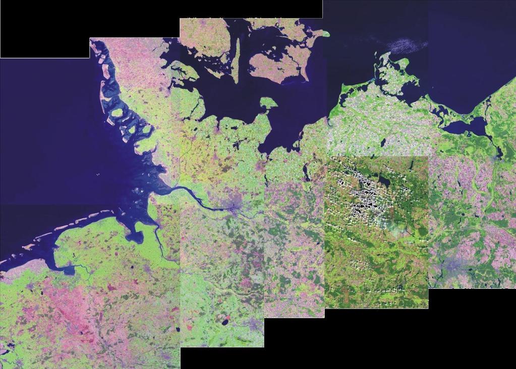
11 RS at Different Geographic Scales global Global coverage requires mosaicking of images acquired in one orbital cycle (Campbell. Introduction to Remote


12 Why is Remote Sensing Important? (Jensen )


13 Different Sensors for Different Scales (Hurrican Fran 1996, image source: NASA) (Glaser, A Satellite Imagery. Princeton )

14 Why is Remote Sensing Important?


15 Land Use and its Change Deep water Shallow water Wetland Vegetation Agriculture Sand dunes Deep water Shallow water Wetland Vegetation Agriculture Sand dunes

16 Change Detection & Hazard Management


17 Why is Remote Sensing Important?

 Near-infrared (700")
18 Radiation Beyond our Visual Perception Natural color ( nm) Near-infrared ( nm)


19 Why Differ Satellite Images from Photographs? Landsat TM 5 images of central China: true colour image using TM bands 3,2 and 1 Landsat TM 5 image of central China: false colour image using TM bands 4,3 and 2 RS sensors can collect electromagnetic radiation which humans cannot see
![The Electromagnetic Spectrum Q h hc Q = Radiation intensity [J] h](/docs-images/77/75219178/images/20-2.jpg "= Planck constant 6.")
![626 * 10-34 [Js] v = frequency [s -1 ] = wavelength [µm]](/docs-images/77/75219178/images/20-3.jpg "(Modified from Albertz. (Modified 2007. from Albertz. Remote sensing.")
20 The Electromagnetic Spectrum Q h hc Q = Radiation intensity [J] h = Planck constant * [Js] v = frequency [s -1 ] = wavelength [µm] (Modified from Albertz. (Modified from Albertz. Remote sensing. Einführung Springer) in die Fernerkundung. 2000)

21 Textbook Spectral Reflectances Reflectance = The part of incoming radiation reflected by the Earth s surface [%] = MIR Reflectance depends on wavelength!!!! (RSACL 2000)
![Reflectance [%] Spectral Bands 1 2 3 4 5 7 dry soil vegetation water Wavelength [µm] The above sensor provides six bands in the solar domain All bands obtained at](/docs-images/77/75219178/images/22-3.jpg "same time and at exact same location All pixel have same spatial resolution (at least with most sensors) Spectral resolution (how many bands covering which")
22 Reflectance [%] Spectral Bands dry soil vegetation water Wavelength [µm] The above sensor provides six bands in the solar domain All bands obtained at same time and at exact same location All pixel have same spatial resolution (at least with most sensors) Spectral resolution (how many bands covering which wavelengths)


23 Spectral Bands If a single band is displayed on the monitor it appears in grey values Bright pixel represent areas where a lot of radiation is being reflected in that particular band Band 1 Band 7 Band 2 Band 3 Band 4 Band 5
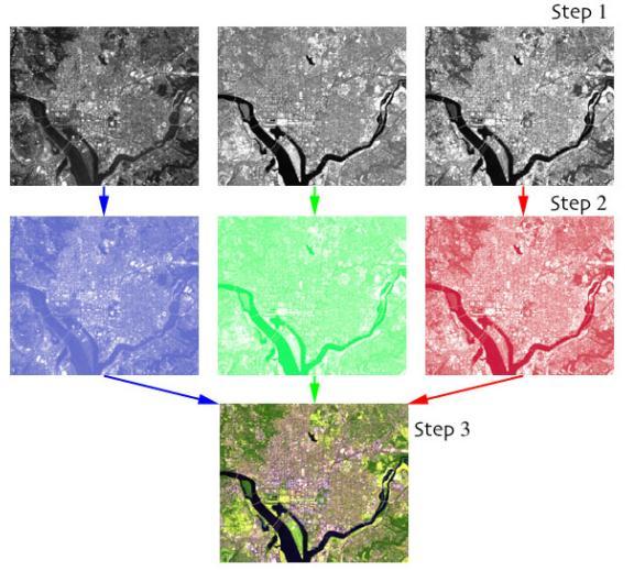
24 Colour Composites


25 Field Instrument AVIS CHRIS Landsat TM Spectral vs. Spatial Resolution m 17 m 2m ASD 0.2 m

26 Applications (modified from Oppelt et al Fundamentals of remote sensing. NASA handbook of remote sensing. Taylor & Francis)


27 Remote Sensing for Water Resource Management


28 RS Products: Precipitation (FAO Sahel weather and crop situation report. GIEWIS Sahel Report 4.)


29 RS Products: Land Use / Land Cover (Oppelt et al Întegration of land use data into the SWAT model. ESA SP 707) (Murawski Sustainable development in the peri-urban regions of Chennai. Study project.)
![Precipitation April 29-30 [mm] RS Products: Soil Moisture](/docs-images/77/75219178/images/30-4.jpg "Bremen Soltau April 30 Lüchow May 1st Difference 3 Diepholz")


30 Precipitation April [mm] RS Products: Soil Moisture Bremen Soltau April 30 Lüchow May 1st Difference 3 Diepholz Celle Gardelegen Hannover Osnabrück Braunschweig Hildesheim Salzgitter 0 Bad Salzuflen Brocken < >50 Soil Moisture from ERS [Vol %] dry wet > >5 Difference [Vol %] (Oppelt et al. 1998; Schneider & Oppelt 1998)


31 RS Products: Soil Moisture SMOS soil moisture map covering the period 8-15 June 2010 (resolution 50km)


32 RS Products: Vegetation Indices (Atzberger et al Phenological Metrics Derived over the European Continent from NDVI3g Data and MODIS Time Series. Remote Sensing 6(1): )

33 RS Products: Water Quality (Zhang et al A spectral decomposiiton algorithm for estimating chl-a concentrations in Lake Taih, China. Remote Sensing 6(6): )


34 RS Products: Water Quality (Photographs: M. Liekefett)

 (Doernhoefer et al. 2015.")
35 RS Products: Water Quality (Liekefett Verwendung von Landsat 8 OLI Daten zur Modellierung von Wasserinhaltsstoffen im Kummerower See. Master thesis) (Doernhoefer et al Mapping fresh water macrophytes and shallow water bathymetry. ESA Water Mapping Workshop.)
36 Some Global RS Services Parameter Soil moisture Evapotranspiration Land surface temperature Precipitation Snow cover Product ASCAT soil moisture product ET MODIS ET product MODIS land surface temperature (LST) MSG-LST Accumulated precipitation at ground MSG snow cover (SC) MODIS snow cover Spatial resolution 1/12,5/25/50 km 5.6 km 1,0 /5,0 km ,0/5,0 km km 30 km 5.6 km 0,5/ 1 / 5 km 0.05 Spatial coverage 25 N - 75 N, 25 W - 45 E -40 N - 40 N, 26 E - 78 E global Temporal resolution 36 hours Accuracy not yet available 30 min 20 % 1 day not yet available Distributer EUMETSAT H-SAF EUMETSAT H-SAF NASA global 1 day 1 K NASA -81 N 81 N, 79 W 79 E 25 N - 75 N, 25 W - 45 E -40 N -40 N, 26 E - 78 E global 15 min 2 K 3 hours 40 % 1 day 1 day falsche Zuordnung < 3 % 93 % for the 5.5 km Product EUMETSAT H-SAF EUMETSAT H-SAF EUMETSAT H-SAF NASA


37 Conclusion
Learning Objectives. Thermal Remote Sensing. Thermal = Emitted Infrared
 November 2014 lava flow on Kilauea (USGS Volcano Observatory) (http://hvo.wr.usgs.gov) Landsat-based thermal change of Nisyros Island (volcanic) Thermal Remote Sensing Distinguishing materials on the ground
Spectral reflectance: When the solar radiation is incident upon the earth s surface, it is either
 Spectral reflectance: When the solar radiation is incident upon the earth s surface, it is either reflected by the surface, transmitted into the surface or absorbed and emitted by the surface. Remote sensing
Overview of Remote Sensing in Natural Resources Mapping
 Overview of Remote Sensing in Natural Resources Mapping What is remote sensing? Why remote sensing? Examples of remote sensing in natural resources mapping Class goals What is Remote Sensing A remote sensing
Land Surface Temperature Measurements From the Split Window Channels of the NOAA 7 Advanced Very High Resolution Radiometer John C.
 Land Surface Temperature Measurements From the Split Window Channels of the NOAA 7 Advanced Very High Resolution Radiometer John C. Price Published in the Journal of Geophysical Research, 1984 Presented
ASSESSMENT OF DIFFERENT WATER STRESS INDICATORS BASED ON EUMETSAT LSA SAF PRODUCTS FOR DROUGHT MONITORING IN EUROPE
 ASSESSMENT OF DIFFERENT WATER STRESS INDICATORS BASED ON EUMETSAT LSA SAF PRODUCTS FOR DROUGHT MONITORING IN EUROPE G. Sepulcre Canto, A. Singleton, J. Vogt European Commission, DG Joint Research Centre,
REMOTE SENSING KEY!!
 REMOTE SENSING KEY!! This is a really ugly cover page I m sorry. Name Key. Score / 100 Directions: You have 50 minutes to take this test. You may use a cheatsheet (2 pages), a non-graphing calculator,
Estimation of Wavelet Based Spatially Enhanced Evapotranspiration Using Energy Balance Approach
 Estimation of Wavelet Based Spatially Enhanced Evapotranspiration Using Energy Balance Approach Dr.Gowri 1 Dr.Thirumalaivasan 2 1 Associate Professor, Jerusalem College of Engineering, Department of Civil
GEOG Lecture 8. Orbits, scale and trade-offs
 Environmental Remote Sensing GEOG 2021 Lecture 8 Orbits, scale and trade-offs Orbits revisit Orbits geostationary (36 000 km altitude) polar orbiting (200-1000 km altitude) Orbits revisit Orbits geostationary
Physical Basics of Remote-Sensing with Satellites
 - Physical Basics of Remote-Sensing with Satellites Dr. K. Dieter Klaes EUMETSAT Meteorological Division Am Kavalleriesand 31 D-64295 Darmstadt dieter.klaes@eumetsat.int Slide: 1 EUM/MET/VWG/09/0162 MET/DK
ESM 186 Environmental Remote Sensing and ESM 186 Lab Syllabus Winter 2012
 ESM 186 Environmental Remote Sensing and ESM 186 Lab Syllabus Winter 2012 Instructor: Susan Ustin (slustin@ucdavis.edu) Phone: 752-0621 Office: 233 Veihmeyer Hall and 115A, the Barn Office Hours: Tuesday
ECMWF. ECMWF Land Surface Analysis: Current status and developments. P. de Rosnay M. Drusch, K. Scipal, D. Vasiljevic G. Balsamo, J.
 Land Surface Analysis: Current status and developments P. de Rosnay M. Drusch, K. Scipal, D. Vasiljevic G. Balsamo, J. Muñoz Sabater 2 nd Workshop on Remote Sensing and Modeling of Surface Properties,
Surface temperature what does this data tell us about micro-meteorological processes?
 Surface temperature what does this data tell us about micro-meteorological processes? Prof. Dr. Eberhard Parlow Meteorology, Climatology and Remote Sensing (MCR Lab) Department of Environmental Sciences
Lecture 2: principles of electromagnetic radiation
 Remote sensing for agricultural applications: principles and methods Lecture 2: principles of electromagnetic radiation Instructed by Prof. Tao Cheng Nanjing Agricultural University March Crop 11, Circles
Fundamentals of Remote Sensing
 Division of Spatial Information Science Graduate School Life and Environment Sciences University of Tsukuba Fundamentals of Remote Sensing Prof. Dr. Yuji Murayama Surantha Dassanayake 10/6/2010 1 Fundamentals
History & Scope of Remote Sensing FOUNDATIONS
 History & Scope of Remote Sensing FOUNDATIONS Lecture Overview Introduction Overview of visual information Power of imagery Definition What is remote sensing? Definition standard for class History of Remote
PRINCIPLES OF REMOTE SENSING. Electromagnetic Energy and Spectral Signatures
 PRINCIPLES OF REMOTE SENSING Electromagnetic Energy and Spectral Signatures Remote sensing is the science and art of acquiring and analyzing information about objects or phenomena from a distance. As humans,
Lecture 4: Radiation Transfer
 Lecture 4: Radiation Transfer Spectrum of radiation Stefan-Boltzmann law Selective absorption and emission Reflection and scattering Remote sensing Importance of Radiation Transfer Virtually all the exchange
Lectures 7 and 8: 14, 16 Oct Sea Surface Temperature
 Lectures 7 and 8: 14, 16 Oct 2008 Sea Surface Temperature References: Martin, S., 2004, An Introduction to Ocean Remote Sensing, Cambridge University Press, 454 pp. Chapter 7. Robinson, I. S., 2004, Measuring
Joint International Surface Working Group and Satellite Applications Facility on Land Surface Analysis Workshop, IPMA, Lisboa, June 2018
 Joint International Surface Working Group and Satellite Applications Facility on Land Surface Analysis Workshop, IPMA, Lisboa, 26-28 June 2018 Introduction Soil moisture Evapotranspiration Future plan
METRIC tm. Mapping Evapotranspiration at high Resolution with Internalized Calibration. Shifa Dinesh
 METRIC tm Mapping Evapotranspiration at high Resolution with Internalized Calibration Shifa Dinesh Outline Introduction Background of METRIC tm Surface Energy Balance Image Processing Estimation of Energy
Remote Sensing Based Inversion of Gap Fraction for Determination of Leaf Area Index. Alemu Gonsamo 1 and Petri Pellikka 1
 Remote Sensing Based Inversion of Gap Fraction for Determination of Leaf Area Index Alemu Gonsamo and Petri Pellikka Department of Geography, University of Helsinki, P.O. Box, FIN- Helsinki, Finland; +-()--;
Assimilation of land surface satellite data for Numerical Weather Prediction at ECMWF
 4 th workshop on Remote Sensing and Modelling of Surface properties Saint Martin d Hères, 14-16 March 2016 Assimilation of land surface satellite data for Numerical Weather Prediction at ECMWF P. de Rosnay,
Soil Moisture Prediction and Assimilation
 Soil Moisture Prediction and Assimilation Analysis and Prediction in Agricultural Landscapes Saskatoon, June 19-20, 2007 STEPHANE BELAIR Meteorological Research Division Prediction and Assimilation Atmospheric
Many of remote sensing techniques are generic in nature and may be applied to a variety of vegetated landscapes, including
 Remote Sensing of Vegetation Many of remote sensing techniques are generic in nature and may be applied to a variety of vegetated landscapes, including 1. Agriculture 2. Forest 3. Rangeland 4. Wetland,
Torben Königk Rossby Centre/ SMHI
 Fundamentals of Climate Modelling Torben Königk Rossby Centre/ SMHI Outline Introduction Why do we need models? Basic processes Radiation Atmospheric/Oceanic circulation Model basics Resolution Parameterizations
Evaluation of remotely sensed and modelled soil moisture products using global ground-based in situ observations
 Evaluation of remotely sensed and modelled soil moisture products using global ground-based in situ observations C. Albergel (1), P. de Rosnay (1), G. Balsamo (1),J. Muñoz-Sabater(1 ), C. Gruhier (2),
REMOTE SENSING TEST!!
 REMOTE SENSING TEST!! This is a really ugly cover page I m sorry. Name. Score / 100 Directions: (idk if I need to put this???) You have 50 minutes to take this test. You may use a cheatsheet (2 pages),
- satellite orbits. Further Reading: Chapter 04 of the text book. Outline. - satellite sensor measurements
 (1 of 12) Further Reading: Chapter 04 of the text book Outline - satellite orbits - satellite sensor measurements - remote sensing of land, atmosphere and oceans (2 of 12) Introduction Remote Sensing:
GIS ASTER ASTER. * GIS
 Vol. 6, No. 4, Winter 2015 Iranian Remote Sensing & - * ph. * Email: zohre_ebrahimi@hotmail.com . Tasseled cap ETM+ 2. Advanced Space borne Thermal Emission and Reflection Radiometer 3. Gutierrez and Johnsin
Thermal Infrared (TIR) Remote Sensing: Challenges in Hot Spot Detection
 Remote Sensing: Challenges in Hot Spot Detection") Thermal Infrared (TIR) Remote Sensing: Challenges in Hot Spot Detection ASF Seminar Series Anupma Prakash Day : Tuesday Date : March 9, 2004 Time : 2.00 pm to 2.30 pm Place : GI Auditorium Geophysical
Thermal Infrared (TIR) Remote Sensing: Challenges in Hot Spot Detection ASF Seminar Series Anupma Prakash Day : Tuesday Date : March 9, 2004 Time : 2.00 pm to 2.30 pm Place : GI Auditorium Geophysical
Lecture 19: Operational Remote Sensing in Visible, IR, and Microwave Channels
 MET 4994 Remote Sensing: Radar and Satellite Meteorology MET 5994 Remote Sensing in Meteorology Lecture 19: Operational Remote Sensing in Visible, IR, and Microwave Channels Before you use data from any
ECMWF. ECMWF Land Surface modelling and land surface analysis. P. de Rosnay G. Balsamo S. Boussetta, J. Munoz Sabater D.
 Land Surface modelling and land surface analysis P. de Rosnay G. Balsamo S. Boussetta, J. Munoz Sabater D. Vasiljevic M. Drusch, K. Scipal SRNWP 12 June 2009 Slide 1 Surface modelling (G. Balsamo) HTESSEL,
International Journal of Intellectual Advancements and Research in Engineering Computations
 ISSN:2348-2079 Volume-5 Issue-2 International Journal of Intellectual Advancements and Research in Engineering Computations Agricultural land investigation and change detection in Coimbatore district by
Flux Tower Data Quality Analysis in the North American Monsoon Region
 Flux Tower Data Quality Analysis in the North American Monsoon Region 1. Motivation The area of focus in this study is mainly Arizona, due to data richness and availability. Monsoon rains in Arizona usually
INTRODUCTION TO MICROWAVE REMOTE SENSING - II. Dr. A. Bhattacharya
 1 INTRODUCTION TO MICROWAVE REMOTE SENSING - II Dr. A. Bhattacharya The Radiation Framework The information about features on the Earth s surface using RS depends on measuring energy emanating from the
An Algorithm for Retrieving Land Surface Temperatures Using VIIRS Data in Combination with Multi-Sensors
 Sensors 2014, 14, 21385-21408; doi:10.3390/s141121385 Article OPEN ACCESS sensors ISSN 1424-8220 www.mdpi.com/journal/sensors An Algorithm for Retrieving Land Surface Temperatures Using VIIRS Data in Combination
Defining microclimates on Long Island using interannual surface temperature records from satellite imagery
 Defining microclimates on Long Island using interannual surface temperature records from satellite imagery Deanne Rogers*, Katherine Schwarting, and Gilbert Hanson Dept. of Geosciences, Stony Brook University,
Comparison between Land Surface Temperature Retrieval Using Classification Based Emissivity and NDVI Based Emissivity
 Comparison between Land Surface Temperature Retrieval Using Classification Based Emissivity and NDVI Based Emissivity Isabel C. Perez Hoyos NOAA Crest, City College of New York, CUNY, 160 Convent Avenue,
Land Surface Remote Sensing II
 PROCEEDINGS OFSPIE Land Surface Remote Sensing II Thomas J. Jackson Jing Ming Chen Peng Gong Shunlin Liang Editors 13-16 October 2014 Beijing, China Sponsored by SPIE Cosponsored by State Key Laboratory
Satellite-based Lake Surface Temperature (LST) Homa Kheyrollah Pour Claude Duguay
 Homa Kheyrollah Pour Claude Duguay") Satellite-based Lake Surface Temperature (LST) Homa Kheyrollah Pour Claude Duguay Lakes in NWP models Interaction of the atmosphere and underlying layer is the most important issue in climate modeling
Satellite-based Lake Surface Temperature (LST) Homa Kheyrollah Pour Claude Duguay Lakes in NWP models Interaction of the atmosphere and underlying layer is the most important issue in climate modeling
Evapotranspiration monitoring with Meteosat Second Generation satellites: method, products and utility in drought detection.
 Evapotranspiration monitoring with Meteosat Second Generation satellites: method, products and utility in drought detection. Nicolas Ghilain Royal Meteorological Institute Belgium EUMeTrain Event week
Lake parameters climatology for cold start runs (lake initialization) in the ECMWF forecast system
 in the ECMWF forecast system") 2nd Workshop on Parameterization of Lakes in Numerical Weather Prediction and Climate Modelling Lake parameters climatology for cold start runs (lake initialization) in the ECMWF forecast system R. Salgado(1),
2nd Workshop on Parameterization of Lakes in Numerical Weather Prediction and Climate Modelling Lake parameters climatology for cold start runs (lake initialization) in the ECMWF forecast system R. Salgado(1),
Monitoring daily evapotranspiration in the Alps exploiting Sentinel-2 and meteorological data
 Monitoring daily evapotranspiration in the Alps exploiting Sentinel-2 and meteorological data M. Castelli, S. Asam, A. Jacob, M. Zebisch, and C. Notarnicola Institute for Earth Observation, Eurac Research,
Modeling of Environmental Systems
 Modeling of Environmental Systems While the modeling of predator-prey dynamics is certainly simulating an environmental system, there is more to the environment than just organisms Recall our definition
Remote Sensing I: Basics
 Remote Sensing I: Basics Kelly M. Brunt Earth System Science Interdisciplinary Center, University of Maryland Cryospheric Science Laboratory, Goddard Space Flight Center kelly.m.brunt@nasa.gov (Based on
MASSACHUSETTS INSTITUTE OF TECHNOLOGY Department of Physics Problem Solving 10: The Greenhouse Effect. Section Table and Group
 MASSACHUSETTS INSTITUTE OF TECHNOLOGY Department of Physics 8.02 Problem Solving 10: The Greenhouse Effect Section Table and Group Names Hand in one copy per group at the end of the Friday Problem Solving
Lecture 2 Global and Zonal-mean Energy Balance
 Lecture 2 Global and Zonal-mean Energy Balance A zero-dimensional view of the planet s energy balance RADIATIVE BALANCE Roughly 70% of the radiation received from the Sun at the top of Earth s atmosphere
Assimilation of ASCAT soil wetness
 EWGLAM, October 2010 Assimilation of ASCAT soil wetness Bruce Macpherson, on behalf of Imtiaz Dharssi, Keir Bovis and Clive Jones Contents This presentation covers the following areas ASCAT soil wetness
Moore County Schools. High School Level
 Moore County Schools High School Level EARTH AND ENVIRONMENTAL SCIENCE Science, by nature, is an inquiry-based discipline whereby students gain knowledge through observation and experimentation. Scientific
SNOW COVER MAPPING USING METOP/AVHRR AND MSG/SEVIRI
 SNOW COVER MAPPING USING METOP/AVHRR AND MSG/SEVIRI Niilo Siljamo, Markku Suomalainen, Otto Hyvärinen Finnish Meteorological Institute, P.O.Box 503, FI-00101 Helsinki, Finland Abstract Weather and meteorological
European Space Agency
 Guidelines - Guidelines how/when to interact during the WebEx session: - Due to the number of attendees, please keep always your webcam and microphone switched-off - You can use anytime the chat to all
Advanced Image Analysis in Disaster Response
 Advanced Image Analysis in Disaster Response Creating Geographic Knowledge Thomas Harris ITT The information contained in this document pertains to software products and services that are subject to the
Atmospheric correction in presence of sun glint: the POLYMER Algorithm
 Atmospheric correction in presence of sun glint: the POLYMER Algorithm Dominique Jolivet François Steinmetz Pierre-Yves Deschamps Jan 17, 2011 Atelier National Couleur de l'eau - GIS COOC c 2011 Atmospheric
Drought Estimation Maps by Means of Multidate Landsat Fused Images
 Remote Sensing for Science, Education, Rainer Reuter (Editor) and Natural and Cultural Heritage EARSeL, 2010 Drought Estimation Maps by Means of Multidate Landsat Fused Images Diego RENZA, Estíbaliz MARTINEZ,
Development of the Canadian Precipitation Analysis (CaPA) and the Canadian Land Data Assimilation System (CaLDAS)
 and the Canadian Land Data Assimilation System (CaLDAS)") Development of the Canadian Precipitation Analysis (CaPA) and the Canadian Land Data Assimilation System (CaLDAS) Marco L. Carrera, Vincent Fortin and Stéphane Bélair Meteorological Research Division Environment
Development of the Canadian Precipitation Analysis (CaPA) and the Canadian Land Data Assimilation System (CaLDAS) Marco L. Carrera, Vincent Fortin and Stéphane Bélair Meteorological Research Division Environment
A 2016 CEOS Chair Initiative. Non-meteorological Applications for Next Generation Geostationary Satellites
 A 2016 CEOS Chair Initiative Committee on Earth Observation Satellites Non-meteorological Applications for Next Generation Geostationary Satellites Co-chaired by EUMETSAT (Holmlund), CSIRO (Schroeder),
Climate Roles of Land Surface
 Lecture 5: Land Surface and Cryosphere (Outline) Climate Roles Surface Energy Balance Surface Water Balance Sea Ice Land Ice (from Our Changing Planet) Surface Albedo Climate Roles of Land Surface greenhouse
SUPPORTING INFORMATION. Ecological restoration and its effects on the
 SUPPORTING INFORMATION Ecological restoration and its effects on the regional climate: the case in the source region of the Yellow River, China Zhouyuan Li, Xuehua Liu,* Tianlin Niu, De Kejia, Qingping
Amita Mehta and Ana Prados
 Building Capacity in Utilizing NASA Remote Sensing Observations in SWAT for Water Resources and Agricultural Management Applications Amita Mehta and Ana Prados NASA - University of Maryland Baltimore County
Principles of Radiative Transfer Principles of Remote Sensing. Marianne König EUMETSAT
 - Principles of Radiative Transfer Principles of Remote Sensing Marianne König EUMETSAT marianne.koenig@eumetsat.int Remote Sensing All measurement processes which perform observations/measurements of
Emissivity and Remote Sensing
 Emissivity and Remote Sensing Introduction: In the last laboratory with reflectivity we touched on the subject of emissivity. In comparison to reflectivity, emissivity is actually a bit more complex from
Assessing Drought in Agricultural Area of central U.S. with the MODIS sensor
 Assessing Drought in Agricultural Area of central U.S. with the MODIS sensor Di Wu George Mason University Oct 17 th, 2012 Introduction: Drought is one of the major natural hazards which has devastating
«Action Thématique Incitative sur Programme» CNRS/INSU
 Development and validation of a regional model of desert dust for the study of seasonal and interannual variations over Sahara and Sahel coupling with satellite observations «Action Thématique Incitative
Assimilation of satellite derived soil moisture for weather forecasting
 Assimilation of satellite derived soil moisture for weather forecasting www.cawcr.gov.au Imtiaz Dharssi and Peter Steinle February 2011 SMOS/SMAP workshop, Monash University Summary In preparation of the
Solar Radiation and Environmental Biophysics Geo 827, MSU Jiquan Chen Oct. 6, 2015
 Solar Radiation and Environmental Biophysics Geo 827, MSU Jiquan Chen Oct. 6, 2015 1) Solar radiation basics 2) Energy balance 3) Other relevant biophysics 4) A few selected applications of RS in ecosystem
UNIT I EMR AND ITS INTERACTION WITH ATMOSPHERE & EARTH MATERIAL
 Date deliverance : UNIT I EMR AND ITS INTERACTION WITH ATMOSPHERE & EARTH MATERIAL Definition remote sensing and its components Electromagnetic spectrum wavelength regions important to remote sensing Wave
Ajoke Onojeghuo & Alex Onojeghuo (Nigeria)
") Mapping and Predicting Urban Sprawl Using Remote Sensing and Geographic Information System Techniques: A Case Study of Eti-Osa Local Government Area, Lagos, Nigeria Ajoke Onojeghuo & Alex Onojeghuo (Nigeria)
Mapping and Predicting Urban Sprawl Using Remote Sensing and Geographic Information System Techniques: A Case Study of Eti-Osa Local Government Area, Lagos, Nigeria Ajoke Onojeghuo & Alex Onojeghuo (Nigeria)
Remote Sensing C. Rank: Points: Science Olympiad North Regional Tournament at the University of Florida. Name(s): Team Name: School Name:
: Team Name: School Name:") Remote Sensing C Science Olympiad North Regional Tournament at the University of Florida Rank: Points: Name(s): Team Name: School Name: Team Number: Instructions: DO NOT BEGIN UNTIL GIVEN PERMISSION. DO
Remote Sensing C Science Olympiad North Regional Tournament at the University of Florida Rank: Points: Name(s): Team Name: School Name: Team Number: Instructions: DO NOT BEGIN UNTIL GIVEN PERMISSION. DO
THE LAND-SAF SURFACE ALBEDO AND DOWNWELLING SHORTWAVE RADIATION FLUX PRODUCTS
 THE LAND-SAF SURFACE ALBEDO AND DOWNWELLING SHORTWAVE RADIATION FLUX PRODUCTS Bernhard Geiger, Dulce Lajas, Laurent Franchistéguy, Dominique Carrer, Jean-Louis Roujean, Siham Lanjeri, and Catherine Meurey
Meteorological Satellite Image Interpretations, Part III. Acknowledgement: Dr. S. Kidder at Colorado State Univ.
 Meteorological Satellite Image Interpretations, Part III Acknowledgement: Dr. S. Kidder at Colorado State Univ. Dates EAS417 Topics Jan 30 Introduction & Matlab tutorial Feb 1 Satellite orbits & navigation
EVR 6268 Remote Sensing in Hydrology Department of Earth and Environment. Spring 2013
 EVR 6268 Remote Sensing in Hydrology Department of Earth and Environment Spring 2013 Location: GL 274 Time: MW 11:00AM - 12:15 PM Instructor: Assefa M. Melesse Office: ECS 339 Tel. (305) 348-6518 E-mail:
Research Article A Quantitative Assessment of Surface Urban Heat Islands Using Satellite Multitemporal Data over Abeokuta, Nigeria
 International Atmospheric Sciences Volume 2016, Article ID 3170789, 6 pages http://dx.doi.org/10.1155/2016/3170789 Research Article A Quantitative Assessment of Surface Urban Heat Islands Using Satellite
Once a specific data set is selected, NEO will list related data sets in the panel titled Matching Datasets, which is to the right of the image.
 NASA Earth Observations (NEO): A Brief Introduction NEO is a data visualization tool that allows users to explore a wealth of environmental data collected by NASA satellites. The satellites use an array
Lecture 4b: Meteorological Satellites and Instruments. Acknowledgement: Dr. S. Kidder at Colorado State Univ.
 Lecture 4b: Meteorological Satellites and Instruments Acknowledgement: Dr. S. Kidder at Colorado State Univ. US Geostationary satellites - GOES (Geostationary Operational Environmental Satellites) US
Basic cloud Interpretation using Satellite Imagery
 Basic cloud Interpretation using Satellite Imagery Introduction Recall that images from weather satellites are actually measurements of energy from specified bands within the Electromagnetic (EM) spectrum.
The Delaware Environmental Monitoring & Analysis Center
 The Delaware Environmental Monitoring & Analysis Center Tina Callahan Delaware Estuary Science & Environmental Summit 2013 January 27-30, 2013 What is DEMAC? Delaware Environmental Monitoring & Analysis
Permafrost: Earth Observation Applications: Introduction
 Polar Meeting 3 Permafrost: Earth Observation Applications: Introduction Mark Drinkwater CNES, Paris, 22 23 May, 2013 Remote Sensing of Permafrost which Remote Sensing products? applicability to Permafrost
LAND COVER CATEGORY DEFINITION BY IMAGE INVARIANTS FOR AUTOMATED CLASSIFICATION
 LAND COVER CATEGORY DEFINITION BY IMAGE INVARIANTS FOR AUTOMATED CLASSIFICATION Nguyen Dinh Duong Environmental Remote Sensing Laboratory Institute of Geography Hoang Quoc Viet Rd., Cau Giay, Hanoi, Vietnam
ASSESSMENT OF ALGORITHMS FOR LAND SURFACE ANALYSIS DOWN-WELLING LONG-WAVE RADIATION AT THE SURFACE
 ASSESSMENT OF ALGORITHMS FOR LAND SURFACE ANALYSIS DOWN-WELLING LONG-WAVE RADIATION AT THE SURFACE Isabel F. Trigo, Carla Barroso, Sandra C. Freitas, Pedro Viterbo Instituto de Meteorologia, Rua C- Aeroporto,
ECNU WORKSHOP LAB ONE 2011/05/25)
") ECNU WORKSHOP LAB ONE (Liam.Gumley@ssec.wisc.edu 2011/05/25) The objective of this laboratory exercise is to become familiar with the characteristics of MODIS Level 1B 1000 meter resolution data. After
ECNU WORKSHOP LAB ONE (Liam.Gumley@ssec.wisc.edu 2011/05/25) The objective of this laboratory exercise is to become familiar with the characteristics of MODIS Level 1B 1000 meter resolution data. After
Role of GIS and Remote Sensing to Environment Statistics
 United Nations Economic Commission for Africa Role of GIS and Remote Sensing to Environment Dozie Ezigbalike Data Management Coordinator A Definition Environment statistics are statistics that describe
Satellites, Weather and Climate Module 1: Introduction to the Electromagnetic Spectrum
 Satellites, Weather and Climate Module 1: Introduction to the Electromagnetic Spectrum What is remote sensing? = science & art of obtaining information through data analysis, such that the device is not
Summary Remote Sensing Seminar
 Summary Remote Sensing Seminar Lectures at CREST Paul Menzel NOAA/NESDIS/ORA March 2006 Satellite remote sensing of the Earth-atmosphere Observations depend on telescope characteristics (resolving power,
Greening of Arctic: Knowledge and Uncertainties
 Greening of Arctic: Knowledge and Uncertainties Jiong Jia, Hesong Wang Chinese Academy of Science jiong@tea.ac.cn Howie Epstein Skip Walker Moscow, January 28, 2008 Global Warming and Its Impact IMPACTS
Lesson 4b Remote Sensing and geospatial analysis to integrate observations over larger scales
 Lesson 4b Remote Sensing and geospatial analysis to integrate observations over larger scales We have discussed static sensors, human-based (participatory) sensing, and mobile sensing Remote sensing: Satellite
INTRODUCTION TO THERMAL REMOTE SENSING
 INTRODUCTION TO THERMAL REMOTE SENSING Professor Constantinos Cartalis Department of Environmental Physics Remote Sensing and Image Processing Research Unit National and Kapodistrian University of Athens
Interpretation of Polar-orbiting Satellite Observations. Atmospheric Instrumentation
 Interpretation of Polar-orbiting Satellite Observations Outline Polar-Orbiting Observations: Review of Polar-Orbiting Satellite Systems Overview of Currently Active Satellites / Sensors Overview of Sensor
Preparation of LULC map from GE images for GIS based Urban Hydrological Modeling
 International Conference on Modeling Tools for Sustainable Water Resources Management Department of Civil Engineering, Indian Institute of Technology Hyderabad: 28-29 December 2014 Abstract Preparation
LESSON THREE Time, Temperature, Chlorophyll a Does sea surface temperature affect chlorophyll a concentrations?
 STUDENT PAGES LESSON THREE A partnership between California Current Ecosystem Long Term Ecological Research (CCE LTER) and Ocean Institute (OI) Beth Simmons, Education and Outreach Coordinator, CCE LTER,
Graduate Courses Meteorology / Atmospheric Science UNC Charlotte
 Graduate Courses Meteorology / Atmospheric Science UNC Charlotte In order to inform prospective M.S. Earth Science students as to what graduate-level courses are offered across the broad disciplines of
Lecture 5: Greenhouse Effect
 Lecture 5: Greenhouse Effect S/4 * (1-A) T A 4 T S 4 T A 4 Wien s Law Shortwave and Longwave Radiation Selected Absorption Greenhouse Effect Global Energy Balance terrestrial radiation cooling Solar radiation
Vegetation Remote Sensing
 Vegetation Remote Sensing Huade Guan Prepared for Remote Sensing class Earth & Environmental Science University of Texas at San Antonio November 2, 2005 Outline Why do we study vegetation remote sensing?
Drought Monitoring with Hydrological Modelling
 st Joint EARS/JRC International Drought Workshop, Ljubljana,.-5. September 009 Drought Monitoring with Hydrological Modelling Stefan Niemeyer IES - Institute for Environment and Sustainability Ispra -
Principles of Satellite Remote Sensing
 Chapter 5 Principles of Satellite Remote Sensing Goal: Give a overview on the characteristics of satellite remote sensing. Satellites have several unique characteristics which make them particularly useful
Introduction to Satellite Derived Vegetation Indices
 Introduction to the Use of Geospatial Information Technology for Drought Risk Management 13-17 November, 2017 Tonle Bassac II Restaurant, Phnom Penh, Cambodia Introduction to Satellite Derived Vegetation
Field Emissivity Measurements during the ReSeDA Experiment
 Field Emissivity Measurements during the ReSeDA Experiment C. Coll, V. Caselles, E. Rubio, E. Valor and F. Sospedra Department of Thermodynamics, Faculty of Physics, University of Valencia, C/ Dr. Moliner
Comparison of NASA AIRS and MODIS Land Surface Temperature and Infrared Emissivity Measurements from the EOS AQUA platform
 Comparison of NASA AIRS and MODIS Land Surface Temperature and Infrared Emissivity Measurements from the EOS AQUA platform Robert Knuteson, Steve Ackerman, Hank Revercomb, Dave Tobin University of Wisconsin-Madison
Day Snow-Fog RGB Detection of low-level clouds and snow/ice covered area
 JMA Day Snow-Fog RGB Detection of low-level clouds and snow/ice covered area Meteorological Satellite Center, JMA What s Day Snow-Fog RGB? R : B04 (N1 0.86) Range : 0~100 [%] Gamma : 1.7 G : B05 (N2 1.6)
Monitoring Vegetation Growth of Spectrally Landsat Satellite Imagery ETM+ 7 & TM 5 for Western Region of Iraq by Using Remote Sensing Techniques.
 Monitoring Vegetation Growth of Spectrally Landsat Satellite Imagery ETM+ 7 & TM 5 for Western Region of Iraq by Using Remote Sensing Techniques. Fouad K. Mashee, Ahmed A. Zaeen & Gheidaa S. Hadi Remote
MSG/SEVIRI AND METOP/AVHRR SNOW EXTENT PRODUCTS IN H-SAF
 MSG/SEVIRI AND METOP/AVHRR SNOW EXTENT PRODUCTS IN H-SAF Niilo Siljamo, Otto Hyvärinen Finnish Meteorological Institute, Erik Palménin aukio 1, Helsinki, Finland Abstract Weather and meteorological processes