Great Lakes Tributary Modeling: Canaseraga Creek Watershed
|
|
|
- Maurice Potter
- 5 years ago
- Views:
Transcription


1 Great Lakes Tributary Modeling: Canaseraga Creek Watershed SWAT Model Authority: Section 516(e) of WRDA 1996 US Army Corps of Engineers


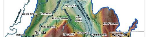
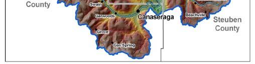
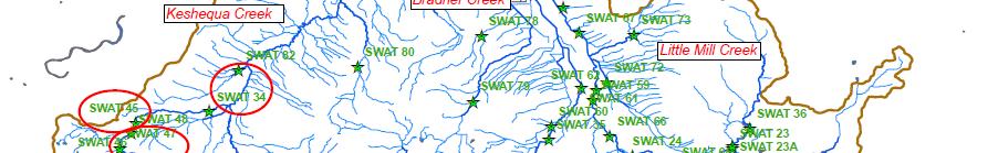
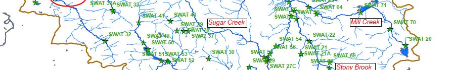
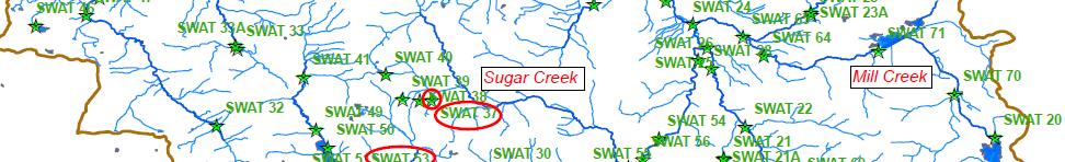
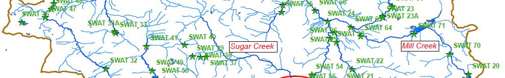
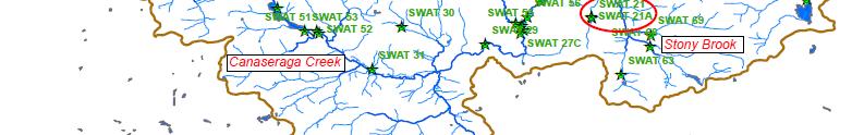
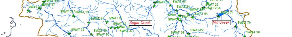
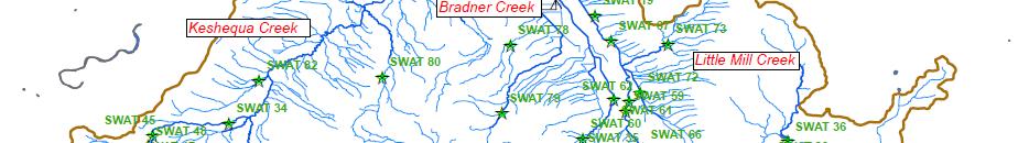
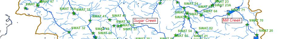
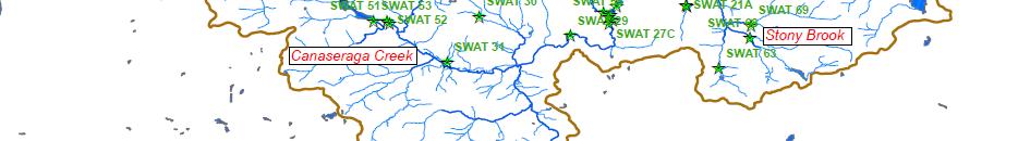
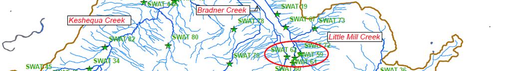
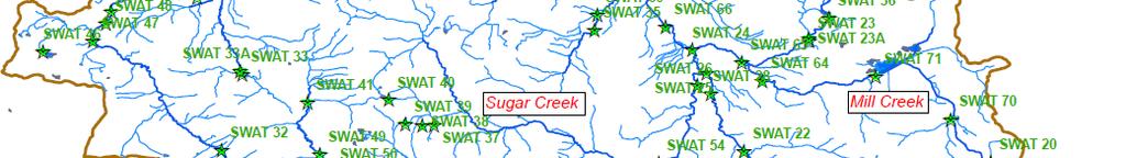
2 Canaseraga Creek Project Location - Encompasses portions of Livingston, Steuben, and Allegany Counties. USACE Mount Morris Dam - Drains into the Genesee River just downstream from the USACE Mount Morris Dam. - The Genesee River drains into Lake Ontario at the city of Rochester. - Is the largest sub-watershed of the Genesee River Watershed Basin. - Drainage area is approximately 340 square miles.
3 Canaseraga Creek Watershed Project - Project was initiated by Jeffery Parker at NRCS in Steuben County - Additional stakeholders that support the project are Robert Stryker at NRCS in Livingston County and Scott Torrey at Soil and Water Conservation District in Allegany County. - Ed Bugliosi, U.S. Geological Survey, has requested to be involved in the development of the study.
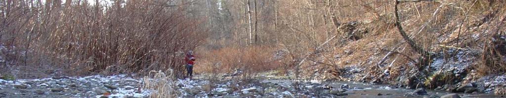
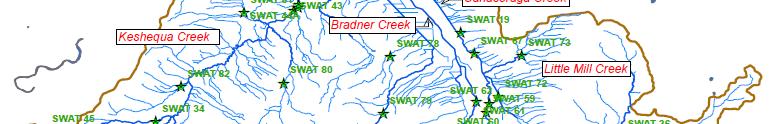
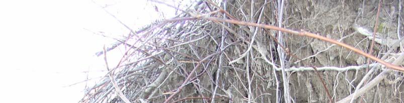
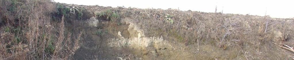
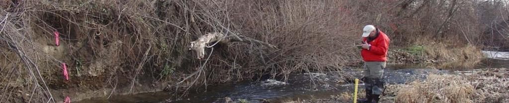
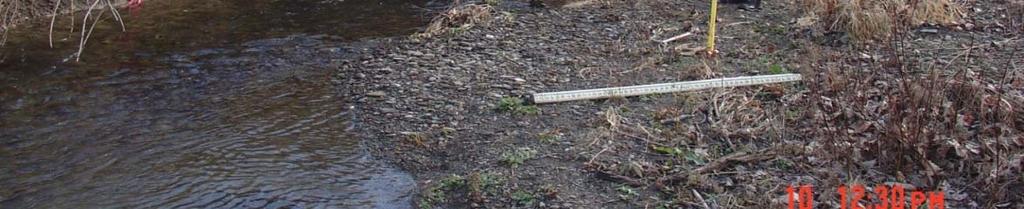
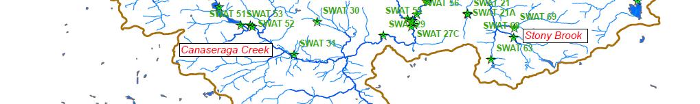
4 Field Reconnaissance (89 locations) To better understand the watershed, a field reconnaissance was undertaken. To date, 89 sites within the watershed have been visited and the channel characteristics documented.
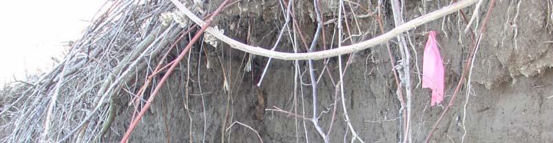
5 BEHI & NBS Locations (49 Total) Bank Pin Locations (15 Total) During the field reconnaissance Bank Pins were set at 15 locations and BEHI & NBS ratings were determined at 49 locations. The bank pins were installed to determine the rate of erosion over a period of time. The BEHI & NBS ratings and the bank rate of erosion will be used in the SWAT Model calibration.
 Level IV Ecoregions: - Glaciated Low")
 - Ontario Lowlands (6%) Soils: -")


6 Canaseraga Creek Watershed Ecoregions and Soils Three (3) Level IV Ecoregions: - Glaciated Low Allegheny Plateau (51%) - Finger Lakes Uplands and Gorges (43%) - Ontario Lowlands (6%) Soils: - Devonian shale - Thin limestone beds - Glacial till deposits of gravel, sand, clay, and silt - Alluvial sediments of sands, silts, and clays in various mixtures - Thick dense deposit of lacustrine blue clay
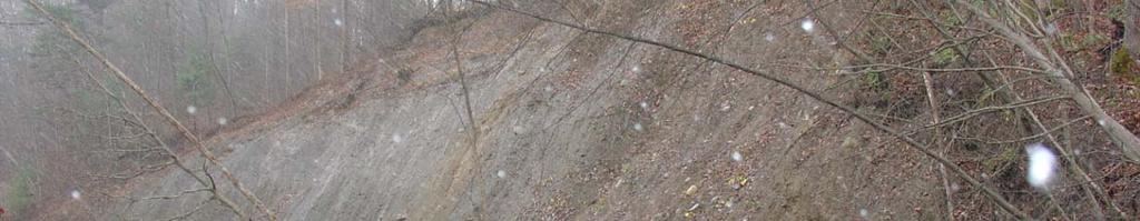
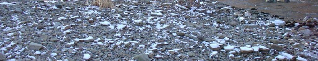
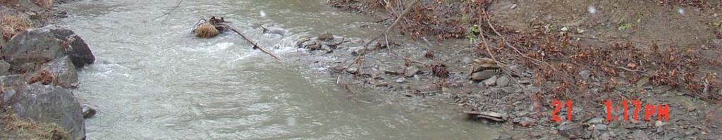
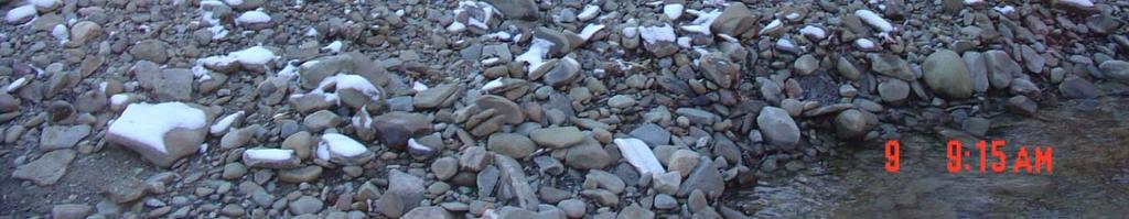
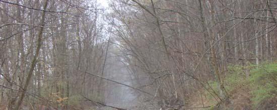
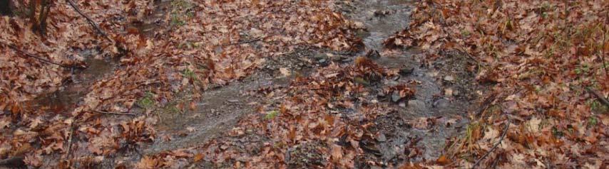
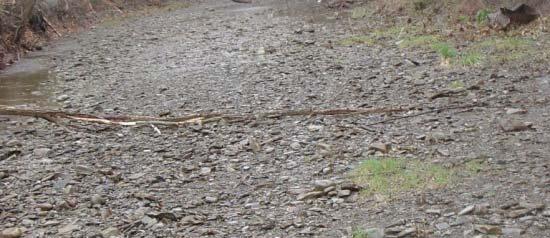
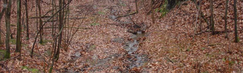
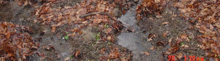
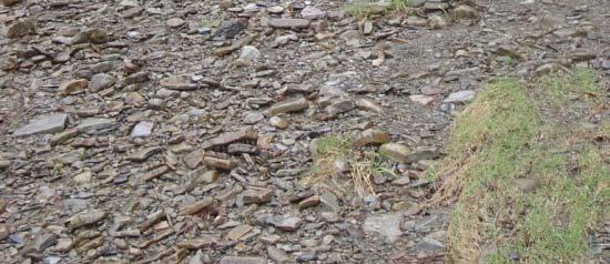
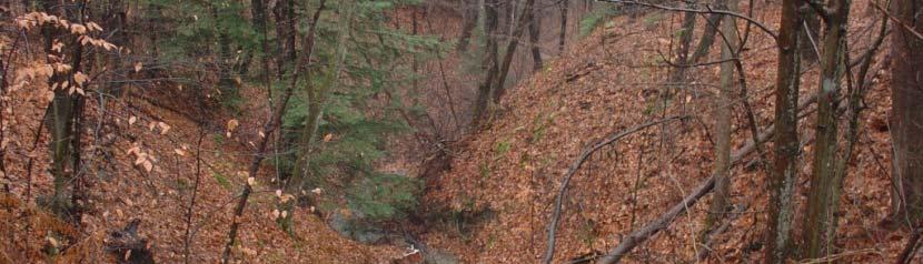
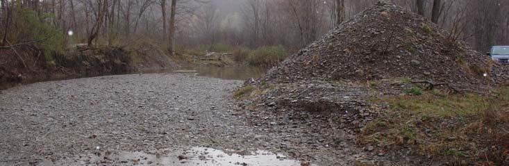
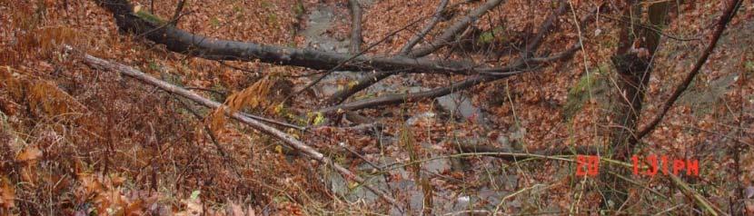
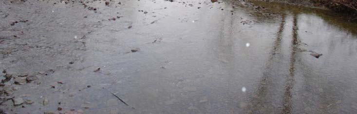
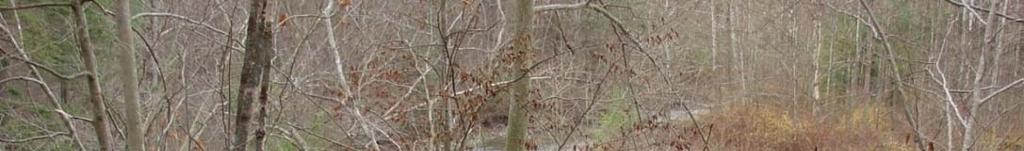
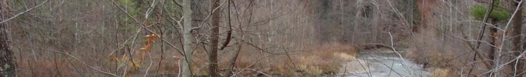
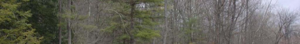
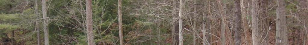
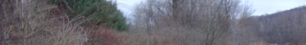
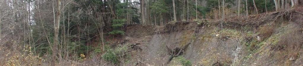
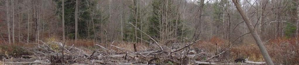
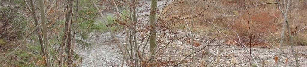
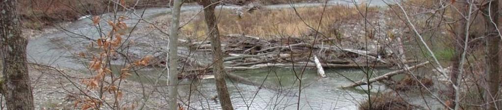
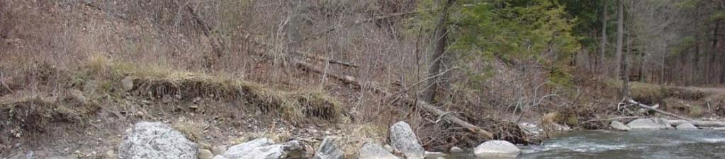
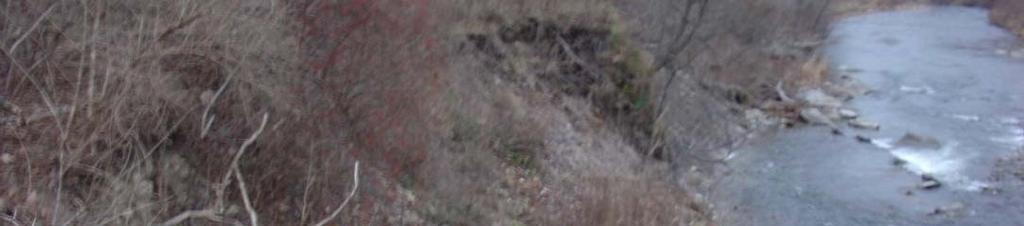
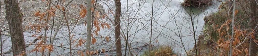
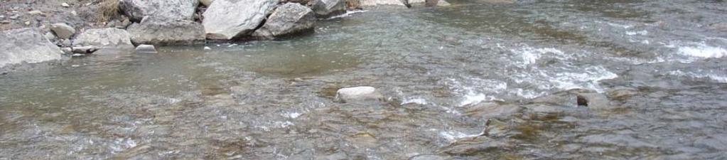
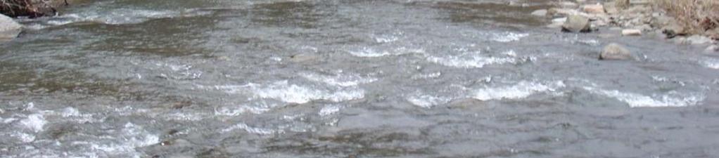
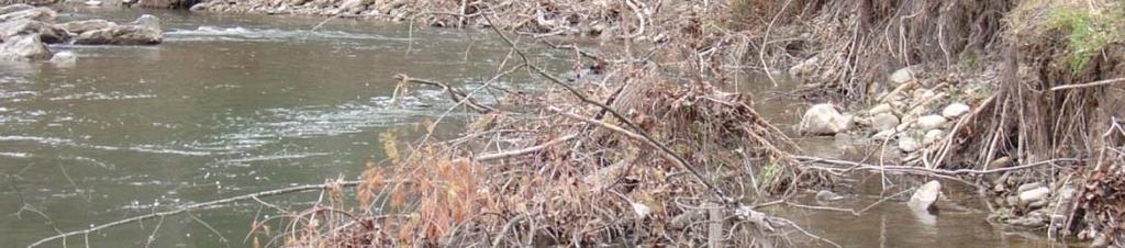
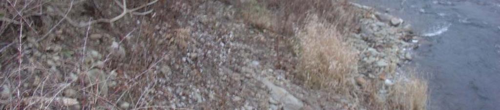
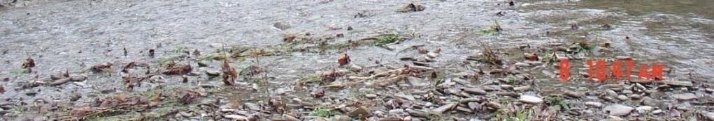
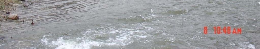
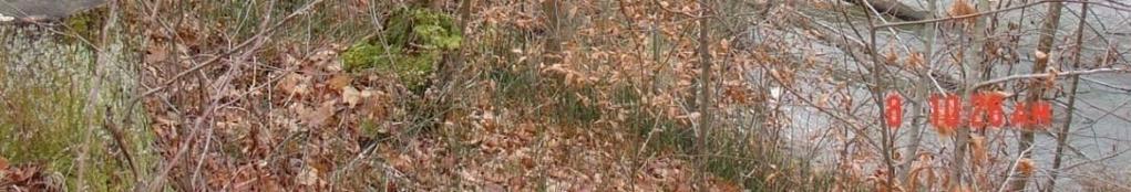
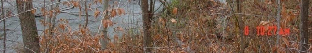
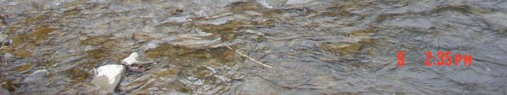
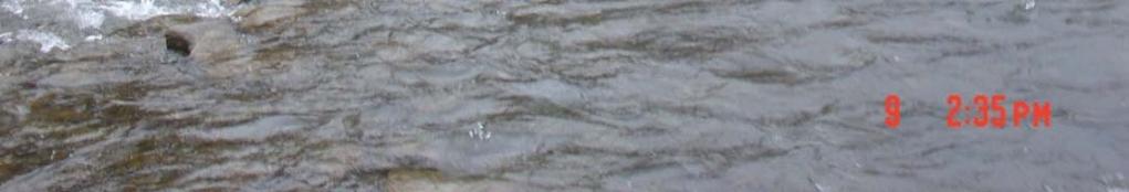
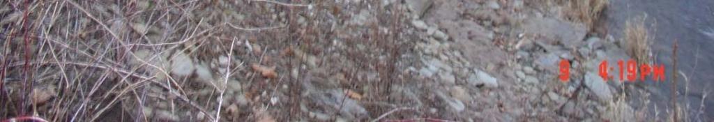
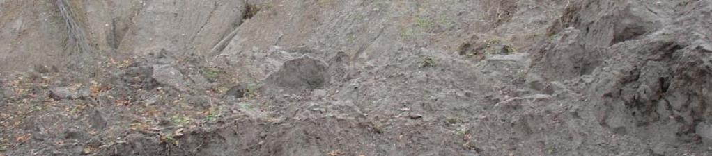
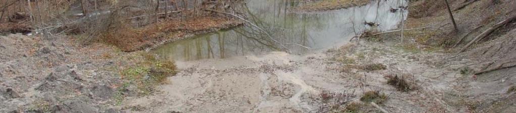
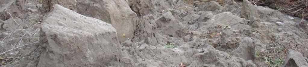
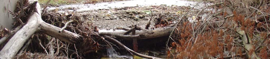
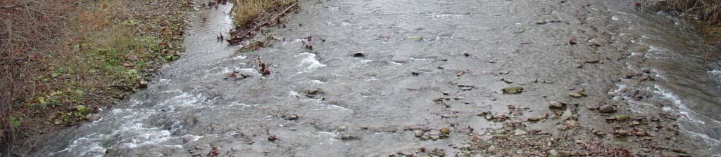
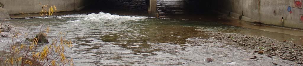
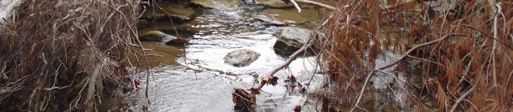
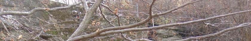
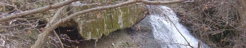
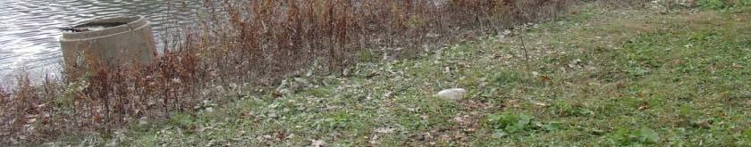
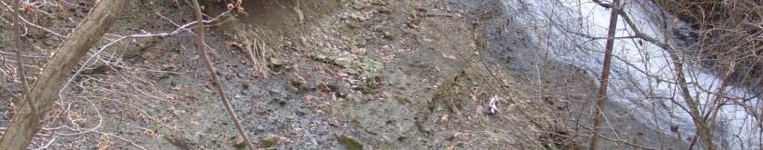
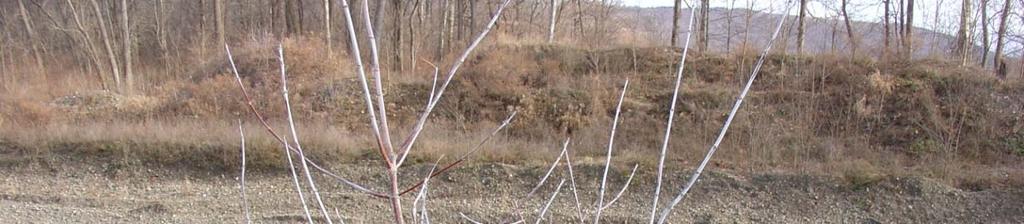
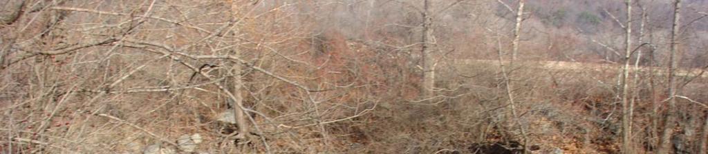
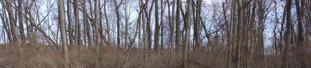
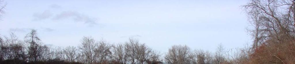
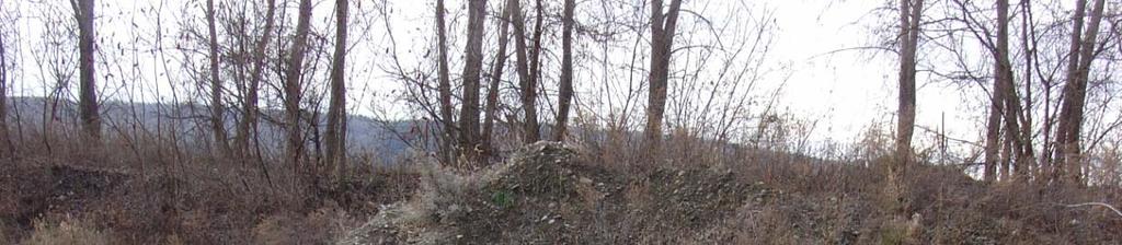
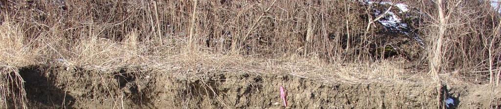
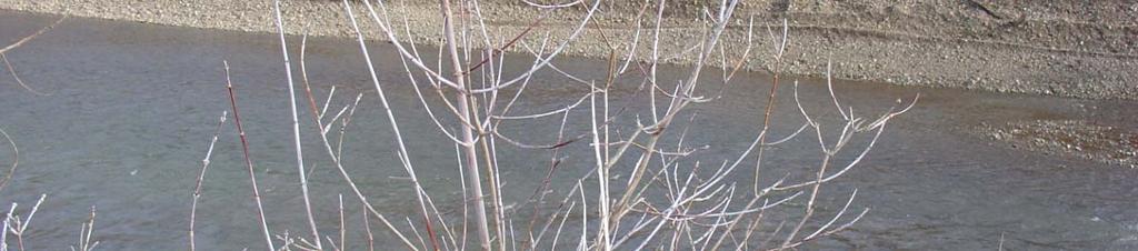
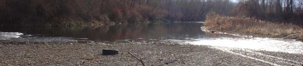
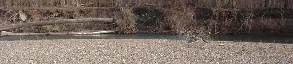
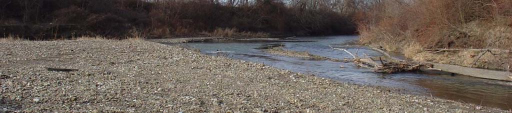
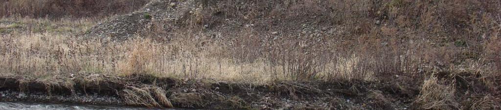
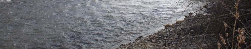
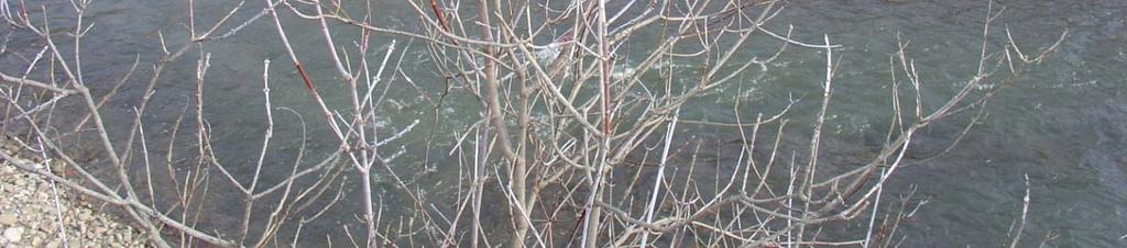
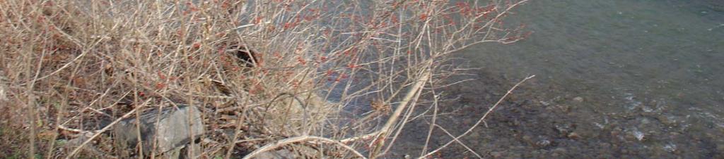
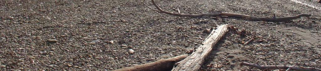
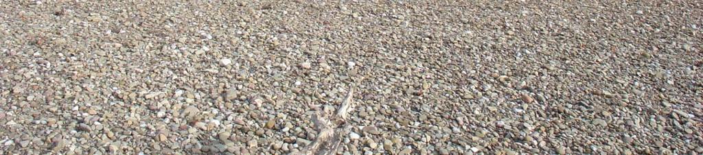
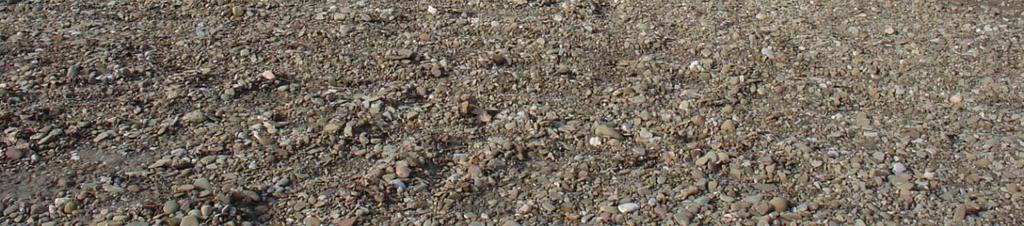
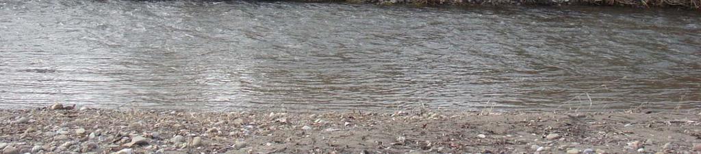
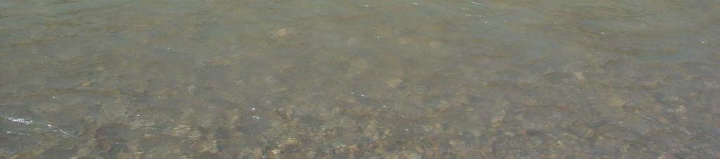
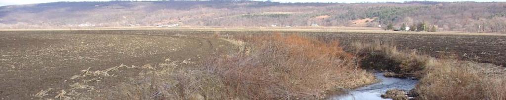
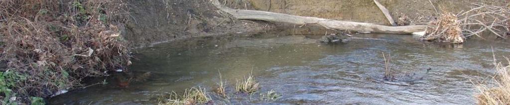
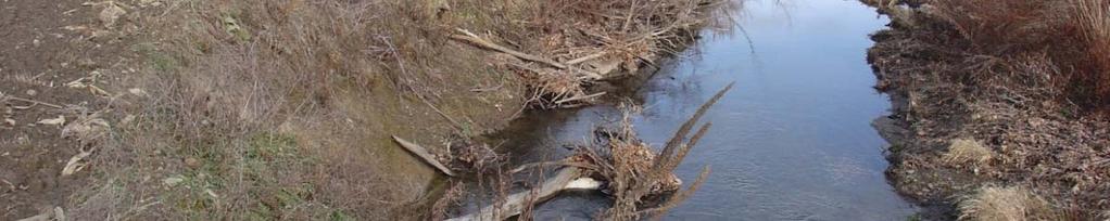
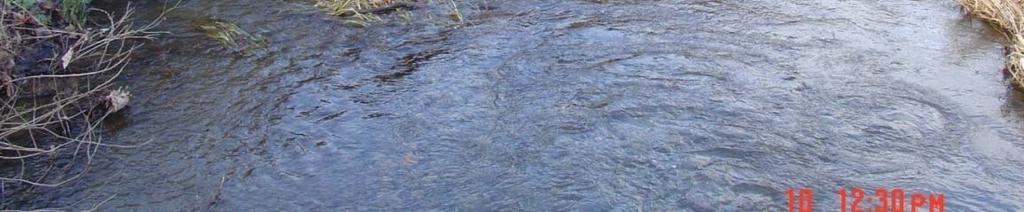
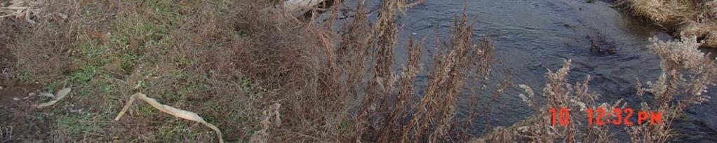
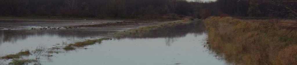
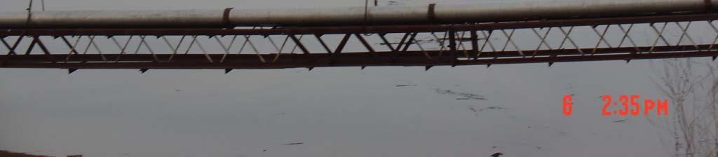
7 Canaseraga Creek Watershed Photos From the Field Reconnaissance


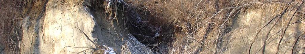


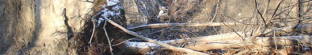
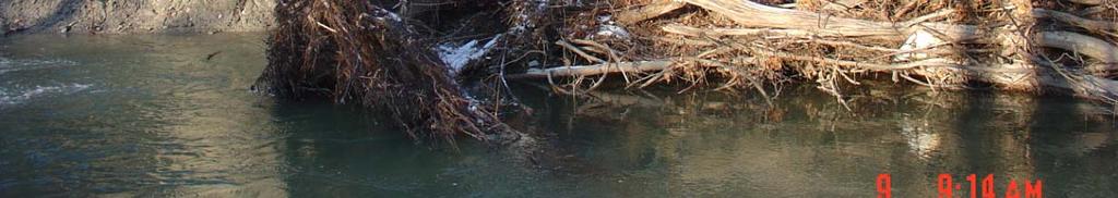

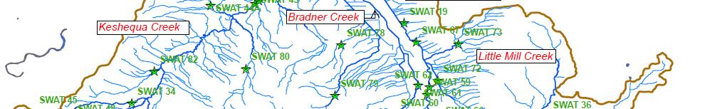
8 SWAT 34, 45, & 47 - Keshequa Creek BUILDING STRONG


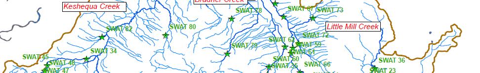
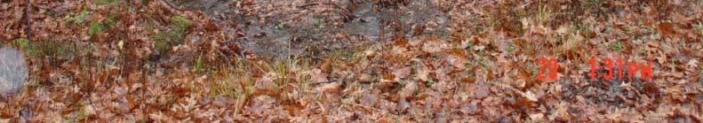
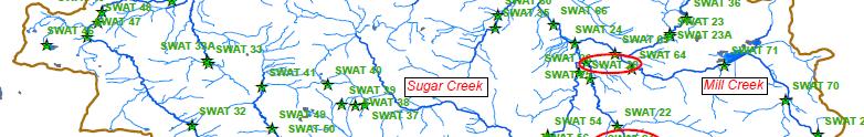
9 SWAT 37 Sugar Crk., Rattlesnake Hill SWAT 53 Ewart Creek

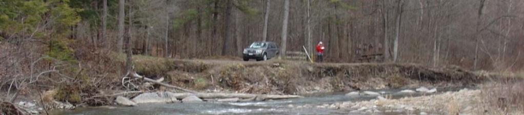
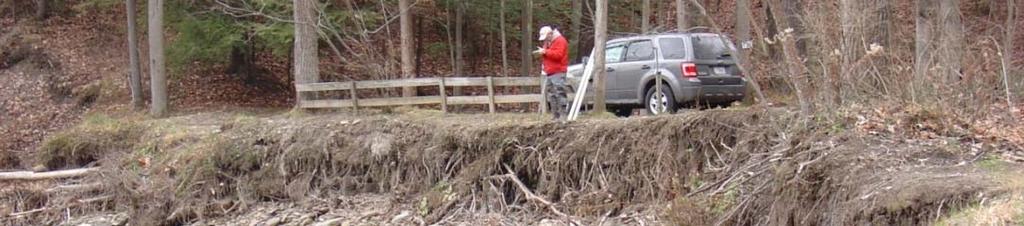
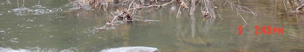
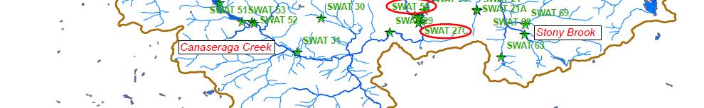
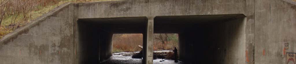
10 SWAT 27 & 55 Canaseraga Creek, Sugar pg Creek Glen Campground BUILDING STRONG


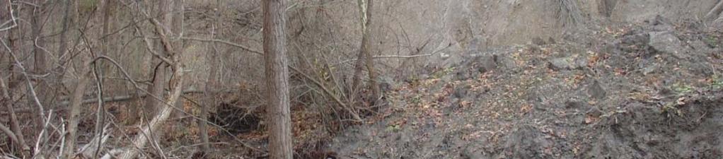
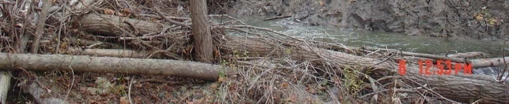
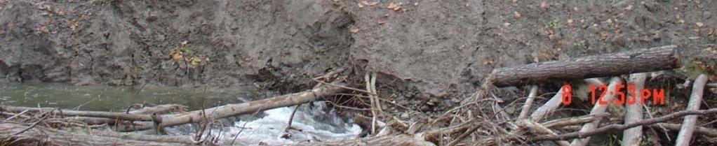
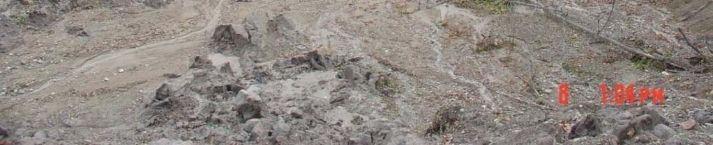
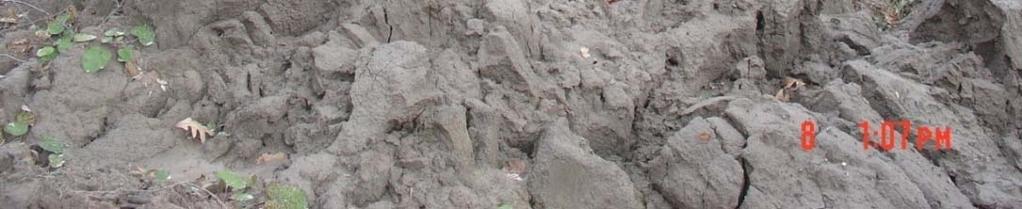
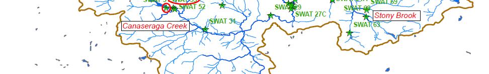
11 SWAT 28 Stony Brook, massive slope failure and sediment supply


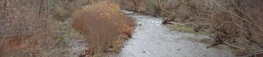

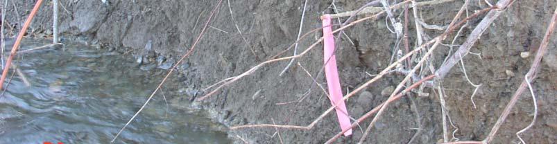
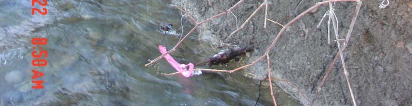
12 SWAT 22 - Stony Brook at Bluff Point Road


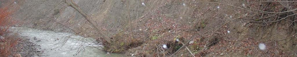
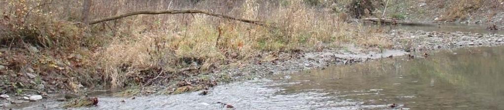
13 SWAT 35 Bradner Creek


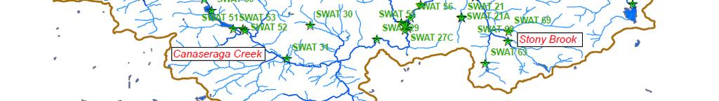
14 SWAT 59 & 62 Canaseraga Creek BUILDING STRONG


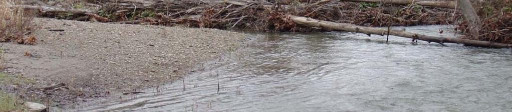
15 SWAT 61 Bradner Creek


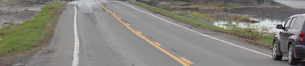
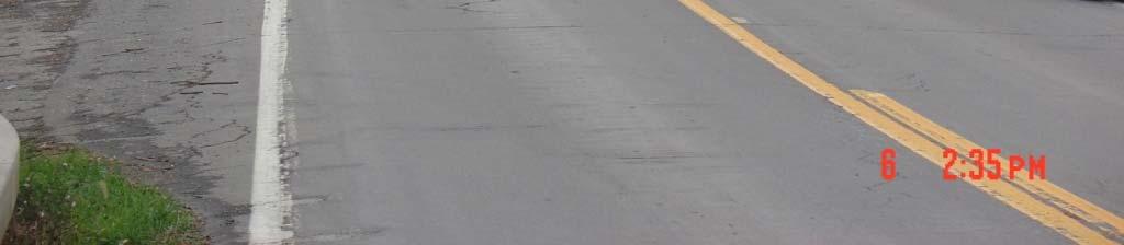
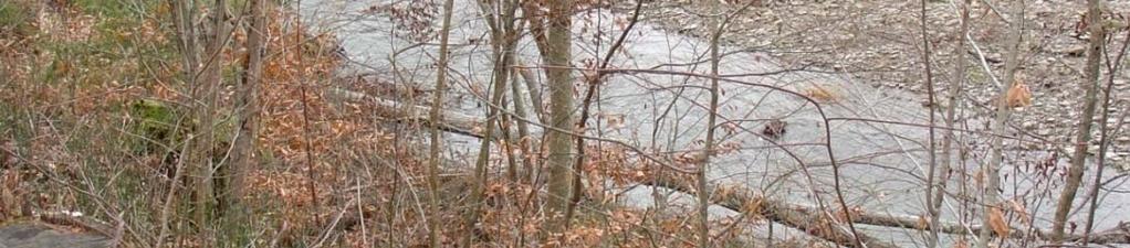
16 SWAT 15 Bradner Creek flooding at SR 258 on 15 Nov 2011 (1.25 of rain).
17 Stakeholders observations Migration of large sediment deposits downstream and the excessive build up of sediments at numerous locations in the stream channel. Major bank failure in numerous areas. Significant migration of stream channel due to sediment bars and bank erosion. Significant timber debris and follow-up sediment deposition in channel due to stream bank failure from erosion. Higher water levels and the increased frequency of flooding during storm events as the results of the loss of channel storage capacity. Transport of soils from agricultural fields into the Genesee River during and after flooding events.
18 Stakeholders Expectations Identify sediment sources and areas with highest erosion potential Estimate soil losses from both overland and streambank erosion Evaluate methods of reducing sediment deposition in the channels Evaluate the effects of alternate land-uses Evaluate the best locations for removal of sediment deposits from the system. Compare impacts of proposed best management practices
19 Great Lakes Tributary Modeling: Canaseraga Creek SWAT Brent LaSpada Program Manager US Army Corps of Engineers Buffalo District Keith R. Koralewski, PE Chief H&H Engineering gteam US Army Corps of Engineers Buffalo District Joshua Unghire Planner US Army Corps of Engineers Buffalo District i t Joshua.Unghire@usace.army.mil Michael Baker, PE Project Manager US Army Corps of Engineers Buffalo District i t Michael.G.Baker@usace.army.mil
CR AAO Bridge. Dead River Flood & Natural Channel Design. Mitch Koetje Water Resources Division UP District
 CR AAO Bridge Dead River Flood & Natural Channel Design Mitch Koetje Water Resources Division UP District Old County Road AAO Bridge Map courtesy of Marquette County Silver Lake Basin McClure Basin
Limitation to qualitative stability indicators. the real world is a continuum, not a dichotomy ~ 100 % 30 % ~ 100 % ~ 40 %
 Stream Stability Assessment & BEHI Surveys Joe Rathbun MDEQ Water Resources Division rathbunj@michigan.gov 517--373 517 373--8868 Stability Stream can transport its water and sediment inputs without changing
STUDY GUIDE FOR CONTENT MASTERY. Surface Water Movement
 Surface Water SECTION 9.1 Surface Water Movement In your textbook, read about surface water and the way in which it moves sediment. Complete each statement. 1. An excessive amount of water flowing downslope
Bank Erosion and Morphology of the Kaskaskia River
 Bank Erosion and Morphology of the Kaskaskia River US Army Corps Of Engineers St. Louis District Fayette County Soil and Water Conservation District Team Partners : Carlyle Lake Ecosystem Partnership Vicinity
Erosion Surface Water. moving, transporting, and depositing sediment.
 + Erosion Surface Water moving, transporting, and depositing sediment. + Surface Water 2 Water from rainfall can hit Earth s surface and do a number of things: Slowly soak into the ground: Infiltration
Earth Science Chapter 6 Section 2 Review
 Name: Class: Date: Earth Science Chapter 6 Section Review Multiple Choice Identify the choice that best completes the statement or answers the question. 1. Most streams carry the largest part of their
CASE STUDY #9 - Brushy Fork Dam, Sugar Grove, West Virginia
 CASE STUDY #9 - Brushy Fork Dam, Sugar Grove, West Virginia Brushy Fork Dam is a flood control structure built by the Soil Conservation Service southeast of the city of Franklin in Pendleton County, West
mountain rivers fixed channel boundaries (bedrock banks and bed) high transport capacity low storage input output
 high transport capacity low storage input output") mountain rivers fixed channel boundaries (bedrock banks and bed) high transport capacity low storage input output strong interaction between streams & hillslopes Sediment Budgets for Mountain Rivers Little
mountain rivers fixed channel boundaries (bedrock banks and bed) high transport capacity low storage input output strong interaction between streams & hillslopes Sediment Budgets for Mountain Rivers Little
Working with Natural Stream Systems
 Working with Natural Stream Systems Graydon Dutcher Delaware County Soil & Water Conservation District Stream Corridor Management Program Tropical Storm Sandy October 29,2012 What is a Watershed?
SECTION G SEDIMENT BUDGET
 SECTION G SEDIMENT BUDGET INTRODUCTION A sediment budget has been constructed for the for the time period 1952-2000. The purpose of the sediment budget is to determine the relative importance of different
1. The map below shows a meandering river. A A' is the location of a cross section. The arrows show the direction of the river flow.
 1. The map below shows a meandering river. A A' is the location of a cross section. The arrows show the direction of the river flow. Which cross section best represents the shape of the river bottom at
Use of Launched Soil Nails to Stabilize Landslides in Summit County, Ohio
 Use of Launched Soil Nails to Stabilize Landslides in Summit County, Ohio Mitchell W. Weber, P.G. Gannett Fleming Engineers & Architects, P.C. Greg Bachman, P.E., P.S. County of Summit Engineer Robert
Waterbury Dam Disturbance Mike Fitzgerald Devin Rowland
 Waterbury Dam Disturbance Mike Fitzgerald Devin Rowland Abstract The Waterbury Dam was completed in October 1938 as a method of flood control in the Winooski Valley. The construction began in April1935
Laboratory Exercise #3 The Hydrologic Cycle and Running Water Processes
 Laboratory Exercise #3 The Hydrologic Cycle and Running Water Processes page - 1 Section A - The Hydrologic Cycle Figure 1 illustrates the hydrologic cycle which quantifies how water is cycled throughout
Overview of fluvial and geotechnical processes for TMDL assessment
 Overview of fluvial and geotechnical processes for TMDL assessment Christian F Lenhart, Assistant Prof, MSU Research Assoc., U of M Biosystems Engineering Fluvial processes in a glaciated landscape Martin
Cattaraugus Creek: A Story of Flowing Water and the Geology of the Channel It Flows Through Presentation to West Valley Citizen Task Force 4/27/16
 Cattaraugus Creek: A Story of Flowing Water and the Geology of the Channel It Flows Through Presentation to West Valley Citizen Task Force 4/27/16 Raymond C. Vaughan, Ph.D. What happens if you drop a
Summary. Streams and Drainage Systems
 Streams and Drainage Systems Summary Streams are part of the hydrologic cycle and the chief means by which water returns from the land to the sea. They help shape the Earth s surface and transport sediment
16 AUGUST (Monday) Glacial Sediment
 Glacial Sediment") Presented By: U.S. Army Corps of Engineers, Detroit District Great Lakes Hydraulics and Hydrology Office With Support from the Great Lakes Commission 16 AUGUST (Monday) Glacial Sediment 9:00 9:30 Introduction
Presented By: U.S. Army Corps of Engineers, Detroit District Great Lakes Hydraulics and Hydrology Office With Support from the Great Lakes Commission 16 AUGUST (Monday) Glacial Sediment 9:00 9:30 Introduction
Weathering, Erosion, Deposition, and Landscape Development
 Weathering, Erosion, Deposition, and Landscape Development I. Weathering - the breakdown of rocks into smaller particles, also called sediments, by natural processes. Weathering is further divided into
Description DESCRIPTION
 DESCRIPTION The location of the Upper James Watershed is located in northeastern South Dakota as well as southeastern North Dakota. It includes the following counties located in North Dakota Barnes, Dickey,
Diagnostic Geomorphic Methods for Understanding Future Behavior of Lake Superior Streams What Have We Learned in Two Decades?
 Diagnostic Geomorphic Methods for Understanding Future Behavior of Lake Superior Streams What Have We Learned in Two Decades? Faith Fitzpatrick USGS WI Water Science Center, Middleton, WI fafitzpa@usgs.gov
Chris Lenhart, John Nieber, Ann Lewandowski, Jason Ulrich TOOLS AND STRATEGIES FOR REDUCING CHANNEL EROSION IN MINNESOTA
 Chris Lenhart, John Nieber, Ann Lewandowski, Jason Ulrich TOOLS AND STRATEGIES FOR REDUCING CHANNEL EROSION IN MINNESOTA Background and approach Channel loading major source of sediment in much of MN River
Great Lakes Dam Capacity Study
 Great Lakes Dam Capacity Study Project Team: USACE, Detroit District Wayne State University, Detroit, Michigan Great Lakes Environmental Center, Traverse City, Michigan BUILDING STRONG Study Objectives
Watershed concepts for community environmental planning
 Purpose and Objectives Watershed concepts for community environmental planning Dale Bruns, Wilkes University USDA Rural GIS Consortium May 2007 Provide background on basic concepts in watershed, stream,
Template for Sediment and Erosion Control Plan General Instructions. Section Instructions
 Template for Sediment and Erosion Control Plan General Instructions Introduction: Soil erosion and sediment deposition from farmlands can contribute to degraded surface water quality. Sediment delivery
Technical Memorandum No
 Pajaro River Watershed Study in association with Technical Memorandum No. 1.2.10 Task: Evaluation of Four Watershed Conditions - Sediment To: PRWFPA Staff Working Group Prepared by: Gregory Morris and
Lectures Hydrology & Fluvial Geomorphology. Gauley River Images. Ancients' (= Biblical) Model of Water (Hydrologic) Cycle
 Model of Water (Hydrologic) Cycle") Lectures 11-13 13 Hydrology & Fluvial Geomorphology Gauley River Images http://www.youtube.com/watch?v=eulmuyegtz4&feature=related Ancients' (= Biblical) Model of Water (Hydrologic) Cycle Stream Water
Lectures 11-13 13 Hydrology & Fluvial Geomorphology Gauley River Images http://www.youtube.com/watch?v=eulmuyegtz4&feature=related Ancients' (= Biblical) Model of Water (Hydrologic) Cycle Stream Water
MEANDER MIGRATION MODEL ASSESSMENT FOR THE JANUARY 2005 STORM, WHITMAN PROPERTY, SAN ANTONIO CREEK, VENTURA COUNTY, CALIFORNIA
 MEANDER MIGRATION MODEL ASSESSMENT FOR THE JANUARY 2005 STORM, WHITMAN PROPERTY, SAN ANTONIO CREEK, VENTURA COUNTY, CALIFORNIA Prepared by Eric Larsen, Ph.D. Mark Rains, Ph.D. October 2006 INTRODUCTION
Simulating the groundwater discharge to wetlands. Mukwonago Basin Example and Potential Application in Dane County
 Simulating the groundwater discharge to wetlands Mukwonago Basin Example and Potential Application in Dane County Conceptual Model Topography is major control on flow to wetlands Land Surface Water Table
Practice 3rd Quarter Exam Page 1
 Name 1. Which characteristic would most likely remain constant when a limestone cobble is subjected to extensive abrasion? A) shape B) mass C) volume D) composition 2. Which activity demonstrates chemical
7.3 Sediment Delivery Analysis
 7.3 Sediment Delivery Analysis In order to evaluate potential changes in sedimentation patterns that could occur due to impacts from the FCP and LPP alignments, sediment assessment models were constructed
How Do Geology and Physical Streambed Characteristics Affect Water Quality?
 Teacher s Guide How Do Geology and Physical Streambed Characteristics Affect Water Quality? Lesson Description In this lesson, the students research a dynamic, vertical dimension of a watershed - the geological
PHASE 1 STUDIES UPDATE EROSION WORKING GROUP
 PHASE 1 STUDIES UPDATE EROSION WORKING GROUP Presented By MICHAEL WOLFF, PG Erosion Study Area Manager West Valley Demonstration Project Quarterly Public Meeting February 24, 2016 OUTLINE Study 1 Terrain
Black Gore Creek 2013 Sediment Source Monitoring and TMDL Sediment Budget
 Black Gore Creek 2013 Sediment Source Monitoring and TMDL Sediment Budget Prepared for: Prepared By: - I. Introduction The Black Gore Creek Total Maximum Daily Load (TMDL) was developed in collaboration
FOLLOW-UP ON CHANNELIZATION IN SPRING CREEK SUB-WATERSHED
 FOLLOW-UP ON CHANNELIZATION IN SPRING CREEK SUB-WATERSHED Justin R. Beebe, Department of Earth Sciences, University of South Alabama, Mobile, AL 36688. jrb308@jaguar1.usouthal.edu. Spring Creek is a tributary
How Do Human Impacts and Geomorphological Responses Vary with Spatial Scale in the Streams and Rivers of the Illinois Basin?
 How Do Human Impacts and Geomorphological Responses Vary with Spatial Scale in the Streams and Rivers of the Illinois Basin? Bruce Rhoads Department of Geography University of Illinois at Urbana-Champaign
Development and testing of improved physically based streambank erosion and sediment routing routines in SWAT
 Development and testing of improved physically based streambank erosion and sediment routing routines in SWAT Balaji Narasimhan, P. M. Allen, Stephanie Capello, and Dave Coffman, J.G. Arnold, and R. Srinivasan
STREAM SYSTEMS and FLOODS
 STREAM SYSTEMS and FLOODS The Hydrologic Cycle Precipitation Evaporation Infiltration Runoff Transpiration Earth s Water and the Hydrologic Cycle The Hydrologic Cycle The Hydrologic Cycle Oceans not filling
Precipitation Evaporation Infiltration Earth s Water and the Hydrologic Cycle. Runoff Transpiration
 STREAM SYSTEMS and FLOODS The Hydrologic Cycle Precipitation Evaporation Infiltration Earth s Water and the Hydrologic Cycle Runoff Transpiration The Hydrologic Cycle The Hydrologic Cycle Oceans not filling
Rivers T. Perron
 1 Rivers T. Perron 12.001 After our discussions of large-scale topography, how we represent topography in maps, and how topography interacts with geologic structures, you should be frothing at the mouth
Measuring Streambank Erosion Bank Profiles to more Robustly Estimate Recession Rates and Calibration of the AnnAGNPS-CEAP Model
 Measuring Streambank Erosion Bank Profiles to more Robustly Estimate Recession Rates and Calibration of the AnnAGNPS-CEAP Model Clare Prestwich, P.E. 1 & W. Barry Southerland, Ph.D. 2 Water Quality and
Name: Mid-Year Review #2 SAR
 Name: Mid-Year Review #2 SAR Base your answers to questions 1 through 3 on on the diagram below, which shows laboratory materials used for an investigation of the effects of sediment size on permeability,
Patrick Baskfield. Scott Matteson. Minnesota Pollution Control Agency. Minnesota State University Water Resource Center
 Regression Analysis of Total Suspended Solids Concentrations to Estimate Streambank, Upland Field, and Classic Gully Sediment Contributions to Minnesota River Tributaries Patrick Baskfield Minnesota Pollution
Technical Memorandum No Sediment Model
 Pajaro River Watershed Study in association with Technical Memorandum No. 1.2.9 Sediment Model Task: Development of Sediment Model To: PRWFPA Staff Working Group Prepared by: Gregory Morris and Elsie Parrilla
Modeling Upland and Channel Sources of Sediment in the Le Sueur River Watershed, Minnesota
 Modeling Upland and Channel Sources of Sediment in the Le Sueur River Watershed, Minnesota Solomon Folle and David Mulla Department of Soil, Water and Climate University of Minnesota August 6, 2009 5 th
Surface Water Short Study Guide
 Name: Class: Date: Surface Water Short Study Guide Multiple Choice Identify the letter of the choice that best completes the statement or answers the question. 1. The three ways in which a stream carries
Evaluation of the two stage ditch as a best management practice. A. Hodaj, L.C. Bowling, C. Raj, I. Chaubey
 Evaluation of the two stage ditch as a best management practice A. Hodaj, L.C. Bowling, C. Raj, I. Chaubey Two-stage ditch: Stage 1 : main channel Stage 2 : flood plain bench Traditional ditch Twostage
Betsy Stevenson and Allison Mohrs (Skagit County Planning and Development Services) Jenny Baker, The Nature Conservancy
 Jenny Baker, The Nature Conservancy") TC Fisher Slough Final Design and Permitting Subject: Well Review Memorandum To: From: Betsy Stevenson and Allison Mohrs (Skagit County Planning and Development Services) Jenny Baker, The ature Conservancy
TC Fisher Slough Final Design and Permitting Subject: Well Review Memorandum To: From: Betsy Stevenson and Allison Mohrs (Skagit County Planning and Development Services) Jenny Baker, The ature Conservancy
The effectiveness of check dams in controlling upstream channel stability in northeastern Taiwan
 Erosion, Debris Mows and Environment in Mountain Regions (Proceedings of the Chengdu Symposium, July 1992). IAHS Publ. no. 209, 1992. 423 The effectiveness of check dams in controlling upstream channel
6.11 Naas River Management Unit
 6.11 Naas River Management Unit 6.11.1 Site 41 Issue: Bed and bank erosion Location: E 0685848 N 6058358 Waterway: Naas River Management Unit: Naas River Facing downstream from Bobeyan Rd bridge Facing
Template for Sediment and Erosion Control Plan General Instructions
 Template for Sediment and Erosion Control Plan General Instructions Introduction: Soil erosion and sediment deposition from farmlands can contribute to degraded surface water quality. Sediment delivery
Subcommittee on Sedimentation Draft Sediment Analysis Guidelines for Dam Removal
 Subcommittee on Sedimentation Draft Sediment Analysis Guidelines for Dam Removal August 4, 2011 Jennifer Bountry, M.S., P.E. Tim Randle, M.S., P.E., D.WRE. Blair Greimann, Ph.D., P.E. Sedimentation and
Assessment of Lake Forest Lake Sediment Trapping Efficiency and Capacity. Marlon R. Cook Groundwater Assessment Program Geological Survey of Alabama
 Assessment of Lake Forest Lake Sediment Trapping Efficiency and Capacity Marlon R. Cook Groundwater Assessment Program Geological Survey of Alabama Impacts of the Lake at Lake Forest on the connectivity
Surface Water and Stream Development
 Surface Water and Stream Development Surface Water The moment a raindrop falls to earth it begins its return to the sea. Once water reaches Earth s surface it may evaporate back into the atmosphere, soak
Soils in Minnesota Calcareous Fens
 Soils in Minnesota Calcareous Fens MGWA TECHNICAL WORKSHOP June 18, 2004 George Poch 6/23/2004 1 Introduction Our presentation today is to show What soils are in the Fen areas How they have been mapped
Numerical modeling of sediment flushing from Lewis and Clark Lake
 University of Nebraska - Lincoln DigitalCommons@University of Nebraska - Lincoln US Army Research U.S. Department of Defense 2013 Numerical modeling of sediment flushing from Lewis and Clark Lake Jungkyu
Implementing a Project with 319 Funds: The Spring Brook Meander Project. Leslie A. Berns
 Implementing a Project with 319 Funds: The Spring Brook Meander Project Leslie A. Berns "...to acquire... and hold lands... for the purpose of protecting and preserving the flora, fauna and scenic beauties...
Streams. Stream Water Flow
 CHAPTER 14 OUTLINE Streams: Transport to the Oceans Does not contain complete lecture notes. To be used to help organize lecture notes and home/test studies. Streams Streams are the major geological agents
Roger Andy Gaines, Research Civil Engineer, PhD, P.E.
 Roger Andy Gaines, Research Civil Engineer, PhD, P.E. Research Civil Engineer/Regional Technical Specialist Memphis District August 24, 2010 Objectives Where we have been (recap of situation and what s
Earth Science. STREAM DRAINAGE PATTERNS (start by reading the first page of these notes!)
") Name _ Earth Science STREAM DRAINAGE PATTERNS (start by reading the first page of these notes!) WHAT IS A DRAINAGE PATTERN? Streams seek the lowest path as they move downhill, and they tend to erode their
Name _ Earth Science STREAM DRAINAGE PATTERNS (start by reading the first page of these notes!) WHAT IS A DRAINAGE PATTERN? Streams seek the lowest path as they move downhill, and they tend to erode their
Page 1. Name:
 Name: 1) Which event is the best example of erosion? dissolving of rock particles on a limestone gravestone by acid rain breaking apart of shale as a result of water freezing in a crack rolling of a pebble
Name: Which rock layers appear to be most resistant to weathering? A) A, C, and E B) B and D
 A, C, and E B) B and D") Name: 1) The formation of soil is primarily the result of A) stream deposition and runoff B) precipitation and wind erosion C) stream erosion and mass movement D) weathering and biological activity 2)
Name: 1) The formation of soil is primarily the result of A) stream deposition and runoff B) precipitation and wind erosion C) stream erosion and mass movement D) weathering and biological activity 2)
The Yellow River Initiative: The Birth of a System Approach to Challenges Facing the Everglades of the North
 The Yellow River Initiative: The Birth of a System Approach to Challenges Facing the Everglades of the North Robert Barr and Siavash Beik 2016 INAFSM Annual Conference Belterra Conference Center, Indiana
The Hydrologic Cycle STREAM SYSTEMS. Earth s Water and the Hydrologic Cycle. The Hydrologic Cycle. Hydrologic Cycle
 STREAM SYSTEMS Earth Science: Chapter 5 Reading pages 114-124 The Hydrologic Cycle Oceans not filling up Evaporation = precipitation System is balanced Earth s Water and the Hydrologic Cycle Earth s Water
Chapter 3 Erosion and Deposition. The Big Question:
 Chapter 3 Erosion and Deposition The Big Question: 1 Design a way to represent and describe the 4 types of mass movement. You may use pictures, diagrams, list, web, chart, etc 2 Chapter 3: Erosion and
Sediment Traps. CAG Meeting May 21, 2012
 Sediment Traps CAG Meeting May 21, 2012 Agenda Background Fundamentals of Sediment Transport Sediment Trap Existing Information Next Steps 2 The Site Saginaw River 22 mile river beginning at confluence
Conceptual Model of Stream Flow Processes for the Russian River Watershed. Chris Farrar
 Conceptual Model of Stream Flow Processes for the Russian River Watershed Chris Farrar Several features of creeks affect the interactions between surface and groundwater. This conceptual model uses the
Stream Geomorphology. Leslie A. Morrissey UVM July 25, 2012
 Stream Geomorphology Leslie A. Morrissey UVM July 25, 2012 What Functions do Healthy Streams Provide? Flood mitigation Water supply Water quality Sediment storage and transport Habitat Recreation Transportation
Remaining Capacity in Great Lakes Reservoirs
 US Army Corps of Engineers Detroit District Remaining Capacity in Great Lakes Reservoirs Storage Capacity Behind Great Lakes Dams Field Data and Modeling Motivation for project Project overview Data and
Landscape Development
 Landscape Development Slopes Dominate Natural Landscapes Created by the interplay of tectonic and igneous activity and gradation Deformation and uplift Volcanic activity Agents of gradation Mass wasting
PENNSYLVANIA DEPARTMENT OF TRANSPORTATION ENGINEERING DISTRICT 3-0
 PENNSYLVANIA DEPARTMENT OF TRANSPORTATION ENGINEERING DISTRICT 3-0 LYCOMING COUNTY S.R.15, SECTION C41 FINAL HYDROLOGIC AND HYDRAULIC REPORT STEAM VALLEY RUN STREAM RELOCATION DATE: June, 2006 REVISED:
Session C1 - Applying the Stream Functions Pyramid to Geomorphic Assessments and Restoration Design
 University of Massachusetts - Amherst ScholarWorks@UMass Amherst International Conference on Engineering and Ecohydrology for Fish Passage International Conference on Engineering and Ecohydrology for Fish
Mammoth Cave National Park, Kentucky
 Mammoth Cave National Park, Kentucky Objectives of Today s Lecture Refresher on Sedimentary Depositional Systems and Rock Classifications Transgressive and Regressive Marine Environments Carbonate Depositional
Vermont Stream Geomorphic Assessment. Appendix E. River Corridor Delineation Process. VT Agency of Natural Resources. April, E0 - April, 2004
 Vermont Stream Geomorphic Assessment Appendix E River Corridor Delineation Process Vermont Agency of Natural Resources - E0 - River Corridor Delineation Process Purpose A stream and river corridor delineation
Laboratory Exercise #4 Geologic Surface Processes in Dry Lands
 Page - 1 Laboratory Exercise #4 Geologic Surface Processes in Dry Lands Section A Overview of Lands with Dry Climates The definition of a dry climate is tied to an understanding of the hydrologic cycle
Science EOG Review: Landforms
 Mathematician Science EOG Review: Landforms Vocabulary Definition Term canyon deep, large, V- shaped valley formed by a river over millions of years of erosion; sometimes called gorges (example: Linville
Landscape. Review Note Cards
 Landscape Review Note Cards Last Ice Age Pleistocene Epoch that occurred about 22,000 Years ago Glacier A large, long lasting mass of ice which forms on land and moves downhill because of gravity. Continental
Unconventional Wisdom and the Effects of Dams on Downstream Coarse Sediment Supply. Byron Amerson, Jay Stallman, John Wooster, and Derek Booth
 Unconventional Wisdom and the Effects of Dams on Downstream Coarse Sediment Supply 3 February 2009 Byron Amerson, Jay Stallman, John Wooster, and Derek Booth Sultan River, WA OBJECTIVE Consider the landscape
SEARCHING FOR SEDIMENT SOURCES IN SPRING CREEK
 SEARCHING FOR SEDIMENT SOURCES IN SPRING CREEK Christopher Frederick, Department of Earth Sciences, University of South Alabama, Mobile, AL 36688. E-mail: cjf702@jaguar1.usouthal.edu. Sediment deposition
Running Water Earth - Chapter 16 Stan Hatfield Southwestern Illinois College
 Running Water Earth - Chapter 16 Stan Hatfield Southwestern Illinois College Hydrologic Cycle The hydrologic cycle is a summary of the circulation of Earth s water supply. Processes involved in the hydrologic
Understanding the effects of roads in upland settings on hydrology, geomorphology and water quality
 Understanding the effects of roads in upland settings on hydrology, geomorphology and water quality Beverley Wemple Department of Geography and Rubenstein School of Environment & Natural Resources The
Jim Turenne. Soils on Social Media
 Jim Turenne USDA-NRCS 60 Quaker Lane, Suite 46 Warwick, RI. 02886 401-822-8832 Jim.turenne@ri.usda.gov Soils on Social Media www.twitter.com/soilsne www.fb.com/soilsne www.nesoil.com U.S. Department of
APPENDIX A M&T/Llano Seco Long-Term Water Reliability Study These photos are examples of rock spurs in use throughout the United States
 APPENDIX A M&T/Llano Seco Long-Term Water Reliability Study These photos are examples of rock spurs in use throughout the United States Glenn Colusa Irrigation District completed a Sacramento River project
Watershed Conservation Management Planning Using the Integrated Field & Channel Technology of AnnAGNPS & CONCEPTS
 Watershed Conservation Management Planning Using the Integrated Field & Channel Technology of AnnAGNPS & CONCEPTS Eddy Langendoen Ron Bingner USDA-ARS National Sedimentation Laboratory, Oxford, Mississippi
The Geology of Sebago Lake State Park
 Maine Geologic Facts and Localities September, 2002 43 55 17.46 N, 70 34 13.07 W Text by Robert Johnston, Department of Agriculture, Conservation & Forestry 1 Map by Robert Johnston Introduction Sebago
RIVERS, GROUNDWATER, AND GLACIERS
 RIVERS, GROUNDWATER, AND GLACIERS Delta A fan-shaped deposit that forms when a river flows into a quiet or large body of water, such as a lake, an ocean, or an inland sea. Alluvial Fan A sloping triangle
Griswold Creek August 22, 2013
 Creek August 22, 2013 1 Lake Erie Protection Fund Creek Study ver Evaluate the overall condition of Creek Determine stable channel dimensions & appropriate restoration techniques Starting Stat gpoint for
Application of SWAT Model to Estimate the Runoff and Sediment Load from the Right Bank Valleys of Mosul Dam Reservoir
 Application of SWAT Model to Estimate the Runoff and Sediment Load from the Right Bank Valleys of Mosul Dam Reservoir Dr Mohammad Ezeel Deen Prof. Nadhir Al-Ansari Prof Sven Knutsson Figure 1.Map of Iraq
Why Geomorphology for Fish Passage
 Channel Morphology - Stream Crossing Interactions An Overview Michael Love Michael Love & Associates mlove@h2odesigns.com (707) 476-8938 Why Geomorphology for Fish Passage 1. Understand the Scale of the
Improved physically based approaches for Channel Erosion Modeling in SWAT. Balaji Narasimhan, P. M. Allen, J. G. Arnold, and R.
 Improved physically based approaches for Channel Erosion Modeling in SWAT Balaji Narasimhan, P. M. Allen, J. G. Arnold, and R. Srinivasan Outline Channel Erosion Sediment Routing In SWAT2000 and SWAT2005
APPENDIX E. GEOMORPHOLOGICAL MONTORING REPORT Prepared by Steve Vrooman, Keystone Restoration Ecology September 2013
 APPENDIX E GEOMORPHOLOGICAL MONTORING REPORT Prepared by Steve Vrooman, Keystone Restoration Ecology September 2 Introduction Keystone Restoration Ecology (KRE) conducted geomorphological monitoring in
Materials. Use materials meeting the following.
 208.01 Section 208. SOIL EROSION AND SEDIMENTATION CONTROL 208.01 Description. Install and maintain erosion and sedimentation controls to minimize soil erosion and to control sedimentation from affecting
NATURAL RIVER. Karima Attia Nile Research Institute
 NATURAL RIVER CHARACTERISTICS Karima Attia Nile Research Institute NATURAL RIVER DEFINITION NATURAL RIVER DEFINITION Is natural stream of water that flows in channels with ih more or less defined banks.
Dan Miller + Kelly Burnett, Kelly Christiansen, Sharon Clarke, Lee Benda. GOAL Predict Channel Characteristics in Space and Time
 Broad-Scale Models Dan Miller + Kelly Burnett, Kelly Christiansen, Sharon Clarke, Lee Benda GOAL Predict Channel Characteristics in Space and Time Assess Potential for Fish Use and Productivity Assess
Upper Mississippi River Basin Environmental Management Program Workshop
 Presentation to the Upper Mississippi River Basin Environmental Management Program Workshop by Michael Rodgers River Engineer US Army Corps of Engineers, St. Louis District August 17, 2007 Engineering
Weathering, Erosion, Deposition
 Weathering, Erosion, Deposition The breakdown of rocks at or near the Earth s Surface. Physical Chemical - The breakdown of rock into smaller pieces without chemical change. - Dominant in moist /cold conditions
Big Rivers Electric Corporation Disposal of Coal Combustion Residuals (CCR) from Electric Utilities Final Rule CCR Impoundment Liner Assessment Report
 from Electric Utilities Final Rule CCR Impoundment Liner Assessment Report") Big Rivers Electric Corporation Disposal of Coal Combustion Residuals (CCR) from Electric Utilities Final Rule CCR Impoundment Liner Assessment Report CCR Surface Impoundment Information Name: Operator:
Big Rivers Electric Corporation Disposal of Coal Combustion Residuals (CCR) from Electric Utilities Final Rule CCR Impoundment Liner Assessment Report CCR Surface Impoundment Information Name: Operator:
Four Mile Run Levee Corridor Stream Restoration
 Four Mile Run Levee Corridor Stream Restoration 30% Design Summary U.S. Army Corps of Engineers, Baltimore District Presentation Outline Four Mile Run 1.) Historic Perspective 2.) Existing Conditions 3.)
What are the different ways rocks can be weathered?
 Romano - 223 What are the different ways rocks can be weathered? Weathering - the breakdown of rocks and minerals at the Earth s surface 1. 2. PHYSICAL WEATHERING Rock is broken into smaller pieces with
WATER ON AND UNDER GROUND. Objectives. The Hydrologic Cycle
 WATER ON AND UNDER GROUND Objectives Define and describe the hydrologic cycle. Identify the basic characteristics of streams. Define drainage basin. Describe how floods occur and what factors may make