Roger Andy Gaines, Research Civil Engineer, PhD, P.E.
|
|
|
- Laureen Hall
- 5 years ago
- Views:
Transcription


1 Roger Andy Gaines, Research Civil Engineer, PhD, P.E. Research Civil Engineer/Regional Technical Specialist Memphis District August 24, 2010
2 Objectives Where we have been (recap of situation and what s been done in previous years) Where we are in analysis (what we ve been doing this year) Preliminary Sedimentation Results Alternatives AGNPS modeling Sediment Transport modeling


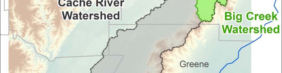
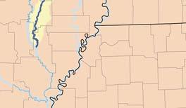
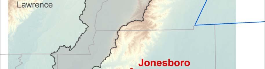
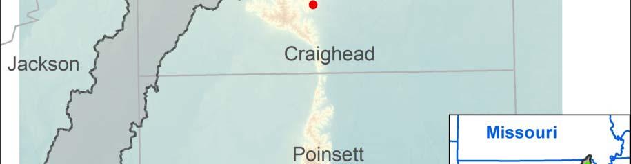
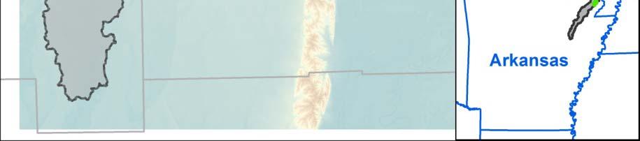
3 Cache River, Arkansas Memphis, TN
4 Background The Cache River watershed is located between the White River and Crowley s Ridge in eastern Arkansas and extends into southeastern Missouri. The basin is approximately 200 miles north to south and is only about 10 miles wide. Upper basin, Grubbs and upstream, have been channelized by local l interests. t Basin between Grubbs and outlet developed for agriculture (clearing and floodplain encroachment), but river has a historic meandering planform. Lowest 7 miles was channelized by the Corps of Engineers Development of the watershed for agriculture began in the early 20 th century. Blockages below Grubbs, AR cause significant flooding to community and surrounding area. There is significant interest in the basin for agriculture and the environment. There is significant interest in the basin for agriculture and the environment. The US Fish and Wildlife Service own and manage the Cache River Wildlife Refuge located in the lower part of the watershed. The Nature Conservancy has interest within the basin to preserve habitat and river function. EPA provided funds in to TNC for data collection that targets evaluation of sedimentation and water quality within the basin.
5 Basinwide Concerns Flooding in communities Sustaining Agriculture Water Quality Waterfowl Hunting Irrigation Bottomland Hardwood Forest Health Federal Wildlife Management Areas State Wildlife Management Areas National Attention (TNC, DU, etc.)
6 Sediment Problems Blockages below Grubbs completely fill channel High sediment load coming from upper watershed Transport capability significantly less in lower reach Water quality reduced due to sediment Continual channel maintenance perpetuates water quality issues Restricted floodplain width from agricultural development limits natural system function Declining health of bottomland hardwoods and swamps Limited data on quantity of sediments and quality of water NEED: sediment budget and sediment balance to assess system health and function; Will also allow evaluation of measures that t may be used to change landuse and/or practices.
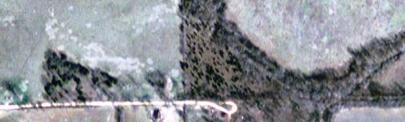
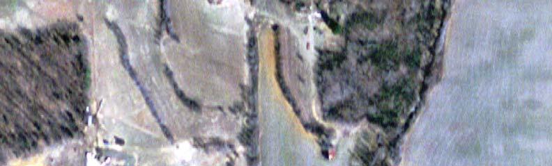
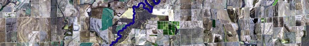
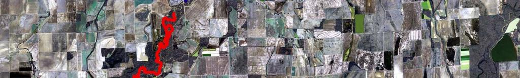
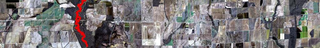
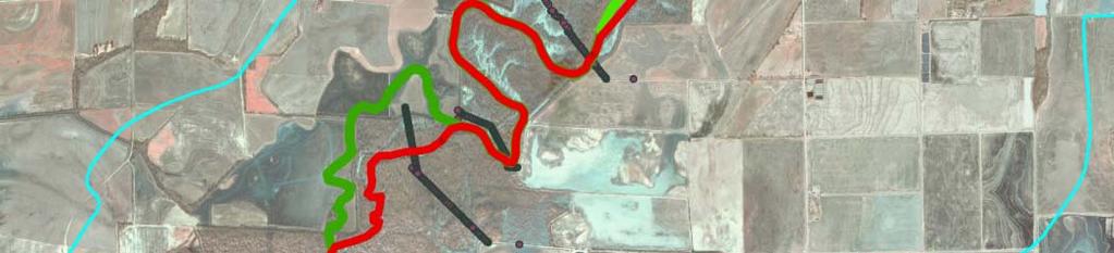
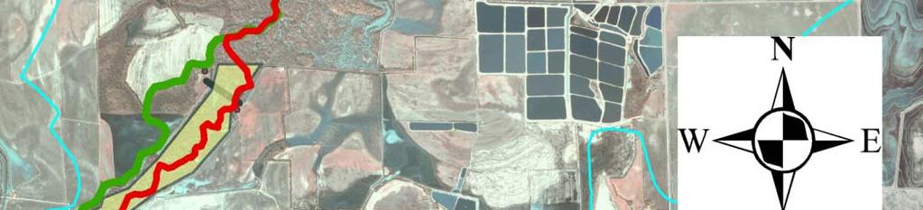
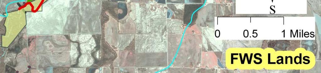
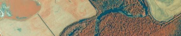
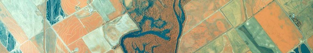
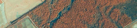
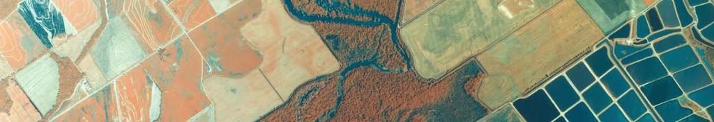
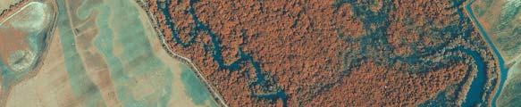
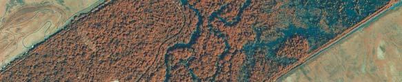
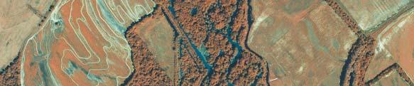
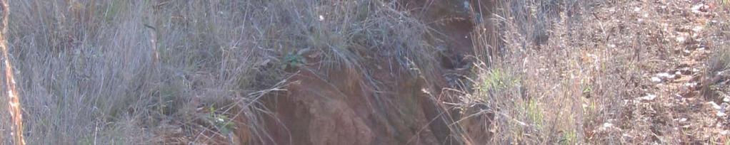
7 Source: GoogleEarth
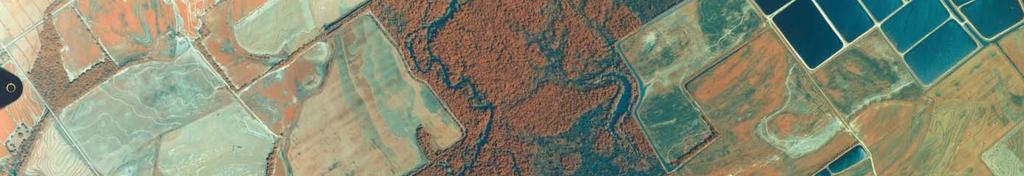
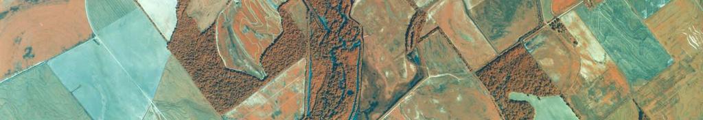
8 Source: TNC Sediment Data Collection Report
9
10 Alternatives Sediment Coming From Watershed Do Nothing Change tillage practices Implement conservation practices at waterways Reduce gully erosion Reduce in-channel erosion Sediment Blockage Do Nothing Restore channel function at blockage reach Provide distributed transition between channelized and unchannelized reach
11 Modeling OUTLINE Watershed Component Basic AGNPS concepts/inputs Landuse DEM Soils Gross Erosion Gully In-stream Yield Delivery Sub-basin/Cells Highest sources Base Condition vs Alternative Scenarios Big Creek Sub-basin Cache Basin upstream of Grubbs, AR
12 AnnAGNPS Model Erosion Engine Based on the Revised Universal Soil Loss Equation A = R * K * LS * C * P Where: A = estimated average soil loss in tons per acre per year R = rainfall-runoff runoff factor K = soil erodibility factor L = slope length factor S = slope steepness factor C = Cover-management factor P = support practice factor
13 AnnAGNPS Analysis Hypothetical hydrology for 30-year simulation i GIS layers for each parameter in RUSLE Landcover Soil Type Precipitation/Runoff Management Practice Slope Length (network) Outputs Annualized sediment yield for surface and rill erosion from RUSLE Average annual Gully Erosion to be estimated using enhanced techniques implemented in AGNPS Average annual In-Channel Erosion estimated using hydraulic geometry and generalized hydraulics for multiple reaches in stream network
14 BIG CREEK SUB-BASIN
15 Source: Dennis Carmen Landuse Big Creek Basin
16 Source: Dennis Carmen Elevations Big Creek Basin
17 Source: Dennis Carmen Runoff by Cell Big Creek


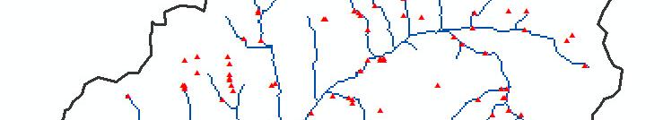

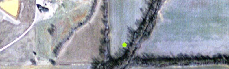

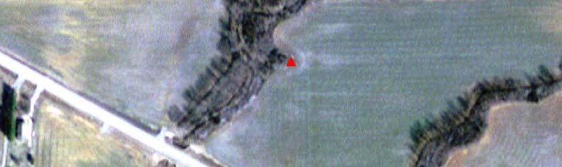
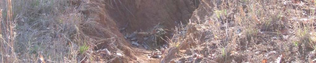
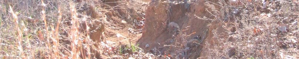
18 BIG CREEK GULLY LOCATIONS


19 BASE CONDITION SEDIMENT LOAD Figure 33: Big Creek Watershed spatial distribution of sediment load to the Big Creek outlet for the base condition simulation in tons per acre per year.


20 BASE CONDITION GULLY SEDIMENT YIELD Figure 35: Big Creek Watershed spatial distribution of gully sediment yield for the base condition simulation in tons per acre per year.


 from the base simulation with")
21 Red = Top 10% sources Yellow = Greater than watershed average sources Figure 38: Big Creek Watershed portion of Cache River Watershed showing the top 10% sediment load producing areas in red and areas that produce sediment higher than the watershed average (yellow) from the base simulation with no gully control.


22 Big Creek Sub-Basin Highest Sediment Producing Areas - Base
23 Big Creek Sub-Basin Table 9: Summary of Big Creek base condition simulation output Item Amount Units Watershed Average Runoff 7.54 in/yr Watershed Average Total Rate of Erosion 5.11 t/ac/yr Watershed Total Tons of Erosion 150,039 t/yr Watershed Sediment Yield to Streams 2.18 t/ac/yr Sediment Loading Rate to Watershed Outlet 1.90 t/ac/yr Sediment Loading Amount to Watershed Outlet t 55,817 t/yr Highest Erosion from an Individual Cell w/gully t/ac/yr Highest Erosion from Individual Cell-Sheet&Rill t/ac/yr
24 CACHE RIVER WATERSHED UPSTREAM OF GRUBBS, AR
 and soybeans (bright")
 and forest Pasture (yellow) and forest")
25 2004 NASS CDL for the Cache River Watershed. Note the dominance of rice (red) and soybeans (bright green) in the flat areas. Pasture (yellow) and forest Pasture (yellow) and forest (dull green) dominate in the Crowley s Ridge area.


26 RUSLE LS-Factors designated for each AnnAGNPS cell
, and the AGNPS-generated gully")
27 GULLY LOCATIONS USACE gully locations (green), and the AGNPS-generated gully locations (red)

28 BASE CONDITION SEDIMENT LOAD Figure 21: Spatial distribution of sediment load for the base condition simulation in tons per acre per year.
 from the base simulation with no gully control.")
29 Red = Top 10% sources Yellow = Greater than watershed average sources Figure 26: Cache River Watershed top 10% sediment load producing areas in red and areas that produce sediment higher than the watershed average (yellow) from the base simulation with no gully control.


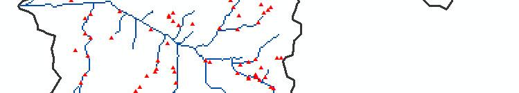
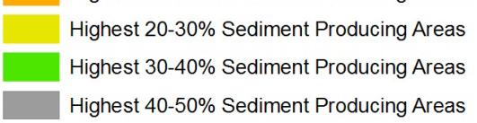
30 Figure 59: Cache River Watershed highest sediment producing areas at the 10, 20, 30, 40 and 50% levels for the base conditions.
31 Cache River Watershed Upstream of Grubbs, AR Table 7: Summary of base condition simulation output Item Amount Units Watershed Average Runoff in/yr Watershed Average Total Rate of Erosion 2.27 t/ac/yr Watershed Total Tons of Erosion 1,364,690, t/yr Watershed Sediment Yield to Streams 0.84 t/ac/yr Sediment Loading Rate to Watershed Outlet 0.59 t/ac/yr Sediment Loading Amount to Watershed Outlet 352,072 t/yr Highest Erosion from an Individual Cell w/gully t/ac/yr Highest Erosion from Individual Cell-Sheet&Rill t/ac/yr
32 Comparison of Big Creek and Cache River above Grubbs, AR AnnAGNPS Outputs (BASE) Base Condition Simulation Output Comparison Item Amount Amount Units (Big Creek) (Entire Watershed) Watershed Average Runoff in/yr Watershed Average Total Rate of t/ac/yr Erosion Watershed Total Tons of Erosion 150,039 1,364,690 t/yr Watershed Sediment Yield to Streams t/ac/yr Sediment Loading Rate to Watershed t/ac/yr Outlet Sediment Loading Amount to 55, ,072 t/yr Watershed Outlet Highest Erosion from an Individual t/ac/yr Cell w/gully Highest Erosion from Individual Cell- Sheet&Rill t/ac/yr
33 AGNPS Scenarios Base Condition (circa present day, 2004) Gully Control Entire Watershed Crowley s Ridge only Big Creek Conservation Tillage (no/minimum till) CRP Entire Watershed Crowley s Ridge only Flashboard Risers Reforestation Entire Watershed Cropland Uplands (primarily Crowley s Ridge) Channel stabilization Various Combinations of Above
34 Change in Sedimentation between mid-1980 s and %
35 Table 8: Summary of Sediment load at the outlet of Cache River watershed with and without channel erosion control. Item Total Load w/ Channel Total Load w/out Channel Erosion (t/ac/yr) Erosion (t/ac/yr) Base Base with gully control over the entire watershed Base with gully control on Crowley s Ridge only All Forest without gully control All Forest with gully control over the entire watershed Conservation tillage with gully control on Crowley s Ridge only Conservation tillage with gully control over the entire watershed Conservation tillage without gully control CRP with gully control over the entire watershed CRP with gully control on Crowley s Ridge only CRP with gully control


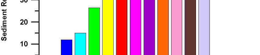
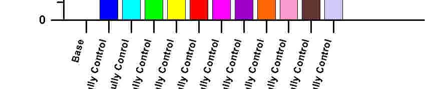


36 Percent sediment reduction from the base level of base conditions for selected management alternatives.


 Gully")
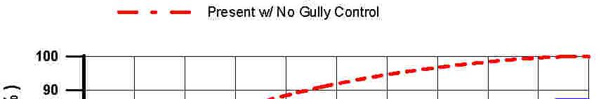
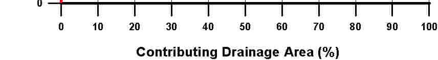
37 SEDIMENT LOAD BY CONTRIBUTING DRAINAGE AREA CURRENT CONDTIONS No gully control (blue) Gully control for Crowley s Ridge (green) Gully control for entire watershed (red)


38 Figure 28: Cache River Watershed Sediment Load by contributing drainage area for all conditions including those with no gully control, gully control for the entire watershed, and gully control only for Crowley s Ridge.


39 Figure 29: Cache River Watershed Sediment Load by contributing drainage area for additional conditions including those with gully control for the entire watershed but forests, riser boards, and notillage conservation practices with CRP.

40 Load Reductions (BLUE) and Increases (RED) from base condition Conservation Tillage for entire watershed and no gully control.
41 Load Reductions (BLUE) and Increases (RED) from base condition Conservation Tillage and gully control entire watershed.
42 Load Reductions (BLUE) and Increases (RED) from base condition Conservation Tillage and gully control only in Crowley s Ridge area.
43
44
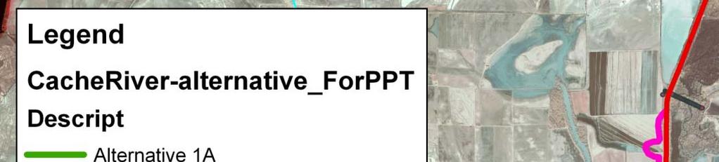
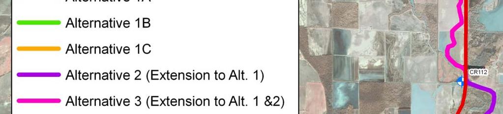
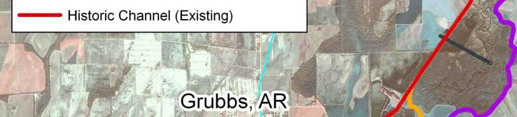
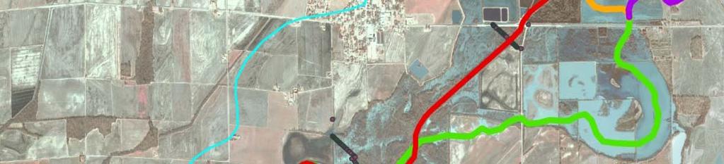
45 Sediment Transport Model HEC-RAS Sediment 1-D numerical model used for simulation Existing Conditions model from 1992 used in calibration Base Conditions Previous HEC-6 model geometry updated with 2007 surveys Alternatives Avoid existing historic channel alignment due to blockages and physical access, constructability, and maintenance issues Use reference reach approach to define alignment and geometry for alternative channels Sediment Loads Initial same as in 1990 s model Adjust to reflect reduced loads with changed farming practices (2010 vs 1985) Consider several reductions as indicated by watershed sediment modeling with AGNPS Sediment Trap(s) to preserve channel capacity without passing problem downstream
46 Reference Reach Approach for Alternative Alignments


47 Reference Reach Design Reach Reference Reach 1 Reference Reach 2
48
49 Summary Upper Cache Sediment Study (Watershed sediment budget) AnnAGNPS modeling component nearing completion A Number of management practice scenarios considered Separately Various combinations Considered Reasonable level of participation Identified highest sources of sediment contribution Ranked model cell sediment loads into 10% intervals to aid in focusing future efforts Attempted to give relationships to guide in selecting appropriate level of implementation to achieve various degree of sediment load reduction AnnAGNPS results give good relative comparisons between alternatives and the base. Results are not quantitative, but give consistent estimates for each scenario modeled.
50 Summary (continued) Upper Cache Sediment Study (Sediment Routing) HEC-RAS sediment simulation analyzed sediment reduction necessary to achieve short-term AND long-term solution to blockages Can long-term target be achieved? Target can be reasonably be achieved (technically), but costs will be high (on order of $ million or more for full implementation) Likely require additional Congressional authorizations to implement watershed measures What maintenance can be expected for short-term solution? Still working this question, but outlook is frequent maintenance will be required until additional watershed features could be in place. USDA-NRCS currently working MRBI (~$3 million funding to start 5 year program)
51 ? Questions?
52 THE END
53 BLANK DIVIDER SUPPORTING MATERIAL FOLLOWS


54 BASE CONDITION EROSION Figure 31: Big Creek Watershed spatial distribution of erosion for the base condition simulation in tons per acre per year.


55 BASE CONDITION GULLY EROSION Figure 34: Big Creek Watershed spatial distribution of gully erosion for the base condition simulation in tons per acre per year.

56 BASE CONDITION EROSION Figure 19: Spatial distribution of erosion for the base condition simulation in tons per acre per year.
57 BASE CONDITION SEDIMENT YIELD Figure 20: Spatial distribution of sediment yield for the base condition simulation in tons per acre per year.
")

58 Load Reductions (BLUE) and Increases (RED) from base condition all forest and no gully control.

59 Load Reductions (BLUE) and Increases (RED) from base condition all forest WITH all gully control.
60 Figure 27: Cache River Watershed Sediment Load reductions (blue) and increases (red) from the base conditions with no gully control to the entire watershed containing gully control.
61 Load Reductions (BLUE) and Increases (RED) from base condition Gully Control only in Crowley s Ridge area.
62 Load Reductions (BLUE) and Increases (RED) from base condition CRP and gully control entire watershed.

63 Load Reductions (BLUE) and Increases (RED) from base condition Risers + Conservation Tillage + CRP + gully control for entire watershed EXCEPT Forested Areas.
64 Flood Control Act of Authorized Project, Cache River circa 1960s Grubbs, AR
65 Upper Basin Blockages near Grubbs, AR, 1973


66 Flooding Grubbs, AR May 1973
67
68
69


70 The Nature Conservancy Data Report, 2005


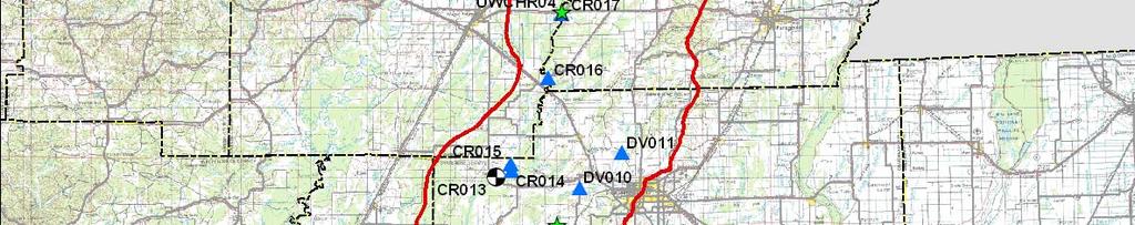
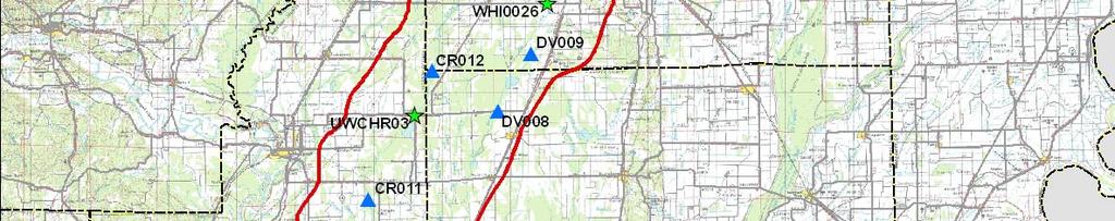
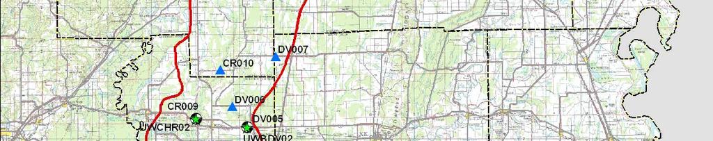
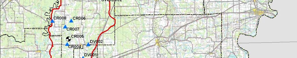
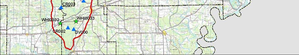
71 TNC Sampling Sites, EPA 319 Grant
72 Sediment Studies HEC-6T model (circa 1990 s) to evaluate changed sediment load due to practices evaluated in AnnAGNPS. Preliminary sensitivity indicates sediment load must be reduced approximately 50% to achieve sustainable channel with minimal long-term maintenance. Big Creek sub-watershed Pilot to assess BMP implementation on sediment production Using AnnAGNPS model includes Surface and Rill Erosion Sources Gully Erosion Sources In-Channel Erosion Sources Cache River upstream of Grubbs, AR p, Use methodology from Big Creek pilot Evaluate potential to reduce sediment loading to Grubbs Reach Investigate possible methods to alleviate flooding caused by channel blockages Lowering sediment load is critical to solving blockage problems at Grubbs
73 AnnAGNPS Analysis Hypothetical hydrology for 30-year simulation GIS layers for each parameter in RUSLE Landcover Soil Type Precipitation/Runoff Practice Slope Length (network) Outputs t Annualized sediment yield for gully and rill erosion from RUSLE Average annual Gully Erosion to be estimated using new technique implemented in AGNPS Average annual In-Channel Erosion estimated using hydraulic geometry and generalized hydraulics for multiple reaches in stream network
74 AnnAGNPS Analysis Continued Results provide: Order of magnitude estimates of total sediment at point(s) of interest for each scenario Broken down between sands, silts, and clays where input detail supports calculation General locations of sources within basin/sub-basin Mechanism to compare relative changes between treatment practices and/or structural t measures Measure A changes sediment total by X%, Measure B changes sediment total by Y%
75 Landuse Big Creek Basin Source: Dennis Carmen
76 Source: Dennis Carmen Elevations Big Creek Basin
77 Soils, Landuse, subbasins, & stream network combined Source: Dennis Carmen
78 Runoff by Cell Big Creek Source: Dennis Carmen
79 Surface/Rill Erosion Contribution to Outlet Source: Dennis Carmen
80 GULLY STRUCTURE LOCATIONS Nearly 1800 Locations Effected Area Range (Acres) Number of Locations Less than


81 SHEET PILE WEIR


82 CONCRETE CHUTE ROCK LINED CHUTE

83 STRAIGHT PIPE DROP INLET
84 84 BUILDING STRONG
Watershed Conservation Management Planning Using the Integrated Field & Channel Technology of AnnAGNPS & CONCEPTS
 Watershed Conservation Management Planning Using the Integrated Field & Channel Technology of AnnAGNPS & CONCEPTS Eddy Langendoen Ron Bingner USDA-ARS National Sedimentation Laboratory, Oxford, Mississippi
Application of an Enhanced, Fine-Scale SWAT Model to Target Land Management Practices for Maximizing Pollutant Reduction and Conservation Benefits
 Application of an Enhanced, Fine-Scale SWAT Model to Target Land Management Practices for Maximizing Pollutant Reduction and Conservation Benefits Amanda Flynn, Todd Redder, Joe DePinto, Derek Schlea Brian
7.3 Sediment Delivery Analysis
 7.3 Sediment Delivery Analysis In order to evaluate potential changes in sedimentation patterns that could occur due to impacts from the FCP and LPP alignments, sediment assessment models were constructed
Hydrologic and Water Quality Modeling for the Missouri River Basin (MORB)
") 2016 International SWAT Conference in Beijing, China Hydrologic and Water Quality Modeling for the Missouri River Basin (MORB) Zhonglong Zhang, PhD, PE, May Wu, PhD Courtesy of USACE Outline Missouri River
2016 International SWAT Conference in Beijing, China Hydrologic and Water Quality Modeling for the Missouri River Basin (MORB) Zhonglong Zhang, PhD, PE, May Wu, PhD Courtesy of USACE Outline Missouri River
Assessing Spatial and Temporal Distribution of Sediment, Nitrogen and Phosphorous Loading in the Missouri River Basin (MORB)
") Assessing Spatial and Temporal Distribution of Sediment, Nitrogen and Phosphorous Loading in the Missouri River Basin (MORB) Zhonglong Zhang, PhD, PE, May Wu, PhD LimnoTech, Environmental Laboratory, ERDC,
Assessing Spatial and Temporal Distribution of Sediment, Nitrogen and Phosphorous Loading in the Missouri River Basin (MORB) Zhonglong Zhang, PhD, PE, May Wu, PhD LimnoTech, Environmental Laboratory, ERDC,
Subject Name: SOIL AND WATER CONSERVATION ENGINEERING 3(2+1) COURSE OUTLINE
 COURSE OUTLINE") Subject Name: SOIL AND WATER CONSERVATION ENGINEERING 3(2+1) COURSE OUTLINE (Name of Course Developer: Prof. Ashok Mishra, AgFE Department, IIT Kharagpur, Kharagpur 721 302) Module 1: Introduction and
Subject Name: SOIL AND WATER CONSERVATION ENGINEERING 3(2+1) COURSE OUTLINE (Name of Course Developer: Prof. Ashok Mishra, AgFE Department, IIT Kharagpur, Kharagpur 721 302) Module 1: Introduction and
Section 4: Model Development and Application
 Section 4: Model Development and Application The hydrologic model for the Wissahickon Act 167 study was built using GIS layers of land use, hydrologic soil groups, terrain and orthophotography. Within
Measuring Streambank Erosion Bank Profiles to more Robustly Estimate Recession Rates and Calibration of the AnnAGNPS-CEAP Model
 Measuring Streambank Erosion Bank Profiles to more Robustly Estimate Recession Rates and Calibration of the AnnAGNPS-CEAP Model Clare Prestwich, P.E. 1 & W. Barry Southerland, Ph.D. 2 Water Quality and
Web-based Tools for Soil Erosion Assessment/Management
 Web-based Tools for Soil Erosion Assessment/Management Glenn O Neil GIS Specialist Institute of Water Research Michigan State University Managing and Understanding Sediments in Your Watershed Workshop
Little Swan Lake. Dam Inspection & Siltation Study Prepared By: William Klingner, P.E., CFM October 28, 2018
 Little Swan Lake Dam Inspection & Siltation Study Prepared By: William Klingner, P.E., CFM October 28, 2018 Agenda Little Swan Lake Dam Inspection Theoretical Little Swan Lake Siltation Rate Calculations
INFLOW DESIGN FLOOD CONTROL SYSTEM PLAN 40 C.F.R. PART PLANT YATES ASH POND 2 (AP-2) GEORGIA POWER COMPANY
 GEORGIA POWER COMPANY") INFLOW DESIGN FLOOD CONTROL SYSTEM PLAN 40 C.F.R. PART 257.82 PLANT YATES ASH POND 2 (AP-2) GEORGIA POWER COMPANY EPA s Disposal of Coal Combustion Residuals from Electric Utilities Final Rule (40 C.F.R.
INFLOW DESIGN FLOOD CONTROL SYSTEM PLAN 40 C.F.R. PART 257.82 PLANT YATES ASH POND 2 (AP-2) GEORGIA POWER COMPANY EPA s Disposal of Coal Combustion Residuals from Electric Utilities Final Rule (40 C.F.R.
Illinois State Water Survey Division
 Illinois State Water Survey Division SURFACE WATER SECTION SWS Miscellaneous Publication 108 SEDIMENT YIELD AND ACCUMULATION IN THE LOWER CACHE RIVER by Misganaw Demissie Champaign, Illinois June 1989
Conservation Planning evaluate land management alternatives to reduce soil erosion to acceptable levels. Resource Inventories estimate current and
 Conservation Planning evaluate land management alternatives to reduce soil erosion to acceptable levels. Resource Inventories estimate current and projected erosion levels and their impact on natural resource
Data Collection and GIS Applications
 Data Collection and GIS Applications Governor s s Conference on the Management of the Illinois River System Jeff Jack of all Trades Boeckler, IDNR Introduction Collecting available GIS data sets Creating
How Do Human Impacts and Geomorphological Responses Vary with Spatial Scale in the Streams and Rivers of the Illinois Basin?
 How Do Human Impacts and Geomorphological Responses Vary with Spatial Scale in the Streams and Rivers of the Illinois Basin? Bruce Rhoads Department of Geography University of Illinois at Urbana-Champaign
EAGLES NEST AND PIASA ISLANDS
 EAGLES NEST AND PIASA ISLANDS HABITAT REHABILITATION AND ENHANCEMENT PROJECT MADISON AND JERSEY COUNTIES, ILLINOIS ENVIRONMENTAL MANAGEMENT PROGRAM ST. LOUIS DISTRICT FACT SHEET I. LOCATION The proposed
Bank Erosion and Morphology of the Kaskaskia River
 Bank Erosion and Morphology of the Kaskaskia River US Army Corps Of Engineers St. Louis District Fayette County Soil and Water Conservation District Team Partners : Carlyle Lake Ecosystem Partnership Vicinity
Overview of fluvial and geotechnical processes for TMDL assessment
 Overview of fluvial and geotechnical processes for TMDL assessment Christian F Lenhart, Assistant Prof, MSU Research Assoc., U of M Biosystems Engineering Fluvial processes in a glaciated landscape Martin
TPDES: Soil, Erosion and Sedimentation Methods
 SAWS TPDES: Soil, Erosion and Sedimentation Methods Philip Handley Supervisor-Resource Protection & Compliance August 25, 2014 TPDES: Soil, Erosion and Sedimentation Methods Soil Common term: Dirt Common
FUTURE MEANDER BEND MIGRATION AND FLOODPLAIN DEVELOPMENT PATTERNS NEAR RIVER MILES 241 TO 235, SACRAMENTO RIVER
 FUTURE MEANDER BEND MIGRATION AND FLOODPLAIN DEVELOPMENT PATTERNS NEAR RIVER MILES 241 TO 235, SACRAMENTO RIVER Eric W. Larsen University of California, Davis With the assistance of Evan Girvetz REPORT
Stream Geomorphology. Leslie A. Morrissey UVM July 25, 2012
 Stream Geomorphology Leslie A. Morrissey UVM July 25, 2012 What Functions do Healthy Streams Provide? Flood mitigation Water supply Water quality Sediment storage and transport Habitat Recreation Transportation
BANK EROSION AND HISTORICAL MORPHOLOGY STUDY OF THE MIDDLE KASKASKIA RIVER. Building Strong
 BANK EROSION AND HISTORICAL MORPHOLOGY STUDY OF THE MIDDLE KASKASKIA RIVER Building Strong Study Conducted Jun 2001-Dec 2002 Last Presented in 2004 2002 United States and Great Britain Invade Afghanistan
Watershed Processes and Modeling
 Watershed Processes and Modeling Pierre Y. Julien Hyeonsik Kim Department of Civil Engineering Colorado State University Fort Collins, Colorado Kuala Lumpur - May Objectives Brief overview of Watershed
Island Design. UMRS EMP Regional Workshop. Presentation for the
 Island Design Presentation for the UMRS EMP Regional Workshop by Jon Hendrickson Hydraulic Engineer Regional Technical Specialist, Water Quality and Habitat Restoration August 17 19, 2005 Project Delivery
PENNSYLVANIA DEPARTMENT OF TRANSPORTATION ENGINEERING DISTRICT 3-0
 PENNSYLVANIA DEPARTMENT OF TRANSPORTATION ENGINEERING DISTRICT 3-0 LYCOMING COUNTY S.R.15, SECTION C41 FINAL HYDROLOGIC AND HYDRAULIC REPORT STEAM VALLEY RUN STREAM RELOCATION DATE: June, 2006 REVISED:
 Red River Flooding June 2015 Caddo and Bossier Parishes Presented by: Flood Technical Committee Where the Rain Falls Matters I-30 versus I-20 I-20 Backwater and Tributary Floods (Localized) 2016 Flood
Watershed concepts for community environmental planning
 Purpose and Objectives Watershed concepts for community environmental planning Dale Bruns, Wilkes University USDA Rural GIS Consortium May 2007 Provide background on basic concepts in watershed, stream,
What Is Water Erosion? Aren t they the same thing? What Is Sediment? What Is Sedimentation? How can Sediment Yields be Minimized?
 Jerald S. Fifield, Ph.D. CISEC HydroDynamics Incorporated Parker, CO 303-841-0377 Aren t they the same thing? What Is Sediment? Soil particles deposited or suspended in water or air The process of depositing
CR AAO Bridge. Dead River Flood & Natural Channel Design. Mitch Koetje Water Resources Division UP District
 CR AAO Bridge Dead River Flood & Natural Channel Design Mitch Koetje Water Resources Division UP District Old County Road AAO Bridge Map courtesy of Marquette County Silver Lake Basin McClure Basin
Evaluation of the two stage ditch as a best management practice. A. Hodaj, L.C. Bowling, C. Raj, I. Chaubey
 Evaluation of the two stage ditch as a best management practice A. Hodaj, L.C. Bowling, C. Raj, I. Chaubey Two-stage ditch: Stage 1 : main channel Stage 2 : flood plain bench Traditional ditch Twostage
Floodplain modeling. Ovidius University of Constanta (P4) Romania & Technological Educational Institute of Serres, Greece
 Romania & Technological Educational Institute of Serres, Greece") Floodplain modeling Ovidius University of Constanta (P4) Romania & Technological Educational Institute of Serres, Greece Scientific Staff: Dr Carmen Maftei, Professor, Civil Engineering Dept. Dr Konstantinos
Floodplain modeling Ovidius University of Constanta (P4) Romania & Technological Educational Institute of Serres, Greece Scientific Staff: Dr Carmen Maftei, Professor, Civil Engineering Dept. Dr Konstantinos
Kaskaskia Morphology Study Headwaters to Lake Shelbyville
 Kaskaskia Morphology Study Headwaters to Lake Shelbyville KWA Mini Summit 5 March 2012 1 Kaskaskia Morphology Study Headwaters to Lake Shelbyville Conducted by U.S. Army Corps of Engineers, St. Louis District
Summary Description Municipality of Anchorage. Anchorage Coastal Resource Atlas Project
 Summary Description Municipality of Anchorage Anchorage Coastal Resource Atlas Project By: Thede Tobish, MOA Planner; and Charlie Barnwell, MOA GIS Manager Introduction Local governments often struggle
Continuing Education Associated with Maintaining CPESC and CESSWI Certification
 Continuing Education Associated with Maintaining CPESC and CESSWI Certification Module 2: Stormwater Management Principles for Earth Disturbing Activities Sponsors: ODOTs Local Technical Assistance Program
Black Gore Creek 2013 Sediment Source Monitoring and TMDL Sediment Budget
 Black Gore Creek 2013 Sediment Source Monitoring and TMDL Sediment Budget Prepared for: Prepared By: - I. Introduction The Black Gore Creek Total Maximum Daily Load (TMDL) was developed in collaboration
Results of the Sava River Model
 Results of the Sava River Model Jamie G. James, P.E. Nashville District September 2010 US Army Corps of Engineers BUILDING STRONG Discussion Outline Study Goals Model Limitations HEC-RAS Model Results
Erosion Surface Water. moving, transporting, and depositing sediment.
 + Erosion Surface Water moving, transporting, and depositing sediment. + Surface Water 2 Water from rainfall can hit Earth s surface and do a number of things: Slowly soak into the ground: Infiltration
Technical Memorandum No
 Pajaro River Watershed Study in association with Technical Memorandum No. 1.2.10 Task: Evaluation of Four Watershed Conditions - Sediment To: PRWFPA Staff Working Group Prepared by: Gregory Morris and
Sediment Detention Basin Feasibility Study of Horseshoe Lake, Alexander County, Illinois
 Sediment Detention Basin Feasibility Study of Horseshoe Lake, Alexander County, Illinois by Ming T. Lee Office of Spatial Data Analysis & Information Prepared for the Illinois Department of Conservation
Standards for Soil Erosion and Sediment Control in New Jersey May 2012
 STANDARD FOR SEDIMENT BASIN Definition A barrier, dam, excavated pit, or dugout constructed across a waterway or at other suitable locations to intercept and retain sediment. Basins created by construction
Diagnostic Geomorphic Methods for Understanding Future Behavior of Lake Superior Streams What Have We Learned in Two Decades?
 Diagnostic Geomorphic Methods for Understanding Future Behavior of Lake Superior Streams What Have We Learned in Two Decades? Faith Fitzpatrick USGS WI Water Science Center, Middleton, WI fafitzpa@usgs.gov
Case Study 2: Twenty-mile Creek Rock Fords
 Case Study : Twenty-mile Creek Rock Fords Location Crossing Description Washington. Okanagan National Forest. Methow Valley Ranger District. Chewuch river basin, East Chewuch Road. The Twenty-mile Creek
Detroit 516 Activities
 Detroit 516 Activities Dam Capacity Study Sediment Workshop in Traverse City START 2.0 Saginaw River Study Dam Capacity Study A progress report Outline Study Objective (Why are we doing this?) Reservoir
The Yellow River Initiative: The Birth of a System Approach to Challenges Facing the Everglades of the North
 The Yellow River Initiative: The Birth of a System Approach to Challenges Facing the Everglades of the North Robert Barr and Siavash Beik 2016 INAFSM Annual Conference Belterra Conference Center, Indiana
Running Water Earth - Chapter 16 Stan Hatfield Southwestern Illinois College
 Running Water Earth - Chapter 16 Stan Hatfield Southwestern Illinois College Hydrologic Cycle The hydrologic cycle is a summary of the circulation of Earth s water supply. Processes involved in the hydrologic
Solutions to Flooding on Pescadero Creek Road
 Hydrology Hydraulics Geomorphology Design Field Services Photo courtesy Half Moon Bay Review Solutions to Flooding on Pescadero Creek Road Prepared for: San Mateo County Resource Conservation District
Erosion and Sedimentation Basics
 Erosion and Sedimentation Basics Coastal San Luis Resource Conservation District G.W. Bates, PE, CPESC Outline: 1. Terms & Concepts 2. Causes of Erosion 3. The Erosion/Sedimentation Process 4. Erosion
Modeling Upland and Channel Sources of Sediment in the Le Sueur River Watershed, Minnesota
 Modeling Upland and Channel Sources of Sediment in the Le Sueur River Watershed, Minnesota Solomon Folle and David Mulla Department of Soil, Water and Climate University of Minnesota August 6, 2009 5 th
What is a watershed or landscape perspective?
 What is a watershed or landscape perspective? -remove sediment -add sediment -add wood, riparian manipulation -alter (engineer) channel/floodplain morphology -restore/abandon roads You are here What is
Tom Ballestero University of New Hampshire. 1 May 2013
 Tom Ballestero University of New Hampshire 1 May 2013 1 Hydrology 2 Basic Hydrology Low flows most common Flows that fill the stream to the banks and higher are much less common Filling the stream to the
COLUSA BASIN WATERSHED ASSESSMENT. Final. Prepared by: H. T. Harvey & Associates. In Collaboration With:
 COLUSA BASIN WATERSHED ASSESSMENT Prepared by: In Collaboration With: G. Mathias Kondolf Geomorph Blankinship & Associates Prepared for: Colusa County Resource Conservation District 100 Sunrise Boulevard,
GEOL 1121 Earth Processes and Environments
 GEOL 1121 Earth Processes and Environments Wondwosen Seyoum Department of Geology University of Georgia e-mail: seyoum@uga.edu G/G Bldg., Rm. No. 122 Seyoum, 2015 Chapter 6 Streams and Flooding Seyoum,
low turbidity high turbidity
 What is Turbidity? Turbidity refers to how clear the water is. The greater the amount of total suspended solids (TSS) in the water, the murkier it appears and the higher the measured turbidity. Excessive
NORTHUMBERLAND COUNTY, PA
 QUAKER RUN Stream and Wetland Restoration As-Built Completion Report and First Year Monitoring Data Coal Township NORTHUMBERLAND COUNTY, PA Upstream Before Upstream After Prepared for: COAL TOWNSHIP 805
Influence of the Major Drainages to the Mississippi River and Implications for System Level Management
 Influence of the Major Drainages to the Mississippi River and Implications for System Level Management Brian M. Vosburg Geologist Louisiana Coastal Protection and Restoration Authority brian.vosburg@la.gov
Modeling Vegetative Buffer Performance Considering Topographic Data Accuracy
 University of Nebraska - Lincoln DigitalCommons@University of Nebraska - Lincoln USDA Forest Service / UNL Faculty Publications U.S. Department of Agriculture: Forest Service -- National Agroforestry Center
SPECIFIC DEGRADATION AND RESERVOIR SEDIMENTATION. By Renee Vandermause & Chun-Yao Yang
 SPECIFIC DEGRADATION AND RESERVOIR SEDIMENTATION By Renee Vandermause & Chun-Yao Yang Outline Sediment Degradation - Erosion vs Sediment Yield - Sediment Yield - Methods for estimation - Defining Sediment
!"#$%&&'()*+#$%(,-./0*)%(!
*+#$%(,-./0*)%(!") 8:30 Sign in Hoosic River Revival Coalition!"#$%&&'()*+#$%(,-./0*)%(! 12-#30+4/#"5-(60 9:00 Welcome and Introductions 9:15 Goals for Today s Program: A Description of the Planning Process 9:30 First Session:
8:30 Sign in Hoosic River Revival Coalition!"#$%&&'()*+#$%(,-./0*)%(! 12-#30+4/#"5-(60 9:00 Welcome and Introductions 9:15 Goals for Today s Program: A Description of the Planning Process 9:30 First Session:
AREAL MODELING OF EROSION FOR ENVIRONMENTAL NONPOINT APPLICATIONS (AMEENA)
") AREAL MODELING OF EROSION FOR ENVIRONMENTAL NONPOINT APPLICATIONS (AMEENA) Mohammad Ahmed Al-Smadi Dissertation submitted to the Faculty of Virginia Polytechnic Institute and State University in partial
AREAL MODELING OF EROSION FOR ENVIRONMENTAL NONPOINT APPLICATIONS (AMEENA) Mohammad Ahmed Al-Smadi Dissertation submitted to the Faculty of Virginia Polytechnic Institute and State University in partial
Floods Lecture #21 20
 Floods 20 Lecture #21 What Is a Flood? Def: high discharge event along a river! Due to heavy rain or snow-melt During a flood, a river:! Erodes channel o Deeper & wider! Overflows channel o Deposits sediment
Hydrologic Modelling of the Upper Malaprabha Catchment using ArcView SWAT
 Hydrologic Modelling of the Upper Malaprabha Catchment using ArcView SWAT Technical briefs are short summaries of the models used in the project aimed at nontechnical readers. The aim of the PES India
Bachelor of Biosystems Technology Faculty of Technology South Eastern University of Sri Lanka
 Bachelor of Biosystems Technology Faculty of Technology South Eastern University of Sri Lanka BSE 11042 Principles of Irrigation Furrow Irrigation Running water in small channels (furrows) Water infiltration
Fish Passage and Abundance around Grade Control Structures on Incised Streams in Western Iowa
 Fish Passage and Abundance around Grade Control Structures on Incised Streams in Western Iowa John Thomas Hungry Canyons Alliance Mary Culler Iowa State University / Missouri DNR Dimitri Dermisis IIHR
Tarbela Dam in Pakistan. Case study of reservoir sedimentation
 Tarbela Dam in Pakistan. HR Wallingford, Wallingford, UK Published in the proceedings of River Flow 2012, 5-7 September 2012 Abstract Reservoir sedimentation is a main concern in the Tarbela reservoir
Garner State Park Pavilion Preservation Study
 D4 Garner State Park Pavilion Preservation Study Presented by Andy Johnston, PE, CPESC, CFM Halff Associates, Inc. Austin Mark Winford, RA, LEED AP Texas Parks and Wildlife Department, Austin Location
Implementing a Project with 319 Funds: The Spring Brook Meander Project. Leslie A. Berns
 Implementing a Project with 319 Funds: The Spring Brook Meander Project Leslie A. Berns "...to acquire... and hold lands... for the purpose of protecting and preserving the flora, fauna and scenic beauties...
NREM 407/507 - March 26. International Rivers Project. 1. Yellow River Presentation today Nile River next Tuesday
 NREM 407/507 - March 26 1. Yellow River Presentation today Nile River next Tuesday 2. Calculate stream bank erosion, gully erosion and sheet and rill erosion for the Swenson Farm that we visited on Tuesday
Date of Report: EPA agreement number: Center Name and Institution of Ctr. Director: Identifier used by Center for Project: Title of Project:
 Date of Report: March 31, 2003 EPA agreement number: R829515C003 Center Name and Institution of Ctr. Director: Rocky Mountain Regional Hazardous Substance Research Center, Colorado State University, Fort
Chris Lenhart, John Nieber, Ann Lewandowski, Jason Ulrich TOOLS AND STRATEGIES FOR REDUCING CHANNEL EROSION IN MINNESOTA
 Chris Lenhart, John Nieber, Ann Lewandowski, Jason Ulrich TOOLS AND STRATEGIES FOR REDUCING CHANNEL EROSION IN MINNESOTA Background and approach Channel loading major source of sediment in much of MN River
Four Beetles Project Mendocino National Forest
 Four Beetles Project Mendocino National Forest Jose Chavez Bakersfield College 06/07/2016-08/02/2016 District Archeologist Curtis Fair & District Hydrologist John Kelley 2016 Acknowledgements: This project
Great Lakes Tributary Modeling: Canaseraga Creek Watershed
 Great Lakes Tributary Modeling: Canaseraga Creek Watershed SWAT Model Authority: Section 516(e) of WRDA 1996 US Army Corps of Engineers Canaseraga Creek Project Location - Encompasses portions of Livingston,
Laboratory Exercise #3 The Hydrologic Cycle and Running Water Processes
 Laboratory Exercise #3 The Hydrologic Cycle and Running Water Processes page - 1 Section A - The Hydrologic Cycle Figure 1 illustrates the hydrologic cycle which quantifies how water is cycled throughout
Upper Truckee River Restoration Lake Tahoe, California Presented by Brendan Belby Sacramento, California
 Upper Truckee River Restoration Lake Tahoe, California Presented by Brendan Belby Sacramento, California Mike Rudd (Project Manager), Charley Miller & Chad Krofta Declines in Tahoe s Water Clarity The
Soil Map Boulder County Area, Colorado (Planet Blue Grass) Web Soil Survey National Cooperative Soil Survey
 Web Soil Survey National Cooperative Soil Survey") 475910 476000 476090 476180 476270 476360 105 16' 21'' W 476450 476540 476630 476720 476810 4453350 4453440 4453260 4453350 4453170 4453260 4453080 4453170 4453080 475820 475910 4452990 476000 476090 476180
475910 476000 476090 476180 476270 476360 105 16' 21'' W 476450 476540 476630 476720 476810 4453350 4453440 4453260 4453350 4453170 4453260 4453080 4453170 4453080 475820 475910 4452990 476000 476090 476180
Probabilistic Evaluation of a Meandering Low-Flow Channel. February 24 th, UMSRS
 Probabilistic Evaluation of a Meandering Low-Flow Channel February 24 th, 2014 2014 UMSRS 1 2 acknowledgments Low- Flow Channel (LFC) overview Proposed Diversion Channel collects runoff from: The Rush
ASFPM - Rapid Floodplain Mapping
 ASFPM - Nicole Cominoli Hydraulic Engineer USACE - Omaha District mary.n.cominoli@usace.army.mil June 3, 2015 US Army Corps of Engineers Mitigation = Risk Informed Decisions 2 The National Flood Insurance
STUDY GUIDE FOR CONTENT MASTERY. Surface Water Movement
 Surface Water SECTION 9.1 Surface Water Movement In your textbook, read about surface water and the way in which it moves sediment. Complete each statement. 1. An excessive amount of water flowing downslope
Swift Creek Sediment Management Action Plan (SCSMAP)
") Swift Creek Sediment Management Action Plan (SCSMAP) PHASE 2 PROJECT PLAN PROPOSAL Whatcom County Public Works Department 322 N. Commercial Street, Suite 210 Bellingham, WA 98225 (360) 676-6692 June 2013
Swift Creek Sediment Management Action Plan (SCSMAP) PHASE 2 PROJECT PLAN PROPOSAL Whatcom County Public Works Department 322 N. Commercial Street, Suite 210 Bellingham, WA 98225 (360) 676-6692 June 2013
Dealing with Zone A Flood Zones. Topics of Discussion. What is a Zone A Floodplain?
 Dealing with Zone A Flood Zones Topics of Discussion Overview of Zone A Floodplains Permitting Development in Zone A Floodplains Estimating Flood Elevations in Zone A Flood Insurance Implications Letters
Technical Memorandum. To: From: Copies: Date: 10/19/2017. Subject: Project No.: Greg Laird, Courtney Moore. Kevin Pilgrim and Travis Stroth
 Technical Memorandum To: From: Greg Laird, Courtney Moore Kevin Pilgrim and Travis Stroth 5777 Central Avenue Suite 228 Boulder, CO 80301 www.otak.com Copies: [Electronic submittal] Date: 10/19/2017 Subject:
Great Lakes Dam Capacity Study
 Great Lakes Dam Capacity Study Project Team: USACE, Detroit District Wayne State University, Detroit, Michigan Great Lakes Environmental Center, Traverse City, Michigan BUILDING STRONG Study Objectives
Nutrient Delivery from the Mississippi River to the Gulf of Mexico and Effects of Cropland Conservation
 Nutrient Delivery from the Mississippi River to the Gulf of Mexico and Effects of Cropland Conservation Mike White, Jeff Arnold, Lee Norfleet, Santhi Chinnasamy, and Mauro DiLuzio USDA-ARS Grassland, Soil
Summary. Streams and Drainage Systems
 Streams and Drainage Systems Summary Streams are part of the hydrologic cycle and the chief means by which water returns from the land to the sea. They help shape the Earth s surface and transport sediment
Assessment. Assessment
 2001 SPRINGBROOK CREEK RESTORATION - THREE YEAR POST-CONSTRUCTION REVIEW - Presented by Bruce Henderson and Andy Harris 2005 River Restoration Northwest Symposium Skamania Lodge, Washington www.hendersonlandservices.com
Template for Sediment and Erosion Control Plan General Instructions. Section Instructions
 Template for Sediment and Erosion Control Plan General Instructions Introduction: Soil erosion and sediment deposition from farmlands can contribute to degraded surface water quality. Sediment delivery
Long Valley Meadow Restoration Project
 Long Valley Meadow Restoration Project USDA Forest Service Mogollon Rim Ranger District Coconino National Forest Coconino County, Arizona T13N, R9E, Section 12 and T13N, R10E, Sections 6 and 7 Gila and
Analysis of Road Sediment Accumulation to Monumental Creek using the GRAIP Method
 Analysis of Road Sediment Accumulation to Monumental Creek using the GRAIP Method Introduction (from http://www.neng.usu.edu/cee/faculty/dtarb/graip/#over): The Geomorphologic Road Analysis and Inventory
YELLOWSTONE RIVER FLOOD STUDY REPORT TEXT
 YELLOWSTONE RIVER FLOOD STUDY REPORT TEXT TECHNICAL REPORT Prepared for: City of Livingston 411 East Callender Livingston, MT 59047 Prepared by: Clear Creek Hydrology, Inc. 1627 West Main Street, #294
State Water Survey Division SURFACE WATER SECTION
 State Water Survey Division SURFACE WATER SECTION AT THE UNIVERSITY OF ILLINOIS Illinois Department of Energy and Natural Resources SWS Miscellaneous Publication 88 SEDIMENTATION OF POOL 19 ON THE MISSISSIPPI
Pequabuck River Flooding Study and Flood Mitigation Plan The City of Bristol and Towns of Plainville and Plymouth, CT
 Pequabuck River Flooding Study and Flood Mitigation Plan The City of Bristol and Towns of Plainville and Plymouth, CT Raymond Rogozinski and Maged Aboelata The City of Bristol and Towns of Plainville and
Illinois State Water Survey Division
 Illinois State Water Survey Division SURFACE WATER SECTION SWS Contract Report 413 AT THE UNIVERSITY OF ILLINOIS SEDIMENTATION SURVEY OF DAWSON LAKE, MORAINE VIEW STATE PARK, MC LEAN COUNTY, ILLINOIS by
CITY OF CAPE CORAL STORMWATER MASTER PLAN PHASE II - PART 1 BASINS 4, 10, & 14 SUB-BASIN DRAINAGE IMPROVEMENTS HYDRAULIC ANALYSIS SUMMARY
 CITY OF CAPE CORAL STORMWATER MASTER PLAN PHASE II - PART 1 BASINS 4, 10, & 14 SUB-BASIN DRAINAGE IMPROVEMENTS HYDRAULIC ANALYSIS SUMMARY Cape Coral, FL Prepared for: The City of Cape Coral Public Works
Black Gore Creek Sediment Source Monitoring and TMDL Sediment Budget
 Black Gore Creek 2012 Sediment Source Monitoring and TMDL Sediment Budget Prepared for: The Eagle River Watershed Council Prepared By: RiverRestoration.org - I. Introduction Interstate 70 is a major highway
CHAPTER 3. Section I. Introduction
 15 E 89 CHAPTER 3 SEDIMENT YIELD Section I. Introduction 3-1. Purpose and Scope. This chapter presents guidance on the selection and application of procedures for calculating sediment yield. Procedures
Science EOG Review: Landforms
 Mathematician Science EOG Review: Landforms Vocabulary Definition Term canyon deep, large, V- shaped valley formed by a river over millions of years of erosion; sometimes called gorges (example: Linville
Griswold Creek August 22, 2013
 Creek August 22, 2013 1 Lake Erie Protection Fund Creek Study ver Evaluate the overall condition of Creek Determine stable channel dimensions & appropriate restoration techniques Starting Stat gpoint for
Soil Erosion Calculation using Remote Sensing and GIS in Río Grande de Arecibo Watershed, Puerto Rico
 Soil Erosion Calculation using Remote Sensing and GIS in Río Grande de Arecibo Watershed, Puerto Rico Alejandra M. Rojas González Department of Civil Engineering University of Puerto Rico at Mayaguez.
Chapter 3 Erosion in the Las Vegas Wash
 Chapter 3 Erosion in the Las Vegas Wash Introduction As described in Chapter 1, the Las Vegas Wash (Wash) has experienced considerable change as a result of development of the Las Vegas Valley (Valley).
Appendix K.2: Sediment Management Excerpt from South Orange County Hydromodification Management Plan
 Appendix K.2: Sediment Management Excerpt from South Orange County Hydromodification Management Plan 4 Sediment Supply Management Requirements Permit Order R9-2013-0001 as amended by Order No. R9-2015-0001Section
3/3/2013. The hydro cycle water returns from the sea. All "toilet to tap." Introduction to Environmental Geology, 5e
 Introduction to Environmental Geology, 5e Running Water: summary in haiku form Edward A. Keller Chapter 9 Rivers and Flooding Lecture Presentation prepared by X. Mara Chen, Salisbury University The hydro