Watershed Conservation Management Planning Using the Integrated Field & Channel Technology of AnnAGNPS & CONCEPTS
|
|
|
- Anne Hudson
- 6 years ago
- Views:
Transcription
1 Watershed Conservation Management Planning Using the Integrated Field & Channel Technology of AnnAGNPS & CONCEPTS Eddy Langendoen Ron Bingner USDA-ARS National Sedimentation Laboratory, Oxford, Mississippi


2 BMP s can be studied from field scale to their impact on a watershed scale. Field scale BMP A watershed with diverse landuse, including BMPs.

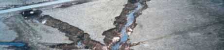
3 Erosion can occur anywhere in a watershed Erosion in fields Erosion in small field channels Erosion in stream systems

4 Tillage-Induced Ephemeral Gully Erosion - TIEGEM As a result of a non-erosive layer at the bottom of the tillage depth

5 Branching of Ephemeral Gullies


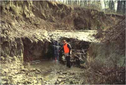
6 Disturbed Stream Systems


7 AnnAGNPS A partnering effort between the USDA: Agricultural Research Service and Natural Resource Conservation Service National Sedimentation Laboratory


8 CONCEPTS CONservational Channel Evolution and Pollutant Transport System CONCEPTS simulates long-term response of channels to loadings of water and sediments, and to instream structures Bendway weir Streambank erosion Bed evolution and sediment transport Flow hydraulics Input: Output: Channel geometry Composition of bed and bank materials Erosion resistance and shear strength of bed and bank materials Rates of flow and sediments entering the channel Changes in channel geometry Time series of hydraulic variables and sediment yield
9 TYPES OF EROSION Interrill and rill (sheet-rill) Wind Ephemeral gully Permanent, incised (classical) gully Stream channel Mass movement Geologic


10 Watershed Erosion Model Components Sheet & Rill Ephemeral Gully Classical Gully Channel Erosion RUSLE EGEM REGEM TIEGEM Runoff/Sediment Relat. CONCEPTS when significant changes of channel morphology are possible
11 Watershed Sedimentation Processes ARS Models CONCEPTS RUSLE Surface Erosion AnnAGNPS Hillslope Gully Erosion Hillslope Storage REMM Mass Erosion Channel Transport Net Watershed Sediment Yield Channel Bank Erosion Channel Storage Yield Storage and Transport Production
12 RUSLE EROSION Concentrated Flow Sediment and nutrients transported to the edge of the field.
13 AnnAGNPS Cell Landscape Overland flow Interrill Rill Ephemeral Gully (Concentrated flow) Erosion Types
14 Water, Sediment, & Chemical Sources Track loadings by source throughout the transport process Cell A reach 1 gully Cell B reach 2 reach 3 Cell C feedlot Cell D Impoundment point source Cell E reach 4 watershed outlet Cell F

15 AGNPS WATERSHED DESCRIPTION FOCUS ON STREAM REACHES by CONCEPTS SUBWATERSHEDS CONNECTED BY THE CHANNEL NETWORK
16 Reach Processes AnnAGNPS Incorporates simple reach routing processes. There is no memory between runoff events.


17 Reach Processes CONCEPTS is better suited: When a significant portion of sediment originates from channel sources. When hydrodynamic channel morphological process simulations are needed.


18 Integration of REMM Within Models Riparian Buffer System Stream Field Erosion and Deposition
 Construction of Tennessee- Tombigbee waterway (1980s).-, 55 Monroe #S Aberdeen #S Jackson.-, 20.")
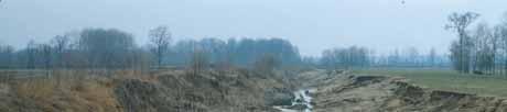
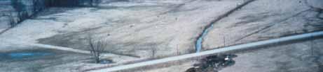
19 Case Study James Creek, MS Listed as impaired due to excessive sedimentation Channel impacted by: Channelization (~1905) Dredging and snagging (1968) Construction of several lowwater crossings (1960s 1990s) Construction of Tennessee- Tombigbee waterway (1980s).-, 55 Monroe #S Aberdeen #S Jackson.-, 20.-, 59 Flow direction

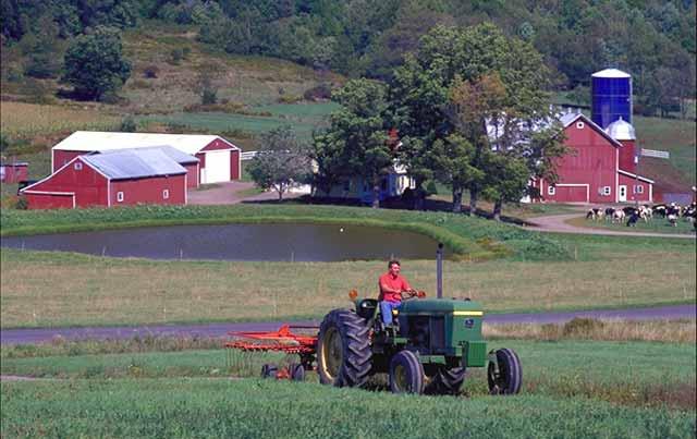
20 James Creek Description 1430 mm rainfall Drainage area 111 sq km (43 sq mi) Soils: dominated by silty clays and silt loams Most of the watershed in cultivated croplands, pasture or fallow conditions Main crops: corn, soybeans, cotton, wheat, and sorghum Implemented BMPs: reduced tillage, strip cropping, terraces


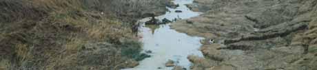
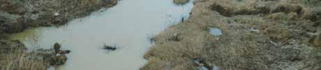
21 James Creek Channel Characteristics Lower 6.6 km has natural sinuous alignment Bank erosion is prevalent Boundary materials are predominantly silts and clays

22 DETERMINATION OF ACTUAL SEDIMENT LOADINGS AT THE OUTLET OF JAMES CREEK DARRACOTT ROAD OUTLET JAMES CREEK OUTLET CONCEPTS MAIN CHANNEL ANNAGNPS TRIBUTARIES SEDIMENT FROM MEASURED CROSS SECTIONS SEDIMENT FROM ANNAGNPS


23 GIS Landuse Layer PLANTING SOYBEANS INTO HARVESTED WHEAT FIELDS GULLY MIGRATION INTO FURROWS LANDUSE TYPE CORN SOYBEANS IN A REDUCED TILLAGE FIELD COTTON FALLOW FOREST PASTURE SORGHUM SOYBEANS URBAN WHEAT
24 Synthesis of 1967 Cross-Sections THALWEG ELEVATION, IN METERS Floodplain Low-water crossing Sinuous reach Channelized reach DISTANCE ABOVE MOUTH OF JAMES CREEK, IN KILOMETERS
25 YEARLY RAINFALL FROM ABERDEEN, MISSISSIPPI PRECIPITATION (mm) YEAR AVERAGE (1411 mm) LONG-TERM AVERAGE (1317 mm)
26 ANNAGNPS SIMULATED YEARLY RUNOFF AT DARRACOTT ROAD RAINFALL or RUNOFF (mm) RAINFALL RUNOFF YEAR
27 AnnAGNPS Simulated Runoff and Sediment Yield by Field mm/y T/ha/y 484 mm/y Sediment Load Portion from Upland Outlet = 2.2 T/ha/y (1 t/ac/y)
28 Comparison of Cross Sections ELEVATION, IN METERS Initial Condition 2002 Measured 2002 Simulated HORIZONTAL DISTANCE, IN METERS
29 Sediment Load SEDIMENT LOAD, IN TONNES All channels Fields Total YEAR
30 Sediment Load at the Watershed Outlet ( ) Total Sediment Load Reach Channel Sheet and Rill Total (T) (T) (T) Above rkm Below rkm Total Load (T) Average Load (T/y) Average Yield (T/y/km 2 ) Contribution (%)
31 Summary AnnAGNPS is a watershed conservation planning tool (CEAP). CONCEPTS provides needed capabilities to characterize channel erosion contributions. Used together these technologies allow watershed management planning to target the appropriate issues.
32 Thank you
Roger Andy Gaines, Research Civil Engineer, PhD, P.E.
 Roger Andy Gaines, Research Civil Engineer, PhD, P.E. Research Civil Engineer/Regional Technical Specialist Memphis District August 24, 2010 Objectives Where we have been (recap of situation and what s
Application of an Enhanced, Fine-Scale SWAT Model to Target Land Management Practices for Maximizing Pollutant Reduction and Conservation Benefits
 Application of an Enhanced, Fine-Scale SWAT Model to Target Land Management Practices for Maximizing Pollutant Reduction and Conservation Benefits Amanda Flynn, Todd Redder, Joe DePinto, Derek Schlea Brian
Conservation Planning evaluate land management alternatives to reduce soil erosion to acceptable levels. Resource Inventories estimate current and
 Conservation Planning evaluate land management alternatives to reduce soil erosion to acceptable levels. Resource Inventories estimate current and projected erosion levels and their impact on natural resource
Overview of fluvial and geotechnical processes for TMDL assessment
 Overview of fluvial and geotechnical processes for TMDL assessment Christian F Lenhart, Assistant Prof, MSU Research Assoc., U of M Biosystems Engineering Fluvial processes in a glaciated landscape Martin
Soil Erosion and Sedimentation
 Soil Erosion and Sedimentation Geologic and accelerated erosion -- Erosion is a natural process : stream development, landscape lowering -- Geologic erosion rates vary with climate, but usually low (
Stream Geomorphology. Leslie A. Morrissey UVM July 25, 2012
 Stream Geomorphology Leslie A. Morrissey UVM July 25, 2012 What Functions do Healthy Streams Provide? Flood mitigation Water supply Water quality Sediment storage and transport Habitat Recreation Transportation
Gully Erosion Part 1 GULLY EROSION AND ITS CAUSES. Introduction. The mechanics of gully erosion
 Gully Erosion Part 1 GULLY EROSION AND ITS CAUSES Gully erosion A complex of processes whereby the removal of soil is characterised by incised channels in the landscape. NSW Soil Conservation Service,
How Do Human Impacts and Geomorphological Responses Vary with Spatial Scale in the Streams and Rivers of the Illinois Basin?
 How Do Human Impacts and Geomorphological Responses Vary with Spatial Scale in the Streams and Rivers of the Illinois Basin? Bruce Rhoads Department of Geography University of Illinois at Urbana-Champaign
Modeling Vegetative Buffer Performance Considering Topographic Data Accuracy
 University of Nebraska - Lincoln DigitalCommons@University of Nebraska - Lincoln USDA Forest Service / UNL Faculty Publications U.S. Department of Agriculture: Forest Service -- National Agroforestry Center
Diagnostic Geomorphic Methods for Understanding Future Behavior of Lake Superior Streams What Have We Learned in Two Decades?
 Diagnostic Geomorphic Methods for Understanding Future Behavior of Lake Superior Streams What Have We Learned in Two Decades? Faith Fitzpatrick USGS WI Water Science Center, Middleton, WI fafitzpa@usgs.gov
Measuring Streambank Erosion Bank Profiles to more Robustly Estimate Recession Rates and Calibration of the AnnAGNPS-CEAP Model
 Measuring Streambank Erosion Bank Profiles to more Robustly Estimate Recession Rates and Calibration of the AnnAGNPS-CEAP Model Clare Prestwich, P.E. 1 & W. Barry Southerland, Ph.D. 2 Water Quality and
What Is Water Erosion? Aren t they the same thing? What Is Sediment? What Is Sedimentation? How can Sediment Yields be Minimized?
 Jerald S. Fifield, Ph.D. CISEC HydroDynamics Incorporated Parker, CO 303-841-0377 Aren t they the same thing? What Is Sediment? Soil particles deposited or suspended in water or air The process of depositing
Erosion Rate is a Function of Erodibility and Excess Shear Stress = k ( o - c ) From Relation between Shear Stress and Erosion We Calculate c and
 From Relation between Shear Stress and Erosion We Calculate c and") Equilibrium, Shear Stress, Stream Power and Trends of Vertical Adjustment Andrew Simon USDA-ARS, Oxford, MS asimon@msa-oxford.ars.usda.gov Non-Cohesive versus Cohesive Materials Non-cohesive: sands and
Equilibrium, Shear Stress, Stream Power and Trends of Vertical Adjustment Andrew Simon USDA-ARS, Oxford, MS asimon@msa-oxford.ars.usda.gov Non-Cohesive versus Cohesive Materials Non-cohesive: sands and
low turbidity high turbidity
 What is Turbidity? Turbidity refers to how clear the water is. The greater the amount of total suspended solids (TSS) in the water, the murkier it appears and the higher the measured turbidity. Excessive
7.3 Sediment Delivery Analysis
 7.3 Sediment Delivery Analysis In order to evaluate potential changes in sedimentation patterns that could occur due to impacts from the FCP and LPP alignments, sediment assessment models were constructed
Chapter 1. OVERVIEW OF THE WEPP EROSION PREDICTION MODEL
 1.1 Chapter 1. OVERVIEW OF THE WEPP EROSION PREDICTION MODEL D.C. Flanagan, J.C. Ascough II, A.D. Nicks, M.A. Nearing and J.M. Laflen 1.1 Introduction The USDA - Water Erosion Prediction Project (WEPP)
Long Valley Meadow Restoration Project
 Long Valley Meadow Restoration Project USDA Forest Service Mogollon Rim Ranger District Coconino National Forest Coconino County, Arizona T13N, R9E, Section 12 and T13N, R10E, Sections 6 and 7 Gila and
EXECUTIVE SUMMARY MANAGEMENT OF NONPOINT SOURCE POLLUTION AN INTEGRATIVE GIS-ANNAGNPS MODEL SEPTEMBER 2003
 EXECUTIVE SUMMARY MANAGEMENT OF NONPOINT SOURCE POLLUTION AN INTEGRATIVE GIS-ANNAGNPS MODEL SEPTEMBER 2003 CENTRAL PLAINS CENTER FOR BIOASSESSMENT KANSAS BIOLOGICAL SURVEY AND KANSAS GEOLOGICAL SURVEY
CONCEPTS Conservational Channel Evolution and Pollutant Transport System
 CONCEPTS Conservational Channel Evolution and Pollutant Transport System Eddy J. Langendoen Watershed Physical Processes Research Unit National Sedimentation Laboratory USDA Agricultural Research Service
Subject Name: SOIL AND WATER CONSERVATION ENGINEERING 3(2+1) COURSE OUTLINE
 COURSE OUTLINE") Subject Name: SOIL AND WATER CONSERVATION ENGINEERING 3(2+1) COURSE OUTLINE (Name of Course Developer: Prof. Ashok Mishra, AgFE Department, IIT Kharagpur, Kharagpur 721 302) Module 1: Introduction and
Subject Name: SOIL AND WATER CONSERVATION ENGINEERING 3(2+1) COURSE OUTLINE (Name of Course Developer: Prof. Ashok Mishra, AgFE Department, IIT Kharagpur, Kharagpur 721 302) Module 1: Introduction and
Application of the CONCEPTS Channel Evolution Model in Stream Restoration Strategies
 Application of the CONCEPTS Channel Evolution Model in Stream Restoration Strategies Eddy J. Langendoen National Sedimentation Laboratory, Agricultural Research Service, USDA, Oxford, Mississippi, USA
EXAMPLE WATERSHED CONFIGURATIONS
 APPENDIX B EXAMPLE WATERSHED CONFIGURATIONS The watershed configuration file defines the spatial relationship of objects within the watershed. The three techniques used to subdivide a watershed are the
NATURE OF RIVERS B-1. Channel Function... ALLUVIAL FEATURES. ... to successfully carry sediment and water from the watershed. ...dissipate energy.
 1 2 Function... Sevier River... to successfully carry sediment and water from the watershed....dissipate energy. 3 ALLUVIAL FEATURES 4 CHANNEL DIMENSION The purpose of a stream is to carry water and sediment
Squaw Creek. General Information
 General Information is a tributary to the Salmon River. It enters the north side of the river about 0 miles downstream of North Fork, Idaho. The study reach is about a 30 ft length of stream about 2 miles
Each basin is surrounded & defined by a drainage divide (high point from which water flows away) Channel initiation
 Channel initiation") DRAINAGE BASINS A drainage basin or watershed is defined from a downstream point, working upstream, to include all of the hillslope & channel areas which drain to that point Each basin is surrounded &
DRAINAGE BASINS A drainage basin or watershed is defined from a downstream point, working upstream, to include all of the hillslope & channel areas which drain to that point Each basin is surrounded &
Updating Slope Topography During Erosion Simulations with the Water Erosion Prediction Project
 This paper was peer-reviewed for scientific content. Pages 882-887. In: D.E. Stott, R.H. Mohtar and G.C. Steinhardt (eds). 2001. Sustaining the Global Farm. Selected papers from the 10th International
SMALL WATERSHED MODELING WITH WEPP USING GRID-BASED DEMS AND GIS
 Paper No. 993089 An ASAE Meeting Presentation SMALL WATERSHED MODELING WITH WEPP USING GRID-BASED DEMS AND GIS by T. A. Cochrane and D.C. Flanagan Agricultural and Biological Engineering Department and
The Iowa Watershed Approach
 A vision for a more resilient Iowa Larry Weber Director, IIHR Hydroscience & Engineering Larry-weber@uiowa.edu 1 Kickoff Iowa Grant meeting Award: follow-up $96,887,177 2 How can we stay informed about
Use of SWAT to Scale Sediment Delivery from Field to Watershed in an Agricultural Landscape with Depressions
 Use of SWAT to Scale Sediment Delivery from Field to Watershed in an Agricultural Landscape with Depressions James E. Almendinger St. Croix Watershed Research Station, Science Museum of Minnesota Marylee
Working with Natural Stream Systems
 Working with Natural Stream Systems Graydon Dutcher Delaware County Soil & Water Conservation District Stream Corridor Management Program Tropical Storm Sandy October 29,2012 What is a Watershed?
Illinois State Water Survey Division
 Illinois State Water Survey Division SURFACE WATER SECTION SWS Miscellaneous Publication 108 SEDIMENT YIELD AND ACCUMULATION IN THE LOWER CACHE RIVER by Misganaw Demissie Champaign, Illinois June 1989
Patrick Baskfield. Scott Matteson. Minnesota Pollution Control Agency. Minnesota State University Water Resource Center
 Regression Analysis of Total Suspended Solids Concentrations to Estimate Streambank, Upland Field, and Classic Gully Sediment Contributions to Minnesota River Tributaries Patrick Baskfield Minnesota Pollution
Figure 0-18: Dendrogeomorphic analysis of streambank erosion and floodplain deposition (from Noe and others, 2015a)
") Appendix 9A: Stream to River During the development of the Phase 6 Watershed Model, multiple methods for determining coefficients were often attempted. In some cases, the methods are averaged or otherwise
Appendix 9A: Stream to River During the development of the Phase 6 Watershed Model, multiple methods for determining coefficients were often attempted. In some cases, the methods are averaged or otherwise
Why Geomorphology for Fish Passage
 Channel Morphology - Stream Crossing Interactions An Overview Michael Love Michael Love & Associates mlove@h2odesigns.com (707) 476-8938 Why Geomorphology for Fish Passage 1. Understand the Scale of the
STREAM CORRIDOR ASSESSMENT A PROCESS GUIDE
 STREAM CORRIDOR ASSESSMENT A PROCESS GUIDE 2017 Funding Provided by: NYS Department of Agriculture and Markets 1 TABLE OF CONTENTS 1. Purpose of the Guide and Overview page 3 2. Stream Corridor Inventory
STUDY GUIDE FOR CONTENT MASTERY. Surface Water Movement
 Surface Water SECTION 9.1 Surface Water Movement In your textbook, read about surface water and the way in which it moves sediment. Complete each statement. 1. An excessive amount of water flowing downslope
ES 105 Surface Processes I. Hydrologic cycle A. Distribution % in oceans 2. >3% surface water a. +99% surface water in glaciers b.
 ES 105 Surface Processes I. Hydrologic cycle A. Distribution 1. +97% in oceans 2. >3% surface water a. +99% surface water in glaciers b. >1/3% liquid, fresh water in streams and lakes~1/10,000 of water
PHYSICAL GEOGRAPHY. By Brett Lucas
 PHYSICAL GEOGRAPHY By Brett Lucas FLUVIAL PROCESSES Fluvial Processes The Impact of Fluvial Processes on the Landscape Streams and Stream Systems Stream Channels Structural Relationships The Shaping and
SWANSON HYDROLOGY + GEOMORPHOLOGY
 4. Sediment Budget / Transport Analysis 4.1. CONSTRUCTING THE SEDIMENT BUDGET / BACKGROUND 4.1.1. DESCRIPTION Development of a sediment budget is an approach that considers the erosion processes occurring
WEPP: MODEL USE, CALIBRATION,
 WEPP: MODEL USE, CALIBRATION, AND VALIDATION D. C. Flanagan, J. R. Frankenberger, J. C. Ascough II ABSTRACT. The Water Erosion Prediction Project (WEPP) model is a process-based, continuous simulation,
STREAM SEDIMENT MONITORING PROGRAM FOR ILLINOIS. Nani G. Bhowmik and J. Rodger Adams
 STREAM SEDIMENT MONITORING PROGRAM FOR ILLINOIS By Nani G. Bhowmik and J. Rodger Adams Illinois State Water Survey 2201 Griffith Drive Champaign, IL 61820 August 1985 STREAM SEDIMENT MONITORING PROGRAM
Surface Water and Stream Development
 Surface Water and Stream Development Surface Water The moment a raindrop falls to earth it begins its return to the sea. Once water reaches Earth s surface it may evaporate back into the atmosphere, soak
mountain rivers fixed channel boundaries (bedrock banks and bed) high transport capacity low storage input output
 high transport capacity low storage input output") mountain rivers fixed channel boundaries (bedrock banks and bed) high transport capacity low storage input output strong interaction between streams & hillslopes Sediment Budgets for Mountain Rivers Little
mountain rivers fixed channel boundaries (bedrock banks and bed) high transport capacity low storage input output strong interaction between streams & hillslopes Sediment Budgets for Mountain Rivers Little
Illinois State Water Survey Division
 Illinois State Water Survey Division SURFACE WATER SECTION SWS Contract Report 397 AT THE UNIVERSITY OF ILLINOIS SEDIMENTATION SURVEY OF ASHLEY LAKE, WASHINGTON COUNTY, ILLINOIS by William C. Bogner Prepared
Introduction Fluvial Processes in Small Southeastern Watersheds
 Introduction Fluvial Processes in Small Southeastern Watersheds L. Allan James Scott A. Lecce Lisa Davis Southeastern Geographer, Volume 50, Number 4, Winter 2010, pp. 393-396 (Article) Published by The
Lake Tahoe Watershed Model. Lessons Learned through the Model Development Process
 Lake Tahoe Watershed Model Lessons Learned through the Model Development Process Presentation Outline Discussion of Project Objectives Model Configuration/Special Considerations Data and Research Integration
Waterborne Environmental, Inc., Leesburg, VA, USA 2. Syngenta Crop Protection, LLC, North America 3. Syngenta Crop Protection, Int.
 Application of High Resolution Elevation Data (LiDAR) to Assess Natural and Anthropogenic Agricultural Features Affecting the Transport of Pesticides at Multiple Spatial Scales Josh Amos 1, Chris Holmes
Gully erosion in winter crops: a case study from Bragança area, NE Portugal
 Gully erosion in winter crops: a case study from Bragança area, NE Portugal T. de Figueiredo Instituto Politécnico de Bragança (IPB/ESAB), CIMO Mountain Research Centre, Bragança, Portugal Foreword This
The Effects of Urbanization on the Streambed Sediment Characteristics in a Ridge and Valley Watershed
 University of Tennessee, Knoxville Trace: Tennessee Research and Creative Exchange Masters Theses Graduate School 5-2005 The Effects of Urbanization on the Streambed Sediment Characteristics in a Ridge
Description DESCRIPTION
 DESCRIPTION The location of the Upper James Watershed is located in northeastern South Dakota as well as southeastern North Dakota. It includes the following counties located in North Dakota Barnes, Dickey,
Instream Erosion Control General
 Instream Erosion Control General EROSION CONTROL TECHNIQUES Revegetation Temperate Climates Short-Term Non Vegetation Wet Tropics Long-Term Weed Control [1] Semi-Arid Zones Permanent [1] Weed control attributes
Erosion Surface Water. moving, transporting, and depositing sediment.
 + Erosion Surface Water moving, transporting, and depositing sediment. + Surface Water 2 Water from rainfall can hit Earth s surface and do a number of things: Slowly soak into the ground: Infiltration
Application of SWAT Model to Estimate the Runoff and Sediment Load from the Right Bank Valleys of Mosul Dam Reservoir
 Application of SWAT Model to Estimate the Runoff and Sediment Load from the Right Bank Valleys of Mosul Dam Reservoir Dr Mohammad Ezeel Deen Prof. Nadhir Al-Ansari Prof Sven Knutsson Figure 1.Map of Iraq
Data Collection and GIS Applications
 Data Collection and GIS Applications Governor s s Conference on the Management of the Illinois River System Jeff Jack of all Trades Boeckler, IDNR Introduction Collecting available GIS data sets Creating
State Water Survey Division SURFACE WATER SECTION
 State Water Survey Division SURFACE WATER SECTION AT THE UNIVERSITY OF ILLINOIS Illinois Department of Energy and Natural Resources SWS Miscellaneous Publication 88 SEDIMENTATION OF POOL 19 ON THE MISSISSIPPI
Geomorphic Assessment of City Center Athletic Club Development Impacts on Existing Stream Channel Stability, Lenexa, KS.
 Ozarks Environmental and Water Resources Institute (OEWRI) Geomorphic Assessment of City Center Athletic Club Development Impacts on Existing Stream Channel Stability, Lenexa, KS. Final report to Olsson
NREM 407/507 - March 26. International Rivers Project. 1. Yellow River Presentation today Nile River next Tuesday
 NREM 407/507 - March 26 1. Yellow River Presentation today Nile River next Tuesday 2. Calculate stream bank erosion, gully erosion and sheet and rill erosion for the Swenson Farm that we visited on Tuesday
Watershed concepts for community environmental planning
 Purpose and Objectives Watershed concepts for community environmental planning Dale Bruns, Wilkes University USDA Rural GIS Consortium May 2007 Provide background on basic concepts in watershed, stream,
Technical Memorandum No
 Pajaro River Watershed Study in association with Technical Memorandum No. 1.2.10 Task: Evaluation of Four Watershed Conditions - Sediment To: PRWFPA Staff Working Group Prepared by: Gregory Morris and
Web (Java, ArcGIS Server [WebADF, flex, silverlight]) Mobile (ArcGIS Mobile, ArcPad, Windows Mobile) Deskt
![Web (Java, ArcGIS Server [WebADF, flex, silverlight]) Mobile (ArcGIS Mobile, ArcPad, Windows Mobile) Deskt](/thumbs/96/129284052.jpg "Web (Java, ArcGIS Server [WebADF, flex, silverlight]) Mobile (ArcGIS Mobile, ArcPad, Windows Mobile) Deskt") GIS Services company in Lincoln, NE Custom GIS database design and build (for local, county, state and private corporations) Custom (ESRI and non-esri) application design and build in Java, C++, C#,.Net
GIS Services company in Lincoln, NE Custom GIS database design and build (for local, county, state and private corporations) Custom (ESRI and non-esri) application design and build in Java, C++, C#,.Net
Understanding the effects of roads in upland settings on hydrology, geomorphology and water quality
 Understanding the effects of roads in upland settings on hydrology, geomorphology and water quality Beverley Wemple Department of Geography and Rubenstein School of Environment & Natural Resources The
APPENDIX A REACH DECRIPTIONS. Quantico Creek Watershed Assessment April 2011
 APPENDIX A REACH DECRIPTIONS Basin 615, South Fork of Quantico Creek - Project Reach Descriptions Reach Name: 615-A Coordinates (NAD 83, Virginia State Plane North): 11796510.57, 6893938.95 to 11801555.79,
Geomorphic Assessment of the Middle and Lower Swan Lake Watershed, Calhoun Division of Two Rivers National Wildlife Refuge.
 Geomorphic Assessment of the Middle and Lower Swan Lake Watershed, Calhoun Division of Two Rivers National Wildlife Refuge Report Figures 33 34 Figure 1. Location of Middle and Lower Swan Lake watersheds
AREAL MODELING OF EROSION FOR ENVIRONMENTAL NONPOINT APPLICATIONS (AMEENA)
") AREAL MODELING OF EROSION FOR ENVIRONMENTAL NONPOINT APPLICATIONS (AMEENA) Mohammad Ahmed Al-Smadi Dissertation submitted to the Faculty of Virginia Polytechnic Institute and State University in partial
AREAL MODELING OF EROSION FOR ENVIRONMENTAL NONPOINT APPLICATIONS (AMEENA) Mohammad Ahmed Al-Smadi Dissertation submitted to the Faculty of Virginia Polytechnic Institute and State University in partial
Great Lakes Tributary Modeling: Canaseraga Creek Watershed
 Great Lakes Tributary Modeling: Canaseraga Creek Watershed SWAT Model Authority: Section 516(e) of WRDA 1996 US Army Corps of Engineers Canaseraga Creek Project Location - Encompasses portions of Livingston,
Sediment Sources, Baseline Sediment- Transport Rates and the Effectiveness of Restoration Measures for Reducing Loads to Receiving Waters
 Sediment Sources, Baseline Sediment- Transport Rates and the Effectiveness of Restoration Measures for Reducing Loads to Receiving Waters Andrew Simon Cardno, Oxford, MS, USA andrew.simon@cardno.com Not
Watershed Assessment of River Stability and Sediment Supply: Advancing the Science of Watershed Analysis
 Watershed Assessment of River Stability and Sediment Supply: Advancing the Science of Watershed Analysis 2009 MWEA Annual Conference Rob Myllyoja, CET rmyllyoja@hrc-engr.com Watershed Assessment of River
TPDES: Soil, Erosion and Sedimentation Methods
 SAWS TPDES: Soil, Erosion and Sedimentation Methods Philip Handley Supervisor-Resource Protection & Compliance August 25, 2014 TPDES: Soil, Erosion and Sedimentation Methods Soil Common term: Dirt Common
Geomorphology Studies
 Geomorphology Studies Technical Workgroup Meeting February 14, 2012 Prepared by: Tetra Tech Prepared for: Alaska Energy Authority Overall Goal Geomorphology Studies Two studies Geomorphology Study (RSP
IIHR - Hydroscience & Engineering The University of Iowa Iowa City, Iowa
 The Effects of Agriculture Management Practices on Hydrologic Forcing at the Watershed Scale Under Various Hydrologic Conditions by Thanos Papanicolaou IIHR - Hydroscience & Engineering The University
ENGINEERING HYDROLOGY
 ENGINEERING HYDROLOGY Prof. Rajesh Bhagat Asst. Professor Civil Engineering Department Yeshwantrao Chavan College Of Engineering Nagpur B. E. (Civil Engg.) M. Tech. (Enviro. Engg.) GCOE, Amravati VNIT,
Subsurface Erosion in Response to Land Management Changes and Soil Hydropedology. G.V. Wilson, J. R. Rigby, S.M. Dabney
 Subsurface Erosion in Response to Land Management Changes and Soil Hydropedology G.V. Wilson, J. R. Rigby, S.M. Dabney USDA-ARS National Sedimentation Laboratory Soil Pipeflow & Internal Erosion Impacts
Streamflow, Sediment, and Nutrient Simulation of the Bitterroot Watershed using SWAT
 Streamflow, Sediment, and Nutrient Simulation of the Bitterroot Watershed using SWAT by Dr. Michael Van Liew Montana Department of Environmental Quality Helena, Montana, USA Site Map of SWAT Watersheds
USDA-Agricultural Research Service (ARS)
") THE WEPP WATERSHED MODEL: I. HYDROLOGY AND EROSION J. C. Ascough II, C. Baffaut, M. A. Nearing, B. Y. Liu ABSTRACT. The Water Erosion Prediction Project (WEPP) watershed scale model is a continuous simulation
THE WEPP WATERSHED MODEL: I. HYDROLOGY AND EROSION J. C. Ascough II, C. Baffaut, M. A. Nearing, B. Y. Liu ABSTRACT. The Water Erosion Prediction Project (WEPP) watershed scale model is a continuous simulation
SCOPE OF PRESENTATION STREAM DYNAMICS, CHANNEL RESTORATION PLANS, & SEDIMENT TRANSPORT ANALYSES IN RELATION TO RESTORATION PLANS
 DESIGN METHODS B: SEDIMENT TRANSPORT PROCESSES FOR STREAM RESTORATION DESIGN PETER KLINGEMAN OREGON STATE UNIVERSITY CIVIL ENGINEERING DEPT., CORVALLIS 2 ND ANNUAL NORTHWEST STREAM RESTORATION DESIGN SYMPOSIUM
Dan Miller + Kelly Burnett, Kelly Christiansen, Sharon Clarke, Lee Benda. GOAL Predict Channel Characteristics in Space and Time
 Broad-Scale Models Dan Miller + Kelly Burnett, Kelly Christiansen, Sharon Clarke, Lee Benda GOAL Predict Channel Characteristics in Space and Time Assess Potential for Fish Use and Productivity Assess
Aquifer an underground zone or layer of sand, gravel, or porous rock that is saturated with water.
 Aggradation raising of the streambed by deposition that occurs when the energy of the water flowing through a stream reach is insufficient to transport sediment conveyed from upstream. Alluvium a general
NREM 407/507 April Jordan River today Danube on Tuesday. 2. Quiz. 3. Discuss Stream Bank Stabilization
 NREM 407/507 April 9 1. Jordan River today Danube on Tuesday 2. Quiz 3. Discuss Stream Bank Stabilization 4. Lab Tuesday bring gloves, waders if you have them & be ready to get muddy, learn & have fun.
Modeling Upland and Channel Sources of Sediment in the Le Sueur River Watershed, Minnesota
 Modeling Upland and Channel Sources of Sediment in the Le Sueur River Watershed, Minnesota Solomon Folle and David Mulla Department of Soil, Water and Climate University of Minnesota August 6, 2009 5 th
Little Swan Lake. Dam Inspection & Siltation Study Prepared By: William Klingner, P.E., CFM October 28, 2018
 Little Swan Lake Dam Inspection & Siltation Study Prepared By: William Klingner, P.E., CFM October 28, 2018 Agenda Little Swan Lake Dam Inspection Theoretical Little Swan Lake Siltation Rate Calculations
Application of the WEPP model with digital geographic information GIS/EM4 No. 149
 4th International Conference on Integrating GIS and Environmental Modeling (GIS/EM4): Problems, Prospects and Research Needs. Banff, Alberta, Canada, September 2-8, 2000. Application of the WEPP model
Riparian Assessment. Steps in the right direction... Drainage Basin/Watershed: Start by Thinking Big. Riparian Assessment vs.
 Riparian Assessment vs. Monitoring Riparian Assessment What is a healthy stream? Determine stream/riparian health Determine change or trend, especially in response to mgmt Classification = designation
Estimation of Ravine Sediment Production and Sediment Dynamics in the Lower Le Sueur River Watershed, Minnesota
 Florida International University FIU Digital Commons FIU Electronic Theses and Dissertations University Graduate School 11-12-2009 Estimation of Ravine Sediment Production and Sediment Dynamics in the
A Sediment Budget for the Tombigbee River Basin and the Mobile River Basin
 A Sediment Budget for the Tombigbee Basin and the Mobile Basin John J. Ramírez-Avila Geosystems Research Institute Mississippi State University William H. McAnally Northern Gulf Institute Mississippi State
Landscape Development
 Landscape Development Slopes Dominate Natural Landscapes Created by the interplay of tectonic and igneous activity and gradation Deformation and uplift Volcanic activity Agents of gradation Mass wasting
CHAPTER 2 LITERATURE REVIEW
 7 CHAPTER 2 LITERATURE REVIEW A broad understanding of various topics in environmental science and modeling technology was required to complete the studies presented in this thesis, and it is important
Black Gore Creek 2013 Sediment Source Monitoring and TMDL Sediment Budget
 Black Gore Creek 2013 Sediment Source Monitoring and TMDL Sediment Budget Prepared for: Prepared By: - I. Introduction The Black Gore Creek Total Maximum Daily Load (TMDL) was developed in collaboration
THE CASPAR CREEK EXPERIMENTAL WATERSHED. Thomas Lisle, Hydrologist Pacific Southwest Forest and Range Experiment Station Arcata, Califorina
 THE CASPAR CREEK EXPERIMENTAL WATERSHED Thomas Lisle, Hydrologist Pacific Southwest Forest and Range Experiment Station Arcata, Califorina The Caspar Creek Experimental Watershed was set up as a traditional
NATURAL RIVER. Karima Attia Nile Research Institute
 NATURAL RIVER CHARACTERISTICS Karima Attia Nile Research Institute NATURAL RIVER DEFINITION NATURAL RIVER DEFINITION Is natural stream of water that flows in channels with ih more or less defined banks.
16 AUGUST (Monday) Glacial Sediment
 Glacial Sediment") Presented By: U.S. Army Corps of Engineers, Detroit District Great Lakes Hydraulics and Hydrology Office With Support from the Great Lakes Commission 16 AUGUST (Monday) Glacial Sediment 9:00 9:30 Introduction
Presented By: U.S. Army Corps of Engineers, Detroit District Great Lakes Hydraulics and Hydrology Office With Support from the Great Lakes Commission 16 AUGUST (Monday) Glacial Sediment 9:00 9:30 Introduction
Tracing and tracking sediment sources in river catchments
 Insert image here Insert image here Tracing and tracking sediment sources in river catchments Adrian Collins and Yusheng Zhang www.adas.co.uk Delivering the WFD 1 The sediment problem information on sediment
Griswold Creek August 22, 2013
 Creek August 22, 2013 1 Lake Erie Protection Fund Creek Study ver Evaluate the overall condition of Creek Determine stable channel dimensions & appropriate restoration techniques Starting Stat gpoint for
REPRESENTATIVE HILLSLOPE METHODS FOR APPLYING
 REPRESENTATIVE HILLSLOPE METHODS FOR APPLYING THE WEPP MODEL WITH DEMS AND GIS T. A. Cochrane, D. C. Flanagan ABSTRACT. In watershed modeling with WEPP, the process of manually identifying hillslopes and
Effect of GIS data quality on small watershed stream flow and sediment simulations
 HYDROLOGICAL PROCESSES Hydrol. Process. 19, 629 650 (2005) Published online in Wiley InterScience (www.interscience.wiley.com). DOI: 10.1002/hyp.5612 Effect of GIS data quality on small watershed stream
Exploring the role of channel processes and legacy sediment in nutrient and sediment delivery, Upper Pecatonica River, Wisconsin
 Exploring the role of channel processes and legacy sediment in nutrient and sediment delivery, Upper Pecatonica River, Wisconsin Faith Fitzpatrick and Rebecca Carvin (USGS WI Water Science Center), Robert
PHASE 1 STREAM GEOMORPHIC ASSESSMENT. Castleton River, Rutland County Vermont. Final Report
 PHASE 1 STREAM GEOMORPHIC ASSESSMENT Castleton River, Rutland County Vermont Final Report September 15, 2005 TABLE OF CONTENTS INTRODUCTION.. 3 STUDY AREA BACKGROUND... 5 METHODOLOGY 5 DATA INPUTS/STUDY
Section 4: Model Development and Application
 Section 4: Model Development and Application The hydrologic model for the Wissahickon Act 167 study was built using GIS layers of land use, hydrologic soil groups, terrain and orthophotography. Within
Web-based Tools for Soil Erosion Assessment/Management
 Web-based Tools for Soil Erosion Assessment/Management Glenn O Neil GIS Specialist Institute of Water Research Michigan State University Managing and Understanding Sediments in Your Watershed Workshop
Sediment Detention Basin Feasibility Study of Horseshoe Lake, Alexander County, Illinois
 Sediment Detention Basin Feasibility Study of Horseshoe Lake, Alexander County, Illinois by Ming T. Lee Office of Spatial Data Analysis & Information Prepared for the Illinois Department of Conservation
Landscape Function Analysis
 Landscape Function Analysis Ephemeral Drainage-line Assessments (EDA): Indicators of Stability Ephemeral drainage-lines are present in almost all landscapes such as those observed on a hillslope in a watershed