GE 11 Overview of Geodetic Engineering. Florence A. Galeon Assistant Professor U.P. College of Engineering
|
|
|
- Rosaline Howard
- 6 years ago
- Views:
Transcription
1 GE 11 Overview of Geodetic Engineering Florence A. Galeon Assistant Professor U.P. College of Engineering 1
2 Outline I. Five Major Fields of Geodetic Engineering II. Overview of Surveying III. Overview of Remote Sensing and Photogrammetry IV. Overview of Geographic Information Systems (GIS) V. Overview of Global Positioning System (GPS) VI. Overview of Cartography VII. Geomatics Engineering 2
3 Five Major Fields of Geodetic Engineering Course I. Surveying II. Remote Sensing and Photogrammetry III. Geographic Information Systems (GIS) IV. Global Positioning System (GPS) V. Cartography 3


4 Overview of Surveying 4
5 Definition of Surveying 1 Surveying is the science or art of making such measurements as are necessary to determine the relative position of points above, on, or beneath the surface of the earth, or to establish such points. (Breed, Hosmer, and Bone) 2 Surveying is the art of measuring horizontal and vertical distances between objects, of measuring angles between lines, of determining the direction of lines, and of establishing points by predetermined angular and linear measurements. (Davis, Foote, Anderson, and Mikhail) 5


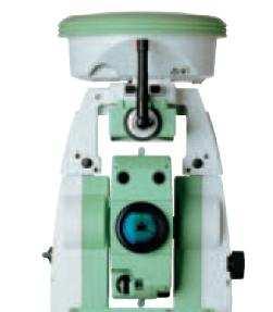

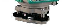

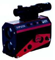
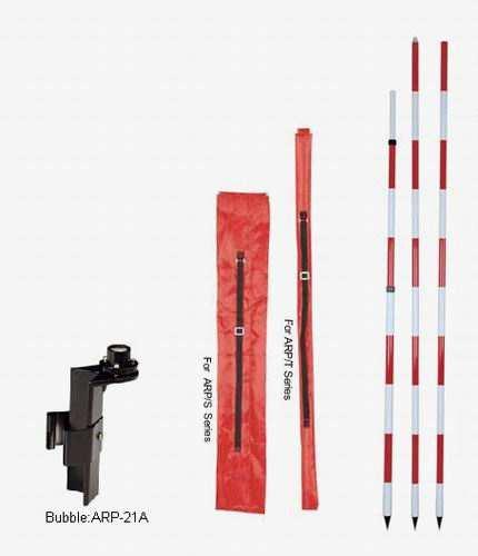

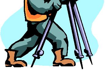
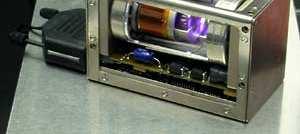
6 Sample Surveying Instruments 6
7 Overview of Remote Sensing and Photogrammetry 7
8 Definition of Remote Sensing It is the measurement or acquisition of some property of an object or phenomenon, by a recording device that is not in physical contact with the object or phenomenon under study (formal definition of the ASPRS). Remote sensing is both an art and a science. 8
9 Remote Sensing System 9


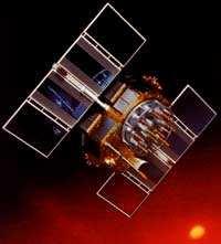
10 Some Remote Sensing Satellites SPOT 1, 2, 4 QuickBird RADARSAT 1 NOAA 12, 14, 16 10


11 Sample Products of Remote Sensing SPOT False Color Image Ikonos True Color Image 11


12 NOAA-14 Satellite Image of Hurricane Isaac 12


13 Satellite Image of a Philippine Typhoon 13


14 2004 QuickBird Satellite Image of UP Campus 14


15 Large Scale Display 15

16 Close-up Shot of the UP College of Engineering 16


17 2002 UP Campus Aerial Photo 17

18 Close-up Shot of the UP College of Engineering 18


19 Sample Aerial Photo of Parañaque (res = 0.1 m) 19


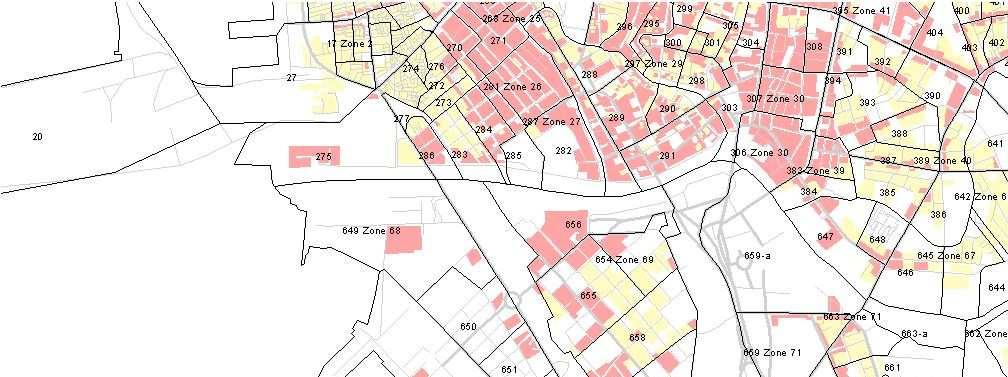
20 Larger Scale Display 20


21 People can be seen on the image 21

22 Overview of GIS 22
23 Defining Geographic Information Systems (GIS) In simple terms, GIS is a set of computer-based systems for managing geographic data and using these data to solve real-world spatial problems. 23


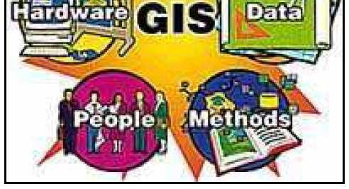
24 Anatomy of GIS The anatomy of GIS refers to the various components that make up the system. GIS is generally thought to be comprised of the following components: hardware, software, data, people and organizations, and methods and institutional arrangements for collecting, storing, analyzing and disseminating information about areas of the earth. 24


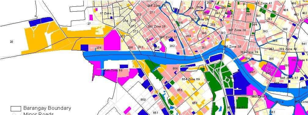
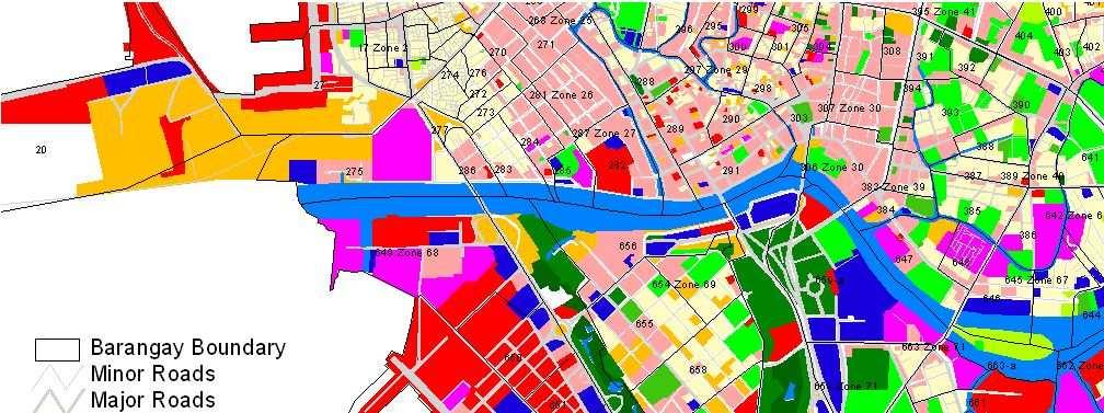
25 GIS layers to model the real world 25
.")

26 GIS stores information as a collection of thematic layers (left image). By a processing called geocoding, the location of a particular thematic feature may be recorded (right image). 26

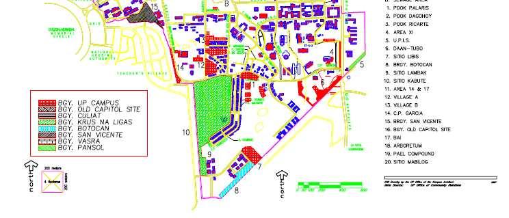
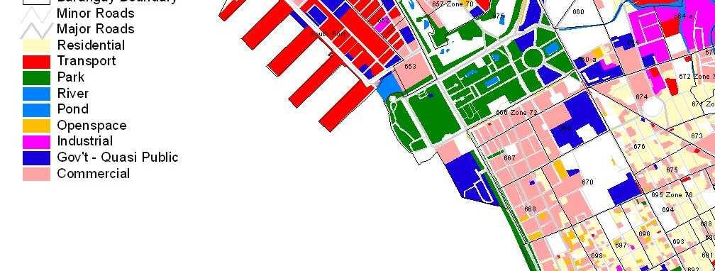
27 UP Campus Barangay Jurisdiction 27


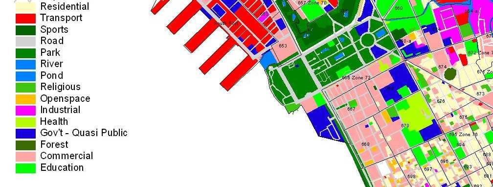
28 Sample GIS Layers Extraction 28


29 29
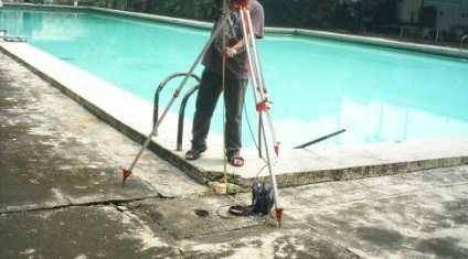
30 30

31 Overview of GPS 31
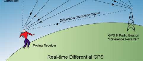
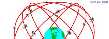
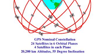
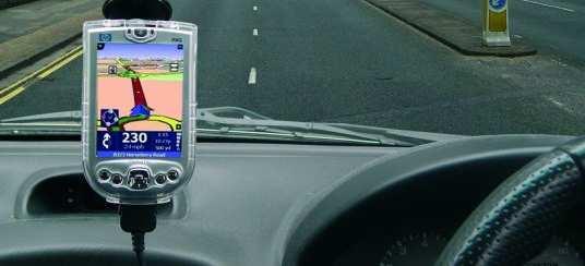
32 GPS Facts The Global Positioning System, better known as GPS, is a satellite-based radio navigation system developed and operated by the U.S. Department of Defense. GPS permits land, sea, and airborne users to determine their three dimensional position, velocity, and time, 24 hours a day in all weather, anywhere in the world. GPS provides specially coded satellite signals that can be processed by a GPS receiver, which can compute position, velocity, and time. Four GPS satellite signals are used to compute 4 dimensions of X, Y, Z (position), and time. 32
33 Position Determination with GPS 33
34 Position Determination with GPS 34
35 Three Satellites (2D Positioning)

36 GPS Receivers Handheld GPS Receivers Survey Grade GPS Receivers 36
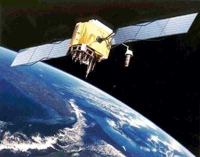
37 GPS Satellites Atomic Clock 37


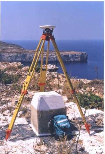
38 Actual GPS Survey 38

39 Actual GPS Survey 39


40 Some Practical GPS Applications 40


41 Overview of Cartography 41

 and graphy")
42 Cartography science and art of making maps and charts word "cartography" is derived from the Greek words chartes (sheet of papyrus) and graphy (writing). 42


43 Sample Map Products 43
44 GeomaticsEngineering It is the discipline of gathering, storing, processing, and delivering of geographic information, or spatially referenced information It includes the tools and techniques used in land surveying, remote sensing, Geographic Information Systems (GIS), Global Navigation Satellite Systems (GPS, GLONASS, GALILEO, COMPASS), and related forms of earth mapping 44
45 Interrelationship of the Different Geospatial Technologies G e o m a t i c s Remote Sensing Surveying GPS GIS Cartography Application Fields 45
46 46
netw rks Guided Reading Activity Essential Question: How does geography influence the way people live? What Is Geography?
 Guided Reading Activity What Is Geography? Lesson 1 Thinking Like a Geographer Essential Question: How does geography influence the way people live? Directions: Read the lesson and use your textbook to
Identifying Audit, Evidence Methodology and Audit Design Matrix (ADM)
") 11 Identifying Audit, Evidence Methodology and Audit Design Matrix (ADM) 27/10/2012 Exercise XXX 2 LEARNING OBJECTIVES At the end of this session participants will be able to: 1. Identify types and sources
11 Identifying Audit, Evidence Methodology and Audit Design Matrix (ADM) 27/10/2012 Exercise XXX 2 LEARNING OBJECTIVES At the end of this session participants will be able to: 1. Identify types and sources
Yrd. Doç. Dr. Saygın ABDİKAN Öğretim Yılı Güz Dönemi
 Yabancı Dil III (YDL285) Introduction to Geomatics Yrd. Doç. Dr. Saygın ABDİKAN 2017-2018 Öğretim Yılı Güz Dönemi 1 géomatique Geo (Earth) + informatics Geodesy + Geoinformatics Geomatics: The mathematics
CE 316 GEOMATICS COURSE NOTES DR. MOIR D HAUG, C.L.S., P. ENG. JANUARY 2012
 CE 316 GEOMATICS COURSE NOTES DR. MOIR D HAUG, C.L.S., P. ENG. JANUARY 2012 0 COURSE INFORMATION Dr Moir D Haug, P. Eng University Office 2B25 Engineering 966 5355 moir.haug@usask.ca MDH Engineered Solutions
Overview of Remote Sensing in Natural Resources Mapping
 Overview of Remote Sensing in Natural Resources Mapping What is remote sensing? Why remote sensing? Examples of remote sensing in natural resources mapping Class goals What is Remote Sensing A remote sensing
GIS = Geographic Information Systems;
 What is GIS GIS = Geographic Information Systems; What Information are we talking about? Information about anything that has a place (e.g. locations of features, address of people) on Earth s surface,
An Introduction to Geographic Information System
 An Introduction to Geographic Information System PROF. Dr. Yuji MURAYAMA Khun Kyaw Aung Hein 1 July 21,2010 GIS: A Formal Definition A system for capturing, storing, checking, Integrating, manipulating,
History & Scope of Remote Sensing FOUNDATIONS
 History & Scope of Remote Sensing FOUNDATIONS Lecture Overview Introduction Overview of visual information Power of imagery Definition What is remote sensing? Definition standard for class History of Remote
Cutting Edge Engineering for Modern Geospatial Systems Rear Admiral Dr. S Kulshrestha, retd
 Cutting Edge Engineering for Modern Geospatial Systems Rear Admiral Dr. S Kulshrestha, retd 11 Jun 2015 GeoIntelligence Asia 2015 The technology would become so pervasive that it becomes a part of you
5/15/ Use of Geographic Information System (GIS) in Grazing Management Muhammad Farooq Hussain Faisal 12-Arid-604 (M.
 in Grazing Management Muhammad Farooq Hussain Faisal 12-Arid-604 (M.") 5/15/218 1 Use of Geographic Information ystem (GI) in Grazing Management Muhammad Farooq Hussain Faisal 12-Arid-64 (M.phill LM) 1 Contents History Back Ground Information Introduction of GI Who use GI?
5/15/218 1 Use of Geographic Information ystem (GI) in Grazing Management Muhammad Farooq Hussain Faisal 12-Arid-64 (M.phill LM) 1 Contents History Back Ground Information Introduction of GI Who use GI?
REVIEW MAPWORK EXAM QUESTIONS 31 JULY 2014
 REVIEW MAPWORK EXAM QUESTIONS 31 JULY 2014 Lesson Description In this lesson we: Focus on key concepts and exam questions relating to GIS. Question 1 Test Yourself The most important component of a GIS
Geospatial data and analysis fundamentals applied to renewable energies potential assessment
 Geospatial data and analysis fundamentals applied to renewable energies potential assessment Network analysis: Do we go to Perugia by car? Guideline Introduction renewable energy and Geospatial Technologies
BUILDING AN ACCURATE GIS
 BUILDING AN ACCURATE GIS 2006 GIS in the Rockies Denver, Colorado September 13, 2006 William E. Linzey United States Department of Commerce National Oceanic and Atmospheric Administration National Geodetic
INSTITUTE OF AERONAUTICAL ENGINEERING (Autonomous) Dundigal, Hyderabad
 Dundigal, Hyderabad") INSTITUTE OF AERONAUTICAL ENGINEERING (Autonomous) Dundigal, Hyderabad -00 0 CIVIL ENGINEERING TUTORIAL QUESTION BANK Course Name : Remote Sensing and GIS Course Code : A00 Class : IV B. Tech I Semester
INSTITUTE OF AERONAUTICAL ENGINEERING (Autonomous) Dundigal, Hyderabad -00 0 CIVIL ENGINEERING TUTORIAL QUESTION BANK Course Name : Remote Sensing and GIS Course Code : A00 Class : IV B. Tech I Semester
CARTOGRAPHIC INFORMATION MANAGEMENT IN COLOMBIA REACH A LEVEL OF PERFECTION
 CARTOGRAPHIC INFORMATION MANAGEMENT IN COLOMBIA REACH A LEVEL OF PERFECTION Jaime Alberto Duarte Castro 1 Carrera 30 No. 48 51 Bogotá - Colombia, jduarte@igac.gov.co Claudia Inés Sepúlveda Fajardo 2 Carrera
Techniques for Science Teachers: Using GIS in Science Classrooms.
 Techniques for Science Teachers: Using GIS in Science Classrooms. After ESRI, 2008 GIS A Geographic Information System A collection of computer hardware, software, and geographic data used together for
SURVEYING Chapter 1 Introduction
 PHILADELPHIA UNIVERSITY Faculty of Engineering. Department of Civil Engineering. SURVEYING Chapter 1 Introduction Surveying : the art or science of measuring and representing natural and artificial features
Developing Spatial Awareness :-
 Developing Spatial Awareness :- We begin to exercise our geographic skill by examining he types of objects and features we encounter. Four different spatial objects in the real world: Point, Line, Areas
GE 113 REMOTE SENSING
 GE 113 REMOTE SENSING Topic 1. Concepts and Fundamentals of Remote Sensing Lecturer: Engr. Jojene R. Santillan jrsantillan@carsu.edu.ph Division of Geodetic Engineering College of Engineering and Information
What you learned. Lecture 27: Class Summary. Maps and geodesy. How you learned it
 What you learned Geography 12: Maps and Spatial Reasoning Lecture 27: Class Summary Professor Keith Clarke Map geometry, construction and content Practical map use, reading and navigation Map representation
Basic Principles of Surveying and Mathematics
 AMRC 2012 MODULE 1 Basic Principles of Surveying and Mathematics CONTENTS Overview... 1-1 Objectives... 1-1 Procedures... 1-1 1.1 Surveying Defined... 1-3 1.2 Types of Surveys... 1-5 1.3 Precision and
Presented to Sub-regional workshop on integration of administrative data, big data and geospatial information for the compilation of SDG indicators
 Presented to Sub-regional workshop on integration of administrative data, big data and geospatial information for the compilation of SDG indicators 23-25 April,2018 Addis Ababa, Ethiopia By: Deogratius
LEADS. The Essential Elements of a 3-D Geographic Coordinate
 The Essential Elements of a 3-D Geographic Coordinate John W. Dix 13 September 2005 ESRI Homeland Security GIS Summit - Denver, CO John.W.Dix@nga.mil NATIONAL GEOSPATIAL-INTELLIGENCE AGENCY Overview is
Geoinformatics. Dieter Fritsch, Institute for Photogrammetry, University of Stuttgart. Copyright: Institut fuer Photogrammetrie, Univ Stutgart 1
 Geoinformatics Dieter Fritsch, Institute for Photogrammetry, University of tuttgart Copyright: Institut fuer Photogrammetrie, Univ tutgart 1 Geoinformatics Every Tuesday, 6-8pm Labs & Assignments Prof.
Exploring the boundaries of your built and natural world. Geomatics
 Exploring the boundaries of your built and natural world Geomatics Before the Luxor brought magic to the Las Vegas strip and before the South LRT extension in Edmonton gave residents a new route to travel,
AP Human Geography Chapter 1: Thinking Geographically Key Issue 1: How do Geographers describe where things are?
 AP Human Geography Chapter 1: Thinking Geographically Key Issue 1: How do Geographers describe where things are? Studying Human Geography Physical Geography Physical geography deals with Earth s natural
Geomatics: Geotechnologies in Action, Grade 12, University/College Expectations
 Geographic Foundations: Space and Systems SSV.01 explain how the earth is modelled for scientific and mapping purposes; SSV.02 demonstrate an understanding of basic spatial concepts; Page 1 SSV.03 explain
COURSE SCHEDULE, GRADING, and READINGS
 COURSE SCHEDULE, GRADING, and READINGS Note: All academic classes will be held in the GIS lab at Royal Thimphu College. These dates are listed here. Other days will involve travel or days off, and the
Geography involves the study of places: their locations, their characteristics, and how humans use and move around them.
 Physical Geography Looking at the Earth Geography involves the study of places: their locations, their characteristics, and how humans use and move around them. NEXT Physical Geography Looking at the Earth
GEOMATICS. Shaping our world. A company of
 GEOMATICS Shaping our world A company of OUR EXPERTISE Geomatics Geomatics plays a mayor role in hydropower, land and water resources, urban development, transport & mobility, renewable energy, and infrastructure
What are the five components of a GIS? A typically GIS consists of five elements: - Hardware, Software, Data, People and Procedures (Work Flows)
") LECTURE 1 - INTRODUCTION TO GIS Section I - GIS versus GPS What is a geographic information system (GIS)? GIS can be defined as a computerized application that combines an interactive map with a database
LECTURE 1 - INTRODUCTION TO GIS Section I - GIS versus GPS What is a geographic information system (GIS)? GIS can be defined as a computerized application that combines an interactive map with a database
GIS and Remote Sensing
 Spring School Land use and the vulnerability of socio-ecosystems to climate change: remote sensing and modelling techniques GIS and Remote Sensing Katerina Tzavella Project Researcher PhD candidate Technology
a system for input, storage, manipulation, and output of geographic information. GIS combines software with hardware,
 Introduction to GIS Dr. Pranjit Kr. Sarma Assistant Professor Department of Geography Mangaldi College Mobile: +91 94357 04398 What is a GIS a system for input, storage, manipulation, and output of geographic
What is GIS? ESRI Canada. August 2011
 What is GIS? ESRI Canada August 2011 Geography Matters! Environmental Park Management Agriculture Public Utilities Health Care Emergency 911 Real Estate Marketing Environmental What are the effects of
Geospatial Technologies for the Agricultural Sciences
 Geospatial Technologies for the Agricultural Sciences Maggi Kelly Assoc. Cooperative Extension Specialist Department of Environmental Science, Policy & Management Director, GIIF UC Berkeley Karin Tuxen
Land Administration and Cadastre
 Geomatics play a major role in hydropower, land and water resources and other infrastructure projects. Lahmeyer International s (LI) worldwide projects require a wide range of approaches to the integration
GIS Workshop Data Collection Techniques
 GIS Workshop Data Collection Techniques NOFNEC Conference 2016 Presented by: Matawa First Nations Management Jennifer Duncan and Charlene Wagenaar, Geomatics Technicians, Four Rivers Department QA #: FRG
Rural GIS Applications Geospatial Technology Awareness
 Rural GIS Applications Geospatial Technology Awareness Mike Rudibaugh, Ph.D. Co-PI NSF GeoTech Center Geography/GIS Instructor Lake Land College mrudibau@lakeland.cc.il.us 217-234-5244 What is the GeoTech
HANDBOOK OF PRECISION AGRICULTURE PRINCIPLES AND APPLICATIONS
 http://agrobiol.sggw.waw.pl/cbcs Communications in Biometry and Crop Science Vol. 2, No. 2, 2007, pp. 90 94 International Journal of the Faculty of Agriculture and Biology, Warsaw University of Life Sciences,
Unit 1, Lesson 3 What Tools and Technologies Do Geographers Use?
 Unit 1, Lesson 3 What Tools and Technologies Do Geographers Use? Geographers use a variety of tools and technologies in investigating geographic questions. Maps and globes both represent the earth, but
Chapter 02 Maps. Multiple Choice Questions
 Chapter 02 Maps Multiple Choice Questions 1. Every projection has some degree of distortion because A. a curved surface cannot be represented on a flat surface without distortion. B. parallels and meridians
Figure B.15 - Example of plotting the landslide potential points
 Figure B.15 - Example of plotting the landslide potential points Figure B.16 - Example of landslide potential map based on topographic factor in north area of kabupaten Jember 37 from 61 Figure B.17 -
CENSUS MAPPING WITH GIS IN NAMIBIA. BY Mrs. Ottilie Mwazi Central Bureau of Statistics Tel: October 2007
 CENSUS MAPPING WITH GIS IN NAMIBIA BY Mrs. Ottilie Mwazi Central Bureau of Statistics E-mail: omwazi@npc.gov.na Tel: + 264 61 283 4060 October 2007 Content of Presentation HISTORICAL BACKGROUND OF CENSUS
Capacity Building Activities at CRECTEALC. Ing. Jerjes Molina Blancas Professor and Developer.
 Capacity Building Activities at CRECTEALC Ing. Jerjes Molina Blancas Professor and Developer. Centro Regional de Enseñanza de Ciencia y Tecnología del Espacio para América Latina y el Caribe (CRECTEALC)
DATA SOURCES AND INPUT IN GIS. By Prof. A. Balasubramanian Centre for Advanced Studies in Earth Science, University of Mysore, Mysore
 DATA SOURCES AND INPUT IN GIS By Prof. A. Balasubramanian Centre for Advanced Studies in Earth Science, University of Mysore, Mysore 1 1. GIS stands for 'Geographic Information System'. It is a computer-based
THE USE OF GEOMATICS IN CULTURAL HERITAGE AND ARCHAEOLOGY FOR VARIOUS PURPOSES
 THE USE OF GEOMATICS IN CULTURAL HERITAGE AND ARCHAEOLOGY FOR VARIOUS PURPOSES FEBRUARY 2013 AL BEIDA GEOPLAN CONTENT Company Profile Concept Objectives and Strategies Data Production Methods Data Samples
MULTIPLE CHOICE. Choose the one alternative that best completes the statement or answers the question.
 Practice Chapter 1 Exam Name MULTIPLE CHOICE. Choose the one alternative that best completes the statement or answers the question. 1) The historic diffusion of HIV/AIDS in the United States is an example
GEOGRAPHIC INFORMATION SYSTEMS
 GEOGRAPHIC INFORMATION SYSTEMS 4-H Round-Up Community Transitions Workshop Daniel Hanselka June 14, 2011 Goals of the Workshop Answer the question: What is GIS? Uses of GIS. Some of the Common Terminology
Brazil Paper for the. Second Preparatory Meeting of the Proposed United Nations Committee of Experts on Global Geographic Information Management
 Brazil Paper for the Second Preparatory Meeting of the Proposed United Nations Committee of Experts on Global Geographic Information Management on Data Integration Introduction The quick development of
Metadata for 2005 Orthophotography Products
 Metadata for 2005 Orthophotography Products What does this data set describe? 1. How should this data set be cited? 2. What geographic area does the data set cover? 3. What does it look like? 4. Does the
Building a National Data Repository
 Building a National Data Repository Mladen Stojic, Vice President - Geospatial 1/30/2013 2012 Intergraph Corporation 1 Information has meaning and gives power only when shared and distributed. Information,
10-C Approach for Quality Assesment and Accuracy of Geospatial Information in Indonesia
 10-C Approach for Quality Assesment and Accuracy of Geospatial Information in Indonesia Dr.-Ing Fahmi Amhar 1 1 Geospatial Information Agency, Jl. Jakarta-Bogor km. 46 Cibinong-Indonesia famhar@yahoocom
Developing a Tactical-Level Geospatial Course for Army Engineers
 Developing a Tactical-Level Geospatial Course for Army Engineers Jared L. Ware Geospatial Information Science Program Department of Geography and Environmental Engineering United States Military Academy
Geospatial Intelligence
 Geospatial Intelligence Geospatial analysis has existed as long as humans have made and studied maps but its importance to the intelligence community has skyrocketed in the past several years, with Unmanned
GEOGRAPHIC INFORMATION SYSTEMS Session 8
 GEOGRAPHIC INFORMATION SYSTEMS Session 8 Introduction Geography underpins all activities associated with a census Census geography is essential to plan and manage fieldwork as well as to report results
Key Issue #1. How do geographers describe where things are? 2014 Pearson Education, Inc.
 Key Issue #1 How do geographers describe where things are? Learning Outcomes 1.1.1: Explain differences between early maps and contemporary maps. 1.1.2: Describe the role of map scale and projections and
URBAN WATERSHED RUNOFF MODELING USING GEOSPATIAL TECHNIQUES
 URBAN WATERSHED RUNOFF MODELING USING GEOSPATIAL TECHNIQUES DST Sponsored Research Project (NRDMS Division) By Prof. M. GOPAL NAIK Professor & Chairman, Board of Studies Email: mgnaikc@gmail.com Department
Regional GIS Initiatives Geospatial Technology Center
 Regional GIS Initiatives Geospatial Technology Center Mr. Bobby Lear GIS Coordinator St. James Parish & Dr. Balaji Ramachandran Contractors Educational Trust Fund Endowed Professor Geomatics Program, Department
Geospatial Data Standards Considerations for the delivery of 2D and 3D spatial data February 2019
 Geospatial Data Standards Considerations for the delivery of 2D and 3D spatial data February 2019 Prepared by: GRCA Geomatics Version Date Summary of Changes Changes Made By: 1.00 March 16, 2018 Version
INTEGRATION OF HIGH RESOLUTION QUICKBIRD IMAGES TO GOOGLEEARTH
 INTEGRATION OF HIGH RESOLUTION QUICKBIRD IMAGES TO GOOGLEEARTH M. Alkan a, *, U.G. Sefercik a, M. Oruç a a ZKU, Engineering Faculty, 67100 Zonguldak, Turkey - (mehmetalkan44@yahoo.com) Interactive Sessions,
Unit 1, Lesson 2. What is geographic inquiry?
 What is geographic inquiry? Unit 1, Lesson 2 Understanding the way in which social scientists investigate problems will help you conduct your own investigations about problems or issues facing your community
STUDY GUIDE. Exploring Geography. Chapter 1, Section 1. Terms to Know DRAWING FROM EXPERIENCE ORGANIZING YOUR THOUGHTS
 For use with textbook pages 19 22. Exploring Geography Terms to Know location A specific place on the earth (page 20) absolute location The exact spot at which a place is found on the globe (page 20) hemisphere
Test Bank Chapter 2: Representations of Earth
 Multiple Choice Test Bank Chapter 2: Representations of Earth 1. A rhumb line on a Mercator projection is a line of. a. true size b. true shape c. true compass bearing d. true location 2. Maximum longitude
Introduction INTRODUCTION TO GIS GIS - GIS GIS 1/12/2015. New York Association of Professional Land Surveyors January 22, 2015
 New York Association of Professional Land Surveyors January 22, 2015 INTRODUCTION TO GIS Introduction GIS - GIS GIS 1 2 What is a GIS Geographic of or relating to geography the study of the physical features
Combining Geospatial and Statistical Data for Analysis & Dissemination
 Combining Geospatial and Statistical Data for Analysis & Dissemination (with Special Reference to Qatar Census 2010) Presentation by Mansoor Al Malki, Director of IT Department Qatar Statistics Authority
The B.S.G.E. program is accredited by the Engineering Accreditation Commission of ABET,
 Geomatics Engineering The program of study leading to the Bachelor of Science in Geomatics Engineering (B.S.G.E.) deals with designing solutions to measure, map, model, analyze and graphically display
Positioning the Pacific: NOAA s Geospatial Activities. Juliana Blackwell, Director NOAA s National Geodetic Survey March 6, 2012
 Positioning the Pacific: NOAA s Geospatial Activities Juliana Blackwell, Director NOAA s National Geodetic Survey March 6, 2012 A Common Problem of the Early 19 th Century 1807 President Thomas Jefferson
USING GIS CARTOGRAPHIC MODELING TO ANALYSIS SPATIAL DISTRIBUTION OF LANDSLIDE SENSITIVE AREAS IN YANGMINGSHAN NATIONAL PARK, TAIWAN
 CO-145 USING GIS CARTOGRAPHIC MODELING TO ANALYSIS SPATIAL DISTRIBUTION OF LANDSLIDE SENSITIVE AREAS IN YANGMINGSHAN NATIONAL PARK, TAIWAN DING Y.C. Chinese Culture University., TAIPEI, TAIWAN, PROVINCE
CHAPTER EXIT CHAPTER. Models of Earth. 3.1 Modeling the Planet. 3.2 Mapmaking and Technology. 3.3 Topographic Maps CHAPTER OUTLINE
 EXIT CHAPTER.1 Modeling the Planet.2 Mapmaking and Technology. Topographic Maps CHAPTER OUTLINE CHAPTER.1 Modeling the Planet A flat of Earth is a convenient tool, but it can distort the shape, distance,
Applied Cartography and Introduction to GIS GEOG 2017 EL. Lecture-1 Chapters 1 and 2
 Applied Cartography and Introduction to GIS GEOG 2017 EL Lecture-1 Chapters 1 and 2 What is GIS? A Geographic Information System (GIS) is a computer system for capturing, storing, querying, analyzing and
Syllabus Reminders. Geographic Information Systems. Components of GIS. Lecture 1 Outline. Lecture 1 Introduction to Geographic Information Systems
 Syllabus Reminders Geographic Information s Lecture Introduction to Geographic Information s. Class Info: www.saigis.com/class/ 2. Office T / TH (8:00-9:30 a.m.) and (2:30 3:30pm) or Appt 3. Email: burgerpr@unk.edu
Geodesy. orientation. shape. gravity field
 Geodesy noun Science of measuring the shape, orientation and gravity field of the Earth and how it changes over time. shape orientation gravity field Positioning has always been important Downstream applications
Lecture 1 Introduction to GIS. Dr. Zhang Spring, 2017
 Lecture 1 Introduction to GIS Dr. Zhang Spring, 2017 Topics of the course Using and making maps Navigating GIS Map design Working with spatial data Geoprocessing Spatial data infrastructure Digitizing
Surveying for Civil Engineering. Esra Tunc Gormus, PhD
 Surveying for Civil Engineering Esra Tunc Gormus, PhD Working Fields for Surveying Engineers It is also called as Geomatics Engineering or Geodesy and Photogrammetry Engineering Making maps with right
UNITED NATIONS E/CONF.96/CRP. 5
 UNITED NATIONS E/CONF.96/CRP. 5 ECONOMIC AND SOCIAL COUNCIL Eighth United Nations Regional Cartographic Conference for the Americas New York, 27 June -1 July 2005 Item 5 of the provisional agenda* COUNTRY
Geographical Information System (GIS) Prof. A. K. Gosain
 Prof. A. K. Gosain") Geographical Information System (GIS) Prof. A. K. Gosain gosain@civil.iitd.ernet.in Definition of GIS GIS - Geographic Information System or a particular information system applied to geographical data
Geographical Information System (GIS) Prof. A. K. Gosain gosain@civil.iitd.ernet.in Definition of GIS GIS - Geographic Information System or a particular information system applied to geographical data
Cartographic and Geospatial Futures
 Cartographic and Geospatial Futures 1. Web Cartography, WebGIS, & Virtual Globes--New Roles for Maps, GIS, and GIS professionals 2. Map Mashups, the Neo Neo-geography Movement, & Crowd-sourcing Geospatial
Molinaro Keyword: Geography. Associate Professors: Walasek, Ph.D.; (Chair), Wolf, Ph.D.
, Wolf, Ph.D.") 126 - Geography GENERAL INFO GRADUATE UNDREGRADUATE ADULT/NON-TRAD POLICIES STUDENT LIFE ADMISSIONS INTRODUCTION Degree Offered: Bachelor of Arts. Associate Professors: Walasek, Ph.D.; (Chair), Wolf, Ph.D.
126 - Geography GENERAL INFO GRADUATE UNDREGRADUATE ADULT/NON-TRAD POLICIES STUDENT LIFE ADMISSIONS INTRODUCTION Degree Offered: Bachelor of Arts. Associate Professors: Walasek, Ph.D.; (Chair), Wolf, Ph.D.
TOWARDS ROBUST LOCALIZATION OF RTK-GPS TOPOGRAPHIC SURVEYS 23
 TOWARDS ROBUST LOCALIZATION OF RTK-GPS TOPOGRAPHIC SURVEYS Jerry W. Nave, North Carolina A&T University; Tarig A. Ali, American University of Sharjah Abstract Localization is performed to fit the observed
GEOGRAPHICAL INFORMATION SYSTEMS. GIS Foundation Capacity Building Course. Introduction
 GEOGRAPHICAL INFORMATION SYSTEMS. GIS Foundation Capacity Building Course. Introduction In recent times digital mapping has become part and parcel of our daily lives with experience from Google Maps on
Part : General Situation of Surveying and Mapping. The Development of Surveying and Mapping in China. The contents
 The Development of Surveying and Mapping in China Dr. Ping Xiao China.P.R The contents Part : General Situation of Surveying and Mapping 1. The legal systems of surveying and mapping 2. The technologies
DATA DEVELOPMENT IN BRUNEI DARUSSALAM. Submitted by Survey Department, Brunei Darussalam **
 UNITED NATIONS E/CONF.97/6/IP. 45 ECONOMIC AND SOCIAL COUNCIL Seventeenth United Nations Regional Cartographic Conference for Asia and the Pacific Bangkok, 18-22 September 2006 Item 7 of the provisional
SPOT DEM Product Description
 SPOT DEM Product Description Version 1.1 - May 1 st, 2004 This edition supersedes previous versions Acronyms DIMAP DTED DXF HRS JPEG, JPG DEM SRTM SVG Tiff - GeoTiff XML Digital Image MAP encapsulation
Contents... GIS Approach. 4D Geo-referenced Database Approach for GIS. G IS Specific GIS Applications. FIG Working Week 2004.
 FIG Working Week 2004 4D Geo-referenced Database Approach for GIS Components of GIS GIS Approach How to Produce Maps Contents... Everything is moving with Earth by Time Why 4D Geo-referenced Database Design
Country Report on SDI Activities in Singapore *
 UNITED NATIONS E/CONF.100/CRP.9 ECONOMIC AND SOCIAL COUNCIL Eighteenth United Nations Regional Cartographic Conference for Asia and the Pacific Bangkok, 26-29 October 2009 Item 7(a) of the provisional
Software. People. Data. Network. What is GIS? Procedures. Hardware. Chapter 1
 People Software Data Network Procedures Hardware What is GIS? Chapter 1 Why use GIS? Mapping Measuring Monitoring Modeling Managing Five Ms of Applied GIS Chapter 2 Geography matters Quantitative analyses
GPS and Mean Sea Level in ESRI ArcPad
 Summary In order to record elevation values as accurately as possible with, it is necessary to understand how ArcPad records elevation. Rather than storing elevation values relative to Mean Sea Level (MSL),
Smart use of Geographic Information System (GIS) platform for delivering weather information and nowcasting services
 platform for delivering weather information and nowcasting services") Smart use of Geographic Information System (GIS) platform for delivering weather information and nowcasting services C. K. Pan Hong Kong Observatory Hong Kong, China It is a world of beauty Source: Image
Smart use of Geographic Information System (GIS) platform for delivering weather information and nowcasting services C. K. Pan Hong Kong Observatory Hong Kong, China It is a world of beauty Source: Image
Technical Drafting, Geographic Information Systems and Computer- Based Cartography
 Technical Drafting, Geographic Information Systems and Computer- Based Cartography Project-Specific and Regional Resource Mapping Services Geographic Information Systems - Spatial Analysis Terrestrial
Geography General Course Year 12. Selected Unit 3 syllabus content for the. Externally set task 2019
 Geography General Course Year 12 Selected Unit 3 syllabus content for the Externally set task 2019 This document is an extract from the Geography General Course Year 12 syllabus, featuring all of the content
Remote Sensing and Spatial Analysis (RSSA)
") MESM Track Remote Sensing and Spatial Analysis (RSSA) Dr. Y.Q. Wang (Track Chair) http://nrs.uri.edu/people/faculty/wang.html Remote Sensing and Spatial Analysis Remote sensing, GIS, GPS and their applications
MESM Track Remote Sensing and Spatial Analysis (RSSA) Dr. Y.Q. Wang (Track Chair) http://nrs.uri.edu/people/faculty/wang.html Remote Sensing and Spatial Analysis Remote sensing, GIS, GPS and their applications
Chapter 5. GIS The Global Information System
 Chapter 5 GIS The Global Information System What is GIS? We have just discussed GPS a simple three letter acronym for a fairly sophisticated technique to locate a persons or objects position on the Earth
Geography & Technology. Geography of Canada
 Geography & Technology Geography of Canada www.craigmarlatt.com/school Geography & Technology 1. Geographic Informationn Systems 2. Global Positioning System 3. Aerial Photographs 4. Satellite Imagery
94-802Z: Geographic Information Systems Summer 2018
 94-802Z: Geographic Information Systems Summer 2018 Instructor: Professor Kristen Kurland Teaching Assistant(s): (Office hours to be posted on Canvas) TBA Class Web Site: http:/www.cmu.edu/canvas
Geospatial capabilities, spatial data and services provided by Military Geographic Service
 Geospatial capabilities, spatial data and services provided by Military Geographic Service LtC Mariyan Markov PhD CONTENTS 1. INTRODUCTION - Workflow - Data sources remote sensing, direct field observation.
Chapter 3 Models of the Earth. 3.1 Finding Locations on the Earth. 3.1 Objectives
 Chapter 3 Models of the Earth 3.1 Finding Locations on the Earth 3.1 Objectives Explain latitude and longitude. How can latitude and longitude be used to find locations on Earth? How can a magnetic compass
ESCI 110: 2 s.h. Introduction to Earth Sciences Programs ESCI 322: 3 s.h. Environmental Hydrology ESCI 241: 4 s.h. Meteorology (G2, L)
") ESCI 110: 2 s.h. Introduction to Earth Sciences Programs General introduction to each of the earth sciences disciplines and to college life. 2 hrs. lec. Offered in fall. Restricted to earth sciences majors.
ESCI 110: 2 s.h. Introduction to Earth Sciences Programs General introduction to each of the earth sciences disciplines and to college life. 2 hrs. lec. Offered in fall. Restricted to earth sciences majors.
Frank Hegyi President, Ferihill Technologies Ltd Victoria, B.C.
 REMOTE SENSING TECHNIQUES IN ENVIRONMENTAL MONITORING By Frank Hegyi President, Ferihill Technologies Ltd Victoria, B.C. ABSTRACT Increasing public awareness about environmental concerns is creating pressures
Basics of GIS reviewed
 Basics of GIS reviewed Martin Breunig Karlsruhe Institute of Technology martin.breunig@kit.edu GEODETIC INSTITUTE, DEPARTMENT OF CIVIL ENGINEERING, GEO AND ENVIRONMENTAL SCIENCES, CHAIR IN GEOINFORMATICS
Exploring Geography. Chapter 1
 Exploring Geography Chapter 1 The Study of Geography Geography is the study of where people, places, and things are located and how they relate to each other. Greek meaning writing about or describing