Combining Geospatial and Statistical Data for Analysis & Dissemination
|
|
|
- Johnathan Hardy
- 5 years ago
- Views:
Transcription
1 Combining Geospatial and Statistical Data for Analysis & Dissemination (with Special Reference to Qatar Census 2010) Presentation by Mansoor Al Malki, Director of IT Department Qatar Statistics Authority Web: Integrating Statistical and Geospatial Information: Issues and Challenges UN-GGIM,, Seoul. Thursday, 27 October
2 Combining Geospatial and Statistical Data for Analysis & Dissemination Overview Geospatial Data is Important to Statistical Information Integrating Geospatial and Statistical Data Qatar Statistics Integrated through Nationwide Geospatial Infrastructure Using Geospatial and Statistical Data for Analysis & Dissemination 2
3 Geospatial Data is Important to Statistical Information 3
4 Geospatial Data is Important to Statistical Information Spatial (Geographic) Data is the Key for: Collection Processing Analysis & Dissemination Spatial (Geographic) Analysis of Statistics- Transforms Data into Information,, and Presents results to the users in a concise and easy to understand manner 4

5 Spatial (Geographic) Analysis of Statistics- Answering Where & How! Population Distribution (By Census Blocks) Tables Maps 5

6 Answering Where & How! Population Growth Tables Maps 6
7 Integrating Geospatial and Statistical Data 7
8 Integrating Geospatial and Statistical Data Requires- Proper Geo-referencing and Coding of Census Data Units for Collection and Representation of Data. This is to be done at the time of Census Operations. A Census Geography Database is to be created, e.g., Qatar Census Geography.. 8

9 Qatar Census Geography Qatar Three Tier Administrative/ Census Data Unit Hierarchy
10 Qatar Census Geography contd Qatar Census Geography- Data Unit Hierarchy 2010 QATAR MUNICIPALITIES 7 ZONES (QARS) 90 CENSUS BLOCKS 4345 PLOTS (QARS) 150,000 10
11 Qatar Census Geography- Census Data Aggregation & Dissemination Units Census Data Aggregated to Agency Specific Spatial Data Units 11
12 Coding of Geospatial & Statistical Data Zone Level- Census GIS Database 12
13 Coding of Geospatial & Statistical Data Census Block Level- Census GIS Database 13
14 Qatar Statistics Integrated through Nationwide Geospatial Infrastructure 14
")

15 Qatar Statistics is part of- The Qatar Nationwide GIS 1992: National GIS Steering Committee Centre for (CGIS) The Qatar Nationwide GIS Standards systematic fashion. Today > 60 Govt. & S-Govt S Agencies linked to GIS Net. 15
16 The Qatar Nationwide GIS GISnet : High speed fibre optic network. 16
17 Geospatial Data in Qatar is Integrated through Qatar Nationwide GIS Factors that make Integration of Geospatial Data special in Qatar Statistics is that- Requirements for statistical operations: Maps GPS Coordinates Ortho and Satellite Images Economical in resource. Time saving. High quality output Statistics integrated with other agencies data On-line dissemination on Qatar GISnet. 17
18 Base Map Information Geo-Info. Available on-line to QSA (QSA maintains only GIS data for the Census Data Units and Census Charge Area Boundaries) 18
19 Up-to to-date Geospatial & Statistical Information Shared on-line Combining Layers of Information for Analysis & on-line Data Dissemination 19
20 Using Geospatial and Statistical Data for Analysis & Dissemination 20
21 Combining Geospatial and Statistical Data- Some Prevalent Forms Thematic Mapping- Choropleths/ Colour Maps Table Map 21
22 Spatial & Temporal Analysis & Mapping Table 22
")
23 2D & 3D Representation of Census 2010 Population Data 3D Zone 22 & 23- (Data by Census Blocks 2010) 23
24 Dasymetric Mapping using Ancillary Information (e.g., Land use) Before After 24
25 Volumetric Mapping Building Foot Prints and Heights. Population Data by Census Blocks Estimated Population Data by Buildings Zone 22 Formula & Program for estimating Building level population Zone 23 25
26 Combining Geospatial and Statistical Data for Query & Display Census Blocks with Large Labor Gatherings Zones Recording more than 200 % Growth in Population during
27 Trends & Patterns Changing Concentration of Qatari Population in 25 Years 27
28 Changing Trends & Patterns Changing Population Concentration ( ) 28

29 Transformation- Buffering Population Characteristics in 3 Km distance Line Bufferalong the Al Shamal Road Point Buffersurrounding Al khore Health Centre 29


30 Spatial Interpolation Method designed to fill in values that lie between observations (Samples) Z Scores Kriging Interpolation Technique Legend Ordinary Kriging- Prediction Map 75.6% of the zones have Population below National Average 72.2% of the Zones have Buildings below National Averages. Values Zone Population 2010 Z Scores
31 Qatar Statistics Output using Geospatial & Statistical Data Data User Requests QSA Publications & Reports 31
32 How GIS is been utilized to disseminate/visualize Qatar Census 2010 Results for the Stakeholders? 32
33 How GIS is been utilized to disseminate Qatar Census 2010 Results for the Stakeholders? Tailored results = specialization of agencies Importance of statistics in decision making. Supporting the needs: National Strategy for the Development of the Statistics (NSDS). National Development Strategy (NDS). 14 Task teams (Social Economic) Areas for improvements. 33


34 Utilizing the Results: Identify the Population distribution for the developed areas


35 Utilizing the Results: Identify Population Characteristics (Qatari, Non- Qatari).


36 Utilizing the Results: Select the public Services Location
37 Utilizing the Results: Select the public Services Location
38 Utilizing the Results: Select the public Services Location (schools) Class room Capacity is 25 Students


39 Utilizing the Results: Select the public Services Location


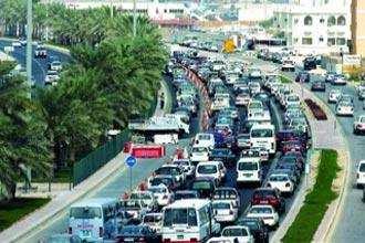
40 Utilizing the Results: Enhance Transportation Traffic Jams


41 Utilizing the Results: Public Service Area Selection: Roads Expansion Buffers - Population in the Buffer
42 Future Projects


43 Utilizing the Results: Public Service Area Selection: s s s s s s s s s s s s s s s s s s s s s


44
45 Qatar Statistics Output using Geospatial & Statistical Data Thematic Maps &Reports being prepared for Data User Requests QSA Publications & Reports 45


46 Qatar Statistics Output using Geospatial & Statistical Data Atlases Digital (Interactive) and Printed Qatar Census 1997 Qatar Census
47 Qatar Statistics Output using Geospatial & Statistical Data Qatar Atlas Digital (Interactive) and Printed About Qatar Atlas 2010 A2 size portrait Atlas (200 Map Plates) in printed format and an interactive DVD of the same is under preparation The Atlas is primarily based on Qatar Census 2010 Results Geographic Layers of Administrative and Physiographic and Infrastructure etc. are added for better references and analysis and the interpretation of Census Data. 47
48 Qatar Atlas The Scope Phase I-I Printing of an A2 size publication named Qatar Atlas 2010 Includes: Theme Selection- Research and Organization Data Collection, Storing, Processing and Analysis Programming and Mapping Applications Cartographic Design and Map Templates Thematic map Preparations & Tables, Charts and Images for Themes Explanatory Notes for Themes in English and then translation in Arabic Adding Ancillary Notes and Text, Cover etc.. Preparing Manuscript for Press, Proof Reading & Printing Process Final publication of the Qatar Atlas
49 Qatar Atlas The Scope Phase II- Digital version of the Atlas (DVD) & GIS Web Application Includes: converting manuscript into digital format : an interactive DVD - multi-media media techniques Internet application (on-line Atlas) 49
50 Qatar Atlas The Methods Derive main themes and their sub-themes based on available information and past studies and a review of literature, Compile up-to to-date geographic and statistical information available for the country at the lowest geographic unit level (Census Block), Compile the past two to three decades statistical data and the geographic data available in the form of aerial and orth-photographs, satellite images and records in digital and printed formats Store all data digitally and process for thematic mapping using the latest techniques of GIS Develop programmes and customized applications for cartography and a mapping and Perform statistical analysis 50
51 Qatar Atlas The Methods contd.. Draft brief notes including introduction, the methodology followed and description for each Theme and Translate to Arabic Prepare manuscript ready to press, & Printing Process and final publication of Qatar Atlas 2010 in A2 size Creating interactive DVDs of the Atlas for easy access and handling of the users, and A web based internet application to provide easy-to to-use tools to display, manipulate, and query statistical data so that customers can access and produce their own relevant information through interpretations. 51
52 Qatar Atlas Contents Section Section Name Total Themes Total Map Plates 1 THE ADMINISTRATIVE SETUP THE HISTORY & CHANGING LANDSCAPE THE PHYSIOGRAPHIC THE ENVIRONMENT THE SETTLEMENTS THE SERVICES & FACILITIES THE HOUSING & HOUSEHOLDS THE POPULATION THE AGRICULTURE, INDUSTRY, TRADE & COMMERCE 8 16 Total Themes


53 Qatar Statistics Output using Geospatial & Statistical Data Interactive GIS Web Applications Many Applications prepared targeting Statistical Operations and Data Users. The main applications are- The Landmark Locator Data Dissemination and Mapping System (DDMS) Geo-Statistical Application (GSA) 53
: GSA is Web based Application of:")

54 Geo-Statistics Application (GSA) The GSA (English/Arabic): GSA is Web based Application of: Socio-Economic & Demographic Data Facilitate the field Operations: Census 2010 Other Socio-economic surveys 54


55 Geo-Statistics Application (GSA) Features General- Includes base geographic information- Topographic features, Administrative areas, Road and Street network, Addresses, Place names and Landmarks. Thematic- Socio-economic and Demographic Themes representation at selected geographic level using chloropleth (color map) mapping techniques; Diagrammatic representation through pie and bars on map; Displaying theme table and exporting Query & Display To locate an address with Plot, Street and Zone names. Query about Census Enumeration Units and Landmarks and overlay necessary geographic information required to carry out the survey. 55
56 Challenges: 1- Dissemination is on aggregated data level. 2- Map size -> Data/diagram overlapping. 56
57 Conclusions: 1- Availability of a unified and standardized Geospatial information is the key for assured integration: - Long term Investment (Time Budget). - Quality Accuracy. - Dissemination of the results. - Support Decision Making. 57
58 Thank You! Mansoor Al Malki, Director of IT Department Qatar Statistics Authority Web:
SPATIAL ANALYSIS OF STATISTICS (WITH SPECIAL REFERENCE TO QATAR CENSUS 2010)
") SPATIAL ANALYSIS OF STATISTICS (WITH SPECIAL REFERENCE TO QATAR CENSUS 2010) Mohamad Saoud Al Boainain Ministry of Development Planning & Statistics State of Qatar Spatial Analysis of Statistics Overview
SPATIAL ANALYSIS OF STATISTICS (WITH SPECIAL REFERENCE TO QATAR CENSUS 2010) Mohamad Saoud Al Boainain Ministry of Development Planning & Statistics State of Qatar Spatial Analysis of Statistics Overview
Qatar Statistical Geospatial Integration
 Qatar Statistical Geospatial Integration A Presentation by the Ministry of Development Planning & Statistics (MDPS), State of Qatar http://www.mdps.gov.qa (Fourth UN-GGIM Arab States Committee Meeting,
CENSUS MAPPING WITH GIS IN NAMIBIA. BY Mrs. Ottilie Mwazi Central Bureau of Statistics Tel: October 2007
 CENSUS MAPPING WITH GIS IN NAMIBIA BY Mrs. Ottilie Mwazi Central Bureau of Statistics E-mail: omwazi@npc.gov.na Tel: + 264 61 283 4060 October 2007 Content of Presentation HISTORICAL BACKGROUND OF CENSUS
GEOGRAPHIC INFORMATION SYSTEMS Session 8
 GEOGRAPHIC INFORMATION SYSTEMS Session 8 Introduction Geography underpins all activities associated with a census Census geography is essential to plan and manage fieldwork as well as to report results
Second High Level Forum on GGIM Seminar on Regional Cooperation in Geospatial Information Management Doha, Qatar, 7 February 2013
 Second High Level Forum on GGIM Seminar on Regional Cooperation in Geospatial Information Management Doha, Qatar, 7 February 2013 Overview on Geospatial Activities in Egypt BY : Eng.Nahla Seddik Mohamed
Qatar s Nation-Wide GIS Cooperation on Local and Regional Levels
 Qatar s Nation-Wide GIS Cooperation on Local and Regional Levels Dr. Mohammad Abd El-Wahab Hamouda GIS Consultant & Chairman of GIS Coordinators Group The Center for GIS State of Qatar Second High Level
Brazil Paper for the. Second Preparatory Meeting of the Proposed United Nations Committee of Experts on Global Geographic Information Management
 Brazil Paper for the Second Preparatory Meeting of the Proposed United Nations Committee of Experts on Global Geographic Information Management on Data Integration Introduction The quick development of
Presented to Sub-regional workshop on integration of administrative data, big data and geospatial information for the compilation of SDG indicators
 Presented to Sub-regional workshop on integration of administrative data, big data and geospatial information for the compilation of SDG indicators 23-25 April,2018 Addis Ababa, Ethiopia By: Deogratius
GIS Supports to Economic and Social Development
 GIS Supports to Economic and Social Development Dang Van Duc and Le Quoc Hung Institute of Information Technology 18, Hoang Quoc Viet Rd., Cau Giay Dist., Hanoi, Vietnam Email: dvduc@ioit.ncst.ac.vn; lqhung@ioit.ncst.ac.vn
GIS = Geographic Information Systems;
 What is GIS GIS = Geographic Information Systems; What Information are we talking about? Information about anything that has a place (e.g. locations of features, address of people) on Earth s surface,
Towards National Geographic Information System in Nepal
 2 nd High Level Forum on Global Geospatial Information Management, Qatar National Convention Centre, Doha, Qatar, 4 6 February, 2013 Towards National Geographic Information System in Nepal Krishna Raj
Compact guides GISCO. Geographic information system of the Commission
 Compact guides GISCO Geographic information system of the Commission What is GISCO? GISCO, the Geographic Information System of the COmmission, is a permanent service of Eurostat that fulfils the requirements
DEPARTMENT OF GEOGRAPHY B.A. PROGRAMME COURSE DESCRIPTION
 DEPARTMENT OF GEOGRAPHY B.A. PROGRAMME COURSE DESCRIPTION (3 Cr. Hrs) (2340100) Geography of Jordan (University Requirement) This Course pursues the following objectives: - The study the physical geographical
GIS Geographical Information Systems. GIS Management
 GIS Geographical Information Systems GIS Management Difficulties on establishing a GIS Funding GIS Determining Project Standards Data Gathering Map Development Recruiting GIS Professionals Educating Staff
Geography. Geography A. Curriculum Planner and Skills Mapping Grid GCSE Version 1 October 2012
 Geography GCSE 2012 Geography A Curriculum Planner and Skills Mapping Grid Version 1 October 2012 www.ocr.org.uk/gcse2012 Year 10 Exam work Controlled Assessment Autumn 1 Autumn 2 Spring 1 Spring 2 Summer
Spatial Statistical Information Services in KOSTAT
 Distr. GENERAL WP.30 12 April 2010 ENGLISH ONLY UNITED NATIONS ECONOMIC COMMISSION FOR EUROPE (UNECE) CONFERENCE OF EUROPEAN STATISTICIANS EUROPEAN COMMISSION STATISTICAL OFFICE OF THE EUROPEAN UNION (EUROSTAT)
Module - 3 GIS MAPPING, MIS AND GIS UNDER RAY
 Module - 3 1 GIS MAPPING, MIS AND GIS MIS INTEGRATION UNDER RAY Role of GIS & MIS under RAY Under the scheme, two step implementation strategy has been adopted i.e. preparation of SFCPoAs on whole city
Fundamentals of Environment Statistics
 6. Environment Protection, Management and Engagement 5. Human Settlements and Environmental Health 1. Environmental Conditions and Quality 4. Extreme Events and Disasters 2. Environmental Resources and
An Internet-Based Integrated Resource Management System (IRMS)
") An Internet-Based Integrated Resource Management System (IRMS) Third Quarter Report, Year II 4/1/2000 6/30/2000 Prepared for Missouri Department of Natural Resources Missouri Department of Conservation
An Internet-Based Integrated Resource Management System (IRMS) Third Quarter Report, Year II 4/1/2000 6/30/2000 Prepared for Missouri Department of Natural Resources Missouri Department of Conservation
1 ST High Level Forum on United Nations Global Geoespatial Information Management GEOGRAPHIC REFERENCING OF ECONOMIC UNITS. México
 1 ST High Level Forum on United Nations Global Geoespatial Information Management Thematic Seminar 27 October, Korea 2011. GEOGRAPHIC REFERENCING OF ECONOMIC UNITS México CONTENTS Introduction Census Cartography
Geography General Course Year 12. Selected Unit 3 syllabus content for the. Externally set task 2019
 Geography General Course Year 12 Selected Unit 3 syllabus content for the Externally set task 2019 This document is an extract from the Geography General Course Year 12 syllabus, featuring all of the content
GDDS2: GIS AND SMALL AREA STATISTICS. Page 1 of 6
 GDDS2: GIS AD SMALL AREA STATISTICS GDDS2: CHECKLIST Ghana GHAA: AEXURE C Background ame of country Ghana Size of population 21m % of population in urban App 60% Size of country (sq km) 238533 sqkm Geographical
GED 554 IT & GIS. Lecture 6 Exercise 5. May 10, 2013
 GED 554 IT & GIS Lecture 6 Exercise 5 May 10, 2013 Free GIS data sources ******************* Mapping numerical data & Symbolization ******************* Exercise: Making maps for presentation GIS DATA SOFTWARE
Global Geospatial Information Management Country Report Finland. Submitted by Director General Jarmo Ratia, National Land Survey
 Global Geospatial Information Management Country Report Finland Submitted by Director General Jarmo Ratia, National Land Survey Global Geospatial Information Management Country Report Finland Background
Working with Census Operations Case Study from KSA
 Working with Census Operations Case Study from KSA International Workshop on Integrating Geospatial and Statistical Information Beijing 9 12 June 2014 Abdullah M.Alhamlan Kingdom of Saudi Arabia Central
BACHELOR OF GEOINFORMATION TECHNOLOGY (NQF Level 7) Programme Aims/Purpose:
 Programme Aims/Purpose:") BACHELOR OF GEOINFORMATION TECHNOLOGY ( Level 7) Programme Aims/Purpose: The Bachelor of Geoinformation Technology aims to provide a skilful and competent labour force for the growing Systems (GIS) industry
BACHELOR OF GEOINFORMATION TECHNOLOGY ( Level 7) Programme Aims/Purpose: The Bachelor of Geoinformation Technology aims to provide a skilful and competent labour force for the growing Systems (GIS) industry
Geographic Information Systems (GIS) in Environmental Studies ENVS Winter 2003 Session III
 in Environmental Studies ENVS Winter 2003 Session III") Geographic Information Systems (GIS) in Environmental Studies ENVS 6189 3.0 Winter 2003 Session III John Sorrell York University sorrell@yorku.ca Session Purpose: To discuss the various concepts of space,
Geographic Information Systems (GIS) in Environmental Studies ENVS 6189 3.0 Winter 2003 Session III John Sorrell York University sorrell@yorku.ca Session Purpose: To discuss the various concepts of space,
Roles of NGII in successful disaster management
 The Second UN-GGIM-AP Plenary Meeting Roles of NGII in successful disaster management Republic of Korea Teheran Iran 28 October 2013 Sanghoon Lee, Ph.D. NGII Outline Type of Disasters Occur in Korea Practical
Egypt Public DSS. the right of access to information. Mohamed Ramadan, Ph.D. [R&D Advisor to the president of CAPMAS]
![Egypt Public DSS. the right of access to information. Mohamed Ramadan, Ph.D. [R&D Advisor to the president of CAPMAS]](/thumbs/89/98483713.jpg "Egypt Public DSS. the right of access to information. Mohamed Ramadan, Ph.D. [R&D Advisor to the president of CAPMAS]") Egypt Public DSS ì the right of access to information Central Agency for Public Mobilization and Statistics Arab Republic of Egypt Mohamed Ramadan, Ph.D. [R&D Advisor to the president of CAPMAS] Egypt
Egypt Public DSS ì the right of access to information Central Agency for Public Mobilization and Statistics Arab Republic of Egypt Mohamed Ramadan, Ph.D. [R&D Advisor to the president of CAPMAS] Egypt
Chapter 1: Overview of Environment Statistics Characteristics and Challenges
 Chapter 1: Overview of Environment Statistics Characteristics and Challenges Workshop on Environment Statistics in support of the implementation of the Framework for the Development of Environment Statistics
Corporate. Information. Railway Infrastructure Administrator. Year indracompany.com
 geospatial and mobility Corporate Geographic Information System of ADIF Railway Infrastructure Administrator. Year 2009-2010 Corporate Geographic Information System of ADIF ADIF. Spanish Administrator
Integrating Official Statistics and Geospatial Information NBS Experience
 Integrating Official Statistics and Geospatial Information NBS Experience Presented by Eng. Reda AL Sabbagh Director of IT Dept. Prepared by Eng. Adham Makky GIS Specialist Topics to be covered: Background
GRID map of Household and Population data in Kosovo. European Forum for Geostatistics, 5 7 October 2009, in The Hague, Netherlands
 GRID map of Household and Population data in Kosovo European Forum for Geostatistics, 5 7 October 2009, in The Hague, Netherlands SUMMARY Introduction Data sources Methods Results, & Maps WebGIS Description
Techniques for Science Teachers: Using GIS in Science Classrooms.
 Techniques for Science Teachers: Using GIS in Science Classrooms. After ESRI, 2008 GIS A Geographic Information System A collection of computer hardware, software, and geographic data used together for
Department of Statistics Malaysia
 Department of Statistics Malaysia 1 2 1 2 3 4 5 Introduction Geographic Information Systems (GIS) Geospatial activities for 2020 Modernisation Way Forward 3 Malaysia Population (Millions) Census 2010 2018
The Global Statistical Geospatial Framework and the Global Fundamental Geospatial Themes
 The Global Statistical Geospatial Framework and the Global Fundamental Geospatial Themes Sub-regional workshop on integration of administrative data, big data and geospatial information for the compilation
CARTOGRAPHIC INFORMATION MANAGEMENT IN COLOMBIA REACH A LEVEL OF PERFECTION
 CARTOGRAPHIC INFORMATION MANAGEMENT IN COLOMBIA REACH A LEVEL OF PERFECTION Jaime Alberto Duarte Castro 1 Carrera 30 No. 48 51 Bogotá - Colombia, jduarte@igac.gov.co Claudia Inés Sepúlveda Fajardo 2 Carrera
APPLICATION OF GIS IN ELECTRICAL DISTRIBUTION NETWORK SYSTEM
 See discussions, stats, and author profiles for this publication at: https://www.researchgate.net/publication/305263658 APPLICATION OF GIS IN ELECTRICAL DISTRIBUTION NETWORK SYSTEM Article October 2015
Integration of Geo spatial and Statistical Information: The Nepelese Experience
 Integration of Geo spatial and Statistical Information: The Nepelese Experience Krishna Raj B.C. Joint Secretary Ministry of Land Reform and Management, Nepal 11 June, 2014 Presentation Outline The Country
ArcGIS for Desktop. ArcGIS for Desktop is the primary authoring tool for the ArcGIS platform.
 ArcGIS for Desktop ArcGIS for Desktop ArcGIS for Desktop is the primary authoring tool for the ArcGIS platform. Beyond showing your data as points on a map, ArcGIS for Desktop gives you the power to manage
Digital EIA - The Increasing Use of GIS
 Digital EIA - The Increasing Use of GIS The Benefits of Using GIS Tools in the EIA Process Gary Benson GIS Consultant, AECOM Environment Topics to be considered: 1. What is GIS? 2. What can GIS do/what
Common geographies for dissemination of SDG Indicators
 5 th High Level Forum on United Nations GGIM, Mexico 2017 Common geographies for dissemination of SDG Indicators Understanding statistical and geodetic division of territory Janusz Dygaszewicz Central
The econ Planning Suite: CPD Maps and the Con Plan in IDIS for Consortia Grantees Session 1
 The econ Planning Suite: CPD Maps and the Con Plan in IDIS for Consortia Grantees Session 1 1 Training Objectives Use CPD Maps to analyze, assess, and compare levels of need in your community Use IDIS
MALDIVES. Regional Expert Workshop On Land Accounting For SDG Monitoring & Reporting (25-27 th Sept 2017) - Fathimath Shanna, Aishath Aniya -
 - Fathimath Shanna, Aishath Aniya -") MALDIVES Regional Expert Workshop On Land Accounting For SDG Monitoring & Reporting (25-27 th Sept 2017) - Fathimath Shanna, Aishath Aniya - ABOUT MALDIVES Approximately 860 km long and 120 km wide Consists
MALDIVES Regional Expert Workshop On Land Accounting For SDG Monitoring & Reporting (25-27 th Sept 2017) - Fathimath Shanna, Aishath Aniya - ABOUT MALDIVES Approximately 860 km long and 120 km wide Consists
Desktop GIS for Geotechnical Engineering
 Desktop GIS for Geotechnical Engineering Satya Priya Deputy General Manager (Software) RMSI, A-7, Sector 16 NOIDA 201 301, UP, INDIA Tel: +91-120-2511102 Fax: +91-120-2510963 Email: Satya.Priya@rmsi.com
Merging statistics and geospatial information
 Merging statistics and geospatial information Demography / Commuting / Spatial planning / Registers Mirosław Migacz Chief GIS Specialist Janusz Dygaszewicz Director Central Statistical Office of Poland
UNITED NATIONS E/CONF.96/CRP. 5
 UNITED NATIONS E/CONF.96/CRP. 5 ECONOMIC AND SOCIAL COUNCIL Eighth United Nations Regional Cartographic Conference for the Americas New York, 27 June -1 July 2005 Item 5 of the provisional agenda* COUNTRY
THE SPATIAL DATA WAREHOUSE OF SEOUL
 THE SPATIAL DATA WAREHOUSE OF SEOUL Jae-Ho Han The Seoul Metropolitan Government Seoul City Hall, Taepyeongno 1(il)-ga, Jung-gu, Seoul 100-744, Korea djhjha@hanmail.net Impyeong Lee Dept. of Geoinformatics,
Introducing the WISERD Geoportal. WISERD DATA TEAM Dr Robert Berry & Dr Richard Fry, University of Glamorgan Dr Scott Orford, Cardiff University
 Introducing the WISERD Geoportal WISERD DATA TEAM Dr Robert Berry & Dr Richard Fry, University of Glamorgan Dr Scott Orford, Cardiff University WISERD What is WISERD? Wales Institute of Social and Economic
Challenges and Potentials of Place Based Information Management in Nepal"
 Nineteenth United Nations Regional Cartographic Conference for Asia and the Pacific, Bangkok, Thailand, 29 October 1 November 2012 Challenges and Potentials of Place Based Information Management in Nepal"
An Information Model for Maps: Towards Cartographic Production from GIS Databases
 An Information Model for s: Towards Cartographic Production from GIS Databases Aileen Buckley, Ph.D. and Charlie Frye Senior Cartographic Researchers, ESRI Barbara Buttenfield, Ph.D. Professor, University
National Spatial Data Infrastructure International workshop 9 th June, 2015 Terelj Hotel, Mongolia
 1 st session: NSDI policy, planning and the legal framework Formation of NSDI policy and legal framework in Mongolia Khurelshagai Ayurzana, Director General, Administration of Land Affairs, Geodesy and
Preparation of Database for Urban Development
 Preparation of Database for Urban Development By PunyaP OLI, 1. Chairman, ERMC (P) Ltd., Kathmandu, Nepal. Email: punyaoli@ermcnepal.com 2. Coordinator, Himalayan College of Geomatic Engineering and Land
Introduction to Field Data Collection
 Introduction to Field Data Collection Dr. Yuji Murayama (Professor) Dr. Ko Ko Lwin (JSPS Postdoctoral Researcher) Division of Spatial Information Science Graduate School of Life and Environmental Sciences
Basics of GIS. by Basudeb Bhatta. Computer Aided Design Centre Department of Computer Science and Engineering Jadavpur University
 Basics of GIS by Basudeb Bhatta Computer Aided Design Centre Department of Computer Science and Engineering Jadavpur University e-governance Training Programme Conducted by National Institute of Electronics
Use of Geospatial Data: Philippine Statistics Authority 1
 Use of Geospatial Data: Philippine Statistics Authority 1 1 Presentation by Lisa Grace S. Bersales at the UNSC 2016 side event on Geospatial information and earth observations: supporting official statistics
Preparing the GEOGRAPHY for the 2011 Population Census of South Africa
 Preparing the GEOGRAPHY for the 2011 Population Census of South Africa Sharthi Laldaparsad Statistics South Africa; E-mail: sharthil@statssa.gov.za Abstract: Statistics South Africa (Stats SA) s Geography
Economic and Social Council
 United Nations Economic and Social Council Distr.: General 23 May 2012 Original: English E/CONF.101/100 Tenth United Nations Conference on the Standardization of Geographical Names New York, 31 July 9
National Cartographic Center
 National Cartographic Center NCC activities and accomplishments Activities of national organizations, institutions and universities in field of geomatics Large scale maps Medium scale maps Small scale
Economic and Social Council
 United Nations Economic and Social Council Distr.: General 18 July 2016 Original: English Committee of Experts on Global Geospatial Information Management Sixth session New York, 3-5 August 2016 Item 2
An online data and consulting resource of THE UNIVERSITY OF TOLEDO THE JACK FORD URBAN AFFAIRS CENTER
 An online data and consulting resource of THE JACK FORD URBAN AFFAIRS CENTER THE CENTER FOR GEOGRAPHIC INFORMATION SCIENCE AND APPLIED GEOGRAPHICS DEPARTMENT OF GEOGRAPHY AND PLANNING THE UNIVERSITY OF
Second Administrative Level Boundaries (SALB) initiative & geographic names in cartography. Geospatial Information Section
 initiative & geographic names in cartography. Geospatial Information Section") Second Administrative Level Boundaries (SALB) initiative & geographic names in cartography Geospatial Information Section Introduction Goals Global agenda How does SALB work? Latest News on geographic
Second Administrative Level Boundaries (SALB) initiative & geographic names in cartography Geospatial Information Section Introduction Goals Global agenda How does SALB work? Latest News on geographic
Set-up of subnational statistical systems Statistical Development Strategy for the State of Jalisco México, 2016
 Set-up of subnational statistical systems Statistical Development Strategy for the State of Jalisco México, 2016 Statistical and Geographical Information Institute of Jalisco (IIEG) 2013. Merger of three
SDI DEVELOPMENT UPDATES OF INDONESIA
 SDI DEVELOPMENT UPDATES OF INDONESIA DR. ANTONIUS B. WIJANARTO Center For Management And Dissemination Of Geospatial Information GEOSPATIAL INFORMATION AUTHORITY GOVERNMENT OF THE REPUBLIC OF INDONESIA
NSDI as a tool for Secure land tenure
 NSDI as a tool for Secure land tenure General Overview To look at the progress in SDI development and its application in policy formulation and impact on land tenure. INTEGRATION OF INFORMATION POLICIES
Key Elements of the Geographical Information System of Mexico *
 UNITED NATIONS E/CONF.99/IP.1 ECONOMIC AND SOCIAL COUNCIL Ninth United Nations Regional Cartographic Conference for the Americas New York, 10-14 August 2009 Item 7(a) of the provisional agenda Strategy,
The Added Value of Geospatial Data in a Statistical Office. Pedro Diaz Munoz Director Sectoral and Regional Statistics EUROSTAT European Commission
 The Added Value of Geospatial Data in a Statistical Office Pedro Diaz Munoz Director Sectoral and Regional Statistics EUROSTAT European Commission Why integrate Responsibility of all the information we
Data Origin. Ron van Lammeren CGI-GIRS 0910
 Data Origin Ron van Lammeren CGI-GIRS 0910 How to obtain geodata? Geo data initiative Executive Order 12906, "Coordinating Geographic Data Acquisition and Access: The National Spatial Data Infrastructure,"
Understanding China Census Data with GIS By Shuming Bao and Susan Haynie China Data Center, University of Michigan
 Understanding China Census Data with GIS By Shuming Bao and Susan Haynie China Data Center, University of Michigan The Census data for China provides comprehensive demographic and business information
Creation of an Internet Based Indiana Water Quality Atlas (IWQA)
") Department of Environmental Management Creation of an Internet Based Water Quality Atlas (IWQA) May 4, 2005 IUPUI 1200 Waterway Blvd., Suite 100 polis, 46202-5140 Water Quality Atlas John Buechler, Neil
Department of Environmental Management Creation of an Internet Based Water Quality Atlas (IWQA) May 4, 2005 IUPUI 1200 Waterway Blvd., Suite 100 polis, 46202-5140 Water Quality Atlas John Buechler, Neil
Data Origin. How to obtain geodata? Ron van Lammeren CGI-GIRS 0910
 Data Origin How to obtain geodata? Ron van Lammeren CGI-GIRS 0910 Spatial Data interest Improvement of policy making. ± 90% of all information used by government has spatial characteristics SPATIAL INFORMATION
Pal NIKOLLI Bashkim IDRIZI Ismail KABASHI Adelajda HALILI THE IMPLEMENTATION OF NATIONAL SPATIAL DATA INFRASTRUCTURE IN ALBANIA
 Pal NIKOLLI Bashkim IDRIZI Ismail KABASHI Adelajda HALILI THE IMPLEMENTATION OF NATIONAL SPATIAL DATA INFRASTRUCTURE IN ALBANIA Overview: Goals of paper Some definitions of SDI NSDI Development NSDI in
Developing a Community Geographical Information System (GIS) in Rural India
 in Rural India") Developing a Community Geographical Information System (GIS) in Rural India Before rushing off and describing the unique challenges of developing a small scale GIS system India I better first describe
Developing a Community Geographical Information System (GIS) in Rural India Before rushing off and describing the unique challenges of developing a small scale GIS system India I better first describe
SHARE. Structured Humanitarian Assistance Reporting
 SHARE Structured Humanitarian Assistance Reporting A Summary Description and Requirements for Geo-referenced Data Collection and Mapping to Support Humanitarian Assistance Operations Geographic Information
How GIS can be used for improvement of literacy and CE programmes
 How GIS can be used for improvement of literacy and CE programmes Training Workshop for Myanmar Literacy Resource Center (MLRC) ( Yangon, Myanmar, 11 20 October 2000 ) Presented by U THEIN HTUT GEOCOMP
Current Status of the Standardization of Geographical Names in Cambodia
 1 Current Status of the Standardization of Geographical Names in Cambodia His Excellency Ith Sotha, Under Secretary of States, MLMUPC Mr Chharom Chin, Deputy Director, Geography Department, MLMUPC Mr Narith
Selection of the Most Suitable Locations for Telecommunication Services in Khartoum
 City and Regional Planning Term Project Final Report Selection of the Most Suitable Locations for Telecommunication Services in Khartoum By Amir Abdelrazig Merghani (ID:g201004180) and Faisal Mukhtar (ID:
Belfairs Academy GEOGRAPHY Fundamentals Map
 YEAR 12 Fundamentals Unit 1 Contemporary Urban Places Urbanisation Urbanisation and its importance in human affairs. Global patterns of urbanisation since 1945. Urbanisation, suburbanisation, counter-urbanisation,
Alleghany County Schools Curriculum Guide GRADE/COURSE: World Geography
 GRADE/COURSE: World 2013-14 GRADING PERIOD: 1 st Six Weeks Time Frame Unit/SOLs SOL # Strand Resource Assessment 8 days* The student will use maps, globes, satellite images, photographs, or diagrams to
KENYA NATIONAL BUREAU OF STATISTICS Workshop on
 KENYA NATIONAL BUREAU OF STATISTICS Workshop on Capacity Building in Environment Statistics: the Framework for the Development of Environment Statistics (FDES 2013) Coordination with Sector Ministries
1. Omit Human and Physical Geography electives (6 credits) 2. Add GEOG 677:Internet GIS (3 credits) 3. Add 3 credits to GEOG 797: Final Project
 2. Add GEOG 677:Internet GIS (3 credits) 3. Add 3 credits to GEOG 797: Final Project") The Department of Geography and the Office of Professional Studies propose to modify the Master of Professional Studies in Geospatial Information Sciences (GIS) as follows: 1. Omit Human and Physical Geography
The Department of Geography and the Office of Professional Studies propose to modify the Master of Professional Studies in Geospatial Information Sciences (GIS) as follows: 1. Omit Human and Physical Geography
Production Line Tool Sets
 Production Line Tool Sets Tools for high-quality database production and cartographic output Production Line Tool Sets Production Line Tool Sets (PLTS) by ESRI are a collection of software applications
Syllabus Reminders. Geographic Information Systems. Components of GIS. Lecture 1 Outline. Lecture 1 Introduction to Geographic Information Systems
 Syllabus Reminders Geographic Information s Lecture Introduction to Geographic Information s. Class Info: www.saigis.com/class/ 2. Office T / TH (8:00-9:30 a.m.) and (2:30 3:30pm) or Appt 3. Email: burgerpr@unk.edu
Economic and Social Council
 United Nations Economic and Social Council Distr.: General 2 July 2012 E/C.20/2012/10/Add.1 Original: English Committee of Experts on Global Geospatial Information Management Second session New York, 13-15
My Map Activity MINNESOTA SOCIAL STUDIES STANDARDS & BENCHMARKS
 My Map Activity OVERVIEW & OBJECTIVES Students will learn the basics of Google Maps while using geospatial data to create their neighborhood map with the places they spend time. They will also collect
Mapping Data 1: Constructing a Choropleth Map
 Mapping Data 1: Constructing a Choropleth Map OVERVIEW & OBJECTIVES Students will become acquainted with mapping data and understanding the importance of recognizing patterns by constructing a choropleth
Cartographic and Geospatial Futures
 Cartographic and Geospatial Futures 1. Web Cartography, WebGIS, & Virtual Globes--New Roles for Maps, GIS, and GIS professionals 2. Map Mashups, the Neo Neo-geography Movement, & Crowd-sourcing Geospatial
Cadcorp Introductory Paper I
 Cadcorp Introductory Paper I An introduction to Geographic Information and Geographic Information Systems Keywords: computer, data, digital, geographic information systems (GIS), geographic information
Oman NSDI Supporting Economic Development. Saud Al-Nofli Director of Spatial Data Directorate General of NSDI, NCSI
 Oman NSDI Supporting Economic Development 2017 Saud Al-Nofli Director of Spatial Data Directorate General of NSDI, NCSI "It s critical to make correct decisions the first time to optimize the Investments
Department of Economic and Social Affairs May 2007
 UNITED NATIONS SECRETARIAT ESA/STAT/AC.115/13 Department of Economic and Social Affairs May 2007 Statistics Division English only United Nations Expert Group Meeting on Contemporary Practices in Census
SUPPORTS SUSTAINABLE GROWTH
 DDSS BBUUN NDDLLEE G E O S P AT I A L G O V E R N A N C E P A C K A G E SUPPORTS SUSTAINABLE GROWTH www.digitalglobe.com BRISBANE, AUSTRALIA WORLDVIEW-3 30 CM International Civil Government Programs US
Bentley Map Advancing GIS for the World s Infrastructure
 Bentley Map Advancing GIS for the World s Infrastructure Presentation Overview Why would you need Bentley Map? What is Bentley Map? Where is Bentley Map Used? Why would you need Bentley Map? Because your
e-pathai GIS (Electronic Project, Administration, Traffic, Highway Assets and Information management system) in Tamil Nadu Highways
 in Tamil Nadu Highways") e-pathai GIS (Electronic Project, Administration, Traffic, Highway Assets and Information management system) in Tamil Nadu Highways Er.G.Kumar¹, Er.R.Sendel Raj², Er.P.Eshwarmoorthy³, Dr.P.Rajakumar 4
e-pathai GIS (Electronic Project, Administration, Traffic, Highway Assets and Information management system) in Tamil Nadu Highways Er.G.Kumar¹, Er.R.Sendel Raj², Er.P.Eshwarmoorthy³, Dr.P.Rajakumar 4
Utilization and Provision of Geographical Name Information on the Basic Map of Japan*
 UNITED NATIONS WORKING PAPER GROUP OF EXPERTS NO. 1/9 ON GEOGRAPHICAL NAMES Twenty-eight session 28 April 2 May 2014 Item 9 of the Provisional Agenda Activities relating to the Working Group on Toponymic
Display data in a map-like format so that geographic patterns and interrelationships are visible
 Vilmaliz Rodríguez Guzmán M.S. Student, Department of Geology University of Puerto Rico at Mayagüez Remote Sensing and Geographic Information Systems (GIS) Reference: James B. Campbell. Introduction to
Chapter 1. GIS Fundamentals
 1. GIS Overview Chapter 1. GIS Fundamentals GIS refers to three integrated parts. Geographic: Of the real world; the spatial realities, the geography. Information: Data and information; their meaning and
Using MAGIC to Access Spatial Imagery: Putting ER Mapper Image Web Server, ArcIMS and MrSID to work in your Library
 Using MAGIC to Access Spatial Imagery: Putting ER Mapper Image Web Server, ArcIMS and MrSID to work in your Library Patrick McGlamery Shirley Quintero University of Connecticut Libraries Building the Connecticut
HIGH RESOLUTION BASE MAP: A CASE STUDY OF JNTUH-HYDERABAD CAMPUS
 HIGH RESOLUTION BASE MAP: A CASE STUDY OF JNTUH-HYDERABAD CAMPUS K.Manjula Vani, Abhinay Reddy, J. Venkatesh, Ballu Harish and R.S. Dwivedi ABSTRACT The proposed work High Resolution Base map: A Case study
Country Report of Spain *
 Committee of Experts on Global Geospatial Information Management Second Session New York, United Nations (UN), 13 15 de August de 2012 Country Report of Spain * * Submitted by: Mr. Antonio Arozarena, Deputy
The Global Fundamental Geospatial Data Themes Journey. April Clare Hadley WG Chair
 The Global Fundamental Geospatial Data Themes Journey April 2018 Clare Hadley WG Chair The Road to here Why Global? Why Geospatial? Why Fundamental? Why Themes? The route we took Where does the road go