The EarthScope Geophysical Observatories. Slides courtesy Bob Woodward, Incorporated Research Institutions for Seismology (IRIS)
|
|
|
- Augustus Hill
- 5 years ago
- Views:
Transcription

1 The EarthScope Geophysical Observatories Slides courtesy Bob Woodward, Incorporated Research Institutions for Seismology (IRIS) 1

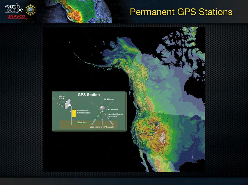
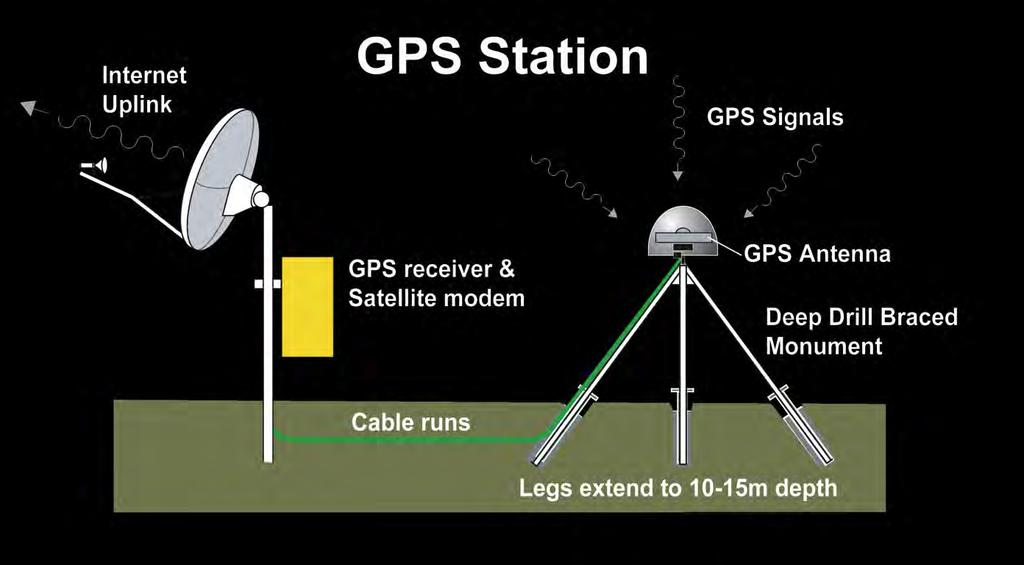
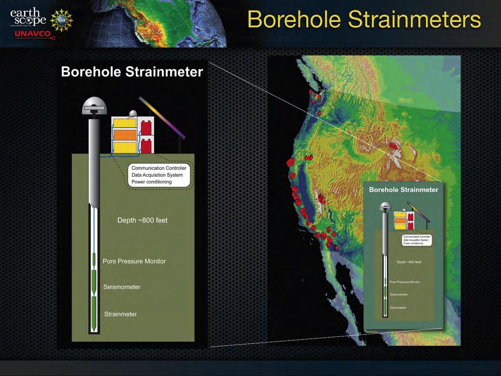
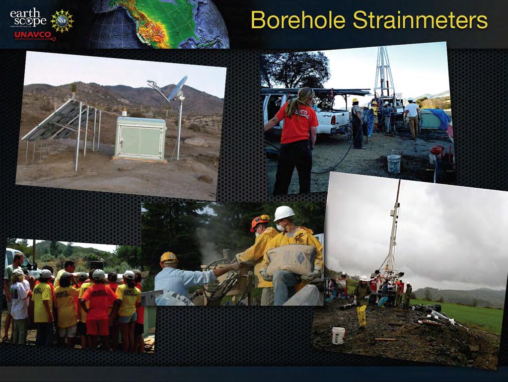
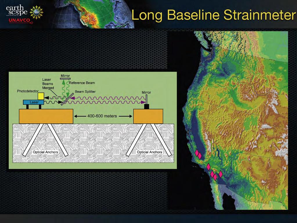
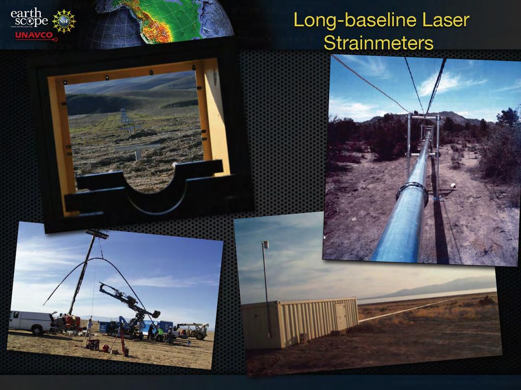
2 EarthScope Project Study the four dimensional structure and evolution of the North American Continent 3.2 km borehole into the San Andreas Fault 1099 permanent GPS stations 74 borehole strainmeters 5 laser strainmeters 100 Permanent seismic stations 400 transportable seismic stations occupying 2000 sites 30 magnetotelluric systems 100 campaign GPS stations 2146 campaign seismic stations 2


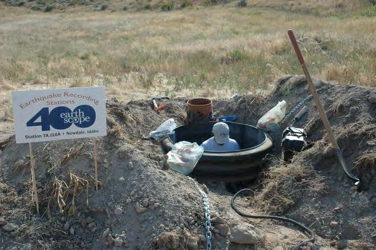
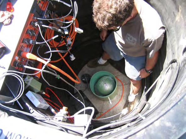
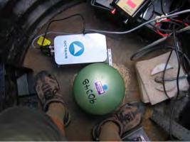
3 EarthScope Project EarthScope Components Plate Boundary Observatory SAFOD USArray USArray Observatory Components Transportable Array 400 seismic stations, 70km grid Flexible Array 2146 portable seismic instruments for PI driven experiments Reference Network about 100 permanent seismic stations Magnetotelluric 7 backbone stations and 20 portable instruments 3


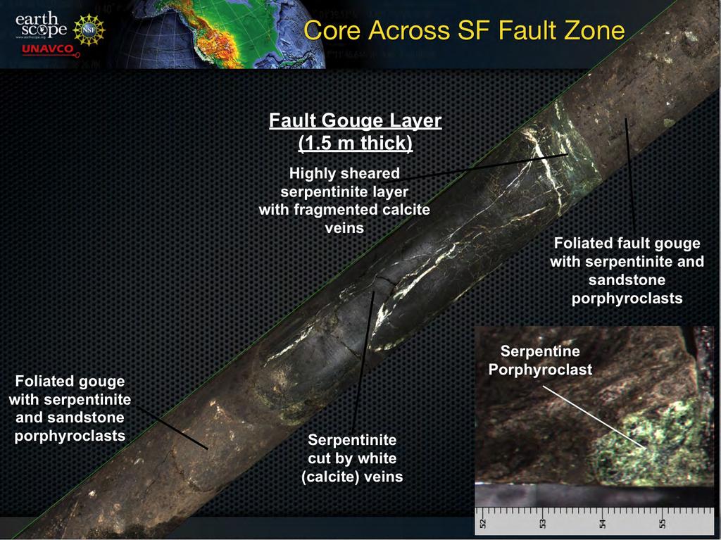
4 SAFOD Drilling through the San Andreas Fault Collecting core samples Installing long-term instrumentation 4


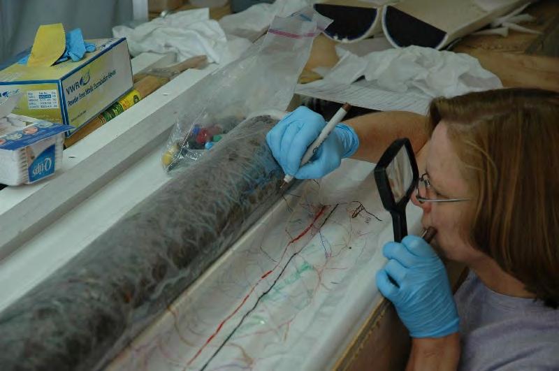
5 Core retrieved - Summer, 2007! SAFOD 5
6 6
7 7
8 8
9 9


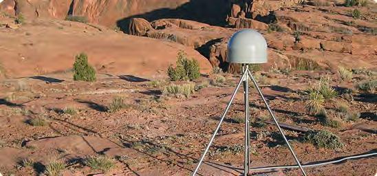
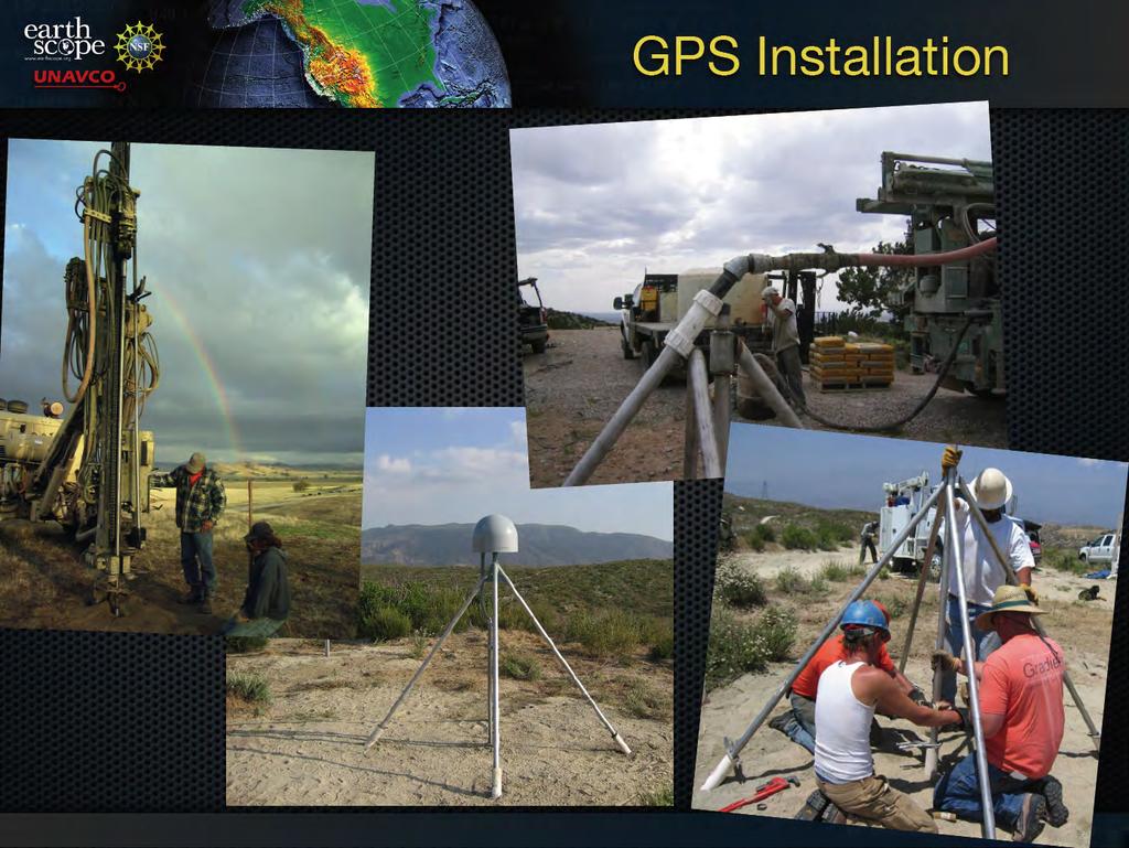
10 Some GPS Sites Los Osos, CA Seal Rock, AK Rainy Pass, AK 10
11 11
12 12
13 13
14 14
15 LiDAR 15
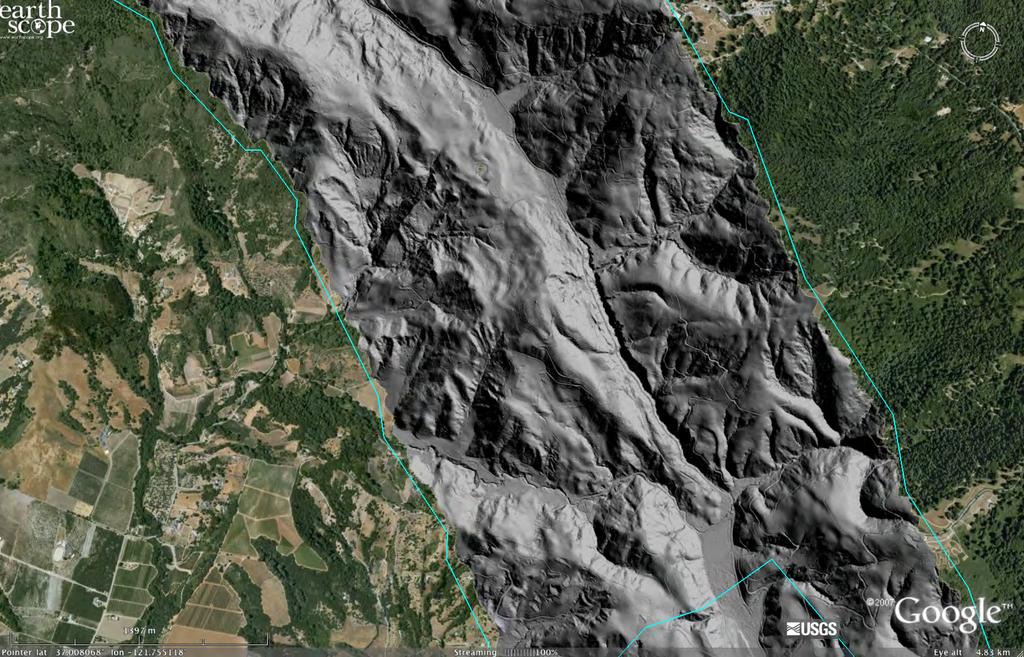
16 LiDAR 16
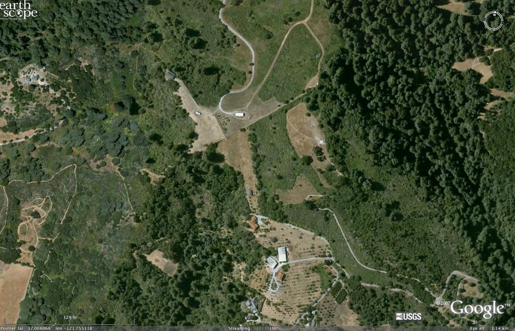
17 LiDAR 17
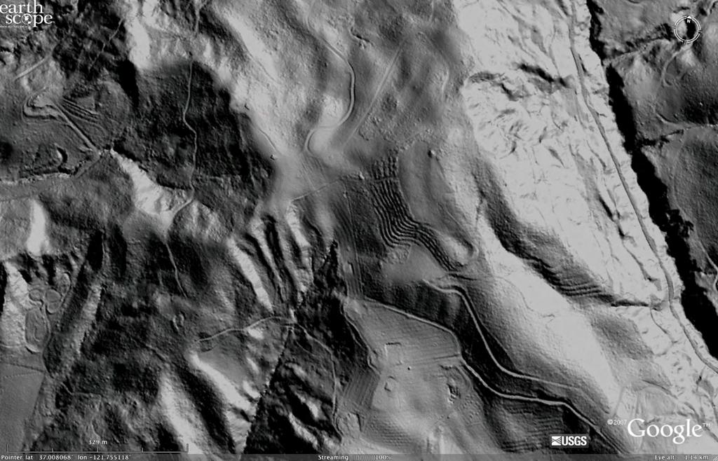
18 LiDAR 18

19 USArray Close-up Observatory components of USArray Transportable Array 400 seismic stations, 70km grid Rolling across the country, west to east Flexible Array 2146 portable seismic instruments Used by individual experiment teams Reference Network ~100 permanent seismic stations A fixed background network Magnetotelluric 7 backbone stations providing a fixed background network 20 portable instruments deployed each summer 19


20 Flexible Array A pool of high quality instrumentation used by teams for experiments lasting 1 day to two years Provide complete station sets to teams Solar panels, power systems, cables, enclosures,... Provide training and assistance Guralp Broadbands RefTek Texan with geophones Guralp short period Kinemetrics EpiSensor


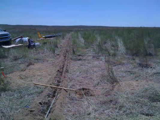
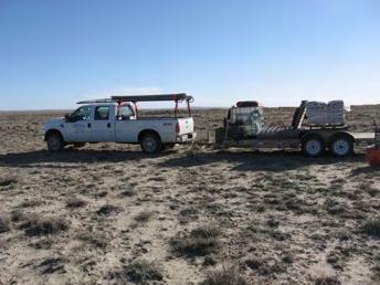
21 Flexible Array Seven FA experiments currently in the field High data return E.g., 94.5% for CAFÉ Includes nearreal-time comms Equipment: 326 broadband 120 short period 1700 active source 21

22 Flexible Array 22

23 Reference Network ~ 100 stations in contiguous US ANSS stations Regional network stations USArray Permanent Array23

")


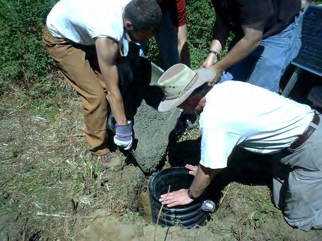
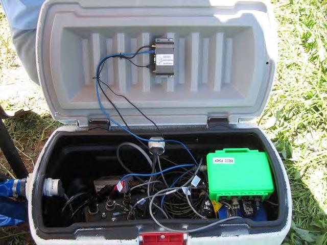
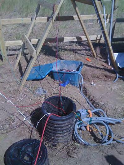
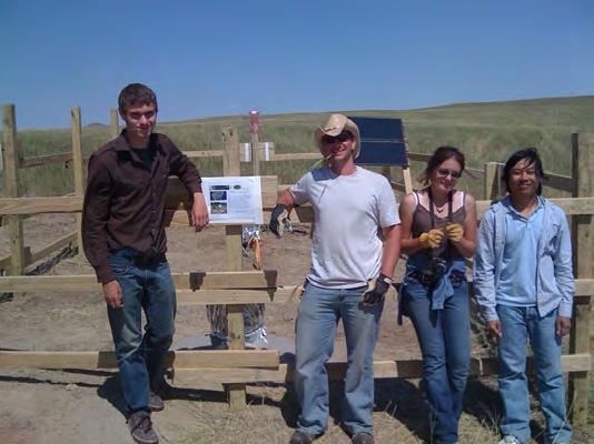
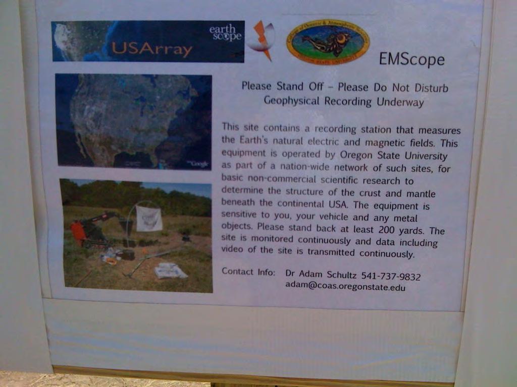
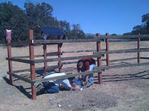
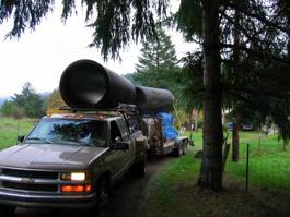
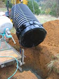
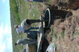
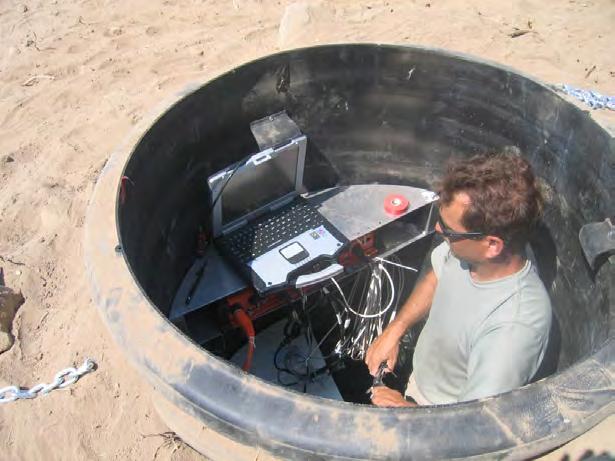
24 Magnetotellurics Transportable Array Backbone 170 campaign sites (2006, 2007, 2008) MBB06 Miles City, MT 7 backbone sites All data at IRIS DMC Station has already withstood mph winds and golfball-sized 24 hail!

 Some")


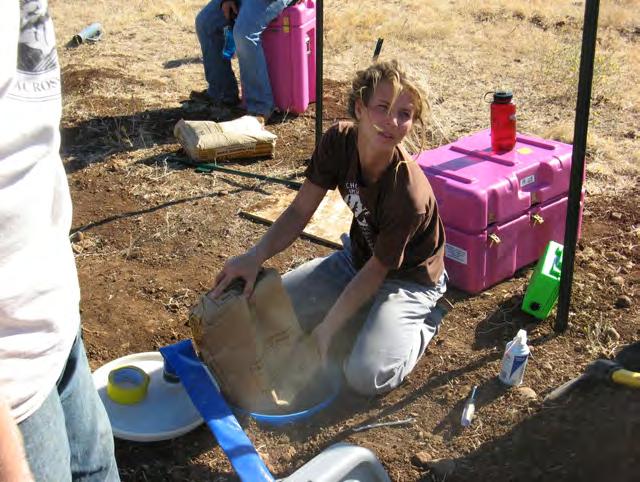
25 MT Summer Campaign Taking care of details... MT TA vehicles on site for installation :) Some field photos from the first site of Summer Bear Lake, Idaho Connecting cables... Magnetometer 25before burying

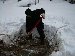
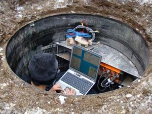
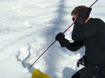
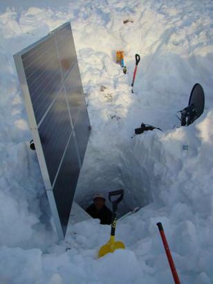
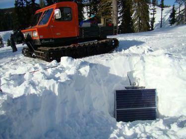
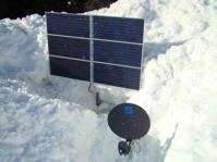
26 MT Permanent Sites 26

27 Transportable Array


28 Transportable Array As of September 30, commissioned 448 operating 200 removed Rolling eastward at a rate of about 400 km / Stations going in and coming out 28

29 TA Progress Rolling from west to east ~18 stations installed / month ~18 stations removed per month 29

 Data in near real time 40 and 1 sps")
30 Array & Station Design 400 broadband seismic stations ~70 km spacing ~1500 x 1500 km footprint ~2 year deployments at each site 10 years and 1623 sites to roll across the country Goals High-quality broadband data Maximize data return (>85%) Data in near real time 40 and 1 sps continuous 30


31 Construction

32 Installation 32

33 Last Step... 33

34 Construction & Installation Complete 34


35 Servicing Or maybe some cold temperatures... Just some plants in the way or some snow


36 Servicing Or maybe quite a bit of snow... 36


37 Servicing... or a lot of snow 37

38 Servicing 38


39 Servicing 39


40 Siting Outreach Site reconnaissance by student teams 32 students in the field right now >100 students and 20 universities already involved Active Earth Displays at museums and interpretive centers 40


41 Involvement in USArray TA stations can be adopted for the cost of the instrumentation 25 stations adopted so far, numerous others in planning stages WA, OR, ID, AZ, UT,... The TA is leaving a wake of permanent stations Adopted Stations in WA and OR Student Participation in TA Siting Activities TA site reconnaissance Use university students in summer >70 students and 20 universities already involved 41

42 Want More Info? All EarthScope observatories are fully operational All data are completely open Data are rolling in and some very exciting science is underway On the Web EarthScope USArray National Science Foundation Stay tuned... EarthScope is funded by the National Science Foundation. EarthScope is being constructed, operated, and maintained as a collaborative effort with UNAVCO, IRIS, and Stanford University, with contributions from the US Geological Survey, NASA and several other national and international organizations. 42
Seismic Recording Station AZ_PFO Summary Report
 Seismic Recording Station AZ_PFO Summary Report Thank you for hosting station AZ_PFO on your property. We hope that you find the enclosed report interesting. Your station is one of the 2000 USArray seismic
the IRIS Consortium Collaborative, Multi-user Facilities for Research and Education Briefing NSF Business Systems Review September 9, 2008
 the IRIS Consortium Collaborative, Multi-user Facilities for Research and Education Briefing NSF Business Systems Review September 9, 2008 A facilities program for collection and distribution of seismological
Seismic Recording Station TA_109C Summary Report
 Seismic Recording Station TA_109C Summary Report Thank you for hosting station TA_109C on your property. We hope that you find the enclosed report interesting. Your station is one of the 2000 USArray seismic
Plans For Alaska and Yukon
 Transportable Array Plans For Alaska and Yukon Robert Busby, TA Manager Katrin Hafner, Chief of Operations Bob Woodward, Director USArray EarthScope National Meeting Raleigh NC May 13-15, 2013 1 Outline
USArray the first five years
 www.earthscope.org USArray the first five years USArray A Continental-Scale Seismic By the Numbers (2003 2008) More than 600 Transportable Array sites have been occupied and more than 535 permits acquired
TEGAM s Connection to the EarthScope Project
 TEGAM s Connection to the EarthScope Project Introduction The EarthScope Project is an undertaking funded by the National Science Foundation in partnership with the United States Geological Survey and
The San Andreas Fault Observatory at Depth: Recent Site Characterization Studies and the 2.2-Km-Deep Pilot Hole
 The San Andreas Fault Observatory at Depth: Recent Site Characterization Studies and the 2.2-Km-Deep Pilot Hole Steve Hickman and Bill Ellsworth (USGS) Mark Zoback (Stanford University) and the Pre-EarthScope
EarthScope Facility Operation and Maintenance
 FACILITY OPERATION & MAINTENANCE OctOber 1, 2008 SepteMber 30, 2018 Proposal to the National Science Foundation March 2007 EarthScope Facility Operation and Maintenance October 1, 2008 September 30, 2018
Plate Boundary Observatory the first five years
 www.earthscope.org Plate Boundary Observatory the first five years Plate Boundary Observatory A Continental-Scale, Integrated Geodetic By the Numbers (2003 2008) Installed 891 permanent Global Positioning
Alaska Earthquake Center. By Natalia A. Ruppert Seismic Network Manager
 Alaska Earthquake Center By Natalia A. Ruppert Seismic Network Manager Geophysical Institute, University of Alaska Fairbanks Alaska Earthquake Center mission and historical perspective! Regional seismic
Getting to know EarthScope Plate
 Getting to know EarthScope Plate Boundary Observatory & UNAVCO Shelley Olds, UNAVCO !!"#$%&'$!("($)*&'+'$$!!,&-./,01$!2,&3,/4*5$!6+57+/389.-:,;+/&+'$ About UNAVCO!"#$%$&"&'()*'+(#$',#') -'('"-#.)",/)'/0#"1+,)
Seismicity in Pennsylvania and the Pennsylvania State Seismic Network (PASEIS)
") Seismicity in Pennsylvania and the Pennsylvania State Seismic Network (PASEIS) Andy Nyblade Department of Geosciences, Penn State University May 19, 2017 Shale Network Workshop Introduction Review of historic
Seismicity in Pennsylvania and the Pennsylvania State Seismic Network (PASEIS) Andy Nyblade Department of Geosciences, Penn State University May 19, 2017 Shale Network Workshop Introduction Review of historic
5.3 Scientific Viability of the USArray Transportable Array Network As a Real-Time Weather Monitoring Platform
 5.3 Scientific Viability of the USArray Transportable Array Network As a Real-Time Weather Monitoring Platform Frank Vernon* 1, Jonathan Tytell 1, Bob Busby 2, Jennifer Eakins 1, Michael Hedlin 1, Andreas
Objective. Background
 Proposal Closing the Seismic Monitoring Gap at Mount Shasta Volcano Shasta-Trinity National Forest, California USGS California Volcano Observatory February 2017 Objective Install three new seismograph
TexNet and CISR: An Update on Monitoring and Understanding Seismicity in Texas
 TexNet and CISR: An Update on Monitoring and Understanding Seismicity in Texas Michael H. Young a, Alexandros Savvaidis a, Peter Hennings a, Ellen Rathje b a Bureau of Economic Geology, Jackson School
Magnetotelluric and Seismic Investigation of Arc Melt Generation, Delivery, and Storage beneath Okmok Volcano
 Magnetotelluric and Seismic Investigation of Arc Melt Generation, Delivery, and Storage beneath Okmok Volcano PIs Ninfa Bennington (U. Wisconsin-Madison) and Kerry Key (Scripps Institution of Oceanography)
Refraction Microtremor for Shallow Shear Velocity in Urban Basins
 Refraction Microtremor for Shallow Shear Velocity in Urban Basins John Louie, Nevada Seismological Lab UNR students: J. B. Scott, T. Rasmussen, W. Thelen, M. Clark Collaborators: S. Pullammanappallil &
Microseismicity applications in hydraulic fracturing monitoring
 Available online atwww.scholarsresearchlibrary.com Archives of Applied Science Research, 2016, 8 (4):13-19 (http://scholarsresearchlibrary.com/archive.html) ISSN 0975-508X CODEN (USA) AASRC9 Microseismicity
New Progress of SinoProbe:
 New Progress of SinoProbe: Deep Exploration in China, 2008-2012 Shuwen DONG, Tingdong LI, et al. Chinese Academy of Geological Sciences Beijing 100037 China Background of Deep Exploration in World USA
Montana Bureau of Mines and Geology presents the 2009 SEMINAR SERIES. Trilby Cox, Seismologist University of California, San Diego
 presents the 2009 SEMINAR SERIES April 9, 2009 April 16, 2009 April 23, 2009 April 30, 2009 May 7, 2009 Up, Up, and Array Trilby Cox, Seismologist University of California, San Diego Pharmaceuticals in
The Vision of a Polar Observing System - Seismology
 The Vision of a Polar Observing System - Seismology Andy Nyblade, Dept. of Geosciences, Penn State University Autonomous Polar Observing Systems Workshop, Sept 30, 2010 Outline Why do we need a polar obs.
Observations of Atmospheric Phenomena from USArray and ANZA Observing Systems
 Observations of Atmospheric Phenomena from USArray and ANZA Observing Systems Text Frank Vernon Antelope User Group Meeting Muscat, Oman 2-4 March 2013 Collaboration with the High Performance Wireless
Education and Outreach:
 EarthScope National Meeting - Pre-meeting workshops May 12, 2009: (Update: April 8, 2009) Education and Outreach: Interpretive Methods for Scientists: Communicating EarthScope to the Public Interpretation
Haiti: Earthquake on January 12, 2010
 Geophysical Hazards and Plate Boundary Processes In Central America, Mexico and the Caribbean Haiti: Earthquake on January 12, 2010 Situation, achievements and perspective. Hotel La Condesa, Costa Rica
Online material: Updated 3-D tomography model and plotting script with examples
 Model Update January 2010: Upper Mantle Heterogeneity beneath North merica from Traveltime Tomography with Global and usarray Transportable rray Data Scott urdick, Robert D. van der Hilst, Frank L. Vernon,
Activity - Using GPS Data and Geologic Markers to Track Plate Motion
 Name: Date: Hour: Activity - Using GPS Data and Geologic Markers to Track Plate Motion Section Points Received Points Possible Part A Analysis 4.5 Part B Analysis 11.5 Total 16 Introduction: GPS satellites
Seismic Observation and Seismicity of Zimbabwe
 Seismic Observation and Seismicity of Zimbabwe Mr. Innocent Gibbon Tirivanhu MASUKWEDZA (2016 Global Seismology course) Meteorological Services Department of Zimbabwe 1. Introduction The Seismology section
Yellowstone Hotspot Component of the Plate Boundary Observatory
 Yellowstone Hotspot Component of the Plate Boundary Observatory (Investigators: Smith, Thatcher, Meertens, Humphreys, Dzurisin, Oldow Co-Investigators: Christiansen, Doss, Schwartz, Machette, Wong, Olig,
Magnitude 8.2 NORTHWEST OF IQUIQUE, CHILE
 An 8.2-magnitude earthquake struck off the coast of northern Chile, generating a local tsunami. The USGS reported the earthquake was centered 95 km (59 miles) northwest of Iquique at a depth of 20.1km
MT Prospecting. Map Resistivity. Determine Formations. Determine Structure. Targeted Drilling
 MT Prospecting Map Resistivity Determine Formations Determine Structure Targeted Drilling Cross-sectional interpretation before and after an MT survey of a mineral exploration prospect containing volcanic
One of the coldest places in the country - Peter Sinks yet again sets this year s coldest temperature record for the contiguous United States.
 One of the coldest places in the country - Peter Sinks yet again sets this year s coldest temperature record for the contiguous United States. In the early morning of February 22, 2010 the temperature
T W E N T I E T. Twenty Years of Support for Seismological Research. The IRIS Consortium
 Y T W R A E N T I E T H A N N I V E S R Twenty Years of Support for Seismological Research The IRIS Consortium 1984 2004 Washington, DC 20005 Cover of the proposal that formed the basis for the 2001-2006
Earthquakes, Tsunamis and Nuclear Explosions: Open Data Exchange for Research and Monitoring in Seismology
 Earthquakes, Tsunamis and Nuclear Explosions: Open Data Exchange for Research and Monitoring in Seismology David Simpson IRIS Consortium Washington, DC Symposium on Data Sharing Plans for GEOSS and Benefits
Magnitude 7.0 SOUTH ISLAND OF NEW ZEALAND
 A powerful 7.0-magnitude earthquake shook much of New Zealand's South Island early Saturday morning local time. USGS A damaged building near Manchester St. New Zealand Herald Photo / Colin Cross A car
OHIO S NEW CLASS II REGULATIONS AND ITS PROACTIVE APPROACH TO SEISMIC MONITORING AND INDUCED SEISMICITY
 OHIO S NEW CLASS II REGULATIONS AND ITS PROACTIVE APPROACH TO SEISMIC MONITORING AND INDUCED SEISMICITY Tom Tomastik, ODNR, Division of Oil and Gas Resources Management THE YOUNGSTOWN EVENT On December
Diablo Canyon SSHAC Level 3 Study
 1 Diablo Canyon SSHAC Level 3 Study Workshop 1 Summary of SSC Hazard Significant Issues and Data Needed William Lettis November 29 to December 1, 2011 PG&E DCPP SSHAC Study 2 Hosgri Hosgri Location Hosgri
CRUSTAL DYNAMICS IN CALIFORNIA: IMPLICATIONS FOR LARGE-SCALE CSP TOWER SYSTEMS
 CRUSTAL DYNAMICS IN CALIFORNIA: IMPLICATIONS FOR LARGE-SCALE CSP TOWER SYSTEMS Clement Ogaja Department of Civil & Geomatics Engineering California State University, Fresno Introduction Clement Ogaja Department
Meteorological Service of Canada Pan Am / Parapan Games. Our Mandate Includes: Our Mandate Does Not Include: In support of the
 Meteorological Service of Canada In support of the 2015 Pan Am / Parapan Games Presented by: Rob Simpson Head: Projects and Installations Air Monitoring and Operations Section MSC, Toronto, ON May 29 th,
Lithospheric structure of West Greenland
 Report on Loan 813 Lithospheric structure of West Greenland Richard England (University of Leicester), Peter Voss, (Geological Survey of Denmark and Greenland) On behalf of : Formation and evolution of
Empirical Green s Function Analysis of the Wells, Nevada, Earthquake Source
 Nevada Bureau of Mines and Geology Special Publication 36 Empirical Green s Function Analysis of the Wells, Nevada, Earthquake Source by Mendoza, C. 1 and Hartzell S. 2 1 Centro de Geociencias, Universidad
Digital Research Space of Induced Seismicity for EPOS Purposes (IS-EPOS project)
") Digital Research Space of Induced Seismicity for EPOS Purposes (IS-EPOS project) The project IS-EPOS (https://tcs.ah-epos.eu/) was financed from Polish structural funds (POIG.02.03.00-14-090/13-00) in
Digital Research Space of Induced Seismicity for EPOS Purposes (IS-EPOS project) The project IS-EPOS (https://tcs.ah-epos.eu/) was financed from Polish structural funds (POIG.02.03.00-14-090/13-00) in
Plate Boundary Observatory Working Group for the Central and Northern San Andreas Fault System PBO-WG-CNSA
 Plate Boundary Observatory Working Group for the Central and Northern San Andreas Fault System PBO-WG-CNSA Introduction Our proposal focuses on the San Andreas fault system in central and northern California.
Wireless Networks in Geophysical Monitoring
 Workshop on New Frontiers in Internet of Things 7-18 March 2016 Trieste, Italy Wireless Networks in Geophysical Monitoring Hairo Villalobos Vulcanological and Seismological Observatory of Costa Rica, National
Nanometrics Posthole Seismometers. World Class Performance
 Contents Summary... 3 Performance of the Trillium Posthole versus World Class Vault Instruments... 3 Variation in Noise with Depth... 3 Installation Examples... 4 Shallow Bedrock Installation... 4 Thick
GEOL4714 Final Exam Fall 2005, C. H. Jones instructor
 GEOL4714 Final Exam Fall 2005 p. 1 GEOL4714 Final Exam Fall 2005, C. H. Jones instructor Name: Student ID #: Feel free to use the back of the sheets for answers needing more space. (1) (10 pts) For each
TexNet and CISR Integrated Seismicity Monitoring and Research in Texas
 Alliance Regulatory and Legislative Forum August, 2015 TexNet and CISR Integrated Seismicity Monitoring and Research in Texas Scott W. Tinker Bureau of Economic Geology University of Texas at Austin Energy
EarthScope Facility Operation and Maintenance
 FACILITY OPERATION & MAINTENANCE OctOber 1, 2008 SepteMber 30, 2018 Volume II earthscope Facilities Volume III earthscope Science Proposal to the National Science Foundation March 2007 EarthScope Facility
Magnitude 7.0 N of ANCHORAGE, ALASKA
 A magnitude 7.0 earthquake occurred just before 8:30 am local time 8 miles north of Anchorage at a depth of 40.9 km (25.4 miles). There are reports of major infrastructure damage and damage to many homes
THE NEW DIGITAL SEISMIC NETWORK IN GHANA THE WAYFORWARD AND THE CHALLENGES
 THE NEW DIGITAL SEISMIC NETWORK IN GHANA THE WAYFORWARD AND THE CHALLENGES By NICHOLAS OPOKU Seismologist, Ghana Geological Survey JANUARY, 2013 IRIS METADATA WORKSHOP - KUWAIT Seismicity / Instrumental
UNAVCO COMMUNITY AND FACILITY PROPOSAL GEODESY ADVANCING EARTH SCIENCE RESEARCH
 2008-2012 UNAVCO COMMUNITY AND FACILITY PROPOSAL GEODESY ADVANCING EARTH SCIENCE RESEARCH About the Cover The cover shows the three primary activities of the UNAVCO facility requested in this proposal.
PRELIMINARY. Select Geophysical Methods and Groundwater Modeling: Examples from USGS studies. Claudia Faunt and a cast of others
 Select Geophysical Methods and Groundwater Modeling: Examples from USGS studies Claudia Faunt and a cast of others Current Preliminary Studies Stanford Water in the West Groundwater Data Workshop Series:
The Hellenic Seismological Network of Crete (HSNC): Monitoring results and the new strong motion network
: Monitoring results and the new strong motion network") The Hellenic Seismological Network of Crete (HSNC): Monitoring results and the new strong motion network Georgios Chatzopoulos 1, Ilias Papadopoulos 1 and Filippos Vallianatos 1 1 Technological Educational
The Hellenic Seismological Network of Crete (HSNC): Monitoring results and the new strong motion network Georgios Chatzopoulos 1, Ilias Papadopoulos 1 and Filippos Vallianatos 1 1 Technological Educational
1. Introduction/Goals and expected outcomes
 Request for use of the NSF Facilities for Education at the University of Colorado Boulder CABL: Characterizing the Atmospheric Boundary Layer Julie K. Lundquist Dept. of Atmospheric and Oceanic Sciences
Magnitude 6.9 GULF OF CALIFORNIA
 A pair of strong earthquakes struck off the coast of Mexico early Thursday only minutes apart. The magnitude 6.9 and 6.2 were centered about 85 miles northeast of Guerrero Negro in the Mexican state of
Final Report for DOEI Project: Bottom Interaction in Long Range Acoustic Propagation
 Final Report for DOEI Project: Bottom Interaction in Long Range Acoustic Propagation Ralph A. Stephen Woods Hole Oceanographic Institution 360 Woods Hole Road (MS#24) Woods Hole, MA 02543 phone: (508)
Ambient Noise Tomography in the Western US using Data from the EarthScope/USArray Transportable Array
 Ambient Noise Tomography in the Western US using Data from the EarthScope/USArray Transportable Array Michael H. Ritzwoller Center for Imaging the Earth s Interior Department of Physics University of Colorado
Chapter 5 LiDAR Survey and Analysis in
 Chapter 5 LiDAR Survey and Analysis in 2010-2011 Christopher Fennell A surveyor s plat and town plan filed in 1836 set out an intended grid of blocks, lots, alleys, and streets for New Philadelphia. Geophysical,
Earthquake patterns in the Flinders Ranges - Temporary network , preliminary results
 Earthquake patterns in the Flinders Ranges - Temporary network 2003-2006, preliminary results Objectives David Love 1, Phil Cummins 2, Natalie Balfour 3 1 Primary Industries and Resources South Australia
SEPTEMBER 2013 REVIEW
 Monthly Long Range Weather Commentary Issued: October 21, 2013 Steven A. Root, CCM, President/CEO sroot@weatherbank.com SEPTEMBER 2013 REVIEW Climate Highlights The Month in Review The average temperature
GEORED Project: GNSS Geodesy Network for Geodynamics Research in Colombia, South America. Héctor Mora-Páez
 GEORED Project: GNSS Geodesy Network for Geodynamics Research in Colombia, South America. Héctor Mora-Páez Colombian Geological Survey UNAVCO SCIENCE MEETING Feb 27 March 1, 2012 Boulder, CO, TECTONIC
NEES/IRIS/USGS Workshop
 George E. Brown, Jr. Network for Earthquake Engineering Simulation (NEES) Program nees@utexas: Cooperative and Outreach Opportunities/Examples NEES Consortium Annual Meeting Kenneth H.Stokoe, II May 20,
Seismic Observation and Seismicity of Uganda
 (Uganda, Mr. Nyago Joseph, 2012-2013S) Seismic Observation and Seismicity of Uganda 1. Seismic observation in Uganda In 1989, UNESCO and the International Programs in Physical Sciences (IPPS) donated four
Plow Camera and Location Sharing Practices. National Rural ITS Conference October 23, 2018
 Plow Camera and Location Sharing Practices National Rural ITS Conference October 23, 2018 Outline NWP Program Overview Project Background Purpose What we did State Summaries ID, MT, ND, MN, IA, PA Project
CHILEAN PART OF SIRGAS REFERENCE FRAME, REALIZATION, ADOPTION, MAINTENANCE AND ACTUAL STATUS. Geodesy for Planet Earth IAG 2009, Buenos Aires
 CHILEAN PART OF SIRGAS REFERENCE FRAME, REALIZATION, ADOPTION, MAINTENANCE AND ACTUAL STATUS Geodesy for Planet Earth IAG 2009, Buenos Aires Ing. Héctor Parra hparra@igm.cl, IGM Chile Dr. Juan Báez jbaez@udec.cl,
Electrical Impedance Tomography of a Seafloor Volcano R.V. Revelle shiptime proposal submitted by David Myer, Steven Constable, and Kerry Key
 Electrical Impedance Tomography of a Seafloor Volcano R.V. Revelle shiptime proposal submitted by David Myer, Steven Constable, and Kerry Key Abstract. We propose to use R.V. Roger Revelle student shiptime
USGS Volcano Hazards Program
 USGS Volcano Hazards Program NAS Board on Earth Sciences and Resources May 12, 2014 Charlie Mandeville USGS Program Coordinator cmandeville@usgs.gov www.volcanoes.usgs.gov Volcano Hazards Program Mission:
Contemporary Tectonics and Seismicity of the Teton and Southern Yellowstone Fault Systems- Phase I
 University of Wyoming National Park Service Research Center Annual Report Volume 4 4th Annual Report, 1980 Article 16 1-1-1980 Contemporary Tectonics and Seismicity of the Teton and Southern Yellowstone
Magnitude 7.8 SCOTIA SEA
 A magnitude 7.8 earthquake has occurred in the South Orkney Island region in the Scotia Sea. According to the USGS, this earthquake is the latest in a series of moderate-tolarge earthquakes to strike this
AN INVENTORY ON EXISTING AND RELEVANT EQUIPMENT FOR GEOTHERMAL DEVELOPEMENT IN THE ARGeo COUNTRIES
 AN INVENTY N EISTING AND ELEVANT EQUIPMENT F GETHEMAL DEVELPEMENT IN THE AGeo CUNTIES Based on a fact finding mission 5.0. -- 6.. 2005 Knútur Árnason Gestur Gíslason verview. Scope of work 2. Countries
The 2003, M W 7.2 Fiordland Earthquake, and its nearsource aftershock strong motion data
 The 2003, M W 7.2 Fiordland Earthquake, and its nearsource aftershock strong motion data P. McGinty Institute of Geological & Nuclear Sciences, PO Box 30-368, Lower Hutt, New Zealand 2004 NZSEE Conference
Longitudinal Dependence of Equatorial Irregularities and Electrodynamics!
 Longitudinal Dependence of Equatorial Irregularities and Electrodynamics! Endawoke Yizengaw Institute for Scientific Research, Boston College Special Thanks: M. Magoun, M. Moldwin, E. Zesta, F. Anad, A.
Urban Dispersion Program New York City Mesonet ROOFTOP WEATHER STATION NETWORK
 Urban Dispersion Program New York City Mesonet ROOFTOP WEATHER STATION NETWORK GENERAL DESCRIPTION Introduction The Department of Homeland Security has established a meteorological research program in
ECEN 615 Methods of Electric Power Systems Analysis Lecture 23: Geomagnetic Disturbances, Optimal Power Flow
 ECEN 615 Methods of Electric Power Systems Analysis Lecture 23: Geomagnetic Disturbances, Optimal Power Flow Prof. Tom Overbye Dept. of Electrical and Computer Engineering Texas A&M University overbye@tamu.edu
An Assessment of Geological Carbon Sequestration in the Illinois Basin: The Illinois Basin-Decatur Site
 An Assessment of Geological Carbon Sequestration in the Illinois Basin: The Illinois Basin-Decatur Site presented by Robert J. Finley and the MGSC Project Team April 15, 2009 Illinois Sustainable Technology
Identified a possible new offset location where the customer is currently exploring drill options.
 GroundMetrics was hired to conduct a Full-Field Resistivity Survey for an oil and gas producer that needed to make crucial decisions to drive profitability at the location. The results saved them hundreds
Introduction to Strain and Borehole Strainmeter Data
 Introduction to Strain and Borehole Strainmeter Data Evelyn Roeloffs U. S. Geological Survey Earthquake Science Center March 28, 2016 Evelyn Roeloffs, USGS ESC Strainmeters: Introduction March 28, 2016
Breakout Session III Evolving landscapes and global environmental change
 Breakout Session III Evolving landscapes and global environmental change 1. Hydrology and critical zone imaging 2. Glaciology: Instrumenting glaciers and ice sheets 3. Polar networks and glacial isostatic
Environment Canada and TO2015 Sailing. Paul Joe
 Environment Canada and TO2015 Sailing Paul Joe 20140801 Background The PanAm 2015 games will bring international guests to the Toronto area. The terrorism threat is not considered substantial. The games
1. Analysis of P-wave traveltimes to USGS permanent stations.
 Seismicity Study - Hawaii Geothermal The proposed work will allow us to: 1. Determine baseline background seismicity (intensity, directionality and waveform characteristics) for comparison to seismicity
ESTIMATES OF HORIZONTAL DISPLACEMENTS ASSOCIATED WITH THE 1999 TAIWAN EARTHQUAKE
 ESTIMATES OF HORIZONTAL DISPLACEMENTS ASSOCIATED WITH THE 1999 TAIWAN EARTHQUAKE C. C. Chang Department of Surveying and Mapping Engineering Chung Cheng Institute of Technology, Taiwan, ROC ABSTRACT A
RECENT ADVANCES IN SEISMIC AND INFRASONIC ANALYSES OF VOLCANIC ERUPTIONS AND POTENTIAL FOR USING EARTHSCOPE DATA
 RECENT ADVANCES IN SEISMIC AND INFRASONIC ANALYSES OF VOLCANIC ERUPTIONS AND POTENTIAL FOR USING EARTHSCOPE DATA DAVID FEE WILSON ALASKA TECHNICAL CENTER, ALASKA VOLCANO OBSERVATORY GEOPHYSICAL INSTITUTE,
SONGS Seismic Research Projects
 SONGS Seismic Research Projects Energy Division Independent Peer Review Group September 21, 2012 Agenda Background Overview Project Support Permits, Approvals, and Reviews Schedule Use of Advanced Technologies
Seismicity Associated with Geothermal Systems
 Seismicity Associated with Geothermal Systems Randi Walters: McNair Scholar Dr. Kasper van Wijk: Mentor Geosciences Abstract Studying natural and induced seismicity associated with geothermal systems can
Investigation 3: Plate Tectonics
 Investigation 3: Plate Tectonics Table of Contents Folder 1: Plate Geography and Structure... 18 Folder 2: Rates of Plate Movement... 19 Folder 3: Driving Forces... 20 Folder 4: Plate Interactions... 22
7.1 FIJI 1, :57:22 UTC
 A magnitude 7.1 earthquake struck 141 km (88 miles) northeast of Ndoi Island, Fiji, and 313 km (194 mi) west-northwest of Nuku alofa, Tonga according to the US Geological Survey, but there were no reports
Principles of the Global Positioning System Lecture 24
 12.540 Principles of the Global Positioning System Lecture 24 Prof. Thomas Herring http://geoweb.mit.edu/~tah/12.540 OVERVIEW Examination of results from Earthscope Reference frame definition: SNARF High-rate
Magnitude 7.9 SE of KODIAK, ALASKA
 A magnitude 7.9 earthquake occurred at 12:31 am local time 181 miles southeast of Kodiak at a depth of 25 km (15.5 miles). There are no immediate reports of damage or fatalities. Light shaking from this
Geophysics the use of geology, laboratory & field experiments, mathematics, and instruments to study: Earthquakes and Volcanoes seismometers,
 Geophysics the use of geology, laboratory & field experiments, mathematics, and instruments to study: Earthquakes and Volcanoes seismometers, tiltmeters, EDM, remote sensing, Energy: oil, gas, hydrothermal
Real time Monitoring System for Earthquakes and Tsunamis (DONET)
") Real time Monitoring System for Earthquakes and Tsunamis (DONET) NankaiTrough Yoshiyuki Kaneda Japan Agency for Marine-Earth Science and Technology (JAMSTEC) POGO@Seoul Presentation 1 Earthquakes in the
Real time Monitoring System for Earthquakes and Tsunamis (DONET) NankaiTrough Yoshiyuki Kaneda Japan Agency for Marine-Earth Science and Technology (JAMSTEC) POGO@Seoul Presentation 1 Earthquakes in the
WMO Public Weather Services: Enhanced Communication Skills for Improved Service Delivery. by S.W. Muchemi (WMO)
") WMO Public Weather Services: Enhanced Communication Skills for Improved Service Delivery by S.W. Muchemi (WMO) Functions of the Public Weather Services (PWS) programme of WMO To strengthen the capabilities
WMO Public Weather Services: Enhanced Communication Skills for Improved Service Delivery by S.W. Muchemi (WMO) Functions of the Public Weather Services (PWS) programme of WMO To strengthen the capabilities
Theory of Geomagnetic Disturbance Modeling
 Theory of Geomagnetic Disturbance Modeling Professor Tom Overbye Texas A&M University 2001 South First Street Champaign, Illinois 61820 +1 (217) 384.6330 support@powerworld.com http://www.powerworld.com
Low Cost Seismic Monitoring Strategies
 Low Cost Seismic Monitoring Strategies Derrick J. Chambers Mining Engineer Spokane Mining Research Division NIOSH Research Team: Shawn Boltz, Derrick Chambers, Dave Hanson, Sean Johnson, Jerry Richardson,
Trends Forecasting. Overview: Objectives: GLEs Addressed: Materials: Activity Procedure:
 Trends Forecasting Overview: How do meteorologists forecast weather? Students learn one of 5 main methods for forecasting weather, use it to create a forecast, and analyze results. Objectives: The student
Initial Borehole Drilling in the Hornepayne and Manitouwadge Area
 MAY 2017 PRELIMINARY ASSESSMENT OF POTENTIAL SUITABILITY Initial Borehole Drilling in the Hornepayne and Manitouwadge Area In 2010, the Nuclear Waste Management Organization (NWMO) began technical and
Ludwig Combrinck HartRAO 3rd Space Geodesy Workshop 16 March 2009 Matjiesfontein
 Space Geodesy and Space Science Ludwig Combrinck HartRAO 3rd Space Geodesy Workshop 16 March 2009 Matjiesfontein DST s Concept of Space Science SA Space Agency, commercial applications, CSIR Satellite
Geophysical Site Surveys
 Geophysical Site Surveys Simon Oakley Geoscience Team Leader Fugro Survey Limited 16/04/2014 Contents Menu Introduction Section 1 - Geophysical Site Surveys - Seabed Bathymetry - Shallow Geology - Seabed
crustal structure experiment beneath Wairarapa - Wellington area: results from SAHKE
 crustal structure experiment beneath Wairarapa - Wellington area: results from SAHKE Tim Stern and SAHKE team* * VUW, GNS, University of Southern California, University of Tokyo(Japan) SAHKE = Seismic
Imagerie à l'échelle d'un massif, par méthodes électromagnétiques actives et passives. Liens avec Resif
 Imagerie à l'échelle d'un massif, par méthodes électromagnétiques actives et passives Liens avec Resif Contributeurs: Jean-François Girard (IPGS-EOST, Strasbourg) Stéphane Garambois (ISTerre, Grenoble)
Earthscope in the Northern Rockies Workshop
 Earthscope in the Northern Rockies Workshop Co-conveners: David Foster - University of Florida Paul Mueller - University of Florida David Mogk - Montana State University EarthScope in the Northern Rockies
MAGMATIC, ERUPTIVE AND TECTONIC PROCESSES IN THE ALEUTIAN ARC, ALASKA
 MAGMATIC, ERUPTIVE AND TECTONIC PROCESSES IN THE ALEUTIAN ARC, ALASKA Introduction The Aleutian Arc contains roughly ten percent of the world s active volcanoes. Hardly a year goes by without a major eruption