Flooding and Development in Low-Lying areas in Jamaica : Impact of Climate Change
|
|
|
- Brenda Stone
- 6 years ago
- Views:
Transcription


1 Flooding and Development in Low-Lying areas in Jamaica : Impact of Climate Change Session : Managing Ecosystmes for more Resilient Cities in India, Bolivia, Jamaica Resilient Cities, 2016, Bonn Arpita Mandal Department of Geography and Geology, University of the West Indies, Mona, Jamaica
2 Researchers Dr Matthew Wilson Department of Geography, University of the West Indies, St Augustine, Trinidad and Tobago. Prof Michael Taylor, Dr Tannecia Stephenson, Mr Jayaka Campbell, Mr Alrick Brown Climate Studies Group Mona, Department of Physics, University of the West Indies, Mona Campus, Jamaica. Dr David Smith Co-ordinator, Institute of Sustainable Development, University of the West Indies, Mona Campus, Jamaica. Dr Arpita Nandi Department of Geosciences, East Tennessee State University, Tennessee, USA Dr Christopher Burgess CEAC Solutions Ltd, Jamaica Miss Anuradha Maharaj, Mphil, UWI MONA, Research Associate, CERMES, UWI Cave Hill Campus. Acknowledgement : Coastline damage pictures : Miss Taneisha Edwards, Assistant Lecturer and Ph.D candidate, Department of Geography and Geology, University of the West Indies, Mona Campus, Jamaica.


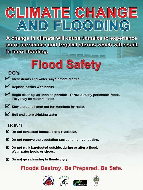
3 KEY MESSAGES Flooding, a major hydrometeorological hazard in Jamaica has significantly affected major infrastructures located on coastal areas and floodplains. OUTLINE OF THE TALK Flood hazard maps showing present and future flood risk for vulnerable communities at national and sub-national level are hence of particular significance for disaster management and planning for climate compatible development in flood prone areas. Continuous training for local government staff to use geospatial data and understanding its importance in disaster management and climate studies by increased cooperation and data sharing between academia and local and national governments
 climate.")
.")

4 Introduction: Jamaica INTRODUCTION 40 km Jamaica has a tropical maritime (marine) climate. Mean daily temperature ranges from a seasonal low of 26 º C in February to a high of 28º C in August (33 º C in recent years). Islandwide long term mean annual rainfall exhibits a characteristic pattern, with the primary maximum in October and the secondary in May. The main dry season lasts from December to April.

5 Riverine Flood Hazard Potential Map (Nandi et al, 2016)


6 Population density per kilometer Road network Comparing the population density map, road network map with the riverine flood hazard map created by LR. Population vulnerability map shows areas marked in red which are major coastal and inland towns, vulnerable to riverine flooding.


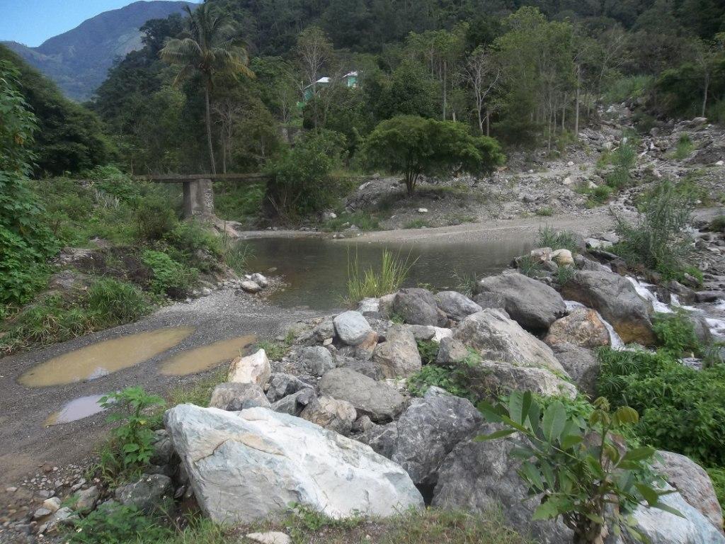
7 FLOODING WOES.. Kintyre, Hope River, Tropical Storm Nicole, Harbour View, Kingston, August 2008 Port Maria, St Mary, after Hurricane Sandy, Oct,2012 Port Maria, St Mary, after Hurricane Sandy, Oct,2012 Effect of tropical storm Nicole, 2010, on beach in Negril, picture shows whole beach gone. Much of the beach was lost in the storm - there used to be at least 15 feet of sand between this wall and the water ( Other pictures from Gleaner Archives and from WRA archives. COURTS STORE MAIN STREET Outram River SHELL SERVICE STATION

8 CLIMATE CHANGE : IMPACTS MELTING OF GLACIERS DROUGHT > AFFECTING WATER AND AGRICULTURE SECTOR FLOODING FROM INCREASE IN INTENSITY OF STORMS HURRICANES SEA LEVEL RISE AND COASTAL FLOODING WATER RESOURCES : DEPLETION DUE TO DECREASE IN DAILY RAINFALL Increase in temperature of the earth s air and oceans, increase in greenhouse gas emissions leading to a warmer climate.


9 Present Climate More storms and hurricanes Nandi et al., 2016 Mandal et al, 2013


10 Future Climate 1 2 Models Scenarios or Storylines of future global development Future Climate Temperature Rainfall Extremes Sea Level Rise
11 Deaths and damages, JMD billions (2010 value) Deaths (# persons) and damages EAD, in JMS billions Future Climate Temperatures still increasing Variable + Drying trend More intense extremes Deaths-present climate Deaths-future climate Damages-present climate Damages-future climate Probability of exceedance Jamaica Present climate 100 year 24 hour 7.0 precipitation depths will become the and 57 year 5.2 RP events by 2100 for NMIA 5.0 and SIA 4.7 respectively Flood risks of deaths and damages are 3.0 expected to increase 11% and 9% 2.0 respectively to ~4.4 persons per 1.0 annum and JMD9.2 billion (USD105.2) 0.0 in 2010 dollars Deaths Damages Presentobserved Presentvalidation Future, 2100 Burgess et al. (2015)


12 Study Areas : Yallahs and South Negril-Orange River hydrometerological events Hurricane Gilbert, 1988 Study Areas Hurricane Ivan, 2004 South Negril-Orange river Watershed Yallahs River Watershed


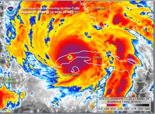
13 Watershed 1: Yallahs River Upland catchment in south-east Jamaica, draining the Blue Mountains. HEC-HMS model structure, Yallahs River Major riverine flooding associated with Hurricane Gustav (28 August 2008).


14 Tropical Storm Gustav: Results for Yallahs 1hr rainfall Maximum flood depth HEC-HMS Generation of flow data for upstream input and subcatchment inflows LISFLOOD-FP Routing of flood wave along main channel and across floodplain (m)

 Blue: 2% (50 year return period) Red: 1% (100 year return period) Main difference between")
15 Estimation of current flood risk: results HEC-HMS run for 25, 50 and 100 year rainfall events Flows from HEC-HMS routed through the LISFLOOD-FP model to predict inundation extents and depths Topographically constrained flooding Right: Map of exceedance probability: Green: 4% (25 year return period) Blue: 2% (50 year return period) Red: 1% (100 year return period) Main difference between flood areas
16 Estimation of future flood risk: results No reduction in inundation risk in valley Maps of exceedance probability: Green: 4% (25 year return period) Blue: 2% (50 year return period) Red: 1% (100 year return period) Present annual exceedance probability annual exceedance probability (ECHAM, B1) Lower risk downstream

 from stereo phogrammetry (Mona")
17 Orange/ Negril Rivers Flood model domain Orange/ South Negril Rivers: Low lying twin catchments in west Jamaica. Important center of tourism. Exposed to storm surge and flood risk associated with storms and hurricanes. Flood model development: LISFLOOD- FP: Orange/ S. Negril catchment flow inputs from HEC-HMS models Rain direct to the floodplain Buildings Orange River S. Negril River Topography: 6 m horizontal and 1 m vertical resolution Digital Elevation Model (DEM) from stereo phogrammetry (Mona Geoinformatix Institute) Bathymetry: Interpolated from GEBCO data


18 1 hourrainfall Tropical Storm Gustav: Results HEC-HMS Generation of flow data for upstream input Maximum flood depth LISFLOOD-FP Routing of flood wave along main channel and across floodplain (no storm-surge included) (m)


 (DEFRA, 2003) Present annual")

19 Estimation of future flood risk: results Buildings at risk: substantially more affected in future rainfall/ sea-level rise scenario Greatest hazard for buildings is along the coast Buildings: probability of inundation Hazard to buildings Haz = Depth * (Velocity+1.5) (DEFRA, 2003) Present annual exceedance probability, surge Future annual exceedance probability, surge/ SLR (high) Future 100-yr, surge + SLR (high)

20 COMMUNITY SURVEY IN YALLAHS : PRE AND POST PROJECT
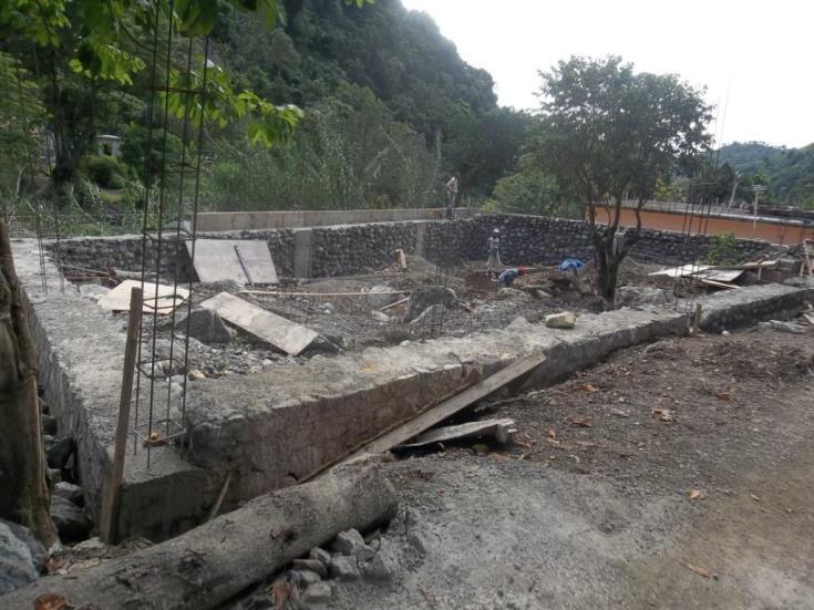
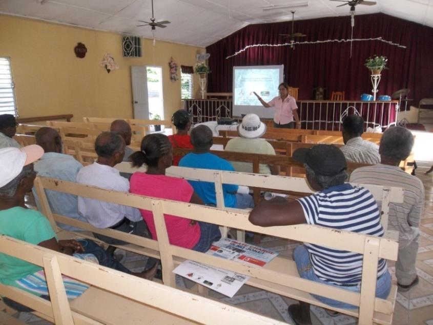
21 CONSTRUCTION ALONG RIVER BANK IN BROOKLODGE AND GRASSPIECE, COMMUNITY MEETING AND DISSEMINATION OF

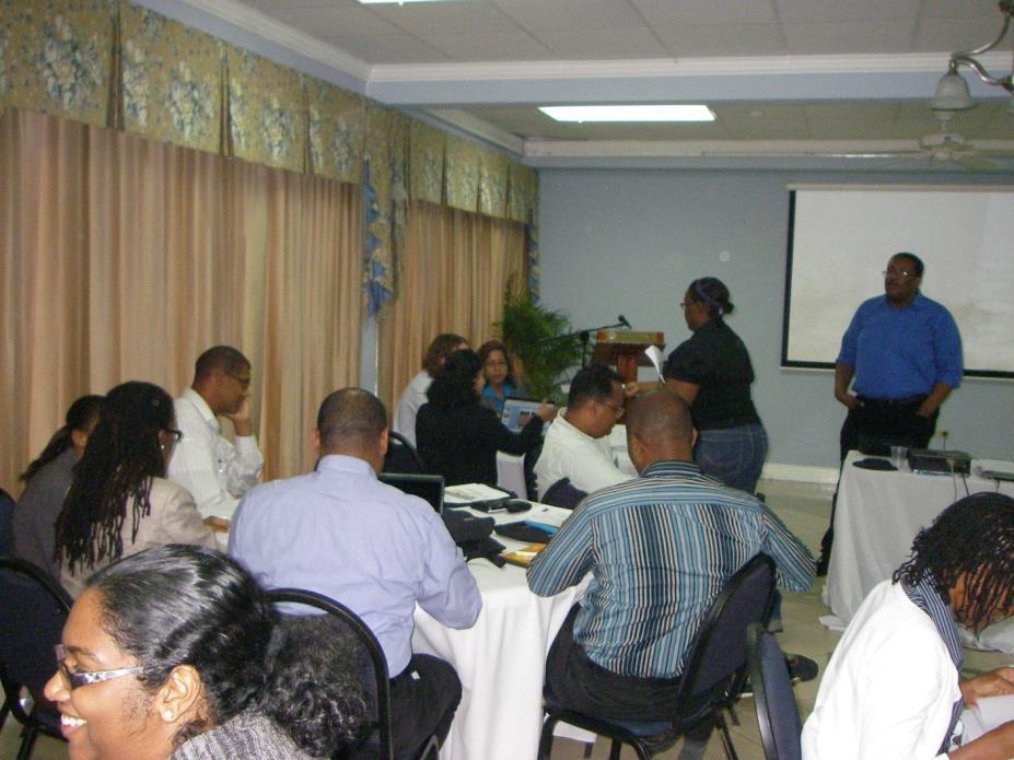
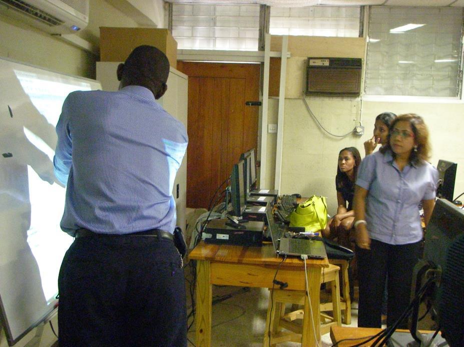
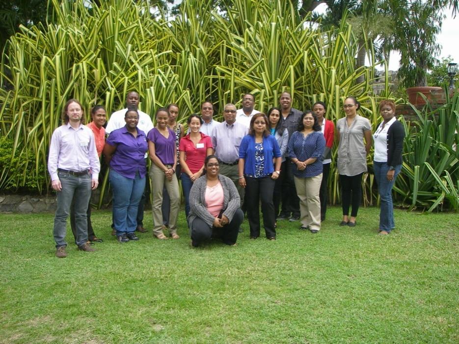
22 TRAINING ON FLOOD MODELS TO STAKEHOLDERS

23 DISSEMINATION OF RESULTS : UPLOAD DATA THROUGH OPEN SOURCE PLATFORM CARISKA 24
24 Upload or Download data Decide on what you want to allow people to do with the data you can give different people different permissions View or edit Download Choose who can view or download the data Choose who can edit the data Choose who can manage the data Shapefiles and GeoTiffs can be uploaded 25
25 CHALLENGES Resolution of the existing climate models for the Caribbean (50-25km). How useful are they for predicting rainfall variability at watershed/sub-watershed level? OUTLINE OF THE TALK Loss of data (rainfall, streamflow) from gages during flash floods, damage to the gages. Lack of good quality topographical data for flood plain mapping. Insufficient data on damages from past events, needs more training on data collection, data sharing. Implementation of existing and new policies on water management, disaster management, national building code.
26 Data on site Squatter Communities Major Roads Hospitals Parishes Geology Kingston soils map (preliminary classification) Preliminary data on flood risk for Hope River 27


27 Acknowledgements Department of Geography and Geology, UWI Mona, Jamaica. Water Resources Authority of Jamaica Office of Disaster Preparedness and Emergency Management Meteorological Service of Jamaica Mona Geoinformatix Ltd CEAC Solutions Ltd Funding: CDKN and managed by CARIBSAVE
28
Terrestrial Flood Risk and Climate Change in the Yallahs River, Jamaica. An assessment of future flood risk. projections of future climate
 Terrestrial Flood Risk and Climate Change in the Yallahs River, Jamaica An assessment of future flood risk using hydrodynamic models driven by projections of future climate Matthew Wilson1, Arpita Mandal2,
CARIWIG Case Study Report Scenarios of discharge for the Hope River Watershed in response to variable tropical cyclone characteristics
 CARIWIG Case Study Report Scenarios of discharge for the Hope River Watershed in response to variable tropical cyclone characteristics Arpita Mandal1, Michael Taylor2, Tannecia Stephenson2, Jayaka Campbell2,
European Geosciences Union General Assembly Vienna, Austria 27 April - 02 May 2014
 European Geosciences Union General Assembly Vienna, Austria 27 April - 02 May 2014 Projecting the Current & Future Impact of Storm Surges on Coastal Flood Extent at Pigeon Point, South-West Tobago, through
After 2017 Is the Future Predictable?
 After 2017 Is the Future Predictable? Presented by: Evan Thompson Director, Meteorological Service, Jamaica At Caribbean Insurance Conference, Montego Bay, Jamaica June 4, 2018 What s Happening with the
SCIENCE FOR CLIMATE CHANGE RESILIENCE A MUST! CLIMATE STUDIES GROUP, MONA (CSGM) DEPARTMENT OF PHYSICS UNIVERSITY OF THE WEST INDIES, MONA
 DEPARTMENT OF PHYSICS UNIVERSITY OF THE WEST INDIES, MONA") SCIENCE FOR CLIMATE CHANGE RESILIENCE A MUST! CLIMATE STUDIES GROUP, MONA (CSGM) DEPARTMENT OF PHYSICS UNIVERSITY OF THE WEST INDIES, MONA WHAT IS...? Climate Change Distinct changes in measures of climate
SCIENCE FOR CLIMATE CHANGE RESILIENCE A MUST! CLIMATE STUDIES GROUP, MONA (CSGM) DEPARTMENT OF PHYSICS UNIVERSITY OF THE WEST INDIES, MONA WHAT IS...? Climate Change Distinct changes in measures of climate
Disaster Risk Assessment: Opportunities for GIS and data management with Open DRI
 Disaster Risk Assessment: Opportunities for GIS and data management with Open DRI Jacob Opadeyi Department of Geomatics Engineering and Land Management, The University of the West Indies, St. Augustine,
CLIMATE-SMART AGRICULTURE: THE POTENTIAL ROLE OF MODELLING AS PART OF
 CLIMATE-SMART AGRICULTURE: THE POTENTIAL ROLE OF MODELLING AS PART OF THE SOLUTION FOR THE CARIBBEAN Michael A. Taylor Climate Studies Group, Mona University of the West Indies, Mona. IN THE CONTEXT OF
Mapping of Future Coastal Hazards. for Southern California. January 7th, David Revell, Ph.D. E.
 Mapping of Future Coastal Hazards for Southern California January 7th, 2014 David Revell, Ph.D. drevell@esassoc.com E. Vandebroek, 2012 Outline Coastal erosion hazard zones Flood hazard zones: Coastal
STATUS OF HAZARD MAPS VULNERABILITY ASSESSMENTS AND DIGITAL MAPS
 JapanInternational Cooperation Agency STATUS OF HAZARD MAPS VULNERABILITY ASSESSMENTS AND DIGITAL MAPS ANGUILLA REPORT THE CARIBBEAN DISASTER EMERGENCY RESPONSE AGENCY () Table of Contents Page Preface
JCOMM-CHy Coastal Inundation Forecasting Demonstration Project (CIFDP)
") WMO World Meteorological Organization Working together in weather, climate and water JCOMM-CHy Coastal Inundation Forecasting Demonstration Project (CIFDP) Coastal Flooding & Vulnerable Populations Coastal
WMO World Meteorological Organization Working together in weather, climate and water JCOMM-CHy Coastal Inundation Forecasting Demonstration Project (CIFDP) Coastal Flooding & Vulnerable Populations Coastal
Use of Geospatial data for disaster managements
 Use of Geospatial data for disaster managements Source: http://alertsystemsgroup.com Instructor : Professor Dr. Yuji Murayama Teaching Assistant : Manjula Ranagalage What is GIS? A powerful set of tools
VULNERABILITY OF WATER SUPPLY TO NATURAL HAZARDS IN JAMAICA
 VULNERABILITY OF WATER SUPPLY TO NATURAL HAZARDS IN JAMAICA RAFI AHMAD rafi.ahmad@uwimona.edu.jm Unit for disaster studies, Department of Geography & Geology, The University of the West Indies, Mona Kingston
Flooding in Western North Carolina: Some Spatial, Hydrologic, and Seasonal Characteristics CAUTION!! Outline. Basic Flood Facts.
 Flooding in Western North Carolina: Some Spatial, Hydrologic, and Seasonal Characteristics J. Greg Dobson CAUTION!! National Environmental Modeling and Analysis Center RENCI at UNC-Asheville Engagement
CLIMATE READY BOSTON. Climate Projections Consensus ADAPTED FROM THE BOSTON RESEARCH ADVISORY GROUP REPORT MAY 2016
 CLIMATE READY BOSTON Sasaki Steering Committee Meeting, March 28 nd, 2016 Climate Projections Consensus ADAPTED FROM THE BOSTON RESEARCH ADVISORY GROUP REPORT MAY 2016 WHAT S IN STORE FOR BOSTON S CLIMATE?
Ellen L. Mecray NOAA Regional Climate Services Director, Eastern Region Taunton, MA
 Ellen L. Mecray NOAA Regional Climate Services Director, Eastern Region Taunton, MA Regions of the US National Climate Assessment What we Observe: Climate changes and impacts Increasing temperature Increasingly
A QUICK OVERVIEW OF REGIONAL CLIMATE
 A QUICK OVERVIEW OF REGIONAL CLIMATE MODELLING EFFORTS IN THE CARIBBEAN M. A. TAYLOR 1, A. CENTELLA 2, J. CHARLERY 3, A. BENZANILLA 2,, J. CAMPBELL 1, I. BORRAJERO 2, T. STEPHENSON 1, R. NURMOHAMED 4 1
Improving global coastal inundation forecasting WMO Panel, UR2014, London, 2 July 2014
 Improving global coastal inundation forecasting WMO Panel, UR2014, London, 2 July 2014 Cyclone Sidr, November 2007 Hurricane Katrina, 2005 Prof. Kevin Horsburgh Head of marine physics, UK National Oceanography
New Jersey Department of Transportation Extreme Weather Asset Management Pilot Study
 New Jersey Department of Transportation Extreme Weather Asset Management Pilot Study Overview Prepared for: June 26, 2018 Introduction Overview of Pilot Study New Jersey s Climate New Jersey s Transportation
Storm Surge Analysis Update Meeting Cross City, Florida June 17, 2014
 Big Bend Coastal Storm Surge Study Storm Surge Analysis Update Meeting Cross City, Florida June 17, 2014 Introductions Risk MAP Project Team FEMA Region IV Florida Division of Emergency Management (FDEM)
West Carroll Parish Hazard Mitigation Plan Update Public Meeting. August 25, 2015 Oak Grove, LA
 West Carroll Parish Hazard Mitigation Plan Update Public Meeting August 25, 2015 Oak Grove, LA Agenda Hazard Mitigation Planning Process SDMI Staff Risk Assessment SDMI Staff Update on Previous/Current
FLOOD HAZARD AND RISK ASSESSMENT IN MID- EASTERN PART OF DHAKA, BANGLADESH
 FLOOD HAZARD AND RISK ASSESSMENT IN MID- EASTERN PART OF DHAKA, BANGLADESH Muhammad MASOOD MEE07180 Supervisor: Prof. Kuniyoshi TAKEUCHI ABSTRACT An inundation simulation has been done for the mid-eastern
USING GIS TO MODEL AND ANALYZE HISTORICAL FLOODING OF THE GUADALUPE RIVER NEAR NEW BRAUNFELS, TEXAS
 USING GIS TO MODEL AND ANALYZE HISTORICAL FLOODING OF THE GUADALUPE RIVER NEAR NEW BRAUNFELS, TEXAS ASHLEY EVANS While the state of Texas is well-known for flooding, the Guadalupe River Basin is one of
NOAA National Centers for Environmental Information State Summaries 149-FL. Observed and Projected Temperature Change
 19-FL FLORIDA Key Messages Under a higher emissions pathway, historically unprecedented warming is projected by the end of the 1st century. Rising temperatures will likely increase the intensity of naturally-occurring
Public Disclosure Copy
 Public Disclosure Authorized LATIN AMERICA AND CARIBBEAN Dominica Social, Urban, Rural and Resilience Global Practice Global Practice IBRD/IDA Investment Project Financing FY 2014 Seq No: 7 ARCHIVED on
BLUEFIELDS EMERGENCY PLATFORM:
 BLUEFIELDS EMERGENCY PLATFORM: Community Early Warning Systems for Mitigating Hydro-Meteorological Impacts in Bluefields, Jamaica T. Hyman, J. Horney, B. Carby, K. Miller, M. Taylor OUTLINE Background
Comparative Analysis of Hurricane Vulnerability in New Orleans and Baton Rouge. Dr. Marc Levitan LSU Hurricane Center. April 2003
 Comparative Analysis of Hurricane Vulnerability in New Orleans and Baton Rouge Dr. Marc Levitan LSU Hurricane Center April 2003 In order to compare hurricane vulnerability of facilities located in different
CLIMATE CHANGE ADAPTATION BY MEANS OF PUBLIC PRIVATE PARTNERSHIP TO ESTABLISH EARLY WARNING SYSTEM
 CLIMATE CHANGE ADAPTATION BY MEANS OF PUBLIC PRIVATE PARTNERSHIP TO ESTABLISH EARLY WARNING SYSTEM By: Dr Mamadou Lamine BAH, National Director Direction Nationale de la Meteorologie (DNM), Guinea President,
SITUATION REPORT OFFICE OF DISASTER PREPAREDNESS
 SITUATION REPORT OFFICE OF DISASTER PREPAREDNESS AND EMERGENCY MANAGEMENT DATE: TIME: EVENT: October 23-24, 2012 5:30 a.m. Tropical Storm Sandy DATE OF EVENT: October 23, 2012, 2012 SITUATION REPORT NO.:
NATURAL HAZARDS PROFILE OF JAMAICA RAFI AHMAD
 NATURAL HAZARDS PROFILE OF JAMAICA RAFI AHMAD rafi.ahmad@uwimona.edu.jm UNIT FOR DISASTER STUDIES DEPARTMENT OF GEOGRAPHY AND GEOLOGY Tel. 1-876-927-2728/2129 Fax: 1-876-977-6029 THE UNIVERSITY OF THE
Hurricane Matthew. National Weather Service Wilmington NC. Steven Pfaff, WCM.
 Hurricane Matthew Threat Assessment for northeast South Carolina & southeast North Carolina National Weather Service Wilmington NC 730 AM EDT Tuesday October 4, 2016 Steven Pfaff, WCM Steven.Pfaff@noaa.gov
Flash Flood Guidance System On-going Enhancements
 Flash Flood Guidance System On-going Enhancements Hydrologic Research Center, USA Technical Developer SAOFFG Steering Committee Meeting 1 10-12 July 2017 Jakarta, INDONESIA Theresa M. Modrick Hansen, PhD
A More Comprehensive Vulnerability Assessment: Flood Damage in Virginia Beach
 A More Comprehensive Vulnerability Assessment: Flood Damage in Virginia Beach By Raj Shah GIS in Water Resources Fall 2017 Introduction One of the most obvious effects of flooding events is death. Humans
West Baton Rouge Parish Hazard Mitigation Plan Update Public Meeting. September 9, 2015 Port Allen, LA
 West Baton Rouge Parish Hazard Mitigation Plan Update Public Meeting September 9, 2015 Port Allen, LA Agenda Hazard Mitigation Planning Process SDMI Staff Risk Assessment SDMI Staff Update on Previous/Current
Lorna V Inniss, Ph.D SAGE Workshop, New York City
 Lorna V Inniss, Ph.D SAGE Workshop, New York City 2014-05-21 Why me? The globally recognized success of the Barbados ICZM programme has generated requests for technical assistance and CD from many Governments
Appendix C Fluvial Flood Hazards
 Appendix C Fluvial Flood Hazards Sea Level Rise Vulnerability Assessment and Adaptation Project March 2019 Contents Contents... i Figures... i Tables... i Definitions, Acronyms, & Abbreviations... ii
HIGHLIGHTS. Selected stations in eight parishes received below-normal rainfall in November.
 AGROMET BULLETIN Volume 6. No. 11 November 2018 Weather Summary November 2018 HIGHLIGHTS Selected stations in eight parishes received below-normal rainfall in November. Drier conditions were noticeable
Climate Adaptation Challenges for Boston s Water and Sewer Systems
 National Association of Flood & Stormwater Management Agencies Climate Adaptation Challenges for Boston s Water and Sewer Systems John P Sullivan P.E. October 15,2014 Boston 1630 Boston 1630-2012 Boston
COUNTRY PRESENTATION ON MR JAYNAL ABEDIN JOINT SECRETARY ( WORKS & DEVELOPMENT ) MINISTRY OF DEFENCE
 MINISTRY OF DEFENCE") COUNTRY PRESENTATION ON By MR JAYNAL ABEDIN JOINT SECRETARY ( WORKS & DEVELOPMENT ) MINISTRY OF DEFENCE Bangladesh Geographical Location of Bangladesh Bangladesh Country at a Glance Physical Features 1,230
COUNTRY PRESENTATION ON By MR JAYNAL ABEDIN JOINT SECRETARY ( WORKS & DEVELOPMENT ) MINISTRY OF DEFENCE Bangladesh Geographical Location of Bangladesh Bangladesh Country at a Glance Physical Features 1,230
Like other coastal cities, Honolulu s
 Worst-Case Scenarios: Flooding and Evacuation Plans in Honolulu Karl Kim, Pradip Pant, Eric Yamashita Like other coastal cities, Honolulu s long-term viability depends on how well it can adapt to climate
Tropical Cyclone Sandy (AL182012)
") Tropical Cyclone Sandy (AL182012) Event Briefing Caribbean Risk Managers Ltd Facility Supervisor 29 October 2012 Facility Supervisor: Caribbean Risk Managers Ltd Email: ccrif@ccrif.org Tel (Barbados):
Tropical Cyclone Sandy (AL182012) Event Briefing Caribbean Risk Managers Ltd Facility Supervisor 29 October 2012 Facility Supervisor: Caribbean Risk Managers Ltd Email: ccrif@ccrif.org Tel (Barbados):
Geospatial application in Kiribati
 Geospatial application in Kiribati ICC-21 ST RESAP (9 TH TO 13 TH OCTOBER, 2017) BANGKOK, THAILAND Outline Kiribati Profile Natural disasters in Kiribati Achievements Challenges/Issues Ways forward 1 Kiribati
A Cloud-Based Flood Warning System For Forecasting Impacts to Transportation Infrastructure Systems
 A Cloud-Based Flood Warning System For Forecasting Impacts to Transportation Infrastructure Systems Jon Goodall Associate Professor, Civil and Environmental Engineering Associate Director, Link Lab April
Vulnerability of Bangladesh to Cyclones in a Changing Climate
 Vulnerability of Bangladesh to Cyclones in a Changing Climate Susmita Dasgupta Kiran Pandey Mainul Huq Zahirul Huq Khan M.M. Zahid Ahmed Nandan Mukherjee Malik Fida Khan 2010 Bangladesh: Tropical Cyclone
Three main areas of work:
 Task 2: Climate Information 1 Task 2: Climate Information Three main areas of work: Collect historical and projected weather and climate data Conduct storm surge and wave modeling, sea-level rise (SLR)
Progress Report. Flood Hazard Mapping in Thailand
 Progress Report Flood Hazard Mapping in Thailand Prepared By: Mr. PAITOON NAKTAE Chief of Safety Standard sub-beuro Disaster Prevention beuro Department of Disaster Prevention and Mitigation THAILAND E-mail:
The Urban Sea and Coastal Zone Management
 The Urban Sea and Coastal Zone Management David NEALE, Trinidad and Tobago Key words: hydrography, Caribbean, coastal zone management, land use. SUMMARY Within the coastal zone of Eastern Caribbean States,
NOAA National Centers for Environmental Information State Summaries 149-HI. Observed and Projected Temperature Change
 9-HI HAWAI I Key Messages Average annual temperature has increased by about F since 95, with a leveling off of the rate of warming in the last two decades. Under a higher emissions pathway, historically
NOAA National Centers for Environmental Information State Summaries 149-TX. Observed and Projected Temperature Change
 19-TX TEXAS Key Messages Mean annual temperature has increased by approximately 1 F since the first half of the th century. Under a higher emissions pathway, historically unprecedented warming is projected
Experiences on Data and Observational Requirements in the Caribbean
 Experiences on Data and Observational Requirements in the Caribbean UNFCCC Expert Workshop on Methods & Tools and on Data & Observations under the NWP on Impacts, Vulnerability & Adaptation to Climate
Mozambique. General Climate. UNDP Climate Change Country Profiles. C. McSweeney 1, M. New 1,2 and G. Lizcano 1
 UNDP Climate Change Country Profiles Mozambique C. McSweeney 1, M. New 1,2 and G. Lizcano 1 1. School of Geography and Environment, University of Oxford. 2.Tyndall Centre for Climate Change Research http://country-profiles.geog.ox.ac.uk
What is happening to the Jamaican climate?
 What is happening to the Jamaican climate? Climate Change and Jamaica: Why worry? Climate Studies Group, Mona (CSGM) Department of Physics University of the West Indies, Mona Part 1 RAIN A FALL, BUT DUTTY
Pequabuck River Flooding Study and Flood Mitigation Plan The City of Bristol and Towns of Plainville and Plymouth, CT
 Pequabuck River Flooding Study and Flood Mitigation Plan The City of Bristol and Towns of Plainville and Plymouth, CT Raymond Rogozinski and Maged Aboelata The City of Bristol and Towns of Plainville and
Grant 0299-NEP: Water Resources Project Preparatory Facility
 Document Produced under Grant Project Number: 45206 May 2016 Grant 0299-NEP: Water Resources Project Preparatory Facility Final Report Volume 3 East Rapti (1 of 9) Prepared by Pvt. Ltd. For Ministry of
Recent development of the National Hydro-Meteorological Service (NHMS) of Viet Nam for disaster risk reduction
 of Viet Nam for disaster risk reduction") Ministry of Natural Resources and Environment National Hydro-Meteorological Service Recent development of the National Hydro-Meteorological Service (NHMS) of Viet Nam for disaster risk reduction Tran Van
Ministry of Natural Resources and Environment National Hydro-Meteorological Service Recent development of the National Hydro-Meteorological Service (NHMS) of Viet Nam for disaster risk reduction Tran Van
Coastal Inundation Forecasting Demonstration Project CIFDP. Flood Forecasting Initiative-Advisory Group (FFI-AG 3), Geneva, 5-7 Dec, 2017
, Geneva, 5-7 Dec, 2017") Coastal Inundation Forecasting Demonstration Project CIFDP Flood Forecasting Initiative-Advisory Group (FFI-AG 3), Geneva, 5-7 Dec, 2017 Coastal Flooding & Vulnerable Populations Coastal populations are
Coastal Inundation Forecasting Demonstration Project CIFDP Flood Forecasting Initiative-Advisory Group (FFI-AG 3), Geneva, 5-7 Dec, 2017 Coastal Flooding & Vulnerable Populations Coastal populations are
Haiti and Dominican Republic Flash Flood Initial Planning Meeting
 Dr Rochelle Graham Climate Scientist Haiti and Dominican Republic Flash Flood Initial Planning Meeting September 7 th to 9 th, 2016 Hydrologic Research Center http://www.hrcwater.org Haiti and Dominican
Climate Change Impacts and Adaptation for Coastal Transport Infrastructure in Caribbean SIDS
 UNCTAD National Workshop Saint Lucia 24 26 May 2017, Rodney Bay, Saint Lucia Climate Change Impacts and Adaptation for Coastal Transport Infrastructure in Caribbean SIDS Applying the thresholds method/approach
Assumption Parish Hazard Mitigation Plan Update Public Meeting. September 1, 2015 Napoleonville, LA
 Assumption Parish Hazard Mitigation Plan Update Public Meeting September 1, 2015 Napoleonville, LA Agenda Hazard Mitigation Planning Process SDMI Staff Risk Assessment SDMI Staff Update on Previous/Current
Ms. Latoya Regis. Meteorologist Hydrometeorological Service, Guyana
 Ms. Latoya Regis Meteorologist Hydrometeorological Service, Guyana Background Ninety percent (90%) of Guyana s population resides along the (Atlantic) Coast, which is below mean sea level and accounts
United States Multi-Hazard Early Warning System
 United States Multi-Hazard Early Warning System Saving Lives Through Partnership Lynn Maximuk National Weather Service Director, Central Region Kansas City, Missouri America s s Weather Enterprise: Protecting
Global Climate Change, Weather, and Disasters
 Global Climate Change, Weather, and Disasters The Hype and the Available Data! K.E. Kelly Is Climate Change Causing Extreme Weather? New Republic www.greenpeace.org Zogby Analytics poll shortly after hurricane
Climate Change Impacts and Adaptation for Coastal Transport Infrastructure in Caribbean SIDS
 UNCTAD National Workshop Saint Lucia 24 26 May 2017, Rodney Bay, Saint Lucia Climate Change Impacts and Adaptation for Coastal Transport Infrastructure in Caribbean SIDS Impacts of Natural Hazards on the
SECTION II Hydrological risk
 Chapter 3 Understanding disaster risk: hazard related risk issues SECTION II Hydrological risk Peter Salamon Coordinating lead author Hannah Cloke Lead author 3.4 Giuliano di Baldassarre Owen Landeg Florian
Disaster Risk Management in India. Kamal Kishore New Delhi, 27 October 2016
 Disaster Risk Management in India Kamal Kishore New Delhi, 27 October 2016 Hazard, Exposure and Vulnerability Disaster Prevention Mitigation Hurricane Matthew: Cuba & Haiti Emergency Response Coordination
Strategic Framework on Geospatial Information and Services for Disasters Relevance for the Americas Region
 Strategic Framework on Geospatial Information and Services for Disasters Relevance for the Americas Region Seventh Session of the Committee of Experts on UN-GGIM Side Event --- UN Headquarters, New York
Changing Climate. An Engineering challenge for today and the future. Milwaukee School of Engineering December 2, 2015
 Changing Climate An Engineering challenge for today and the future David S. Liebl UW- Madison, EPD; UW-Extension; Wisconsin Initiative on Climate change Impacts Milwaukee School of Engineering December
Long-range Forecast of Climate Change: Sri Lanka Future Scenario. G. B. Samarasinghe Director General of Meteorology
 Long-range Forecast of Climate Change: Sri Lanka Future Scenario G. B. Samarasinghe Director General of Meteorology 1 Line-up Global and Regional Future Scenarios Observed and Potential Impacts Observed
Sea Level Rise and the Scarborough Marsh Scarborough Land Trust Annual Meeting April 24, 2018
 Sea Level Rise and the Scarborough Marsh Scarborough Land Trust Annual Meeting April 24, 2018 Peter A. Slovinsky, Marine Geologist Maine Geological Survey Funded by: 50% 40% Figure modified from Griggs,
Revealing the interaction between Society and Nature. DesInventar, disaster inventories for damage and loss assessment
 UNFCCC Regional expert meeting on a range approaches to address loss and damage associated with the adverse effects climate change, including impacts related to extreme weather events and slow onset events
Storms. 3. Storm types 4. Coastal Sectors 5. Sorm Location and Seasonality 6. Storm Severity 7. Storm Frequency and grouping 8. The design storm event
 1. Introduction Storms 2. The Impact of Storms on the coast 3. Storm types 4. Coastal Sectors 5. Sorm Location and Seasonality 6. Storm Severity 7. Storm Frequency and grouping 8. The design storm event
Hurricane Matthew. Life Threatening Flash Flooding Likely. National Weather Service Wilmington NC. Josh Weiss, Meteorologist
 Hurricane Matthew Life Threatening Flash Flooding Likely Threat Assessment for northeast South Carolina & southeast North Carolina National Weather Service Wilmington NC 630 PM EDT Friday October 7, 2016
Hurricane Matthew Threats and Impacts Briefing for Eastern NC
 Hurricane Matthew Threats and Impacts Briefing for Eastern NC October 6 th, 2016 Date/Time Created: 10/6/2016, Noon EDT National Weather Service Newport/Morehead City, NC Hurricane Matthew Key Points Changes
SOCIO-ECONOMIC IMPACTS OF FLOODING IN DIRE DAWA, ETHIOPIA
 SOCIO-ECONOMIC IMPACTS OF FLOODING IN DIRE DAWA, ETHIOPIA Alemu Yonas Tadesse * Supervisor: Prof. A.W. Jayawardena ** MEE08182 ABSTRACT Dire Dawa, the second largest city of Ethiopia, has been suffering
FLOOD HAZARD MAPPING OF DHAKA-NARAYANGANJ-DEMRA (DND) PROJECT USING GEO-INFORMATICS TOOLS
 PROJECT USING GEO-INFORMATICS TOOLS") FLOOD HAZARD MAPPING OF DHAKA-NARAYANGANJ-DEMRA (DND) PROJECT USING GEO-INFORMATICS TOOLS Md. Aminul Islam MEE07178 Supervisor: Prof. Kuniyoshi TAKEUCHI ABSTRACT Dhaka-Narayanganj-Demra (DND) Project is
FLOOD HAZARD MAPPING OF DHAKA-NARAYANGANJ-DEMRA (DND) PROJECT USING GEO-INFORMATICS TOOLS Md. Aminul Islam MEE07178 Supervisor: Prof. Kuniyoshi TAKEUCHI ABSTRACT Dhaka-Narayanganj-Demra (DND) Project is
CLIMATE CHANGE A THREAT TO THE FUTURE SUSTAINABLE DEVELOPMENT IN THE CARIBBEAN. U Trotz CCCCC
 CLIMATE CHANGE A THREAT TO THE FUTURE SUSTAINABLE DEVELOPMENT IN THE CARIBBEAN 1 Key Observations from the IPCC IV Assessment Temperature trend from actual observations "Warming of the climate system is
Queensland Floods- Part A
 Queensland Floods- Part A Floods Flooding is when the water level in a creek, river, lake or the sea rises and covers land that is normally dry. The rise in water can be due to numerous causes, although
Climate Change Impacts and Adaptation for Coastal Transport Infrastructure in Caribbean SIDS
 UNCTAD National Workshop Saint Lucia 24 26 May 2017, Rodney Bay, Saint Lucia Climate Change Impacts and Adaptation for Coastal Transport Infrastructure in Caribbean SIDS LISCoAsT Large Scale Integrated
Bossier Parish Hazard Mitigation Plan Update Public Meeting. August 10, 2016 Bossier City, LA
 Bossier Parish Hazard Mitigation Plan Update Public Meeting August 10, 2016 Bossier City, LA Agenda Hazard Mitigation Planning Process SDMI Staff Risk Assessment SDMI Staff Update on Previous/Current Mitigation
GIS in Weather and Society
 GIS in Weather and Society Olga Wilhelmi Institute for the Study of Society and Environment National Center for Atmospheric Research WAS*IS November 8, 2005 Boulder, Colorado Presentation Outline GIS basic
Hurricane Matthew Life Threatening Flash Flooding Likely
 Hurricane Matthew Life Threatening Flash Flooding Likely Threat Assessment for northeast South Carolina & southeast North Carolina National Weather Service Wilmington NC 12 AM EDT Saturday October 8, 2016
Preliminary Vulnerability Assessment of Coastal Flooding Threats - Taylor County, Florida
 Preliminary Vulnerability Assessment of Coastal Flooding Threats - Taylor County, Florida North Central Florida Regional Planning Council Northeast Florida Regional Council April 28, 2016 BACKGROUND This
RISK ASSESSMENT COMMUNITY PROFILE NATURAL HAZARDS COMMUNITY RISK PROFILES. Page 13 of 524
 RISK ASSESSMENT COMMUNITY PROFILE NATURAL HAZARDS COMMUNITY RISK PROFILES Page 13 of 524 Introduction The Risk Assessment identifies and characterizes Tillamook County s natural hazards and describes how
Integrating Hydrologic and Storm Surge Models for Improved Flood Warning
 Integ Hydrologic and Storm Surge Models for Improved Flood Warning Leahy, C.P, Entel, M, Sooriyakumaran, S, and Warren, G Flood Warning Program Office, Bureau of Meteorology, Docklands, Victoria National
Caribbean Early Warning System Workshop
 Caribbean Early Warning System Workshop Hamonization in Existing EWS April 14-16, 2016 Presenter: Shawn Boyce Caribbean Institute for Meteorology and Hydrology Husbands, St. James Barbados Background Between
Outline of Guideline for Development and Utilization of Tsunami Disaster Management Map
 Outline of Guideline for Development and Utilization of Tsunami Disaster Management Map Port and Airport Research Institute, Japan The Overseas Coastal Area Development Institute of Japan Ports and Harbours
Basins-Level Heavy Rainfall and Flood Analyses
 Basins-Level Heavy Rainfall and Flood Analyses Peng Gao, Greg Carbone, and Junyu Lu Department of Geography, University of South Carolina (gaop@mailbox.sc.edu, carbone@mailbox.sc.edu, jlu@email.sc.edu)
DAGUPAN CITY EXPERIENCES, GOOD PRACTICES, CHALLENGES AND LESSONS LEARNED ON DISASTER RISK MANAGEMENT
 DAGUPAN CITY EXPERIENCES, GOOD PRACTICES, CHALLENGES AND LESSONS LEARNED ON DISASTER RISK MANAGEMENT Reducing Vulnerability to Climate Change Impacts and Related Natural Disasters in East Asia 12 and 13
COMPOUND FLOODING: EXAMPLES,
 1 COMPOUND FLOODING: EXAMPLES, METHODS, AND CHALLENGES Thomas Wahl Civil, Environmental and Construction Engineering & National Center for Integrated Coastal Research University of Central Florida Definition(s)
Tool 2.1.4: Inundation modelling of present day and future floods
 Impacts of Climate Change on Urban Infrastructure & the Built Environment A Toolbox Tool 2.1.4: Inundation modelling of present day and future floods Authors M. Duncan 1 and G. Smart 1 Affiliation 1 NIWA,
Understanding Weather and Climate Risk. Matthew Perry Sharing an Uncertain World Conference The Geological Society, 13 July 2017
 Understanding Weather and Climate Risk Matthew Perry Sharing an Uncertain World Conference The Geological Society, 13 July 2017 What is risk in a weather and climate context? Hazard: something with the
Climate Risk Visualization for Adaptation Planning and Emergency Response
 Climate Risk Visualization for Adaptation Planning and Emergency Response NCR Flood Fact Finding Workshop Ricardo Saavedra ricardo@vizonomy.com Social Media, Mobile, and Big Data St. Peter s Basilica,
South Carolina s Climate Report Card: South Carolina State Climatology Office. Understanding South Carolina s Climate Trends and Variability
 The information provided here is for informational and educational purposes and current as of the date of publication. The information is not a substitute for legal advice and does not necessarily reflect
USGS Flood Inundation Mapping of the Suncook River in Chichester, Epsom, Pembroke and Allenstown, New Hampshire
 USGS Flood Inundation Mapping of the Suncook River in Chichester, Epsom, Pembroke and Allenstown, New Hampshire NH Water & Watershed Conference Robert Flynn, USGS NH-VT Water Science Center March 23, 2012
Climate Change Impacts and Adaptation for Coastal Transport Infrastructure in Caribbean SIDS. Applying the thresholds method/approach
 UNCTAD National Workshop Jamaica 30 May 1 June 2017, Kingston, Jamaica Climate Change Impacts and Adaptation for Coastal Transport Infrastructure in Caribbean SIDS Applying the thresholds method/approach
Training Courses 2018
 Caribbean Institute for Meteorology and Hydrology The Caribbean Institute for Meteorology and Hydrology The Caribbean Institute for Meteorology and Hydrology is the regional Institution mandated to conduct
LAND DEGRADATION IN THE CARIBBEAN: QUATERNARY GEOLOGICAL PROCESSES. RAFI AHMAD
 EXTENDED TASK FORCE MEETING OF PARTICIPATING AGENCIES AND LATIN AMERICAN COUNTRIES FOR ENHANCING SOUTH-SOUTH COOPERATION BETWEEN LAC-CARIBBEAN SIDS PARTNERSHIP INITIATIVE ON LAND DEGRADATION AND SUSTAINABLE
Coastal Vulnerability Assessment in Semarang City, Indonesia Based on Sea Level Rise and Land Subsidence Scenarios
 Coastal Vulnerability Assessment in Semarang City, Indonesia Based on Sea Level Rise and Land Subsidence Scenarios I. M. Radjawane, D. Hartadi and W. R. Lusano Oceanography Research Division Fac. of Earth
L OWER N OOKSACK R IVER P ROJECT: A LTERNATIVES A NALYSIS A PPENDIX A: H YDRAULIC M ODELING. PREPARED BY: LandC, etc, LLC
 L OWER N OOKSACK R IVER P ROJECT: A LTERNATIVES A NALYSIS A PPENDIX A: H YDRAULIC M ODELING PREPARED BY: LandC, etc, LLC TABLE OF CONTENTS 1 Introduction... 1 2 Methods... 1 2.1 Hydraulic Model... 1 2.2
Climate. Annual Temperature (Last 30 Years) January Temperature. July Temperature. Average Precipitation (Last 30 Years)
 January Temperature. July Temperature. Average Precipitation (Last 30 Years)") Climate Annual Temperature (Last 30 Years) Average Annual High Temp. (F)70, (C)21 Average Annual Low Temp. (F)43, (C)6 January Temperature Average January High Temp. (F)48, (C)9 Average January Low Temp.
Climate Annual Temperature (Last 30 Years) Average Annual High Temp. (F)70, (C)21 Average Annual Low Temp. (F)43, (C)6 January Temperature Average January High Temp. (F)48, (C)9 Average January Low Temp.
Agricultural Outlook Forum Presented: February 17, 2006 THE SCIENCE BEHIND THE ATLANTIC HURRICANES AND SEASONAL PREDICTIONS
 Agricultural Outlook Forum Presented: February 17, 2006 THE SCIENCE BEHIND THE ATLANTIC HURRICANES AND SEASONAL PREDICTIONS Gerald Bell Meteorologist, National Centers for Environmental Prediction NOAA,