European Geosciences Union General Assembly Vienna, Austria 27 April - 02 May 2014
|
|
|
- Hector Morris
- 5 years ago
- Views:
Transcription


1 European Geosciences Union General Assembly Vienna, Austria 27 April - 02 May 2014 Projecting the Current & Future Impact of Storm Surges on Coastal Flood Extent at Pigeon Point, South-West Tobago, through Hydrodynamic Modeling Analyses Avidesh Seenath 1, Matthew Wilson 1, Keith Miller 2 1: Department of Geography, The University of the West Indies, St. Augustine, Trinidad & Tobago. 2: Department of Geomatics Engineering & Land Management, The University of the West Indies, St. Augustine, Trinidad & Tobago.
2 Introduction 80 Global Mean Sea Level ( ) 0.8 Annual Global Temperature ( ) MSL (mm) Year ( o C) Year Rising Sea Levels Rising Global Temperatures Increase storm surge intensity (Grinsted et al 2012; 2013) Increase proportion of Category 4 5 hurricanes (Holland & Bruyere, 2014) Increased probability of coastal floods for low lying coastal areas 2


3 Aim & Objective AIM: To determine the potential current and future extent of area that will flood from storm surges, of different levels, in the low lying Pigeon Point area of South-West Tobago. OBJECTIVE: To develop an understanding of the degree of flooding and possible damage that these events can cause on low lying coastal areas which are widespread throughout the Caribbean under current and future sea level conditions through LISFLOOD-FP. 3


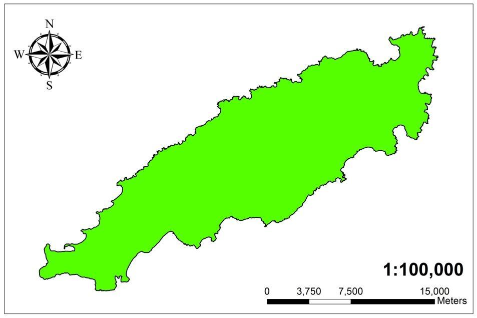
4 Study Site Venezuela 4


5 Study Site Overview of Pigeon Point Sandpit formed by waves and wave current. Flat and low lying. Characterised by white, sandy beaches. Composed of coralline limestone. Susceptible to wave erosion. Sea around Tobago governed by trade winds. Waves associated with tropical low pressure systems can approach the coastline from any direction (Deane 1993). 5

6 Study Site Tobago s Population Estimate per Parish 6
7 Study Site Pigeon Point Exposure to Storms/hurricanes: No. of Tropical Cyclones within km Radius of Pigeon Point per Decade ( ) 12 Radius (km) # of Tropical Cyclones Quantity of Tropical Cyclones Decade 100km 150km 200km Direct Landfalls ( ): 1. Tropical Storm Arthur (1990) 2. Tropical Storm Joyce (2000) 3. Category 3 Hurricane Flora (1963) Source: National Hurricane Center, NOAA. 7
8 Study Site Damage from Past Storms/Hurricanes Hurricane Flora 1963 (Category 3 Direct Landfall) Caused an estimated damage of US $60, in agricultural loss, Destroyed >35% of houses and damaged an additional 46.7% Killed 18 people Induced coastal erosion in south-west Tobago (inclusive of Pigeon Point) Destroyed a significant section of the mangroves near Pigeon Point. Changed the face of the economy Hurricane Tomas 2010 (Category 2 Within Close Proximity) A feeder band generated from Hurricane Tomas (2010) caused landslides and flooding in 13 and 9 communities, respectively. 8
9 Methodologies February-April 2013 Topographic Survey Bathymetric Survey Tide Gauge Recordings October-November 2013 Flood Model Creation Hydrodynamic Modelling January-March 2014 Data Analysis Flood Risk Maps 9


10 Methodologies Topography, Bathymetry & Tide Gauge Survey Topography Surveyed using a Total Station. Two control points established due to absence of real ground coordinates. GPS data acquired at each control point to georeference all surveyed topographic points. Bathymetry Surveyed using an Innerspace 455 Echo-sounder Supplemental Data Bathymetry and Topography data acquired from GEBCO to account for gaps of missing data. Tide Gauge Tide Gauge Recordings Tide Gauge deployed for one month. Tidally derived MSL used for vertical georeferencing of all topographic surveys and bathymetry corrections. Overview of Surveyed Area 10
11 Methodologies Flood Model Creation, Digital Elevation Model (Dem) Topography + Bathymetry points combined into point shapefile, interpolated to 10 m grid spacing and exported in ASCII format using ArcGIS Storm Surge Levels Minimum surge level on the Saffir Simpson Scale for Cat. 1-5 hurricanes combined with CMSL and IPCC minimum (0.28m) and maximum (0.98m) projection of sea level for Creation of Storm Surge Levels Saffir-Simpson Storm Surge Height Storm Surge Levels Category Metres (m) CMSL IPCC-Min IPCC-Max m +0.98m m 1.28 m 1.88 m m 2.08 m 1.98 m m 2.98 m 2.78 m m 4.28 m 3.68 m 5 > m 5.88 m 4.98 m 11
12 Methodologies Modelling & Data Analysis Modelling Simulations were performed using the LISFLOOD-FP code. Data Analysis Maximum flood output file (.max) loaded onto ArcMap 10.1 to determine inundation extent and quantity of area likely to flood. Maximum flooded area was found using a depth threshold of 0.01m. Results acquired converted into flood inundation maps. 12
13 Results 13

14 Results 14
15 Results 15
16 Data Analysis Percentage of Area Likely to Flood under Current & Future Sea Level from Minimum Storm Surge Levels per Hurricane Category No Increase Percentage of Area Flooded Current Mean Sea Level IPCC Min. Projection IPCC Max. Projection Hurricane Category 16

17 Discussion Potential Implications on the People & Economy: Tobago s economy thrives on coastal tourism with > 74% of Tourists visiting for Leisure/Beach Vacation. However, Tourism has been declining since Despite decline, Pigeon Point maintained its level of visitors with >100,000 visitors per year (domestic + foreign) mostly from cruise ships and domestic tourism (Armstrong 2012). Pigeon Point is perhaps the main tourism destination in Tobago. Number of Tourist Arrivals Year Visitor Arrival to Tobago (CSO Trinidad & Tobago) Loosing Pigeon Point => Tourism Decline => Decline in GDP => Decline in economic growth 17

18 Conclusion(s) 1. Under current and future sea level, all of Pigeon Point will be affected by storm surges from Cat. 2-5 hurricanes. Those associated with a Cat. 1 will have minimal impact under CMSL, but, will affect majority of Pigeon Point under future sea level. 2. Rising sea levels will not significantly increase flood extent from storm surges, but instead, flood depth at Pigeon Point 3. Rising sea levels will increase the vulnerability of the locals and the island s economy to the impacts of storm surges. Pigeon Point Pigeon Point, SW Tobago, is susceptible to SLR and coastal flooding from storm surges. 18
19 Acknowledgements Research Funding : Co-led by: The University of Waterloo & The CARIBSAVE Partnership 19
20 Thank you for your attention... Any Questions? FOR FURTHER ENQUIRIES Contact Information: Avidesh Seenath Department of Geography, The University of the West Indies, Trinidad & Tobago 20
STATUS OF HAZARD MAPS VULNERABILITY ASSESSMENTS AND DIGITAL MAPS
 JapanInternational Cooperation Agency STATUS OF HAZARD MAPS VULNERABILITY ASSESSMENTS AND DIGITAL MAPS ANGUILLA REPORT THE CARIBBEAN DISASTER EMERGENCY RESPONSE AGENCY () Table of Contents Page Preface
Terrestrial Flood Risk and Climate Change in the Yallahs River, Jamaica. An assessment of future flood risk. projections of future climate
 Terrestrial Flood Risk and Climate Change in the Yallahs River, Jamaica An assessment of future flood risk using hydrodynamic models driven by projections of future climate Matthew Wilson1, Arpita Mandal2,
Flooding and Development in Low-Lying areas in Jamaica : Impact of Climate Change
 Flooding and Development in Low-Lying areas in Jamaica : Impact of Climate Change Session : Managing Ecosystmes for more Resilient Cities in India, Bolivia, Jamaica Resilient Cities, 2016, Bonn Arpita
Vulnerability of Bangladesh to Cyclones in a Changing Climate
 Vulnerability of Bangladesh to Cyclones in a Changing Climate Susmita Dasgupta Kiran Pandey Mainul Huq Zahirul Huq Khan M.M. Zahid Ahmed Nandan Mukherjee Malik Fida Khan 2010 Bangladesh: Tropical Cyclone
Climate Change Impacts and Adaptation for Coastal Transport Infrastructure in Caribbean SIDS
 UNCTAD National Workshop Saint Lucia 24 26 May 2017, Rodney Bay, Saint Lucia Climate Change Impacts and Adaptation for Coastal Transport Infrastructure in Caribbean SIDS LISCoAsT Large Scale Integrated
GIS 2010: Coastal Erosion in Mississippi Delta
 1) Introduction Problem overview To what extent do large storm events play in coastal erosion rates, and what is the rate at which coastal erosion is occurring in sediment starved portions of the Mississippi
Modeling Sea Level Rise in Caribbean SIDS: The Need for Tide Gauge Data
 Modeling Sea Level Rise in Caribbean SIDS: The Need for Tide Gauge Data Michael Sutherland and Demi Singh Department of Geomatics Engineering and Land Management Faculty of Engineering University of the
Disaster Risk Assessment: Opportunities for GIS and data management with Open DRI
 Disaster Risk Assessment: Opportunities for GIS and data management with Open DRI Jacob Opadeyi Department of Geomatics Engineering and Land Management, The University of the West Indies, St. Augustine,
Climate Change Impacts and Risks: The Challenge for Caribbean Ports. STC-13, April Georgetown, Guyana
 Climate Change Impacts and Risks: The Challenge for Caribbean Ports STC-13, April 15-18 Georgetown, Guyana Leonard A. Nurse, PhD CERMES, Faculty of Pure and Applied Sciences University of the West Indies
Sea Level Rise and Hurricane Florence storm surge research methodology
 Sea Level Rise and Hurricane Florence storm surge research methodology Hurricane Florence storm surge analysis was conducted using a variety of input sources. In order to determine the maximum storm surge
Comparative Analysis of Hurricane Vulnerability in New Orleans and Baton Rouge. Dr. Marc Levitan LSU Hurricane Center. April 2003
 Comparative Analysis of Hurricane Vulnerability in New Orleans and Baton Rouge Dr. Marc Levitan LSU Hurricane Center April 2003 In order to compare hurricane vulnerability of facilities located in different
Rising Sea Levels: Time for Proactive Action in Florida and the Caribbean?
 Rising Sea Levels: Time for Proactive Action in Florida and the Caribbean? Dr. Alan Fyall and Dr. Thomas Wahl National Center for Integrated Coastal Research, University of Central Florida Dr. Roberta
Coastal Inundation Forecasting and Community Response in Bangladesh
 WMO Coastal Inundation Forecasting and Community Response in Bangladesh Bapon (SHM) Fakhruddin Nadao Kohno 12 November 2015 System Design for Coastal Inundation Forecasting CIFDP-PSG-5, 14-16 May 2014,
Climate Change Impacts and Adaptation for Coastal Transport Infrastructure in Caribbean SIDS
 UNCTAD National Workshop Saint Lucia 24 26 May 2017, Rodney Bay, Saint Lucia Climate Change Impacts and Adaptation for Coastal Transport Infrastructure in Caribbean SIDS LISCoAsT Large Scale Integrated
Draft for Discussion 11/11/2016
 Coastal Risk Consulting (CRC) Climate Vulnerability Assessment for Village of Key Biscayne Deliverable 1.1 in Statement of Work. Preliminary Vulnerability Assessment Identifying Flood Hotspots Introduction...
MODELLING CATASTROPHIC COASTAL FLOOD RISKS AROUND THE WORLD
 MODELLING CATASTROPHIC COASTAL FLOOD RISKS AROUND THE WORLD Nicola Howe Christopher Thomas Copyright 2016 Risk Management Solutions, Inc. All Rights Reserved. June 27, 2016 1 OUTLINE MOTIVATION What we
Massachusetts Hurricane Evacuation Study
 Massachusetts Hurricane Evacuation Study Technical Data Report May 2016 New England District Massachusetts Hurricane Evacuation Study Technical Data Report May 2016 Table of Contents 1.0 Study Area...
Natural Disasters. in Florida. Severe Thunderstorms
 Natural Disasters in Florida SC.6.E.7.7 Investigate how natural disasters have affected human life in Florida. Severe Thunderstorms While the typical afternoon thunderstorm in Florida may not appear to
EFFECTIVE TROPICAL CYCLONE WARNING IN BANGLADESH
 Country Report of Bangladesh On EFFECTIVE TROPICAL CYCLONE WARNING IN BANGLADESH Presented At JMA/WMO WORKSHOP ON EFFECTIVE TROPICAL CYCLONE WARNING IN SOUTHEAST ASIA Tokyo, Japan,11-14 March 2014 By Sayeed
FIG Working Week May, Bulgaria From the wisdom of the ages to the challanges of modern world
 FIG Working Week 17-21 May, Bulgaria From the wisdom of the ages to the challanges of modern world COASTAL RISK ANALYSIS OF THE BLACK SEA UNDER THE SEA LEVEL RISE N e v i n B e t u l A V S A R, S e n o
NOAA National Centers for Environmental Information State Summaries 149-HI. Observed and Projected Temperature Change
 9-HI HAWAI I Key Messages Average annual temperature has increased by about F since 95, with a leveling off of the rate of warming in the last two decades. Under a higher emissions pathway, historically
USING MIKE TO MODEL COASTAL CATASTROPHE RISK
 USING MIKE TO MODEL COASTAL CATASTROPHE RISK Nicola Howe, Christopher Thomas, Joss Matthewman, John Maskell* 1 SUMMARY About RMS Who are we and what do we do? How do we use MIKE in our workflow? Case study:
Remote sensing and GIS for multi-hazard risk assessments in the coastal zone: recent applications and challenges in the Pacific Jens Kruger
 Remote sensing and GIS for multi-hazard risk assessments in the coastal zone: recent applications and challenges in the Pacific Jens Kruger Geoscience Division Pacific Community (SPC) The First Pacific
THE NEW STORM SURGE MODULE IN AIR S U.S. HURRICANE MODEL
 THE NEW STORM SURGE MODULE IN AIR S U.S. HURRICANE MODEL Hurricane Ike storm surge devastation of Bolivar Peninsula near Galveston, Texas. (Source: Chuck Davis, flickr) When a hurricane comes onshore,
User s Guide to Storm Hazard Maps and Data
 Storm Hazard Assessment for St. Lucia and San Pedro/Ambergris Caye, Belize User s Guide to Storm Hazard Maps and Data Prepared For: Caribbean Development Bank Advanced technology and analysis solving problems
Modelling coastal flood risk in the data poor Bay of Bengal region
 Modelling coastal flood risk in the data poor Bay of Bengal region Matt Lewis*, Kevin Horsburgh (NOC), Paul Bates (Bristol) *m.j.lewis@bangor.ac.uk Funded by the EPSRC Flood Risk Management Research Consortium
SLOSH New Orleans Basin 2012 Update
 SLOSH New Orleans Basin 2012 Update Michael Koziara Science and Operations Officer National Weather Service Slidell, LA The Basics What is storm surge? What is SLOSH? Details Assumptions Inundation = Storm
Climate Change Impacts and Adaptation for Coastal Transport Infrastructure in Caribbean SIDS
 UNCTAD National Workshop Jamaica 30 May 1 June 2017, Kingston, Jamaica Climate Change Impacts and Adaptation for Coastal Transport Infrastructure in Caribbean SIDS LISCoAsT Large Scale Integrated Sealevel
WP4: COASTAL PROCESSES
 WP4: COASTAL PROCESSES Coordinator: G. EBERHARDS Faculty of Geography and Earth Sciences, University of Latvia Daugavpils, 2008 Goal: The objective of this study is analysis of coastal changes and forecast
LECTURE #17: Severe Weather: Introduction to Hurricanes
 GEOL 0820 Ramsey Natural Disasters Spring, 2018 LECTURE #17: Severe Weather: Introduction to Hurricanes Date: 15 March 2018 I. Hurricane Overview hurricanes o what they are? o how they form? storm stages:
COASTAL DATA APPLICATION
 2015 Coastal GeoTools Proactive By Design. Our Company Commitment COASTAL DATA APPLICATION Projecting Future Coastal Flood Risk for Massachusetts Bay Bin Wang, Tianyi Liu, Daniel Stapleton & Michael Mobile
The Urban Sea and Coastal Zone Management
 The Urban Sea and Coastal Zone Management David NEALE, Trinidad and Tobago Key words: hydrography, Caribbean, coastal zone management, land use. SUMMARY Within the coastal zone of Eastern Caribbean States,
1.2 DEVELOPMENT OF THE NWS PROBABILISTIC EXTRA-TROPICAL STORM SURGE MODEL AND POST PROCESSING METHODOLOGY
 1.2 DEVELOPMENT OF THE NWS PROBABILISTIC EXTRA-TROPICAL STORM SURGE MODEL AND POST PROCESSING METHODOLOGY Huiqing Liu 1 and Arthur Taylor 2* 1. Ace Info Solutions, Reston, VA 2. NOAA / NWS / Science and
Supplement of Scenario-based numerical modelling and the palaeo-historic record of tsunamis in Wallis and Futuna, Southwest Pacific
 Supplement of Nat. Hazards Earth Syst. Sci., 15, 1763 1784, 2015 http://www.nat-hazards-earth-syst-sci.net/15/1763/2015/ doi:10.5194/nhess-15-1763-2015-supplement Author(s) 2015. CC Attribution 3.0 License.
Global Climate Change and Human Health Cycloning out of Control: Climate Change Impacts on Natural Disasters; Cyclones
 INSTRUCTOR BACKGROUND Cyclones are one of the world s most devastating natural disasters causing billions of dollars in damages to homes, building and infrastructure annually. The United Nations estimates
Calhoun County, Texas Under 5 Meter Sea Level Rise
 Kyle Kacal GEO 327G Calhoun County, Texas Under 5 Meter Sea Level Rise PROBLEM AND PURPOSE: Sea level rise is threat to all coastal areas. Although natural sea level rise happens at a very slow rate, hurricanes
SEA LEVEL RISE MODELLING IN SUPPORT OF SOCIOECONOMIC IMPACT ANALYSIS: GRANDE RIVIERE, TRINIDAD AND TOBAGO
 SEA LEVEL RISE MODELLING IN SUPPORT OF SOCIOECONOMIC IMPACT ANALYSIS: GRANDE RIVIERE, TRINIDAD AND TOBAGO 1 SEA LEVEL RISE MODELLING IN SUPPORT OF SOCIOECONOMIC IMPACT ANALYSIS: GRANDE RIVIERE, TRINIDAD
- West Africa. Abuja, Nigeria May Fredericton Canada Heeswijk The Netherlands Washington DC United States Adelaide Australia
 A Case Study in Land and Sea Data Interoperability Patricia GASPAR(Netherlands), Andrew HOGGARTH(Canade), Gordon JOHNSTON(UK), Charles de JONG(Netherlands) - West Africa Abuja, Nigeria - 6-10 May 2013
HURRICANE SURVIVAL KIT
 HURRICANE SURVIVAL KIT DEFINITION-A hurricane is a very vast and powerful storm that originates in the tropics of the Atlantic Ocean. They become hurricanes when the sustained winds associated with it
Homework 8: Hurricane Damage (adapted from Pipkin et al.)
") 1 Homework 8: Hurricane Damage (adapted from Pipkin et al.) Tropical cyclones have a significant impact on coastal areas of the world. In the Atlantic and Eastern Pacific Oceans they are called hurricanes
1 Homework 8: Hurricane Damage (adapted from Pipkin et al.) Tropical cyclones have a significant impact on coastal areas of the world. In the Atlantic and Eastern Pacific Oceans they are called hurricanes
Sea-level Rise on Cape Cod: How Vulnerable Are We? Rob Thieler U.S. Geological Survey Woods Hole, MA
 Sea-level Rise on Cape Cod: How Vulnerable Are We? Rob Thieler U.S. Geological Survey Woods Hole, MA Outline Sea-level and coastal processes Past sea-level change Predictions for the future Coastal responses
USACE-ERDC Coastal Storm Modeling System Updates Chris Massey, PhD
 USACE-ERDC Coastal Storm Modeling System Updates Chris Massey, PhD Research Mathematician USACE-ERDC Coastal & Hydraulics Lab Chris.Massey@usace.army.mil ERDC s Coastal Storm-Modeling System (ERDC CSTORM-MS)
The Coastal Change Analysis Program and the Land Cover Atlas. Rebecca Love NOAA Office for Coastal Management
 The Coastal Change Analysis Program and the Land Cover Atlas Rebecca Love NOAA Office for Coastal Management Natural Infrastructure = Greater Resilience NOAA C-CAP Regional Land Cover and Change coast.noaa.gov/digitalcoast/data/ccapregional
CLIMATE CHANGE A THREAT TO THE FUTURE SUSTAINABLE DEVELOPMENT IN THE CARIBBEAN. U Trotz CCCCC
 CLIMATE CHANGE A THREAT TO THE FUTURE SUSTAINABLE DEVELOPMENT IN THE CARIBBEAN 1 Key Observations from the IPCC IV Assessment Temperature trend from actual observations "Warming of the climate system is
TOWNSVILLE STORM SURGE HYPOTHETICAL: TECHNICAL SPECIFICATIONS
 TOWNSVILLE STORM SURGE HYPOTHETICAL: TECHNICAL SPECIFICATIONS Stuart Mead, Mahesh Prakash and Fletcher Woolard CSIRO Mathematics, Informatics and Statistics, Private Bag 33, Clayton South, VIC 3168, Australia
New Jersey Department of Transportation Extreme Weather Asset Management Pilot Study
 New Jersey Department of Transportation Extreme Weather Asset Management Pilot Study Overview Prepared for: June 26, 2018 Introduction Overview of Pilot Study New Jersey s Climate New Jersey s Transportation
Disaster Risk Management in India. Kamal Kishore New Delhi, 27 October 2016
 Disaster Risk Management in India Kamal Kishore New Delhi, 27 October 2016 Hazard, Exposure and Vulnerability Disaster Prevention Mitigation Hurricane Matthew: Cuba & Haiti Emergency Response Coordination
A National Scale Landslide Susceptibility Assessment for St. Lucia, Caribbean Sea
 A National Scale Landslide Susceptibility Assessment for St. Lucia, Caribbean Sea Submitted by James Varghese As a part of M.Sc. Module On Empirical Modeling of Hazard Processes TABLE OF CONTENTS INTRODUCTION...
Boston Coastal Flooding Analysis and Mapping
 Boston Coastal Flooding Analysis and Mapping Philip Orton, Dara Mendeloff, Jane Mills, Malgosia Madajewicz Funding This research was funded by the National Oceanic and Atmospheric Administration (NOAA)
Hurricanes and Storm Surge : Before coming to lab, visit the following web site:
 Geol 108 Lab #7 Week of October 15-19, 2012 Coastal Studies Hurricanes and Storm Surge : Before coming to lab, visit the following web site: http://www.usatoday.com/graphics/weather/gra/gsurge/flash.htm
ERDC Support for Hurricane Sandy
 ERDC Support for Hurricane Sandy Chris Massey, CHL; Aaron Byrd, CHL; Nawa Pradhan, CHL; Jeff Melby, CHL; Jane Smith, CHL; Robert Walker, ITL; and Jennifer Wozencraft, JALBTCX ERDC Support for Hurricane
P2.57 Cyclone Yasi Storm Surge in Australia Implications for Catastrophe Modeling
 P2.57 Cyclone Yasi Storm Surge in Australia Implications for Catastrophe Modeling Kevin A. Hill*, Peter Sousounis, and Jason Butke AIR Worldwide Corporation, Boston, Massachusetts 1. INTRODUCTION Storm
Prepared by: Ryan Ratcliffe GPH-903 December 10, 2011
 Prepared by: Ryan Ratcliffe GPH-903 December 10, 2011 Scientific studies have proven that global sea level has risen 7.1 inches in the past century and computer models have suggested that climate change
Coastal Vulnerability Assessment in Semarang City, Indonesia Based on Sea Level Rise and Land Subsidence Scenarios
 Coastal Vulnerability Assessment in Semarang City, Indonesia Based on Sea Level Rise and Land Subsidence Scenarios I. M. Radjawane, D. Hartadi and W. R. Lusano Oceanography Research Division Fac. of Earth
Are You Ready For Hurricane Season? 2018 Hurricane Talk B Y : S T O R M T E A M 8 M E T E O R O L O G I S T J U L I E P H I L L I P S
 Are You Ready For Hurricane Season? 2018 Hurricane Talk B Y : S T O R M T E A M 8 M E T E O R O L O G I S T J U L I E P H I L L I P S About Me I am Currently a Weekday Meteorologist at WFLA Channel 8.
Macroeconomic implications of natural disasters on small economies
 Macroeconomic implications of natural disasters on small economies Sebastian Acevedo IMF Western Hemisphere Department Central Bank of Curaçao and Sint Maarten March 22, 2018 Disclaimer: The views expressed
Determining and Monitoring Sea Level in the Caribbean using
 Determining and Monitoring Sea Level in the Caribbean using Satellite Altimetry Dexter DAVIS (UWI,Trinidad & Tobago), Michael SUTHERLAND (Canada), Sandesh JAGGAN & Demi SINGH (UWI, Trinidad & Tobago) Overview
Effect of Small-Scale Continental Shelf Bathymetry on Storm Surge Generation
 University of New Orleans ScholarWorks@UNO University of New Orleans Theses and Dissertations Dissertations and Theses Fall 12-16-2016 Effect of Small-Scale Continental Shelf Bathymetry on Storm Surge
Preliminary Vulnerability Assessment of Coastal Flooding Threats - Taylor County, Florida
 Preliminary Vulnerability Assessment of Coastal Flooding Threats - Taylor County, Florida North Central Florida Regional Planning Council Northeast Florida Regional Council April 28, 2016 BACKGROUND This
6 - STORM SURGES IN PUERTO RICO_Power Plants-Aguirre. Aguirre
 1 6 - STORM SURGES IN PUERTO RICO_Power Plants-Aguirre Aguirre Figure 1 shows a GE image of the Aguirre Electric Power Plant inside Jobos Bay. Figure 2 shows a picture of the plant looking at base level
NOAA National Centers for Environmental Information State Summaries 149-FL. Observed and Projected Temperature Change
 19-FL FLORIDA Key Messages Under a higher emissions pathway, historically unprecedented warming is projected by the end of the 1st century. Rising temperatures will likely increase the intensity of naturally-occurring
2013 ATLANTIC HURRICANE SEASON OUTLOOK. June RMS Cat Response
 2013 ATLANTIC HURRICANE SEASON OUTLOOK June 2013 - RMS Cat Response Season Outlook At the start of the 2013 Atlantic hurricane season, which officially runs from June 1 to November 30, seasonal forecasts
Tropical Cyclones Modelling For Natural Disaster Risk Management
 Tropical Cyclones Modelling For Natural Disaster Risk Management Juan Savioli a, M. Britton b, S. Szylkarski a and Claus Pederson a a DHI Water and Environment, 2 Elliott Street, Suite 1a, QLD 4217 Surfers
FOWPI Metocean Workshop Modelling, Design Parameters and Weather Windows
 FOWPI Metocean Workshop Modelling, Design Parameters and Weather Windows Jesper Skourup, Chief Specialist, COWI 1 The Project is funded by The European Union Agenda 1. Metocean Data Requirements 2. Site
Date: 27 April UF Research Contract Number: Project Date: Project Start: 6 November 2017 Project End: 30 June 2018
 Date: 27 April 2018 Project: Performance of Single-Family Residential Buildings in Hurricane Irma Evaluating the Impact of the 1st March 2002 Florida Building Code and Homeowner/Occupant Survey on Risk
Cause, Assessment & Management of Flood Hazards associated with Landfalling Tropical Cyclones & Heavy Rain
 Cause, Assessment & Management of Flood Hazards associated with Landfalling Tropical Cyclones & Heavy Rain by CHEN Charng Ning, Professor Emeritus Nanyang Technological University (NTU), Singapore Consultant,
Preliminary Data Release for the Humboldt Bay Sea Level Rise Vulnerability Assessment: Humboldt Bay Sea Level Rise Inundation Mapping
 Preliminary Data Release for the Humboldt Bay Sea Level Rise Vulnerability Assessment: Humboldt Bay Sea Level Rise Inundation Mapping Prepared by: Jeff Anderson, Northern Hydrology & Engineering (jeff@northernhydrology.com)
Flood and Sea Level Rise Mapping Methodologies: The Way Forward
 Flood and Sea Level Rise Mapping Methodologies: The Way Forward Malcolm L. Spaulding Professor Emeritus, Ocean Engineering University of Rhode Island spaulding@egr.uri.edu Interagency Coordination Meeting
Crystal Goodison & Alexis Thomas University of Florida GeoPlan Center
 Crystal Goodison & Alexis Thomas University of Florida GeoPlan Center A1A Fort Lauderdale, Hurricane Sandy, October 2012 Photo Credits: Susan Stocker, Sun Sentinel FAU s Research Report (completed Jan
Summary Visualizations for Coastal Spatial Temporal Dynamics
 Summary Visualizations for Coastal Spatial Temporal Dynamics October 24 2011 Providence, RI Sidharth Thakur 1, Laura Tateosian 2, Helena Mitasova, Eric Hardin, and Margery Overton 1. sthakur@renci.org,
Savannah Harbor Expansion Project
 Savannah Harbor Expansion Project Evaluation of Hurricane Surge Impacts with Proposed Mitigation Plan December 2007 Introduction This report summarizes the results of hurricane surge impacts with implementation
FLOOD HAZARD AND RISK ASSESSMENT IN MID- EASTERN PART OF DHAKA, BANGLADESH
 FLOOD HAZARD AND RISK ASSESSMENT IN MID- EASTERN PART OF DHAKA, BANGLADESH Muhammad MASOOD MEE07180 Supervisor: Prof. Kuniyoshi TAKEUCHI ABSTRACT An inundation simulation has been done for the mid-eastern
Tropical Cyclone Sandy (AL182012)
") Tropical Cyclone Sandy (AL182012) Event Briefing Caribbean Risk Managers Ltd Facility Supervisor 29 October 2012 Facility Supervisor: Caribbean Risk Managers Ltd Email: ccrif@ccrif.org Tel (Barbados):
Tropical Cyclone Sandy (AL182012) Event Briefing Caribbean Risk Managers Ltd Facility Supervisor 29 October 2012 Facility Supervisor: Caribbean Risk Managers Ltd Email: ccrif@ccrif.org Tel (Barbados):
Geospatial application in Kiribati
 Geospatial application in Kiribati ICC-21 ST RESAP (9 TH TO 13 TH OCTOBER, 2017) BANGKOK, THAILAND Outline Kiribati Profile Natural disasters in Kiribati Achievements Challenges/Issues Ways forward 1 Kiribati
August Forecast Update for Atlantic Hurricane Activity in 2016
 August Forecast Update for Atlantic Hurricane Activity in 2016 Issued: 5 th August 2016 by Professor Mark Saunders and Dr Adam Lea Dept. of Space and Climate Physics, UCL (University College London), UK
SAINT LUCIA: A case study
 Climate Change Impacts on Coastal Transportation Infrastructure in the Caribbean: Enhancing the Adaptive Capacity of Small Island Developing States (SIDS) SAINT LUCIA: A case study EXECUTIVE SUMMARY* Prepared
Storms. 3. Storm types 4. Coastal Sectors 5. Sorm Location and Seasonality 6. Storm Severity 7. Storm Frequency and grouping 8. The design storm event
 1. Introduction Storms 2. The Impact of Storms on the coast 3. Storm types 4. Coastal Sectors 5. Sorm Location and Seasonality 6. Storm Severity 7. Storm Frequency and grouping 8. The design storm event
HAZUS th Annual Conference
 HAZUS 2014 7 th Annual Conference VALIDATING THE HAZUS COASTAL SURGE MODEL FOR SUPERSTORM SANDY Spiridon Katehis 1 Jordan T. Hastings 1 1 University of Southern California 1 Superstorm Sandy, Oct 12 2
April Forecast Update for Atlantic Hurricane Activity in 2018
 April Forecast Update for Atlantic Hurricane Activity in 2018 Issued: 5 th April 2018 by Professor Mark Saunders and Dr Adam Lea Dept. of Space and Climate Physics, UCL (University College London), UK
Modelling the effect of sea level rise on tropical cyclone storm surge impact
 21st International Congress on Modelling and Simulation, Gold Coast, Australia, 29 Nov to 4 Dec 2015 www.mssanz.org.au/modsim2015 Modelling the effect of sea level rise on tropical cyclone storm surge
July Forecast Update for Atlantic Hurricane Activity in 2016
 July Forecast Update for Atlantic Hurricane Activity in 2016 Issued: 5 th July 2016 by Professor Mark Saunders and Dr Adam Lea Dept. of Space and Climate Physics, UCL (University College London), UK Forecast
April Forecast Update for Atlantic Hurricane Activity in 2016
 April Forecast Update for Atlantic Hurricane Activity in 2016 Issued: 5 th April 2016 by Professor Mark Saunders and Dr Adam Lea Dept. of Space and Climate Physics, UCL (University College London), UK
Future Sea Level Rise and its Implications for SIDS and LDCs
 Future Sea Level Rise and its Implications for SIDS and LDCs Bill Hare, Michiel Schaeffer, Mahé Perrette, Matthias Mengel COP17, Durban, 2 nd December Overview Part 1: Global sea level: past and future
Impact of Changes in Morphology on Extent and Duration of Inundation during Tropical Cyclones
 DISTRIBUTION STATEMENT A. Approved for public release; distribution is unlimited. Impact of Changes in Morphology on Extent and Duration of Inundation during Tropical Cyclones Jayaram Veeramony Code 7322,
Outline. Extreme sea levels: past and future. Tropical cyclones 12/07/2013. North Sea Storm Surge of Understanding of coastal extremes
 Outline Extreme sea levels: past and future Svetlana Jevrejeva National Oceanography Centre, Liverpool, UK Introduction Changes in extreme sea levels in the recent past ( progress and limitation in understanding)
CHANGING PHYSICAL AND HUMAN LANDSCAPES SAMPLE ASSESSMENT MATERIALS
 GCSE GEOGRAPHY A Sample Assessment Materials 5 GCSE GEOGRAPHY A COMPONENT 1 CHANGING PHYSICAL AND HUMAN LANDSCAPES SAMPLE ASSESSMENT MATERIALS 1 hour 30 minutes Section Question Mark SPaG A B 1 2 Either
Tools to Assess Flood Risk of Commercial Property Investment
 Tools to Assess Flood Risk of Commercial Property Investment NSERC Workshop March 1, 2016 Kate Collins, Tim Webster, Nathan Crowell AGRG, NSCC, Middleton, NS https://eatsleepride.com/ http://users.eastlink.ca/~tbulley/
Bathymetry Data and Models: Best Practices
 Bathymetry Data and Models: Best Practices Barry Eakins & Lisa Taylor The NOAA National Geophysical Data Center Over 600 data types - from the core of the Earth to the surface of the Sun NGDC Bathymetry
Modeling Storm Surge for Emergency Management
 Modeling Storm Surge for Emergency Management Study Area: Guam is the southern-most island of the Mariana Archipelago and is located at 13 28 N, 144 47 E. It has a total area of 541.3 sq. km. and the highest
Current and future climate of Vanuatu. Pacific-Australia Climate Change Science and Adaptation Planning Program
 Pacific-Australia Climate Change Science and Adaptation Planning Program Hiu Torres Islands Vanua Lava Gaua Banks Islands Espiritu Santo Malekula Ambae Épi Maéwo Pentecost Ambrym Shepherd Islands Éfate
Coastal Storms of the New Jersey Shore
 Coastal Storms of the New Jersey Shore Dr. Steven G. Decker Dept. of Environmental Sciences School of Environmental and Biological Sciences Rutgers University May 25, 2011 Overview Threats Historical Examples
HURRICANES. The History, Structure, Development, and Destruction. Source:
 HURRICANES The History, Structure, Development, and Destruction Source: http://www.dc.peachnet.edu/~pgore/students/w97/matheson/hpage.htm Hurricane Sandy was the deadliest and most destructive tropical
What is happening to the Jamaican climate?
 What is happening to the Jamaican climate? Climate Change and Jamaica: Why worry? Climate Studies Group, Mona (CSGM) Department of Physics University of the West Indies, Mona Part 1 RAIN A FALL, BUT DUTTY
Hurricanes in a Warming World. Jeff Donnelly Woods Hole Oceanographic Institution
 Hurricanes in a Warming World Jeff Donnelly Woods Hole Oceanographic Institution Hurricanes impacting the NE US Hurricane Sandy Was Hurricane Sandy a freak of nature? Or had we just been lucky? What are
Sea Level Rise in Connecticut A Risk-Informed Approach
 GZA GeoEnvironmental, Inc. CAFM Conference October 25, 2017 Proactive By Design. Our Company Commitment Proactive By Design. Our Company Commitment Sea Level Rise in Connecticut A Risk-Informed Approach
Pre-Season Forecast for North Atlantic Hurricane Activity in 2018
 Pre-Season Forecast for North Atlantic Hurricane Activity in 2018 Issued: 30 th May 2018 by Professor Mark Saunders and Dr Adam Lea Dept. of Space and Climate Physics, UCL (University College London),
July Forecast Update for North Atlantic Hurricane Activity in 2018
 July Forecast Update for North Atlantic Hurricane Activity in 2018 Issued: 5 th July 2018 by Professor Mark Saunders and Dr Adam Lea Dept. of Space and Climate Physics, UCL (University College London),
HURRICANES. Source:
 HURRICANES Source: http://www.dc.peachnet.edu/~pgore/students/w97/matheson/hpage.htm What is a hurricane? Violent cyclonic storm that develops in the tropical region Wind speeds are > 74 mph Source: http://www.google.com/imgres?hl=en&sa=x&biw=1920&bih=955&tbm=
Climate Change Impacts and Adaptation for Coastal Transport Infrastructure in Caribbean SIDS
 UNCTAD National Workshop Jamaica 30 May 1 June 2017, Kingston, Jamaica Climate Change Impacts and Adaptation for Coastal Transport Infrastructure in Caribbean SIDS Impacts of Natural Hazards on the Transport
Climate change, vulnerability and the coasts. Sifting the evidence sea level rise
 CSE s Regional Media Briefing Workshop on Coasts, Coastal Populations and their Concerns Goa, August 13-14, 2010 Climate change, vulnerability and the coasts Sifting the evidence sea level rise Satheesh