Observational aspects of cloud microstructures. Po-Hsiung Lin November 20, 2006
|
|
|
- Mercy Lindsay Warner
- 5 years ago
- Views:
Transcription
1 Observational aspects of cloud microstructures Po-Hsiung Lin November 20, 2006
2 Outline Motivation Cloud microstructure parameters observed in laboratory, field and used in models Laboratory observations Field observations Aircrafts popular on-bard instruments and fleets in different countries Polarization radar and Lidar Satellite (CERES,GOES) Integration experiments

3 Motivation Civil Aviation Administration (Taiwan) will release a Kingair 350 aircraft Cloud seeding proposal at Taiwan needs observation of cloud microphysics What is the linkage between the flight observation of cloud microphysics and cloud model simulations, or what are the major observed parameters that cloud models care?
4 Cloud microstructure parameters observed in Laboratory and Field Diameters (of raindrop,snow, hail) ---Lab./Field Size distribution--- Field Habit (shape vs. air temperature & RH) ) ---Lab./Field Growth rate---lab. Terminal velocity ---Lab. LWC,IWC,TWC --- Field

")

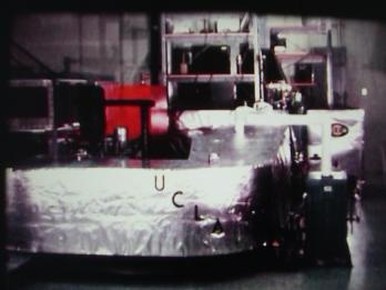
5 UCLA cloud tunnel (1960s) Flow tube condenser

6 UCLA

7 Germany Mainz vertical wind tunnel (Z tunnel) vacuum pumps ultra-sonic nozzle experimental section contraction section nets honeycombs particle filter plenum chamber heating/cooling humidifying/drying

8

9 Desert Research Institute Chamber Hydrometeor Imaging Laboratory Ice Physics Laboratory No detail information released

10 Japan MRI cloud simulation chamber

11
")
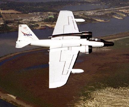
12 DRI Bailey and Hallett (2004)

13 Cloud physics in WISCDYMM Parameterizations linked with D,S,H,G,T information (page 4)

")
14 in-situ cloud measurements 1943/ open cockpit of a single engine reconnaissance Heinkel aircraft (Weickmann,1947) 1951/ ice particle image by camera from the aircraft (McCullough and Perkins, 1951) Formvar on a slice
 Tethered balloon")
15 Vediosonde with (tethered) balloon (Takahashi,1990) Tethered balloon Vediosonde
 Precipitation")
 Height Diameter temperature")
16 Meteorological balloon & PPIS TOGA/COARE(Takahashi,1995) Precipitation Particle Image Sensor (New version of vediosonde) Height Diameter temperature Number density


17 Family of PMI (particle metrics Inc.) optical array probe aerosol cloud raindrop FSSP


18


19 Cloud particle Imager CPI (SPEC inc. ) Under the wingset or on the cabin roof

20 CPI data sample TRMM validation experiment 1999/08/19


21 NASA DC-8 NASA-ER2 pod NASA-WB57

")
22 DOE Gulfstream-1 CIRPAS ( the Center for Interdisciplinary Remotely Piloted Aircraft Studies ) Twin Otter

 Specific Pods")
23 NSF/NCAR HIAPER High-performance Instrumented Airborne Platform for Environmental Research (March, 2005) Specific Pods under design

24 NSF/NCAR C130

25 University of North Dakota (UND) Cessana Citation II *Unfortunately, this aircraft was lost in 2005


26 University of Wyoming (UW) Kingair-200


27 South Dakota School of Mines & Technology--- T28 *The aircraft has been moved to the Strategic Air and Space Museum near Omaha, NE (2005)

--- for continuing")
28 Next generation for storm-penetrating airplane A10 Thunderbolt (after 2008)--- for continuing T28 missions


29 Deutsches Zentrum fü r Luft- und Raumfahrt e.v. (DLR) Donier 228 Falcon 20
 200kg")
30 Germany Helicopter-borne ACTOS (airborne cloud turbulence observing system) 200kg
 and the Natural Environment Research Council (NERC)")
31 UK-FAAM (Facility for Airborne Atmospheric Measurement) the Met Office(TM) and the Natural Environment Research Council (NERC) BAE-146


32 France SAFIRE Service des Avions Franç ais Instrumentés pour la Recherche en Environnement ATR-42 Falcon-20
 is a Research Centre at")


33 Airborne Research Australia (ARA) is a Research Centre at Flinders University and Australia's National Research Aircraft Facility Grob G520T Egrett. Diamond Aircraft ECO-Dimona

34 Canada National Research Council CONVAIR-580 LWC/TWC probe LWC

35 Israel Cheyenne-II cloud physics aircraft


36 Japan Diamond Air service Gulfstream G-2 Cloud Radar

37 Best spot for airplane in-situ measurement Weather Modification Inc. (Lerjet)


38 UAV (Unmanned Aerial Vehicle)--Altair
 --Aerosonde + micro")
39 Cloud particle imager UAV (Unmanned Aerial Vehicle) --Aerosonde + micro CPI

's generally dropped below.")
 values shown in the image have been multiplied by 10).")
40 CSU-CHILL Doppler polarimetric radar (11cm) The coexistance of a wide variety of hydrometeor shapes and sizes within a radar pulse volume lowers the zero lag correlation between the H and V signal returns (RhoHV(0) Fig. 5 To a first approximation, the RhoHV(0)'s generally dropped below.92 near the perimeter of the enhanced LDR area. (Note: the RhoHV(0) values shown in the image have been multiplied by 10). These regions of low RhoHV(0) may indicate areas where the signal returns from the hail and rain precipitation components were approximately equal. Distrometer

41 NOAA P3 Cloud radar

42 UW W-band cloud Radar Weather-tight, liquid cooled enclosures. 1.5 kw peak power with pulse-to-pulse polarization agility on transmit. 80 W average pwer at Ka-band, up to 45 W average power at W-band. Two-channel receiver for simultaneous reception of orthogonal polarizations. Receiver LNA noise figures of 3 db at Ka-band, 4.5 db at W-band. PC-based digital receiver with real-time full spectrum processing.

43 Satellite remote sensing on cloud physics

44 AIRS/ 13km (at nadir) channels MODIS/ 250m (at nadir), 36 bands Effective cloud amount Effective cloud size Cloud classification (water/ice, low-level/high-level)


45 MODIS natural color MODIS classification mask ClrSfc Midcld Lowcld Lowcld Lowcld


46 polarization Lidar is used to estimate ice/raindrop shape. sky ER2 Lidar Lidar on ground


47 CALIPSO: Cloud-Aerosol Lidar and Infrared Pathfinder Satellite Observation CloudSat and CALIPSO were launched into a 705-kilometer circular. fly just 15 seconds apart. This pairing sets a new standard in terms of precision placement of Earth-orbiting satellites. The reason for this is simple: both satellites will look at the same clouds in the atmosphere.

48 Cloudsat+ CLIPSO The Cloud Profiling Radar (CPR) 3D cloud strcture The Cloud Profiling Radar (CPR) is a 94-GHz nadir-looking radar which measures the power backscattered by clouds as a function of distance from the radar. The overall design of the CPR is simple, well understood, and has strong heritage from many cloud radars already in operation in ground-based and airborne applications. Most of the design parameters and subsystem configurations are nearly identical to those for the Airborne Cloud Radar, which has been flying on the NASA DC-8 aircraft since 1998.
49 CRYSTAL-FACE (Florida/ Key West, July,2002) The Cirrus Regional Study of Tropical Anvils and Cirrus Layers - Florida Area Cirrus Experiment Aircrafts used: NASA: ER-2 and WB-57 Northrop Grumman :Proteus CIRPAS :UV-18A, Twin Otter UND: Cessna Citation II NRL: P-3

50
51

52


53 TWP-ICE (Tropical Warm Pool-International Cloud Experiment) Feb.,2006 (Darwin, Australia)
54 summaries Laboratory and airborne observations provide microstructure information of cloud Aircraft is a flexible and worldwide platform to provide information of aerosol/cloud/precipitation particles Small cloud Radar is under developed on aircraft and satellite Airborne polarization Lidar is used to estimate ice/raindrop shape. Ground Doppler/polarization Radar + distrometer on surface estimate the ice/raindrop shapes in air and collect raindrop size distribution on ground Integration experiments are necessary to combine different instruments/platform to observe the same cloud system
Jorg M. Hacker Flinders University Airborne Research Australia - ARA Flinders Centre for Airborne Research - FCAR
 Airborne measurements of the atmospheric structure, evaporation and heat fluxes over the Arafura Sea and the Northern Australian savannah during the TWP-ICE field experiment Jorg M. Hacker Flinders University
Lecture 4b: Meteorological Satellites and Instruments. Acknowledgement: Dr. S. Kidder at Colorado State Univ.
 Lecture 4b: Meteorological Satellites and Instruments Acknowledgement: Dr. S. Kidder at Colorado State Univ. US Geostationary satellites - GOES (Geostationary Operational Environmental Satellites) US
Convective Structures in Clear-Air Echoes seen by a Weather Radar
 Convective Structures in Clear-Air Echoes seen by a Weather Radar Martin Hagen Deutsches Zentrum für Luft- und Raumfahrt Oberpfaffenhofen, Germany Weather Radar Weather radar are normally used to locate
The Development of a Routine Observational Program with Piloted and Unpiloted Aerospace Vehicles: New Directions for ARM UAV
 The Development of a Routine Observational Program with Piloted and Unpiloted Aerospace Vehicles: New Directions for ARM UAV 1. Program Objectives Written by Greg McFarquhar University of Illinois at Urbana-Champaign
On the Satellite Determination of Multilayered Multiphase Cloud Properties. Science Systems and Applications, Inc., Hampton, Virginia 2
 JP1.10 On the Satellite Determination of Multilayered Multiphase Cloud Properties Fu-Lung Chang 1 *, Patrick Minnis 2, Sunny Sun-Mack 1, Louis Nguyen 1, Yan Chen 2 1 Science Systems and Applications, Inc.,
Figure 1: A summary of the validation strategy for C3VP incorporating ground truth (GT) and physical validation (PV).
 and physical validation (PV).") 3.3 THE CANADIAN CLOUDSAT CALIPSO VALIDATION PROJECT:EVALUATION OF SENSITIVITY AND SUB-PIXEL VARIABILITY OF CLOUDSAT DATA PRODUCTS D. Hudak 1 *, H. Barker 1, K. Strawbridge 1, M. Wolde 2, A. Kankiewicz
3.3 THE CANADIAN CLOUDSAT CALIPSO VALIDATION PROJECT:EVALUATION OF SENSITIVITY AND SUB-PIXEL VARIABILITY OF CLOUDSAT DATA PRODUCTS D. Hudak 1 *, H. Barker 1, K. Strawbridge 1, M. Wolde 2, A. Kankiewicz
Improving the Accuracy of Particle Mass Concentration Prediction. Lessons learned from the Eyjafjallajokull crisis and other cases
 Improving the Accuracy of Particle Mass Concentration Prediction Lessons learned from the Eyjafjallajokull crisis and other cases J-L Brenguier Head Météo-France Experimental Research EUFAR Coordinator
ON LINE ARCHIVE OF STORM PENETRATING DATA
 ON LINE ARCHIVE OF STORM PENETRATING DATA Matthew Beals, Donna V. Kliche, and Andrew G. Detwiler Institute of Atmospheric Sciences, South Dakota School of Mines and Technology, Rapid City, SD Steve Williams
Federal Aviation Administration
 High Ice Water Content Research International Collaboration and Field Campaign Presented to: FPAW By: Tom Bond Date: Statement of Need Over the past 10+ years, it has been recognized that jet engine powerloss
The EarthCARE mission: An active view on aerosols, clouds and radiation
 The EarthCARE mission: An active view on aerosols, clouds and radiation T. Wehr, P. Ingmann, T. Fehr Heraklion, Crete, Greece 08/06/2015 EarthCARE is ESA s sixths Earth Explorer Mission and will be implemented
Unmanned Aircraft Hurricane Reconnaissance. Pat Fitzpatrick GeoSystems Research Institute Mississippi State University Stennis Space Center branch
 Unmanned Aircraft Hurricane Reconnaissance Pat Fitzpatrick GeoSystems Research Institute Mississippi State University Stennis Space Center branch Outline Motivation Unmanned Aircraft Systems (UAS) [also
Interpretation of Polar-orbiting Satellite Observations. Atmospheric Instrumentation
 Interpretation of Polar-orbiting Satellite Observations Outline Polar-Orbiting Observations: Review of Polar-Orbiting Satellite Systems Overview of Currently Active Satellites / Sensors Overview of Sensor
P6.10 COMPARISON OF SATELLITE AND AIRCRAFT MEASUREMENTS OF CLOUD MICROPHYSICAL PROPERTIES IN ICING CONDITIONS DURING ATREC/AIRS-II
 P6.10 COMPARISON OF SATELLITE AND AIRCRAFT MEASUREMENTS OF CLOUD MICROPHYSICAL PROPERTIES IN ICING CONDITIONS DURING ATREC/AIRS-II Louis Nguyen*, Patrick Minnis NASA Langley Research Center, Hampton, VA,
APPENDIX 2 OVERVIEW OF THE GLOBAL PRECIPITATION MEASUREMENT (GPM) AND THE TROPICAL RAINFALL MEASURING MISSION (TRMM) 2-1
 AND THE TROPICAL RAINFALL MEASURING MISSION (TRMM) 2-1") APPENDIX 2 OVERVIEW OF THE GLOBAL PRECIPITATION MEASUREMENT (GPM) AND THE TROPICAL RAINFALL MEASURING MISSION (TRMM) 2-1 1. Introduction Precipitation is one of most important environmental parameters.
APPENDIX 2 OVERVIEW OF THE GLOBAL PRECIPITATION MEASUREMENT (GPM) AND THE TROPICAL RAINFALL MEASURING MISSION (TRMM) 2-1 1. Introduction Precipitation is one of most important environmental parameters.
Characterizing the role of diabatic processes for the modification of mid-latitude Rossby waves and Jetstream winds
 Characterizing the role of diabatic processes for the modification of mid-latitude Rossby waves and Jetstream winds Andreas Schäfler 1, George Craig 2, Andreas Dörnbrack 1, Florian Harnisch 4, Uwe Marksteiner
Remote Sensing in Meteorology: Satellites and Radar. AT 351 Lab 10 April 2, Remote Sensing
 Remote Sensing in Meteorology: Satellites and Radar AT 351 Lab 10 April 2, 2008 Remote Sensing Remote sensing is gathering information about something without being in physical contact with it typically
Preliminary Observations of Cloud and Precipitation Characteristics in the Brisbane, Australia Region
 Preliminary Observations of Cloud and Precipitation Characteristics in the Brisbane, Australia Region Sarah Tessendorf April 23, 2008 R. Bruintjes,, J. Wilson, R. Roberts, E. Brandes,, P. May, J. Peter,
Module 11: Meteorology Topic 5 Content: Weather Maps Notes
 Introduction A variety of weather maps are produced by the National Weather Service and National Oceanographic Atmospheric Administration. These maps are used to help meteorologists accurately predict
Title: The Impact of Convection on the Transport and Redistribution of Dust Aerosols
 Authors: Kathryn Sauter, Tristan L'Ecuyer Title: The Impact of Convection on the Transport and Redistribution of Dust Aerosols Type of Presentation: Oral Short Abstract: The distribution of mineral dust
CloudSat Data Processing Center (DPC)
") CloudSat Data Processing Center (DPC) CloudSat Data Processing and R05 Processing Plan CloudSat Data Processing Center Overview 1 C l o u d S a t: Data Capture Stats The USAF has collected 99.97% of all
CloudSat Data Processing Center (DPC) CloudSat Data Processing and R05 Processing Plan CloudSat Data Processing Center Overview 1 C l o u d S a t: Data Capture Stats The USAF has collected 99.97% of all
Snow Microphysical Retrieval Based on Ground Radar Measurements
 Snow Microphysical Retrieval Based on Ground Radar Measurements V. Chandrasekar Colorado State University June 27, 2007 1 Outline Role of inter comparing ground and space borne radar Class of measurements
McIDAS Activities Within The NASA Langley Research Center Clouds And Radiation Group
 McIDAS Activities Within The NASA Langley Research Center Clouds And Radiation Group Kristopher Bedka Science Systems and Applications Inc @ NASA LaRC In Collaboration With (in alphabetical order) J. K.
MICROPHYSICAL AND PRECIPITATION FORMATION PROCESSES AND RADAR SIGNATURES
 MICROPHYSICAL AND PRECIPITATION FORMATION PROCESSES AND RADAR SIGNATURES 4 TH International Workshop on Weather Modification 3 rd Workshop on Cloud Physics 21-22 October 2010 Daegu, Korea Projects Current
University of Notre Dame 2. University of Utah 3. US Army Dugway Proving Grounds 4. University of Virginia 5. Oregon State University 6
 The Mountain Terrain Atmospheric Modeling and Observations (MATERHORN) Program: The First Field Experiment (MATERHORN-X1) H.J.S. Fernando 1, E. Pardyjak 2, D. Zajic 3, S. De Wekker 4 and J. Pace 3 S. Hoch
Weather Modification and its development in Xinjiang. Caixia Cui, Xinjiang Meteorological Bureau 12 December 2015
 Weather Modification and its development in Xinjiang Caixia Cui, Xinjiang Meteorological Bureau 12 December 2015 Outline Operational activities and research in weather modification Legislation and policies
AEROSOL-CLOUD INTERACTIONS AND PRECIPITATION IN A GLOBAL SCALE. SAHEL Conference April 2007 CILSS Ouagadougou, Burkina Faso
 AEROSOL-CLOUD INTERACTIONS AND PRECIPITATION IN A GLOBAL SCALE SAHEL Conference 2007 2-6 April 2007 CILSS Ouagadougou, Burkina Faso The aerosol/precipitation connection Aerosol environment has changed
A Description of Convective Weather Containing Ice Crystals Associated with Engine Powerloss and Damage
 A Description of Convective Weather Containing Ice Crystals Associated with Engine Powerloss and Damage The Boeing Company 1 Photo: courtesy of Ian McPherson The Boeing Company acknowledges the contributions
Investigation of the Air-Wave-Sea Interaction Modes Using an Airborne Doppler Wind Lidar: Analyses of the HRDL data taken during DYNAMO
 DISTRIBUTION STATEMENT A. Approved for public release; distribution is unlimited. Investigation of the Air-Wave-Sea Interaction Modes Using an Airborne Doppler Wind Lidar: Analyses of the HRDL data taken
Cloud Observations at UFS Schneefernerhaus Towards the Evaluation of Satellite Observations and Numerical Weather Prediction
 Cloud Observations at UFS Schneefernerhaus Towards the Evaluation of Satellite Observations and Numerical Weather Prediction Martin Hagen 1, Tobias Zinner 2, Bernhard Mayer 2, Axel Häring 1,2 1 Institut
An operational geostationary satellite data product for detecting high ice water content
 An operational geostationary satellite data product for detecting high ice water content Jos de Laat #, Jan Fokke Meirink E. Defer, F. Parol, J. Delanoe, J.-M. Moisselin, A. Gounou, S. Turner, F. Dezitter,
Orbit and Transmit Characteristics of the CloudSat Cloud Profiling Radar (CPR) JPL Document No. D-29695
 JPL Document No. D-29695") Orbit and Transmit Characteristics of the CloudSat Cloud Profiling Radar (CPR) JPL Document No. D-29695 Jet Propulsion Laboratory California Institute of Technology Pasadena, CA 91109 26 July 2004 Revised
Orbit and Transmit Characteristics of the CloudSat Cloud Profiling Radar (CPR) JPL Document No. D-29695 Jet Propulsion Laboratory California Institute of Technology Pasadena, CA 91109 26 July 2004 Revised
Global sea surface temperature October 25 th 2007
 The VOCALS Regional Experiment Aerosols, clouds, and precipitation in southeast Pacific stratocumulus Robert Wood Atmospheric Sciences University of Washington Global sea surface temperature October 25
Spaceborne Wind Lidar Observations by Aeolus Data Products and Pre-Launch Validation with an Airborne Instrument
 DRAGON 3 Project ID 10532 Cal/Val Spaceborne Wind Lidar Observations by Aeolus Data Products and Pre-Launch Validation with an Airborne Instrument Reitebuch Oliver, Lemmerz Christian, Marksteiner Uwe,
The EarthCARE mission: An active view on aerosols, clouds and radiation
 The EarthCARE mission: An active view on aerosols, clouds and radiation T. Wehr, T. Fehr, P. Ingmann, J. v. Bismarck ESRIN, Frascati, Italy 20/10/2015 EARTH Clouds, Aerosols and Radiation Explorer EarthCARE
Probability of Cloud-Free-Line-of-Sight (PCFLOS) Derived From CloudSat and CALIPSO Cloud Observations
 Derived From CloudSat and CALIPSO Cloud Observations") Probability of Cloud-Free-Line-of-Sight (PCFLOS) Derived From CloudSat and CALIPSO Cloud Observations Donald L. Reinke, Thomas H. Vonder Haar Cooperative Institute for Research in the Atmosphere Colorado
Probability of Cloud-Free-Line-of-Sight (PCFLOS) Derived From CloudSat and CALIPSO Cloud Observations Donald L. Reinke, Thomas H. Vonder Haar Cooperative Institute for Research in the Atmosphere Colorado
The HIAPER Cloud Radar Performance and Observations During Winter Storm Observations of a Nor easter
 The HIAPER Cloud Radar Performance and Observations During Winter Storm Observations of a Nor easter S. Ellis 1*, R. Rauber 2, P. Tsai 1, J. Emmett 1, E. Loew 1, C. Burghart 1, M. Dixon 1, J. Vivekanandan
Meteorological Satellite Image Interpretations, Part III. Acknowledgement: Dr. S. Kidder at Colorado State Univ.
 Meteorological Satellite Image Interpretations, Part III Acknowledgement: Dr. S. Kidder at Colorado State Univ. Dates EAS417 Topics Jan 30 Introduction & Matlab tutorial Feb 1 Satellite orbits & navigation
Climatologies of ultra-low clouds over the southern West African monsoon region
 Climatologies of ultra-low clouds over the southern West African monsoon region Andreas H. Fink 1, R. Schuster 1, R. van der Linden 1, J. M. Schrage 2, C. K. Akpanya 2, and C. Yorke 3 1 Institute of Geophysics
Aircraft Observations of Tropical Cyclones. Robert Rogers NOAA/AOML Hurricane Research Division Miami, FL
 Aircraft Observations of Tropical Cyclones Robert Rogers NOAA/AOML Hurricane Research Division Miami, FL 1 Motivation Why are observations important? Many important physical processes within hurricanes
Sensors and Programs for Inflight Icing. Dr. Darrel Baumgardner Droplet Measurement Technologies Boulder, CO
 Sensors and Programs for Inflight Icing Dr. Darrel Baumgardner Droplet Measurement Technologies Boulder, CO In-Flight Icing Users Technical Interchange Meeting (TIM) Washington, DC 25-26 February 2015
Differences from CERES EBAF
 Summary of Session 3 (16 talks) A. Protat, S. Siems, R. Marchand Talk 1: Kalli Furtado (UKMO) SO SST bias linked to lack of SLW clouds in the UM model Developed a new parameterization using turbulence
IARA - GoAmazon 2014
 IARA - GoAmazon 2014 Activities related to Aerosol, Cloud, Precipitation, and Radiation Interactions and Dynamics of Convective Cloud Systems (ACRIDICON) and CHUVA Project Luiz.Machado@cptec.inpe.br CHUVA
CALIPSO measurements of clouds, aerosols, ocean surface mean square slopes, and phytoplankton backscatter
 CALIPSO measurements of clouds, aerosols, ocean surface mean square slopes, and phytoplankton backscatter Yongxiang Hu, Chris Hostetler, Kuanman Xu,, and CALIPSO team NASA Langley Research Center Alain
Mutah University, P.O. Box 7, Mutah, Al-Karak, 61710, Jordan 2 Department of Electrical Engineering,
 American Journal of Applied Sciences 5 (12): 1764-1768, 2008 ISSN 1546-9239 2008 Science Publications Models for Mixed Ensemble of Hydrometeors and their Use in Calculating the Total Random Cross Section
UK Contribution to YMC Observational Field Campaign
 UK Contribution to YMC Observational Field Campaign Land, air and sea, operational modelling YMC 3 rd Workshop, Malaysia 2017 Paul Barrett paul.barrett@metoffice.gov.uk UK Involvement in YMC HotHouse TerraMaris
The Next Generation Polarimetric Airborne Doppler Radar
 The Next Generation Polarimetric Airborne Doppler Radar Wen Chau Lee, James Moore, J. Vivekanandan, Eric Loew, J. Salazar Peisang Tsai, and Vanda Grubišić National Center for Atmospheric Research* Boulder,
REMOTE SENSING KEY!!
 REMOTE SENSING KEY!! This is a really ugly cover page I m sorry. Name Key. Score / 100 Directions: You have 50 minutes to take this test. You may use a cheatsheet (2 pages), a non-graphing calculator,
Remote sensing of ice clouds
 Remote sensing of ice clouds Carlos Jimenez LERMA, Observatoire de Paris, France GDR microondes, Paris, 09/09/2008 Outline : ice clouds and the climate system : VIS-NIR, IR, mm/sub-mm, active 3. Observing
A critical review of the design, execution and evaluation of cloud seeding experiments
 A critical review of the design, execution and evaluation of cloud seeding experiments Roelof T. Bruintjes WMA Meeting September 2013, Santiago Research Applications Program, National Center for Atmospheric
Lecture 19: Operational Remote Sensing in Visible, IR, and Microwave Channels
 MET 4994 Remote Sensing: Radar and Satellite Meteorology MET 5994 Remote Sensing in Meteorology Lecture 19: Operational Remote Sensing in Visible, IR, and Microwave Channels Before you use data from any
Hampton University 2. University of Wisconsin-Madison 3. NASA Langley Research Center
 Ultra High Spectral Resolution Satellite Remote Sounding - Results from Aircraft and Satellite Measurements W. L. Smith Sr. 1,2, D.K. Zhou 3, A. M. Larar 3, and H. E. Revercomb 2 1 Hampton University 2
COPS - FRANCE. Proposal funded by ANR, CNES, LEFE/INSU & FINANCIAL SUPPORT: ~700 k k
 COPS - FRANCE Proposal funded by ANR, CNES, LEFE/INSU & Météo-France FINANCIAL SUPPORT: ~700 k k + 24 months of post-doc secured through ANR + 2 x 24 months of post-doc requested from INSU/CNRS PARTICIPANTS
Overview of Physical Sciences on Parabolic Flight Aircraft Platforms
 Workshop on Suborbital Platforms and Nanosatellites April 14 16, 2010 John H. Chapman Space Centre Overview of Physical Sciences on Parabolic Flight Aircraft Platforms Andrew Higgins McGill University
Graphene Loop Heat Pipes for Thermal Control in Space Missions. Marco Molina GRAPHENE Barcelona
 Graphene Loop Heat Pipes for Thermal Control in Space Missions Marco Molina GRAPHENE 2017 - Barcelona Our Business Leonardo is a global company in the high technology sector, and is one of the key actors
Climate & Earth System Science. Introduction to Meteorology & Climate. Chapter 05 SOME OBSERVING INSTRUMENTS. Instrument Enclosure.
 Climate & Earth System Science Introduction to Meteorology & Climate MAPH 10050 Peter Lynch Peter Lynch Meteorology & Climate Centre School of Mathematical Sciences University College Dublin Meteorology
Cathryn Fox, Juliet Pickering Jon Murray, Alan Last.
 Cathryn Fox, Juliet Pickering Jon Murray, Alan Last c.fox11@imperial.ac.uk Campaign overview Cirrus Coupled Cloud-Radiation Experiment Aims: to understand the link between cirrus microphysical properties
WLS70: A NEW COMPACT DOPPLER WIND LIDAR FOR BOUNDARY LAYER DYNAMIC STUDIES.
 WLS70: A NEW COMPACT DOPPLER WIND LIDAR FOR BOUNDARY LAYER DYNAMIC STUDIES. VALIDATION RESULTS AND INTERCOMPARISON IN THE FRAME OF THE 8TH CIMO-WMO CAMPAIGN. S. Lolli 1, L.Sauvage 1, M. Boquet 1, 1 Leosphere,
Role of atmospheric aerosol concentration on deep convective precipitation: Cloud-resolving model simulations
 Role of atmospheric aerosol concentration on deep convective precipitation: Cloud-resolving model simulations Wei-Kuo Tao,1 Xiaowen Li,1,2 Alexander Khain,3 Toshihisa Matsui,1,2 Stephen Lang,4 and Joanne
How does NASA study hurricanes? 17 August 2015, by Max Gleber
 How does NASA study hurricanes? 17 August 2015, by Max Gleber Hurricanes are the most powerful weather event on Earth. NASA's expertise in space and scientific exploration contributes to essential services
NOAA/NESDIS Tropical Web Page with LEO Satellite Products and Applications for Forecasters
 NOAA/NESDIS Tropical Web Page with LEO Satellite Products and Applications for Forecasters Sheldon Kusselson National Oceanic and Atmospheric Administration (NOAA) National Environmental Satellite Data
On the Limitations of Satellite Passive Measurements for Climate Process Studies
 On the Limitations of Satellite Passive Measurements for Climate Process Studies Steve Cooper 1, Jay Mace 1, Tristan L Ecuyer 2, Matthew Lebsock 3 1 University of Utah, Atmospheric Sciences 2 University
SkyScanner. Deploying fleets of enduring drones to probe atmospheric phenomena " Kicked off on June the 16 th, 2014
 SkyScanner Deploying fleets of enduring drones to probe atmospheric phenomena " Kicked off on June the 16 th, 2014 Project supported by the STAE foundation, 2014 / 2016 Scope of the project" Overall target:
Sunday, 13 June 1999
 Sunday, 13 June 1999 Julian Day 164 Meteorological Summary A cold front moved in over night, cooling the air at low levels. Warming aloft occurred and stabilized the air in mid-levels, suppressing convective
1. INTRODUCTION. designed. The primary focus of this strategy was the extratropical transition (ET) of tropical cyclones based on the poleward
 of tropical cyclones based on the poleward") P1.98 THE THORPEX PACIFIC ASIAN REGIONAL CAMPAIGN (T-PARC) OBJECTIVE ON THE EXTRATROPICAL TRANSITION OF TROPICAL CYCLONES: OBSERVED CASES, THEIR STRUCTURE AND DOWNSTREAM IMPACTS P. A. Harr 1, S. C. Jones
P1.98 THE THORPEX PACIFIC ASIAN REGIONAL CAMPAIGN (T-PARC) OBJECTIVE ON THE EXTRATROPICAL TRANSITION OF TROPICAL CYCLONES: OBSERVED CASES, THEIR STRUCTURE AND DOWNSTREAM IMPACTS P. A. Harr 1, S. C. Jones
A 2-d modeling approach for studying the formation, maintenance, and decay of Tropical Tropopause Layer (TTL) cirrus associated with Deep Convection
 cirrus associated with Deep Convection") A 2-d modeling approach for studying the formation, maintenance, and decay of Tropical Tropopause Layer (TTL) cirrus associated with Deep Convection Presenting: Daniel R. Henz Masters Student Atmospheric,
A 2-d modeling approach for studying the formation, maintenance, and decay of Tropical Tropopause Layer (TTL) cirrus associated with Deep Convection Presenting: Daniel R. Henz Masters Student Atmospheric,
AVIATR: Aerial Vehicle for In situ and Airborne Titan Reconnaissance
 AVIATR: Aerial Vehicle for In situ and Airborne Titan Reconnaissance Jason W. Barnes Assistant Professor of Physics University of Idaho OPAG Meeting 2011 October 20 Pasadena, CA TSSM: Titan Saturn System
Moisture, Clouds, and Precipitation: Clouds and Precipitation. Dr. Michael J Passow
 Moisture, Clouds, and Precipitation: Clouds and Precipitation Dr. Michael J Passow What Processes Lift Air? Clouds require three things: water vapor, a condensation nucleus, and cooling Cooling usually
Atmospheric Lidar The Atmospheric Lidar (ATLID) is a high-spectral resolution lidar and will be the first of its type to be flown in space.
 is a high-spectral resolution lidar and will be the first of its type to be flown in space.") www.esa.int EarthCARE mission instruments ESA s EarthCARE satellite payload comprises four instruments: the Atmospheric Lidar, the Cloud Profiling Radar, the Multi-Spectral Imager and the Broad-Band Radiometer.
www.esa.int EarthCARE mission instruments ESA s EarthCARE satellite payload comprises four instruments: the Atmospheric Lidar, the Cloud Profiling Radar, the Multi-Spectral Imager and the Broad-Band Radiometer.
Clouds, Precipitation and their Remote Sensing
 Clouds, Precipitation and their Remote Sensing Prof. Susanne Crewell AG Integrated Remote Sensing Institute for Geophysics and Meteorology University of Cologne Susanne Crewell, Kompaktkurs, Jülich 24.
Aerosol, Cloud, Precipitation, and Radiation Interactions and Dynamics of Convective Cloud Systems (ACRIDICON)
") Aerosol, Cloud, Precipitation, and Radiation Interactions and Dynamics of Convective Cloud Systems (ACRIDICON) Project Outline for a HALO Demo Mission Coordinated by M. Wendisch (Uni Leipzig) and U. Pöschl
Aerosol, Cloud, Precipitation, and Radiation Interactions and Dynamics of Convective Cloud Systems (ACRIDICON) Project Outline for a HALO Demo Mission Coordinated by M. Wendisch (Uni Leipzig) and U. Pöschl
Instrumentation planned for MetOp-SG
 Instrumentation planned for MetOp-SG Bill Bell Satellite Radiance Assimilation Group Met Office Crown copyright Met Office Outline Background - the MetOp-SG programme The MetOp-SG instruments Summary Acknowledgements:
ME 425: Aerodynamics
 ME 45: Aerodynamics Dr. A.B.M. Toufique Hasan Professor Department of Mechanical Engineering Bangladesh University of Engineering & Technology (BUET), Dhaka Lecture-0 Introduction toufiquehasan.buet.ac.bd
Measurements are infrequent in this region due to difficulty in making both ship- and air-based measurements Natural pristine region far removed from
 PLANNED OBSERVATIONAL CAMPAIGNS OVER THE SOUTHERN OCEANS FOR DETERMINING THE ROLES OF CLOUDS, AEROSOLS AND RADIATION IN THE CLIMATE SYSTEM: SOCRATES, MARCUS & MICRE G. McFarquhar, U. Illinois C. Bretherton,
Abstract 1 INTRODUCTION OF WATER CLOUD PARAMETERS 1R.4 RADAR-LIDAR SYNERGY FOR SPACE-BASED RETRIEVAL
 1R.4 RADAR-LIDAR SYNERGY FOR SPACE-BASED RETRIEVAL OF WATER CLOUD PARAMETERS Gregory May Herman Russchenberg Oleg Krasnov Delft University of Technology, IRCTR, Delft, The Netherlands Abstract Knowledge
Mountain Snowpacks, Climate Change and the Silver Solution
 Mountain Snowpacks, Climate Change and the Silver Solution Climate Change Seminar Series University of Nevada Las Vegas 11 July 2012 Arlen Huggins Desert Research Institute Reno, Nevada Climate, snow and
The Design and Construction of an Airborne High Spectral Resolution Lidar.
 The Design and Construction of an Airborne High Spectral Resolution Lidar. E. W. Eloranta, I. A. Razenkov, J. Hedrick and J. P. Garcia Space Science and Engineering Center University of Wisconsin-Madison
The Green-OAWL (GrOAWL) Airborne Demonstrator for the ATHENA-OAWL Mission Concept: System Progress and Flight Plans
 Airborne Demonstrator for the ATHENA-OAWL Mission Concept: System Progress and Flight Plans") The Green-OAWL (GrOAWL) Airborne Demonstrator for the ATHENA-OAWL Mission Concept: System Progress and Flight Plans International Winds Working Group Workshop 27 June 1 July 2016 Monterey, CA Sara Tucker
The Green-OAWL (GrOAWL) Airborne Demonstrator for the ATHENA-OAWL Mission Concept: System Progress and Flight Plans International Winds Working Group Workshop 27 June 1 July 2016 Monterey, CA Sara Tucker
Steven Greco* and George D. Emmitt Simpson Weather Associates, Charlottesville, VA. 2. Experiments
 3.3 INVESTIGATION OF FLOWS WITHIN COMPLEX TERRAIN AND ALONG COASTLINES USING AN AIRBORNE DOPPLER WIND LIDAR: OBSERVATIONS AND MODEL COMPARISONS Steven Greco* and George D. Emmitt Simpson Weather Associates,
FAA Weather Research Plans
 FAA Weather Research Plans Presented to: Friends /Partners in Aviation Weather Vision Forum By: Ray Moy FAA Aviation Weather Office Date: Aviation Weather Research Program (AWRP) Purpose: Applied Research
Influence of Clouds and Aerosols on the Earth s Radiation Budget Using Clouds and the Earth s Radiant Energy System (CERES) Measurements
 Measurements") Influence of Clouds and Aerosols on the Earth s Radiation Budget Using Clouds and the Earth s Radiant Energy System (CERES) Measurements Norman G. Loeb Hampton University/NASA Langley Research Center Bruce
Influence of Clouds and Aerosols on the Earth s Radiation Budget Using Clouds and the Earth s Radiant Energy System (CERES) Measurements Norman G. Loeb Hampton University/NASA Langley Research Center Bruce
Colorado University d Harvard University e Texas A&M University 1. INTRODUCTION
 P7.22 FORMULATION OF A SUITE OF RETRIEVAL ALGORITHMS FOR THE RETRIEVAL OF CIRRUS MICROPHYSICAL PROPERTIES USING RADAR, LIDAR AND RADIOMETER OBSERVATIONS APPLICABLE TO SATELLITE, AIRBORNE AND GROUND-BASED
HICO Science Mission Overview
 HICO Science Mission Overview Michael R. Corson* and Curtiss O. Davis** * Naval Research Laboratory Washington, DC corson@nrl.navy.mil ** College of Oceanic and Atmospheric Sciences Oregon State University
Steve Ackerman, R. Holz, R Frey, S. Platnick, A. Heidinger, and a bunch of others.
 Steve Ackerman, R. Holz, R Frey, S. Platnick, A. Heidinger, and a bunch of others. Outline Using CALIOP to Validate MODIS Cloud Detection, Cloud Height Assignment, Optical Properties Clouds and Surface
A Suite of Retrieval Algorithms for Cirrus Cloud Microphysical Properties Applied To Lidar, Radar, and Radiometer Data Prepared for the A-Train
 P1R.15 A Suite of Retrieval Algorithms for Cirrus Cloud Microphysical Properties Applied To Lidar, Radar, and Radiometer Data Prepared for the A-Train Yuying Zhang * and Gerald G. Mace Department of Meteorology,
P11R.3. David J. Serke 1*, G. Zhang 2, J. Vivekanandan 1, T. Schneider 3, P. Minnis 4 and M. Poellot 5 1. INTRODUCTION
 P11R.3 VERIFICATION OF S-POLKA KA BAND RADAR/RADIOMETER LWC AND RES RETRIEVALS WITH GRIDS RETRIEVALS AND AIRCRAFT MEASUREMENTS AND COMPARISON TO GOES ICING PRODUCTS FOR THE WISP04 10-11MARCH EVENT David
Fundamentals of Radar Display. Atmospheric Instrumentation
 Fundamentals of Radar Display Outline Fundamentals of Radar Display Scanning Strategies Basic Geometric Varieties WSR-88D Volume Coverage Patterns Classic Radar Displays and Signatures Precipitation Non-weather
EUMETNET Statement for the EASA Workshop Volcanic Ash Cloud: Detection, Observation, Measurement, Modelling The Way Forward
 EUMETNET Statement for the EASA Workshop Volcanic Ash Cloud: Detection, Observation, Measurement, Modelling The Way Forward Cologne, 21 st June 2010 Background GIE EUMETNET (the network of European Meteorological
Detection of convective overshooting tops using Himawari-8 AHI, CloudSat CPR, and CALIPSO data
 Detection of convective overshooting tops using Himawari-8 AHI, CloudSat CPR, and CALIPSO data Miae Kim¹, Jungho Im¹, Seonyoung Park¹ ¹Ulsan National Institute of Science and Technology (UNIST), South
3.4 Synergisms and comparisons between airborne Doppler Wind Lidar observations and other remote and in-situ wind measurements and model forecasts
 3.4 Synergisms and comparisons between airborne Doppler Wind Lidar observations and other remote and in-situ wind measurements and model forecasts S. Greco*, G.D. Emmitt, S.A. Wood and C. O Handley Simpson
Flight Report September 12, 2014 Summary
 Flight Report September 12, 2014 Summary 1. HALO Flight Report AC10... 2 1.1 Flight Strategy... 2 1.2 Weather Conditions Before the Flight... 2 1.3 Conditions During the Flight... 5 1. HALO Flight Report
P1.6 Simulation of the impact of new aircraft and satellite-based ocean surface wind measurements on H*Wind analyses
 P1.6 Simulation of the impact of new aircraft and satellite-based ocean surface wind measurements on H*Wind analyses Timothy L. Miller 1, R. Atlas 2, P. G. Black 3, J. L. Case 4, S. S. Chen 5, R. E. Hood
Novel Product Line FMCW Cloud Radars
 Novel Product Line RPG Dual Polarization Dual Frequency Scanning Cloud Radar Systems: Configurations and Applications Edited by Dr. Alexander Myagkov and Dr. Thomas Rose 1 2 Benefit from high operation
SCIENTIFIC REPORT. Universität zu Köln, Germany. Institut für Geophysik und Meteorologie, Universität zu Köln, Germany
 SCIENTIFIC REPORT 1 ACTION: ES1303 TOPROF STSM: COST-STSM-ES1303-30520 TOPIC: Boundary layer classification PERIOD: 9-13 November 2015 VENUE: Institut für Geophysik und Meteorologie, Universität zu Köln,
Prospects for radar and lidar cloud assimilation
 Prospects for radar and lidar cloud assimilation Marta Janisková, ECMWF Thanks to: S. Di Michele, E. Martins, A. Beljaars, S. English, P. Lopez, P. Bauer ECMWF Seminar on the Use of Satellite Observations
Hydrometeor Detection Using Cloudsat An Earth-Orbiting 94-GHz Cloud Radar
 APRIL 2008 M A R C H A N D E T A L. 519 Hydrometeor Detection Using Cloudsat An Earth-Orbiting 94-GHz Cloud Radar ROGER MARCHAND Joint Institute for the Study of the Atmosphere and Ocean, University of
BJORN STEVENS MAX PLANCK INSTITUTE FOR METEOROLOGY, HAMBURG GERMANY
 PROPOSAL FOR AN ISSI (BERN) INTERNATIONAL TEAM BJORN STEVENS MAX PLANCK INSTITUTE FOR METEOROLOGY, HAMBURG GERMANY Abstract The aim of the International Team will be to advance understanding of what controls
C-RITE Workshop Physical Processes in Convection Lawrence Carey
 Lightning Image Courtesy Phillip Bitzer Lightning Image Courtesy Phillip Bitzer C-RITE Workshop Physical Processes in Convection Lawrence Carey 5/23/2017 C-RITE - Cloud Electricity and Lightning 1 Properties
Hydrometeor Detection using CloudSat - an Earth Orbiting 94 GHz Cloud Radar
 Hydrometeor Detection using CloudSat - an Earth Orbiting 94 GHz Cloud Radar Roger Marchand 1, Gerald G. Mace 2, Thomas Ackerman 1 and Graeme Stephens 4 1. Joint Institute for the Study of the Atmosphere
Characterization of ice-particle concentration, size,
 Small Ice Particles in Tropospheric Clouds: Fact or Artifact? Airborne Icing Instrumentation Evaluation Experiment by A. V. Ko r o l e v, E. F. Em e ry, J. W. Str app, S. G. Co b e r, G. A. Is a a c, M.
Airborne Remote Sensing for Ocean and Coastal Applications
 Airborne Remote Sensing for Ocean and Coastal Applications Ben Reineman, Luc Lenain, Nick Statom, David Castel, Ken Melville Scripps Institution of Oceanography 17 October, 2011 Address for correspondence: