State Of the City Update CITY OF MAGNOLIA MAY 2018
|
|
|
- Kimberly Higgins
- 5 years ago
- Views:
Transcription
1 State Of the City Update CITY OF MAGNOLIA MAY 2018


2 FM1488- FM149 Flyover This image cannot currently be displayed. Magnolia High School

3 State of the City Roads FM 1488 /FM 149 Railroad Flyover Under Construction and projected for bridge opening in February 2018; Bridge completion in 2Q2018


4 Coming soon FM 1488/FM 149 Flyover Butler s Crossing


5 Soft opening of Butler's Crossing Feb 2018


6 SH 249 in under Construction in Magnolia at FM 1488


7 SH 249 at FM 1486


8 Widening of FM 1488


9 State of FM 1488 FM 1488 from SH 149 to Magnolia is projected to be widened in to 2 lanes each way with a shoulder and a parkway vegetative barrier in the center Work is currently scheduled for 2019

10 State of FM South to SH249 Pinehurst Construction underway Estimated time of completion Summer 2018 Results - 4 lanes with a center turn lane

11 State of Road Improvements FM 1774 RR Flyover Started Dec 2016 Est. construction time - 32 months $23 million project Phase II to Waller County line in 2018 Phase III to Grimes County line Flyover
12 FM 1774 Flyover FM 1486 Mustang Ridge MISD Business Park Walgreens FM 1488/FM 1774 = 4 Way


13 FM 1774 Flyover in progress began Dec. 2016


14 1774 Railroad Flyover
 December 2019 Update:")
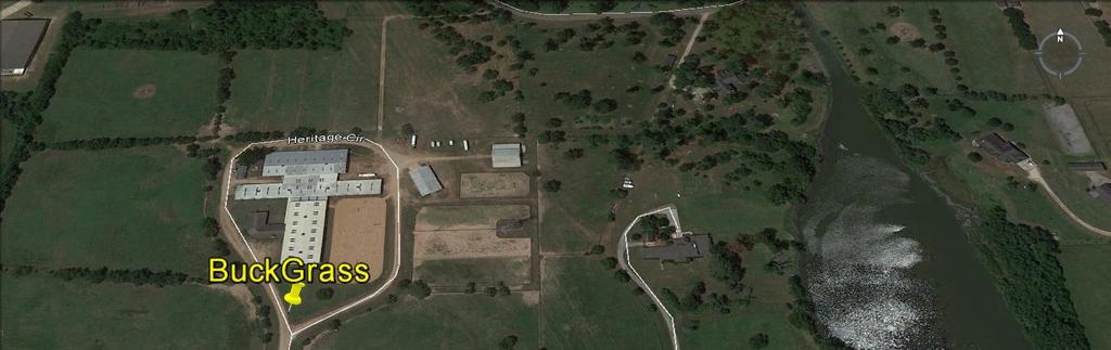
15 State of 249 Toll Road TX Transportation Commissioners selecting multiple companies in April Plans call for traffic to be moving from Tomball to Grimes County (SH 105) December 2019 Update: 1Q2020

16 Magnolia Relief Route Magnolia Bypass running from SH 249 to FM 1486 to FM 1774 and south to FM 1488 $10 million dedicated by County

17 Developments HEB Magnolia Woods Escondido Woodard Tract 6000 AC Sold Development Reynolds Reserve Glen Oaks Sec 4/ 3/548 Lots Available Magnolia Audubon Mustang Ridge Homes Magnolia Ridge - New Owners 479 AC Magnolia Reserve at Karen Switch homes Parkside Capital 95 Ac


18 FM 149 Utility Project


19 New Business Coming to Magnolia Retail/Restau rants: B lue Iguana Taco H ouse o pen now D ollar Tre e o pening in July M cd onald's and B urger K ing rem o dels co m pleted in past year N ew jobs: Legacy A ir o pening at fo rm er Kem ah Seafoo d locatio n 8 to 10 em ployees w ith additio na l o ffice spa ce N ew industry o pening this sum m er - 20 em ployees, w ill gro w to 75 N ew industry m o ving into Industrial Park no w w ith 7-10 em plo yee s, expect 20 SH 249 Toll Ro ad brining 200 w o rkers to the a rea thro ugh Year 2020


20 Reynolds Reserve P a r k s i d e

21 SPUR 149 Update mixed use
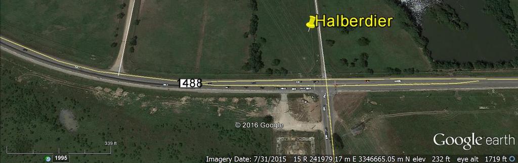
22 Halberdier Business Park

23 Buck Grass

24 State of Commercial Developments The former Buck Grass Stables is planning a 32-acre commercial area with pad sites - a work in progress


25 HEB Fall Thanksgiving


26 Mill Creek Estates Project 500+ homes, now
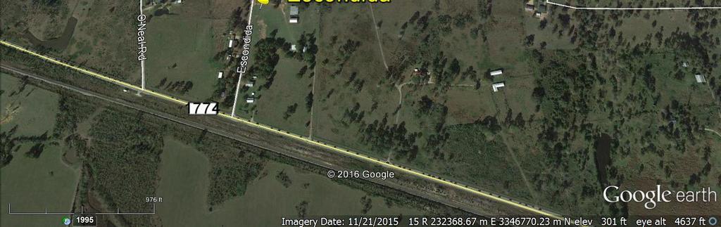
27 Mill Creek Estates


28 Magnolia 1138/ Magnolia Audubon 3,300 ACs

29 Legacy Trust/ Magnolia 1138/ Magnolia Audubon Expected to begin late 2018 installing infrastructure for homes in Acquired Devon Tract AC north of FM 1488 Currently at 3,000-plus acres


30 Magnolia Town Center mixed use by Meridian Investments


31 Mixed use on Commerce St. Livings Waters U n i t y P a r k Post Office D r


32 Mixed Use Development 112 Units 24,000 Sq. ft Retail Walkable Community M I X U S E


33 Magnolia Ridge


34 Mustang Ridge Magnolia West HS

35 Escondida Ranch

36 Development Plans Escondido 150 Acres residential with Commercial on FM 1774 Projected 2018


37 Magnolia Woods 2017

38 Development Plans Yellow arrow - Magnolia Woods Blue Arrow The Woodard Tract 5,900 Acres.


39 The Woodard Tract


40 Crown Ranch


41 Bluejack National - Doing very well


42 High Meadows Estates


43 Glen Oaks began Lots, Sec. 3 to bring 125 lots now


44 Magnolia Reserve at Karen Switch - underway Magnolia High

45 Development Magnolia Reserve at Karen Switch 170 AC 216 Homes: $350k to $450k


46 3000 Acre Mystery Development
47 WOODHAVEN COUNTY LINE FM 1488 TO FM ,732 ACRES 564 HOMES /LOTS WOODHAVEN INTERESTS LLC

48 Lone Star College is coming to Magnolia PROJECTED TIME FRAME UNKNOWN
49 Roads & Cooperation CITY OF MAGNOLIA MONTGOMERY COUNTY TEXAS DEPARTMENT OF TRANSPORTATION WORKING TOGETHER!


50 Roadways Driving the Future This image cannot currently be displayed.


51 Audubon Transportation Plan
52 Magnolia Transportation Plan


53 David & Goliath Bumper to Bumper

54 Smith & Wesson
Welcome to the Business Owner Task Force. Selma Stockstill SouthGate Constructors Public Information Manager
 Welcome to the Business Owner Task Force Selma Stockstill SouthGate Constructors Public Information Manager Interim Project Limits SH 183 SH 121 to IH 35E SH 114 International Parkway to SH 183 Loop 12
ACTIVE SINGLE FAMILY SUBDIVISIONS CITY OF BURLESON March 2011
 ACTIVE SINGLE FAMILY SUBDIVISIONS CITY OF BURLESON March 2011 SUBDIVISION TOTAL LOTS VACANT LOTS ALSBURY ESTATES EAST - PHASE II 45 1 ALSBURY MEADOWS - PHASE II 112 1 BROAD VALLEY FARMS 31 2 CASTLE HILL
ACTIVE SINGLE FAMILY SUBDIVISIONS CITY OF BURLESON January 2011
 ACTIVE SINGLE FAMILY SUBDIVISIONS CITY OF BURLESON January 2011 SUBDIVISION TOTAL LOTS VACANT LOTS ALSBURY ESTATES EAST - PHASE II 45 1 ALSBURY MEADOWS - PHASE II 112 1 BROAD VALLEY FARMS 1 2 CASTLE HILL
I-10 East at Redd closes for 24 hours this Sunday, Feb 11. Then, I-10 West at Resler closes for 27 hours on Feb 25
 NEWS RELEASE a TxDOT Project For immediate release EL PASO DISTRICT Jennifer Wright (915) 790-4340 Jennifer.Wright3@txdot.gov February 9, 2018 I-10 East at Redd closes for 24 hours this Sunday, Feb 11
White River Update. Jeanne Stypula, Supervising Engineer. Advisory Committee Meeting April 26, 2016
 White River Update Jeanne Stypula, Supervising Engineer Advisory Committee Meeting April 26, 2016 Department of Natural Resources and Parks Water and Land Resources Division River and Floodplain Management
Wesley Chapel Area Roadway Needs Study Build-Out Analysis (Beardsley Dr/Oldwoods Ave Need Study) Project Progress Meeting 1
 Project Progress Meeting 1") Build-Out Analysis (Beardsley Dr/Oldwoods Ave Need Study) Project Progress Meeting 1 9:30 AM Pasco County Development Services Conference Room 1. Welcome/Introductions 2. Project Overview Purpose Major
Build-Out Analysis (Beardsley Dr/Oldwoods Ave Need Study) Project Progress Meeting 1 9:30 AM Pasco County Development Services Conference Room 1. Welcome/Introductions 2. Project Overview Purpose Major
A New Approach to Estimating Population Growth Along a Major Arterial Highway.
 . ABSTRACT In the last twenty years Texas has undergone extensive growth as people move across the country and relocate in the Lone Star State. Many of these new Texans choose suburbs outside major cities
APPENDIX 1 LITTLE EGYPT FROM THE AIR
 APPENDIX 1 LITTLE EGYPT FROM THE AIR FIGURE 1. In this 1930 City of Dallas aerial photo, the land surrounding Little Egypt is seen as cultivated fields and agricultural structures. The Hill property is
REQUEST FOR PROPOSALS CLOSING DATE:
 Request for Proposals 110 Westlake Drive City of West Lake Hills 110 Westlake Drive REQUEST FOR PROPOSALS CLOSING DATE: Tuesday, October 23, 2018 City of West Lake Hills Request for Proposals 1 I. INTRODUCTION
CITY OF PORTLAND, TEXAS SERVICE PLAN FOR ANNEXATION AREA
 CITY OF PORTLAND, TEXAS SERVICE PLAN FOR ANNEXATION AREA Location and Acreage Approximately 1,863 acres of land in San Patricio County, located in the ETJ northwest of the existing City Limits. Metes and
III. FORECASTED GROWTH
 III. FORECASTED GROWTH In order to properly identify potential improvement projects that will be required for the transportation system in Milliken, it is important to first understand the nature and volume
January 12, Mr. Ryan Granger TMGB Wilson, LLC 2221 Health Drive SW, Suite 2200 Wyoming, Michigan 49519
 January 12, 2018 Mr. Ryan Granger TMGB Wilson, LLC 2221 Health Drive SW, Suite 2200 Wyoming, Michigan 49519 Re: Proposed Reserve at Rivertown Mixed-Use Development Updated Trip Generation and Site Driveway
Texas Land Survey Maps For Wise County By Gregory A. Boyd READ ONLINE
 Texas Land Survey Maps For Wise County By Gregory A. Boyd READ ONLINE Jul 06, 2015 Genealogy Family Maps Cemetery Wise County Texas Land Survey in Books, Magazines, Texas Land Survey Maps for Wise County
PIONEERING A NEW FRONTIER IN PEACHTREE CORNERS
 PIONEERING A NEW FRONTIER IN PEACHTREE CORNERS Project Snapshot R ER S TR C H and Scipio Ventures, 3550 Engineering Drive is a 4-story, W Y R 3550 Engineering is poised for companies who place high IN
APPENDIX I - AREA PLANS
 ROUTE 37 WEST LAND USE PLAN ROUTE 37 WEST LAND USE PLAN Recent land use decisions and development trends have drawn attention to the land within the Route 37 western by-pass area between Route 50 and
PIONEERING A NEW FRONTIER IN PEACHTREE CORNERS 3550ENGINEERING.COM
 PIONEERING A NEW FRONTIER IN PEACHTREE CORNERS Project Snapshot Recently acquired by Icarus Alternative Investments and Scipio Ventures, 3550 Engineering Drive is a 4-story, 101,809 square foot suburban
MAPS AND THEIR CLASSIFICATION
 MAPPING MAPS AND THEIR CLASSIFICATION WHAT IS A MAP? A map is representation of the Earth's surface, showing how things are related to each other by distance, direction, and size. Maps are a way of showing
HEAD NORTH. a cross b d e v e lo p m e n t
 HEA NORTH A MASTER- PLANNE COMMUNITY FOR A GROWING OESSA, TEXAS a cross b d e v e lo p m e n t PHASE EVELOPMENT OESSA, TEXAS AT THE INTERSECTION OF NORTH OESSA AN THE NORTH STAR, WE VE FOUN A SWEET SPOT.
Drought. Jeffrey Lindner Meteorologist Harris County Flood Control District September 20, 2011
 2010-2011 Drought Jeffrey Lindner Meteorologist Harris County Flood Control District September 20, 2011 Texas Annual Rainfall Texas Annual Rainfall 1895-2010 Texas Annual Temperature 1895-2010 Notice Any
JOURNAL OF THE CSXT HISTORICAL SOCIETY Volume 7 Number 2
 JOURNAL OF THE CSXT HISTORICAL SOCIETY Volume 7 Number 2 A CSXT MONON SYSTEM ABANDONMENT CSXTHS is not affiliated with CSX Transportation and is a nonprofit corporation chartered under the laws of Kentucky.
East Bay BRT. Planning for Bus Rapid Transit
 East Bay BRT Planning for Bus Rapid Transit Regional Vision Draper Prison The Bottleneck is a State-Level issue, Salt Lake County 2050 Population: 1.5M Draper Prison hopefully with some State-Level funding!
TRAFFIC ALERT FOR WEEK OF February 4 8, 2008
 TRAFFIC ALERT FOR WEEK OF February 4 8, 2008 Highway work zones in the Staunton District The following is a list of highway work that might affect traffic in the Staunton transportation district during
BUILDING AND SAFETY FEE SCHEDULE (Effective July1, 2013)
") BUILDING AND SAFETY DIVISION TELEPHONE (949) 724-6300 BUILDING AND SAFETY FEE SCHEDULE (Effective July1, 2013) Payment: When a plan is required by the Administrative Authority to be submitted, a plan check
BUILDING AND SAFETY DIVISION TELEPHONE (949) 724-6300 BUILDING AND SAFETY FEE SCHEDULE (Effective July1, 2013) Payment: When a plan is required by the Administrative Authority to be submitted, a plan check
WOODRUFF ROAD CORRIDOR ORIGIN-DESTINATION ANALYSIS
 2018 WOODRUFF ROAD CORRIDOR ORIGIN-DESTINATION ANALYSIS Introduction Woodruff Road is the main road to and through the commercial area in Greenville, South Carolina. Businesses along the corridor have
The Sunland Park flyover ramp is set to close the week of March 19 until early summer
 March 2, 2018 The Sunland Park flyover ramp is set to close the week of March 19 until early summer GO 10 is targeting the week of March 19 to close the Sunland Park Drive flyover entrance ramp to I 10
Ellis County-Midlothian to Waxahachie Trail Corridor Research
 Ellis County- to Trail Corridor Research The University of Texas at Arlington Program in Landscape Architecture, School of Architecture and The Institute of Urban Studies, The School of Urban and Public
Proclaiming Certain Lands as Reservation for the Confederated Tribes of the
 This document is scheduled to be published in the Federal Register on 11/05/2018 and available online at https://federalregister.gov/d/2018-24174, and on govinfo.gov [4337-15] DEPARTMENT OF THE INTERIOR
Hurricane Florence Recovery Report 4:00 PM October 31, 2018
 Hurricane Florence Recovery Report 4:00 PM October 3, 208 SCDOT Operations Mode: Recovery Statewide Summary There are 2 road closures on primary and secondary routes due to damage or flooding throughout
FOR SALE +/- 419 ACRES ¼ Mile South of Alliance Airport
 FOR SALE +/- 419 ACRES ¼ Mile South of Alliance Airport Alliance Airport Subject property +/- 419 AC Pat McDowell +1 817 334 8106 pat.mcdowell@am.jll.com JLL 201 Main Street, Suite 1440 Fort Worth, TX
FOR LEASE LEASE OPPORTUNITIES 3,500-50,000 SF. Proposed Tenant Mix. A Project by Zelman Development Co.
 Walla Walla Town Center LEASE OPPORTUNITIES 3,500-50,000 SF PAD 1 3,500 SF PAD 2 3,500 SF PAD 3 4,000 SF PAD 4 5,500 SF PAD 5 6,000 SF PAD 6 6,000 SF RETAIL A 34,200 SF RETAIL A1 15,210 SF RETAIL B 50,000
BEFORE THE BOARD OF COUNTY COMMISSIONERS OF LANE COUNTY, OREGON
 BEFORE THE BOARD OF COUNTY COMMISSIONERS OF LANE COUNTY, OREGON ORDER NO. 18-04-10-06 IN THE MATTER OF SETTING A PUBLIC HEARING FOR THE PROPOSED SURRENDER OF A PORTION OF COAST GUARD STATION ROAD (COUNTY
Appendixx C Travel Demand Model Development and Forecasting Lubbock Outer Route Study June 2014
 Appendix C Travel Demand Model Development and Forecasting Lubbock Outer Route Study June 2014 CONTENTS List of Figures-... 3 List of Tables... 4 Introduction... 1 Application of the Lubbock Travel Demand
of the street when facing south and all even numbers south of Railroad Avenue shall be on the righthand side of the street when facing south.
 Page 312 of the street when facing south and all even numbers south of Railroad Avenue shall be on the righthand side of the street when facing south. (Code 1980, 26-133; Code 2003, 22-267) Secs. 46-310
Blue Ridge Relay Course Outline. leg distance
 Blue Ridge Relay Course Outline leg leg distance segment distance direction road markers 1 Grayson Highlands State Park Visitors Center 3.90 3.90 S Grayson Highlands State Park Office and Gate 2 S Grayson
APPLICATION TO AMEND THE FUTURE LAND USE MAP (FLUM) SMALL SCALE
 SMALL SCALE") DEPARTMENT OF DEVELOPMENT & PLANNING 825 Ohio Avenue - Lynn Haven, FL 32444 (850) 265-2961 - (850) 265-3478 APPLICATION TO AMEND THE FUTURE LAND USE MAP (FLUM) SMALL SCALE Deadline to submit is 30 days
DEPARTMENT OF DEVELOPMENT & PLANNING 825 Ohio Avenue - Lynn Haven, FL 32444 (850) 265-2961 - (850) 265-3478 APPLICATION TO AMEND THE FUTURE LAND USE MAP (FLUM) SMALL SCALE Deadline to submit is 30 days
APPENDIX (R) Committed Developments Documentation
 Committed Developments Documentation") APPENDIX 21-10 (R) Committed Developments Documentation Revised October 2008 Committed Developments Trip Generation Beacon Countyline DRI Development Location Land Use Approved Built Remaining PM Peak
APPENDIX 21-10 (R) Committed Developments Documentation Revised October 2008 Committed Developments Trip Generation Beacon Countyline DRI Development Location Land Use Approved Built Remaining PM Peak
DOWNLOAD OR READ : MONROE LA STREET MAP PDF EBOOK EPUB MOBI
 DOWNLOAD OR READ : MONROE LA STREET MAP PDF EBOOK EPUB MOBI Page 1 Page 2 monroe la street map monroe la street map pdf monroe la street map monroe la street map monroe la street map pdf monroe la street
West Tennessee Construction June 14-21, 2017
 FOR IMMEDIATE RELEASE Wednesday, June 14, 2017 CONTACT: Nichole Lawrence CELL: 731-225-6041 West Tennessee Construction June 14-21, 2017 BENTON COUNTY, I-40 Truck Climbing Lane Wednesday, June 7 through
WEBER ROAD RESIDENTIAL DEVELOPMENT Single Family Residential Project
 WEBER ROAD RESIDENTIAL DEVELOPMENT Single Family Residential Project WEBER ROAD RESIDENTIAL DEVELOPMENT TRAFFIC IMPACT STUDY TABLE OF CONTENTS 1.0 Executive Summary Page 2.0 Introduction 2.1 DEVELOPMENT
Rockefeller Group Corporate Center Master Plan
 9,698± AADT 46 wayside dr 97,033± AADT international Pkwy SITE Seminole Towne Center 88,790± AADT Colonial Town Park SITE SPECIFICATIONS is a 28-acre development site strategically located along International
If searching for a ebook The Roads of Texas in pdf form, in that case you come on to right site. We present full option of this ebook in PDF, DjVu,
 The Roads Of Texas If searching for a ebook The Roads of Texas in pdf form, in that case you come on to right site. We present full option of this ebook in PDF, DjVu, epub, txt, doc forms. You may reading
CITY OF PAPILLION PLANNING COMMISSION STAFF REPORT MAY 27, 2015 AGENDA 2015 ANNEXATION MISC
 PLANNING COMMISSION STAFF REPORT MAY 27, 2015 AGENDA 2015 ANNEXATION MISC-15-0005 I. GENERAL INFORMATION A. APPLICANT: City of Papillion 122 East Third St. Papillion, NE 68046 B. LEGAL DESCRIPTION: See
Active Traffic & Safety Management System for Interstate 77 in Virginia. Chris McDonald, PE VDOT Southwest Regional Operations Director
 Active Traffic & Safety Management System for Interstate 77 in Virginia Chris McDonald, PE VDOT Southwest Regional Operations Director Interstate 77 at Fancy Gap Mountain Mile markers 0-15 Built in late
THE NEED FOR AN ADDITIONAL SPILLWAY AT THE SANFORD DAM BOILING SPRING LAKES, NC. Presentation for The Brunswick County Commissioners April 20, 2015
 THE NEED FOR AN ADDITIONAL SPILLWAY AT THE SANFORD DAM BOILING SPRING LAKES, NC Presentation for The Brunswick County Commissioners April 20, 2015 The Sanford Dam Earth Dam constructed in 1961 Drainage
[Leveraging & Improving Neighborhood Connections] Area E Cedar Creek
![[Leveraging & Improving Neighborhood Connections] Area E Cedar Creek](/thumbs/86/93508963.jpg "[Leveraging & Improving Neighborhood Connections] Area E Cedar Creek") Community Charrette LINC Dallas [Leveraging & Improving Neighborhood Connections] Area E Cedar Creek 06.02.12 LINC Workshop Area E Area E has the unique distinction of at-grade frontage to the Trinity
Community Charrette LINC Dallas [Leveraging & Improving Neighborhood Connections] Area E Cedar Creek 06.02.12 LINC Workshop Area E Area E has the unique distinction of at-grade frontage to the Trinity
City of Brainerd, Minnesota Snowplowing Policy
 City of Brainerd, Minnesota Snowplowing Policy 1. Introduction The city of Brainerd, Minnesota, finds that it is in the best interest of the residents of the city to assume basic responsibility for control
APPENDIX A M&T/Llano Seco Long-Term Water Reliability Study These photos are examples of rock spurs in use throughout the United States
 APPENDIX A M&T/Llano Seco Long-Term Water Reliability Study These photos are examples of rock spurs in use throughout the United States Glenn Colusa Irrigation District completed a Sacramento River project
Sky Park Business Center
 Lic. Lic. Suite Size Asking Rate Available 9210 Sky Park Court Suite 150 8,091 SF $2.05 + E AVAILABLE NOW 9265 Sky Park Court 100% Leased PROJECT FEATURES: Newly remodeled common areas and upgraded mechanical
PROJECTS IN PROGRESS. October 2015
 PROJECTS IN PROGRESS October 2015 DEVELOPMENT UPDATE Village Location Map O N G O I N G P R O J E C T S I N G L E N V I E W 2 DEVELOPMENT UPDATE Village Location Map G L E N P O I N T E I - 2 9 4 & W I
Drilling & Developing the Marcellus Shale
 Drilling & Developing the Marcellus Shale Presented by the Independent Oil and Gas Association of Pennsylvania at the Pennsylvania State Association of Township Supervisors Annual Meeting, May 12, 2008,
Frayser. A Turning Point. Comprehensive Planning Studio Fall Graduate Program in City and Regional Planning University of Memphis LIST OF MAPS
 Frayser A Turning Point Comprehensive Planning Studio Fall 2006 Graduate Program in City and Regional Planning University of Memphis LIST OF MAPS Map 1. Memphis Region (T. Moreland) Map 2. Frayser (T.
Office of Enterprise Technology
 Office of Enterprise Technology Transforming the Maricopa Department of Transportation (MCDOT) GIS-based Transportation Asset Inventory System January 21, 2016 Presented By Steve Hossack, GIS Database
CONGLETON INDUSTRIAL PARK LT 6 EX W 300' & E 350' LT 7 BLK 1, a subdivision of land in the City of Overland Park, Johnson County, Kansas.
 NOTICE OF PUBLIC HEARING CITY PLANNING COMMISSION CITY OF OVERLAND PARK, KANSAS Notice is hereby given that the City Planning Commission of Overland Park, Kansas, will hold a public hearing Monday, July
PERSONAL REAL ESTATE CORPORATION Comox Valley Home Sales for the month of June, 2018 (Single Family) MB - Merville/Black Creek Sales Avg Sale Price 1
 MB - Merville/Black Creek Sales Avg Sale Price 1") PERSONAL REAL ESTATE CORPORATION Comox Valley Home Sales for the month of June, 2018 (Single Family) MB - Merville/Black Creek 1 $630,000 MW - Mt. Washington 1 $407,000 CN - Courtenay North 0 CP - Comox
PERSONAL REAL ESTATE CORPORATION Comox Valley Home Sales for the month of June, 2018 (Single Family) MB - Merville/Black Creek 1 $630,000 MW - Mt. Washington 1 $407,000 CN - Courtenay North 0 CP - Comox
Urban Planning Word Search Level 1
 Urban Planning Word Search Level 1 B C P U E C O S Y S T E M P A R E U O E U R B A N P L A N N E R T N S T D H E C O U N T Y G E R E R D W R E N I C I T Y C O U N C I L A A A S U G G C I L A G P R I R
CITY OF ORILLIA POLICY MANUAL. Winter Operations. Table of Contents. WINTER CONTROL Objectives 2. WINTER CONTROL Season 3
 Page 1 of 12 Winter Operations Table of Contents WINTER CONTROL Objectives 2 WINTER CONTROL Season 3 SNOW ACCUMULATION Road Plowing 4,5 ICY ROADWAYS Application of Deicers/Abrasives 6 SNOW ACCUMULATION
Study Overview. the nassau hub study. The Nassau Hub
 Livable Communities through Sustainable Transportation the nassau hub study AlternativeS analysis / environmental impact statement The Nassau Hub Study Overview Nassau County has initiated the preparation
THE TRINITY RIVER VISION/ GATEWAY PARK / PANTHER ISLAND
 Quarterly Project Status Report May 2018 THE TRINITY RIVER VISION/ GATEWAY PARK / PANTHER ISLAND Flood Control Project Update Construction of North Main Street Bridge by TxDOT s bridge contractor, Texas
Crow River Plaza - Retail Development South Diamond Lake Rd. Rogers, MN FOR LEASE 1,024 SF Retail Space. Lease Rate: $16.
 FEATURES: - Available in Rogers, MN Lease Rate: $16.00 / psf NNN - Excellent location with freeway signage on I-94! - Near large retailers such as Target, Kohls, & Applebees. Taxes $3.65 / psf Cam $3.20
Debbie Lee, Communications and Public Affairs Officer. Update on Southern California Edison s Capital Improvement Projects
 Information Item Date: June 22, 2015 To: From: Subject: Mayor and City Council Debbie Lee, Communications and Public Affairs Officer Update on Southern California Edison s Capital Improvement Projects
classroomsecrets.com Reasoning and Problem Solving Read and Interpret Line Graphs Teaching Information
 Reasoning and Problem Solving Read and Interpret Line Graphs 1 National Curriculum Objective: Mathematics Year 5: Solve comparison, sum and difference problems using information presented in a line graph
NORTH HOUSTON HIGHWAY IMPROVEMENT PROJECT (NHHIP)
") NORTH HOUSTON HIGHWAY IMPROVEMENT PROJECT (NHHIP) Project Overview Briefing Packet September 2015 RECOMMENDED ALTERNATIVES Environmental Impact Statement (EIS) Project Divided into 3 Segments Segment 1:
NORTH HOUSTON HIGHWAY IMPROVEMENT PROJECT (NHHIP) Project Overview Briefing Packet September 2015 RECOMMENDED ALTERNATIVES Environmental Impact Statement (EIS) Project Divided into 3 Segments Segment 1:
2267 N o r t h 1500 W C l i n t o n U T 84015
 P l a n n i n g C o m m i s s i o n M e m b e r s C h a i r J a c o b B r i g g s V i c e C h a i r G a r y T y l e r T o n y T h o m p s o n J o l e n e C r e s s a l l A n d y H a l e D e r e c k B a
6 th Line Municipal Class Environmental Assessment
 6 th Line Municipal Class Environmental Assessment County Road 27 to St John s Road Town of Innisfil, ON September 6, 2016 APPENDIX L: TRAVEL DEMAND FORECASTING MEMORANDUM Accessible formats are available
Monroe County: Key West and Lower Keys
 FDOT PROJECT UPDATES June 15-21, 2015 Monroe County: Key West and Lower Keys Monroe County projects website: www.fdotmonroe.com Opt Out: If you no longer wish to receive these weekly notifications, please
HIGH W EST C HESTER P REMIER O FFICE N. C H U RC H S T W E S T C H E S T E R, PA
 N 9 HIGH W EST C HESTER P REMIER O FFICE W E S T C H E S T E R, PA A VAILABLE F OR L EASE 4,607 SF TO 30,000 SF C LASS A O FFICE P i l l a r R e a l E s tat e A d v i s o r s, L l c E r i c Ku h n A n
Hurricane Florence Recovery Report 4:00 PM October 17, 2018
 Hurricane Florence Recovery Report 4:00 PM October 17, 2018 SCDOT Operations Mode: Recovery Statewide Summary There are 27 road closures on primary and secondary routes due to damage or flooding throughout
Crow River Plaza - Retail Development South Diamond Lake Rd. Rogers, MN FOR LEASE 2,066 SF Retail Space. Lease Rate: $16.
 FEATURES: - 2,066 SF End Cap Retail Space Available in Rogers, MN - Excellent location with freeway signage on I-94! - Near large retailers such as Target, Kohls, & Applebees. - Convenient location off
NORTH HOUSTON HIGHWAY IMPROVEMENT PROJECT (NHHIP)
") NORTH HOUSTON HIGHWAY IMPROVEMENT PROJECT (NHHIP) Planning for a Mega Project in a Metropolitan Area TxDOT Short Course October 13, 2015 RECOMMENDED ALTERNATIVES Environmental Impact Statement (EIS) Project
NORTH HOUSTON HIGHWAY IMPROVEMENT PROJECT (NHHIP) Planning for a Mega Project in a Metropolitan Area TxDOT Short Course October 13, 2015 RECOMMENDED ALTERNATIVES Environmental Impact Statement (EIS) Project
TABLE OF CONTENTS ARTICLE I. POLK COUNTY COMPREHENSIVE PLAN VOLUME 1. Page CHAPTER 1. GENERAL... A-1
 TABLE OF CONTENTS ARTICLE I. POLK COUNTY COMPREHENSIVE PLAN VOLUME 1 Page CHAPTER 1. GENERAL... A-1 DIVISION 1.100 GENERAL PROVISIONS... A-1 DIVISION 1.200 BASIC PRINCIPLES... A-6 DIVISION 1.300 THE PLANNING
Hurricane Florence Recovery Report 4:00 PM November 15, 2018
 Hurricane Florence Recovery Report 4:00 PM November 5, 208 SCDOT Operations Mode: Recovery Statewide Summary There are 9 road closures on primary and secondary routes due to damage or flooding throughout
Forecasts for the Reston/Dulles Rail Corridor and Route 28 Corridor 2010 to 2050
 George Mason University Center for Regional Analysis Forecasts for the Reston/Dulles Rail Corridor and Route 28 Corridor 21 to 25 Prepared for the Fairfax County Department of Planning and Zoning Lisa
MEMORANDUM. Trip Generation Analysis
 MEMORANDUM To: RMC Architects From: Matthew Palmer, PE Subject: Trip Generation, Parking Analysis & Level of Service Project: Port of Everett, GTC #13-053 Date: August 25, 2014 The trip generation and
JEWSON 33 ST PETERS ROAD, HUNTINGDON PE29 7DA TRADE COUNTER INVESTMENT OPPORTUNITY
 JEWSON 33 ST PETERS ROAD, HUNTINGDON PE29 7DA JEWSON 33 ST PETERS ROAD, HUNTINGDON PE29 7DA INVESTMENT CONSIDERATIONS Well located Trade Counter in the market town of Huntingdon Prominently situated between
Sky Park Business Center
 Suite Size Available Rate 9210 Sky Park Court Suite 220 4,738 SF Now $1.95 + Util. 9265 Sky Park Court Suite 250 6,085 SF Now $1.95 + Util. * Suite 250 is divisible Project FEATURES: Newly remodeled common
TREASURE COAST REGIONAL PLANNING COUNCIL M E M O R A N D U M. To: Council Members AGENDA ITEM 4B10
 TREASURE COAST REGIONAL PLANNING COUNCIL M E M O R A N D U M To: Council Members AGENDA ITEM 4B10 From: Date: Subject: Staff December 14, 2018 Council Meeting Local Government Comprehensive Plan Review
Write a report (6-7 pages, double space) on some examples of Internet Applications. You can choose only ONE of the following application areas:
 on some examples of Internet Applications. You can choose only ONE of the following application areas:") UPR 6905 Internet GIS Homework 1 Yong Hong Guo September 9, 2008 Write a report (6-7 pages, double space) on some examples of Internet Applications. You can choose only ONE of the following application
UPR 6905 Internet GIS Homework 1 Yong Hong Guo September 9, 2008 Write a report (6-7 pages, double space) on some examples of Internet Applications. You can choose only ONE of the following application
City of Escondido Sphere of Influence Update Background
 City of Escondido Sphere of Influence Update Background The City of Escondido Sphere of Influence was initially adopted by the San Diego Local Agency Formation Commission in 1979. The city sphere was most
Remote Sensing the Urban Landscape
 Remote Sensing the Urban Landscape Urban landscape are composed of a diverse assemblage of materials (concrete, asphalt, metal, plastic, shingles, glass, water, grass, shrubbery, trees, and soil) arranged
City of Camrose Winter Road Maintenance Policy
 City of Camrose Winter Road Maintenance Policy The purpose of this policy is to outline the level of service that the City of Camrose delivers regarding the maintenance of roads in winter conditions. 1.
Warner Real Estate Advisors, Inc. Minto West Non -Residential Intensity Analysis
 Warner Real Estate Advisors, Inc. Non -Residential Intensity Analysis 12/16/2013 Warner Real Estate Advisors, Inc. Real Estate Research, Market Studies & GIS December 16, 2013 Ms. Tara W. Duhy, Esq. Lewis,
Case Special Exception request for Planned Unit Development (PUD) The Vineyards
 The Vineyards") Case 1627 Applicant: Developer: Request: Location: Pointe South Land Trust Contact Information: Jimmy Garrett 901-271-3642 N/A Special Exception request for Planned Unit Development (PUD) The Vineyards
Case 1627 Applicant: Developer: Request: Location: Pointe South Land Trust Contact Information: Jimmy Garrett 901-271-3642 N/A Special Exception request for Planned Unit Development (PUD) The Vineyards
Suppression of colonies of Reticulitermes spp. using the Sentricon termite colony elimination system: : A case study in Chatsworth, CA
 Suppression of colonies of Reticulitermes spp. using the Sentricon termite colony elimination system: : A case study in Chatsworth, CA Gail M. Getty, MS, Chris Solek, MS, Ron 1 1 Sbragia, Ph.D., Michael
BRUNSWICK COUNTY. North Carolina State Highway Patrol Coastal Evacuation Plan 1
 North Carolina State Highway Patrol Coastal Evacuation Plan 1 Contact Information for Emergency Management Director and EOC Contact Address Telephone Number Brian Watts Building C 3325 Old Ocean Hwy. Bolivia,
City of Chino Hills General Plan Update 13GPA02 Scoping Meeting. June 4, 2013
 13GPA02 Scoping Meeting June 4, 2013 Every California city must adopt a comprehensive, long-term general plan. The General Plan is the City s constitution or blueprint for its long-range physical development.
April 10, Mr. Curt Van De Walle, City Manager City of Castle Hills 209 Lemonwood Drive Castle Hills, Texas 78213
 Mr. Curt Van De Walle, City Manager City of Castle Hills 209 Lemonwood Drive Castle Hills, Texas 78213 Subject: Revised Castle Hills BASIS Charter School Traffic Impact Analysis Review City of Castle Hills,
SHADOW STUDY REPORT REGARDING
 SHADOW STUDY REPORT REGARDING an APPLICATION TO REDEVELOP Three 6 Storey Condominiums Regional Road 25 (Ontario Street) and Britannia Road Milton, Ontario KNYMH FILE # 17030 Prepared by: Krista Lilley
2267 N o r t h 1500 W C l i n t o n U T 84015
 P l a n n i n g C o m m i s s i o n M e m b e r s C h a i r J a c o b B r i g g s V i c e C h a i r G a r y T y l e r T o n y T h o m p s o n J o l e n e C r e s s a l l A n d y H a l e D e r e c k B a
INVITATION TO NEGOTIATE DOWNTOWN DEVELOPMENT OF CITY- OWNED SITES WITH PRIVATE SECTOR INVESTMENT PARTICIPATION
 INVITATION TO NEGOTIATE DOWNTOWN DEVELOPMENT OF CITY- OWNED SITES WITH PRIVATE SECTOR INVESTMENT PARTICIPATION John Zobler, City Manager March 10, 2015 Review of Needs, Wants & Desires 2 2004 Downtown
MOULDING CATALOG TRUECUSTOMTRUEQUALITY
 MOULDING CATALOG TRUECUSTOMTRUEQUALITY Texas Wood Supply wants to be known for the best product, the most dynamic range of product customization and the best customer service in Texas. Come compare the
Information Paper. Kansas City District. Missouri River Fish and Wildlife Mitigation Project Jim and Olivia Hare Wildlife Area, MO
 City District Information Paper River Fish and Wildlife Mitigation Project Jim and Olivia Hare Wildlife Area, MO Riverine habitat created in 2004/2005 by modifying existing river structures along the banks,
DISTRICT ATLANTA 3004 BOWIE US STP 2012(053) $ 4,495, NO AWARD
 $ 4,495, NO AWARD") HIGHWAY AND TRANSPORTATION ENHANCEMENT BUILDING CONSTRUCTION CONTRACTS PAGE 1 DISTRICT ATLANTA 3004 BOWIE US 67 0010-11-068 STP 2012(053) 110.500 $ 4,495,000.00 5-12.80 NO AWARD CONTRACTOR: CLARK CONSTRUCTION
HIGHWAY AND TRANSPORTATION ENHANCEMENT BUILDING CONSTRUCTION CONTRACTS PAGE 1 DISTRICT ATLANTA 3004 BOWIE US 67 0010-11-068 STP 2012(053) 110.500 $ 4,495,000.00 5-12.80 NO AWARD CONTRACTOR: CLARK CONSTRUCTION
Urban White Paper on Tokyo Metropolis 2002
 Urban White Paper on Tokyo Metropolis 2002 By Bureau of City Planning Tokyo Metropolitan Government Part I. "Progress in IT and City Building" Effects of computer networks on cities and cities' response
Tools to Assess Flood Risk of Commercial Property Investment
 Tools to Assess Flood Risk of Commercial Property Investment NSERC Workshop March 1, 2016 Kate Collins, Tim Webster, Nathan Crowell AGRG, NSCC, Middleton, NS https://eatsleepride.com/ http://users.eastlink.ca/~tbulley/
Transforming the Maricopa County Department of Transportation (MCDOT) GIS-based Transportation Asset Inventory System June 30, 2016
 GIS-based Transportation Asset Inventory System June 30, 2016") Transforming the Maricopa County Department of Transportation (MCDOT) GIS-based Transportation Asset Inventory System June 30, 2016 Presented By Steve Hossack, GIS Database Administrator 2016 Esri User
Transforming the Maricopa County Department of Transportation (MCDOT) GIS-based Transportation Asset Inventory System June 30, 2016 Presented By Steve Hossack, GIS Database Administrator 2016 Esri User
Request Applicant Owner Zoning Location Attachments Site and Surrounding Area Direction Surrounding Zoning Surrounding Land Use Access
 Planning & Zoning Commissionn Planning & Development Department September, 0 Preliminary/Final Plat Westwood, Section, Phase Request Applicant Owner Zoning Location Attachments Subdivision of approximately.
The Greater Drogheda Area - Drogheda (Co. Louth), Drogheda South (Co. Meath) & the Meath Coast
, Drogheda South (Co. Meath) & the Meath Coast") Submission to National Planning Framework The Greater Drogheda Area - Drogheda (Co. Louth), Drogheda South (Co. Meath) & the Meath Coast Date: 31st March 2017 From: Cormac Bohan, Proposal: that Drogheda
Submission to National Planning Framework The Greater Drogheda Area - Drogheda (Co. Louth), Drogheda South (Co. Meath) & the Meath Coast Date: 31st March 2017 From: Cormac Bohan, Proposal: that Drogheda
presents challenges related to utility infrastructure planning. Many of these challenges
 1 Introduction: - a. Purpose According to U.S. Census Bureau the population of stark county was 367,585 in 1990, and in 2000 it was increase to 378,098. Thus County is experiencing a growth that presents
Seasonal Hazard Outlook
 Winter 2016-2017 Current as of: October 21 Scheduled Update: December 614-799-6500 emawatch@dps.ohio.gov Overview Executive Summary Seasonal Forecast Heating Fuel Supply Winter Driving Preparedness Scheduled
Dunn County Snow Removal Policy
 Dunn County Snow Removal Policy OVERVIEW With the advent of another winter season in the northern plains comes the possibility of snow, freezing rain and slippery roadways, and area resident s concern