Mercury and methylmercury transport in the Cache Creek Settling Basin, California, U.S.A.
|
|
|
- Alan Welch
- 5 years ago
- Views:
Transcription


1 Mercury and methylmercury transport in the Cache Creek Settling Basin, California, U.S.A. Alpers, C.N. 1, Fleck, J.A. 1, Marvin- DiPasquale, M. 2, Beaulieu, E. 1, and Wright, S.A. 1 1 U.S. Geological Survey, Sacramento, CA 2 U.S. Geological Survey, Menlo Park, CA
2 Outline of Presentation Background Objectives Approach Preliminary Results Conclusions
 Coast Ranges Central Valley Cache Creek watershed one of the most Hg-contaminated Downstream effects of MeHg in San Francisco Bay and Delta USGS Fact Sheet")
3 Sacramento River Clear Lake Cache Creek Cache Creek Settling Basin Mercury Contamination from Historical Mining Hg-contaminated sediment from Hg mines (Coast Range) and Au mines (Sierra Nevada) Coast Ranges Central Valley Cache Creek watershed one of the most Hg-contaminated Downstream effects of MeHg in San Francisco Bay and Delta USGS Fact Sheet
 prior to 1904, and 34.")
4 California Mercury Production More than 100 million kg of Hg produced from 239 mines About 35 million kg lost to atmosphere from furnaces A flask contained 34.8 kg (76.5 lbs) prior to 1904, and 34.1 kg (75 lbs) afterwards (Churchill, 2000)


5 Background (1 of 2) Cache Creek Hg hot spot Half the Hg load of the entire Sacramento R. watershed Drains ~ 5% of the area of the Sacramento R. watershed Multiple Hg sources Active hot springs: Clear Lake / Sulphur Creek Fossil hot springs: hydrothermal alteration, Hg deposits Active cold springs: saline waters with high Hg, DOC Hg mine wastes: calcines, waste rock Several Hg mine sites with recent / ongoing remediation Sulphur Bank Mine (Superfund site) Abbott / Turkey Run Mines Rathburn / Petray Mines
6 Rathburn and Petray mines Cache Creek watershed adapted from: Domgalski et al. (2004)
 USGS WRIR")
7 From: Domgalski et al. (2004) USGS WRIR


8 Inflow January 22, 2010 Discharge: ~3,000 ft 3 /s ~85,000 L/s Outflow - gate Outflow - weir
9 Background (2 of 2) Cache Creek Settling Basin (CCSB) a sediment trap Built by U.S. ACE in 1937, improved in 1990 s Keeps sediment out of Yolo Bypass Protects City of Sacramento from flooding Interest in Hg trapping efficiency of CCSB Currently traps ~50% of sediment and p-hg load Future TMDL goal: 75% trapping efficiency Concerns about methylmercury CCSB may be a source of MeHg Sensitive downstream areas: Yolo Bypass, SF Bay-Delta

")
")

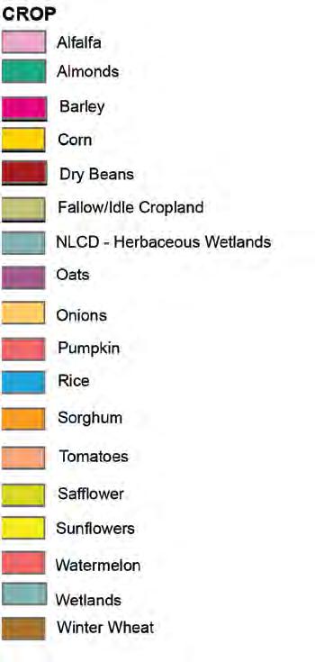
10 2009 Data from CropScape (USDA) Orthophoto from NAIP (2009) : 51% crops, 49% riparian
11 Overall Study Objectives Primary: In vs. out Determine [THg] & [MeHg] in water at CCSB inlet/outlet: storm and non-storm flow conditions Compute THg and MeHg loads in/out of CCSB Secondary: In-basin processes Assess spatial/temporal variability of [THg] & [MeHg] in water & sediment within the CCSB Assess vertical variability in sediment [THg] in deep cores Identify high [THg] layers
12 Overall Study Objectives Primary: In vs. out Determine [THg] & [MeHg] in water at CCSB inlet/outlet: storm and non-storm flow conditions Compute THg and MeHg loads in/out of CCSB Secondary: In-basin processes Assess spatial/temporal variability of [THg] & [MeHg] in water & sediment within the CCSB Assess vertical variability in sediment [THg] in deep cores Identify high [THg] layers
13 Approach Water and Sediment Sampling Water sampling WY2010: Dec June 2010 WY2011: Dec 2010 June 2011 Sediment sampling May 2010 Sept Feb May 2011 Sept Feb. 2012
14 Water-quality sampling Three sampling locations: Cache Rd. 102, CCSB Outlet & CCSB Spillway (weir) Baseline sampling at 3-wk intervals during wet season Storm event sampling: 8-10 samples per year (rising, peak, falling) Parameters: THg, filtered and unfiltered (or filtered and particulate) MeHg, filtered and unfiltered (or filtered and particulate) RHg(II), particulate Suspended sediment concentration (SSC) w/sand breakdoc & optical properties Field parameters (T, SC, ph, DO, turbidity) *Anions *Chlorophyll-a & pheophytin-a * baseline samples only

15 Approach Water and Sediment Sampling Water sampling WY2010: Dec June 2010 WY2011: Dec 2010 June 2011 Sediment sampling May 2010 Sept Feb May 2011 Sept Feb. 2012
16 Conclusions Cache Creek Settling Basin Inflow vs. Outflows: During flow across CCSB: Decrease in concentration of SS, p-thg Increase in concentration of MeHg, f-thg, and DOC Esp. during lower-flow periods between storms Spatial variations in ag vs. riparian land use: In riparian areas: Higher sediment MeHg/THg Higher LOI, TRS & Fe(II) consistent with Hg-methylation Management challenge: balancing THg load reduction with possible increase in MeHg production and export
17 Planned reports Primary Objective: In vs. out Determine [THg] & [MeHg] in water at CCSB inlet/outlet: storm and non-storm flow conditions Compute THg and MeHg loads in/out of CCSB Journal articles: THg, MeHg, SS loads 2012, 2014? Secondary Objective: In-basin processes Assess spatial/temporal variability of [THg] & [MeHg] in water & sediment within the CCSB Assess vertical variability in sediment [THg] in deep cores Identify high [THg] layers Journal article: In-basin variability 2014?
Cache Creek Settling Basin Mercury Studies
 Cache Creek Settling Basin Mercury Studies Charlie Alpers 1 and Josh Ackerman 2 1 USGS California Water Science Center, Sacramento, CA 2 USGS Western Ecological Research Center, Davis, CA Outline of Presentation
of Nebraska - Lincoln
 University of Nebraska - Lincoln DigitalCommons@University of Nebraska - Lincoln USGS Staff -- Published Research US Geological Survey 2008 The persistence of lead from past gasoline emissions and mining
Lu, S., P. Craig, C. Wallen, Z. Liu, A. Stoddard, W. McAnnally and E. Maak. Dynamic Solutions, Knoxville, TN USACOE, Sacramento District
 An Extended-Delta Hydrodynamic Model Framework for Sea Level Rise Analysis to Support Resource Management Planning for the Sacramento-San Joaquin River Delta Lu, S., P. Craig, C. Wallen, Z. Liu, A. Stoddard,
Attachment B to Technical Memorandum No.2. Operations Plan of Ross Valley Detention Basins
 Attachment B to Technical Memorandum No.2 Operations Plan of Ross Valley Detention Basins Operations Plan of Ross Valley Detention Basins Stetson Engineers Inc. January 26, 2011 1.0 Introduction Achieving
FORECAST-BASED OPERATIONS AT FOLSOM DAM AND LAKE
 FORECAST-BASED OPERATIONS AT FOLSOM DAM AND LAKE 255 237 237 237 217 217 217 200 200 200 0 163 131 Bridging the Gap163Conference 255 0 132 255 0 163 122 The Dana on Mission Bay San Diego, CA January 28,
3.3 CLIMATE, GEOLOGY, TOPOGRAPHY, AND SOILS CLIMATE GEOLOGY TOPOGRAPHY
 3.3 CLIMATE, GEOLOGY, TOPOGRAPHY, AND SOILS This section describes the climate, geology, topography, and soil resource characteristics of the Yolo Bypass Wildlife Area (Wildlife Area). Agricultural soil
Phase I System Characterization: Year 2 Study Plans
 Phase I System Characterization: Year 2 Study Plans Year I Physical and Biological Data Sets Quarterly Storm Sampling Four storm events with 8 sample stations at bridges Monthly Baseline Characterization
Instream Sediment Control Systems
 Instream Sediment Control Systems INSTREAM PRACTICES Photo 1 Photo 2 Modular sediment The information contained within this series of fact sheets deals only with the design of temporary instream sediment
Lower Susquehanna River Reservoir System Proposed Modeling Enhancements
 Lower Susquehanna River Reservoir System Proposed Modeling Enhancements Presented at the Chesapeake Bay Program Scientific and Technical Advisory Committee (STAC) Workshop January 13, 2016 Overview Due
Source Identification for particle bound metals in the San Juan River
 Source Identification for particle bound metals in the San Juan River Logan Frederick, William Johnson, Diego Fernandez, Thure Cerling University of Utah, Geology and Geophysics Mines in the area (Upper
Technical Memorandum No
 Pajaro River Watershed Study in association with Technical Memorandum No. 1.2.10 Task: Evaluation of Four Watershed Conditions - Sediment To: PRWFPA Staff Working Group Prepared by: Gregory Morris and
REDWOOD VALLEY SUBAREA
 Independent Science Review Panel Conceptual Model of Watershed Hydrology, Surface Water and Groundwater Interactions and Stream Ecology for the Russian River Watershed Appendices A-1 APPENDIX A A-2 REDWOOD
California OES Atmospheric River Events Weather Threat Briefing
 California OES Atmospheric River Events Weather Threat Briefing 23 February 2017 10:00 AM PST Day 1: Flooding continues along small streams and creeks and some main stem rivers. National Weather Service
President s Day Weekend Storm Community Meeting and Workshop April 17, 2017
 President s Day Weekend Storm Community Meeting and Workshop April 17, 2017 Meeting outline 1. Progress update on the City of San Jose s recovery efforts 2. Water district presentation on: Weather situation
2. PRESENT CONDITION OF THE RESERVOIR 2.1 View of Wonogiri Reservoir (1/3)
") 2.1 View of Wonogiri Reservoir (1/3) Wonogiri dam abutment on the left side of dam Spillway forebay on thet left side of dam Bank erosion around Wonogiri reservoir. Wonogiri Dam view from chersonese. An
2.1 View of Wonogiri Reservoir (1/3) Wonogiri dam abutment on the left side of dam Spillway forebay on thet left side of dam Bank erosion around Wonogiri reservoir. Wonogiri Dam view from chersonese. An
CR AAO Bridge. Dead River Flood & Natural Channel Design. Mitch Koetje Water Resources Division UP District
 CR AAO Bridge Dead River Flood & Natural Channel Design Mitch Koetje Water Resources Division UP District Old County Road AAO Bridge Map courtesy of Marquette County Silver Lake Basin McClure Basin
SPECIFIC DEGRADATION AND RESERVOIR SEDIMENTATION. By Renee Vandermause & Chun-Yao Yang
 SPECIFIC DEGRADATION AND RESERVOIR SEDIMENTATION By Renee Vandermause & Chun-Yao Yang Outline Sediment Degradation - Erosion vs Sediment Yield - Sediment Yield - Methods for estimation - Defining Sediment
HEC-RAS Reservoir Transport Simulation of Three Reservoirs in the Lower Susquehanna River Basin. Mike Langland and Ed Koerkle
 HEC-RAS Reservoir Transport Simulation of Three Reservoirs in the Lower Susquehanna River Basin Mike Langland and Ed Koerkle Topics Background / Project Objectives Data Selection - Sediment and Geometric
How Do Human Impacts and Geomorphological Responses Vary with Spatial Scale in the Streams and Rivers of the Illinois Basin?
 How Do Human Impacts and Geomorphological Responses Vary with Spatial Scale in the Streams and Rivers of the Illinois Basin? Bruce Rhoads Department of Geography University of Illinois at Urbana-Champaign
San Joaquin River Tributary Sediment Transport and Geomorphology Study
 Study 22 San Joaquin River Tributary Sediment Transport and Geomorphology Study Public Draft 2013 Monitoring and Analysis Plan September 2012 22.0 San Joaquin River Tributary Sediment Transport and Geomorphology
CASE STUDY BINGA, PHILIPPINES
 SEDIMENT MANAGEMENT CASE STUDY BINGA, PHILIPPINES Key project features Name: Binga Country: Philippines Category: modify operating rule (focus or redistribute sediment); adaptive strategies Reservoir volume
Assessment of Lake Forest Lake Sediment Trapping Efficiency and Capacity. Marlon R. Cook Groundwater Assessment Program Geological Survey of Alabama
 Assessment of Lake Forest Lake Sediment Trapping Efficiency and Capacity Marlon R. Cook Groundwater Assessment Program Geological Survey of Alabama Impacts of the Lake at Lake Forest on the connectivity
Transport and fate of sediment and associated contaminants in SF Bay. Mike Connor & John Oram 2007 LTMS Science Workshop
 Transport and fate of sediment and associated contaminants in SF Bay Mike Connor & John Oram 2007 LTMS Science Workshop Major Points Bay Still Responding to 1800 s mgmt Transport Has Spread Contamination
Figure 1. Map of Feather River Basin in northern California. (A) Region straddles the northwestern Sierra Nevada and Sacramento Valley.
 Region straddles the northwestern Sierra Nevada and Sacramento Valley.") Figure 1. Map of Feather River Basin in northern California. (A) Region straddles the northwestern Sierra Nevada and Sacramento Valley. (B) Feather River Basin with Yuba and Bear subbasins. Most hydraulic
Figure 1. Map of Feather River Basin in northern California. (A) Region straddles the northwestern Sierra Nevada and Sacramento Valley. (B) Feather River Basin with Yuba and Bear subbasins. Most hydraulic
Rivers and Streams. Streams. Hydrologic Cycle. Drainage Basins and Divides. Colorado River Drainage Basin. Colorado Drainage Basins.
 Chapter 14 Hydrologic Cycle Rivers and Streams Streams A stream is a body of water that is confined in a channel and moves downhill under the influence of gravity. This definition includes all sizes of
Eco Bay Pathways Watershed related exhibits in the Exploratorium
 Eco Bay Pathways Watershed related exhibits in the Exploratorium This Pathwa y is a guide to engagement wi th museu m exhibit s at the Explo ratorium and includes activiti es for p re- an d post-fi eldtri
Illinois State Water Survey Division
 Illinois State Water Survey Division SURFACE WATER SECTION SWS Miscellaneous Publication 108 SEDIMENT YIELD AND ACCUMULATION IN THE LOWER CACHE RIVER by Misganaw Demissie Champaign, Illinois June 1989
Earth Science Chapter 6 Section 2 Review
 Name: Class: Date: Earth Science Chapter 6 Section Review Multiple Choice Identify the choice that best completes the statement or answers the question. 1. Most streams carry the largest part of their
Climate Change and Water Supply Research. Drought Response Workshop October 8, 2013
 Climate Change and Water Supply Research Drought Response Workshop October 8, 2013 DWR Photo Oroville Reservoir, 2009 Talk Overview Expectations History Atmospheric Rivers and Water Supply Current Research
Lower Susquehanna River Integrated Sediment & Nutrient Monitoring Program
 Lower Susquehanna River Integrated Sediment & Nutrient Monitoring Program Presented at the Chesapeake Bay Program Scientific and Technical Advisory Committee (STAC) Workshop January 13, 2016 Background
Final Report. Prepared for. American Rivers, California Trout, Friends of the River and Trout Unlimited
 A of the Potential Downstream Sediment Deposition Following the Removal of Iron Gate, Copco, and J.C. Boyle Dams, Klamath River, CA Final Report Prepared for American Rivers, California Trout, Friends
Overview of fluvial and geotechnical processes for TMDL assessment
 Overview of fluvial and geotechnical processes for TMDL assessment Christian F Lenhart, Assistant Prof, MSU Research Assoc., U of M Biosystems Engineering Fluvial processes in a glaciated landscape Martin
Chapter 3 Erosion in the Las Vegas Wash
 Chapter 3 Erosion in the Las Vegas Wash Introduction As described in Chapter 1, the Las Vegas Wash (Wash) has experienced considerable change as a result of development of the Las Vegas Valley (Valley).
M. MARVIN- DIPASQUALE B. JAFFE, J. ACKERMAN & G. SHELLENBARGER U.S. GEOLOGICAL SURVEY D. SLOTTON UNIV. CALIFORNIA - DAVIS
 MERCURY IN MOTION: An Examination of Mercury Mobilization and Transformation Associated With Wetland Restoration in South San Francisco Bay M. MARVIN- DIPASQUALE B. JAFFE, J. ACKERMAN & G. SHELLENBARGER
Mae Gustin University of Nevada
 Mae Gustin Mae Gustin University of Nevada General -atmospheric Hg and watersheds Atmospheric contribution i from mining i Sources Form Measuring deposition Effect of mining on deposition Local Nevada
Watershed concepts for community environmental planning
 Purpose and Objectives Watershed concepts for community environmental planning Dale Bruns, Wilkes University USDA Rural GIS Consortium May 2007 Provide background on basic concepts in watershed, stream,
CASE STUDY BINGA, PHILIPPINES
 SEDIMENT MANAGEMENT CASE STUDY BINGA, PHILIPPINES Key project features Name: Binga Country: Philippines Category: modify operating rule (focus or redistribute sediment); adaptive strategies Binga hydropower
INFLOW DESIGN FLOOD CONTROL SYSTEM PLAN 40 C.F.R. PART PLANT YATES ASH POND 2 (AP-2) GEORGIA POWER COMPANY
 GEORGIA POWER COMPANY") INFLOW DESIGN FLOOD CONTROL SYSTEM PLAN 40 C.F.R. PART 257.82 PLANT YATES ASH POND 2 (AP-2) GEORGIA POWER COMPANY EPA s Disposal of Coal Combustion Residuals from Electric Utilities Final Rule (40 C.F.R.
INFLOW DESIGN FLOOD CONTROL SYSTEM PLAN 40 C.F.R. PART 257.82 PLANT YATES ASH POND 2 (AP-2) GEORGIA POWER COMPANY EPA s Disposal of Coal Combustion Residuals from Electric Utilities Final Rule (40 C.F.R.
Date of Report: EPA agreement number: Center Name and Institution of Ctr. Director: Identifier used by Center for Project: Title of Project:
 Date of Report: March 31, 2003 EPA agreement number: R829515C003 Center Name and Institution of Ctr. Director: Rocky Mountain Regional Hazardous Substance Research Center, Colorado State University, Fort
Sedimentation in the Nile River
 Advanced Training Workshop on Reservoir Sedimentation Sedimentation in the Nile River Prof. Dr. Abdalla Abdelsalam Ahmed 10-16 Oct. 2007, IRTCES, Beijing, China CWR,Sudan 1 Water is essential for mankind
Aquatic Transfer Facility (ATF) San Pablo Bay (SPB) Proposed Region of ATF. Proposed Seabed Pipeline
 San Pablo Bay (SPB) Proposed Region of ATF. Proposed Seabed Pipeline") Aquatic Transfer Facility (ATF) San Pablo Bay (SPB) Proposed Region of ATF Proposed Seabed Pipeline Technical Studies An Overview Scope: Provide background and new scientific information and analysis for
Aquatic Transfer Facility (ATF) San Pablo Bay (SPB) Proposed Region of ATF Proposed Seabed Pipeline Technical Studies An Overview Scope: Provide background and new scientific information and analysis for
Discharge. Discharge (Streamflow) is: Q = Velocity (L T -1 ) x Area (L 2 ) Units: L 3 T -1 e.g., m 3 s -1. Velocity. Area
 is: Q = Velocity (L T -1 ) x Area (L 2 ) Units: L 3 T -1 e.g., m 3 s -1. Velocity. Area") Discharge Discharge (Streamflow) is: Q = Velocity (L T -1 ) x Area (L 2 ) Units: L 3 T -1 e.g., m 3 s -1 Velocity Area Where is the average velocity?? 3 Source: Brooks et al., Hydrology and the Management
Discharge Discharge (Streamflow) is: Q = Velocity (L T -1 ) x Area (L 2 ) Units: L 3 T -1 e.g., m 3 s -1 Velocity Area Where is the average velocity?? 3 Source: Brooks et al., Hydrology and the Management
WELCOME Lake Wabukayne OPEN HOUSE
 WELCOME Lake Wabukayne Sediment Removal Project OPEN HOUSE We are here to: Update you, the community, on recent developments and activities at Lake Wabukayne Present the preferred alternative and receive
Appendix O. Sediment Transport Modelling Technical Memorandum
 Appendix O Sediment Transport Modelling Technical Memorandum w w w. b a i r d. c o m Baird o c e a n s engineering l a k e s design r i v e r s science w a t e r s h e d s construction Final Report Don
Paso Robles Groundwater Basin: Effects of Geothermal Waters on Water Quality and Availability
 Paso Robles Groundwater Basin: Effects of Geothermal Waters on Water Quality and Availability Jim Rytuba and Daniel Goldstein U.S. Geological Survey, Menlo Park, CA Paso Robles Intake from Lake Nacimiento
Additional Sediment Sampling and Analysis Plan. South Bay Salt Ponds Initial Stewardship Plan
 Additional Sediment Sampling and Analysis Plan 1.0 Introduction South Bay Salt Ponds Initial Stewardship Plan Prepared by Lisa R. Stallings, Life Science!, Inc. In preparation of the initial Report of
INTRODUCTION TO HEC-HMS
 INTRODUCTION TO HEC-HMS Hydrologic Engineering Center- Hydrologic Modeling System US Army Corps of Engineers Hydrologic Engineering Center HEC-HMS Uses Schematics Enter properties: watershed, rivers (reaches),
Upper Truckee River Restoration Lake Tahoe, California Presented by Brendan Belby Sacramento, California
 Upper Truckee River Restoration Lake Tahoe, California Presented by Brendan Belby Sacramento, California Mike Rudd (Project Manager), Charley Miller & Chad Krofta Declines in Tahoe s Water Clarity The
COLUSA BASIN WATERSHED ASSESSMENT. Final. Prepared by: H. T. Harvey & Associates. In Collaboration With:
 COLUSA BASIN WATERSHED ASSESSMENT Prepared by: In Collaboration With: G. Mathias Kondolf Geomorph Blankinship & Associates Prepared for: Colusa County Resource Conservation District 100 Sunrise Boulevard,
San Francisco Public Utilities Commission Hydrological Conditions Report For April 2014
 San Francisco Public Utilities Commission Hydrological Conditions Report For April 2014 J. Chester, C. Graham, A. Mazurkiewicz, & M. Tsang, May 13, 2014 Snow in the High Country The view from Bond Pass
Modelling vulnerability of coastal ecosystems to land-based mining pollution: a case study from Brazil
 Modelling vulnerability of coastal ecosystems to land-based mining pollution: a case study from Brazil By Rafael A. Magris, Natalie C. Ban, Jose Monteiro Mining in Brazil is a significant primary industry
Erosion Surface Water. moving, transporting, and depositing sediment.
 + Erosion Surface Water moving, transporting, and depositing sediment. + Surface Water 2 Water from rainfall can hit Earth s surface and do a number of things: Slowly soak into the ground: Infiltration
Stone Outlet Sediment Trap
 3.12 Sediment Control Description: A stone outlet sediment trap is a small detention area formed by placing a stone embankment with an integral stone filter outlet across a drainage swale for the purpose
Bathymetric Survey and Sediment Hydroacoustic Study of Canyon Lake. Michael Anderson UC Riverside
 Bathymetric Survey and Sediment Hydroacoustic Study of Canyon Lake Michael Anderson UC Riverside Introduction Canyon Lake was constructed in 1928 as the Railroad Canyon Reservoir as a result of the impoundment
Stormwater Outlet Sediment Traps
 Stormwater Outlet Traps SEDIMENT CONTROL TECHNIQUES Photo 1 Excavated sediment trap just prior to scheduled clean-out (note energy dissipater at end of pipe) Photo 2 A supplementary straw bale barrier
Bushkill Creek 3 rd Street Dam Removal Analysis
 Bushkill Creek 3 rd Street Dam Removal Analysis HEC HMS Runoff and Routing Model Stephen Beavan, Melanie DeFazio, David Gold, Peter Mara and Dan Moran CE 421: Hydrology Fall 2010 December 15, 2010 Contents
Stop 1: Marmot Dam Stop 1: Marmot Dam
 Stop 1: Marmot Dam Stop 1: Marmot Dam Following the removal of Marmot Dam in 2007, the fate of the reservoir sediments has been monitored through a series of surveys and sediment transport measurements.
Sedimentation Impacts on California Water Infrastructure
 Sedimentation Impacts on California Water Infrastructure G Mathias Kondolf University of California Berkeley Reclaiming the Sierra, 08 May 2017, Sacramento Rivers carry not only water, but also sediment
Hydrologic budget of the ORW mitigation wetland, 2002
 Billabong Hydrology 2002 81 Hydrologic budget of the ORW mitigation wetland, 2002 Li Zhang and William J. Mitsch School of Natural Resources, The Ohio State University Introduction Understanding the hydrologic
In the space provided, write the letter of the description that best matches the term or phrase. a. any form of water that falls to Earth s
 Skills Worksheet Concept Review In the space provided, write the letter of the description that best matches the term or phrase. 1. condensation 2. floodplain 3. watershed 4. tributary 5. evapotranspiration
Watershed Processes and Modeling
 Watershed Processes and Modeling Pierre Y. Julien Hyeonsik Kim Department of Civil Engineering Colorado State University Fort Collins, Colorado Kuala Lumpur - May Objectives Brief overview of Watershed
A physical feature of the Earth s surface
 Earth s Landforms A physical feature of the Earth s surface A physical feature of the Earth s surface LANDFORM Highest of Earth s physical features Highest of Earth s physical features MOUNTAIN Low area
Great California Delta Trail Blueprint for Contra Costa and Solano Counties GIS AND MAPPING MEMORANDUM JULY 2010
 Great California Delta Trail Blueprint for Contra Costa and Solano Counties GIS AND MAPPING MEMORANDUM JULY 2010 {DRAFT} July 2010 Introduction Geographic Information Systems (GIS) are computer-based
Water Quality and Water Quantity: Two sides of the Same Coin. Chris Jones
 Water Quality and Water Quantity: Two sides of the Same Coin Chris Jones Unit of the College of Engineering Director: Larry Weber 90 Graduate Students from 16 countries 61 Research Engineers and Scientists
Sessom Creek Sand Bar Removal HCP Task 5.4.6
 Sessom Creek Sand Bar Removal HCP Task 5.4.6 Prepared by: Dr. Thomas Hardy Texas State University Dr. Nolan Raphelt Texas Water Development Board January 6, 2013 DRAFT 1 Introduction The confluence of
WATER ON AND UNDER GROUND. Objectives. The Hydrologic Cycle
 WATER ON AND UNDER GROUND Objectives Define and describe the hydrologic cycle. Identify the basic characteristics of streams. Define drainage basin. Describe how floods occur and what factors may make
9. PROBABLE MAXIMUM PRECIPITATION AND PROBABLE MAXIMUM FLOOD
 9. PROBABLE MAXIMUM PRECIPITATION AND PROBABLE MAXIMUM FLOOD 9.1. Introduction Due to the size of Watana Dam and the economic importance of the Project to the Railbelt, the Probable Maximum Flood (PMF)
[1] Performance of the sediment trap depends on the type of outlet structure and the settling pond surface area.
![[1] Performance of the sediment trap depends on the type of outlet structure and the settling pond surface area.](/thumbs/76/74245181.jpg "[1] Performance of the sediment trap depends on the type of outlet structure and the settling pond surface area.") Sediment Trench SEDIMENT CONTROL TECHNIQUE Type 1 System Sheet Flow Sandy Soils Type 2 System [1] Concentrated Flow Clayey Soils Type 3 System [1] Supplementary Trap Dispersive Soils [1] Performance of
Sediment Trench SEDIMENT CONTROL TECHNIQUE Type 1 System Sheet Flow Sandy Soils Type 2 System [1] Concentrated Flow Clayey Soils Type 3 System [1] Supplementary Trap Dispersive Soils [1] Performance of
Diagnostic Geomorphic Methods for Understanding Future Behavior of Lake Superior Streams What Have We Learned in Two Decades?
 Diagnostic Geomorphic Methods for Understanding Future Behavior of Lake Superior Streams What Have We Learned in Two Decades? Faith Fitzpatrick USGS WI Water Science Center, Middleton, WI fafitzpa@usgs.gov
Technical Memorandum No Sediment Model
 Pajaro River Watershed Study in association with Technical Memorandum No. 1.2.9 Sediment Model Task: Development of Sediment Model To: PRWFPA Staff Working Group Prepared by: Gregory Morris and Elsie Parrilla
Differentiating Mining and Non-mining Sourced Contaminants in the San Juan River Delta of Lake Powell, USA
 Differentiating Mining and Non-mining Sourced Contaminants in the San Juan River Delta of Lake Powell, USA Logan Frederick, Thure Cerling, Diego Fernandez, James VanDerslice, William P. Johnson San Juan
Lagunitas Creek Stewardship Plan. Marin Municipal Water District
 Lagunitas Stewardship Plan Marin Municipal Water District Final June 2011 FIGURES Lagunitas Stewardship Plan Final June 2011 Legend Tomales Bay Highway 1 Major Roads Public Lands Marin Municipal Water
Rock & Aggregate Drop Inlet Protection
 Rock & Aggregate Drop Inlet Protection SEDIMENT CONTROL TECHNIQUE Type 1 System Sheet Flow Sandy Soils Type 2 System [1] Concentrated Flow Clayey Soils Type 3 System Supplementary Trap Dispersive Soils
Monitoring of suspended sediment concentration in discharge from regulated lakes in glacial deposits
 Erosion and Sediment Transport Monitoring Programmes in River Basins (Proceedings of the Oslo Symposium, August 1992). IAHS Publ. no. 210, 1992. 269 Monitoring of suspended sediment concentration in discharge
Experimental Investigation on Density Currents Propagating over Smooth and Rough Beds
 Experimental Investigation on Density Currents Propagating over Smooth and Rough Beds Reza Nasrollahpour 1, Mohamad Hidayat Bin Jamal 2*, Mehdi Ghomeshi 3, Peiman Roushenas 4 1,2,4 Faculty of Civil Engineering,
CFD Modeling for Structure Designs in Environmental Impacts Mitigation
 CFD Modeling for Structure Designs in Environmental Impacts Mitigation June 05 Navid Nekouee, Hugo Rodriguez and Steven Davie Environmental Impact Mitigation Design Savannah Harbor Expansion Project (SHEP)
Integrating Weather Forecasts into Folsom Reservoir Operations
 Integrating Weather Forecasts into Folsom Reservoir Operations California Extreme Precipitation Symposium September 6, 2016 Brad Moore, PE US Army Corps of Engineers Biography Brad Moore is a Lead Civil
Mine Contamination at the California Gulch Superfund Site by Leadville, Colorado
 Mine Contamination at the California Gulch Superfund Site by Leadville, Colorado Timothy Williams May 5, 2016 Background: The goal of this project was to calculate the volume of tailings piles leftover
Technical Memorandum
 2855 Telegraph Avenue, Suite 4, Berkeley, CA 9475, Phone (51) 848-898, Fax (51) 848-8398 Technical Memorandum Date: September 6, 27 To: Mr. Michael Bowen, Project Manager From: Yantao Cui, Ph.D., Hydraulic
Unchain the River and Allow it to Build a Delta
 Unchain the River and Allow it to Build a Delta Harley S. Winer Atkins Harley.Winer@atkinsglobal.com Mississippi River Drainage Basin Basin Facts Drains 41% of continental U.S. Includes 31 states & 2 Canadian
Sierra Nevada Hydroclimatology: An Experimental Prediction of Maximum Daily Snowmelt Discharge in 2005
 Sierra Nevada Hydroclimatology: An Experimental Prediction of Maximum Daily Snowmelt Discharge in 2005 David Peterson, Jessica Lundquist, Iris Stewart, Noah Knowles, Madeline Solomon and Stephen Hager
David Coffman, M.S. & Becky Griffith, Ph.D. July 31, 2013
 David Coffman, M.S. & Becky Griffith, Ph.D. July 31, 2013 Texas River Basins Sulphur River Watershed Sediment Sulphur River Watershed Sediment Sulphur River Watershed Sediment Sulphur River Watershed
Linking Sediment Transport in the Hudson from the Tidal River to the Estuary
 Linking Sediment Transport in the Hudson from the Tidal River to the Estuary Or, what happened to all the mud from Irene? David Ralston, Rocky Geyer, John Warner, Gary Wall Hudson River Foundation seminar
Atmospheric Rivers: Western U.S. Rainmakers and Key to Forecast-Informed Reservoir Operations
 Atmospheric Rivers: Western U.S. Rainmakers and Key to Forecast-Informed Reservoir Operations F. Martin Ralph UC San Diego/Scripps Institution of Oceanography A New Frontier in Water Operations: Atmospheric
Napa County Comprehensive Groundwater Monitoring Program 2015 Annual Report and CASGEM Update
 Napa County Comprehensive Groundwater Monitoring Program 2015 Annual Report and CASGEM Update April 21, 2016 Watershed Information & Conservation Council By Vicki Kretsinger Grabert Overview Evolving groundwater
CW3E Atmospheric River Update
 CW3E Atmospheric River Update Update on ARs Currently Impacting and Forecast to Impact West Coast Precipitation continues to fall over a majority of California The Transverse Mountains (north of Santa
Water, geology, climate & soils: Sierra Nevada, Merced River & Central Valley connections
 Water, geology, climate & soils: Sierra Nevada, Merced River & Central Valley connections Geography & geology Merced River basin Climate & hydrology Soils & soil formation Roger Bales UC Merced Water,
Lake Tahoe Watershed Model. Lessons Learned through the Model Development Process
 Lake Tahoe Watershed Model Lessons Learned through the Model Development Process Presentation Outline Discussion of Project Objectives Model Configuration/Special Considerations Data and Research Integration
Rock Sizing for Batter Chutes
 Rock Sizing for Batter Chutes STORMWATER MANAGEMENT PRACTICES Photo 1 Rock-lined batter chute Photo 2 Rock-lined batter chute 1. Introduction In the stormwater industry a chute is a steep drainage channel,
Water flowing in the stream can move sediments along the stream channel because of an exchange of energy from the
 1. Base your answer(s) to the following question(s) on the Earth Science Reference Tables, the diagram below, and your knowledge of Earth science. The diagram represents a laboratory stream table. Water
Task Determine total mercury and methylmercury in surface sediments of different Delta ecosystems
 Task 4.1 - Determine total mercury and methylmercury in surface sediments of different Delta ecosystems Wesley A. Heim, Mark Stephenson, Autumn Bonnema, and Kenneth Coale Introduction For this task the
Hydrologic and Water Quality Modeling for the Missouri River Basin (MORB)
") 2016 International SWAT Conference in Beijing, China Hydrologic and Water Quality Modeling for the Missouri River Basin (MORB) Zhonglong Zhang, PhD, PE, May Wu, PhD Courtesy of USACE Outline Missouri River
2016 International SWAT Conference in Beijing, China Hydrologic and Water Quality Modeling for the Missouri River Basin (MORB) Zhonglong Zhang, PhD, PE, May Wu, PhD Courtesy of USACE Outline Missouri River
Floods Lecture #21 20
 Floods 20 Lecture #21 What Is a Flood? Def: high discharge event along a river! Due to heavy rain or snow-melt During a flood, a river:! Erodes channel o Deeper & wider! Overflows channel o Deposits sediment
San Francisco Public Utilities Commission Hydrological Conditions Report For March 2016
 San Francisco Public Utilities Commission Hydrological Conditions Report For March 2016 J. Chester, C. Graham, A. Mazurkiewicz, & M. Tsang, April 7, 2016 Snow Surveyor Chris Graham crossing Huckleberry
Assessing Spatial and Temporal Distribution of Sediment, Nitrogen and Phosphorous Loading in the Missouri River Basin (MORB)
") Assessing Spatial and Temporal Distribution of Sediment, Nitrogen and Phosphorous Loading in the Missouri River Basin (MORB) Zhonglong Zhang, PhD, PE, May Wu, PhD LimnoTech, Environmental Laboratory, ERDC,
Assessing Spatial and Temporal Distribution of Sediment, Nitrogen and Phosphorous Loading in the Missouri River Basin (MORB) Zhonglong Zhang, PhD, PE, May Wu, PhD LimnoTech, Environmental Laboratory, ERDC,
Mercury Modeling Case Studies in NY/NJ Harbor
 Mercury Modeling Case Studies in NY/NJ Harbor Robert Santore HydroQual, Inc. Presented at the Mercury Fate and Transport Modeling Workshop University of Delaware January 4 and 5, 2005 Contaminant Assessment
Geological and Anthropogenic Factors Influencing Mercury Speciation in Mine Wastes
 Science Highlight June 2005 Geological and Anthropogenic Factors Influencing Mercury Speciation in Mine Wastes Christopher S. Kim 1, James J. Rytuba 2, Gordon E. Brown, Jr. 3 1 Department of Physical Sciences,
The Late Quaternary Rio Grande Delta A Distinctive, Underappreciated Geologic System
 The Late Quaternary Rio Grande Delta A Distinctive, Underappreciated Geologic System Thomas E. Ewing 1 and Juan L. Gonzalez 2 1 Frontera Exploration Consultants, 19240 Redland Rd., Ste. 250, San Antonio,
Investigating the contribution of allochthonous subsidies to kelp forests in central California
 Investigating the contribution of allochthonous subsidies to kelp forests in central California melissa m foley UCSC Institute of Marine Science and Center for Ocean Solutions system connectivity rivers
Coastal Processes and Shoreline Erosion on the Oregon Coast, Cascade Head to Cape Kiwanda
 State of Oregon Department of Geology and Mineral Industries Vicki S. McConnell, State Geologist Open File Report OFR O-04-11 Coastal Processes and Shoreline Erosion on the Oregon Coast, Cascade Head to