Phase I System Characterization: Year 2 Study Plans
|
|
|
- Noah Hardy
- 5 years ago
- Views:
Transcription

1 Phase I System Characterization: Year 2 Study Plans
2 Year I Physical and Biological Data Sets Quarterly Storm Sampling Four storm events with 8 sample stations at bridges Monthly Baseline Characterization 13 baseline stations in study area; 3 reference stations Matrix/Type March April May June July August September October November December January February Physical Media Surface W ater Sediment Biological Tissue Filamentous Algae Aquatic Plants Crayfish Corbicula Diptera Ephemerotera Trichoptera Centrarchidae Cyprinidae (pool) Cyprinidae (riffle) Aquatic Community Assessments Invertebrates Fish
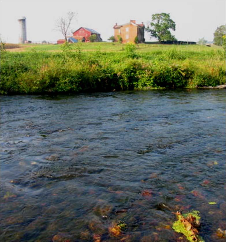
3 General Overview of South River Study Reach RRM 0-12 Higher floodplain and channel storage capacity Lower gradient Greater FGS volume Greater floodplain area Higher percentage of eroding channel banks Predominant landuse in 5-yr floodplain includes agriculture and pasture Closer proximity to source; highest THg and MeHg soil and sediment data sets Highest baseline loading rates for MeHg and THg; generally positive loads during year of sampling RRM Greater number of island side channels (roughly 4X upper segment) Two standout RRM features Deep pool near RRM 12.7 with substantial FGS floodplain area and river gradient change near confluence at RRM Predominant landuse in 5-yr floodplain includes undeveloped forest types Receives Hg loads from upper reach; biota tissue Hg levels generally equivalent to or higher than upper reach
4 Goals and Objectives of the Year 2 Study Plan Collect and integrate data from numerous SRST activities to: 1. Characterize potential sources (i.e. physical media) of Hg to the South River System 2. Determine loading rates and the relative importance of various major potential sources of Hg to the South River system 3. Describe and rank various river and floodplain habitats (substrate types) with favorable overall conditions for methylation
5 Year 2 Study Plans Evaluating potential sources of Hg to the South River Targeted sediment deposits Participate in VADEQ floodplain study Integrated MeHg study in various river environments Targeted tributary and floodplain loading study between RRM 0 to 10 Revised baseline monitoring
6 Year 2 Characterization of Depositional Features Scope of Work 17 targeted features with est. volumes >30-m 3 Core sample collected at deepest sediment point Survey of THg using Lumex mercury analyzer; 10% confirmation at laboratory Surficial samples collected for MeHg, AVS Integrated with other studies; subsample collections for laboratory testing; leaching, bioavailable fraction, methylation bioassays Deposit ID RRM Volume (m 3 ) Deposit Category H2B Riffle, LWD H4A Riffle, LWD H4B Riffle, LWD H4C Riffle, LWD H4D Riffle, LWD D1A Pool D1B Riffle, LWD D2A Riffle, LWD D6B Riffle, LWD C1D Riffle, LWD C2A Riffle, LWD C2B Riffle, LWD C5A Pool T63A Pool T63B Pool T63C Pool T68A Pool
7 Year 2 Characterization of Depositional Features Estimate of Mapped Sediment Volume (cubic meters) U.D. Characterization in 2006 Volume Estimate of Mapped Sediment Deposits Geomorphology Investigations South River, Virginia Targeted Year 2 Reach Cumulative Estimate of Mapped Sediment Volume RRM
 Island side channel or mill race pool open water wetland on 0.")
8 Year 2 MeHg Studies Integrated data collections to characterize five river environments: main channel pool (repeat stations from Year 1 baseline) main channel pool with embedded substrate main channel pool edge (two stations in depositional area that undergo changes in flow during year due to SAV) Island side channel or mill race pool open water wetland on 0.3-yr floodplain

9 Year 2 MeHg Studies Benthic flux chambers Measure MeHg flux through diurnal cycles in DO Mercury bioavailability and methylation potentials study (with Rutgers University) Soils and sediments from SRST studies Identify which source materials have the most bioavailable mercury Sequential extraction, methylation assays Identify which habitat types have highest ability to methylate mercury 203 Hg assays Additional characterization In situ data logging for near bottom water conditions in four environments Co-locations targeted to environments with available data Data logging for ~one month during three seasons (summer, fall, spring 2008)

10 Year 2 Targeted Loading Study Study Goals: 2 storm events Focus on THg loading from mainstem, tribs, and floodplain between RRM 0 to RRM 10 Evaluate mainstem and direct floodplain runoff post storm
11 Year 2 Targeted Loading Study Study Methods: Passive storm water samplers to evaluate: floodplain direct drainages evaluate contributions from tributaries above the floodplain and at the confluence Acoustic Doppler Profiler (ADP) to evaluate trib. discharges Direct samples from bridges on South River over hydrograph Direct grab samples post storm at safely accessible direct drainages on the floodplain Rising limb samples collected for unfiltered THg, TSS Post storm samples on floodplain collected for filtered and unfiltered THg and MeHg, TSS, TOC, DOC

12 Methods - ADP Technology Provides: Depth profile for channel cross section Velocity profiles at varying depths Real time discharge estimate Check on South River discharge estimates
13 Major Tributaries between RRM 0 and 10 Shaded tributaries to be evaluated in loading study Total Drainage Area Tributary Drainage Area in Flood Plain (KM 2 ) RRM Confluence Common Name (KM 2 ) 100-yr 5-yr 2-yr 0.3-yr 0.1 to 0.2 Rockfish Run to 1.6 Steele Run to to to to 4.8 Sawmill Run to to to to 7.3 Porterfield Run to to to to 8.7 Mine Branch


14 Potential Stations for Floodplain Direct Runoff ~RRM 3 to 5 ~RRM 7 to 9

15 Year 2 - Baseline Monitoring Program Program revisions along South River: Surface water stations moved to bridges on South River Sediment sampling revised to MeHg in various riverine/wetland environments on South River Additional SW and SED characterization for Middle River station No biota monitoring in Year 2
16 Collaborative Efforts to Evaluate THg Sources Various studies will allow us to: Characterize potential sources of THg Develop spatially integrated THg concentration data for various floodplain soils and sediment types Evaluate loading rates and relative contributions for various sources along the river Revise the soil and sediment budgets for the floodplain and river Phase II studies will focus on Hg releasing mechanisms and river particulate transfer processes at targeted study areas
17 Collaborative Efforts to Evaluate MeHg Various studies will allow us to: Evaluate loading rates Identify and rank environments with favorable overall conditions for methylation Spatially describe these environments along the river Phase II will focus on how MeHg is produced in targeted habitats Dominant microbial processes Sulfate reduction, iron reduction Seasonal controls on methylation Changes in bioavailability or patterns of carbon mineralization
18 Scheduled Activities Meet with NRDC on July 26 th Year 2 field data collections starting in August Development of Year 1 Data Report
Modeling Processes in the South River: Discussion. South River Science Team
 Modeling Processes in the South River: Discussion South River Science Team 09-09-03 Dual Approach May Be Appropriate Fluvial Geomorphology Study landforms and changes through erosion and sedimentation
Changing Hydrology under a Changing Climate for a Coastal Plain Watershed
 Changing Hydrology under a Changing Climate for a Coastal Plain Watershed David Bosch USDA-ARS, Tifton, GA Jeff Arnold ARS Temple, TX and Peter Allen Baylor University, TX SEWRU Objectives 1. Project changes
Analysis of real-time prairie drought monitoring and forecasting system. Lei Wen and Charles A. Lin
 Analysis of real-time prairie drought monitoring and forecasting system Lei Wen and Charles A. Lin Back ground information A real-time drought monitoring and seasonal prediction system has been developed
low turbidity high turbidity
 What is Turbidity? Turbidity refers to how clear the water is. The greater the amount of total suspended solids (TSS) in the water, the murkier it appears and the higher the measured turbidity. Excessive
Chiang Rai Province CC Threat overview AAS1109 Mekong ARCC
 Chiang Rai Province CC Threat overview AAS1109 Mekong ARCC This threat overview relies on projections of future climate change in the Mekong Basin for the period 2045-2069 compared to a baseline of 1980-2005.
Surface Water and Stream Development
 Surface Water and Stream Development Surface Water The moment a raindrop falls to earth it begins its return to the sea. Once water reaches Earth s surface it may evaporate back into the atmosphere, soak
Bathymetric Survey and Sediment Hydroacoustic Study of Canyon Lake. Michael Anderson UC Riverside
 Bathymetric Survey and Sediment Hydroacoustic Study of Canyon Lake Michael Anderson UC Riverside Introduction Canyon Lake was constructed in 1928 as the Railroad Canyon Reservoir as a result of the impoundment
How Do Human Impacts and Geomorphological Responses Vary with Spatial Scale in the Streams and Rivers of the Illinois Basin?
 How Do Human Impacts and Geomorphological Responses Vary with Spatial Scale in the Streams and Rivers of the Illinois Basin? Bruce Rhoads Department of Geography University of Illinois at Urbana-Champaign
Geomorphology Studies
 Geomorphology Studies Technical Workgroup Meeting February 14, 2012 Prepared by: Tetra Tech Prepared for: Alaska Energy Authority Overall Goal Geomorphology Studies Two studies Geomorphology Study (RSP
CR AAO Bridge. Dead River Flood & Natural Channel Design. Mitch Koetje Water Resources Division UP District
 CR AAO Bridge Dead River Flood & Natural Channel Design Mitch Koetje Water Resources Division UP District Old County Road AAO Bridge Map courtesy of Marquette County Silver Lake Basin McClure Basin
Nitrogen and phosphorus dynamics in restored riverine floodplains in intensively managed watersheds
 Nitrogen and phosphorus dynamics in restored riverine floodplains in intensively managed watersheds Sara McMillan 1, Alex Johnson 1, Celena Alford 1, Greg Noe 2, Venkatesh Merwade 1, Sayan Dey, 1 Siddharth
Island Design. UMRS EMP Regional Workshop. Presentation for the
 Island Design Presentation for the UMRS EMP Regional Workshop by Jon Hendrickson Hydraulic Engineer Regional Technical Specialist, Water Quality and Habitat Restoration August 17 19, 2005 Project Delivery
Missouri River Basin Water Management
 Missouri River Basin Water Management US Army Corps of Engineers Missouri River Navigator s Meeting February 12, 2014 Bill Doan, P.E. Missouri River Basin Water Management US Army Corps of Engineers BUILDING
Sediment Deposition LET THE RIVER RUN T E A C H E R. Activity Overview. Activity at a Glance. Time Required. Level of Complexity.
 Activity at a Glance Grade: 6 9 Subject: Science Category: Physical Science, Earth Science Topic: Deposition, River Systems Time Required Two 45-minute periods Level of Complexity Medium Materials* TI-73
Mercury and methylmercury transport in the Cache Creek Settling Basin, California, U.S.A.
 Mercury and methylmercury transport in the Cache Creek Settling Basin, California, U.S.A. Alpers, C.N. 1, Fleck, J.A. 1, Marvin- DiPasquale, M. 2, Beaulieu, E. 1, and Wright, S.A. 1 1 U.S. Geological Survey,
Monitoring and evaluation of benthic macroinvertebrates in the Big Hole River and tributaries
 Monitoring and evaluation of benthic macroinvertebrates in the Big Hole River and tributaries Michael A. Bias Big Hole River Foundation Introduction BMI used to evaluate stream biological health Quantifies
Appendix O. Sediment Transport Modelling Technical Memorandum
 Appendix O Sediment Transport Modelling Technical Memorandum w w w. b a i r d. c o m Baird o c e a n s engineering l a k e s design r i v e r s science w a t e r s h e d s construction Final Report Don
Quantifying and Valuing Floodplain Nutrient and Sediment Retention
 Quantifying and Valuing Floodplain Nutrient and Sediment Retention Krissy Hopkins, Dianna Hogan, Emily Pindilli, Greg Noe, Fabiano Franco, and Stephanie Gordon A Community on Ecosystem Services December
Sediment and nutrient transport and storage along the urban stream corridor
 Sediment and nutrient transport and storage along the urban stream corridor Greg Noe, Cliff Hupp, Ed Schenk, Jackie Batson, Nancy Rybicki, Allen Gellis What is the role of floodplains everywhere? Noe 2013,
Assessment. Assessment
 2001 SPRINGBROOK CREEK RESTORATION - THREE YEAR POST-CONSTRUCTION REVIEW - Presented by Bruce Henderson and Andy Harris 2005 River Restoration Northwest Symposium Skamania Lodge, Washington www.hendersonlandservices.com
Opportunities to Improve Ecological Functions of Floodplains and Reduce Flood Risk along Major Rivers in the Puget Sound Basin
 Opportunities to Improve Ecological Functions of Floodplains and Reduce Flood Risk along Major Rivers in the Puget Sound Basin Christopher Konrad, US Geological Survey Tim Beechie, NOAA Fisheries Managing
Use of benthic invertebrate biological indicators in evaluating sediment deposition impairment on the Middle Truckee River, California
 Use of benthic invertebrate biological indicators in evaluating sediment deposition impairment on the Middle Truckee River, California David B. Herbst Sierra Nevada Aquatic Research Laboratory University
Lower South Fork McKenzie River Floodplain Enhancement Project
 Lower South Fork McKenzie River Floodplain Enhancement Project McKenzie River Ranger District Willamette National Forest Project Location The project is located in the South Fork McKenzie River Watershed,
!"#$%&&'()*+#$%(,-./0*)%(!
*+#$%(,-./0*)%(!") 8:30 Sign in Hoosic River Revival Coalition!"#$%&&'()*+#$%(,-./0*)%(! 12-#30+4/#"5-(60 9:00 Welcome and Introductions 9:15 Goals for Today s Program: A Description of the Planning Process 9:30 First Session:
8:30 Sign in Hoosic River Revival Coalition!"#$%&&'()*+#$%(,-./0*)%(! 12-#30+4/#"5-(60 9:00 Welcome and Introductions 9:15 Goals for Today s Program: A Description of the Planning Process 9:30 First Session:
Stream Geomorphology. Leslie A. Morrissey UVM July 25, 2012
 Stream Geomorphology Leslie A. Morrissey UVM July 25, 2012 What Functions do Healthy Streams Provide? Flood mitigation Water supply Water quality Sediment storage and transport Habitat Recreation Transportation
Drought Characterization. Examination of Extreme Precipitation Events
 Drought Characterization Examination of Extreme Precipitation Events Extreme Precipitation Events During the Drought For the drought years (1999-2005) daily precipitation data was analyzed to find extreme
PRELIMINARY DRAFT FOR DISCUSSION PURPOSES
 Memorandum To: David Thompson From: John Haapala CC: Dan McDonald Bob Montgomery Date: February 24, 2003 File #: 1003551 Re: Lake Wenatchee Historic Water Levels, Operation Model, and Flood Operation This
Strategies for managing sediment in dams. Iwona Conlan Consultant to IKMP, MRCS
 Strategies for managing sediment in dams Iwona Conlan Consultant to IKMP, MRCS 1 Sediment trapping by dams Active storage capacity Dead storage coarse material (bed load) Fine materials (suspension) Francis
Illinois State Water Survey Division
 Illinois State Water Survey Division SURFACE WATER SECTION SWS Miscellaneous Publication 108 SEDIMENT YIELD AND ACCUMULATION IN THE LOWER CACHE RIVER by Misganaw Demissie Champaign, Illinois June 1989
ADDRESSING GEOMORPHIC AND HYDRAULIC CONTROLS IN OFF-CHANNEL HABITAT DESIGN
 ADDRESSING GEOMORPHIC AND HYDRAULIC CONTROLS IN OFF-CHANNEL HABITAT DESIGN Conor Shea - Hydrologist U.S. Fish and Wildlife Service Conservation Partnerships Program Arcata, CA Learning Objectives Examine
Nutrient and Sediment Cycling and Retention in Urban Floodplain Wetlands
 Nutrient and Sediment Cycling and Retention in Urban Floodplain Wetlands Greg Noe, Cliff Hupp, Nancy Rybicki, Ed Schenk, and Jackie Batson National Research Program, Reston VA U.S. Department of the Interior
Surface Water Short Study Guide
 Name: Class: Date: Surface Water Short Study Guide Multiple Choice Identify the letter of the choice that best completes the statement or answers the question. 1. The three ways in which a stream carries
Kootenai River Habitat Restoration Program Update
 Kootenai River Habitat Restoration Program Update Kootenai Tribe of Idaho Kootenai Valley Resource Initiative November 19, 2012 Bonners Ferry, Idaho Changes to Kootenai Basin Beaver trapping Floodplain
SEDIMENT TRANSPORT IN RIVER MOUTH ESTUARY
 SEDIMENT TRANSPORT IN RIVER MOUTH ESTUARY Katsuhide YOKOYAMA, Dr.Eng. dredge Assistant Professor Department of Civil Engineering Tokyo Metropolitan University 1-1 Minami-Osawa Osawa, Hachioji,, Tokyo,
3/3/2013. The hydro cycle water returns from the sea. All "toilet to tap." Introduction to Environmental Geology, 5e
 Introduction to Environmental Geology, 5e Running Water: summary in haiku form Edward A. Keller Chapter 9 Rivers and Flooding Lecture Presentation prepared by X. Mara Chen, Salisbury University The hydro
Aquifer an underground zone or layer of sand, gravel, or porous rock that is saturated with water.
 Aggradation raising of the streambed by deposition that occurs when the energy of the water flowing through a stream reach is insufficient to transport sediment conveyed from upstream. Alluvium a general
Final Exam. Running Water Erosion and Deposition. Willamette Discharge. Running Water
 Final Exam Running Water Erosion and Deposition Earth Science Chapter 5 Pages 120-135 Scheduled for 8 AM, March 21, 2006 Bring A scantron form A calculator Your 3 x 5 paper card of formulas Review questions
Sampling Sediment and Porewaterin the Lower Willamette River St. Helens, Oregon. Henning Larsen, R.G. Oregon Dept of Environmental Quality
 Sampling Sediment and Porewaterin the Lower Willamette River St. Helens, Oregon Henning Larsen, R.G. Oregon Dept of Environmental Quality Columbia River Scappoose Bay Former Pope and Talbot Wood Treatment
Step 5: Channel Bed and Planform Changes
 Step 5: Channel Bed and Planform Changes When disturbed, streams go through a series of adjustments to regain equilibrium with the flow and sediment supply of their watersheds. These adjustments often
ANALYSIS OF THE TEMPORAL DYNAMICS OF SUSPENDED SEDIMENT FLUXES
 ANALYSIS OF THE TEMPORAL DYNAMICS OF SUSPENDED SEDIMENT FLUXES USING DISCRETE SAMPLING AND CONTINUOUS TURBIDITY MEASUREMENTS IN THE MEUSE AND SCHELDT WATERSHEDS (WALLONIA, BELGIUM) JEAN VAN CAMPENHOUT
Diagnostic Geomorphic Methods for Understanding Future Behavior of Lake Superior Streams What Have We Learned in Two Decades?
 Diagnostic Geomorphic Methods for Understanding Future Behavior of Lake Superior Streams What Have We Learned in Two Decades? Faith Fitzpatrick USGS WI Water Science Center, Middleton, WI fafitzpa@usgs.gov
January 22, Coronado National Forest 300 West Congress Street Tucson, AZ Jim Upchurch, Forest Supervisor. Dear Mr.
 January 22, 2015 Coronado National Forest 300 West Congress Street Tucson, AZ 85701 Attn: Jim Upchurch, Forest Supervisor Dear Mr. Upchurch: In your letter dated January 16, 2015, you requested that Hudbay
Stream Restoration and Environmental River Mechanics. Objectives. Pierre Y. Julien. 1. Peligre Dam in Haiti (deforestation)
") Stream Restoration and Environmental River Mechanics Pierre Y. Julien Malaysia 2004 Objectives Brief overview of environmental river mechanics and stream restoration: 1. Typical problems in environmental
Stream Restoration and Environmental River Mechanics Pierre Y. Julien Malaysia 2004 Objectives Brief overview of environmental river mechanics and stream restoration: 1. Typical problems in environmental
Technical Memorandum No
 Pajaro River Watershed Study in association with Technical Memorandum No. 1.2.10 Task: Evaluation of Four Watershed Conditions - Sediment To: PRWFPA Staff Working Group Prepared by: Gregory Morris and
FINAL STREAM. Prepared For: Discharge. Draft Stream. Level Hay Street, Subiaco WA Indiana Street. Golden, CO USA
 Draft Stream Discharge and Water Supply Estimates S F FINAL STREAM DISCHARGE AND WATER SUPPLYS ESTIMATES CITRONEN FJORD F DEVELOPMENT PROJECT Prepared For: Ironbark Zinc Limited Level 1 350 Hay Street,
Local Flood Hazards. Click here for Real-time River Information
 Local Flood Hazards Floods of the White River and Killbuck Creek are caused by runoff from general, and/or intense rainfall. Other areas of flooding concern are from the Boland Ditch and Pittsford Ditch.
Channel Assessments of Selected Watersheds within TFL 52
 Channel Assessments of Selected Watersheds within TFL 52 prepared for: West Fraser Mills Ltd. Quesnel, BC prepared by: John Berry, M.Sc., R.P.F. Victoria, BC Channel Assessments TFL 52 Summary SUMMARY
Dan Miller + Kelly Burnett, Kelly Christiansen, Sharon Clarke, Lee Benda. GOAL Predict Channel Characteristics in Space and Time
 Broad-Scale Models Dan Miller + Kelly Burnett, Kelly Christiansen, Sharon Clarke, Lee Benda GOAL Predict Channel Characteristics in Space and Time Assess Potential for Fish Use and Productivity Assess
Geomorphic Assessment of the Middle and Lower Swan Lake Watershed, Calhoun Division of Two Rivers National Wildlife Refuge.
 Geomorphic Assessment of the Middle and Lower Swan Lake Watershed, Calhoun Division of Two Rivers National Wildlife Refuge Report Figures 33 34 Figure 1. Location of Middle and Lower Swan Lake watersheds
Which map shows the stream drainage pattern that most likely formed on the surface of this volcano? A) B)
 B)") 1. When snow cover on the land melts, the water will most likely become surface runoff if the land surface is A) frozen B) porous C) grass covered D) unconsolidated gravel Base your answers to questions
1. When snow cover on the land melts, the water will most likely become surface runoff if the land surface is A) frozen B) porous C) grass covered D) unconsolidated gravel Base your answers to questions
Stop 1: Marmot Dam Stop 1: Marmot Dam
 Stop 1: Marmot Dam Stop 1: Marmot Dam Following the removal of Marmot Dam in 2007, the fate of the reservoir sediments has been monitored through a series of surveys and sediment transport measurements.
PH YSIC A L PROPERT IE S TERC.UCDAVIS.EDU
 PH YSIC A L PROPERT IE S 8 Lake surface level Daily since 1900 Lake surface level varies throughout the year. Lake level rises due to high stream inflow, groundwater inflow and precipitation directly onto
River Restoration and Rehabilitation. Pierre Y. Julien
 River Restoration and Rehabilitation Pierre Y. Julien Department of Civil and Environmental Engineering Colorado State University Fort Collins, Colorado River Mechanics and Sediment Transport Lima Peru
ODFW AQUATIC INVENTORY PROJECT RESTORATION MONITORING STREAM HABITAT REPORT. Peggy Kavanagh, Trevan Cornwell TOLEDO SOUTH Coast Range Lora Tennant
 ODFW AQUATIC INVENTORY PROJECT RESTORATION MONITORING STREAM HABITAT REPORT STREAM: GCG: 2-MC SITE ID: 489 BASIN: YAQUINA TREATMENT DATE: 24 SURVEY DATE: 2/27/24 SURVEY CREW: USGS MAPS: ECOREGION: REPORT
Biological Response to the Gold King Mine Release in the Animas and San Juan Rivers
 Biological Response to the Gold King Mine Release in the and San Juan Rivers Lareina Guenzel 1, Richard Mitchell, PhD 1, Kate Sullivan, PhD 2, and Michael Cyterski, PhD 2 1 U.S. Environmental Protection
Conceptual Model of Stream Flow Processes for the Russian River Watershed. Chris Farrar
 Conceptual Model of Stream Flow Processes for the Russian River Watershed Chris Farrar Several features of creeks affect the interactions between surface and groundwater. This conceptual model uses the
DETAILED DESCRIPTION OF STREAM CONDITIONS AND HABITAT TYPES IN REACH 4, REACH 5 AND REACH 6.
 DETAILED DESCRIPTION OF STREAM CONDITIONS AND HABITAT TYPES IN REACH 4, REACH 5 AND REACH 6. The Eklutna River was divided into study reaches (figure 1) prior to this site visit. Prominent geologic or
WATER ON AND UNDER GROUND. Objectives. The Hydrologic Cycle
 WATER ON AND UNDER GROUND Objectives Define and describe the hydrologic cycle. Identify the basic characteristics of streams. Define drainage basin. Describe how floods occur and what factors may make
Ecosystem response during the removal of the Elwha River Dams
 Ecosystem response during the removal of the Elwha River Dams Presentation Prepared by George Pess - NOAA Photo by John McMillan December 2015 Elwha The Elwha River Basin Olympic Natl. Park > 90% of habitat
PHYSICAL PROPERTIES TAHOE.UCDAVIS.EDU 8
 PHYSICAL PROPERTIES 8 Lake surface level Daily since 1900 Lake surface level varies throughout the year. Lake level rises due to high stream inflow, groundwater inflow, and precipitation directly onto
Little Blackfoot TPA 2009 Sediment and Habitat Assessment QAQC Review March 9, 2010
 Little Blackfoot TPA 2009 Sediment and Habitat Assessment QAQC Review March 9, 2010 1.0 PROJECT OVERVIEW Sediment and habitat monitoring in the Little Blackfoot TPA was conducted in July of 2009 as outlined
Squaw Creek. General Information
 General Information is a tributary to the Salmon River. It enters the north side of the river about 0 miles downstream of North Fork, Idaho. The study reach is about a 30 ft length of stream about 2 miles
ODFW AQUATIC INVENTORY PROJECT STREAM REPORT
 ODFW AQUATIC INVENTORY PROJECT STREAM REPORT STREAM: BASIN: South Fork Mill Creek Mill Creek / Columbia River DATES: September 7 9, 5 SURVEY CREW: REPORT PREPARED BY: Brian Bangs / LaNoah Babcock Staci
BZ471, Steam Biology & Ecology Exam
 BZ471, Eam1, p.1 BZ471, Steam Biology & Ecology Eam Name Multiple choice When benthic organisms enter the water column with a regular diel periodicity: a) catastrophic drift b) behavioral drift c) constant
The impact of hill land clearance and urbanization on runoff and sediment yield of small catchments in Pulau Pinang, Malaysia
 Human Impact on Erosion and Sedimentation (Proceedings of Rabat Symposium S6, April 1997). IAHS Publ. no. 245, 1997 91 The impact of hill land clearance and urbanization on runoff and sediment yield of
The River Continuum Concept (or not?) Stream Classification
 Stream Classification") The River Continuum Concept (or not?) Stream Classification Goal: Generalization 2 general types of classification streams (longitudinal) streams (e.g., hydrologic regime classification) Longitudinal Classification
The River Continuum Concept (or not?) Stream Classification Goal: Generalization 2 general types of classification streams (longitudinal) streams (e.g., hydrologic regime classification) Longitudinal Classification
Illinois Drought Update, December 1, 2005 DROUGHT RESPONSE TASK FORCE Illinois State Water Survey, Department of Natural Resources
 Illinois Drought Update, December 1, 2005 DROUGHT RESPONSE TASK FORCE Illinois State Water Survey, Department of Natural Resources For more drought information please go to http://www.sws.uiuc.edu/. SUMMARY.
Why Geomorphology for Fish Passage
 Channel Morphology - Stream Crossing Interactions An Overview Michael Love Michael Love & Associates mlove@h2odesigns.com (707) 476-8938 Why Geomorphology for Fish Passage 1. Understand the Scale of the
BZ471, Steam Biology & Ecology Exam 1
 BZ471, Exam1, p.1 BZ471, Steam Biology & Ecology Exam 1 Name Matching. Select the single best (most precise) answer for each of the following. Use each answer no more than once. No partial credit is given.
SCOPE OF PRESENTATION STREAM DYNAMICS, CHANNEL RESTORATION PLANS, & SEDIMENT TRANSPORT ANALYSES IN RELATION TO RESTORATION PLANS
 DESIGN METHODS B: SEDIMENT TRANSPORT PROCESSES FOR STREAM RESTORATION DESIGN PETER KLINGEMAN OREGON STATE UNIVERSITY CIVIL ENGINEERING DEPT., CORVALLIS 2 ND ANNUAL NORTHWEST STREAM RESTORATION DESIGN SYMPOSIUM
BUREAU OF CLEAN WATER. Appendix C Biological Field Methods C1. Habitat Assessment DECEMBER 2013
 BUREAU OF CLEAN WATER Appendix C Biological Field Methods C1. Assessment DECEMBER 2013 HABITAT ASSESSMENT The Department has adopted the habitat assessment methods outlined in EPA s Rapid Bioassessment
OBJECTIVES. Fluvial Geomorphology? STREAM CLASSIFICATION & RIVER ASSESSMENT
 STREAM CLASSIFICATION & RIVER ASSESSMENT Greg Babbit Graduate Research Assistant Dept. Forestry, Wildlife & Fisheries Seneca Creek, Monongahela National Forest, West Virginia OBJECTIVES Introduce basic
Exploring the role of channel processes and legacy sediment in nutrient and sediment delivery, Upper Pecatonica River, Wisconsin
 Exploring the role of channel processes and legacy sediment in nutrient and sediment delivery, Upper Pecatonica River, Wisconsin Faith Fitzpatrick and Rebecca Carvin (USGS WI Water Science Center), Robert
The River Restoration Centre therrc.co.uk. Understanding Fluvial Processes: supporting River Restoration. Dr Jenny Mant
 The River Restoration Centre therrc.co.uk Understanding Fluvial Processes: supporting River Restoration Dr Jenny Mant Jenny@therrc.co.uk Understanding your catchment Hydrology Energy associated with the
White River Update. Jeanne Stypula, Supervising Engineer. Advisory Committee Meeting April 26, 2016
 White River Update Jeanne Stypula, Supervising Engineer Advisory Committee Meeting April 26, 2016 Department of Natural Resources and Parks Water and Land Resources Division River and Floodplain Management
What is a watershed or landscape perspective?
 What is a watershed or landscape perspective? -remove sediment -add sediment -add wood, riparian manipulation -alter (engineer) channel/floodplain morphology -restore/abandon roads You are here What is
Potential Restorable Wetlands (PRWs):
:") ASWM Webinar Sept. 17, 2014 Potential Restorable Wetlands (PRWs): Working definition: wetland hydrology and soils minus presently mapped wetlands for the re-establishment of wetlands Hydric Soil Query
ASWM Webinar Sept. 17, 2014 Potential Restorable Wetlands (PRWs): Working definition: wetland hydrology and soils minus presently mapped wetlands for the re-establishment of wetlands Hydric Soil Query
Deposition and Resuspension of Sediments in Near Bank Water Zones of the River Elbe
 9th International Congress on Environmental Modelling and Software Brigham Young University BYU ScholarsArchive 4th International Congress on Environmental Modelling and Software - Barcelona, Catalonia,
Habitat Monitoring Update Hudson River CAG November 16, 2017
 Habitat Monitoring Update Hudson River CAG November 16, 2017 Habitat Reconstruction Overview: Habitats A habitat replacement program is being implemented in an Adaptive Management context to reconstruct
Remaining Capacity in Great Lakes Reservoirs
 US Army Corps of Engineers Detroit District Remaining Capacity in Great Lakes Reservoirs Storage Capacity Behind Great Lakes Dams Field Data and Modeling Motivation for project Project overview Data and
Global Carbon Cycle - I
 Global Carbon Cycle - I Reservoirs and Fluxes OCN 401 - Biogeochemical Systems 13 November 2012 Reading: Schlesinger, Chapter 11 Outline 1. Overview of global C cycle 2. Global C reservoirs 3. The contemporary
APPENDIX E. GEOMORPHOLOGICAL MONTORING REPORT Prepared by Steve Vrooman, Keystone Restoration Ecology September 2013
 APPENDIX E GEOMORPHOLOGICAL MONTORING REPORT Prepared by Steve Vrooman, Keystone Restoration Ecology September 2 Introduction Keystone Restoration Ecology (KRE) conducted geomorphological monitoring in
Continuing Education Associated with Maintaining CPESC and CESSWI Certification
 Continuing Education Associated with Maintaining CPESC and CESSWI Certification Module 2: Stormwater Management Principles for Earth Disturbing Activities Sponsors: ODOTs Local Technical Assistance Program
Steven Noble MDEQ - WRD Enbridge Response Unit
 EPA situation report, October 19, 2012 Steven Noble MDEQ - WRD Enbridge Response Unit Brief history of the spill Monitoring Monitoring the impacts Follow the oil The Current Situation A Look at the Future
Modeling of peak inflow dates for a snowmelt dominated basin Evan Heisman. CVEN 6833: Advanced Data Analysis Fall 2012 Prof. Balaji Rajagopalan
 Modeling of peak inflow dates for a snowmelt dominated basin Evan Heisman CVEN 6833: Advanced Data Analysis Fall 2012 Prof. Balaji Rajagopalan The Dworshak reservoir, a project operated by the Army Corps
Oceanographic Conditions in the Gulf of St. Lawrence during 1999
 Fisheries and Oceans Science Pêches et Océans Sciences DFO Science Laurentian Region Stock Status Report G4-01 (2000) Researh vessel CCGS Martha L. Black Oceanographic Conditions in the Gulf of St. Lawrence
L OWER N OOKSACK R IVER P ROJECT: A LTERNATIVES A NALYSIS A PPENDIX A: H YDRAULIC M ODELING. PREPARED BY: LandC, etc, LLC
 L OWER N OOKSACK R IVER P ROJECT: A LTERNATIVES A NALYSIS A PPENDIX A: H YDRAULIC M ODELING PREPARED BY: LandC, etc, LLC TABLE OF CONTENTS 1 Introduction... 1 2 Methods... 1 2.1 Hydraulic Model... 1 2.2
Current Climate Trends and Implications
 Current Climate Trends and Implications Dr. Mark Seeley Professor emeritus Department of Soil, Water, and Climate University of Minnesota St Paul, MN 55108 Crop Insurance Conference September 12, 2018
Model Implementation Details for the Final Project in EEOS 465/
 Model Implementation Details for the Final Project in EEOS 465/627 2009 Last week, we introduced a conceptual model of estimating DOC loadings from landscape to coastal waters as a model template for the
Columbia Estuary Province
 Rolling Provincial Review: Implementation 2001-2004 Province 73 Columbia Basin Fish & Wildlife Authority Province FY 2001-2004 Spending Summaries NPCC Recommendations and BPA Spending by Project Category,
Water Supply Conditions and Outlook October 1, 2018
 Water Supply Conditions and Outlook October 1, 2018 Flow Forecasting & Operations Planning Water Security Agency Overview Water supply conditions across Saskatchewan remain near normal, with most reservoirs
Lower Tuolumne River Accretion (La Grange to Modesto) Estimated daily flows ( ) for the Operations Model Don Pedro Project Relicensing
 Estimated daily flows ( ) for the Operations Model Don Pedro Project Relicensing") Lower Tuolumne River Accretion (La Grange to Modesto) Estimated daily flows (1970-2010) for the Operations Model Don Pedro Project Relicensing 1.0 Objective Using available data, develop a daily time series
Lower Tuolumne River Accretion (La Grange to Modesto) Estimated daily flows (1970-2010) for the Operations Model Don Pedro Project Relicensing 1.0 Objective Using available data, develop a daily time series
Savannah District s Revised SOP: Moving Towards A Functional Approach. US Army Corps of Engineers BUILDING STRONG
 Savannah District s Revised SOP: Moving Towards A Functional Approach US Army Corps of Engineers Agenda SOP Revision Concept New Aquatic Resource Credit Types New Urban Mitigation Service Area Filter Background
Fresh Water: Streams, Lakes Groundwater & Wetlands
 Fresh Water:, Lakes Groundwater & Wetlands Oct 27 Glaciers and Ice Ages Chp 13 Nov 3 Deserts and Wind and EXAM #3 Slope hydrologic cycle P = precip I = precip intercepted by veg ET = evapotranspiration
(3) Sediment Movement Classes of sediment transported
 Sediment Movement Classes of sediment transported") 9/17/15 (3) Sediment Movement Classes of sediment transported Dissolved load Suspended load Important for scouring algae Bedload (5-10% total load) Moves along bed during floods Source of crushing for
9/17/15 (3) Sediment Movement Classes of sediment transported Dissolved load Suspended load Important for scouring algae Bedload (5-10% total load) Moves along bed during floods Source of crushing for
Climate Change and Climate Trends in Our Own Backyard
 Climate Change and Climate Trends in Our Own Backyard Dr. Mark Seeley Department of Soil, Water, and Climate University of Minnesota St Paul, MN 55108 For IATP: Rural Climate Dialogue Grand Rapids, MN
Understanding the effects of roads in upland settings on hydrology, geomorphology and water quality
 Understanding the effects of roads in upland settings on hydrology, geomorphology and water quality Beverley Wemple Department of Geography and Rubenstein School of Environment & Natural Resources The
Global Carbon Cycle - I
 Global Carbon Cycle - I OCN 401 - Biogeochemical Systems Reading: Schlesinger, Chapter 11 1. Overview of global C cycle 2. Global C reservoirs Outline 3. The contemporary global C cycle 4. Fluxes and residence
3.0 TECHNICAL FEASIBILITY
 3.0 TECHNICAL FEASIBILITY 3.1 INTRODUCTION To enable seasonal storage and release of water from Lake Wenatchee, an impoundment structure would need to be constructed on the lake outlet channel. The structure
ODFW AQUATIC INVENTORY PROJECT OREGON PLAN FOR SALMON & WATERSHEDS STREAM RESTORATION HABITAT REPORT
 ODFW AQUATIC INVENTORY PROJECT OREGON PLAN FOR SALMON & WATERSHEDS STREAM RESTORATION HABITAT REPORT STREAM: BASIN: SURVEY TYPE: Munson Creek (NC-342) Tillamook River Post-Tx DATE: February 2, 28 SURVEY