Monitoring and evaluation of benthic macroinvertebrates in the Big Hole River and tributaries
|
|
|
- Allen Barnett
- 6 years ago
- Views:
Transcription


1
2 Monitoring and evaluation of benthic macroinvertebrates in the Big Hole River and tributaries Michael A. Bias Big Hole River Foundation
3 Introduction BMI used to evaluate stream biological health Quantifies attributes of community composition, structural and functional organization into a single number estimate of biological integrity Evaluating the biological integrity of BMI assemblages provides an assessment of environmental quality that can be used to identify limiting factors, for detecting impacts from physical alterations, sediment deposition, nutrients and toxicants, and document successful mitigation of environmental degradation
4 Grayling Grayling of all ages feed opportunistically on drifting invertebrates The feeding behavior of grayling is linked to their pattern of habitat selection Snorkel surveys and tracking tagged fish showed that in the upper Big Hole River basin grayling were unevenly distributed in tributaries, with the majority of bigger grayling being found in lower reaches during the summer (Vatland 2008) Most tagged grayling were documented leaving tributaries for the mainstem river, sometime between late September and early December
5 CCAA Monitoring Efforts Biological fish counts (species, occurrence, and numbers) Habitat (i.e., physical) snowpack, streamflow, thermal conditions, and stream channel morphology Project performance Landowner compliance Bugs?
6 Objectives 2002, Evaluate baseline river health and habitat 2007, Evaluate any change in river health , BMI assemblages are correlated with observed seasonal grayling distributions, and Implemented conservation measures improve stream biological health
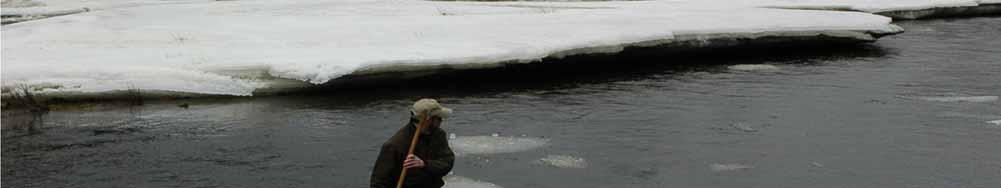
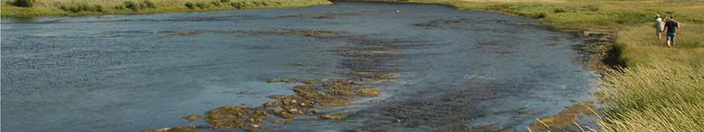
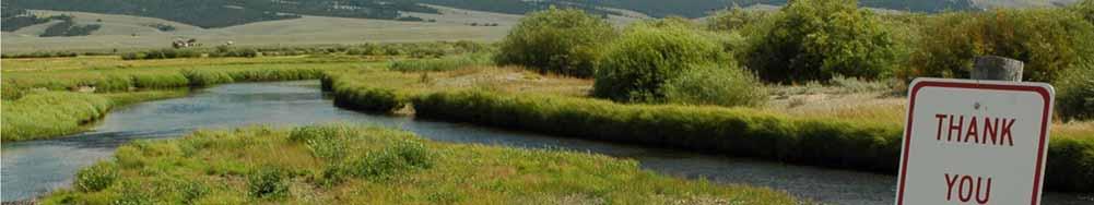
7 Sample Locations Governor Miner Crk Rd Miner Crk Rd Miner Little Lake Crk Rd Little Lake Crk Rd Steel Hwy 43 Wisdom Br Rock Crk NFkBHR Mudd Crk Br Fishtrap Hwy 43 Lamarche Hwy 43 Deep Hwy 43 East Bank FAS FAS Jerry Crk Br Maiden Rock FAS Kalsta Br ` ` Notch Bottom FAS High Rd FAS BMI Sample Locations 2002, 2007


8 Sample Locations Governor Miner Crk Rd Miner Crk Rd Miner Little Lake Crk Rd Little Lake Crk Rd Steel Hwy 43 Wisdom Br Rock Crk NFkBHR Mudd Crk Br Fishtrap Hwy 43 Lamarche Hwy 43 Deep Hwy 43 East Bank FAS FAS Jerry Crk Br Maiden Rock FAS Kalsta Br Notch Bottom FAS High Rd FAS BMI Sample Locations 2008, 2009, 2010
 2")


")
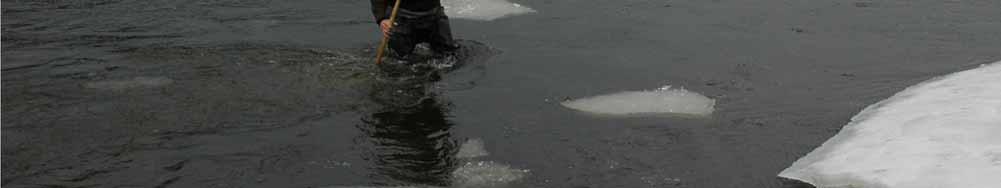
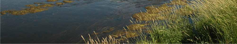
9 Follow MT DEQ RBP (Rapid Bioassessment Protocols) 2 traveling kick samples obtained from target riffle habitats at each site Sampling will be conducted 3 times per year (April, July, and October) at each location

10

11


12

 Further ID d to Genus or species")
13 Lab Methods RBP III sorting methods employed > 300 organisms per sample 2 stage Identification Samples separated to Order (i.e., Picked ) Further ID d to Genus or species (i.e., taxon)
14 Metrics Taxa richness total number of macroinvertebrate types present in a sample an expression of biodiversity and one of the best estimators of environment health EPT (Ephemoptera Plecoptera Tricoptera) Richness typically the dominant macroinvertebrates in healthy trout streams EPT richness and relative abundance metrics characterize this important component of the benthic fauna Biotic Index developed as a measure of organic pollution this index is an excellent gauge of stresses associated with drought % Dominant Taxa % Collectors % Scrapers and Shredders % Hydropsychinae functional feeding group metrics reflect energy pathways in a stream and, thus, are particular responsive to increased nutrient laden sediment deposition and changes in trophic condition Healthy streams typically have fairly even distributions of feeding groups % EPT
15 Intermountain Valley and Foothill Metric Taxa Richness > < 14 EPT Richness > < 11 Biotic Index < > 6 % Dominant < > 50 % Collectors < > 90 % Scrapers & Shredders > < 10 % Hydropsychinae < > 95 % EPT > < 30 Unimpaired Severely Impaired For each site: score, total, divide by 3, results range 0 1 > 0.75 unimpaired, moderate impaired, < 0.25 severely impaired
16 Where are we at? No Sites No Samples Picked ID d
17 100 % EPT by Site % EPT Site
18 100 % EPT by Site % EPT Site
19 Site No Taxa R EPT R % Dom % EPT % Hydrop Taxa R EPT R % Dom % EPT % Hydrop GC BHR MCR MC BHR LLC SC BHR W RC NFk BHR Mud FT LM DC EB DB JC MR Kal No Hi
20 Site No Taxa R EPT R % Dom % EPT % Hydrop Taxa R EPT R % Dom % EPT % Hydrop GC BHR MCR MC BHR LLC SC BHR W RC NFk BHR Mud FT LM DC EB DB JC MR Kal No Hi
21 1.2 H2O Quality Score by Site H2O Quality Score Site
 compared to 02 H2O Quality Scores Revealing different results than EPT FT, DC, LM largely unimpaired; SC moderately impaired Most")

22 Conclusions Results Preliminary 08: 75% complete 09, 10 yet to ID % EPT Tributaries, except RC, unimpaired Most mainstem sites improved (unimpaired) compared to 02 H2O Quality Scores Revealing different results than EPT FT, DC, LM largely unimpaired; SC moderately impaired Most mainstem scores declined from 02 to 08 Drought conditions through the decade? Results preliminary BMI monitoring and evaluation can contribute substantially to the monitoring objectives of the CCAA to help recover fluvial Arctic grayling Excellent tool for monitoring health of the river throughout the system
23
24
Use of benthic invertebrate biological indicators in evaluating sediment deposition impairment on the Middle Truckee River, California
 Use of benthic invertebrate biological indicators in evaluating sediment deposition impairment on the Middle Truckee River, California David B. Herbst Sierra Nevada Aquatic Research Laboratory University
Stream Ecological Assessment in Virginia Using INSTAR. Greg Garman Leonard Smock Stephen McIninch William Shuart Virginia Commonwealth University
 Stream Ecological Assessment in Virginia Using INSTAR Greg Garman Leonard Smock Stephen McIninch William Shuart Virginia Commonwealth University Interactive Stream Assessment Resource (INSTAR( INSTAR)
The River Continuum Concept (or not?) Stream Classification
 Stream Classification") The River Continuum Concept (or not?) Stream Classification Goal: Generalization 2 general types of classification streams (longitudinal) streams (e.g., hydrologic regime classification) Longitudinal Classification
The River Continuum Concept (or not?) Stream Classification Goal: Generalization 2 general types of classification streams (longitudinal) streams (e.g., hydrologic regime classification) Longitudinal Classification
Fish Passage and Abundance around Grade Control Structures on Incised Streams in Western Iowa
 Fish Passage and Abundance around Grade Control Structures on Incised Streams in Western Iowa John Thomas Hungry Canyons Alliance Mary Culler Iowa State University / Missouri DNR Dimitri Dermisis IIHR
Juanita Bacey Environmental Scientist. Terrell Barry Research Scientist III. April 2008
 A Comparison Study of the Proper use of Hester-Dendy Samplers to Achieve Maximum Diversity and Population Size of Benthic Macroinvertebrates Sacramento Valley, California Juanita Bacey Environmental Scientist
Phase I System Characterization: Year 2 Study Plans
 Phase I System Characterization: Year 2 Study Plans Year I Physical and Biological Data Sets Quarterly Storm Sampling Four storm events with 8 sample stations at bridges Monthly Baseline Characterization
Limitation to qualitative stability indicators. the real world is a continuum, not a dichotomy ~ 100 % 30 % ~ 100 % ~ 40 %
 Stream Stability Assessment & BEHI Surveys Joe Rathbun MDEQ Water Resources Division rathbunj@michigan.gov 517--373 517 373--8868 Stability Stream can transport its water and sediment inputs without changing
Learning Objectives: I can identify and interpret river flows and directions.
 Learning Objectives: I can identify and interpret river flows and directions. Bellringer Review: Check for Understanding Questions: 1 2 What Are The Key Parts Of A River s Anatomy? In your data notebooks
Biological Response to the Gold King Mine Release in the Animas and San Juan Rivers
 Biological Response to the Gold King Mine Release in the and San Juan Rivers Lareina Guenzel 1, Richard Mitchell, PhD 1, Kate Sullivan, PhD 2, and Michael Cyterski, PhD 2 1 U.S. Environmental Protection
Session C1 - Applying the Stream Functions Pyramid to Geomorphic Assessments and Restoration Design
 University of Massachusetts - Amherst ScholarWorks@UMass Amherst International Conference on Engineering and Ecohydrology for Fish Passage International Conference on Engineering and Ecohydrology for Fish
BZ471, Steam Biology & Ecology Exam
 BZ471, Eam1, p.1 BZ471, Steam Biology & Ecology Eam Name Multiple choice When benthic organisms enter the water column with a regular diel periodicity: a) catastrophic drift b) behavioral drift c) constant
Stream Study LIFE SCIENCE STANDARDS. LEVELS K-4 LEVELS 5-8 LEVELS 9-12 Characteristics of organisms
 Stream Study LIFE SCIENCE STANDARDS Objectives: LEVELS K-4 LEVELS 5-8 LEVELS 9-12 Characteristics of organisms Structure and function in living systems Interdependence of organisms Life cycles of Populations
Assignment 1. Measuring River Characteristics- Vernon Creek. Applied Fluvial Geomorphology Field Techniques EESc 435
 Assignment 1 Measuring River Characteristics- Vernon Creek Applied Fluvial Geomorphology Field Techniques EESc 435 Amanda Jardine 30100093 Jaime McDonald 14177083 Erica Massey 50870088 April 28, 2012 Introduction
Little Blackfoot TPA 2009 Sediment and Habitat Assessment QAQC Review March 9, 2010
 Little Blackfoot TPA 2009 Sediment and Habitat Assessment QAQC Review March 9, 2010 1.0 PROJECT OVERVIEW Sediment and habitat monitoring in the Little Blackfoot TPA was conducted in July of 2009 as outlined
Site Assessment Report
 A. Site Description CABIN Study Name BC-Elk River Tributaries-Elk River Alliance CABIN Site Code Alx-01 Sampling Date Oct 13 2012 Know Your Watershed (KYW) Basin Central Kootenay Province / Territory British
Lower South Fork McKenzie River Floodplain Enhancement Project
 Lower South Fork McKenzie River Floodplain Enhancement Project McKenzie River Ranger District Willamette National Forest Project Location The project is located in the South Fork McKenzie River Watershed,
Assessment. Assessment
 2001 SPRINGBROOK CREEK RESTORATION - THREE YEAR POST-CONSTRUCTION REVIEW - Presented by Bruce Henderson and Andy Harris 2005 River Restoration Northwest Symposium Skamania Lodge, Washington www.hendersonlandservices.com
Riparian Assessment. Steps in the right direction... Drainage Basin/Watershed: Start by Thinking Big. Riparian Assessment vs.
 Riparian Assessment vs. Monitoring Riparian Assessment What is a healthy stream? Determine stream/riparian health Determine change or trend, especially in response to mgmt Classification = designation
MONITORING OF THE LITTLE SNAKE RIVER AND TRIBUTARIES YEAR 5 FINAL REPORT
 MONITORING OF THE LITTLE SNAKE RIVER AND TRIBUTARIES YEAR 5 FINAL REPORT Daryl B. Simons Building at the Engineering Research Center Department of Civil Engineering Colorado State University Fort Collins,
POPULATION DEMOGRAPHICS IN DOG RIVER WATERSHED OVER TIME
 POPULATION DEMOGRAPHICS IN DOG RIVER WATERSHED OVER TIME Kal-El Q. Waters-Jones, Department of Earth Sciences, University of South Alabama, Mobile, AL 36688. E-mail: kwatersjones@yahoo.com. Over time,
low turbidity high turbidity
 What is Turbidity? Turbidity refers to how clear the water is. The greater the amount of total suspended solids (TSS) in the water, the murkier it appears and the higher the measured turbidity. Excessive
Step 6: Rapid Habitat Assessment (RHA)
") Step 6: Rapid Habitat Assessment (RHA) Background Physical processes, combined with chemical constituents and biological interactions, are what determine biological productivity and diversity; and, in
Step 6: Rapid Habitat Assessment (RHA) Background Physical processes, combined with chemical constituents and biological interactions, are what determine biological productivity and diversity; and, in
Stream Geomorphology. Leslie A. Morrissey UVM July 25, 2012
 Stream Geomorphology Leslie A. Morrissey UVM July 25, 2012 What Functions do Healthy Streams Provide? Flood mitigation Water supply Water quality Sediment storage and transport Habitat Recreation Transportation
Fact sheet: Glacial rivers (all Europe)
") Fact sheet: Glacial rivers (all Europe) General description Valleyplanform Hydrology and The valley form varies from a gorge to a V-shaped valley and the single-thread channel is mainly characterized by
Fact sheet: Glacial rivers (all Europe) General description Valleyplanform Hydrology and The valley form varies from a gorge to a V-shaped valley and the single-thread channel is mainly characterized by
-Assessment of current water conditions. - Precipitation Forecast. - Recommendations for Drought Monitor
 April 27, 2010 -Assessment of current water conditions - Precipitation Forecast - Recommendations for Drought Monitor 7 Day Precipitation 19-25 April 2010 Month-to-Date Precipitation 1-25 April 2010
Evaluation of Geomorphic Effects of Removal of Marmot and Little Sandy Dams and Potential Impacts on Anadromous Salmonids
 PRELIMINARY FINAL Evaluation of Geomorphic Effects of Removal of Marmot and Little Sandy Dams and Potential Impacts on Anadromous Salmonids Prepared for: Portland General Electric 121 SW Salmon Street
Tenmile Lakes Delta Building Study
 Tenmile Lakes Delta Building Study Since the late 1940 s, Tenmile Lakes has seen a sharp increase in sediment accumulation at the mouths of the tributaries that feed the lake. To monitor this sediment
SCOPE OF PRESENTATION STREAM DYNAMICS, CHANNEL RESTORATION PLANS, & SEDIMENT TRANSPORT ANALYSES IN RELATION TO RESTORATION PLANS
 DESIGN METHODS B: SEDIMENT TRANSPORT PROCESSES FOR STREAM RESTORATION DESIGN PETER KLINGEMAN OREGON STATE UNIVERSITY CIVIL ENGINEERING DEPT., CORVALLIS 2 ND ANNUAL NORTHWEST STREAM RESTORATION DESIGN SYMPOSIUM
Savannah District s Revised SOP: Moving Towards A Functional Approach. US Army Corps of Engineers BUILDING STRONG
 Savannah District s Revised SOP: Moving Towards A Functional Approach US Army Corps of Engineers Agenda SOP Revision Concept New Aquatic Resource Credit Types New Urban Mitigation Service Area Filter Background
Upper Mississippi River Basin Environmental Management Program Workshop
 Presentation to the Upper Mississippi River Basin Environmental Management Program Workshop by Michael Rodgers River Engineer US Army Corps of Engineers, St. Louis District August 17, 2007 Engineering
Ecosystem response during the removal of the Elwha River Dams
 Ecosystem response during the removal of the Elwha River Dams Presentation Prepared by George Pess - NOAA Photo by John McMillan December 2015 Elwha The Elwha River Basin Olympic Natl. Park > 90% of habitat
Sediment Quality Improvements Through Science Based Management Actions
 Sediment Quality Improvements Through Science Based Management Actions Andrew Jirik, Port of Los Angeles James Vernon, Port of Long Beach May 30, 2014 Strategy Ports developed a 6 year program to develop
RAILWAYS AND FISH: HOW TO PROTECT AND ENHANCE FISH HABITAT VALUES AT STREAM CROSSINGS THROUGH PROJECT DESIGN AND CONSTRUCTION
 RAILWAYS AND FISH: HOW TO PROTECT AND ENHANCE FISH HABITAT VALUES AT STREAM CROSSINGS THROUGH PROJECT DESIGN AND CONSTRUCTION Rail Environment Conference November 2016 AGENDA Objective Background Benefits
AQUATIC MACROINVERTEBRATE DRIFT DYNAMICS IN A FREESTONE STREAM IN THE ADIRONDACK PARK, New York
 AQUATIC MACROINVERTEBRATE DRIFT DYNAMICS IN A FREESTONE STREAM IN THE ADIRONDACK PARK, New York Nick Griffin Department of Environmental and Forest Biology SUNY College of Environmental Science and Forestry
PH YSIC A L PROPERT IE S TERC.UCDAVIS.EDU
 PH YSIC A L PROPERT IE S 8 Lake surface level Daily since 1900 Lake surface level varies throughout the year. Lake level rises due to high stream inflow, groundwater inflow and precipitation directly onto
INFLUENCE OF A COMMON STREAM RESTORATION PRACTICE ON FISH COMMUNITY STRUCTURE AND DIETS
 INFLUENCE OF A COMMON STREAM RESTORATION PRACTICE ON FISH COMMUNITY STRUCTURE AND DIETS Sophia M. Bonjour, Heidi M. Rantala, Micah G. Bennett, and Matt R. Whiles Department of Zoology and Center for Ecology,
2015 REPORT. Prepared for: City of Santa Barbara, Creeks Division. County of Santa Barbara, Project Clean Water. Prepared By:
 SOUTHERN COASTAL SANTA BARBARA STREAMS AND ESTUARIES BIOASSESSMENT PROGRAM 2015 REPORT Prepared for: City of Santa Barbara, Creeks Division County of Santa Barbara, Project Clean Water Prepared By: www.ecologyconsultantsinc.com
CR AAO Bridge. Dead River Flood & Natural Channel Design. Mitch Koetje Water Resources Division UP District
 CR AAO Bridge Dead River Flood & Natural Channel Design Mitch Koetje Water Resources Division UP District Old County Road AAO Bridge Map courtesy of Marquette County Silver Lake Basin McClure Basin
BUREAU OF CLEAN WATER. Appendix C Biological Field Methods C1. Habitat Assessment DECEMBER 2013
 BUREAU OF CLEAN WATER Appendix C Biological Field Methods C1. Assessment DECEMBER 2013 HABITAT ASSESSMENT The Department has adopted the habitat assessment methods outlined in EPA s Rapid Bioassessment
Phanerozoic Diversity and Mass Extinctions
 Phanerozoic Diversity and Mass Extinctions Measuring Diversity John Phillips produced the first estimates of Phanerozoic diversity in 1860, based on the British fossil record Intuitively it seems simple
George Host and Tom Hollenhorst Natural Resources Research Institute University of Minnesota Duluth
 George Host and Tom Hollenhorst Natural Resources Research Institute University of Minnesota Duluth Marc Hershfield Minnesota Pollution Control Agency Duluth, MN St. Louis River watershed Duluth-Superior
Appendix 10. Habitat Suitability Criteria. Prepared by: Rushing Rivers Institute
 Appendix 10 Habitat Suitability Criteria Prepared by: Rushing Rivers Institute December 2009 Habitat Suitability This appendix describes the details of determining habitat suitability criteria for selected
U.S. DEPARTMENT OF THE INTERIOR U.S. GEOLOGICAL SURVEY MEASUREMENTS OF SAND THICKNESSES IN GRAND CANYON,
 U.S. DEPARTMENT OF THE INTERIOR U.S. GEOLOGICAL SURVEY MEASUREMENTS OF SAND THICKNESSES IN GRAND CANYON, ARIZONA, AND A CONCEPTUAL MODEL FOR CHARACTERIZING CHANGES IN SAND-BAR VOLUME THROUGH TIME AND SPACE
Rivers T. Perron
 1 Rivers T. Perron 12.001 After our discussions of large-scale topography, how we represent topography in maps, and how topography interacts with geologic structures, you should be frothing at the mouth
STUDY AREA AND METHODOLOGY
 . CHAPTER 2 STUDY AREA AND METHODOLOGY 26 CHAPTER 2 STUDY AREA AND METHODOLOGY Kundalika is a major river in konkan region of Maharashtra. River originates in Western Ghats at an altitude of 820 m ASL
Columbia Estuary Province
 Rolling Provincial Review: Implementation 2001-2004 Province 73 Columbia Basin Fish & Wildlife Authority Province FY 2001-2004 Spending Summaries NPCC Recommendations and BPA Spending by Project Category,
VT EPSCoR Streams Project: Highlights & Future Plans. Streams Project Symposium April 27, 2009
 VT EPSCoR Streams Project: Highlights & Future Plans Streams Project Symposium April 27, 2009 What is the Streams Project? Collaborative effort by high schools, colleges and community partners around the
Geomorphology Studies
 Geomorphology Studies Technical Workgroup Meeting February 14, 2012 Prepared by: Tetra Tech Prepared for: Alaska Energy Authority Overall Goal Geomorphology Studies Two studies Geomorphology Study (RSP
Birch Creek Geomorphic Assessment and Action Plan
 Birch Creek Geomorphic Assessment and Action Plan Jim Webster Tim Hanrahan, PhD, CFM Jesse Schwartz, PhD Zach Hill January 22, 2015 White Eagle Grange This Project is a First Step in Strategy Planning
Avoiding Geohazards in the Mid-Atlantic Highlands by Using Natural Stream Principles
 Avoiding Geohazards in the Mid-Atlantic Highlands by Using Natural Stream Principles J. Steven Kite, WVU Neal Carte, WVDOT Will Harman, Michael Baker Corp. Donald D. Gray, WVU Photo: W. Gillespie North
How Do Human Impacts and Geomorphological Responses Vary with Spatial Scale in the Streams and Rivers of the Illinois Basin?
 How Do Human Impacts and Geomorphological Responses Vary with Spatial Scale in the Streams and Rivers of the Illinois Basin? Bruce Rhoads Department of Geography University of Illinois at Urbana-Champaign
Moose Day Summary Report 8th Annual February 27th, 2016
 Moose Day Summary Report 8th Annual February 27th, 2016 Photo taken by Kathy McCurdy. Moose Day 2016 Prepared by: Paul Hood and Alyson Courtemanch Jackson Hole Wildlife Foundation Nature Mapping Jackson
Precipitation. Standardized Precipitation Index. NIDIS Intermountain West Regional Drought Early Warning System December 6, 2016
 12/9/2016 NIDIS Drought and Water Assessment NIDIS Intermountain West Regional Drought Early Warning System December 6, 2016 Precipitation The images above use daily precipitation statistics from NWS COOP,
MILLER ECOLOGICAL CONSULTANTS, INC. Evaluation of Seven Castles Creek Sediment Inflow on the Fryingpan River. Prepared for:
 0 Evaluation of Seven Castles Creek Sediment Inflow on the Fryingpan River Prepared for: Roaring Fork Conservancy Basalt, Colorado Prepared by: William J. Miller Miller Ecological Consultants, Inc. 2111
Calapooia Basin RBA Snorkel Survey Brief. Surveys conducted by Bio-Surveys, LLC. (Steve Trask and Conrad Gowell)
") 2013-2014 Calapooia Basin RBA Snorkel Survey Brief Surveys conducted by Bio-Surveys, LLC. (Steve Trask and Conrad Gowell) Analysis and Reporting prepared by: Steve Trask / Senior Fish Biologist Introduction
2013-2014 Calapooia Basin RBA Snorkel Survey Brief Surveys conducted by Bio-Surveys, LLC. (Steve Trask and Conrad Gowell) Analysis and Reporting prepared by: Steve Trask / Senior Fish Biologist Introduction
Application of Fluvial Geomorphologic Techniques At Abandoned Mine Sites 1. David A. Greenfield 2 Dennis M. Palladino 3
 Application of Fluvial Geomorphologic Techniques At Abandoned Mine Sites 1 David A. Greenfield 2 Dennis M. Palladino 3 ABSTRACT Watersheds that have been severely impacted by mining can no longer transport
Natural Shoreline Landscapes on Michigan Inland Lakes
 Natural Shoreline Landscapes on Michigan Inland Lakes Excerpts from Chapters 2 and 3 Photo Photo by Jane by Jane Herbert Herbert Did you know? Twenty-four species of amphibians, 25 species of reptiles,
Estimating Stream Gradient Using NHD Stream Lines and DEM Data
 Estimating Stream Gradient Using NHD Stream Lines and DEM Data David Nagel, John M. Buffington, and Daniel Isaak U.S. Forest Service, Rocky Mountain Research Station Boise Aquatic Sciences Lab Boise, ID
A Post Processing Tool to Assess Sediment and Nutrient Source Allocations from SWAT Simulations
 A Post Processing Tool to Assess Sediment and Nutrient Source Allocations from SWAT Simulations Michael Van Liew William Puknat Montana Department of Environmental Quality Helena, Montana, USA PROBLEM:
GENERAL SUMMARY BIG WOOD RIVER GEOMORPHIC ASSESSMENT BLAINE COUNTY, IDAHO
 GENERAL SUMMARY BIG WOOD RIVER GEOMORPHIC ASSESSMENT BLAINE COUNTY, IDAHO Prepared For Trout Unlimited 300 North Main Street, Hailey, Idaho, 83333 Prepared By P. O. Box 8578, 140 E. Broadway, Suite 23,
What discharge (cfs) is required to entrain the D 84 (84 th percentile of sediment size distribution) in Red Canyon Wash?
 is required to entrain the D 84 (84 th percentile of sediment size distribution) in Red Canyon Wash?") Gregory Indivero 31 October 2011 What discharge (cfs) is required to entrain the D 84 (84 th percentile of sediment size distribution) in Red Canyon Wash? What discharge was required to deposit observed
Gregory Indivero 31 October 2011 What discharge (cfs) is required to entrain the D 84 (84 th percentile of sediment size distribution) in Red Canyon Wash? What discharge was required to deposit observed
Sediment Distribution and Characteristics
 Sediment Distribution and Characteristics Sediments at the bottom of ponds are a source or sink for nutrients in relation to the water column, contribute to turbidity during storm events, serve as the
Conceptual Model of Stream Flow Processes for the Russian River Watershed. Chris Farrar
 Conceptual Model of Stream Flow Processes for the Russian River Watershed Chris Farrar Several features of creeks affect the interactions between surface and groundwater. This conceptual model uses the
Bob Van Dolah. Marine Resources Research Institute South Carolina Department of Natural Resources
 Bob Van Dolah Marine Resources Research Institute South Carolina Department of Natural Resources Shoreline Change Will Occur! On our front beaches where it is not easy to retreat Shoreline Change Will
Perspectives on river restoration science, geomorphic processes, and channel stability
 Perspectives on river restoration science, geomorphic processes, and channel stability Stream Restoration Forum: Science and Regulatory Connections Andrew C. Wilcox Department of Geosciences University
STUDY PERFORMANCE REPORT
 STUDY PERFORMANCE REPORT State: Michigan Project No.: F-80-R-8 Study No.: 230702 Title: Effects of sediment traps on Michigan river channels Period Covered: October 1, 2006 to September 30, 2007 Study
APPENDIX A REACH DECRIPTIONS. Quantico Creek Watershed Assessment April 2011
 APPENDIX A REACH DECRIPTIONS Basin 615, South Fork of Quantico Creek - Project Reach Descriptions Reach Name: 615-A Coordinates (NAD 83, Virginia State Plane North): 11796510.57, 6893938.95 to 11801555.79,
Effects to Communities & Ecosystems
 Biology 5868 Ecotoxicology Effects to Communities & Ecosystems April 18, 2007 Definitions Ecological Community an assemblage of populations living in a prescribed area or physical habitat [It is] the living
Steven Noble MDEQ - WRD Enbridge Response Unit
 EPA situation report, October 19, 2012 Steven Noble MDEQ - WRD Enbridge Response Unit Brief history of the spill Monitoring Monitoring the impacts Follow the oil The Current Situation A Look at the Future
Water Supply Conditions and Outlook October 1, 2018
 Water Supply Conditions and Outlook October 1, 2018 Flow Forecasting & Operations Planning Water Security Agency Overview Water supply conditions across Saskatchewan remain near normal, with most reservoirs
Four Mile Run Levee Corridor Stream Restoration
 Four Mile Run Levee Corridor Stream Restoration 30% Design Summary U.S. Army Corps of Engineers, Baltimore District Presentation Outline Four Mile Run 1.) Historic Perspective 2.) Existing Conditions 3.)
Oregon Water Conditions Report April 17, 2017
 Oregon Water Conditions Report April 17, 2017 Mountain snowpack continues to maintain significant levels for mid-april. By late March, statewide snowpack had declined to 118 percent of normal after starting
Elwha River response to dam removals through four years and a big flood:
 Elwha River response to dam removals through four years and a big flood: Lessons learned, channel response, and sediment effects from the world s largest engineered dam removal Andy Ritchie NPS Elwha Restoration
Step 5: Channel Bed and Planform Changes
 Step 5: Channel Bed and Planform Changes When disturbed, streams go through a series of adjustments to regain equilibrium with the flow and sediment supply of their watersheds. These adjustments often
Dam Removal Analysis Guidelines for Sediment
 A review of: Dam Removal Analysis Guidelines for Sediment Joe Rathbun (Retired) rathbunj@sbcglobal.net Some Potential Sediment Issues Reservoir restoration Downstream water quality Downstream deposition
INTERNATIONAL RAINY LAKE BOARD OF CONTROL (IRLBC) INTERNATIONAL RAINY RIVER WATER POLLUTION BOARD (IRRWPB) NEWSLETTER.
 INTERNATIONAL RAINY RIVER WATER POLLUTION BOARD (IRRWPB) NEWSLETTER.") INTERNATIONAL RAINY LAKE BOARD OF CONTROL (IRLBC) INTERNATIONAL RAINY RIVER WATER POLLUTION BOARD (IRRWPB) NEWSLETTER 2nd Quarter 212 This newsletter provides a summary of the activities of the International
INTERNATIONAL RAINY LAKE BOARD OF CONTROL (IRLBC) INTERNATIONAL RAINY RIVER WATER POLLUTION BOARD (IRRWPB) NEWSLETTER 2nd Quarter 212 This newsletter provides a summary of the activities of the International
Surface Water and Stream Development
 Surface Water and Stream Development Surface Water The moment a raindrop falls to earth it begins its return to the sea. Once water reaches Earth s surface it may evaporate back into the atmosphere, soak
SEDIMENT BENEFICIAL USE SUPPORT ASSESSMENT FOR OTTER CREEK
 SEDIMENT BENEFICIAL USE SUPPORT ASSESSMENT FOR OTTER CREEK Addresses Otter Creek Assessment Unit MT42C002_020 Prepared by: Kristy Fortman November 15, 2013 1 1.0 INTRODUCTION In the spring of 2013, the
Water Erosion (pages )
") Water Erosion (pages 272 281) Runoff and Erosion (pages 273 274) Key Concept: Moving water is the major agent of the erosion that has shaped Earth s land surface. Falling raindrops can loosen and pick
Water Erosion (pages 272 281) Runoff and Erosion (pages 273 274) Key Concept: Moving water is the major agent of the erosion that has shaped Earth s land surface. Falling raindrops can loosen and pick
Wetland & Floodplain Functional Assessments and Mapping To Protect and Restore Riverine Systems in Vermont. Mike Kline and Laura Lapierre Vermont DEC
 Wetland & Floodplain Functional Assessments and Mapping To Protect and Restore Riverine Systems in Vermont Mike Kline and Laura Lapierre Vermont DEC NWI+ Hydro-Geomorphic Characterization of Wetlands and
Oregon Water Conditions Report May 1, 2017
 Oregon Water Conditions Report May 1, 2017 Mountain snowpack in the higher elevations has continued to increase over the last two weeks. Statewide, most low and mid elevation snow has melted so the basin
Bathymetric Survey and Sediment Hydroacoustic Study of Canyon Lake. Michael Anderson UC Riverside
 Bathymetric Survey and Sediment Hydroacoustic Study of Canyon Lake Michael Anderson UC Riverside Introduction Canyon Lake was constructed in 1928 as the Railroad Canyon Reservoir as a result of the impoundment
SEPTEMBER 2013 REVIEW
 Monthly Long Range Weather Commentary Issued: October 21, 2013 Steven A. Root, CCM, President/CEO sroot@weatherbank.com SEPTEMBER 2013 REVIEW Climate Highlights The Month in Review The average temperature
March 1, 2003 Western Snowpack Conditions and Water Supply Forecasts
 Natural Resources Conservation Service National Water and Climate Center 101 SW Main Street, Suite 1600 Portland, OR 97204-3224 Date: March 17, 2003 Subject: March 1, 2003 Western Snowpack Conditions and
REVIEW. There are 2 types of WEATHERING: 1. CHEMICAL 2. PHYSICAL. What is WEATHERING? The breakdown of rocks at or near Earth s surface
 REVIEW What is WEATHERING? Def: The breakdown of rocks at or near Earth s surface There are 2 types of WEATHERING: 1. CHEMICAL 2. PHYSICAL CHEMICAL WEATHERING EXAMPLES: 1. OXIDATION (rust) CHEMICAL WEATHERING
Island Design. UMRS EMP Regional Workshop. Presentation for the
 Island Design Presentation for the UMRS EMP Regional Workshop by Jon Hendrickson Hydraulic Engineer Regional Technical Specialist, Water Quality and Habitat Restoration August 17 19, 2005 Project Delivery
CHANNEL GEOMORPHIC RESPONSES TO DISTURBANCES ASSESSED USING STREAMGAGE INFORMATION
 CHANNEL GEOMORPHIC RESPONSES TO DISTURBANCES ASSESSED USING STREAMGAGE INFORMATION Kyle E. Juracek, Research Hydrologist, U.S. Geological Survey, Lawrence, KS, kjuracek@usgs.gov; Mark W. Bowen, Ph.D. candidate,
January 25, Summary
 January 25, 2013 Summary Precipitation since the December 17, 2012, Drought Update has been slightly below average in parts of central and northern Illinois and above average in southern Illinois. Soil
Chapter 2 - Little Tennessee River Subbasin Includes Fontana Lake and the Tuckasegee River Watershed
 Chapter 2 - Little Tennessee River Subbasin 04-04-02 Includes Fontana Lake and the Tuckasegee River Watershed 2.1 Water Quality Overview Subbasin 04-04-02 at a Glance Land and Water Land area: 1,021 mi
Final Report for the Green Valley Creek Winter Refugia Enhancement Project Monitoring December 2016
 Final Report for the Green Valley Creek Winter Refugia Enhancement Project Monitoring December 2016 Prepared by: Mariska Obedzinski and Sarah Nossaman University of California Cooperative Extension & California
Ontario Science Curriculum Grade 9 Academic
 Grade 9 Academic Use this title as a reference tool. SCIENCE Reproduction describe cell division, including mitosis, as part of the cell cycle, including the roles of the nucleus, cell membrane, and organelles
Freshwater Mussel Surveys in Mystic Lake and Middle Pond: (Barnstable, Massachusetts)
") REPORT Freshwater Mussel Surveys in Mystic Lake and Middle Pond: 2007-2017 (Barnstable, Massachusetts) prepared for Town of Barnstable 367 Main Street Hyannis, MA 02601 prepared by biodrawversity Biodrawversity
REPORT Freshwater Mussel Surveys in Mystic Lake and Middle Pond: 2007-2017 (Barnstable, Massachusetts) prepared for Town of Barnstable 367 Main Street Hyannis, MA 02601 prepared by biodrawversity Biodrawversity
BZ471, Steam Biology & Ecology Exam 1
 BZ471, Exam1, p.1 BZ471, Steam Biology & Ecology Exam 1 Name Matching. Select the single best (most precise) answer for each of the following. Use each answer no more than once. No partial credit is given.
Channel Assessments of Selected Watersheds within TFL 52
 Channel Assessments of Selected Watersheds within TFL 52 prepared for: West Fraser Mills Ltd. Quesnel, BC prepared by: John Berry, M.Sc., R.P.F. Victoria, BC Channel Assessments TFL 52 Summary SUMMARY
BIODIVERSITY IN LEAF LITTER
 BIODIVERSITY IN LEAF LITTER PURPOSE: The purpose of this lab is to measure the biodiversity of organisms found in a sample of leaf litter. Species diversity is a characteristic that is unique to a community
HYDROLOGY AND HYDRAULICS MUSKEG RIVER BRIDGE
 PUBLIC WORKS CANADA HYDROLOGY AND HYDRAULICS MUSKEG RIVER BRIDGE KILOMETRE 207.9, LIARD HIGKWAY December 1978 I I f I I I I # Bolter Parish Trimble Ltd. ONLIULTINO Public Works, Canada, 9925-109 Street,
Fluvial Geomorphology
 Geomorphic Components of Riparian Ecosystems W. Barry Southerland, Ph.D. Fluvial Geomorphologist, CPESC #514 West National Technology Support Center Water Quality and Quantity Technology Development Team
Pacific Decadal Oscillation ( PDO ):
:") Time again for my annual Winter Weather Outlook. Here's just a small part of the items I considered this year and how I think they will play out with our winter of 2015-2016. El Nino / La Nina: When looking
Time again for my annual Winter Weather Outlook. Here's just a small part of the items I considered this year and how I think they will play out with our winter of 2015-2016. El Nino / La Nina: When looking
Weather and Climate Summary and Forecast Fall/Winter 2016
 Weather and Climate Summary and Forecast Fall/Winter 2016 Gregory V. Jones Southern Oregon University November 5, 2016 After a year where we were seemingly off by a month in terms of temperatures (March
Channel and Fish Response to the. East Fork Hooper Creek Culvert Removal
 Channel and Fish Response to the East Fork Hooper Creek Culvert Removal October 31, 212 Jeff Phillips, Michael Olis, and Curt Veldhuisen Forest and Fish Program Skagit River System Cooperative La Conner,