Sediment Quality Improvements Through Science Based Management Actions
|
|
|
- Verity Cook
- 5 years ago
- Views:
Transcription


1 Sediment Quality Improvements Through Science Based Management Actions Andrew Jirik, Port of Los Angeles James Vernon, Port of Long Beach May 30, 2014


2 Strategy Ports developed a 6 year program to develop the science/tools needed to: 1. Provide the technical basis for making modifications to the TMDL at the reopener 2. Identify the most feasible, cost effective, and meaningful management actions for addressing water body impairments
3 Program Elements Existing data collection and review Conduct a thorough data/knowledge gap analysis Develop a Conceptual Site Model (CSM) Fill data gaps through special studies/data collection Develop models necessary to identify linkages and evaluate potential management actions 3

4 Program Element Status: Existing Data Review Gathered historical data from multiple sources Bio-Baseline, Bight, Port studies, TIWRP, BPTCP, LACSD, SCCWRP SQO Database, RWQCB, NOAA/USEPA, CFCP Screened to retain highest quality information This effort is complete 439 harbor sediment samples 580 harbor fish samples

5 Program Element Status: Data/Knowledge Gap Analysis Identify and prioritize data needs for modeling efforts Accommodate finite budget and schedule Used to design special studies This effort is complete
6 Program Element Status: Develop a Conceptual Site Model A CSM is a conceptual framework for understanding and quantifying chemical sources and sinks to the water column/sediment Guide data collection and modeling efforts by focusing on the more dominant processes CSM is informing integrated water quality model development


7 Program Element Status: Conceptual Site Model for Chemical Fate Machado Lake Dominguez Channel Los Angeles River Nearshore Loading San Gabriel River Deposition Wet Dry Gaseous Exchange Exchange with Ocean Settling Resuspension Groundwater Diffusion Particulate Bound Sediment Bound Dissolved Porewater Dissolved Degradation 7


8 WRAP Model Program Element Status: Water Quality Model Development Hydrodynamic and Sediment Transport Model Currents Waves Shear Stress Bed Consolidation Erosion Bed Armoring PCB and DDT Fate Model H H Hydrologic Model Flow and Pollutant Loadings Current, Mixing, Resuspension, and Deposition H Cl Cl H H H H H Model integrates: Contaminant sources: sediments, water column, ongoing discharges, and tributaries Pathways of contaminant transport Fish habitat, diet, and movement Linkage between sediment and fish tissue Model effectiveness of management alternatives Water column and sediment bed concentration Bioaccumulation Model Water Column Invertebrates Benthic Invertebrates Forage Fish Predator

9 Program Element Status: Special Studies Additional data is required to fill data gaps and develop, inform and calibrate the models Several special studies have been identified to acquire this data Scientific approaches are vetted by the HTWG Many studies are already underway

10 Special Studies: Hydrodynamic/Sediment Transport Continually updating and refining WRAP model Evaluation of watershed loadings High resolution DDT and PCB watershed stormwater sampling Bedded sediment transport study Propwash analysis


11 Special Studies: Temporal Trends Tissue concentration trends Fish and mussel tissue Sediment recovery trend analysis Sediment geochronology analysis


12 Special Studies: Chemical Fate Modeling Ultra-low detection limit water column sampling for DDTs and PCBs

13 Special Studies: Bioaccumulation Bioaccumulation Modeling Fish tracking study Food web transfer of contaminants Collect samples of tissue from sport and prey fish, benthic infauna, and mussels Evaluation of Regional Background Sediment concentrations Fish Tissue
14 Key HTWG Decisions Related to Special Studies Use conceptual site model Use a linked model hydrodynamic/sediment transport/chemical fate/ bioaccumulation Selected appropriate fish species for bioaccumulation model (white croaker, shiner surfperch, CA halibut) Undertaking temporal trend analysis PQAPP covering both required monitoring and special studies reviewed and approved
15 Key HTWG Decisions Related to Special Studies Use empirical methods to estimate watershed loading Use of LSPC watershed models will be considered if funding becomes available Use of high-resolution geochronology core study to understand temporal trends and sediment deposition rates Special studies scopes/saps will be reviewed by HTWG
16 Key HTWG Decisions Related to Special Studies Special study scopes approved: Ultra-low detection limit water column study Ultra-low detection limit watershed study Data gaps analysis approach Geochronology study Fish tracking (phase II) Bedded sediment transport study


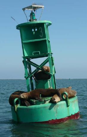
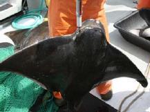
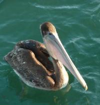
17 Preliminary Results of Selected Special Studies: Fish Tracking Study Source: Chris Lowe, CSULB

18 Preliminary Results of Selected Special Studies: Fish Tracking Study Phase I Approximately 50% of PV fish detected in LA Outer Harbor Consolidated slip is an important area High site fidelity Fish travel there from other areas Fish commonly move between adjoining areas Exception of the outer harbors The passive tracking data will be used to calibrate the bioaccumulation model

19 Preliminary Results of Selected Special Studies: Ultra Low Detection Limit Watershed Loadings Site Total Detectable PCBs (ng/l) Total Detectable DDTs (ng/l) D1 W1 D1 W1 LAR DC FWL ML Still significant loadings of legacy pollutants originating from watershed


20 Preliminary Results of Selected Special Studies: Low Detection Limit Water Column TPCBs and TDDTs


21 Sediment or fish concentrations Model Outcomes Will Inform Management Decisions Conceptual illustration of potential model run results Sediment remediation Fish contamination goal Time (years)

22 Next Steps Continued close collaboration with HTWG Additional special studies implementation Complete model linkages Continue to calibrate model with special study data Preliminary model runs/scenarios


23 DISCUSSION
GIS-Based Sediment Quality Database for the St. Louis River Area of Concern (AOC): Overview Presentations and Demonstration
: Overview Presentations and Demonstration") GIS-Based Sediment Quality Database for the St. Louis River Area of Concern (AOC): Overview Presentations and Demonstration Judy L. Crane 1 and Dawn E. Smorong 2 1 Minnesota Pollution Control Agency, St.
GIS-Based Sediment Quality Database for the St. Louis River Area of Concern (AOC): Overview Presentations and Demonstration Judy L. Crane 1 and Dawn E. Smorong 2 1 Minnesota Pollution Control Agency, St.
Mercury Modeling Case Studies in NY/NJ Harbor
 Mercury Modeling Case Studies in NY/NJ Harbor Robert Santore HydroQual, Inc. Presented at the Mercury Fate and Transport Modeling Workshop University of Delaware January 4 and 5, 2005 Contaminant Assessment
PTM: A Lagrangian Particle Tracking Model. Joseph Gailani
 PTM: A Lagrangian Particle Tracking Model Joseph Gailani Joe.Z.Gailani@usace.army.mil OUTLINE Motivation for sediment/constituent modeling system Objectives of modeling system Description of PTM PTM Example
Mississippi River West Bay Diversion Geomorphic Assessment and 1-D Modeling Plan
 Mississippi River West Bay Diversion Geomorphic Assessment and 1-D Modeling Plan Freddie Pinkard and Charlie Little Research Hydraulic Engineers ERDC-CHL-River Engineering Branch 27 February 2009 Lane
Case Study: Sediment Contamination by Mercury and DDT and Ecological Risk Assessment for Aquatic Biota, Lake Maggiore, Italy
 Intersol March 19th, 2014 Case Study: Sediment Contamination by Mercury and DDT and Ecological Risk Assessment for Aquatic Biota, Lake Maggiore, Italy CO-AUTHORED BY E Bizzotto and F Colombo PRESENTED
Quantifying i the GLRI Metric for Annual Sediment Deposition in Great Lakes Harbors:
 USACE 516(e) Annual Meeting Ann Arbor, MI (May 15, 2013) Quantifying i the GLRI Metric for Annual Sediment Deposition in Great Lakes Harbors: A Pilot Evaluation for Toledo Harbor Todd Redder Joe DePinto
TECHNICAL SUPPORT FOR NY/NJ HARBOR ESTUARY PROGRAM USEPA REGION 2 TOXICS TMDL MODEL DEVELOPMENT. New York/New Jersey Harbor Estuary Program
 New York/New Jersey Harbor Estuary Program SEDIMENT AREA LOADING COMPONENT ANALYSIS AND SPREADSHEET TOOL DEVELOPMENT II HACKENSACK RIVER AND LOWER/RARITAN BAYS INTERPRETATIVE TECHNICAL MEMORANDUM TECHNICAL
Birch Creek Geomorphic Assessment and Action Plan
 Birch Creek Geomorphic Assessment and Action Plan Jim Webster Tim Hanrahan, PhD, CFM Jesse Schwartz, PhD Zach Hill January 22, 2015 White Eagle Grange This Project is a First Step in Strategy Planning
Bathymetric Survey and Sediment Hydroacoustic Study of Canyon Lake. Michael Anderson UC Riverside
 Bathymetric Survey and Sediment Hydroacoustic Study of Canyon Lake Michael Anderson UC Riverside Introduction Canyon Lake was constructed in 1928 as the Railroad Canyon Reservoir as a result of the impoundment
From Monitoring to Measures: Historical Contaminated Sediments in the Elbe River Basin
 From Monitoring to Measures: Historical Contaminated Sediments in the Elbe River Basin Ulrich Förstner (TUHH), Susanne Heise (BIS) and Peter Heininger (BfG) 5th International SedNet Conference, Oslo 27th-29th
Using Mathematical Models to Assess Sediment Stability
 Integrated Environmental Assessment and Management Volume 2, Number 1 pp. 44 50 44 Ó 2006 SETAC Using Mathematical Models to Assess Sediment Stability C Kirk Ziegler* Quantitative Environmental Analysis,
Modeling Processes in the South River: Discussion. South River Science Team
 Modeling Processes in the South River: Discussion South River Science Team 09-09-03 Dual Approach May Be Appropriate Fluvial Geomorphology Study landforms and changes through erosion and sedimentation
Final. Summary of Sediment Quality Conditions in the Port of Long Beach
 Final Summary of Sediment Quality Conditions in the Port of Long Beach Prepared For: Port of Long Beach 925 Harbor Plaza Long Beach, California 90802 May 2009 Final Summary of Sediment Quality Conditions
Stickney Avenue Depositional Zone (SADZ) Investigation
 Investigation") The Ottawa River: A Report to the Community Stickney Avenue Depositional Zone (SADZ) Investigation May 22, 2007 Presented by: Scott Bell, P.E., BCEE (LimnoTech) Kelly Bensman (Hull & Associates) SADZ Location
The Ottawa River: A Report to the Community Stickney Avenue Depositional Zone (SADZ) Investigation May 22, 2007 Presented by: Scott Bell, P.E., BCEE (LimnoTech) Kelly Bensman (Hull & Associates) SADZ Location
NATURAL RECOVERY: MONITORING DECLINES IN SEDIMENT CHEMICAL CONCENTRATIONS AND BIOLOGICAL ENDPOINTS WORKING DRAFT, JUNE 2004
 NATURAL RECOVERY: MONITORING DECLINES IN SEDIMENT CHEMICAL CONCENTRATIONS AND BIOLOGICAL ENDPOINTS WORKING DRAFT, JUNE 2004 Clay Patmont (cpatmont@anchorenv.com, Anchor Environmental, Seattle, Washington,
Modeling of Dredging-Induced Sediment Resuspension: Remaining Questions and Progress Toward Answers
 Modeling of Dredging-Induced Sediment Resuspension: Remaining Questions and Progress Toward Answers Thomas Borrowman Douglas Clarke Tahirih Lackey US Army Corps of Engineers Research and Development Center,
Assessment of Lake Forest Lake Sediment Trapping Efficiency and Capacity. Marlon R. Cook Groundwater Assessment Program Geological Survey of Alabama
 Assessment of Lake Forest Lake Sediment Trapping Efficiency and Capacity Marlon R. Cook Groundwater Assessment Program Geological Survey of Alabama Impacts of the Lake at Lake Forest on the connectivity
Source Control Early Action Focused Feasibility Study
 Source Control Early Action Focused Feasibility Study Empirical Mass Balance Model Results or the Lower Passaic River Edward A. Garvey, PhD, PG Malcolm Pirnie, Inc. Remedial Options Workgroup Meeting June
Heather Schlosser Army Corps of Engineers Coastal Studies Group August 28, 2008
 Got sand? Regional Sediment Management in Orange County Heather Schlosser Army Corps of Engineers Coastal Studies Group August 28, 2008 Regional Sediment Management Regional sediment management recognizes
Lu, S., P. Craig, C. Wallen, Z. Liu, A. Stoddard, W. McAnnally and E. Maak. Dynamic Solutions, Knoxville, TN USACOE, Sacramento District
 An Extended-Delta Hydrodynamic Model Framework for Sea Level Rise Analysis to Support Resource Management Planning for the Sacramento-San Joaquin River Delta Lu, S., P. Craig, C. Wallen, Z. Liu, A. Stoddard,
Swift Creek Sediment Management Action Plan (SCSMAP)
") Swift Creek Sediment Management Action Plan (SCSMAP) PHASE 2 PROJECT PLAN PROPOSAL Whatcom County Public Works Department 322 N. Commercial Street, Suite 210 Bellingham, WA 98225 (360) 676-6692 June 2013
Swift Creek Sediment Management Action Plan (SCSMAP) PHASE 2 PROJECT PLAN PROPOSAL Whatcom County Public Works Department 322 N. Commercial Street, Suite 210 Bellingham, WA 98225 (360) 676-6692 June 2013
Appendix K.2: Sediment Management Excerpt from South Orange County Hydromodification Management Plan
 Appendix K.2: Sediment Management Excerpt from South Orange County Hydromodification Management Plan 4 Sediment Supply Management Requirements Permit Order R9-2013-0001 as amended by Order No. R9-2015-0001Section
GALVESTON BAY RSM Moving toward an Integrated, Cooperative, and Holistic Approach to Estuarine Sediments
 GALVESTON BAY RSM Moving toward an Integrated, Cooperative, and Holistic Approach to Estuarine Sediments RAE Conference 2010 Larry A. Wise Moffatt & Nichol RSM is a system-based approach for collaboratively
Deposition and Resuspension of Sediments in Near Bank Water Zones of the River Elbe
 9th International Congress on Environmental Modelling and Software Brigham Young University BYU ScholarsArchive 4th International Congress on Environmental Modelling and Software - Barcelona, Catalonia,
SCOPE OF PRESENTATION STREAM DYNAMICS, CHANNEL RESTORATION PLANS, & SEDIMENT TRANSPORT ANALYSES IN RELATION TO RESTORATION PLANS
 DESIGN METHODS B: SEDIMENT TRANSPORT PROCESSES FOR STREAM RESTORATION DESIGN PETER KLINGEMAN OREGON STATE UNIVERSITY CIVIL ENGINEERING DEPT., CORVALLIS 2 ND ANNUAL NORTHWEST STREAM RESTORATION DESIGN SYMPOSIUM
Predicting the Fate of Sediment Suspended Due to Dredging and Placement
 Predicting the Fate of Sediment Suspended Due to Dredging and Placement Tahirih Lackey and Thomas Borrowman US Army ERDC, Vicksburg, MS Tahirih.C.Lackey@erdc.usace.army.mil Thomas.D.Borrowman@erdc.usace.army.mil
Monitoring and evaluation of benthic macroinvertebrates in the Big Hole River and tributaries
 Monitoring and evaluation of benthic macroinvertebrates in the Big Hole River and tributaries Michael A. Bias Big Hole River Foundation Introduction BMI used to evaluate stream biological health Quantifies
Research Topic Updated on Oct. 9, 2014
 Research Topic Updated on Oct. 9, 204 Mixed Cohesive/Non-cohesive Sediments Sedimentation in Estuary: Flocculation Deposition Erosion Transport Consolidation *: It has been recognized that when the fraction
Transport and fate of sediment and associated contaminants in SF Bay. Mike Connor & John Oram 2007 LTMS Science Workshop
 Transport and fate of sediment and associated contaminants in SF Bay Mike Connor & John Oram 2007 LTMS Science Workshop Major Points Bay Still Responding to 1800 s mgmt Transport Has Spread Contamination
Proposal for Lower Susquehanna River Reservoir System Model Enhancements in Support of the 2017 Chesapeake Bay TMDL Midpoint Assessment January 2016
 Proposal for Lower Susquehanna River Reservoir System Model Enhancements in Support of the 2017 Chesapeake Bay TMDL Midpoint Assessment January 2016 Exelon Generation Company, LLC (Exelon) submits this
Storm Sewer Design [2]
![Storm Sewer Design [2]](/thumbs/82/86956590.jpg "Storm Sewer Design [2]") Class 5 [1] Storm Sewer Design 9. Check Q < Qf and Vmax > vf > Vmin. Vmin is normally specified to avoid sedimentation. This will normally be 1.0 m/s at pipe full condition. (BS EN 752 suggests that for
Class 5 [1] Storm Sewer Design 9. Check Q < Qf and Vmax > vf > Vmin. Vmin is normally specified to avoid sedimentation. This will normally be 1.0 m/s at pipe full condition. (BS EN 752 suggests that for
Restoration Goals TFG Meeting. Agenda
 San Joaquin River Restoration Program Restoration Goals TFG Meeting Reach 2B Update April 28, 2010 Agenda 1. Introductions 2. Program Restoration Goal Context 3. Program Update a) Interim Flows b) EIS/EIR
Aquatic Sediment Sampling and Analyses
 Aquatic Sediment Sampling and Analyses Richard B. Shepard, Ph.D. March 16, 2011 Introduction Collecting sediment samples for analysis of contaminants particularly in river systems is not just a matter
A close-up view of sediment collected from the tandem Van Veen benthic grab.
 Cover photos Top: Bottom left: Benthic sampling crew aboard the Ocean Sentinel. From left to right: Brent Haggin (Senior Laboratory Technician), Larry Lovell (Senior Biologist), Fred Stern (Senior Biologist,
Sediment management for a living river - the Lahn River case
 Sediment management for a living river - the Lahn River case Alexandra Brinke, Denise Spira, Michael Schleuter, Georg Reifferscheid, Peter Heininger & Ute Feiler Federal Institute of Hydrology, Germany
Appendix G.19 Hatch Report Pacific NorthWest LNG Lelu Island LNG Maintenance Dredging at the Materials Offloading Facility
 Appendix G.19 Hatch Report Pacific NorthWest LNG Lelu Island LNG Maintenance Dredging at the Materials Offloading Facility Project Memo H345670 To: Capt. David Kyle From: O. Sayao/L. Absalonsen December
Seasonal Changes in the Mekong River Delta's Distributary Channels and Nearshore Sedimentary Environments
 DISTRIBUTION STATEMENT A. Approved for public release; distribution is unlimited. Seasonal Changes in the Mekong River Delta's Distributary Channels and Nearshore Sedimentary Environments Paul Liu & David
Use of benthic invertebrate biological indicators in evaluating sediment deposition impairment on the Middle Truckee River, California
 Use of benthic invertebrate biological indicators in evaluating sediment deposition impairment on the Middle Truckee River, California David B. Herbst Sierra Nevada Aquatic Research Laboratory University
Sediment Stability in the Lower Passaic River Integration of Multiple Lines of Evidence
 Sediment Stability in the Lower Passaic River Integration of Multiple Lines of Evidence Fourth Passaic River Symposium June 22, 21 Michael Barbara, mab.consulting, LLC Marcia Greenblatt, AECOM John Connolly,
Emerging Contaminant Soil Fate Model Subroutine Development for SWAT
 Emerging Contaminant Soil Fate Model Subroutine Development for SWAT Louis J. Thibodeaux and Eileen M. Canfield Louisiana State University Cain Department of Chemical Engineering Jesse Coates Hall, South
Land Use Methods & Metrics Development Outcome
 Quarterly Progress Meeting November 15, 2018 Land Use Methods & Metrics Development Outcome Peter Claggett, USGS LUWG Coordinator Through the Chesapeake Bay Watershed Agreement, the Chesapeake Bay Program
Statement of Impact and Objectives. Watershed Impacts. Watershed. Floodplain. Tumblin Creek Floodplain:
 Tumblin Creek Floodplain: Impacts Assessment and Conceptual Restoration Plan Casey A. Schmidt Statement of Impact and Objectives Urbanization has increased stormflow rate and volume and increased sediment,
Development and application of demonstration MIKE 21C morphological model for a bend in Mekong River
 Development and application of demonstration MIKE 21C morphological model for a bend in Mekong River September 2015 0 Table of Contents 1. Introduction... 2 2. Data collection... 3 2.1 Additional data...
Puget Sound Shorelines. Announcements
 Announcements Puget Sound Shorelines Wednesday discussion of Bates paper Bham Bay project: Updates, finals week schedules Last portion of the class: Environmental issues in Puget Sound Puget Sound shorelines:
Mobrand to Jones and Stokes. Sustainable Fisheries Management Use of EDT
 Sustainable Fisheries Management Use of EDT Ecosystem Diagnosis and Treatment EDT EDT designed to provide a practical, science-based approach for developing and implementing watershed plans. Provides decision
Stream Geomorphology. Leslie A. Morrissey UVM July 25, 2012
 Stream Geomorphology Leslie A. Morrissey UVM July 25, 2012 What Functions do Healthy Streams Provide? Flood mitigation Water supply Water quality Sediment storage and transport Habitat Recreation Transportation
Overview of fluvial and geotechnical processes for TMDL assessment
 Overview of fluvial and geotechnical processes for TMDL assessment Christian F Lenhart, Assistant Prof, MSU Research Assoc., U of M Biosystems Engineering Fluvial processes in a glaciated landscape Martin
WELCOME Lake Wabukayne OPEN HOUSE
 WELCOME Lake Wabukayne Sediment Removal Project OPEN HOUSE We are here to: Update you, the community, on recent developments and activities at Lake Wabukayne Present the preferred alternative and receive
Environmental impact assessment study of the new offshore dumping sites for Šventoji port in Lithuania
 Environmental impact assessment study of the new offshore dumping sites for Šventoji port in Lithuania Introduction Summary In 2003 Lithuanian Ministry of Transport initiated the preparation of feasibility
CONTAMINATED SEDIMENTS IN THE RHINE BASIN RELEVANT POLLUTANTS AND RESUSPENSION RISK. Martin Keller Federal Institute of Hydrology, Koblenz, Germany
 CONTAMINATED SEDIMENTS IN THE RHINE BASIN RELEVANT POLLUTANTS AND RESUSPENSION RISK Martin Keller Federal Institute of Hydrology, Koblenz, Germany CHR/ISI SEDIMENT WORKSHOP, Bern 27.-3.4.28 1 CONTAMINATED
Sediment Distribution and Characteristics
 Sediment Distribution and Characteristics Sediments at the bottom of ponds are a source or sink for nutrients in relation to the water column, contribute to turbidity during storm events, serve as the
United States Department of the Interior NATIONAL PARK SERVICE Northeast Region
 United States Department of the Interior NATIONAL PARK SERVICE Northeast Region June 17, 2017 REQUEST FOR STATEMENTS OF INTEREST and QUALIFICATIONS Project Title: ASSESSMENT OF NATURAL RESOURCE CONDITION
MODELING APPROACH MEMORANDUM (1) REMEDIAL INVESTIGATION/FEASIBILITY STUDY NEWTOWN CREEK
 REMEDIAL INVESTIGATION/FEASIBILITY STUDY NEWTOWN CREEK") Photo by Bill Rhodes MODELING APPROACH MEMORANDUM (1) REMEDIAL INVESTIGATION/FEASIBILITY STUDY NEWTOWN CREEK Prepared by Anchor QEA, LLC 305 West Grand Avenue, Suite 300 Montvale, New Jersey 07645 March
Photo by Bill Rhodes MODELING APPROACH MEMORANDUM (1) REMEDIAL INVESTIGATION/FEASIBILITY STUDY NEWTOWN CREEK Prepared by Anchor QEA, LLC 305 West Grand Avenue, Suite 300 Montvale, New Jersey 07645 March
Advancing Microplastic Laboratory Analysis
 Advancing Microplastic Laboratory Analysis Andrew Spanjer 1, Kathy Conn 1, Austin Baldwin 2, Andrea Foster 3, and Robert Black 1 1 U.S. Geological Survey, Washington Water Science Center, Tacoma, WA 2
Why Stabilizing the Stream As-Is is Not Enough
 Why Stabilizing the Stream As-Is is Not Enough Several examples of alternatives to the County s design approach have been suggested. A common theme of these proposals is a less comprehensive effort focusing
Solutions to Flooding on Pescadero Creek Road
 Hydrology Hydraulics Geomorphology Design Field Services Photo courtesy Half Moon Bay Review Solutions to Flooding on Pescadero Creek Road Prepared for: San Mateo County Resource Conservation District
Dam Removal Analysis Guidelines for Sediment
 A review of: Dam Removal Analysis Guidelines for Sediment Joe Rathbun (Retired) rathbunj@sbcglobal.net Some Potential Sediment Issues Reservoir restoration Downstream water quality Downstream deposition
16 AUGUST (Monday) Glacial Sediment
 Glacial Sediment") Presented By: U.S. Army Corps of Engineers, Detroit District Great Lakes Hydraulics and Hydrology Office With Support from the Great Lakes Commission 16 AUGUST (Monday) Glacial Sediment 9:00 9:30 Introduction
Presented By: U.S. Army Corps of Engineers, Detroit District Great Lakes Hydraulics and Hydrology Office With Support from the Great Lakes Commission 16 AUGUST (Monday) Glacial Sediment 9:00 9:30 Introduction
An Update to EPA s Conceptual Site Model for the Lower Passaic River: An Examination of the Most Recent Results
 An Update to EPA s Conceptual Site Model for the ower Passaic River: An Examination of the Most Recent Results Edward A. arvey, Alice Yeh 2, Solomon bondo-tugbawa, Juliana Atmadja, John Kern 3, AmyMarie
U.S. Army Corps of Engineers Detroit District. Sediment Trap Assessment Saginaw River, Michigan
 U.S. Army Corps of Engineers Detroit District December 2001 December 2001 This report has been prepared for USACE, Detroit District by: W.F. BAIRD & ASSOCIATES LTD. 2981 YARMOUTH GREENWAY MADISON, WISCONSIN
Laboratory Exercise #3 The Hydrologic Cycle and Running Water Processes
 Laboratory Exercise #3 The Hydrologic Cycle and Running Water Processes page - 1 Section A - The Hydrologic Cycle Figure 1 illustrates the hydrologic cycle which quantifies how water is cycled throughout
A Comprehensive Inventory of the Number of Modified Stream Channels in the State of Minnesota. Data, Information and Knowledge Management.
 A Comprehensive Inventory of the Number of Modified Stream Channels in the State of Minnesota Data, Information and Knowledge Management Glenn Skuta Environmental Analysis and Outcomes Division Minnesota
Technical Memorandum. Stream Erosion Methodology. Consolidated TMDL Implementation Plan Comprehensive Baseline Analysis.
 Technical Memorandum Stream Erosion Methodology Table of Contents 1 Introduction...1 2 Purpose...1 3 Technical Approach...1 4 Results and Discussion... 8 References... 9 Attachments... 10 Consolidated
Appendix O. Sediment Transport Modelling Technical Memorandum
 Appendix O Sediment Transport Modelling Technical Memorandum w w w. b a i r d. c o m Baird o c e a n s engineering l a k e s design r i v e r s science w a t e r s h e d s construction Final Report Don
What is a watershed or landscape perspective?
 What is a watershed or landscape perspective? -remove sediment -add sediment -add wood, riparian manipulation -alter (engineer) channel/floodplain morphology -restore/abandon roads You are here What is
Watershed Assessment of River Stability and Sediment Supply: Advancing the Science of Watershed Analysis
 Watershed Assessment of River Stability and Sediment Supply: Advancing the Science of Watershed Analysis 2009 MWEA Annual Conference Rob Myllyoja, CET rmyllyoja@hrc-engr.com Watershed Assessment of River
Sediment Connectivity and Exchange in Ameland Inlet
 Sediment Connectivity and Exchange in Ameland Inlet Stuart G. Pearson, Bram C. van Prooijen, Zheng Bing Wang, and Jasper P. Bak January 11 th, 2017 NCK Symposium on Sediment Sorting Study Site: Ameland
Application of an Enhanced, Fine-Scale SWAT Model to Target Land Management Practices for Maximizing Pollutant Reduction and Conservation Benefits
 Application of an Enhanced, Fine-Scale SWAT Model to Target Land Management Practices for Maximizing Pollutant Reduction and Conservation Benefits Amanda Flynn, Todd Redder, Joe DePinto, Derek Schlea Brian
1. Explain the changes in the predicted Cu concentration in Torch L. that result from using different time steps in the numerical model.
 1. Explain the changes in the predicted Cu concentration in Torch L. that result from using different time steps in the numerical model. ANSER: Time steps longer than 2 years cause the model to overpredict
Modelling of flow and sediment transport in rivers and freshwater deltas Peggy Zinke
 1 Modelling of flow and sediment transport in rivers and freshwater deltas Peggy Zinke with contributions from Norwegian and international project partners 2 Outline 1. Introduction 2. Basic ideas of flow
MUDMAP TM. Software Description
 ASA Applied Science Associates, Inc. 70 Dean Knauss Drive Narragansett, RI 02882-1143 U.S.A. Tel: 401-789-6224 Fax: 401-789-1932 asa@asascience.com www.asascience.com MUDMAP TM Software Description MUDMAP
Lower Susquehanna River Reservoir System Proposed Modeling Enhancements
 Lower Susquehanna River Reservoir System Proposed Modeling Enhancements Presented at the Chesapeake Bay Program Scientific and Technical Advisory Committee (STAC) Workshop January 13, 2016 Overview Due
Water flowing in the stream can move sediments along the stream channel because of an exchange of energy from the
 1. Base your answer(s) to the following question(s) on the Earth Science Reference Tables, the diagram below, and your knowledge of Earth science. The diagram represents a laboratory stream table. Water
Geomorphology Studies
 Geomorphology Studies Technical Workgroup Meeting February 14, 2012 Prepared by: Tetra Tech Prepared for: Alaska Energy Authority Overall Goal Geomorphology Studies Two studies Geomorphology Study (RSP
Abstract. This research is supported by US Army Corps of Engineers under Grant No. DACA K-0055 with Penn State.
 Modeling Water Flow and Chemical and Sediment Transport in Watershed Systems Hwai-Ping Cheng and Gour-Tsyh Yeh Department of Civil and Environmental Engineering, The Pennsylvania State University, University
Hydrologic Analysis for Ecosystem Restoration
 Hydrologic Analysis for Ecosystem Restoration Davis, California Objectives: To provide participants with: 1) an understanding of the issues in restoration studies; 2) an overview of Corps policies and
Delaware River Basin Commission
 Delaware River Basin Commission Role of Sediments in Managing PCBs in the Delaware Estuary Gregory J. Cavallo, P.G. Thomas J. Fikslin, Ph.D. NJ Monitoring Council September 21, 2016 Presentation Outline
MEANDER MIGRATION MODEL ASSESSMENT FOR THE JANUARY 2005 STORM, WHITMAN PROPERTY, SAN ANTONIO CREEK, VENTURA COUNTY, CALIFORNIA
 MEANDER MIGRATION MODEL ASSESSMENT FOR THE JANUARY 2005 STORM, WHITMAN PROPERTY, SAN ANTONIO CREEK, VENTURA COUNTY, CALIFORNIA Prepared by Eric Larsen, Ph.D. Mark Rains, Ph.D. October 2006 INTRODUCTION
Fish Passage Studies III: Sediment Redistribution and Impact Analysis: Springborn Dam - Enfield, Connecticut
 University of Massachusetts Amherst ScholarWorks@UMass Amherst International Conference on Engineering and Ecohydrology for Fish Passage International Conference on Engineering and Ecohydrology for Fish
Measurements of In Situ Pick-up Rate of Nutrients on Riverbed
 1th International Conference on Integrated Diffuse Pollution Management (IWA DIPCON 8). Research Center for Environmental and Hazardous Substance Management (EHSM), Khon Kaen University, Thailand; 5-9
APPENDIX N: MONITORED NATURAL RECOVERY ONONDAGA LAKE FEASIBILITY STUDY HONEYWELL
 : MONITORED NATURAL RECOVERY ONONDAGA LAKE FEASIBILITY STUDY Prepared For: HONEYWELL 101 Columbia Road P.O. Box 2105 Morristown, NJ 07962 Main Author: Anchor Environmental, L.L.C. Contributing Authors:
Mercury and methylmercury transport in the Cache Creek Settling Basin, California, U.S.A.
 Mercury and methylmercury transport in the Cache Creek Settling Basin, California, U.S.A. Alpers, C.N. 1, Fleck, J.A. 1, Marvin- DiPasquale, M. 2, Beaulieu, E. 1, and Wright, S.A. 1 1 U.S. Geological Survey,
low turbidity high turbidity
 What is Turbidity? Turbidity refers to how clear the water is. The greater the amount of total suspended solids (TSS) in the water, the murkier it appears and the higher the measured turbidity. Excessive
U.S. DEPARTMENT OF THE INTERIOR U.S. GEOLOGICAL SURVEY MEASUREMENTS OF SAND THICKNESSES IN GRAND CANYON,
 U.S. DEPARTMENT OF THE INTERIOR U.S. GEOLOGICAL SURVEY MEASUREMENTS OF SAND THICKNESSES IN GRAND CANYON, ARIZONA, AND A CONCEPTUAL MODEL FOR CHARACTERIZING CHANGES IN SAND-BAR VOLUME THROUGH TIME AND SPACE
Chapter 3 - White Oak River Subbasin Includes Bogue Sound and the Newport River
 Chapter 3 - White Oak River Subbasin 03-05-03 Includes Bogue Sound and the Newport River 3.1 Water Quality Overview Subbasin 03-05-03 at a Glance Land and Water Area (sq. mi.) Total area: 228 Land area:
Appendix D. Model Setup, Calibration, and Validation
 . Model Setup, Calibration, and Validation Lower Grand River Watershed TMDL January 1 1. Model Selection and Setup The Loading Simulation Program in C++ (LSPC) was selected to address the modeling needs
Amendment to the QAPP/FSP Addendum
 FIELD MODIFICATION FORM LOWER PASSAIC RIVER RESTORATION PROJECT Date: December 19, 2007 Document: Activity: Requested Modification: Rationale: Attachments: Amendment to the 2007-12-17 QAPP/FSP Addendum
Old Stone Sewer Main Street
 Bangor Landing Bangor, Maine Case Study-Sediment Sediment Investigation Maine Department of Environmental Protection City of Bangor, with RMT, Inc. Site Location and Local Site Features 1 Bangor Landing
MEMORANDUM. Scott Pickard, CELRB-TD-EH Michael Asquith, CELRB-PM-PM. From: Paul R. Schroeder, Ph.D., PE Earl Hayter, Ph.D. Date: 14 March 2016
 DEPARTMENT OF THE ARMY ENGINEER RESEARCH AND DEVELOPMENT CENTER, CORPS OF ENGINEERS ENVIRONMENTAL LABORATORY WATERWAYS EXPERIMENT STATION, 3909 HALLS FERRY ROAD VICKSBURG, MISSISSIPPI 39180-6199 29 November
Evaluation of PCB Availability in Sediment after Application of an Activated Carbon Amendment at an Active Naval Shipyard
 Evaluation of PCB Availability in Sediment after Application of an Activated Carbon Amendment at an Active Naval Shipyard January 14, 2015 New Orleans, LA Battelle Eighth International Conference on Remediation
Implementing a Project with 319 Funds: The Spring Brook Meander Project. Leslie A. Berns
 Implementing a Project with 319 Funds: The Spring Brook Meander Project Leslie A. Berns "...to acquire... and hold lands... for the purpose of protecting and preserving the flora, fauna and scenic beauties...
Spring Run Spawning Habitat Assessment Sediment Mobility
 Study 47 Spring Run Spawning Habitat Assessment Sediment Mobility Final 2015 Monitoring and Analysis Plan January 2015 1.0 Spring Run Spawning Habitat Assessment Sediment Mobility Theme(s): Flow management
Computer Model of Water Clarity in Shallow Water for Chesapeake Bay Water Quality Management
 Computer Model of Water Clarity in Shallow Water for Chesapeake Bay Water Quality Management P. Wang 1 and L.C. Linker 2 1 UMCES/CBPO, 2 USEPA/CBPO CERF 09 - Portland, OR November 4, 2009 USA Chesapeake
Chapter 11. Rivers: Shaping our landscape
 Chapter 11 Rivers: Shaping our landscape Learning outcomes In this presentation you will learn: Common terms associated with rivers About the three stages of a river About the processes of river erosion
Celine DUFFA / Hervé THEBAULT. A radioecological risk assessment tool for post-accidental situations: application in the Toulon marine area
 Celine DUFFA / Hervé THEBAULT A radioecological risk assessment tool for post-accidental situations: application in the Toulon marine area Objectives and method IRSN carries out research on the consequences
Can Measurement of Nitrate, Oxygen, and Boron isotopes be useful for your nitrate problem? A guideline. Problem. Measures. November 2009.
 δ 18 O NO3 NO3 Problem O O N δ 11 B δ 15 N NO3 O Measures Can Measurement of Nitrate, Oxygen, and Boron isotopes be useful for your nitrate problem? November 2009 Content 1 Introduction: ISONITRATE project...
Mediterranean Costal Regions: Thermaikos Gulf (Greece) modeling
 modeling") EMRAS II WG8 GROUP MEETING Brussels, 27 28 Sept. 2011 Mediterranean Costal Regions: Thermaikos Gulf (Greece) modeling exercise with MOIRA PLUS Monte L., Brittain J., Eleftheriou G. Thermaikos Gulf, Thessaloniki
EMRAS II WG8 GROUP MEETING Brussels, 27 28 Sept. 2011 Mediterranean Costal Regions: Thermaikos Gulf (Greece) modeling exercise with MOIRA PLUS Monte L., Brittain J., Eleftheriou G. Thermaikos Gulf, Thessaloniki
In-situ capping of contaminated sediments
 In-situ capping of contaminated sediments In-situ capping of Sweden s fiberbank sediments: A unique challenge Joseph Jersak, Gunnel Göransson, Yvonne Ohlsson, Lennart Larsson, Peter Flyhammar, Per Lindh
4 Project Alternatives
 BSD Deepening EIR Page 50 4 Project Alternatives In terms of the EIA regulations (Regulation 6 (1) (d) GN No. R1183, dated 5 September 1997) and NEMA, the applicant is required to demonstrate that alternatives
Phase I System Characterization: Year 2 Study Plans
 Phase I System Characterization: Year 2 Study Plans Year I Physical and Biological Data Sets Quarterly Storm Sampling Four storm events with 8 sample stations at bridges Monthly Baseline Characterization